


bremerton_john
-
Posts
255 -
Joined
-
Last visited
-
Days Won
1
Content Type
Profiles
Forums
Events
Posts posted by bremerton_john
-
-
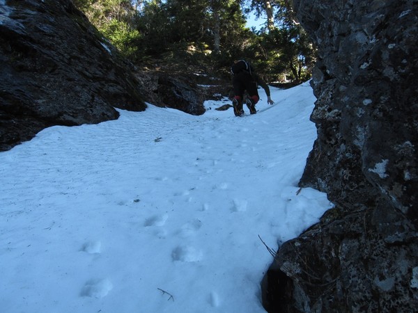
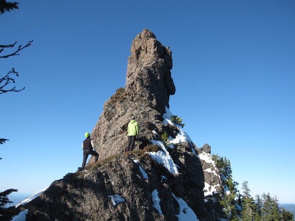
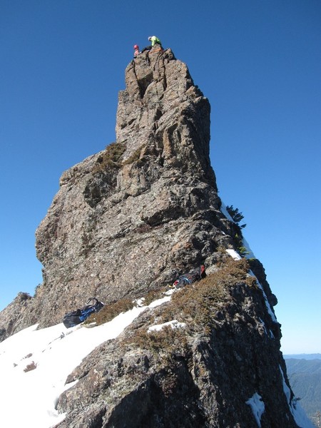
Nice work fellas on threading those Needles! One of my fav places.
-
Haven't heard yet. I think they are weighing their options, which are likely few.
-
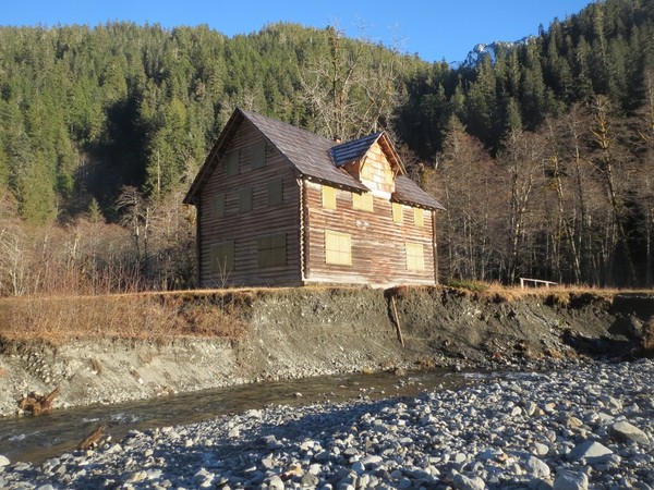
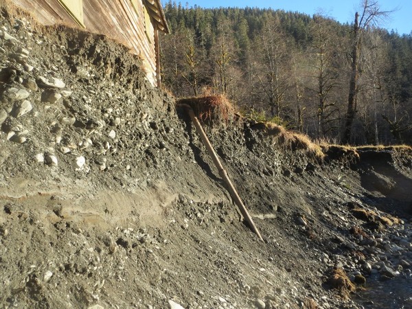
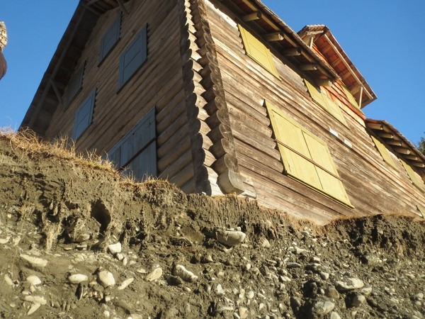
Trip: Enchanted Valley Chalet - Trail
Date: 1/5/2014
Trip Report:
Been a while since I've posted a TR. Been active, just not on CC.
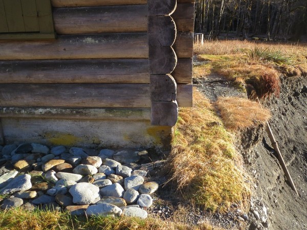
Due to the low snow so far we went up to Enchanted Valley last weekend for an overnight camp up there. We were startled to find the river is now only 18" from the foundation of the chalet. And we confirmed this is the main channel of the river too. With the rains coming in now and this weekend, will there be a chalet next week? Photos and details were sent to the appropriate people at ONP. We'll see what happens.
Nice time to be there:
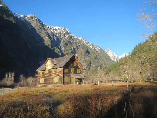
But, not so nice for the chalet...
-
Trip: -
Date: 1/10/2014
Trip Report:
-
Nice work Bob! You've been busy this summer doing Olympics "classics" (when you're not brush crashing in the Quilcene).
Yeah, we noticed the day the new book got published that there was a photo which had Gasp and Sweat reversed in the description.
As Oly said we were up there 2 years ago (or was it 3..?) and placed a small film canister and, I think?, a new piece of webbing. Stuff can age fast up there.
Great TR.
John
-
"We saw no evidence of the 2004 climb"
Looking back at my summit photo of this one (from your link at the top of your TR), I recall the register being wet and ratty. There is a small black film canister (yes, I was still using a film camera in 2004) in the photo in my TR, that I believe I left on top with a small note. I take it you didn't find that?
We probably left a sling up on top too.
Nice job. So that's what it looks like in the sun!
John
-
This is quite the coincidence. Didn't think I would see mention of this creek only a week after reading about it in the Dose ranger station log. I volunteered at the station last weekend and read through past posts. About 3 years ago the high lakes crew from ONP made a trek, fording the river in September near Muscott flats, finding the old trail, which they described as being in surprisingly good shape except for it was overgrown with Rhodies. They ended up taking like 6 hours to gain the ridge above Wildcat Lake before retracing their steps.
I also have a route description going right up the spine between Tumbling Creek and Brokenfinger Creek.
It got my interest up. Would like to check out that lake and little tarn above. If anyone is interested in going sometime give me a shout.
John
-
Great photos. Thanks for sharing.
-
That's interesting concerning the rock and route changes. We'll make a note of it on the guidebook website.
Incredible the snow in Milk Lake.
Thanks for sharing!
John
-
if steel is just a scramble then why the rap? just wondering .. cause it looks like a neat way to get over to marmot
Thanks 'silence'. So on Steel, we went up Route 1 from First Divide, which is listed as class 1, but its some moderately steep heather on those slopes. Maybe "Heather class 2"?
 We went down however on the west side (carried over). I think if we had poked around some more we probably would have found a down route not requiring a rap, but everything at first glance looked to be class 4. The exception was a possible scree descent off the south side which had an unknown circuitous route to get back over to the west side. The short rap was simple to bring us down to the snow below the summit block. Could be that conditions have changed some on that west side too.
'Fairweather'. Thanks for the good words. HiHat said things pretty well. Flypaper looked pretty well filled in, but we were intrigued by the alternate route on Anderson, and the great camping on that side. I have to say that route 2 is a real good alternative I would recommend.
'Oly'. We should have 'roped' you in for this one. There was some great terrain there you would have thrived in. Season isn't over yet...
John
-
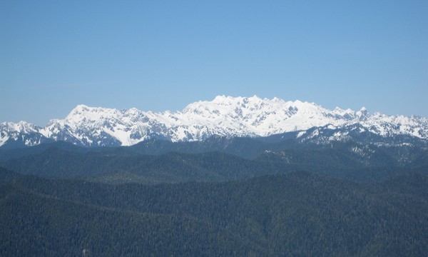
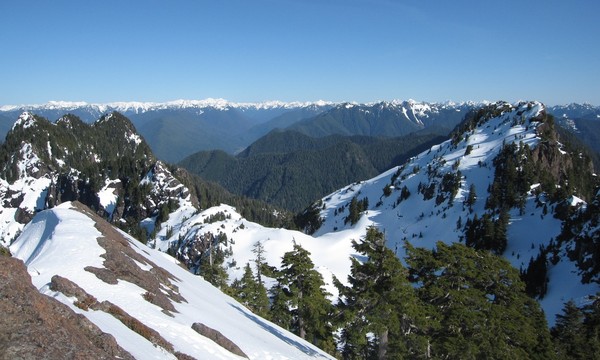
Trip: Olympics - Various - August 21-28 - Hamma-Hamma to Dosi
Date: 8/21/2011
Trip Report:
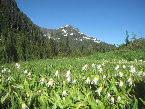
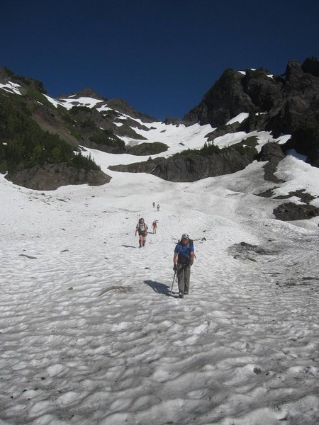
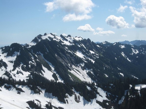
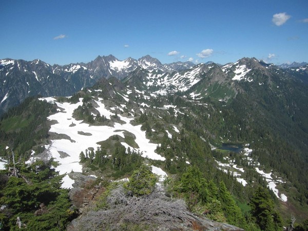
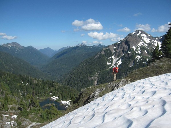
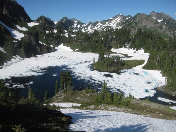
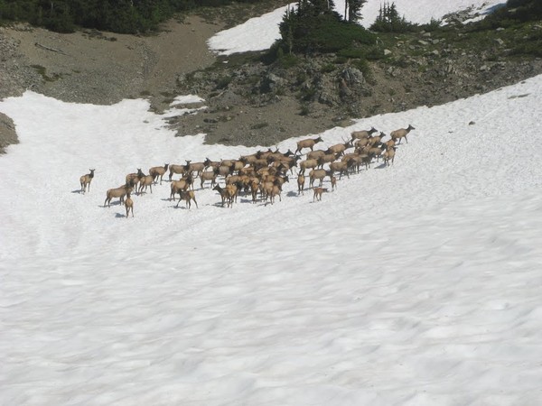
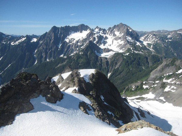
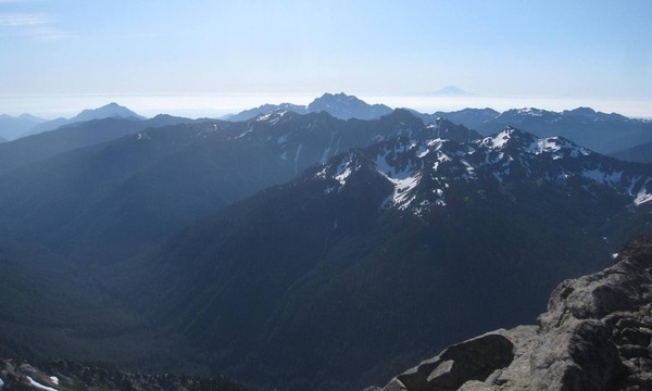
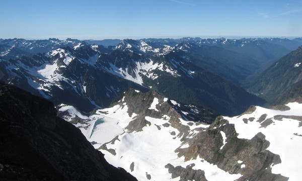
Mike, Julie, Kevin, Terry, Tony and I did an 8 day trip into the Olympics August 21-28. It was a great way to celebrate my 40th birthday with a good group of friends. We entered via the Putvin trail, pas Lake of the Angels and camped above Hagen Lake (night 1). Next day was the only crap weather day, fog and drizzle while X-country over Stonesthrow and Hopper down to First Divide, making camp at Home Sweet Home (night 2). Next day was sunny again, so up and over Mt Steel, down and across to Marmot Lake where we spent the next 3 nights. The following days were climbs of Duckabush, BUmbershoot, O'Neil and Overlook Peak, and explorations of the Heart Lake and Lacrosse Basin. Then it was on to climb White Mountain, encountering a herd of elk while en route, then after summiting, crossing over Anderson Pass to camp on East Anderson's shoulder (night 6). Next day it was up route 2 of Anderson, down the Eel where we met up with friends Jim and Eileen, then over for an ascent of West Peak (3 of our group ascended West Peak - Tony, Jim and Terry). Tony and I went back up and over the main summit of Anderson and down route 2 to return to camp at 10pm. Kevin, Terry and Jim returned via Echo col and made it to camp an hour earlier. Hiked out the Dosi next day (Sunday the 28th). Fabulous trip. Here are a bunch of photos.
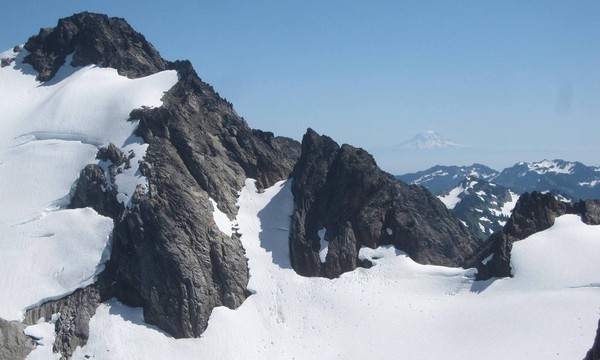
Mt Steel from Home Sweet Home
Short rap off west side of Steel
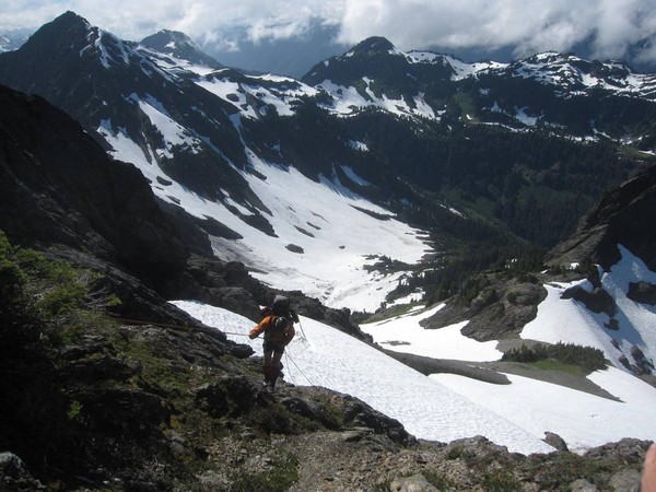
Coming down off Steel
Camp at Marmot Lake
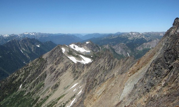
Mt Duckabush
O'Neil Peak at sunset
Mt Duckabush from Overlook
Bumbershoot Peak
Marmot, Heart and Lacrosse Lakes/Basins from Overlook Peak
Looking down Duckabush Valley
Elk Herd at Jack's Pond
Anderson massif from White Mountain
Looking down from summit of Anderson
Main summit of Anderson
Considering West Peak

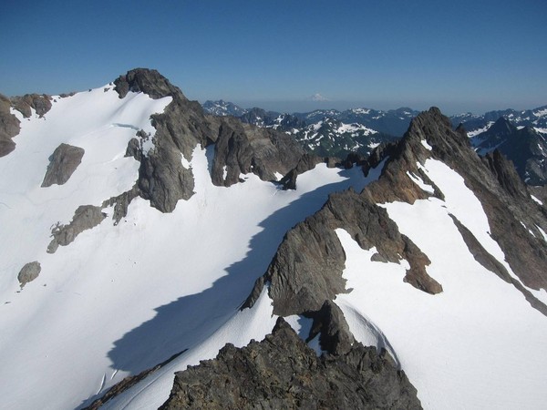
Iceberg Lakes
Main summit of Anderson and Echo Rock
On the false and main summits of West Peak

Gear Notes:
O'Neil is definitely class 4, though not much protection on the single roped pitch.
Pitons and cams to 2 inches were used to protect a few moves on West Peak.
The remaining peaks were walk-ups and scrambles.
Approach Notes:
Various approaches to peaks - Putvin trail in good shape, Hamma Hamma road still has 2 washout areas a little sketchy for small cars, no problem for SUVs/trucks.
-
PhilU, the originator of that TR (Animal) doesn't often log on here. I'll pass on your request for info to him though.
-
Reilly,
There was no intent to leave out your Constance routes. We put in a huge amount of time last spring to get the site up and running, and for no particular reason the Constance section of the book was added towards the end of that initial push, and it frankly didn't get completed. The South Summit of Constance isn't even in there yet, neither route. At the moment your 23rd Party Congress route is listed under the Point Smith page: Point Smith
So I will apologize here if you've felt slighted at all. Again, there was no intent whatsoever. It was merely an issue of burnout on really the 3 of us that were grinding out the page creations. This winter we've been preparing for another push to get things more complete. We have a pile of new photos we've received from people and some new route information as well. So thank you for everyone who has contributed and offered comments and suggestions.
For the Constance section Reilly you have provided some wonderful pictures and route info. We are still interested in posting those, perhaps in a similar fashion to what we did on the Mt Clark Corkscrew route: Mt Clark - Corkscrew
For those interested in the crags on Tyler Peak, take a look at the photo on the Tyler Peak page. I took this from the Gold Creek trail on the opposite side of the Dungeness. A lot of rock over there.
As before, send any contributions or comments to ClimbersGuideOlympics@gmail.com
John
-
We were up and down both sides of the creek and didn't see any sign of the trail. It was pretty miserable for some time.
The trail is on the north side of the creek the entire way, sometimes a little distance from the creek, but not terribly far. It's the usual game/fishermen's/climber's path.
Hmmm, what is it with the rats this season? We had our share on the Needles traverse weekend.
-
That traverse is one of my favorites. The snow is amazing for this time of year.
-
Great time guys. It was a real pleasure getting out there on all those peaks with you. We'll have to hook up again for another.
John
-
Joel told me about this trip when i saw him in Juneau last week at the MRA conference. Now I've seen the photos so I believe him. You guys had an awesome weather window. Looks like a great time.
John (from OMR)
-
As the previous post indicated the new site is up and running, though it is still a bit under construction. Check it out: Climbers Guide Olympics.
We've still got a lot of content yet to add to the website, including a number of peak pages in the Constance section and a few in the Olympus section. But we've put a lot of effort into the site thus far and there is a lot of content on there already. You we see a number of places that indicate 'Photo Needed". In some cases we do have photos already I havent had the chance yet to post. In other cases we just don't have a picture yet.
The intent was to create a complementing resource to the printed guidebook. This will serve as an encyclopedia of sorts of the Olympics. We don't plan on adding a forum like what we have here on cc.com. However, we will be adding in the near future some areas on the site for people to make suggestions on changes to route descriptions, ratings, and the like. We also welcome any comments or photo submissions you have, which can be sent to climbersguideolympics@gmail.com.
Steph Abegg was instrumental in getting this site off the ground, and some of her artistic talent is evident there. So a lot of credit and gratitude from us at OMR goes her way.
So if you get a chance have a look at the site and let us know what you think.
Thanks,
John Myers
Olympic Mountain Rescue
-
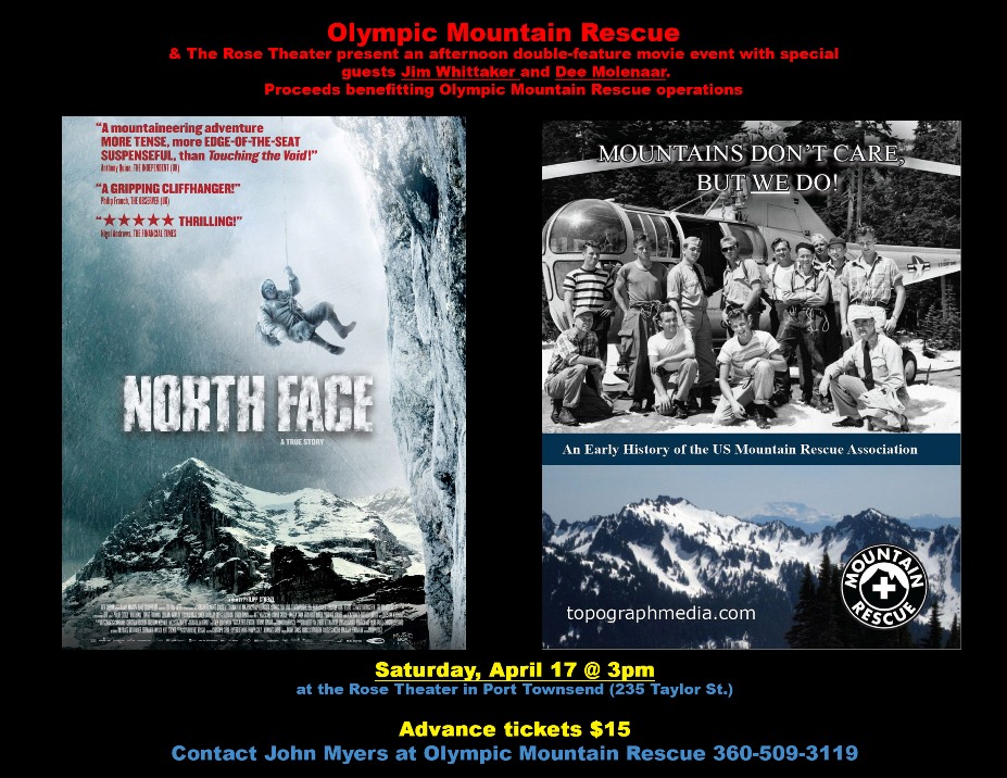
We've only got about 20 tickets remaining for the event this Saturday. So if you're planning to attend and don't have a ticket send me a message quick.
Thanks for all those who have supported.
John
-
Double Feature Event with Mountains Don't Care - But We Do! and North Face
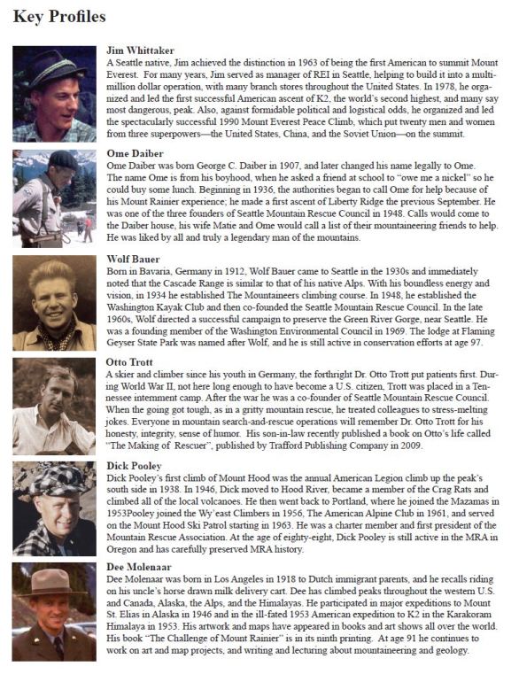
Olympic Mountain Rescue and the Historic Rose Theater in Port Townsend are hosting a special double feature movie event at 3pm on Saturday, April 17 featuring special guests Jim Whittaker and Dee Molenaar. The first short film is called Mountains Don't Care - But We Do!, a 2009 production by OMR/MRA illustrating the history of the US Mountain Rescue Association. See http://www.topographmedia.com
A list of some of the key profiles featured in the film:
The second, full-length feature film is called North Face. It is a newly released film which has already received a fair bit of publicity already, a few local showings, and has received excellent reviews. A brief synopsis:
TO BE THE FIRST TO CLIMB THE FAMOUS, NOTORIOUS EIGER NORTH FACE—THE DREAM OF MOUNTAIN CLIMBERS FROM ALL OVER EUROPE IN THE SUMMER OF 1936.
Based on a true story, NORTH FACE is a gripping adventure drama about a competition to climb the most dangerous rock face in the Alps. In July of 1936 - less than a year after the most recent and fatal attempt, two top German mountaineers, Toni Kurz (BENNO FÜRMANN) and Andi Hinterstoisser (FLORIAN LUKAS), take up the challenge to become the first to scale the infamous rock face, the so-called Murder Wall.
More can be found at www.NorthFaceTheMovie.com
The Rose only seats 158, so tickets will be limited. Advance sale tickets are $15 each and can purchased via e-mail contact John Myers at bremerjohn@comcast.net or calling 360-509-3119. The Rose Theater is located in the heart of historic downtown Port Townsend at 235 Taylor St. (http://www.rosetheatre.com)
----- All proceeds from the show benefiting Olympic Mountain Rescue operations. -----
-
Well done fellas. Glad you could salvage the weekend - both of you.
North side of Washington looks inviting in that pic of yours Terry.
John
-
Great photos and solo trip. Thanks for sharing.
-
Trip: Colonel Bob Wilderness - Various
Date: 2/20/2010
Trip Report:
We spent the fine weekend in the Colonel Bob Wilderness and hiked up Colonel Bob peak, scrambled up Mt. O'Neil and Peak 4500 on Gibson, and climbed up Mike's Spike. Great views of the Pacific Ocean and the interior of the Olympics from the southwest.
Some pics:
Lumpy Ridges to the SW of the Wilderness
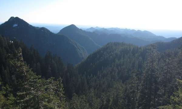
Olympus
From Colonel Bob
On traverse to O'Neil, a little up and down, a little brush
Having a look at Mikes Spike
On the Spike
Camp with a westerly view
Sunset over the Pacific

Gear Notes:
Shorts, T-shirts, shades and sunscreen were nice to have this weekend.
Approach Notes:
Pete's Creek Trail off Humptullips River
-
All great photos Steph. But I think the snowflake shot is particularly neat, especially with that blue background. Real nice.
John
[TR] Burke Range - Chimney, Bi-C, Watterson, Crystal - East fork Quinault 7/7/2014
in Olympic Peninsula
Posted
Trip: Burke Range - Chimney, Bi-C, Watterson, Crystal - East fork Quinault
Date: 7/7/2014
Trip Report:
On July 7-14 four of us made it back up to the Burke Range for another round of fun. We had last been thwarted by a party member getting a stick in the eye a few years ago in the lower forest of Chimney Peak. This year we were succesfull in the attempt. Our approach was via Pyrites Creek, up and over the 5840 ft pass adjacent to Pk 6049, around the basin in upper Godkin and up the south flank of Chimney Peak. Chimney Peak offers such lovely views. A walk down to the tarn immediately to the north made a great camp, and the evening scramble up Bicentennial was quite nice. We had what we thought were good views of the Gnarly Ridge ahead (Dane Burke's aptly descriptive term for that portion of the ridge). Our plan had been to rap down the snow gulley at that point into the basin below Watterson. The Olympics have a relatively low snow pack and we could not see a continuous-enough line to rap into from this vantage point. In hindsight we should have spent the couple hours to traverse over to the ridge and we would have discovered that indeed the rappel would likely have gone without trouble. Instead we opted to descend the north snow chute between Chimney and Bicentennial. Unknown descents into waterfalls and cliffs spiced up the day. Once sufficiently down we turned the corner and went up to the tarn below Watterson, another lovely camp. Next day it was Crystal Peak and back to camp at the tarn. Our exit route was a fairly spirited descent off Gnarly Ridge and down Anderson Creek. I think there were 7 brushy rappels involved. Camp on the Quinault and out.
View looking south from Chimney Peak towards 6049
View looking north from summit of Chimney Peak
Lego-climber dude on Chimney Peak
"The Chimney" on Chimney Peak.
Walking down to the tarn below Chimney
An enchanted and threatened chalet so far down below
Old Snowback (aka Chimney Peak)
Watterson and tarn below
Descent chute
Hmm, waterfalls
Brushy raps
Looking south to Bicentennial and Chimney Peak
Crystal Peak and Upper Crystal Lake
Gear Notes:
Bring a rope, preferably two, if you decide to descend the way we did, which I don't recommend.
Approach Notes:
No easy way into this place. Pyrites and up and over 5840 ft pass probably best option. Once on Chimney give the Gnarly Ridge a look and if the season is early enough there should be a good rap down into the basin below Watterson.