


Phil K
-
Posts
600 -
Joined
-
Last visited
-
Days Won
6
Content Type
Profiles
Forums
Events
Posts posted by Phil K
-
-
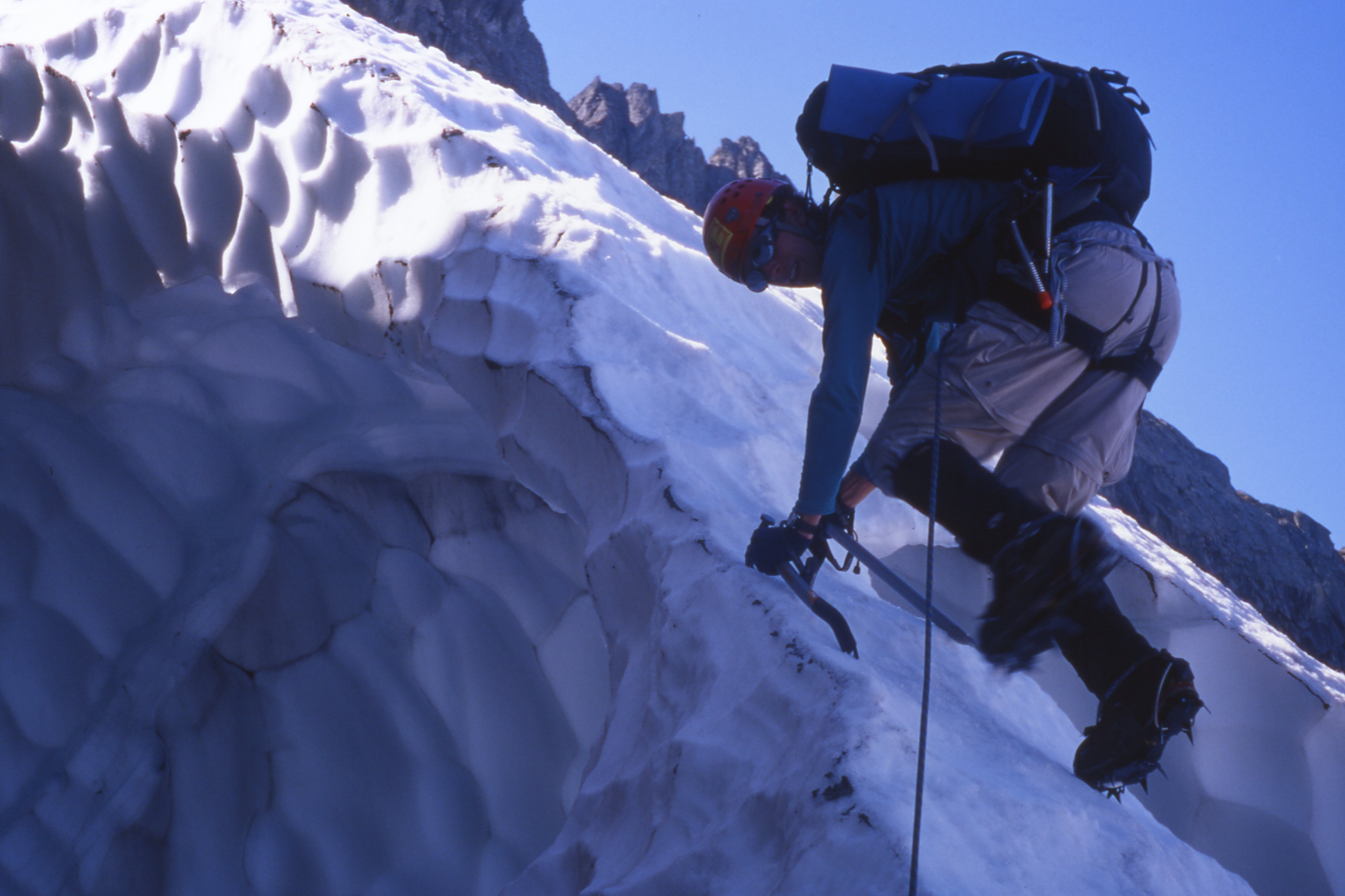
Jason may be a nerd, but he's hardcore. Hardcore choss dog.
-
On 2/19/2024 at 10:55 AM, bigeo said:
You guys rock! I've heard this attributed to bush pilots in Alaska, but it has many applications: you start with a bag full of luck and an empty bag of experience. You hope you fill the latter before the luck runs out.
There is another saying: "There are old pilots, and there are bold pilots, but there are no old, bold pilots."
I'm old, and was never especially bold, so take my advice FWIW; you kids be careful out there.
-
 1
1
-
-
Hell’s bells; since I’m officially a geezer, almost anything I do counts as an achievement. There are still a few bucket list trips that I’d like to tick; semi-rugged off trail stuff that would involve some minor scrambling. I’m going to be 90% or more retired, so hopefully more multi day outings. Lots of high lakes to explore. Maybe finally get up into the Chelan Sawtooths and/or central Pasayten.
-
1
-
 1
1
-
-
Nice try! Ice climbing in Washington is always conditions dependent, and sometimes you've just got to slog in to see what's happening. I think that upper climb could be easier to access with good snow coverage when it's well consolidated. There is quite a bit of slide alder to negotiate traversing below Alaska Mountain, and doing so while floundering would suck, big time.
-
Ha! I found a picture. OK, maybe that snow bridge was more than 3" thick.....
-
 1
1
-
-
I remember that trip with Jason and Mizuki well. Funny story; we were descending down the NE shoulder, picking our way down along rocks and snowfields. At once point we hit a snowfield that rolled off steeply and across a narrow snow bridge that looked a bit sketchy. We put Mizuki (the lightest of us) on belay and sent her down first. As she’s going over the snow bridge she’s saying “It’s very narrow, it’s very narrow.”
Of course we thought “yeah, we know; just do it.” I think it was my turn to go over next , and as I’m cramponing down this snow bridge I realize “Oh, she meant it’s THIN.” As in about 3” thick and maybe 18-20” wide. And if it busted, you’d do a wicked pendulum fall into this big overhanging snow cavern and get bashed up. Yeah, “Jason, tread lightly on your way down!!!”-
 1
1
-
-
I'll bet Joe's Garage is getting Phat.
-
11 hours ago, olyclimber said:
Same. I used/still use Gaia GPS for a long time but they were bought and now my photos no longer sync from my phone with the free version. I really like the typos on CalTopo, now my go to when researching an area.
Best typo ever!
-
1
-
-
On 11/1/2023 at 12:53 PM, JasonG said:
Yes, the masses like me will return! Need to go up Kyes again at some point....
That glacier ain’t what it used to be.
-
On 10/13/2023 at 11:39 AM, bedellympian said:
You mean 5:25 mile pace? If so your math is off. It's 11 minute miles. 5:25 would be 100 mile world record pace on the track.
Ooops. That makes far more sense. But still!!
-
Great work; climbing, and putting up these excellent TRs!
-
I feel sorry for the Sherpas who get caught up in this nonsense.
-
1
-
-
Cool TR, that's a spectacular face.
How was the road? Back around 2018 or '19 we drove that in my wife's Prius (Not my idea!), shortly after it had been regraded with dozens of water bars. I was sure we were going to get stuck and cause a huge Cluster F.
-
I clicked the cascade-ice.com link and got all kinds of malware alerts.
Crap, hadn't noticed it was a zombie thread.
-
1
-
-
Oh, and in the middle of this effort he had the time and energy to place 10th in the Cascade Crest 100 mile run on 7/21, posting up a respectable time of 18:44:45.
That is 100 miles at ~5:25 each.
23,000+ feet of elevation gain.
-
I (sort of) know Jeff Hashimoto from Nordic Skiing, but didn't know that he was a climber. The guy is a beast.
-
It took me a moment to figure that out; it's a plane dropping fire suppressant. I remember back in the day the Neat And Cool area at 'Squish had a red stain from that which lasted for several years.
-
I just got back from a lake loop up out of Gold Creek and found what has the potential to be an awesome, and reasonably accessible line. There is a second moderate route which might be more difficult to find in prime condition. I am way to old to consider either of these, but would get a kick out of seeing someone else tick them off.
Let's start with the moderate. Approximately three trail miles N of the end of the private road, around waypoint 47.43423, -121.34919 there is a creek which drops about 2000' from Rampart Lakes. This is in a huge avalanche swath; trees are blown down several hundred vertical feet up the opposite hillside. It appears there would be multiple pitches of mostly moderate climbing up this creek, with one or more difficult cruxes. The route is generally low angle enough that late in the season it would turn into a Cascade s'nice wallow. We often (or used to) have some hard early season freezes, and with the right timing the route could be just right. Water flow rate is moderate, so it could form up early. Climbing starts at around 3200' elevation.
Now the good stuff! Another two-plus miles up valley a creek drains out of Joe Lake. The approach crosses another alder choked slide path coming off Alaska Mountain. There is a quite decent trail through the alder, and this may be follow-able in winter. Once the trail leaves the valley, it crosses the creek and ascends steep terrain toward Joe Lake. Perhaps 400 vertical feet higher the trail approaches the creek at the toe of a steep rocky canyon. The climb starts with a rambly section.
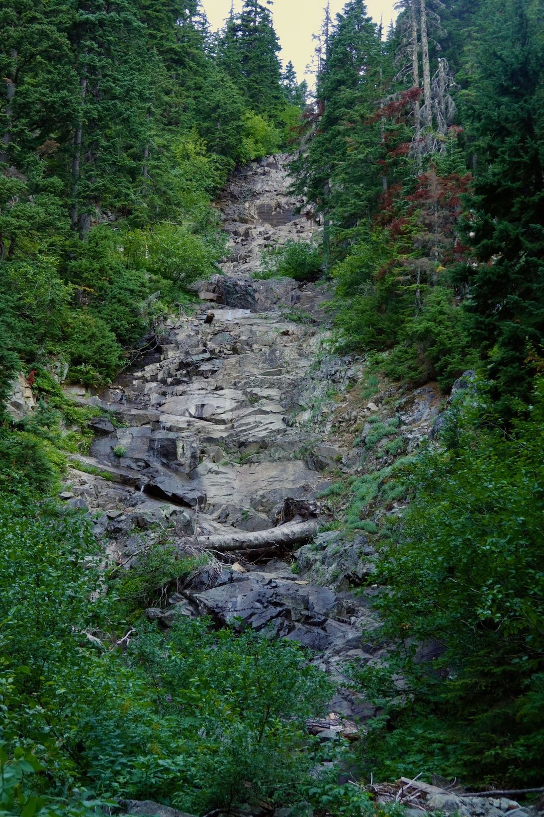
At the very head of the canyon there is a vertical drop that I'd guess is about 200 vertical feet. This would be spectacular, steep, and easily grade V. Again, flow rate appears to be moderate enough that this should form up nicely, and the upper steep section could be prime throughout the season. Climbing starts at about 4200' elevation. From the top one would have the option to walk off climber's right and descend on foot. The trail is quite steep, and exposed enough in places to really get my attention, so treat the descent with appropriate respect. Waypoint for the upper section approximately 47.46544, -121.33019. This climb has a real Canadian Rockies ambiance to it.
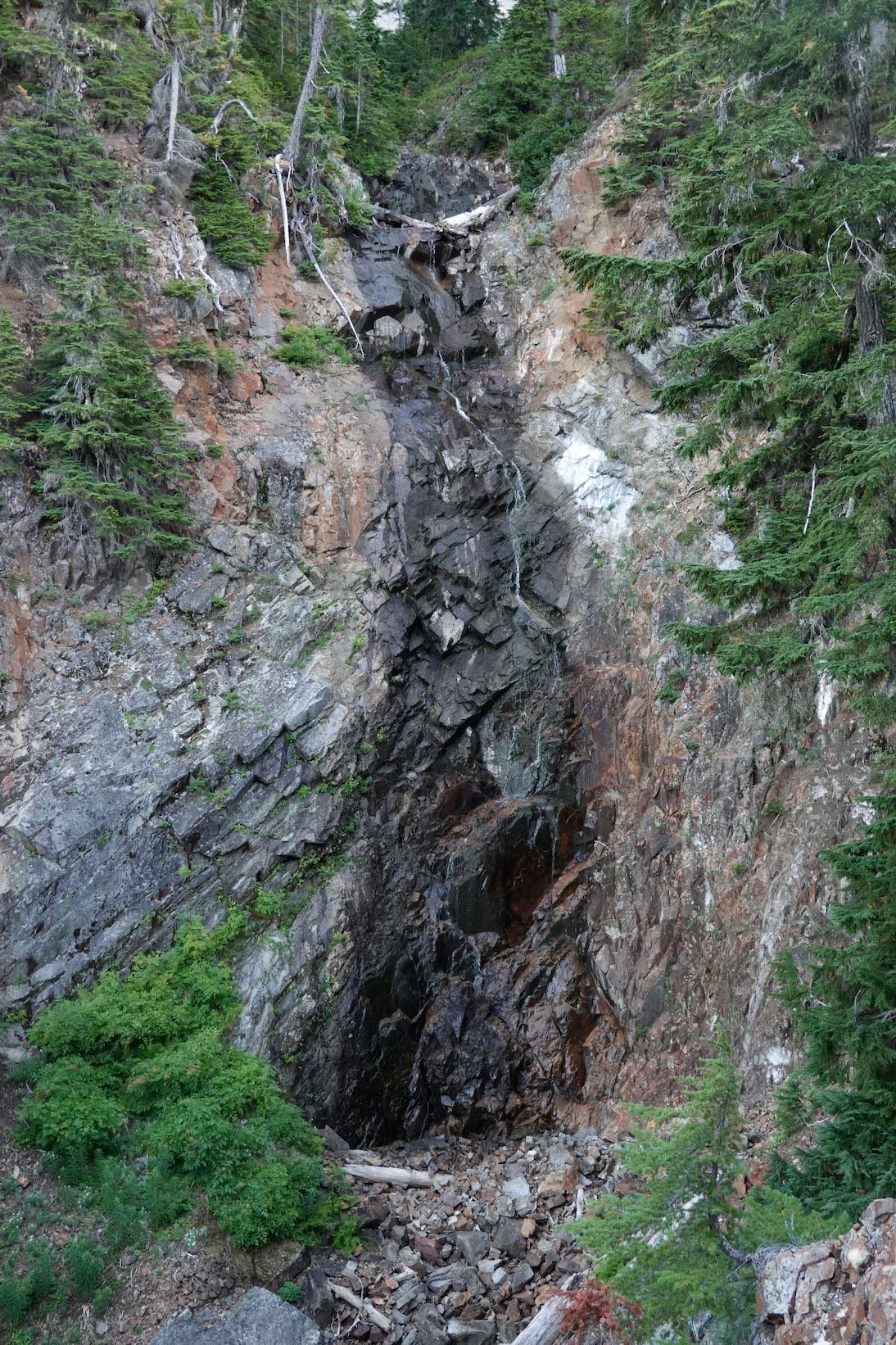
If you do this, and would indulge this geezer, I'd suggest the name Joe's Garage.
Certainly the first climb, and potentially second could be do-able in a day by a fast party. With a good bit of mandatory road walking (probably sled trafficked in winter), and several miles of good trail before getting into the alder messes, one could start well before first light. Go get it. Yo!
-
12 hours ago, Bronco said:
Those are some OG choss dawgs!
Besides renowned Choss Dawg Jason, the other dude is Doug Payne (RIP), one of the most solid guys I ever roped up with.
Funny story- On our first attempt at this climb, after a torrid approach, we woke at the bivy site to unexpected clouds and the threat of afternoon T-storms. Not liking that prospect we opted to go over the Goode/Stormking col, scout the descent, and out via Park Creek. (NPS shuttle, bus, and bakery)
We ascended snow to just below the col and Doug took the sharp end up the final gulley to the top. There he is, like 80' off the deck with barely any meaningful protection, trying to pick his way up a particularly ugly section. Rocks were raining down, Doug was muttering quietly to himself and occasionally cursing out loud; making no progress. It didn't look that hard, and I was surprised that he seemed a bit rattled.
He made it, of course, and when it was my turn to follow I was shocked at what a nasty, downsloping rotten mess that section was. I was creeped out even on toprope.
-
2
-
-
Yeah; a bus ride with bakery stop sounds way better. Fun route for sure!

-
2
-
-
It looks showery up there this week. Probably not enough to quench the fires, but certainly helpful. Definitely enough to screw up our hiking plans for the week.
😒
-
I remember that scree slope of doom. Once over that it all seemed pretty fun, and the final scramble wasn't even too bad.
-
1
-
-
Bicyclists. I think he dislikes bicyclists too.
-
Looks great. I love that bivi pic!
Best offwidth cracks in the PNW
in Climber's Board
Posted
If you're headed up to Midnight, stop and check out Damnation Crack on Jello Tower. It's only rated 9+, but the FA was in 1957, so it's probably a solid old-school 9+.