


Guiran
-
Posts
33 -
Joined
-
Last visited
Content Type
Profiles
Forums
Events
Posts posted by Guiran
-
-
Confirmed with Weyerhaeuser: The traditional access routes to North and South Twin Sister from the Middle Fork Nooksack River Road fall within the new permit area and will require a $50/year permit for each climber for legal non-motorized access across Weyerheuser lands.
Is this something that the WCC or Access Fund can weigh in on? The Weyerhaeuser recreation site has some language about areas set aside for public access without permit, but apparently that doesn't apply to anywhere in the North Cascades-Chelan region:
Q: Has Weyerhaeuser considered continuing to allow non-motorized access without a permit along the specific sections of the roads used to access climbing routes for the North Twin and South Twin?A: No, any access to the designated North Cascades – Chelan permit areas requires either a motorized permit or a non-motorized permit.
-
The west ridge of the North Twin Sister is one of my favorite scrambles in Washington and I've probably done it about a half dozen times over the last ten years in a variety of conditions. The changing nature of the logging roads in the area has always been an "interesting" aspect to route finding on the approach, but it appears that land management has recently changed and access may be changing with it.
The gate at the jump off point from FS Road 38 has a new sign (which conflicts with the older signs) that all users now require a permit for access to Weyerhaeuser lands. This is consistent with the Weyerhaeuser recreation website, which states that motorized and non-motorized permits are required for access from July 1 - December 31.
I suppose that the upside to this is that, if money is less of an object, a motorized access permit can be purchased for $200 annually, allowing access higher up the road network than has been possible for a number of year. The downside is that even bike access through Weyerhaeuser lands requires a $50 annual permit -- for each person entering the area, per the FAQ.
While the sign on the gate says that a permit is required for all access and the traditional approach route for the North Twin falls in the area outlined on the map for a motorized permit, the non-motorized permit map is much smaller, located further south and west. I have a message in to Weyerhaeuser, asking them to clarify their policy on non-motorized access via this gate, but does anyone have further information on this?
Given the relative popularity of this route, particularly for climbers in the Bellingham area, this seemed important enough to bring up.
-
Offering to let an obviously faster party pass might cost you 15 minutes. The cost to faster parties stuck behind a slower can cost them hours.
Just something for less experienced parties on busy routes to think about.
When the less experienced, slow-ass party starting the Ragged Edge asks you which route you're planning to climb and you grunt back, "The North Face" one might be forgiven for thinking that you were planning to climb the north face of Vesper.
Sorry that we dashed your hopes of speed record. But, honestly, the witty banter at the belay ledges was good enough that we wanted to keep you around (seriously, no sarcasm).
Next time, feel free to ask the slower parties to pass. We would have been happy to find a way to let you pass. Just something for the more experience, faster parties to think about.
-
The route was definitely getting some love this weekend -- three parties on it Sunday morning. Really fun, sustained climbing in great position. The "touch of heather" at the top is a bit sporting.
Really appreciate the effort required to put together a well-protected alpine route.
We didn't find anything large and loose on P4. Either it managed to seat itself or someone cleaned it within the last two weeks.
-
If you were the party of two rapping off Godzilla near the end of the day as my partner and I were getting ready to climb it, I think that you may have inadvertently packed out my climbing shoes (Sportiva Mythos). Be great to get these back -- climbing Godzilla in my partner's gym slippers (1 size too large) was not exactly as classic as the climb.
-
I don't suppose any of you left a headlamp on the summit? We carried one down this weekend. Describe it and it's yours.
-
Not sure, we didn't ask. We left the trailhead @2pm and they were sitting on the back gate of their car chatting and smiling. There was a man and a woman, and she looked to be in worse shape with much of one of her legs bandaged, but I have no idea what happened or who they were.
These two are friends of mine - got a debrief from them on Sunday night.
He pulled a microwave sized block off the very beginning of the first pitch (the first real step of 5th class after the 2nd class ledge). Knocked him down slope about 40'. He hadn't put in any protection yet on the pitch (I would be surprised if most do) and the fall came directly onto the belayer. She caught the fall, but the force pulled her off the ledge and tight against the anchor (a 0 - yellow - C3, placed in an idle moment of, "Well, I've climbed this before and I know it's super mellow, but what the hell, I'll put something in."). The C3 held the fall (though is a little worse for wear for the experience).
He banged up his shoulder and wrist and has a set of scrapes on his forehead that bear a remarkable likeness to cam lobes (he thinks his #3 came around and hit him in the head for good measure during the fall). She tore up her leg a bit, but mostly looked worse than it was. Both are in good spirits and were making plans to come back and climb other routes in the area while walking out, so I don't think the incident is likely to have long-lasting effects on either of them.
Lessons learned (?): wearing a helmet is a good idea (a thought that occurred to my friend as he went tumbling down the face while wearing his), WA Pass is not immune to choss, and putting in a belay anchor in easy, but exposed, terrain is a good call.
-
Found near the base of Lost Boys on Friday 8/24. Describe them and they're yours.
-
Saw one two years ago below the summit of Columbia in the Monte Cristos.
-
I think you could probably pull this off as a two-day trip (though three days would certainly be nice). As of mid-November, there was a fair bit of flagging on the Kindy Ridge approach, which should make it easier to stay on track up the steep forested slope. The flagging runs out prior to the main ridge, and our party of four took a few "detours" before getting to the right place.
Two things I'd be cautious about. From the saddle, there are avy prone slopes up to Pt 67??. You should be able to avoid the worst of these by keeping to climber's right in light timber. Along the crest of Pt 67?? there is a wide, long fissure in the granite that would make for one very unpleasant crevasse fall. Keeping to climber's right on the top of the ridge should avoid it.
Haven't you done this as a ski tour before (too lazy to look up old post)?
-
I, Ethan Welty, have these shots to share.
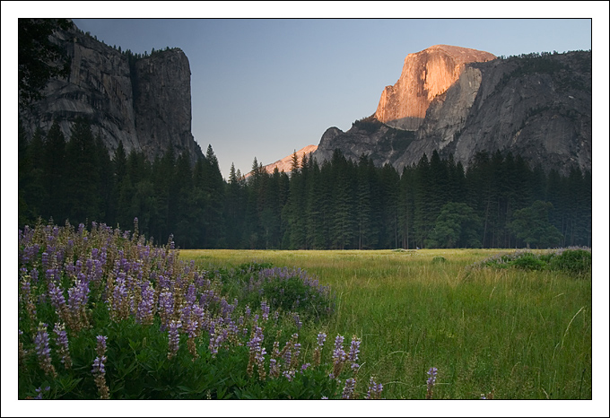
Scenic: Sunset on Half Dome, Yosemite NP, CA.
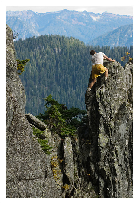
Bouldering: Improvised route along the approach to Vesper Peak.
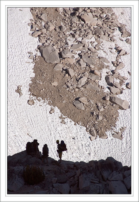
Climbing: Climbers contemplate rock and ice, King's Canyon NP, CA.
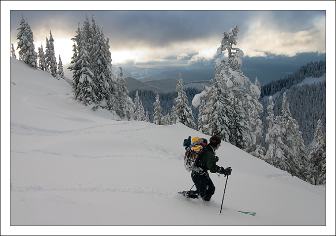
Skiing: Catching some powder above Boulder Lake.
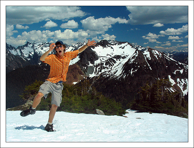
Humor: Shenanigans in Gothic Basin.
-
You'll have to ford the Suiattle at Milk Creek, but that should be feasible (but frickin cold) this time of year. Trying to approach the Sitkum route via NF Sauk would probably be better done as a three day trip given the distances involved.
-
Car manufacturers are warranteeing the batteries for something like 8 years, 80,000 miles. As I understand it, the hybrid battery waste stream isn't likely to be much worse than the waste stream from conventional lead acid batteries.
-
I'm curious as to the reasons why they would use a rocket to test the aerodynamics of the air frame rather than use the jet engines they've already developed. Is it because they don't want to risk losing the air frame and the engines in the same crash?
Scramjets and ramjets don't work at speeds below Mach 1. So there's this little problem with getting off the ground.
-
Haven't heard anything about that - but it would pretty much shut down access to the Spider Gap area. Only options would be to come in on the White River trail, in from Suiattle River, or over from Lake Chelan. *blech*
-
The cabin's still standing - so I'd guess your name is still there, too.
-
Gary - heard that the guy signed in for White Rocks Lake got stung 7 times at the same place. I'm feeling pretty good about only getting hit once.
-
I read recently that they are trying to put a bunch of wind mills out in cape cod and there is a whole group of residents fighting this because their horizon will be ruined. Howsabout we look ahead 30 years when oil is going to be 10$ a quart ...that energy source is looking pretty good now huh?
I think folks opposing the Cape Wind project on NIMBY issues are being short-sited. A pet-peeve of mine: energy generated by wind turbines does not replace oil. Virtually none of our electric power is produced by oil. The real comparison is burning coal vs. blocking the view.
How much energy can be extracted without changing the environment really depends on the size of the resource. Extracting a few hundred MW of wind power doesn't really have much impact (like dipping your toe in the ocean doesn't change the tides), but trying to extract a few hundred MW of tidal energy from Puget Sound would be like jumping up and down in a small puddle.
-
Lost Creek Ridge would make for a long approach. 13 miles to the site of Kennedy Hot Springs, then I'd guess at least another 4-5 up to Boulder Basin.
Did the climb two weeks ago via Glacier Gap by NF Sauk trail. That's probably a more direct approach.
Frostbite might be feasible if you can ford the Suiattle river and go via Suiattle River TH.
-
Hang on, didn't X have a thing for Z, but then was upset after Z hooked up with Y? Or was that A who had a thing for C, but was upset with D?
Could you use more descriptive variables?
-
Nice TR. Captures those key moments of the trip. I'd like to add:
10:00 pm - Snaffle attacks.
and:
12:00 am - 1/2 the group relocates to outside the tent to avoid the rain.
-
Realize this thread is probably old and dead, but thought I'd offer some beta on the fisherman's trail to the lake around 5000 ft. Bailing off a traverse from Hurricane to Snowking, my partner and I managed to (by total and complete luck) locate the trail just below the lake, simplifying our descent. The tread is very faint and occaisionally blocked by large deadfall, but we were able to follow it to within ~1/2 mile of Illabot Road where we lost it at a huge washout. Good times walking down Illabot Creek to get back to the road. At one point the trail looks to have been quite well maintained - there are some massive trunks across the trail that looked to have been cleared with cross-cut saws in bygone days. I'm not sure where the "trailhead" actually hits Illabot Road. We found flagging on both sides of Illabot Creek. I would definitely not recommend our descent route to the creek from the washout - nasty, dense, brush. It's possible that the start of the trail is pretty much gone. Which is too bad, would make for a nicer start to the west shoulder route on Snowking.
-
http://www.fs.fed.us/r6/wenatchee/pct/PCT-trail-detour-map.pdf
Shows locations of bridge and trail damage. Looks like the bridge near Miner's Creek is gone.
-
It was more of a "whump" than a "whoomp".
Found: Black Glove
in Lost and Found
Posted
Found: Small black fleece glove midway up Hell's Highway on Mt. Shuksan. Think it belonged to one of the party of three coming down that my wife and I encountered on the Upper Curtis Glacier on Saturday evening?