LYleK
-
Posts
96 -
Joined
-
Last visited
Never
Content Type
Profiles
Forums
Events
Everything posted by LYleK
-
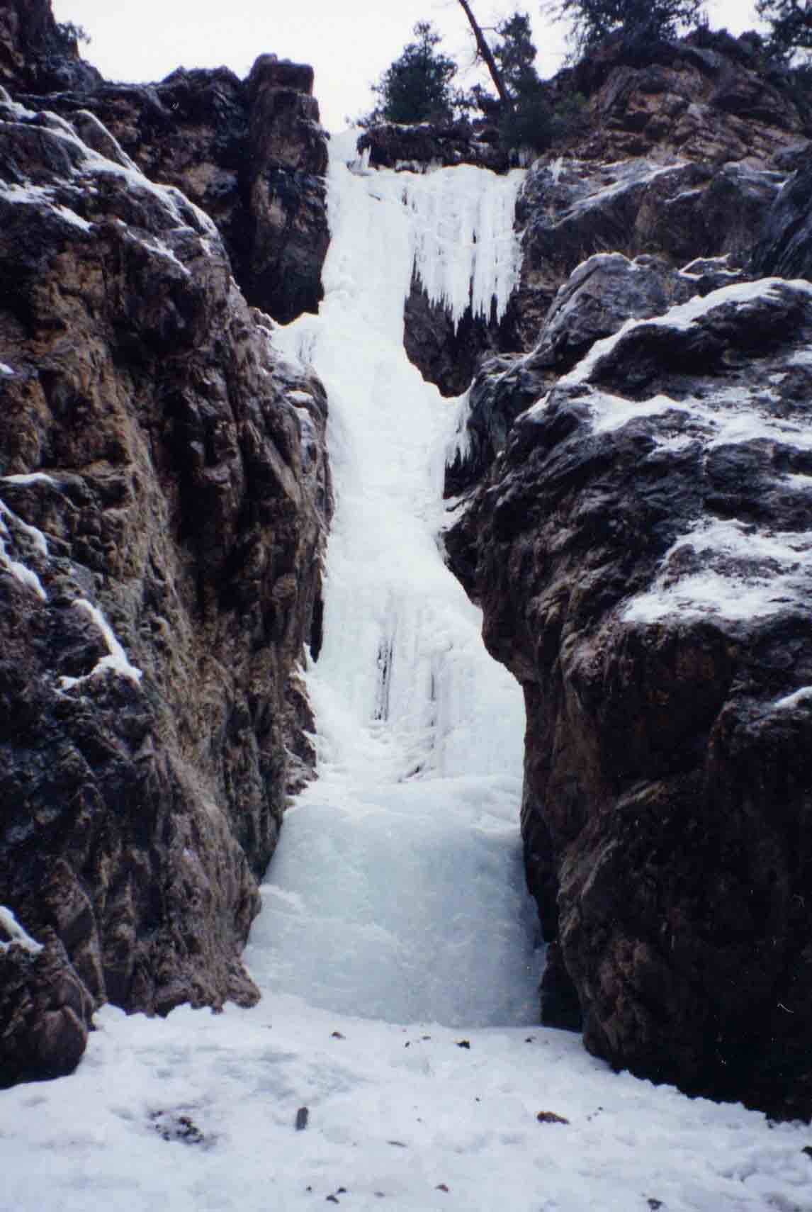
Ok, here's one. Near'ish to Lillooet.
-
This all seemed like a bit of a clusterf*%k to me when I was doing research two years ago, too. The approach descriptions were just too vague and nothing was apparent from the road, John would be the one to kidnap for the roadtrip. After discussions with John I was pretty much convinced that the route opposite Synch was not MWM, as he made it sound like it was more "above the bridge" and not visible from the road. And his approach description to me put it over on the other side of the ridge, ie. towards the bridge facing NE. And it sounded way more "mixed" than I've ever seen the route in question, so this is why I guessed with DD. I don't know why but I'd always thought that you (don) and Robert N. had made the slog up to that pillar opposite Synch, weird. As for The Straw, maybe it's The Tube? And the route you climbed recently was Duffey's Delight? And yes, a tramp in the woods is probably in order. Thanks for the beta on the other routes, I'll get them switched. As for hidden gems, Don and Dru are doing a fine job sniffin' out the lines, there's still lots to do around Lillooet.
-
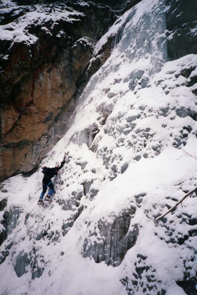
Quote: "Lyle gives it up to wooden goats" Bivy.com made me take down my route description for this one This is Darcy at the crux
-
My two cents: Current ice grades are totally inadequate to deal with the complexities of ice conditions. Unlike rock they are super-dynamic, and a route can change not only season to season (and throughout the season), but in the time it takes to climb the route. It's affected by the volume, the temp., the number of climbers hacking it up, percip., time of day, air pressure, someone pissing off the top of the route. I've started routes in the shade, hit the sunny spots and it was a new route, from dry dinner plates into flowing plastic. Then you place a screw and flood the route with a gusher and the second has a whole new experience. I like Dru's approach that everyone needs to ID their own limits, but it does make it tough when you are new at ice, or to an area. Maybe there should at least be a range to a grade, ie. Deeping could show "4 to 5+" which would give climbers an idea of what to expect. It still needs a lot of work.
-
Note on Honeyman: As soon as it gets near 0C it starts to collapse in on itself pretty quickly due to the sheer volume of water flowing underneatth, and can be pretty sketch after a few warm days. Not to throw out any bad mojo, but I'd consider it one of the more dangerous routes around Lilly due to this unpredictablility. Just something to consider as you venture up in warming conditions. Fun climb, though.
-
Hey Ade, I'm not sure why TRC is so ephemeral, it's too bad as the access is so easy. I can only remember it forming one season while I was in Lillooet ('91 to '02). There really isn't any way for the water to get diverted out of the channel, it must go sub somewhere along the way. I've done lots of mtn. biking adjacent to it and the whole hillside appears to be exfoliating (a big creeping landslide), lots of tight horizontal rolls and even some 30cm fractures that I've seen other creeks disappear into. Maybe it's all that logging, the carcasses of spotted owls are clogging up the channel...
-
Thanks for the site, I went here earlier hoping to find it. It's a similar character, just a few generations later and doing a different route I"ll keep looking.
-
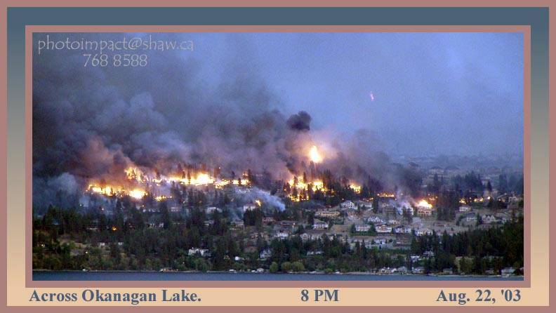
I went and watched the action Friday night from across the lake, wicked... All Kelowna fire pics here: http://www.castanet.net/firepics/
-
Hey , I'm trying to track down an image: A few years back I picked up a t-shirt at Redpoint (Smith Rocks) that had a stylized stickman climbing through an overhang. Anyone have this image/ shirt they can scan (or photocopy and fax) and send? Any help - much appreciated. Lyle
-
Bernard sent through some pics, I'm pretty sure this one is Phair Game taken today. I know where I want to be...

-
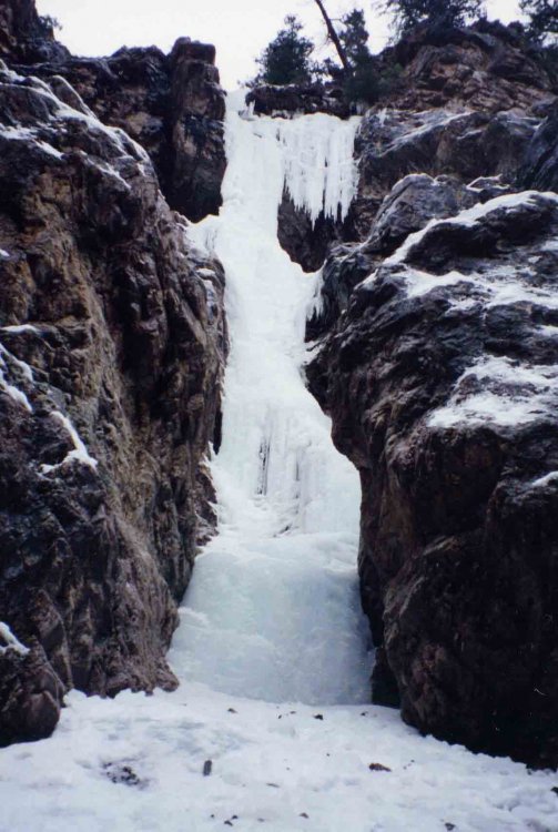
This is "It's Only Phair" - WI3, 60m
-
Dru, this is the first that I've heard of draft Lillooet maps being distributed at the icefest (Bernard e-mailed me to see if he could get a copy, I posted one to him with the caveat that it only be displayed and not reproduced), so I called Bernard tonight to get clarification. He stated they're doing up a 8 to 10 page booklet "to direct climbers to the routes only," which is contrary to his posting (re: beta it will contain): "You've asked for a guide to local climbs - we're making it! And as a participant in the IceFest, you'll get a free copy, listing the whereabouts of each climb, its difficulty, the consistency of formation, avalanche risk and other details where available. You'll want to bring this back with you on each climbing trip." It sounds v. familiar to my draft maps, and much of the info he has promised is beta I've gleaned and researched (lit. and field), and is available on the draft Lillooet Ice Climbing maps only. And while it can be argued that some of this beta is available through guidebooks, CAJ's, and websites and is public knowledge, in my opinion it would be next to impossible for a non-climber to place most of the climbs on a map, let alone come up with the details. I've politely asked Bernard to respect the work I've done and the good faith in which I provided him with a map, and that he not blow the marketability of my project by essentially reproducing my efforts and calling it his own, under the auspice of promoting local tourism. Forrest and Fern, thanks for passing along my request to protect intellectual property, much appreciated. As Fern said, I don't mind if people with drafts are making photocopies for friends, I just don't want my work poached, mass-produced, and/ or marketed (ie. using it as a draw for a $60 event, and calling it "free").
-
Two more sets of maps back this week: Robyn Rankin, Steve Jodoin
-
Just talked with Lula at the Esso in Lillooet. Maps that don't get delivered by the end of this month will be behind the counter there (there's only one Esso station). You'll need I.D. for your smokes and maps.
-
Yep, it's not quite on the mapsheet, it's a steep slog but sounds like it's worth it. I was there in the summer and stopped at the base of the weep for a break. An airline luggage tag fell off my pack. So when Iain et al went in for the FA they found the tag and thought I'd scooped 'em. Car Wrecker Gully is another one that didn't make it on the maps. I think it's Pavilion Creek, between the Fraser and what's left of the General Store, but still want to track down Carl to confirm. Names of people who's maps were returned (or I don't have their address): John Kamencik, Dave Sulina, Jeff Rabinovitch, Steve Pakulak, Kathy Banks, K. Grunenberg, Ron George, Stephen Berard, Lisa Rae, Isabel Budke and Nicole Acerra.
-
Just relieved to have it off my to do list , even it's only a copy. Maybe one day it'll be a real map. Dru's already on me about inconsistencies, so here's my first addendum to address the glaring errors Legend Box (dru's catch) Length of Season is either S = Short, R = Regular, L = Long in the tables. The legend shows Normal where it should be R = Regular. North Map Vertical text box near the "D" on the left side should indicate that mileage starts at the Bridge River Bridge near Lillooet, not the Seton River Bridge. South Map Okay, this one's got some fuck-ups. I had a lot of changes to be made, but they never made it to the sheet. 1. The following routes should be marked with a *, as I couldn't figure out where they should be on the map. I think most of these are fairly close, though: a. Duffey's Delight b. The Waiting Game c. Cowabunga Dude d. Gung Hai Fat Choi e. Cut Throat 2. Mixing With Mike show ups in the table but not on the map. It's up near Duffey's Delight , but I couldn't quite figure out where; 3. The Straw, same as MWM; 4. Lost Boys shows up on the map near Three Ring Circus but is unlabelled. All of the text was taken off the map. The climb still shows up on the map where I thought it might be, but I didn't want any lost boys or girls out there; 5. Polish Sausage and Cunning Runt are closely associated with the Rambles, but this area needs a detailed topo to show exactly where the are. Cunning Runt is still in the table. LILLYWET ICE DANCERS
-
Two more back today, Ron George and Stephen Berard.
-
New returns today: Howie Harshaw, Nicole Acerra, Jon Cornforth, John Kamineik (sp?), Isabel Buelke, Brett Millard . Also, if anyone has an address for Dave Sulina, John Howe, Lisa Rae, or K. Grunenberg it would be appreciated.
-
Hopefully most who were at the 2001 Lillooet Ice Fest have received a copy of the ice maps. Sorry they're late. And now I've moved from the area so wanted to get that monkey off my back. Bad monkey. And I apologize for the poor kwal, but it'll get you to the routes. The mapper didn't get to my last round of changes, so there's a few glaring errors. And there's a few others that Dru will obsess over for a few months (yes, Lone Star is there). Dru, I'll send you two copies of the south map 'cause I know you'll wear one out right away (though you've got access to a big printer for a few more months...). Fern, it would be appreciated if you wouldn't post an electronic copy of the maps as I'd still like to flog the rights, thanks. No probs with the occasional photocopy, though. I only made enough copies for the icefest participants, so don't have any extras to sell. The maps that get returned will be put in a box at a strategic location in Lillooet (I'll ask the Olexsons at the Esso station when I'm there this weekend). I'll put the names of the maps I get back on this site. So far it's been Rebecca Goulding, Colin Woolridge, Jeff RAbinovitch, Kelly Franz, Kathy Banks, Steve Pakulak, Graeme Taylor, and Mike Meitner (all BC). I'd imagine the US ones may start coming back this week. Too bad the season sucks so far...