


iamjacktors
-
Posts
32 -
Joined
-
Last visited
Content Type
Profiles
Forums
Events
Everything posted by iamjacktors
-
btw, where did you see that SuperTopo called it WI4 in the first place? The book calls it 85-degrees.
-
btw, where did you see that SuperTopo called it WI4 in the first place? The book calls it 85-degrees.
-
Ah, K-mart rafts in the Wenatchee. My favorite!
-
Tyrolean over the Wenatchee in winter, Geah!
-
Nice work. You spelled it wrong though - It's "Commandho". They didn't get it wrong in the book did they?
-
[TR] Streaked Wall- Rodeo Queen 3/7/2006
iamjacktors replied to Chris_McNamara's topic in California
Dude that BMW is a total beater with almost 300,000 miles. -
[TR] Streaked Wall- Rodeo Queen 3/7/2006
iamjacktors replied to Chris_McNamara's topic in California
Sick TR Chris! How many ascents has that route/wall had do yo think? What was the descent like? -
Hey now W, I gots some blackmail pics too...
-
Yeah, but you had some help I bet. You already got your prize.
-
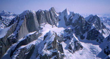
It is possible to climb Crosson, traverse to peak 12,472 (the next peak to the west), then descend west down the ridge to the Foraker Glacier. This was the path that was taken to climb the route Full Circle on the north face of Foraker. The approach is apparently safe and straightforward. Climbing up and over Kahiltna Dome lands you on the Straightaway Glacier, which doesn't connect with the Foraker massif. Flying to the Foraker glacier is not allowed because it is in the national park (and probably not even possible for that matter.) The closest fly in point on the north side is 40+ miles from Foraker, on a small lake (I forget the name.)
-
-
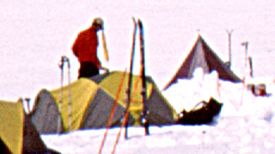
Behold!
-
Is it Peak 12,472?
-
Ah yes. Ron Rico! You mean that guy there...
-
Michael, so sorry to have cropped you out of the picture!
-
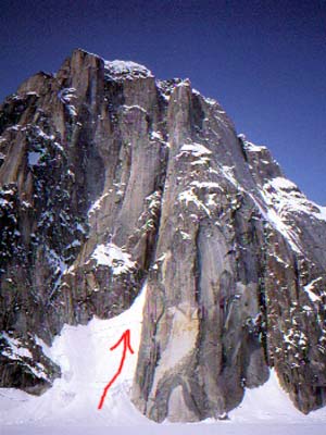
Too easy Dale. But I won't give it away. Here's a hint though. In the photo there are 4 routes and 2 variations. On the entire face, from the 'left' ridge line to the 'right' ridge line (not shown), there are 10 routes, 1 incomplete route, and several variations. btw, My photo was taken near by.
-
The line.
-
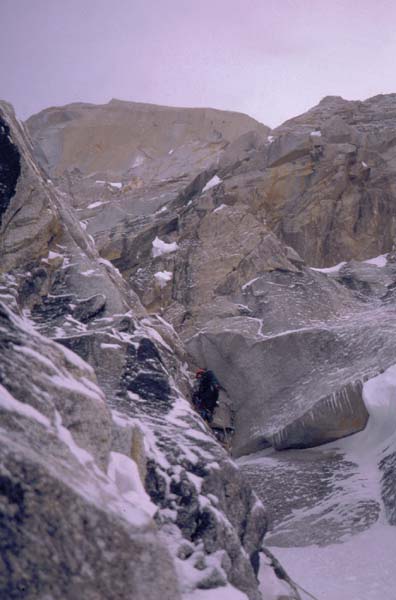
As for the couloir on Dickey: It was attempted by Cordes and DeCapio in May of 2000. The route looked completely in from the ground. They crossed the bergschrund, then did one pitch of near vertical white china with no pro. I think it was Kelly, who downclimbed the entire pitch because there was no anchor. So what appeared to be good ice from a distance, was just vertical snow. They later learned that the entire gulley system is threatened by a, quote "Walmart sized hanger". The line is absolutely stunning- a 5000 ft. ribbon, but will require some real vision to accomplish.
-
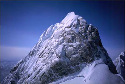
Here it is again so you don't have to download it. Any guesses?
-
First one to guess this peak, wins a prize.
-
Only maps I've ever seen are USGS. Only printed pictures I've seen have been in AAJ's. Washburn has a few as well. Paul from TAT might have some if you ask him real nice. Good luck!
-
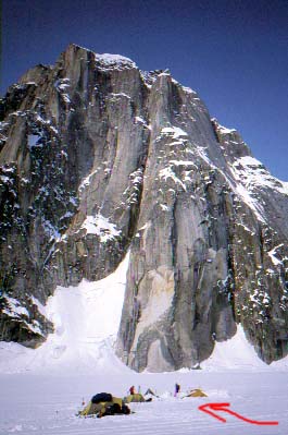
Okay. There have been exactly three routes done. N. Ridge - standard. East Face - horror show, no repeats. S. Ridge - long approach, similar difficulty to N. Ridge, original route, no repeats. Upper Yentna is closest glacier landing to peak, but only gives access to N. Ridge and it is not much of an option to escape from this basin, i.e. if you climb another route and descend the N. Ridge, you must be picked up there. The Chedolatna is not landable anymore, an overland approach is necessary for South and West side routes. If you're not looking at the standard route, it is a logistically complicated mountain in the middle of nowhere.
-
Yeah. Beautiful mountain. Its in Mike and Colby's new book (Alaska Select or something like that), should have all the info you need for standard route.
-
Just giving you a hard time. Snowing in town in August, wow! Did you take advantage on Thursday?
-
Sorry to RAIN on your parade pall, but isnt it pouring rain and snow down to 2500 meters around Zermatt? Isnt the Matterhorn covered with nearly a meter of new snow now? As well as all the peaks in the Alps? Good luck, but dont spray on this site unless you are for real. There are CCers everywhere!!! And for everyones information, Zermatt is a filthy tourist pit full of gapers.