Leaderboard


Popular Content
Showing content with the highest reputation on 12/20/22 in all areas
-
for those of you I have not subjected to pictures of my new new
 1 point
 -
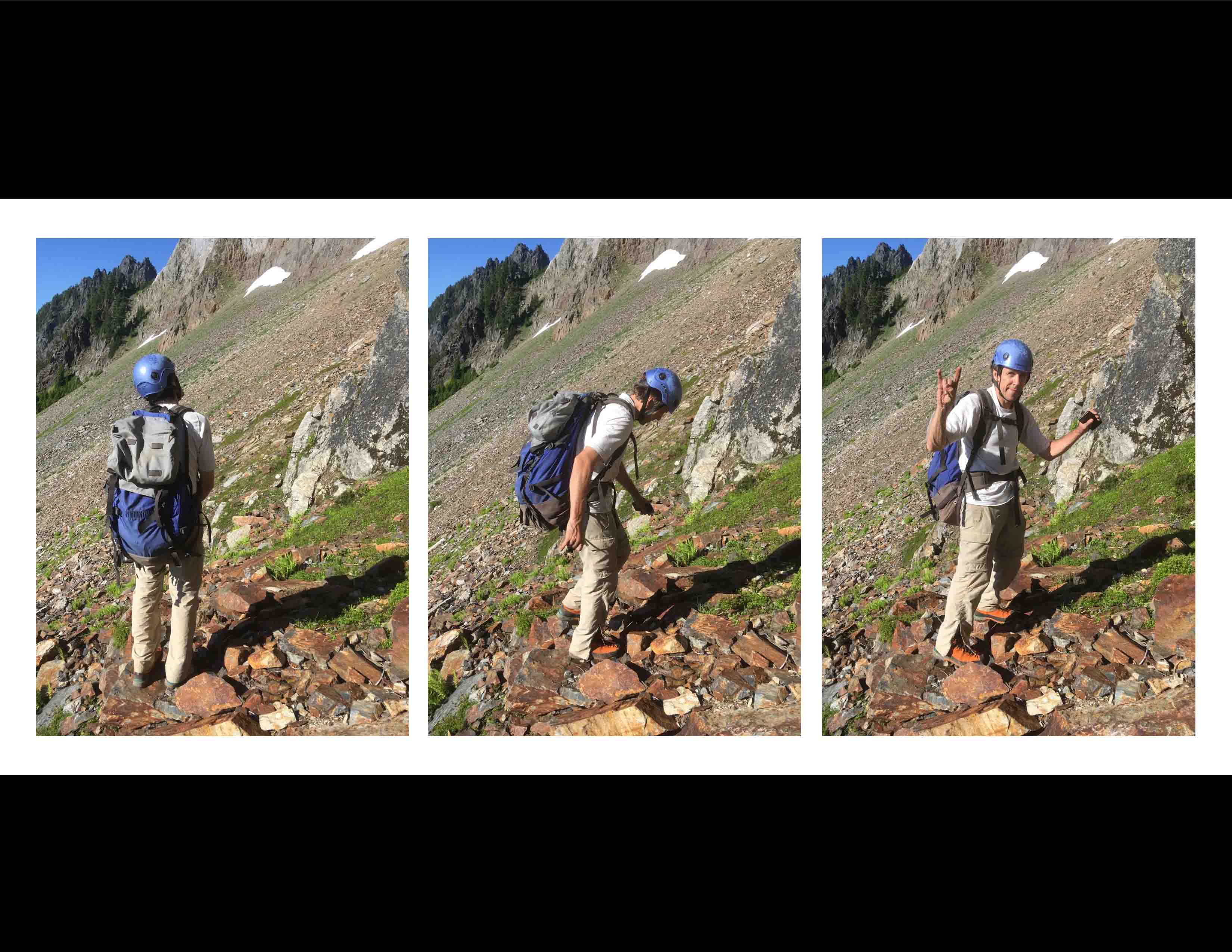
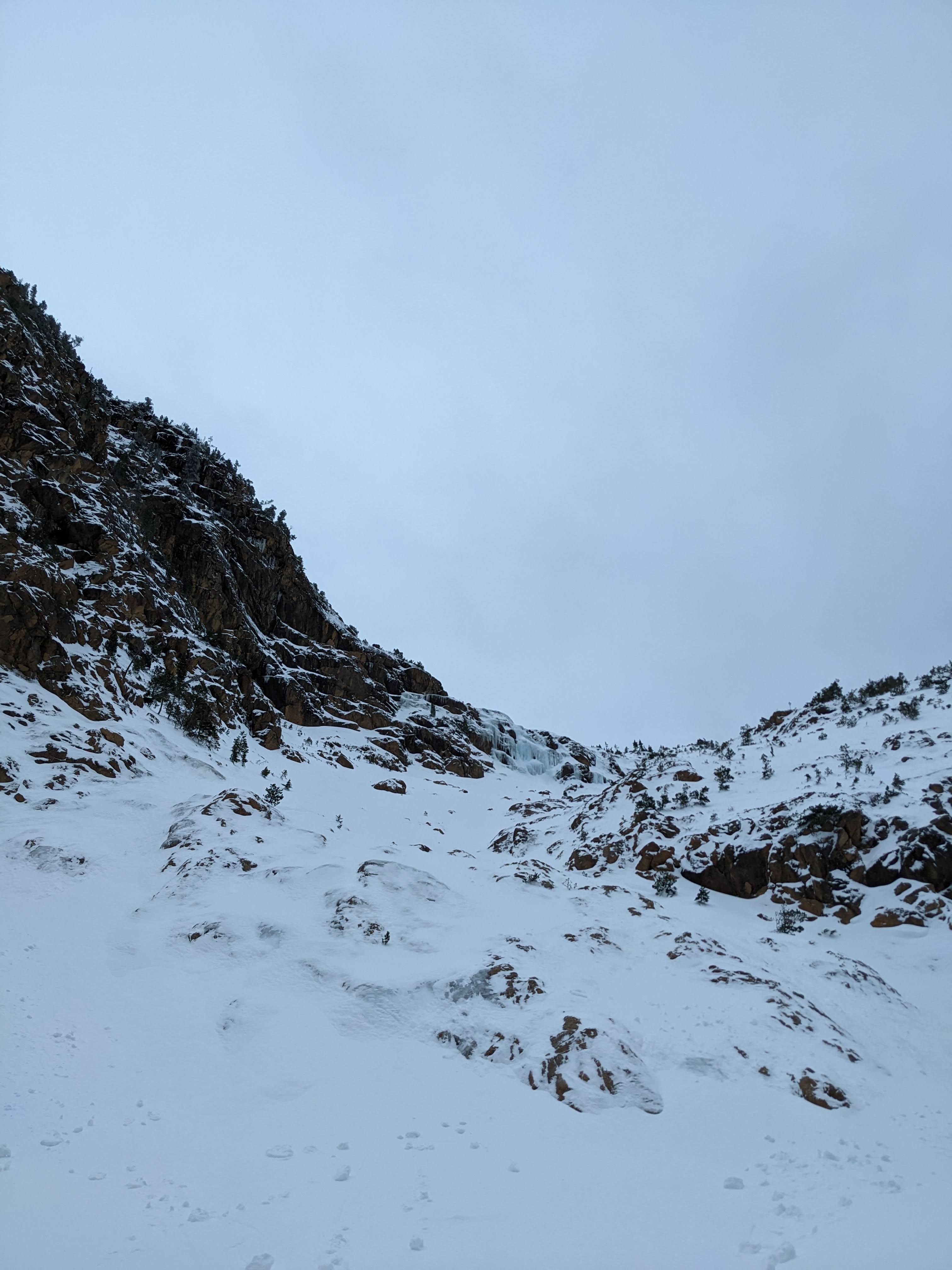
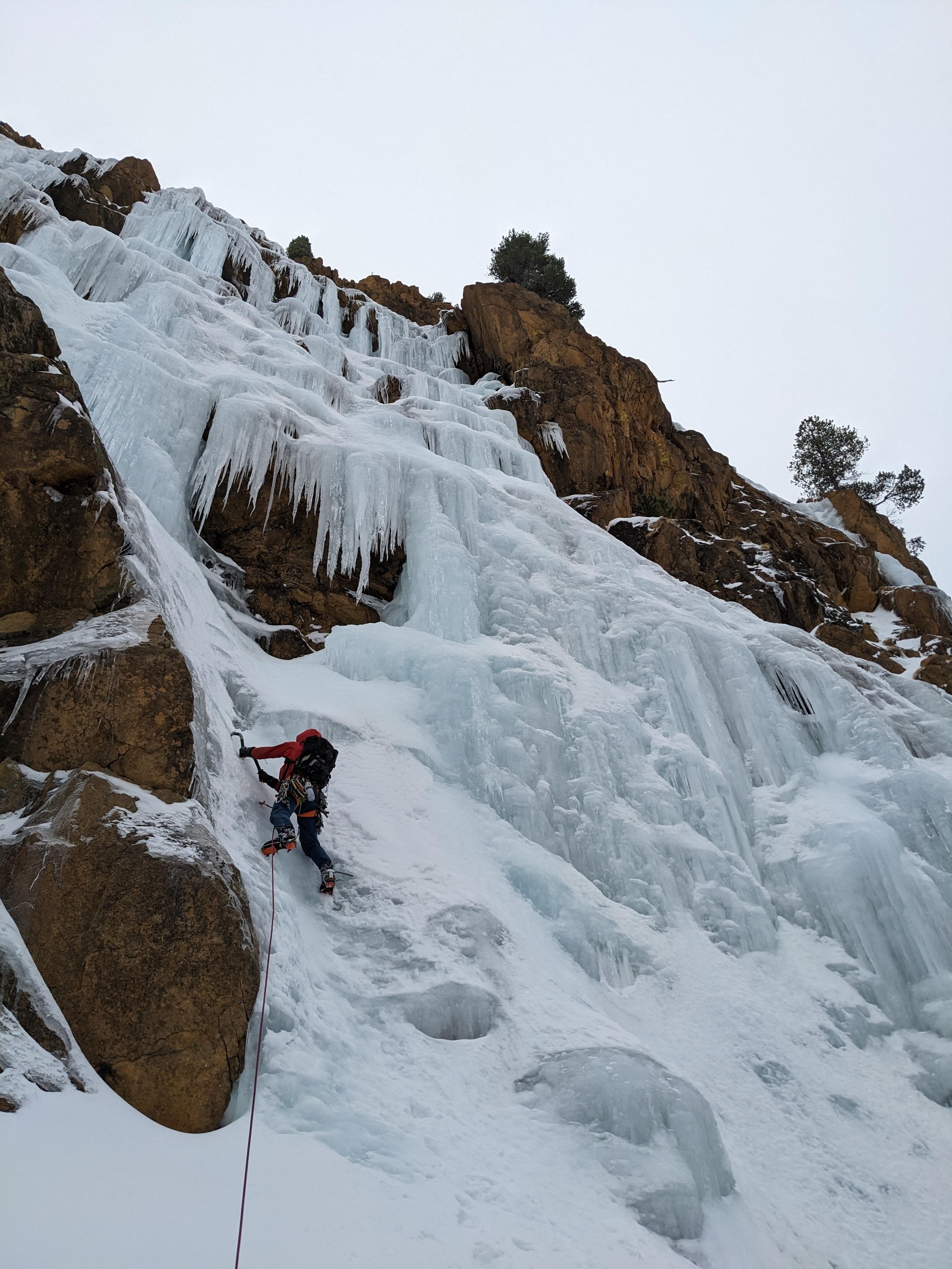
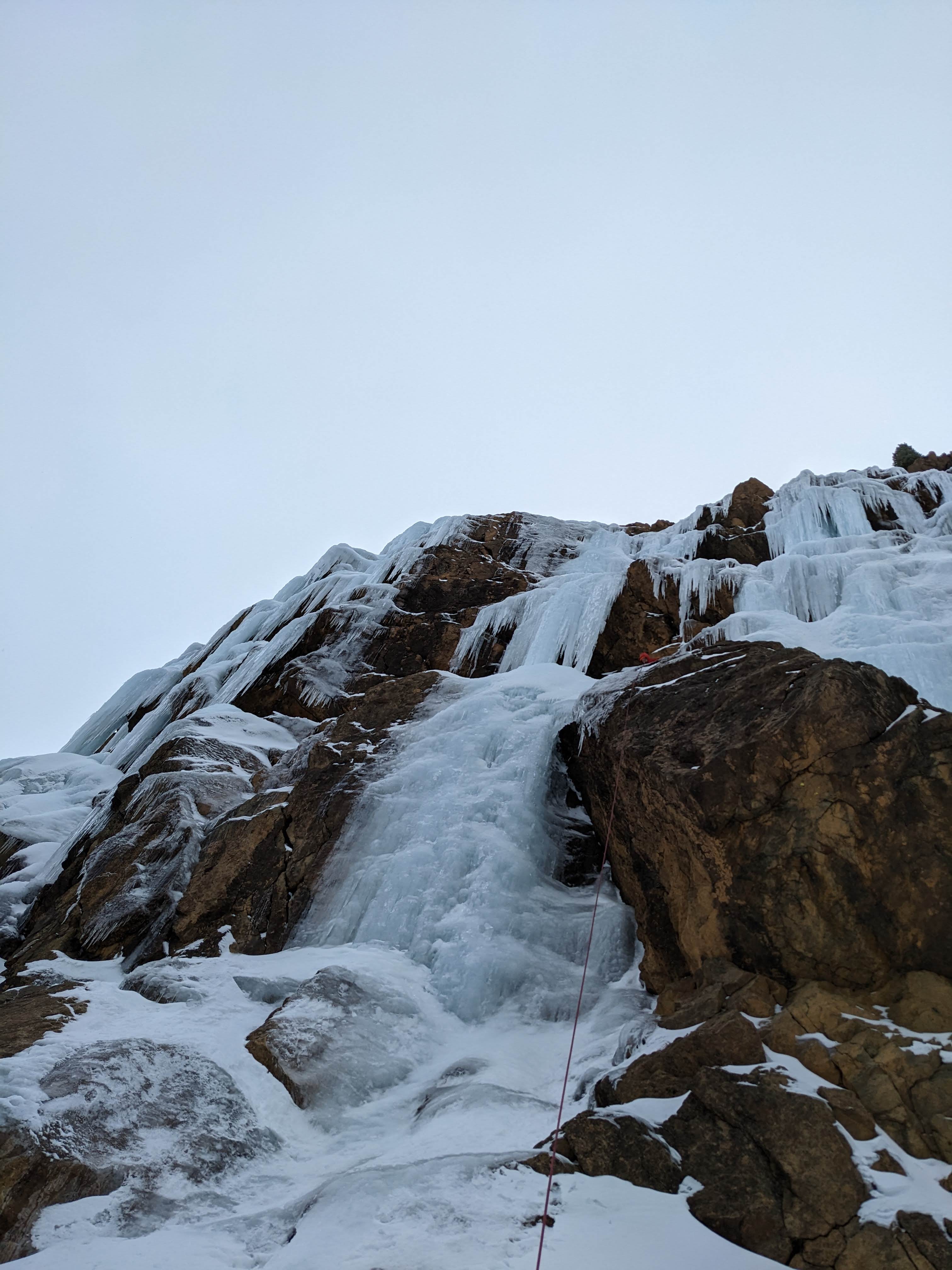
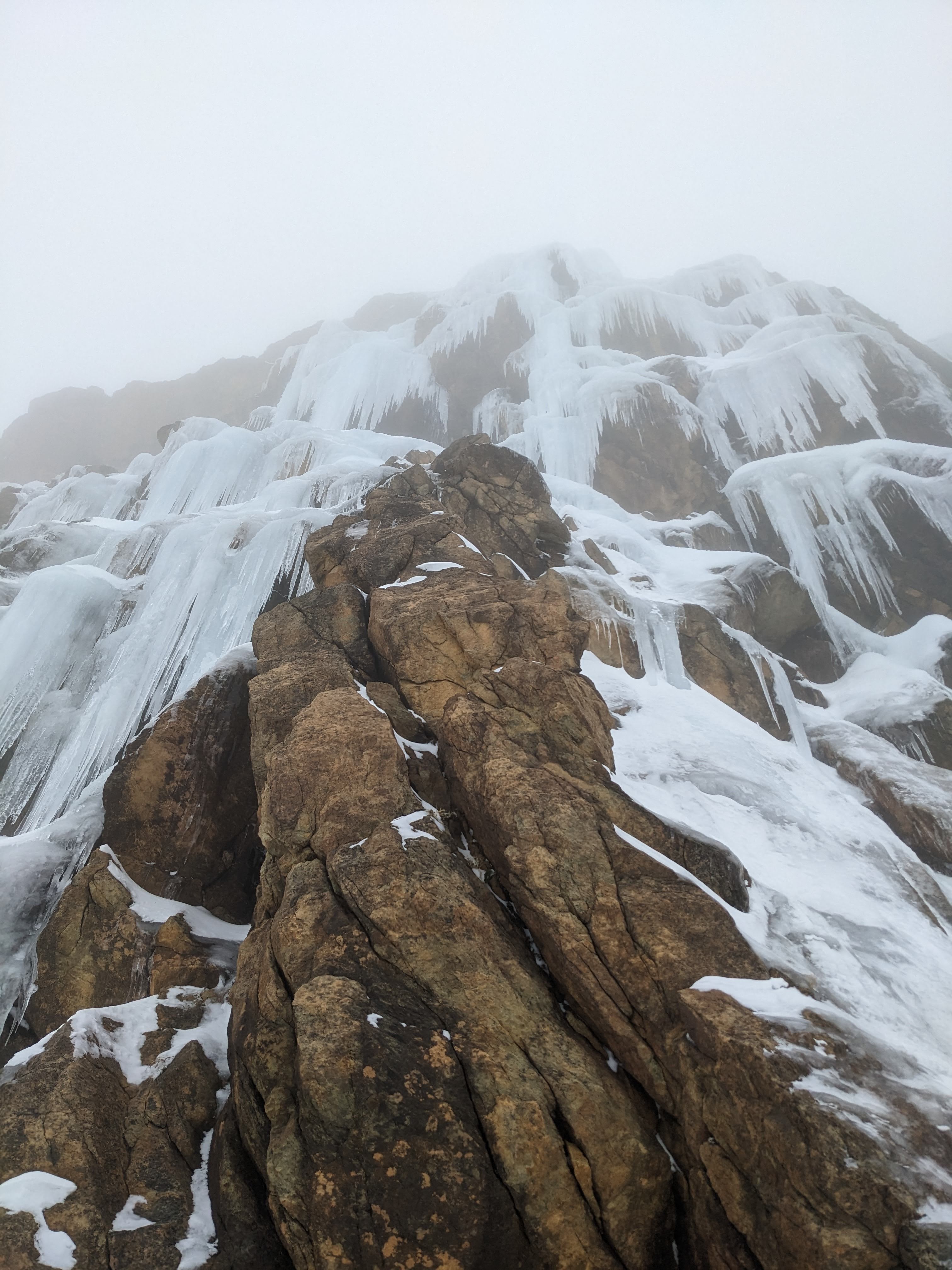
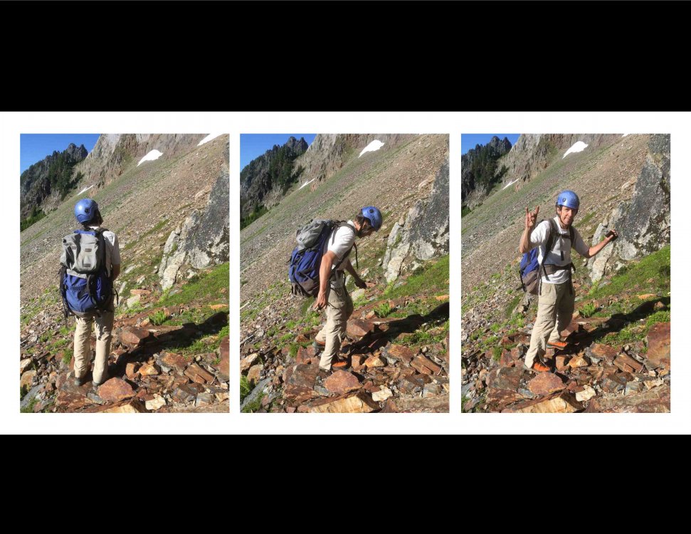
Put in a snowshoe track to access this buttress at the head of seymour creek under north face of north twin sister, this zone is pretty legit. Ice was better than average for washington. Approach took longer than expected and we only did a couple lines on the lower tier at wi3 and wi4. Whole thing probably goes at wi4, maybe 70m tall? Somebody should get out there while they don't have to break fresh trail! 2.5-3 hrs with a trail in place from the gate closure. 4-5 hrs if breaking trail. Looked like decent snow camping next to the creek under the crag.
 1 point
 -
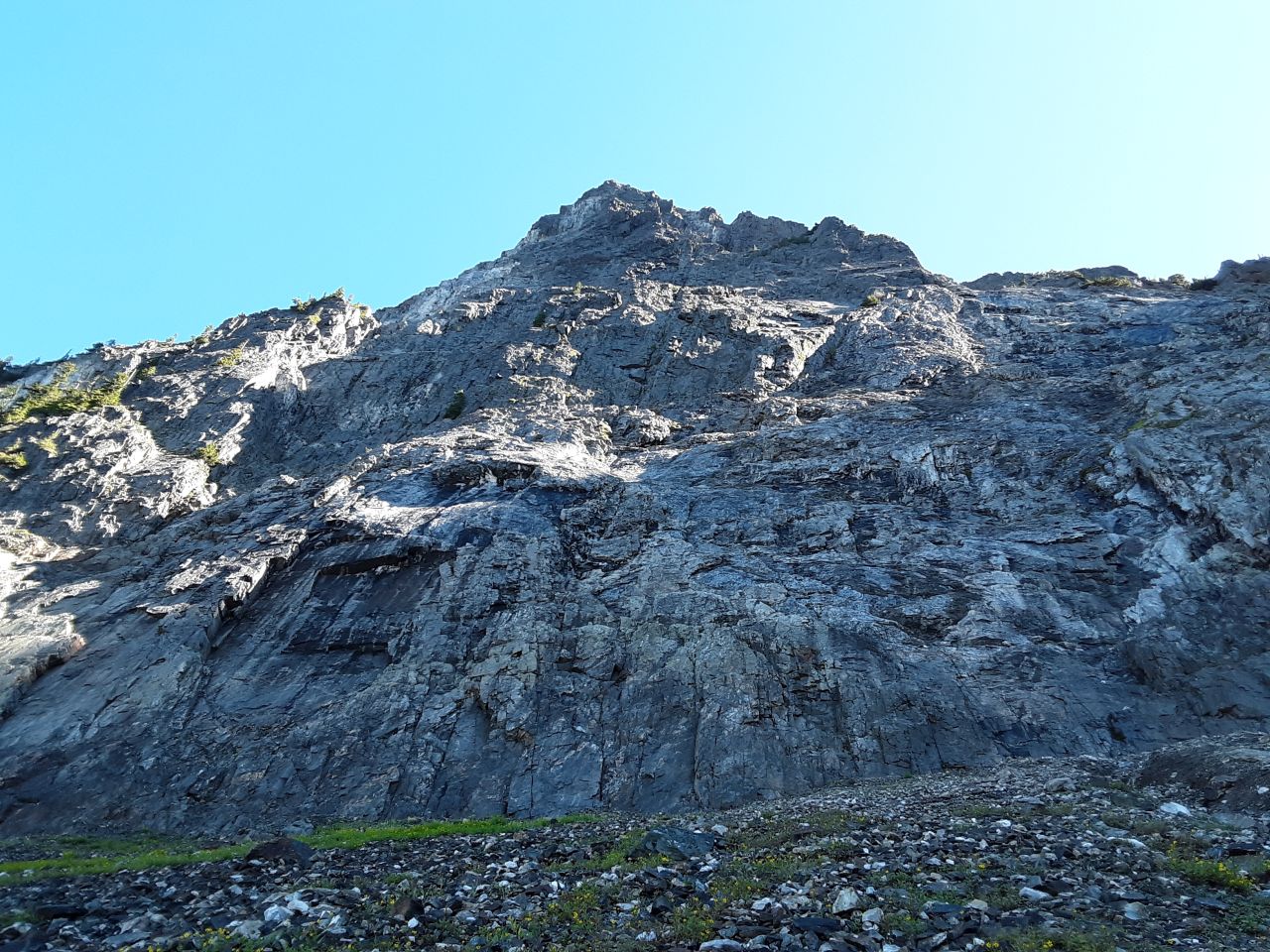
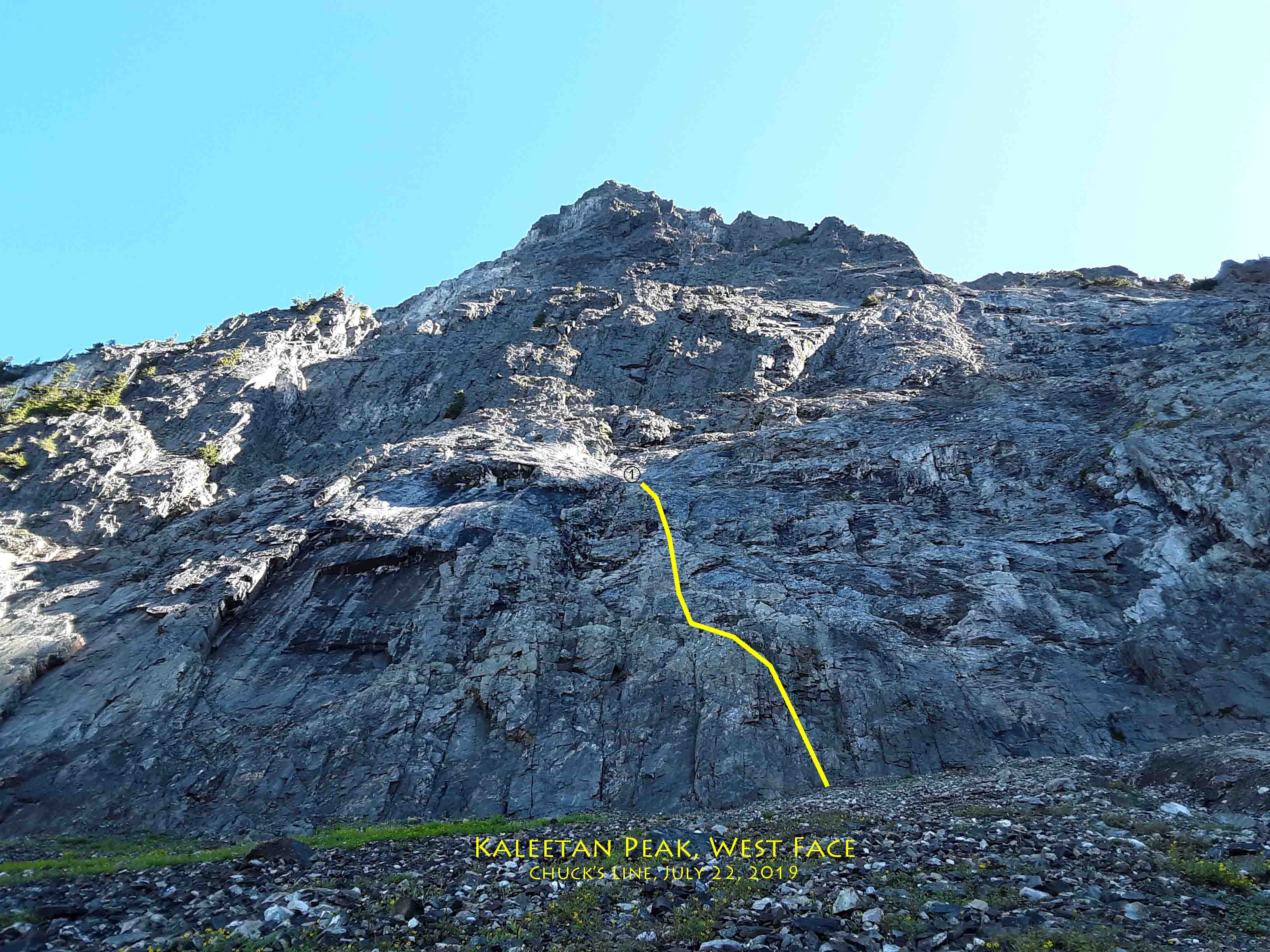
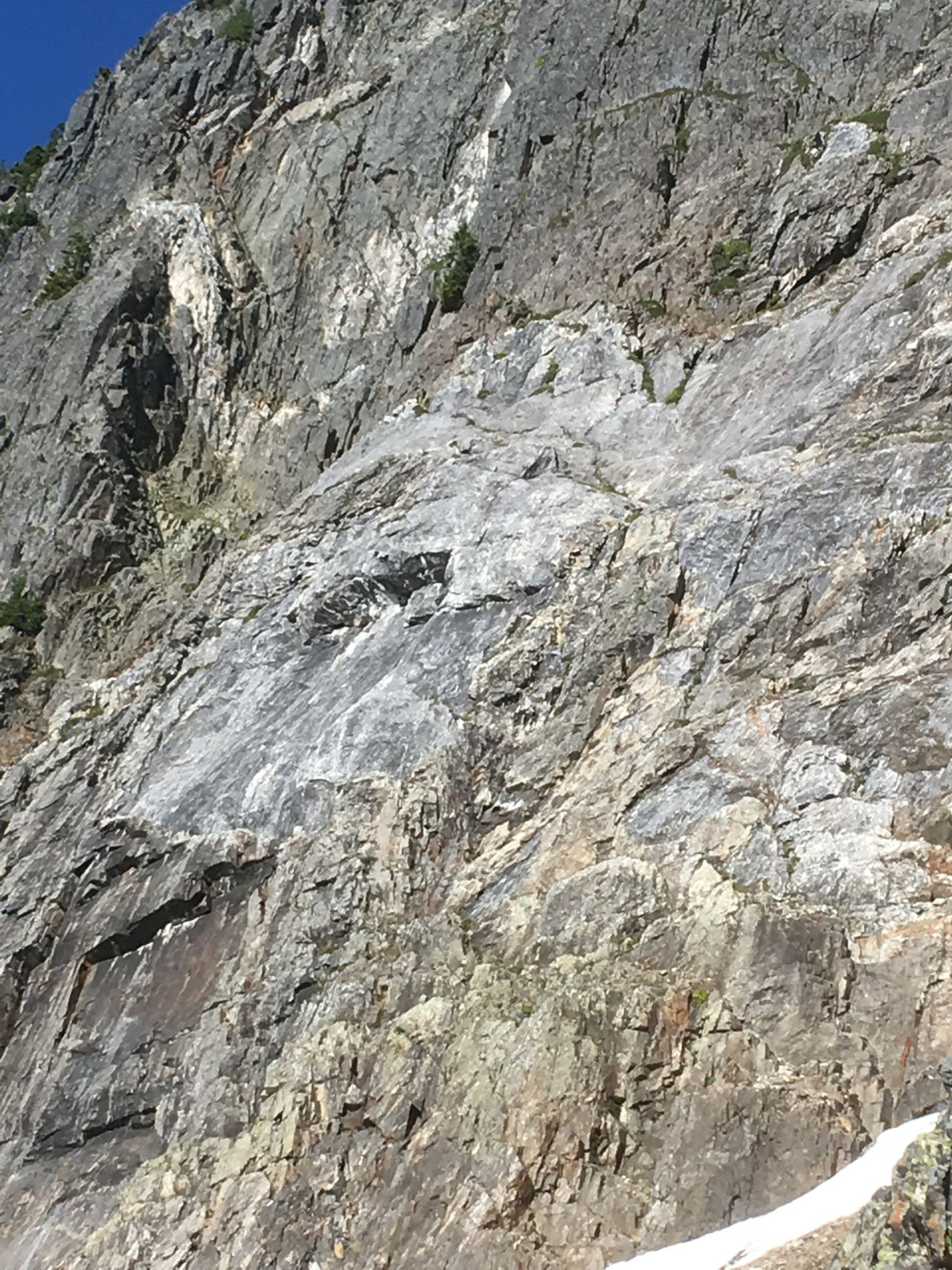
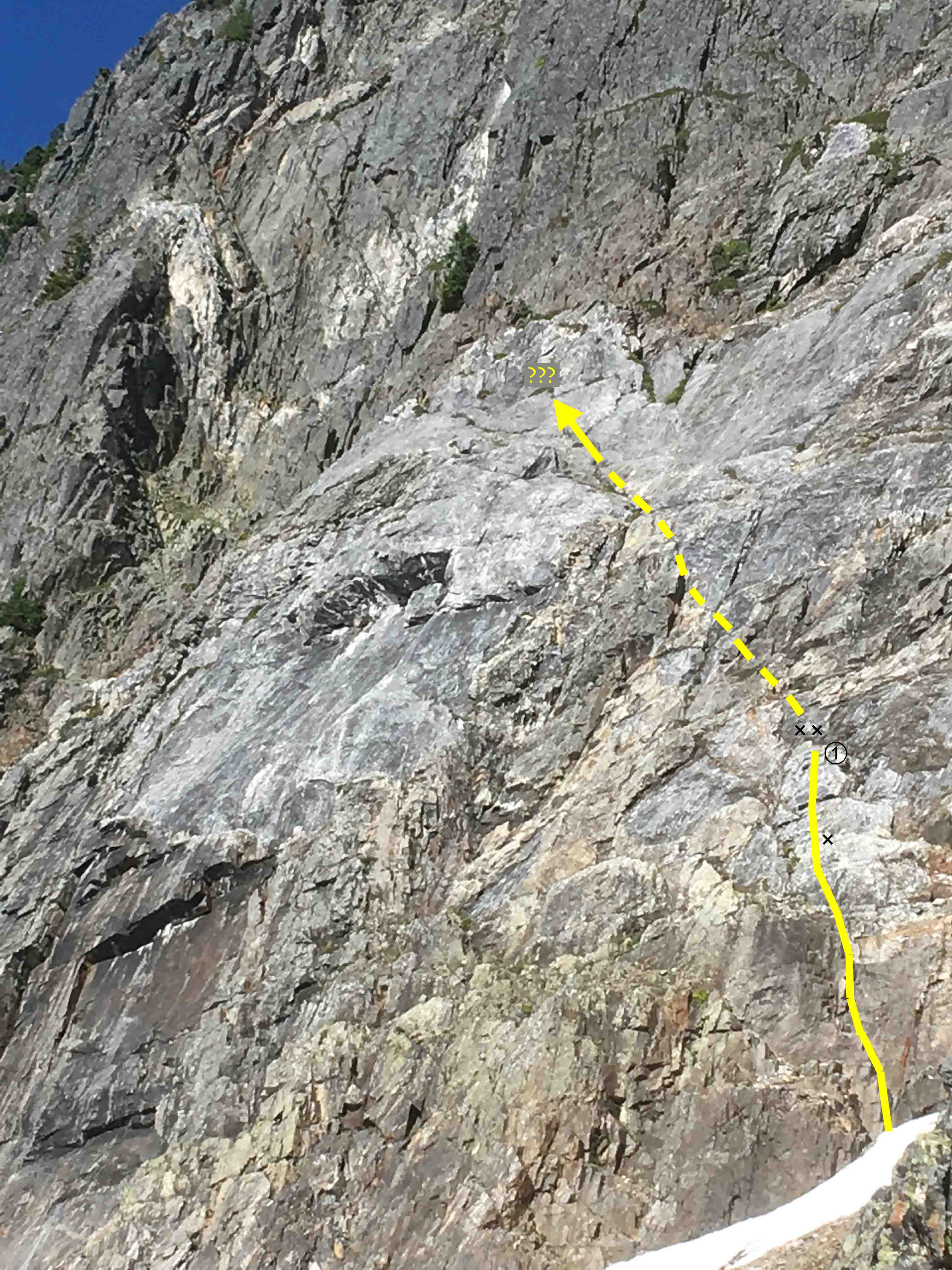
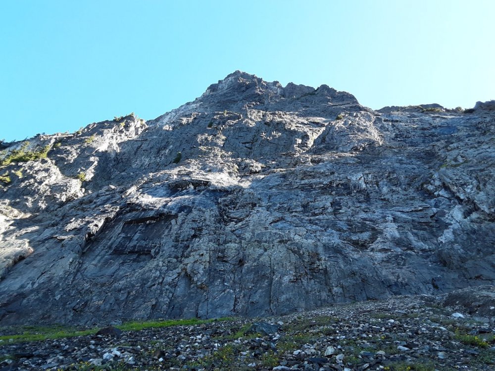
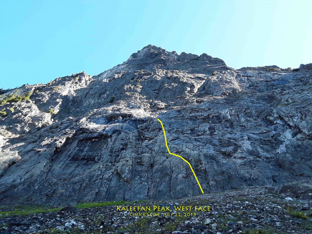
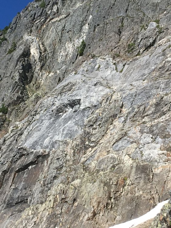
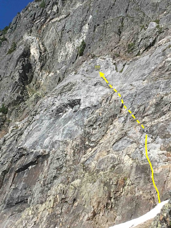
Kaleetan Peak, July 7, 2019 Chuck's Line, one pitch, 5.7, 1x The last outing I did with Chuck Spiekerman was a visit to Kaleetan Peak on 7/22/2019. He had been working on me to get away from Darrington, and sold me on this unclimbed 600-foot West Face. The only problem was the four-hour approach hike. But since I'd been doing that nearly every summer weekend for the last several years, I agreed to help. Chuck had done the research, scoping the face on an earlier solo trip up the North Ridge. He'd returned to work out the approach from Melakwa Lake and the best place to leave the climbers' track to contour around to the west side. He'd found the "magic gully" that leads down from the south shoulder to the west face smoothly. Now he'd invited me to join him on a rock climb of discovery on the west face itself. I was skeptical that there could be a good, unclimbed cliff in a busy, popular hiking area. At the same time, I was skeptical of all the work to hump in the required gear. Surely these two factors opposed themselves and would cancel out! So I agreed, and we'd have the place to ourselves for a day. We brought two 60m ropes, a single rack with wires and cams to 3", my bolt kit with 3 bolts and hangers, drill and hammer, and no bivy gear. It is in the Alpine Lakes Wilderness Area, so no power drills are allowed. We would have to allow four hours of hiking time to get back to Denny Creek trailhead, and set our turn-around time. I didn't want to hike out in the dark. Being on a strict timeline, I didn't stop for photos much. Wanting to document the wall itself, I took shots of the cliff but not of Chuck leading out. He drilled his first ever bolt on lead, protecting a steep short wall on a limestone patch. It only took him about 8 minutes to drill. The climbing on the limestone patches was phenomenal: sharp, sticky, and fun. Then he got in another bolt at the belay anchor, which is in quartzite, or perhaps andesite, much harder, and it took 20 minutes. It's a "pre-Tertiary melange" up there! He brought me up, and I drilled the second anchor bolt. Agreeing to go up and left toward a big tree for Pitch 2 next time, we rapped off. It was late afternoon and time to get out of there. On the talus on the way out I took these three photos of Chuck. Rest in peace, my friend. There is gravel strewn over every ledge and hold, but the rock is sound. We didn't experience any loose rock or rockfall. The talus slope at the base is very loose and littered with bright, white quartz rhomboids. It is a wide wall; there are doubtless better places to start. Indeed, there is a good crack in a left-facing corner directly below our line that could be used as a more direct start at a higher grade. For our continuation, we were going to angle left to the big tree aimed at by the arrow in the annotated photo. We spoke of staying in the light-grey limestone as much as possible, as the climbing there is excellent. If someone hankers for an adventure route, feel free to use Chuck's Line as a first pitch and go from there.
 1 point
 -
Trip: Mt. Goode - Megalodon Ridge ( IV+ 5.10- ) Date: 9/6/2007 Trip Report: Last Wednesday, my friend Sol Wertkin and I headed out to the North Cascades National Park on an attempt to stretch a little more summer into what was rapidly becoming fall. The intended destination was a climb of the complete East Ridge of Mt. Goode. After seeing photos and encountering the ridge last month, I knew it would be a "big fish to fry" hence Sol coined it the " Megalodon Ridge" in honor of the biggest and scariest fish to ever swim the seas. The ridge runs from L->R across the skyline. On the first day we approached the base of the technical climbing and had a perfect bivy on the ridgeline before it steepened up. A few drops of rain fell on us, but by morning it looked as though things might clear up. After crossing some icy snow in the morning, we started up the ridge, with the summit often lurking in distant clouds. Dan Hilden and I had climbed this first part on a traverse a few weeks ago, but bailed off due to 40lb packs, and very little climbing gear. We made one 50m rappel and began swapping leads along the crest. The position was amazing, with alpine lakes below us, and the sun coming out just when we needed it. The rock wass often pretty good along the crest, with memorable highlights including a 5.8 finger crack and another overhang corner of the same grade. Soon the steep wall of the SE peak began to loom closer ahead of us. Sol fired off the first headwall pitch, which ended up being a splitter 5.10- hand crack to a nice belay ledge. I got the next pitch which started up a perfect corner before stepping left and doing some delicate stemming to the top. A bit of scrambling brought us to the last pitch on the SE peak, which Sol lead through with scanty protection. "No life Guard on Duty" here... From the SE Peak we skirted the steep glacial ice by climbing through the moat. Ross and Sky skied from near here ~5,000' down to Bridge Creek a couple years ago, that just blows me away. Some steep solid rock and an au-cheval crest led us up to the final pinnacle before Black Tooth Notch. We had joked around for much of the climb about all the potential shark-themed names, which was fitting as our crux involved this pitch climbing down into Black-Tooth Notch. I belayed Sol down and across the wall to the notch, with several thousand feet of exposure to bridge creek below his feet. He protected this lead perfectly and memorized nearly every move so as to feed me beta as I seconded the traversy downclimb. It ended up being overhanging 5.10 climbing, but it brought us back "on the map" and past all major obstacles. From there we did one long running belay to the summit. It was late and we were tired, so we did some quick construction and settled in for a night on the highest point in the National Park. An amazing sunset and meteor shower had us in awe all night. The next morning's chilly sunrise was a nice sight as well... As Sol says "Livin' the dream, life is Good(e)" Yesterday we made the 5,000' descent down the south side of the mountain to Park Creek and were thankful for the cool fall breeze on our 19-mile hike back to the car. There was also a forest fire that provided some temporary entertainment. This was a really fun trip with a great partner. The summit bivy spot is (obviously) highly recomended by us both. The register which was there last summer is gone now though... Gear Notes: Standard climbing rack. Should have included goldfish crackers to complete the fish theme. Approach Notes: Up N.Fork of bridge creek for 2 miles, turn left and cross the creek through open clearings when the ridge is obvious.1 point