Leaderboard


Popular Content
Showing content with the highest reputation on 10/13/22 in all areas
-
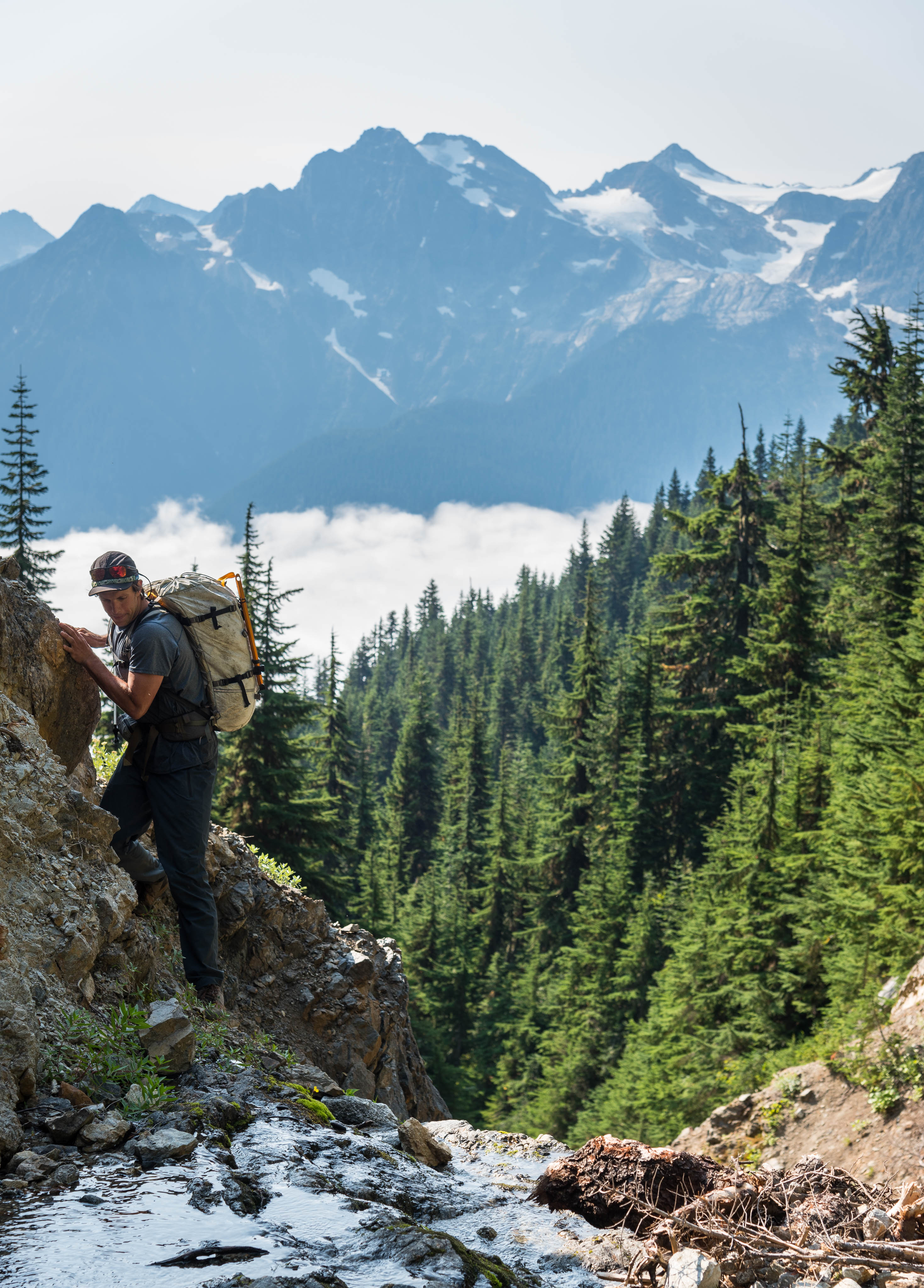
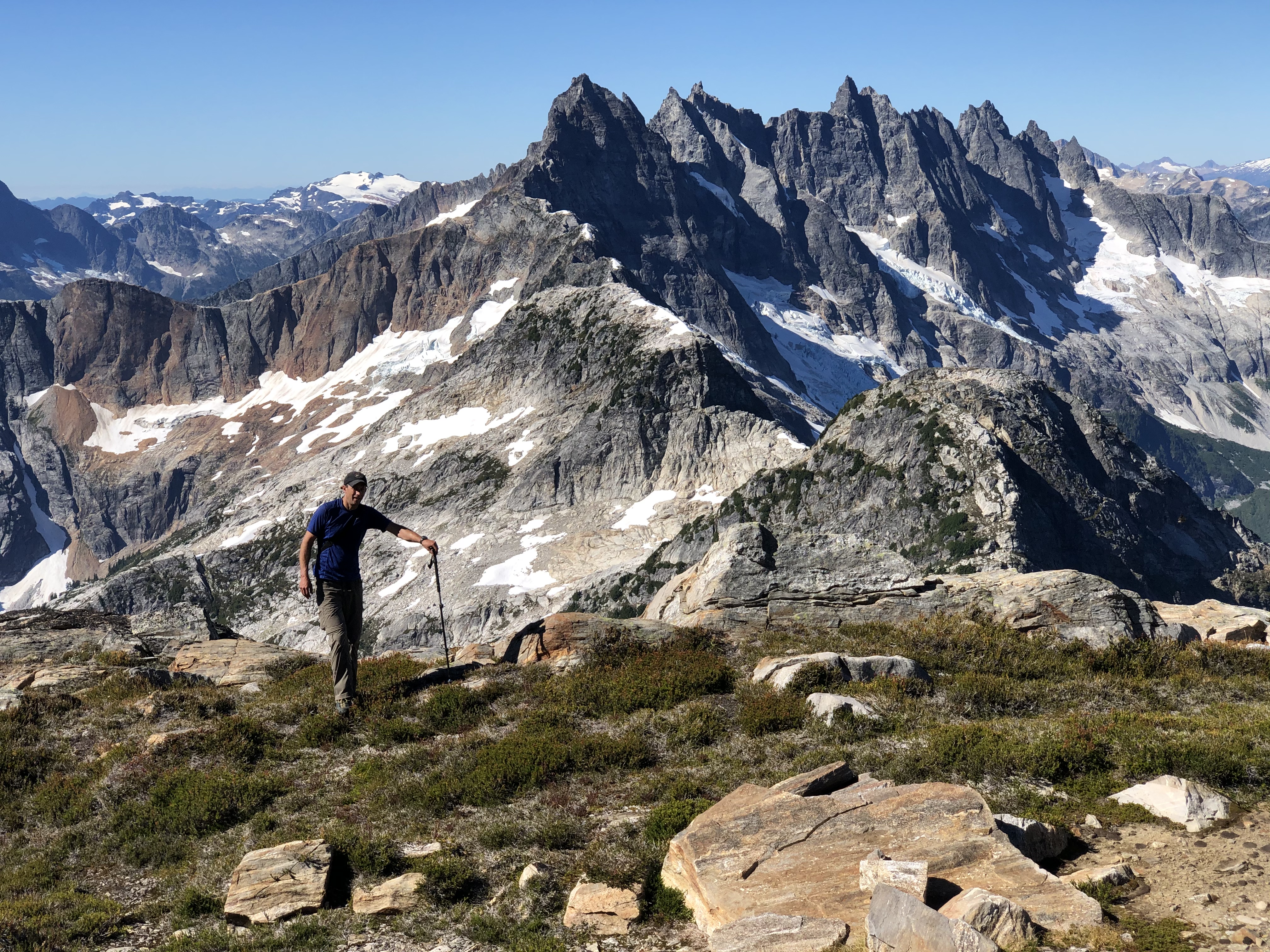
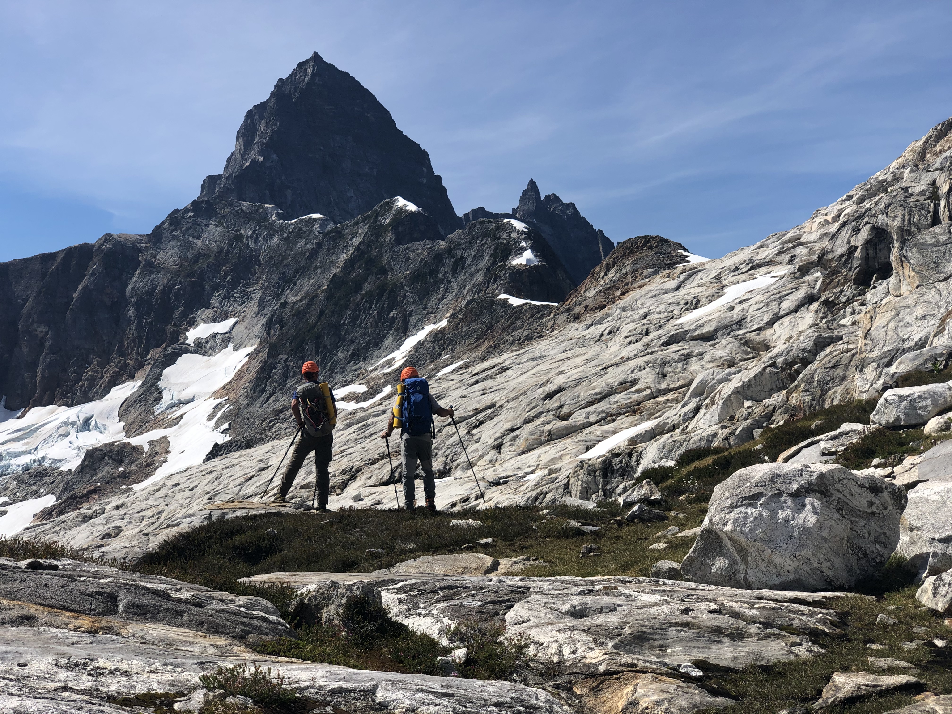
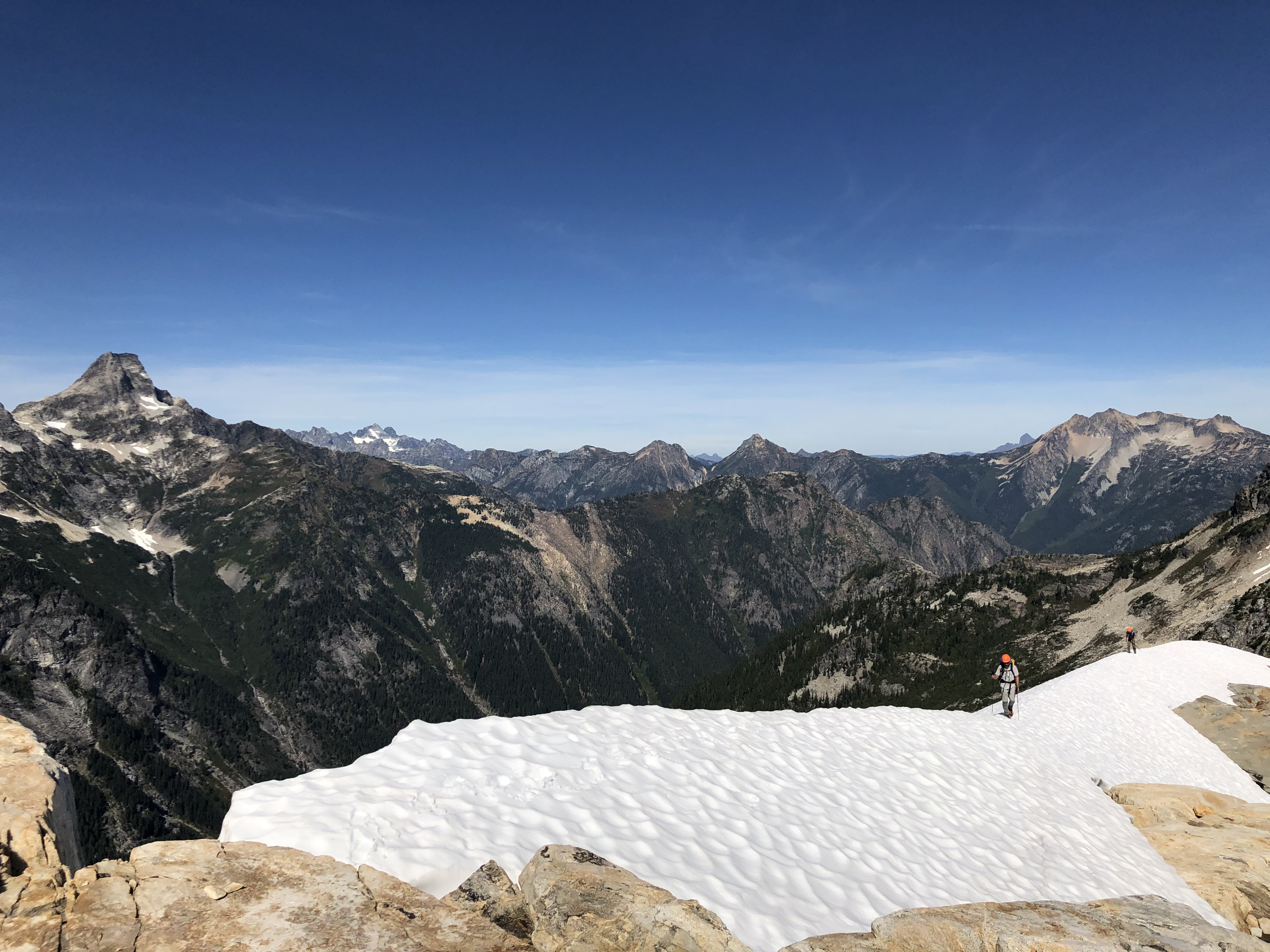
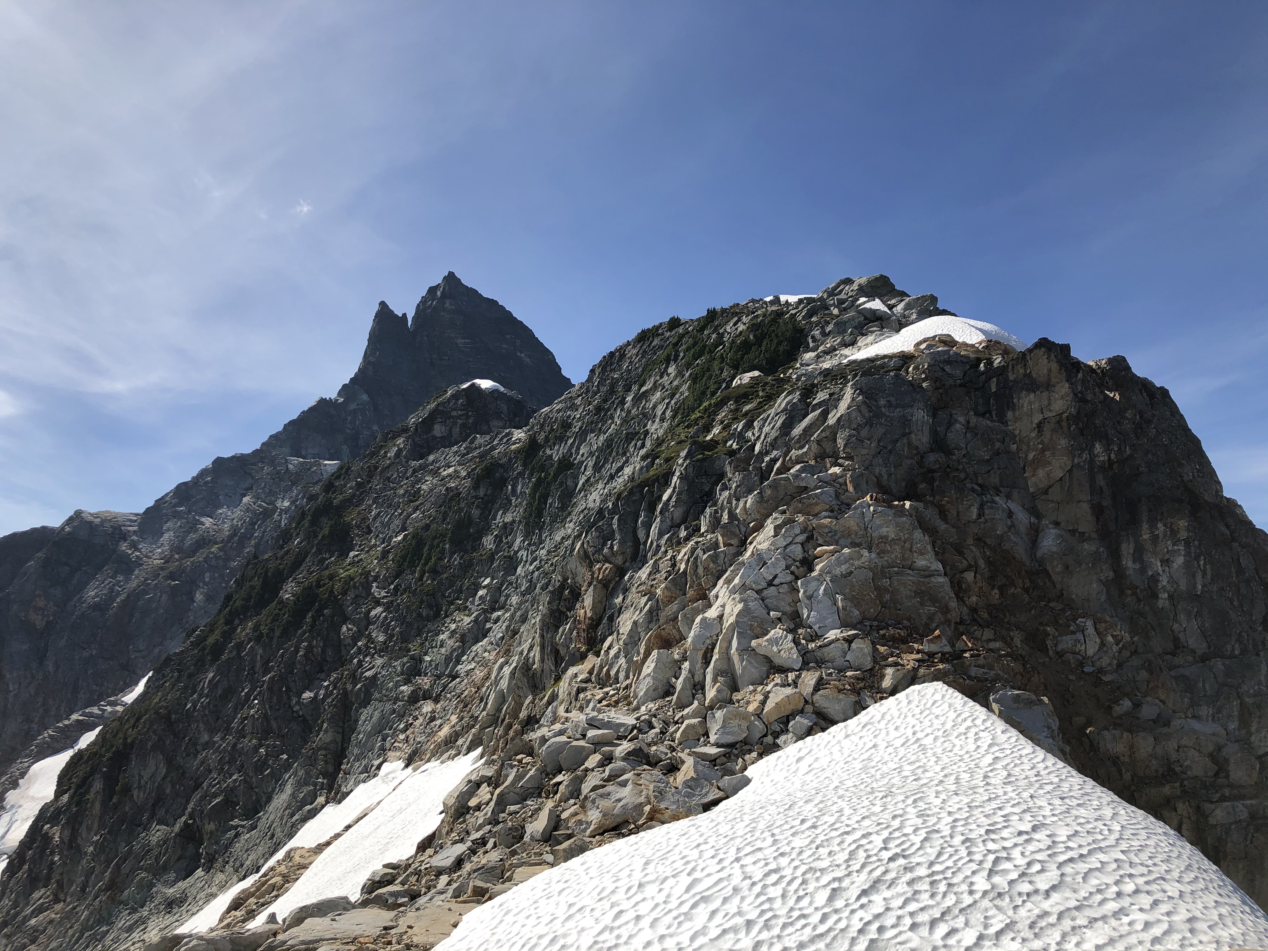
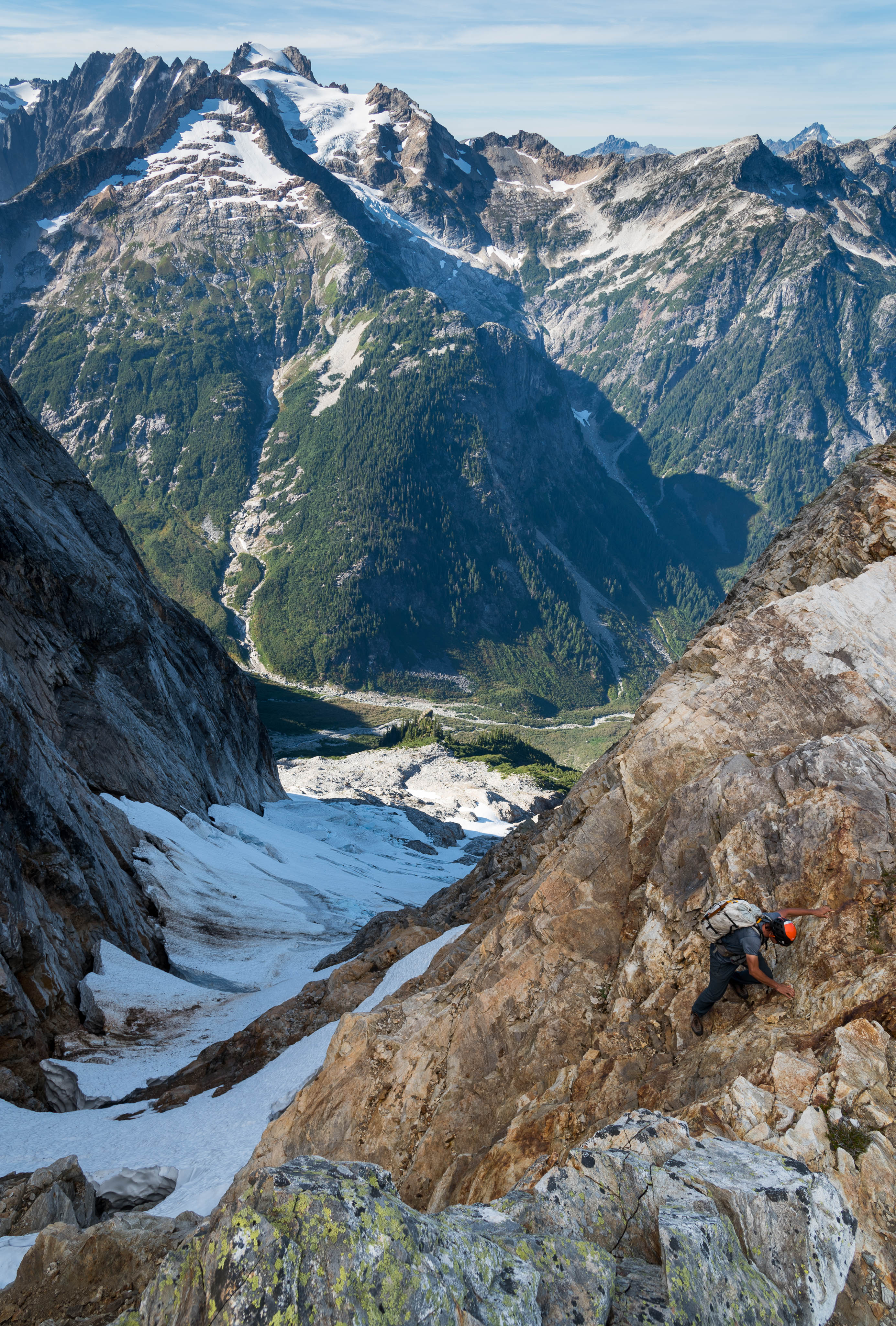
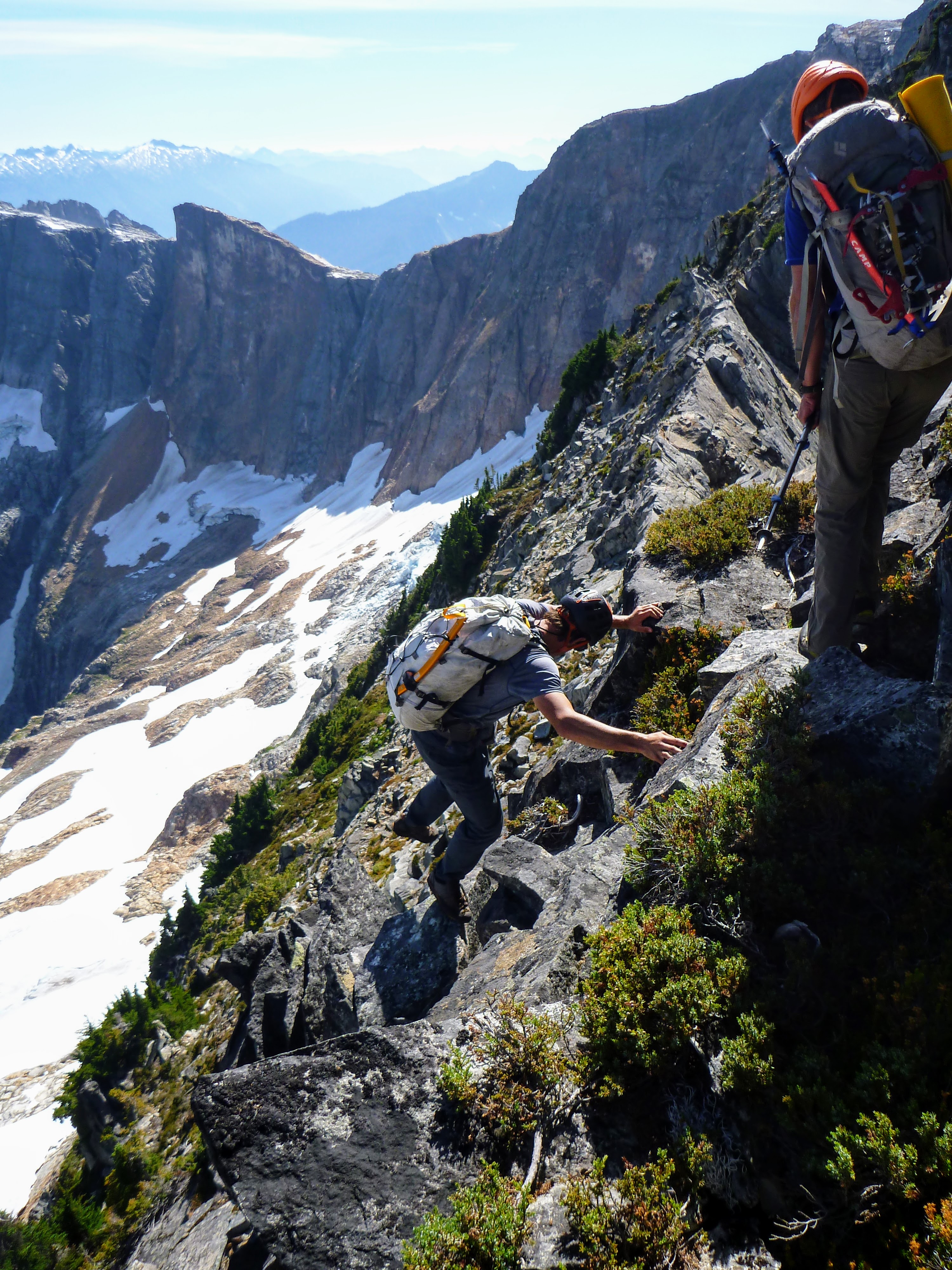
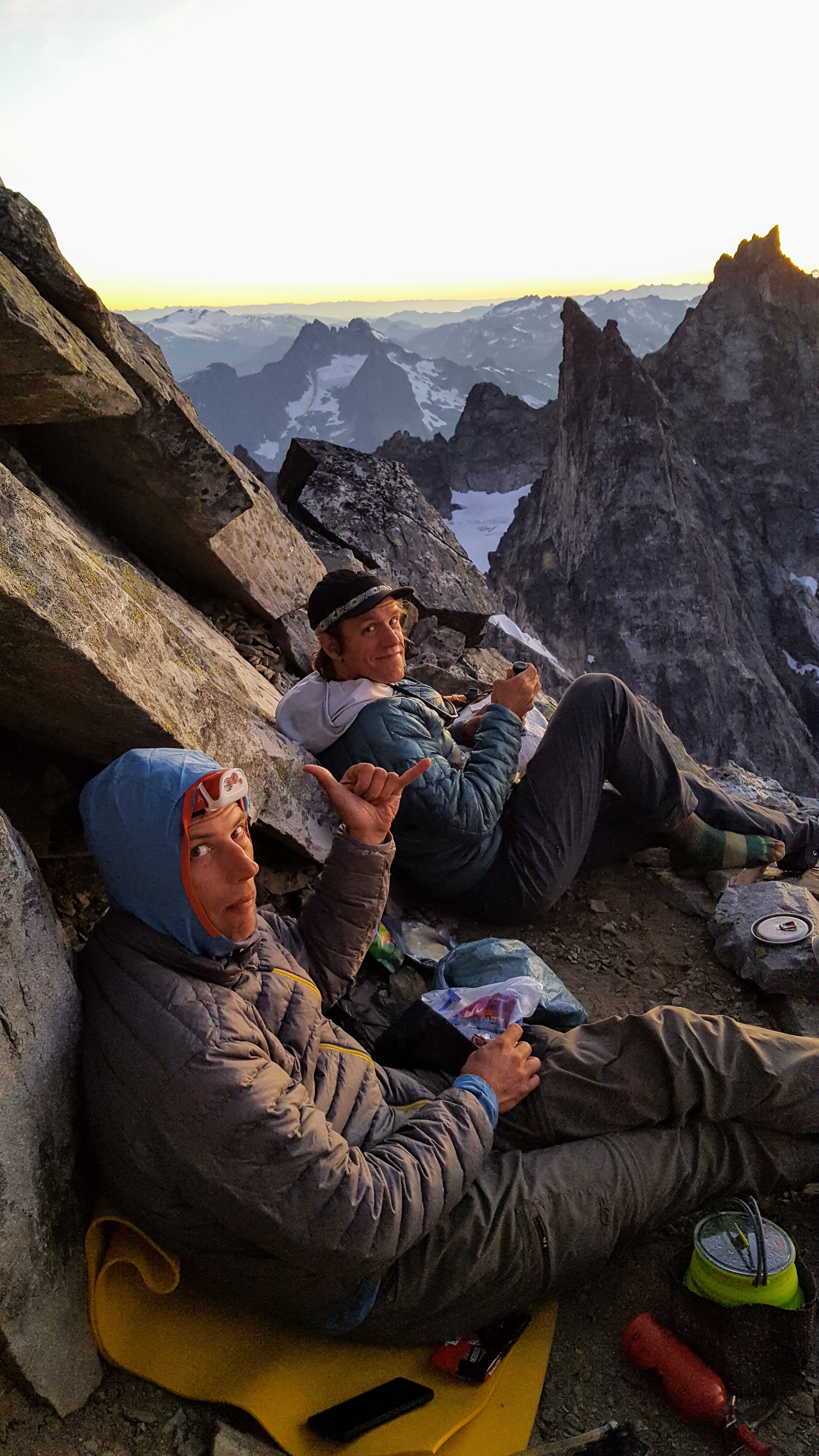
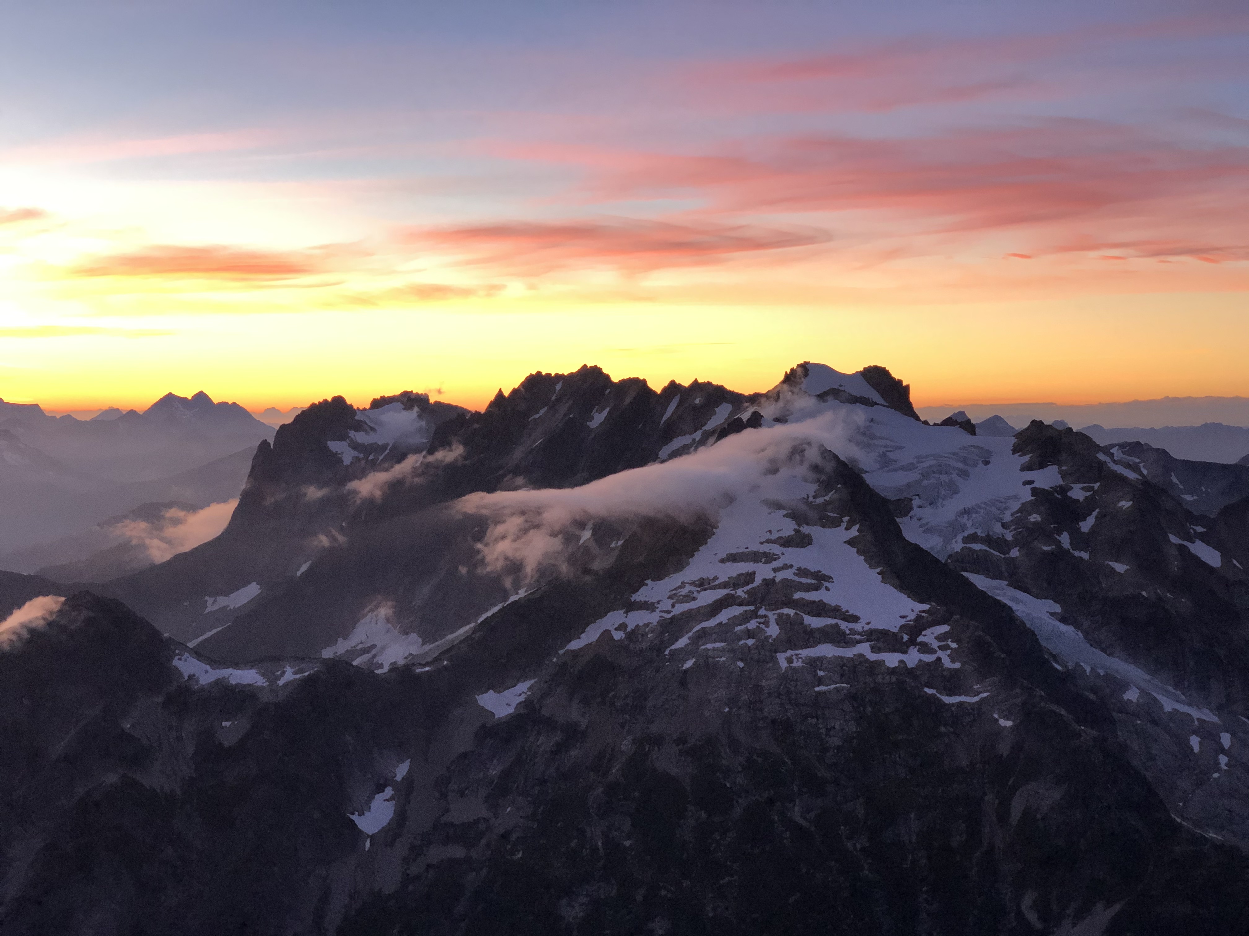
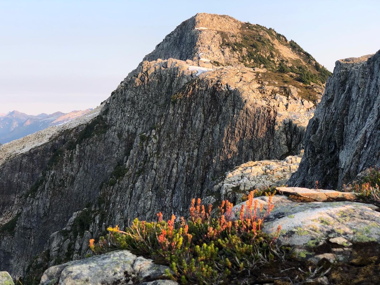
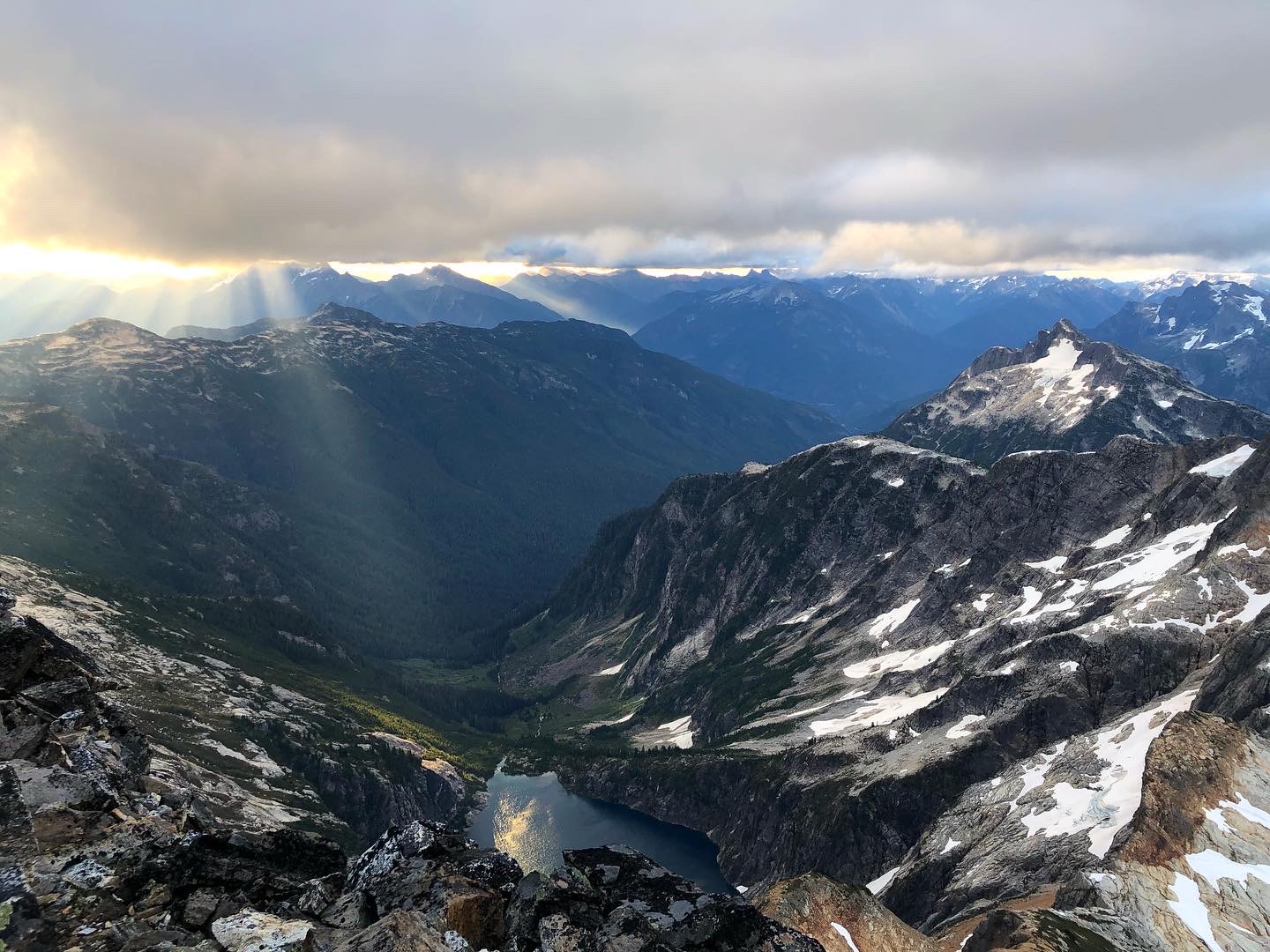
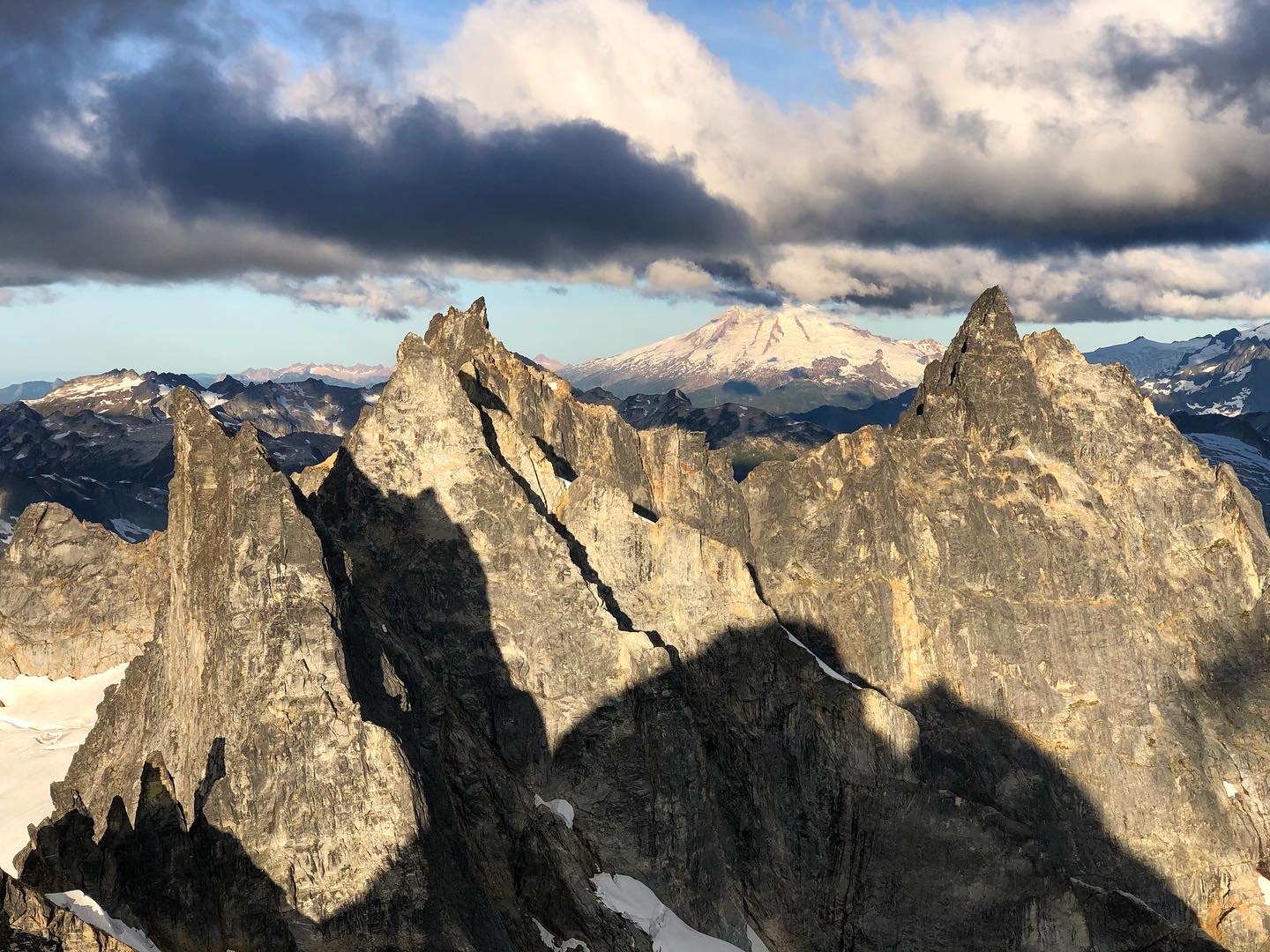
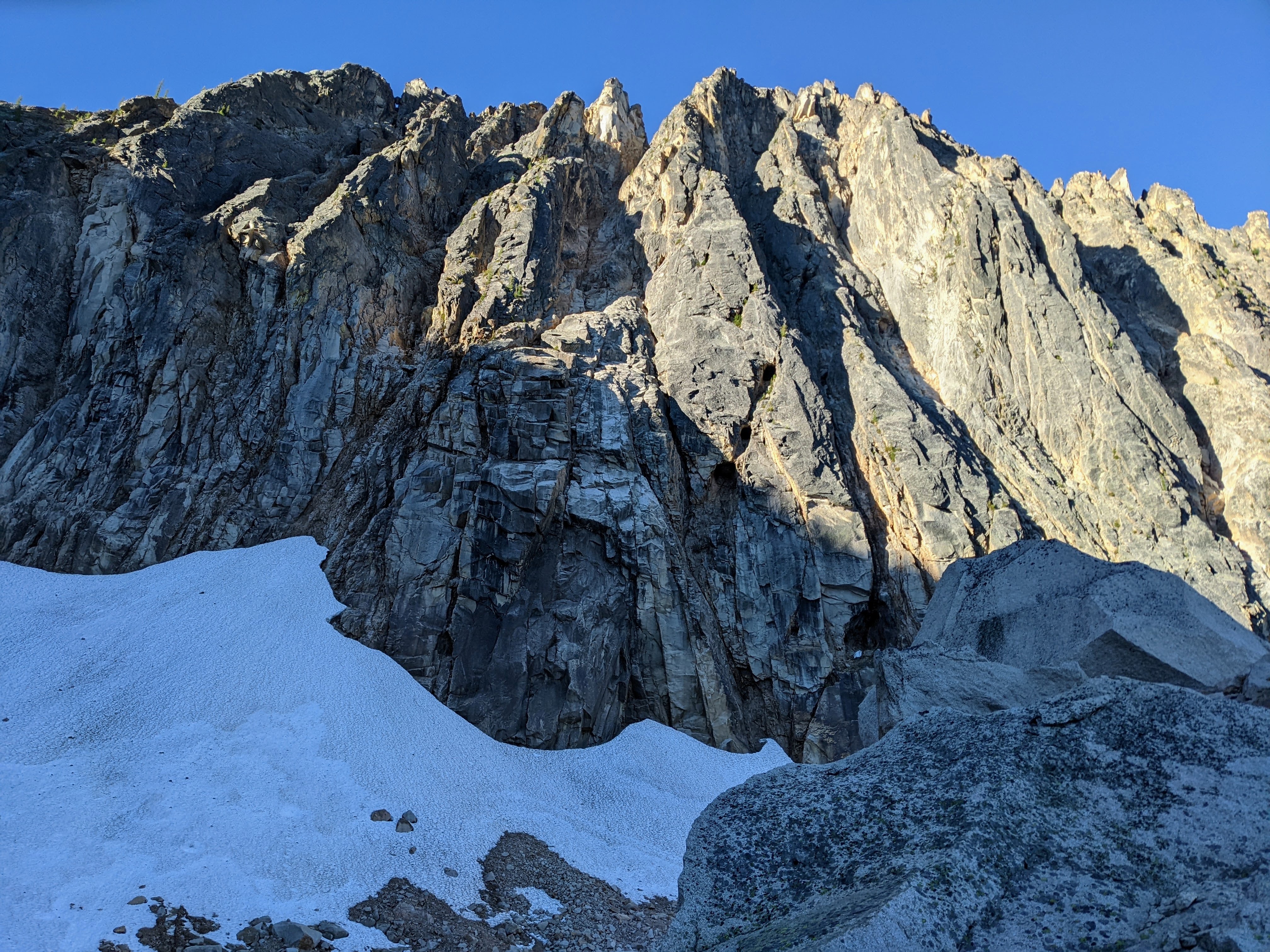
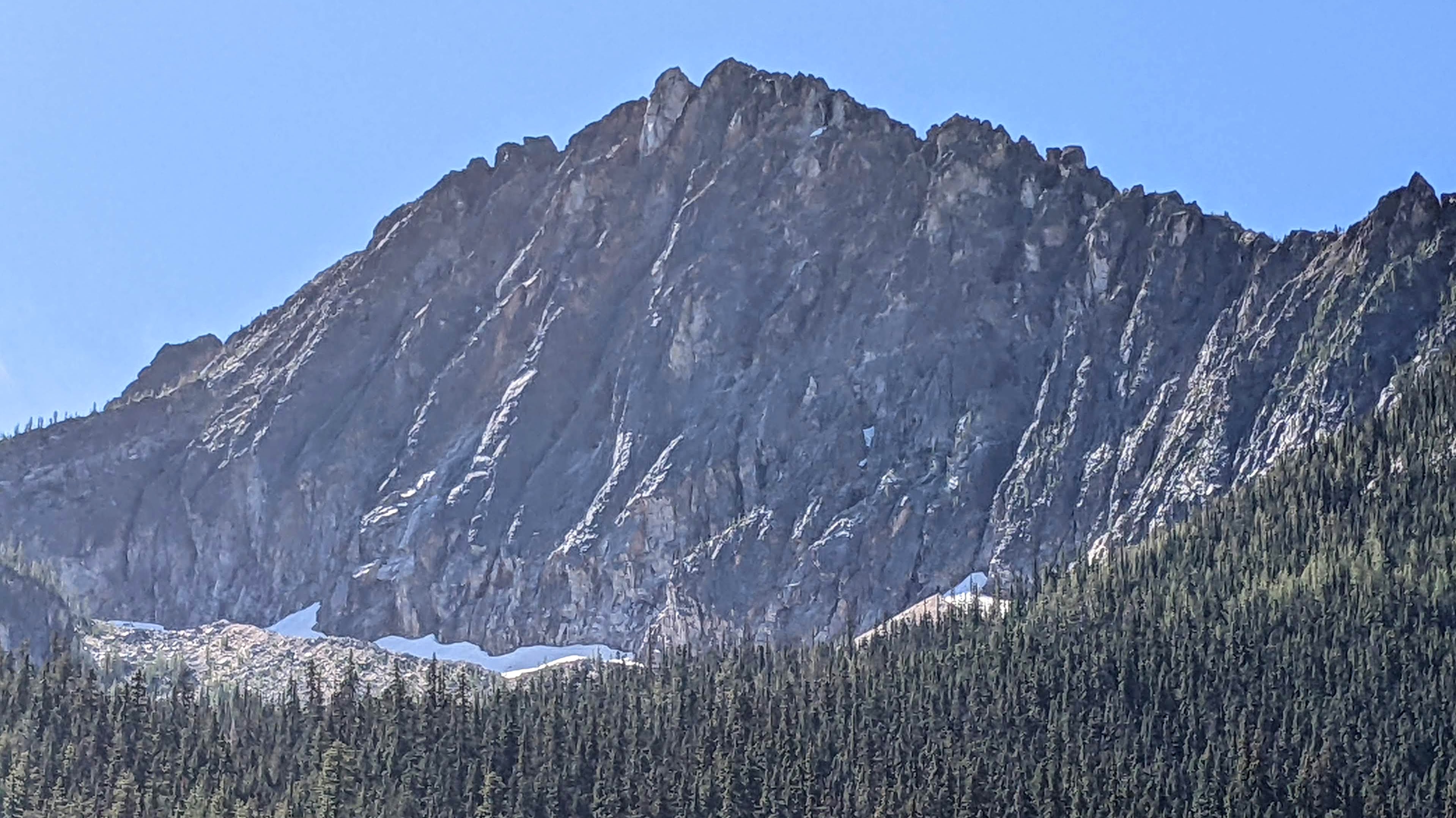
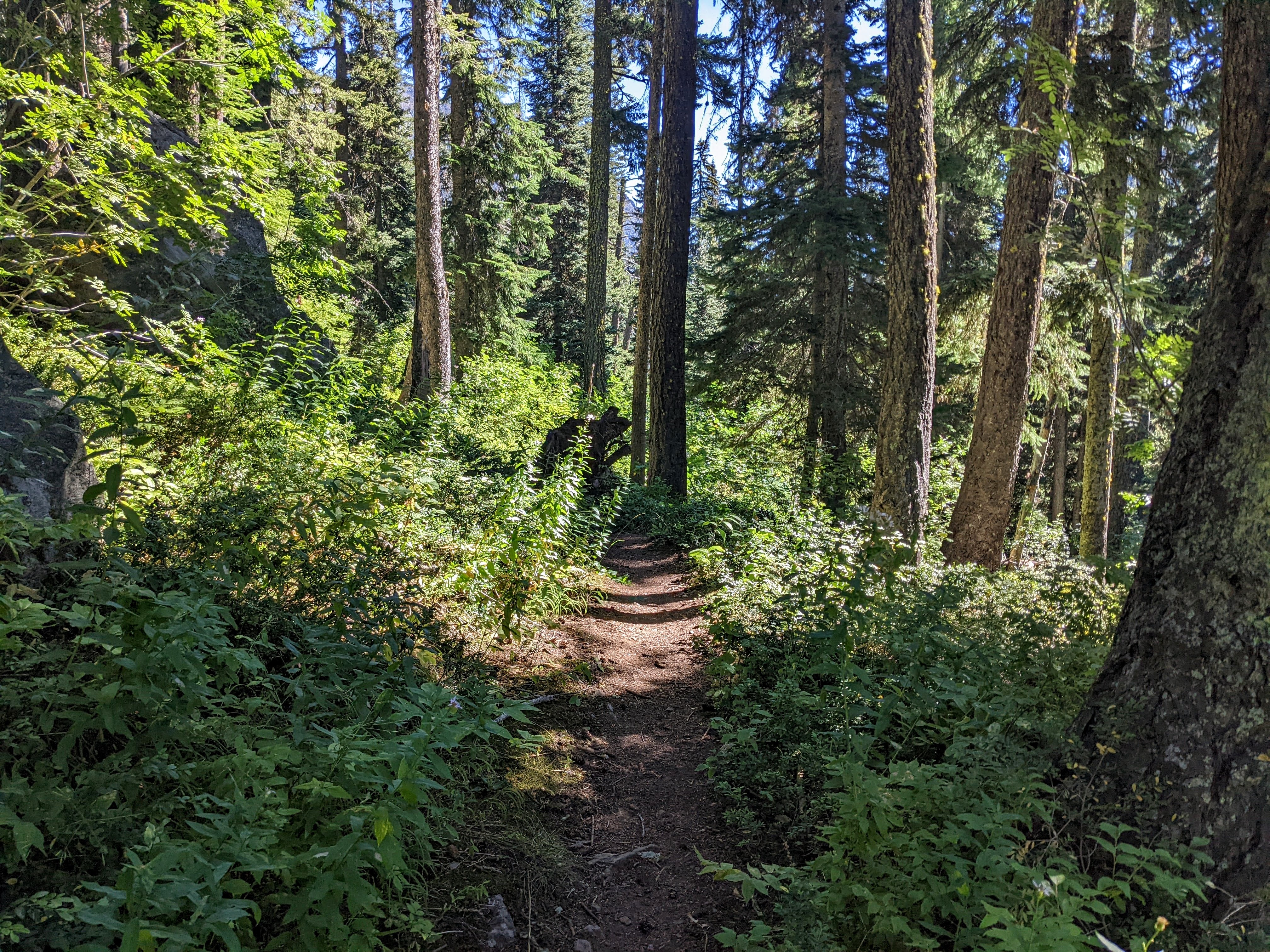
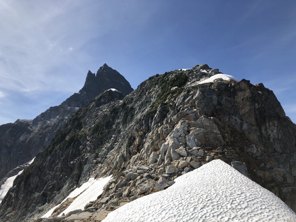
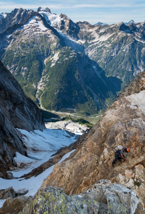
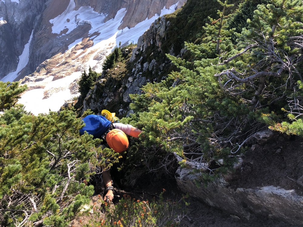
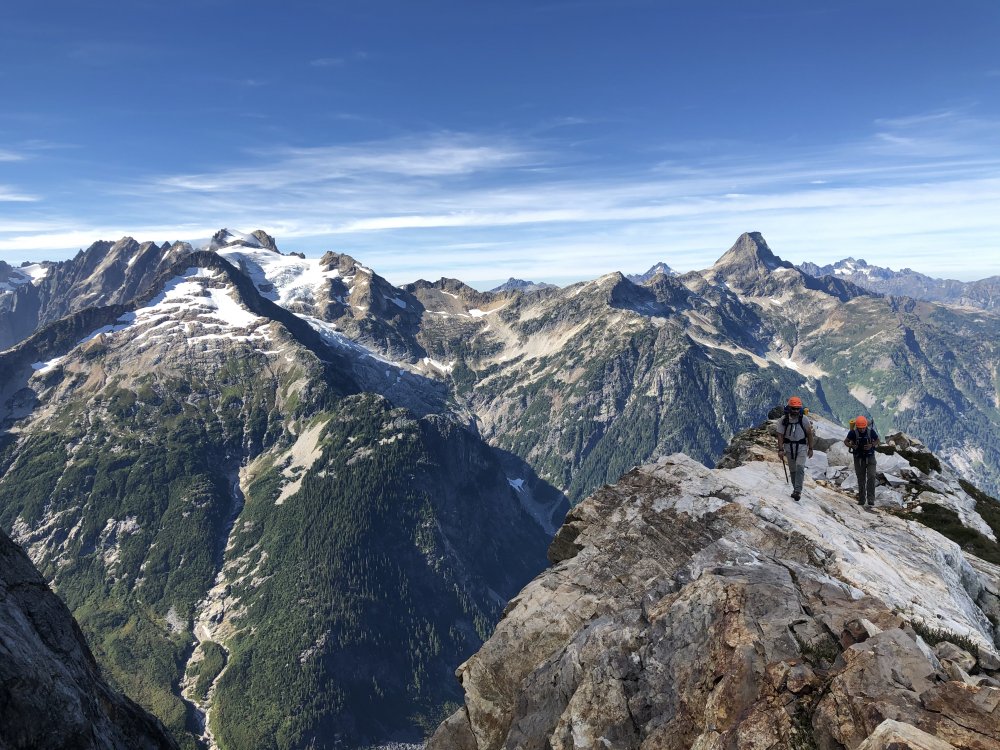
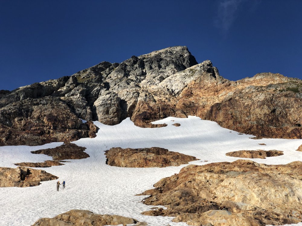
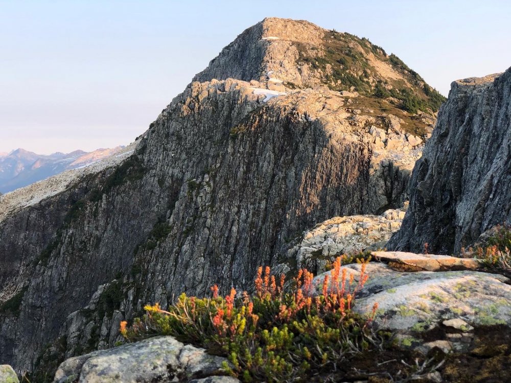
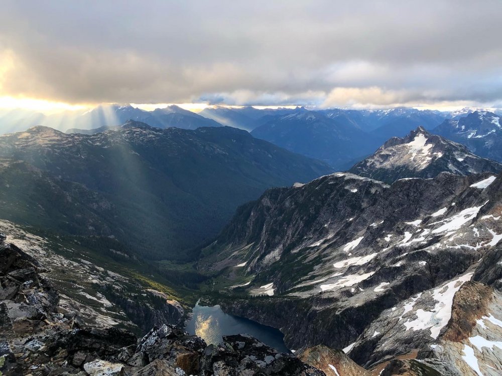
Trip: Sloan Peak - Sloan SE Face Trip Date: 08/14/2022 Trip Report: I'm writing this trip report to put some more information out on an old Fred Beckey and Jerry Fuller 1965 route that is falling into obscurity. The only trip report I could find on the route is 6 or 7 years old and the route description in the Beckey Guide book. There is maybe 5 sentences between the two of these on the route, no hand drawn topo, no pictures or any other information. The best approach description I could put together is listed below which I recommend paying attention too seeing how my brother and I burned 2 to 3 hours between the 3 river crossings and the bushwacking between and after to get to the new trail. The old trail on the map that goes after the river crossing is a path grown over and no longer in use. . See map picture below which I snagged off a blog before the climb and the screen shot off the route above I put together on Gaia after the trip. We chose Sloan SE Face because we wanted a less crowded peak with a glacial crossing and some technical climbing, and the Matterhorn of the Cascades has always been high on own list. My brother and I wanted a full value adventure so we chose this obscure route and decided to do the original approach of Cougar Creek with the river crossings. We left the car around 9am after waking up at sunrise to get packed for the climb and drive to the trailhead after doing "research" the night before. Colin and I arrived at basecamp around 5pm after 3 river crossings and bushwacking which burned a ton of time and numerous down trees to hop or slide under. The further up the trail we got the more overgrown it got. We were surprised to find a guide with 2 clients at basecamp around the corner from where we setup camp. They were making their second attempt on the corkscrew route. We filled up on water and stuffed our faces with dinner and prepped our bags for the morning. We woke up around 3:30-4 am and got going probably around 5ish. My brother and I opted to scramble up the slabs up to where we would start the traverse on the glacier while the guided group started up the steep glacier basically right out of camp maybe 20 minutes after us. We traversed across the glacier to Southwest corner of the glacier where it meets the horizon you view from camp. At the top of the glacier we let the guided group pass on the corkscrew route below us before we started up what we thought was the first pitch of the SE Face route to prevent knocking rocks on that party. I will describe the proper approach and original first pitch to the SE Face before I describe the variation 1st Pitch I accidentally put up. Pitch 1 Original Start (5.7): About 40 paces or 100 feet from the edge of the glacier and underneath(not directly, roof is up and to the right) an enormous roof is where you will locate the start of the route. Approximately 40 feet of scrambling above the corkscrew route boot trail is a platform to belay from. From that platforms left edge ascend a slabby crack system referred to as rightward traversing in the Beckey guidebook(where we had our confusion), up and to the left of the enormous roof, you will come across a sandy ledge where the original party belayed off an arms width 2 foot tall boulder sticking out of the sand(bleached slings), I recommend you climb 20 feet above the ledge next to the roof in a crack system. This sets you up perfectly for pitch 2. Above: Pitch 1 (5.7) to the left of the enormous roof is where pitch one ends, you cannot see the sandy ledge from here. Pitch 1 Variation (5.10a): About another 20 paces or 50 feet past the original start in the next gully-ish system is where I accidentally established a variation pitch. Scramble 30-40 feet above the corkscrew boot trail to a dirty heather ledge to belay from. Climbing up a slopey arete/rib, about 15 feet above the belay is where I found my first gear placement, continue climbing up the rib up to a small roof where I had to dig out some placements for gear(I realized then that these cracks had never seen the light of day and we were off route). Climbing out right around the roof (crux) traverse up and right through crack and slabby climbing up to a sandy ledge, for the best belay climb another 20 feet above the ledge to a crack system to the left of the enormous roof. This put us back on route at the base of pitch 2 which Colin realized when he was climbing up to the belay where the proper first pitch started(bleached slings). With the 60m rope I had approximately 20 feet left of rope and used about 8 pieces of gear. Above: Pitch 1 (5.10a variation) me climbing up the slopey arete to the small roof before making the crux move. Pitch 2 (5.4/5.5) Climb straight up and veering left from the belay up a chimney/gulley system with great protection. Once you leave the chimney it opens up into blocky terrain until you pull onto a 6ft deep heather ledge with a good belay using overhanging cracks. This Pitch is about 200 feet long. Once your second has followed move the belay up and to the climbers left(West) following the sandy ledge about 50 feet or so to the base of an obvious chicken head rock face. You will probably walk past it and notice it when you look back towards your old belay. See Pictures. Above: Picture found on Wayne Wallaces Cascade climber trip report of his SE Ridge climb, used for the overlay above. Thank you Wayne, We forgot to take a picture of pitch 2. Above: Chicken head/dish face, start of pitch 3 Pitch 3 (5.5/5.6) Start up the chicken head/dish face about 20 feet before chicken heads disappear. Becomes blocky terrain before a flared open book corner, above the corner you have the protectable option to do a single chimney move to the climbers right or an unprotectable lichen covered arete(full value according to my brother you climbed it when following) to the left, with one or two bolts it would really add to the pitch. The only loose block on route was just before the chimney move, about the size of a microwave that was in a heather ledge began to rotate out under my weight to fall down towards my brother and I used my foot to push it back in place. We should have kicked the thing off when he made his way up but I forgot to mention it to him. Either way you go reconvenes and traversing right and up to a very big sandy ledge buidling a belay where ever you can find. This was a rope stretcher almost full 60m pitch. Move the belay again and walk about 150-200 feet to the climbers right to where the cliff face suddenly drops below to the glacier. See Photos below. Above: Sandy ledge where you build your belay at the top of pitch 3, move the belay basically to the horizon of this cliff in the picture for the last two scramble-y pitches to the top. Pitch 4&5 (4th class/5.2) Having moved the belay 150-200 feet over to the climber right, climb generally up and right to the top of the ridge on heather ledges with the occasional 5.2 mantle. We opted to stayed roped together and at least have the rope attached to the belay if worst case, one of the heather ledges collapsed under our feet. It was approximately a 60m scramble and maybe another 20-30m scramble after that. The 4th pitch is an incredibly exposed position where you can look down on the glacier and basecamp. Wild mountain with incredible rock quality. Above: Pitch 4 and 5 scramble, generally climbing up the skyline in the photo, mostly looks like chose your own adventure to the top at this point. We passed by another ancient belay with an old bleached sling of cord sticking out of a heather ledge, completely overgrown. We hit the summit at noon. Above: Colin on the Summit!! Above: Another photo I swiped from Waynes trip report to add an overlay to give an approximation of where the route goes and where the belays are. Those last to scramble anchors are on the other side of the ridge, the other side of the horizon of the ridge. Yes this route wanders but not as bad as it seems, a very worthy route with awesome rock. We descended the corkscrew route, roped up for the glacier, hustled back to break down camp then sped our way down the Cougar Creek Trail to get across the river crossings before dark. We ended up back at the car at 7pm, we took our time on the summit enjoying the weather and views. This is a good route which deserves traffic. In Beckeys Guidebook and on the American Alpine Journal for his First Ascent trip report Beckey said this is "Some of the best technical Alpine climbing available on the Western side of the Cascades" AAJ 1966, "The Rock on this route is superb." I'll leave it at that! Great route with Colin White. Gear Notes: We brought an ultralight ice axe each, ultralight harness, Crevasse rescue kit, crampons, headlamp, GAIA GPS, inReach Beacon, UV water filter pen, trekking poles, a 60M rope for Glacier crossing and technical climbing, 5 single length alpine draws, 3 double length slings, 1 triple length sling, set of ultralight cordelette cord each for trad anchors, ATC each, a set of stoppers, and cams: a black totem up to a black diamond number three, doubles in .3, .4, .5 Approach Notes: There are 3 river crossings. The correct path through the river crossings is to take the first log that you see across the river approximately 1/3 to less than a 1/2 of a mile from the trailhead. After the first cut straight through the woods to the next portion of the river, work your way upriver to the next log crossing, next cut up river to the next big river crossing if you are lucky you might run across a few flags at the third river crossing. Once you are across and on a large sandy dry stream bed head upriver approximately 200 feet before ducking into the forest where a pink flag marks the start of the faint new trail rather than trying to find the old trail. You can trust the flags you see here. Trail starts faint at first but becomes more established the further up the trail you go. You will eventually run across an old forest road that you will not stay on for long, follow the cairns and flagging. It cuts sharply uphill with lots of switch backs until reaching an amazing waterfall where we crossed the creek and continued up the trail. The further up the trail you go the more overgrown the trail is, a GPS is advised but most of the time if you watch your feet its clear enough, and we did a fair bit of whacking back the bushes on the way up and back to help whoever comes this way next. Lots of downed logs manageable, it's not the worst I have come across. Getting from the the car to basecamp is just over 4 miles and approximately 4,100 foot elevation gain. There is 3 rock windwalls we came across with decently flat ground for camp for 2 or 3 person tents. Giant cairn pile marks the basecamp area which is in the general below the lower NE corner of the glacier. From basecamp to the summit the mileage depends on the route but the elevation is approximately 1,400 foot elevation gain with the Corkscrew route usually used as the descent route. If you are doing the Cougar Creek approach highly recommend doing the North Fork Sauk river crossings in daylight. Some people do it in a day but we advise spending the night because the views are incredible and it's less stressful to make the river crossings before dark, plus this became one of my favorite spots I have camped. Camps are between 5000 and 5300 foot elevation. There was water run off just below camp the time of year we went. Most people are approaching Sloan regardless of the route from the Bedal Creek Trailhead at the time of writing this trip report but we decided to take on as much adventure as we could for this climb.1 point
-
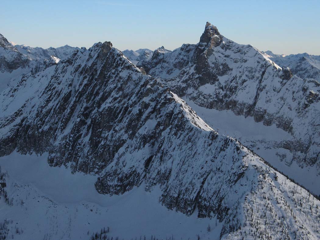
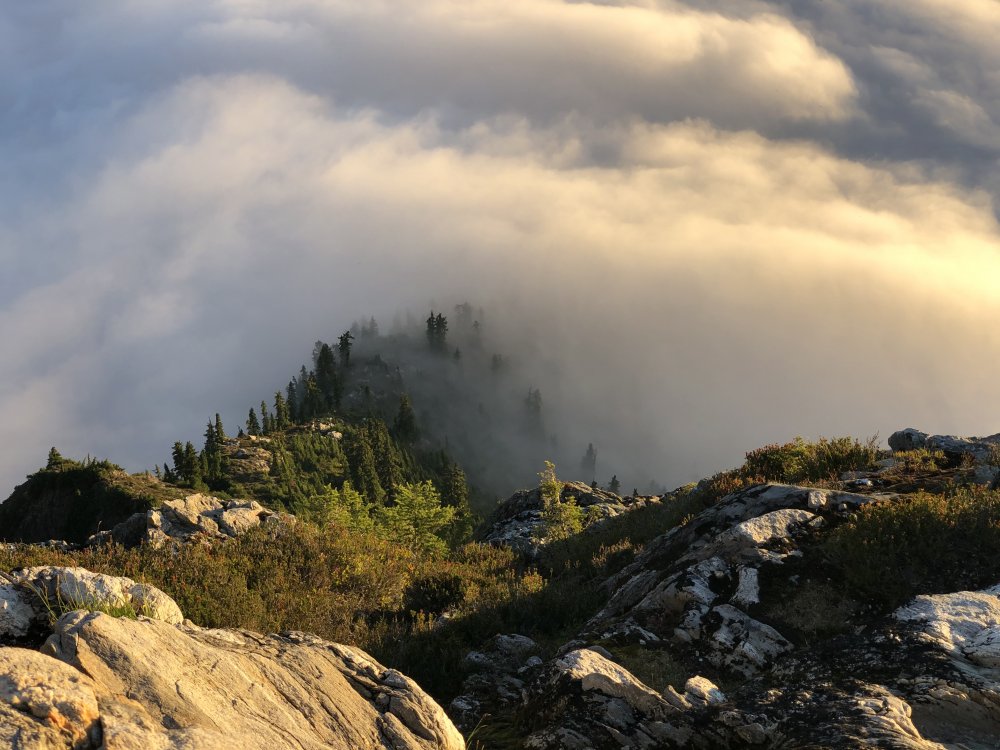
Trip: Holliway Mountain - North Face Route (aka "Scary Bear Attacks") D 5.9+ new route Trip Date: 08/14/2022 Trip Report: Let's start with a John Scurlock photo of this (likely) previously unclimbed face; Holliway's north face is on the left, Golden Horn background right: Here's a shot I took from the trail: Rolf Larson and I bring you a cautionary tale about this attractive nuisance. Our main candidates for an ascent were the two longest ribs that lead up to the two high points you see above (the true summit is on the left, and appears lower). The one on the left had a series of towers that led to the brilliant white -- and largely blank -- spike that forms the summit, while the one on the right appeared more straightforward. We kicked steps up firm snow to the footing of our preferred rib on the right. After futzing around with a difficult moat pitch, and finding a barely passable anchor poised below what looked like a difficult and very spicy next pitch, Rolf wisely downclimbed back to the snow. This cost us 3+ hours. We wandered left on the snow to "scout", and spotted some snow leading up to easy access to the rock, below the second-best left-hand rib and just right of a garbage-chute gully. Standing on the still-hard snow, contemplating the idea of beginning the route at 11:30am, one of us asked "You wouldn't let us do something stupid, would you?". This was a stupid question directed at the wrong person. So both stupidos headed upward to scout. Looking up; we began climbing off on the left, below the high point of the snow, where it makes a prominent triangular nose pointing right. Our false start was the furthest right high snow point. Our top-out on the sub-summit is the high point to the right of the V-notch; the true summit is the white spike on the left. I got the first pitch (5.9+) and it was fantastic, and would be popular if it were at a crag--fun climbing with a little bit of everything on solid rock. The uphill was all downhill from there. Rolf's second pitch (5.8?) went up a chimney that had some fun moves, but also some loose killers that he danced around. Our next several pitches took a left-hand ramp above the gully splitting the two main ribs, a couple more in/across the gully to take ramps on its right, and then we found a way to leave the gully rightward to gain the originally desired right-hand rib to the sub-summit. After pitch 2, the climbing in general wasn't too steep, but there were occasionally difficult moves; and, it was often run out and loose, requiring careful rope management. A few pitches after gaining the right-hand rib, we stood on the 7,920' sub-summit and took in the sunset. We were 9 hours on the route. We descended to the south, hemi-circumnavigated around the east side of the mountain (via headlamp and moonlight) to get back to our packs, then thrashed down to our pleasant camp at the river, arriving at around 2am. Not that anyone will bother, but FWIW, happy to provide details for the descent -- including a plausible more direct route with daylight -- upon request. After the first pitch, due to the loose rock and scarce anchors, bailing would at minimum be risky and costly. Future parties might enjoy exploring the many features on this corrugated face, but should bring a bolt kit and a sense of humor. The line required 10 pitches total. Approx route: More pics here: https://photos.app.goo.gl/zTcs4kQdwBFhEdKc7 Here's the namesake bear (there's a video series of same name too, and on the approach was bear scat and a bear hunter): Gear Notes: We had doubles through 2 when including tri-cams, a single 3, and pins. Rolf used one pin at a belay. A single 70m rope. Approach Notes: West Fork Methow River trail, then PCT (total approx 10 miles) to camp on Methow River; then up a couple thousand feet through brush and forest
 1 point
 -
Trip: Central Idaho - many Trip Date: 08/20/2020 Trip Report: Just in case you ever wanted to climb in a pristine valley in the lower 48 that offers hundreds of first ascents on routes hundreds to over over a thousand feet in height. Check out our excellent adventure from August of 2020. I finally finished the report for Tom Lopez's website that he's waited two years for. https://www.idahoaclimbingguide.com/announcements/ship-island-climbing-2020-by-jim-pace/ Gear Notes: Lots of it. Big cams and off width gear handy. Approach Notes: Long. Read the article. Requires a pack string unless you are happy with Denali sized loads.1 point
-
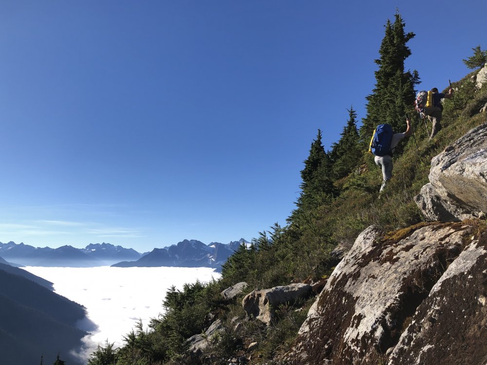
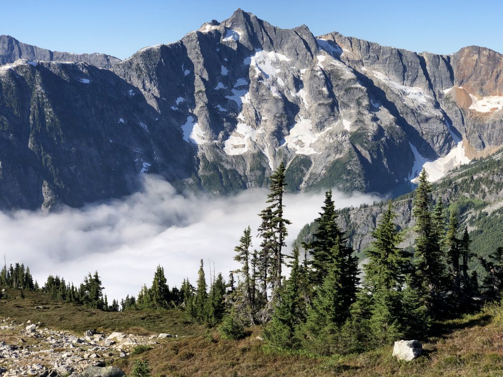
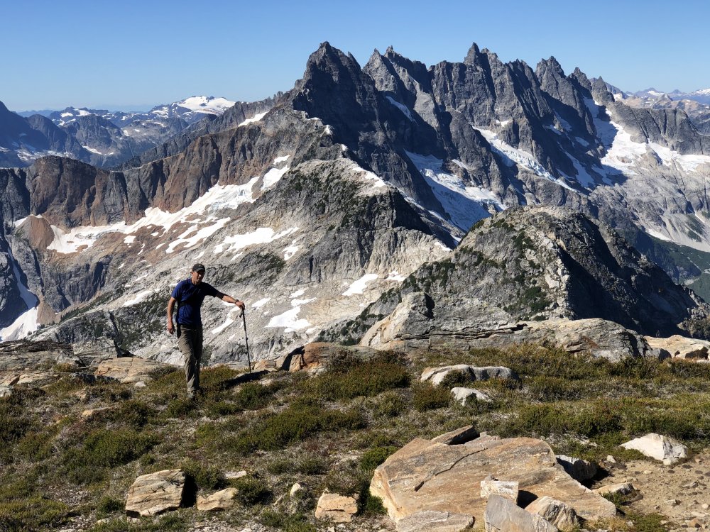
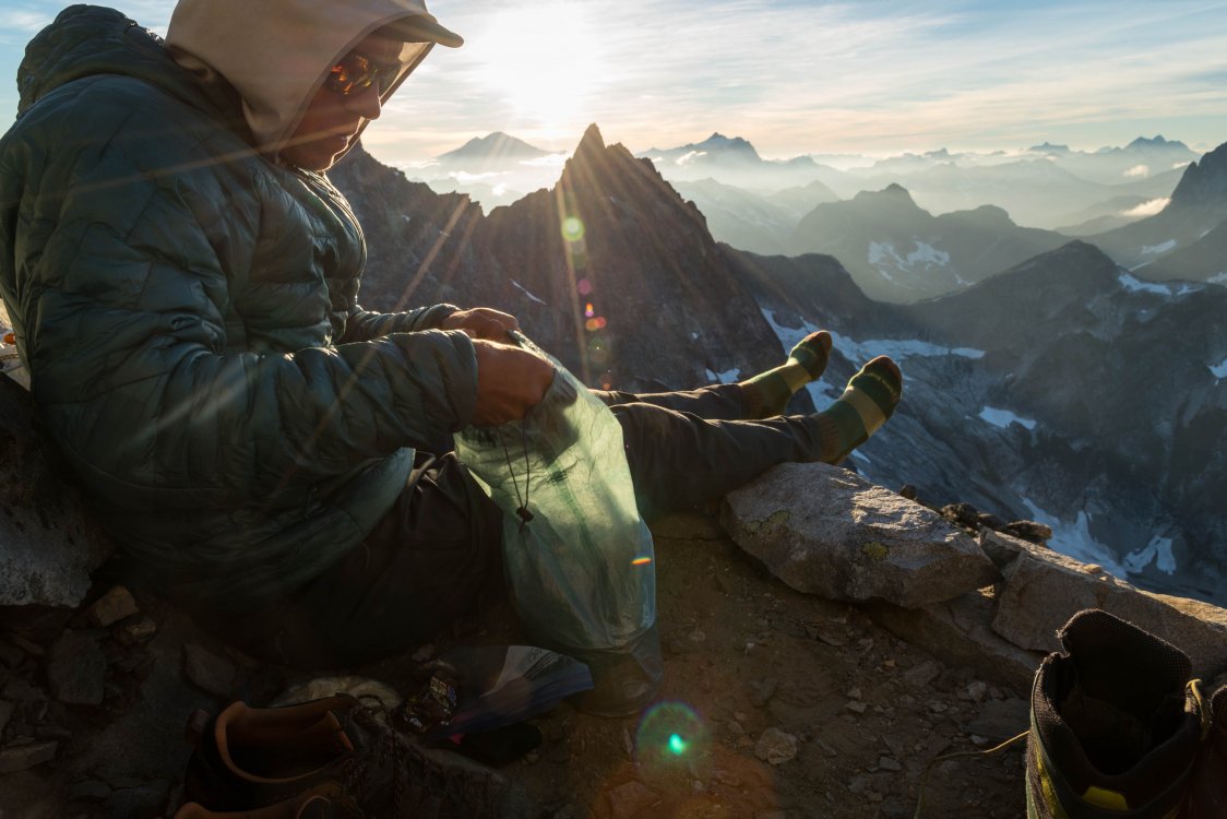
Trip: The Pasayten for the Old and Slow - Amphitheatre, Cathedral, Remmel Trip Date: 10/01/2022 Trip Report: In September 2002 I hiked into Cathedral Lakes with my buddy Russ to do the classic SE Buttress on Cathedral. We got rain, hail, fog, snow, and finally gorgeous sunshine; unfortunately in the wrong order. Our first day at Cathedral Lake we chose not to climb as it was really cold, the fog was thick enough we couldn’t see a thing, and as Russ said, “It would suck to have to retreat and leave gear all over the place—even if it is only your gear.” That night it snowed enough that the next morning we bailed and hiked all the way out to Thirtymile campground. Twenty years later, with a far greater appreciation for and expertise in checking and understanding the weather forecast, I wheedled Gordy-from-the-Pickets into heading back in there last week for another try. I had friends who were doing the Cathedral loop trip with a group and planned to scramble Cathedral, so I figured if Gordy and I got an early start, we could do the Ka’aba Buttress on Amphitheatre on Day 2 before they arrived, Cathedral on Day 3 while they did the scramble, then spend the next two days leisurely hiking out and tagging Remmel with them. We saw no one the first day expect for three yutes (by which I mean people who appeared to be in their early 30s) and their dog. I speculated they were running the loop as they had teeny tiny packs and shorts and seemed to be moving awfully fast, and we’d seen no sign of a tent along the way. We made it as far as the Tungsten Mine (but not to the buildings) before I said “Here’s camp; I can’t go a step further.” We made it to Cathedral Lakes the next morning in plenty of time to do Pilgrimage to Mecca, tag the summit of Amphitheatre, and return to camp, but apparently I’m now too old to hike 20 miles with a full climbing pack in a 24-hour period without being too wasted to do much of anything once I get there. Very disappointing. Also, Pilgrimage to Mecca was clearly not going to come into the sun until 4 or 5 pm, if ever, and it was cold in the shade and I’m an enormous pansy. So after a nap (on my part) we just scrambled the West Ridge of Amphitheatre. Not a very exciting route, but nice views from up there. Amphitheatre and Cathedral from Boundary Trail: We started up the SE Buttress fairly late (8:30 am) on Saturday, so that most of the first pitch was already in the sun, but it was still darn cold belaying. Instead of swinging leads we divided them, with Gordy getting the pitches that were wide or would benefit from brute force and me getting anything that had a thin crack on it. This worked out quite well. Sadly we were both too busy climbing to take many pics, but there are already a gajillion pics of the route so it’s hard to think that’s much of a loss. I think this is the belay before the fifth pitch, but really I have no idea. Who cares; look, it’s sunny! We avoided the headwall pitches as neither of us are leading 5.10 at the moment, heading around the corner to the right to scamper up the ramp and chimney that the Doorish topo in Beckey shows as 5.6. Old age and treachery triumphs again. We posed for summit shots; I did my 1930s Red Army recruiting poster pose. Gordy behaved a little more normally. We were back to camp in plenty of time to move down the trail a couple of miles, but we were behind our friends and didn't catch them. They ended up going a different way than they had planned, so we ended up ahead of them the next day by doing the 800-calorie cross-country shortcut to Four Point Lake. We met them on the trail as we were descending from Remmel and on the way back to where they had ditched packs we had a fun scavenger hunt for the notes they left to inform us of their track. Analog communication: We had a lovely evening camping and eating and telling stories, saw a moose (!!!) in the morning, and stopped by a gorgeous stand of quaking aspen for our last break before returning to the TH. So overall a great final hurrah to a shockingly successful summer season for a middle aged lady with a “real” job. Unless this Indian summer lasts another few weeks.... Gear Notes: I thought I took too big of a rack but we sure did use it Approach Notes: walk and walk and walk and then walk some more1 point
-
Trip: Idaho - Heart of Diamond, Milwaukee's Best Trip Date: 09/15/2022 Trip Report: I've spent chunks of the last two Septembers helping some friends scrub, trundle, and bolt on a unique 800 foot granite wall on a subsummit of Storm Mountain, north of McCall, Idaho. At least for the time being, we're finished, and would love for folks to get on the two resulting routes to get some traffic and confirm grades -- everything about them is geared to optimize the experience of subsequent ascents. The wall has an extraordinarily consistent angle at just under vertical, and is littered with overlaps, layback flakes, and small roofs, which together create routes that are extremely sustained and with varied and high quality movement. It's just the right angle, and has just enough edges and dikes, that it is almost never slabby, and also almost never requires cranking on micro edges. While covered in cracks, many of them are too shallow, flaring, or fragile for bomber gear (but are great for climbing), resulting in routes with around a third natural protection and two thirds bolts. It also tends to excellent free climbing conditions, facing northeast (so warms up quickly before going in the shade) at around 8000 feet in a relatively dry range. Last year started by pushing a route ground up, since that seemed like an important thing to do. It was hard, scary, dangerous and required lots of aid and drilling on lead (not by me), and would have (as is) resulted in a route that was very poorly suited to repeats. So, from that point, we went top down and focused on making quality routes. For instance, much of the wall is initially covered in loose potato chips, which make free climbing ground up extremely challenging (and not very fun), but scrubbing invariably reveals bomber edges, divots, and dishes pointing in wild directions to create interesting boulder problems. As far as protection -- if there's bomber gear, you place it; but if it's questionable we put in a bolt. You can expect sizeable (but safe) whips at cruxes, but will always have confidence in whatever you're whipping on (well, except in a few .10 ish bits), and everything should be both clippable for short folk while still protecting talk folks' ankles. Last year's route, "Milwaukee's Best" (MB, nine pitches, with two options for the last pitch), mostly tries to follow cracks on the left side of the wall, and is sustained at .11 to .12, with one pitch of .9 and one of .10. The two easier pitches are meh (easy .9 slab, somewhat fragile .10 cracks), but every other pitch is really good. This year, we had figured out that the climbing is often better if you avoid the big, obvious crack systems, and "Heart of Diamond" (HoD) zig zags right up the middle of the wall. Of the seven pitches, one (p5, a leftward .12 ish traverse) is perhaps a bit forgettable, but every other pitch is extremely high quality, with sustained and varied movement. There's one or two pitches of .11, two or three of .13 (so I'm told -- I can mostly do the moves but do not send that hard), and the rest some flavor of .12. Also worth saying -- these are real YDS grades, not Washington grades -- for instance I had little input, since my diet of index and ungraded bouldering gyms, and weird body proportions, mean my opinion isn't very transferrable. Michal wrote up an excellent description on mountain project: https://www.mountainproject.com/area/123065053/storm-dome, so I'll just dump some photos here. Northeast face of Storm Dome: The NE aspect enforces the pleasure of relaxed mornings, during which you can explore the variety of shapes into which wood can burn. Maybe these holes were woodpecker homes: MB pitch 3 before the roof: MB pitch 3 at the roof: MB pitch 3 after the roof: MB pitch 7: MB pitch 8, before the groove peters out: MB pitch 8, right where the groove peters out: Through the roof on MB pitch 9a (right option): Starting rightward on HoD pitch 4: Continuing rightward on HoD pitch 4: Starting the journey on HoD pitch 6: Near the top of HoD pitch 6, hanging in a hueco: Immaculate, perfectly sculpted and oh-so-crucial dual pinches on HoD pitch 6: Topo for MB and HoD: Smokey sunrise from camp, which is a pika-filled meadow between the lake and the wall: Gear Notes: Light rack and draws (see MP link for details). Approach Notes: 7 miles, 2800ft, 4-5 hours in, 2-3 hours out, see MP link for details.1 point
-
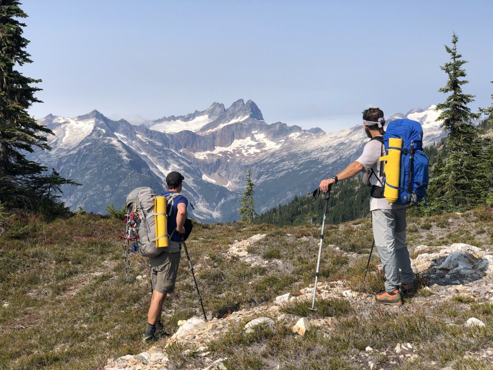
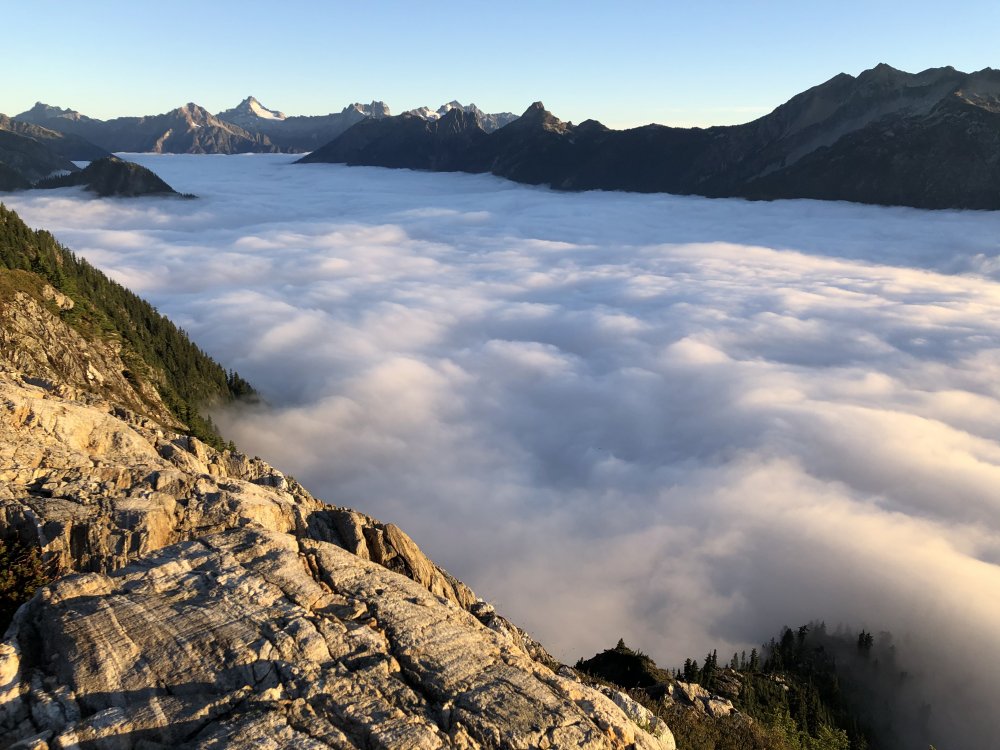
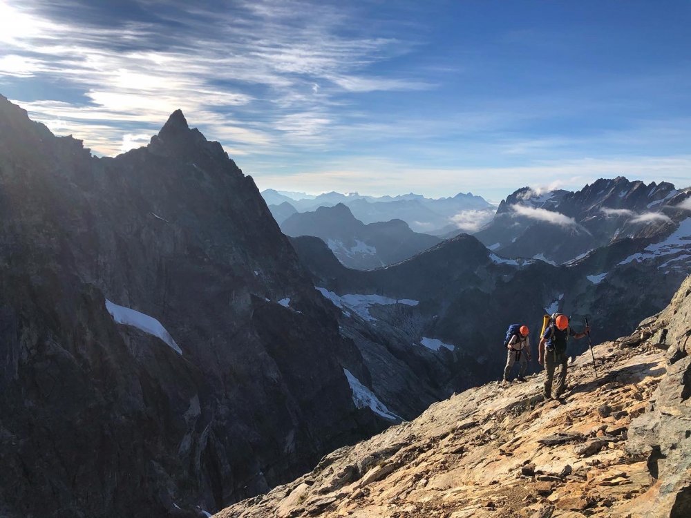
Trip: West Mcmillan Spire/Elephant Butte - West ridges via Stetattle Ridge Trip Date: 09/06/2020 Trip Report: Two weeks ago I had the pleasure of getting back into the Southern Pickets with @JasonG and @Trent. We took the eastern high route/approach via Stetattle Ridge. I outlined the route in the approach notes, this will be more for a general itinerary/thoughts/photo dump. Hiking along Stetattle was extremely panoramic and quite pleasant. We setup camp the first night just north of North Stetattle (pt. 6728). There were abundant tarns for water and flat spots to setup at. Not long after unpacking the guys pulled out the whisky and chocolate, a ritual I'm not familiar with having spent most of my time trying to be as ultralight as possible. We shot the shit for hours and listened to tunes on Steve's little speakers. I'm sure now that theres a little room in my pack for some whiskey. I slept really well until the (full?) moon was dead center over the sky and woke me up with its brightness. We got up decently early for the big day of tagging Elephant Butte and and a plan of making it to the summit of West Mac for the nights bivy. We were a bit above an awesome sea of clouds down in the valley. The drop down to the notch above Torrent creek is fairly straight forward and to get up out of it toward the benches at 6200' above the small lake east of Elephant Butte is just a bit more involved, but not too bad. We dropped packs at the notch at the base of the west ridge of Elephant Butte. Was a quick romp to the summit and we were surprised how many entries in the register there were as of late. We toyed with the idea of staying on the ridge crest and tagging the next two high points west of the Butte (Hippo, Rhino). But some hairy climbing/scrambling, lack of inspiration to tag them, and a concern for having enough time to deal with the ridge to get into Terror basin pushed that idea to the side. I'm glad we spent the effort on the more important task of getting into Terror Basin safely and efficiently. We stayed more or less at 6200' from Elephant Butte until we got to the notch just west of pt 6455. From there it was staying very close to the ridge crest. At this point, the route gets very exposed, serious and committing. Scrambling on 4th class rock, heather benches, veggie pulling. It was not too far removed from what you'd experience on the NEB of Jburg. It finally eases off just before Little Mac. A small sandy notch allows entry into Terror Basin. From there we traversed down across snow to get to the base of West Mac, we were able to go up a dry mossy waterfall on the rib extending down from West Mac which cut out quite a bit of travel. We scrambled up the west ridge and made our way up to the summit. Theres now currently three one-person bivy spots up there now. We made dinner, drank whiskey and waited for the sunset. It was an awesome sunset, highlight of the trip for sure. But after every calm, comes a storm. We settled in for the night in really pleasant weather. At some point the winds picked up dramatically and Steve and I got sand blasted all night. Meanwhile Jason was locked in mortal combat with the snaffles. He said they were trying to take his headlamp off his head. They had told me the night prior that the snaffles really like him. I think the wind that Steve and I were experiencing were keeping the snaffles at bay, leaving Jason as easy prey. Didn't sleep a much that night as you'd guess. Got up and made breakfast and a big pot of coffee in a spot on the summit mostly out of the wind. The sunrise was fantastic and made up for the night we had. Packed up and made out way down West Mac and out Terror basin without issue. This was an incredible trip and thanks to Jason for inviting me on this, I cant say I would've thought to do this kind of trip myself. It was the kind of trip I have been meaning to have for some time now though. And big thanks to Jason and Steve for being SOLID partners. It was really cool being around two guys that have been climbing with each other for as long as you both have. I won't be caught without whiskey on the next Choss Dawgs trip. Myself as we make our way up Sourdough Creek. Jason Photo. Jason and Steve looking at the next two days. North Stetattle. Sunset, Elephant Butte and The Southern Pickets Sunrise, Snowfield group and Davis Peak Sea of Fog. Jason up on Elephant Butte About to make our way into the business end of the traverse. Steve Photo. Steve with the veggie belays. End of the hairy stuff. Jason photo. Into Terror Basin. Headed up West Mac. Up on West Mac preparing for battle with snaffles and wind. Steve photo. Dinner time. Jason photo. Sunset on Mt. Fury Morning light on Inspiration, The Pyramid, Degenhardt and Terror. Kulshan in the distance. Ray of light on Azure Lake. Hopefully Jason and Steve will drop off more of their photos! Gear Notes: Ice Axe, Crampons, Whiskey, Chocolate, Van Halen Approach Notes: Start at Sourdough Lookout Trail, go up along Sourdough creek, Stay on the crest of Stetattle Ridge. From pt. 6154 follow game trails down ramps and ledges to the notch above Torrent Creek. Ascend more ramps and ledges with a bit of steep schwacking up to ~6200'. Traverse westward around that elevation, Elephant Butte is a quick jaunt from the notch west of it. Gain the ridge proper from a notch just west of pt. 6455 (just east of the Mcmillan Spires). This is where the scrambling gets extremely exposed. Traverse mostly solid rock and heather benches toward East Mcmillan, occasional goat trails and veggie belays. Aim for a small notch to the left of where the ridge meets Little Mac.


 1 point