
Leaderboard


Popular Content
Showing content with the highest reputation on 08/24/22 in Posts
-
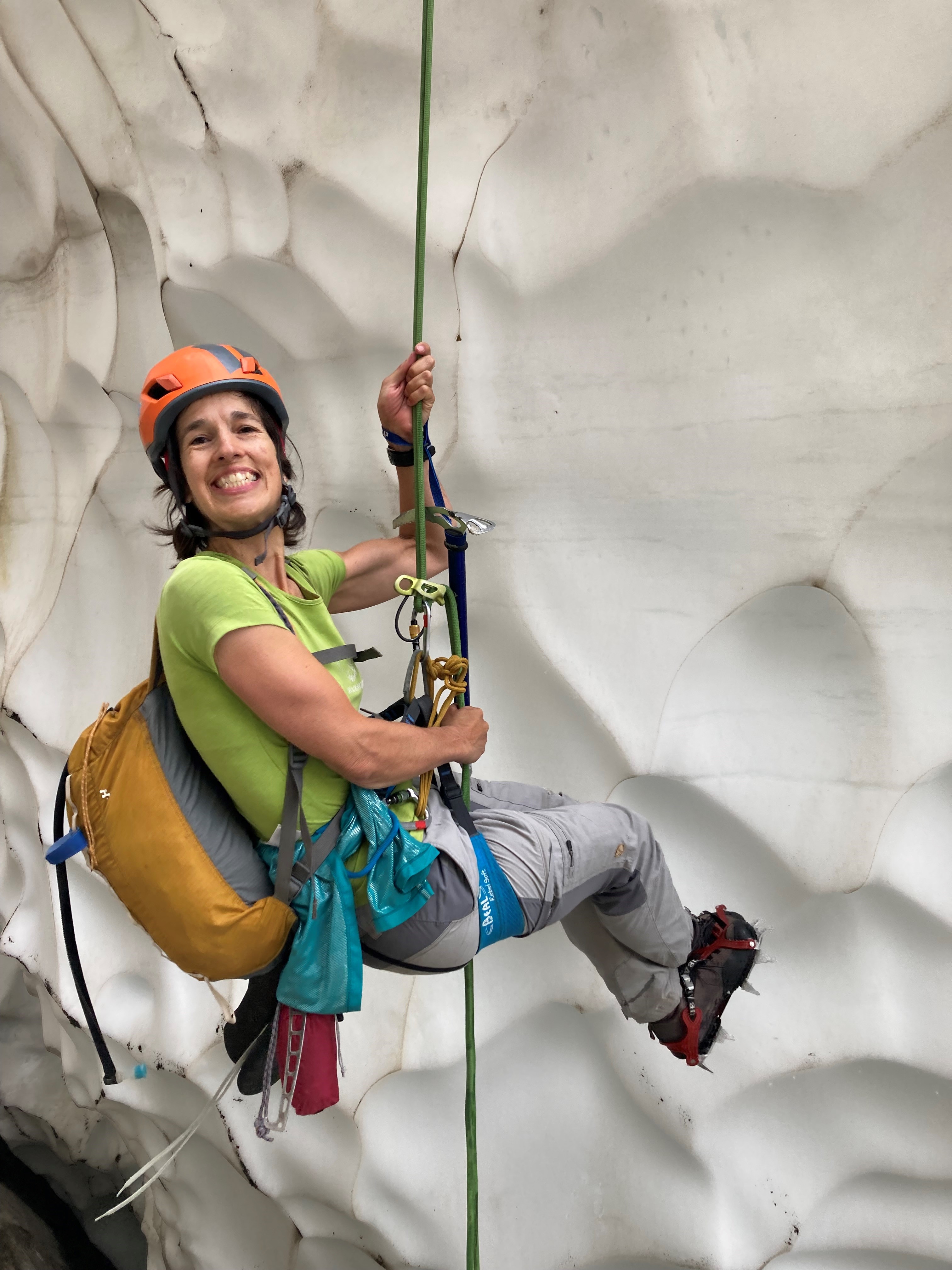
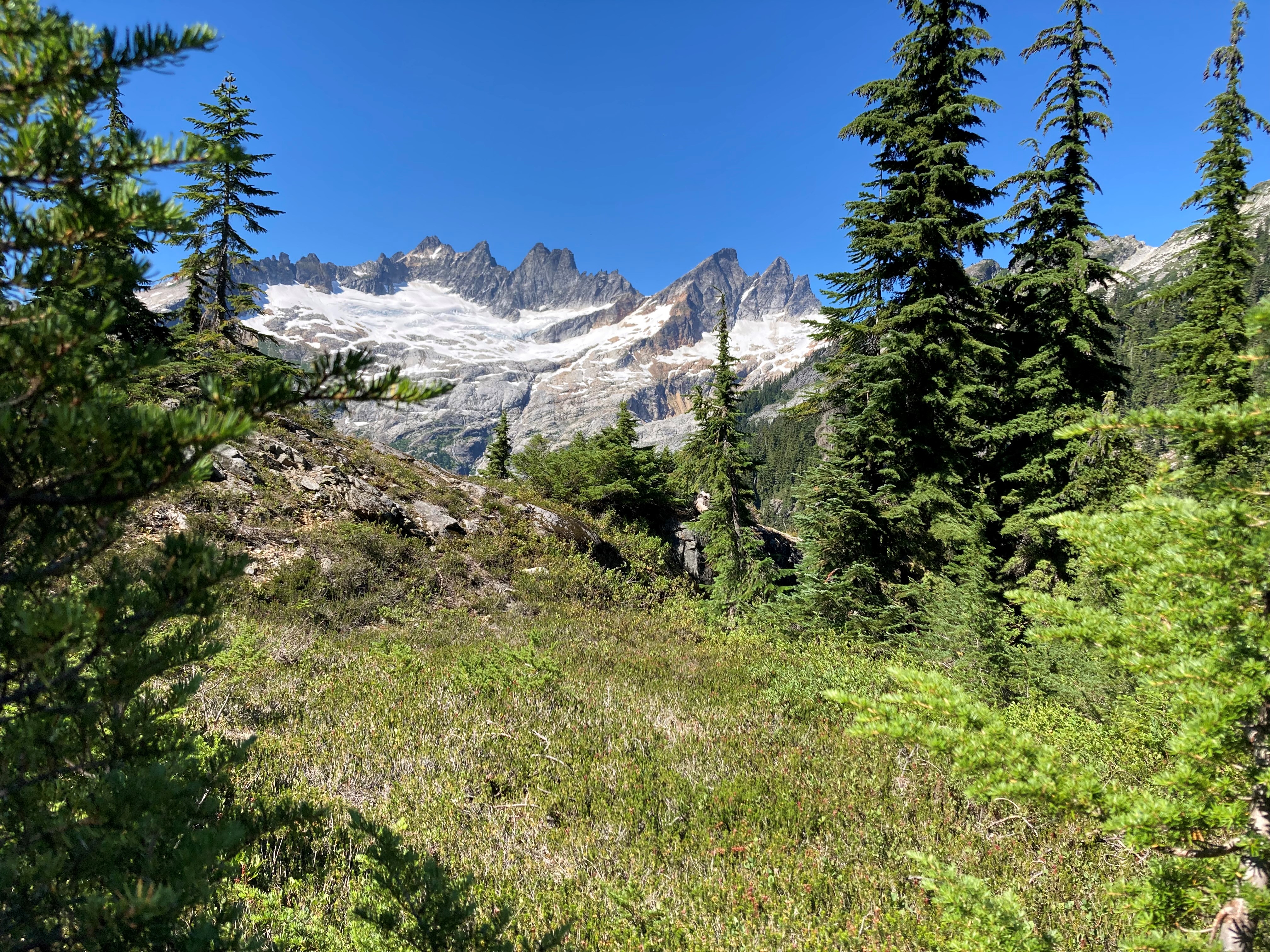
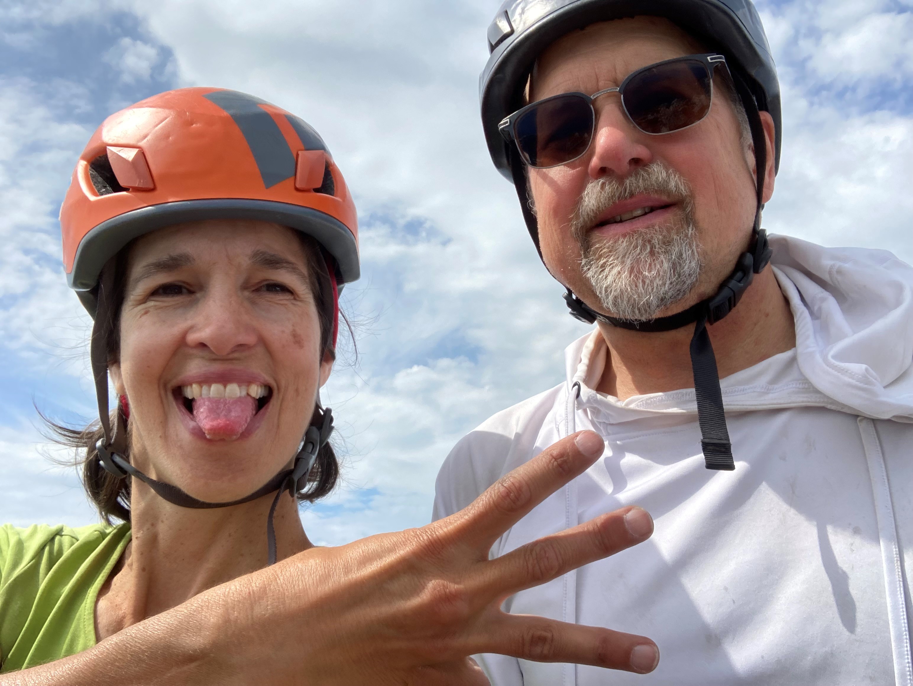
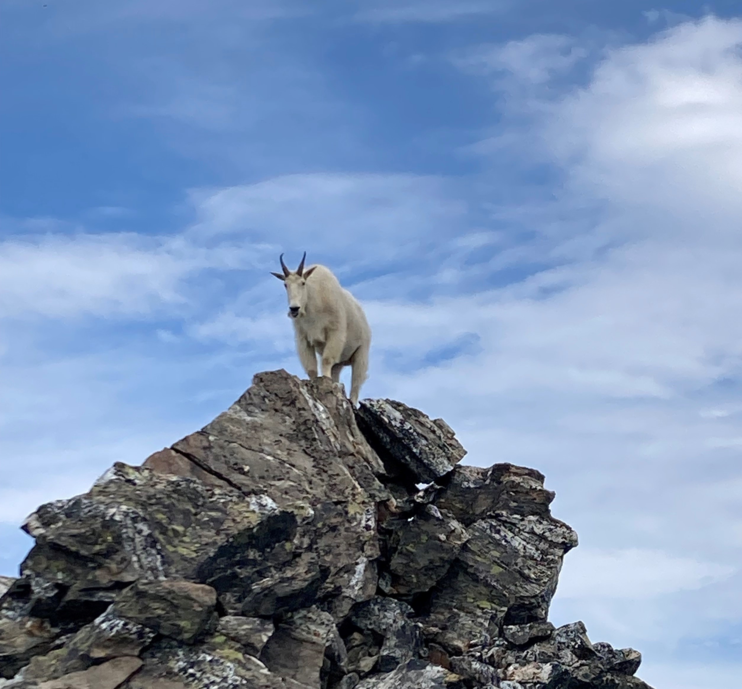
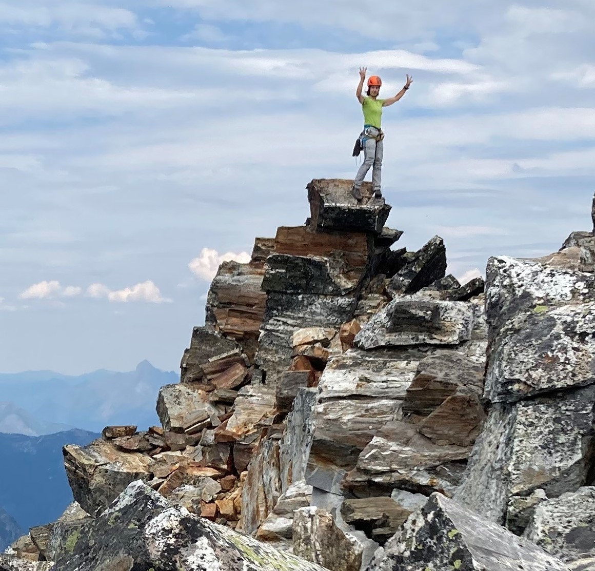
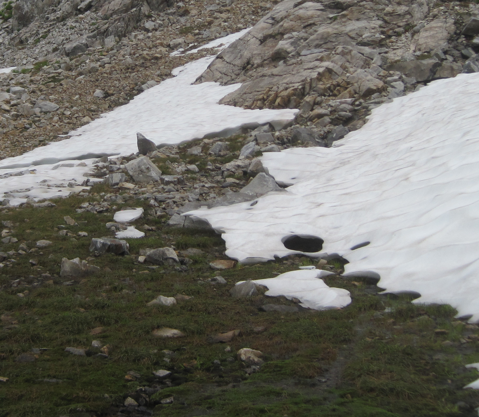
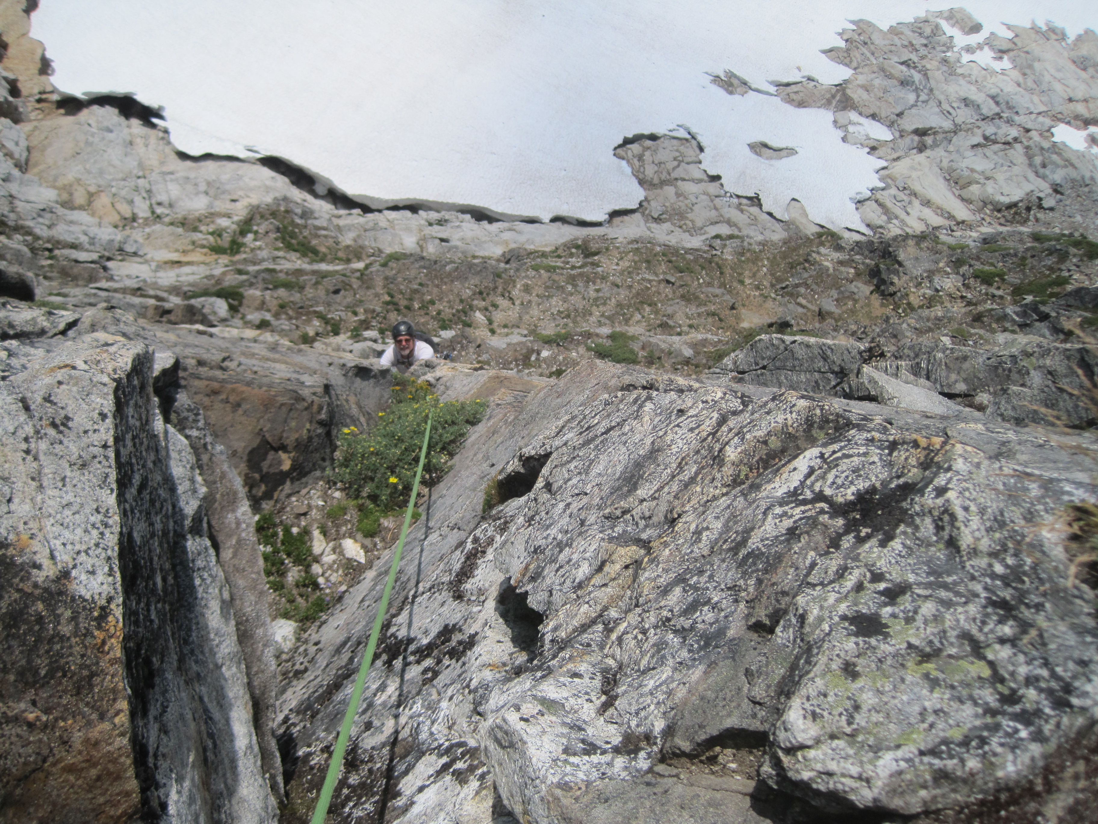
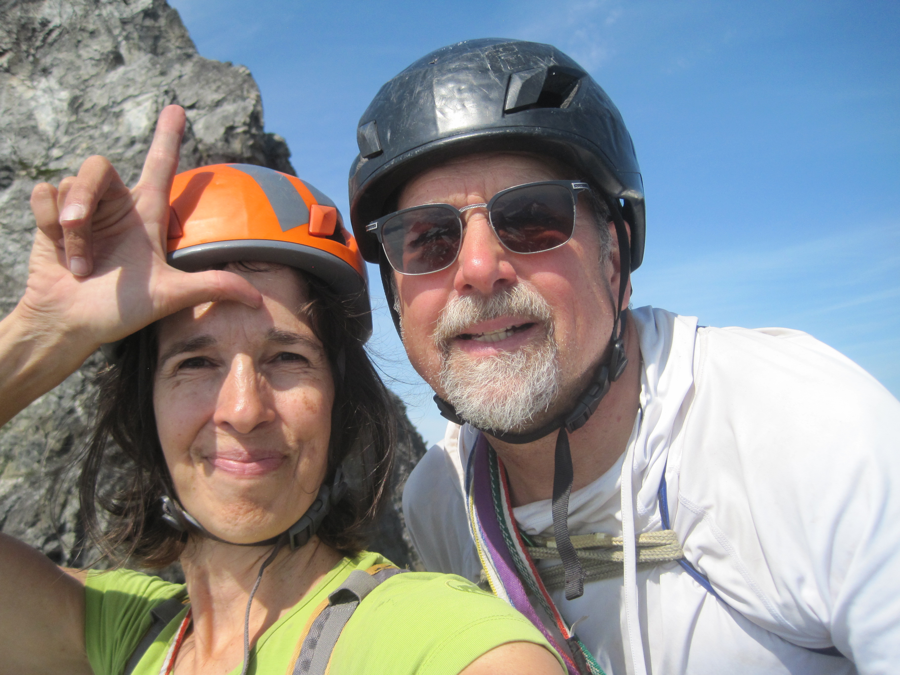
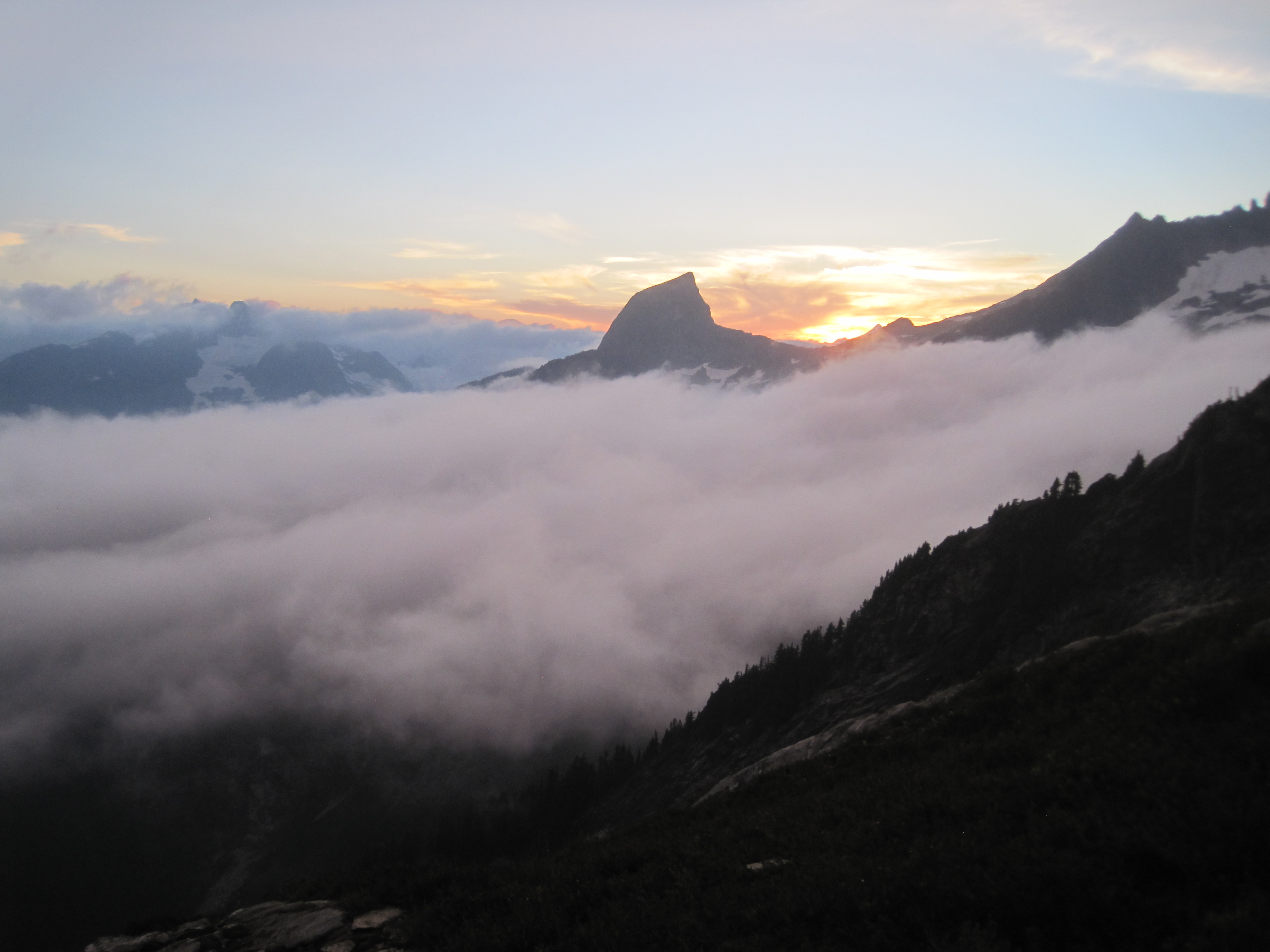
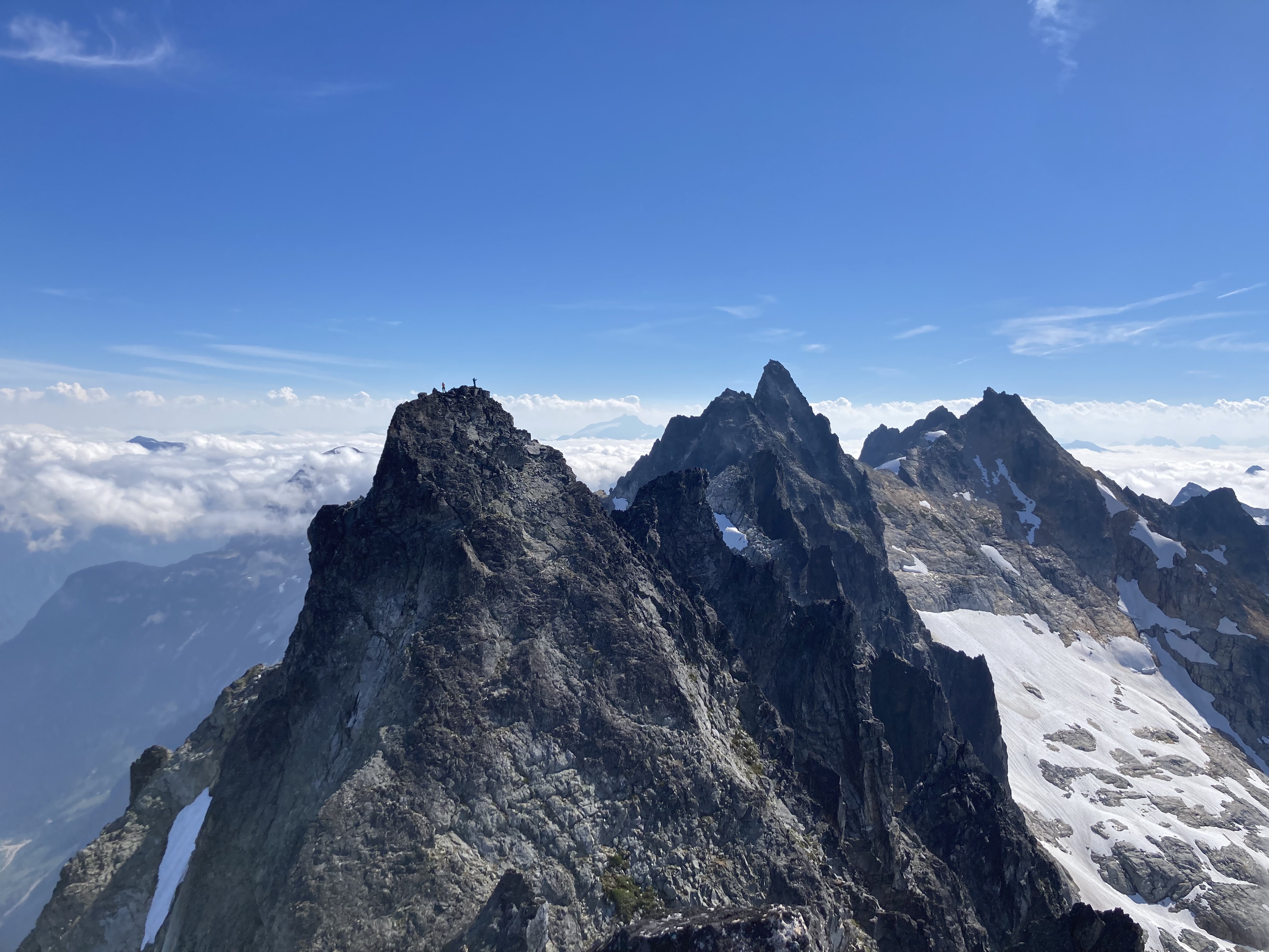
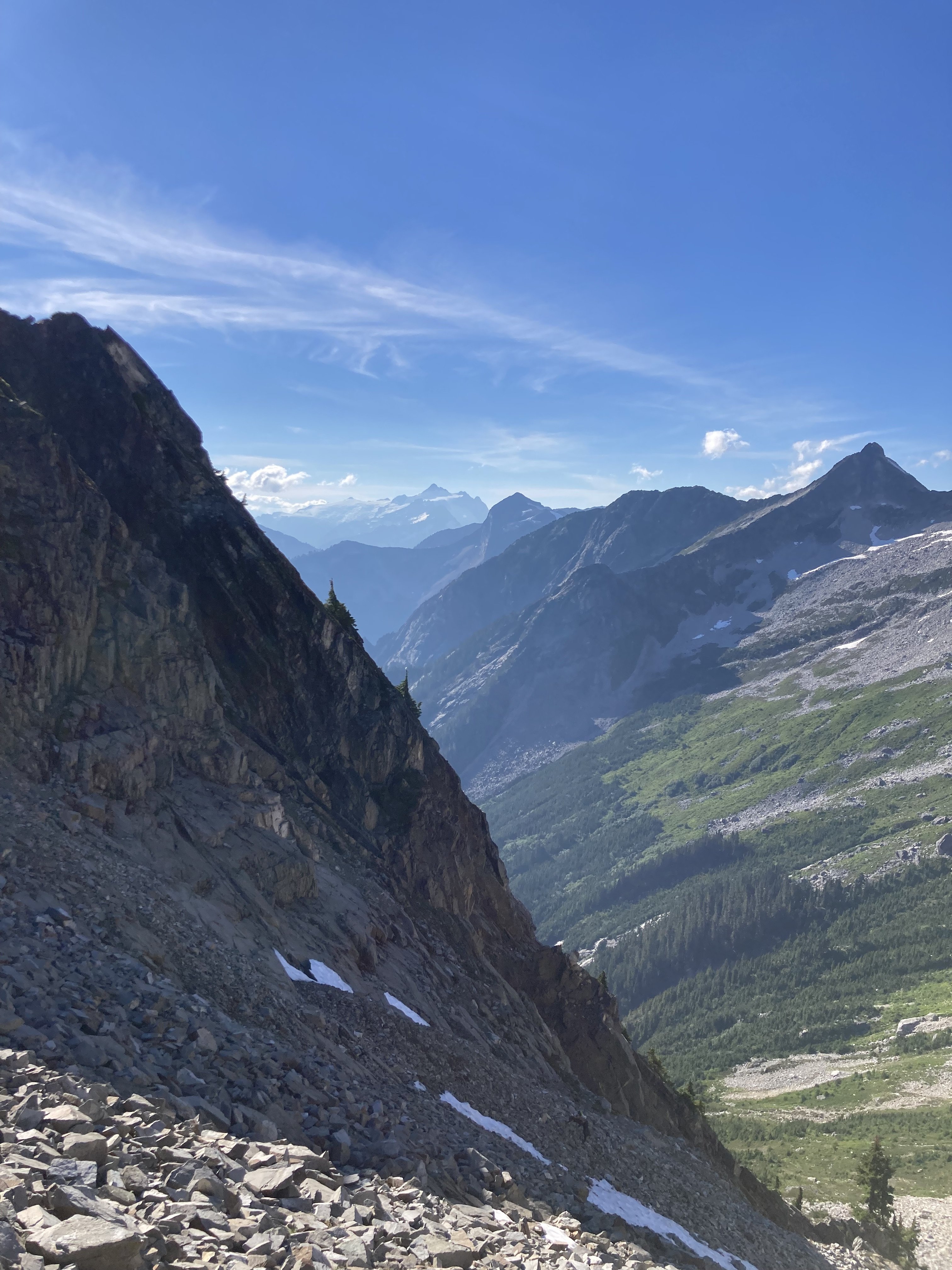
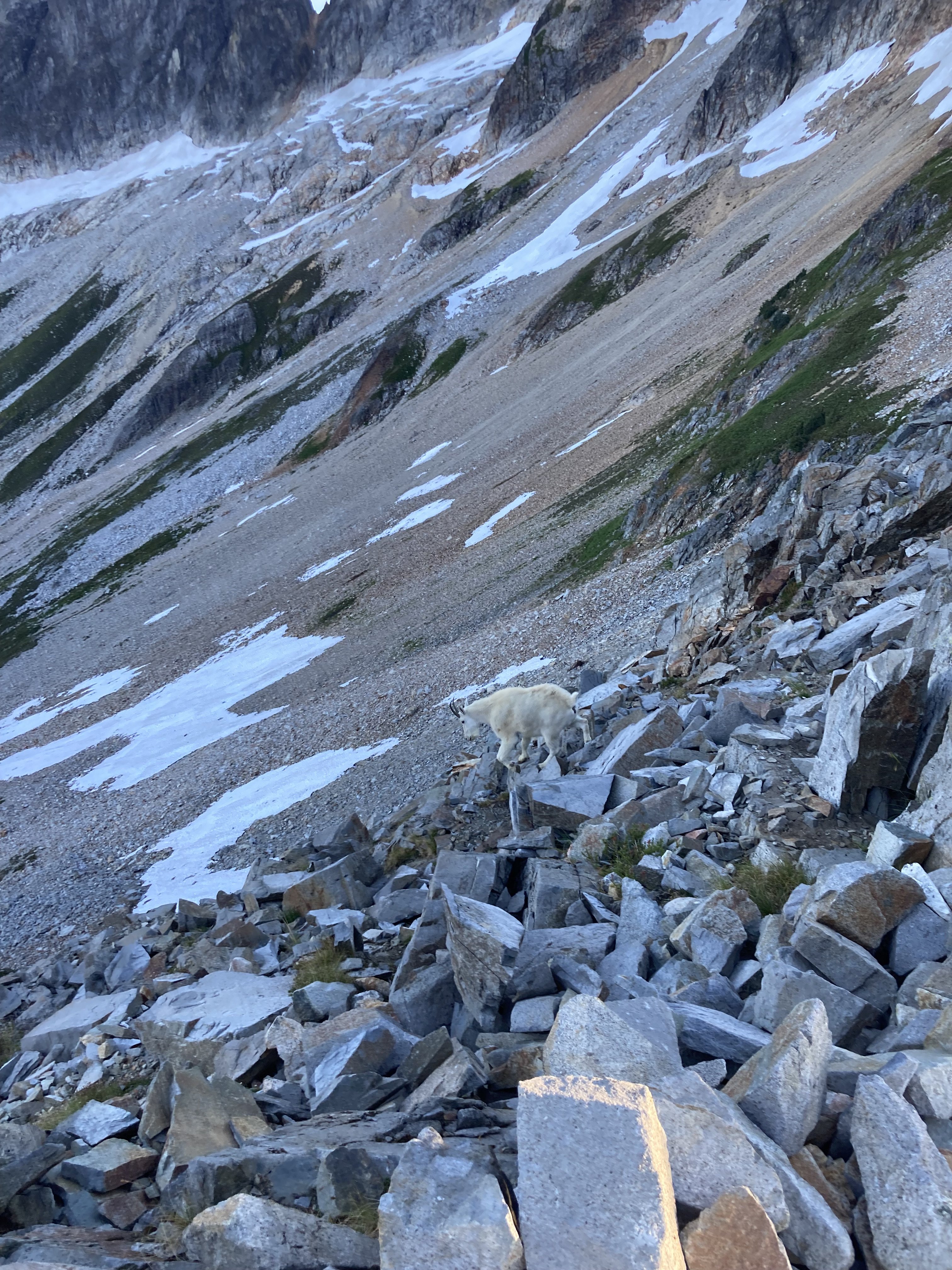
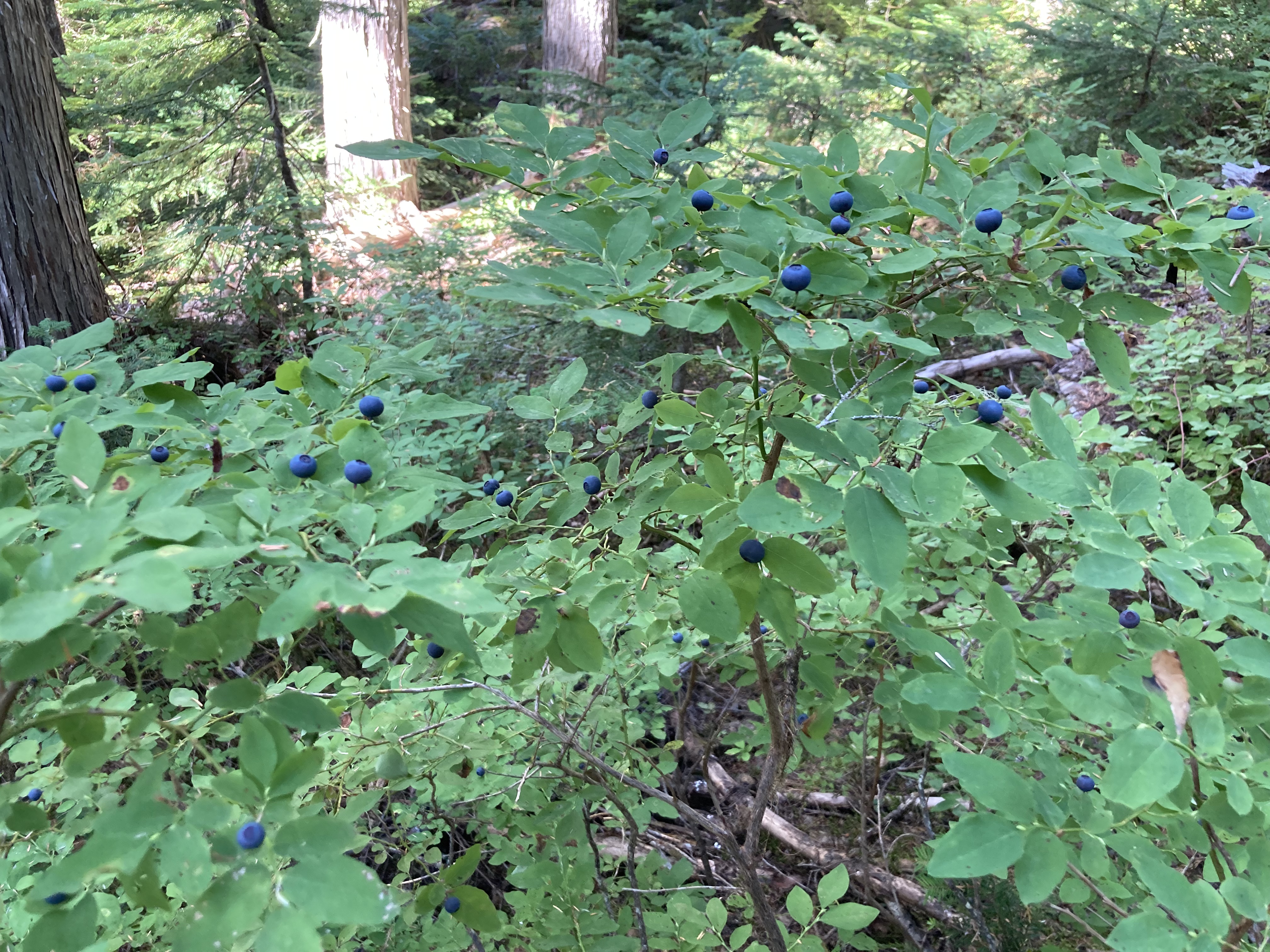
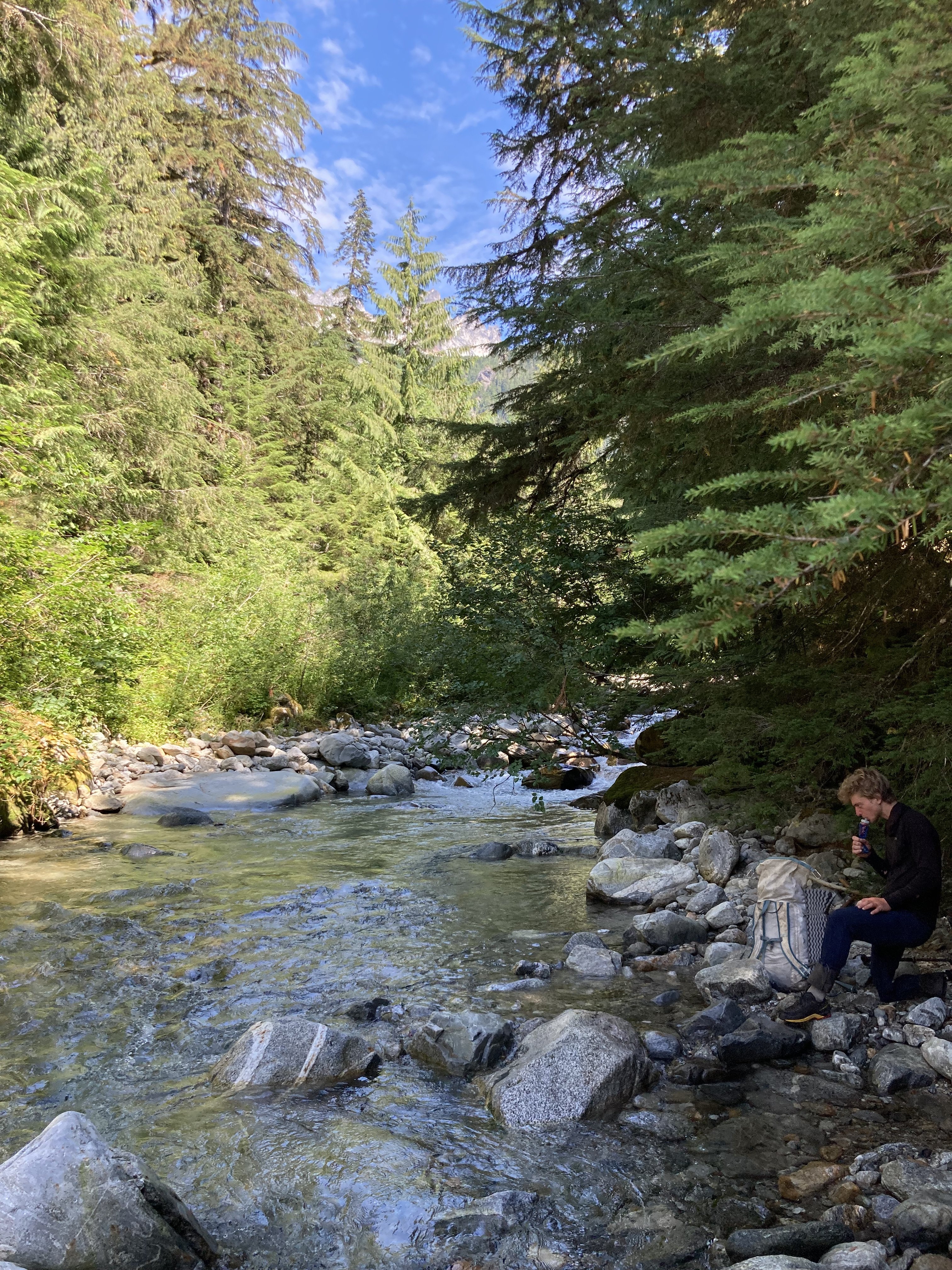
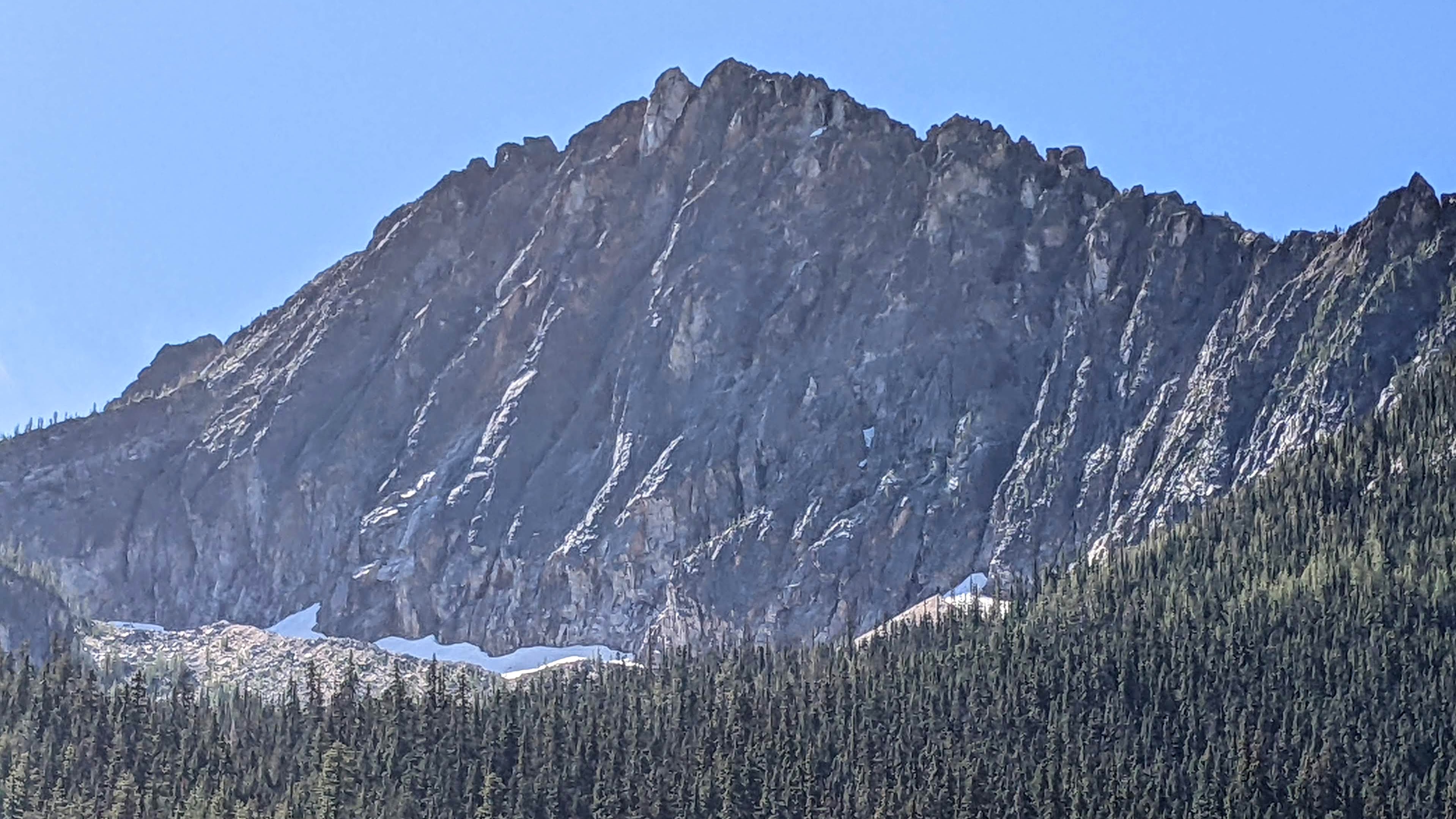
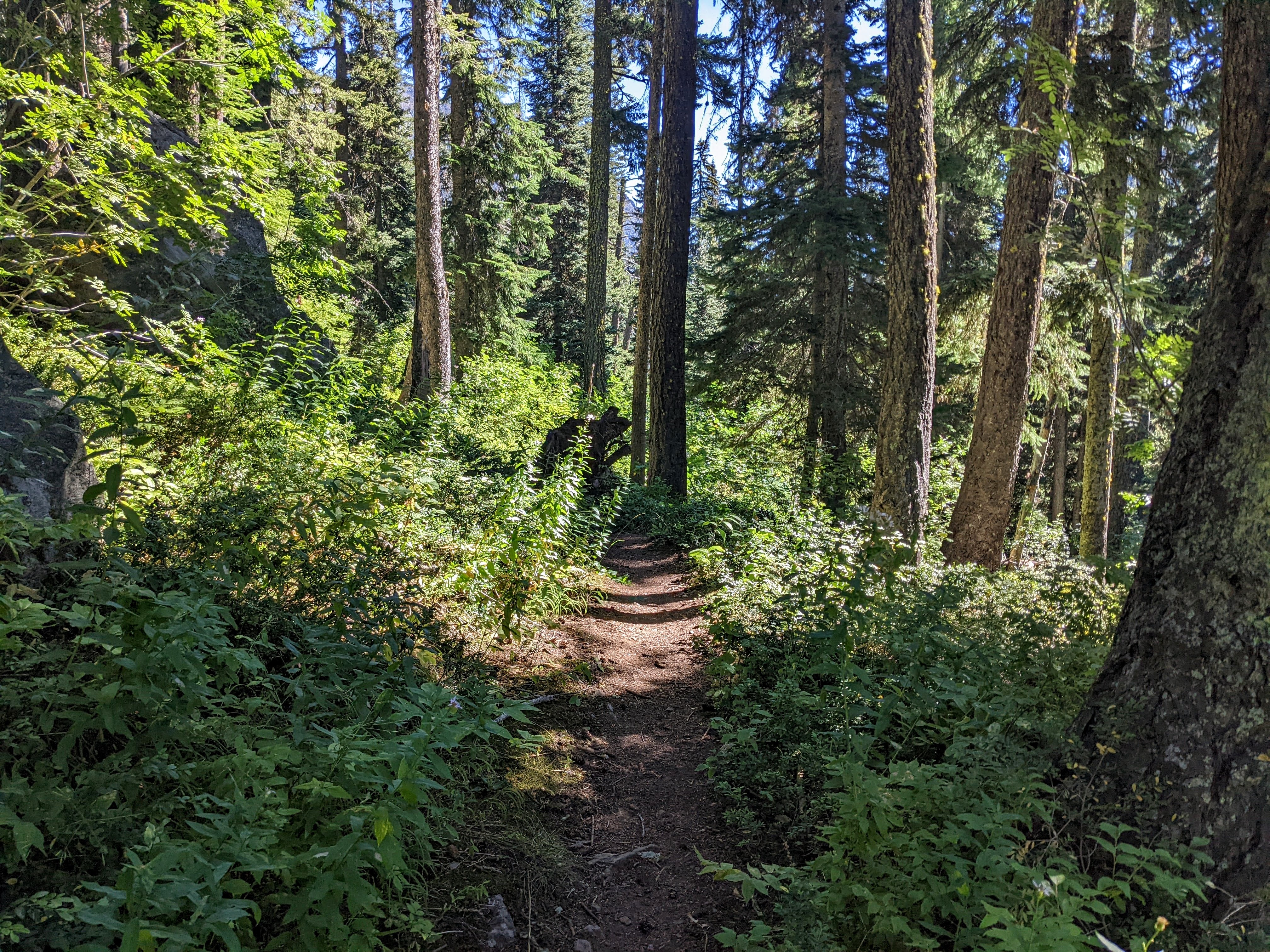
Trip: The Pickets for the Old and Slow - McMillan Spires Trip Date: 08/19/2022 Trip Report: Reading the internet makes it seem like everyone who goes into the Pickets is a total badass doing FAs or enchaining the whole damn range in record time, so here’s a TR for the AARP-eligible among us who perhaps were never all that fast or talented to begin with. Don't expect any useful information. I harangued my friend Gordy into committing to a Pickets trip this summer but he was too busy to go until late season, so mid-August it was. We made a leisurely approach on Wednesday, sweating buckets as we slogged up the hill in the high 80s. Terror Basin was gorgeous in the sunshine. (Note nearly all the photos in this are Gordy’s; he has an iPhone and I have a digital camera from 2009, so his pics are way better.) After a ridiculously civilized wake-up time of 6:30 the next day, we wandered up the slabs to start our day’s objective: East and West McMillan Spires by their SE Faces. This was made more interesting by the necessity of making a free hanging rappel off a snow bollard to access the rock on East Mac. Quoth Gordy, who has at least one FA in Alaska to his name: "I've rapped off a snow bollard twice in my life, and both were in the Pickets." The climbing went quickly as the majority of it was unroped fourth class, and soon we were snacking on the summit looking over at West Mac. We can’t climb enough peaks in a day to make it even remotely necessary to count our summits, so I held up fingers for letters instead. E is for East Mac. We saw a rap sling at the gendarme between East and West Mac, suggesting we should rap down the moat between the snow and gendarme and traverse low, but explored higher and it was easy climbing to get around the gendarme and arrive at Beckey’s “200 feet of fourth class” up the corner, then as I was pulling around the “5.7 bulge” up onto the ridge proper, I looked up and saw this gorgeous local denizen. I didn’t have my camera accessible but he was still hanging around when I brought Gordy up, who snapped this shot. Gordy made me pose for this shot: “Now turn your hips a little that way….” W is for West Mac. The next day we woke to intermittent light sprinkles, which turned to flat-out rain a little before noon. Before it started raining in earnest, we roamed around the basin a bit and spotted the elusive seal of the Pickets. The wildlife there is truly not to be believed. (My photo, you can tell by the crappy quality.) After all the rain on Friday, we decided to just go for Little Mac on our last day as neither of us had done it before and we already had the approach dialed. We made it more interesting by (1) not having any descent beta other than “rap to the col and continue traversing East McMillan spire” and (2) convincing ourselves that the lower vegetated ramp was probably just as good as the higher one and soloing increasing sketchy fourth class until a bit past the point where we should have roped up. I scored the money pitch, which was the nice crack straight up from the ramp. It even had a good spot for a rap anchor, which eased our minds a bit about how we were going to get back down. Gordy following the crack: Gordy led up the final pitch to the top, where we took our last summit shot. L is for Little Mac. At least in this case. We made our way down, adding two rap anchors in the process, packed up and got the crap gully up to the notch behind us before dark, in order to make the last day a tiny bit shorter and so we wouldn’t be above or below anyone else on Sunday when we assumed the other parties would be leaving. A nice camp by a waterfall up in the meadows gave us a stellar view of the Chopping Block in the sunset and rounded out the trip nicely. Gear Notes: Should have taken alcohol. Did take a book (a slender volume), which was nice for the rain day. Approach Notes: The trail to Terror Basin is a highway now, it would take serious effort to lose it.
 4 points
 -
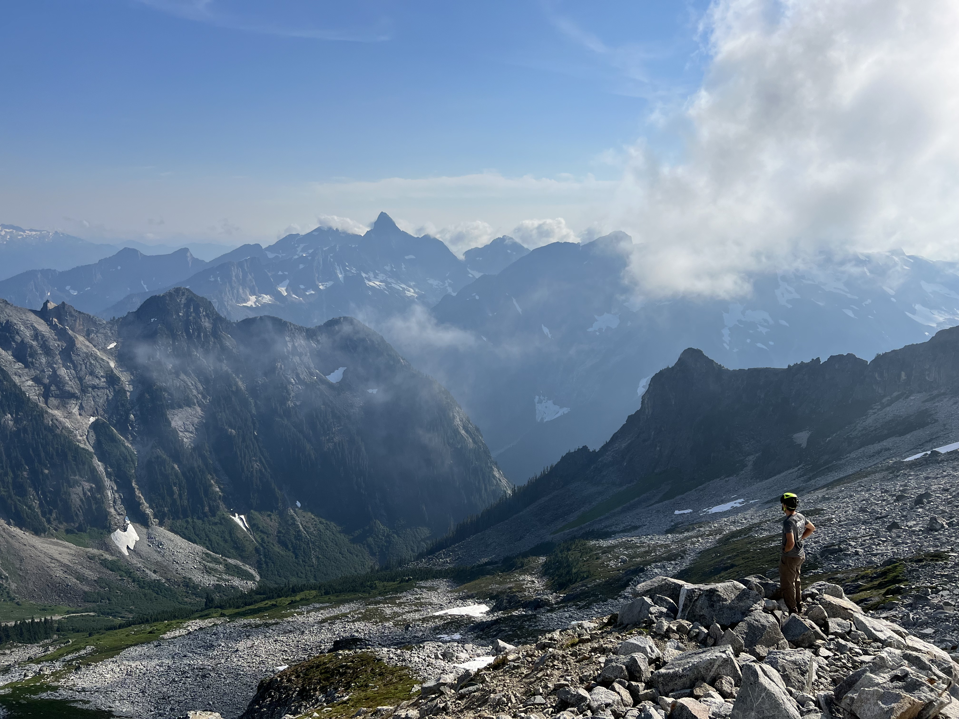
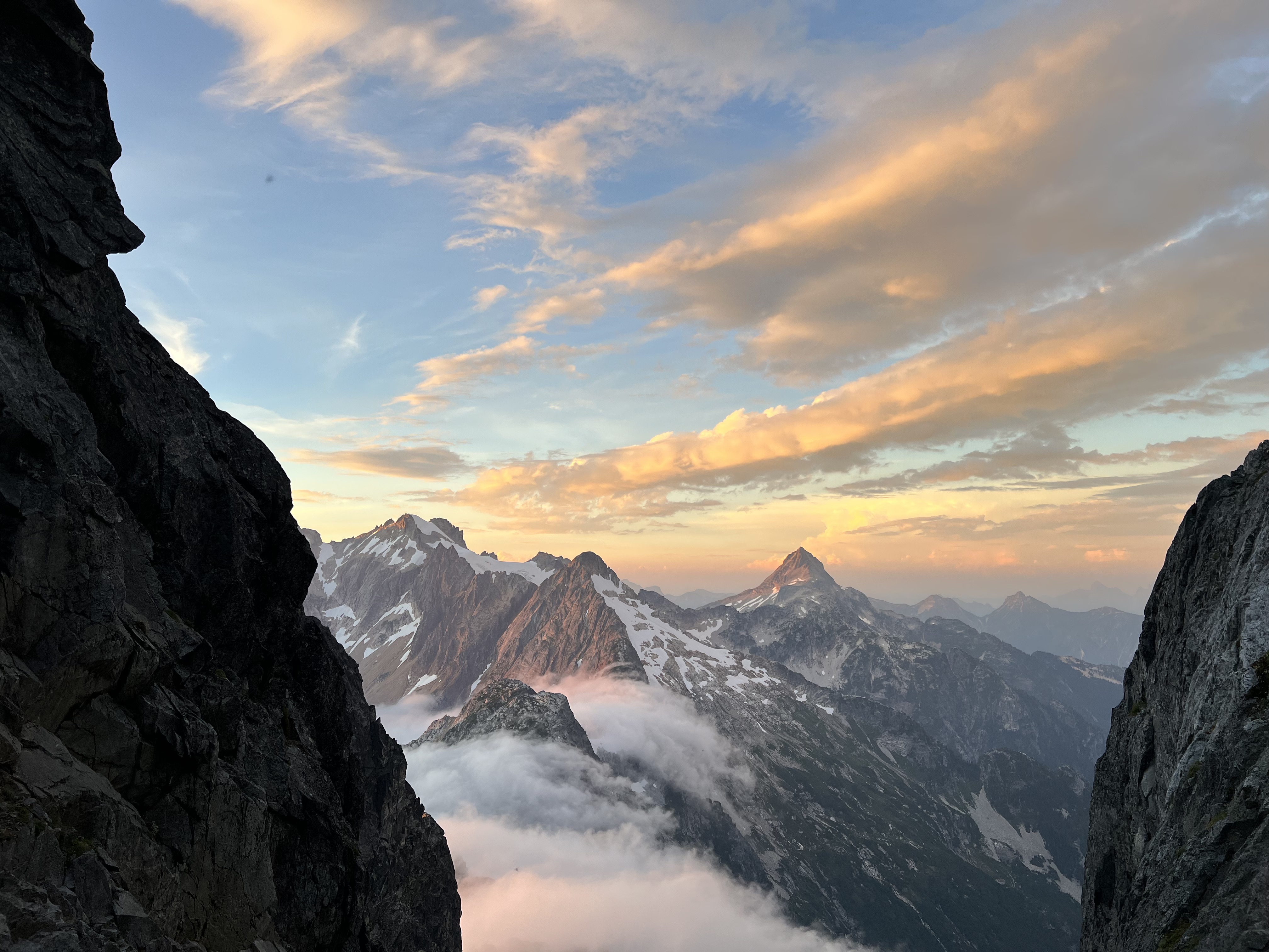
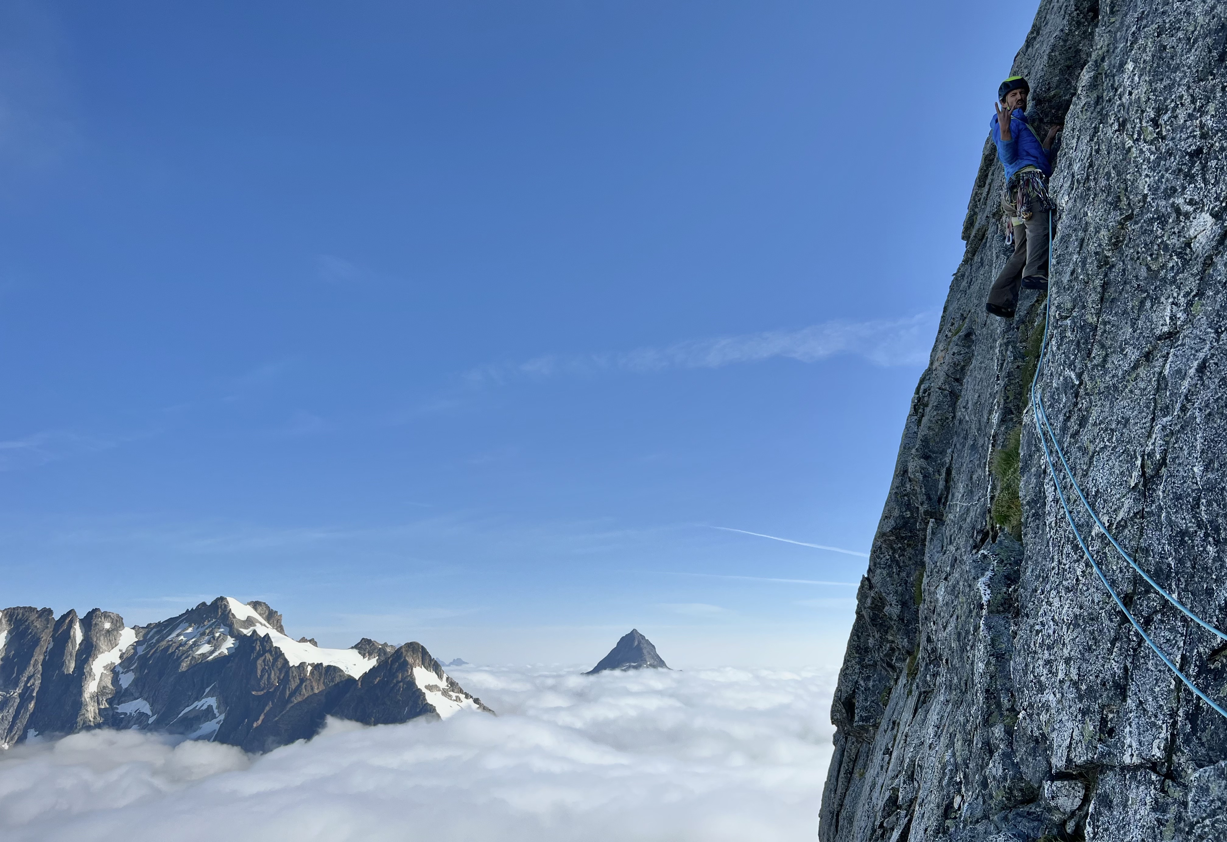
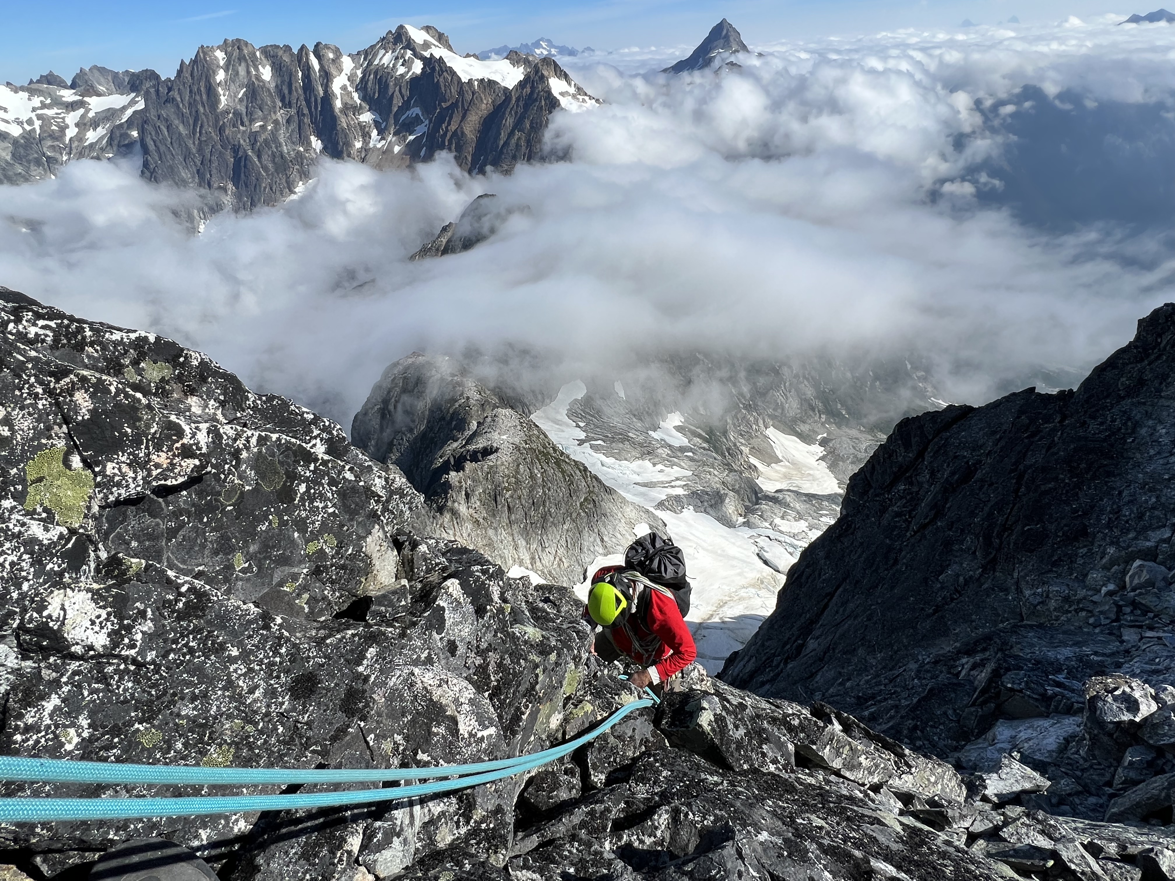
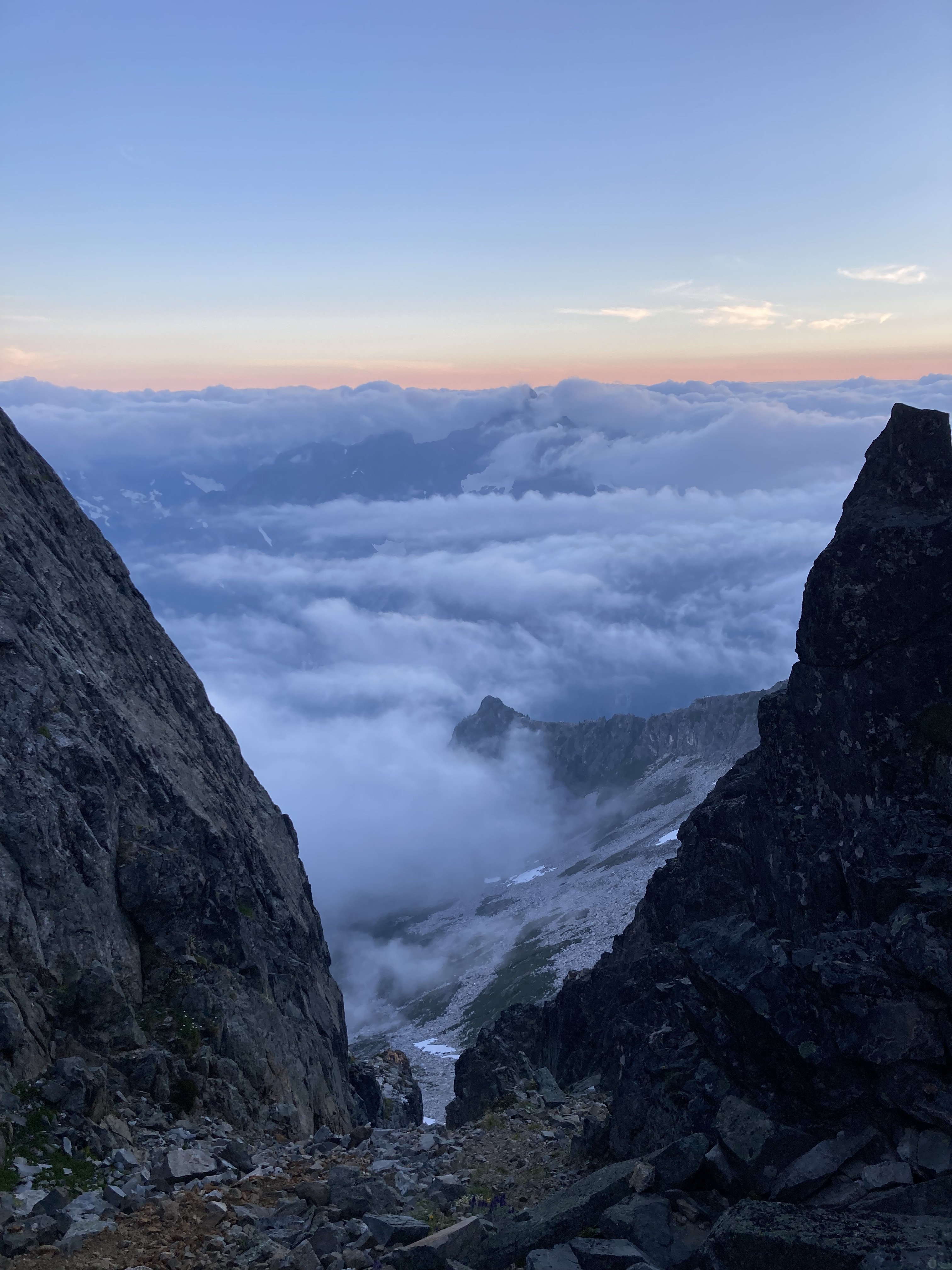
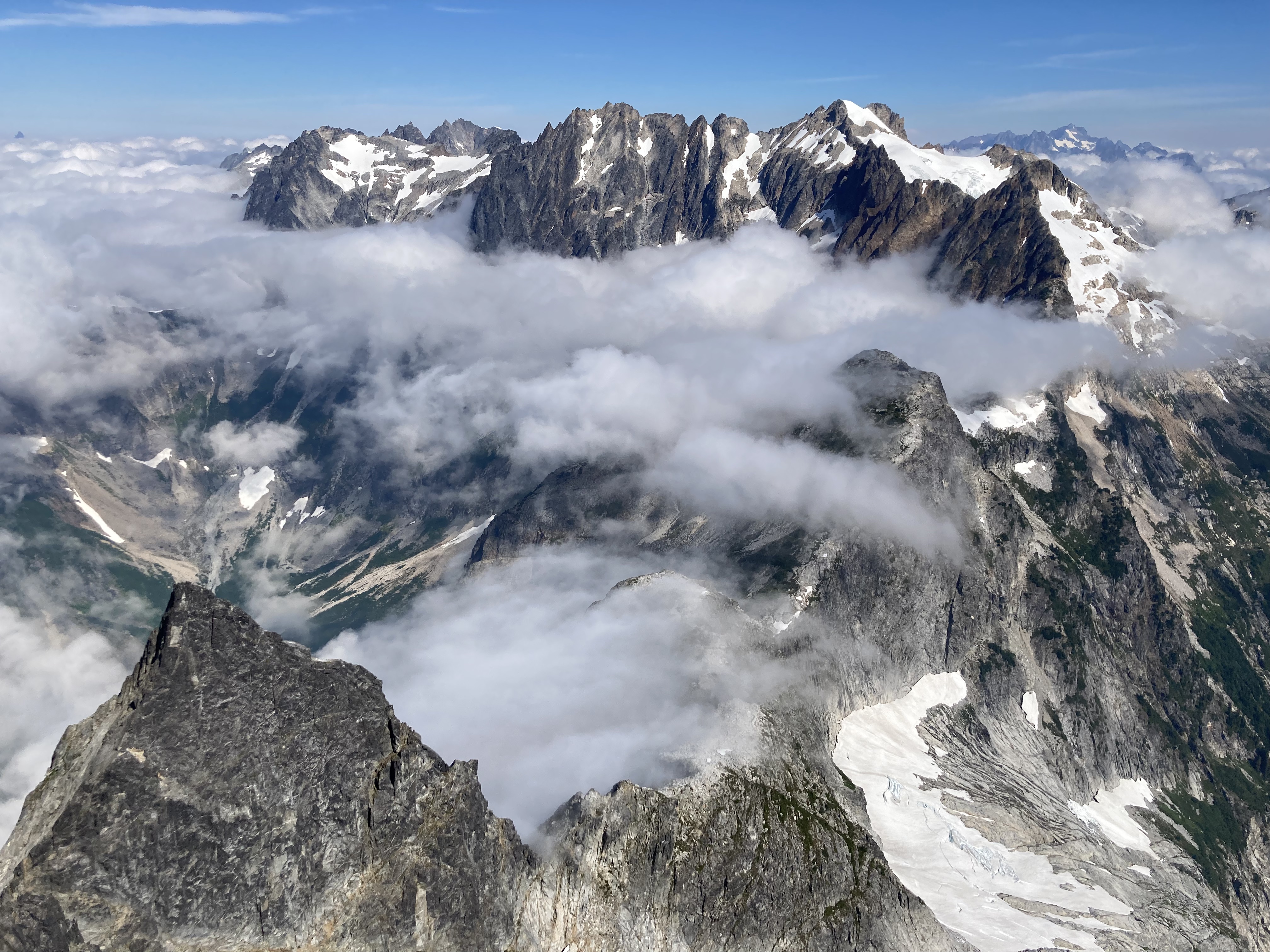
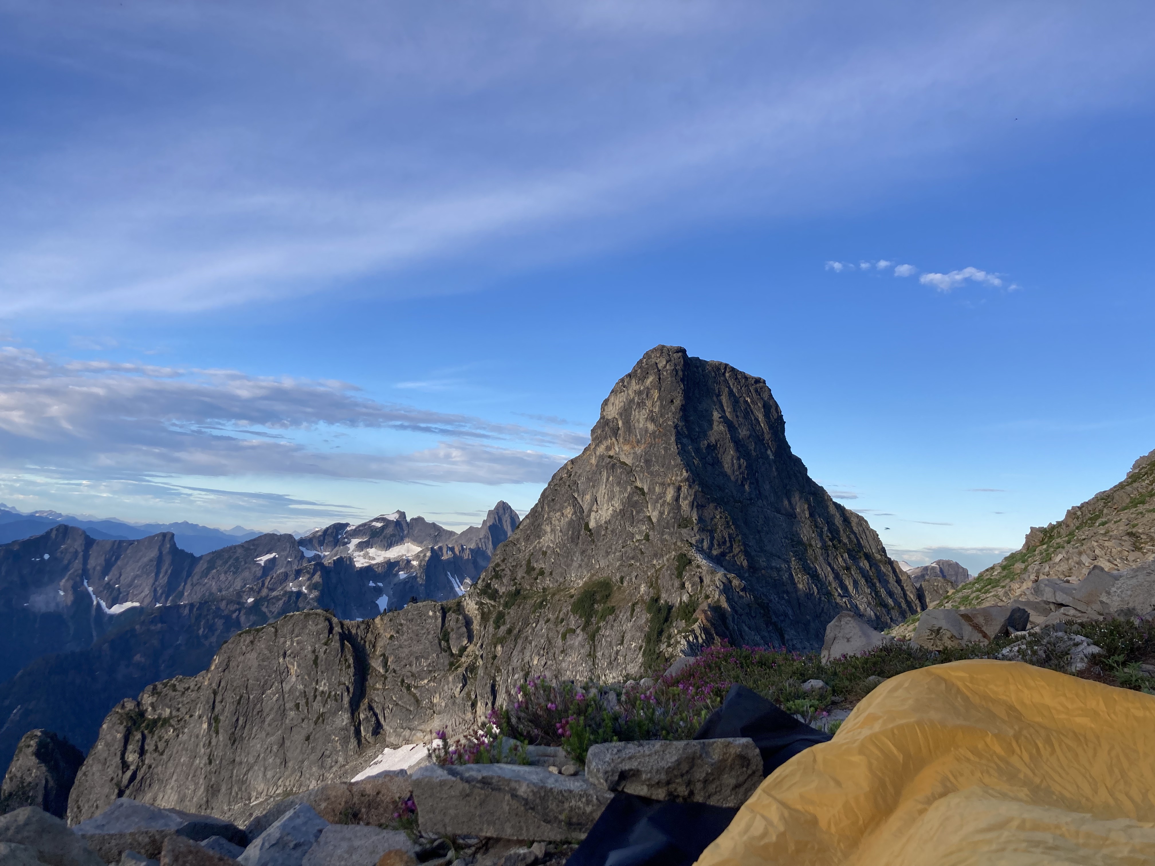
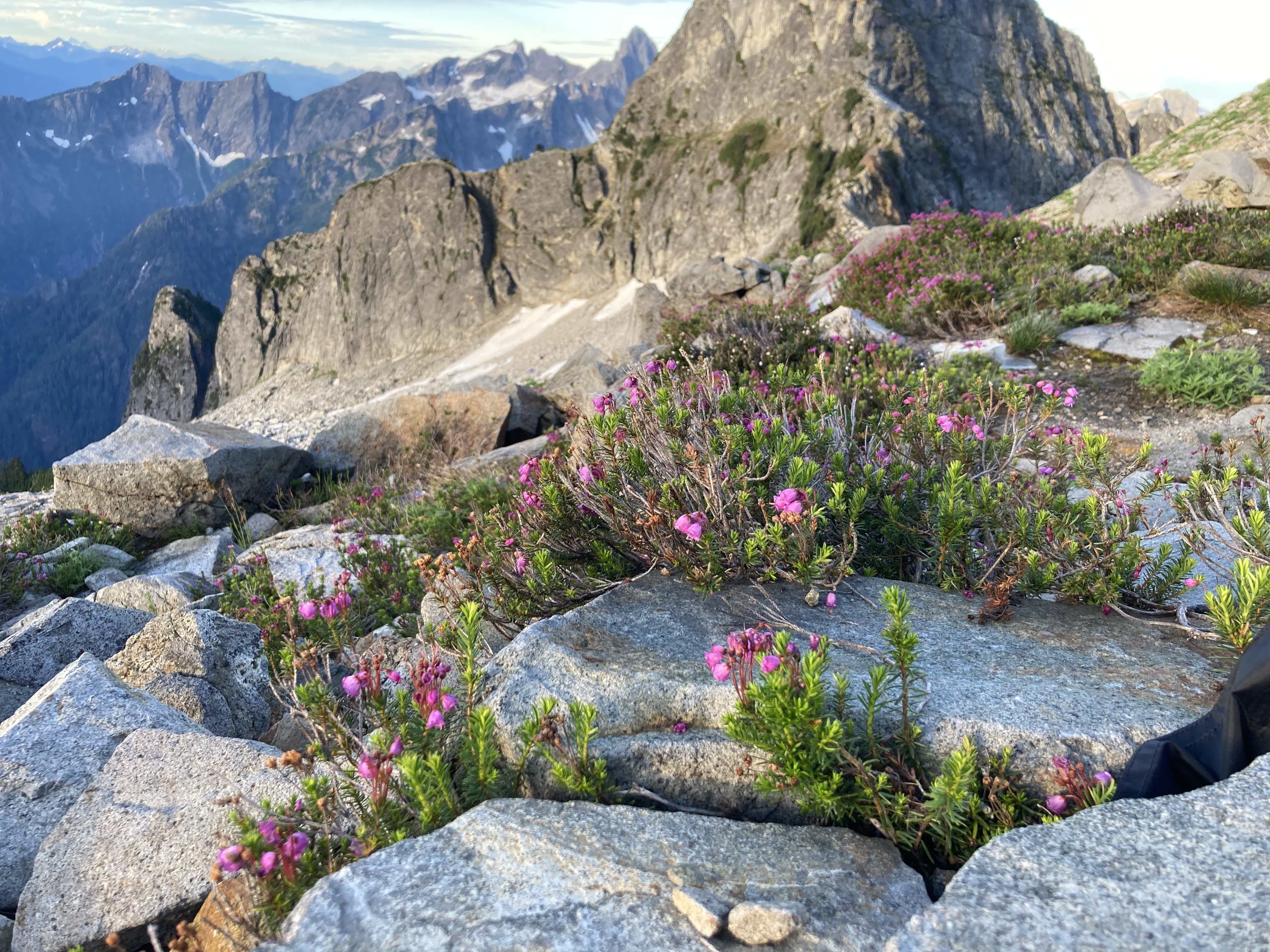
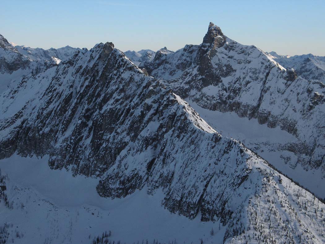
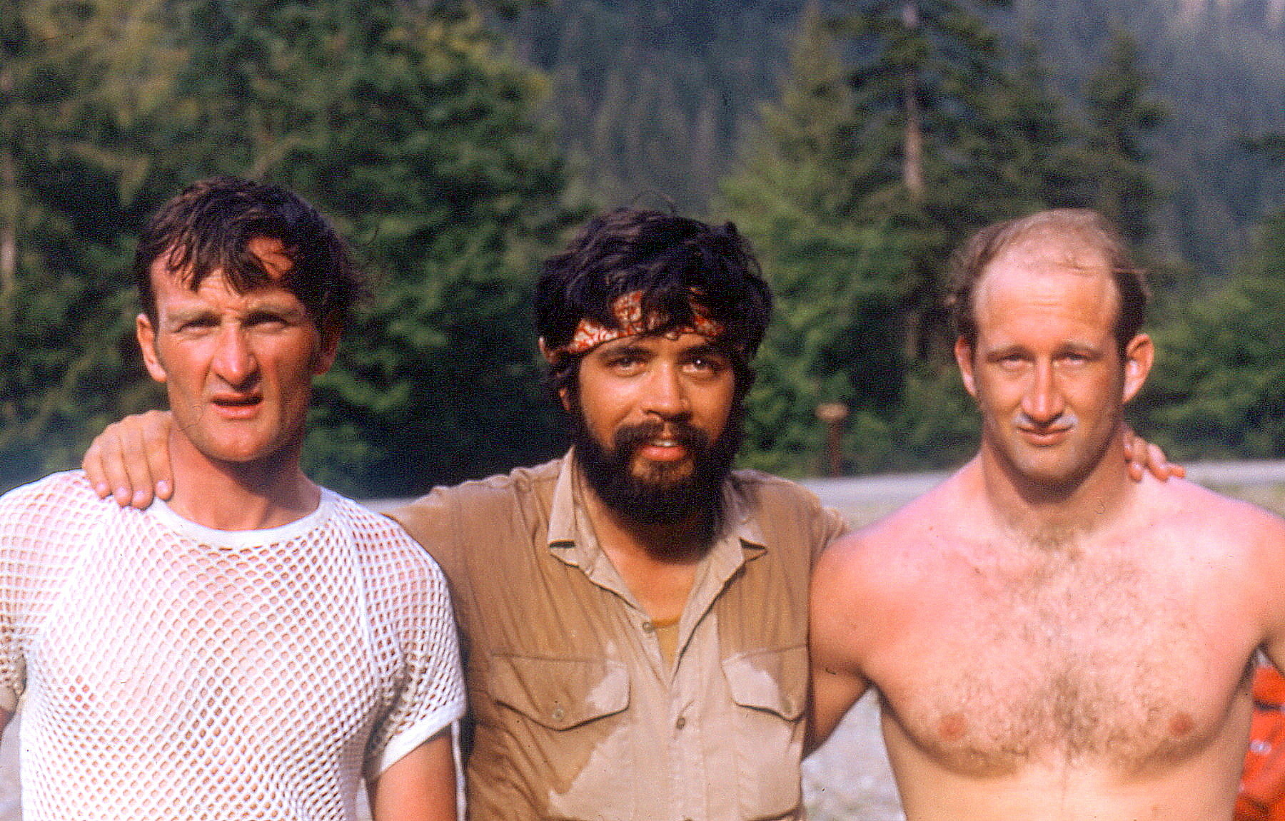
Trip: S Pickets - Himmelhorn - Wild Hair Crack? Trip Date: 08/20/2022 Trip Report: Went to the Pickets with Adrien Costa. Our plan was to approach to the Otto/Himmel col day 1, rap and climb N Butt of Terror and traverse the ridge back to the O/H col day 2, or maybe bivy on the Blob just past Ice Station Dark Star and finish the next day, then hike out. We made it to the col first night but it was definitely a lot of moving. The O/H col approach gully is pretty precarious snow right now (thin, 5m high ridge of snow, undercut n many places). The approach down to the rap anchor for the Mustard Glacier access was a heinous steep sandy choss gully over a drop-off to similarly covered ledges. We could have made an earlier rap station to avoid the worst of it but it looked kinda awful either way and I spent the night thinking about whether or not I really wanted to do it. In the morning a cloud layer was just below us and we could not see the rap anchor or the glacier. After waffling for an hour while eating breakfast the clouds were still there. We didn't want to risk a low vis navigation on the Mustard Glacier so we decided to just climb Wild Hair Crack since it was there and looked fun. We climbed the left of the two cracks to the base of the OW pitch and then moved left to a big groove instead of the OW as we only had gear to 2"... 3x 50-60m pitches lead to the summit ridge and then we traversed to the summit in a short simul block. During this time the clouds cleared and we could see that the glacier was broken off back to the toe of the N Buttress of Twin Needles. We didn't really want to walk under the ice cliffs or try hop blocks right at their edge to get to the N Butt of Terror so we ruled out going off the N side completely. We rapped back to the col and down the gully to Crescent Basin and hiked over to Stump Hollow for the night. Both feeling tired and somewhat unenthusiastic about more choss we hiked out the next day. My thoughts after this trip: The Pickets are beautiful and totally worth a visit. It's a very long approach for mostly shorter routes on low quality rock. I would rather go technical climbing elsewhere and just do scenic 3rd/4th class routes if I went again. The N side of the S Pickets have their glaciers in a nasty state of recession right now, I would consider N Butt of Terror an earlier summer objective at this point to avoid this. It seems that snow gullies and glaciers either need to be accessed early enough to avoid crevasses and other sketchiness, or they need to be totally melted out for a few years to give the gross choss a chance to settle and stabilize. We talked to a couple who had climbed Terror via the 3rd class gully to the Terror/Rake Col, which I had heard horror stories about after it melted out but they said it wasn't bad now... everything is relative though so who knows? It seems like the S Pickets Traverse is something that works better as an approach shoe/rock traverse, and the N buttress routes are more of snow/glacier cruxes on the approach which would be much better earlier season with boots. Of course I've only been in the Pickets a couple times so I would be curious to hear from people with more experience what they think about all that... Here are some pretty pictures... Crescent Basin, pic by Adrien H/O Col bivy, pic by Adrien H/O col bivy Wild Hair P2, not the OW, pic by Adrien Coming up to summit ridge, pic by Adrien Three guys we met at Stump Hollow the previous day on top of the West Twin Needle after climbing something on the S face. Obligatory Fury/N Pickets shot Shuksan from Stump Hollow bivy Chopping Block from Stump Hollow bivy Oooh pretty Goats Huckles Terror Creek crossing... approach was not as bad as we had expected if you really try hard to not loose the trail. Gear Notes: The usual Approach Notes: Standard
 3 points
 -
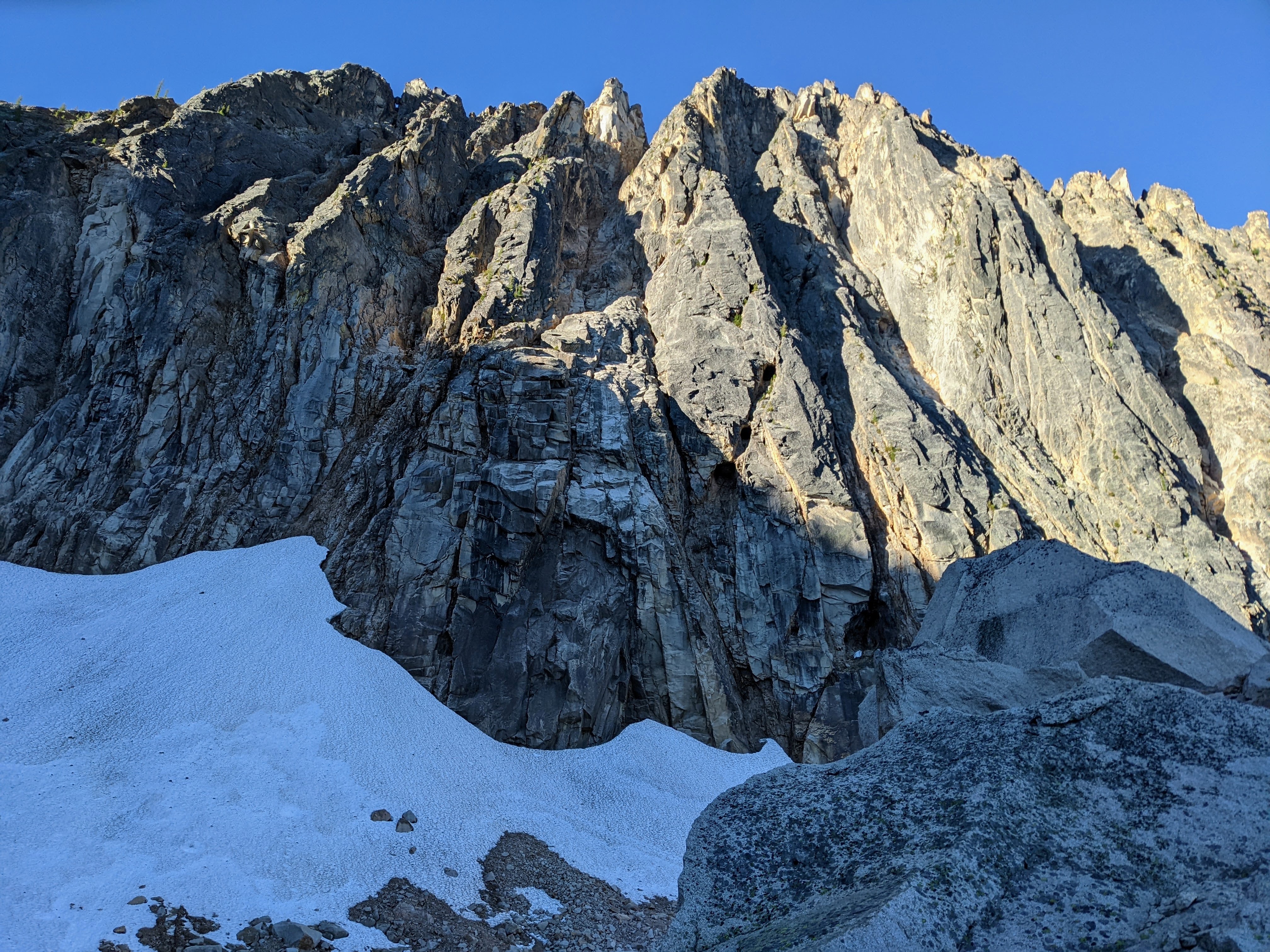
Trip: Holliway Mountain - North Face Route (aka "Scary Bear Attacks") D 5.9+ new route Trip Date: 08/14/2022 Trip Report: Let's start with a John Scurlock photo of this (likely) previously unclimbed face; Holliway's north face is on the left, Golden Horn background right: Here's a shot I took from the trail: Rolf Larson and I bring you a cautionary tale about this attractive nuisance. Our main candidates for an ascent were the two longest ribs that lead up to the two high points you see above (the true summit is on the left, and appears lower). The one on the left had a series of towers that led to the brilliant white -- and largely blank -- spike that forms the summit, while the one on the right appeared more straightforward. We kicked steps up firm snow to the footing of our preferred rib on the right. After futzing around with a difficult moat pitch, and finding a barely passable anchor poised below what looked like a difficult and very spicy next pitch, Rolf wisely downclimbed back to the snow. This cost us 3+ hours. We wandered left on the snow to "scout", and spotted some snow leading up to easy access to the rock, below the second-best left-hand rib and just right of a garbage-chute gully. Standing on the still-hard snow, contemplating the idea of beginning the route at 11:30am, one of us asked "You wouldn't let us do something stupid, would you?". This was a stupid question directed at the wrong person. So both stupidos headed upward to scout. Looking up; we began climbing off on the left, below the high point of the snow, where it makes a prominent triangular nose pointing right. Our false start was the furthest right high snow point. Our top-out on the sub-summit is the high point to the right of the V-notch; the true summit is the white spike on the left. I got the first pitch (5.9+) and it was fantastic, and would be popular if it were at a crag--fun climbing with a little bit of everything on solid rock. The uphill was all downhill from there. Rolf's second pitch (5.8?) went up a chimney that had some fun moves, but also some loose killers that he danced around. Our next several pitches took a left-hand ramp above the gully splitting the two main ribs, a couple more in/across the gully to take ramps on its right, and then we found a way to leave the gully rightward to gain the originally desired right-hand rib to the sub-summit. After pitch 2, the climbing in general wasn't too steep, but there were occasionally difficult moves; and, it was often run out and loose, requiring careful rope management. A few pitches after gaining the right-hand rib, we stood on the 7,920' sub-summit and took in the sunset. We were 9 hours on the route. We descended to the south, hemi-circumnavigated around the east side of the mountain (via headlamp and moonlight) to get back to our packs, then thrashed down to our pleasant camp at the river, arriving at around 2am. Not that anyone will bother, but FWIW, happy to provide details for the descent -- including a plausible more direct route with daylight -- upon request. After the first pitch, due to the loose rock and scarce anchors, bailing would at minimum be risky and costly. Future parties might enjoy exploring the many features on this corrugated face, but should bring a bolt kit and a sense of humor. The line required 10 pitches total. Approx route: More pics here: https://photos.app.goo.gl/zTcs4kQdwBFhEdKc7 Here's the namesake bear (there's a video series of same name too, and on the approach was bear scat and a bear hunter): Gear Notes: We had doubles through 2 when including tri-cams, a single 3, and pins. Rolf used one pin at a belay. A single 70m rope. Approach Notes: West Fork Methow River trail, then PCT (total approx 10 miles) to camp on Methow River; then up a couple thousand feet through brush and forest
 1 point
 -
I want to circle back and say that I really appreciated your TR - good story and photos. Thanks for posting!1 point
-
Fun to relive with photos. Same route 50 years ago (1972) up N Ridge of Tricouni (NR) to Primus with Dallas Kloke, Reed Tindall, Scott Masonholder, Mike Theobald, Paul (not Bob) Greisman had a totally ugly tight-hemlock trailless brush bash approach from McAllister Creek to timberline.
 1 point
 -
This is a solid TR. Thanks for sharing. Though it may seem otherwise, maybe the golden age of CC.com shall bloom anew.1 point
-
This is a fun-to-read, well-themed trip report. I read it all, it was entertaining; don't thank us, we thank you!1 point


