
Leaderboard


Popular Content
Showing content with the highest reputation on 08/09/22 in all areas
-
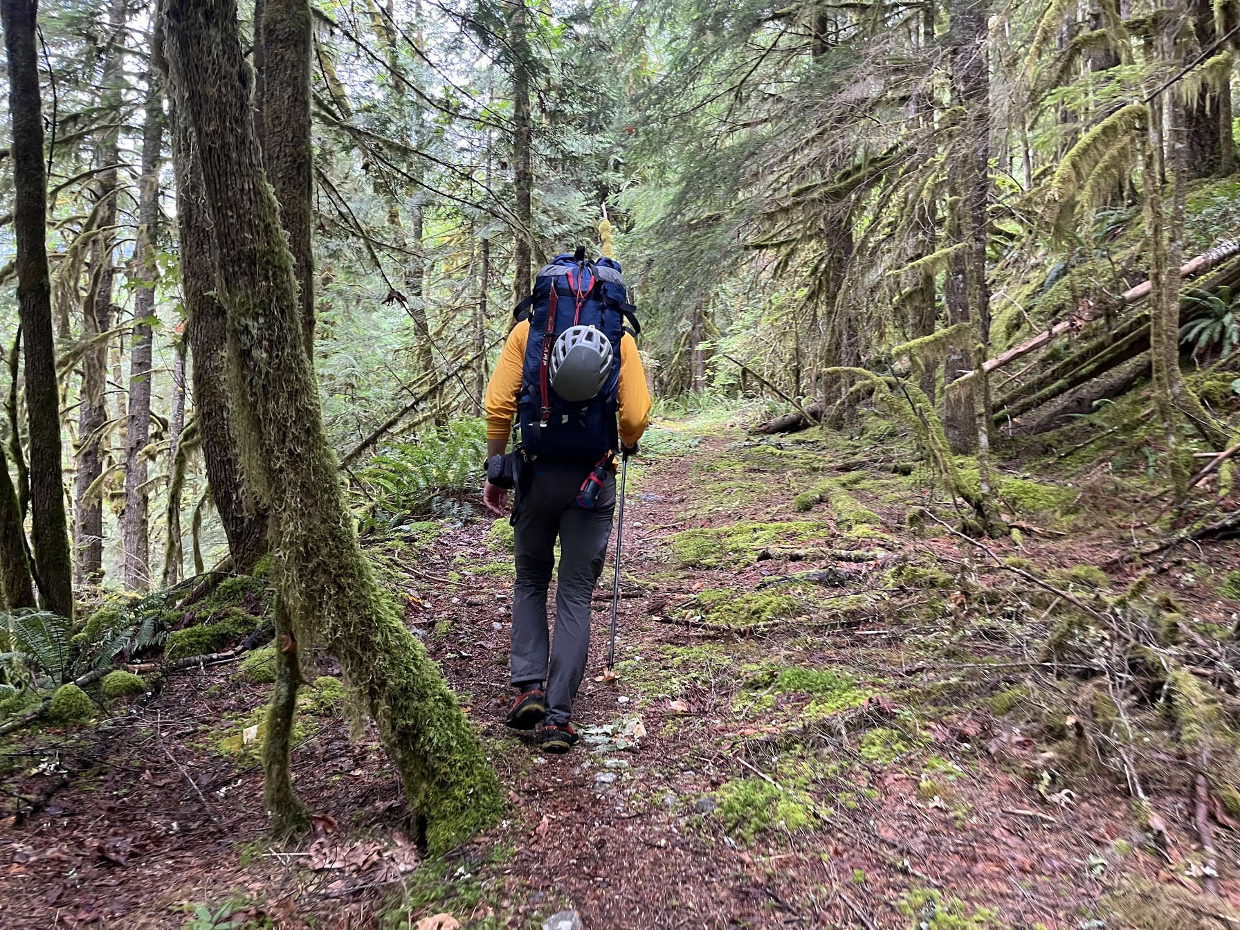
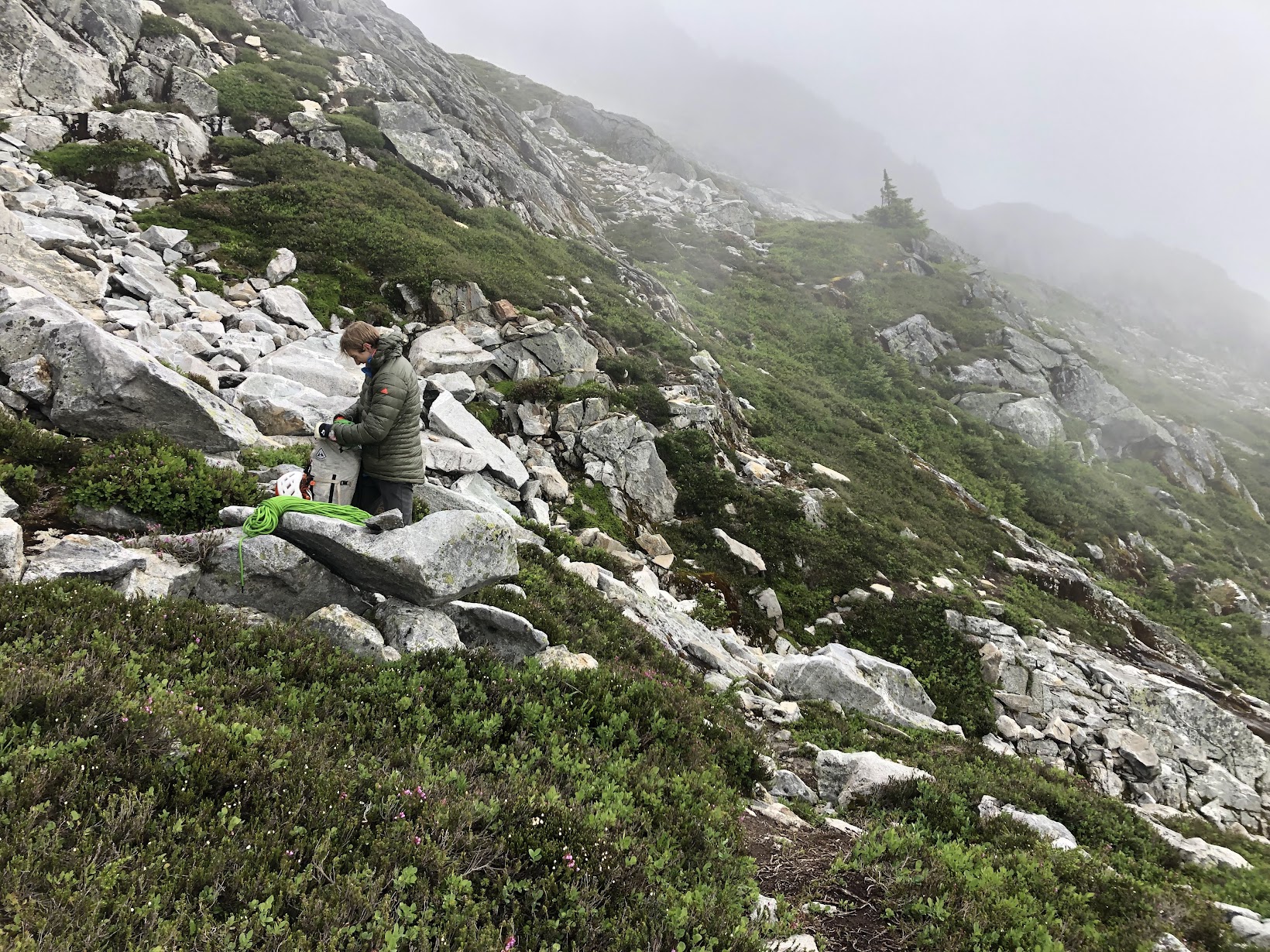
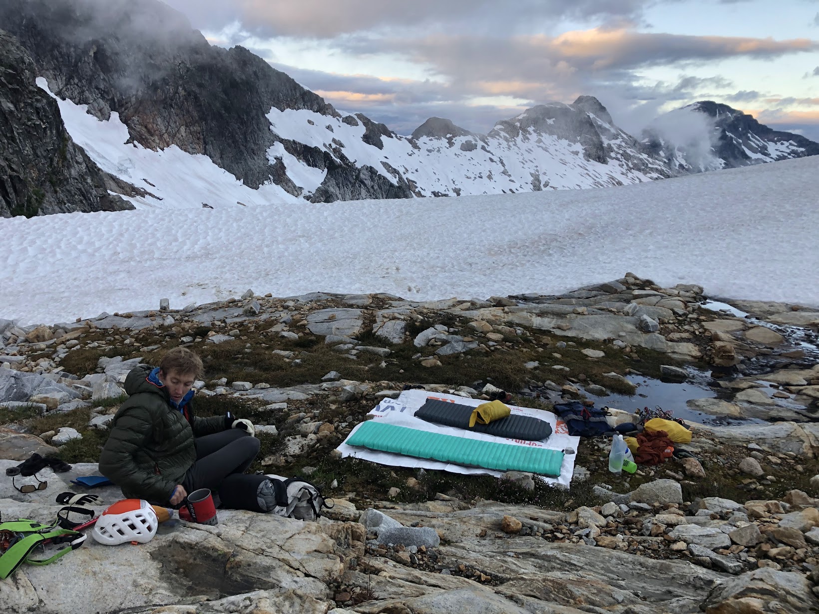
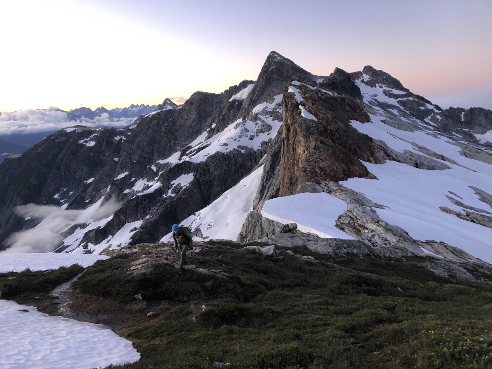
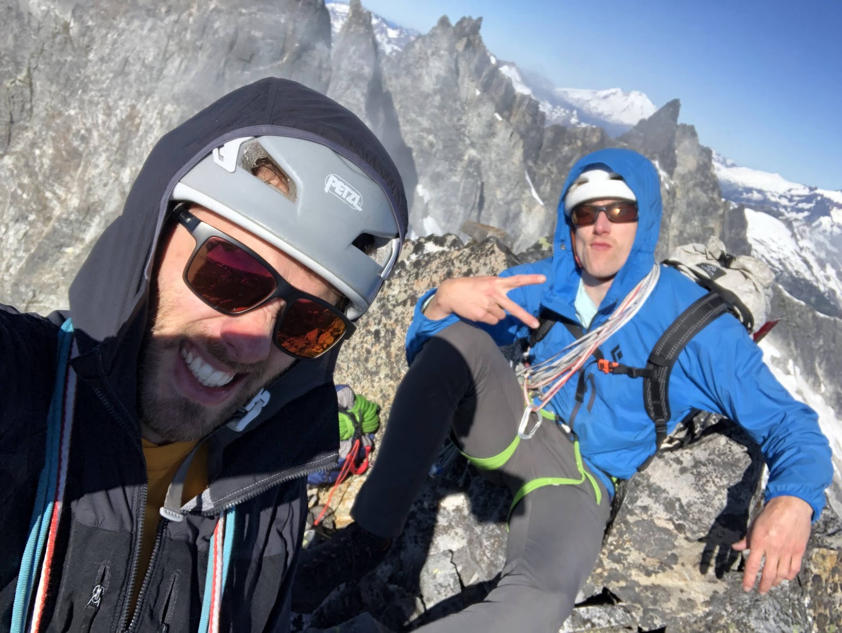
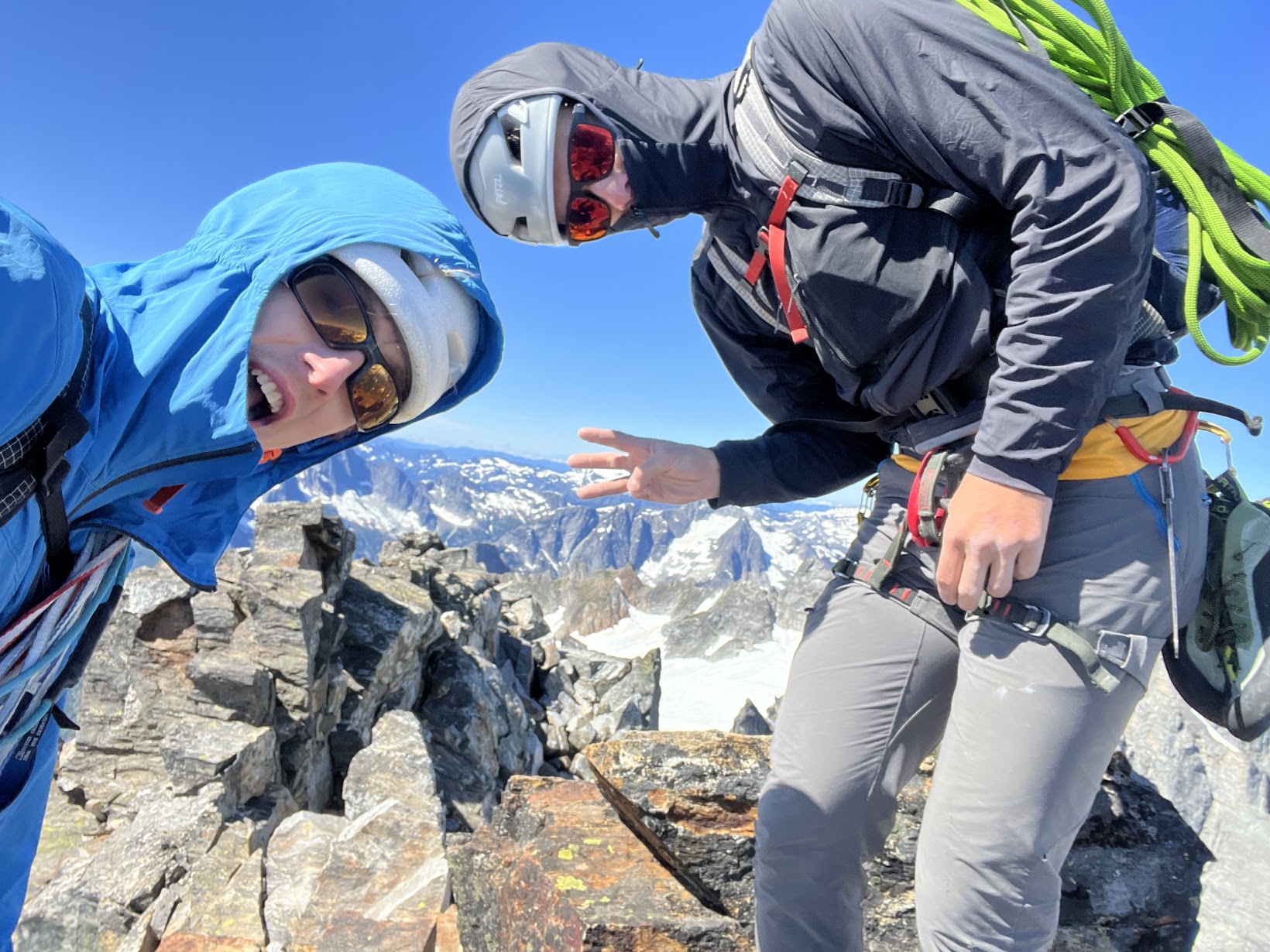
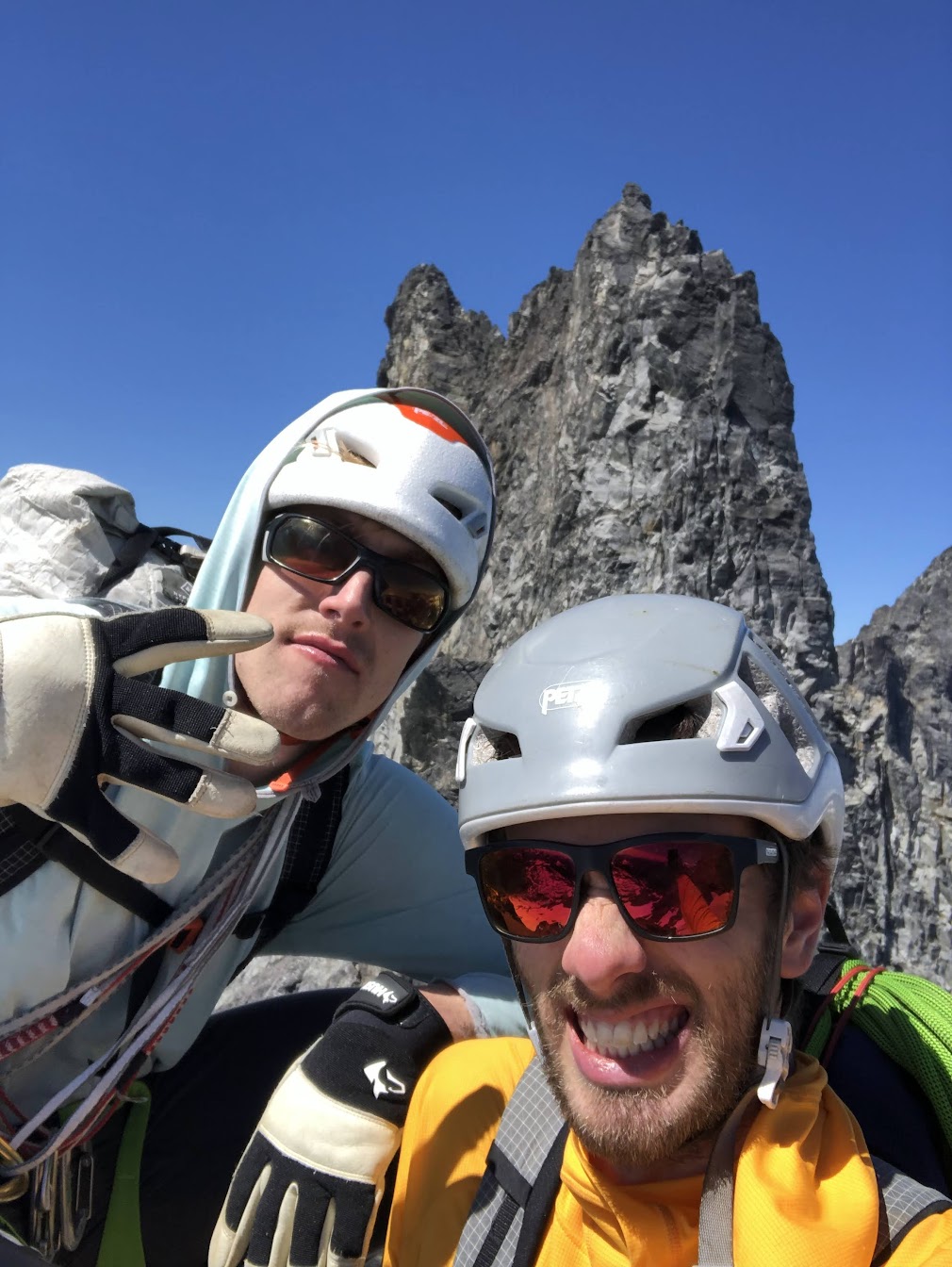
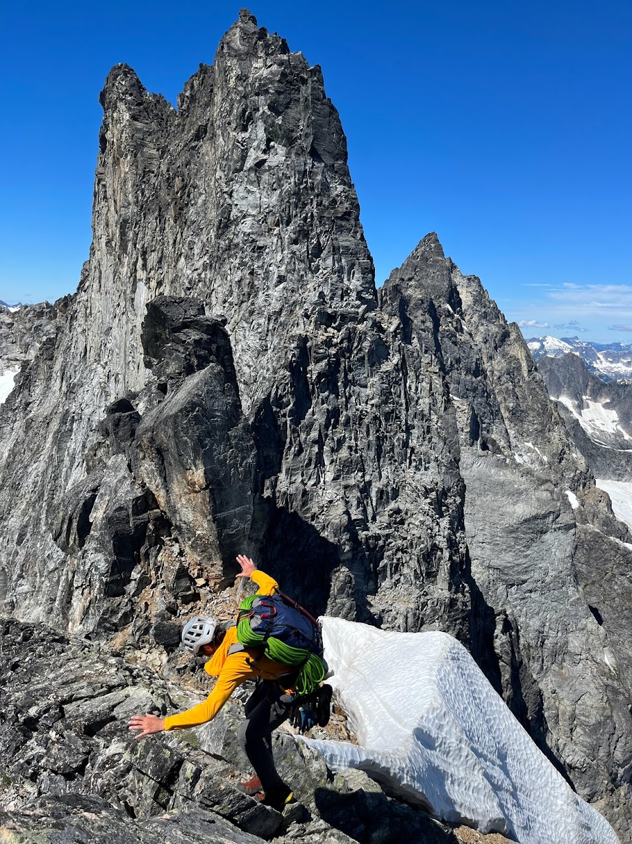
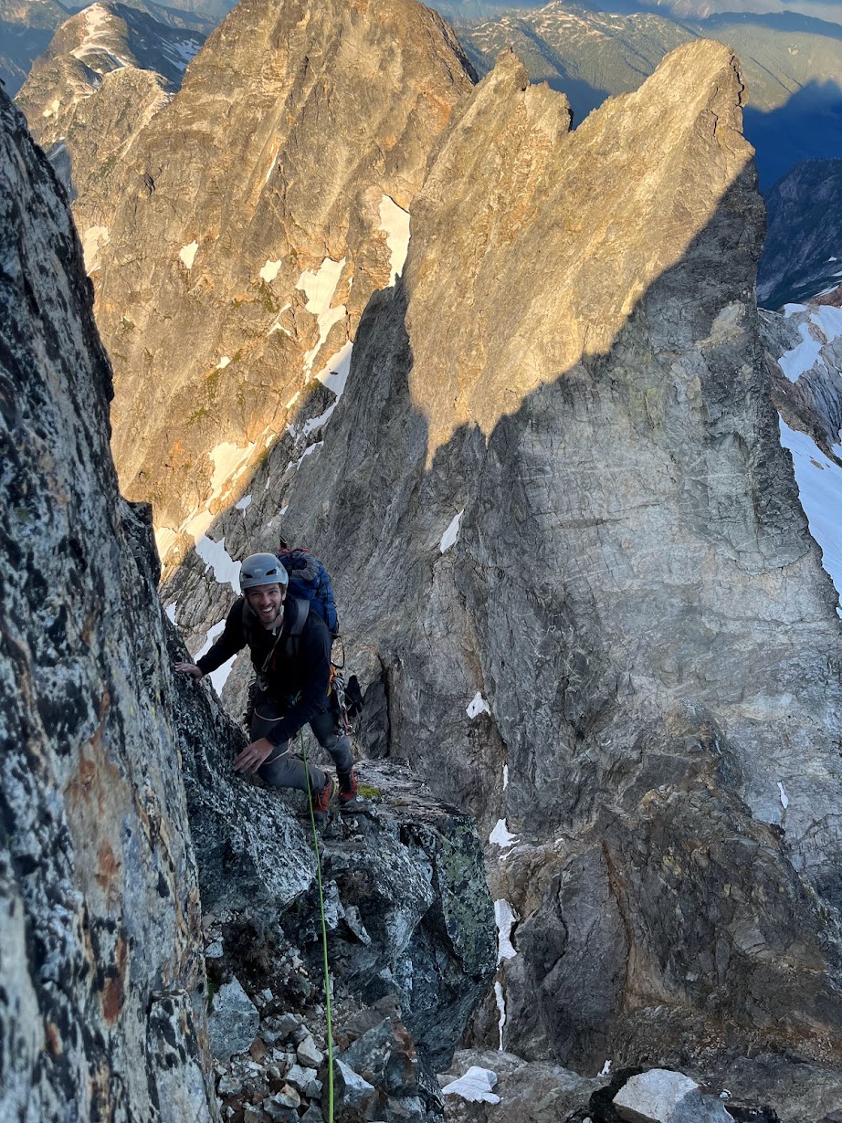
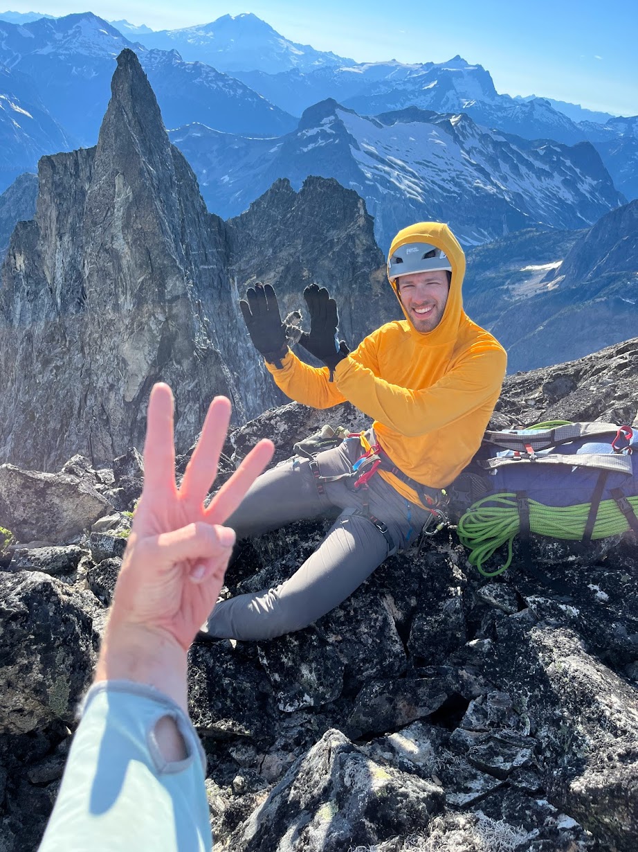
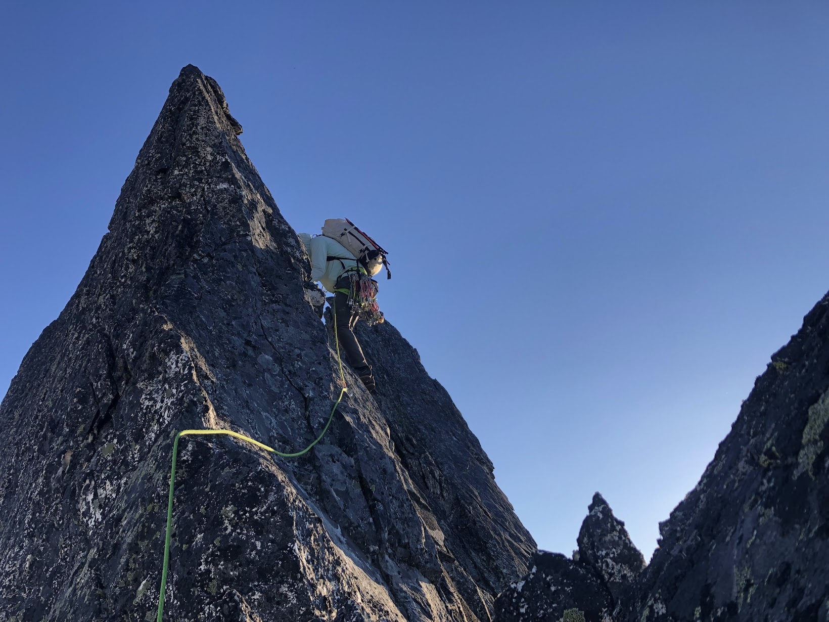
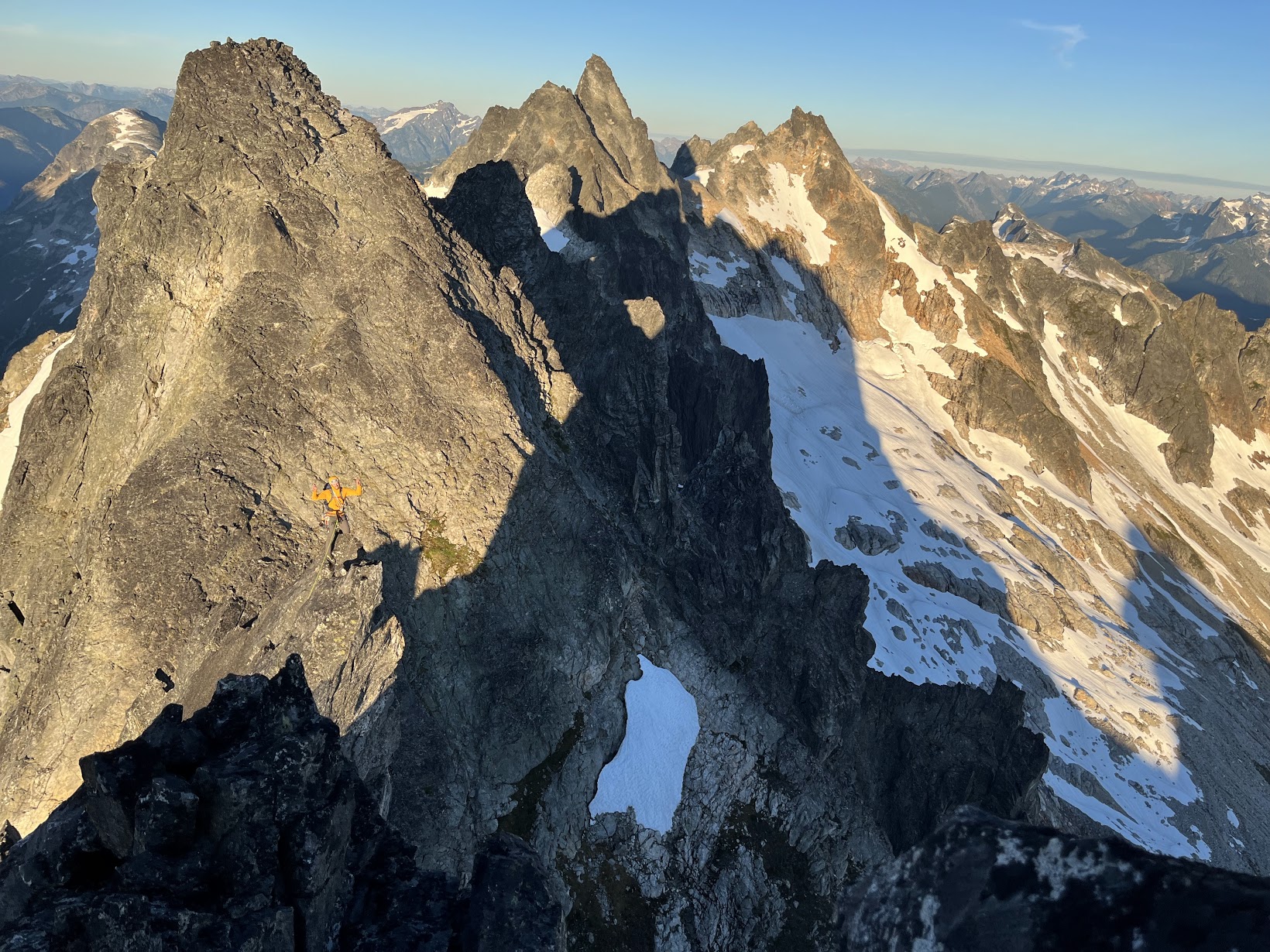
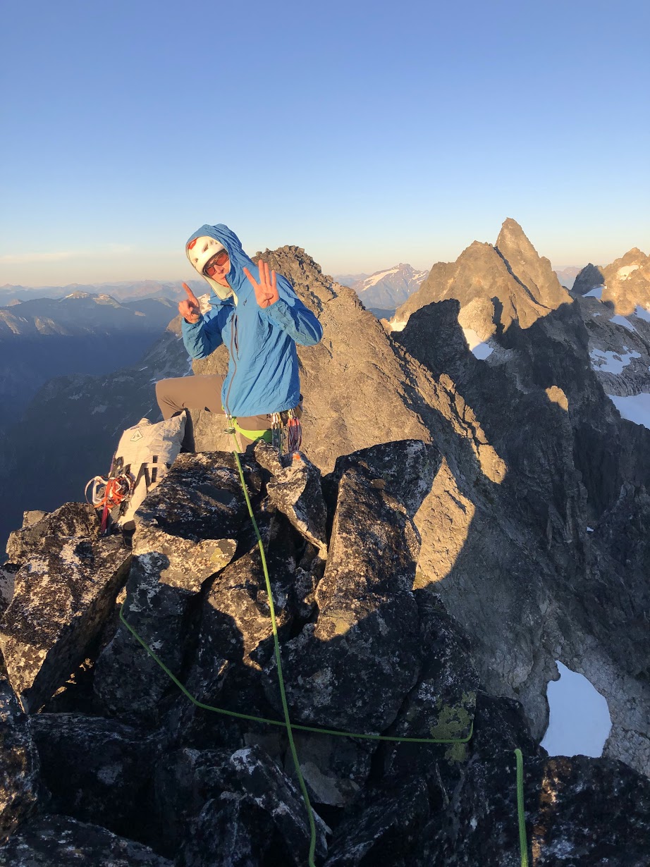
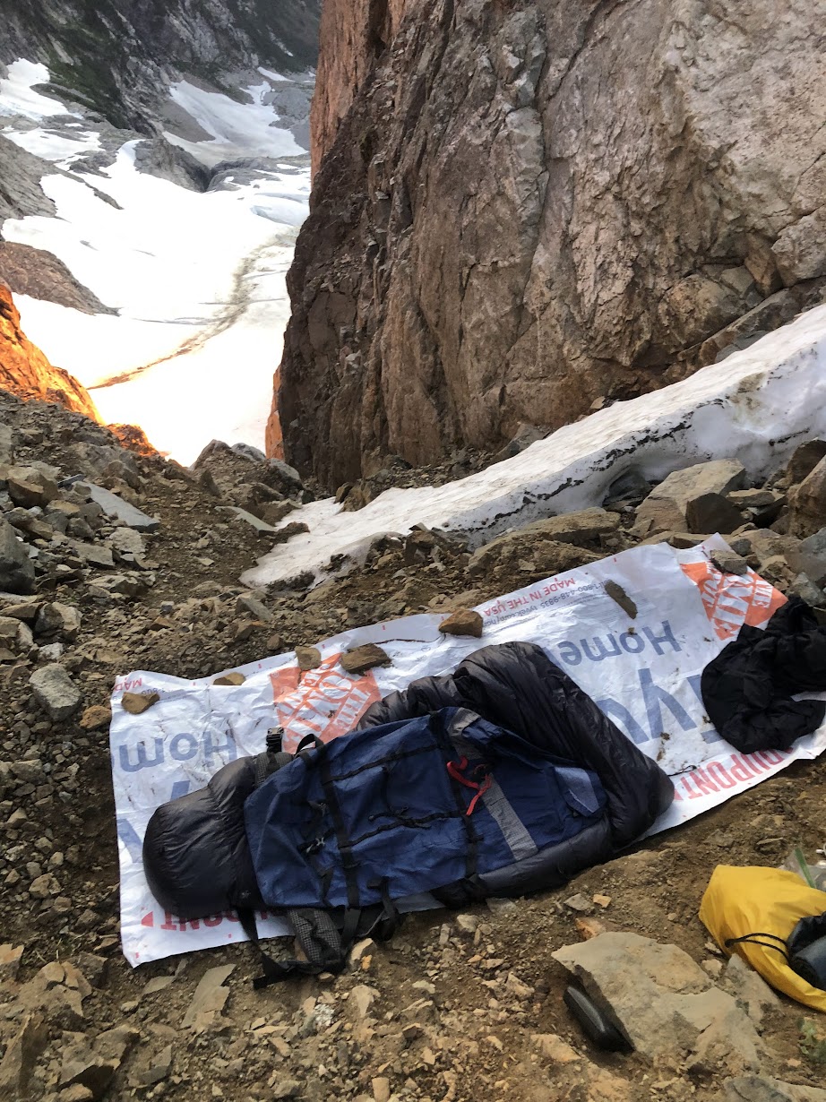
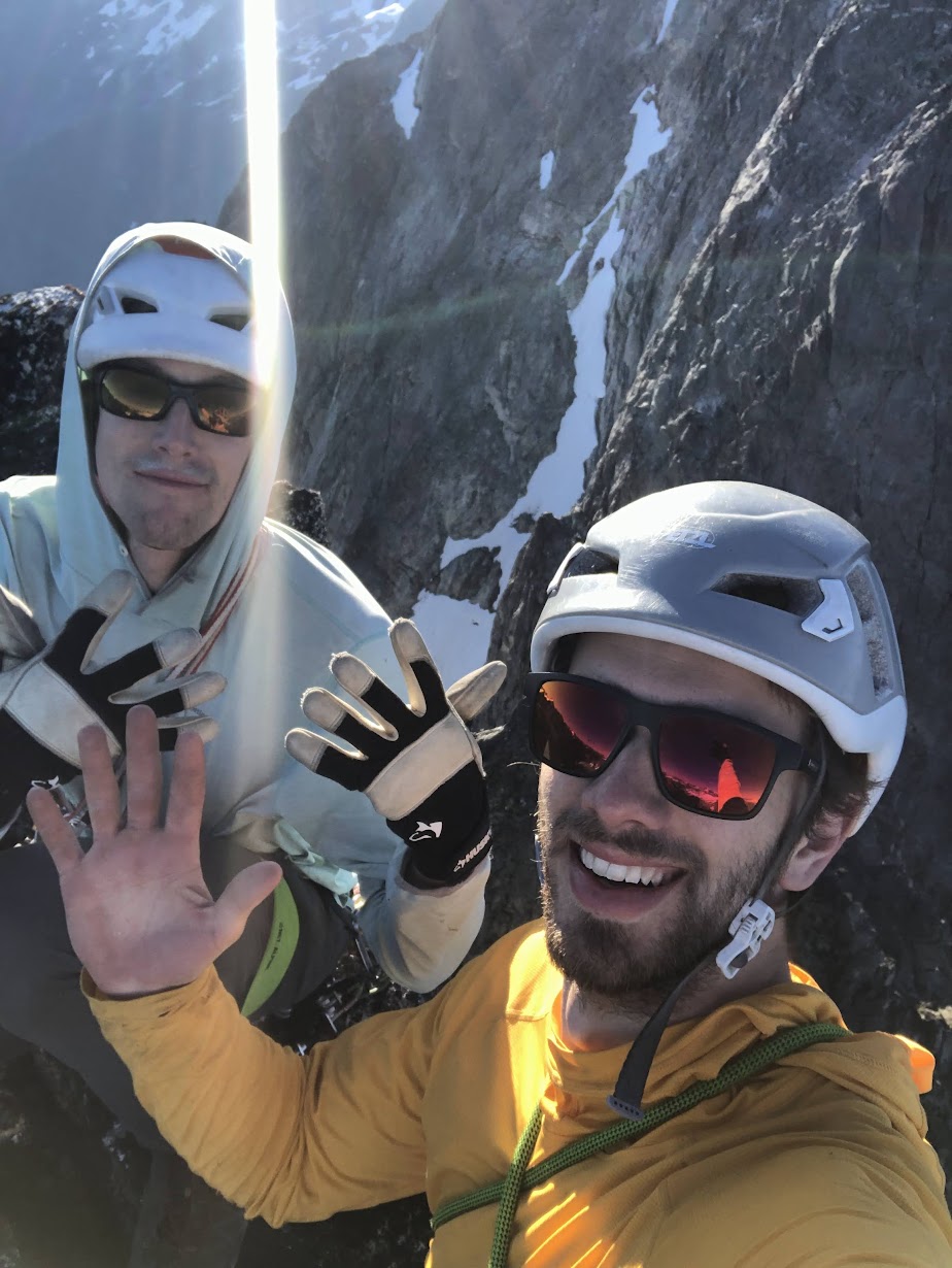
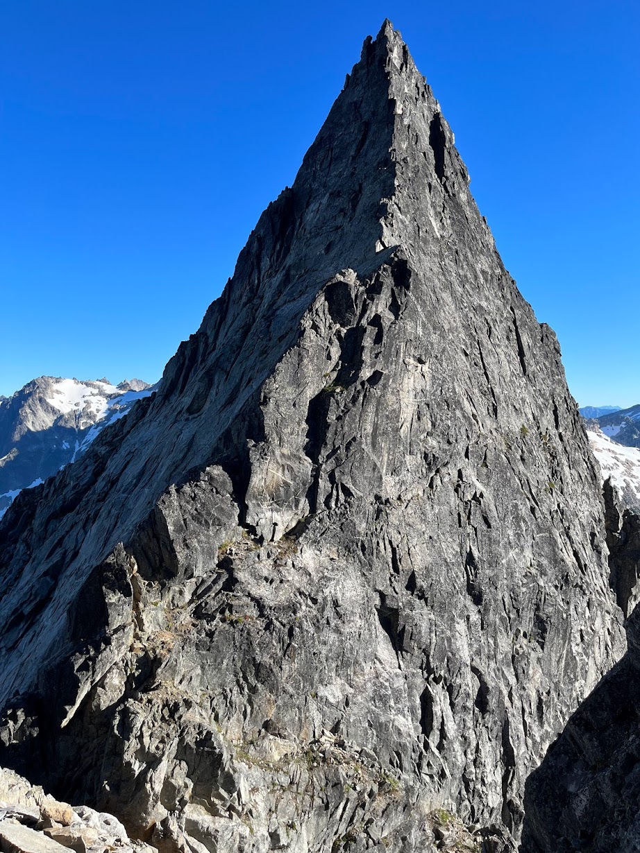
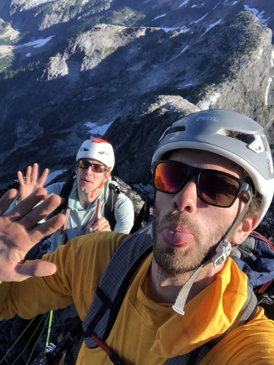
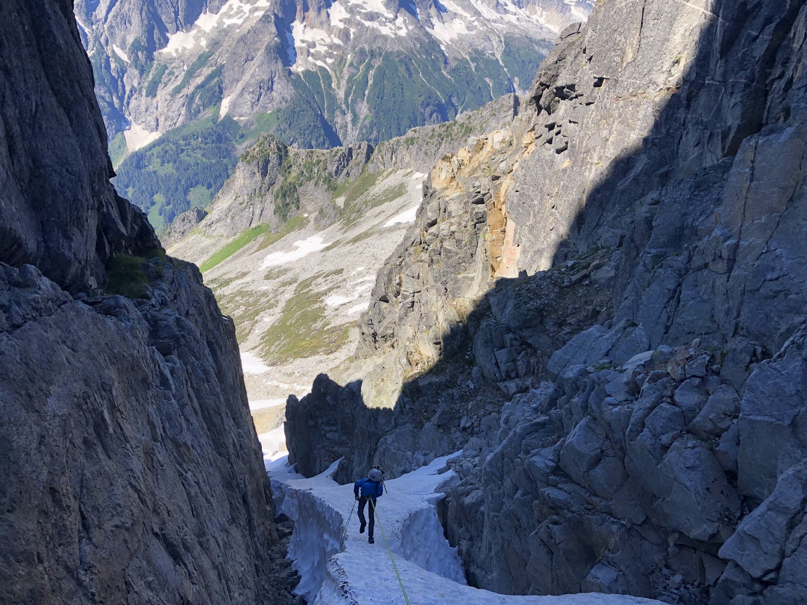
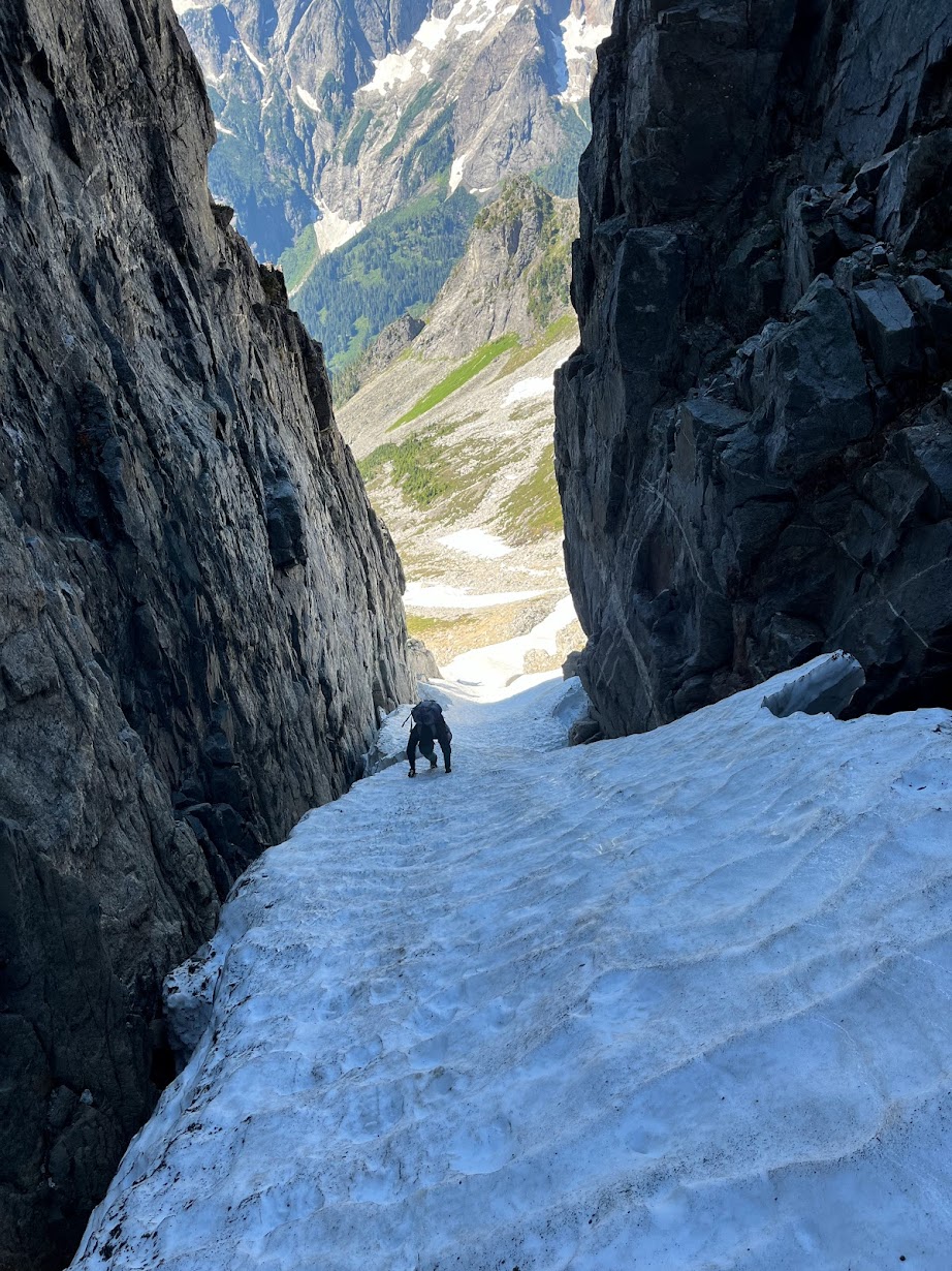
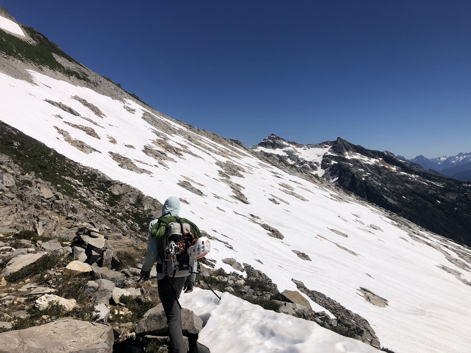
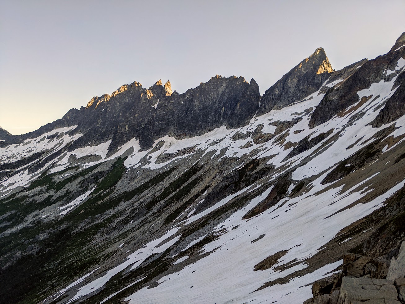
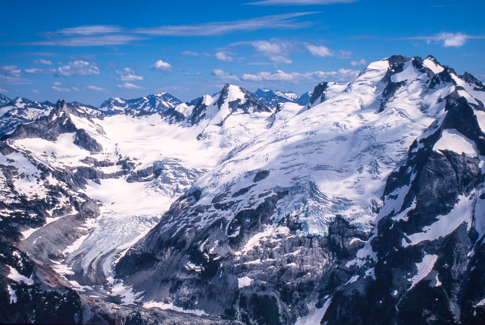
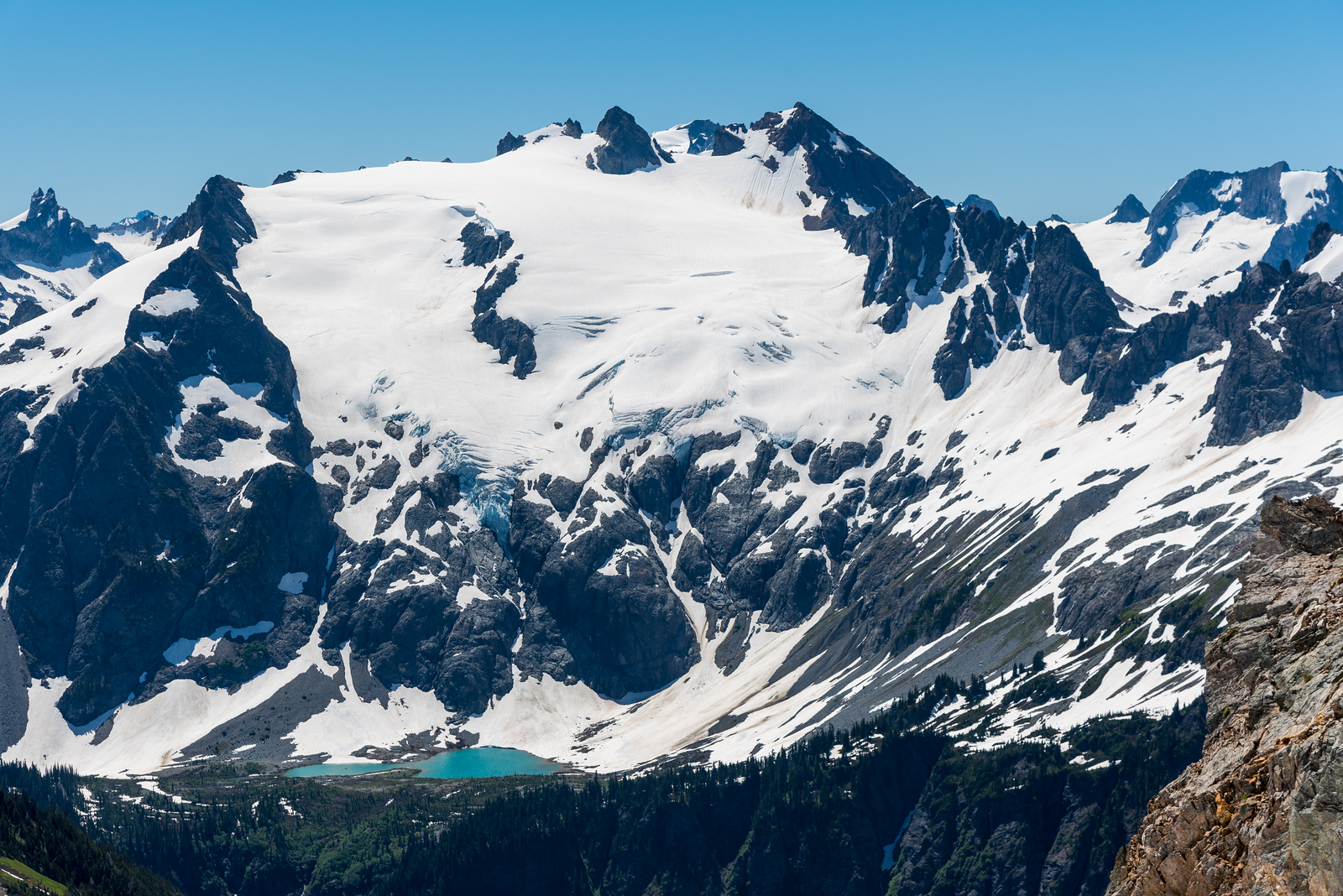
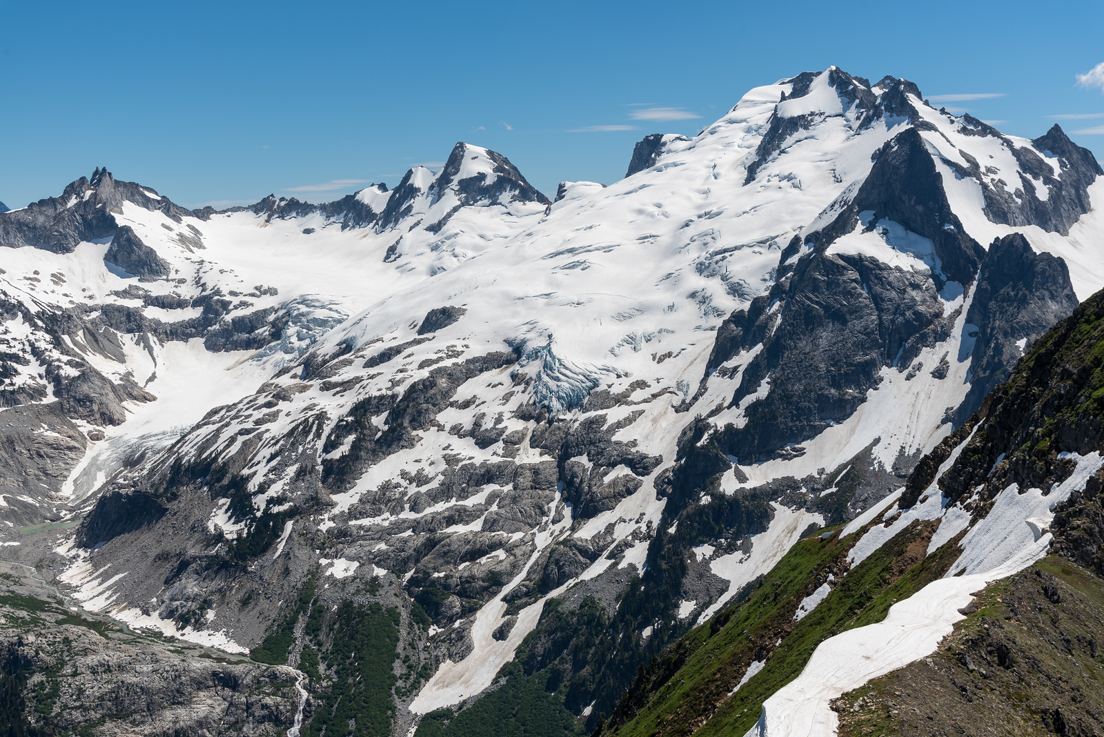
Trip: Picket Range - Southern Pickets Enchainment Trip Date: 8/4-7/2022 Trip Report: It's Pickets season folks! Kurt and I were supposed to be in the Bugaboos last week, but unstable weather encouraged us to stay local and sample a little bit of what the Pickets have to offer. Between weather and work on Monday, we had a pretty tight schedule that was surely going to be a challenge. On Thursday we slept in and got a casual start. AM rain was forecasted, and "all" we had to do was hike in to the base of little Mac spire. As we drove north, the rain poured down. By the time we reached the trailhead there was blue sky poking through, but all the brush was thoroughly soaked. The hike up went on for an eternity, and I was beginning to understand why the Pickets see so little traffic. By the time we made it to the alpine, we were drenched from head to toe, and the cold wind made for some rather uncomfortable slogging up to camp. Thankfully by the time we arrived, we were mostly dried out apart from our feet, which wouldn't fully dry out for another day. Day 2: Little Mac, East Mac, West Mac, Tower 1, Tower 5, Inspiration, Pyramid, Degenhardt. A cold and windy night brought us to a cold and windy morning, but the clouds had finally cleared and we could see our first peak. The brush and soil on little mac was still wet from the day before which made for some pretty unnerving scrambling up the first half of the mountain, but once the sun hit things began to dry out. Little Mac and East Mac went pretty smoothly with mostly scrambling and a couple pitches of roped climbing to the summits. West Mac however provided a little more adventure as Kurt tried to quest up some roofs in the middle of the east face but was thwarted and had to downclimb half a pitch. Thankfully we found the easy way and were off to the races. The East Towers sucked up so much time, and honestly I don't remember what we did to get through them. Huge props to Jeff Wright for remembering all the beta and writing such a detailed trip report. I wish I had that good of a memory.... or maybe I'd rather forget. Surfin' the East Towers Inspiration was Classic! By far the best climbing on route. Super straightforward, fun and engaging crack climbing. A large panel of the west face of Inspiration fell off some time recently, taking one or more of the rap anchors with it. This involved some downclimbing between stations and lots of loose rock on the rappels. At least one new station would be needed to fully rap the face. Rapping through the rock scar "Hey Kurt, I found the anchor!" Low on water, we brewed up below Pyramid and rested for the rest of the climbing ahead. Kurt took the leads up Pyramid and quested us up into some hard 5.10 roofs that ended up bring the crux of the entire traverse. We still have no idea where that 5.8 chimney is. Or where we were for that matter. We forgot to take a picture on top of Pyramid, so here's number 7! Summit 8! Having lost a fair bit of time, we raged up Degenhardt at sunset. Racing the fading light, we traversed along the ridge over to the base of Terror and the supposed "excellent" bivy. We didn't have to climb with headlamps! A cold wind howled up the north side, sending morale plummeting. The only somewhat flat spots were on the frigid windy side of the ridge so after an unsuccessful attempt to rig up my tarp to block the wind, we opted to engineer our own spots to the south. We were both somewhat successful in digging out our own bivys, and went to bed late and exhausted. Day 3: Terror, The Rake, The Blip, East Twin Needle, West Twin Needle, Dusseldorfspitz, Himmelhorn The next morning came too soon and we started with Terror for breakfast. The east ridge went quickly and the mountain most definitely didn't live up to the name. Summit of Terror for the actual ninth summit. The Rake, similar to the East towers sucked up an incredible amount of time. We went too high on the first gendarme and had to downclimb the ridge to get to the 5.7 traverse. The rest was just slow route finding up along over and below the ridge. Low on water and with a lot of climbing still ahead of us. We brewed up again below The Blip, four more towers standing between us and camp, two of which being the 5.10 cruxes of the route. Summit 10! Wonderful rap anchor off The Rake. We cruised over the Blip and up the lower pitches of East Twin Needle. A little intimidated by the 5.10 crux, I took the lead up the spectacular knife edge ridge to where it kicks back to a slight overhang. With my pack feeling heavy, I sized up the moves above me, poked my head around to the left and balanced my way around the corner. Skipping the crux. With that out of the way, we raced down up and over West Twin Needle and over to the base of the intimidating East ridge of Himmelhorn. As the only one who brought rock shoes, I took this crux pitch as well. Pulling around the corner I was greeted by a fixed nut, and wild face climbing on hollow sounding rock. It wasn't all too hard, but by feet and calves were pumping out from the heavy pack and everything we had done up to that point. Thankfully I pulled it off without a hitch, and all the hard climbing was behind us. This pitch is probably only around 10a/b, but I absolutely would have called it 10+ if I had climbed it as an onsight first ascent. The overnight pack certainly doesn't help. Summit 13 and the east ridge of Himmelhorn trying to intimidate us. Dusseldorfspitz! Gipfel 14! Day 4: Ottohorn & Frenzelspitz The next morning at the Himmelhorn-Ottohorn col I woke up to sunlight casting off the mountains around us. I must have turned off my alarm at some point and fallen back asleep without realizing it. Kurt forgot to set one as well. Neither of us were upset by the extra half hour of sleep, but knew we needed to get things moving if we wanted to get out at a reasonable hour. Don't roll over! A quick jaunt up and down Ottohorn started day four. The effort of the last three days weighted on our legs, but the lack of overnight packs made it feel less like a chore. We carried a rope and rack up for the supposed 5.6 summit block, but they never saw any use. Once back down at the col, we scrambled down to the north and around the east face of Ottohorn to reach Frenzelspitz. I don’t think we took the same route as Priti and Jeff, but regardless it got us where we needed to go at loose 4th class with tiny bits of low 5th. Continuing this trend, we scrambled up to the base of the last pitch of Frenzelspitz where Kurt took the sharp end and led us up a short pitch to our final summit. We have a serious problem. This was summit 16. Someone teach us how to count. The descent went pretty much as expected. Lots of knee pain and schwacking took us around Crescent Basin, down stump hollow and out along Goodell creek. Huge thanks to Wayne, Jeff and Priti for all the beta. I can’t imagine how much longer everything would have taken without those detailed topos for every climb and descent. Both Kurt and I were blown away that the FA team of three did it in almost the same timeframe as us, and even tacked on the Chopping Block! Gear Notes: Single rack .1-2 doubles .4-1, One rack "nice" nuts and a half rack leaver nuts, 10 single runners & 4 doubles, 30 feet 5mm cord for rap anchors, 60m 8.5mm rope, Light Axe and Crampons Approach Notes: Over the river and through the woods, then up up up and some more up through more forest until you're finally in the alpine oh god.

 6 points
 -
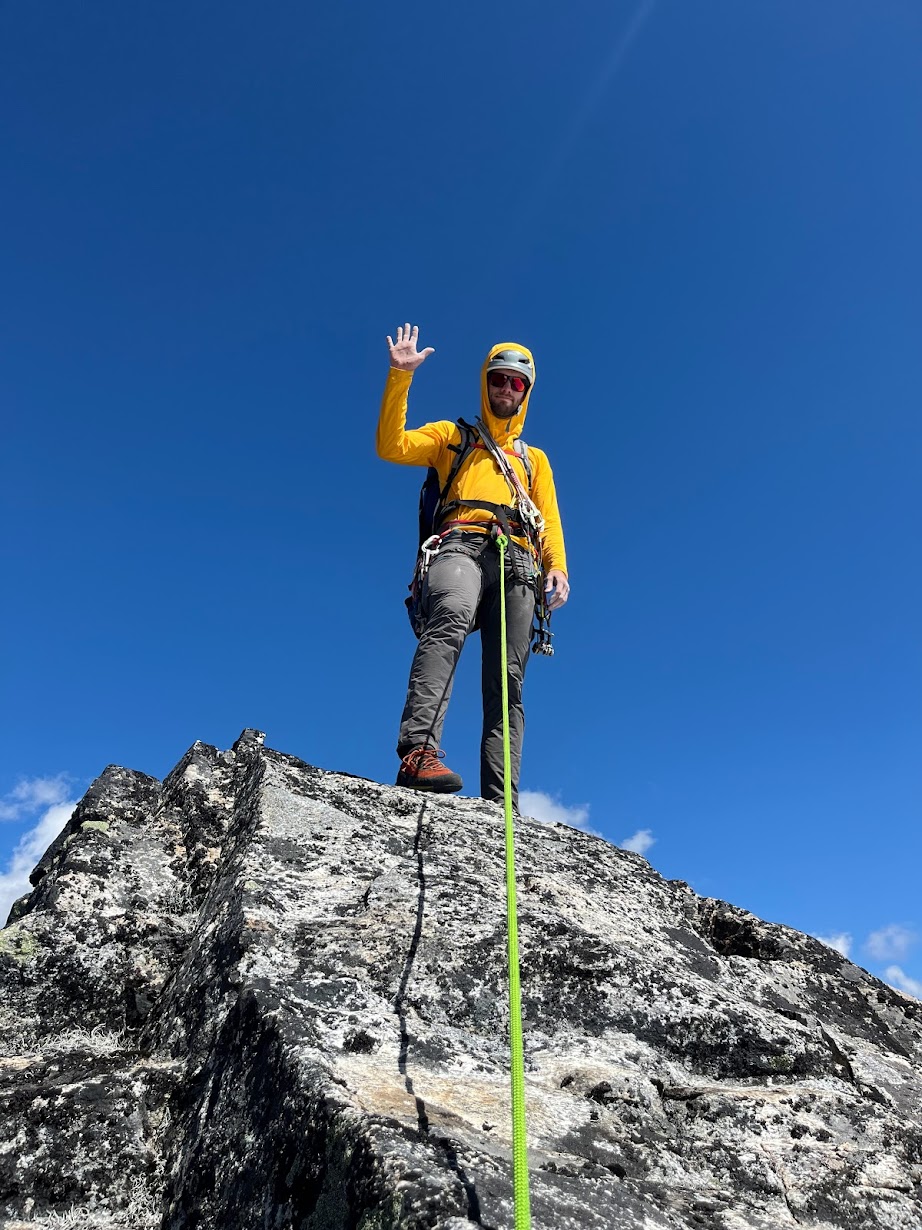
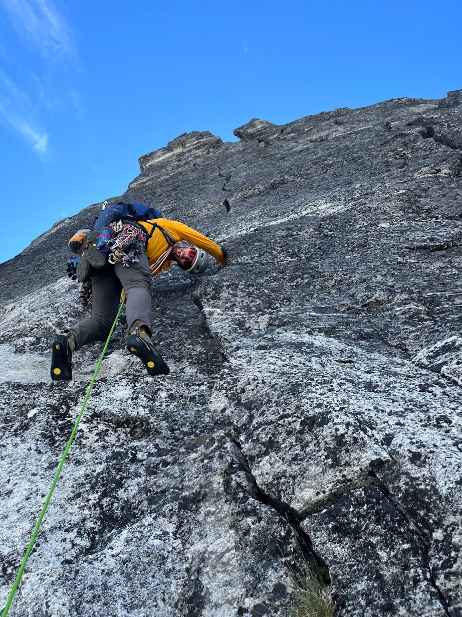
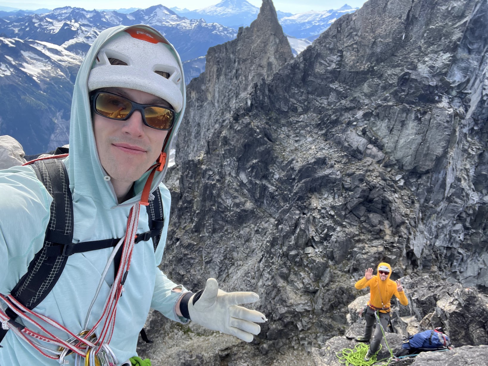
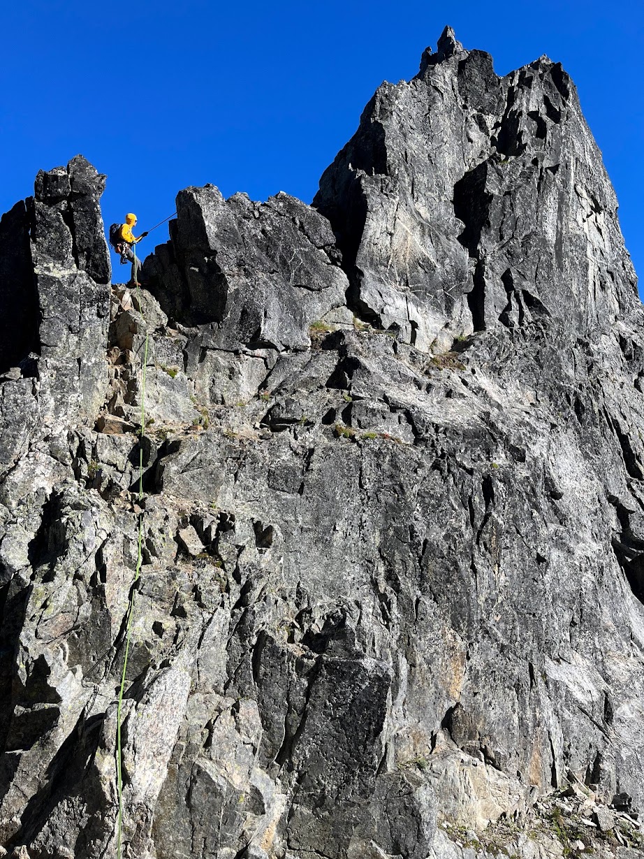
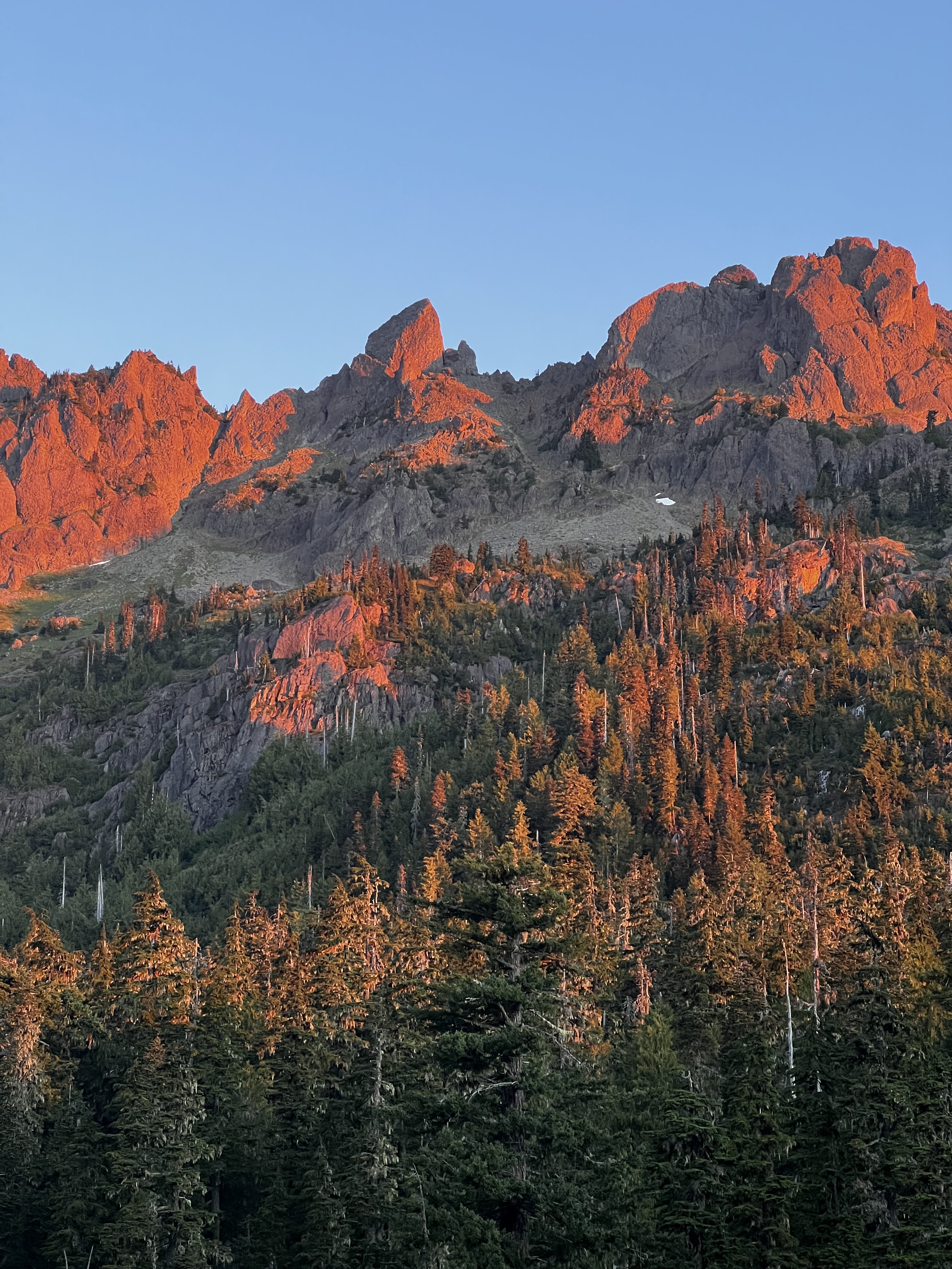
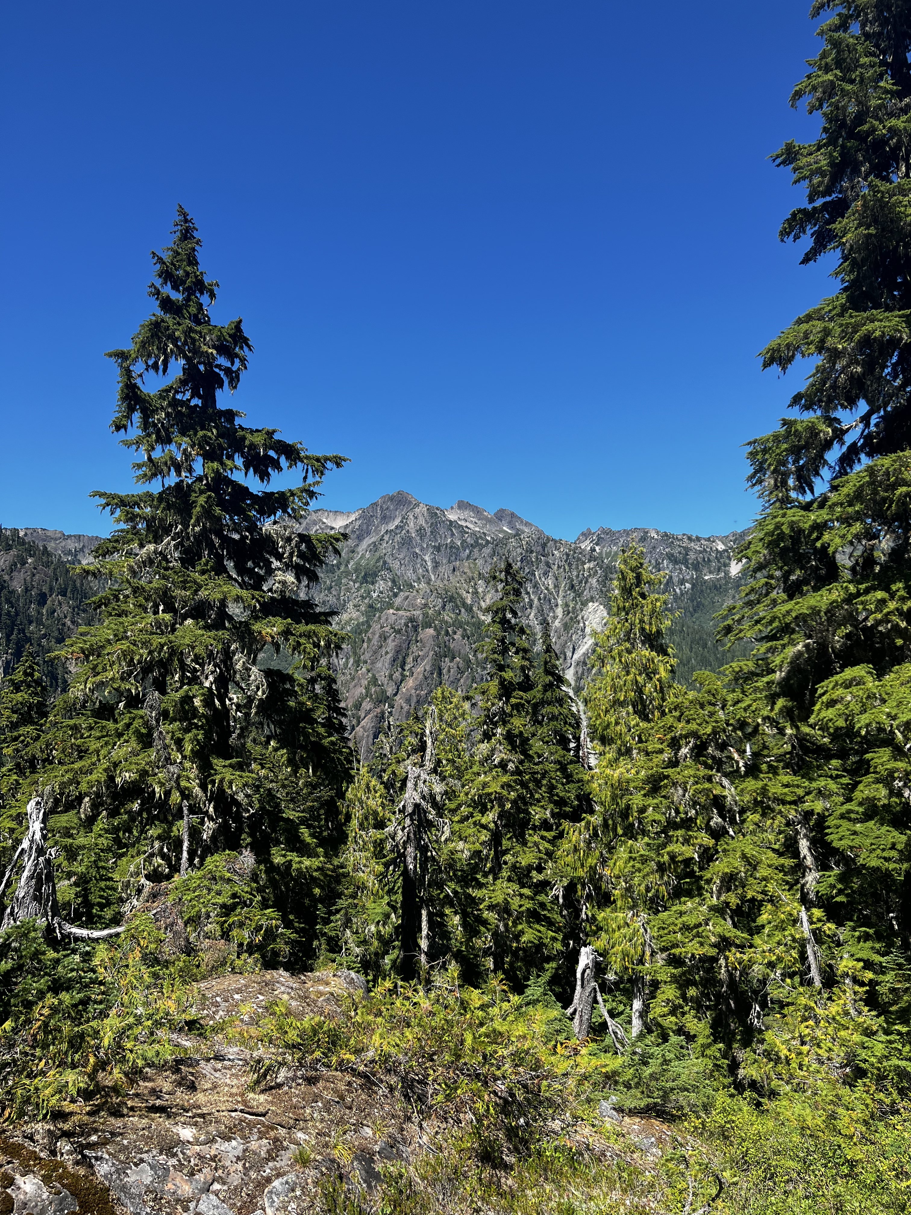
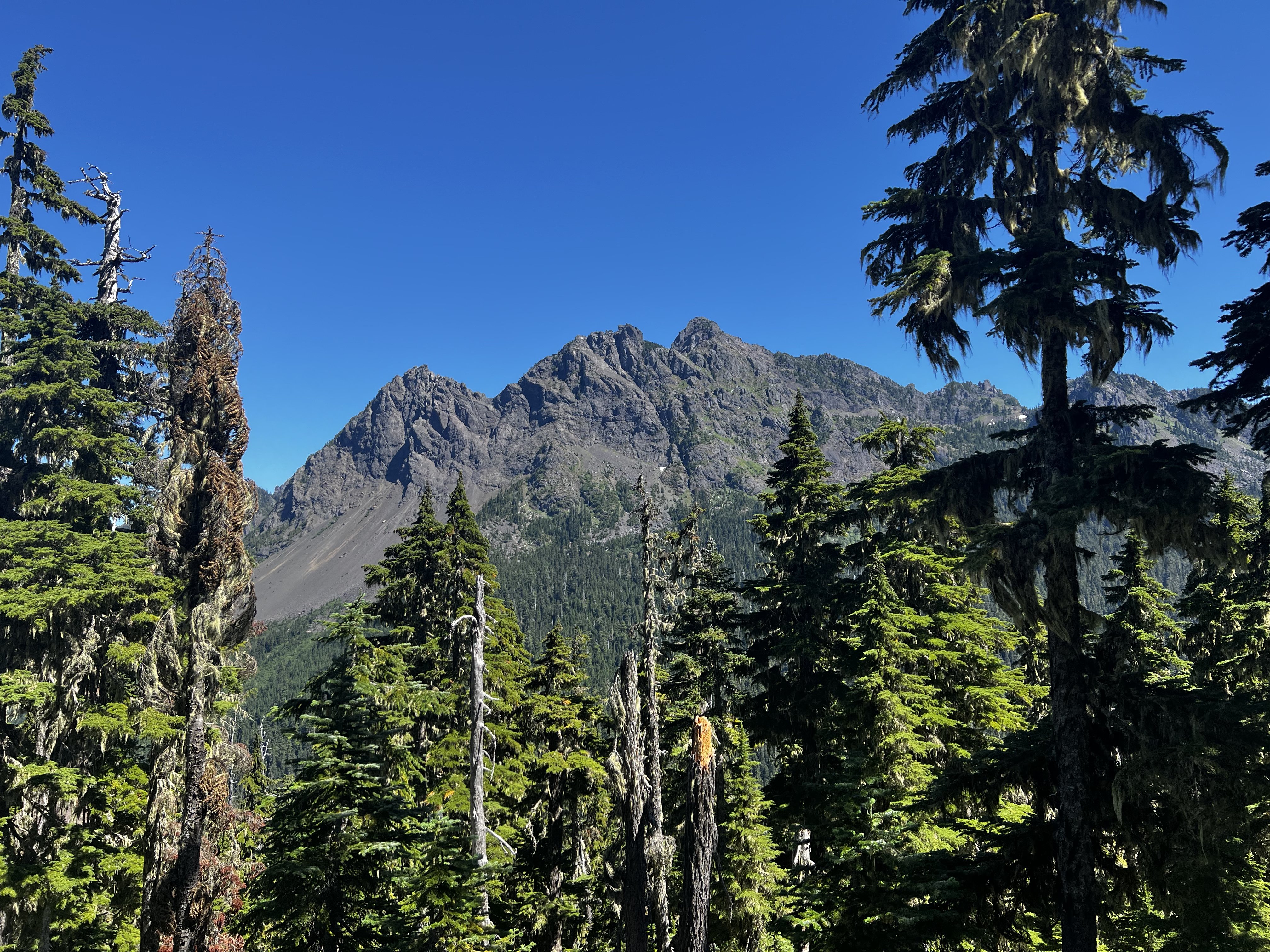
Trip: Whatcom Peak - “Castle in the Sky” FA of the South Buttress of Whatcom 5.10b TD Trip Date: 08/06/2022 Trip Report: Yeeehaw! What a weather window it’s been! From Aug 5-7th Lani and I climbed the first ascent of the south buttress of Whatcom. This route came as a suggestion from Wayne. Thanks! It was excellent climbing on great rock in the most perfect of settings. I would say it’s one of the finer alpine routes I’ve had the pleasure of climbing in the cascades! We would highly recommend the route! There is certainly some choss and some runout but it is the pickets. I have to start work today so a hasty trip report will have to do. Here’s a link to the report I wrote up. Sorry for the forced click through, I’m rolling out the door and don’t have time to format photos for CC. Thanks for the stoke y’all! Go get it while the gettins still there! https://www.theclimbingguides.com/post/castle-in-the-sky-first-ascent-of-the-south-buttress-of-whatcom-peak-iv-5-10b-td Gear Notes: Single rack .1-3 doubles .2-1 full set of nuts. Optional #2 and 3 KB’s. Single 60M rope Approach Notes: We took easy peak to the imperfect impasse.5 points
-
Trip: Glacier Peak - Frostbite Ridge Trip Date: 08/07/2022 Trip Report: TR and GPS track on my site here: https://www.jeffreyjhebert.com/adventures/frostbite-ridge-on-glacier-peak As the fourth-highest peak in Washington State and a beautiful, remote objective, I always wanted to climb more than just the standard route on Glacier Peak. With a perfect weather window over an early-August weekend and a good friend and climbing partner willing to suffer a bit, it was time. Adam and I drove out to the North Fork Sauk Trailhead on Saturday morning with open bivy gear, one axe and one light axe each, crampons, a 30m glacier rope, a few ice screws, a couple of pickets, trail runners, boots, and, perhaps most importantly, a good supply of whiskey. Our 3-day, lollipop plan was to hike 20 miles the first day to get near the start of the Kennedy Glacier, then climb the route and descend the Cool Glacier on the other side a good ways before camping again and then hiking out on the morning of the third day. We left the car at 10am and hiked up the standard approach until we hit the PCT, where we took a left up to Red Pass. We ran into a number of through-hikers on the PCT and each of them was a bit surprised to hear we were there to climb Glacier Peak. We also ran into a soloist who said he’d started up the Kennedy Glacier, but turned around. It was a bit ominous hearing that as we marched our way North on the PCT. The variety and amount of ground we covered this first day was pretty cool and we enjoyed it as much as we could despite the slowly-building pain creeping into our feet, shoulders, and hips. It was after 7pm when we made it to the tricky crossing of the Kennedy Creek. We just put our heads down from here and hiked up Kennedy Ridge to 5,300 feet where we expected to leave the PCT in the morning and saw a creek on the map, hoping there would be somewhere flat to bivy. We arrived at 8pm to find a nice little campsite with one other person, quickly set up shop, and conked out. The mileage and vertical gain from camp to the summit didn’t seem to warrant an alpine start, so we woke up at 5am and were moving by 6am. Heading straight up from camp was exactly the right move and quickly put us on a large moraine overlooking the entire North side of Glacier. There were some old signs of traffic, but the area had the feel of being forgotten and much more remote than other big peaks in Washington. We switched from trail runners to boots at the toe of the Kennedy Glacier at 7:30am, keeping crampons on our backs to start since the snow was reasonably soft and there was a clear dirty, rocky band to get through on the glacier below Kennedy Peak. This section was perhaps the most dangerous of the route—it was a crumbling mess with big boulders waiting to succumb to potential energy, perched on glacial till. After gingerly getting through this bit, we were on the wide-open Kennedy Glacier with very little crevasse hazard on its left half. Things were uneventful until we got to Frostbite Ridge itself. We could see the Rabbit Ears feature above us and our options were getting on a pumice treadmill up the ridge or staying on steep snow to the left. We opted to keep crampons on and stick to the snow. We stayed left past the first gendarme and on some of the steepest snow (~50 degrees) near the top, which went pretty easily with our second axes. The snow took us almost to the top of the face and then we scrambled a few feet to the highest point, just to the right of the highest gendarme (the Rabbit Ears themselves, it turned out) at 12:30pm. From here, we could see the rest of our route and it looked like it would all go. We could also see our 3rd class descent to the upper Kennedy Glacier. It looked loose and nasty, but ended up being quite reasonable and quick. The first 50 feet up the snow on the other side were steep, but it eased off significantly from there and we romped our way up, across, then down to the saddle below the final face. The face had the glimmer of ice to it, which was a welcome departure from walking. We determined the angle was low enough and the steep part short enough that it made more sense to solo than to pitch out. I set off and enjoyed settling into the flow of ice climbing despite the knuckle-bashing involved with straight-shaft axes. After the ice step of 40 feet or so, it was back to snow until the top, but it steepened up again right near the summit and made sense to front-point with both axes—quite fun to climb that way right to the summit. We arrived at 2:15pm. The descent was straightforward and pretty efficient on sloppy snow. We never needed the rope and took our crampons off as soon as we were down the initial steeper sections. We descended all the way to the plateau at 6,750 feet where we found a nice spot to camp off snow with great views. We got moving the next morning at 7:15am and were back to the car a little after noon. We stopped at the bottom of the switchbacks before the final flat slog out to consume most of the remaining whiskey and floated on a cloud of air most of the way back to the car. This route had a more adventurous, remote, wild feel than lots of other climbing in Washington. In a way, it felt more like a destination climb I would have flown somewhere to do. Yes, the walking to climbing ratio was quite high and we never took the rope out, but it did bring some fun challenges, stellar views, and time way out there. Gear Notes: Did use: whiskey Didn't use: 4 ice screws, 2 pickets, 30m rope, glacier kit Approach Notes: Buckle up3 points
-
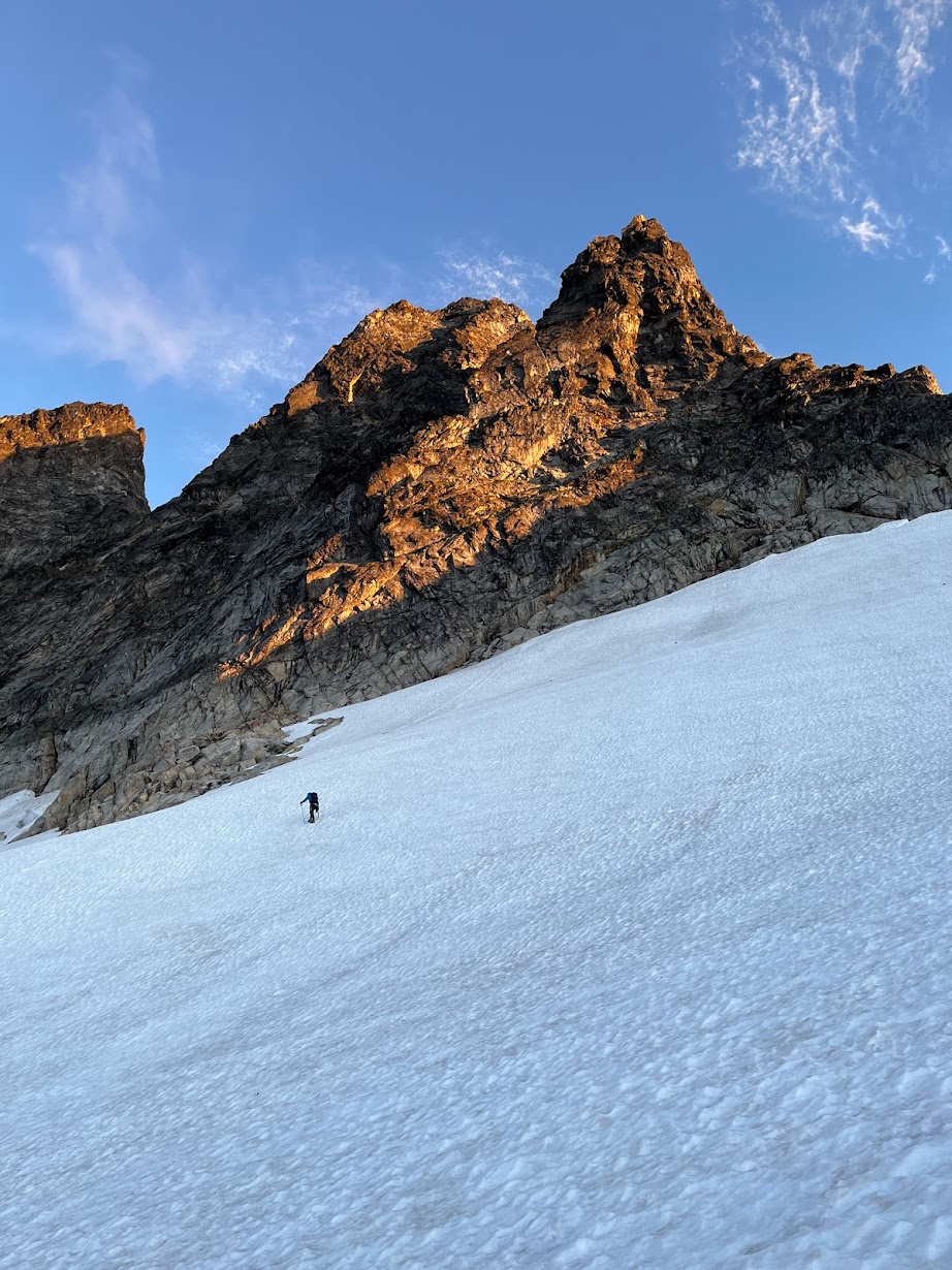
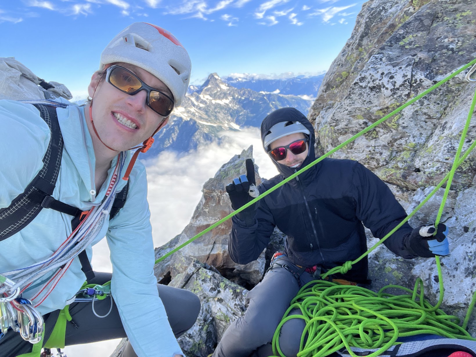
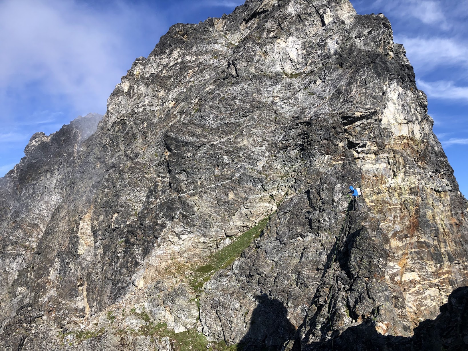
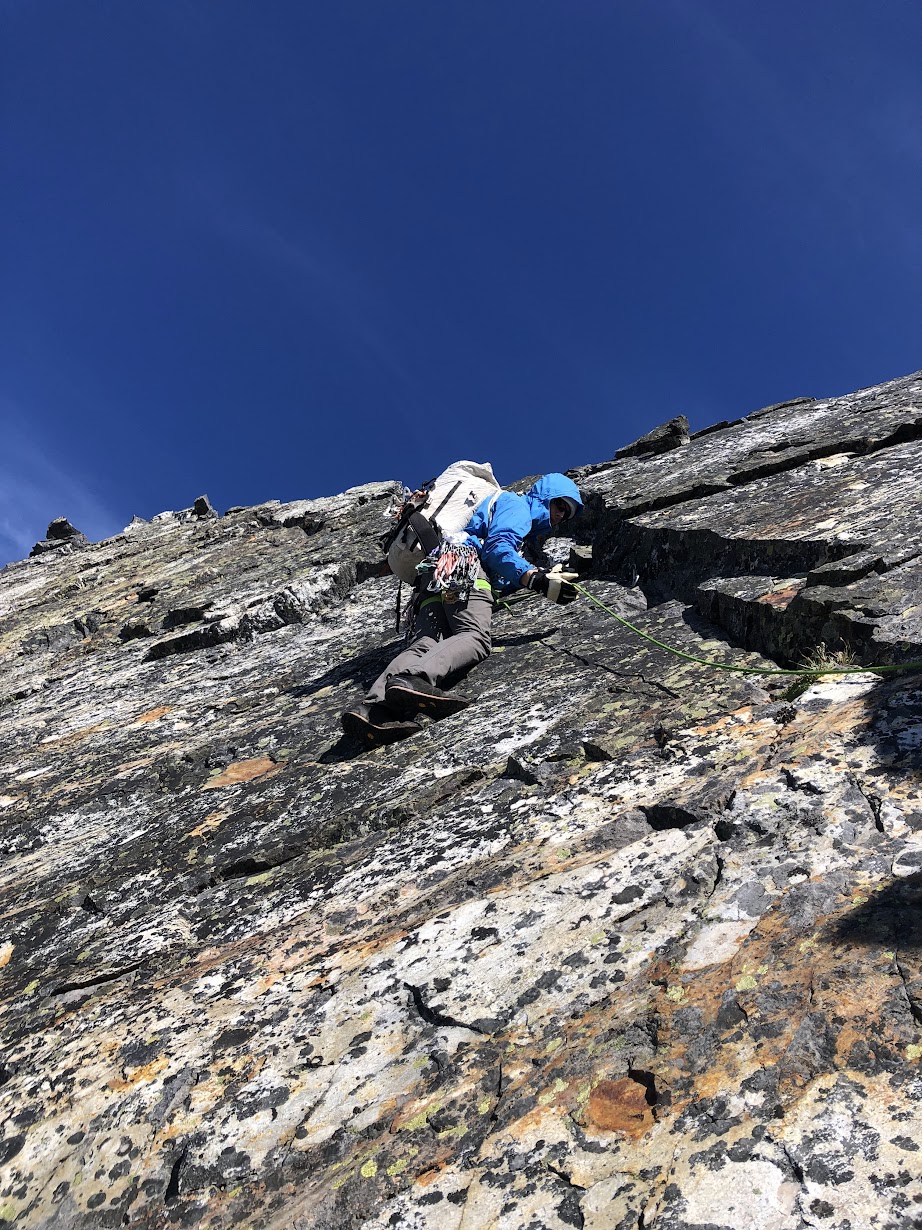
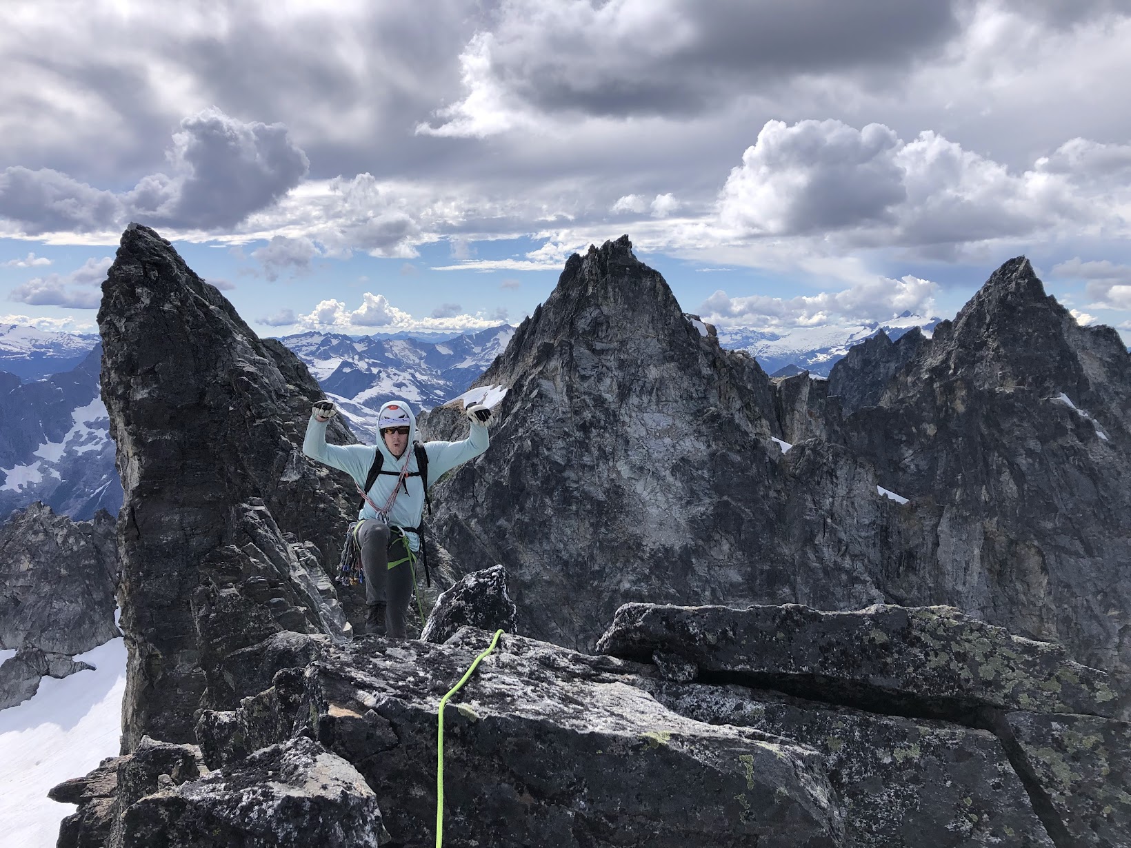
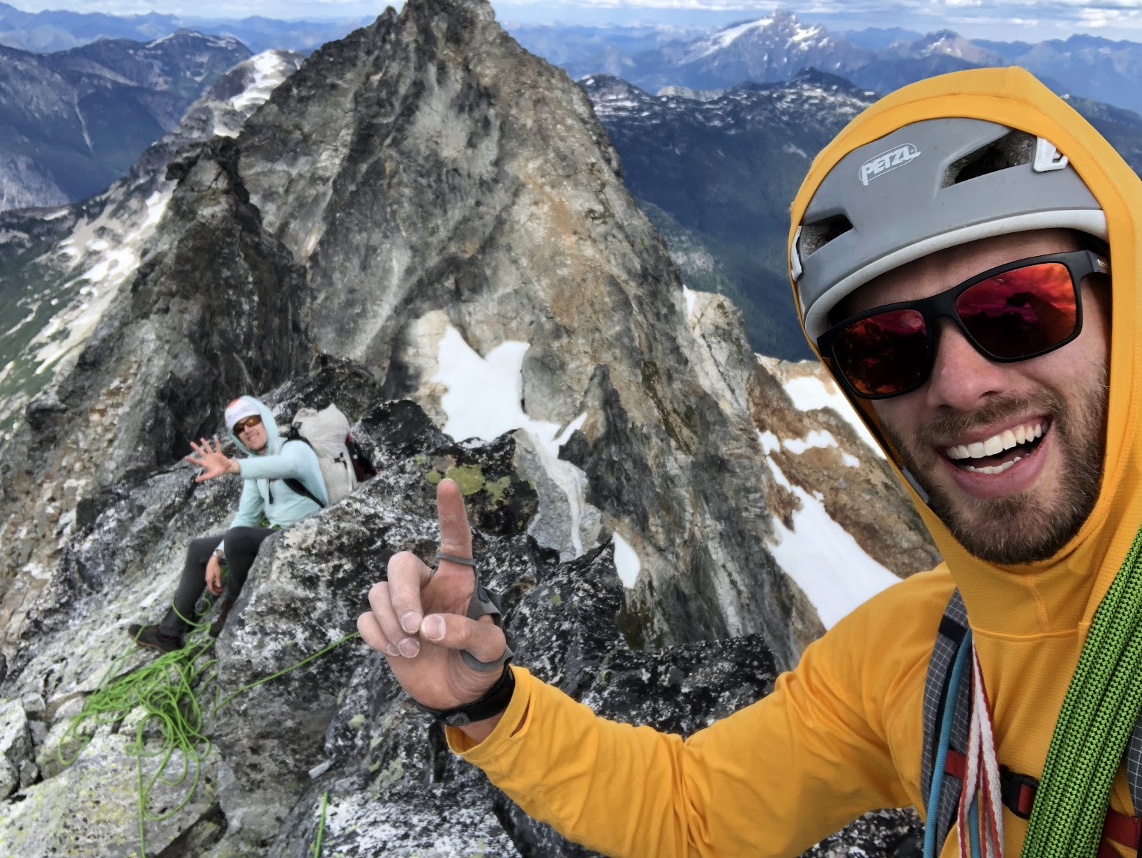
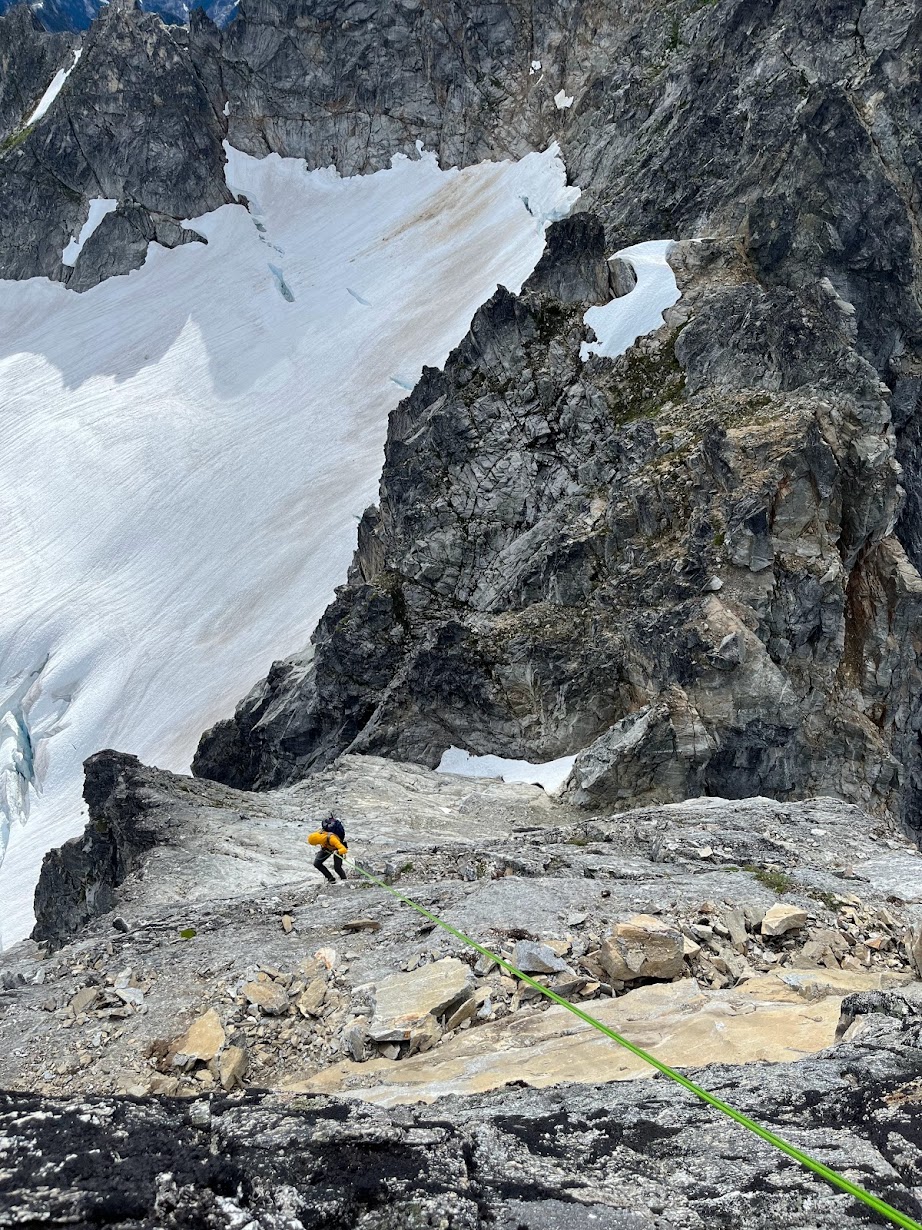
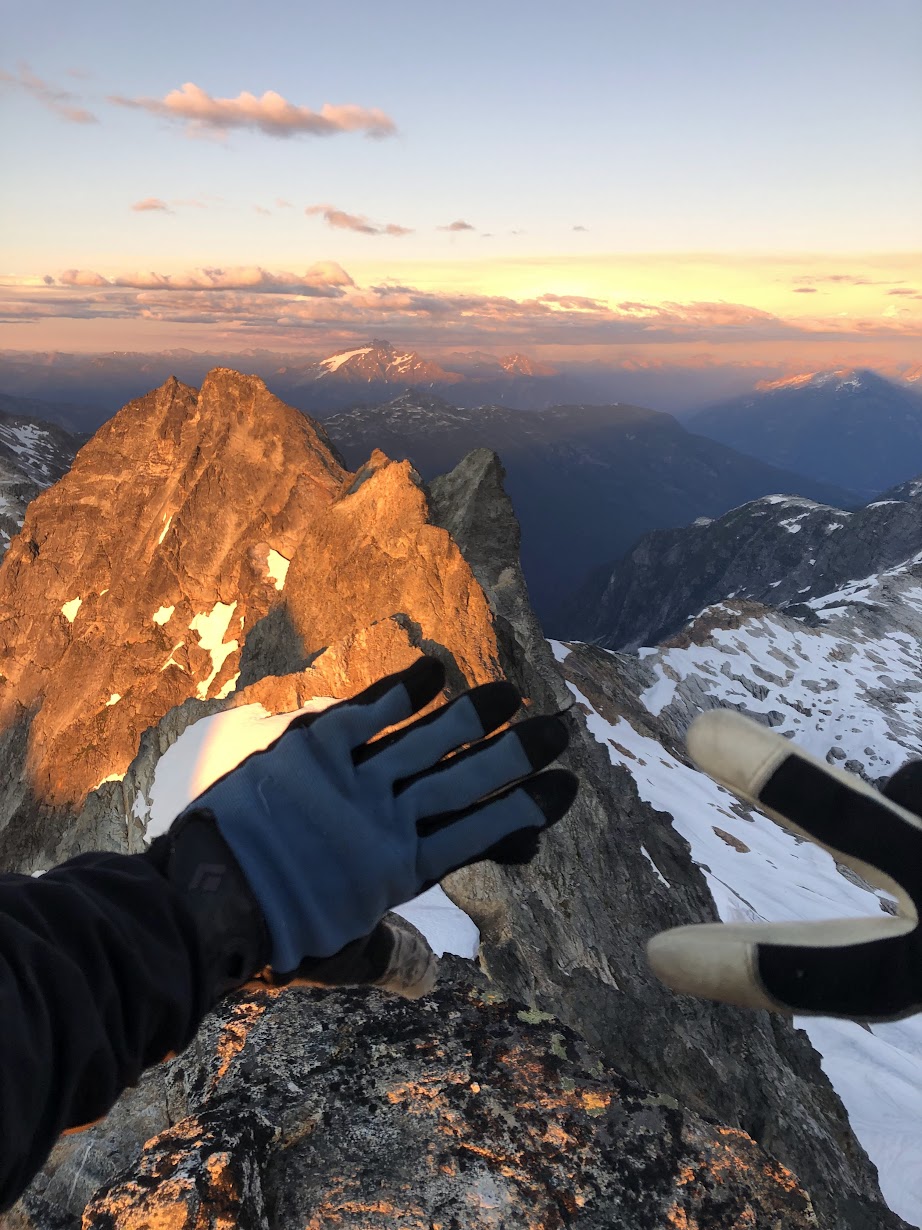
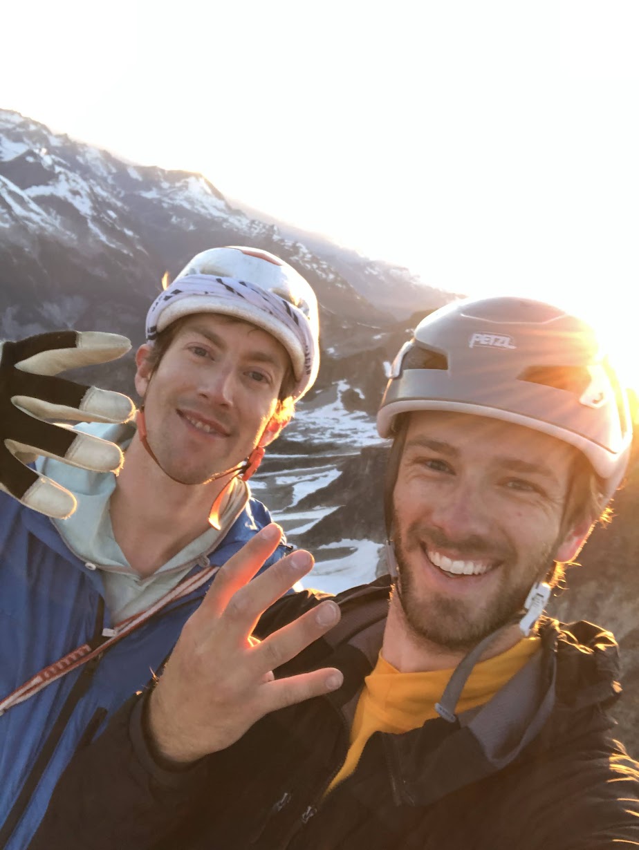
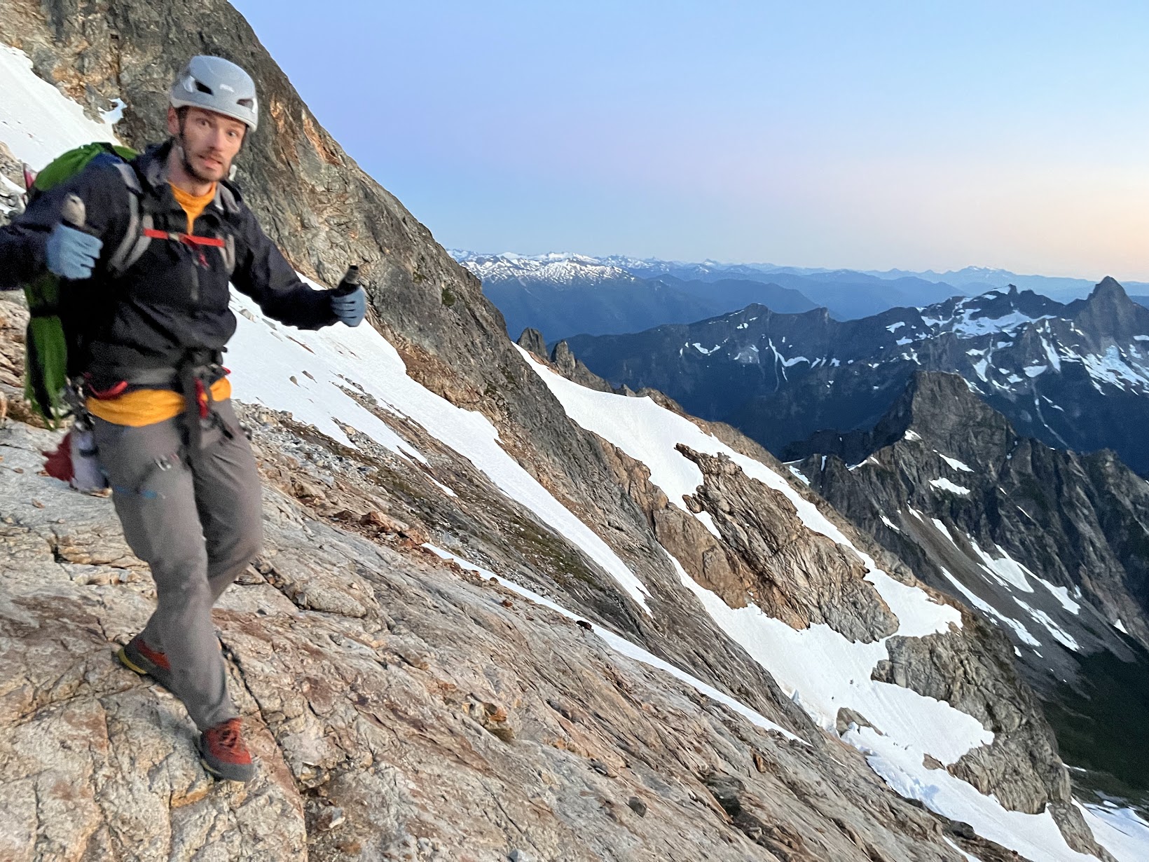
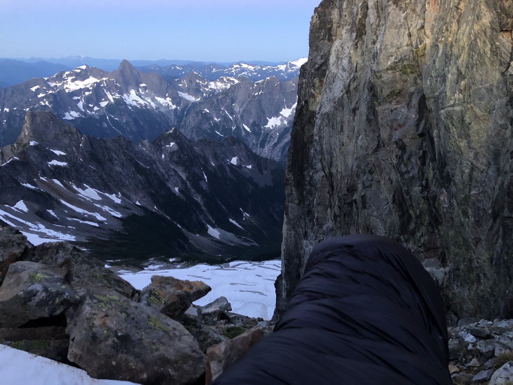
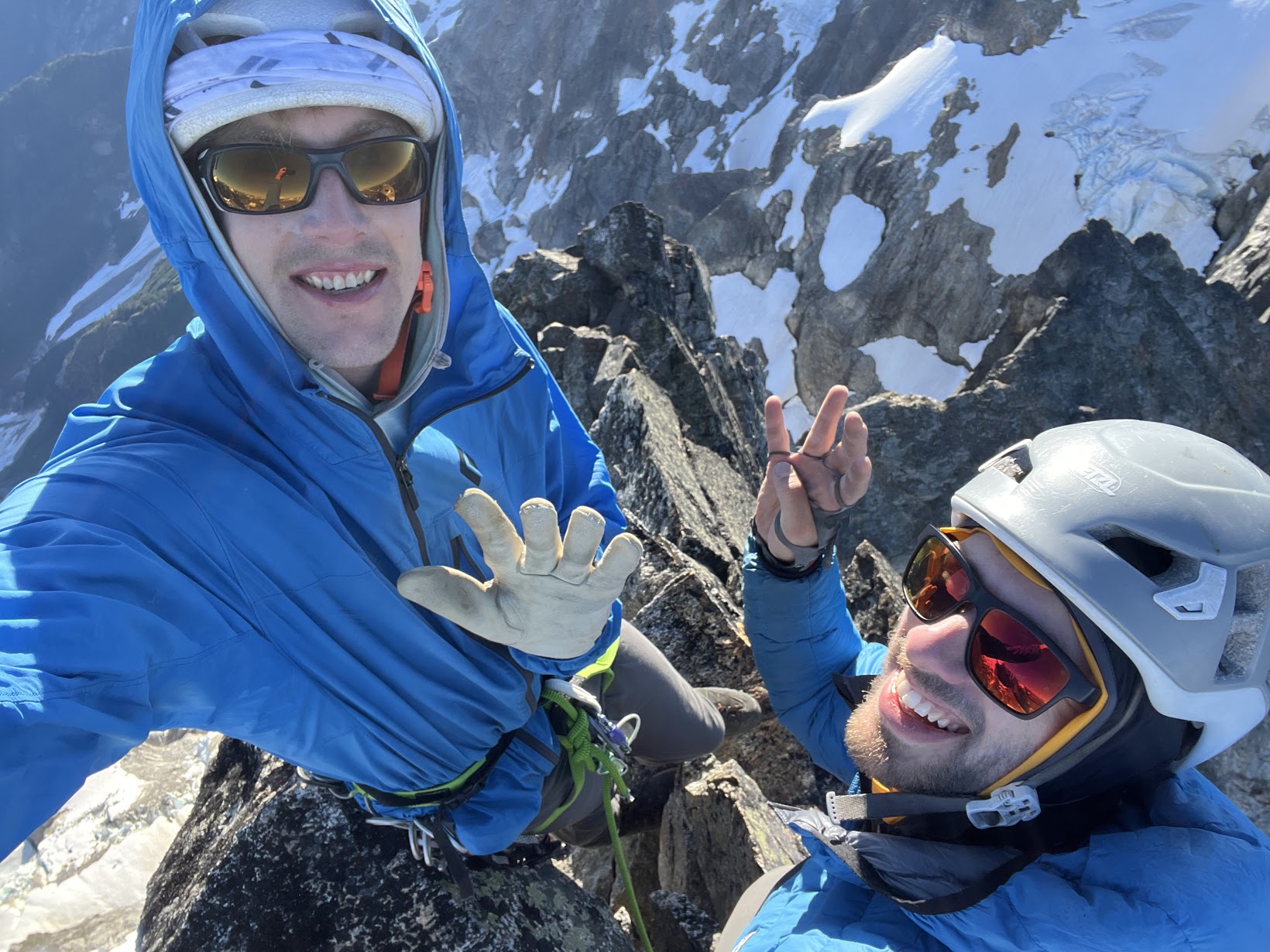
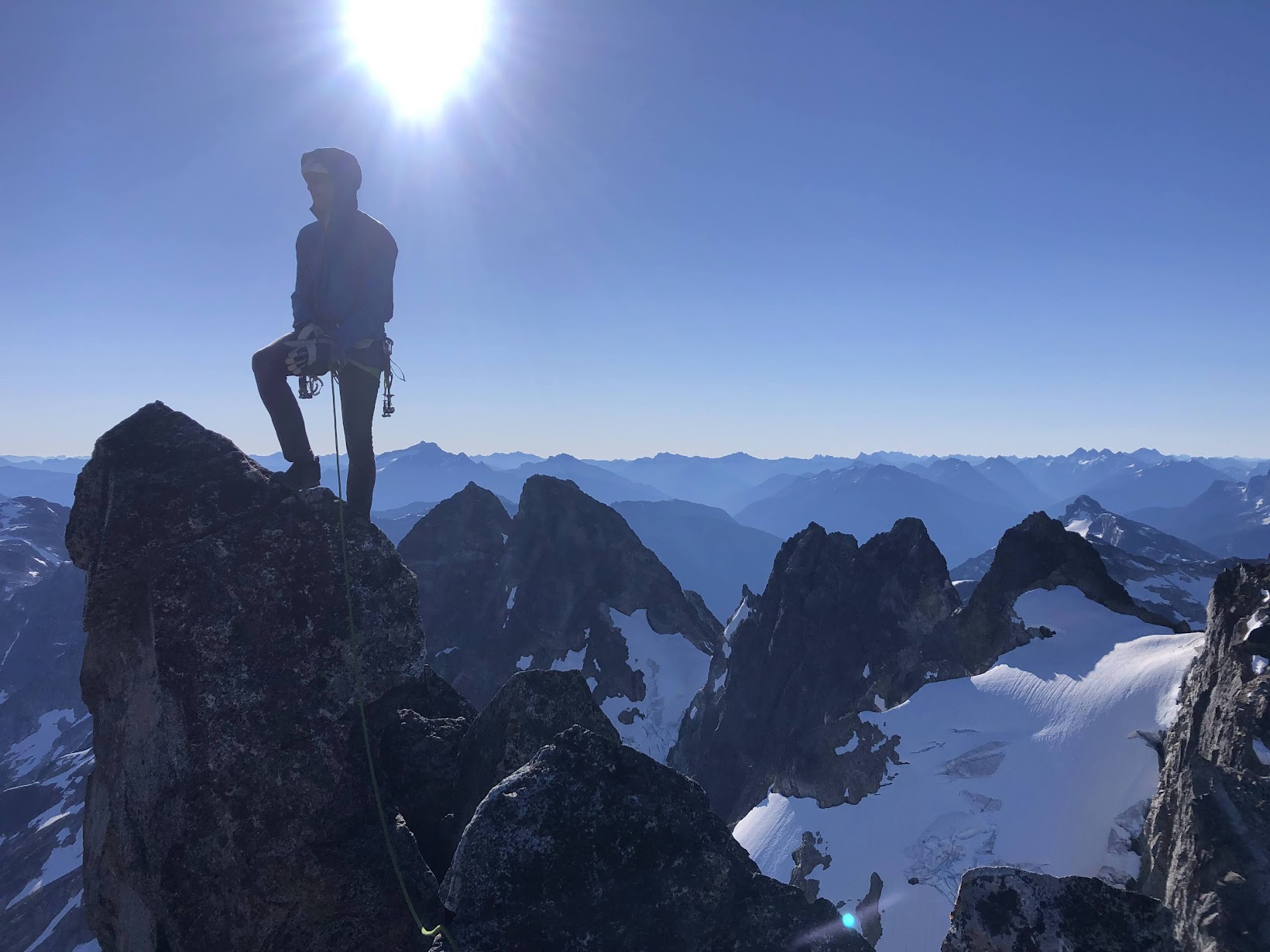
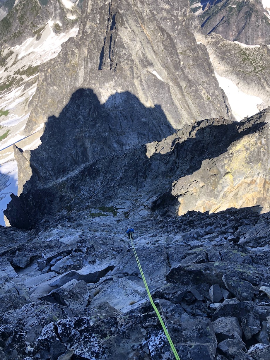
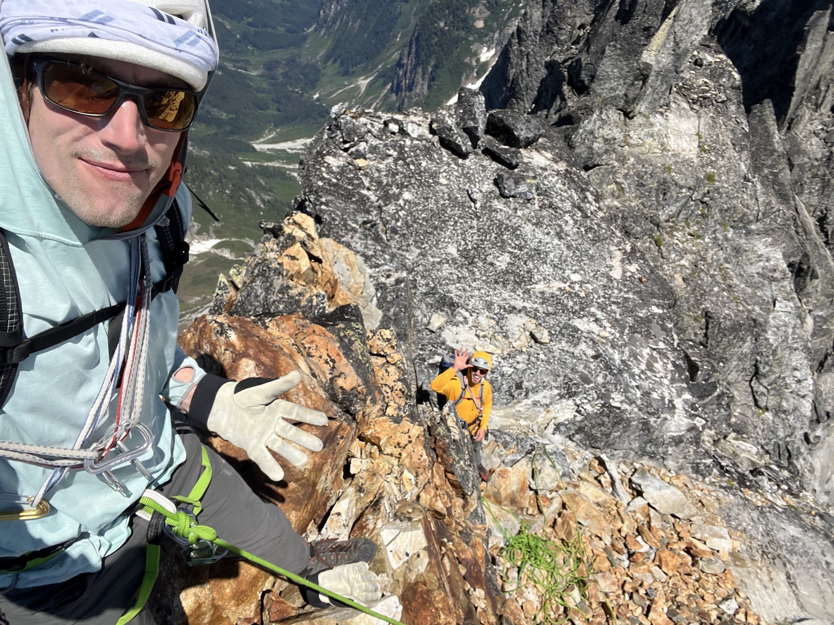
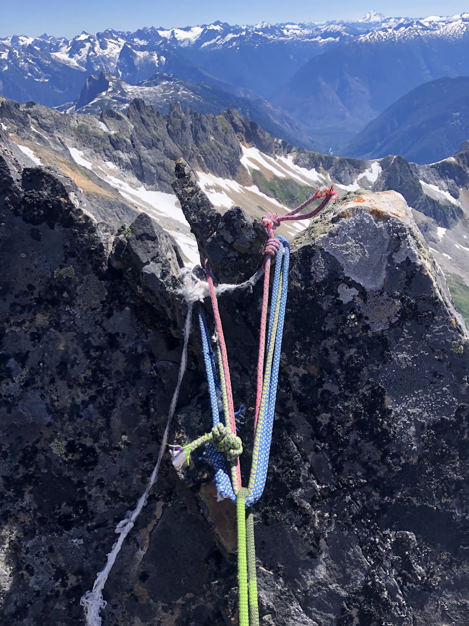
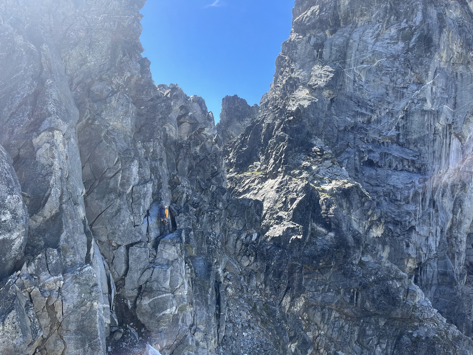
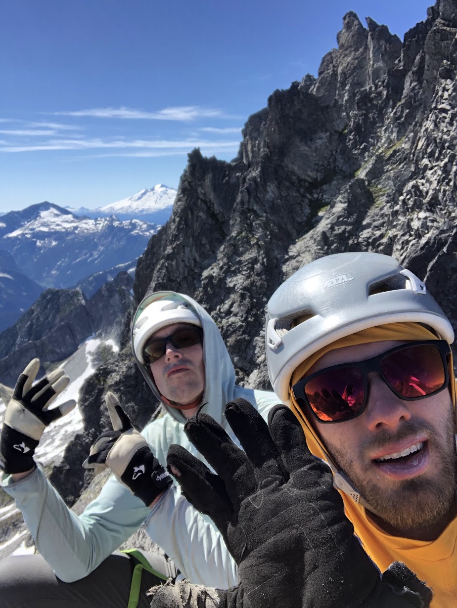
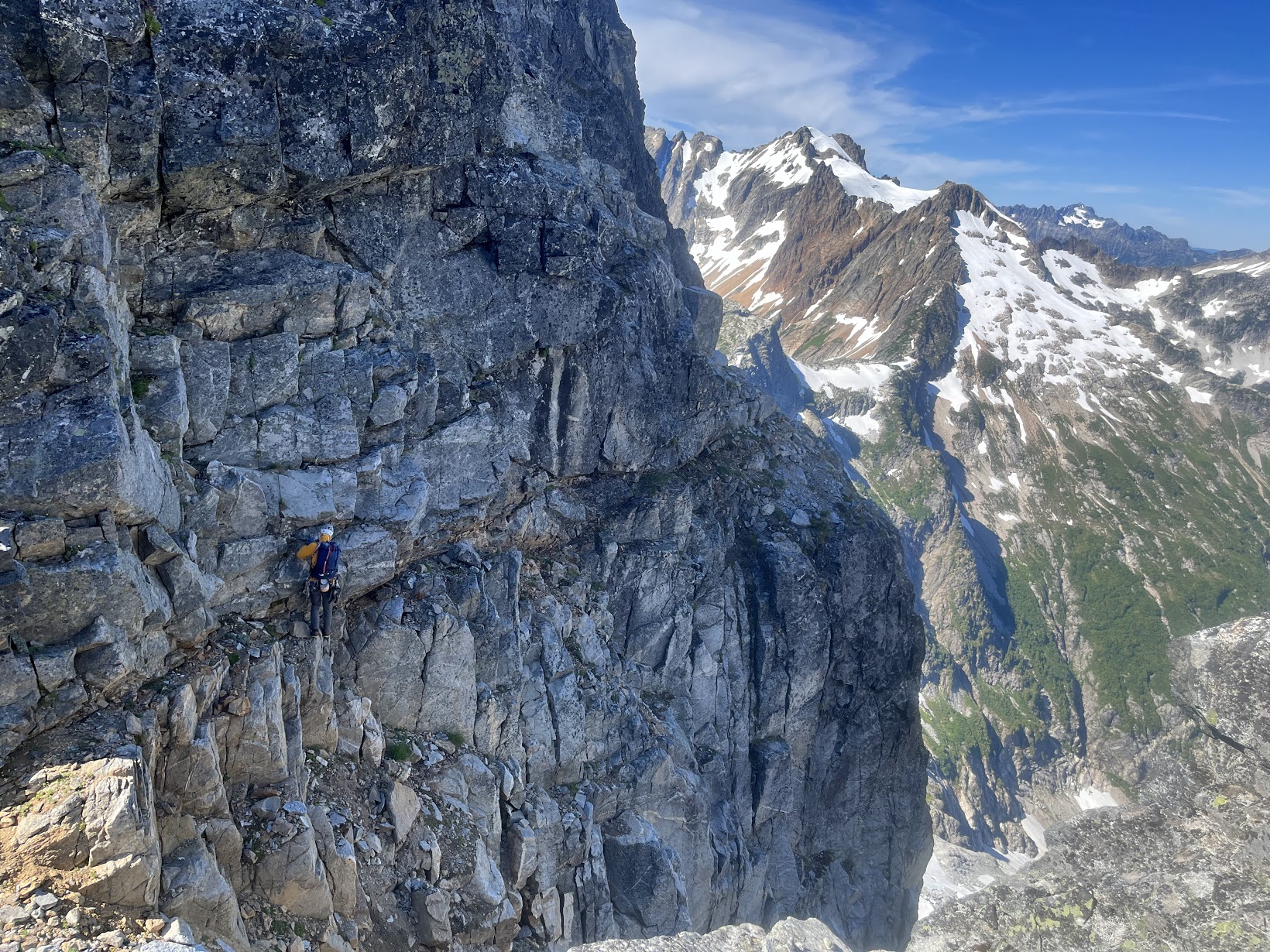
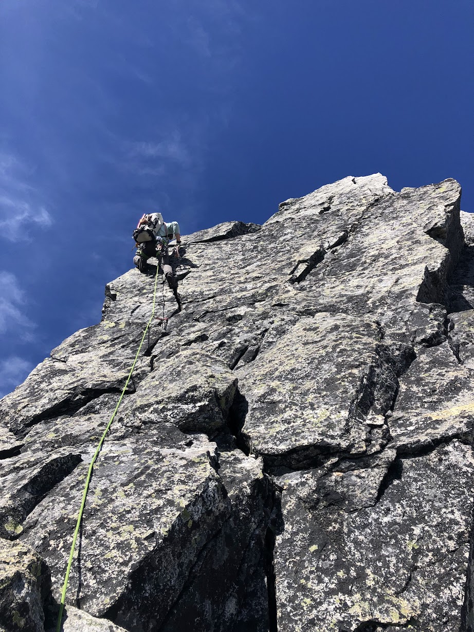
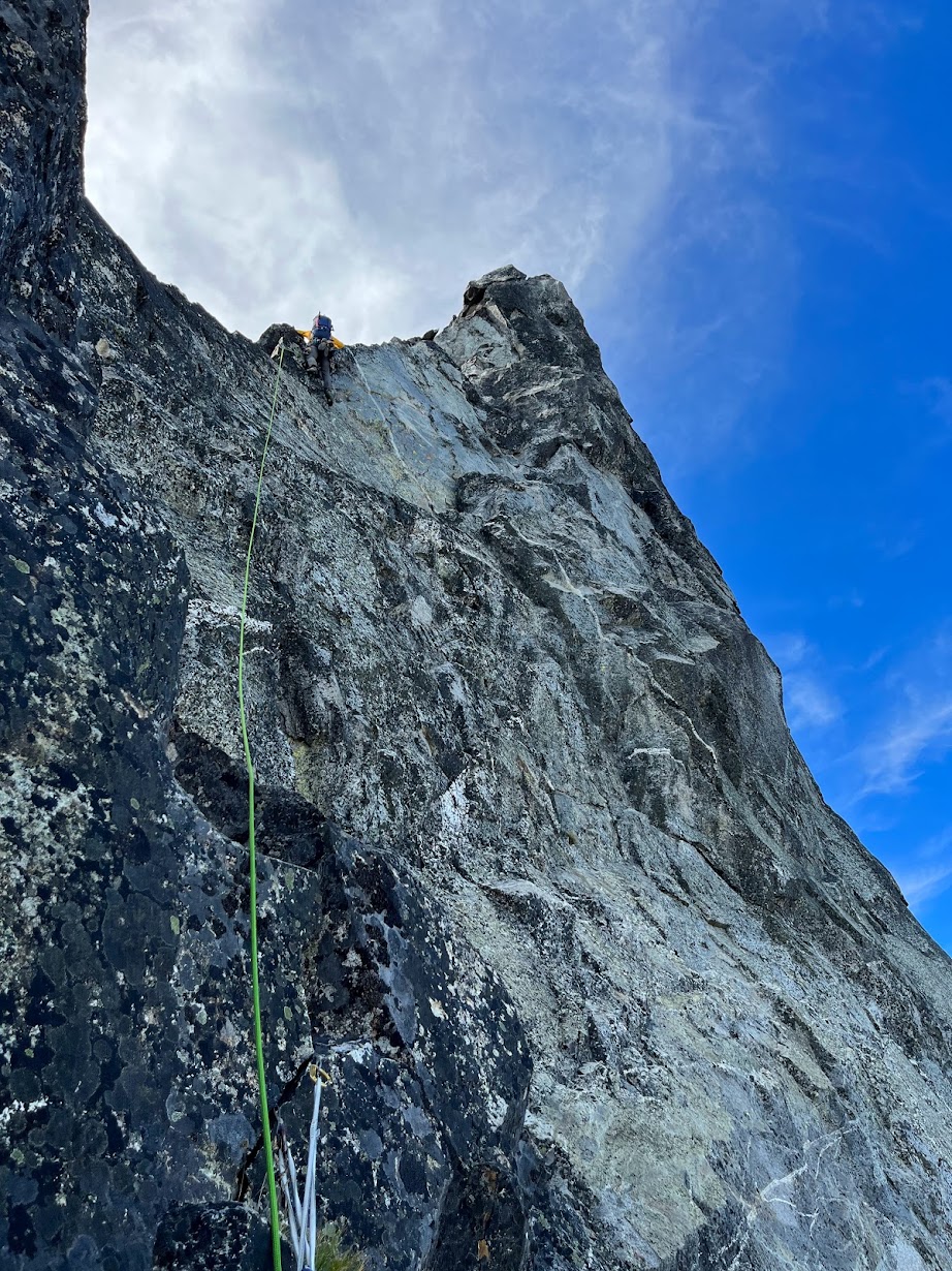
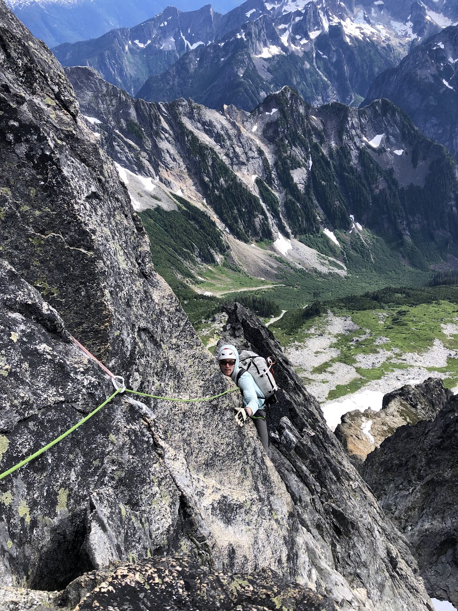
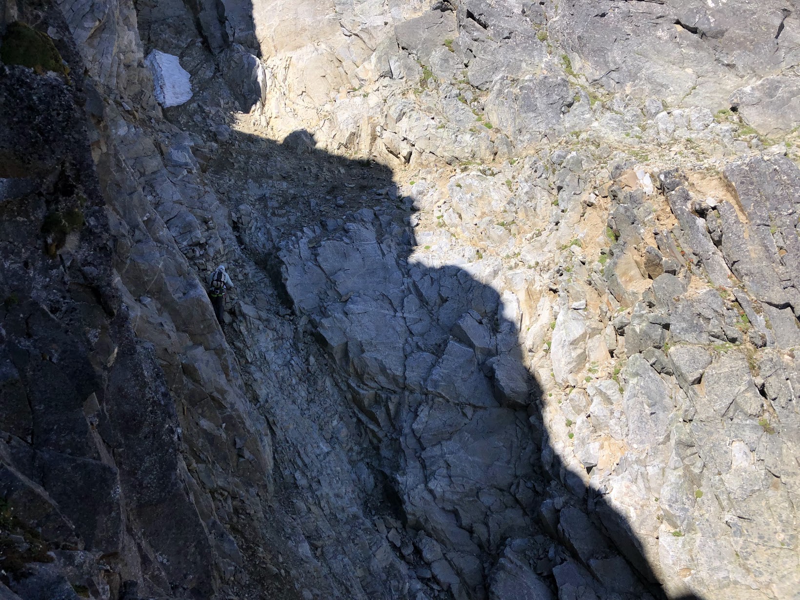
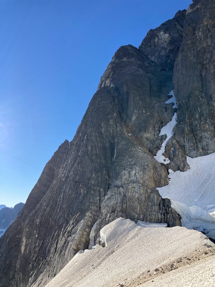
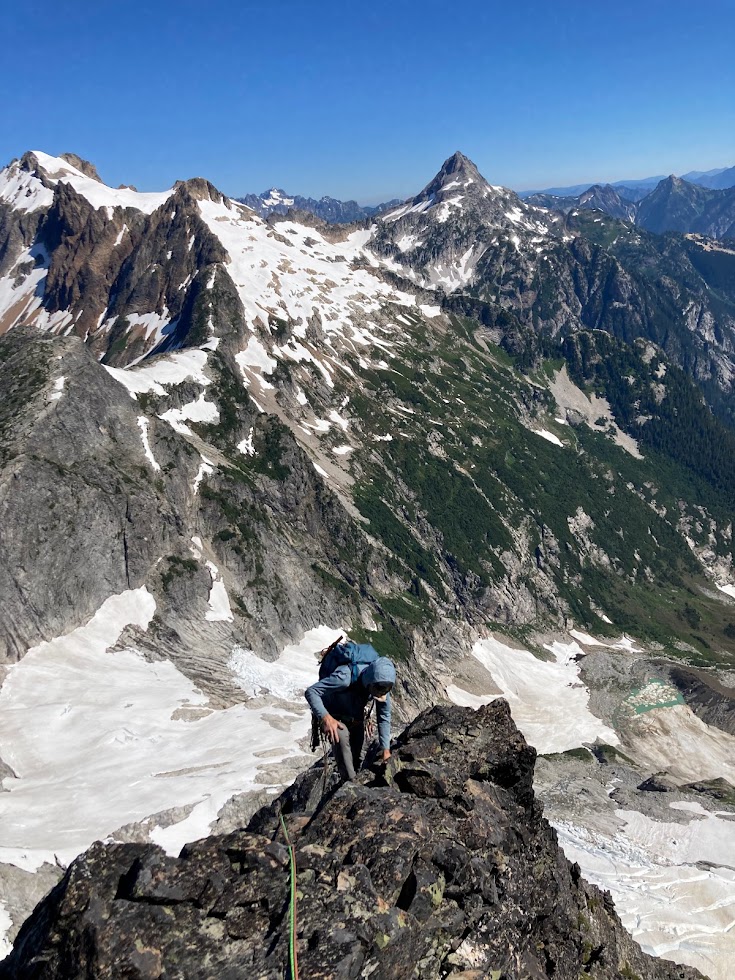
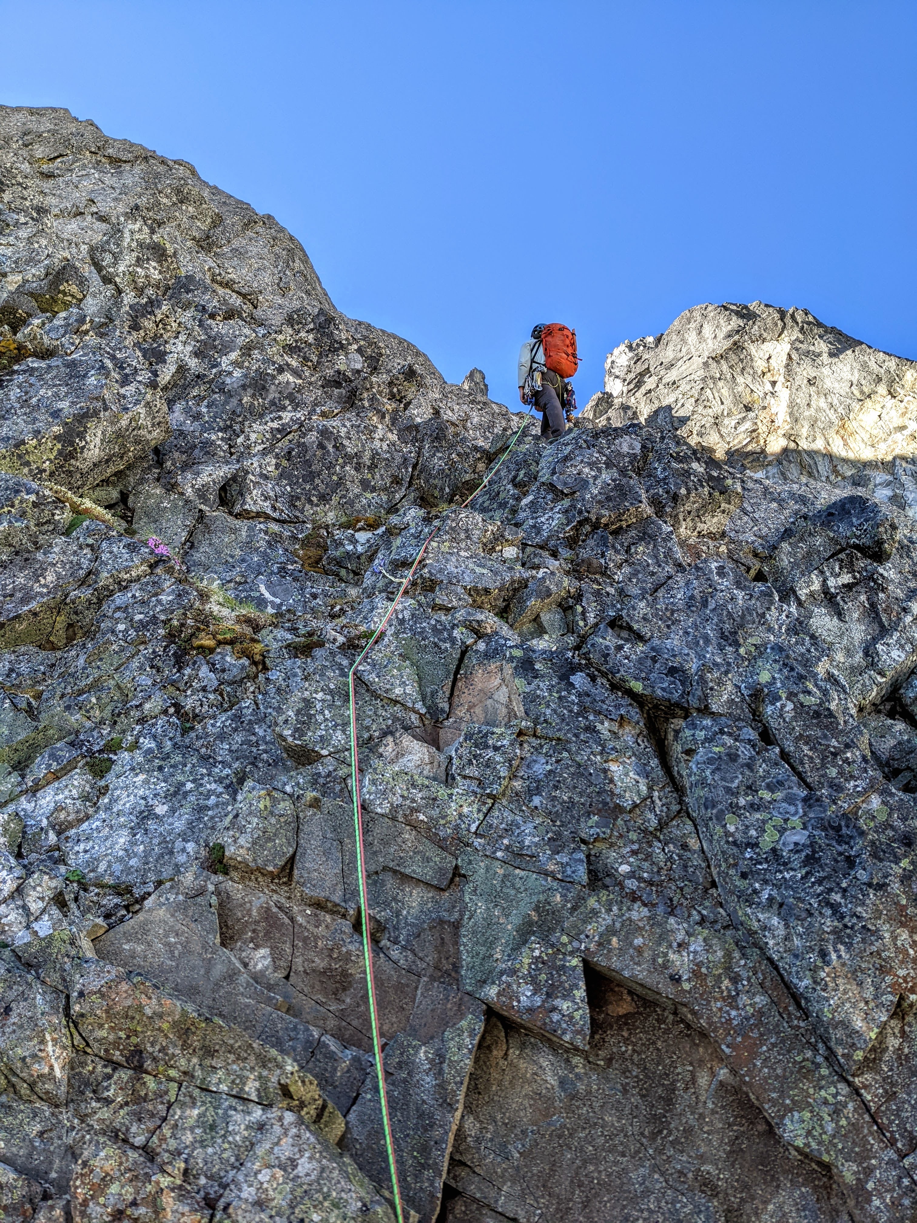
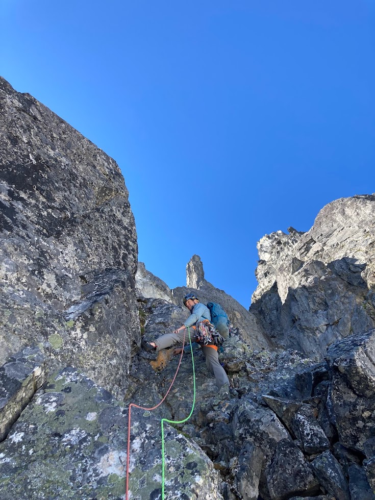
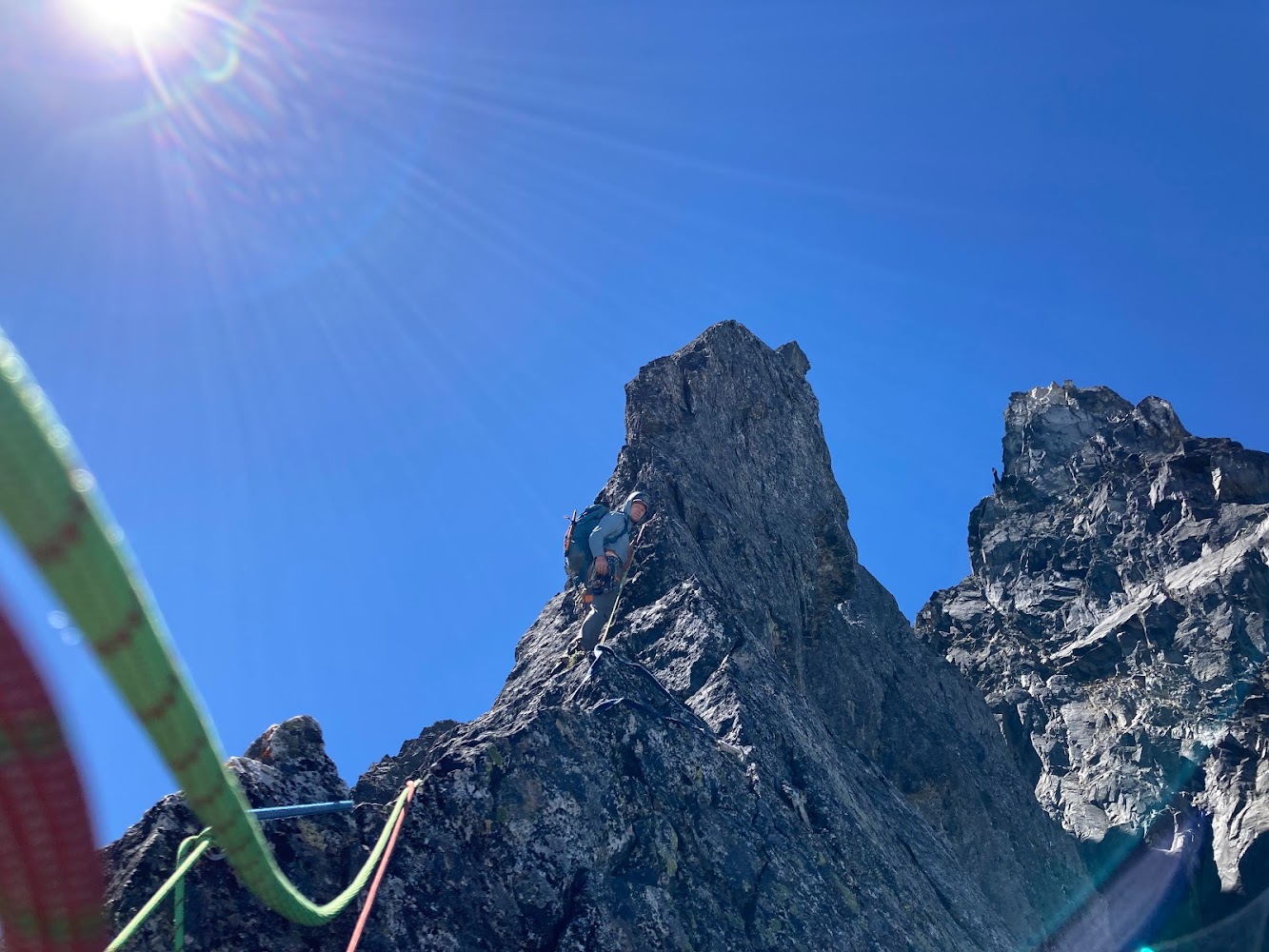
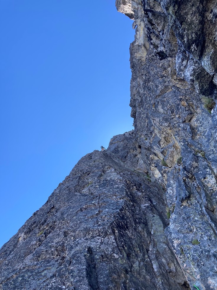
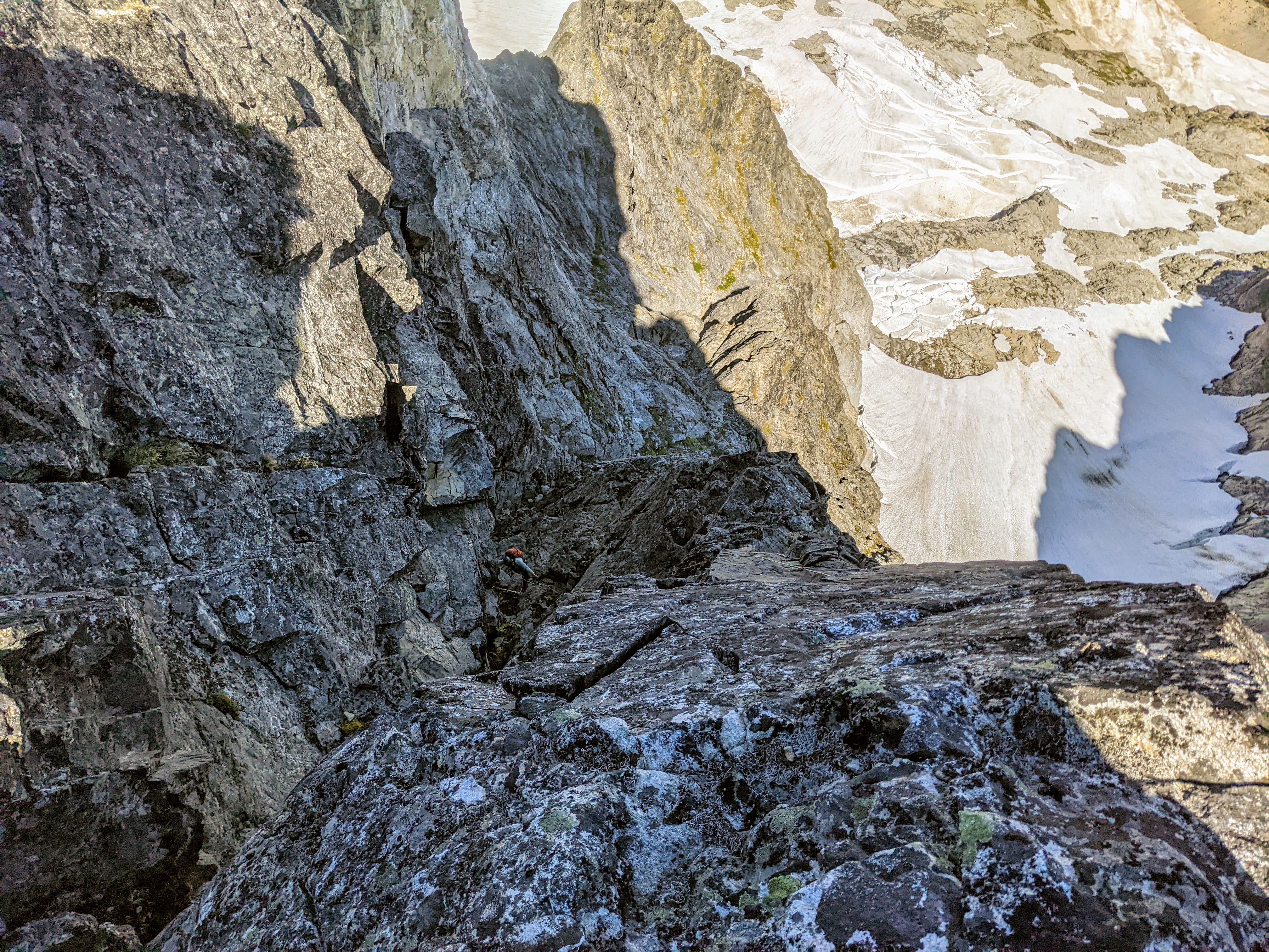
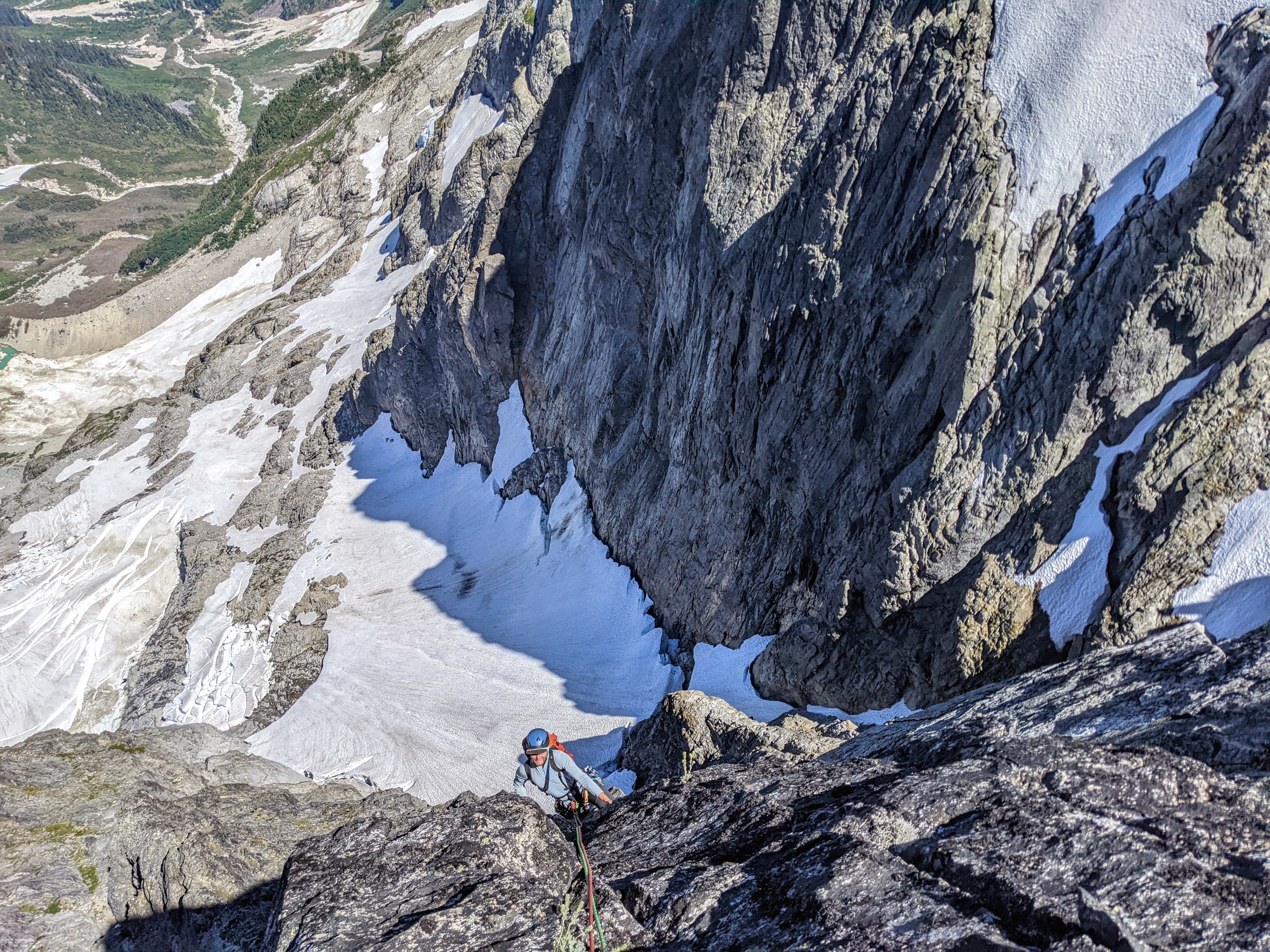
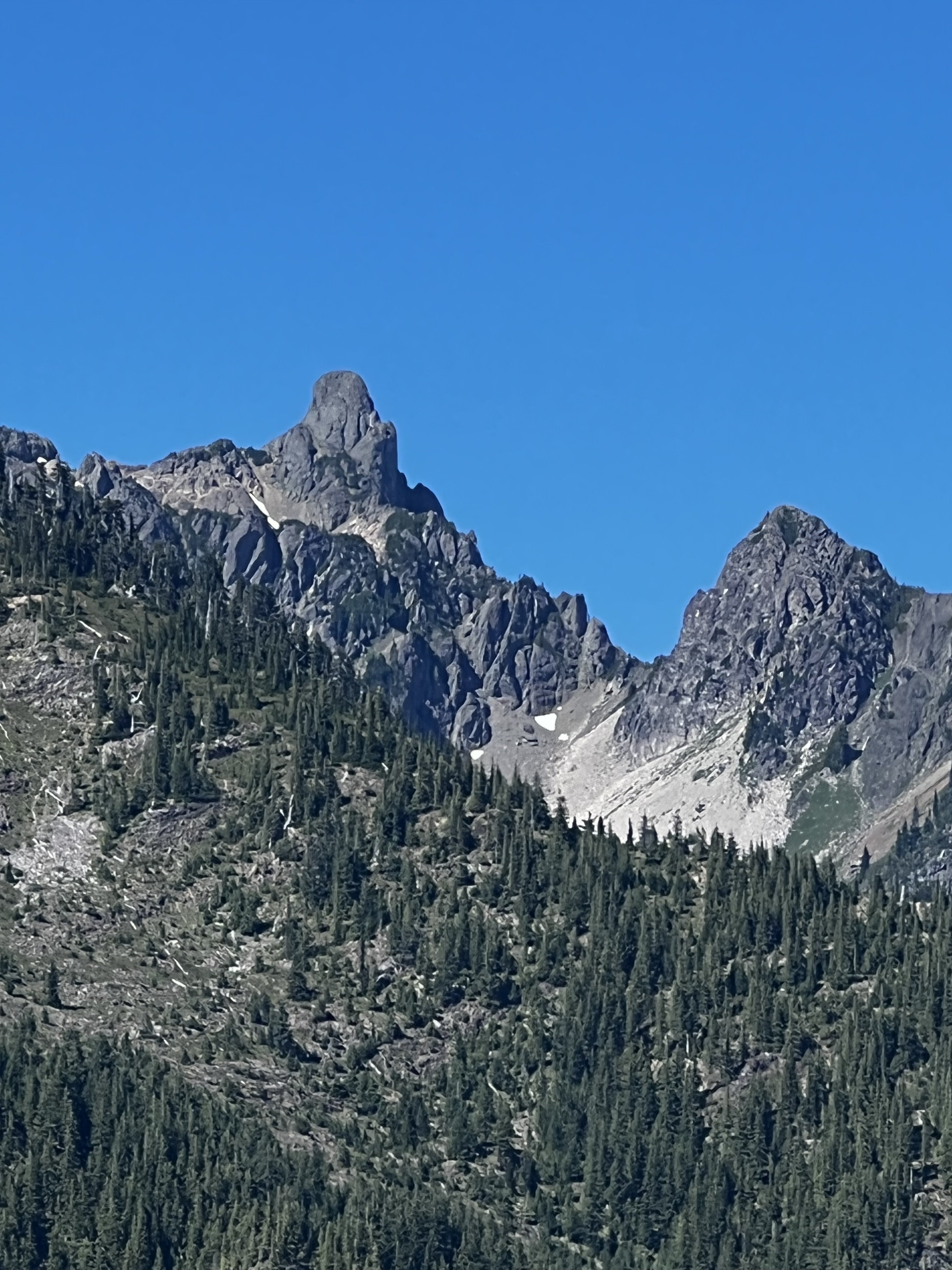
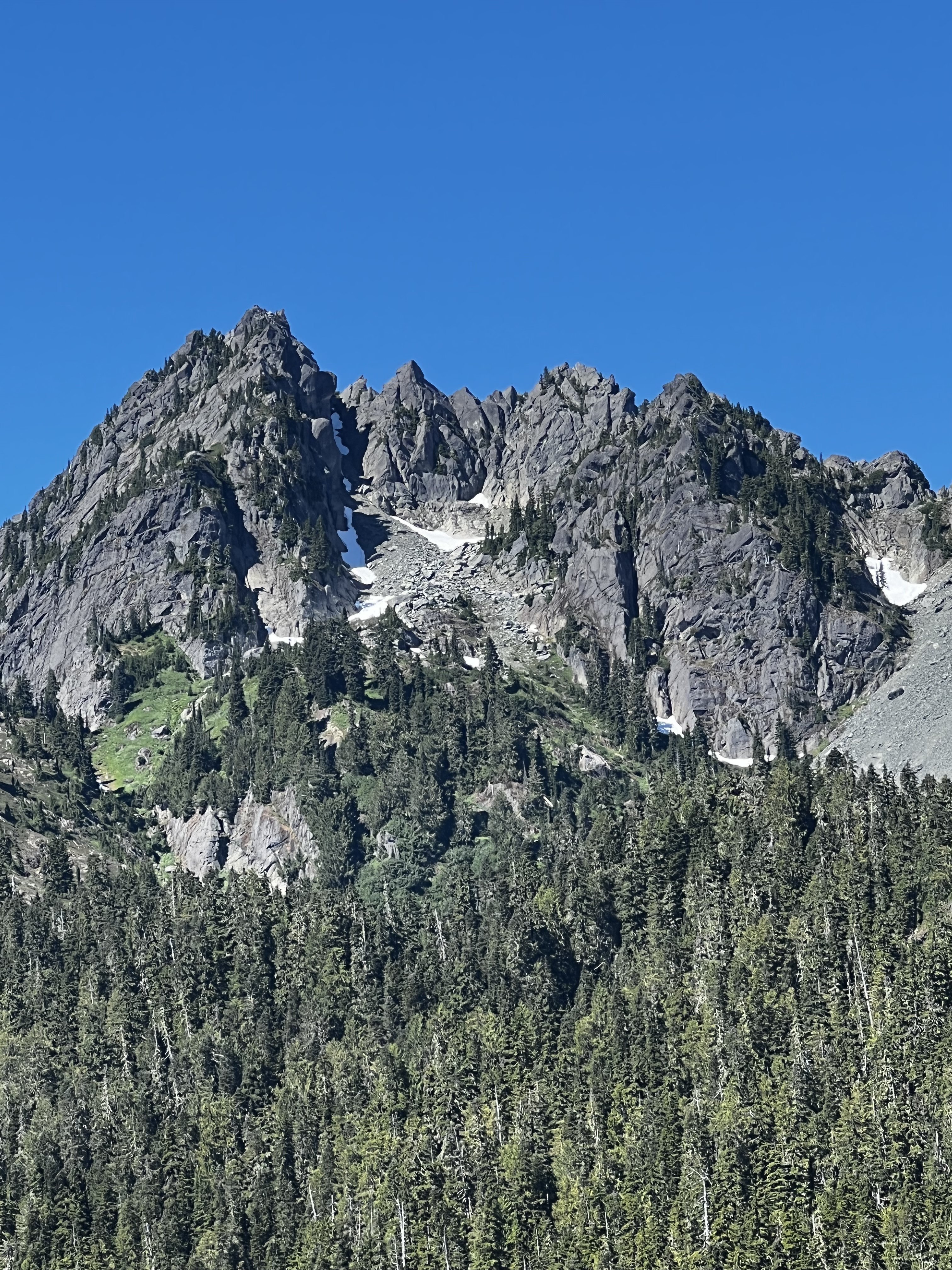
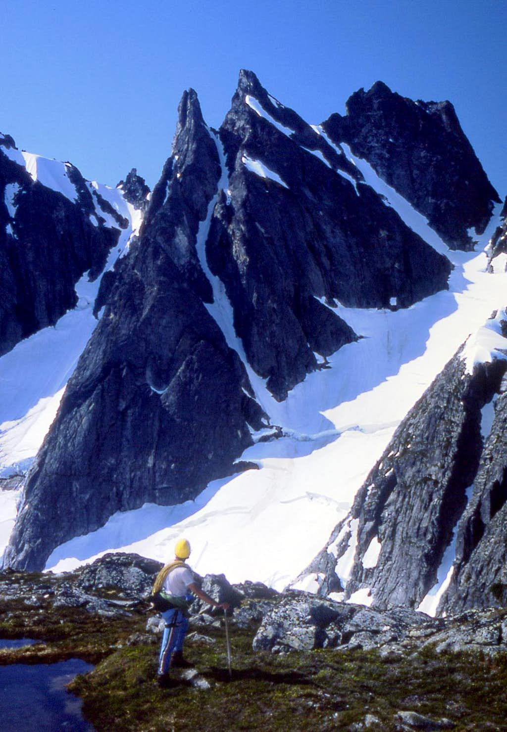
Trip: Crescent Creek Spires, Southern Picket Range - East Twin Needle - North Buttress 5.9 D+ 2,000’ Trip Date: 07/31/2022 Trip Report: Sam Boyce and I climbed the North Buttress (aka the Thread of Gneiss, as coined by John Roper), on July 31, 2022. The buttress rises 1,800 vertical feet and our route took 9 pitches, the majority of which were ~250’ due to simul-climbing–we estimate around 2,000’ feet of roped climbing. Some of you might be curious about this (probable FA) given there are no reported ascents, although a couple parties have reportedly tried. I had tried and failed on this line before, and it had really got under my skin. This time Sam and I started the line in a more sensible place, and it went smoothly. Here's some art by John Scurlock showing the E and W Twin Needles from the north. Our line begins lower right and works its way up the north buttress trending left, eventually squeaking by the sub-summit spire on its left to hit that highest left skyline: The lingering snowpack made the approach relatively easy, for the Pickets. From our camp near the Chopping Block, after traversing the snow, slabs, and talus of Crescent Cr basin, we cramponed up to Otto-Himmelhorn col. From there, the descent of the Mustard Glacier required only one single-rope rap from an established station ~150’ below the col. Gawking up at the very steep and intimidating looking summit spires, we figured that we would need a lot of time to reckon a way to summit. As a result, our route-finding choices generally favored efficiency, as we wanted to be as expedient as possible to save time for expected difficulties up high. As it turns out, our concerns were largely needless. We started climbing a little below the outlet of the gully splitting the E and W Twin Needles (aka, the Thread of Ice), gaining E Twin Needle on its right-hand side, not far up from the buttress toe. A pitch-plus of glacial-flour-covered mid-fifth was followed by a pitch-plus of nasty gully travel with some mid-fifth work-arounds, and that landed us at a notch above the first pillar/tower on the buttress. Future parties should take the rib to the left of the gully on pitch 2 for better climbing, and top out on the pillar—an approx. 20’ rap to the notch might be required, but this would be much better than the loose gully. Our start, from near the buttress’s toe: In the above pic, we gained the rock left of the gaping 'schrund, up to the brownish left-slanting gully, up that thing to the notch between the indistinct pillar and the next tower at the sun-shade line. (Again, likely better to stay on the rib to the left of the gully.) From there, Sam led through some blocky 5.7 terrain that backed off to more low-fifth scrambling. For pitch-plus 4, I continued on pleasant rock at low-fifth class, nearly to the top of another gendarme. For pitch-plus 5, Sam then easily gained the next notch and continued on some solid and fun 5.8 that relented to mid-fifth. For pitch 6, I led an airy 5.7 traverse left of another tower. This was one of the few pitches that did not stretch beyond a rope length. Going up and over this tower would probably be just as fun. Sam’s lead of pitch 7 was a long simul affair involving grassy ramps for about 400’ with difficulties up to 5.7. He finally pulled up to belay at a spot that gave us options for tackling the summit block. My lead of pitch 8 involved a chimney, a leftward-rising traverse of a face, and then working around and up an exposed and somewhat insecure arête to near the summit. This long pitch was the proverbial sting in the tail, requiring some careful and sometimes licheny 5.9 moves. Fun and spicy. (There were certainly more spicy options to gain the striking sub-summit, but we leave that for future parties and variations.) From my belay Sam scrambled to the summit, at perhaps 5.6. Descent: We descended the south face. From the summit, there is a short down climb to an established rap station with a fresh sling from the Wrights’ traverse a few years back. This was a full 30M rap that took us to Eye Col (the notch between E and W Twin Needles). From Eye Col we scrambled down the main south gully, exiting rightward when it got steep and traversing skier's right over 2 or 3 minor ridges to find easier terrain to down climb. After a bit of sandy 4th class, we identified a convenient point to rappel from (cord now in situ) that landed us back into the main gully with its (currently) hanging snowfield. This was a full 60M rap. After downclimbing and traversing right off the snow, we found ourselves at a notch that splits the two main gullies described in the Beckey guide. We decided the gullies looked unpleasant and scrambled the ridge between the two, trending rightward as we went down–our route traversed above the skier’s right gully. This was straightforward 4th class. When the ridge got steeper near another notch we made another rap. This was another ~60M rap down lower angle terrain, which could probably be downclimbed somewhat reasonably with a couple steep steps. From here we continued downclimbing to the moat below the ridge. There was not a comfortable-looking transition to the snow so we rigged one more single-rope rap to clear the moat and get back onto the snowfields in Crescent Creek basin. Once in the basin, it was a quick romp back up to our camp at the Chopping Block col. A handful of pics: Sam on pitch 3, E Twin Needle's sub-summit spire lurking behind immediately left: Me on pitch 4, with the Eye of Sauron menacing behind: Here I'm following pitch 5, Fury and Luna background: For pitch 6, at this point I decided to head left for an airy traverse versus the up-and-over (that's W Twin on the right): Sam shot this pic of me on pitch 8, about to swing around to the exposed arete: A couple of Sam following, first the chimney, then on the arete, obviously having fun: Sam and I really enjoyed this climb. While Sam had impressively climbed three Pickets routes in under two weeks, for me it had been too long since I'd climbed alpine rock, and this was a much-needed alpine shot in the arm. Except for the uncharacteristically somewhat-heady last pitch, we'd recommend this as a "Pickets moderate". Parties comfortable with alpine 5.9 should take a ride on this climb. The Crescent Creek Spires from our camp; the Twin Needles are the pointy ones next to last on the left, and the upper gully snowfield that we rappelled and downclimbed as part of the descent (before veering looker's left on a ridge) is visible dropping down below Eye Col: Gear Notes: Double cams fingers to 1", single 2 and 3, supplemented by tri-cams and nuts. Double/twin 60M ropes. Approach Notes: Crescent Creek basin approach to Chopping Block col.
 2 points
 -
I got back from a repeat of the Ptarmigan after 19 years and it is pretty amazing the glacial recession in that time (2003 was a lean snow year and 2022 phat as well). Here are a couple examples: LeConte in 2003: LeConte in 2022: Chickamin Glacier in 2003: Chickamin Gl in 2022:
 1 point
 -
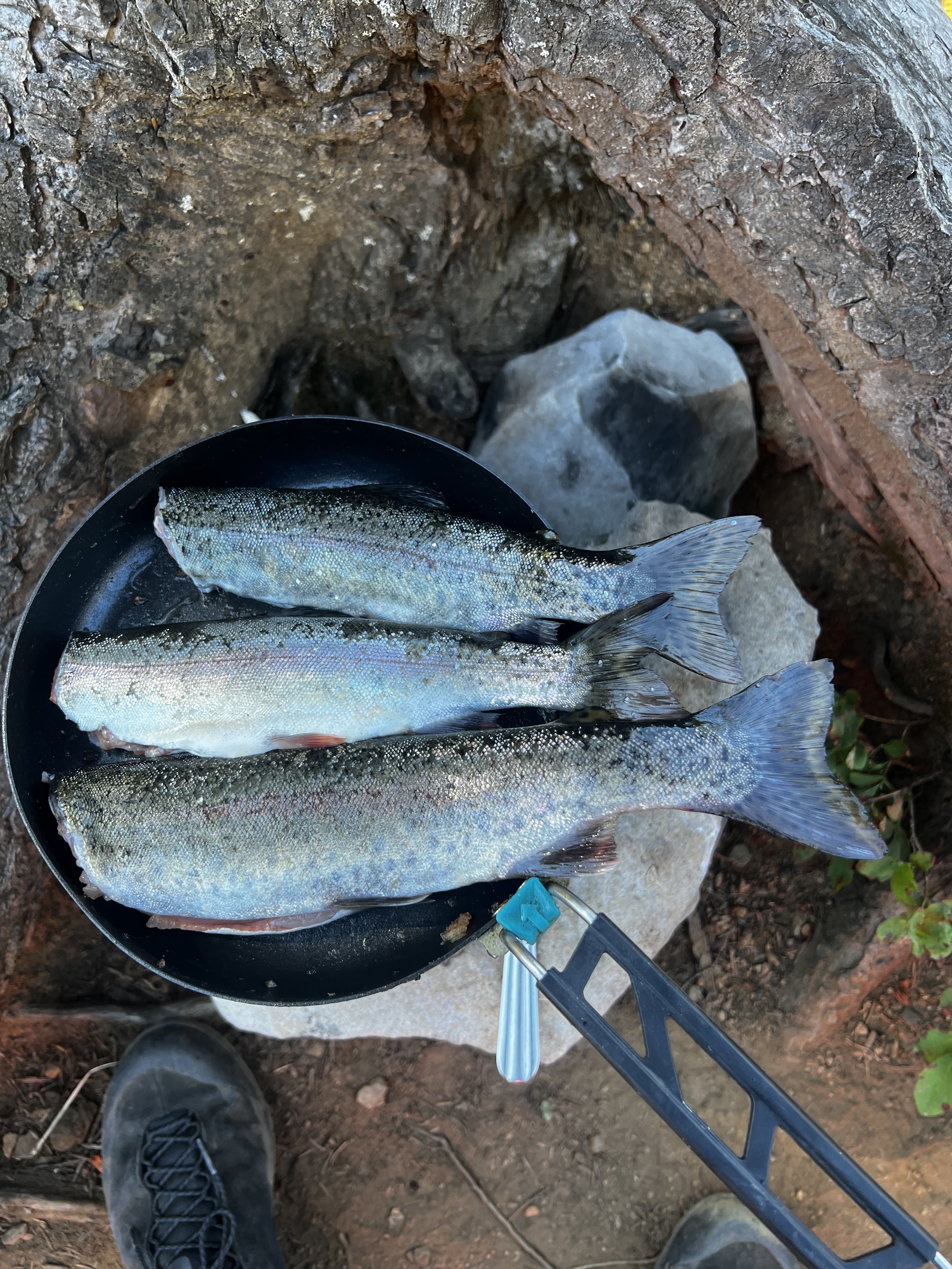
Didn't climb anything, but went up to Mildred Lakes to fish with my son and his friend, who are both in college...and of course Kiba came too. Actually, I hiked up there Friday night, fished Saturday, and then hiked down Saturday afternoon to meet them at the trailhead, and we hiked up that night and fished Sunday morning and then hiked out. The trail in is steep in parts, I've been going up fisherman paths in the Olympics all summer, but this one is stout in parts. All the hikes up were done in the dark, got up there Friday night at 11:30 pm, and with the boys we got to camp just after midnight. Good times. I saw a bear in a tree Friday night. The vistas on the way in gave me some great memories. The views of peaks in the area: Climbing Pershing with @OlympicMtnBoy Climbing Bretheron: Climbing Mt Stone with my friend Steve I think I've climbed Mt Stone at least 3-4 times. One of my favorite scrambles in the Olympics. Climbing Cruiser in "winter" with @Alpinfox the latter being a little laughable that we might think we were the first to get up there in winter, but hey, it was fun non-the-less. I never said I was the sharpest tool and if you know Pax you know he ain't either . See the entry about Cruiser here...I just ordered this book, I have never read it! Lots of interesting info there. "The Bremerton Ski Cruisers" being the name source for Mt Cruiser is one tidbit I learned. I wonder how many times the couloir on the north east side of Lincoln has been skied? See it to the right of the main peak here?: Great success. Thanks for allowing me take my little trip down memory lane. It was a great time up there with the boys. Oh and very cool to see Mildred upper and middle lakes from @JonParker climb of Cruiser this past Friday....the first pic I can see our camp and fishing spot right there.
 1 point
 -
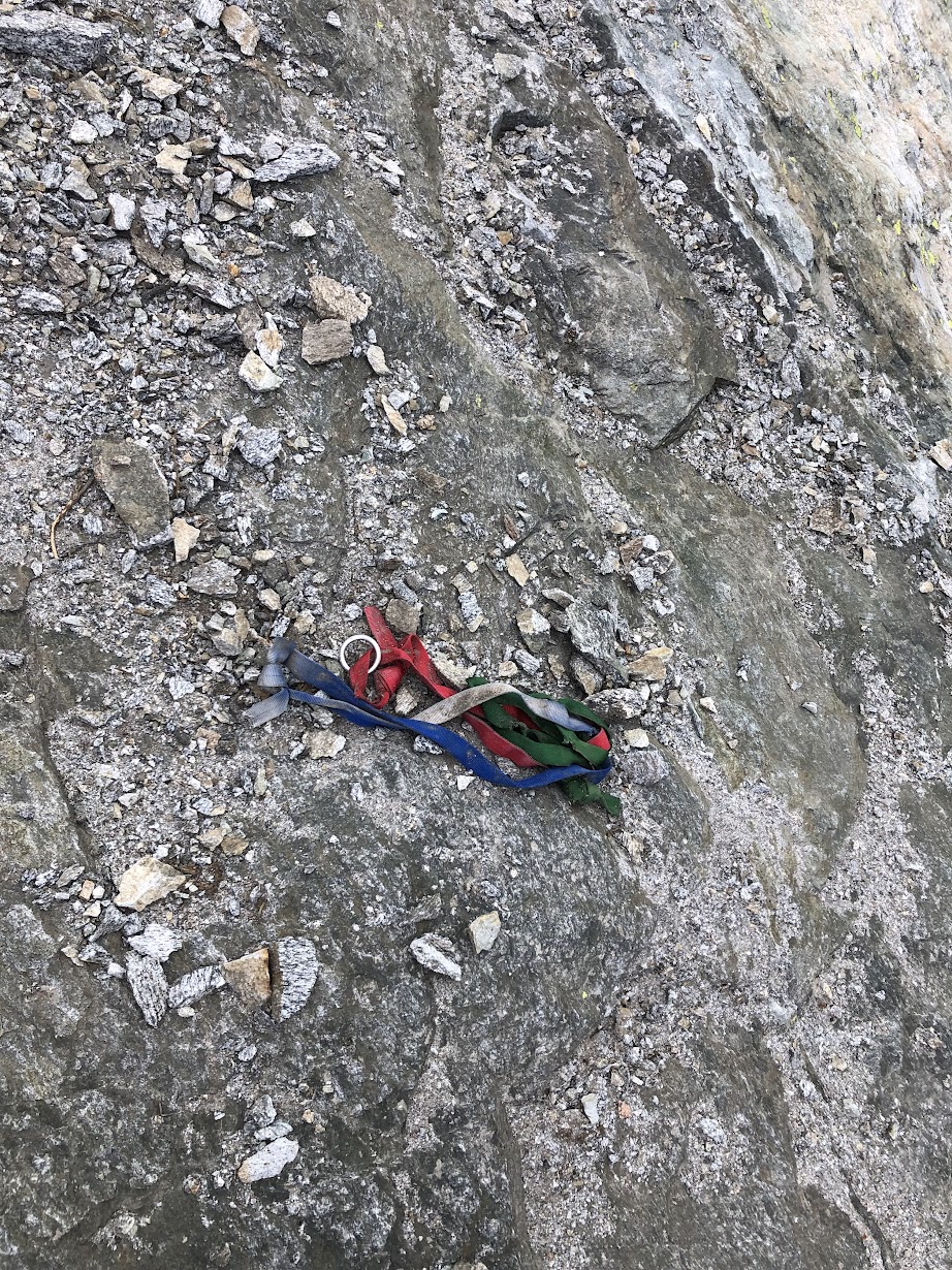
Trip: Corteo Peak (8080') - SW Ridge Trip Date: 08/06/2022 Trip Report: Corteo Peak (8080') – Rainy Pass Approach – August 6-7, 2022 (Sat, Sun) Another perfect weather weekend for climbing. Temp was right around 80 both days. I had limited time for a climb and this one fit the timeslot perfect. Saturday: I started from Rainy Pass at 6:30pm. I headed up Trail 740 to Heather Pass. I crossed over Heather Pass on my way to Lewis Lake. The boulder field crossing on the way to Lewis Lake was somewhat unstable with fresh looking debris. Looks like a large rock slide came down through the area some time this year. I arrived at a level area above Lewis Lake at 8:45pm and setup camp. Sunday: I was up and moving at 6:15am. I headed for the moraine ridge above Lewis Glacier. I headed up and to the left for the 7500’ notch to the West Basin. I reached the crossover notch at 8:15am and headed down the gully. I reach the Southwest Ridge Notch (7400’) at 9:15am. The ridge from there on up was nice Class 3-4 rock. Some loose sections but overall pretty solid. I reached the summit at 10:00 am. I cut out an old tattered, sun bleached, rappel sling that was begging for a fatality and then headed back to camp. I made it back to camp at 12:45pm. I was back at Heather Pass at 2:30pm and back to Rainy Pass at 3:30pm. This was a fun climb with some exposed class 3-4 rock on the ridge. Not too much climbing, not too much distance. I’d say the hardest part was the 400’ gully down into the West Basin. I decided to try out a homemade bug repellant made with several supposedly bug repelling essential oils on this trip. I applied some at the start but the mosquitoes didn’t seem to care, I applied more and more thinking maybe I’m not using enough. I put a bunch of time into researching the bug repelling essential oils so I want to be sure. After being swarmed by mosquitoes for most of the trip, I finally decided that most of the supposed bug repelling essential oils don’t work worth a shit. I pulled out the 34% Deet Ultramarathon bug lotion and lathered it on. The mosquitoes wanted nothing to do with me after that, it was a night and day difference. The next test will be some Oil of Lemon Eucalyptus repellant with high PMD, if that doesn’t work, it will be Deet until the day I die. Some Tips and Notes: 1. There is a good supply of water at the lake and the steams going in and out. The only water once over the notch is down low in the West Basin or melting snow. 2. The bugs are out in force, bring serious bug repellant. 3. The gully down into the West Basin is fairly steep loose rock most of the way. I found it easier going up than down. 4. The boulder field crossing to Lewis Lake is less loose down low. 5. The trip can be done in one long day going light, but the camping in the area is nice. 6. The snow going up the Lewis Glacier and the snow in the West Basin was fine climbing up and down with just boots . A couple sections were firm enough for crampons. Travel Time for reference: Saturday: Trailhead to Lewis Lake Camp (6060’) – 2:15 hours. Sunday: Camp to Summit to Camp to Trailhead – 9:15 hours. Total Mileage: around 12-14 miles Total Elevation Gain: around 4800’ Gear used: Trekking Poles, Ice Axe, Helmet. Not a lot of people at the start. View across the boulder field to Lewis Lake and Black Peak. 7500' Crossover Notch to the West Basin. Looking back across the West Basin and the Crossover Gully from the SW Ridge Notch (7400'). Looking down the SW Ridge from the Summit. View along the SW Ridge, Goode & Logan in the distance. Gear Notes: Trekking Poles, Ice Axe, Helmet. Crampons could be used in a couple sections. Approach Notes: Rainy Pass to Trail 740 to Heather Pass to Lewis Lake1 point
-
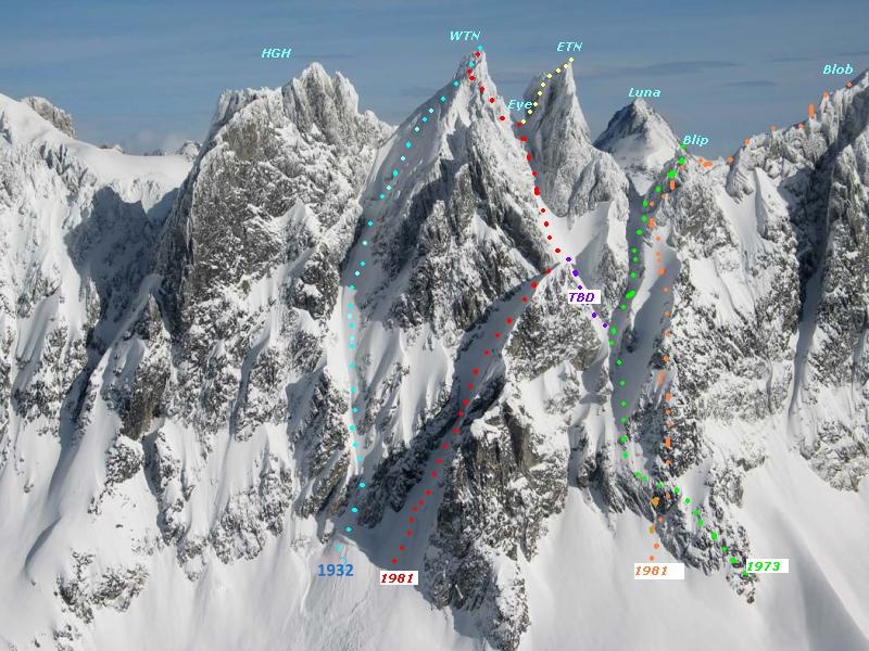
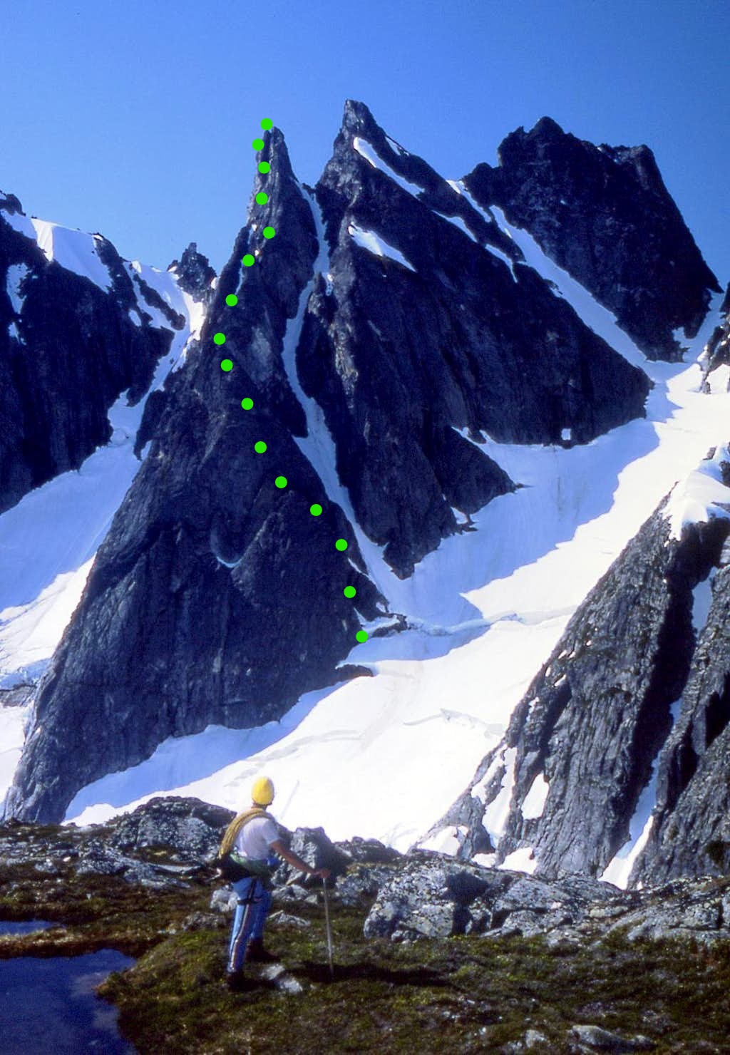
Good to hear from y'all. Yes, I'd say the rock on the route is above average for Skagit alpine, and is one of a few of my FAs that I'd actually recommend to friends. Judging by recent inquiries, might see a repeat as early as this season (?!). Fun to see what seems like above-average Pickets activity this season. geosean, if I recall correctly, it was like 4-4.5 hours to get on the rock, a hustling 6 hours on the climb to the summit, and ~5 for the descent and walk back to camp--with some liberal breaks post-summit. We began our approach an hour or so before dawn. Courtesy of John Roper, here's another perspective of the route, without and with our ascent in green added: And below is another John Scurlock shot of the southern aspects of Himmelgeisterhorn (HGH), West and East Twin Needles (WTN and ETN), etc., with routes annotated by John Roper, that might make the descent description more clear. After climbing up the other side, Sam and I descended from E Twin to Eye Col, then approximately the (red) 1981 route from Eye Col. The main difference: because the lower left hand gully had only intermittent snow and deep moats between, we instead down-climbed and rapped the adjacent ridge just above and right of the gully. (See descent description in original post for more detail.) There are more pics from the trip here: https://photos.app.goo.gl/8aqMQN9gohxrTr586
 1 point
 -
Quite the summer this is turning out to be for all you guys! It’s like the mid 2000s all over again!! It’s great to see “my work” become appreciate it after all these years. I had a feeling it would, I just didn’t think it would take this long. Just everybody stay away from that route I did On Logan, and we will all be OK!1 point
-
Trip: Mt baker - North Ridge Trip Date: 08/01/2022 Trip Report: This adventure started in the most likely place, Instagram. A guy named Remy, who had worked at the same climbing gym I currently work for sent me a message. My boss had heard from Remy that he was looking for partners that wanted to do a lot of climbing; My boss also knows that I am in the same boat. After some messaging back and forth we decided we would give the north ridge of baker a try! Most would say attempting a long and committing route with a new climbing partner would not be the best idea. Most of the time I would agree. The only reason I am able to make this exception was because of our mutual friend/boss. He has known both of us for a long time, with a good understanding of our experience and comfort level in the mountains. Remy and I planned for a full casual day of hiking up the road, up the trail, and to camp. Then a full alpine start climbing day. Then a full day to sleep and walk out. If the weather and company are equally as good this is my favorite way to approach bigger climbs like this. Making the large approach and distances more manageable physically and mentally. I find this is also how I rap my head around larger technical obstacles; Breaking them down into small chunks that I can easily understand and take one at a time. The small chunk mindset works super well until you need to have any amount of forethought about your objectives but for the purpose of giving me confidence that I have the ability to do larger and harder routes, this mindset helps a lot. Remy and I started out our approach day a little bit late putting the pressure on us to get to camp and get to sleep. Making it worse was the fact that I had forgotten my bike back home in a rush to get ready and out the door early. We put our minds together and decided that strapping the packs to the bike like a mule and both pushing that one bike would be faster than swapping out riding the single bike. This feat of engineering let us push up the hill to the trailhead in less than 2 hours. Putting us right back on schedule. We hoisted our packs and walked up the heliotrope ridge trail with excitement for our next day. After arriving at camp and getting our tent set up, I cooked my usual top ramen with a side of tuna (I am still getting better at backcountry cooking). We talked over at time plan and decided on a midnight start. Our alarms rang and it was time to boogie. I threw my boots on and racked up for the big day to come. We did some traversing to get up out onto the helio trope ridge and then out onto the Coleman glacier. The glacier was surprisingly simple and fast travel. Most of the cracks were completely exposed making them obvious and easy to avoid. Until higher on the mountain we did not find any unstable bridges. We hiked in a timely manner up to the toe of the north ridge. The beta that we had gotten from a month before was that gaining the toe of the ridge was out and traversing to lookers left around the ridge was needed. That turned out to be completely false for the conditions we found but existing in our own little headlamp bubble it was hard to tell that at the time. Moving around the toe of the ridge and accending found us just next to looker's left of the ridge for about a thousand feet. Looking up at the ice step and the steeper snow seemingly right above us we pulled out the rope length and prepared to siml. This was not the case. A little after the above picture was taken I arrived at a nearly 50ft wide crack that the GPS track we had, seemingly cruised right over. With the north ridge not gainable to us to the right and icefall to the left we decided to descend slightly and explore our options to the left. Past some broken blocks the glacier seemed to mellow out and provide access around the crack back to the north ridge. The above photo was taken after traversing around the large crack. beautifully broken glacier. Tomfoolery moving through the north face icefall This portion of the climb is something I am debating still in my head. We had no beta on the icefall we were making our way through. The bridges we were crossing were super solid but would they have been later in the day if we needed to descend? what would the icefall hazard be like after the sun heated everything up? Was I in over my head? I believe that the decisions we made were safe enough for the route and situation we were committed to. Remy and I on the way out discussed every decision we made in detail and the reasons behind them. This type of do-it-as-you-go climbing was new to both me and Remy and it was really fucking awesome. You can see in our GPS track we were finding the best crossings were farthest lookers left but we constantly were moving lookers right to see if there was a route back onto the ridge. Finally, after lots of large crack crossings and zig-zagging, we found an entrance to the north ridge around 600 ft below the ice step. A look at the upper north face icefall from below the ice step. Back on route finally. As we looked down the ridge in the light a clear bootpack and a RMI team moving up it made all the hard work we just put in seem meaningless. But was it? I feel like I had to engage more active decision-making, risk management, and route-finding skills much much more than I normally would have on a well-tracked route like the north ridge. I feel I grew as a climber as well as my personal ethic in the mountains. It was a freeing experience to decide to tread my own route and make it work. The ice step was in super good shape. A short section of pretty high-quality vertical ice then followed by another pitch of low-angle ice. This led to a knife edge ridge to the summit bergy which was a simple crossing with some steep snow to the top. The descent was very simple, just a trot down the Coleman Demming which was in very good shape. Back to camp at 2pm made it a 15-hour day including all the icefall buffoonery. Overall a super fun climb with a super cool person. I hope you enjoyed reading about an adventure and thanks for sticking around! Gear Notes: 6 Screws, 3 pickets (wish we had a few more screws) Approach Notes: Heliotrope (bring two bikes)1 point
-
Yes! Yet another great adventure wow. I’m almost completely out of ideas now! I am saving one idea though for myself and Mike Layton though. The “Golden Age of Cascades Climbing “ is still going on! Congratulations again you guys.1 point
-
Yes! Stared at that one and thought it probably more difficult. Strong work, team.1 point
-
That right-hand start looks much better than our attempted direct up the lower left. Congrats. Glad to see the French grades getting traction. Now if we also started using the Scottish ones in winter.....1 point
-
Trip: West Peak (7365') of the Anderson Massif - East Ridge Trip Date: 08/14/2021 Trip Report: West Peak (7365')– Dosewallips River Trail Approach – Aug 14-16, 2021 (Sat, Sun, Mon). I climbed West Peak (7365') of the Anderson Massif over the weekend. I started the climb from the Dosewallips River Trailhead outside Brinnon, WA. I planned for 3 days with a possible bonus summit of Mount Anderson if time and conditions permitted. I wanted to get the hell out of the smoke and breath some fresh air, mission accomplished. Saturday: I caught the 7:10am ferry at Edmonds over to Kingston. I started out from the trailhead at 9:30am. I brought a mountain bike for the first 6.5 miles to the ranger station and for the return trip. I made it to the ranger station at 10:45am. Anderson Pass was reached at 5:15pm. I headed up the Anderson Glacier Trail to camp at a small lake at the top of the trail arriving at 5:45pm. The trail along the way was beautiful with great camping options every hour or so. Mileage was 6.5 miles by bike , 11.5 miles to camp hiking. Sunday: I left camp at 6:15am heading for Flypaper Pass. I crossed over Flypaper Pass (6500’) at 8.50am. Flypaper Pass is almost entirely snow free right now. The route up to the pass is steep, loose rock the entire way. Crossing this pass with snow covering the steep loose rock would be the way to go, earlier in the season. If I wasn’t planning to climb Mount Anderson also, I would have climbed over to the basin below West Peak instead, much better looking terrain. Once at Flypaper Pass I decided to climb West Peak first. I headed down the Eel Glacier to the base of the SE Ridge of West Peak. I reached the North Notch at 11:15am (7000’). I headed up the East Ridge to the Summit arriving at 12:05pm. The route is Class 3 & 4 rock with some decent exposure. Loose rock sections throughout the ridge. I climbed Mount Constance a couple weeks ago, going the standard route, and this route up West Peak is more technically demanding. I was eyeballing the Mount Anderson route the whole way up and it was not looking good. The steep snow that leads to the summit ridge of Anderson is now melted out to the blue glacier ice almost the whole way up. I had aluminum crampons and a standard ice axe so I decided against an Anderson summit attempt with the current conditions. If I was to do Mount Anderson now, I would bring sharp steel crampons and two ice tools for that slope, possibly some protection against a slip; Maybe try a different route up all together, avoiding the glacier ice. I headed back to Flypaper pass from West Peak summit arriving at 2:45pm. Going down Flypaper Pass sucked way worse than going up. Very loose and steep the whole way down. 5:00pm I arrived back at the small lake camp, packed up and headed down for a lower camp. 7:15pm I arrived at Diamond Meadow camp for the evening. Monday: I left camp at 6:30am. I reached the ranger station at 9:15am. I headed down on the mountain bike reaching the Trailhead at 10:30am. This was a great trip in a beautiful area with lots of excellent camping options. Some Tips and Notes: 1. The trail to Anderson Pass is in excellent condition, easy travel & beautiful. The trail to Anderson Glacier is also nice but less traveled. 2. Water access for the whole trip was great with water as high up as 6700’ on summit day. 3. If planning to climb Mount Anderson via the standard route, be prepared for glacier ice climbing. 4. Flypaper Pass is snow free, steep, loose rock currently. I would recommend an alternate route. 5. The East Ridge of West Peak is exposed class 3-4 with sections of loose rock. 6. Bring a mountain or cyclocross bike for the first and last 6.5 miles, it will save you a lot of time. Travel Time for reference: Saturday: Car to Camp – 8.25 hours. Sunday: Camp to Summit to Camp#2 – 13 hours. Monday: Camp to Car – 4 hours Total Mileage: about 42 miles Total Elevation Gain: about 7100’ Gear used: Trekking Poles, Helmet, Ice Axe, Crampons. The trail in is really nice. Small lake camp at the top of the Anderson Glacier Trail. On the way to Flypaper Pass. Easy going until you reach the base of the pass. Rock at the base of Flypaper Pass, it is steeper than it looks. Loose class 3. Looking down the route traveled from Flypaper Pass. Looking across Eel Glacier from Flypaper Pass to the SE Ridge & East Ridge of West Peak. I went straight across to the snow finger at the base. Looking back across the Eel Glacier to Flypaper Pass from the SE Ridge of West Peak. Rock along the East Ridge of West Peak. Summit of West Peak from the false summit. Kind of spicy with a naughty runout. Summit view looking back at Anderson. Anderson route with lots of steep glacial ice. I'll stick with the expose rock ridge climb thanks. Looking back at the terrain traveled. I saw nobody summit day, I had the whole mountain to myself. Hard to believe with the amount of people at the trailhead. There are great camping spots all along the area surrounding the big lake. I haven't spent much time in the Olympics until this year, mostly because of all the red tape that is the usual for this area. With all the park service hiding from the Boogeyman Virus, you can experience the mountains the way they were meant to be, pure & free from bullshit. Gear Notes: Gear used: Trekking Poles, Helmet, Ice Axe, Crampons. If Climbing Anderson via the Eel Glacier Route bring sharp steel crampons and ice tools, you will be dealing with rock hard, steep glacial ice Approach Notes: Dosewallips River Trail Approach & Up the Anderson Glacier Trail.1 point


