Leaderboard


Popular Content
Showing content with the highest reputation on 07/04/22 in all areas
-
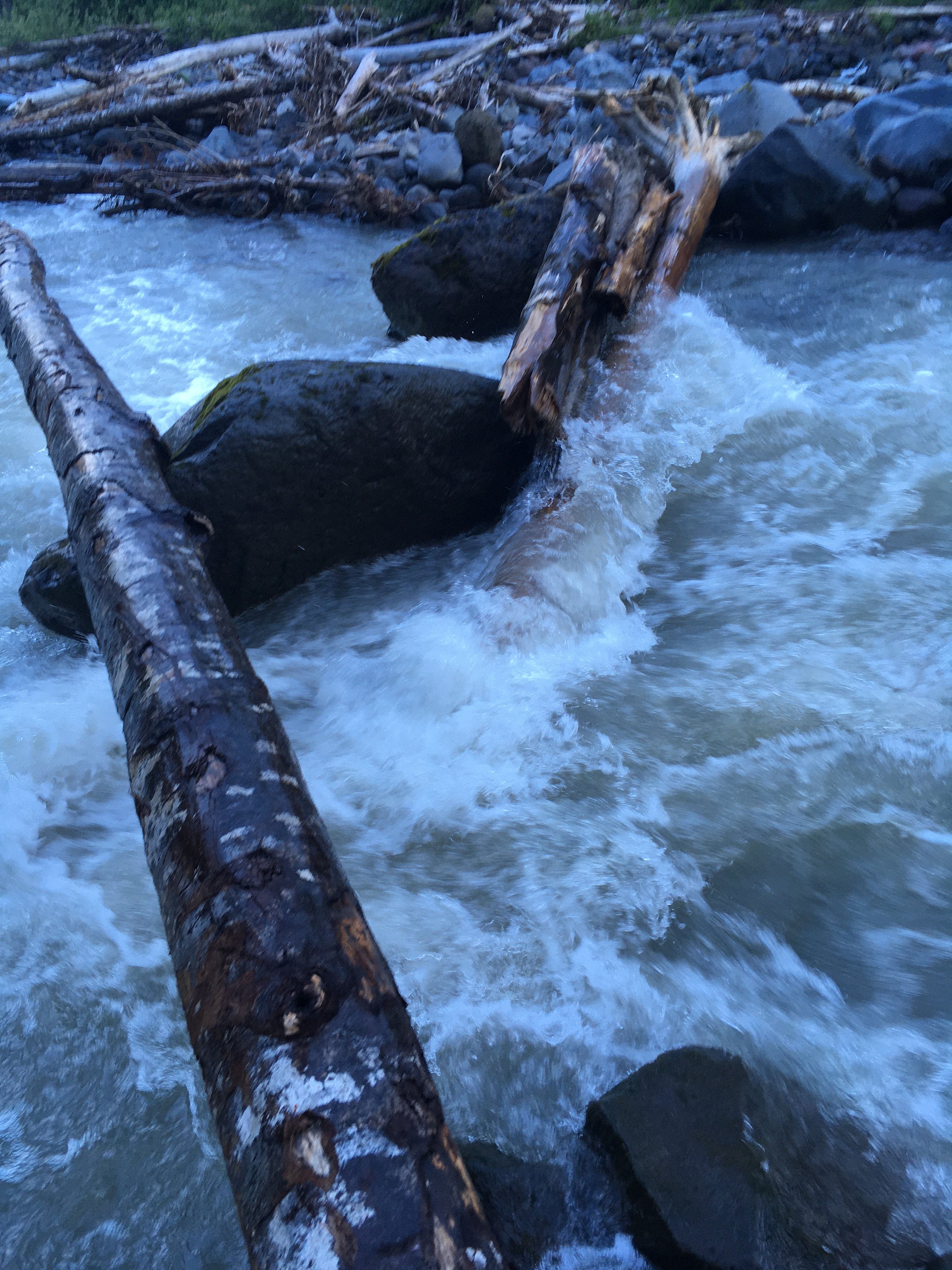
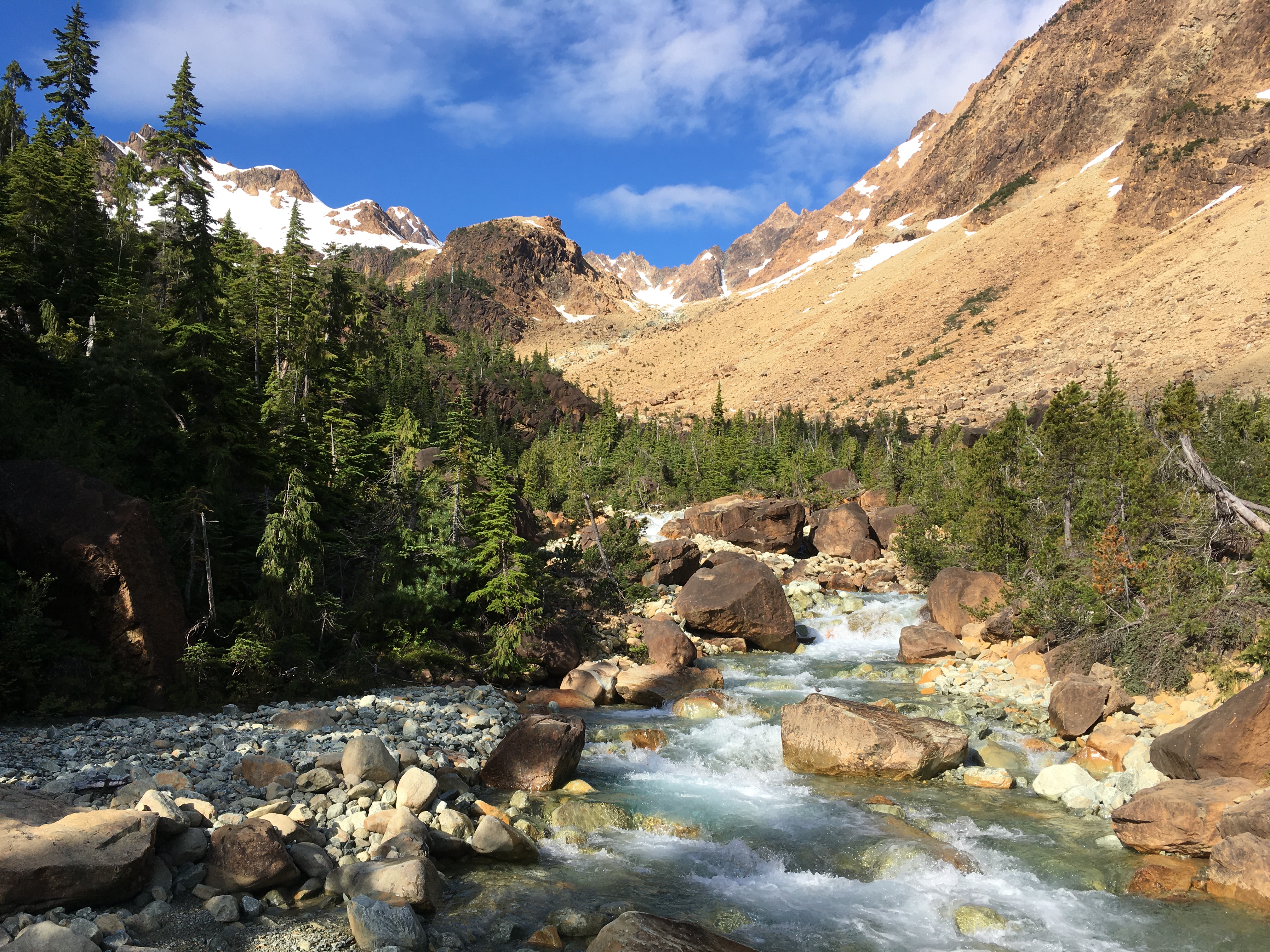
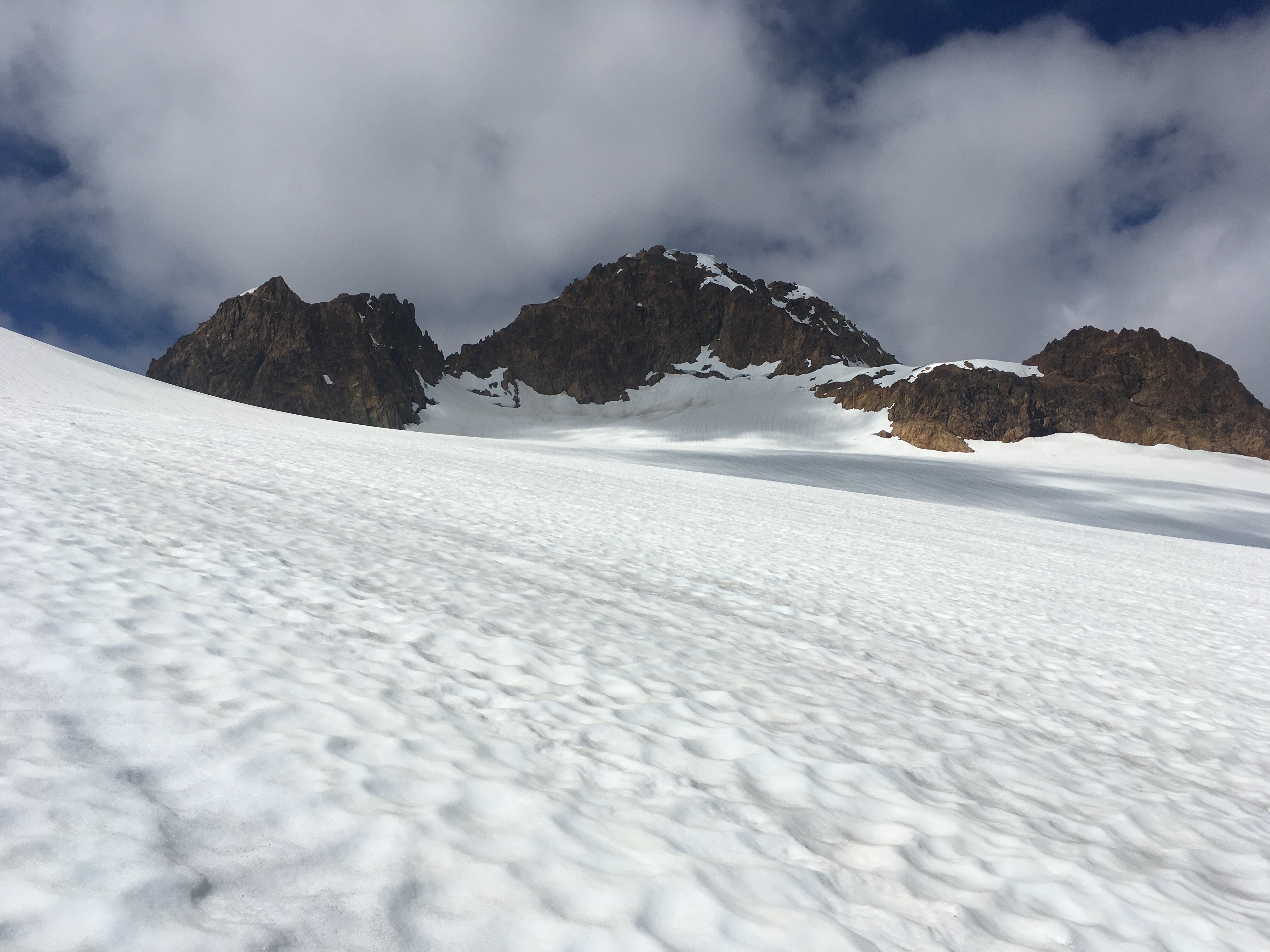
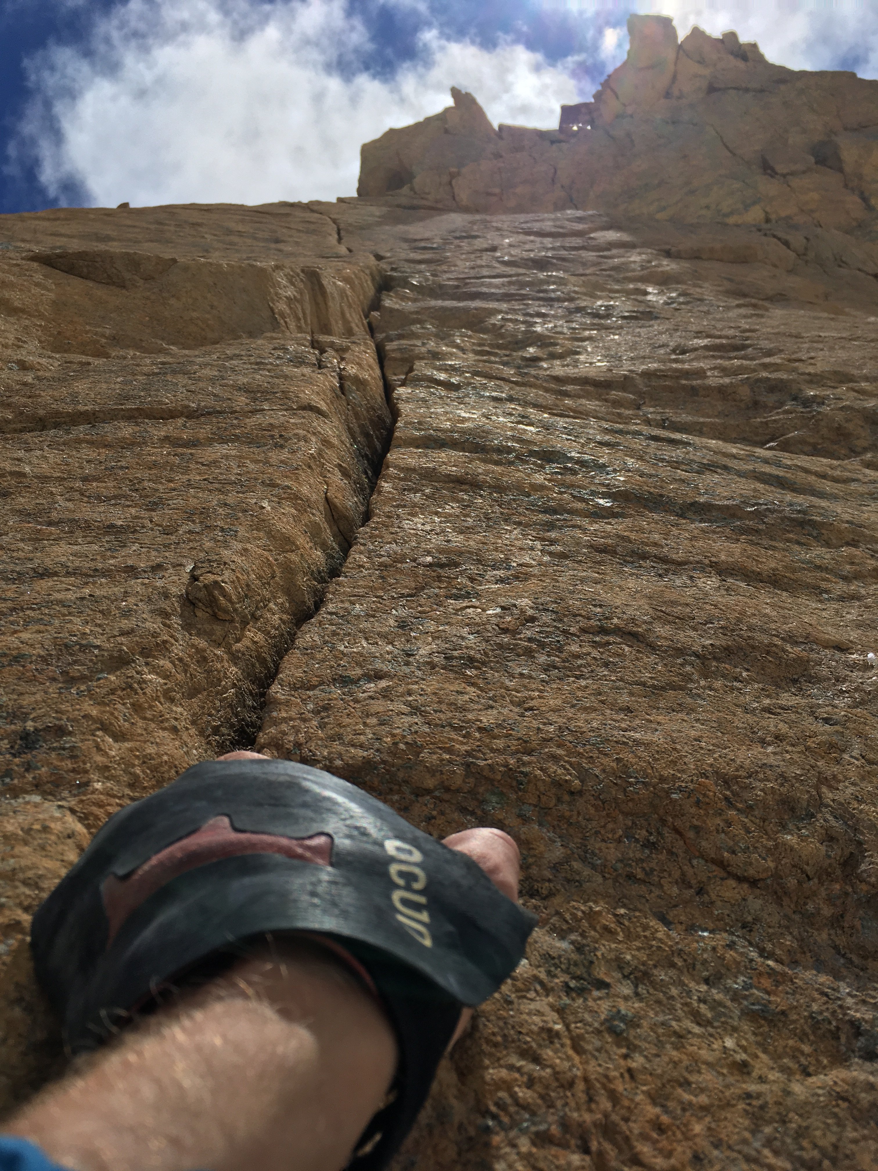
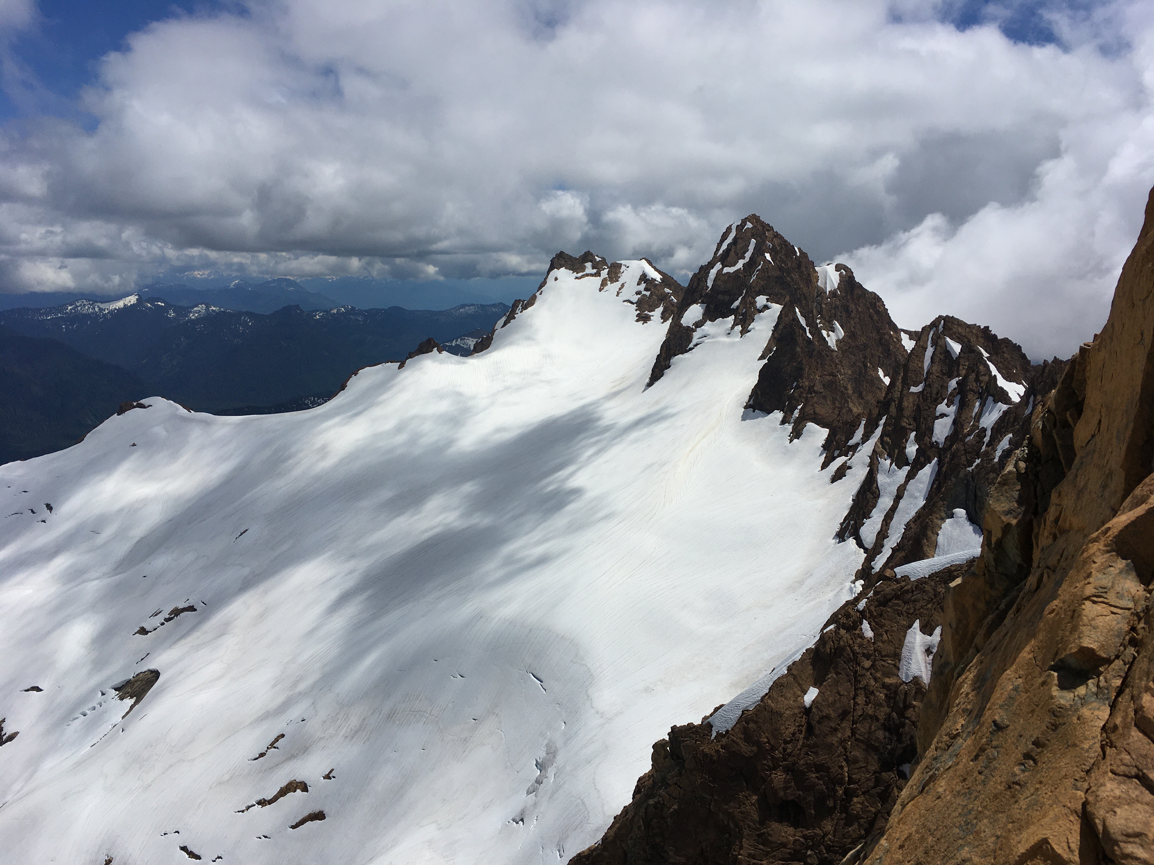
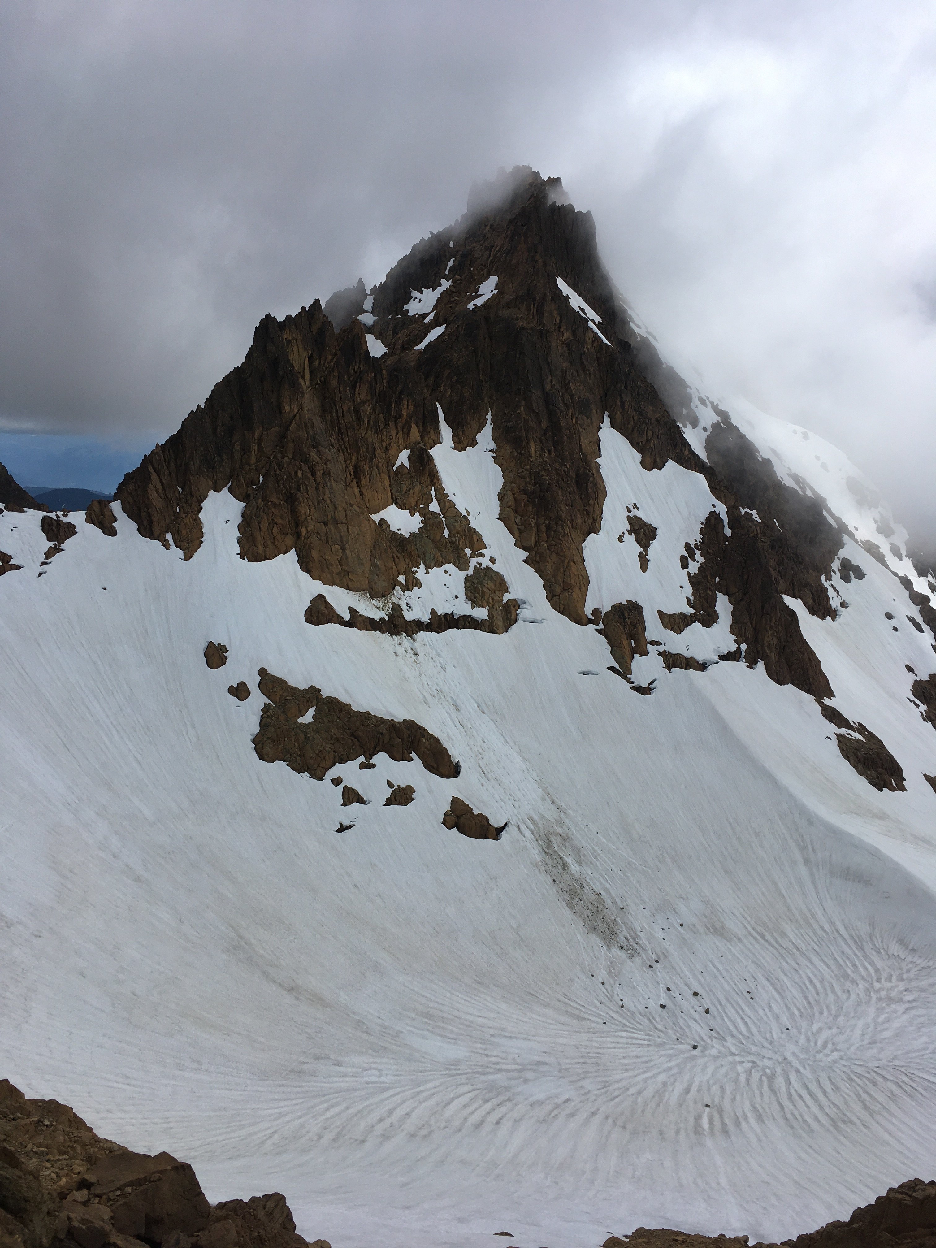
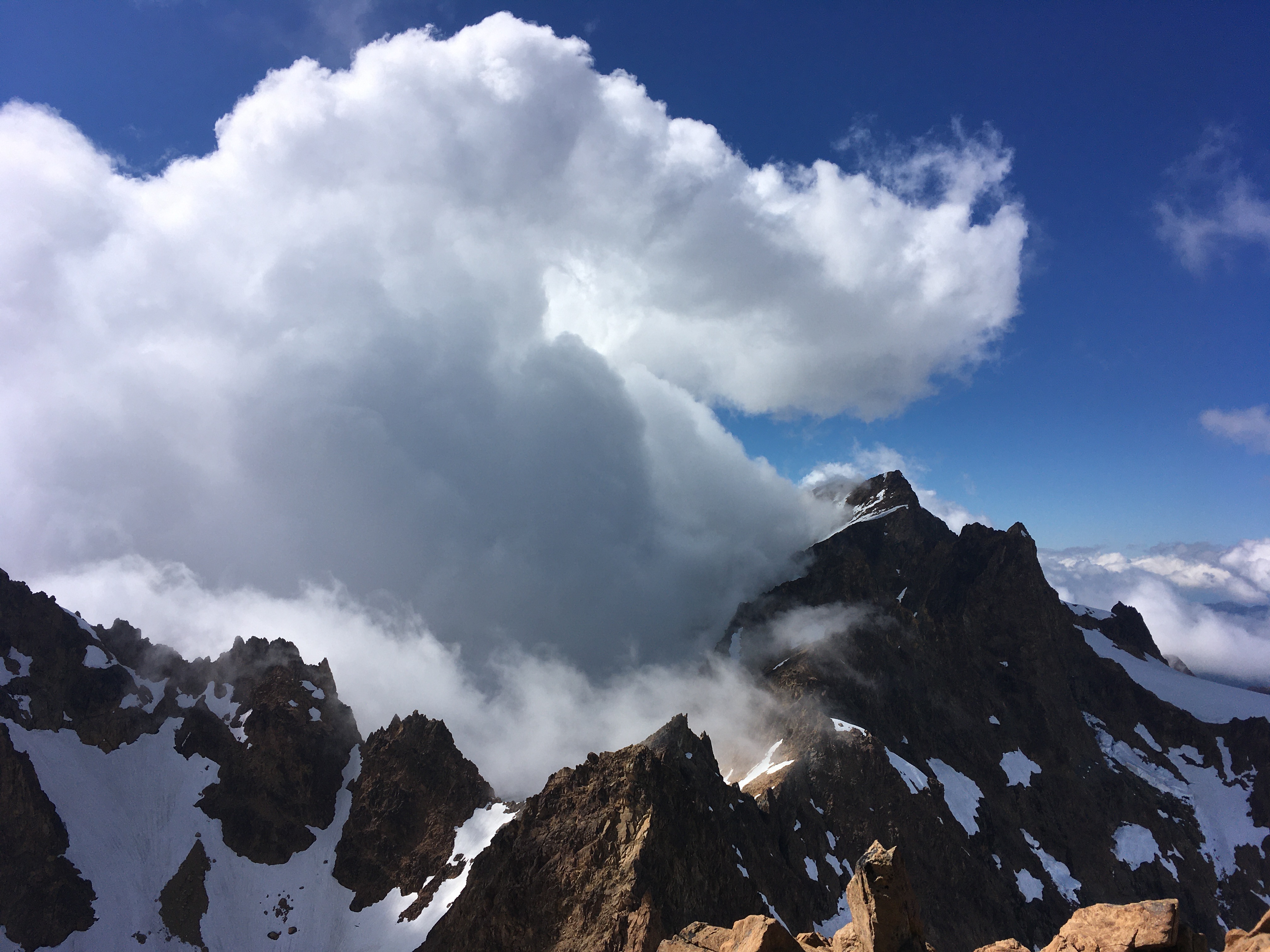
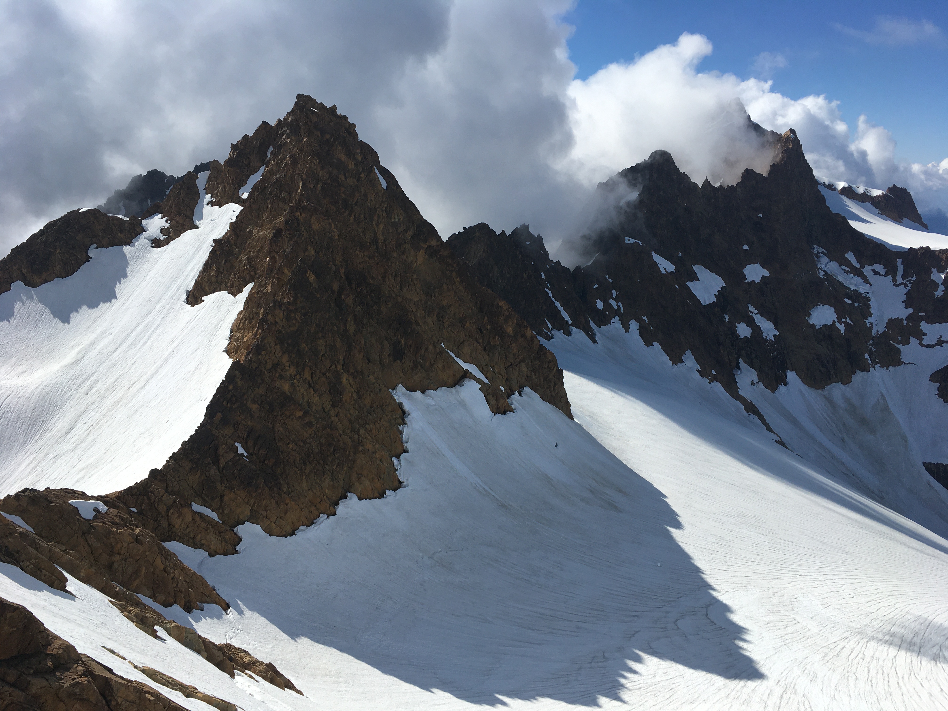
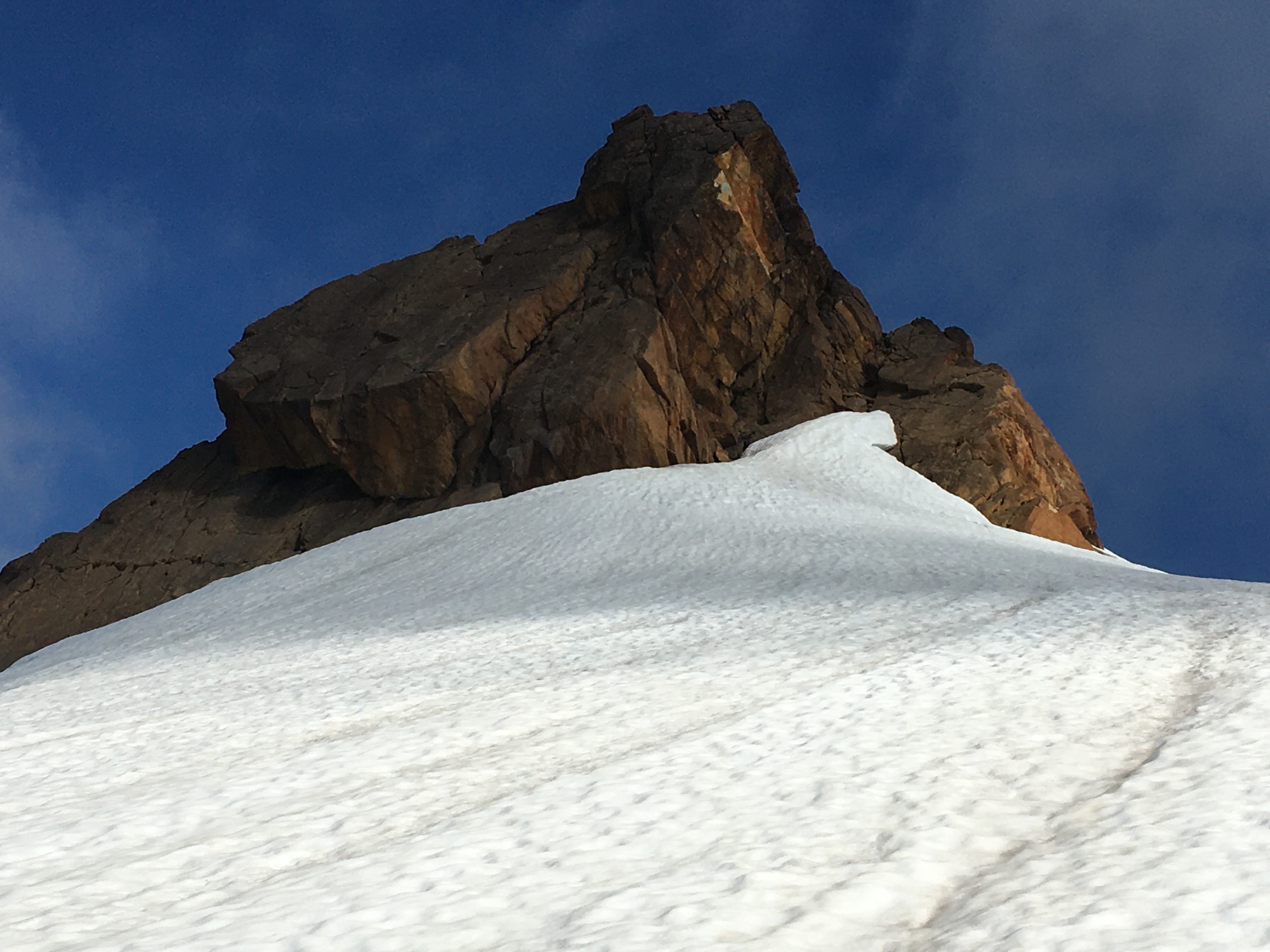
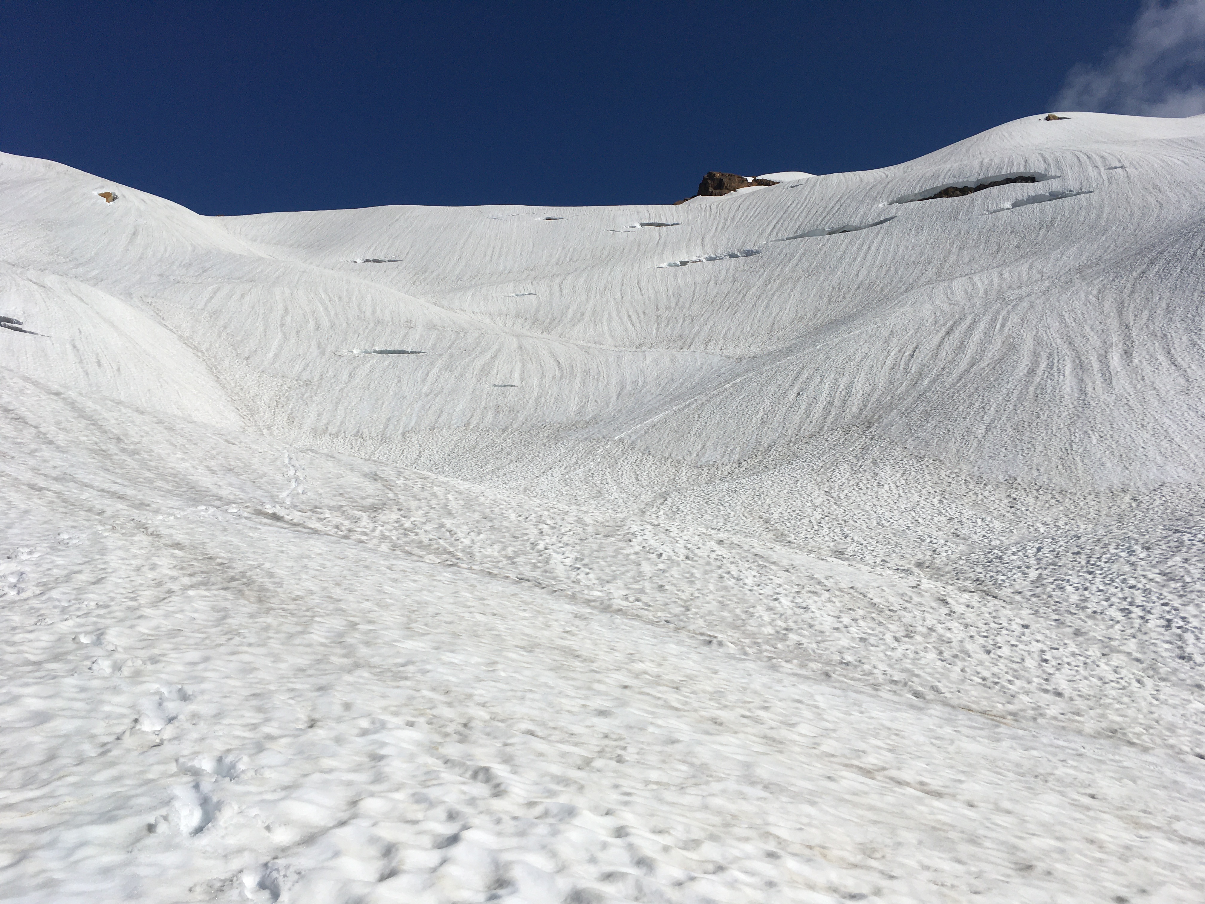
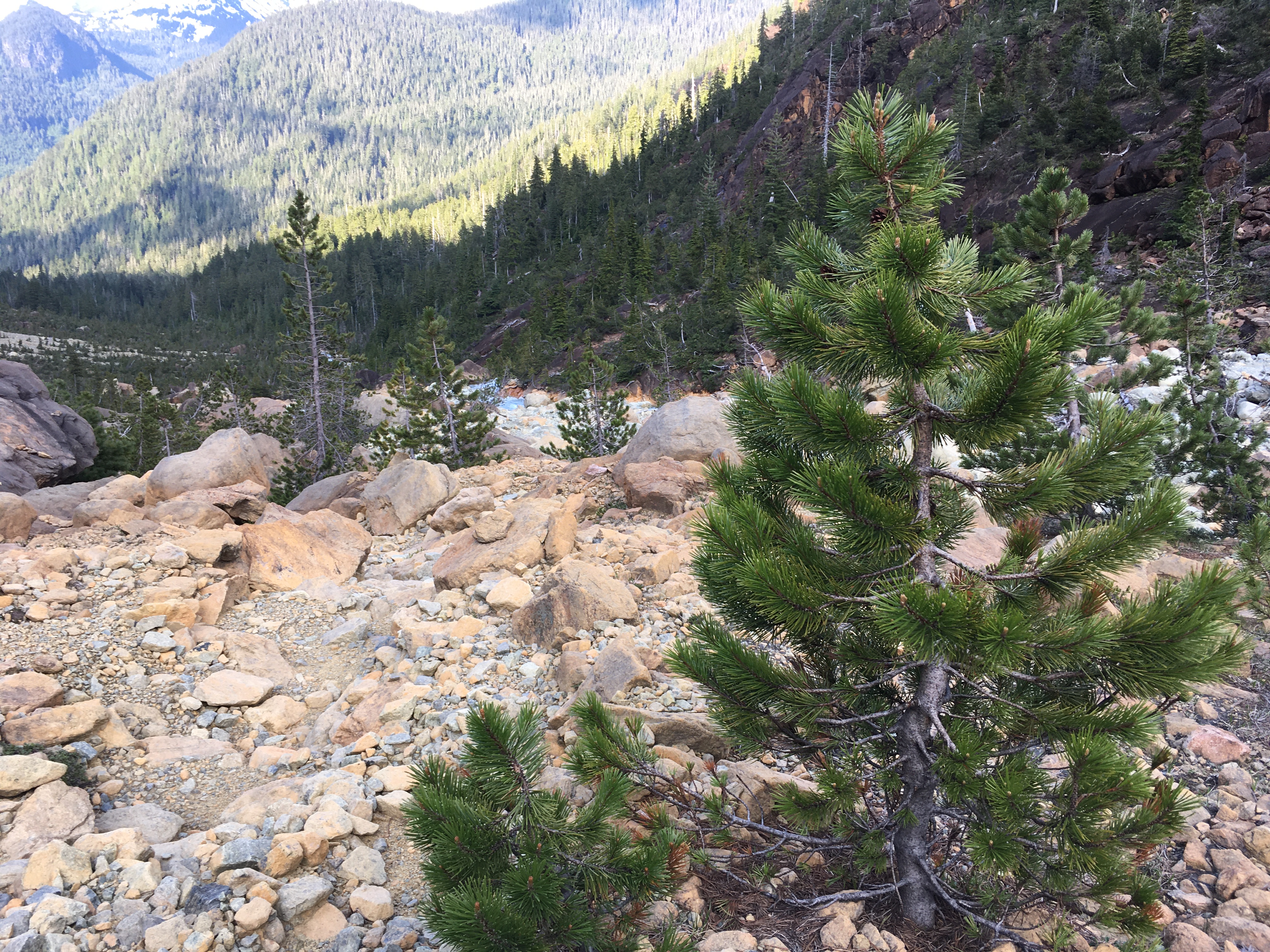
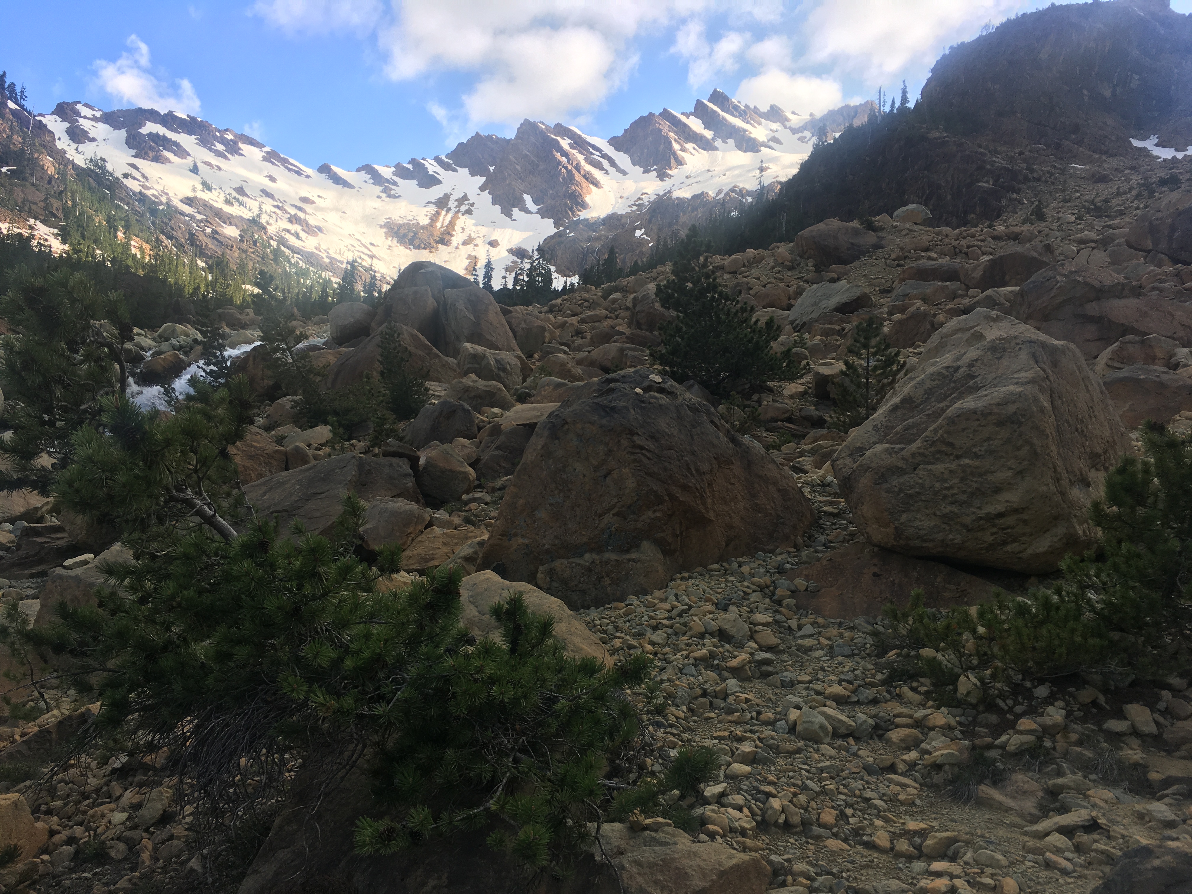
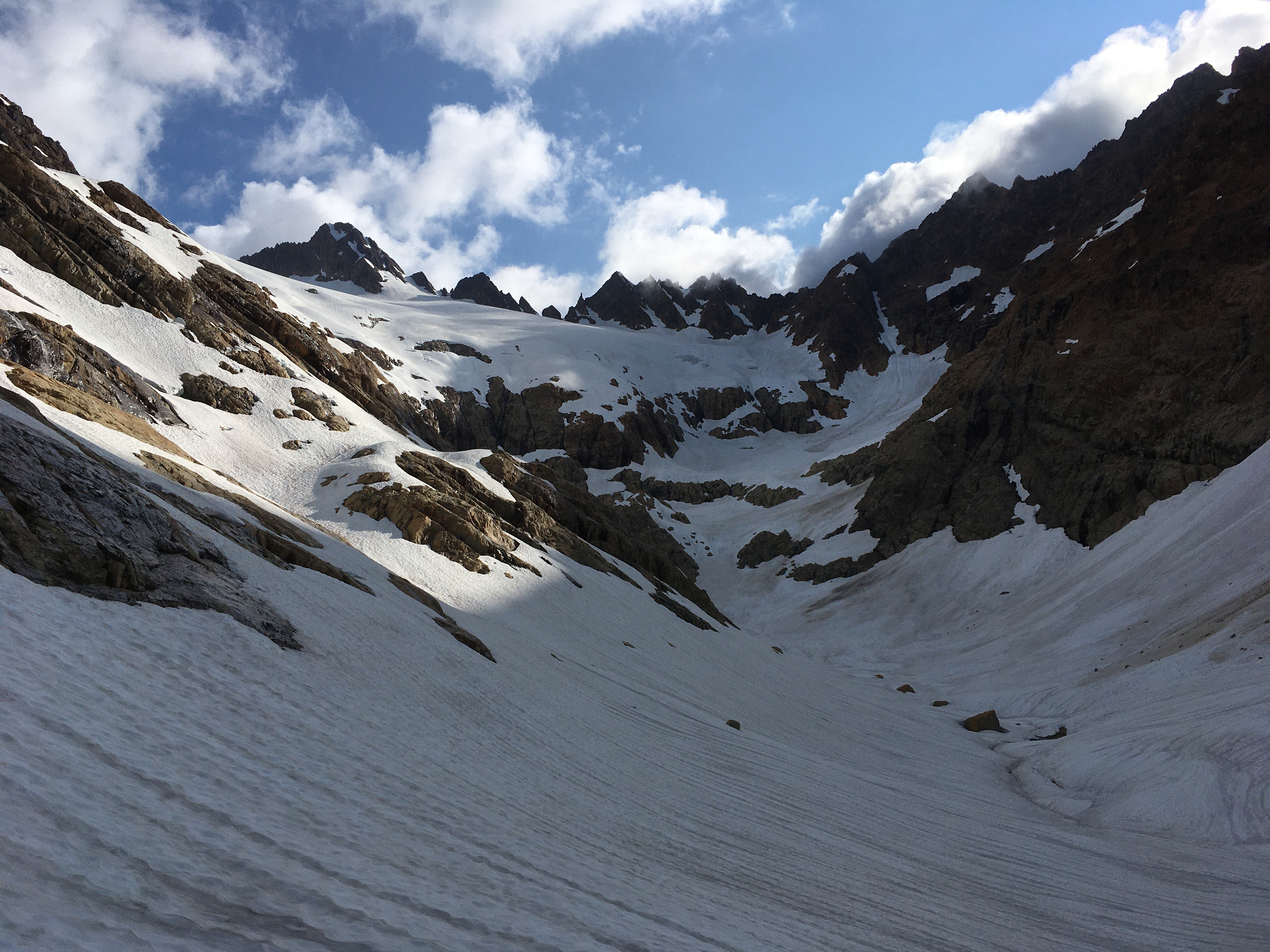
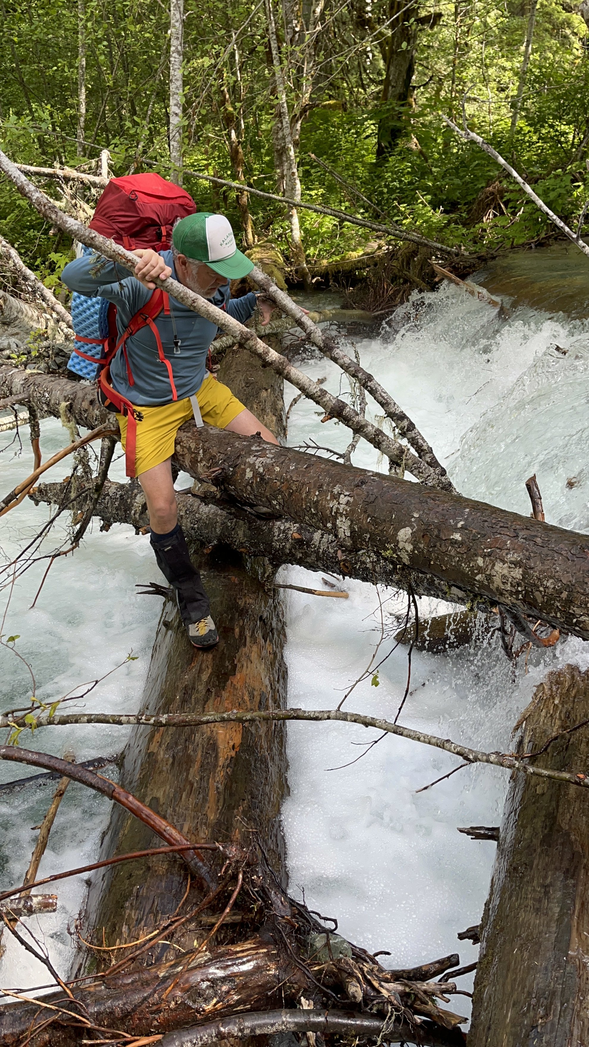
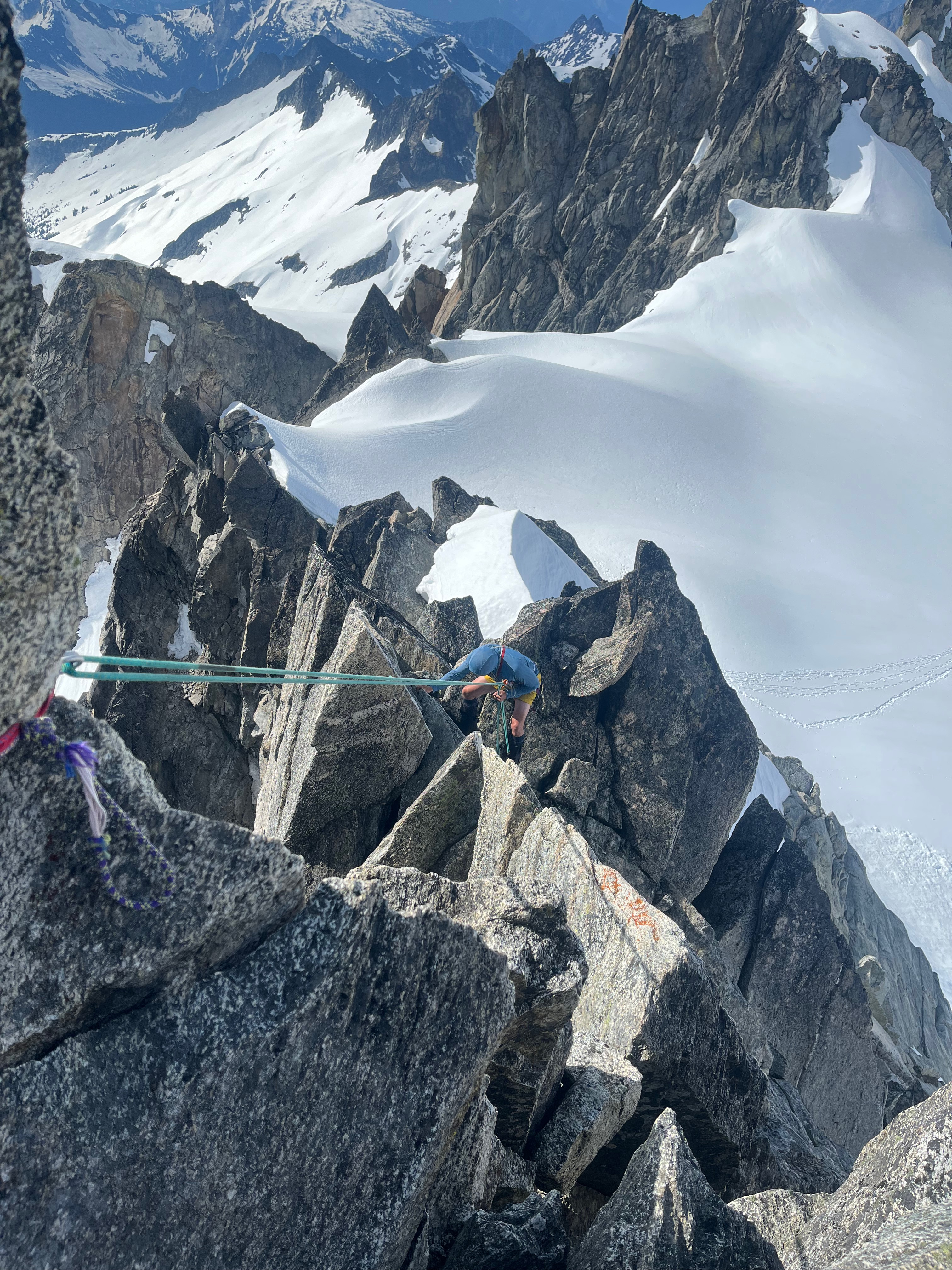
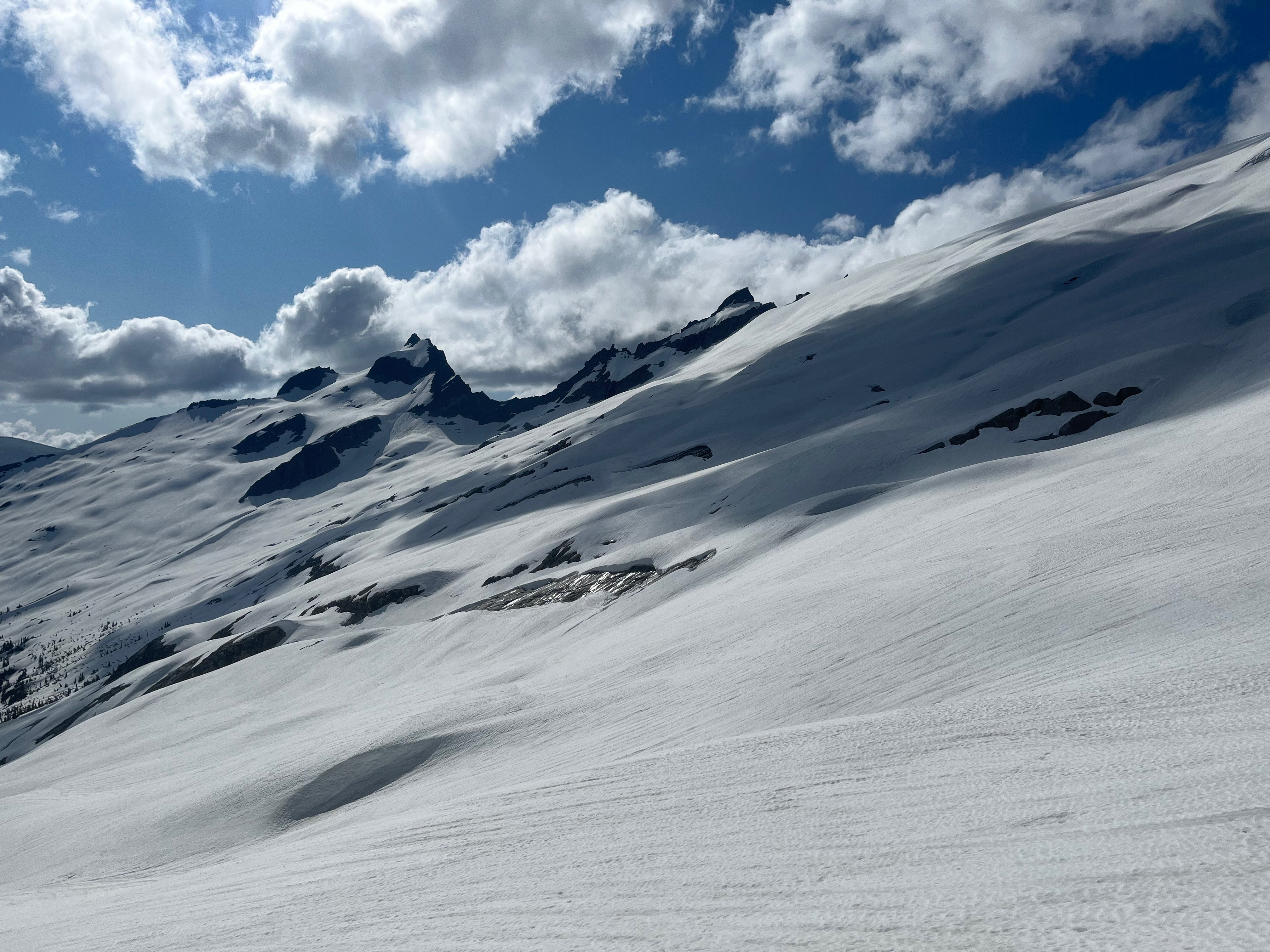
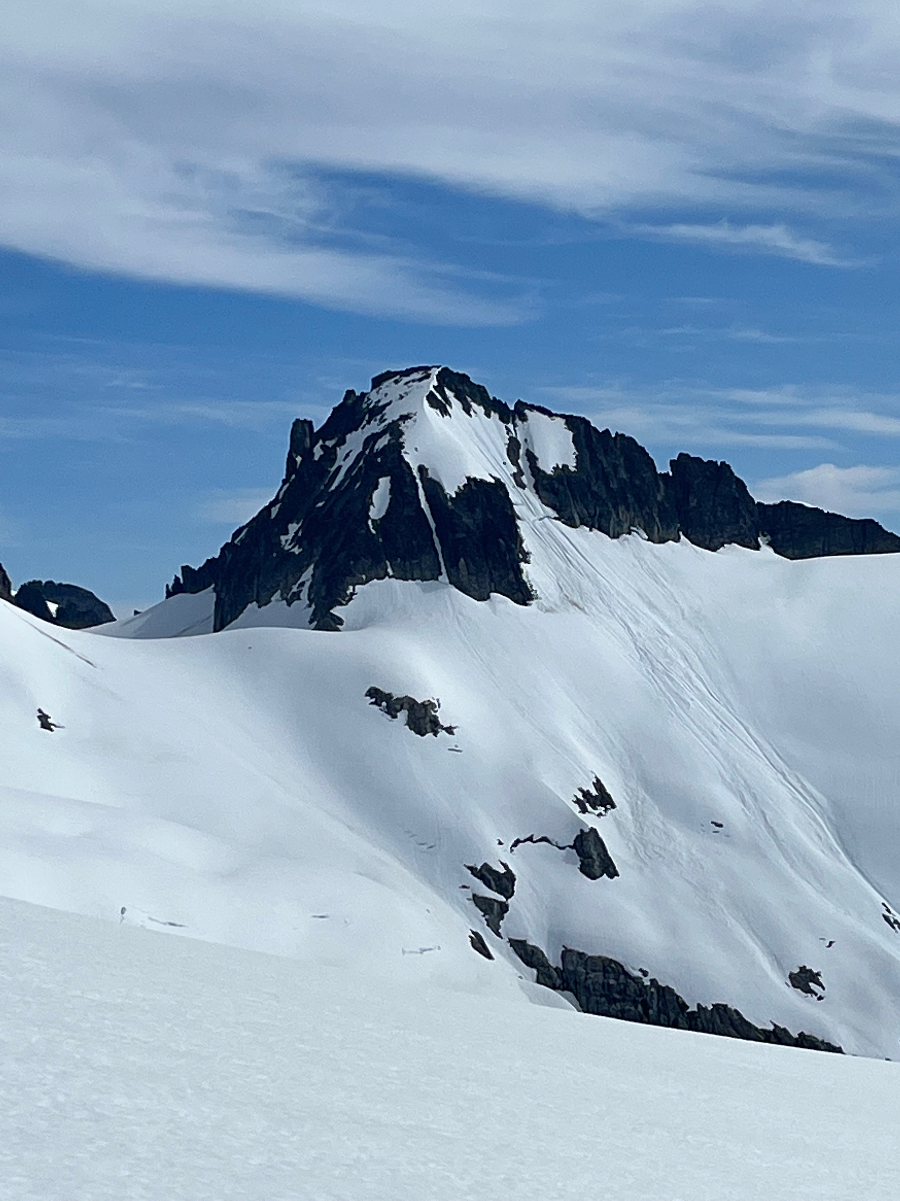
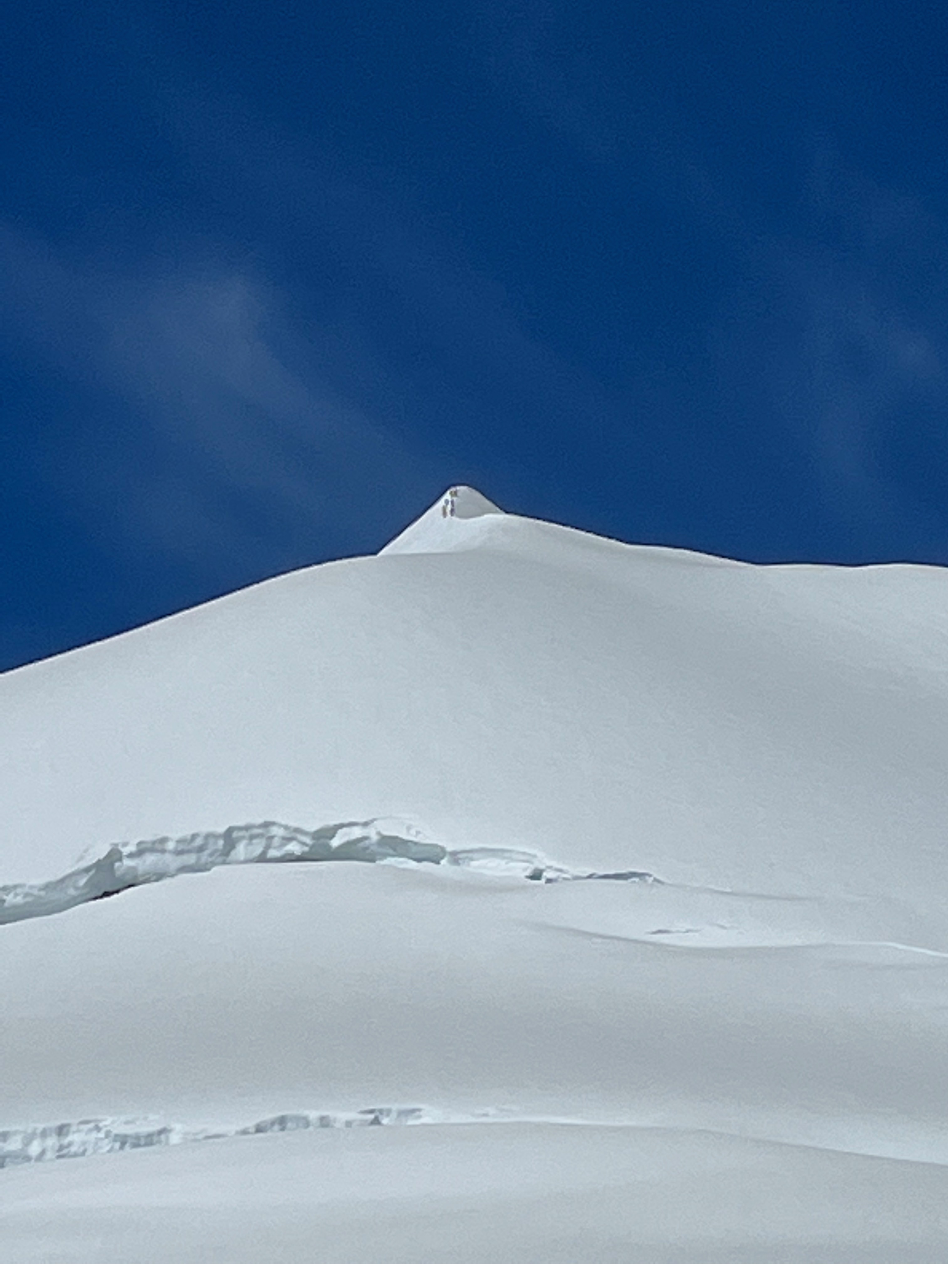
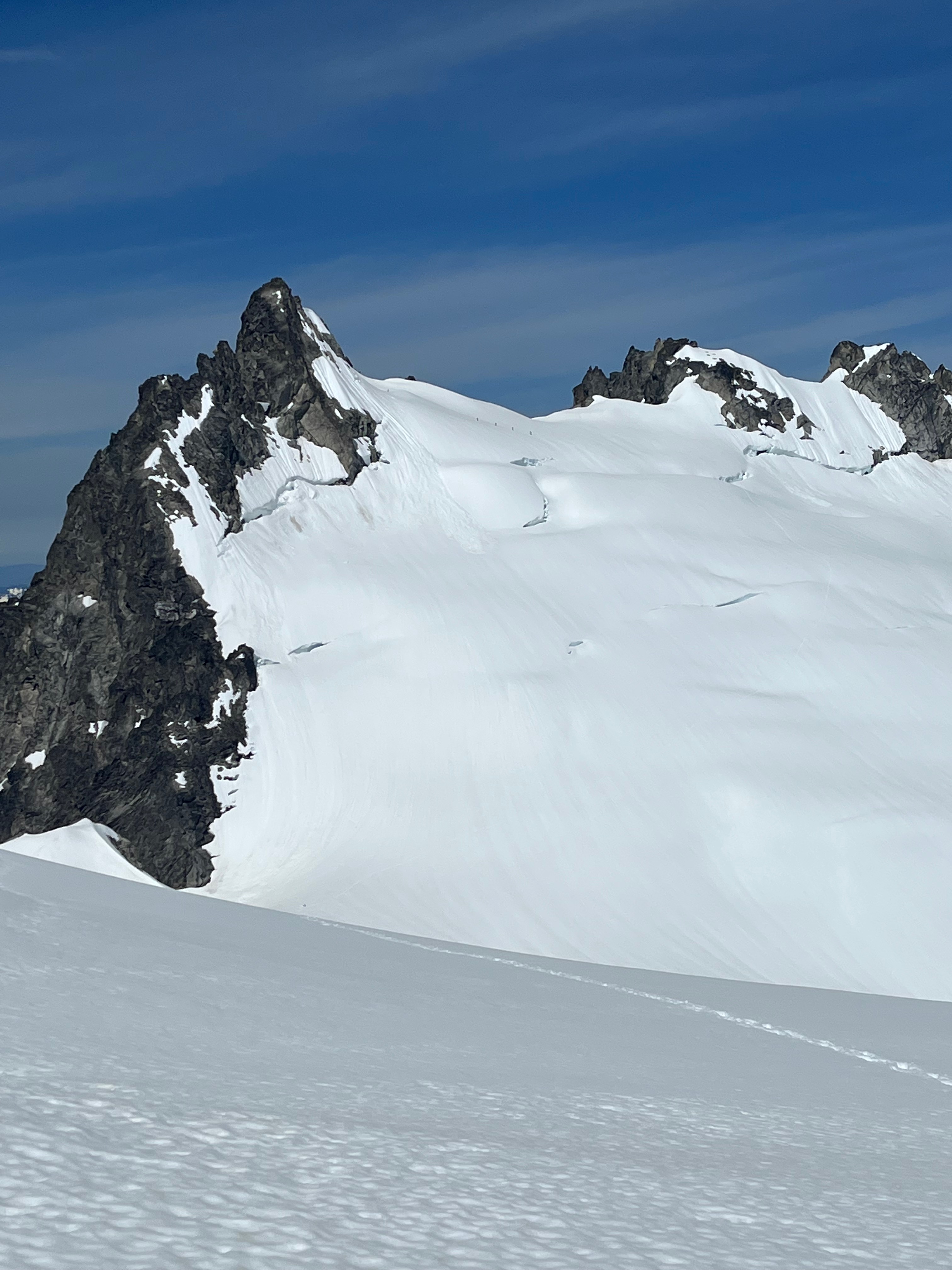
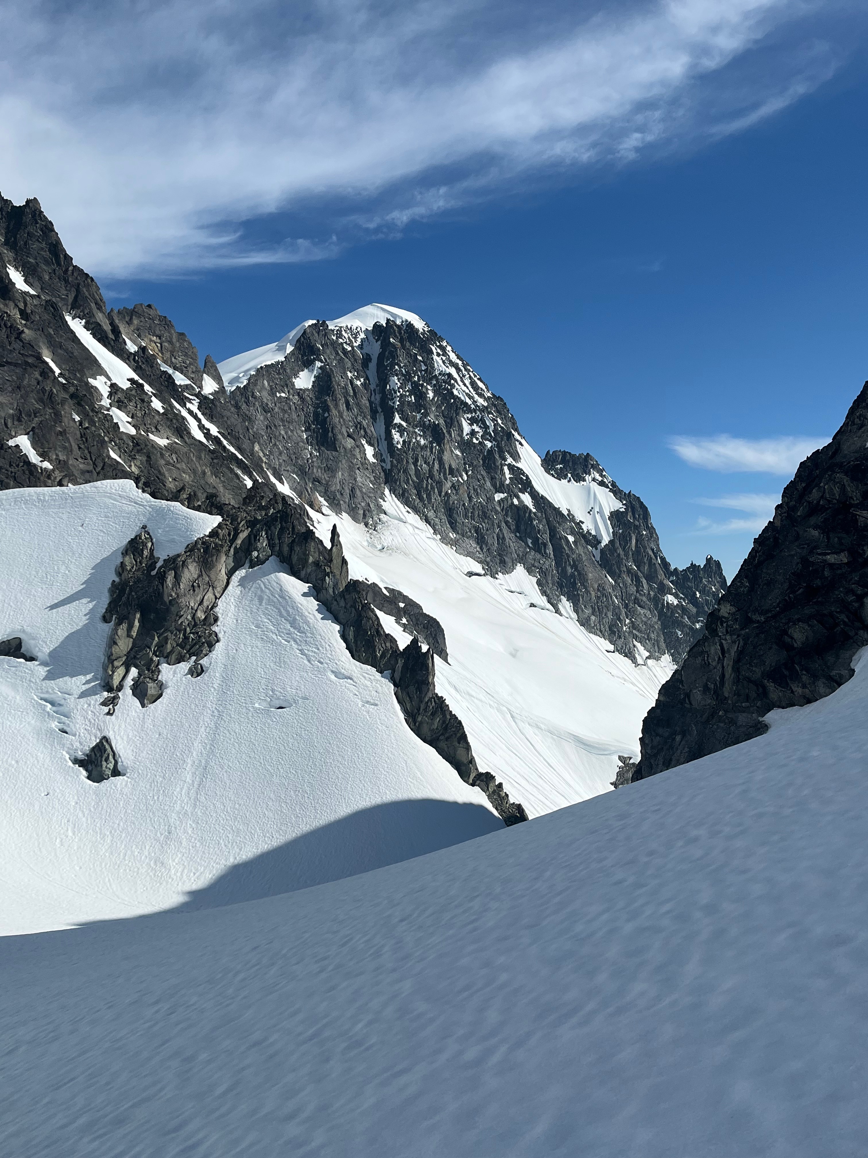
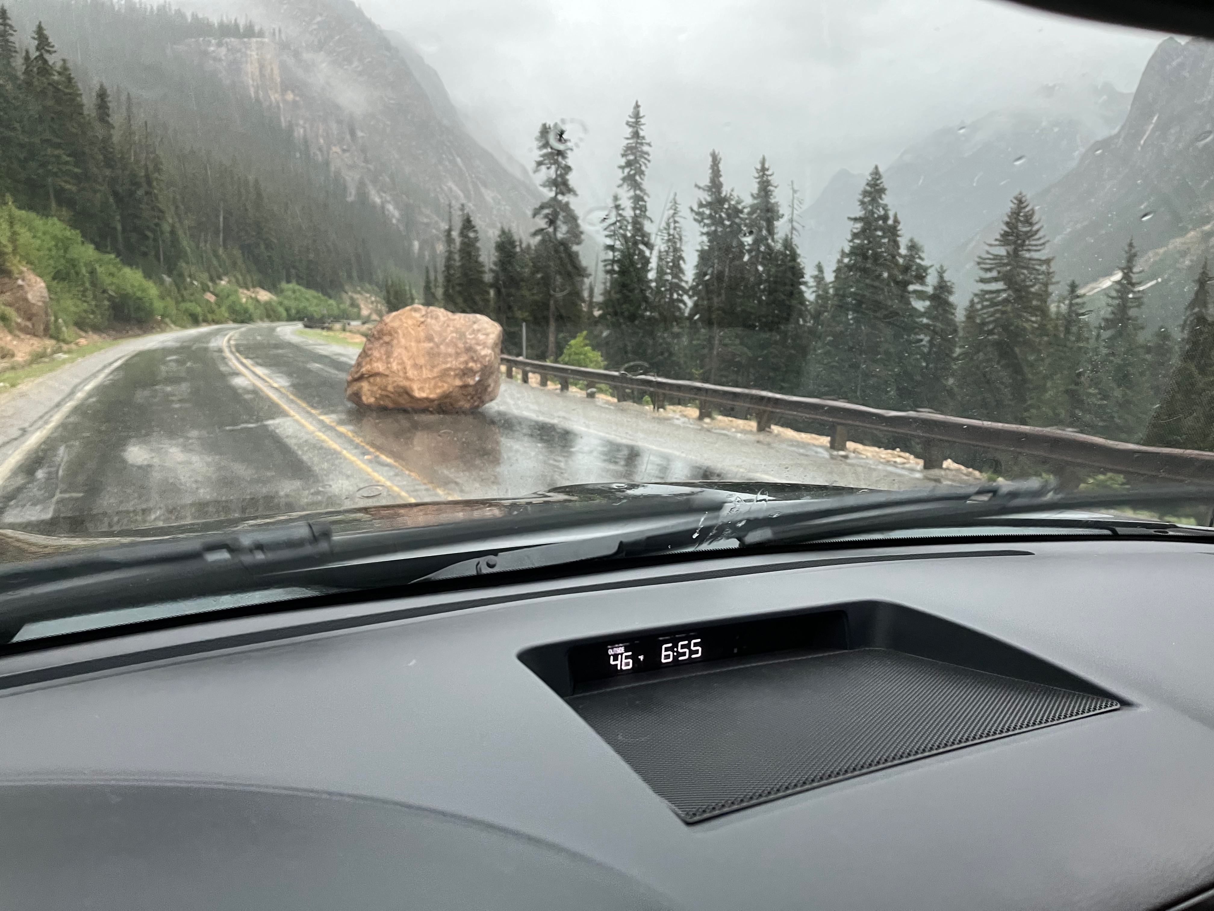
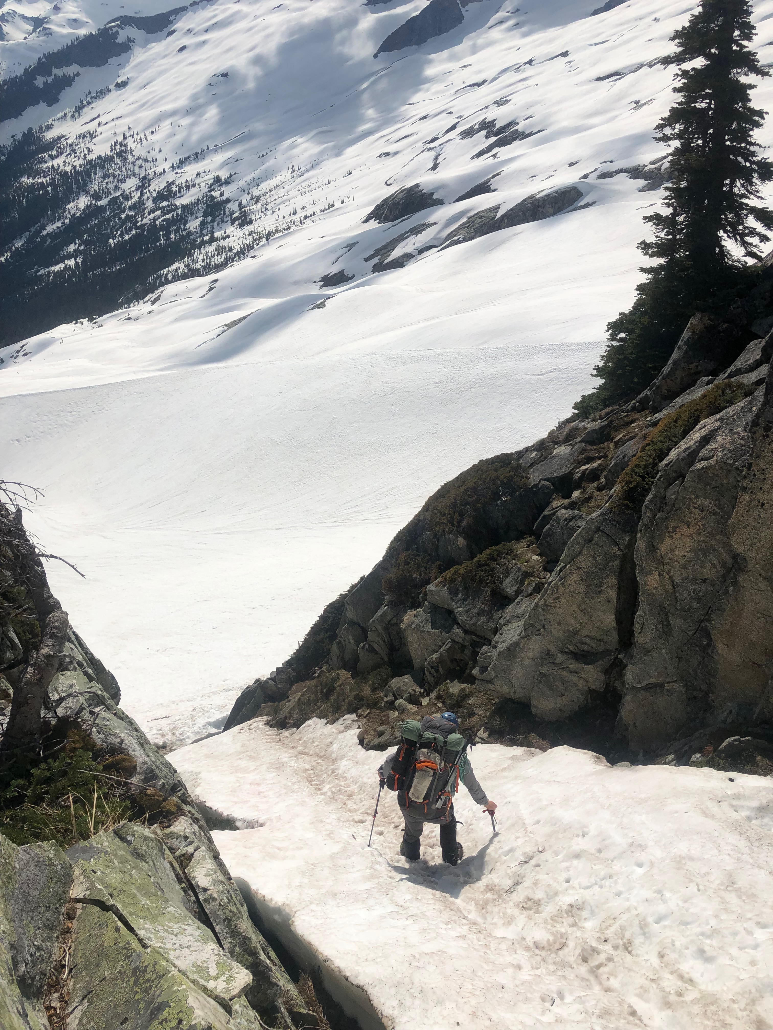
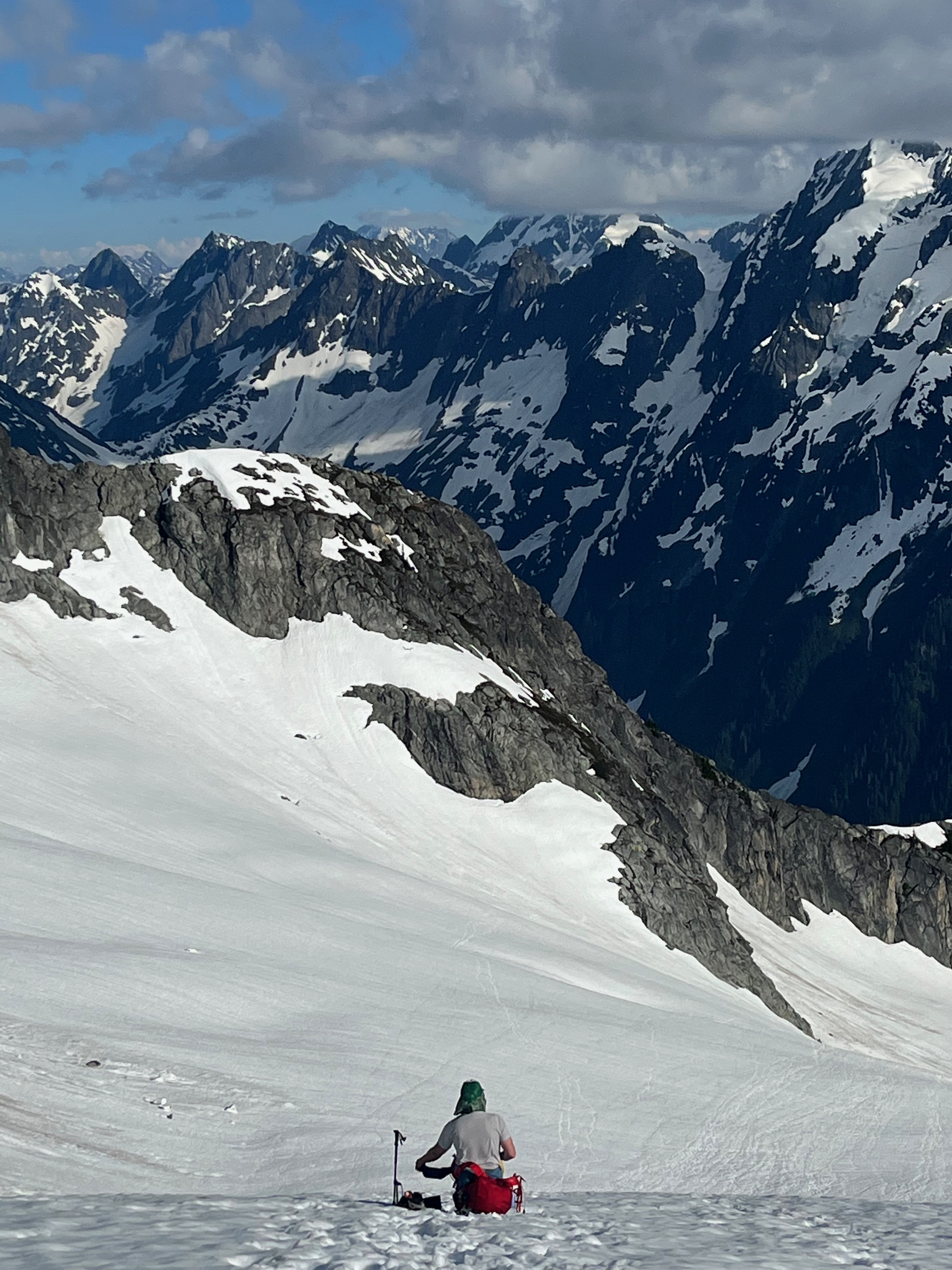
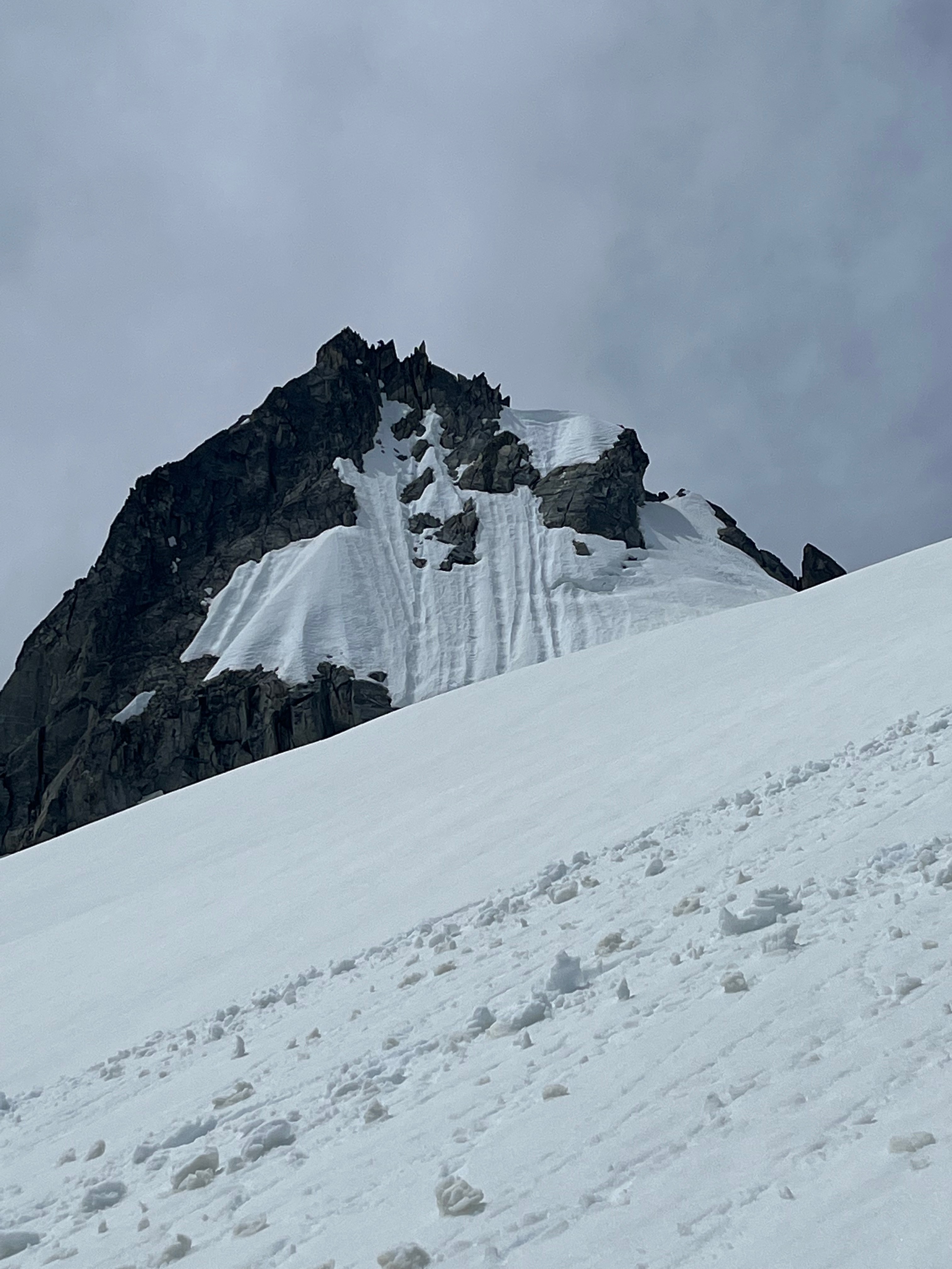
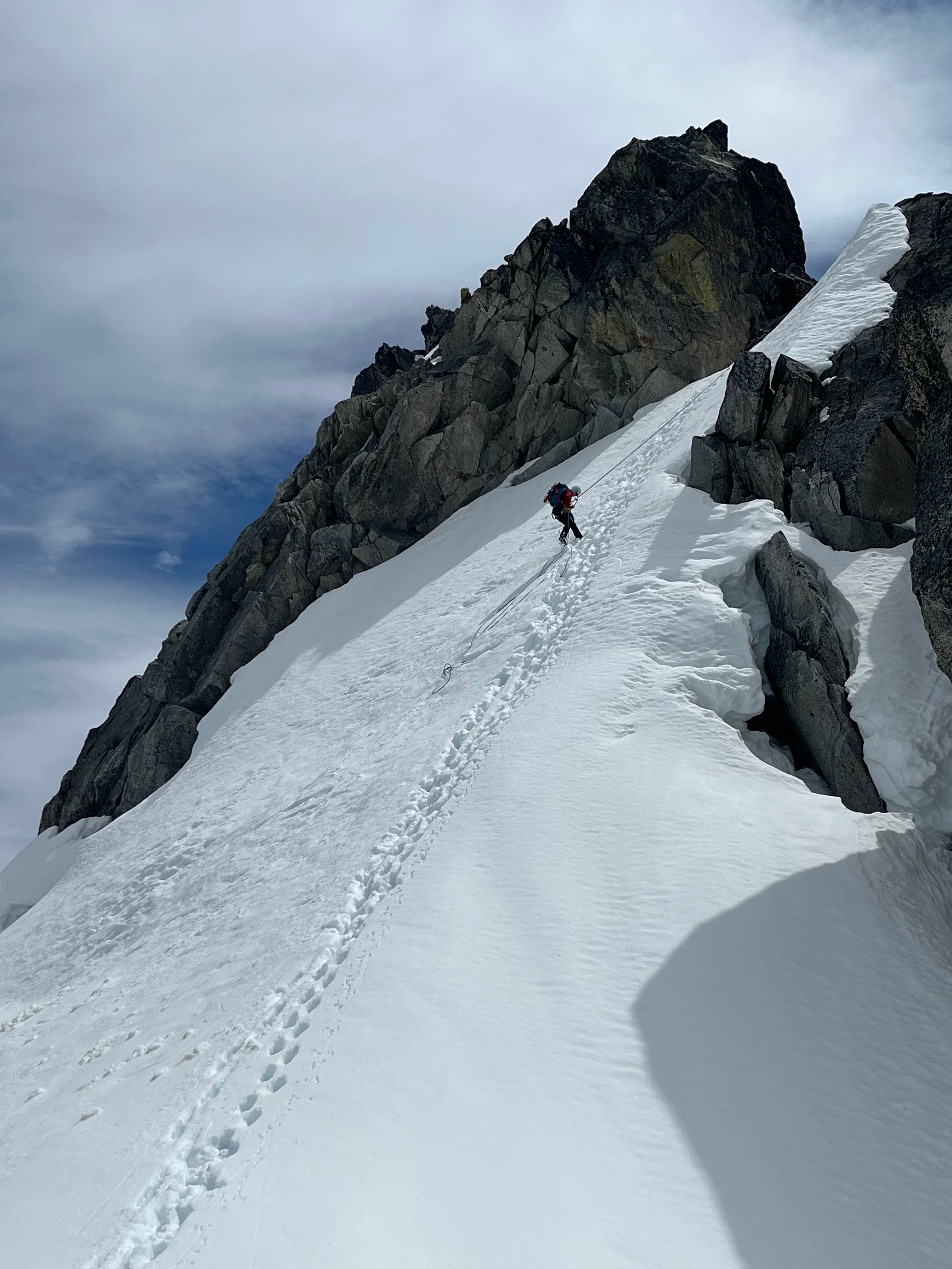
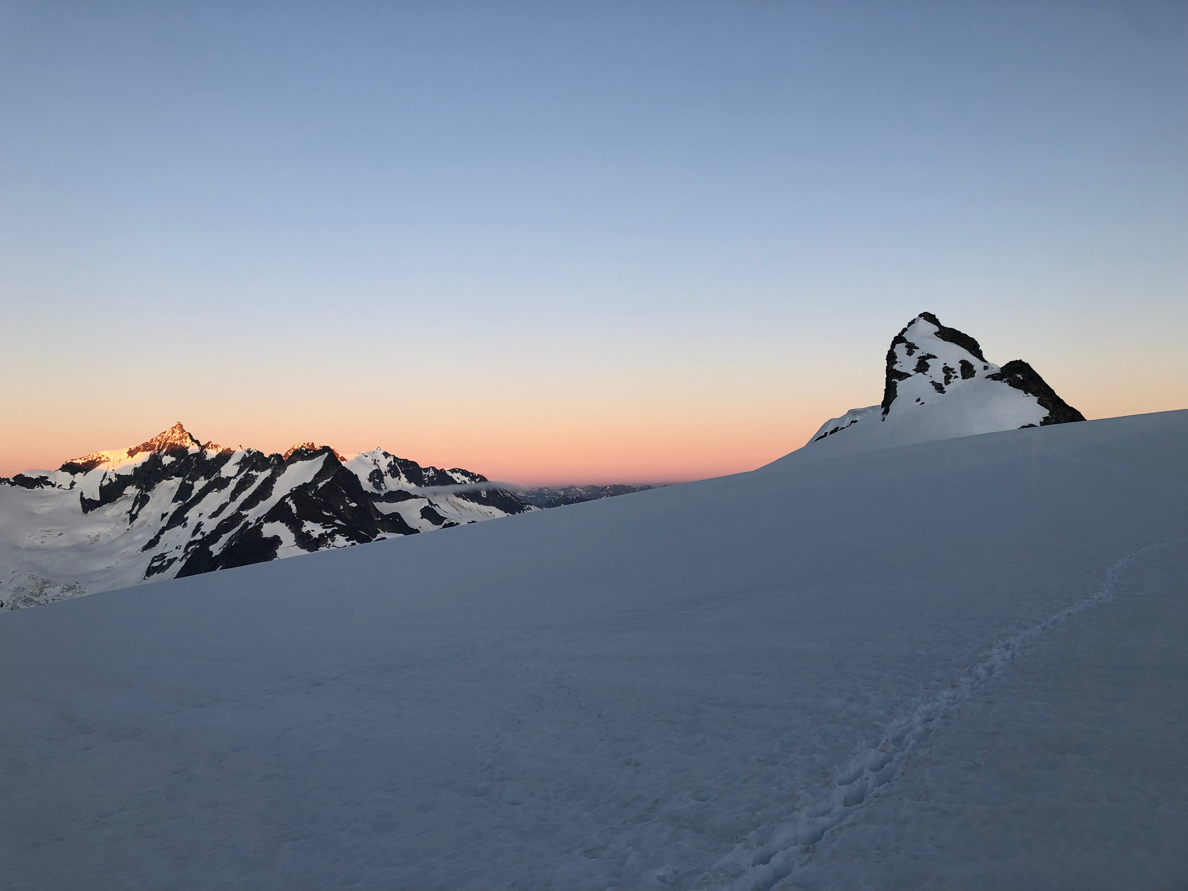
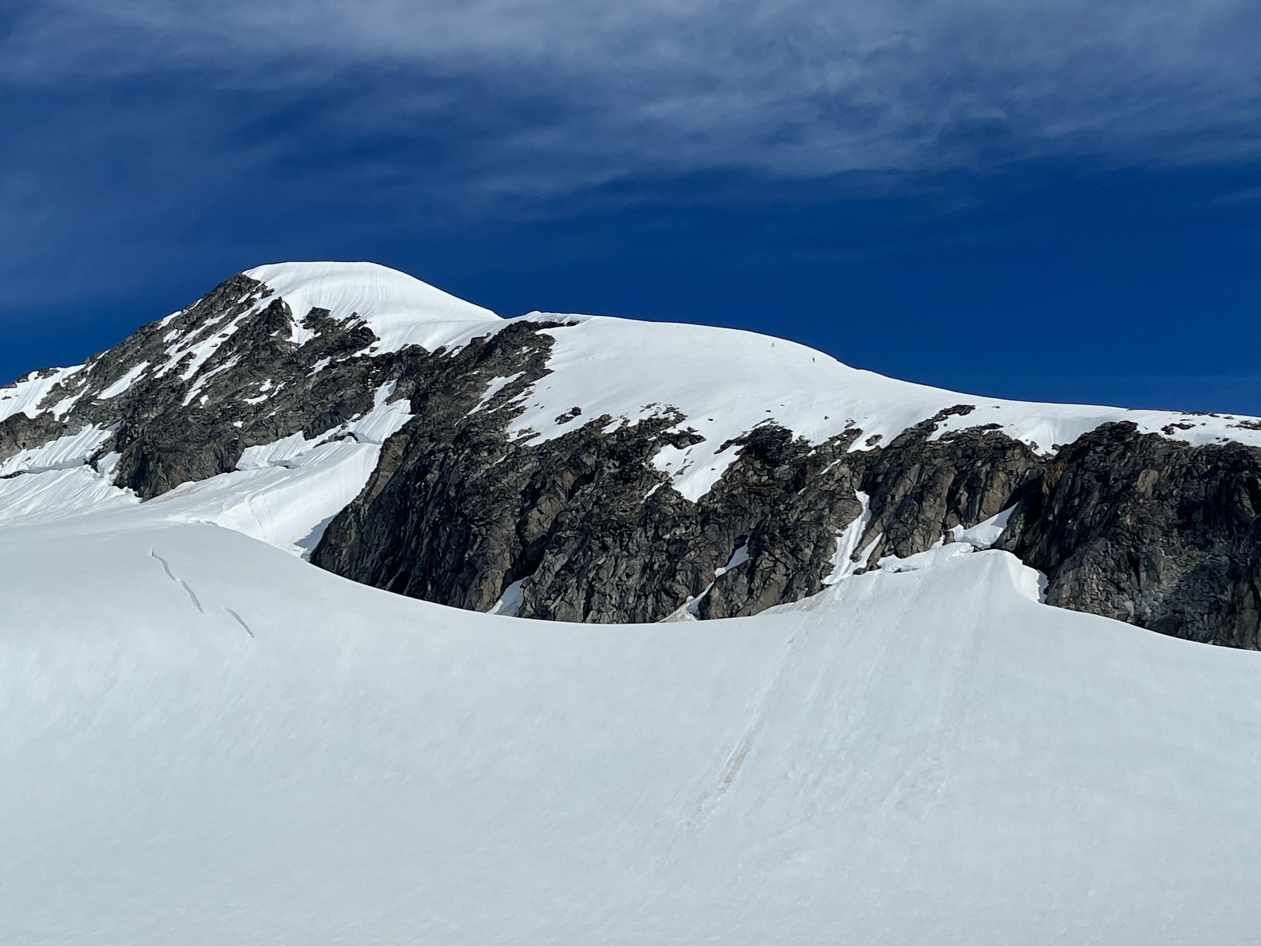
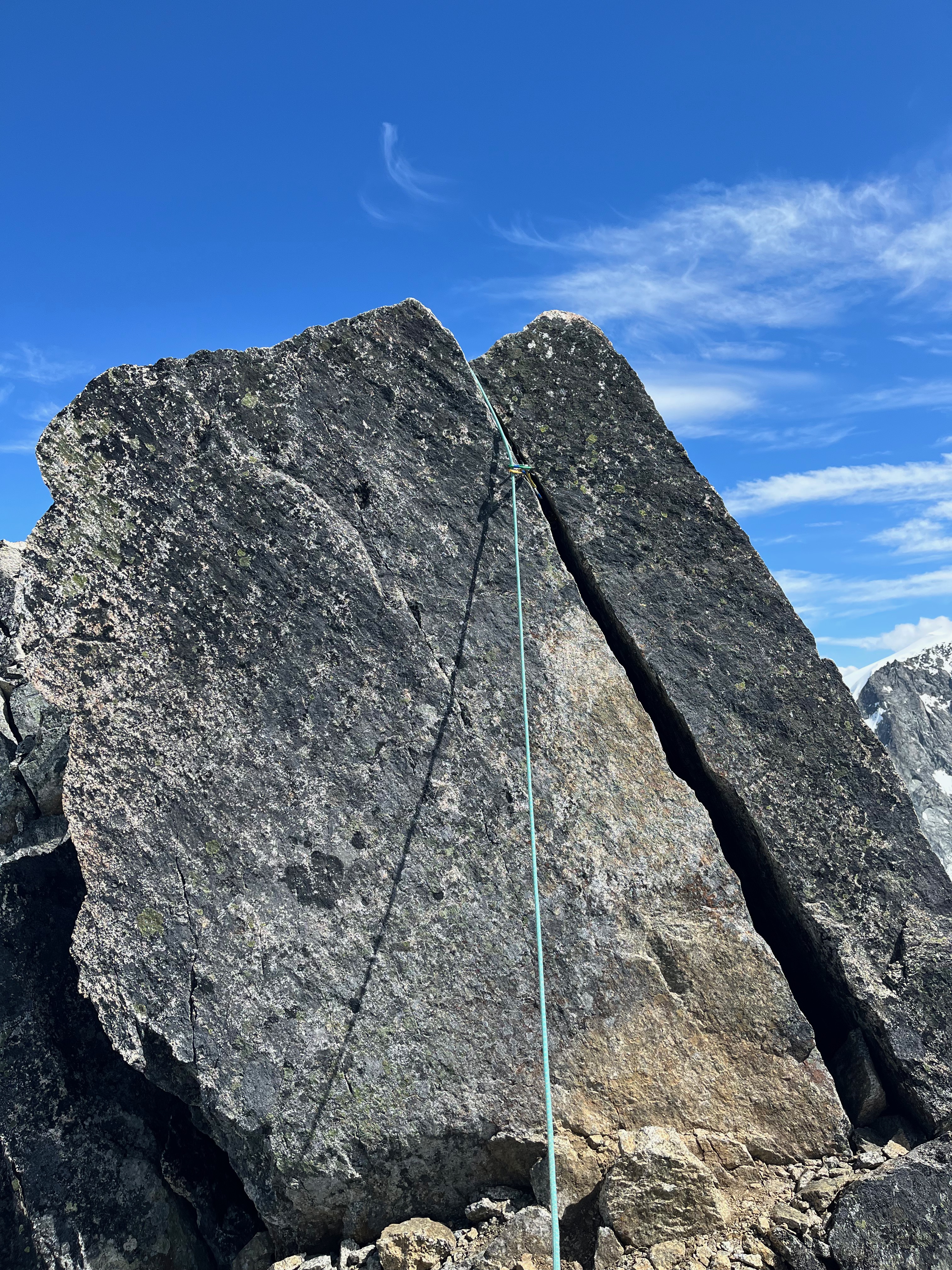
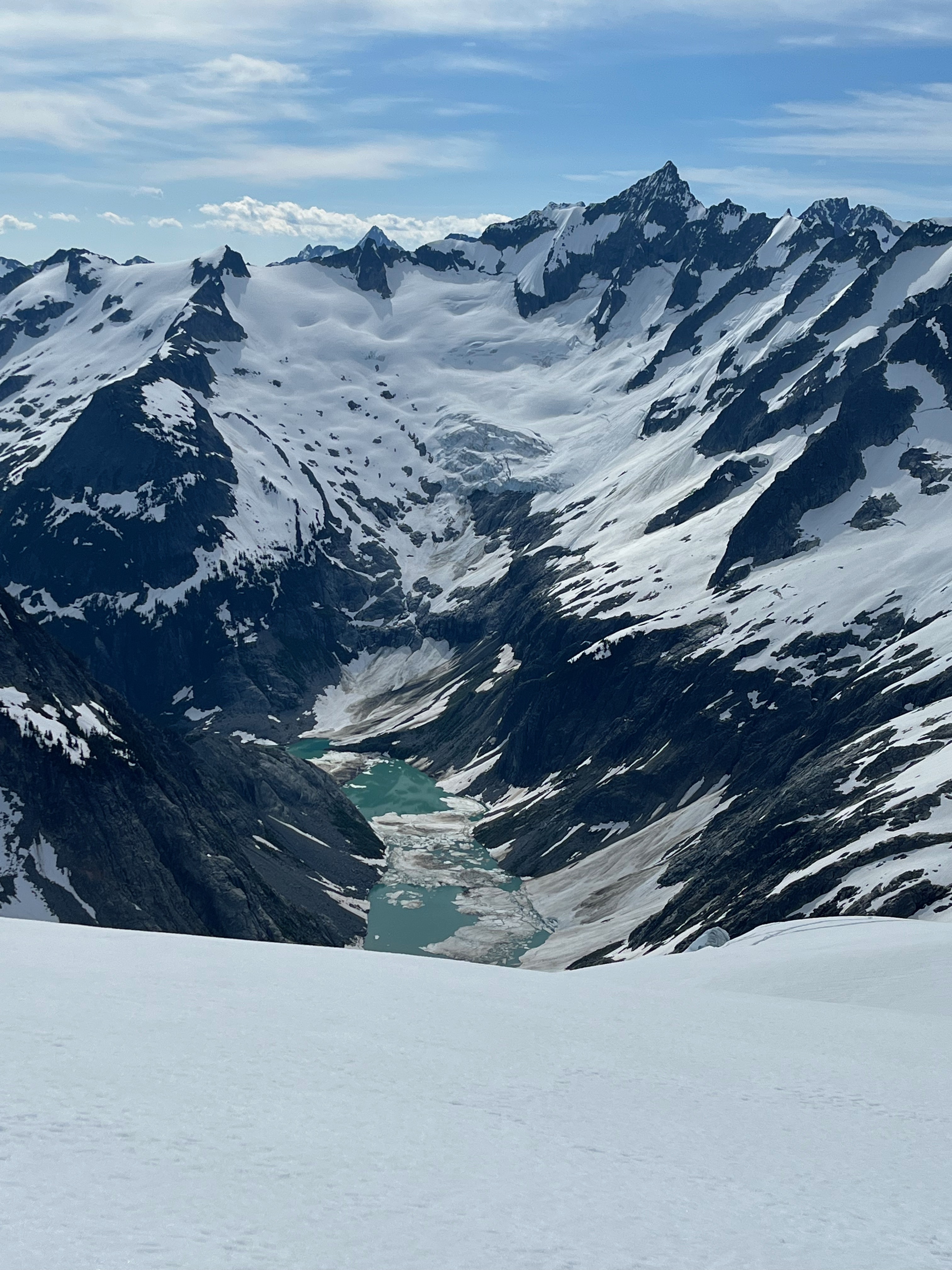
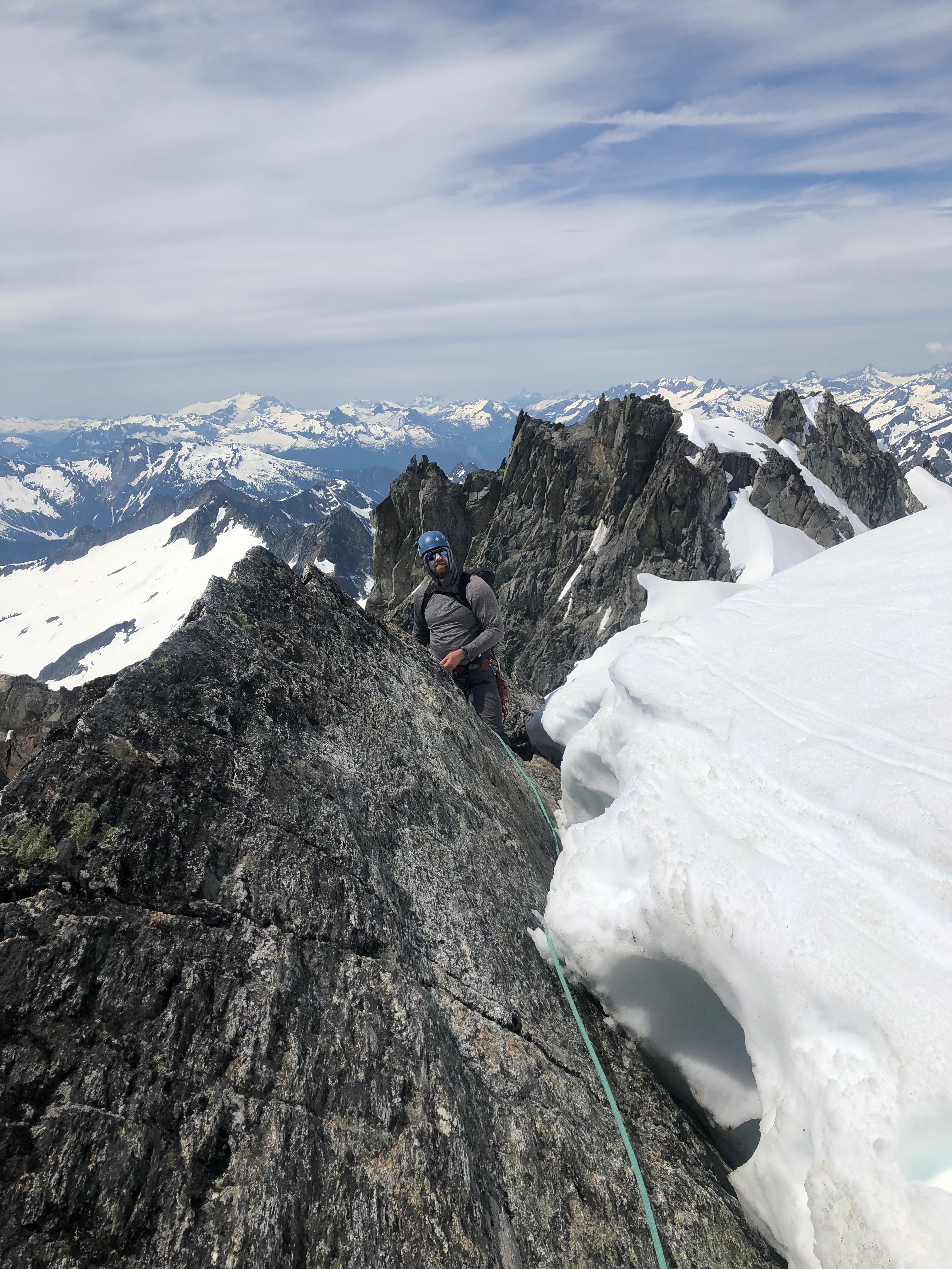
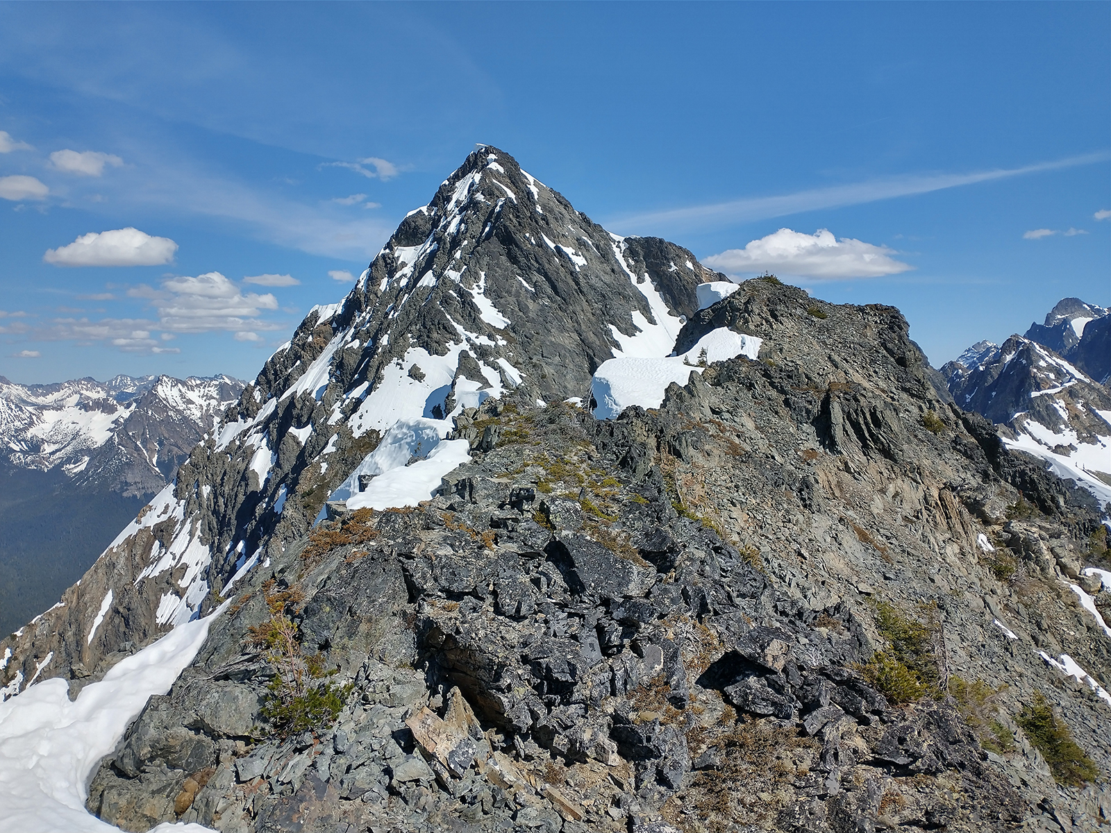
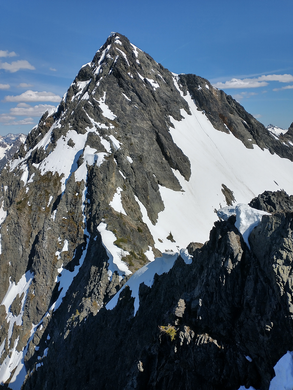
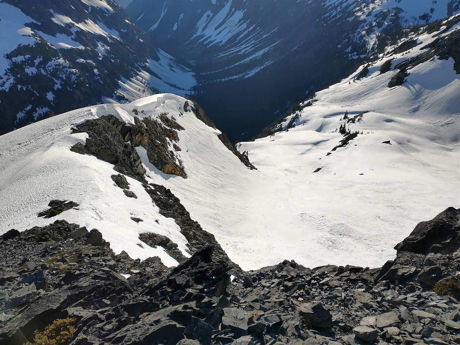
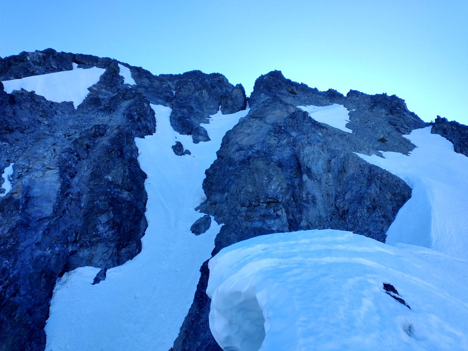
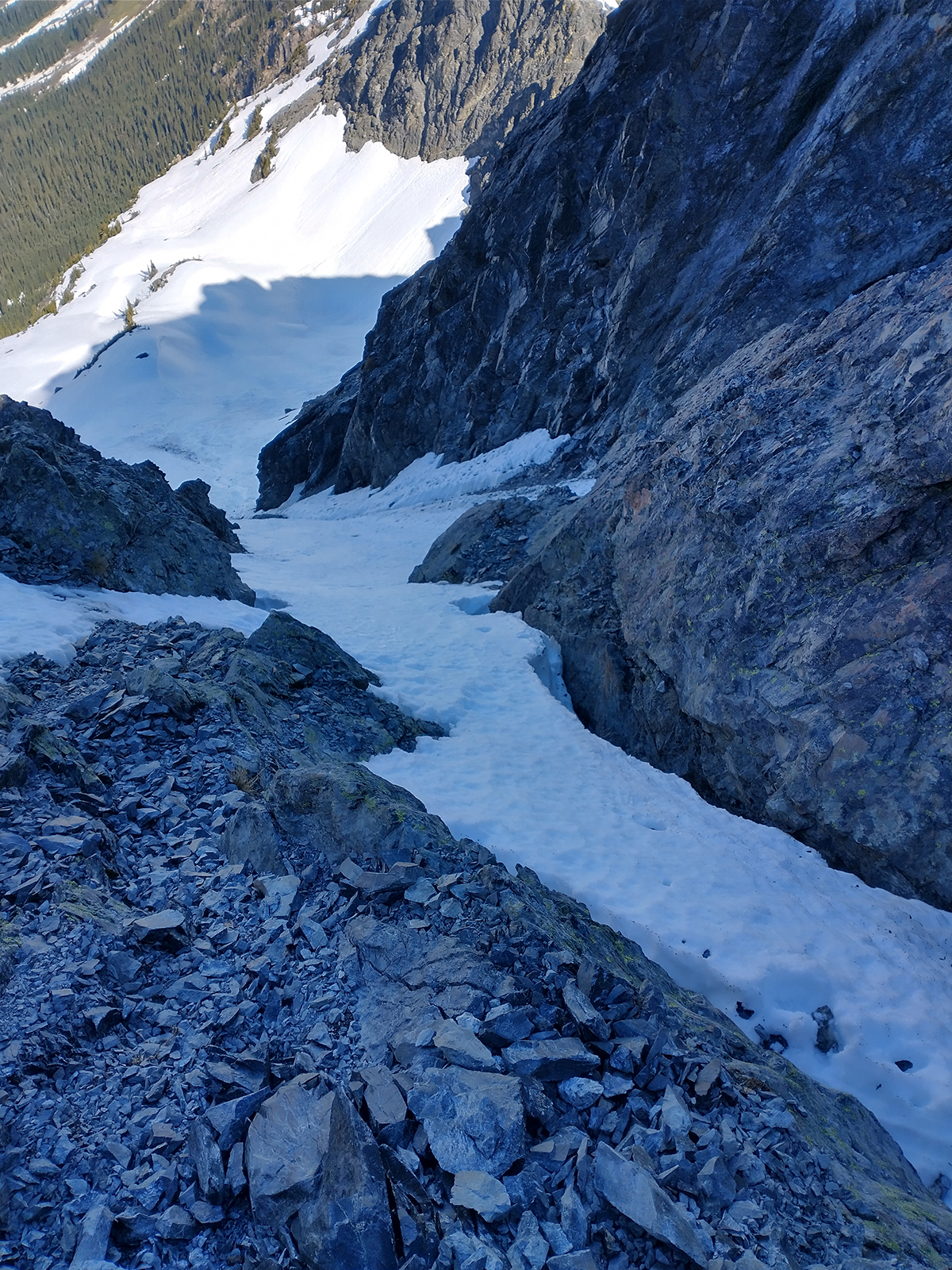
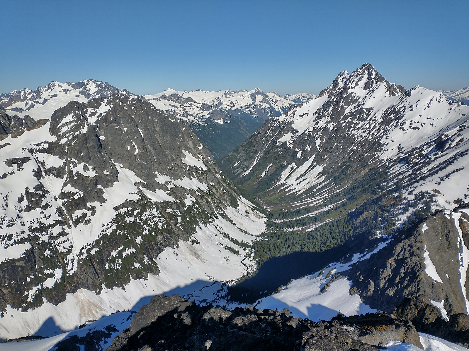
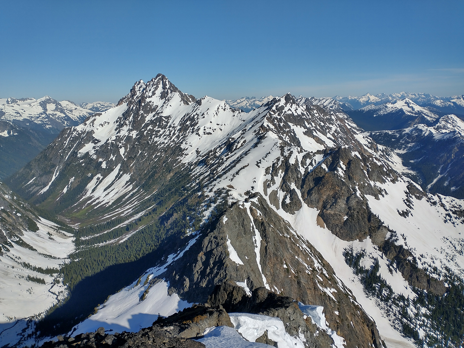
Trip: Dorado Needle - NW ridge Trip Date: 07/03/2022 Trip Report: The old Cascade River crossing by the parking lot at Eldorado is gone. Newer river crossing is available ~100' downstream from the parking lot with two logs that intersect from the road side with another log leading to the island in the river. Flow was high and there are strainers downstream of the crossing so be careful. Another party mentioned finding a log crossing upstream from the parking lot ~200 feet, upstream from where Eldorado creek hits Cascade river and then crossing Eldorado creek back to the climber's trail. Multiple parties on Eldorado. One party skied off the summit! (DM me if that was you and I'll send video!) Dorado Needle snow ramp was in great condition. Good boot steps all the way to shoulder. No crampons needed for the entire trip. Eldorado, Inspiration, and McAllister glaciers all had soft snow. Multiple parties on Dorado Needle. Really cool route with fun blocky climbing and cool rock needles. Able to make two rappels back down the route from summit with one 40m rope. Everyone kept mentioning a "new forecast" with "bad thunderstorms" coming in. Didn't listen to them and camped on the McAllister glacier near the Marble/McAllister col and didn't sleep through the big boom / big flash show. Should have listened. One party didn't like the lightning either and ditched their gear scattered on the glacier. We recovered it the next morning. If you're looking for it, please DM me and let me know where you left it and what you left and I can get it back to you. A true cascades experience with hail and rain all day on the way out. As always, stay east on the boulder fields and suffer less. Snow begins at top of boulder fields. Eldorado stream crossing below basin and above boulder field still under snow currently, but not for long. Gulley to Eldorado glacier quickly becoming post-hole city. lower Eldorado glacier Eldorado Forbidden and Moraine lake Alpenglow Traffic on Eldorado summit ridge Klawatti Dorado Needle and McAllister glacier North Face Eldorado Cascade river stream crossing "Rock!" Gear Notes: pickets, gear to 2", 40m rope Approach Notes: cascade river stream crossing 100' downstream from parking lot
 2 points
 -
Awesome! Its a really fun trip on great rock. I agree on the blue blazes on the climbers trail. Probably a good idea to get a trail more beat in to avoid having a more impactful spider web trail network, but by now they're not necessary (interesting word choice) I don't think.2 points
-
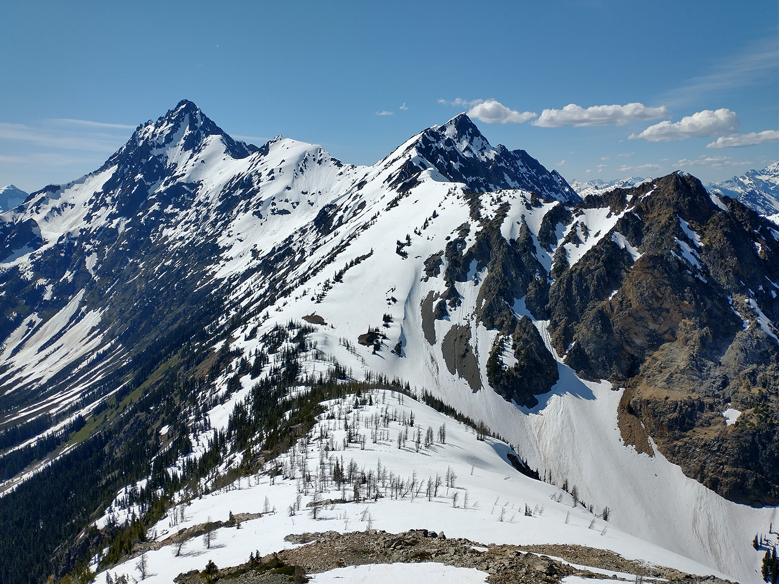
Trip: GOAT MOUNTAIN (6820') West & East Peak - West Ridge Trip Date: 07/02/2022 Trip Report: GOAT MOUNTAIN (6820') West & East Peak – Goat Mountain Trail Approach – JULY 2, 2022 (Sat). The weather was perfect, 70 degrees and clear skies. Rain was supposed to be on the way so time for a day climb. Goat Mountain fit the bill. Saturday: I headed out from the trailhead (2500’) at 6:30am. The trail was in excellent condition up to 4600’. At 4600’ the trail is covered in snow for the rest of the way up. I reached the West Summit at 11:30am. I had to do a bit of down climbing on down sloping wet rock to get to the actual peak. This can be avoided by using the snow to go around the bluff peak that looks at the real peak. I headed down the side of the West Peak into the snow basin between the West and East Peaks. There is a heather shelf that leads into a fine scree ramp down to the snow. I crossed the snow basin to the dip in the saddle between the two peaks (6000’). I climbed the West Ridge up for the East Peak summit arriving at 2:00pm. I meandered along the ridge a bit avoiding the extra steep snow that was soft. I stayed on rock the best I could. The West Ridge of the East Peak is mostly Class 2 & 3 with some steep sections. I headed down the snow on the South side of the East Peak, diagonal back toward the trail up to the West Peak. I had to climb about 300’ to get back up to the trail heading down. I was back at the trailhead at 6:20pm. Overall the climb is a good workout and the views are great. Some Tips and Notes: 1. The last easily accessible water was on the way up to the West Peak at 5600’. 2. The snow was fairly soft. I used boots only and it worked well. Travel Time for reference: Saturday: Trailhead to summit back to trailhead - 11 hours. Total Mileage: about 10 miles Total Elevation Gain: around 5500’ Gear used: Trekking Poles, Ice Axe, Helmet. West and East Peak of Goat Mountain from the trail. View from the West Peak of Goat Mountain. You can see the bluff peak that I climbed down to the snow saddle. View from the West Peak of Goat Mountain. Tomyhoi, Canadian Border Peak, American Border Peak and Mount Larrabee (Left to Right). Snow basin and the West Ridge to the East Summit of Goat Mountain (True Summit 6820'). I achieved the ridge at the saddle low point around 6000'. West Ridge up to the East Peak of Goat Mountain. It is steeper than it looks in the picture. East Peak Goat Mountain summit (6820'). Looking back toward the down route of the East Peak of Goat Mountain. Gear Notes: I used Trekking Poles, Ice Axe, & Helmet. Approach Notes: Goat Mountain Trail Approach.1 point
-
Cool! I should go in there this summer and pull those markers, agreed that they are a bit much. And I know @dberdinka thinks so too... Great TR, thanks for sharing and I am glad your feet didn't slip!1 point
-
Trip: Graybeard Peak (7965') - Southwest Ridge Trip Date: 06/25/2022 Trip Report: Graybeard Peak (7965') – Easy Pass Trail Approach – June 25-26, 2022 (Sat, Sun). The weather was perfect both days, 70+ degrees and clear skies. Saturday: I headed out from the trailhead (3800’) at 9:00am. The trail is in good shape with some down trees to negotiate. The trial ran into solid snow at 4600’ and I promptly lost the trail. I decided to head up and to the right, as that looked like the best option at that point. The terrain got steeper and less forgiving, some bushwhacking was needed. I finally made it out into an open area on the slope at which point I realized I was far off to the side of the actual trail location. I headed across the slope to reach the correct wide snow basin heading to the pass. I should have turned left at 4600' and headed toward the snowfield visible through the trees. Oh well, live and learn. I finally made it to Easy Pass at 2:45pm thanks to my detour and being a bit out of shape. I was planning to climb Graybeard and Kitling Peak over the weekend but my legs where feeling it by the time I reached the pass and I was behind schedule. So I decided to hit Graybeard first and see how I was feeling the next day. I decided to attempt a climb of the Northwest Ridge of Graybeard straight from Easy Pass. I was burned out on side hilling on loose wet snow so I figured a rock route would be much more fun. I haven’t seen much information on the Northwest Ridge of Graybeard so I was on a reconnaissance mission as well. The ridge was going well with class 2 & 3 for the most part. I made it to the saddle between the sub peak and Graybeard. At this point there were a few deep sheer gullies separating the ridge. I didn’t bring a rope and down climbing into the gullies was too dangerous. I decided to drop down into the snow basin of the standard route up Graybeard. I looked up the main snow gully going up to the Graybeard summit area. The snow was soft and wet and the top of the snow gully was 40 degree snow. As I wasn’t feeling like a high speed glissade, I decided to climb over to the Southwest Ridge instead. I decided to call it a day and setup camp on the ridge at 7:30pm. Beautiful views and perfect weather, even though my legs were done, I didn’t really care. Sunday: I broke down camp and was on my way to the summit by 6:45am. The rock was mostly class 2 & 3 with a little class 4 toward the top. I reached the summit at 8:00am. Beautiful views in all directions. On my way back I was planning to take the snow gully down. I was able to tie into the snow gully below the 40 degree section by down climbing the ridge about halfway. The snow was still soft and loose but manageable. I took the standard way back across the snow basin toward Easy Pass. I was back to Easy Pass at 11:00am. My legs were still pretty tired from the previous day so I decided to hit Kitling Peak on another day. I made it back to the trailhead at 1:30pm. Some Tips and Notes: 1. There was very little water above Easy Pass and no water at the Pass. Best option for water was at about 6000’ from the big creek at the bottom of the snow basin heading to Easy Pass. 2. I brought too much gear being unsure of what to expect. I brought crampons and snowshoes. I used the snowshoes a little and found out that boots alone worked the best. 3. The route up the Northwest Ridge was looking to be fairly challenging. A rope is necessary for the route. I’d say it is good mix of class 3,4 & 5. 4. There was still a lot of snow in the area and probably will be for a while. Travel Time for reference: Saturday: Trailhead to Southwest Ridge Camp – 10.5 hours. Sunday: Camp to Summit back to the Trailhead – 6.75 hours. Total Mileage: about 10 miles Total Elevation Gain: around 5000’ Gear: Trekking Poles, Ice Axe, Crampons, Snowshoes, Helmet. Looking back at KITLING & MESAHCHIE PEAK on my way up the Northwest Ridge of Graybeard. Northwest Ridge of Graybeard. Northwest Ridge of Graybeard. I decided to head down to the snow basin at the end of the snow in the ridge saddle. Snow basin up to the Southwest Ridge of Graybeard. Main snow gully and Southwest Ridge to Graybeard. Snow gully branch that I used to come down the main snow gully, bypassing the steep 40 degree soft snow. Summit View down the Fisher Creek Valley. Lots of snow still. Summit View looking down the Northwest Ridge, KITLING & MESAHCHIE PEAK in the background. Gear Notes: Trekking Poles, Ice Axe, Crampons, Snowshoes, Helmet. I didn't need the crampons or snowshoes. Approach Notes: Climbed up Easy Pass Trail. When the trail goes under the snow at 4600' turn left toward the snowfield and follow the snowfield all the way up to Easy Pass.
 1 point
 -
Awesome report, this route is high on my list. Score1 point