Leaderboard


Popular Content
Showing content with the highest reputation on 08/17/21 in all areas
-
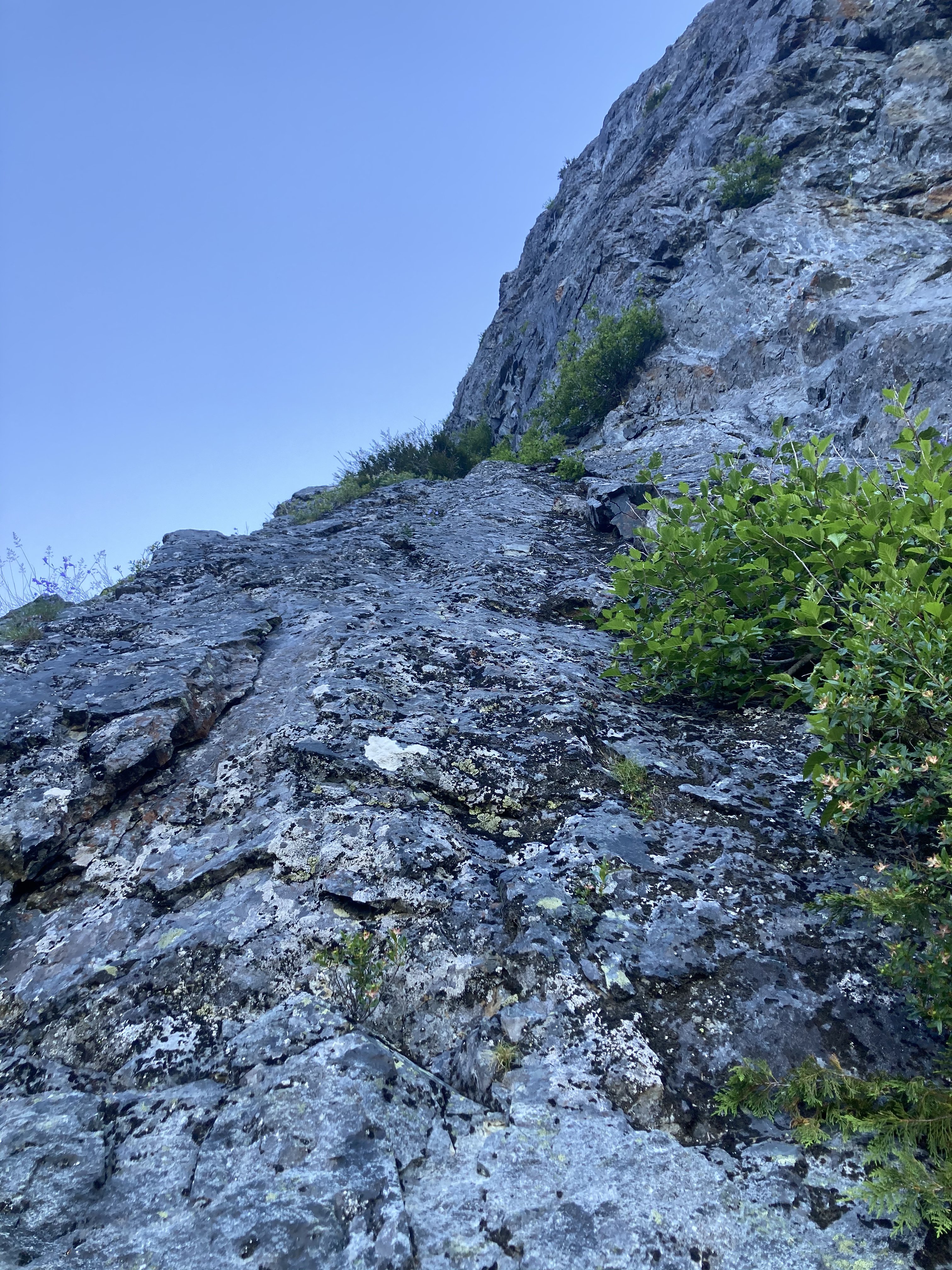
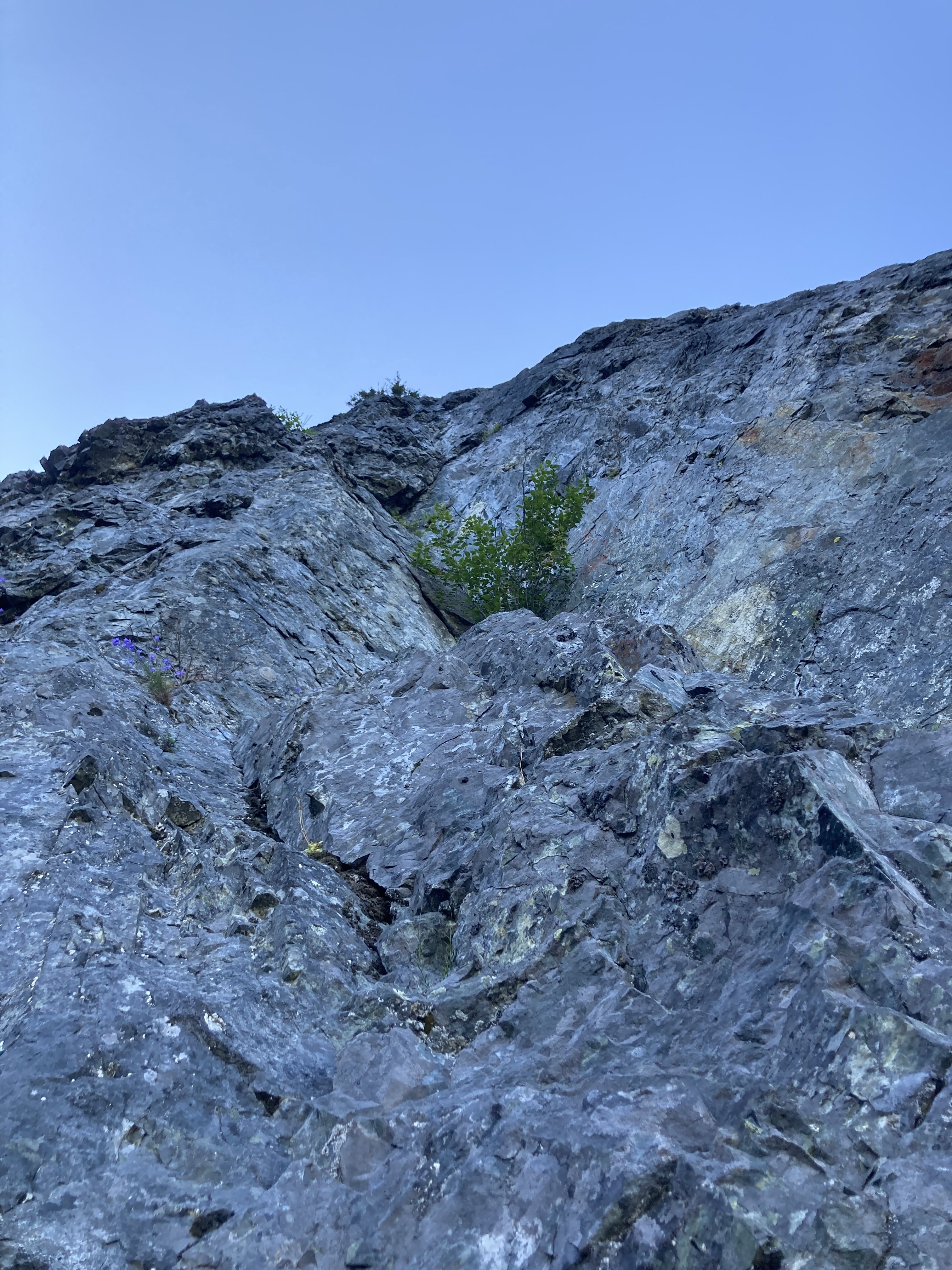
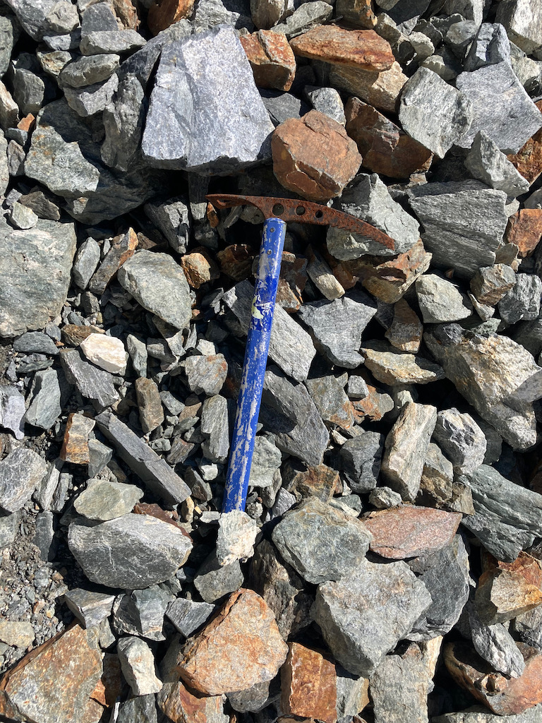
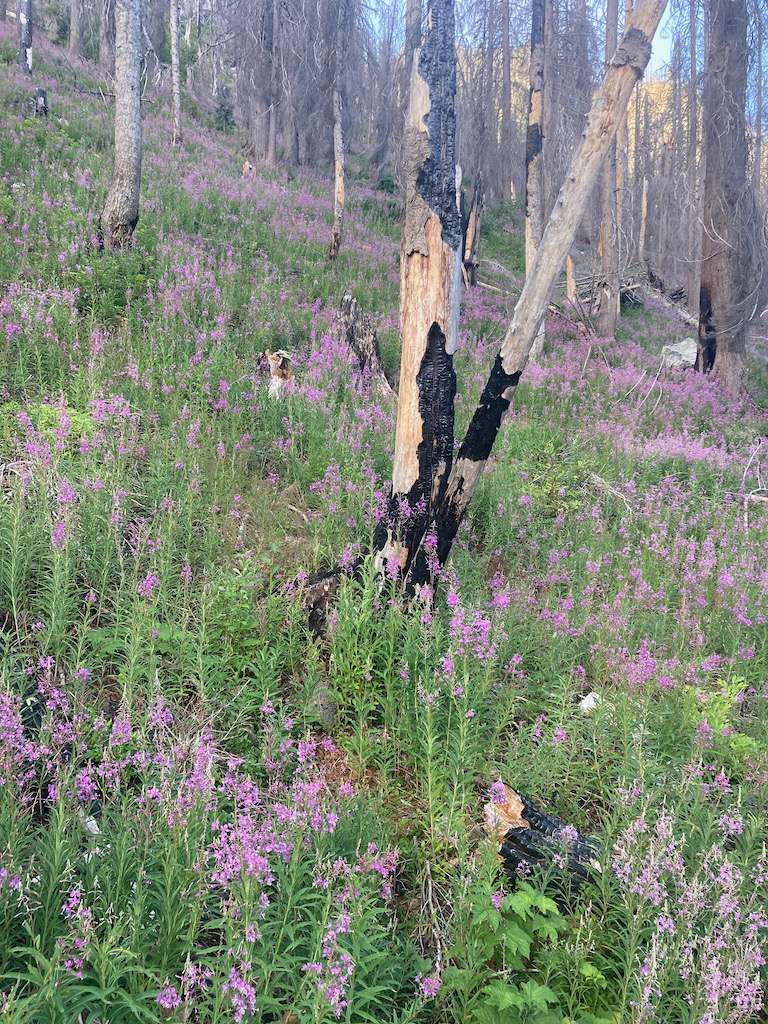
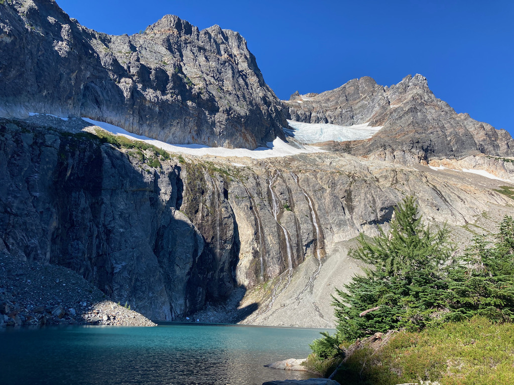
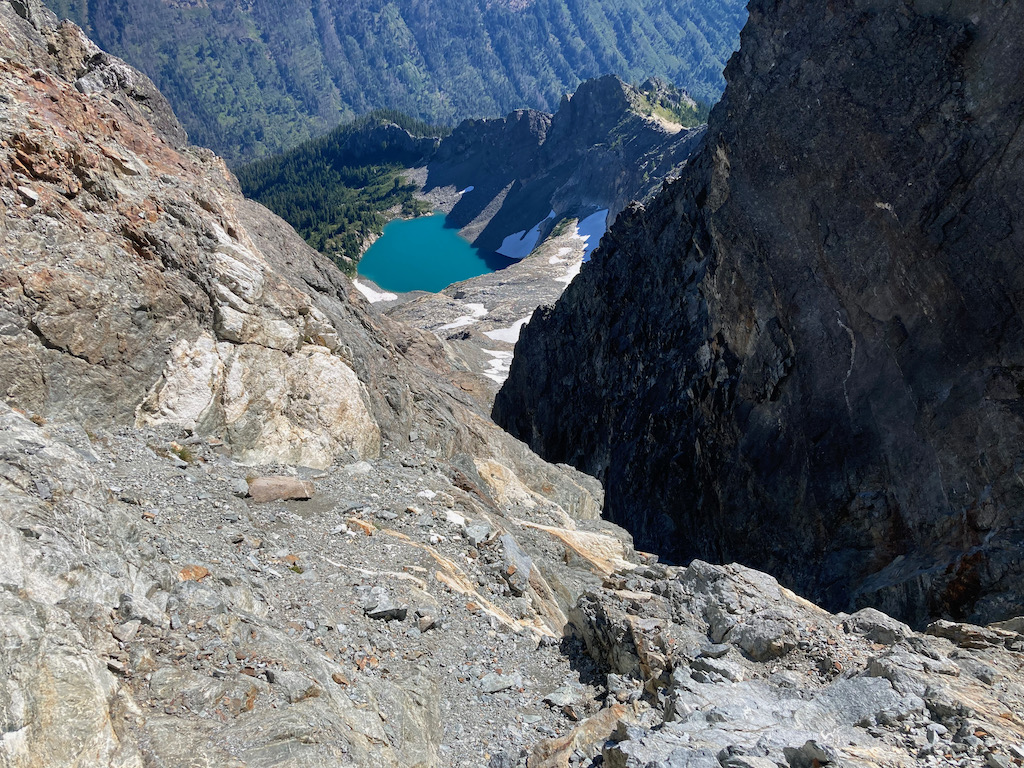
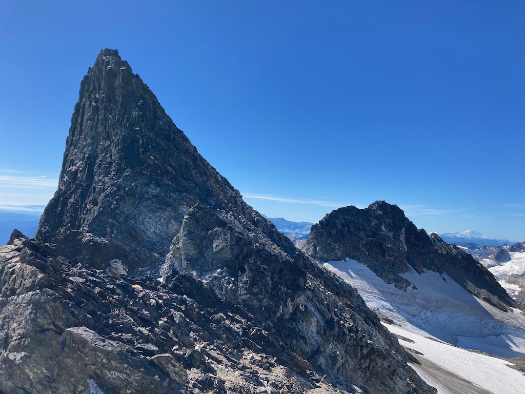
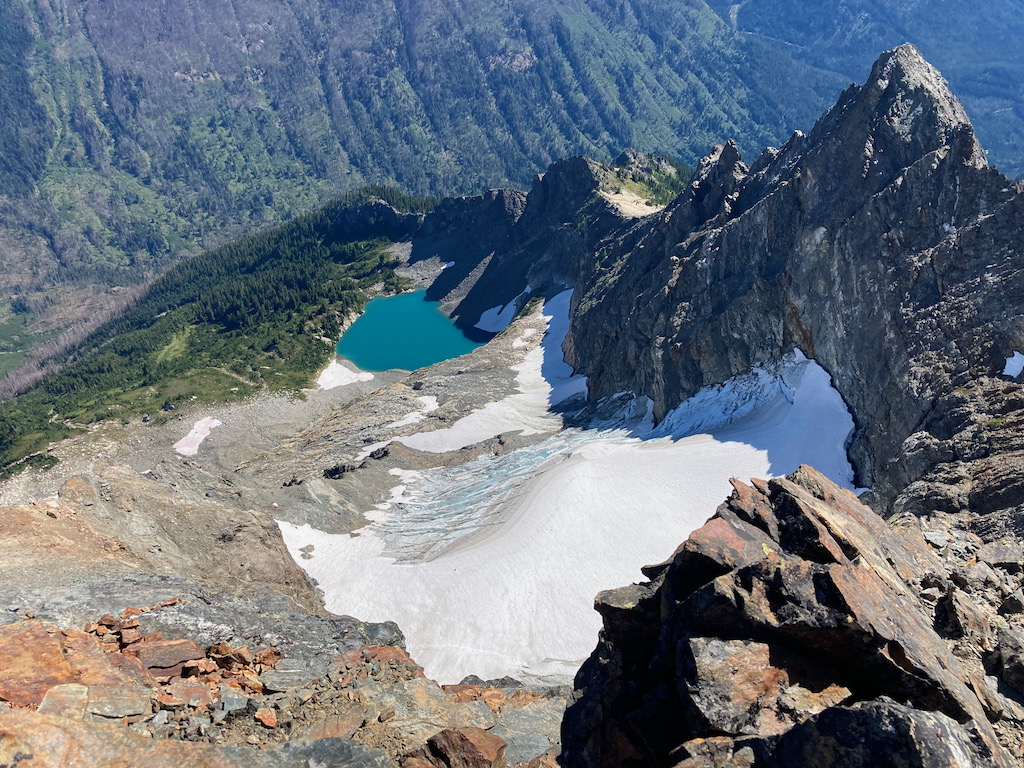
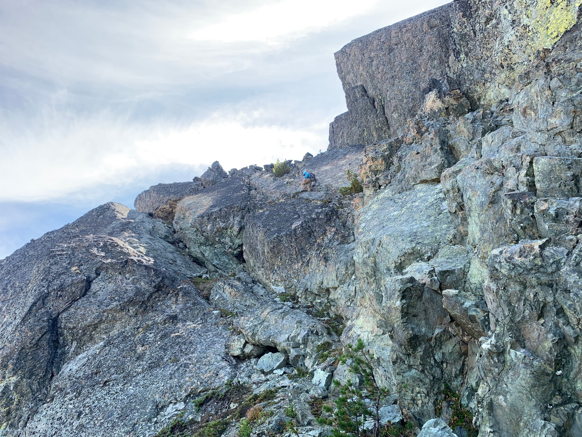
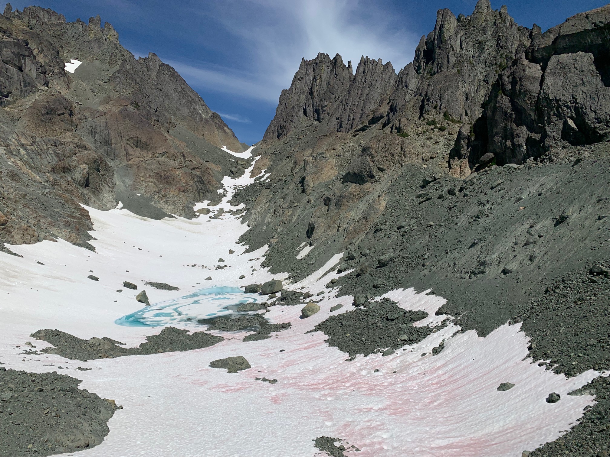
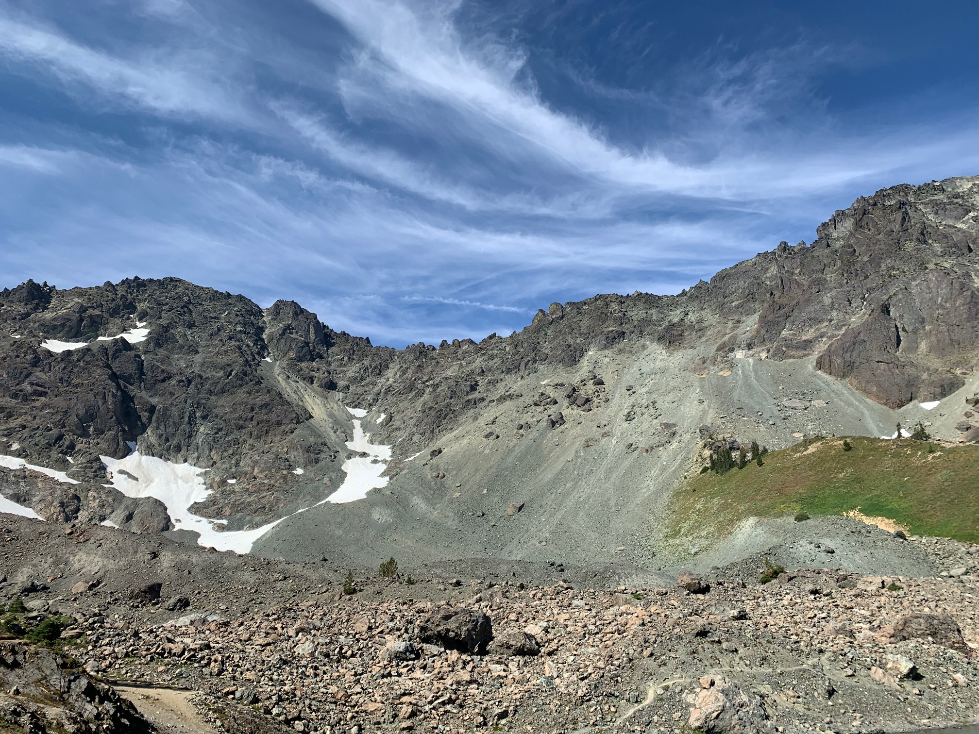
Trip: Buck Mountain - Northeast face Trip Date: 08/11/2021 Trip Report: Summary: I climbed Buck via the seldom-used northeast face above King Lake, then descended via the long standard route to Buck Pass, tagging Berge, Cleator, and Rally Cap along the way. This isn't anything groundbreaking, but it's an interesting line on a peak whose standard route(s) can be a bit of a slog. 26 miles, 10,000 feet of climbing, ice axe and probably crampons required. And if your dad left his axe up there, you're welcome to it: (Original TR here: http://www.drdirtbag.com/2021/08/12/buck-loop-ne-face-to-buck-pass/) Summitpost describes Buck as "one of the man-mountains of the Washington Cascades." Though only three miles from the Trinity trailhead to its southeast, and only class 2-3 from the southwest side, a high and rugged ridge extends north and south from Buck, and there is no road or even trail up the lower Napeequa River to the west. The "normal route" is therefore shockingly roundabout, approaching the peak's west side either over Little Giant Pass to the south, or on a high route from Buck Pass to the north. There is also a direct class 3 route from the east near Alpine Creek, involving a river ford and a savage bushwhack through steep and brushy forest, that is recommended for descent but can of course be done both ways. The Summitpost page also mentions that the northeast ridge is "class 4 or 5," which sounds like my kind of route. With these options in mind, I made the long drive up the Chiwawa River Road to Trinity, and started off around dawn planning to do at least one of these routes. Passing the place for the Alpine Creek route, I decided that I did not want to do that to myself. I continued after the split toward Buck Pass, finding that the bridge was not "out" as advertised, but was probably no longer suitable for my horse. Nearing the turnoff for King Lake and the northeast face, I entered the burn area for the 2016 Buck Creek fire. The forest was in a near-perfect state for cross-country travel, with the trees and underbrush incinerate, but the nasty things that follow a fire not yet established. The main type of plant was fireweed, a bush that is easy to whack. I contemplated the route while I ate a sandwich, then took off across the wasteland. The first obstacle was crossing Buck Creek, but I found a perfect log bridge almost exactly where I needed it. There was even a sort of tunnel through the otherwise-impenetrable alders. Beyond, I followed various deer tracks up the burn, staying on the left side of the drainage and well away from the unburnt alders to the right. I eventually entered steep woods above the burn, and the deer trail faded. Not sure what to aim for, I decided to traverse right to reach open terrain I had seen from below. This turned out to be a savage hell-schwack, variously fighting my way through alders, steep scrub pines, and cliff bands littered with fallen burned trees. After avoiding some of these cliffs, I realized that the rock was fairly solid with a grain that worked well for climbing this way, and simply headed up some class 3 crags, grateful to finally be making upward progress again. Reentering the woods higher up, I found myself on the left side of a deep cleft with a healthy cascade running through it. This was rocky enough to discourage the plants somewhat, so I stayed near the edge as I made my way upward, hoping I could cross the cascade easily higher up. I saw what I thought was a cairn in an open, slabby section, then a few cut branches and a bit of boot-pack higher up. Success! I lost and re-found the ancient fisherman's trail a couple of times, taking my time and eventually ending up in an open, grassy ravine leading easily almost to the east side of King Lake. I have no idea what this "trail" did lower down, and that part has been obliterated by the fire, but I was grateful for what I found. King Lake proved as spectacular as I imagined it would. Buck's small northeast glacier sits perched in a bowl above the lake, sending cascades of milky melt-water down the cliffs that ring the lake to its southwest. I found a couple of fire rings with fresher-than-expected ashes in them, but I can't imagine this cirque sees much traffic. Making my way around the lake's north side, I climbed rubble and easy slabs to the toe of the glacier, putting on crampons to cross one hard snowfield. I avoided the snout and broken-up lower glacier to the right on decent rock that became grittier as I progressed, then returned to the glacier where it was a bit more continuous. The travel was mostly easy, but it was surprisingly possible to fall in a crevasse if one were oblivious, as opposed to having to find one and jump in it. The top of the glacier is separated from the mountain's east ridge and south face by another wall of cliffs, the only potential exit being at the upper right side. I made my way for the highest tongue of snow, passing someone's father's ice axe on the way. This tongue probably used to extend into the gully above, but it was now separated by an expanse of steep dirt and scree. I sketched my way up this, aiming for the obvious gully to the left. The gully was made a bit more obvious by an ancient piece of tat, originally yellow and now bleached completely white. I was once again annoyed at Cascades mountaineers for leaving garbage on routes (who would rap this?!), and at myself for not bringing a knife to remove it. There was a bit of easy fifth class to pass the webbing, but above it looked like the angle eased. If only... Earlier in the season this would probably be a steep snow climb to the summit ridge, but now it was wet gravel, choss, and gritty slabs that often angled in the wrong direction. I worked my way up the right side of the gully, using the wall for handholds or to stem against the dirt. After a failed attempt to exit early to the right, I exited out the top, making a few wide stems against some reddish rock. Above that, I finally managed to traverse right on improving rock, and soon popped out between the north and south (true) summits. The south summit looks incredibly imposing from this saddle, showing only its narrow east-west profile. I scrambled up the layered slabs to the summit, where I quickly pulled the register out of a cairn guarded by flying ants, then sat a safe distance below to look around in the remarkably clear air. To the west were recently-climbed Clark and Luahna, along with the rest of the Dakobed Range, showing the glaciers that clearly make them a better ski than scramble. North was Berge, across a weirdly broad and flat saddle. I also had great views of the Entiat peaks, Bonanza, and even Baker and Rainier at the far ends of the range. Descending from the summit, I crossed the small, flat glacier nestled between Buck's summits, then descended toward the saddle with Berge, entering a surreal landscape of pumice and larches. As this region demonstrates, the Cascades' geology is incredibly complex. Between Buck's ancient dark rock (schist?) and Berge's Sierra-esque white granite lies a small region of pumice reminiscent of a recent volcano. This is presumably from the same event that created Glacier Peak, but does not seem to connect in an obvious way. Through this section I began picking up bits of use trail, leading more or less where I wanted, toward Berge's northeast summit. Most maps incorrectly label Berge's southwest (easier) summit as higher, but as seems clear to the naked eye, and as Eric Gilbertson demonstrated with a surveyor's level, it is not the highpoint. I tagged both for good measure, finding the northeast no harder than class 3 and reminiscent of the Sierra except for the green things between the granite boulders and the deposits of black lichen on some aspects. Berge's north and west sides are cliffy, so it is necessary to circle southwest to a saddle and descend west before circling back around north. Fortunately I had downloaded some other climbers' tracks, as otherwise I would have dropped all the way to the valley bottom instead of making the improbable high traverse. I finally reached a trail in this Sierra-like basin, with its clear, shallow lake and white granite, and from there it was a short hike to High Pass. The trail from these lakes to Buck Pass is one of the most scenic and runnable I have found in my years in the Cascades, reminiscent of nearby White Pass but lacking the PCT hordes. I had miles to go before home, but they were all downhill and easy trail, with clear views of the glacier-y sides of the Dakobeds and Glacier Peak. With time and energy to spare, I decided to tag a couple of easy peaks along the way. The first was Mount Cleator, named for Trinity local Cletus McCoy's tabletop D&D character. Cleator met his untimely end when Cletus' cousin Brigitte "Berge" Hatfield made him promise to give up his boozy Friday gaming sessions as a condition of their engagement. Despite its unfortunate genetic consequences, the union was a key step in reconciling their feuding branches of the family. Mount Cleator has two summits, a grassy walk-up separated from a fierce crag by a steep notch. The grassy one looks a bit higher and has a register, and I did not have enough curiosity or energy to try to reach the other. I returned to the trail after Cleator, then took a side-trip to Rally Cap on the way down to Buck Pass. I pulled out my map to find my way through the mess of trails here, but eventually got on the popular Buck Creek trail. I am not a trail runner, but I had been enjoying my jog from High Pass, and the Buck Creek trail was pleasant in its own way, smooth and gently-graded, with good shade and frequent water sources. I started to feel pretty run-down once the trail reached the valley bottom, but managed to mostly hold it together and maintain a jog back to the car. According to my phone, the whole excursion was about 26 miles with 10,000 feet of elevation gain, all in a bit under 12 hours. It was a satisfying use of what may be my last (smoke-free) day in the Cascades this year. Gear Notes: Ice axe and crampons for short glacier crossing Approach Notes: There's a fisherman's trail leading to King Lake, but you probably won't find it until quite a ways up. The 2016 fire has made travel easy lower down as of 2021, but it will only get worse.
 1 point
 -
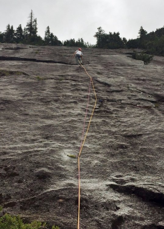
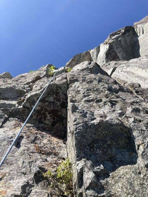
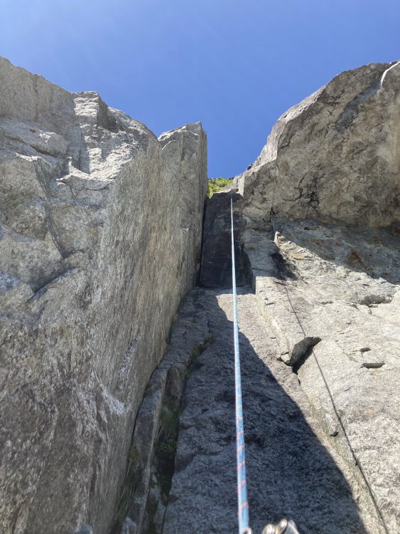
Trip: Salami Slab, Darrington - Snagglepuss Trip Date: 07/05/2020 Trip Report: My COVID-era partner and son, Ty and I made a quick trip to the Salami Slabs to test-drive a new variation to Snagglepuss. You may not be aware of Snagglepuss because it is not among the ‘Only Darrington Routes Worth Doing’ identified in climbing books and the internet. But it is fairly long (7 pitches) and has some good climbing that might entertain you adventurous non-slab-phobic types. Ty looking relaxed among the knobs, dimples and scoops of pitch 4. Leading the Catwalk – which follows the thin white dike angling left Team selfie at top of the route, spitting distance from the Snagglepuss tree The Snagglepuss – a massive Doug-fir with a silvery dead top that that looms over the route Hanman and I kicked off the Snaglepuss Project about four years ago, followed by the neighboring Purdie Shuffle. Both routes have good to great climbing with excellent views of nearby peaks and the Clear Creek valley. The Catwalk variation creates an excellent 7-pitch hybrid option that is slightly easier than the original. CV on FA, July 2016, with the giant snag visible in upper left Hanman below the gleaming goodness that would become the Purdie Shuffle For an abundance of details on how to get there and what you’ll find, check the stuff posted on another climbing website. The approach is comparable in scale to Three O Clock Rock but a bit more 'interesting' (don't worry, no brush). Much of Snagglepuss is mid-fifth with harder sections up to 5.8+, though the easiest line is not always obvious. There are bolts where you need them, runouts where you don’t, but nothing approaching an R rating. If you are offended by bits of moss and needles on your granite, skip pitches 6 and 7. Returning to grand Salami ledge on the descent. Gear Notes: Standard Dtown toolkit - dozen slings, single cams to 3", double 60s Approach Notes: FS Road 2060, take left branch over bridge, park at first boulder drainage, hike uphill. Approach details can be sleuthed from link mentioned in TR
.thumb.jpg.5d3fd25dd3896bb02a1d22f8447cfa36.jpg)
.thumb.jpg.e1309a8f8265a6cbd78bc508ce13a999.jpg)
.thumb.jpg.10854069be10768df2867cab5465ef3f.jpg)
.thumb.jpg.f881748c153426ab8e47084e11bc55d8.jpg)
.jpg.86b2b2a8fe67e11dbab9bbc8dc7a8096.jpg)
.thumb.jpg.7d483264c8b4c53ae6d2fca37353f8cd.jpg) 1 point
1 point -
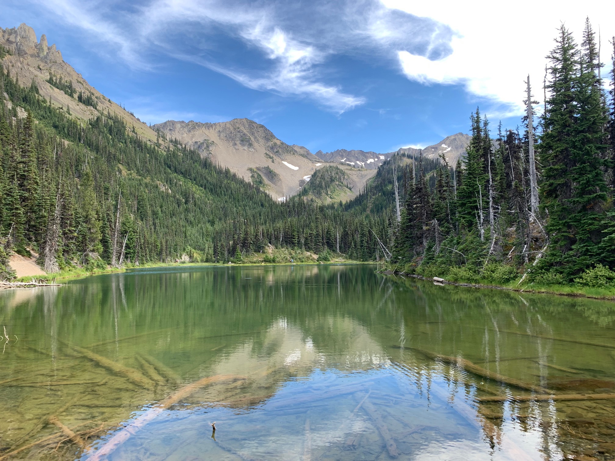
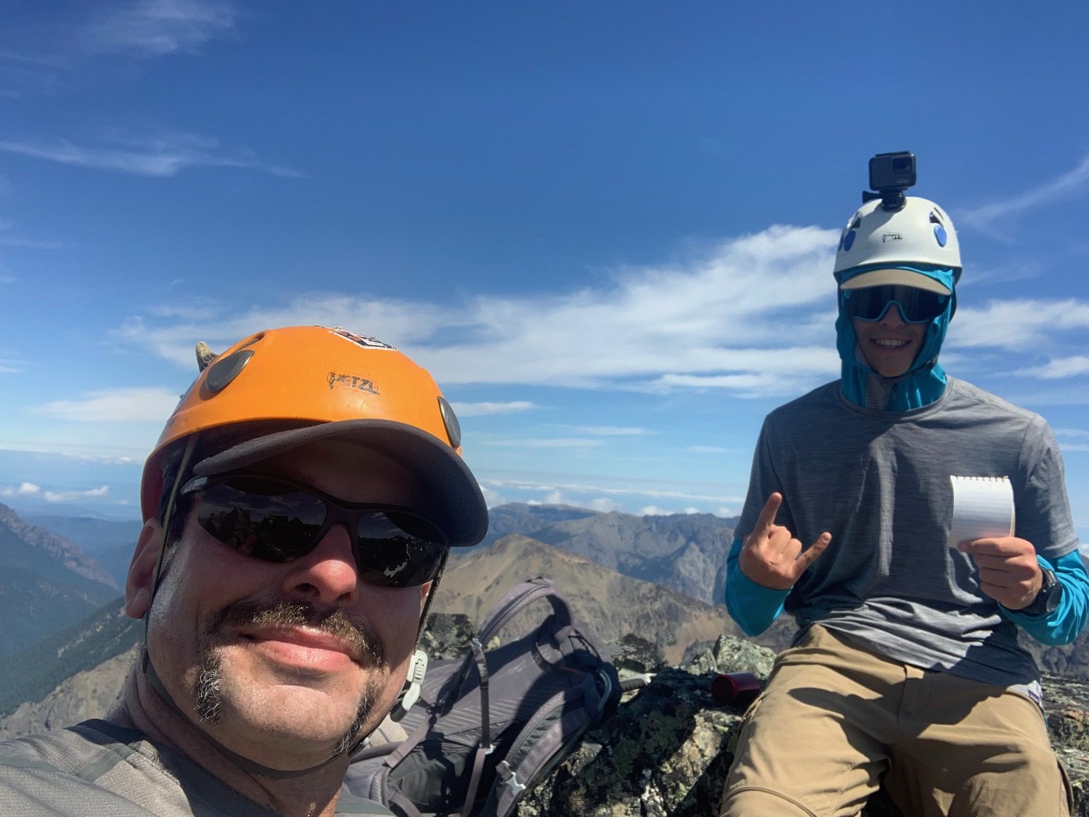
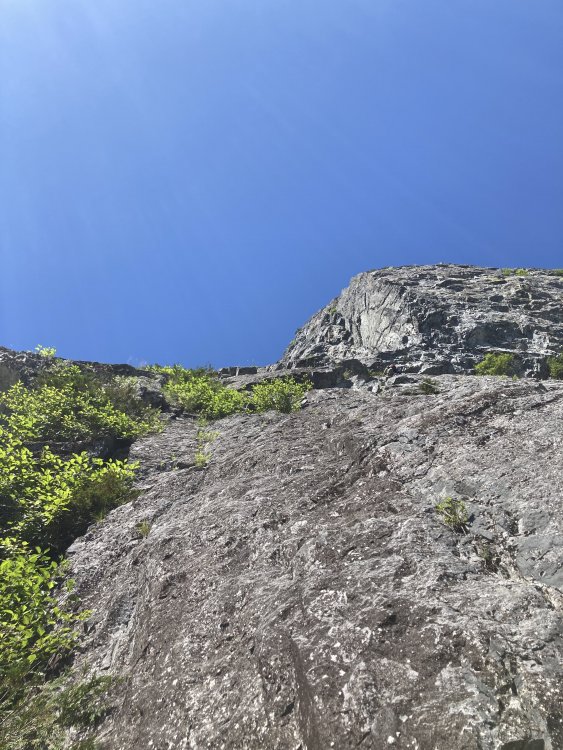
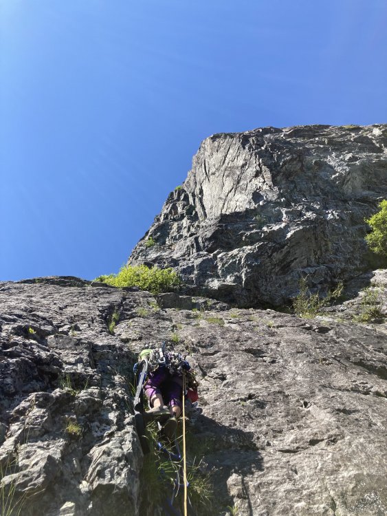
Trip: Mount Clark - Standard Trip Date: 08/09/2021 Trip Report: We attempted Clark back in June as part of a three day trip, which included a summit of Mount Deception and two nights at Royal Lake. After cancelling our plans this weekend (Terror Basin, with advanced permits) due to "meh" weather we opted for a cleanup trip, and allocated Monday for it, C2C. We drove up Sunday night and slept in our cars at the trailhead, setting alarms for 5:30 am. After breakfast and packing up we headed up the Upper Dungeness trail at just after 6:30. Overall we kept a decent pace and summitted Clark without issue at around 1:45, took a quick break and headed back down. The only snow we encountered was in Surprise Basin, which made for a nice break from tedious boulder hopping (the snow was continuous in the basin). The snow at the summit block back in June was totally melted out. The first part of the final block was loose and a bit unsavory class 3. The finish is a nice crack that pushes the limit of class 3 - it's quite steep but has great holds. Mount Deception looking a lot more melted out than it was in June. Glad we did this with snow coverage! View towards Clark from the tarn in upper Royal Basin: View towards upper Royal Basin from the base of Surprise Basin: Continuous snow in Surprise Basin: Traversing on the east side of Clark. This exposed section is one of two 'attention getting' parts. (great holds) Summit Stoke: 91/100 for me, 40/100 for my son (Smoots) Royal Lake as viewed on the way out: Here's to another one in the books! Prost! Gear Notes: Light crampons, approach shoes Approach Notes: Trail in excellent shape - no blowdowns. Snow free except for Surprise Basin.


 1 point
 -
Our intent was to exit via Sinister Arm–Totem Pass–Suiattle Pass–Lyman Lakes–Spider Meadows, but once our fearless leader got a good look at the Chickamin Glacier he felt the conditions were too sketchy for our team and we bailed out via the standard route. The people I was with were very in touch with the outside world via InReach so they had someone contact the Darrington Ranger Station to let them know we were doing that, so we were even "legal." fwiw, I may be a wimp but next time I will most likely take steel crampons, not aluminum, unless I do it significantly earlier. There was more blue ice than I anticipated, much of it wet and mushy enough to get aluminum crampons in but a fair bit of it you just sort of skittered around on.1 point
-
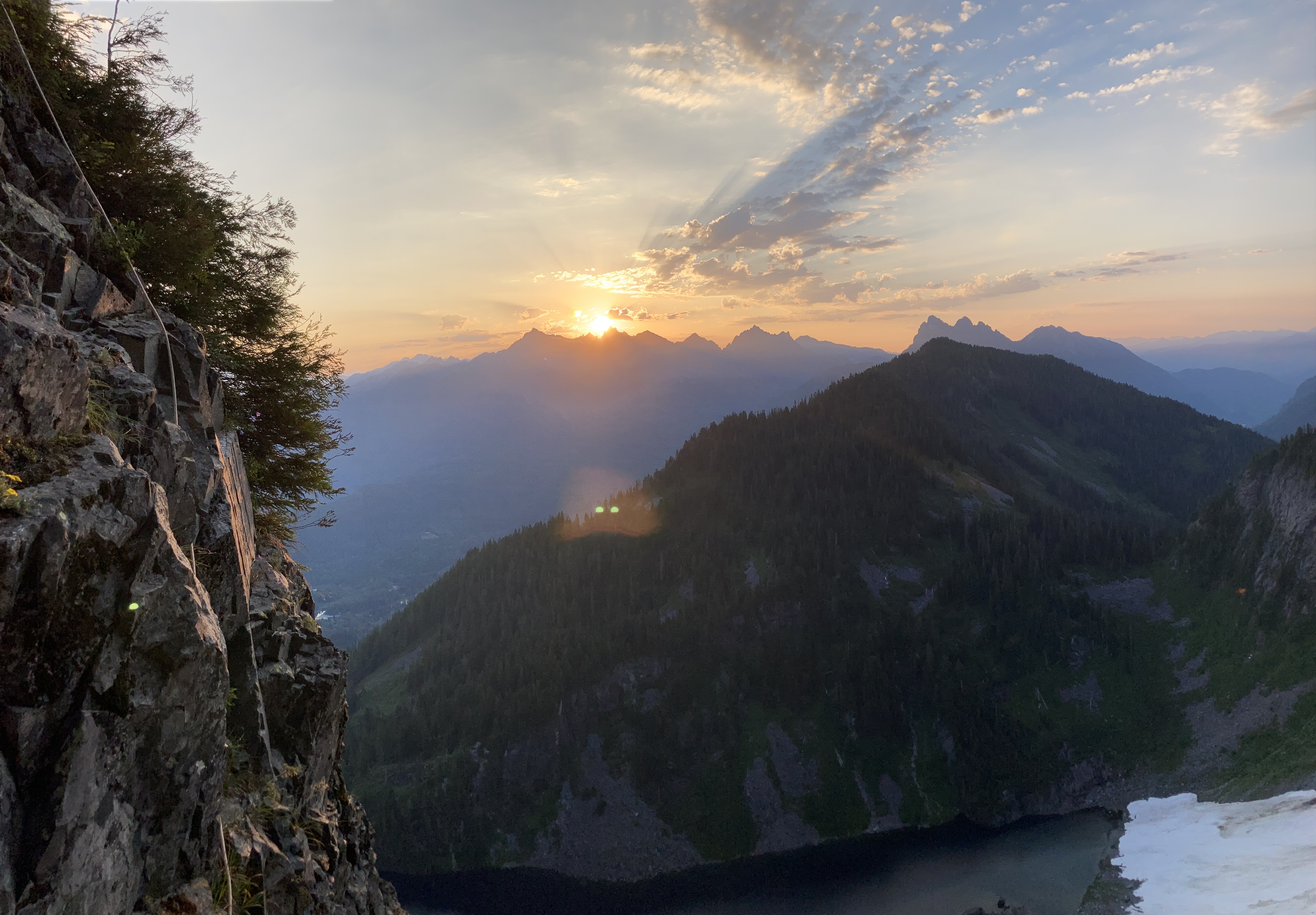
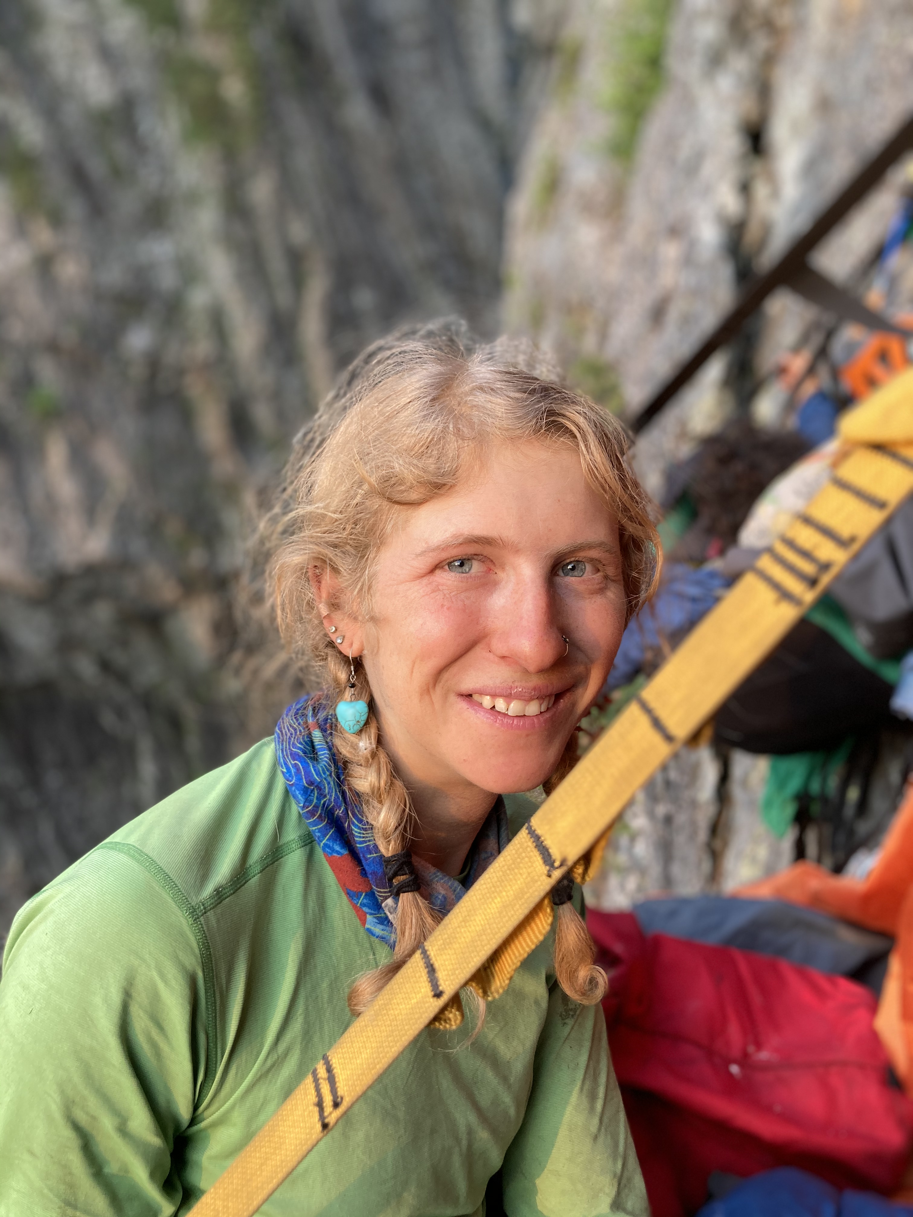
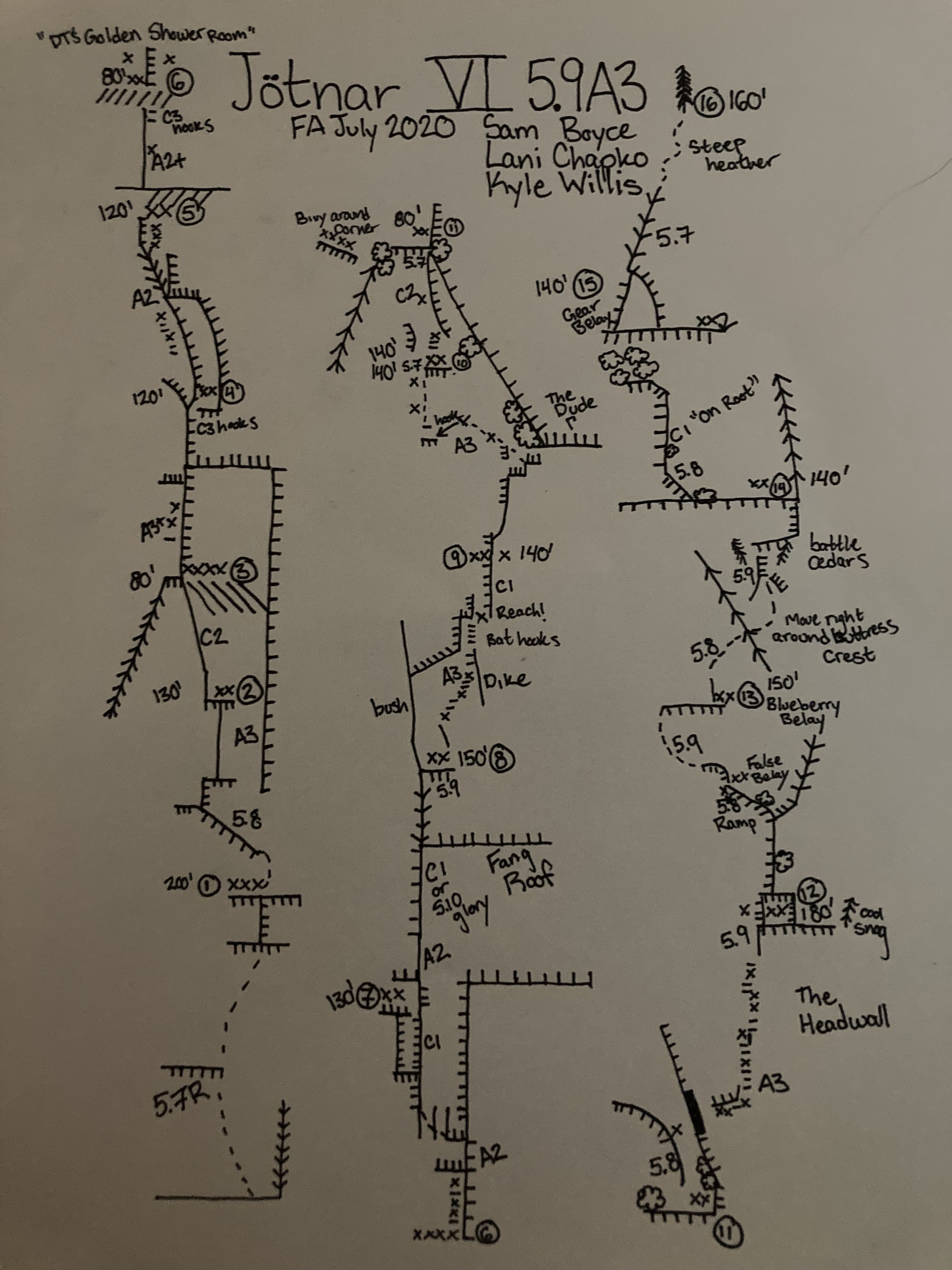
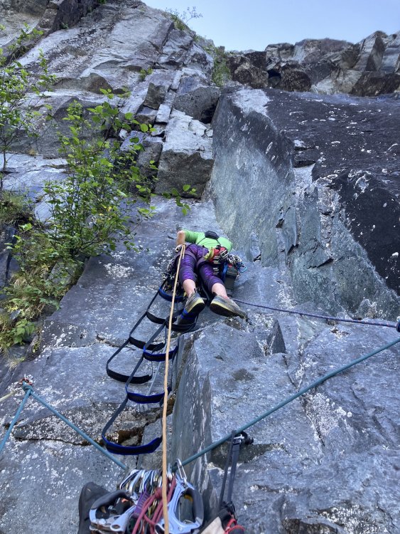
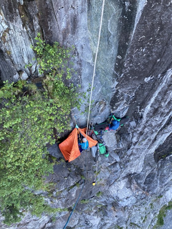
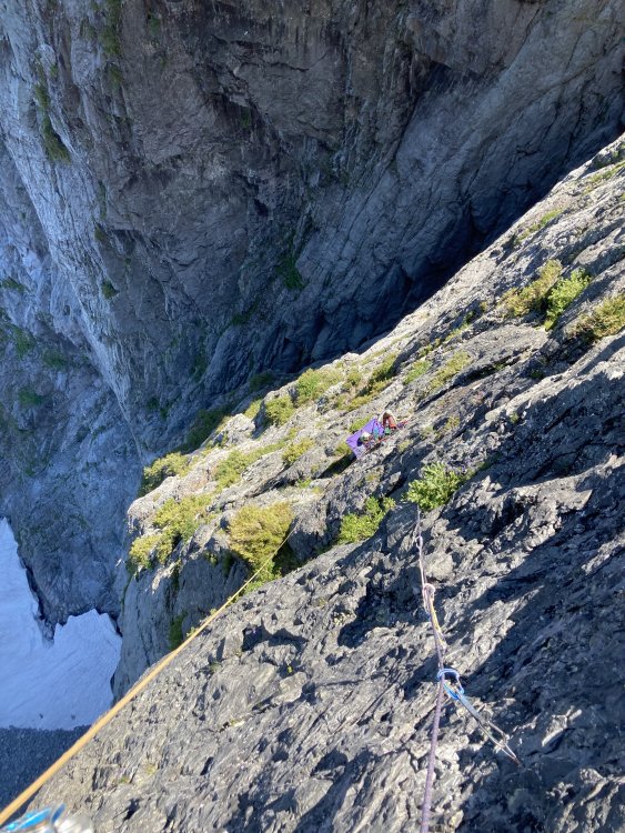
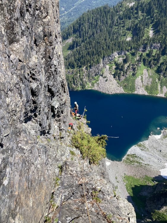
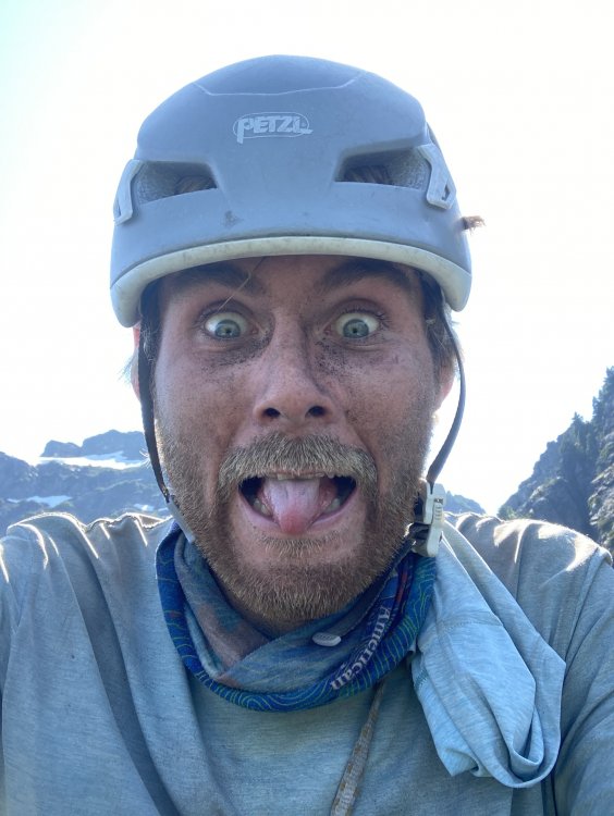
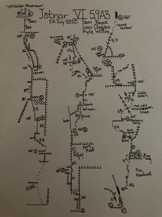
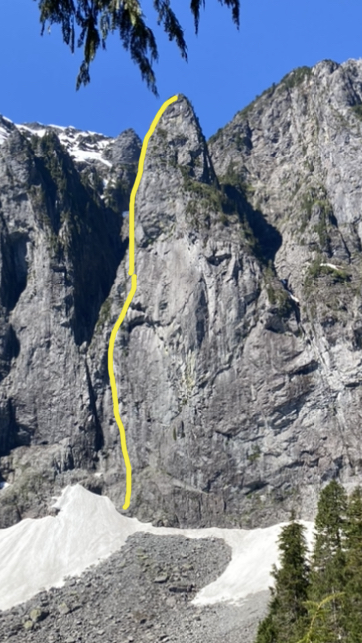
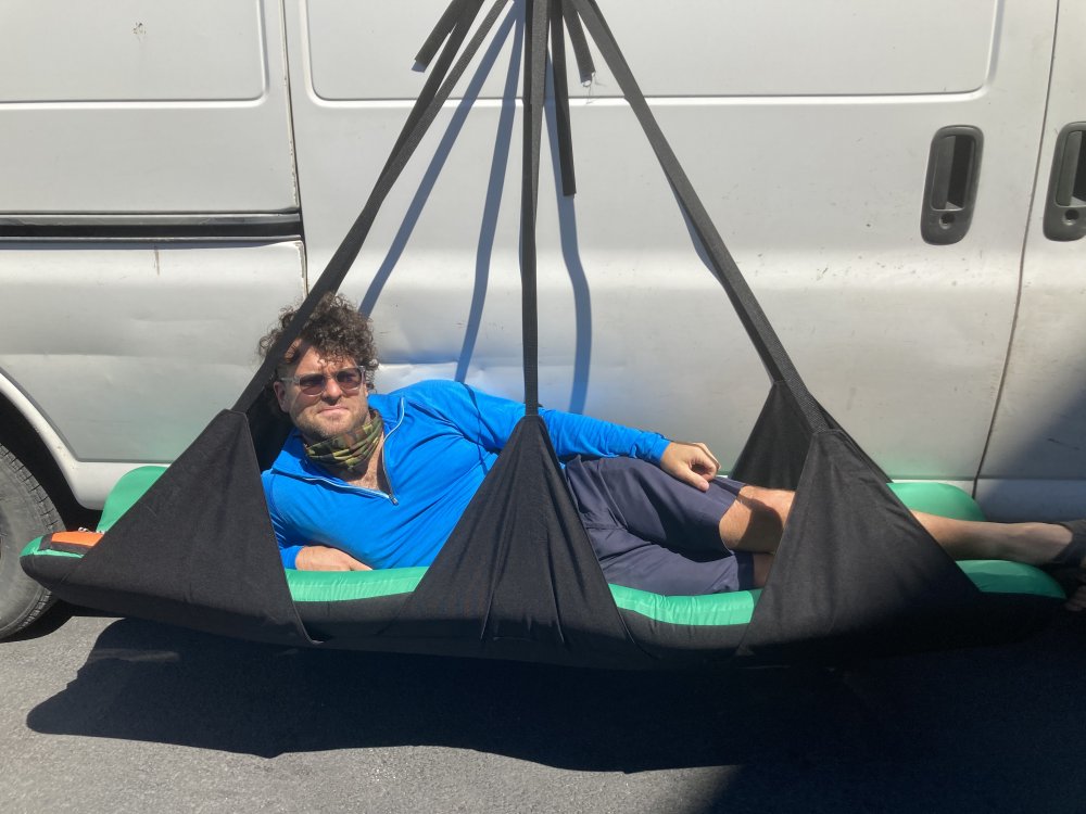
Trip: North Norwegian Buttress - Jötnar VI 5.9 A3 Trip Date: 08/01/2020 Trip Report: Whaddup maggots. The crew of vagrants and miscreants just got down yesterday from north Norwegian round 2. We completed our line to the top of the buttress. We spent 1 day fixing back to the high point then 6 days on the wall climbing in capsule style to complete the route. We are naming the line “Jötnar”, the race of god-like giants in Norse mythology. We unofficially started calling the Norwegian cirque Jötunheim, “the realm of the giants”. While only having one line up there might not give us “authority” to name something, I’m enamored with the zone and like the name, and no one else has to call it that... anywho, here’s a brief report of our experience, hopefully this inspires someone to follow in our footsteps, as it’s an incredible route. In June, we made our first foray onto the wall and found soggy conditions as our route runs through a water streak for a good portion of the lower buttress. Poor weather lead to poor conditions, if you read my previous trip report, you’ll remember we did not get far. In 4 days of climbing we completed about 700’ of the line. We left gear stashed with the intent on returning. Our window of time off about 3 weeks away. Prep for the route started a few days before our departure date. I headed over to kyle’s studio (For his gear business “high mountain gear and repair”) in Ballard to make some various things. One of those being an inflatable big wall hammock that we had been discussing in recent weeks. Kyle would test it out on this wall, likely the secret weapon for big wall alpine routes in the cascades. Kyle came up with the name “Taco” as a mockery of conventional portaledges. After making various things for the wall we set out on our own errands the next day then reconvened to shuttle a load up to lake serene. Fetching water was considerably easier than last time, the moat had opened enough to walk inside, being a whiteout day we decided it was safe enough to brave for 15 min to get water (better than hiking back to the lake!!) After unwrapping our gear stash we discovered a snafflehound gnawed on a rope! The backup lead line nonetheless. Another rope was needed, the volume of rope was becoming absurd. We told Lani to pick one up on her way down from Bellingham. Logistics here got weird. Kyle had commitments in the form of a bike packing trip during the start of the window we had to climb. So when Lani and I started climbing we would have to leave lines fixed to the ground for Kyle to use to join us two days into the climb! On the first day we got a ride to the trailhead early morning and moved with motivation all Day to fix lines the the high point on our route. The line climbed substantially better because of the cleaning we were able to do previously. Fixing high on the wall we descended to the base that evening to sleep on the ground and prep the load to haul. We woke up early again and started the manual labor. Moving faster that expected we were able to haul to the high point and get camp set up around mid afternoon. Plenty of time to start up new terrain. Lani started up the next pitch which would prove the steepest on route. She got about halfway up the pitch before deciding it was time for dinner. On day 3 she headed up the pitch and pulled through the massive steep band that blocked our view of the upper buttress. This would prove to be the only pitch that requires a fixed line for descent. I took over the lead on the next pitch and found cool expanding beak cracks that lead up to a surprise! We pulled into a band of bulletproof skagit gneiss that would run the whole middle part of the route, immaculate stone. I climbed up into a massive right facing corner and up an amazing #2 crack through the second massive roof on the route “the fang” as we had pre named it. Continuing up an easy flare I found a good stance at the base of a large slab. Lani was still feeling mega tired from the steep lead and told me to keep going, I quested upwards on the slab utilizing a mixture of hooks and rivets to reach a dike that proved discouragingly shitty. The dike however led to a good flake that rapidly turned not so good, the whole corner was a Jenga stack. Being on lead I reluctantly bat hooked the face around the choss. These bat hooks could maybe be avoided post cleaning, still chossy and expando in there though. I eventually put a bolt in to reach far and tension to the next small corner, which proved to be cruiser C1 to a good stance for a belay, post dirt removal this would likely be sweet 5.9-10. Here I called off belay while placing the anchor bolts and Lani zipped down to camp to start dinner. Meanwhile Kyle had started up the wall hauling the second half of the load solo, having to haul twice he only got to the bivy at pitch 3 and would camp here. Day 4 started with shenanigans to situate the ropes where they needed to be in order to fix higher. After we were able to snag an independent rope Lani and I again began the commute up the fixed lines to push the line higher while Kyle hailed up to camp. From the high point, Lani led up Inobvious but moderate aid to the crest of “the dude”. The biggest roof on north Norwegian, and an intimidating mega overhang. Incipient and creative low angle A3 led up and left under the roof and around the bushy corner to a small ledge. Reaching this ledge we figured we were far enough up to move camp, and thus Lani went down to assist Kyle in starting to haul while I started soloing the next pitch to the intended next camp. About halfway up my pitch I got a call saying there were technical difficulties at camp, we decided to reestablish camp and fix to the top my pitch. Day 5 would start super early with the big move. Myself and Lani would double counterbalance sky haul the pigs while Kyle cleaned the line below and brought up fixed lines. A few hours of hot manual labor brought us to the high point ledge. A grassy inset which seemed suboptimal for two portaledges, we spotted a good spot left of the buttress crest and concocted a creative plan to swing the bags over. I free climbed up to the top of a flake and put a good bolt in and lowered down (clipping the haul line to the bolt) to the intended spot. I drilled while Kyle and Lani prepped the bags. Once ready I took tight on the haul line with my gri gri and they kicked the bags over top rope style to me where I lowered them in place and docked them at the anchor. Shenanigans. After setting camp up I hugged up to my high point on the pitch and continued my lead. “The head wall” proved to be wicked exposed but I had to fight the features pulling us left into the chossy chasm and drill my way to a stunning corner on the buttress crest. Kyle and Lani came up to join me and Kyle started up the next pitch. Moderate free and aid led up through a tree to a roof. An inobvious ramp cut out left through some chossy bush. Kyle bulldozed his way up eventually running out of patience and drilling around some dangerous choss. Running low on daylight Kyle threw in a belay and called it a day. Day 6 started with a poor decision, only one gallon of water came up the wall... after jugging we were already dehydrated but didn’t think too much of it. We started on the e face and got good afternoon shade but the upper part of the route climbs the crest of the se ridge, and gets blazing sun all day. I got the the high point first and in the spirit of decluttering the tight stance I started free climbing. 50 ft up I hit an awesome ledge too good to pass up, so I added an anchor and moved the team up. Kyle in the mean time cleaned the previous bit to a state of being semi pleasant climbing!! At this belay our peril became evident, we were already spiraling into gnarly dehydration. Kyle was getting loopy, Lani unstoked, and myself crankerous. I would continue up with inobvious route finding. A long circuitous pitch of steep 5.9 led to another good albeit sun exposed ledge. We were closing on the summit, Lani encouraged me to keep leading while Kyle cleaned the route. A blueberry filled corner provided passage to the next tier, a pitch likened to the tree climbing on j berg!! One more mega ledge and we could smell it! A casual pitch of 5.7 led up to a short bit of heather clawing onto the summit of the buttress. We had read that it was easy climbing to the summit of middle index from here and it looked so. It also looked like a bunch of cascadian bush mank that seemed like it would taint our experience in our state of dehydrated madness. We descended to camp to smoke the joint we found in the parking lot and contemplate our descent. One or two puffs in I had this idea to lower Kyle with the bags down the whole face. We all became (mostly) convinced it would work and put wheels in the motion the next day. After wranglin the bags back to fall line we descended two pitches to the intended “drop zone”. We delicately stacked 1000’ of rope joined with edk’s, we would would bump em all through a munter. Kyle and the bags were probably closing on 400 lbs, we needed a gri and munter to control the load. The lower went smooth, and we were amazed! Bags were down!!!! So myself and Lani dropped all but two ropes down the face and Kyle started managing the clusterfuck. Our new friend River had responded to a Facebook call for porter help and met Kyle at the lake to take down 50-60 lbs of our load while me and Lani rapped the face and cleaned our gear. We touched down not too long after and started the soul crushing hike down, we had about 70-80 lbs a piece. I had called my parents again as it seems like all our friends are busy this time of year, they met us at the parking lot with a cooler of cold bubbly, fucking great climb. Shoutout to Lani for stoke, Kyle for his undying willingness to suffer and commitment to the manual labor and route creation, and River! For being willing to come up and help total strangers hump our stinky clusterfuck around. This route was certainly the effort of a village, and a wonderful big wall line that I hope people enjoy. Gear Notes: Double Rack micro to #4, Single 5, Single set of offset nuts (didn’t use rp’s), 4-5 each beaks, 2 small lost arrows, 10 rivet hangers. All bolts and rivets are stainless, one or two bolts didn’t take well in the wet mud, but could potentially be reset with a funk and tightented (all anchors have at least 2 good bolts). Some may need to be tightened up again after initial loading. No ledges big enough even for 1 to sleep, good portaledges camps at the top of pitch 3,6,9, and 12. Do not haul above 12. Bivies at 3,6, and side of 11 take 2 ledges well. Rap the route, some directionals need to be placed on a handful of pitches to get down, pitch 7 needs to remain fixed with an extra 35-40M rope (it could be possible to down aid the roof on rappel to get back to the previous anchor) Approach Notes: Scamper to Lake Serene while the tourons ask about your “paraglide” or “boats”. Easy talus walking to near the waterfall between the buttresses. Enjoy your stay in Jötunheim!


 1 point


.jpg.74ac5110f001001c9054b7f5f5536842.jpg)
.jpg.b4c89268ce07ea65d067b9ce77c7db25.jpg)
.jpg.cc3913456a25d431e834b1bbd6b09c22.jpg)
.jpg.e88e4eda829fdbb91f3696aa420b0fed.jpg)
.jpg.0177ed0e31de0d552a40f62bdff65bc7.jpg)