Leaderboard


Popular Content
Showing content with the highest reputation on 07/22/21 in Posts
-
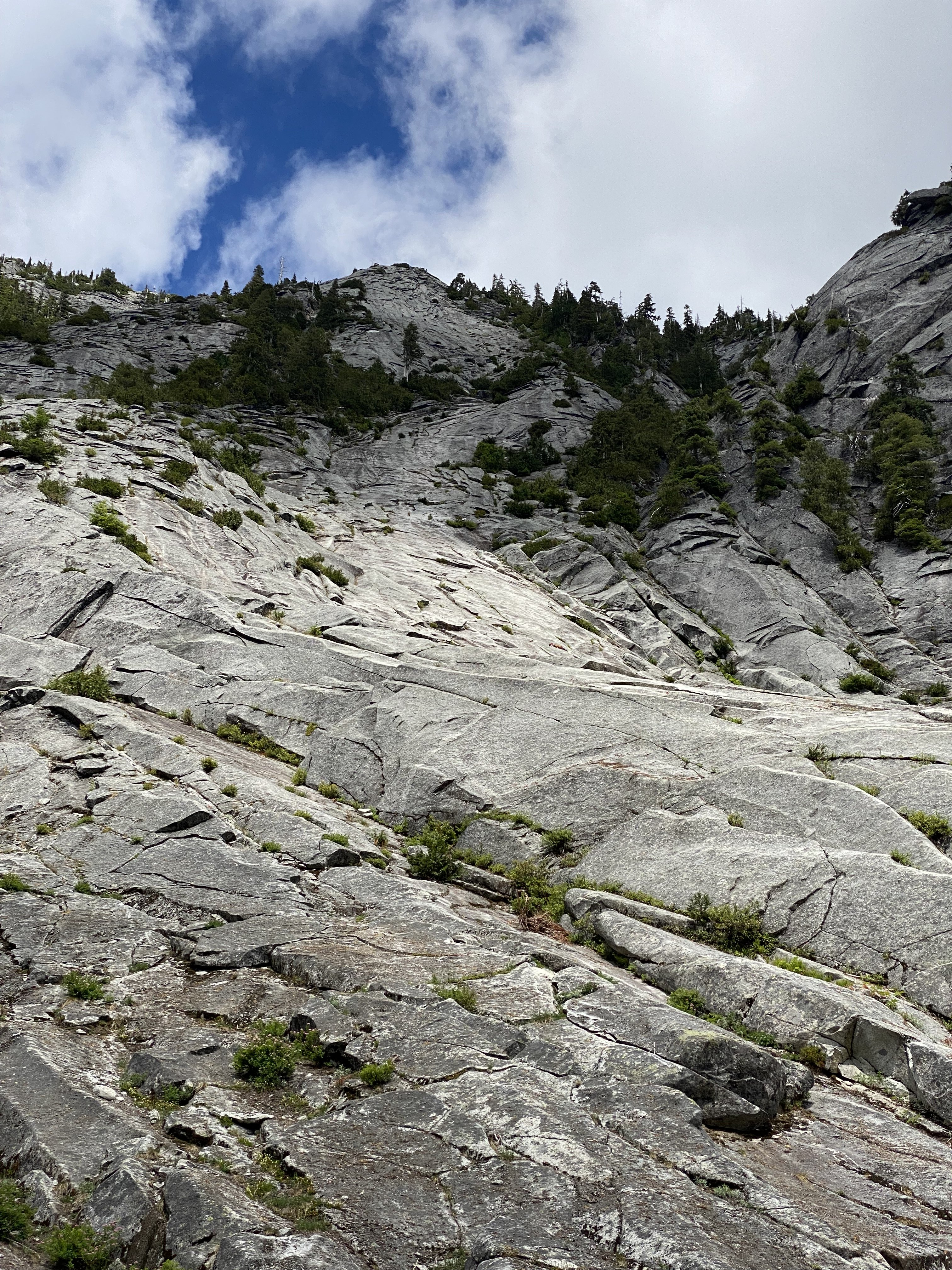
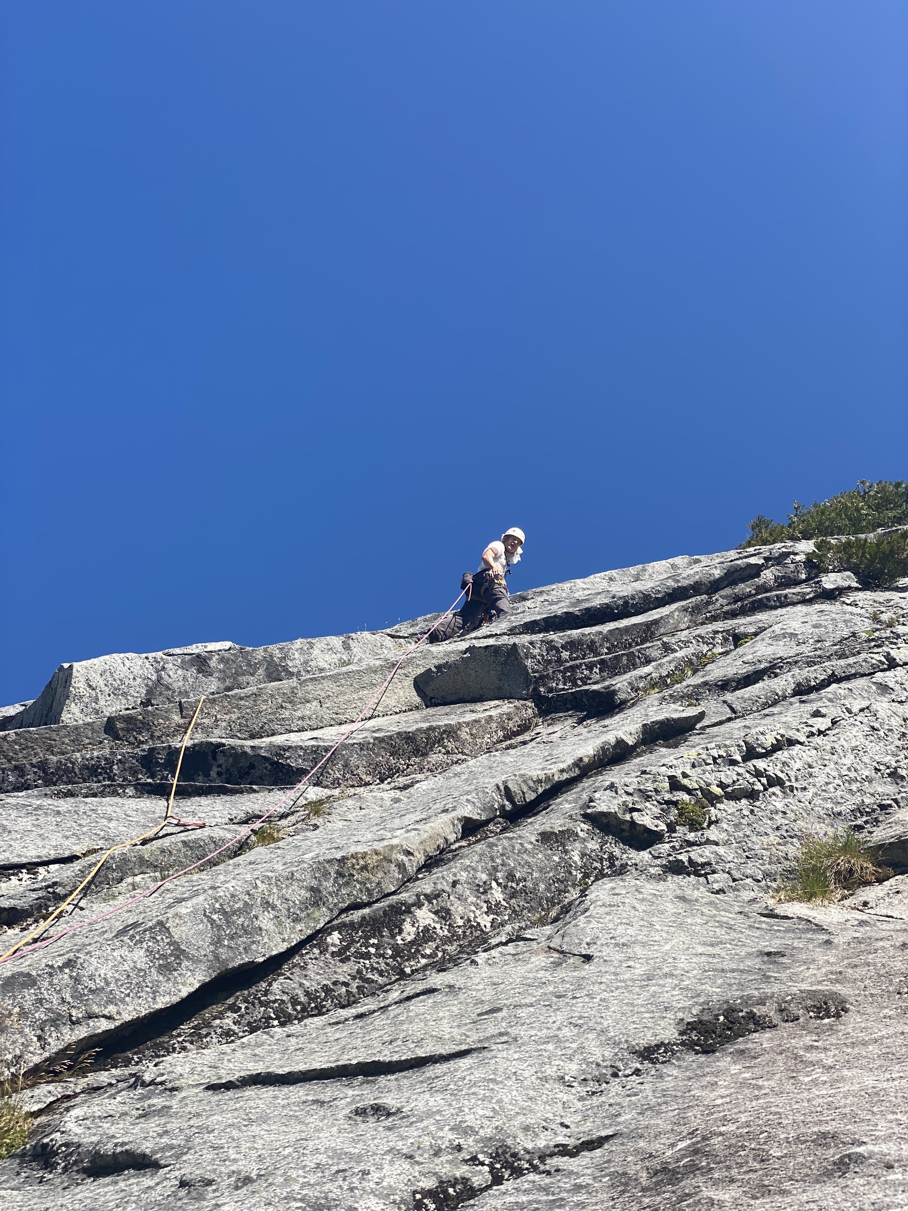
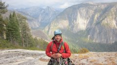
Trip: Mount Goode - Megalodon Ridge Trip Date: 07/19/2021 Trip Report: “Hey bear!” I shout, followed by a convincing monkey call from Sean. We are only a couple hundred yards away from the trail, but swallowed deep in the eight foot tall slide alder of the North Fork of Bridge Creek. Maybe we’re off route, maybe there is no route. A couple days prior Sean and I had been throwing around ideas for the weekend. Sean was interested in something hard on CBR, while I was craving some choss and adventure. Being the great friend and partner that he is, Sean agreed to my idea of Goode, and adjusted his schedule to fit mine. Meeting at the parking lot on Sunday, I ask Sean how comfortable he is soloing most of the ridge. He’s psyched on the idea, and I’m psyched to slim down the rack. I ditch the 4 and a few other pieces. With that I grab a couple bubbly waters to stash in a creek along the way and we’re off. In classic fashion, Sean takes off jogging almost immediately, it feels so good to be moving. The hiking flies by and we soon find ourselves stumbling down an alder infested hillside down to Bridge Creek. With no obvious entry point on the other side, we start hiking upstream along the river bank until the alder overtakes us, and we’re forced to wade up stream in the biting glacier melt water. Just in time for my feet to go fully numb, I find a narrow tunnel through the brush and out of the river. After a brief bout of screaming barfies we’re off and moving again. From this point, things got a little weird. All previous reports of this route seemed intentionally vague about how to gain the ridge. The alpine basin that looked like steep meadows on the map proved to be alder choked waterfalls. After re-reading Dan’s TR, I’m pretty sure we cut up the hill too early and endured some hellish bushwacking. Following the waterfall a little further seems like a better idea. Once re-birthed from the thicket, we followed a loose low 5th class gully up to the ridge crest. Freedom at last! The trudge up the treed ridge felt like it went on for eternity. Every roll, followed by another buttress and so on. It was at this point in the day that the true enormity of Jens and Dan’s single push effort set in. We were tired, and the idea of continuing up the ridge did not appeal. Maybe with tiny packs and perfect approach beta, but even then... As we tucked in for the night, a small plane flew circles around the summit. I assumed it could only be John Scurlock. After a nice night nestled into a bed of heather, we woke with the sun and enjoyed a warm pot of coffee to start the day. The initial part of the ridge proper was phenomenal. Highly textured white stone flowed up the mountain in a stunning spine feature. This section up to the first point would be a classic route on it’s own. I can not overstate how good the rock was through this section. Just perfect scrambling. Now atop point 8200, a cold wind ripped from the shady south side, adding to the intimidation of the ominous drop off ahead. Rather than onsight down-solo into the abyss, we opted to rope up here and simul down to the notch. This section did not boast the same quality rock, but made for comfortable down climbing with adequate protection. Once down, we again unroped and began back up to SE peak. Scrambling across this ridge was an incredible experience. I found myself falling into a flow state unlike much other. The climbing isn’t too hard, nor very sustained, so you are really able to enjoy the movement. Finally below the headwall, we roped up again. I lead a long somewhat loose and scary pitch of 5.9 slightly to the right of the FA party’s route. It went, but I can’t say I recommend it. Sean then took the lead, and after bailing on a N-side option, led an incredible 55m pitch up and left through splitter corners and up a striking arete feature. This pitch onward is definitely the same route that the FA party took. The last ~70m pitch took me up a very poorly protected arete composed of brick sized loose blocks up onto the ridge. As Blake says, “no lifeguard on duty here”. Sean questing the wrong way. Now with the biggest obstacle behind us, we basked in the sun before unroping and scrambling down to the snow patch, and top of the ski line. Things had gone very smoothly up to this point, so we took our time hanging out and brewing up. Sitting there looking at the steep grey ice, and rotten gendarmes was making me nervous. We only had one chintzy light axe between the two of us and no crampons. If there wasn’t a way around, we would be in a pretty bad spot. As we scampered further up the ridge, I theorized how we could dead-man some rocks to rap down the snow and swing over to the other side. Once over the ridge, I was relieved to find a casual (albeit shitty) scree slope taking us around the back side. More scrambling took us through looser and more convoluted gendarmes up towards the Black Tooth notch. Roping up one last time, I lead down and around the final gendarme into black tooth notch. I found this pitch to be easier than the proposed 5.10 grade, probably 5.8 or 5.9 and truly well protected. Maybe after 11 hours of FA questing with big packs this could feel like 10-. A short simul block took us to the summit and nap time! Having mentally prepared for an epic 12+ hour day, I was pleasantly surprised to arrive on the summit in the early afternoon with plenty of day to spare. We had full water bottles and a full seven hours to nap and enjoy the views. Life is Goode! The descent sucked, and the hike out only sucked for the last hour. Too many good photos to share in this TR. Our full photo album can be found HERE Gear Notes: If Simuling/pitching out most of the ridge Double rack .1-2 Single 3&4. If scrambling all but the cruxes, a single rack .1-3 should be fine. Small cams in the .1-.2 range are most useful. Fish themed snacks. Approach Notes: IDK, try and gain the ridge as soon as possible? Follow the waterfall? Maybe someone who has done it right will chime in.4 points
-
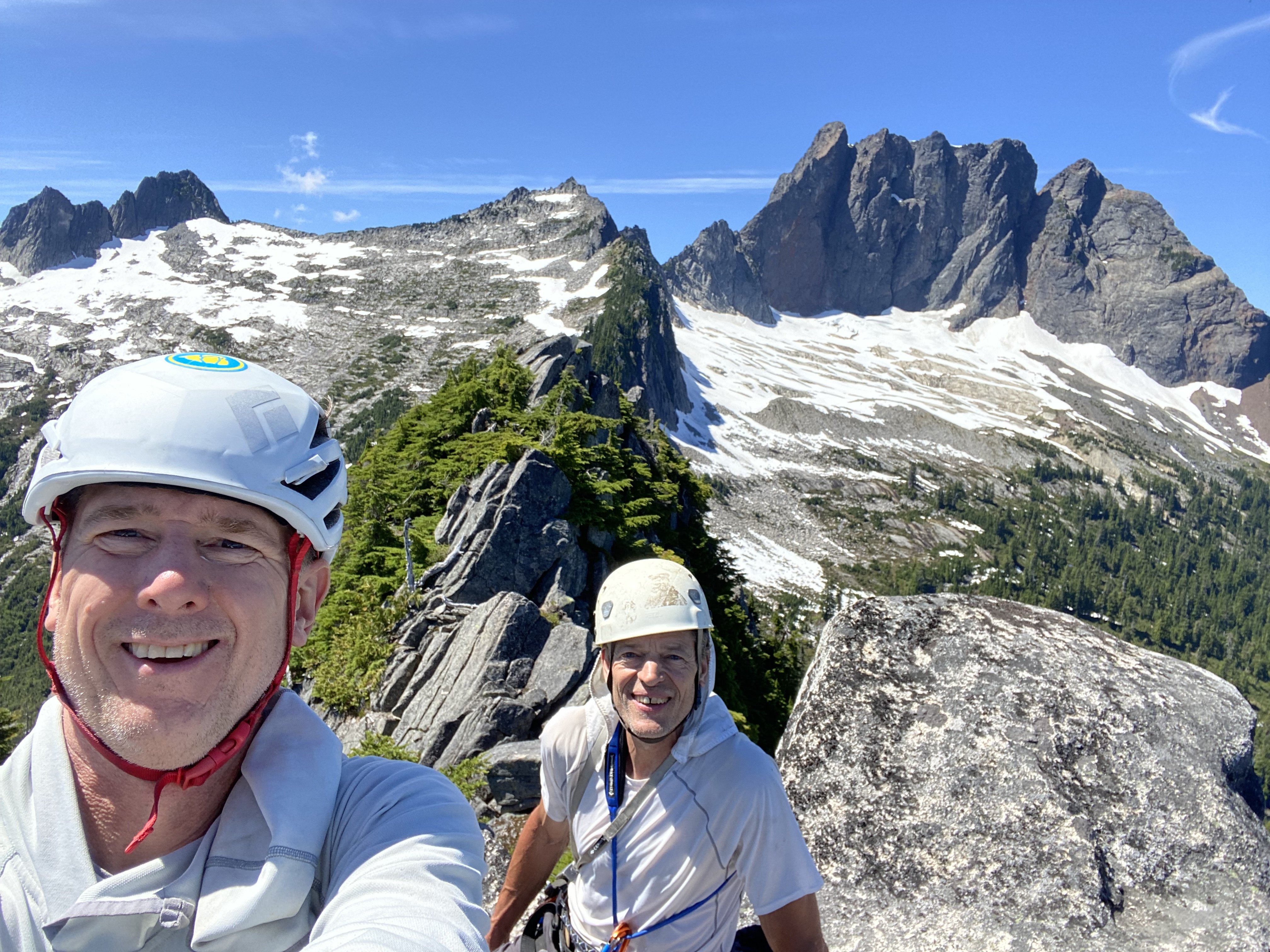
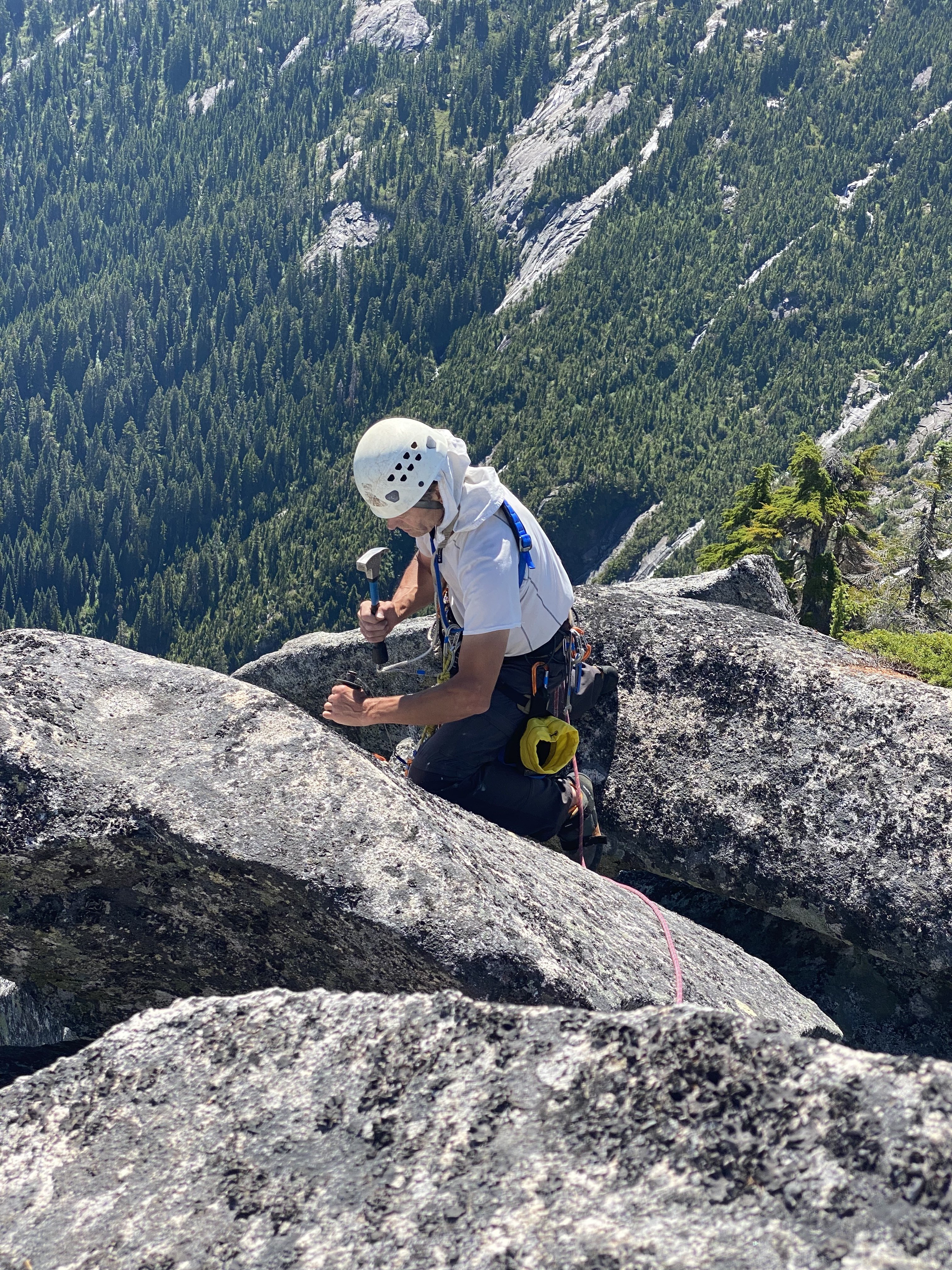
Trip: Squire Creek Wall - Concerto in C for Drill and Hammer Trip Date: 07/18/2021 Trip Report: On Saturday, July 17th I met Brian Young at the Shell station in Darrington for a trip up Concerto in C for Drill and Hammer on Squire Creek Wall. Glad that I'd borrowed Brian's brush cutter earlier this year, the bike ride up the old logging road was pleasant. In no hurry with only the approach to do this day, it took us 3 hours to get to camp. Then we carried our ropes and climbing gear up to the top of Pitch 1, having soloed the easy first pitch, and clipped it all to the anchor there. On Sunday the 18th we awoke at 4:30, first light, and departed after breakfast. At first we worried about the pack weight for the second, as it contained four full water bottles, all drilling gear, a chain anchor, and six bolts with hangers. We even discussed fixing each pitch and the second doing them on jumars. Instead, I tried climbing with it, and not one complaint was aired all day. We climbed rapidly and were at the Bubba Compactor at 7:30am! Brian took Pitch 2, which had me worried, but he cruised it and every even-numbered pitch thereafter. I followed Pitch 10 with no problem with the pack, it was even fun! I noted the piton was still there on Pitch 11; this point didn't seem as scary as on the FA. On Pitch 14 Brian yelled that this was the scariest pitch of the whole route! We noted that a bolt or two would be good on the sandy slabs there. We reached the summit at 2:00. I quickly made ready for drilling the list of fixups, which included: 1) Installing a chain anchor on the summit 2) Adding two bolts to Pitch 14 3) Replacing the piton on Pitch 11 with a bolt 4) Replacing the two quarter-inch buttonheads on Pitch 10 with fat bolts I drilled the summit anchor, and we descended. On the pitches with drilling tasks, we fixed the lead rope and I rapped down it, got on jumars, did the work, and rapped to the next anchor. Then Brian unfixed the rope and rapped both ropes normally. It all got done smoothly but took time and we knew we would be hiking out partly by headlamp. As it turned out, we crossed Squire Creek in the last of the dusky light. We dried off our feet, donned headlamps, hiked and biked down to the trailhead, and reached the cars at around 11:00. The C-shaped route On Pitch 11, with the "inverted prow" on the left Brian taking the summit shot Drilling the top anchor 20210719_002635000_iOS.MOV (an experiment to include a video file, may not work, or may show sideways) Replacing a quarter-inch buttonhead on Pitch 10. When drilling out a smaller hole, you have to make small hits, at first, to keep from binding the drill bit This is now a 14-pitch route, as I measured the remaining rope when Brian reached the "tree belay" atop Pitch 14, and know we could just as well have clambered up the summit blocks to the top. I will be editing the topo and posting it later. While descending high on the ridge we saw two climbers topping out on Skeena26. Good to see that route getting some use. The amazing linkup by Kyle and Jenny will have an effect! My thanks go to a smart, cautious, and patient partner; good on ya' Brian. And thanks, Kellie, for making the suggestion of a bolt on the 'white hump' on Pitch 14, corroborated by Brian; it is now a better pitch. All photos by Brian Young Gear Notes: Standard single rack to 3". Approach Notes: The boot track now has two detours around winter blowdowns. They are pretty well kicked in, watch for the piles of sticks blocking the original way, and turn right.


 1 point
 -
Trip: Mt. Hood - Cathedral Ridge - Summer Climb Trip Date: 07/18/2021 Trip Report: Tim Stabio and I climbed Cathedral Ridge yesterday, July 18, 2021. We left Top Spur TH at 3:45am, and stumbled our way to the summit 5 hours 36 minutes later, where we relaxed alone on the summit in summer sunshine for about half an hour and ate wild boar burritos before descending the ol' south side. We reached my car parked at Timberline 7:34 after leaving, feeling good and unexpectedly wondering what we were going to do with the rest of our day. Overall, the route felt wild and remote, with about 1/2 of the route comprised of moderately OK rock and 1/2 comprised of horrible stuff only faintly resembling rock. If one assumes that everything one touches will move, then the experience will be great. There is also stellar positioning, offering some unique views of some of Mt. Hood's sexiest features. Beta: the route is obvious, and generally follows the path of least resistance. I thought the route photo at https://www.summitpost.org/cathedral-ridge/660166 was good. We didn't encounter any snow/ice to really speak of, which was good because I packed the wrong crampons for my boots (dummy!). Fortunately, we each had two ice tools, so I was able to smear/tool my way down the still-frozen old chute on the descent. We didn't encounter the steep snow slope mentioned in other trip reports on the route, although it'd be easy enough to find one in the upper reaches; instead, we stuck to the ridge proper (rock). The only notable section might have been a pitch-ish of class 4/5 uber-choss that could have been bypassed on climber's left with a snow slope. Lots of downed trees on Timberline Trail, which provided some interesting but not time-consuming navigational experiences in the wee morning light. We wore trail running shoes in, then switched those out for more rigid footwear when we started clawing our way up scree/choss fields. Overall, a worthy and under-appreciated route for those not against a little groveling on choss. Gear Notes: Standard alpine affair. Lighter is righter. Rope would only potentially be of use if there is snow/ice. Approach Notes: Top Spur TH provides the full experience of the ridge, from bottom to top, which was important to me. Better IMO than Timberline, if you can swing a shuttle.1 point
-
Trip: Mt Index - North-Middle-Main Traverse Trip Date: 07/10/2021 Trip Report: The weekend of the 10th and 11th of July Bobby, Chad, and I spent 2 days climbing the North, Middle, and Main peaks of Mount Index. Done as a traverse from north to south this route offers amazing exposure, complex route finding, and engaging climbing. Most interestingly is the proximity to civilization; the remote feeling you get high up on the peaks in juxtaposition of the ever present crowds of Lake Serene and the thrum of the weekend traffic is a dynamic I have not found elsewhere in the Cascades. I have stared at this mountain many times over the years, but always put off the traverse due to timing, lack of solid parters, or lack of physical ability. Fortunately all of the pieces fell together this summer and I had no reason not to do the climb, besides the well deserved reputation of the mountain and the route. It is a big route indeed with over 4k feet of technical scrambling and climbing. Long sections of steep sometimes loose rock on the way up and committing rappels on the way down keep you from gaining each peak. Also for any normal person, it takes an overnight bivy on the middle peak that may or may not have water. For us it was two 14+ hour days, but they were rewarded with one of the most amazing bivies I have slept at and stunning ridge climbing with views not only of Glacier Peak, but Seattle and Bellevue as well. Information on this route was a little hard to come by and it was one of the first times in a while I found the Becky book to have the most reliable route description. We also used trip reports from Tom Sjolseth and Jason Griffith found on this site. Both were helpful. I have added some beta to this trip report for those interested as there were some definite holes in the becky description. We left the parking lot about 6:30 am and enjoyed a talking pace up to the lake on the steep trail. The first views of the route come just before the lake when you can see the traverse in its entirety. As we got to the lake we got fresh water. We did not know when we would be able to get water next as the N face appeared basically dry. Bobby pondering what he had gotten himself into. We skirted the trail along the west side of the lake until the talus slope then headed up to the base of the North Face. The North face of the North Peak of Index is about 2500 feet of technical climbing and scrambling. None of it is extremely hard, but protection can be poor and belays hard to come by at times. While we climbed we passed many rappel station of various quality as well as old fixed pins so it was not too difficult to know we were on route. Route overlay of North Face of North Peak of Index. From the toe of the NNE rib we started up very brushy trees until you could gain the rib. We followed the rib straight up for about 100' then cut left at a bushy section to get into an open book. Climb up this before trending back right onto a long slabby section. Ascend the slab until reach a small roof feature. There is an anchor here made form a pin and nut just under the roof. From here we began simul climbing off left trending around overhanging roof features. The steep walls will kept pushing us left until we gained a treed ledge with an open book above. This is the crux of the route. I climbed an open book, that is more of a face, up about 50-60 feet until it forces you off right on a sharp traverse to gain a long gully system. There were 2 fixed pins at the point of the traverse right that I clipped for pro. The gulley system can't bee seen from the lake or trail as it is facing north. We went up the gully for 300-400 feet until we were able to traverse right into the open bowl of the north face. This put us in about the middle of the bowl at this point. Once there we went left into the obvious large gulley system. Most climbing was done on the right of the gulley until you can traverse right to the notch at the start of the North RIb. The North Rib is pretty obvious once you are there. It is great exposed climbing for 2-3 pitches. Looking down from above the North RIb. Once above the North rib the climbing is below 5th class with mostly exposed moved of 4th class. The false summit is gained via steep heather gullies on the east. We were able to find a patch of Snow just below the False summit and refreshed our water supply. From the false summit you scramble through a series of steep gendarmes. While the climbing is technically easy the exposure it insane. The final climb to the true summit is on the North face and is mostly heather and loose rock. Nothing too difficult, just very exposed. Exposed scrambling along the ridge from the North False Summit to the North Summit. More Insane exposure along the ridge to the North Peak. North peak at top of picture. View toward Main Peak from North Summit. We summited the North peak at about 3 pm. This is where the real choice is made. It is still possible to descend the North face, but once you head down to the North-Middle notch coming back becomes much more difficult. Of course we didn't do all that climbing with overnight packs to not at least try to find our way. At this point it seemed very unclear from the becky description as to where to go. He illiterates to descending to 4880' in a gulley to the west, which is not at all what we did. We descended the south side of the peak to the first gendarme and rappelled to the west about a rope length down a gulley from a block that is kinda hidden behind the gendarme. HFrom the end of the rappel we traversed back up the east side under the gendarme and descended down a gulley to the east about 150'. We did one rappel down the gulley to the east, but could have easily down-climbed. From here you climb back west and up to a notch between the second and third gendarme and rappel down to the west side of the ridge. Traverse down along the ridge on the west side until you get just above the North-Middle notch then do one rappel down to the notch. Not too complicated right? North Peak as viewed from the Middle peak. One can see pretty well how the descent from the North Peak to the North-Middle notch is done from here. This is the second rappel shown in the picture above. The block with all the slings is a pretty obvious point to get to and know you're on the right track. Chad and I getting ready to rap off the block down to the west side of the ridge. Once down to the North-Middle notch it is a simple matter of getting up onto the ridge then climbing this up and over the false summit of Middle to a bivy site we were hoping would have a patch of snow near it. Exactly where to ascend up to the ridge from the notch was unclear. We ended up traversing left about 50' and ascending a shallow east facing corner, which I think is what becky describes in his guide. We could not see that the corner was shallower until we got right underneath it. Once we gained the ridge we were treated with some of the best climbing of the trip. Gorgeous views all around on a knife edge ridge that went on for about 3-4 pitches. We continued this up and over the Middle false summit to one slightly overhanging rappel down to the notch between the Middle Peak false summit and Middle Peak. And just as luck had it there was still a small snow patch to get water from for the night. Amazing ridge climbing in route to Middle Peak. Almost to the Middle Peak false summit. Chad hoping for the long day to be over along the North Ridge of Middle Peak. We got the bivy about 8:30 PM. We melted snow, drank a little Jim Beam, and settled in for the night. The bivy is first class given what else is on the route. Plush and flat with plenty of room for 3, and perfectly located to split the climb into 2 relatively equal days of work. Celebrating getting to the bivy and a good night of sleep. Beautiful sunset over Mt. Persis. The next morning we got going around 7:30 AM and began the ascent to the Middle peak true summit. Most of the mornings travels were fairly easy given yesterdays work. The Middle peak is gained by the east face. Traverse to the east side and ascend broken slabs and heater until the summit is gained. Bobby excited to get up the Middle Peak of Index, one of the most difficult to reach in the state. Sunset falls can be seen in the middle of the photo in the background. From here Becky describes getting to the Middle-Main notch in one sentence. "Descend easily to the Middle-Main Peak notch". I am gonna have to disagree with Becky on this one and say it was a bit more involved then that. We did 2 rappels on the way there and switched from one side of the ridge to the other multiple times. We started mainly on the crest until steep rock forced us down to a gulley to the east. After passing this first gendarme we were forced back onto the west side with a short rappel down to a ledge system. We traversed the ledge system until we went back east onto a broad series of light colored slabby ledges. These ledges had snow for water. From here we went down the slab until we cliffed out and had to cross back to the east side down a steep series of steps leading directly toward the notch. From here one can see the notch. A steep red colored gulley trends back east and we set up a rap anchor on a tree above this gulley then rappelled down it under a chockstone. At the end of the rappel we traversed into the notch. In all parts there was basically only one way to go or it cliffed out. During this whole descent we were treated with the view of the impending north face of the Main Peak. It is very ominous looked at straight on. Foreshortening can be a real mind killer, but it is all there and the climbing is moderate, if not loose and sketchy in places. Technical crux of Main Peak north face coming out of the Middle-Main Notch. We climbed a short chimney out of the notch that lead to more low 5th class climbing. overall the idea was to climb the initial steep wall out of the notch, then trend left until the main ridge emanating from the South Norwegian buttress can be gained. This is climbed until the Wedge gendarme is reached. The climbing involves sections of trees and exposed ridge as well as a cool left facing corner to gain the upper ridge. Once at the Wedge gendarme we down climbed a short section then up the main face until we found a suitable place to traverse across the giant red gash through the middle of the face. View of the North Face of Main Peak from the descent down to the Middle-Main notch. High quality rock we had to traverse to get out of the north face and onto easier terrain. Once across the gulley we traversed ledges until you can pass through a notch and onto the west side of the Main peak. From here the technical climbing is over and it is a short trip to the summit. We continued traversing south from the notch past 3 gullies until we could ascend a heather and dirt gully up to gentle slopes near the summit. Walk SE toward the broad summit of the Main Peak of Index. We were excited to reach the summit. 3 peaks in 2 days of 1 mountain and still we were only half way there. Index does not give up the goods easily and we still had the arduous descent of the Hourglass gulley to get done. None of us had crampons and I only had approach shoes on, so the idea of descending steep snow was questionable at best. The trip to the top of the gulley was a quick easterly traverse from the summit. At the top of the gulley system we stayed skiers left and did one initial rappel off a tree to get onto a snow field. We made a gingerly descent of the snow field to a band of rocks and trees and did two more rappels from here to get down below the hourglass feature. At the time we passed it there was a 5-8 foot wide moat at the bottom of the hourglass that was very deep. Tedious down climbing of snow and a few good snow bollards got us down to the talus slope and most of the difficult descent behind us. We headed down until we got to the top of the ridge visible from Lake serene. We followed the ridge along its crest and did one rappel along the ridge where it got very steep. Talus down to the lake and traverse along the south side until we got to the main trail. It was a long day to get down and we didn't get back to the parking lot until 10:30 pm. It was well worth it though to be able to do such a big adventure so close to home. I am pretty sure I could see my house from the bivy. I would recommend this climb to anyone looking for a big adventure. If you have honed your alpine climbing skills and wish to test them all then Index provides as it always has. Gear Notes: single 60 or 70m rope will work double rack to 2" and set of nuts Long slings for trees and horns. Extra tat for rapel anchors as necessary Approach Notes: Lake serene trail is pretty nice given some of the approaches to climbs in this state.1 point
-
Trip: Mt Shuksan - Fisher Chimneys Trip Date: 07/18/2021 Trip Report: This weekend I roped up with my wife for the first time in several years on an outstandingly beautiful climb. I immediately understood why Becky included Fisher Chimneys in his 100 favorite climbs of North America. We lucked out in every way: fantastic weather that wasn’t too hot or cold, easy route finding up the chimneys, cruiser snow and glacier conditions, and only a few other parties on the summit pyramid scramble. And most importantly, excellent two day child care on the home front! We bivied at the truck Friday night and started hiking Saturday morning. The hike to the chimneys was straight forward, as were the chimneys. We bivied below Winnies Slide, which doesn’t have running water but is a short 10 minute jaunt up to the upper bivies where there is running water. Winnies slide is all steep snow right now. Sunday we were moving at first light. The Upper Curtis is mostly smooth sailing with just a bit of steep snow/ice at the start and some steep snow at the exit up to the Sulphide Glacier. We scrambled up the central gully on the pyramid, putting the rope in my pack and not taking it out until a couple rappels on the way down. Views were spectacular. It took us about 7 hours round trip from our bivy. We had a nice nap back at camp and relaxed for a bit before packing up and heading out. The chimneys took a bit longer going down than they did coming up. We were tired by that point and did a few rappels and were pretty cautious with the exposure in the chimneys. Back at the truck ~8:00 and at home in bed by midnight. Hiking to Lake Ann Spectacular views 24-7 Starting the first scramble section: View of the chimneys. The route finding is fairly obvious once you start up. Relaxing in camp below Winnies Slide Early morning on the Upper Curtis Glacier View of the summit pyramid Katie leading up the central gulley All smiles on top! Parting shot on the drive out Post Script: Unbeknownst to me, my grandmother passed away gracefully at the age of 101 on Saturday night. Sometime around her passing I woke up to look outside and check the weather. I don’t think I’ve ever seen as many stars. I’m not an especially religious person, but in retrospect it seems as though a greater being was calling me out to see her ascend to heaven. RIP Margaret Colson Devot. Gear Notes: Brought a second tool for the steep snow and potential ice but it wasn't necessary Approach Notes: Road closed at Heather Meadows added ~1 mile to the approach1 point