Leaderboard
.thumb.jpg.d8d6db40947cc944f6d3d87de772c58e.jpg)


Popular Content
Showing content with the highest reputation on 03/29/21 in all areas
-
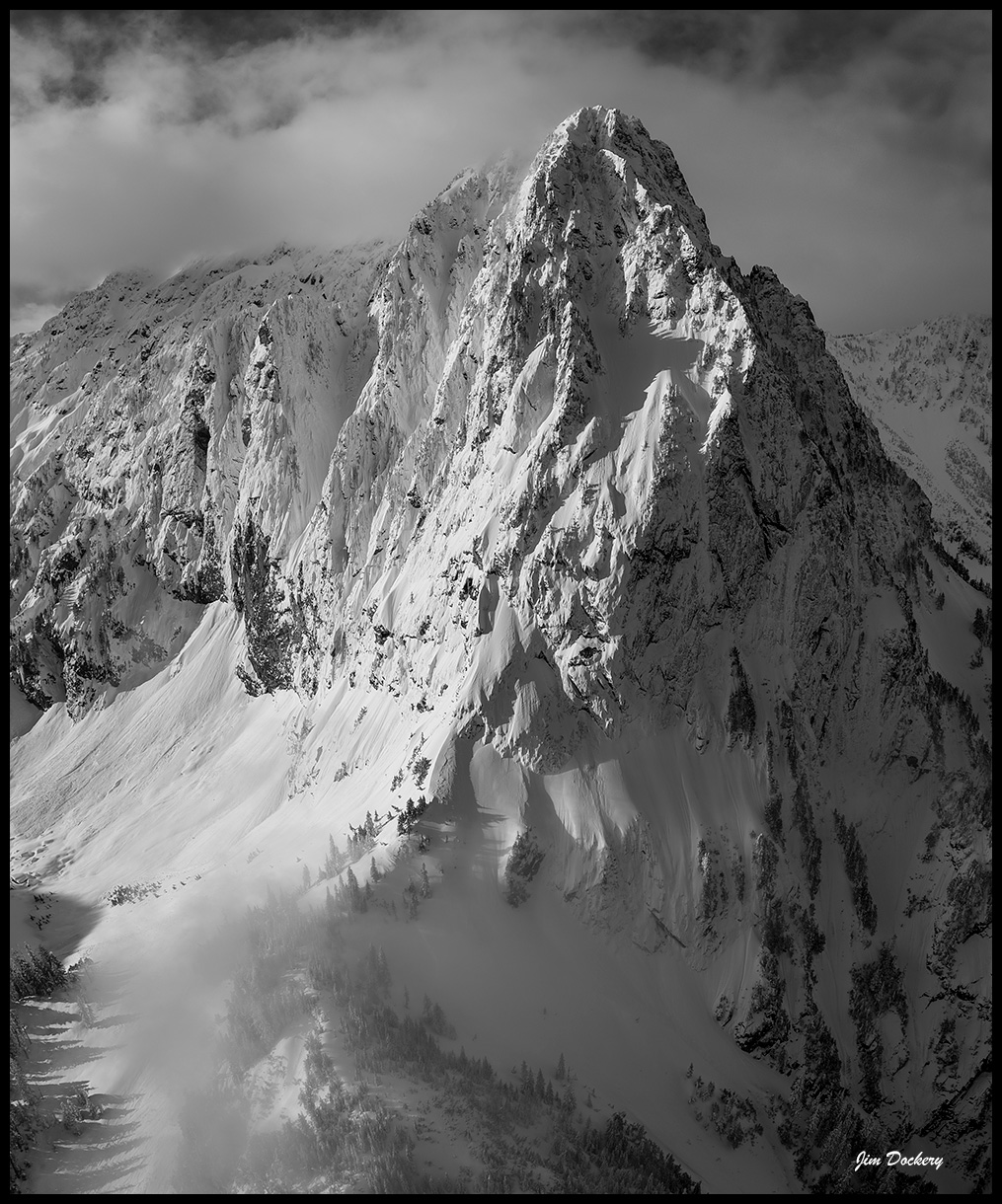
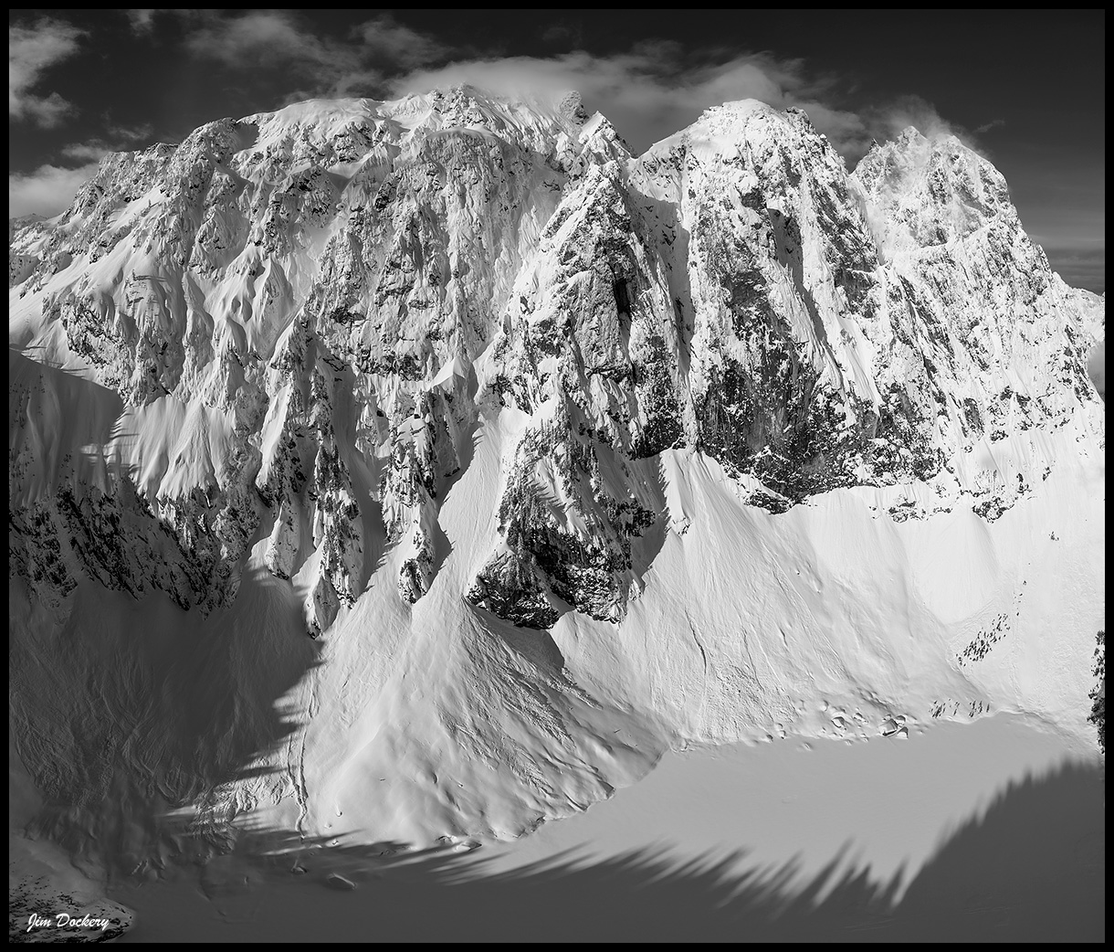
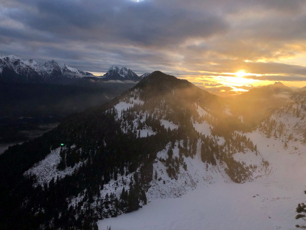
Trip: Mt. Index - Lake Serene photo trip Trip Date: 03/23/2021 Trip Report: I did a morning hike up to Lake Serene last week to fly my drone and get some new views of Mt. Index. Thought some of you might enjoy a couple images. Gear Notes: DJI Mavic 2 Pro Approach Notes: I thought there would be a good boot pack but the last traverse was snowshoed and I punched through a bit.

 1 point
 -
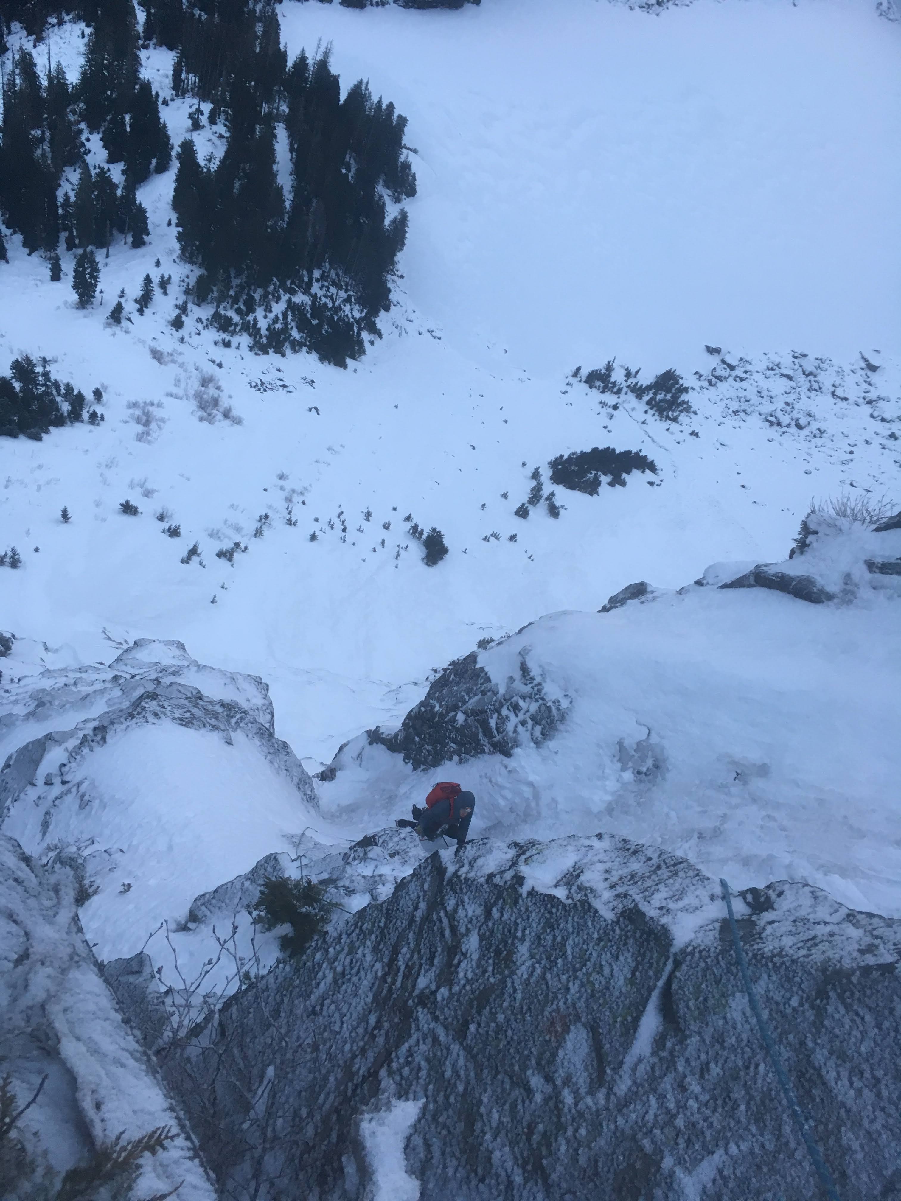
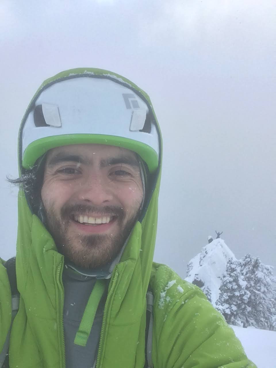
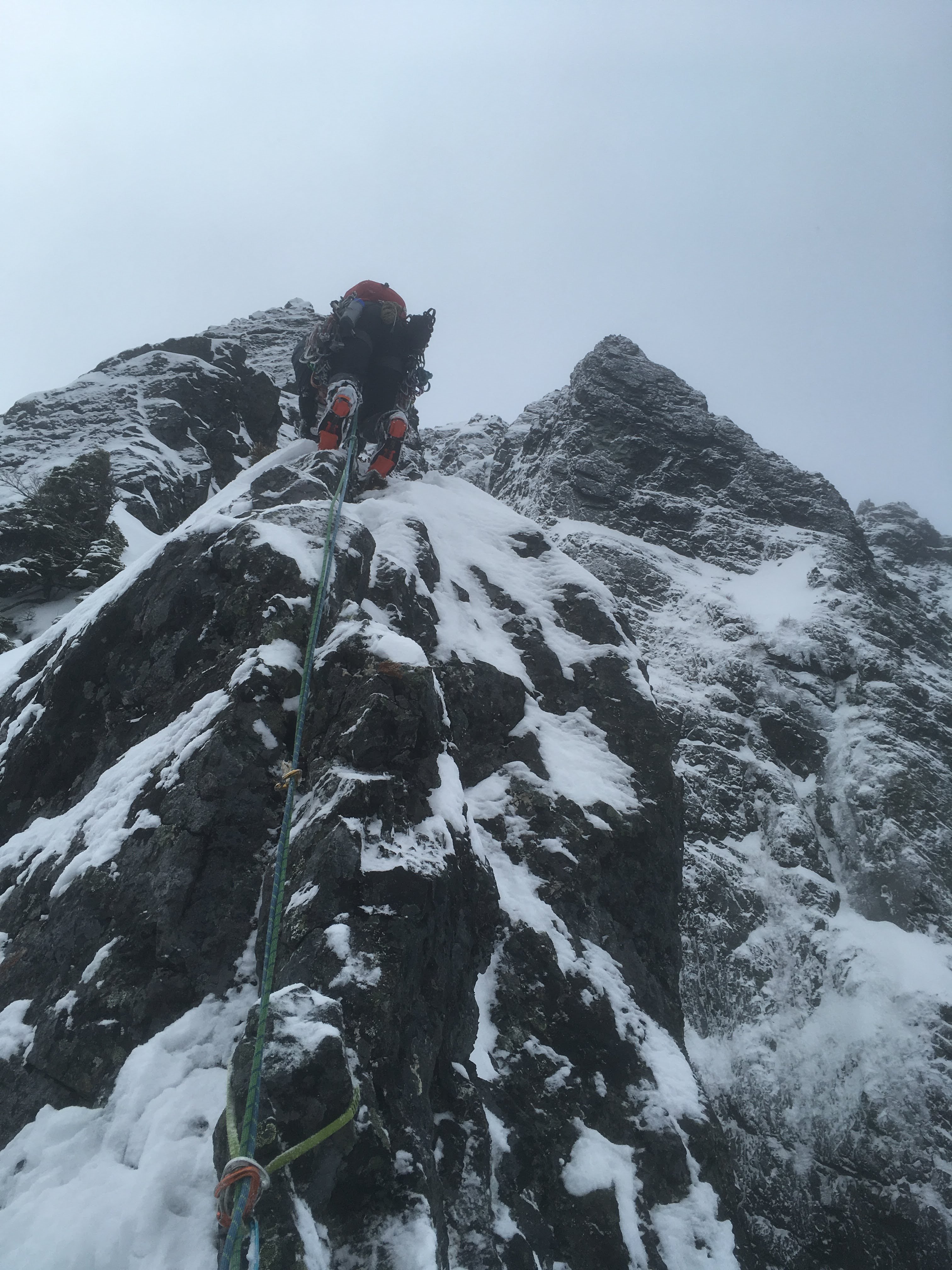
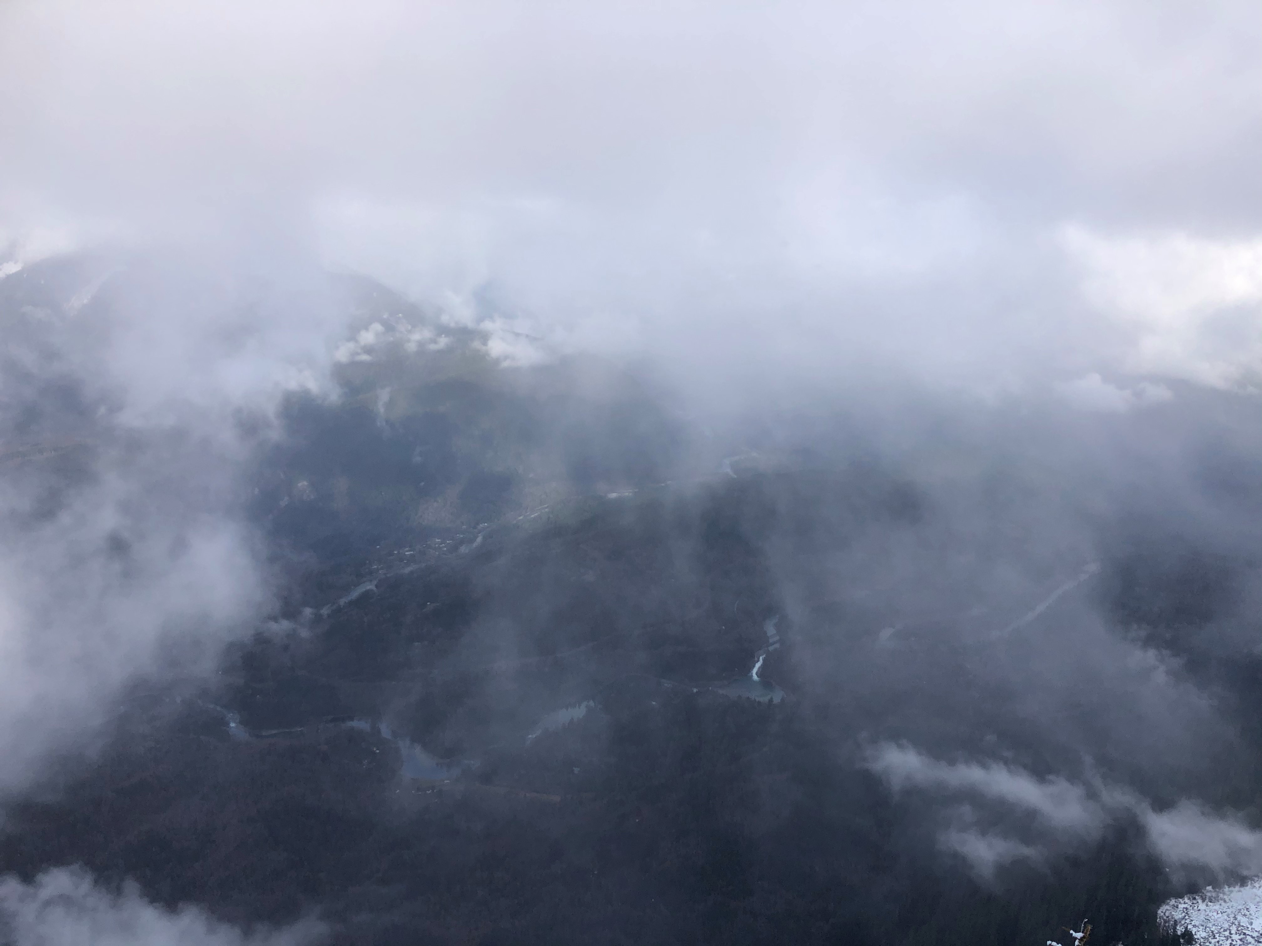
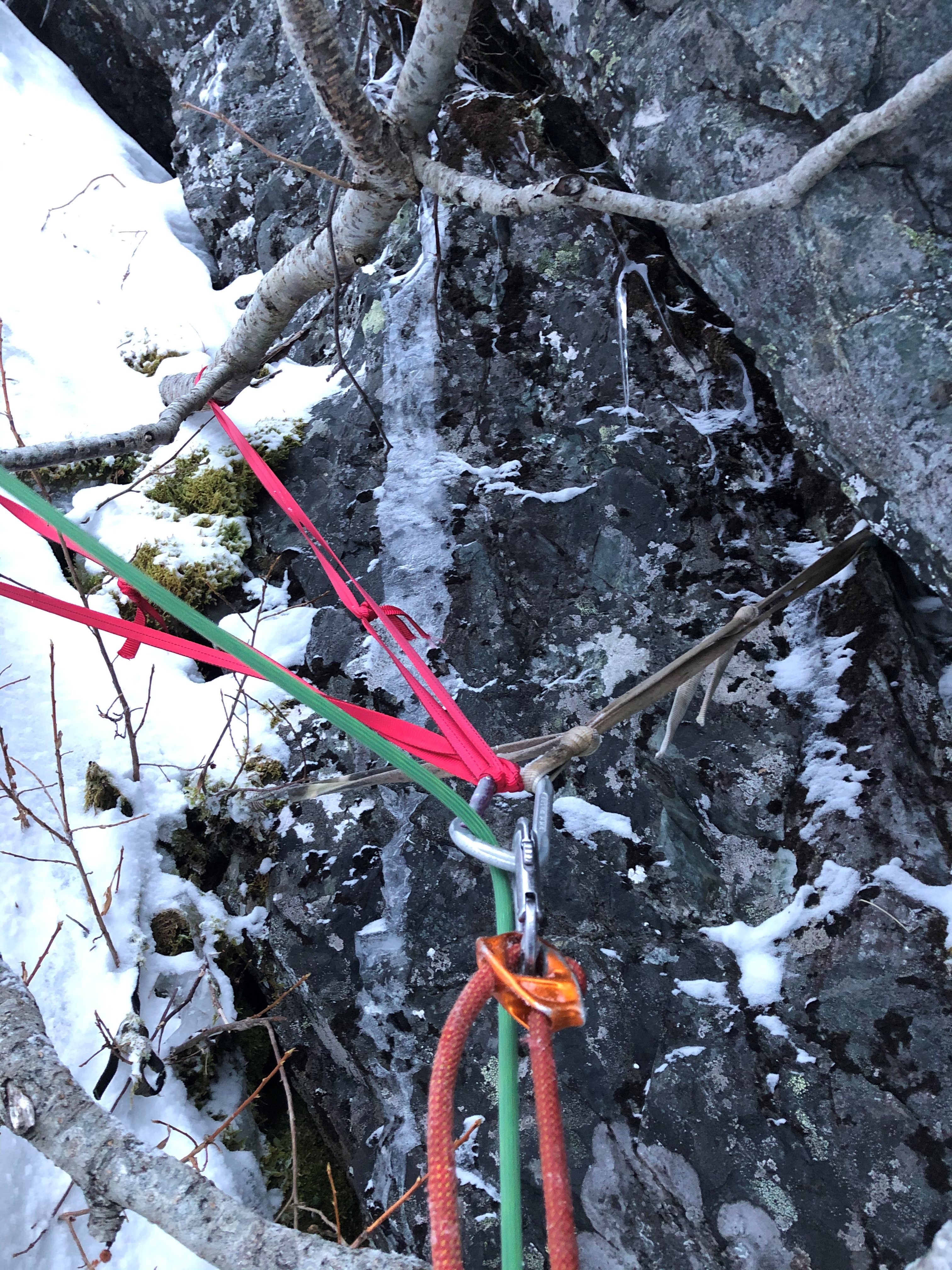
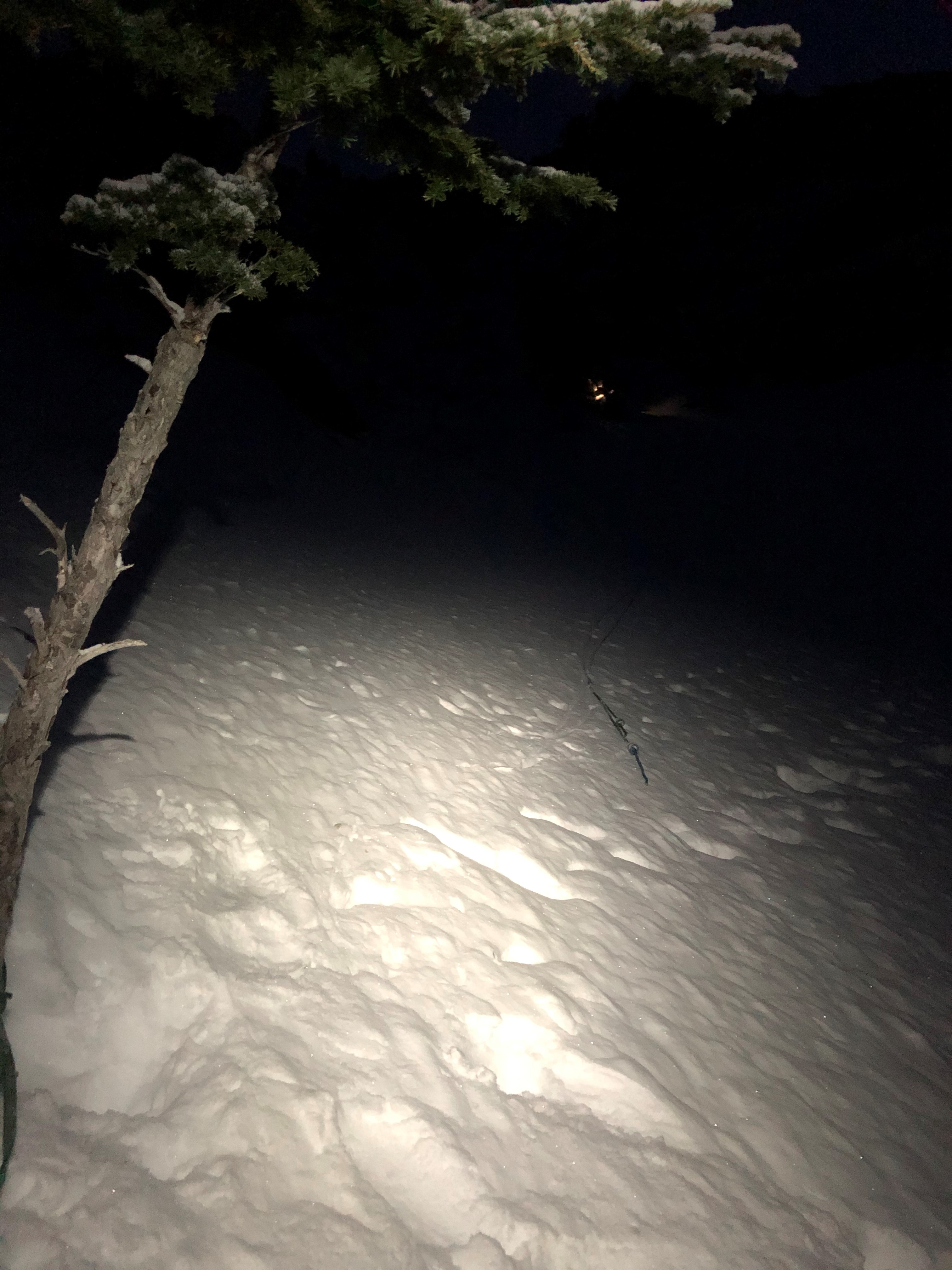
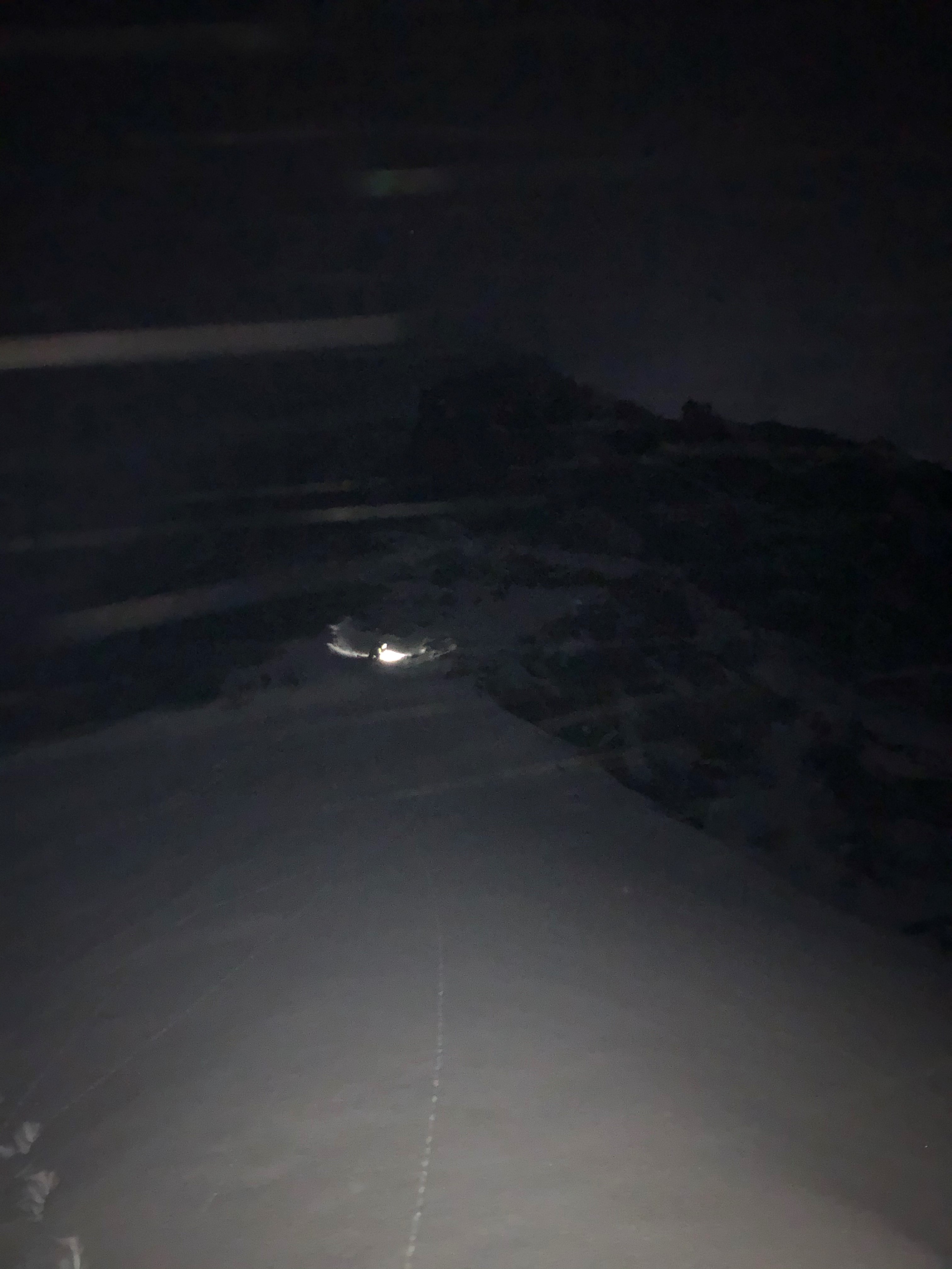
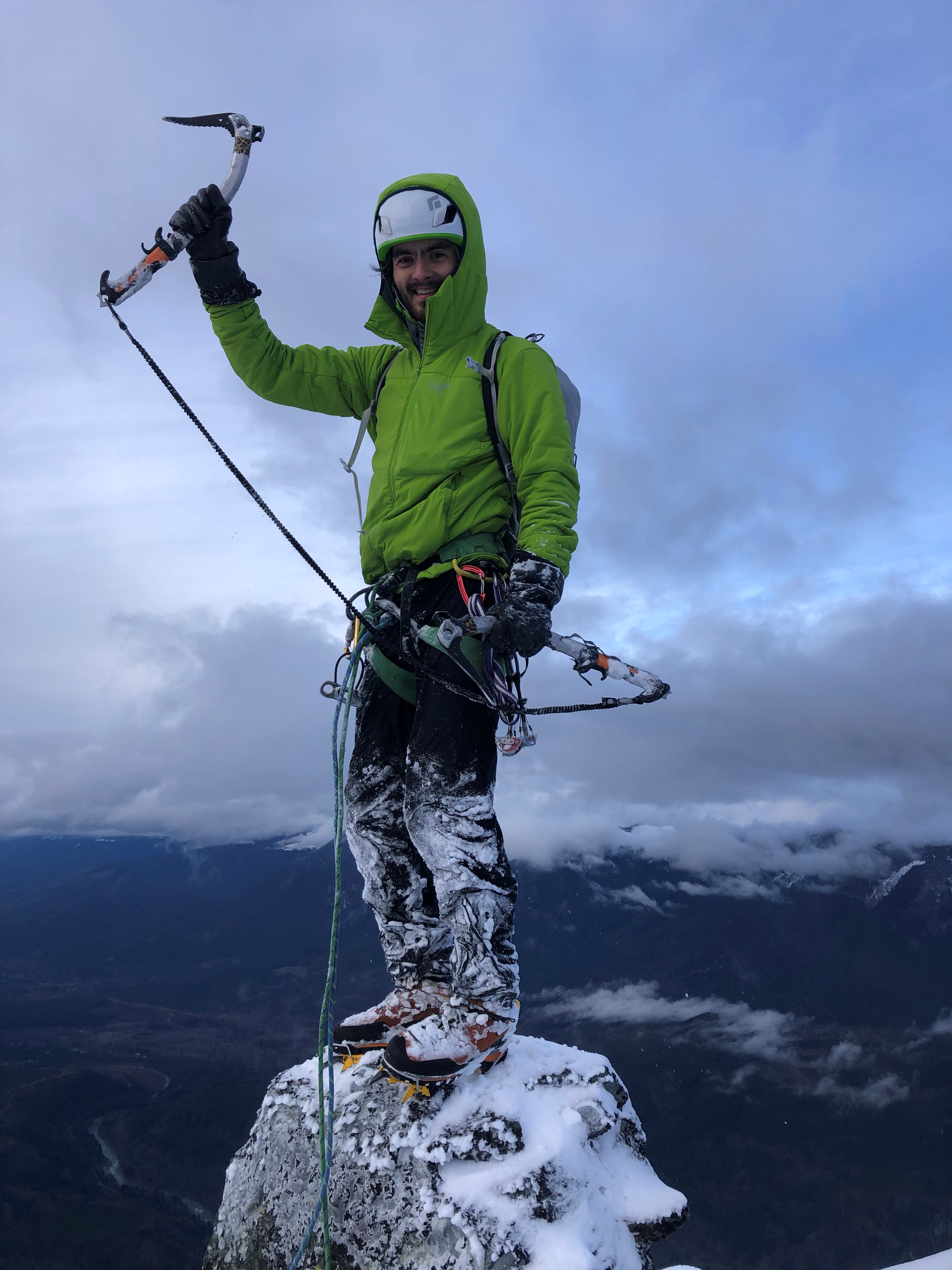
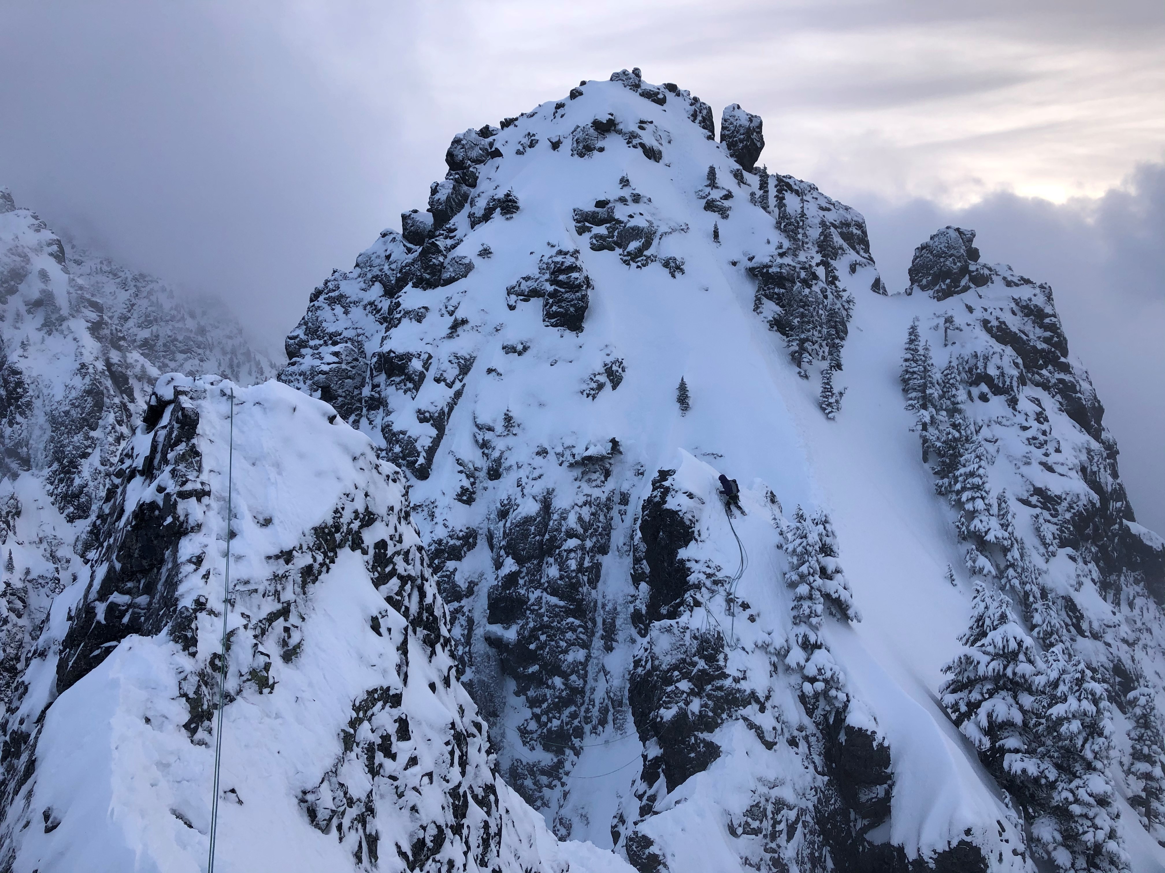
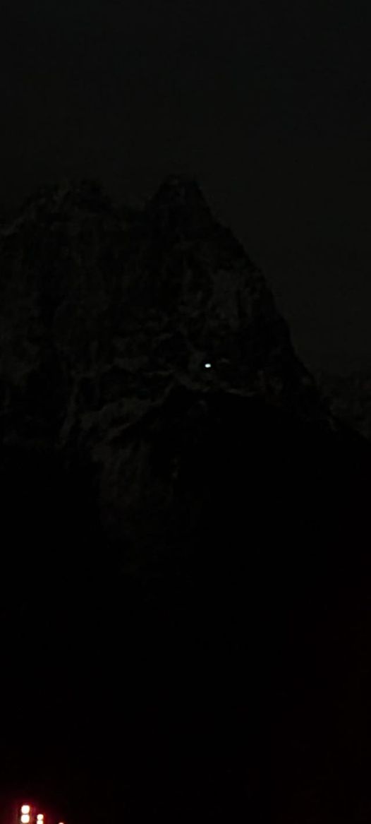
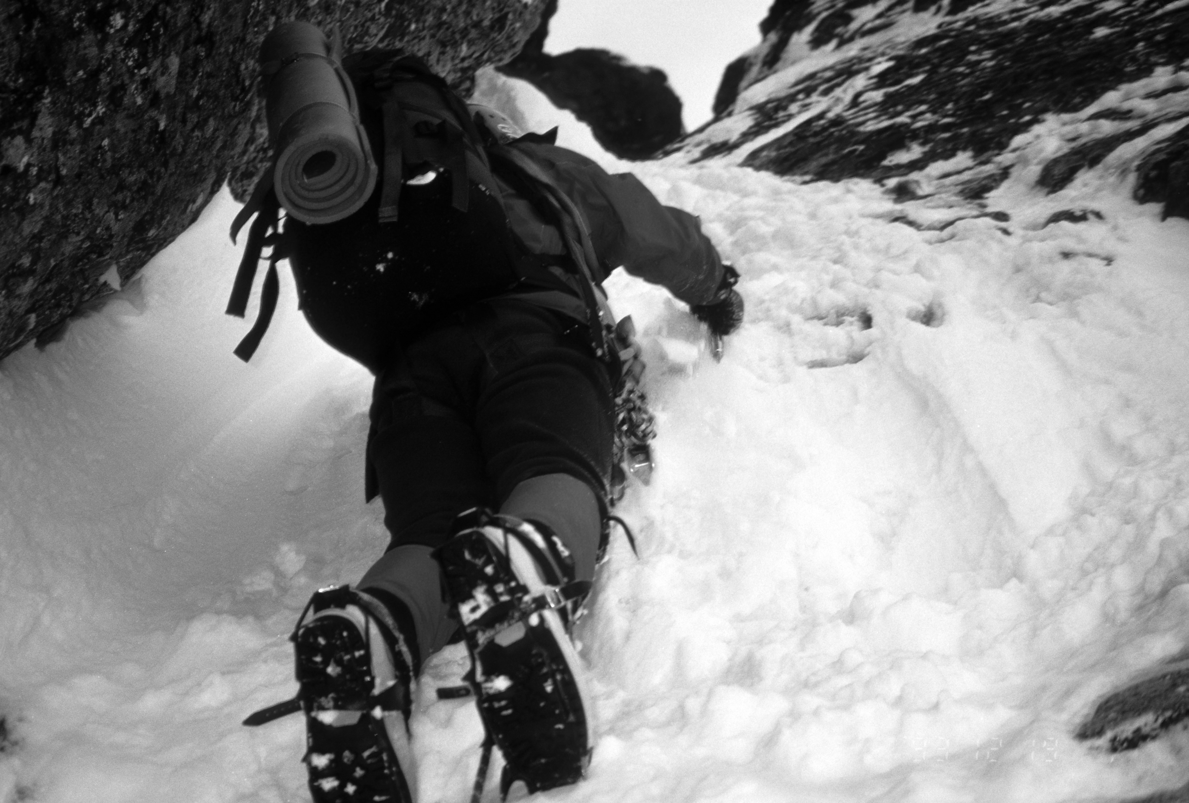
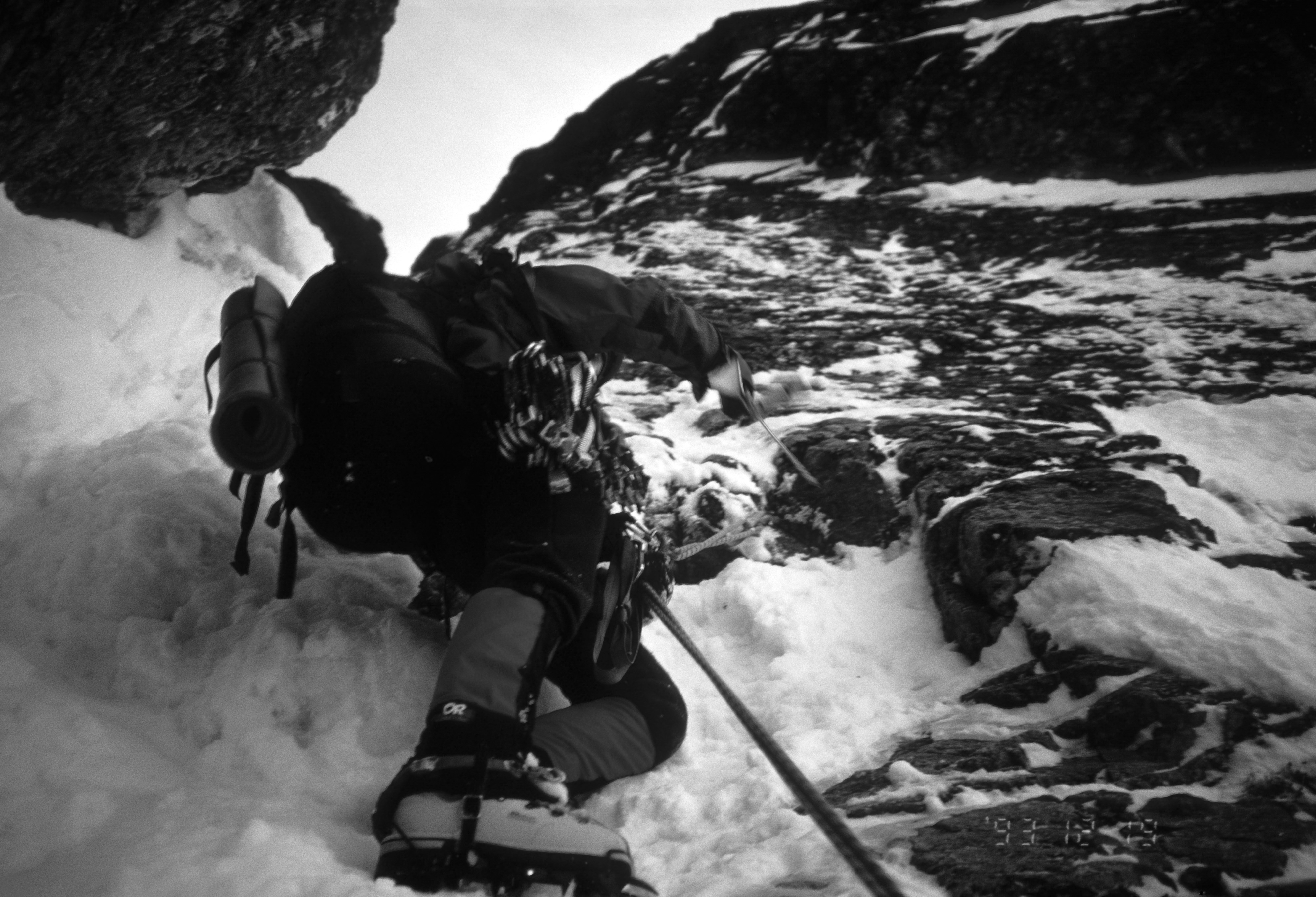
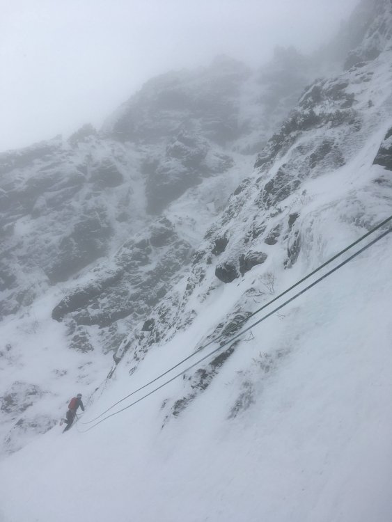
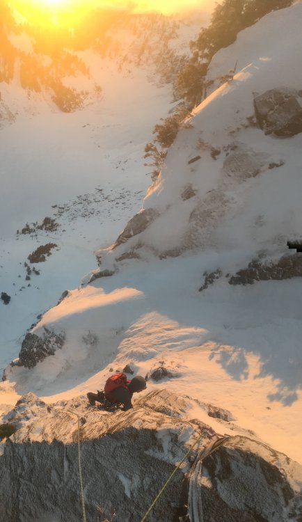
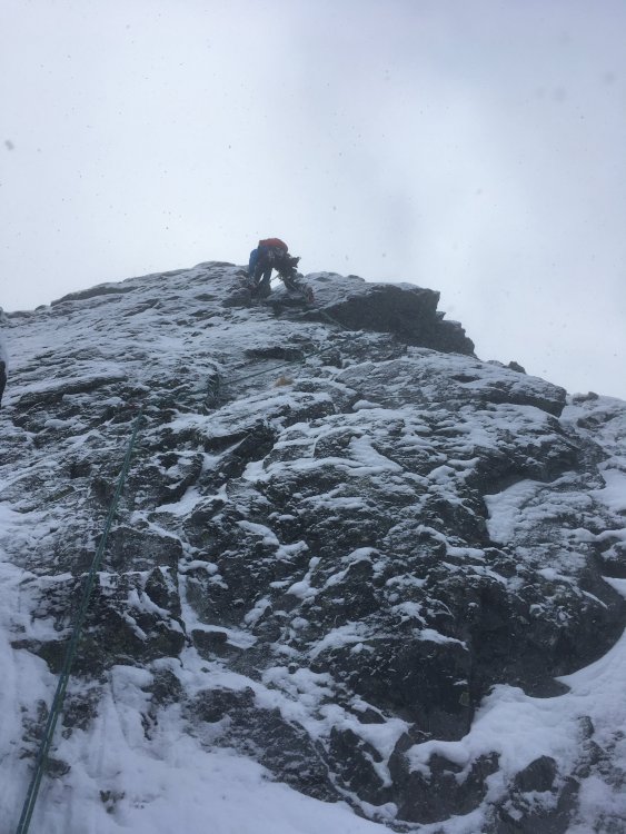
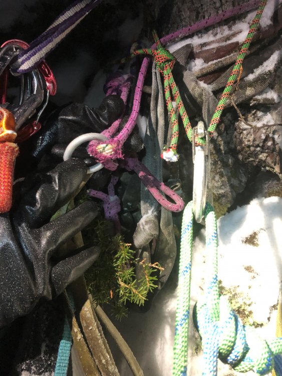
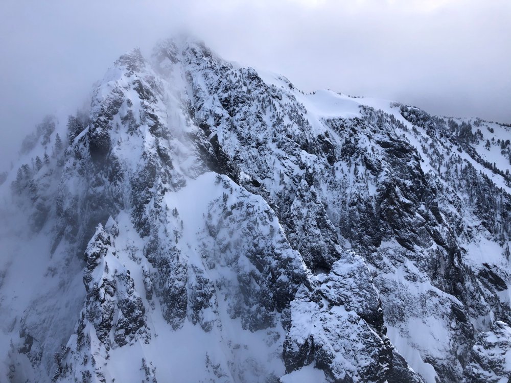
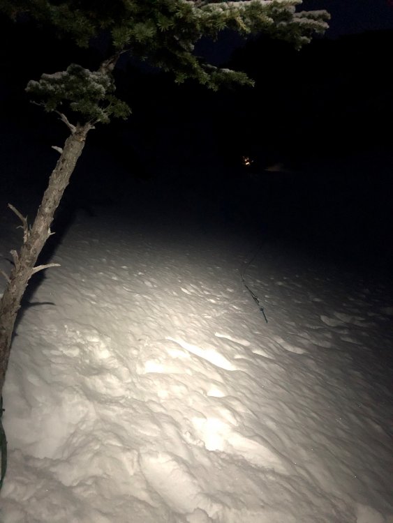
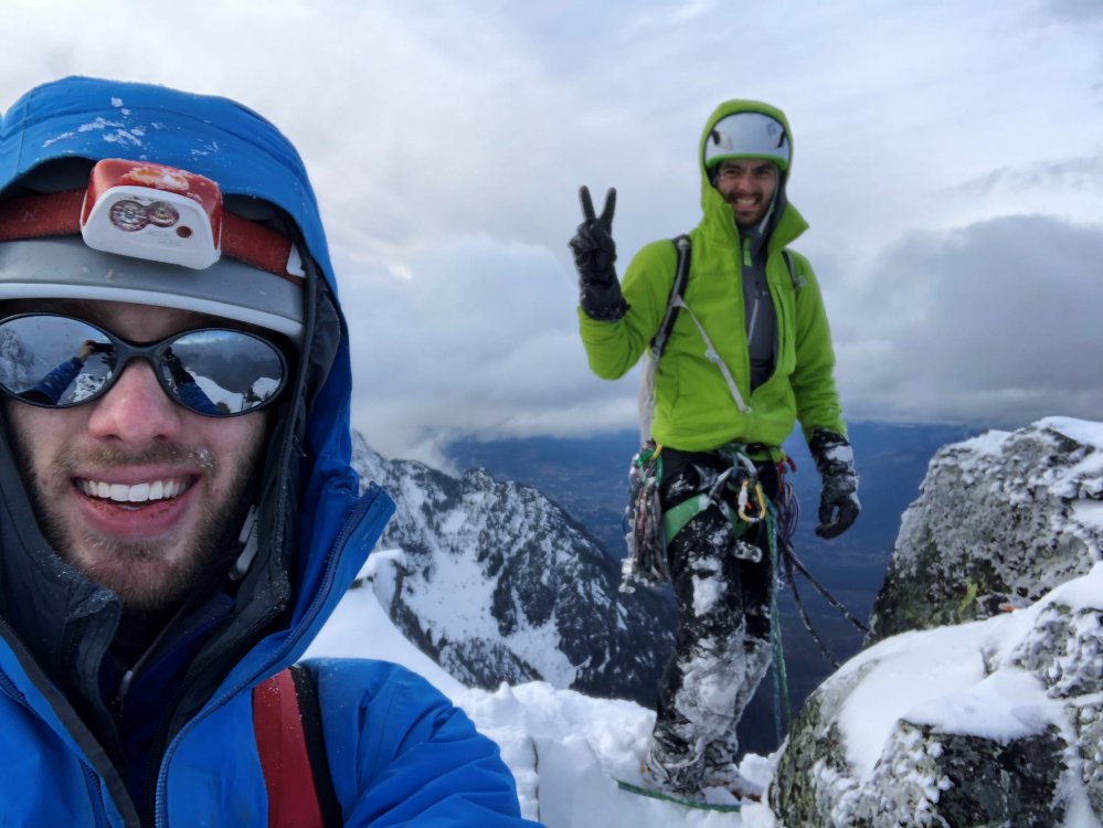
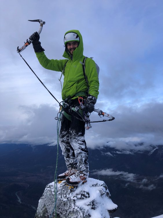
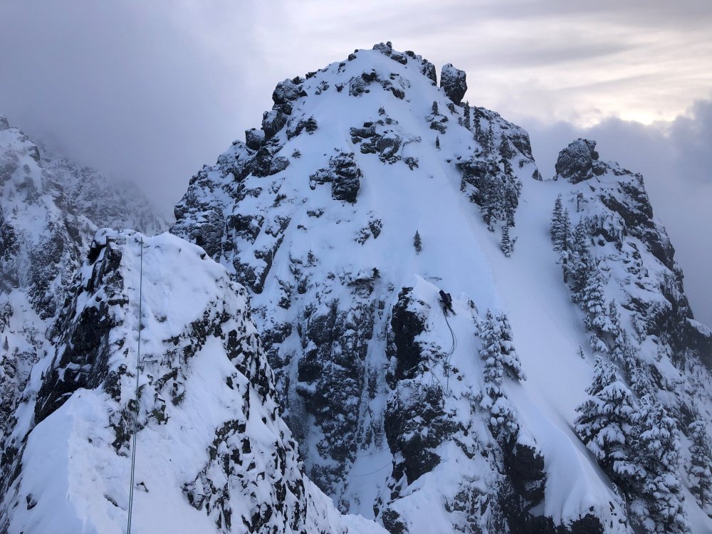
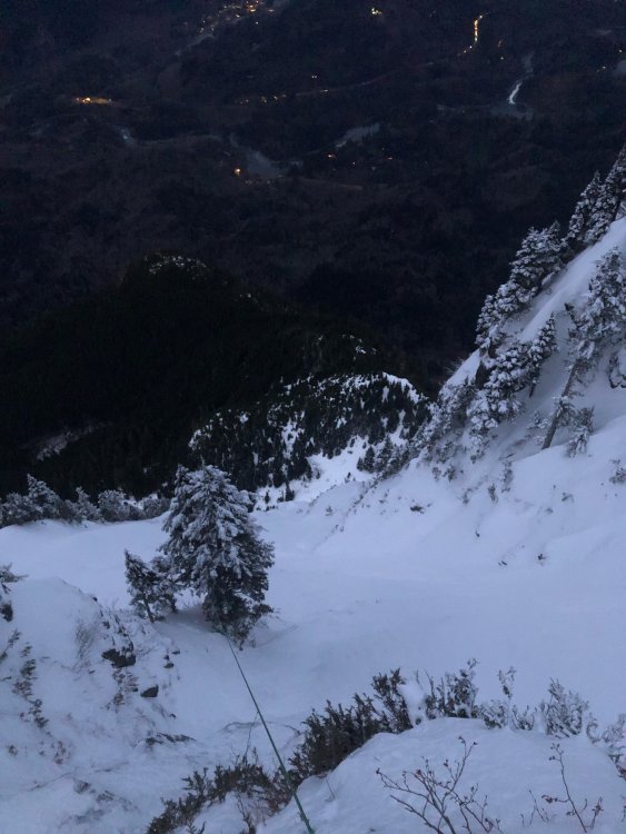
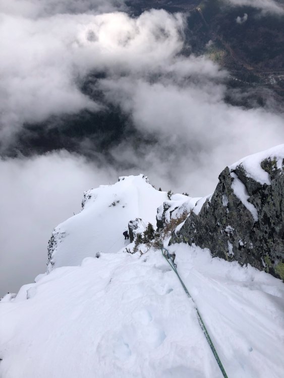
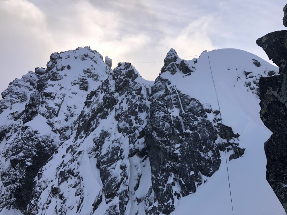
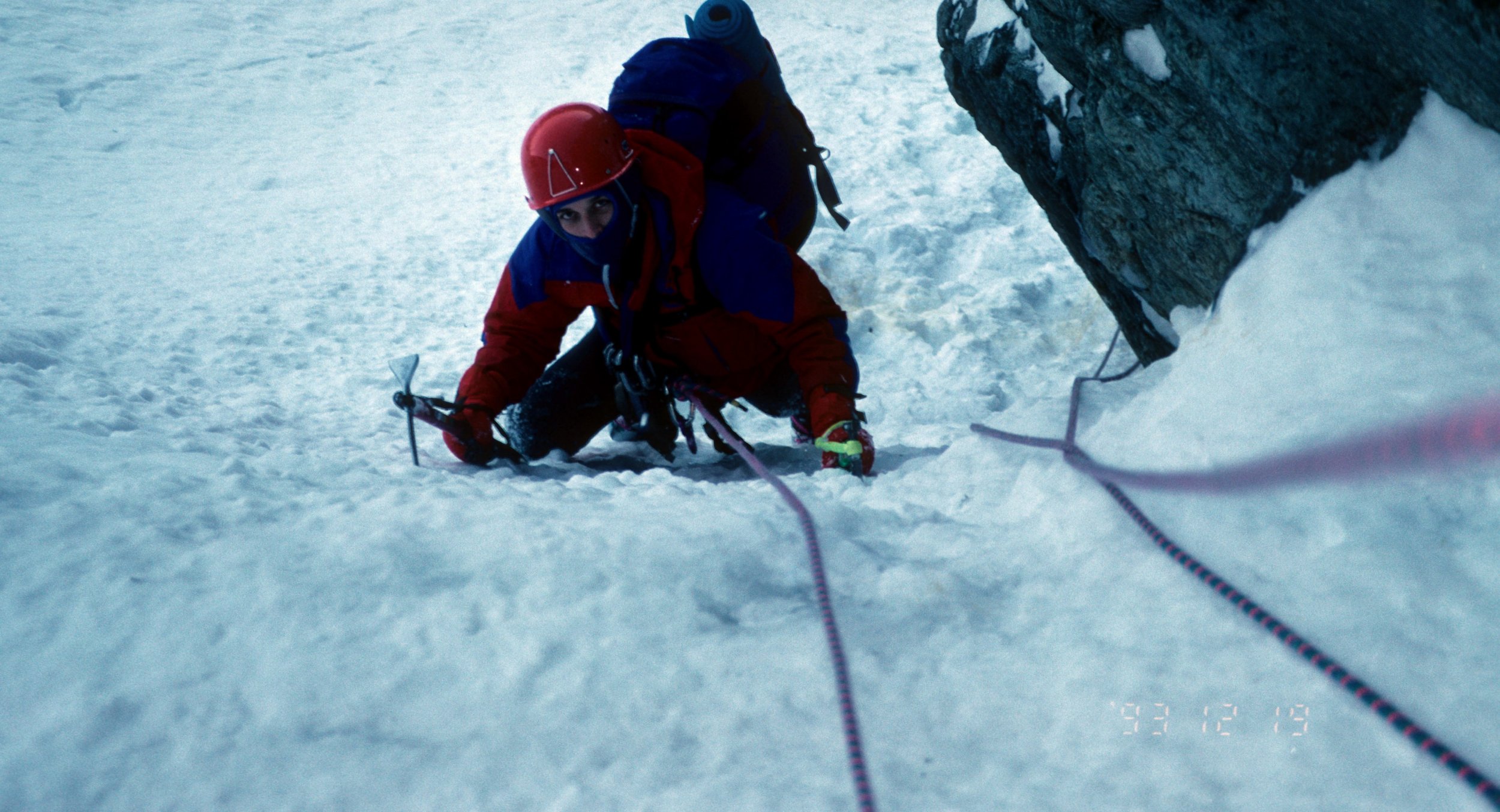
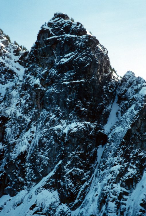
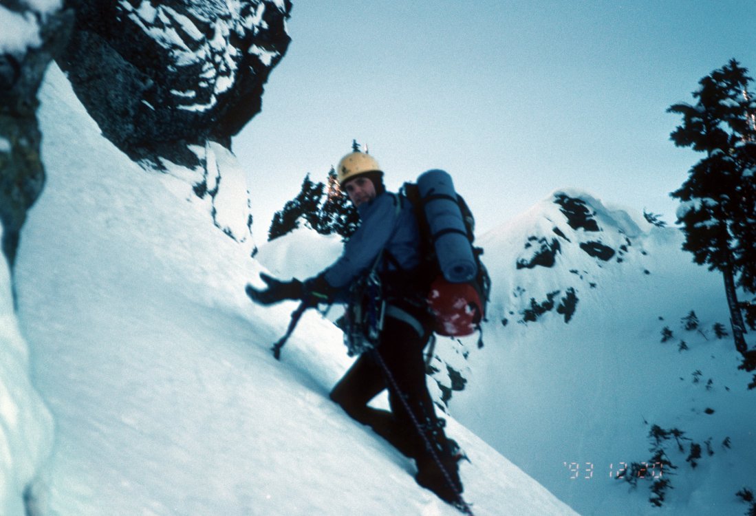
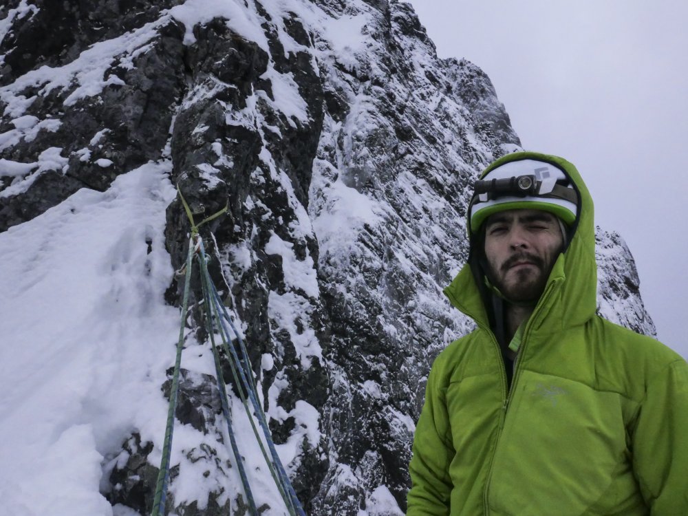
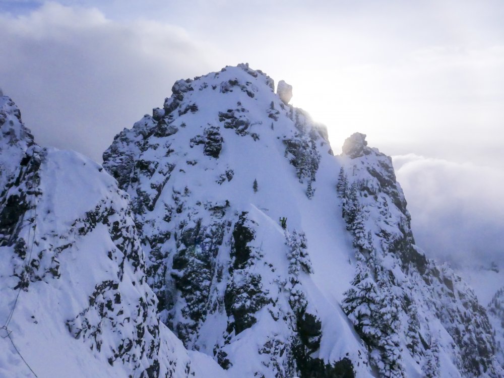
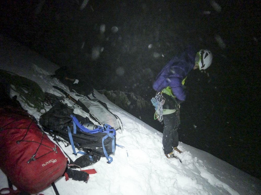
Trip: Mount Index, North Peak - North Face Trip Date: 01/29/2021 Trip Report: @Michael Telstad and I have a wonderful climbing partnership. He sniffs out all the beta and nails down logistics, while I tell bad jokes and ensure the ropes get hopelessly tangled at least once on-route. When I heard about his FA on Chair and adventures in Mazama with @Doug_Hutchinson, in the throes of FOMO and inspired by Doug and Mik's report of 'cruiser alpine conditions', I sent him a text on Tuesday asking if he wanted to climb the North Face of North Index. Between the Scylla of the work-week and the Charybdis of storms for the next month, we decided on Friday as our best and only shot at the beast. Fortunately Doug was stuck with Michael on the long winter drive from Mazama to Seattle, so there was plenty of time to shake him down for beta. There is not too much information about the route out there, so Doug’s info was invaluable. (Another useful source is Jim Nelson’s Selected Climbs in the Cascades, Vol. 1) We decided to meet in the parking lot at 2:45am on Friday. After a few hours of fitful rest I rolled into the Lake Serene parking lot my traditional 15 minutes late at 3:00am (Michael was 10 minutes early). We exchanged groggy greetings and set off by moon and head light. Easy trail hiking in approach shoes to the north end of the lake led to the base of a slide path and some tedious steep snow climbing to the saddle of the northeast rib. (We changed into boots at the end of the trail before stepping onto the lake, and put on crampons partway up the snowfield) Some unexpected light snow gave us pause but we decided to climb until it became problematic. I set off on the first lead, simul-climbing ~3 pitches mainly steep snow with sparse slung trees, with a few short mixed steps protected by cams and nuts. I tried placing ice screws in aerated flows while extremely runout on steep snow, but they were just too marginal to bother. Runout snowfields for the first ~2 pitches took me to a left-leaning gully. At the top of the gully I looked down and gulped at the sheer exposure below me to the east. Wild. A moderate and short but annoyingly snow-covered mixed step took me to the slung blocks marking the ‘hidden ledge’ traverse. (It’s not very well-hidden if you’re looking for it.) I belayed Michael up from here since I would’ve liked a belay on the mixed step below and I believe in the golden rule. At this point I made the inconceivably foolish decision to try scooping up the stacked double ropes and walking them across the hidden ledge. I made it about 15 feet before realizing the error of my ways and setting up an intermediate anchor. Fortunately it only took 15 minutes of cursing and thrashing to untangle the ropes. Michael then belayed me on a short, fun, and confusing simul block through a slide alder grove. I followed my nose through a steep groove of alders to a lower-angle mixed ramp. I wandered around trying to find an easy way up, but eventually gave up and belayed Michael to the top of the alder grove. He decided to down-climb to search for a lower continuation of the traverse, but found only improbable cliffs. He climbed back up and cruised the mixed ramp around whose bushes I’d beaten earlier. We simuled over the ramp and up the awesome snowbowl pitch to an obvious large tree. From here we simuled up ~2 pitches of very fun AI3- (mediocre screws, great sticks) to yet another grove of trees at the base of yet another snowfield. I led a short snowfield to the base of the crux mixed pitches. Michael led us up two cruxy snow-covered mixed pitches, first a narrow ridge-traverse and then a funky slab to a short steep corner protected by a fixed piton. The climbing wasn’t so hard, but it felt tres insecure and poorly protected. I took over the lead and we simuled across a wild knife-edge ridge, up a snowfield, over and around several false summits (with some tricky mixed steps and brutal rope-drag), and finally to the base of the true summit. (From a distance I thought it was the Middle Peak of Index. ) Michael took us to the top, and we mustered the happiest faces we could for some summit pics. As we prepared to descend, a raven floated next to us cawing a blessing. I felt glad then, that the spirit of the mountain was with us. We thanked the raven and began the slog down. Michael led us back to the base of the summit ridge snowfield, and we followed Doug and Mik’s rappel stations for a seemingly interminable, mind-numbing descent. We finally reached a snowfield at the base of the north face. We unroped and contoured around to the base of the route. Unfortunately they added about 3 miles to the Lake Serene trail while we were on the mountain, so the hike out was a bit more tedious than expected. We finally arrived back to our cars alone in the parking lot at 11pm, just as we’d left them 20 hours and many lifetimes before. I grilled up a couple celebratory beyond burgers and we drove off into the night, grateful and dead exhausted. Many, many thanks to Doug and Mik for all the beta, and for setting up so many rap stations! This route is highly condition dependent. This winter and weather window has yielded easy snow climbing, thin and poorly protected but easily climbed gully ice, and snowy but manageable mixed climbing. I think significant time would be saved on the mixed pitches if there were no snow. Suitors should be prepared for sporting runouts on steep snow, tenuous mixed climbing, and a tricky descent after a long physically and mentally tiring day. Descent: Reverse climb along summit ridge to trees at base of the snowfield which leads up to summit ridge, i.e. just after the knife-edge ‘last pitch’ of the climb. Make 4-5 plumb-line rappels (60m double-rope) to large trees atop snow-bowl pitch. Rappel trending east (climber’s left) to small trees near base of snow-bowl. Continue for 5-6 raps along this slightly east trajectory, following shrub and block rap stations to base of the north face. Some of these are rope-stretchers with 60m ropes, 70m would help a lot. Once down contour easy but exposed snowfields to the east until reaching the saddle where the route begins. We mostly used Doug's webbing and carabiner stations, but added green tech cord to the station at the top of the snowbowl. Cut all the other tat there but unfortunately couldn't extract it from the ice. (it was late and we wanted to move fast) Lecture time: Knot both your ropes (and untie one end before you pull the other). Double-check your tether and rap setup every time before you commit your life to them. Pics: Setting sail, snowflakes like shooting stars Michael just after the first cruxy mixed step, taken from the hidden ledge blocks moments before the sun rose The sun also rises Michael heading up the gully at the top of the snowbowl Michael starting the first mixed ridge pitch with the false summit ahead Looking down at me from above first mixed ridge pitch Michael at the mixed crux Selfie from snowfield before summit ridge with Michael on the knife-edge False summit after false summit Moody Sky from summit Happy to be halfway home Classic pose on summit block (might not be there next year, the summit ridge seems to be mainly loose blocks glued together by ice) Index Traverse looking intimidating and appetizing Reversing the summit ridge traverse Possibly the worst rap anchor, but not by much Arriving at the large tree atop the snowbowl as headlights trace out Highway 2 below The result of bounce-testing the rap anchor at the large tree Rope stretcher with 60m ropes Dave Summers got a photo of our headlamps on the descent Gear Notes: Ropes: 2x 60m 7.5mm half/twins (70M recommended) Slings: 15 singles, 4 doubles, 1 quad. (good amount, but bringing more would allow for longer simul blocks. Had 2 carabiners per single sling and 1 per double and quad) Ice screws: 2x 10cm, 2x 13cm, 1x 16cm, (1x 22 for v-threads) (good selection, even though some placements were marginal due to conditions) Cams: single rack .1-2 (perfect, every cam was useful but didn't want any bigger) Nuts: About a dozen from small to large (didn't use too often but glad to have) Tricams: Pink and red (clutch) Pitons: selection of 3 small knifeblades, 1 short Lost Arrow, 1 beak (didn't place any, clipped one fixed pin) Cord/webbing: 20 foot 5mm tech cord useful for slinging large blocks. 40+ft of rap tat highly recommended Microtraxions: 2x for simul-climbing insurance Tools: Less aggressive quark style tools (Thanks to Michael's partner Tess for letting me borrow her quarks so I didn't have to haul the nomics up) Crampons: Dual point preferable, lots of snow Emergency gear: Inreach (+cell service most of the way up), lightweight emergency bivy sacks, small isobutane stove, hardwarmers and dry warm socks in case of epic. Climbing tape for in-situ surgery. We didn't bring any pickets and never wanted to place any, but if you desire protection on <60 degree snow you should bring one. Approach Notes: Took the Lake Serene Trail all the way up, skirted around on the NE shore of the frozen lake to the obvious slide path, ascended to saddle, stashed approach packs in small tree grove and racked up. ~1.5 hours car to base


 1 point
 -
Not exactly a hardman or in the 80's or in a assisted care facility yet but almost! good job finishing the crux pitch, I had twice tried to lead it and had to leave it, although I did top rope it. It's definitely some spicy climbing. I'm surprised you didn't see any of my gear I left(probably buried) although I liked the name I gave it a little better sorry about the huge photos, not sure what happened.


 1 point
 -
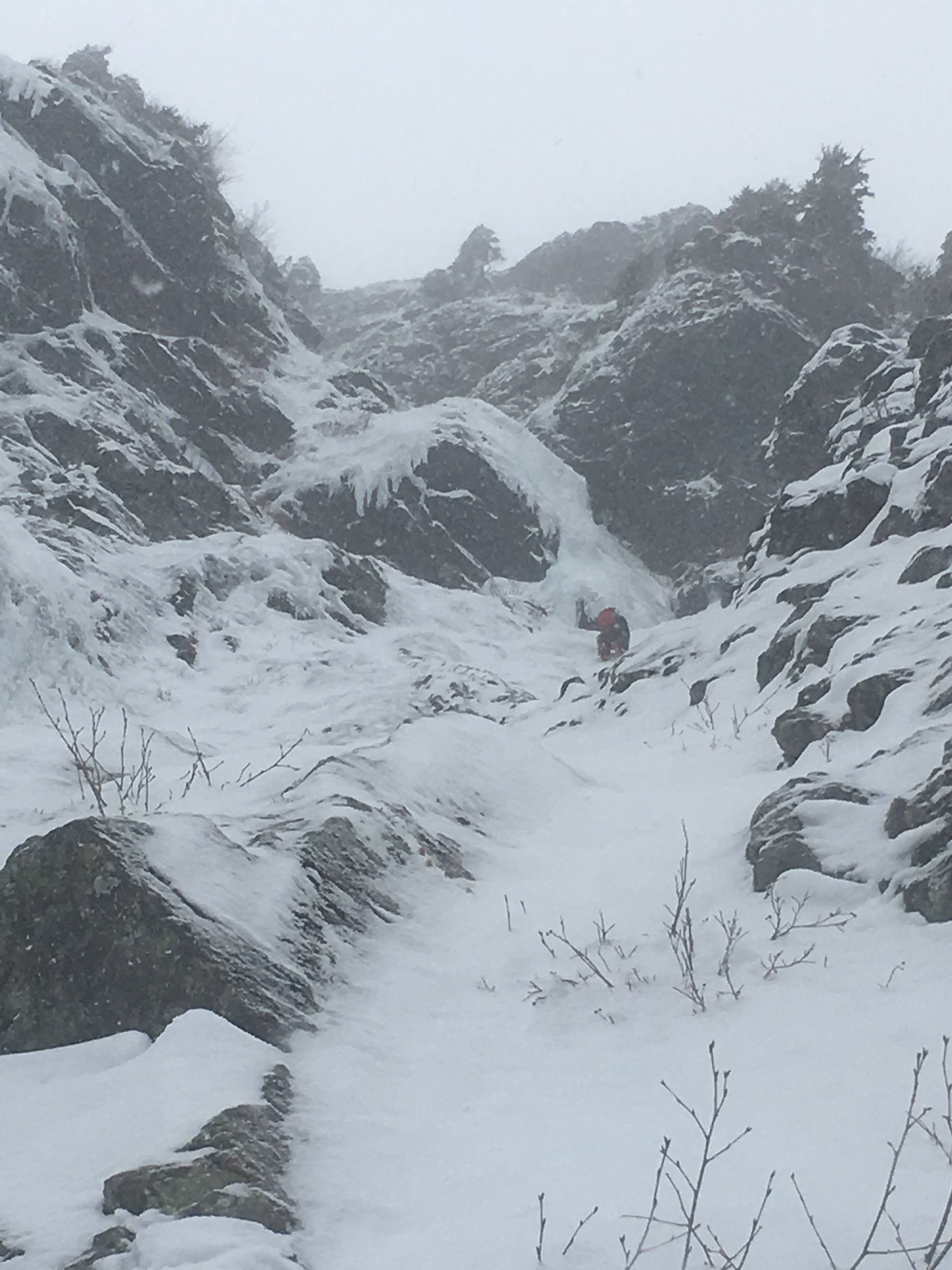
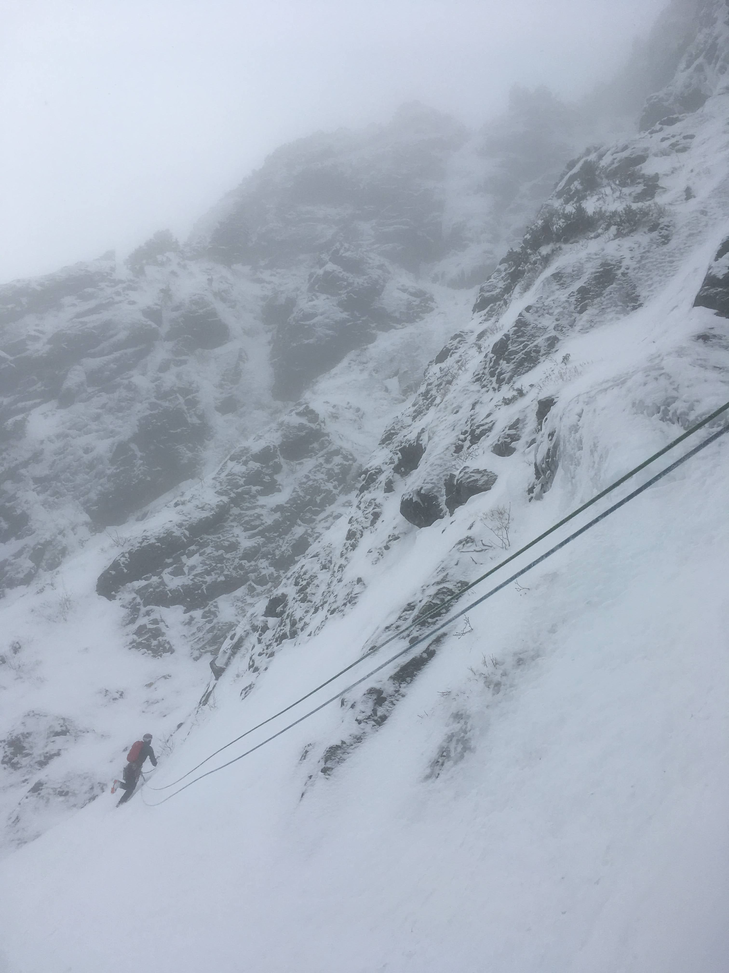
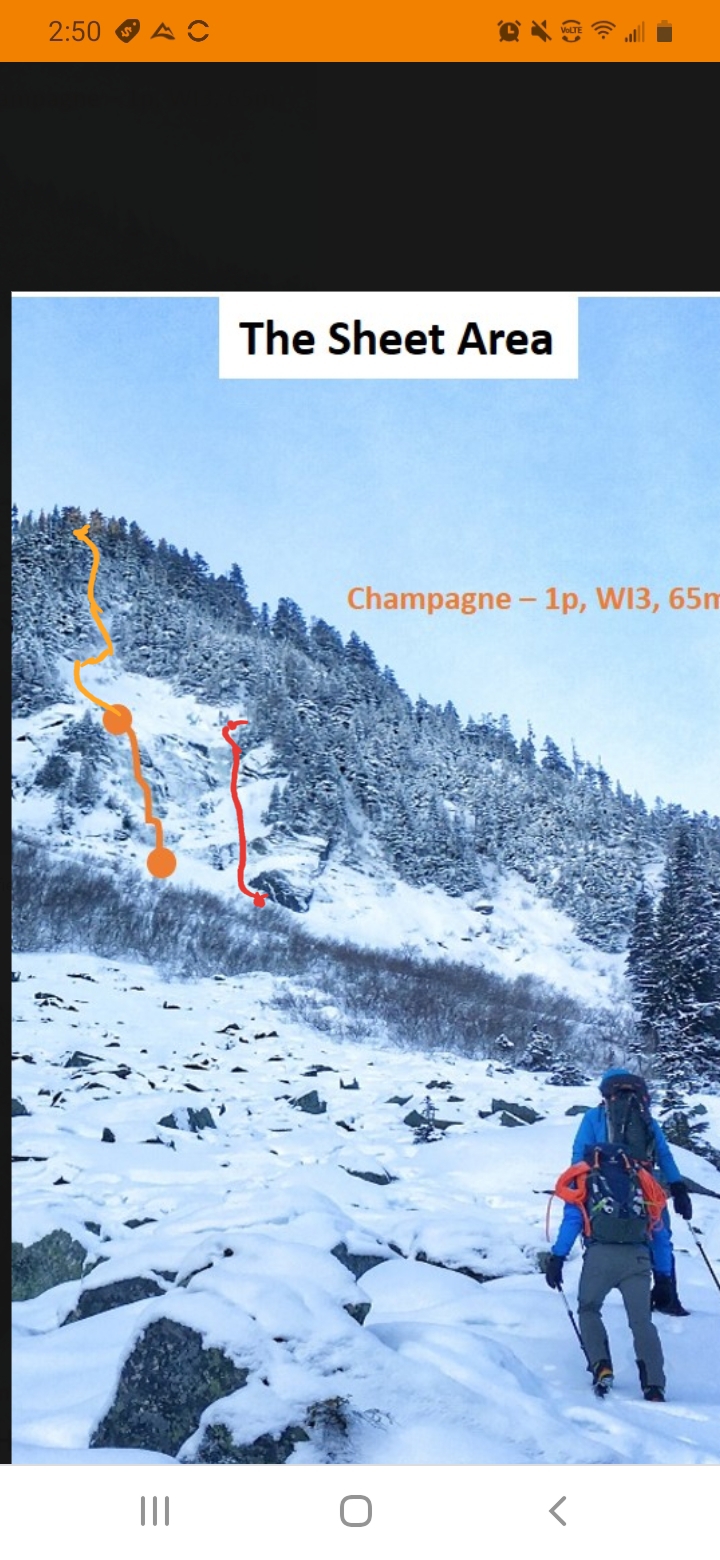
3/28/21 I decided to give this ice a go last weekend, glad i did! Approach took just under 2 hours. I climbed the gulley to right of "sheet" 2 nice ice steps. Then today i went back and climbed the left gulley "champagne" but took it all the way to the top. After topping out on champagne, i climbed above the serac then traversed right to gain upper gulley. Stayed left of gulley, up a few rock faces (all had good ice) then some steep snow to finish it out. It took 4 60m (2 ropes) raps to make it back down. I decided to descend towards the right gulley, ( less trees in the way for pulling ropes.) Both days i climbed solo, roped up for the last pitch through boulders. Going to keep my eye on this next year for sure!
 1 point
 -
Darin is a old school ‘ham curmudgeon. Bellingham was ruined in the 1990.1 point
-
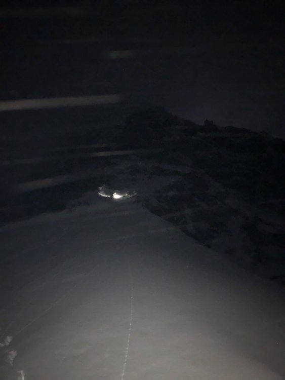
Thanks for writing this Sean! It's an honor to be apart of the first full N-Index winter trip report. This route is so much bigger than I could have imagined. In it's current condition there is a direct ice line that bypasses the N-rib mixed climbing and goes straight up some sweet looking alpine ice. I wish we would have taken this, as it would have shaved probably an hour or more off of our climb. I would probably give the route in these conditions AI3- M5. Strava Track HERE And the only decent photos I got from my camera. Racking up at the base The belay below the N-rib Sean leading across the gendarmes
 1 point