Leaderboard


Popular Content
Showing content with the highest reputation on 01/26/21 in all areas
-
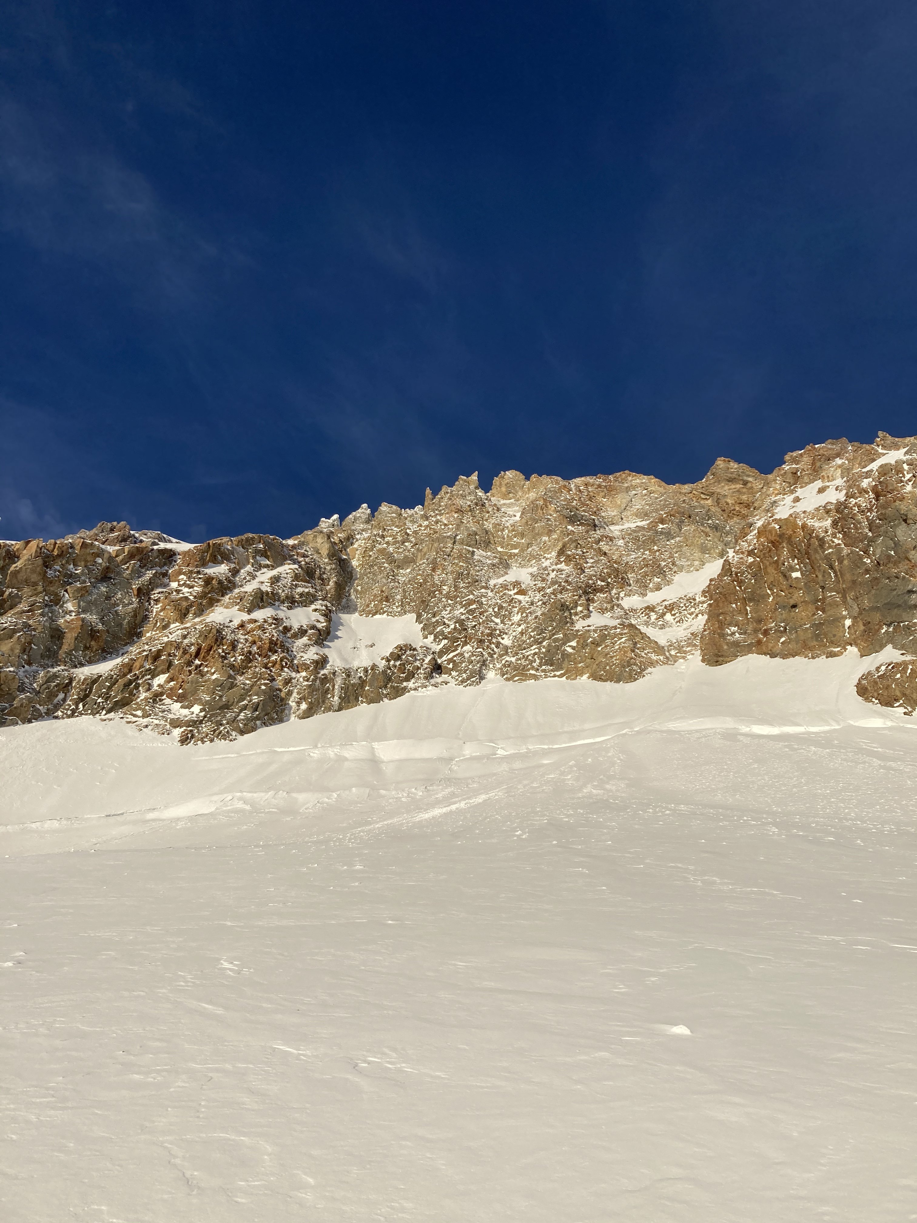
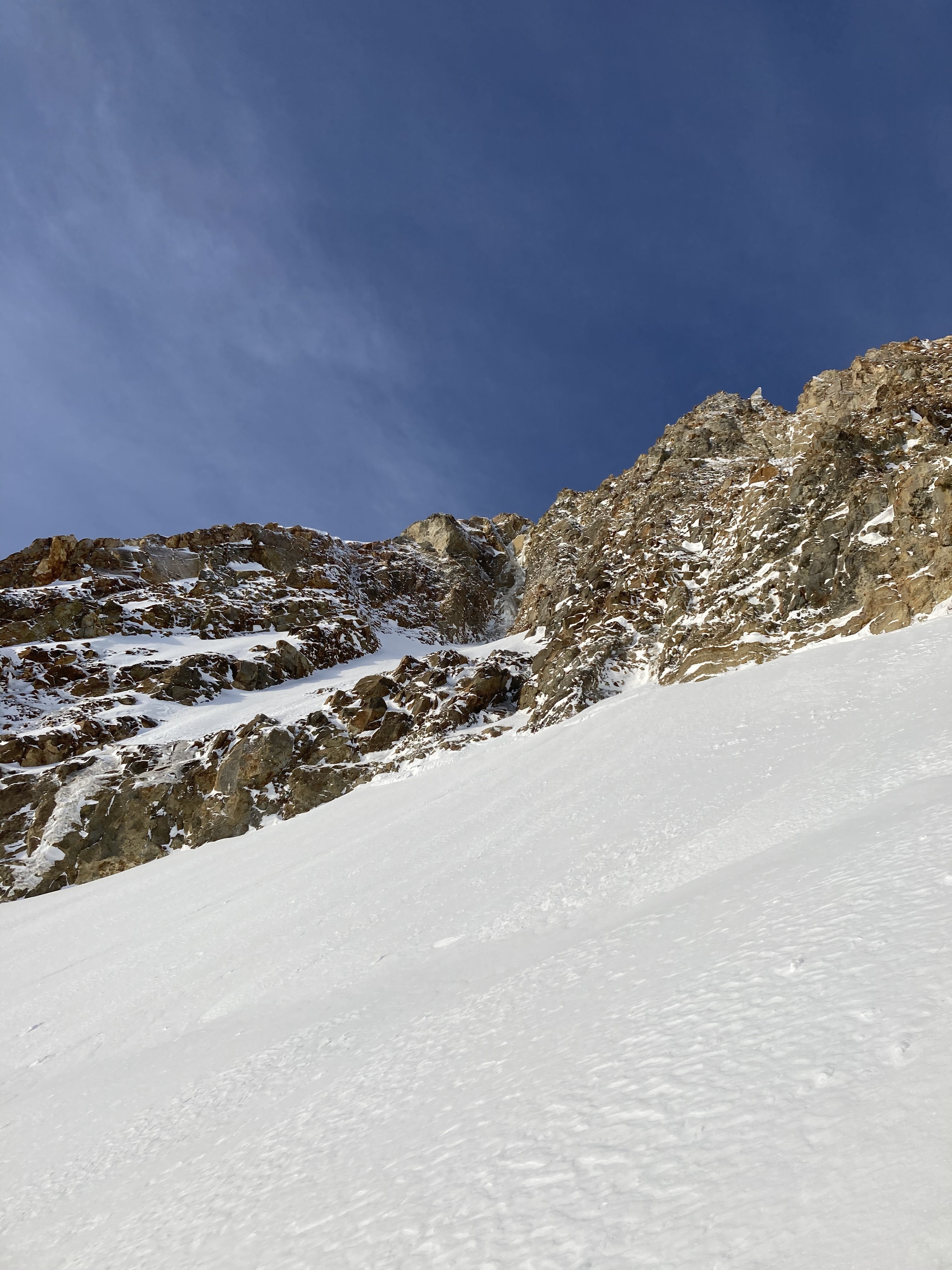
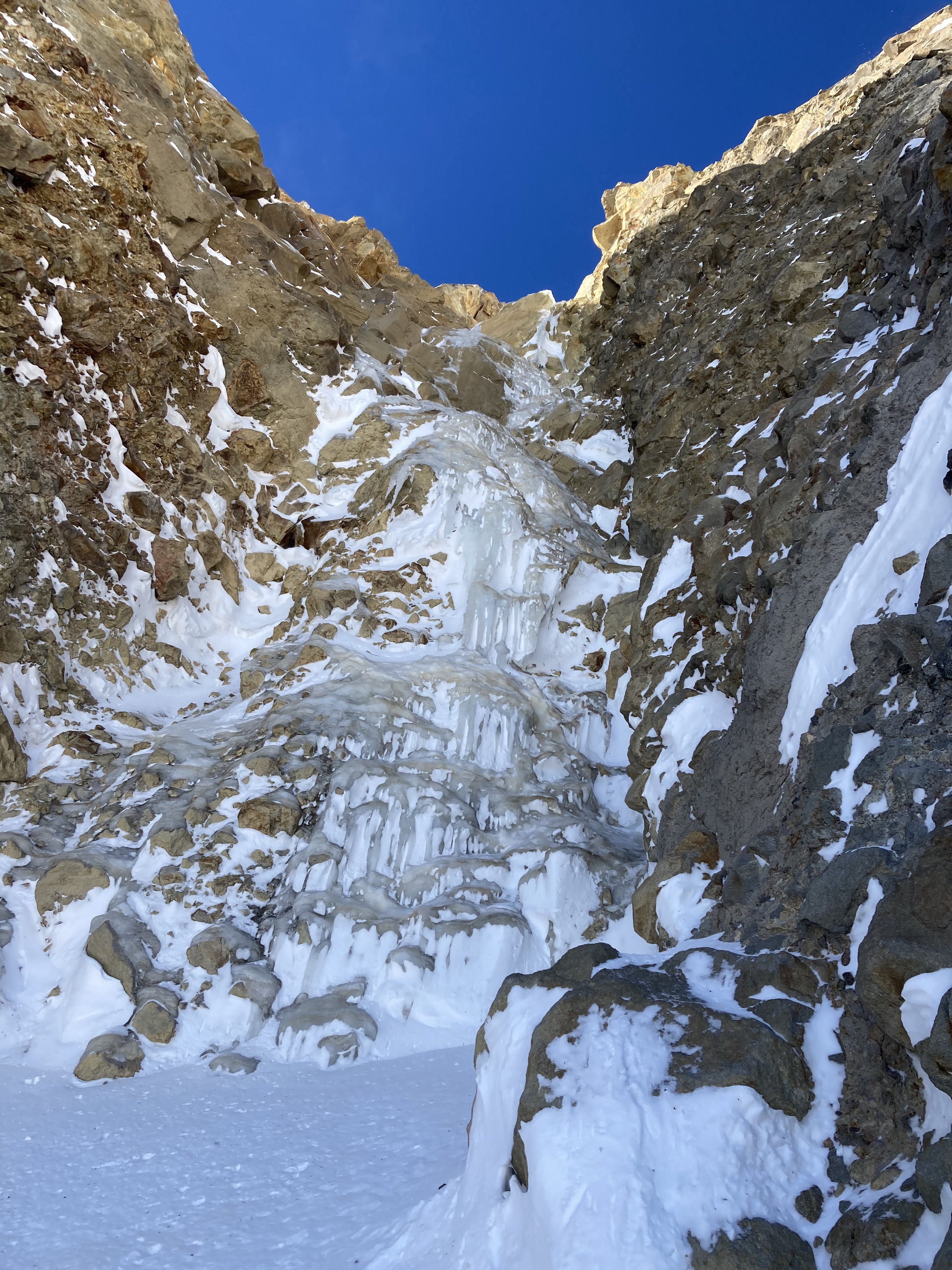
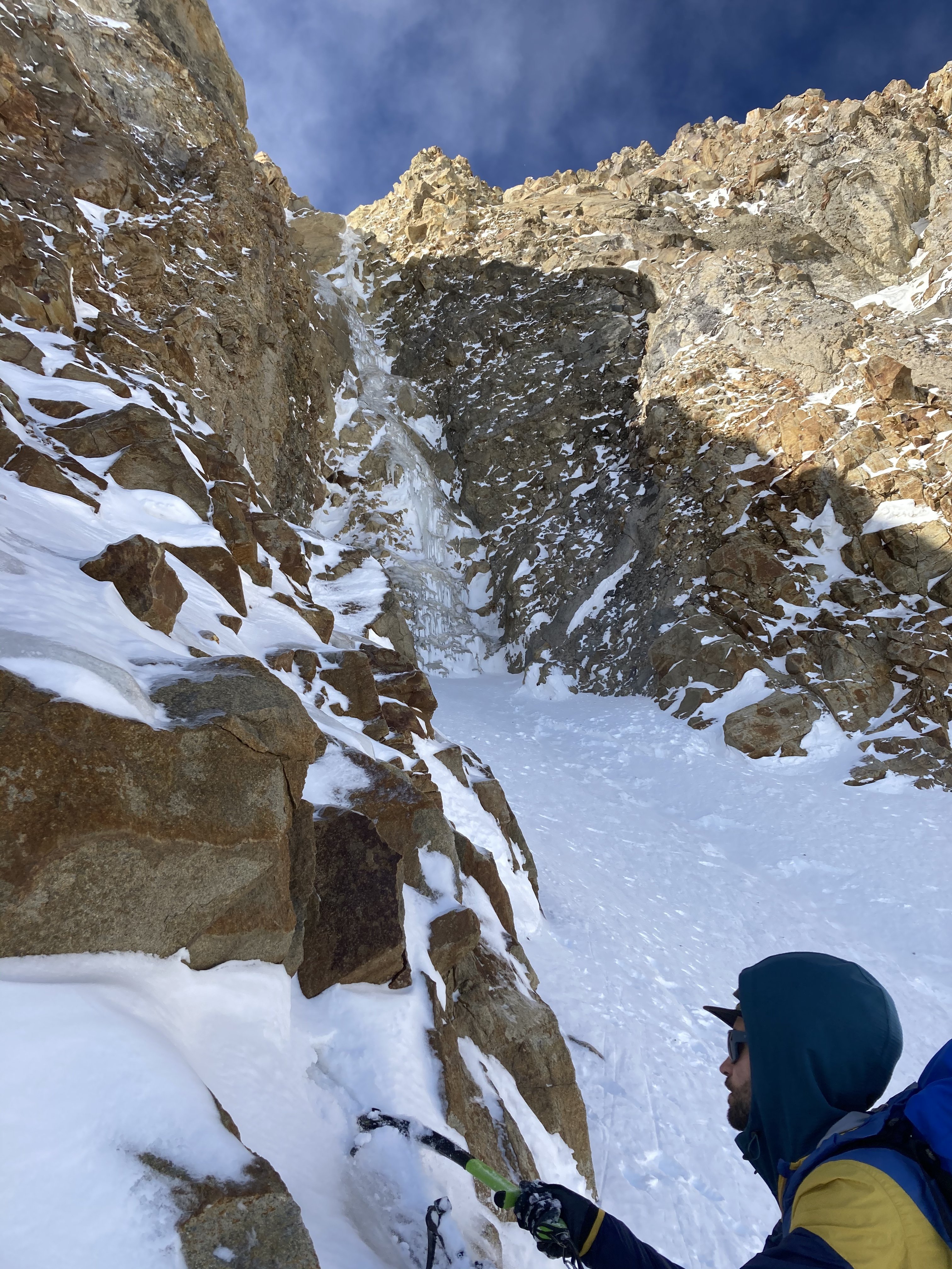
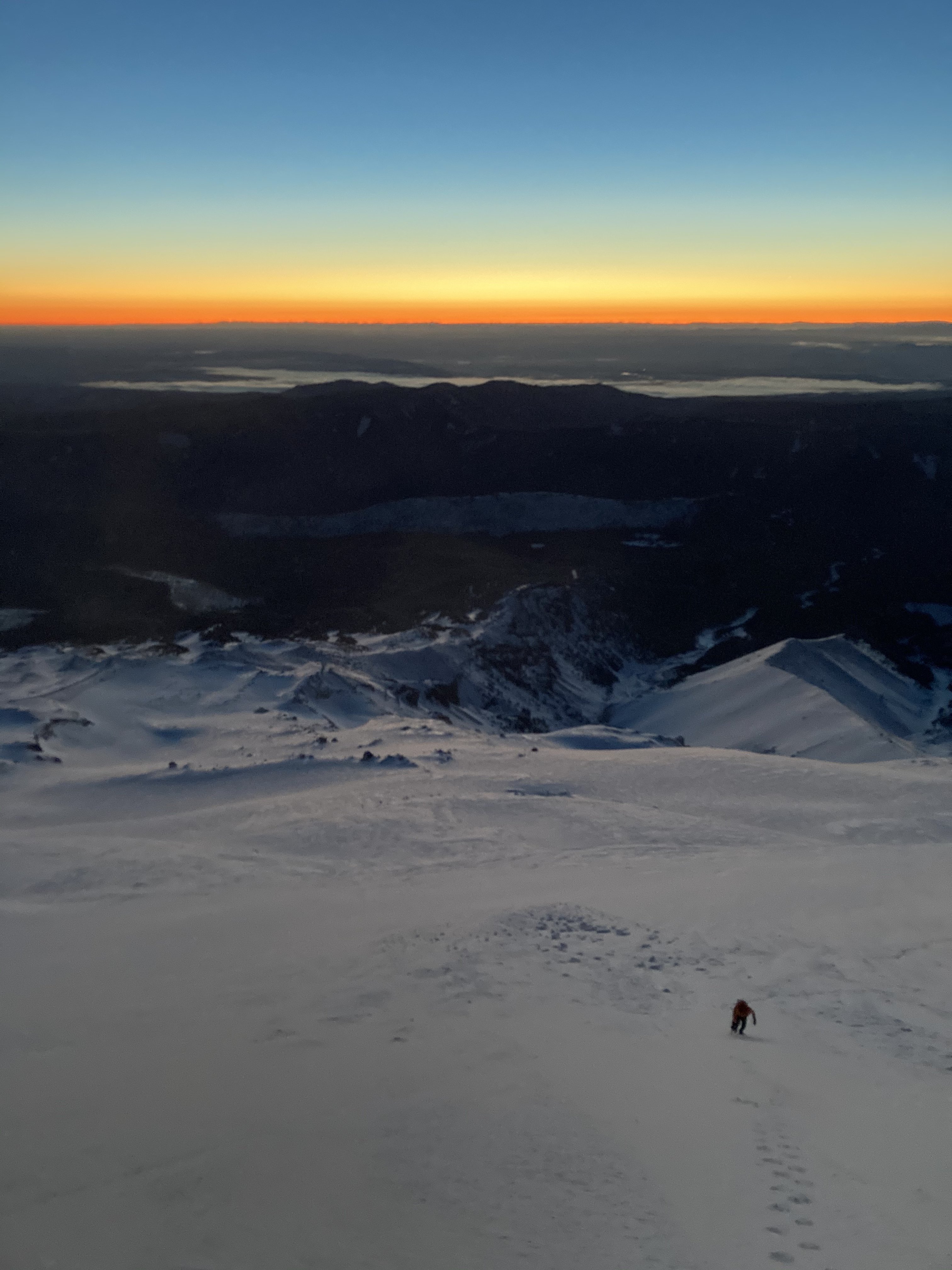
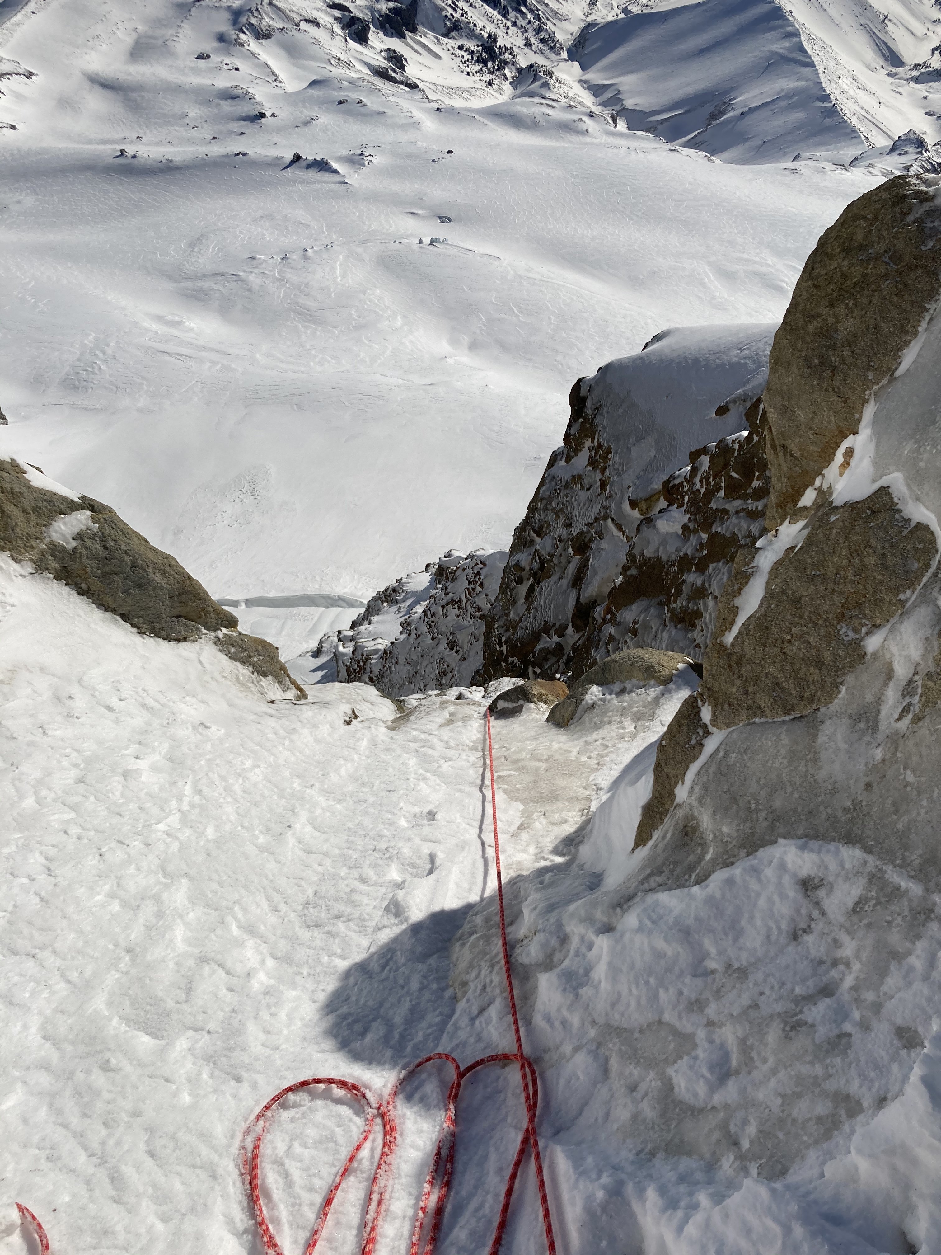
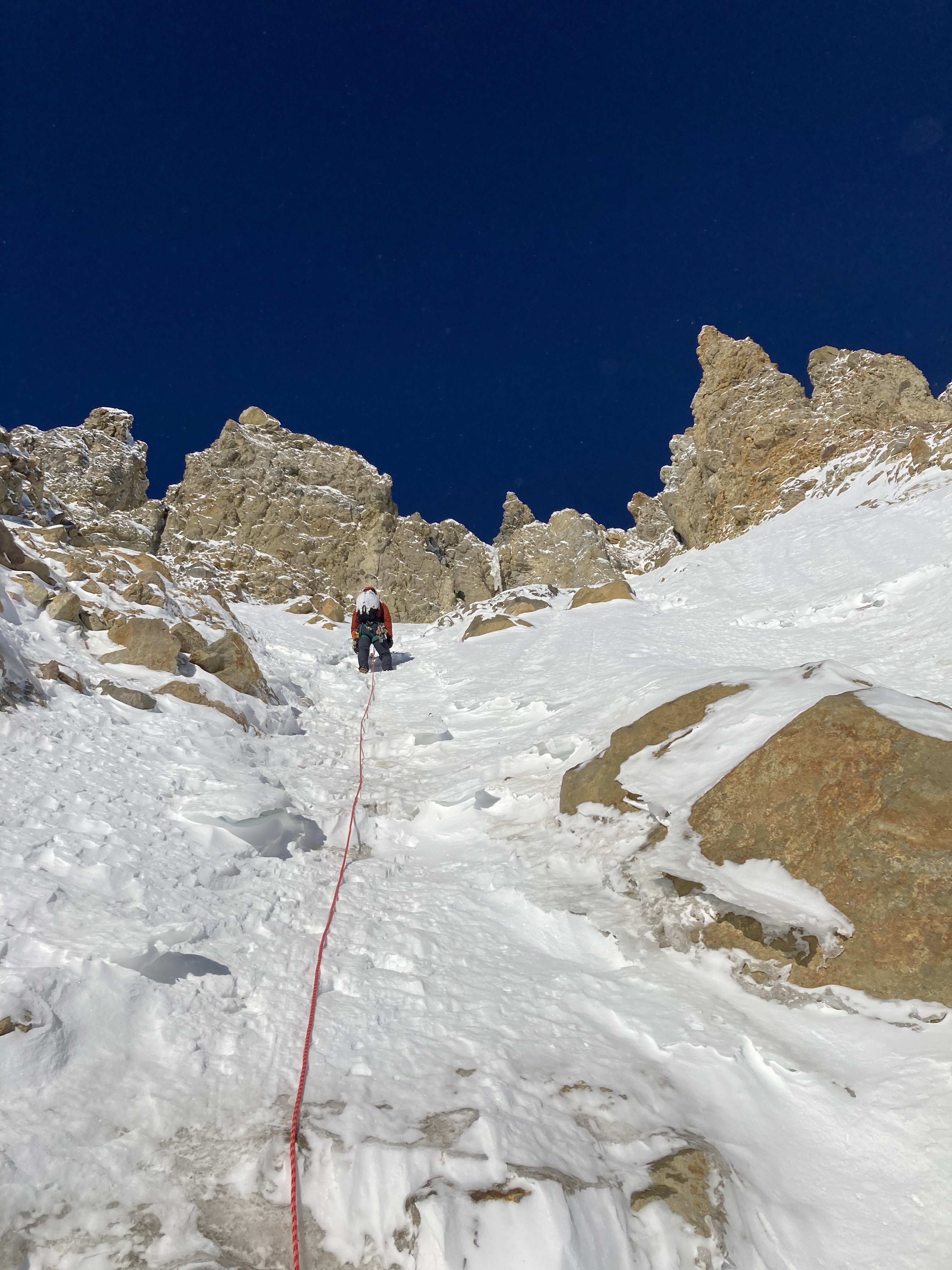
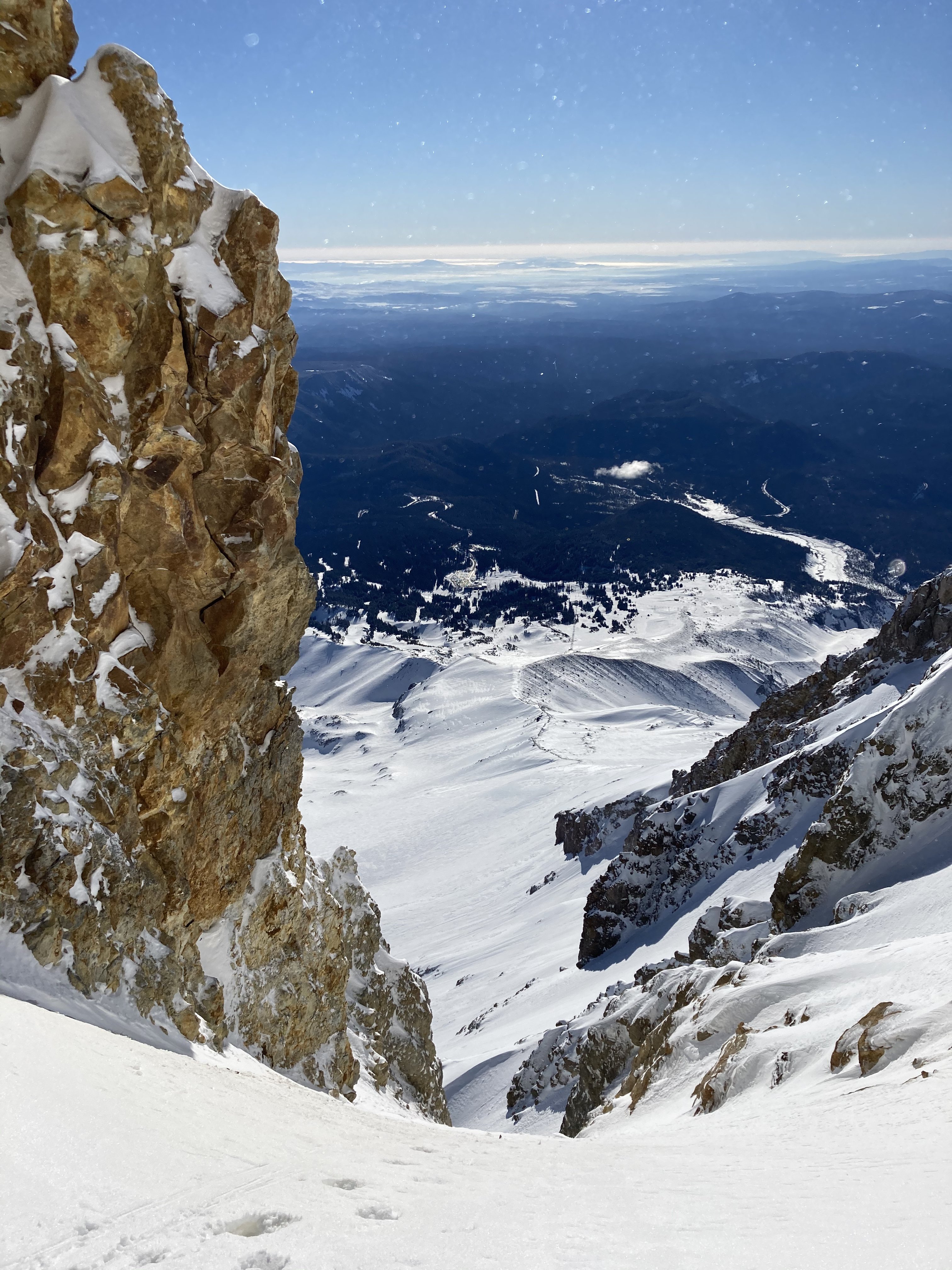
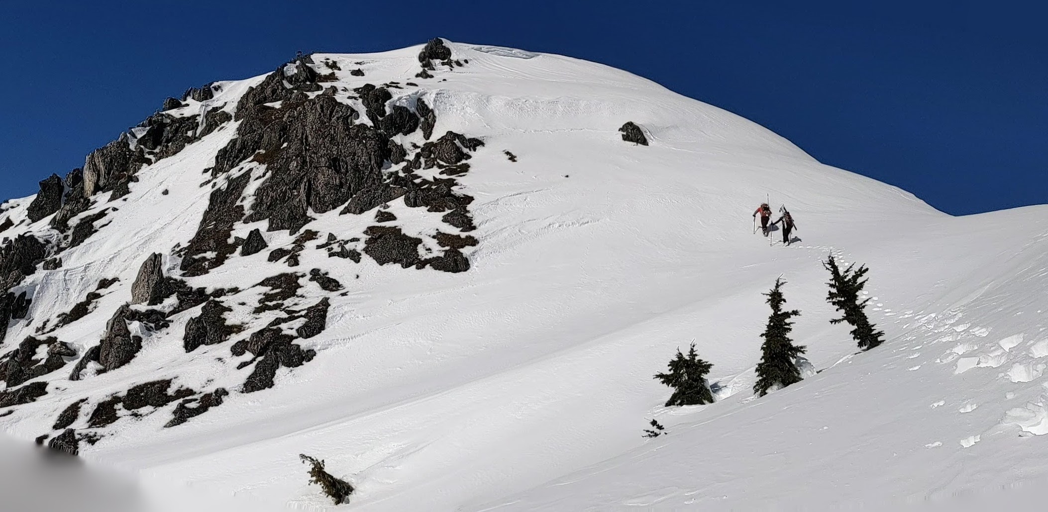
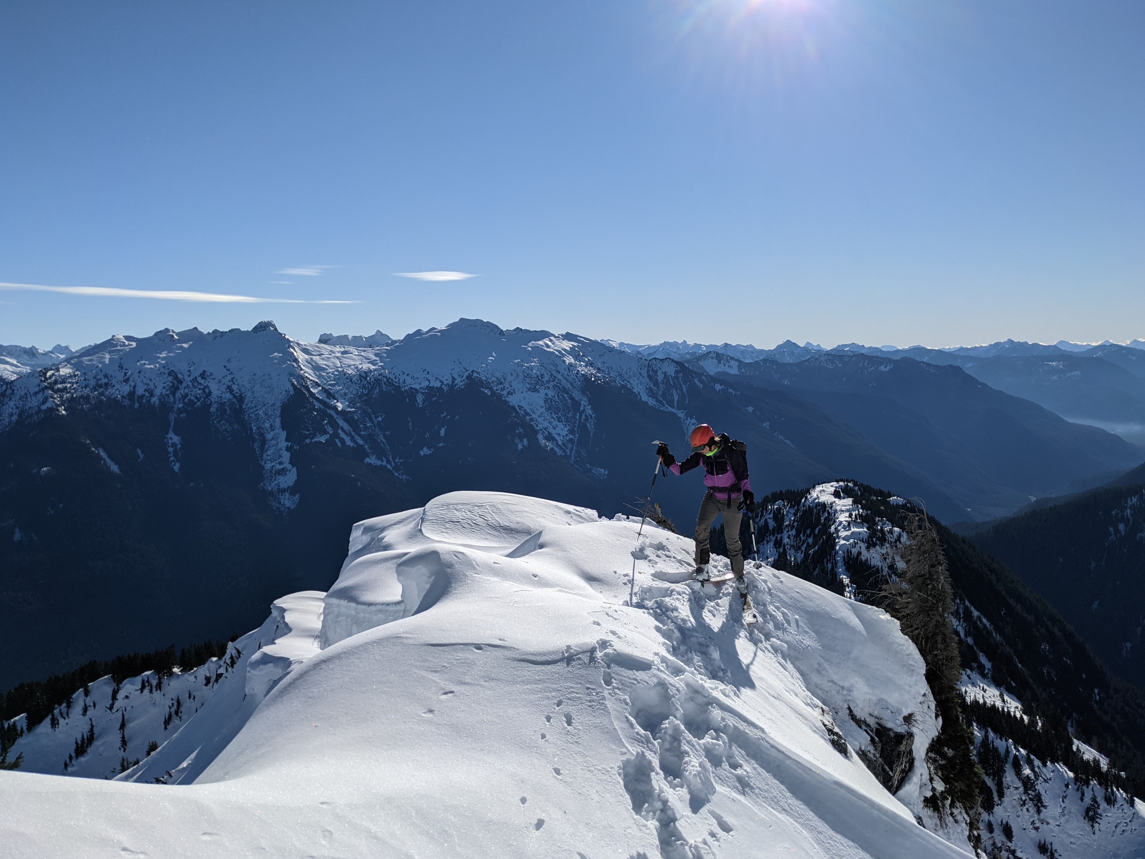
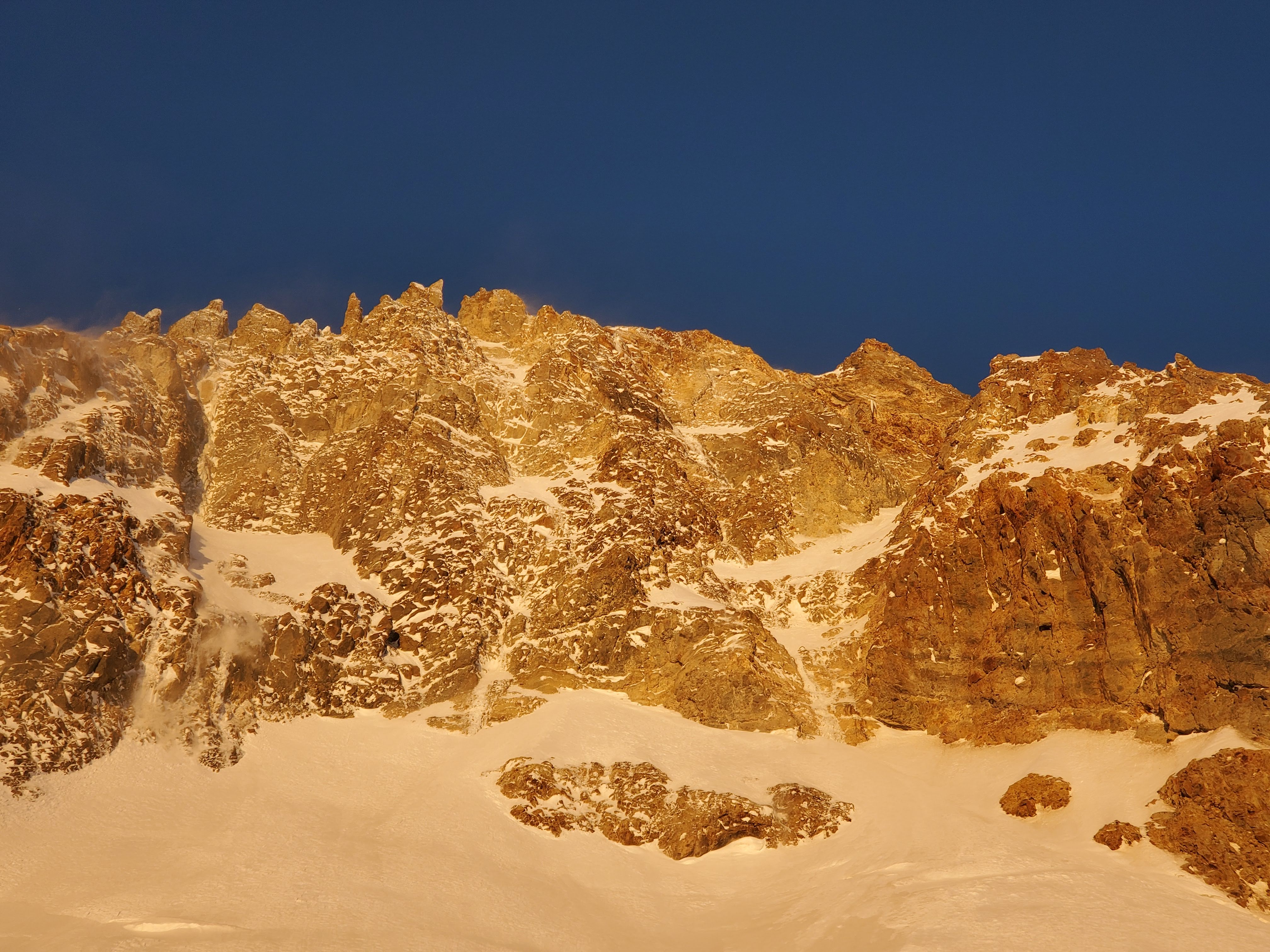
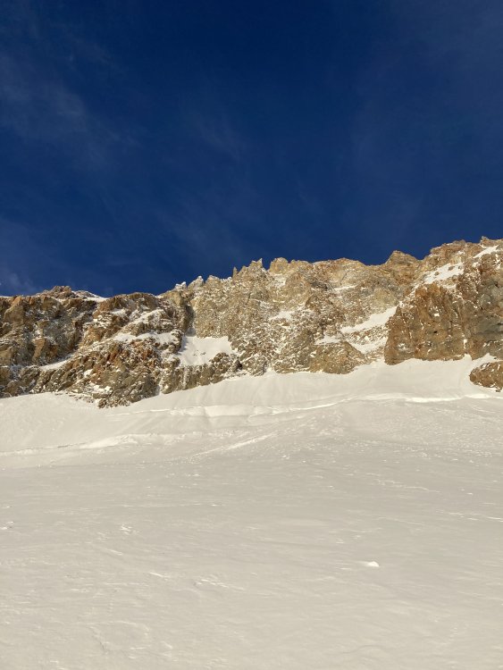
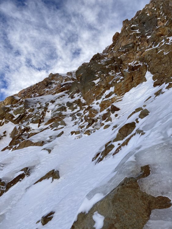
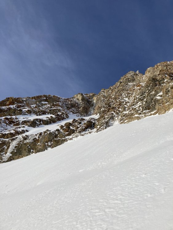
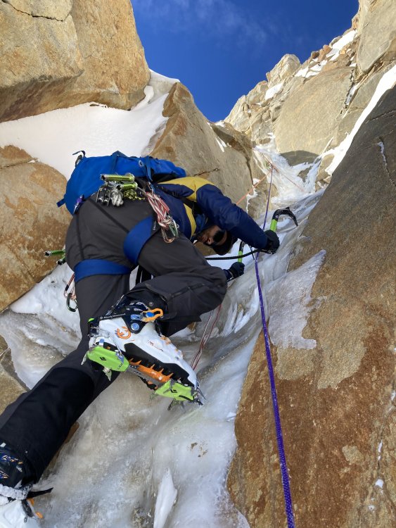
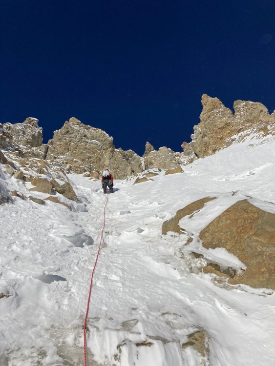
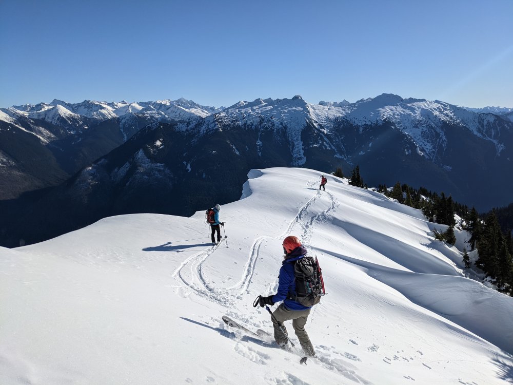
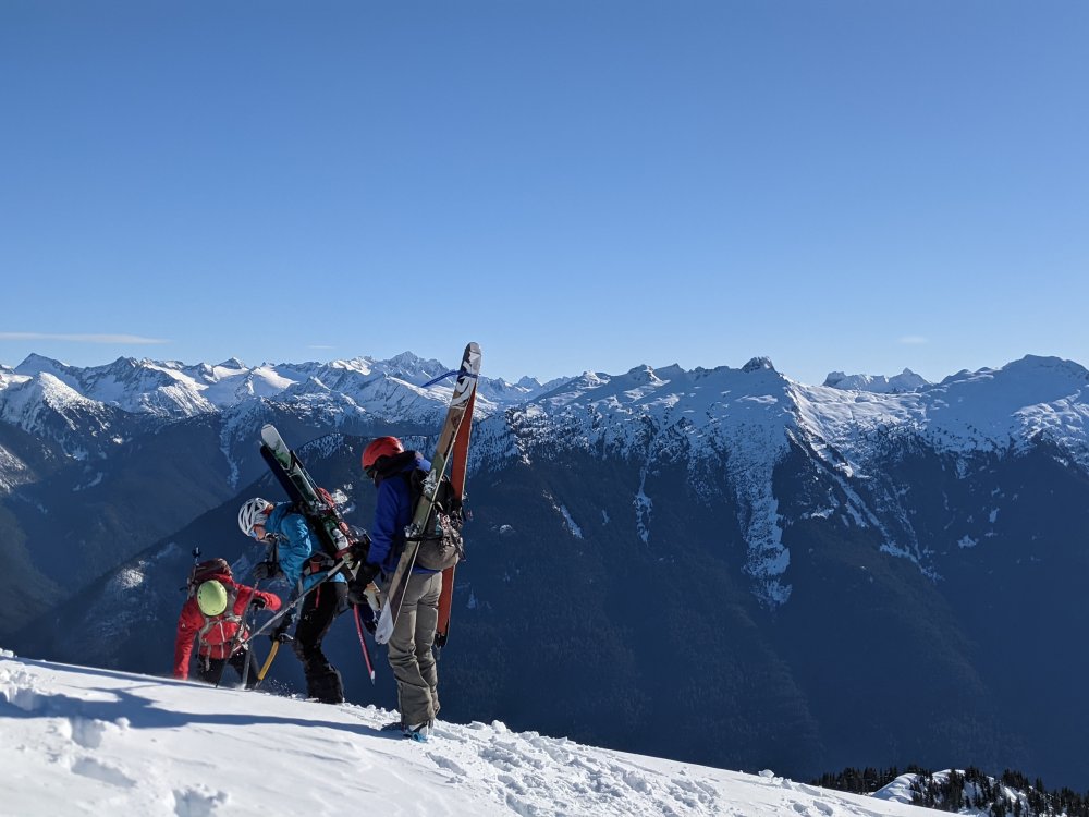
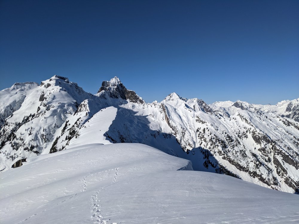
Trip: Sperry Peak - East Gully Trip Date: 01/23/2021 Trip Report: With the long period of sunshine after the rain event, @thedylan and I figured it would be lousy skiing but should be great for climbing... we were right! (This time). Earlier this fall we had made a list of possible winter climbing objectives, but then it started snowing, and snowing, and snowing; so we gave it up and went skiing. But this was our opportunity. Emboldened by some beta from this 2009 trip report, and this extra beta from Kyle M we decided to go for the East Gully route on Sperry Peak. It turned out to be an awesome route for easy ice and snow. Typically crappy ice climbers (like us) are left out in the cold (see what I did there?) when looking for alpine routes. You ask on a forum for east ice routes and everyone suggests Colonial, Eldo, Graybeard, etc. Or else North Twin and east snow routes. There never seems to be a happy medium or real climbing but not AI4. This was it! We nailed the conditions on route, except for a little sugary snow shenanigans on the ridge. The Mountain Loop Highway is closed for the winter at Deer Creek at 1600' so we opted for bikes. After a TH bivy on Friday night we started off at 5am. To our surprise we made it to the summer trailhead with only minimal biking through crusty snow, arriving there at 6:30 with 7.6 miles under our belts already. We brought snowshoes but ditched them at 2400' where the trail breaks out into the open and we got a good view of how crusty the snow was going to be. We did not regret this. The approach is short but was seriously aided by the high elevation snowpack and firm crust. We easily booted to the approach scramble at 3600'. First view: Route from where we left the summer trail: From the trail the route is obvious, up the gully that splits the face. All the photos make it look like there is a notch between two high points, but the right point is just a flat spot on the ridge. At about 3400' the approach scramble begins that shut down Kyle M and party. Fortunately, we had an easy snow gully, the ice step was wet and thin but there is a right variation that worked with an easy scramble section. The climbing begins at about 4400' with the money pitch right off the batt. If there was a way to build a rap anchor I might have been tempted to give up here and just lap the first pitch, there were several variations possible and it was awesome easy ice and hero snice, the kind of conditions to make you feel like a good ice climber! This didn't last and after maybe 100' it turned to snow over rock with no pro and a rock step looming, I built a crappy anchor and belayed Dylan up. He took the rock step that turned out to be an easy scramble move aided by the shockingly warm sunshine (I climbed it without gloves or a jacket). Then we were back into the snow gully. From here it was simul-soloing moderate snow and snice for several simul blocks with one great snice and ice step in the mix for Dylan to lead. First pitch: Second pitch rock step with spindrift: I lead again up to the ridge, as I approached it I realized I was climbing up to a cornice so had to bear left onto some insanely steep sugary snow with no pro and terrible axe plunges. I wallowed upward somehow making decent footholds and trusting that it seemed to be working. After probably 30 minutes for what was realistically probably 50' but felt like 200 I topped out on the ridge at a flat safe spot at 5500' and started burying everything metal I had for a crappy anchor in the sugar snow. I was psychologically done from the insecurity of it. You don't train for those conditions. The climbing worked, somehow, but it felt awful. Dylan, naturally, made it look easy on second. Dylan's photo looking back down to my belay with the NE ridge behind: Dylan lead the next simul block through the same place mentioned in the 2009 report: " the physical crux of the climb on such a move that required hooking a tree and pulling up with disintegrating footholds above a near vertical flute that dropped into the north face." Second that! The summit was close but the cornice looked daunting, fortunately, it was mostly fatigue talking and it was an easy 4' vertical step onto the summit! Summit slope: We had a good snack break in the sun and felt much rejuvenated. The descent went smoothly, some front pointing and careful walking on crusty snow, mostly NW near the scramble route to the head of the cirque and across the lake to the trail route and out to Headley Pass. We hit the summer TH at 6pm making it an 11.5 hour day on foot, just under 14 car to car. This was a fantastic route, if we could figure out a better way to do the NE ridge part I would definitely go back. There was an ice line to the left a few hundred feet below the ridge crest that I think the '09 party took, but it looked hard compared to the snow I did... in retrospect... Gear Notes: bikes, sneakers, boots, axe, ice tool, helmets, 60m 1/2 rope, 3 screws, some nuts and cams (placed 2 rock pieces all day, minimal options), 2 pickets (3 maybe useful?) Approach Notes: Bikes! Crust made for awesomely fast travel on the low angle stuff. The climb is very accessible from the summer TH.4 points
-
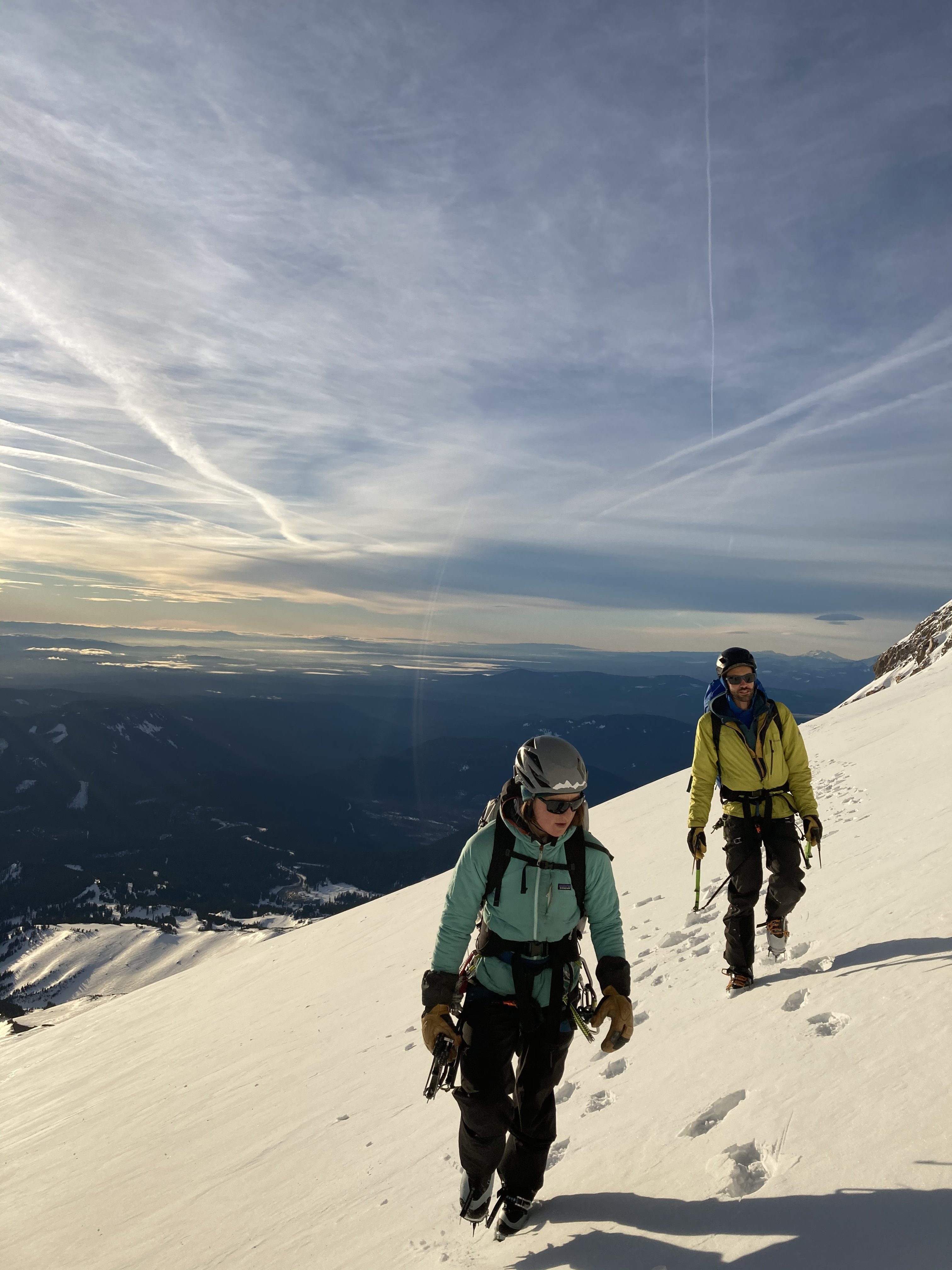
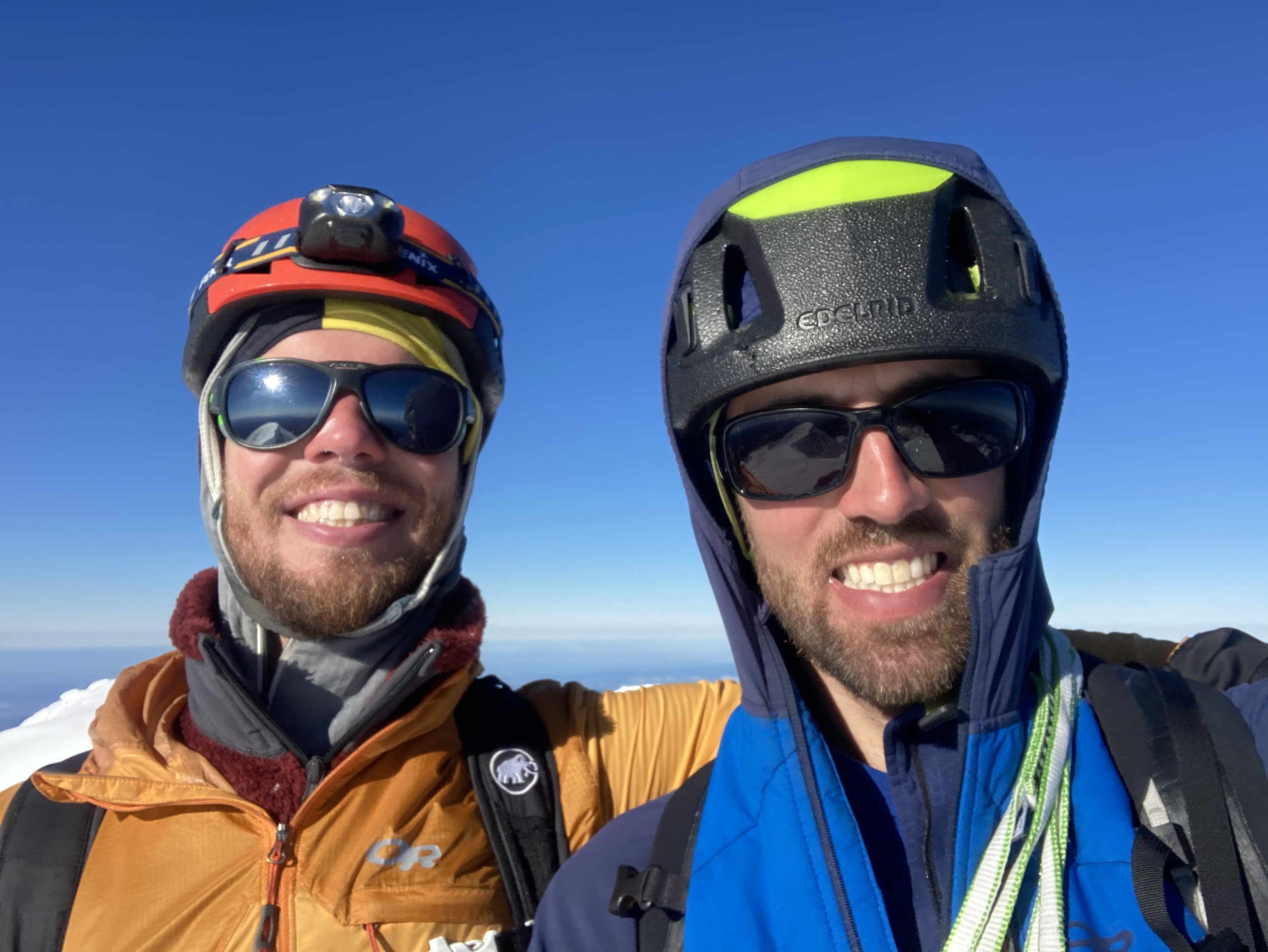
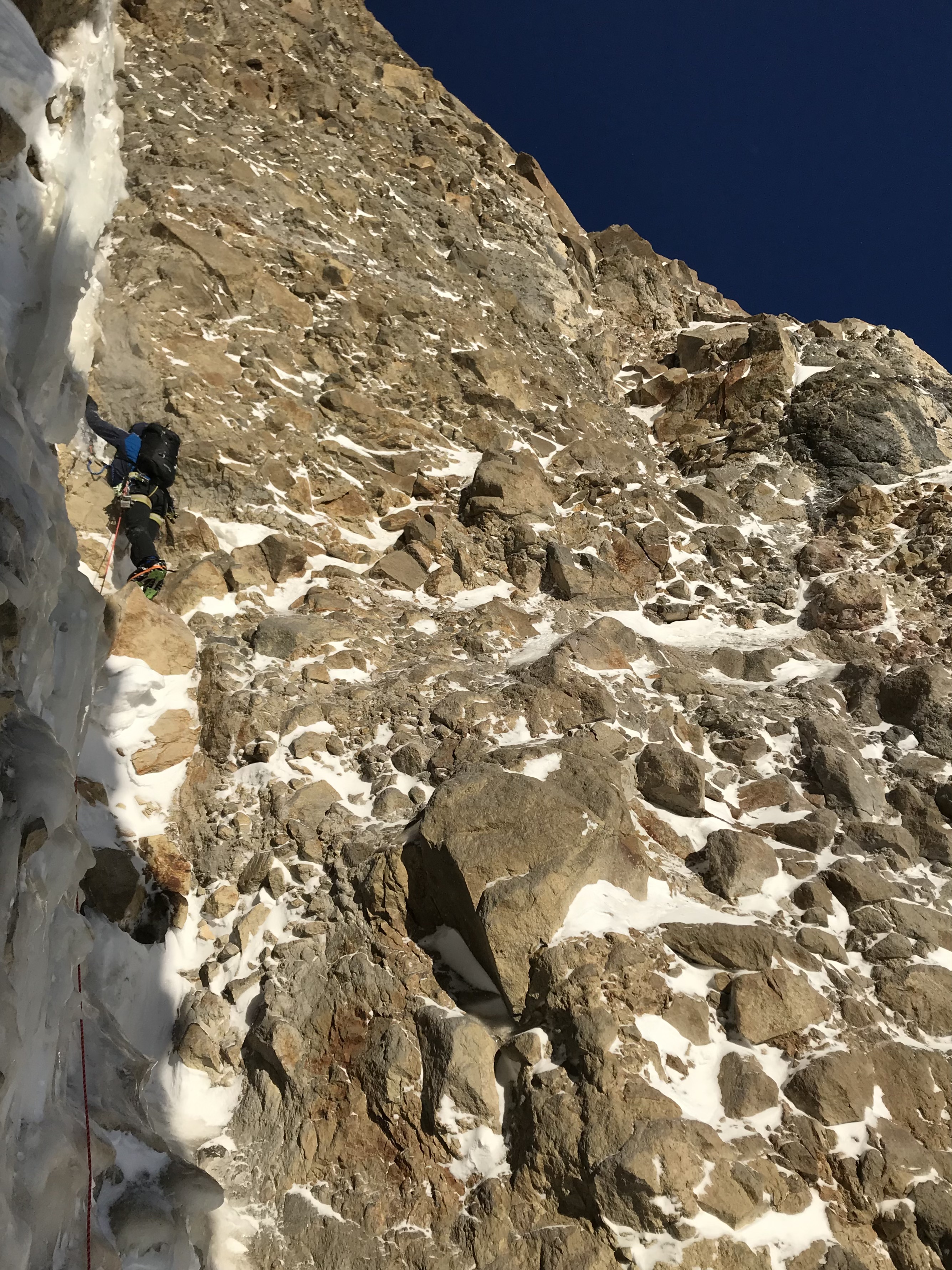
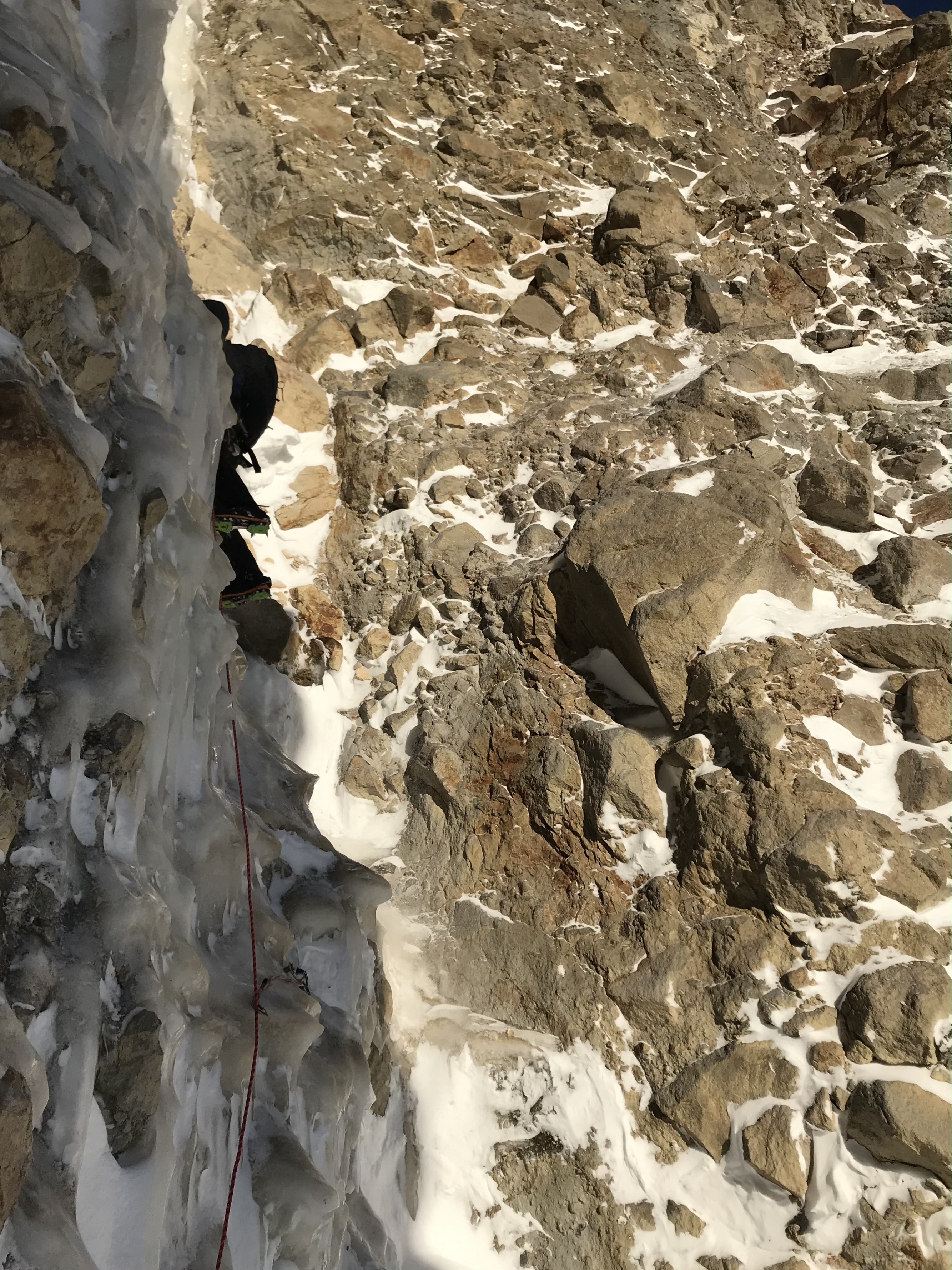
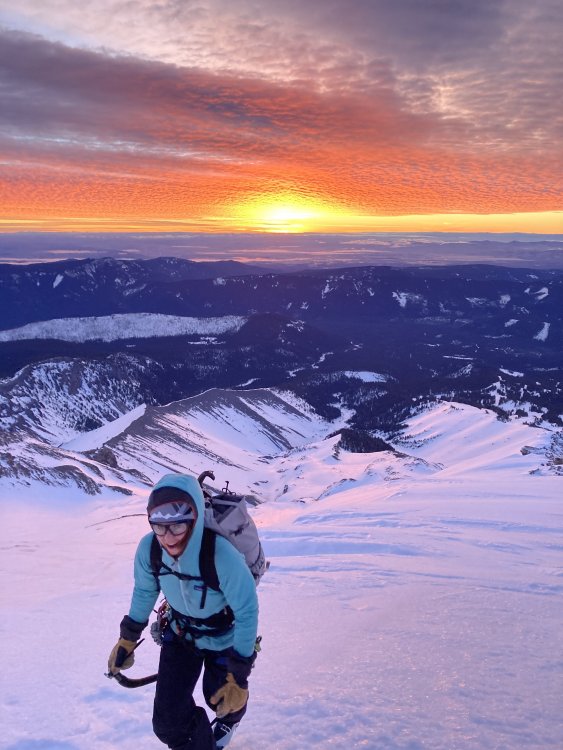
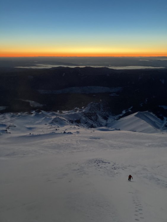
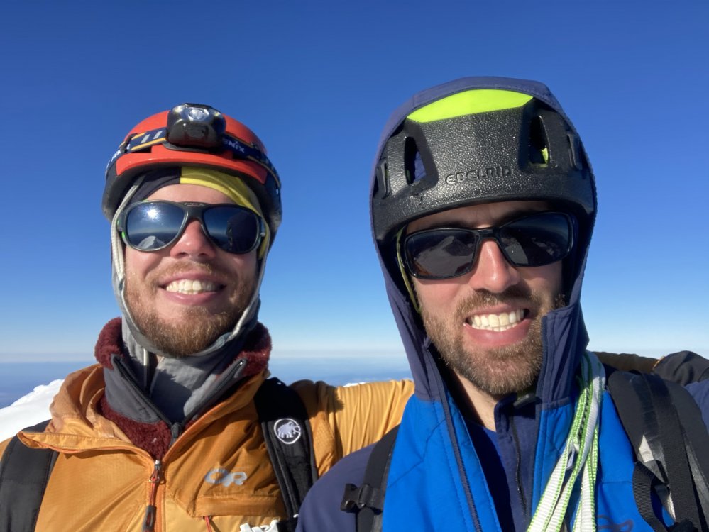
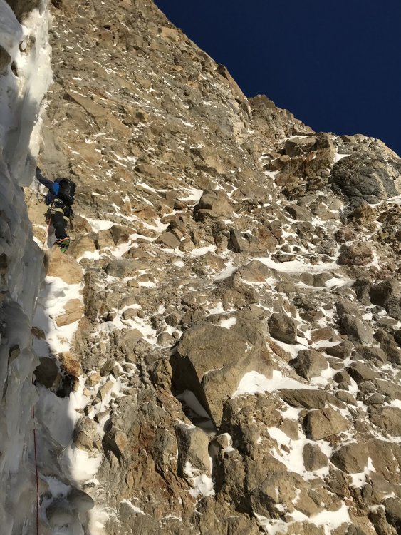
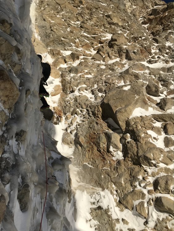
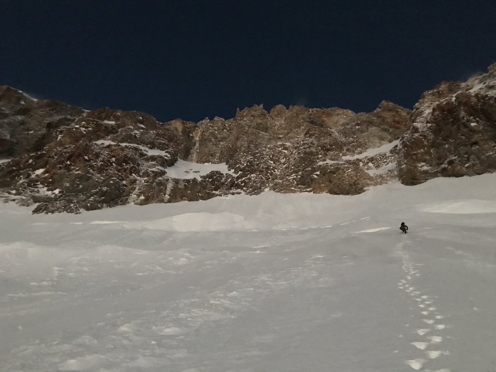
Trip: Wy'east (Mt. Hood) - Fric-Amos Trip Date: 01/23/2021 Trip Report: I went up to the Black Spider last weekend with Lindsey and Riley. We found the Fric-Amos in very nice condition but were too late on a warm day and bailed up an easy mixed pitch to the L of the main pitch. Thankfully the weather granted me another opportunity and I came back this weekend with Kyle to get it done. Noah and Matt saw my Insta story from the first weekend and jumped on the send train. They acted as true gentlemen, coordinating with us and giving us a head start. The route is currently in good condition (but don't expect a straightforward WI4). We used an approach pitch to the R of the original both times that follows an easy ice slot (the original would probably go but is discontinuous ice blobs up a vertical cliff). The crux pitch is a full 60m or could be broken up, expect tricky and sustained climbing but with good ice. Above this snow slopes take you through one more short ice step and up to the summit ridge. This may be one of the more frequently formed ice routes on the Spider given that it is in a shaded cleft, unlike most of the other routes. Though you are basically going for one mega pitch, it is very good and I would recommend it! I talked to Bill Amos the next day and he believes ours was the 3rd (and Noah and Matt the 4th) ascent of the route (2nd was Marcus and Marsha, go figure). Awesome sunrise approaching on first attempt... Lindsey and Riley below the face, clearly too late... The face... Closer view of the Fric-Amos (original approach pitch is on the L, our approach pitch was on the far R of the hanging snow field)... Riley following the approach pitch, classic slot... Our escape pitch... The crux pitch (taken during from 1st attempt)... Kyle booting up to the face on attempt 2 (much earlier)... Kyle's pic, me below the face... Kyle's pics, me on the crux... Looking down from top of crux... Kyle leading above crux... Looking down from ropes off... Summit selfiez... Gear Notes: Screws: 2xstub, 4x13, 2x16, 1x22 (used for the belay but not any good) Rock gear: nuts, cams 0.4-0.75, pins (not used), 2 med hexes (not used) Plenty of slings if you're going to do the crux as one pitch. Approach Notes: Boots from Timberline, crossed White River ~8,800ft.


 3 points
 -
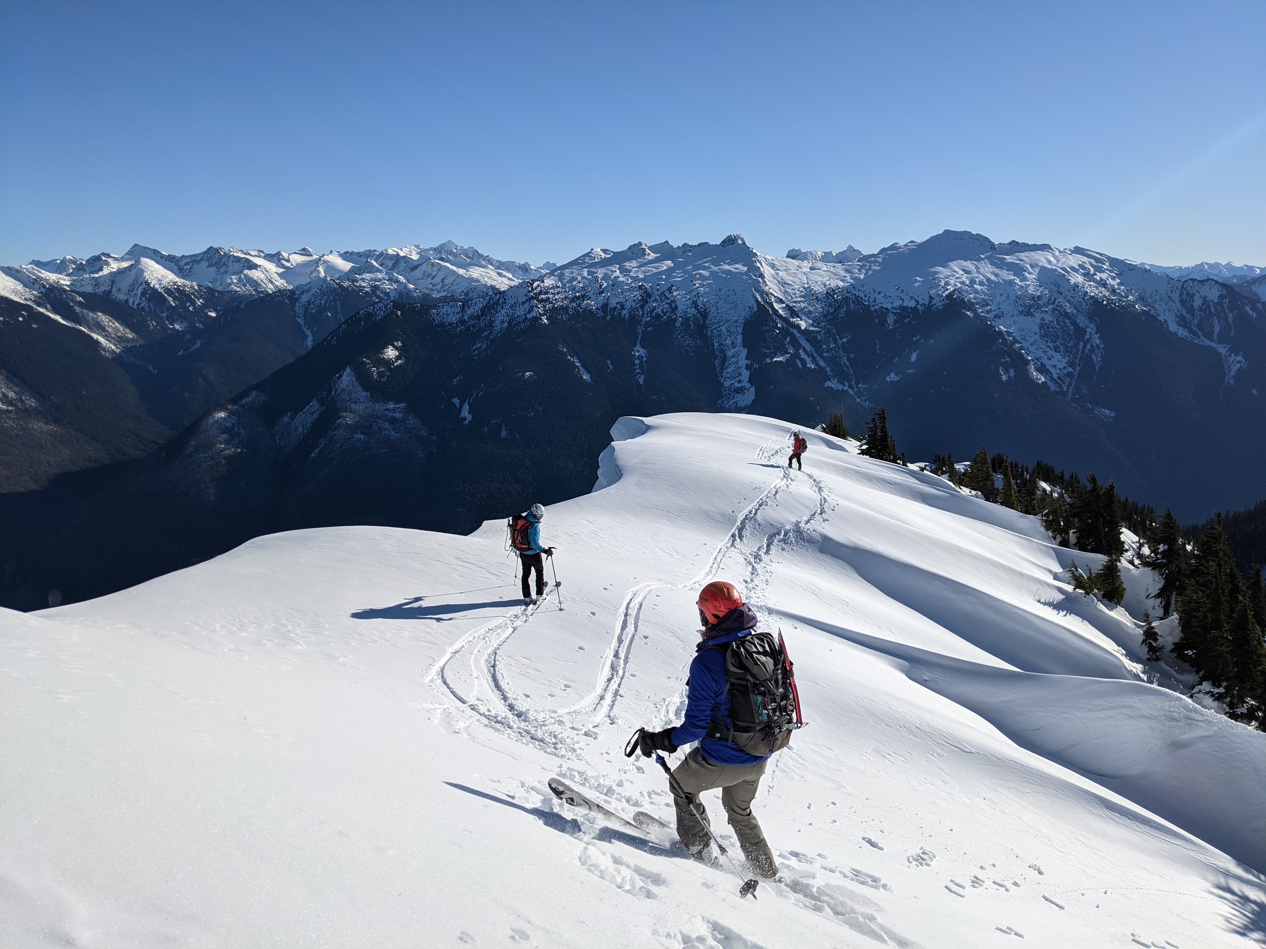
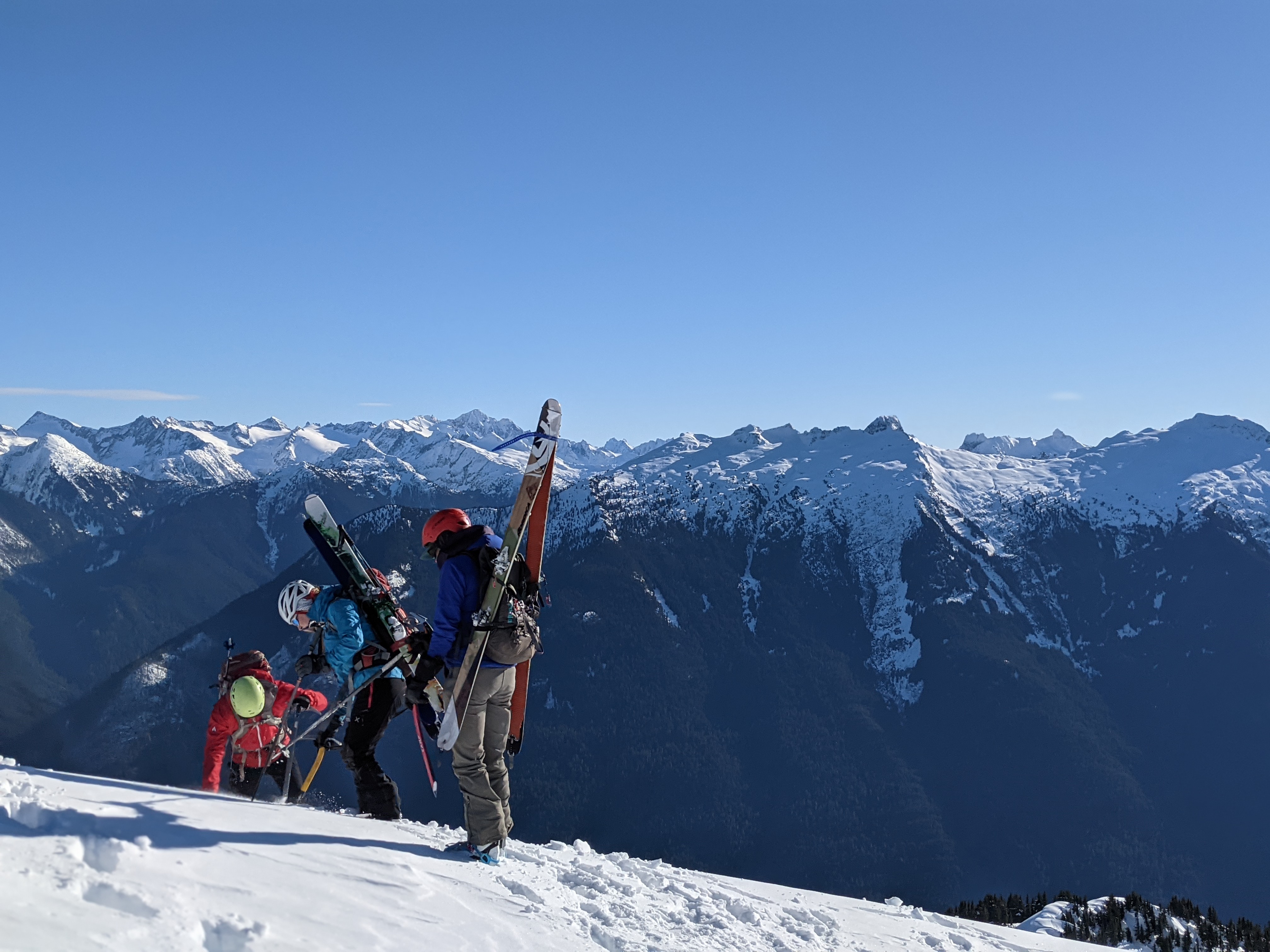
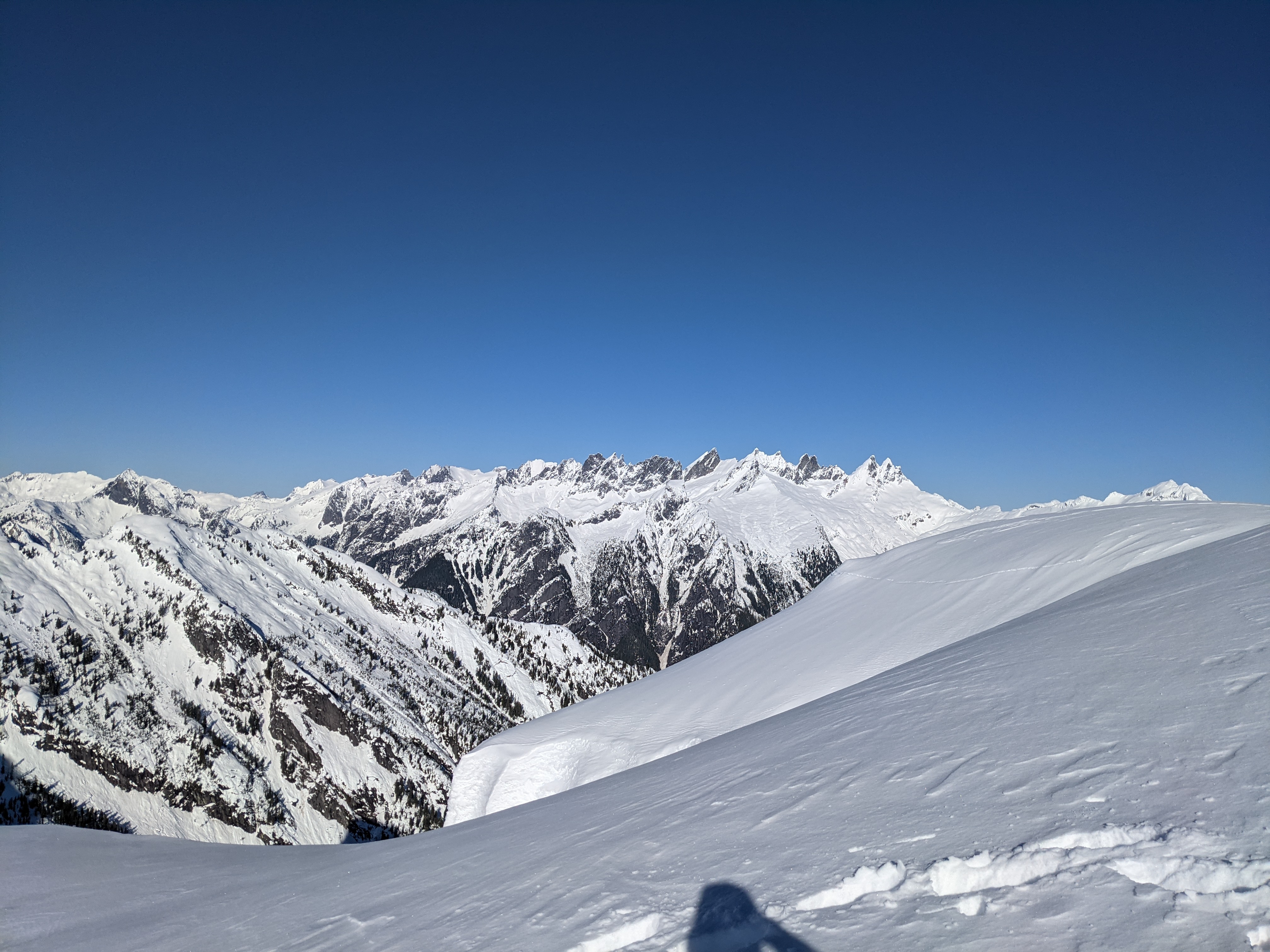
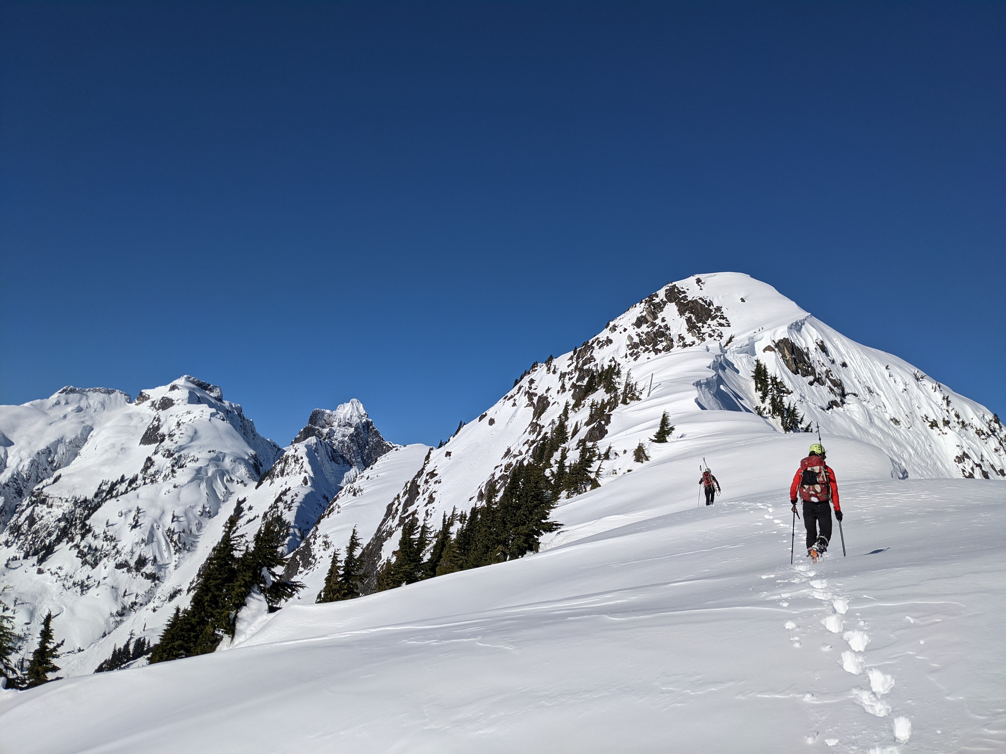
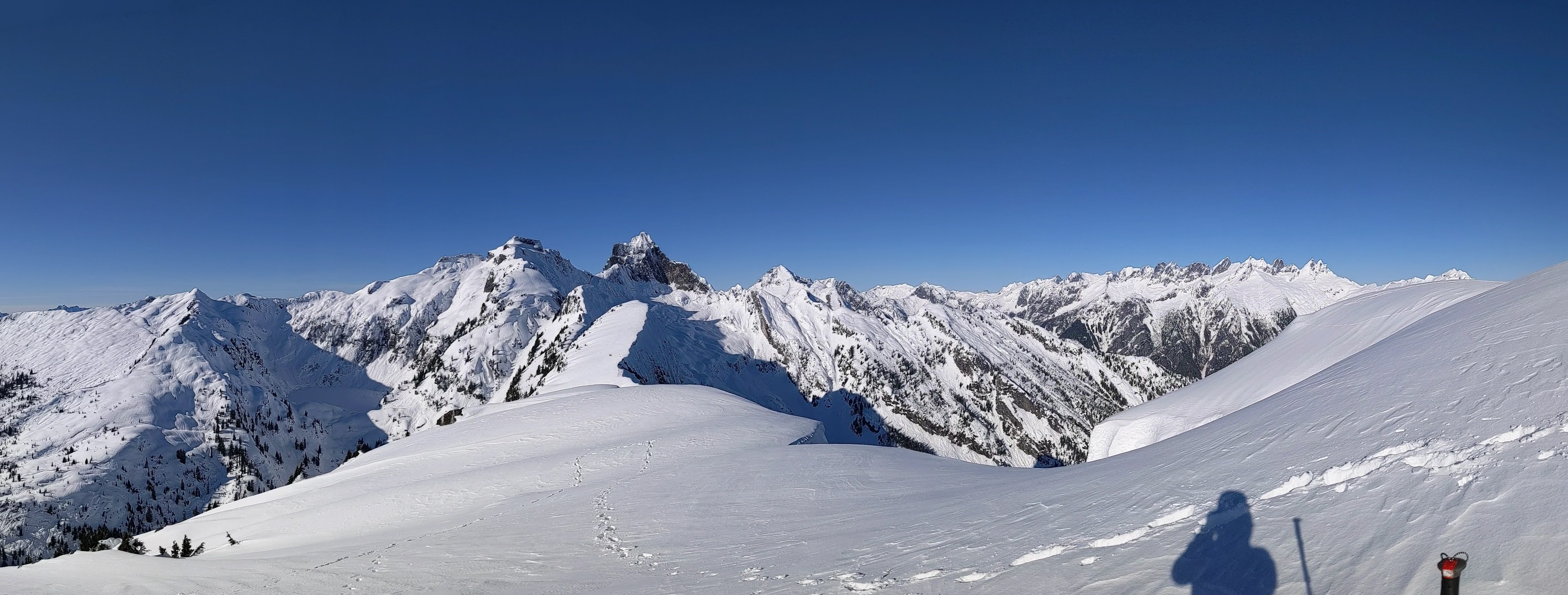
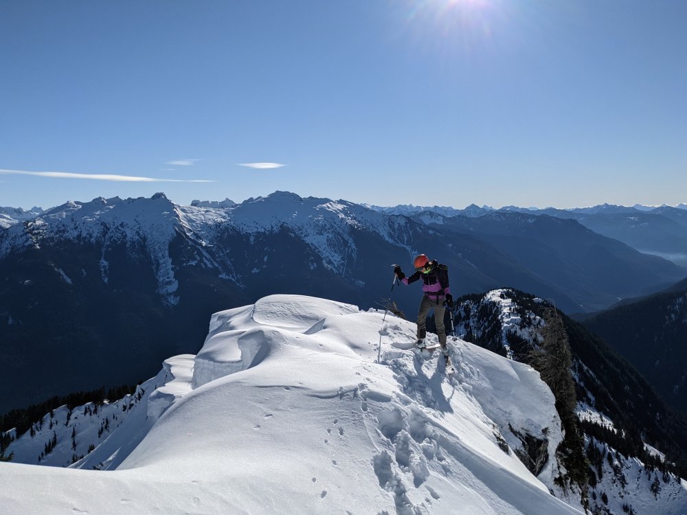
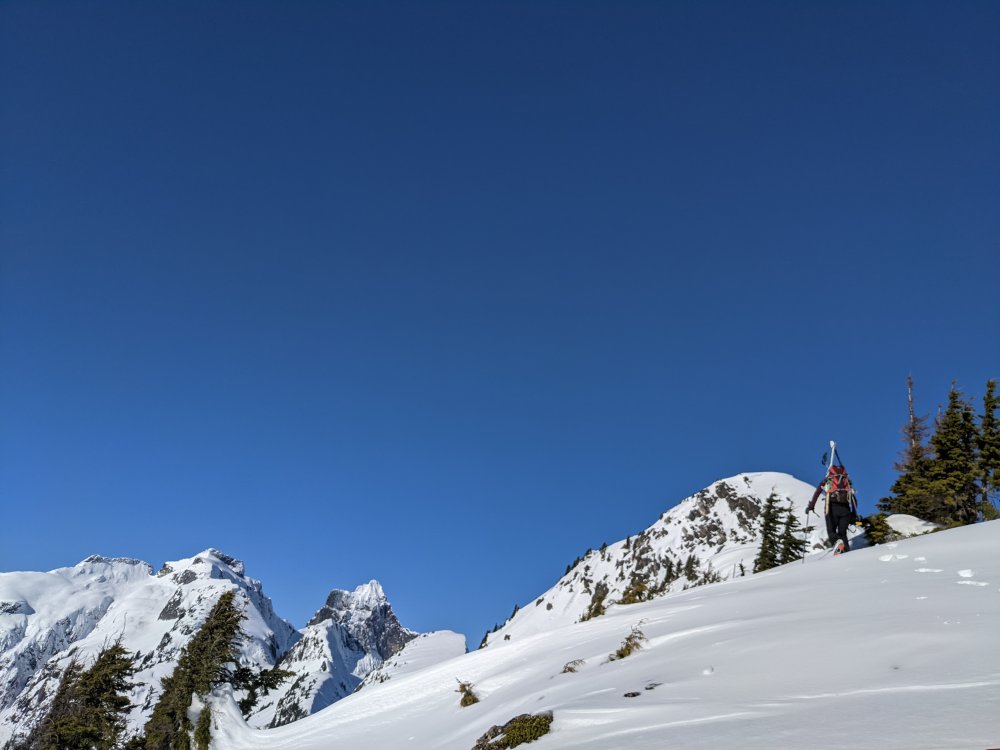
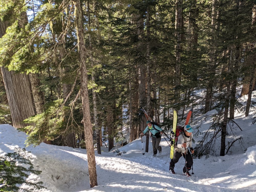
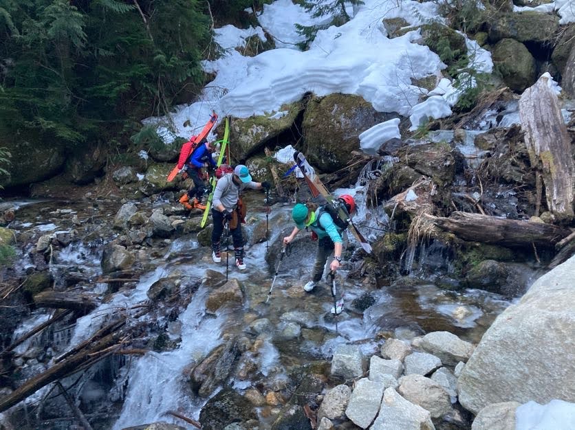
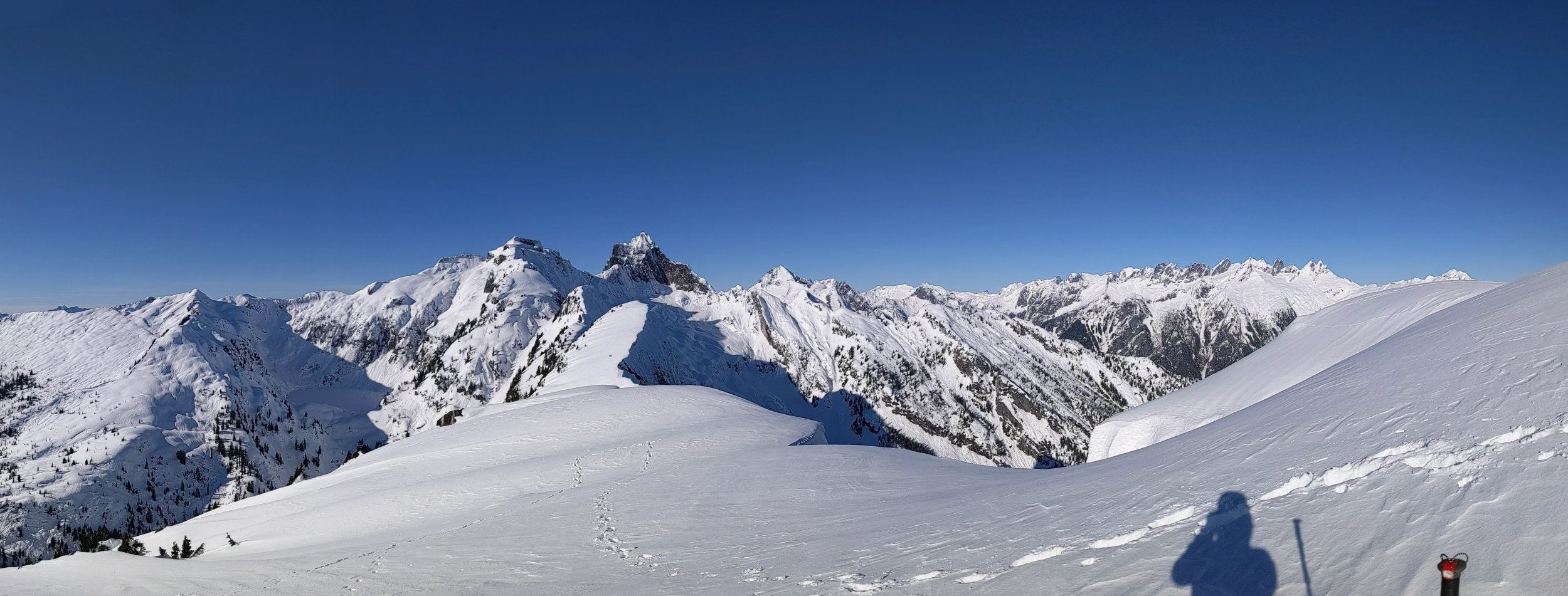
Trip: Trappers Peak - South Ridge Trip Date: 01/23/2021 Trip Report: The incredible weather window on Saturday (1-23-2021) coupled with low avalanche danger inspired @Alisse, Silvia, Rio, and myself to aim for something with a little more adventure than the ski tours we'd been enjoying around the passes for the last few weekends. Trappers Peak seemed to offer a good taste of all the requirements- Questionable forest service road, icy creek crossings, crusty tree skiing, steep enough snow to be fun, and incredible summit views. We found the forest road to be generally easy going despite recent wind events. Instead of blowdown it was snow on the road that stopped us about a mile from the trailhead. With one steeper section on the road and a few modest ruts to navigate I'd recommend a vehicle with more than a few inches of clearance though I'm sure @Alisse could have made it up with her off-roading Civic. We took off from the car in ski boots, carrying skis to the trailhead where we decided to start skinning. Of course this was short lived to the first of the creek crossings. The first two were a bit icy taking some care to not dunk the boots. A nice bridge got us over the third. After crossings to the north side of the valley we were forced to pack up our skis and start booting due to the inconsistent snow on the southern aspect. At about 3,500' we started skinning again on firm and at times icy snow. Conditions and terrain were a bit less consistent than expected and we ended up transitioning more times that I'd like admit before reaching the ridge proper. Continuing up was generally easy going. We followed the summer trail pretty close all the way to the ridge. The first bit of steep snow was encountered at about 5,200'. This open, south facing slope had old avalanche debris towards the bottom and on a warmer day could be a concern, especially on the descent. We topped out that slope to be greeted with ever improving views of the final stretch to the summit and beyond. The ridge was basically all corniced to the east and required some consideration and a little bit of route finding as to not creep too close to the edge. The snow was not too difficult to boot, postholing was generally minimal. Around 5,800' the ridge chokes up for less than 20'. The snow here felt shallower than in previous sections, we bottomed out down to rock on a few steps. The final step to the summit offered some fun moderate snow that steepened up enough that daggering the axe felt good for a little over a body length. The snow here had great purchase, solid footing. Summit! Mount Triumph Southern Pickets On the descent Trip Details: 13 miles, 3,800' gain, 10 hours Gear Notes: Skis, ski crampons, boot crampons, ice axe. A whippet or second tool could be useful for the final summit step if not super comfortable on steep snow, however it climbed fine with just an axe. Approach Notes: Typical forest road. Winter route generally follows summer trail.


 1 point
 -
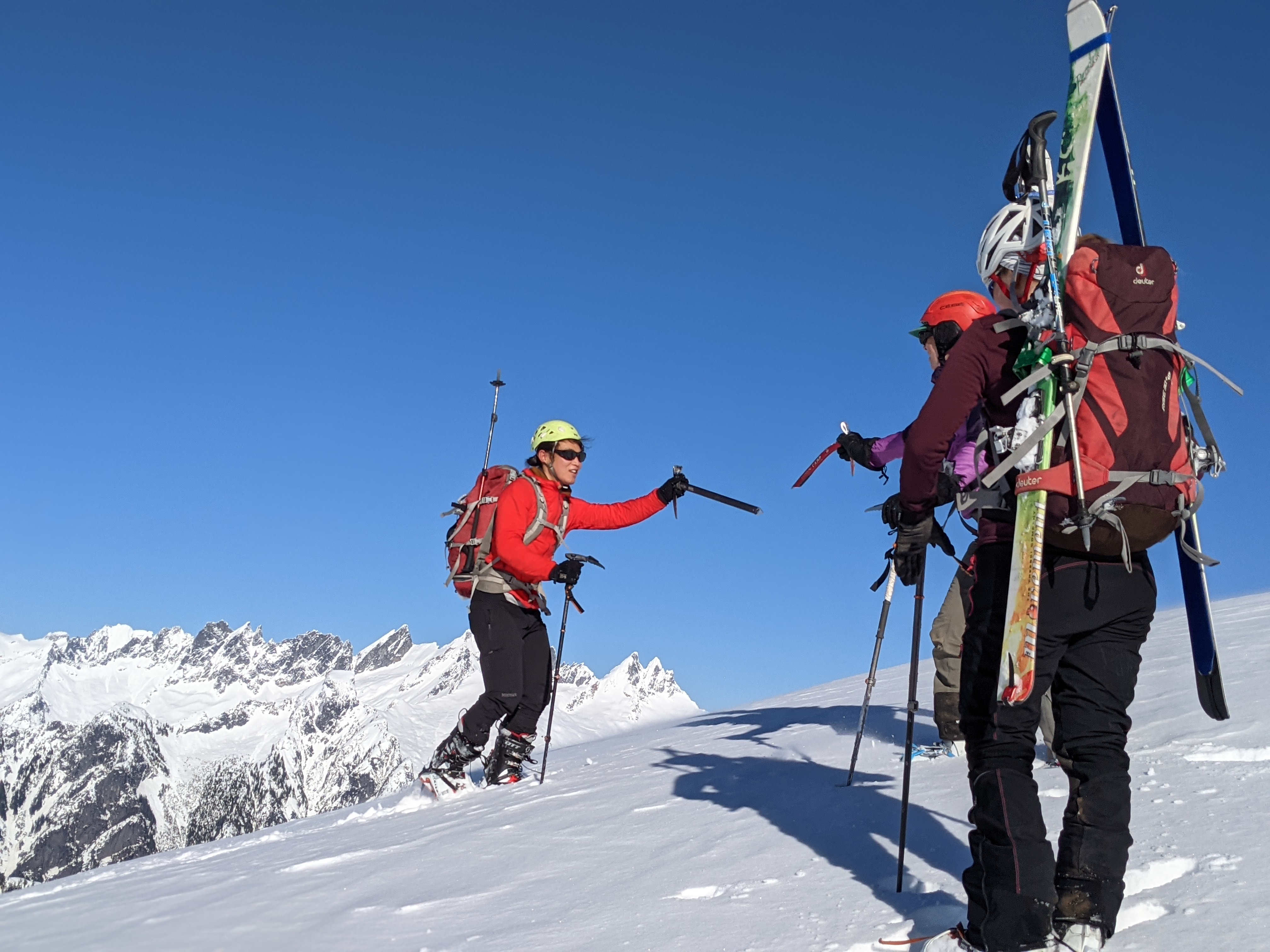
Trip: WELKER! - Whacky Wallow Trip Date: 01/18/2021 Trip Report: You can all feel sorry for @Alisse. She was desperate enough this week to reach out to @Kit and myself to try and climb a mountain somewhere. And so we convinced her that she might as well go where few have gone before.....WELKER! And since it was winter, it would be the WELKER WHACKY WALLOW. Now doesn't that just sound fun? Well, it wasn't, at least not in the traditional sense. It didn't help that JGAP lost his nerve quite high on the NW ridge, muttering that his "mountain sense" demanded an easier route with less danger of bodily harm. @Alisse seemed unconvinced, but nevertheless went along with the ignominious descent and shuffle to the North ridge, where much bodily harm was endured by the team anyways, while post-holing in less than ideal conditions. We were crazy alright, but not crazy enough to bring snowshoes. Didn't it rain several inches up here? Why wasn't this crust thick enough for my fat ass? Why do bad things happen to bad people? Why does fat need to be punished? Why would a nice young lady pack beers to the summit for two jackasses? We might never know the answers to these questions, but we do know that WELKER has quite a good view and is maaaaaaaaaaaybe worth the work to climb. Oh, and that @Alisse is a saint...... despite what @Kit says. (captions, in time) Gear Notes: Whatever you think will lessen the pain. Summit beers are key. Approach Notes: Ha!1 point
-
I second the above comment. For future reference I also wanted to post this photo from December. At that time there was actually more ice on the rest of the face, for instance the obvious smear at the base of Arachnophobia, but I guess we were afraid to commit to anything. Now having done Fric-Amos I'm pretty sure it would've gone at any time over the last couple months. Based on some news helicopter footage, I'm suspicious there was ice on the face as early as October. In any case, this route and possibly some of the others are climbable outside of the brief (and often non-existent) Spring window when people usually look up there.
 1 point
 -
Good stuff! It was fun sharing belays with you guys and I'm psyched we could both get it done. What a great route.1 point
-
Inspired by your pictures, I set upon this hill on Saturday. I took a different route (traditional?) up and was surprised that i didn't see any tracks after knowing that you all did the same trip earlier in the week. It was just me and two dogs going up a very steep peak until we reached the top and saw where you summitted. My track was so exhausting that i assumed you MUST have picked a better route. Damn, I was wrong. So wrong. It was a nightmare coming across the avalanche field and then later down through all the knocked down lumber. The storm did a number on that side of the hill, whereas what I climbed up was completely unmolested. It must have added an hour or more and exhausted the three of us! Kudos to you guys for summitting that way. Fortunately, the views were great and the weather was perfect. No wind meant a nice lunch break at the top and made up for working my way over and under trees through scrub in the dark.1 point
-
Guye Peak south gully had great alpine ice on Saturday. Most of the gully was hard snow and ice, and there were around 4-5 short mixed steps (~M3) which generally had solid ice above/on them, making for some super fun climbing, including a layback move on ice sticks with high feet on rock edges. A lot of the trees had tat on them already, some with rap rings. Knifeblade pins were useful.1 point
-
Trip: Mount Ann (5840') - East Ridge Trip Date: 01/23/2021 Trip Report: A buddy and I climbed Mount Ann this weekend. Snowshoe trip in perfect winter weather. We started from the Mount Baker Ski area. We headed up and over Austin Pass heading towards Lake Ann. We climbed up the north basin between Han Peak and Mount Ann, to the east ridge, to the summit. Temperature was fairly cold, water bladder hose kept freezing along the way. Snow conditions were pretty good, varying between a frozen crust to 6" deep powdery snow on a crust. The snow on the steeper sections was a bit slippery, the top 4" or so wanted to slide on the crust beneath. Surprisingly there was running water available along the route. Great trip and workout for a day climb. Awesome views. Trip distance was around 12 miles round trip. Travel Time: Car to Summit: 5 hours Summit back to Car: 4 hours We started at 8:30am and finished at 6:15pm in the dark. We brought lights but didn't need them, the moon supplied enough light to see. Gear Notes: Snowshoes, Trekking Poles, Whippet. The Whippet worked great on the steeper sections. Approach Notes: Mount Baker Ski Area to Austin Pass to North Basin to East Ridge.1 point