Leaderboard


Popular Content
Showing content with the highest reputation on 01/25/21 in all areas
-
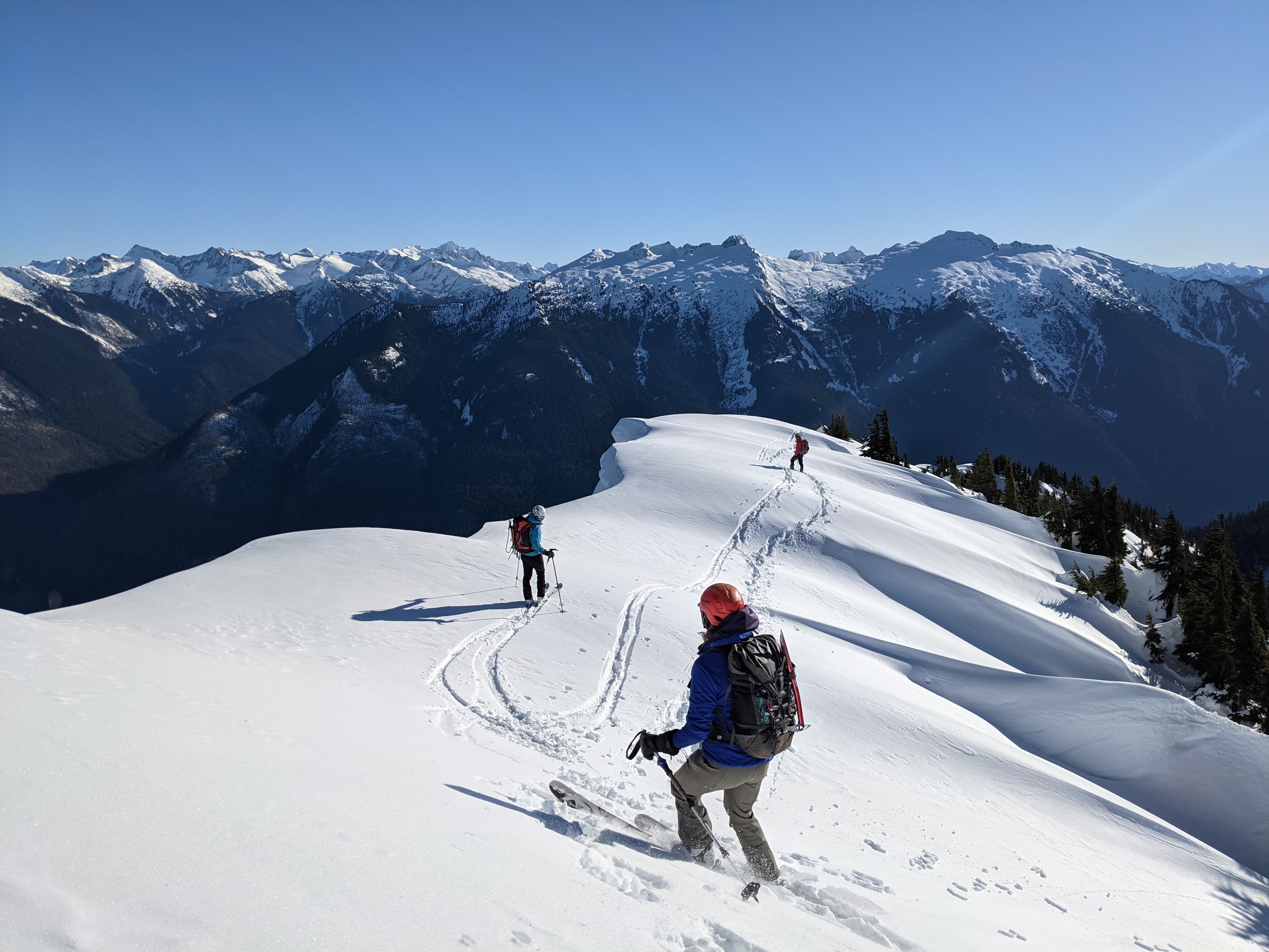
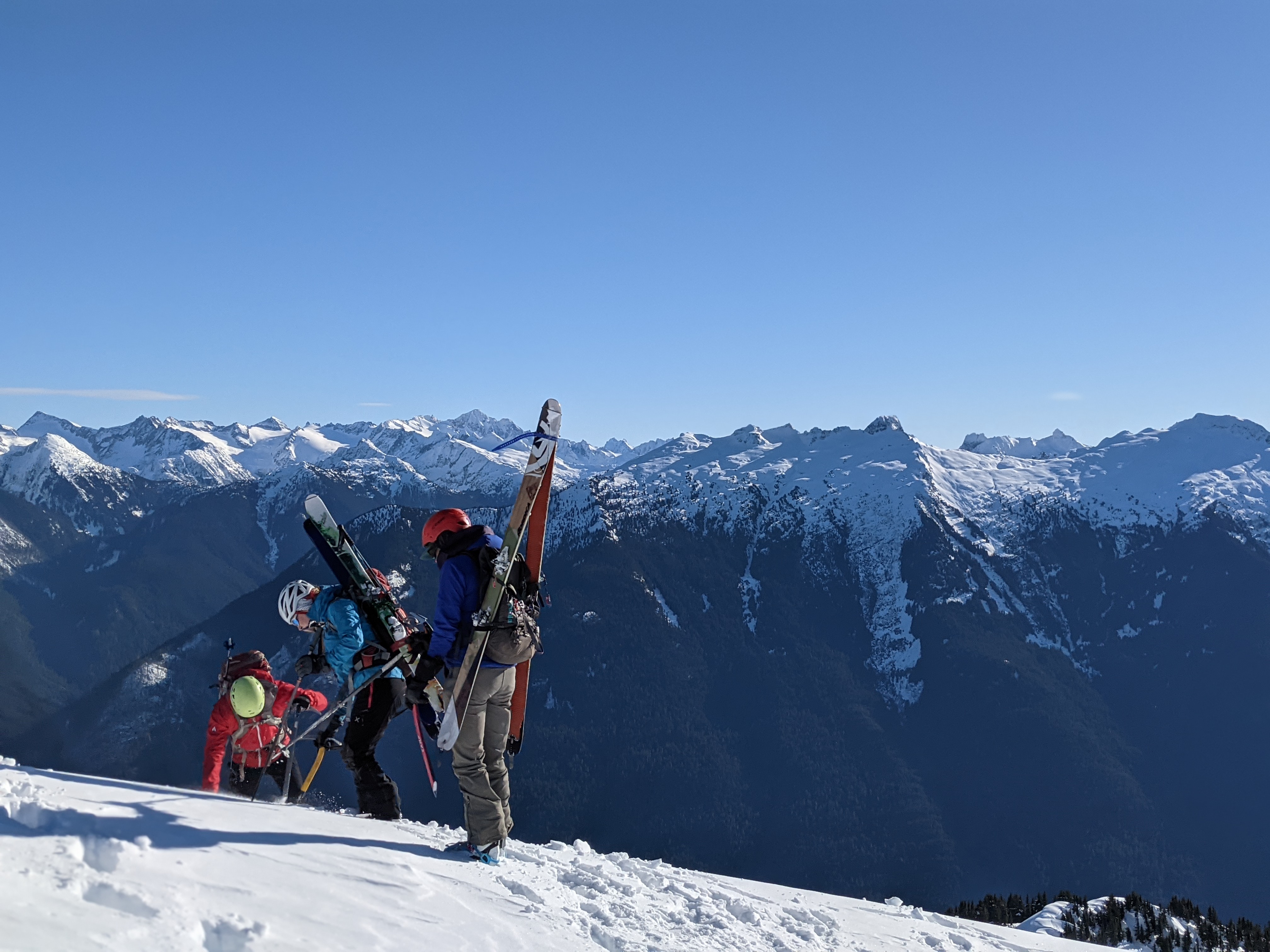
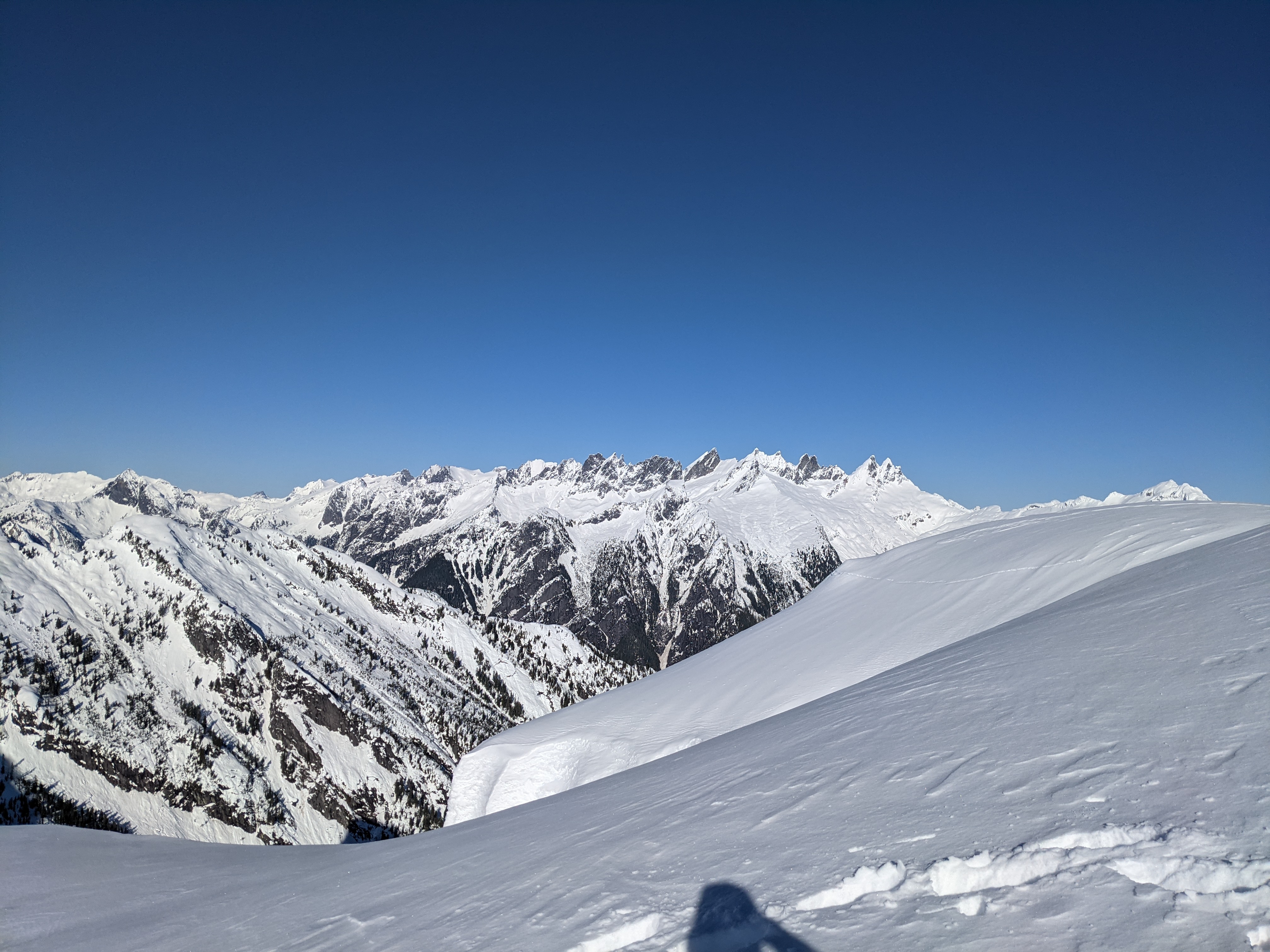
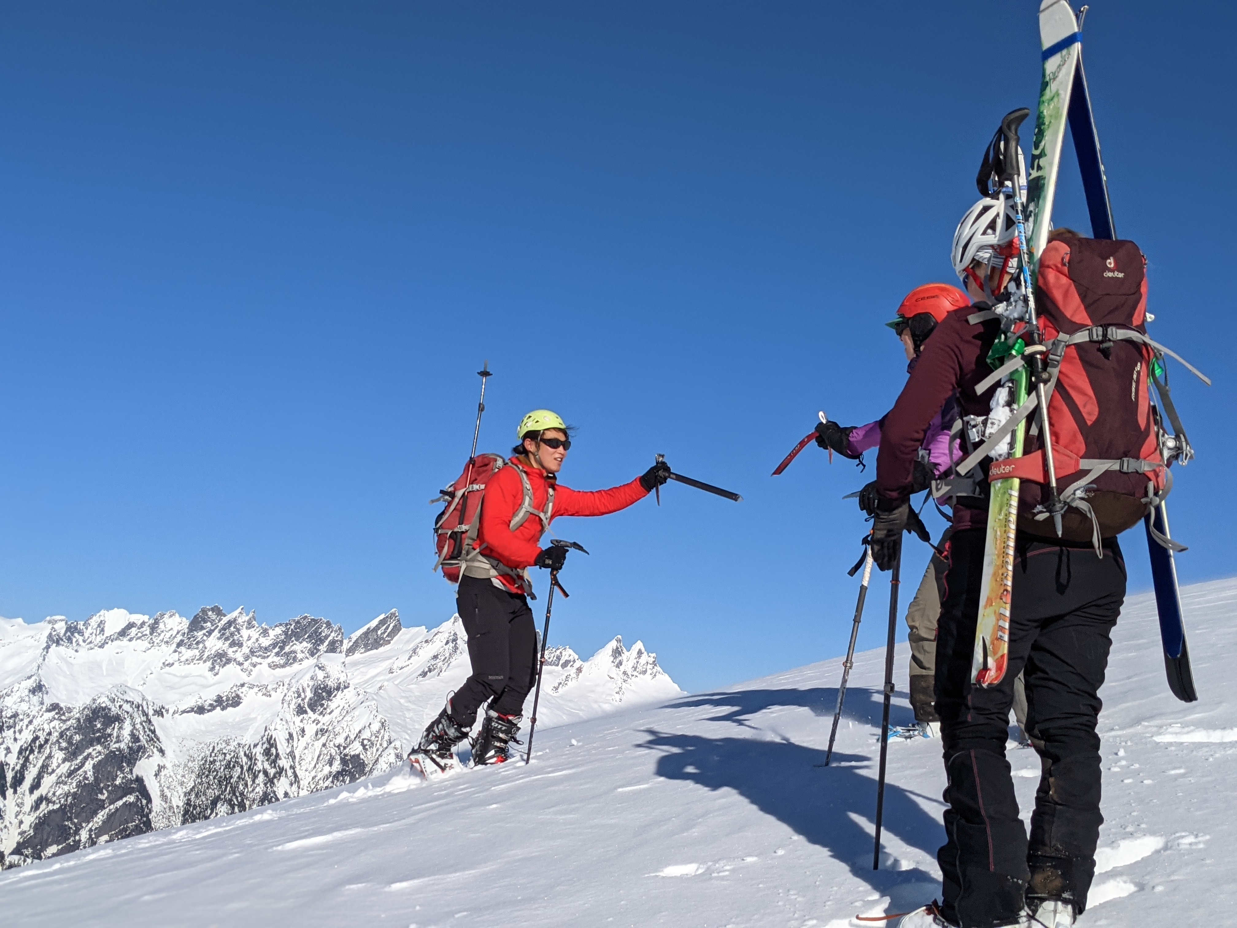
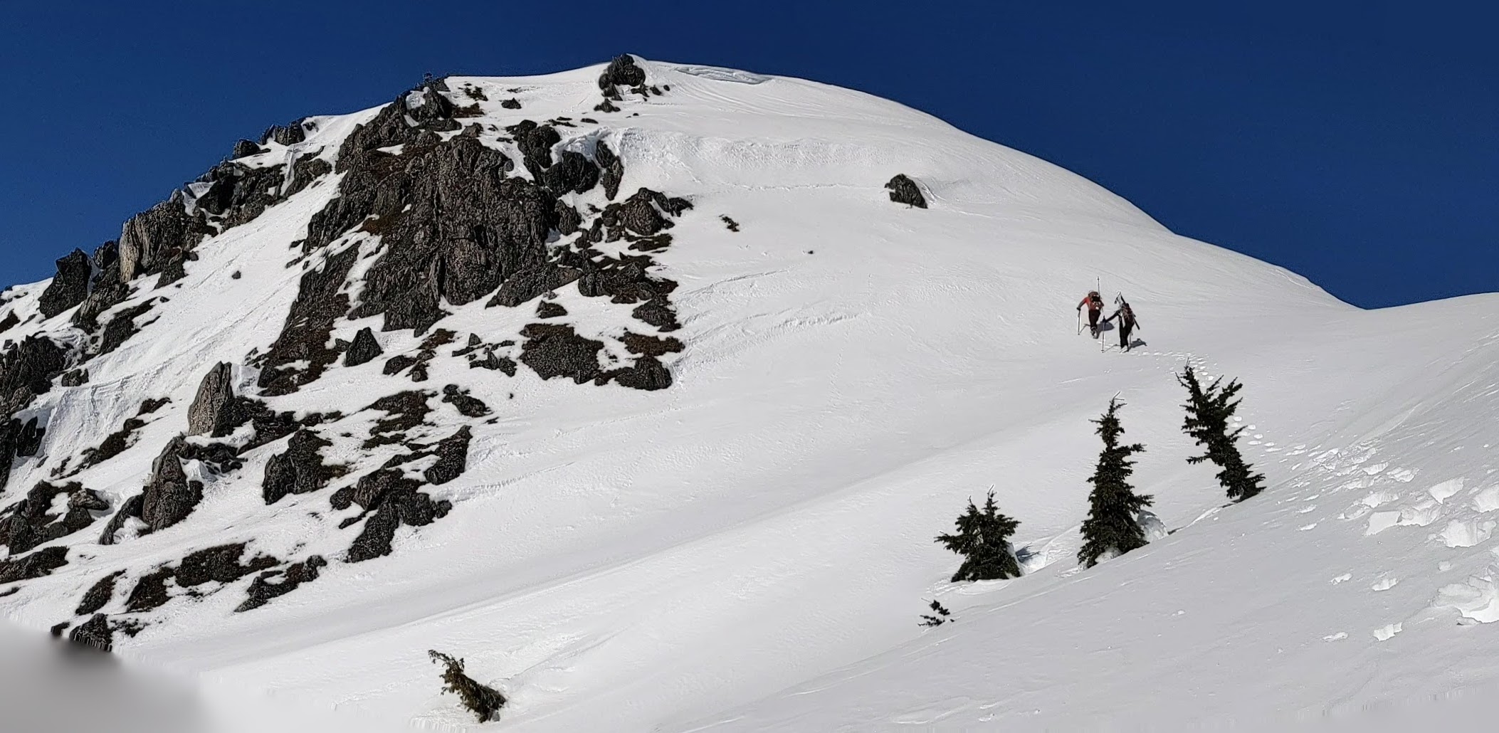
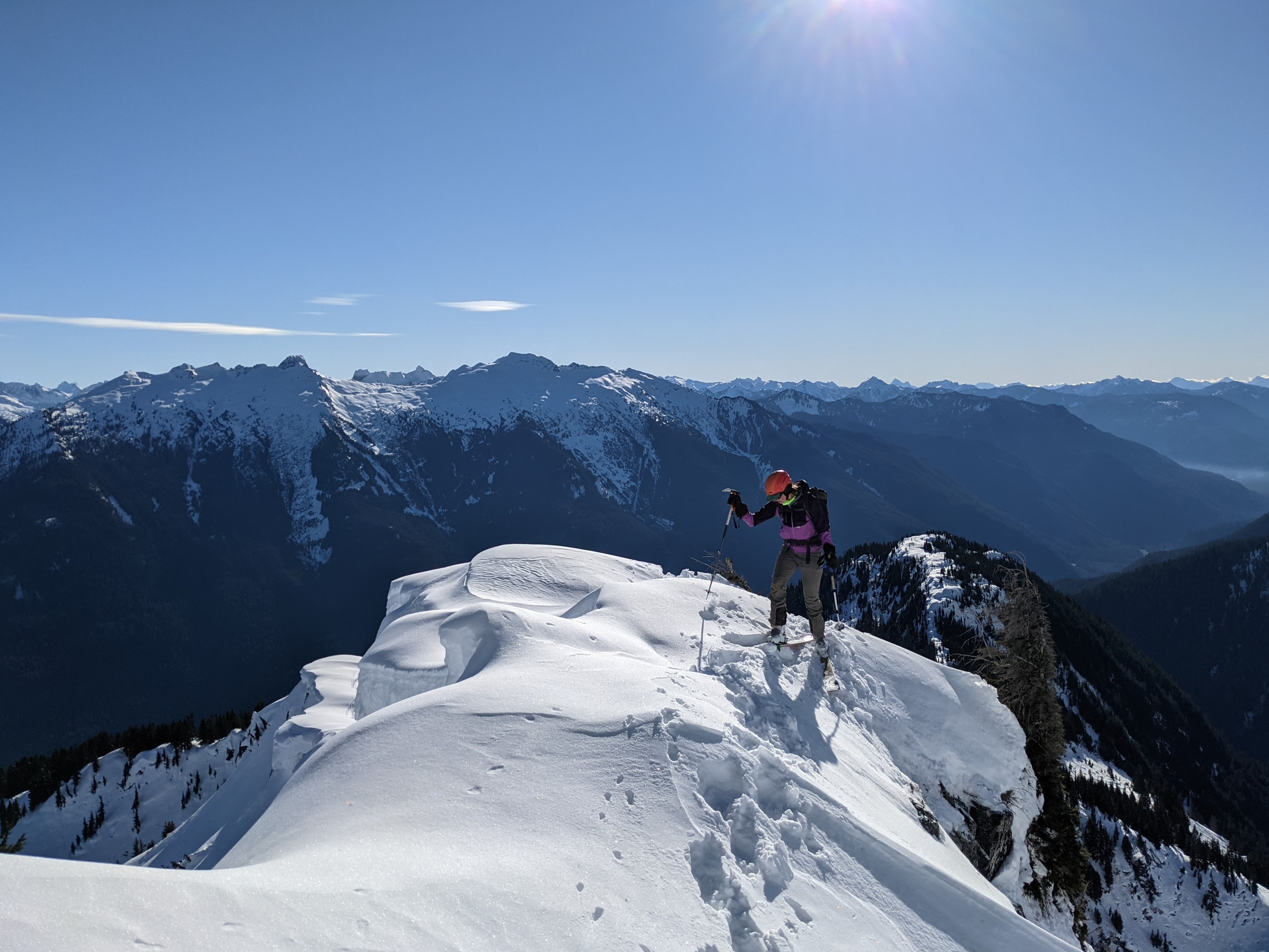
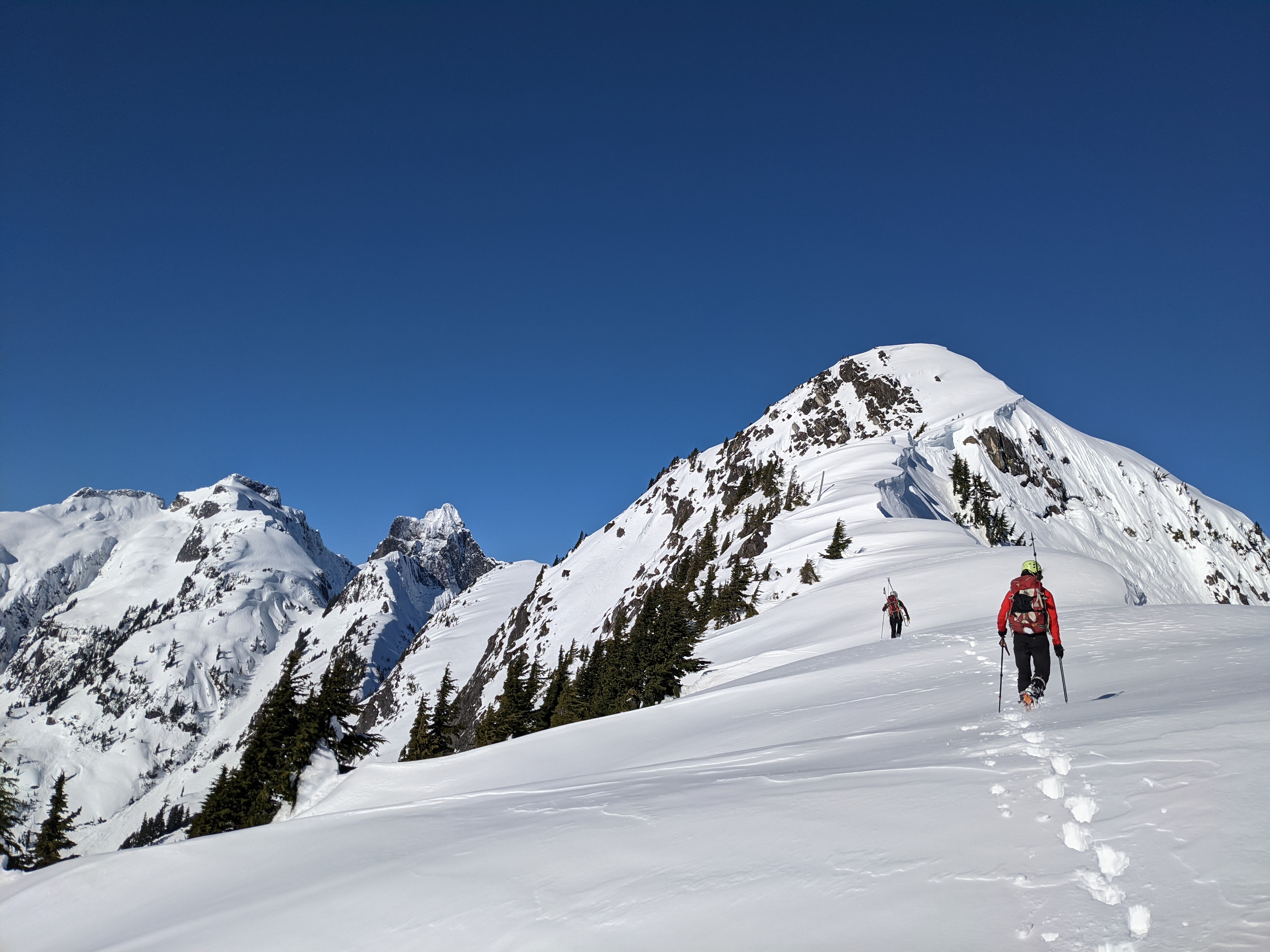
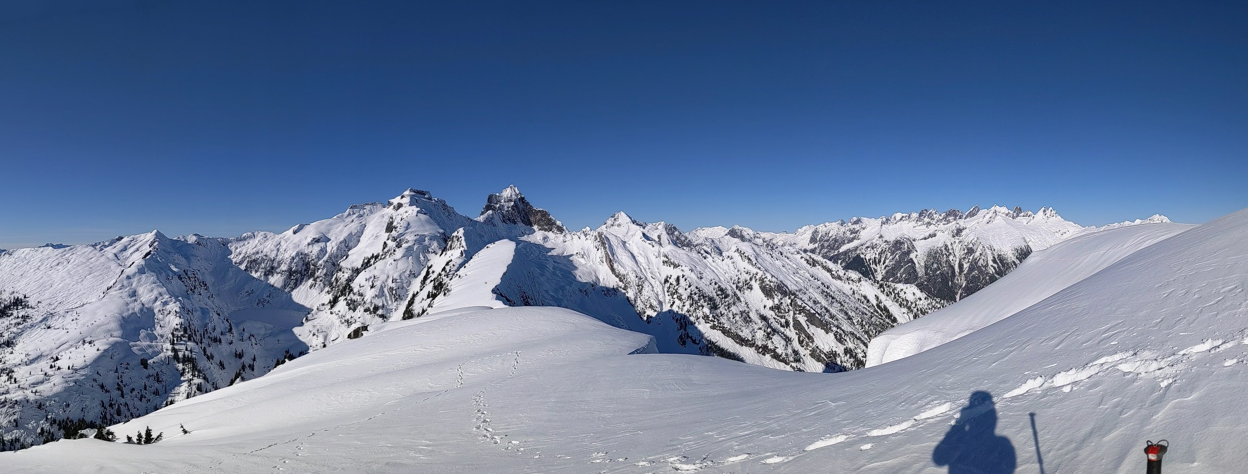
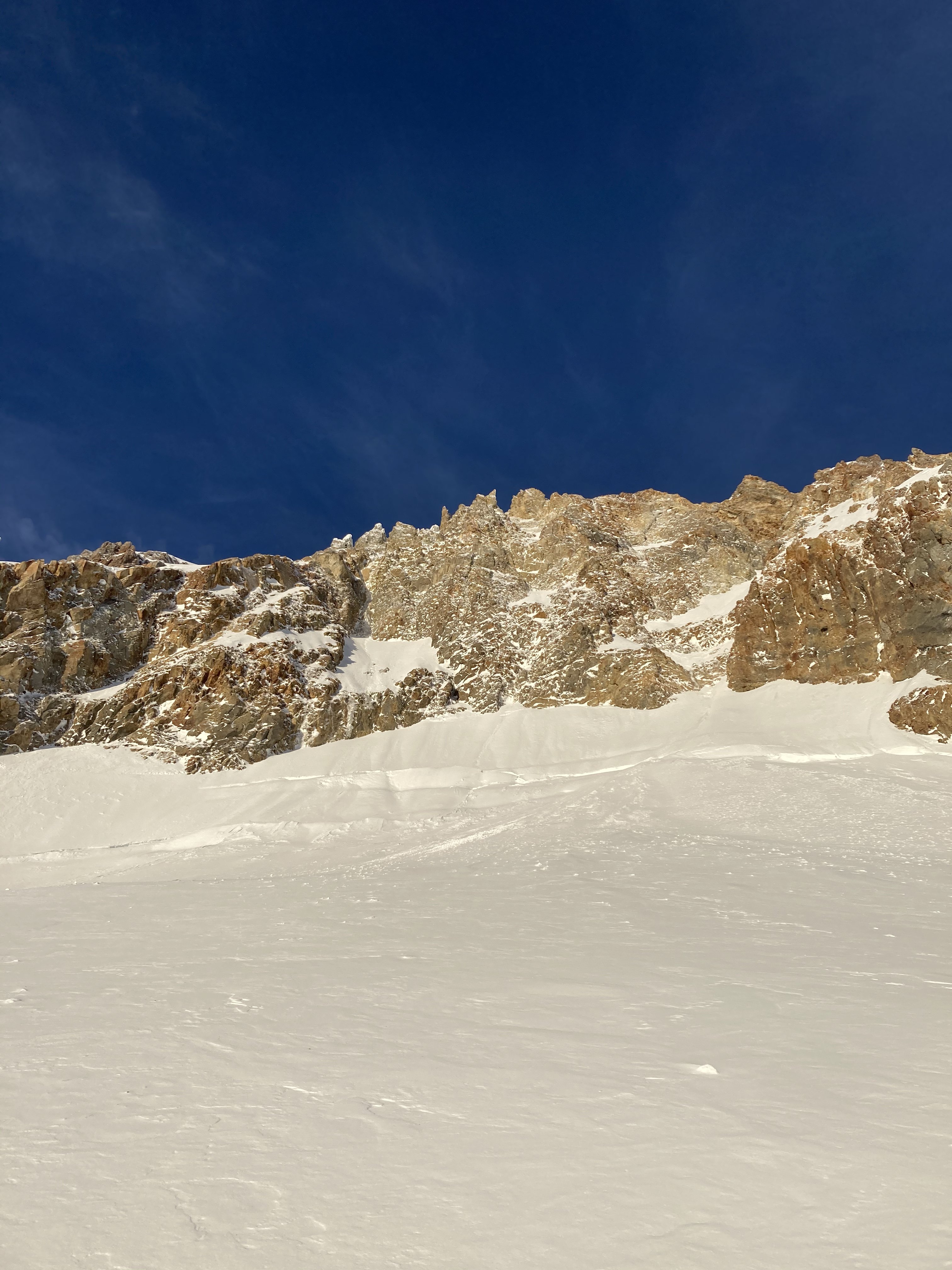
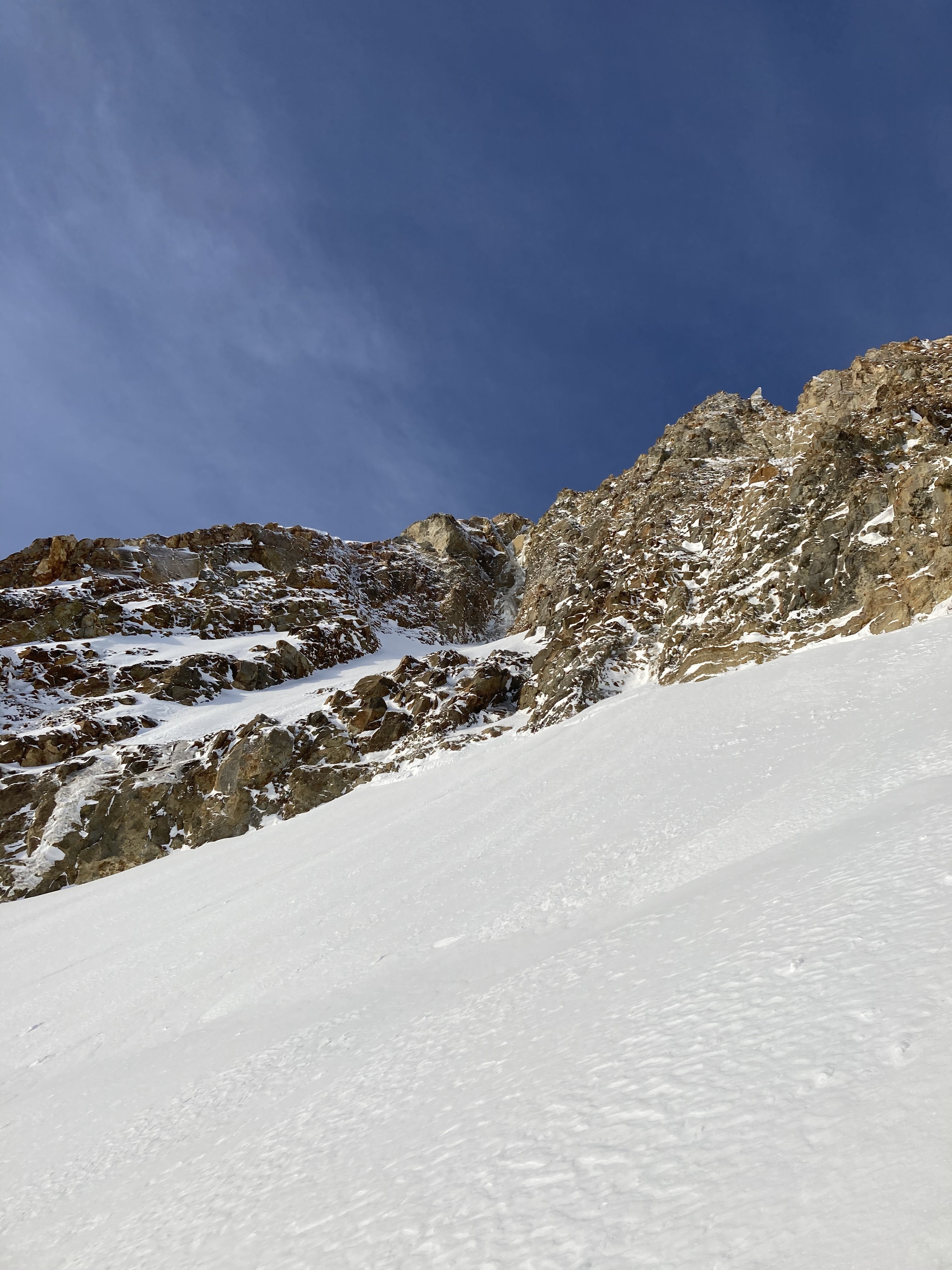
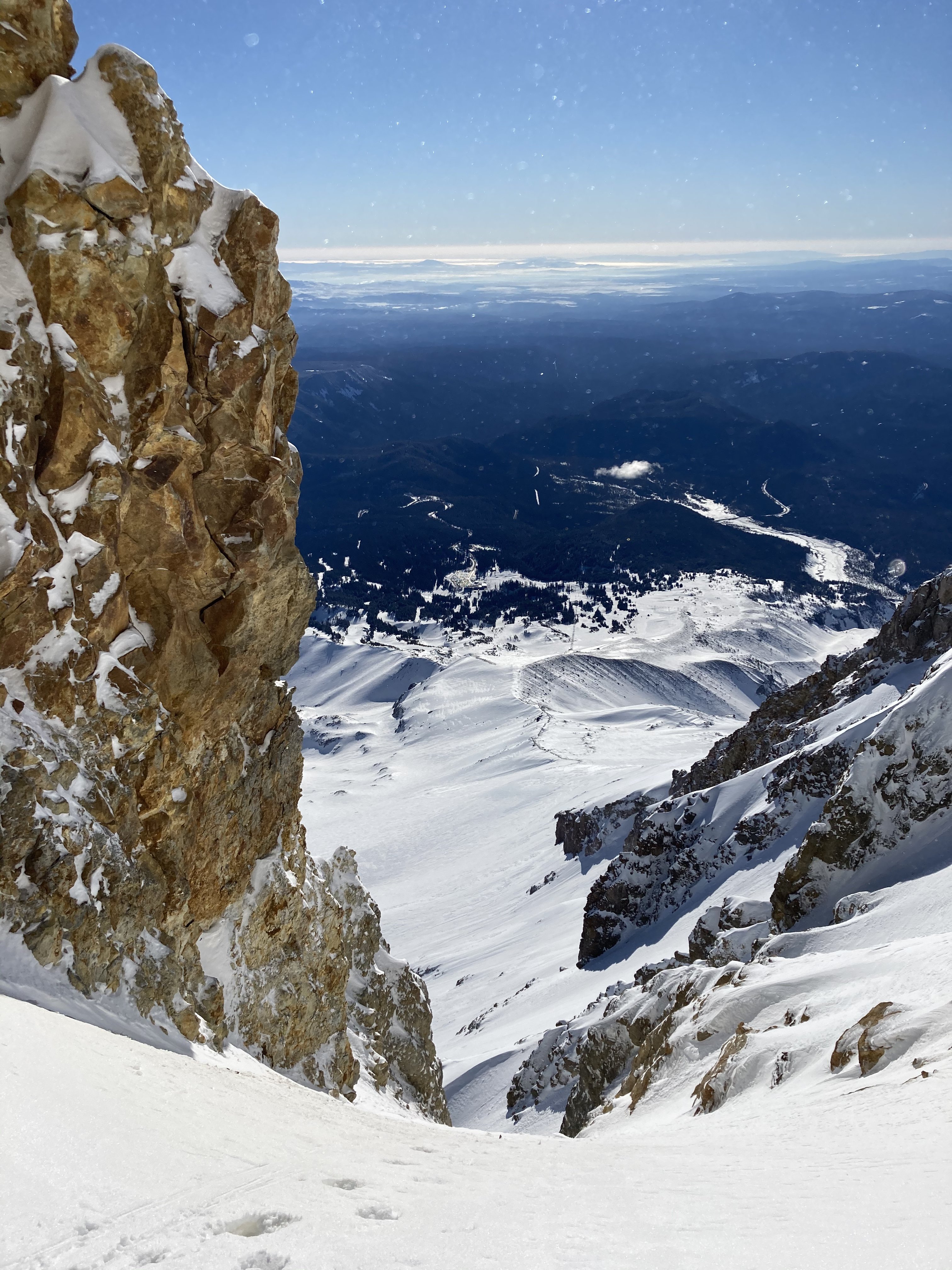
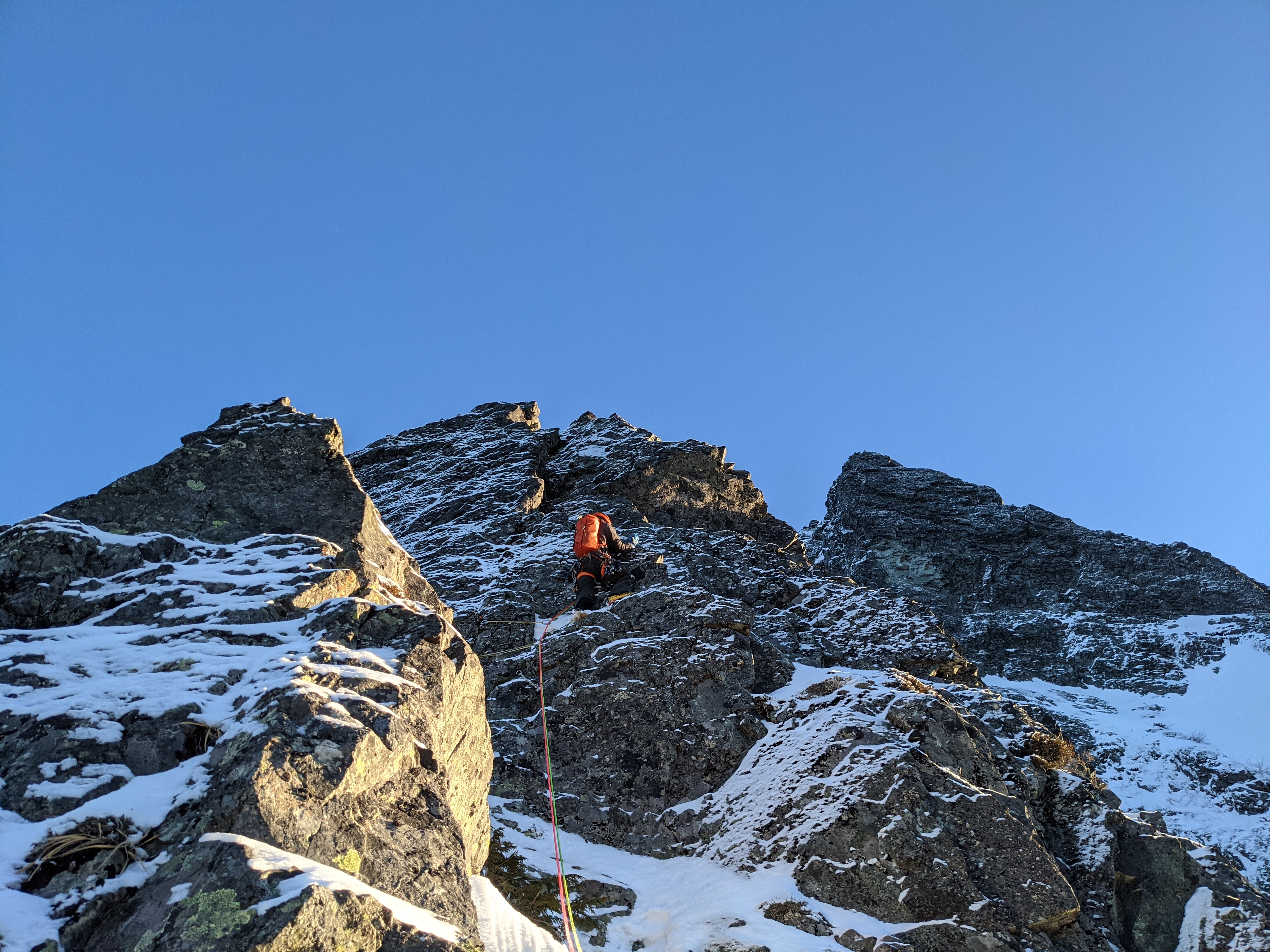
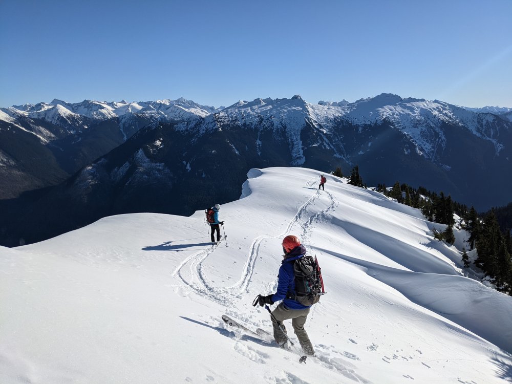
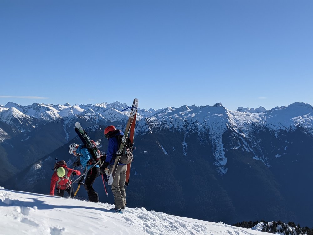
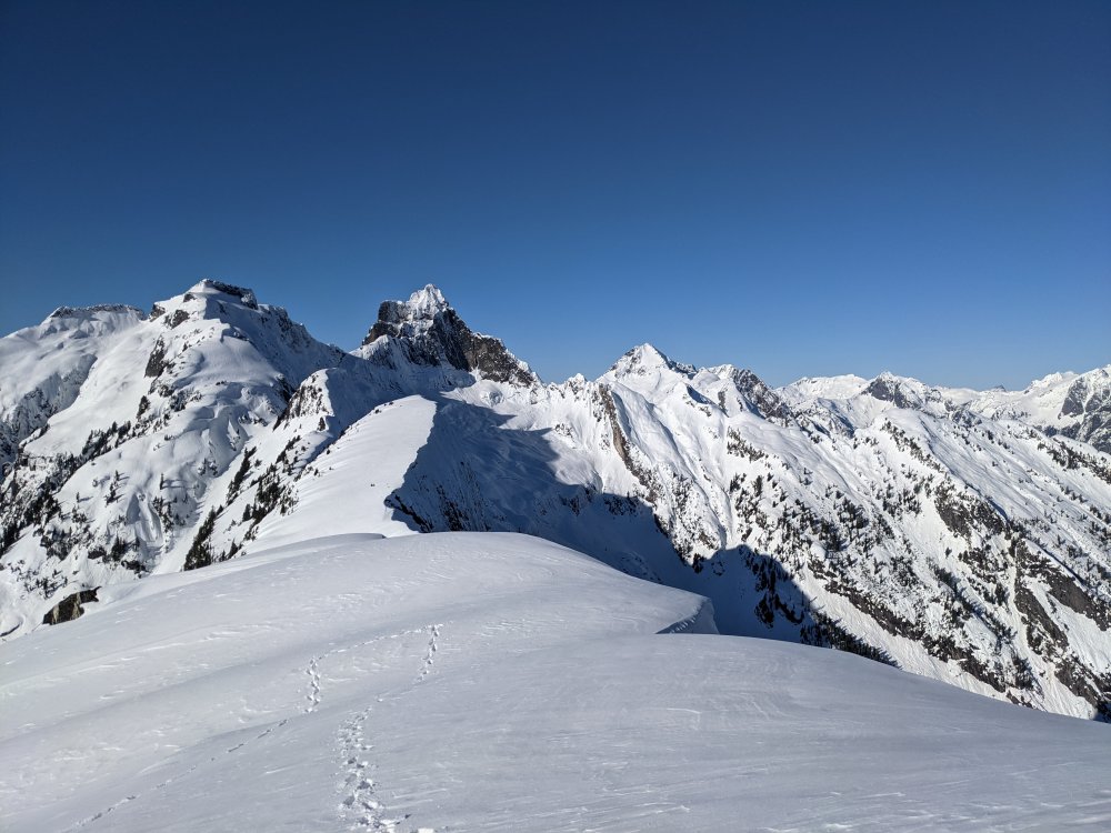
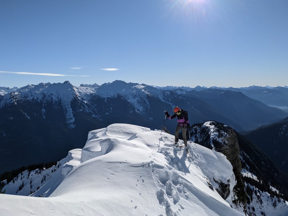
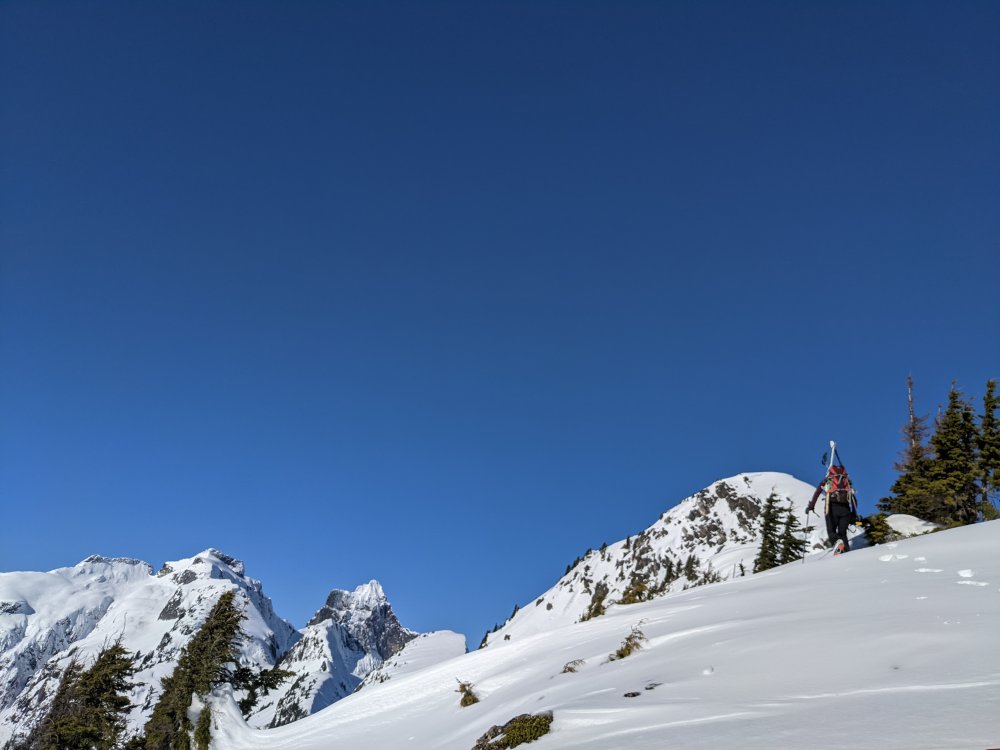
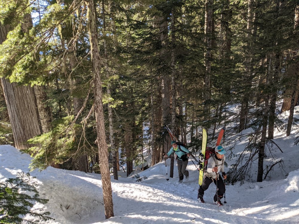
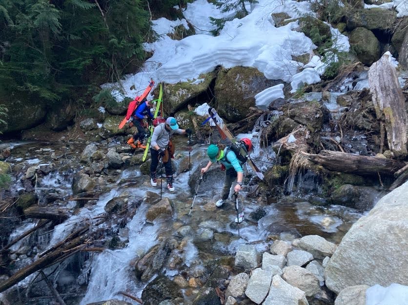
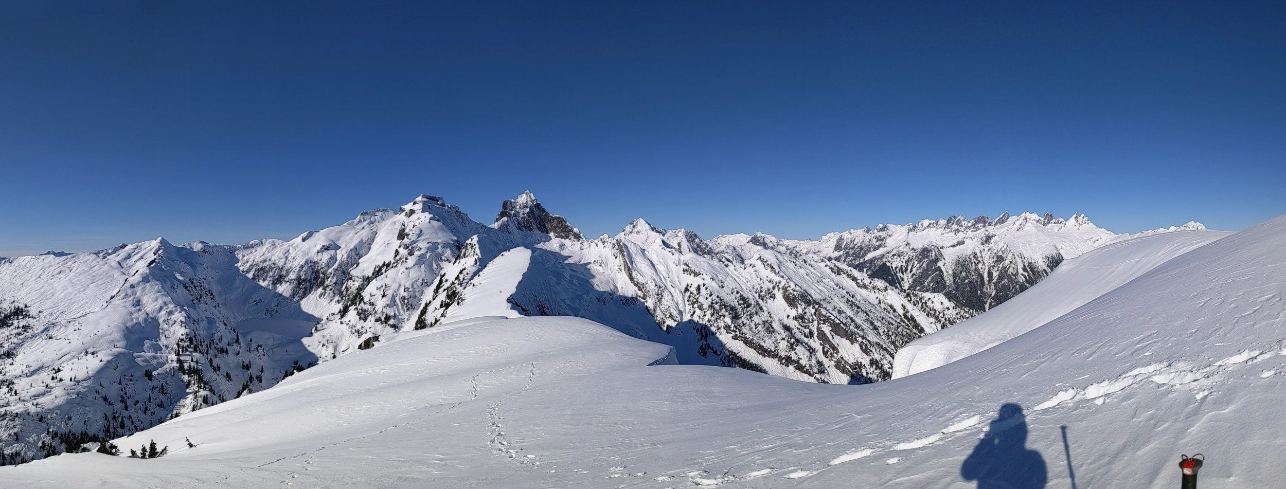
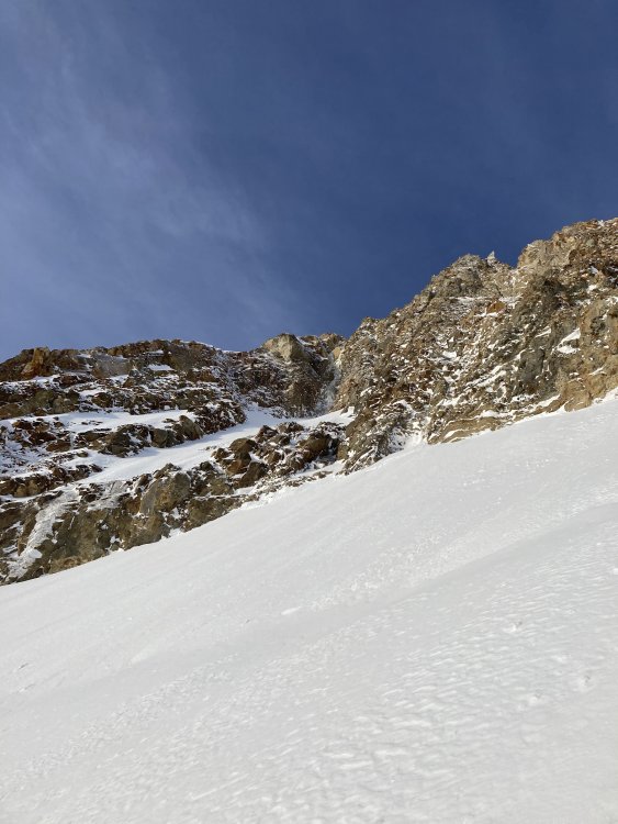
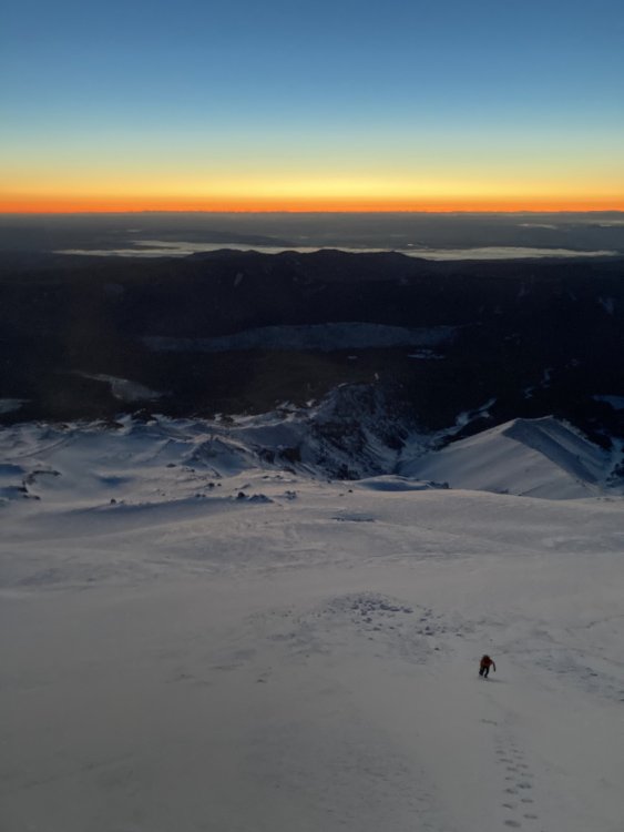
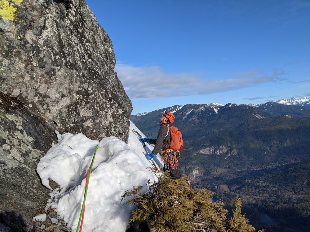
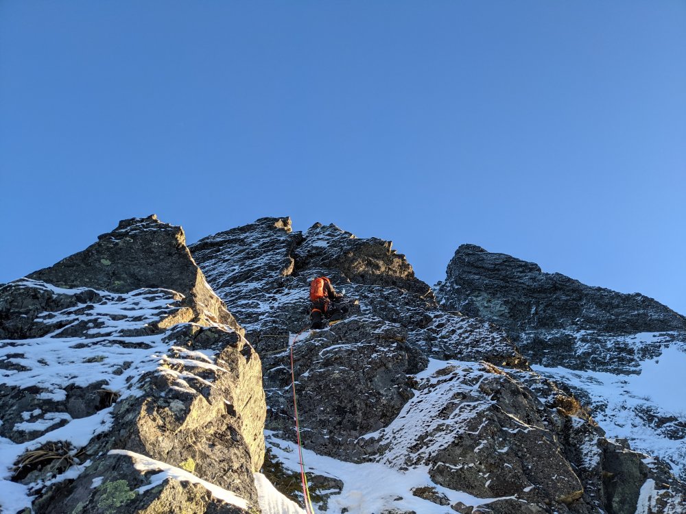
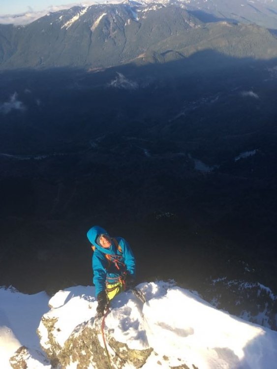
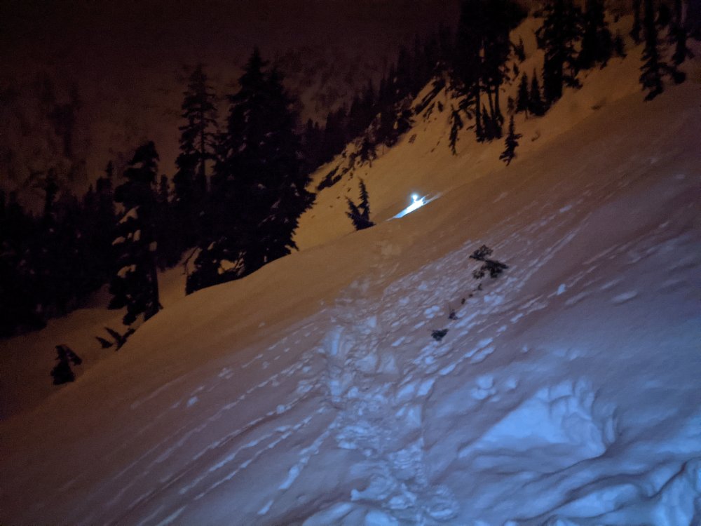
Trip: Trappers Peak - South Ridge Trip Date: 01/23/2021 Trip Report: The incredible weather window on Saturday (1-23-2021) coupled with low avalanche danger inspired @Alisse, Silvia, Rio, and myself to aim for something with a little more adventure than the ski tours we'd been enjoying around the passes for the last few weekends. Trappers Peak seemed to offer a good taste of all the requirements- Questionable forest service road, icy creek crossings, crusty tree skiing, steep enough snow to be fun, and incredible summit views. We found the forest road to be generally easy going despite recent wind events. Instead of blowdown it was snow on the road that stopped us about a mile from the trailhead. With one steeper section on the road and a few modest ruts to navigate I'd recommend a vehicle with more than a few inches of clearance though I'm sure @Alisse could have made it up with her off-roading Civic. We took off from the car in ski boots, carrying skis to the trailhead where we decided to start skinning. Of course this was short lived to the first of the creek crossings. The first two were a bit icy taking some care to not dunk the boots. A nice bridge got us over the third. After crossings to the north side of the valley we were forced to pack up our skis and start booting due to the inconsistent snow on the southern aspect. At about 3,500' we started skinning again on firm and at times icy snow. Conditions and terrain were a bit less consistent than expected and we ended up transitioning more times that I'd like admit before reaching the ridge proper. Continuing up was generally easy going. We followed the summer trail pretty close all the way to the ridge. The first bit of steep snow was encountered at about 5,200'. This open, south facing slope had old avalanche debris towards the bottom and on a warmer day could be a concern, especially on the descent. We topped out that slope to be greeted with ever improving views of the final stretch to the summit and beyond. The ridge was basically all corniced to the east and required some consideration and a little bit of route finding as to not creep too close to the edge. The snow was not too difficult to boot, postholing was generally minimal. Around 5,800' the ridge chokes up for less than 20'. The snow here felt shallower than in previous sections, we bottomed out down to rock on a few steps. The final step to the summit offered some fun moderate snow that steepened up enough that daggering the axe felt good for a little over a body length. The snow here had great purchase, solid footing. Summit! Mount Triumph Southern Pickets On the descent Trip Details: 13 miles, 3,800' gain, 10 hours Gear Notes: Skis, ski crampons, boot crampons, ice axe. A whippet or second tool could be useful for the final summit step if not super comfortable on steep snow, however it climbed fine with just an axe. Approach Notes: Typical forest road. Winter route generally follows summer trail.


 4 points
 -
Trip: Mount Ann (5840') - East Ridge Trip Date: 01/23/2021 Trip Report: A buddy and I climbed Mount Ann this weekend. Snowshoe trip in perfect winter weather. We started from the Mount Baker Ski area. We headed up and over Austin Pass heading towards Lake Ann. We climbed up the north basin between Han Peak and Mount Ann, to the east ridge, to the summit. Temperature was fairly cold, water bladder hose kept freezing along the way. Snow conditions were pretty good, varying between a frozen crust to 6" deep powdery snow on a crust. The snow on the steeper sections was a bit slippery, the top 4" or so wanted to slide on the crust beneath. Surprisingly there was running water available along the route. Great trip and workout for a day climb. Awesome views. Trip distance was around 12 miles round trip. Travel Time: Car to Summit: 5 hours Summit back to Car: 4 hours We started at 8:30am and finished at 6:15pm in the dark. We brought lights but didn't need them, the moon supplied enough light to see. Gear Notes: Snowshoes, Trekking Poles, Whippet. The Whippet worked great on the steeper sections. Approach Notes: Mount Baker Ski Area to Austin Pass to North Basin to East Ridge.2 points
-
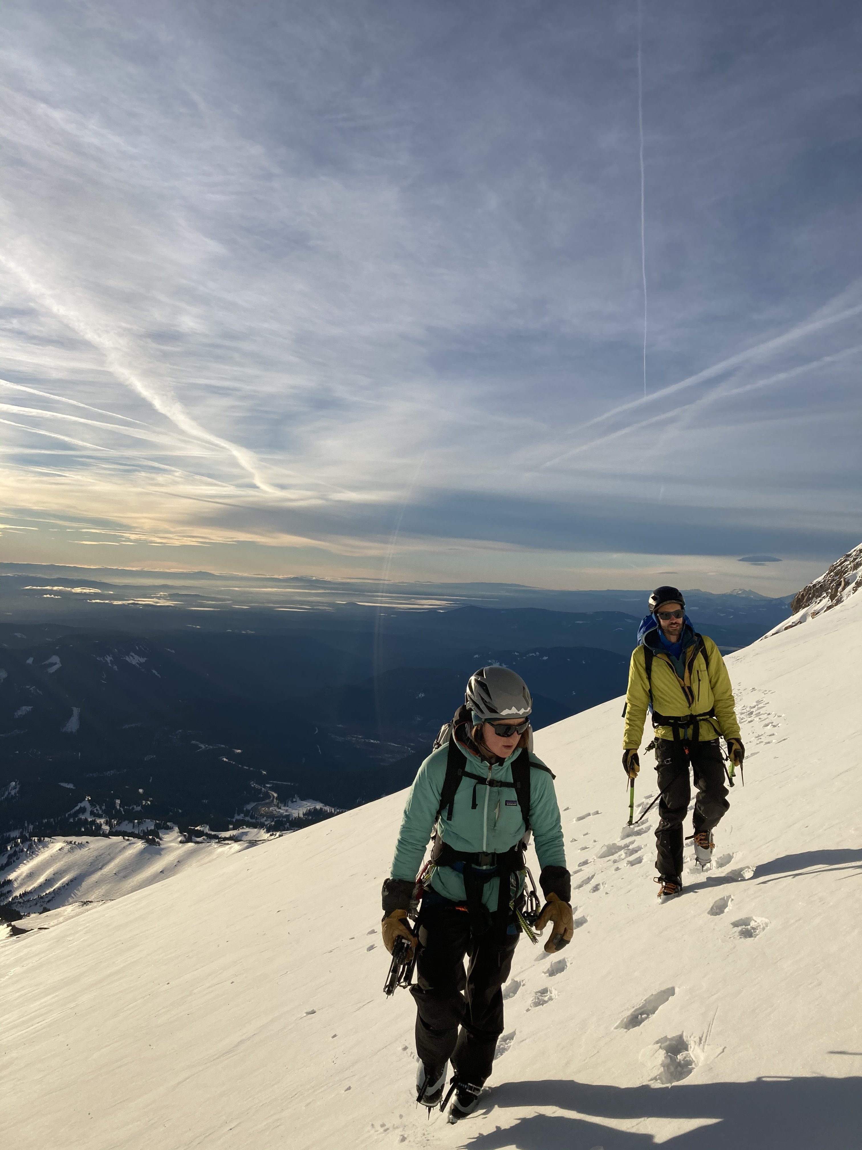
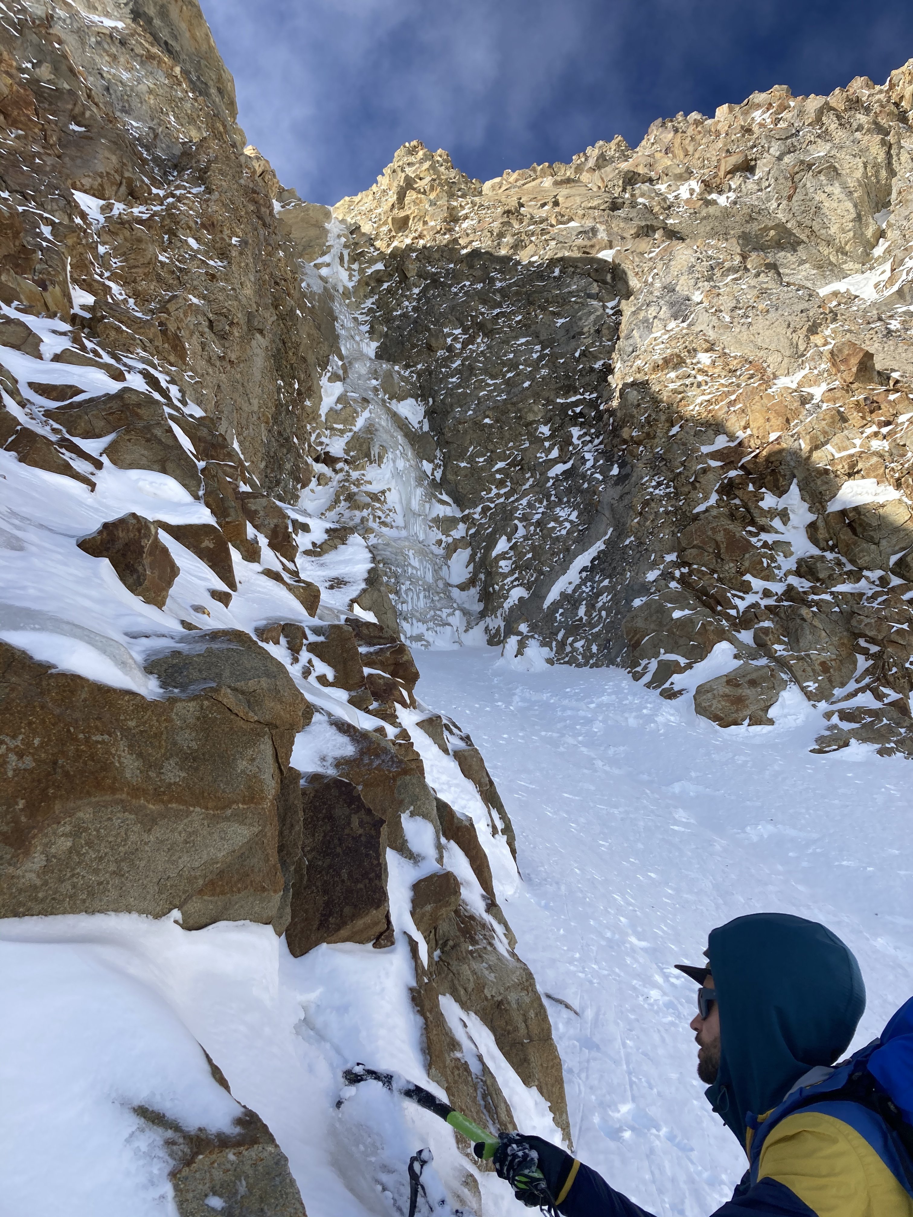
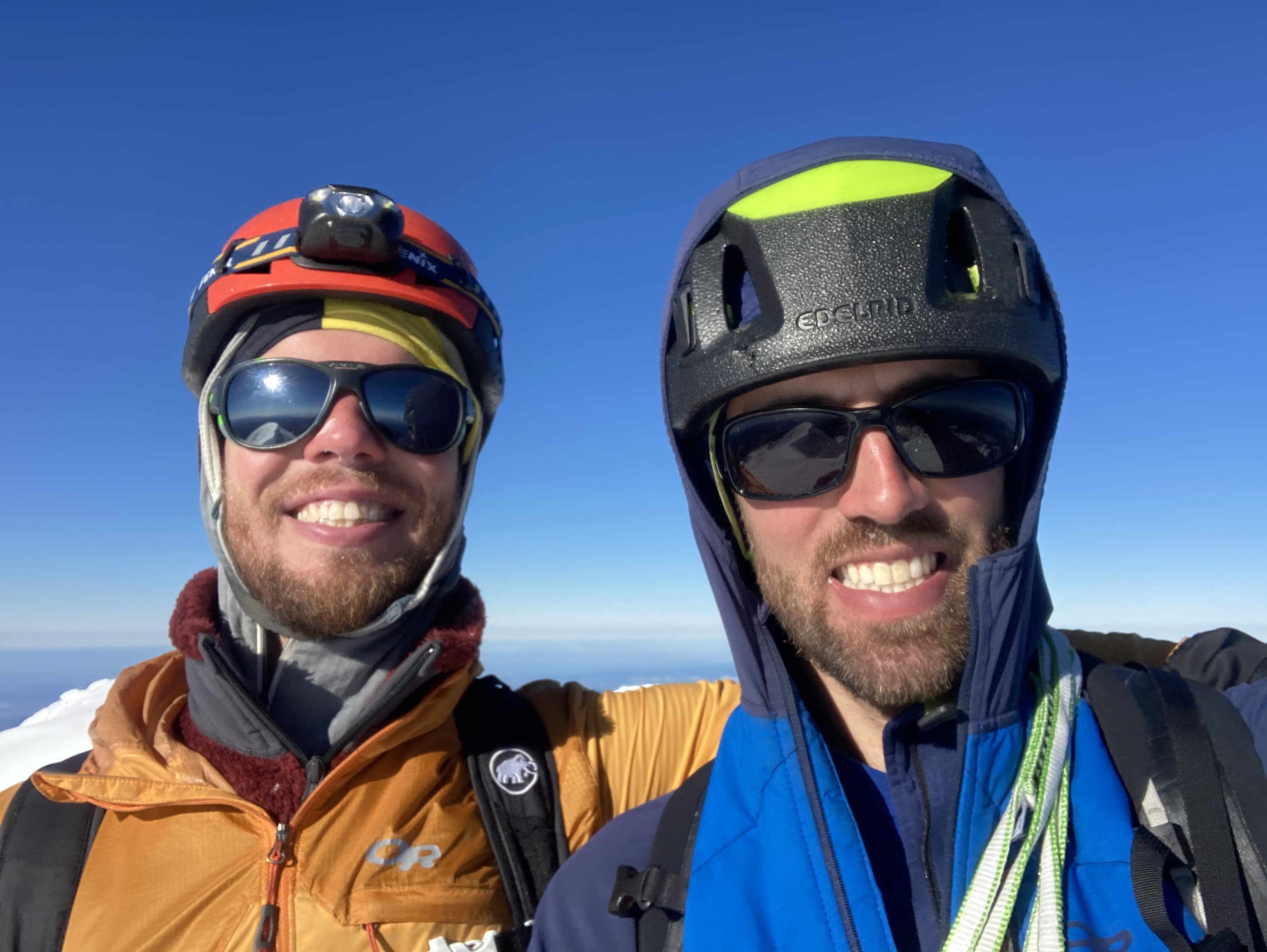
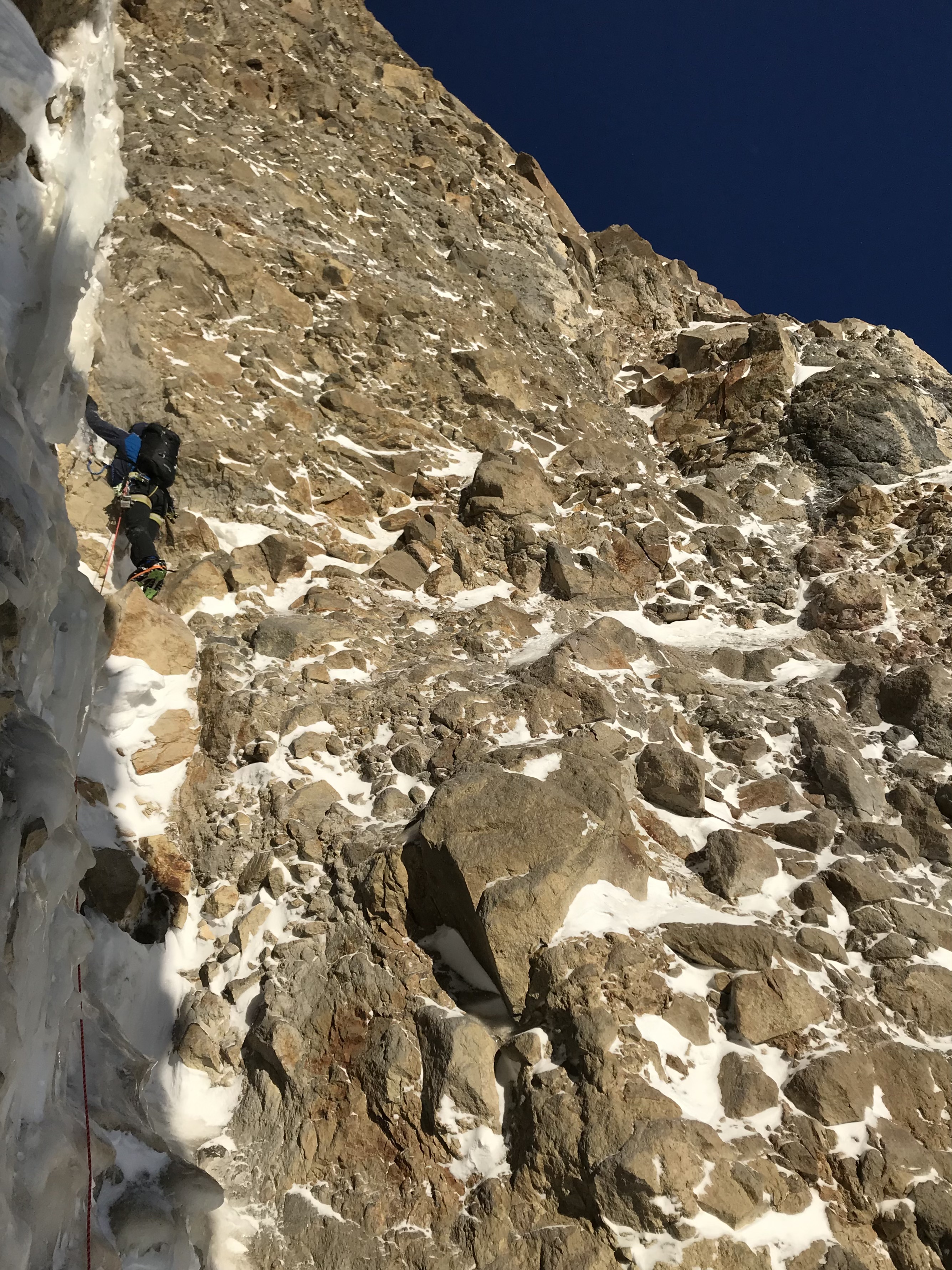
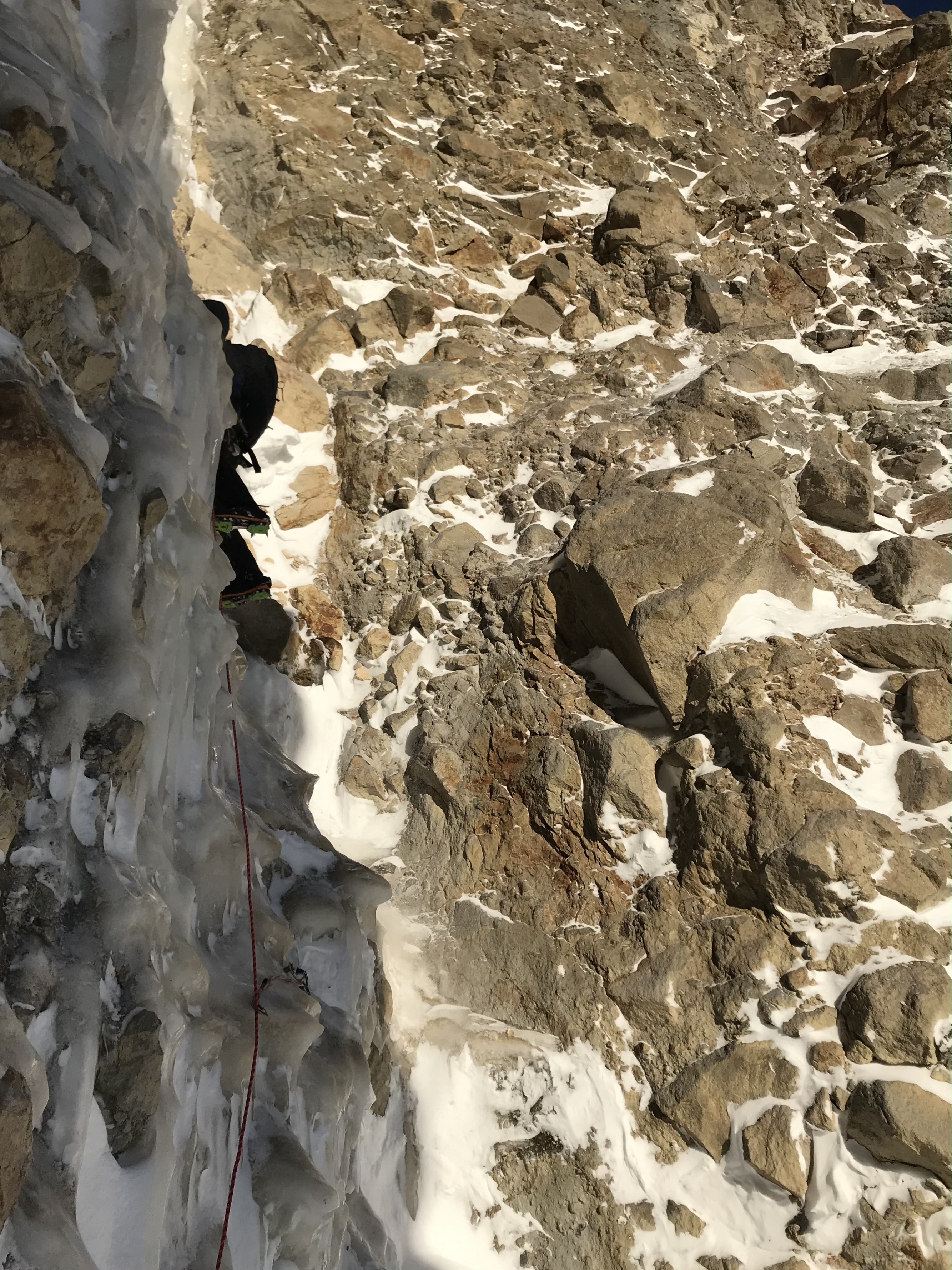
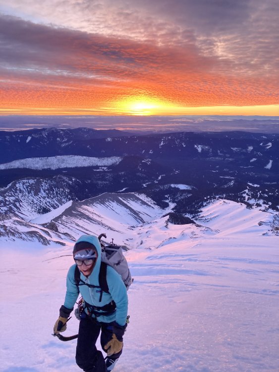
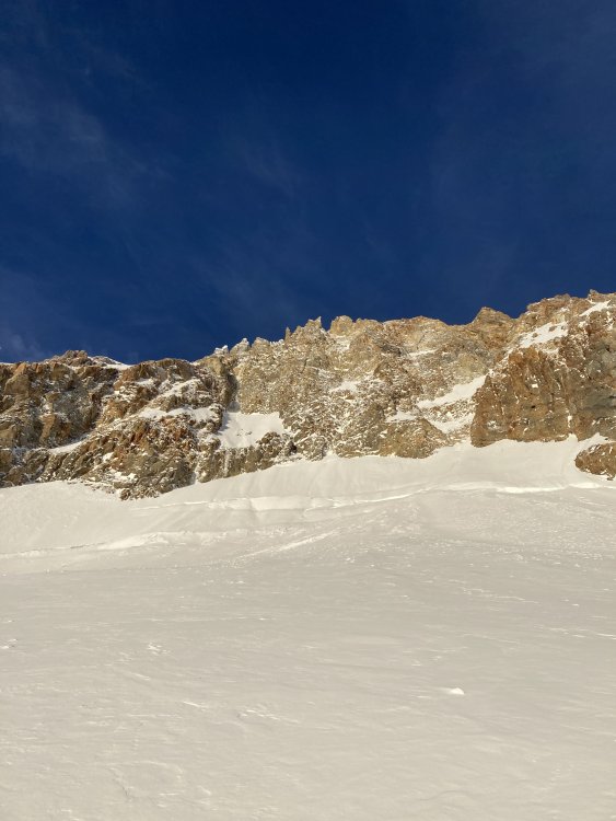
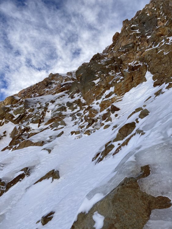
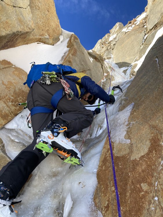
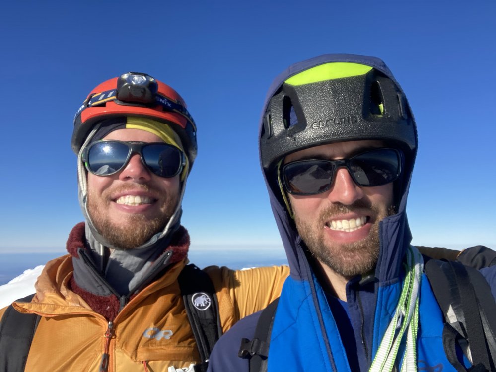
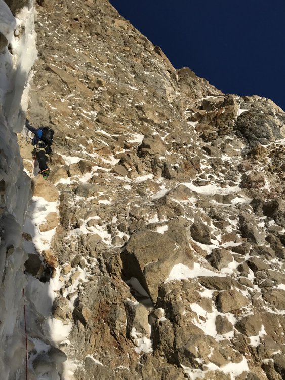
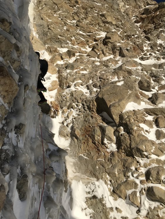
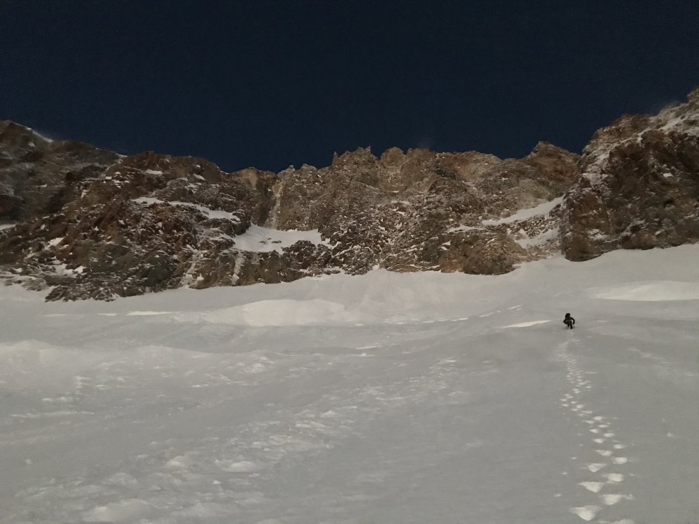
Trip: Wy'east (Mt. Hood) - Fric-Amos Trip Date: 01/23/2021 Trip Report: I went up to the Black Spider last weekend with Lindsey and Riley. We found the Fric-Amos in very nice condition but were too late on a warm day and bailed up an easy mixed pitch to the L of the main pitch. Thankfully the weather granted me another opportunity and I came back this weekend with Kyle to get it done. Noah and Matt saw my Insta story from the first weekend and jumped on the send train. They acted as true gentlemen, coordinating with us and giving us a head start. The route is currently in good condition (but don't expect a straightforward WI4). We used an approach pitch to the R of the original both times that follows an easy ice slot (the original would probably go but is discontinuous ice blobs up a vertical cliff). The crux pitch is a full 60m or could be broken up, expect tricky and sustained climbing but with good ice. Above this snow slopes take you through one more short ice step and up to the summit ridge. This may be one of the more frequently formed ice routes on the Spider given that it is in a shaded cleft, unlike most of the other routes. Though you are basically going for one mega pitch, it is very good and I would recommend it! I talked to Bill Amos the next day and he believes ours was the 3rd (and Noah and Matt the 4th) ascent of the route (2nd was Marcus and Marsha, go figure). Awesome sunrise approaching on first attempt... Lindsey and Riley below the face, clearly too late... The face... Closer view of the Fric-Amos (original approach pitch is on the L, our approach pitch was on the far R of the hanging snow field)... Riley following the approach pitch, classic slot... Our escape pitch... The crux pitch (taken during from 1st attempt)... Kyle booting up to the face on attempt 2 (much earlier)... Kyle's pic, me below the face... Kyle's pics, me on the crux... Looking down from top of crux... Kyle leading above crux... Looking down from ropes off... Summit selfiez... Gear Notes: Screws: 2xstub, 4x13, 2x16, 1x22 (used for the belay but not any good) Rock gear: nuts, cams 0.4-0.75, pins (not used), 2 med hexes (not used) Plenty of slings if you're going to do the crux as one pitch. Approach Notes: Boots from Timberline, crossed White River ~8,800ft.


 1 point
 -
C'mon DPS, I started and have been basically almost single-handedly fluffing this thread for months, isn't that enough?? My publisher has been working with Kyle M on a TR ghostwriting deal, but even with his writing skillz, it will probably be challenging because I haven't had shit for time to recount any of the details, so be prepared to stay let down. And/or someone else go climb that awesome Nordwand and write it up!1 point
-
Definitely good in the alpine now, really good. Mik and I climbed the NF of N Index yesterday and found excellent, firm conditions - hard to imagine it in much better shape. Despite its pedestrian grade, the NF is a mega route, even in a cruiser conditions, it is about 8x harder than Chair despite being "only" 5300' tall. Some pics: The hidden ledge traverse: Upper north bowl with tons of real ice everywhere: Mik leading the upper N Ridge: Final pitch:
 1 point
 -
Hello, An interesting turn of events has brought me here for the first time. I was attempting to write a recollection of my ascent of the East Pillar Direct on Mt. Slesse with Greg Child in 93 and of course had to start by acknowledging John Stoddard and Dennis Mullen's visionary and bold first ascent of the East Face proper of Mt. Slesse in 77, hammerless and no cams? Then in thinking of John, I remembered our adventures together back then and was once again saddened to to think of his untimely passing. I decided to look John up on line and found this thread and the remembrances of so many including most recently Dennis Mullen. I met John in Squamish on one of my first weekends there in spring of 76 and he'd just bailed off the Grand from the start of The Flats and the fact that he was even up there blew my newbie mind. John was the Seattle ambassador to our gang of misfits and we shared a lot of shenanigans on and off the rock with a shared love of climbing, weed and Zappa. He was engaging, smart, fun, sensitive and caring. John's enthusiasm and support was critical to my success in solving the Misled bolt ladder (in Vasque Ascenders) and then freeing the 2nd pitch of The Phew which opened up my eyes to Cruel Shoes. John was a dear soul and I will treasure his memory and miss him for as long as I live; maybe some day when things are better there's a gathering for him somewhere? My condolences to his family and those closest to him. Perry Beckham Squamish BC1 point
-
I do, but not permanently! I'm here for the winter and La Nina isn't being nice to us. Had me dreaming of WA adventures. Just trying to see if anyone had fun stories or exciting pictures of Sawtooth skiing. I wouldn't be surprised if I'm back in WA next winter. In that case...you have a deal!!1 point
-
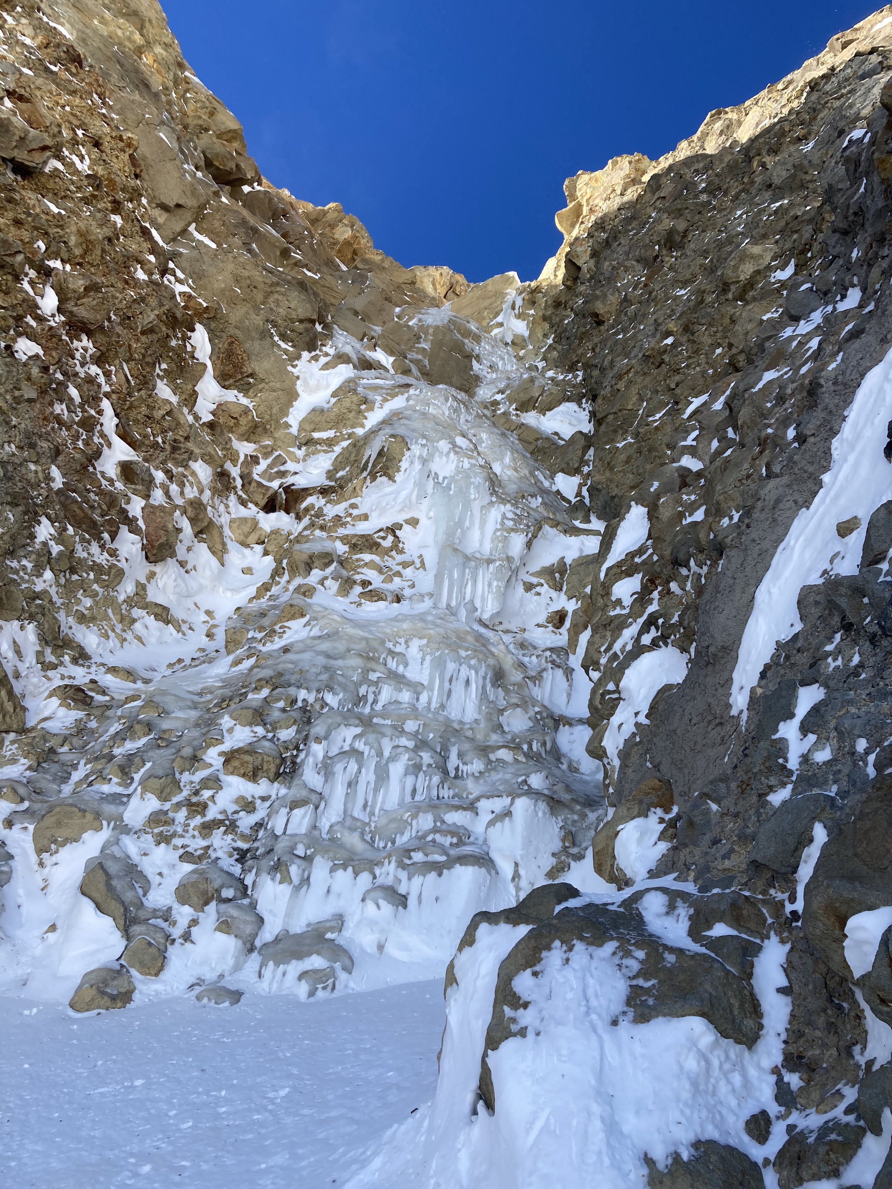
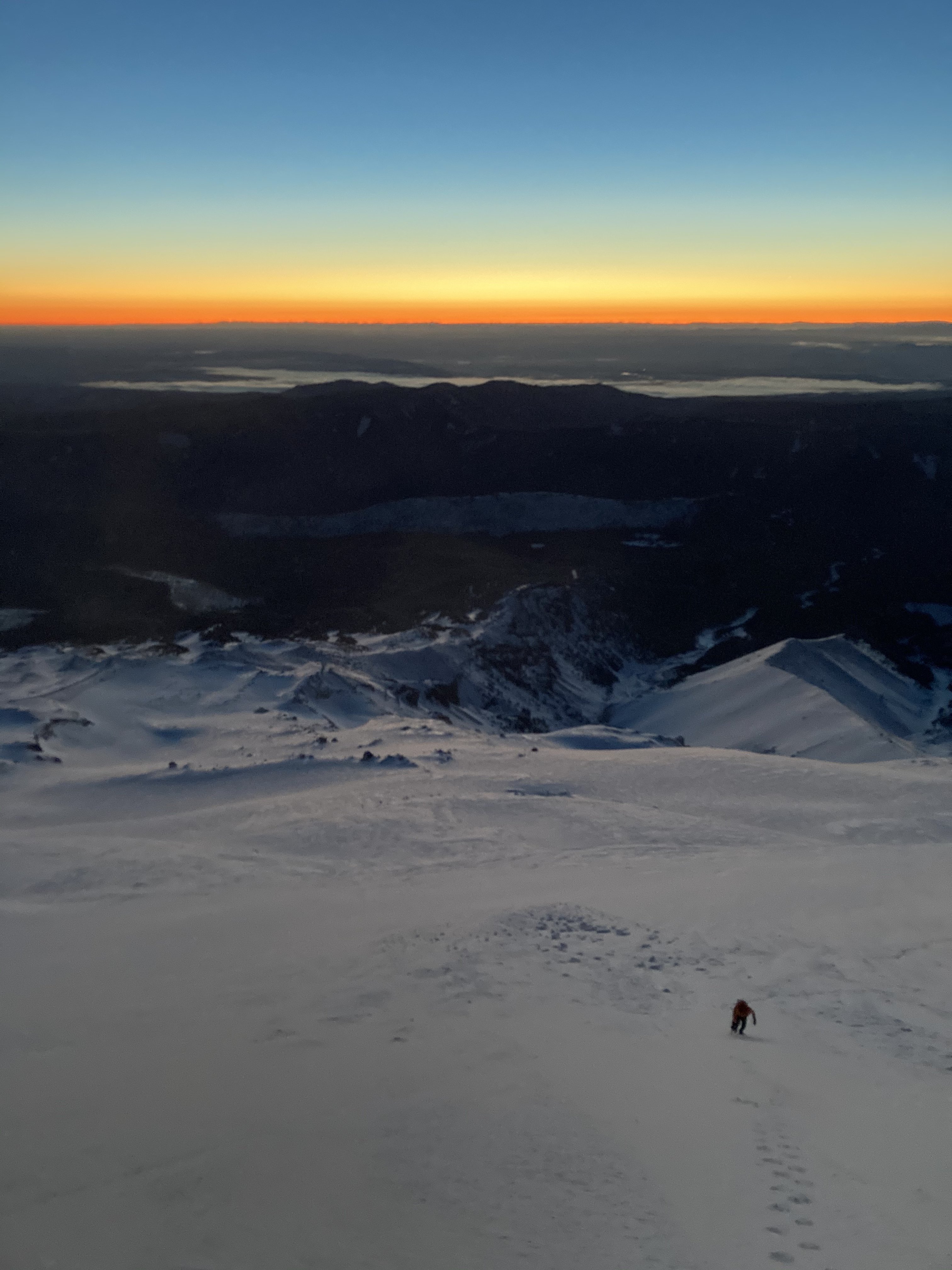
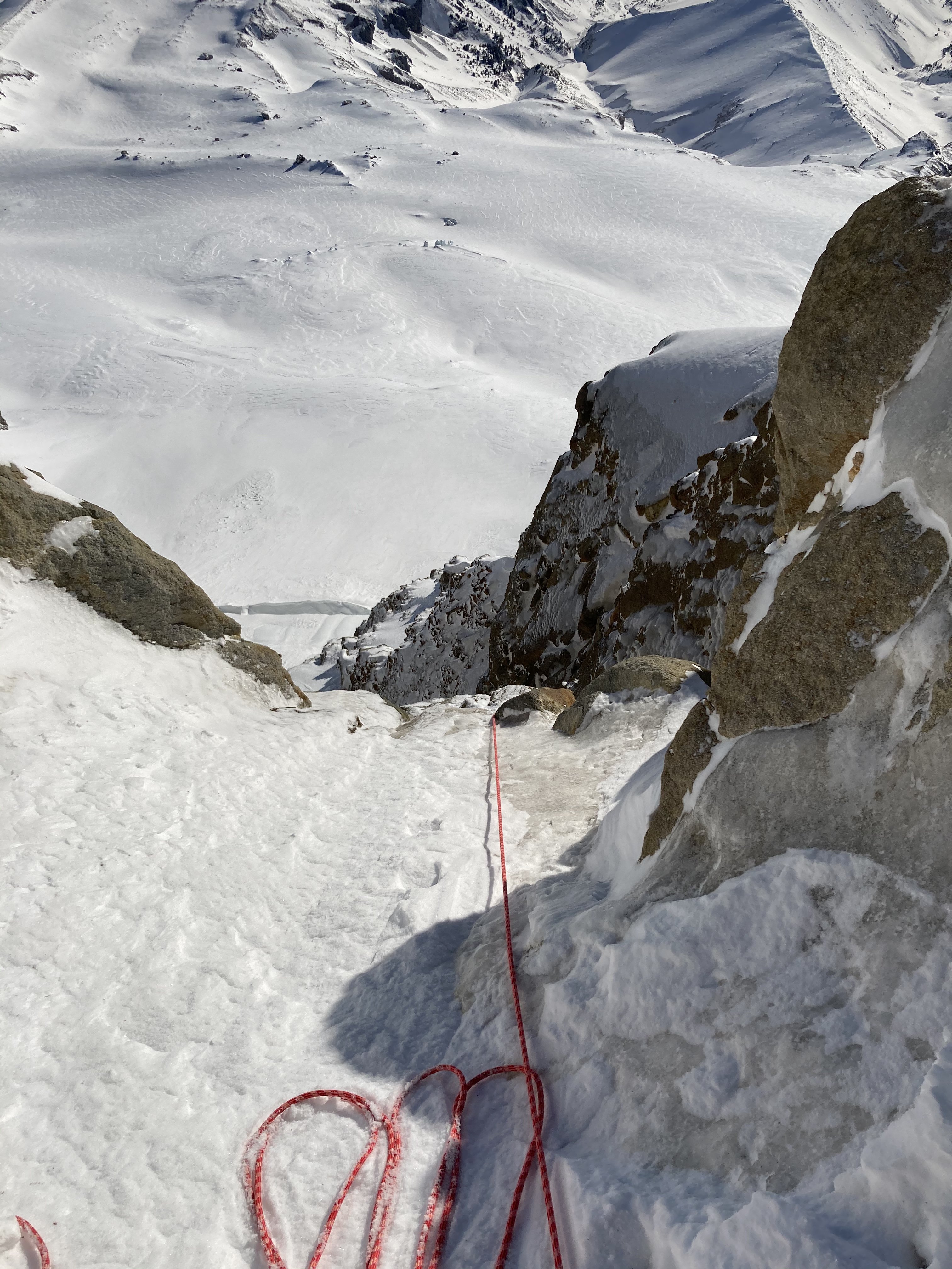
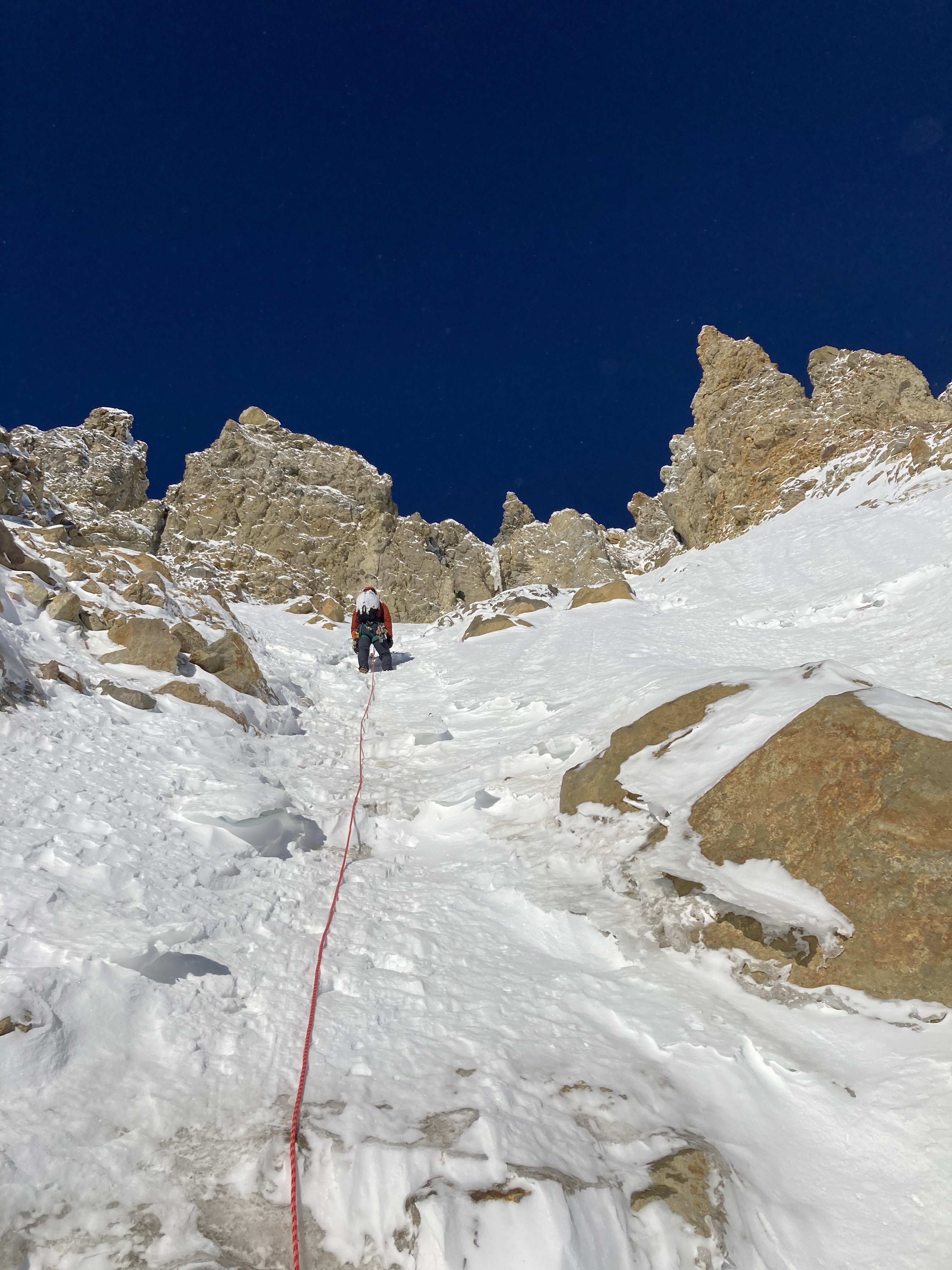
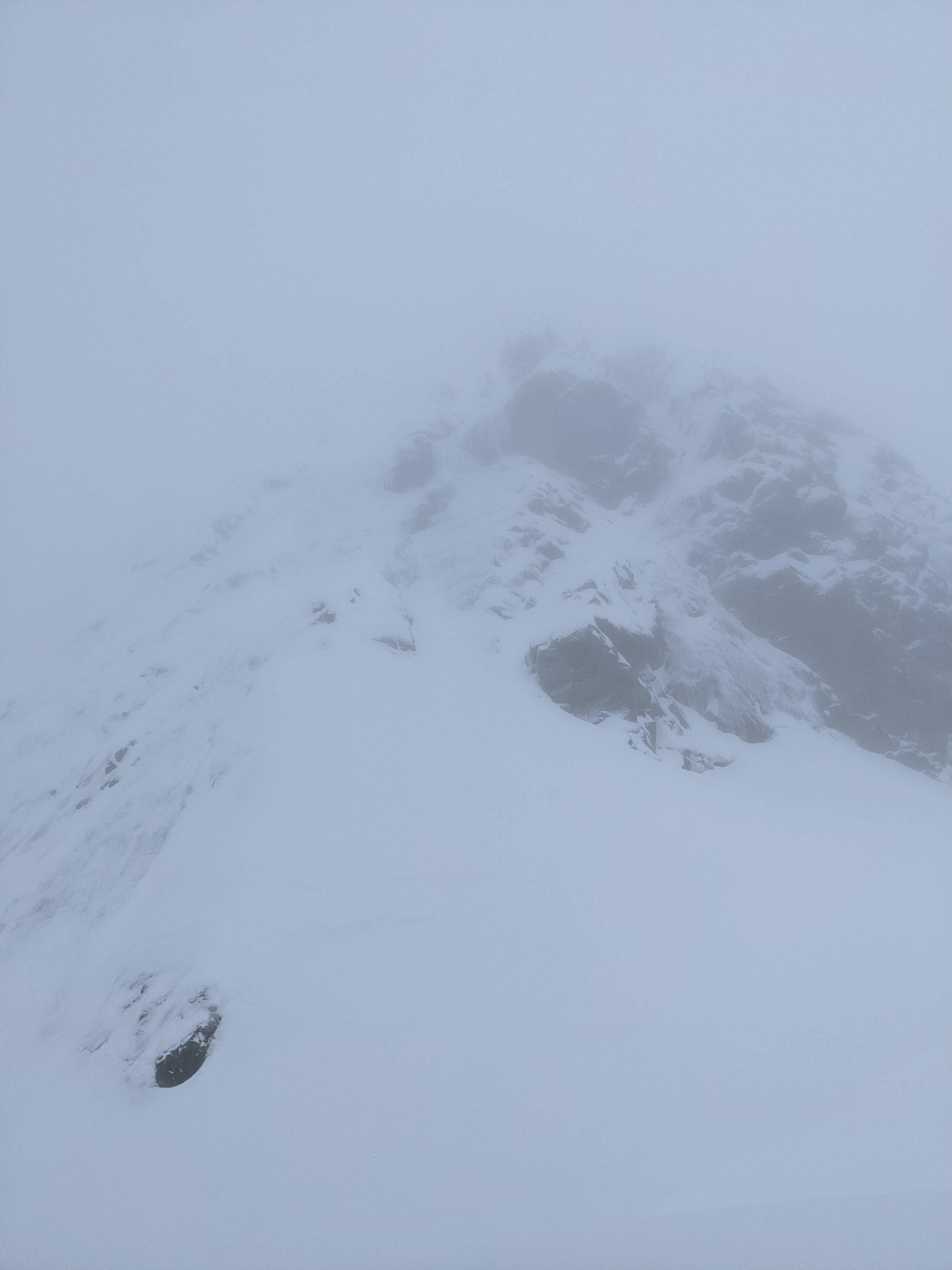
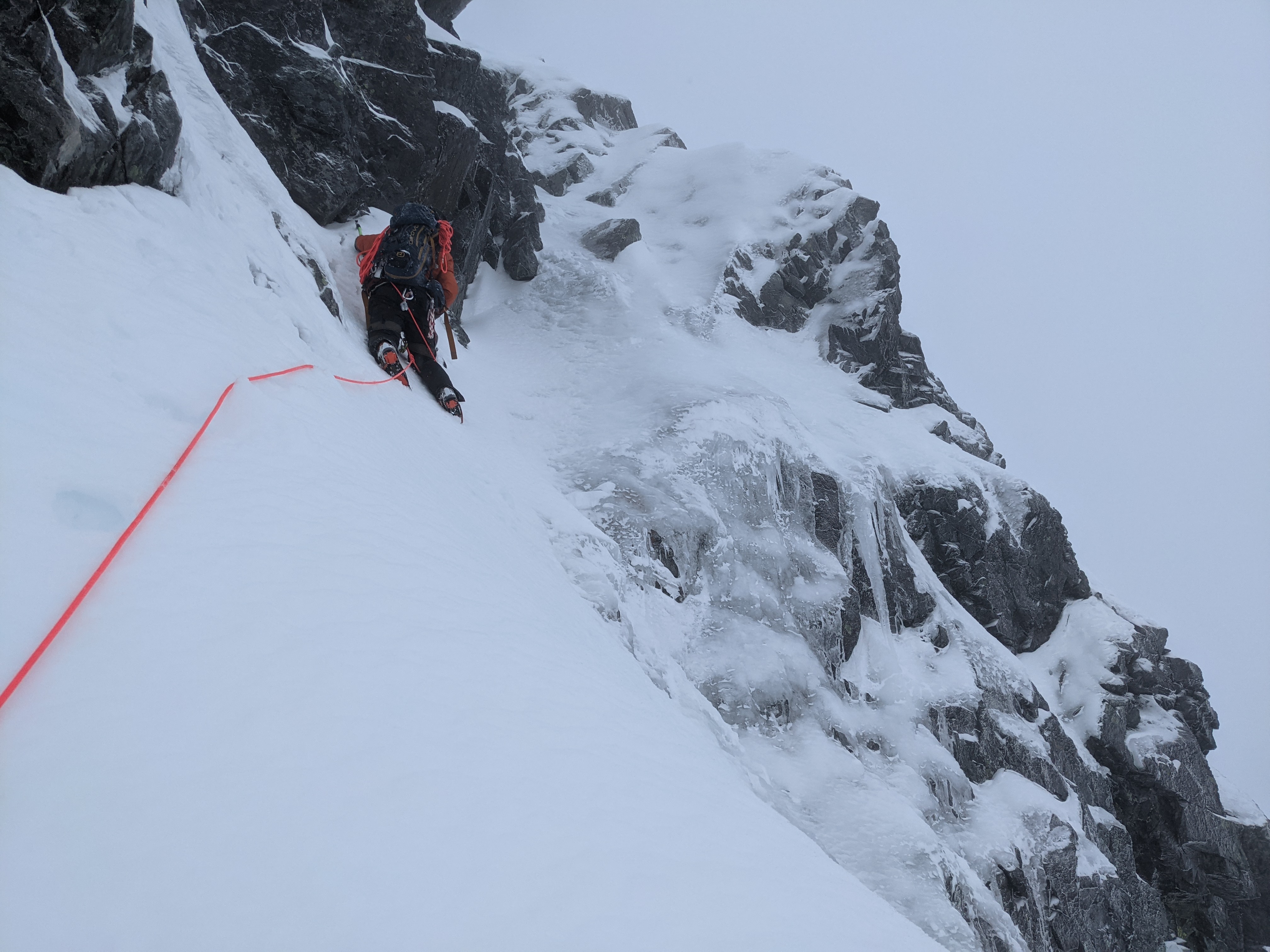
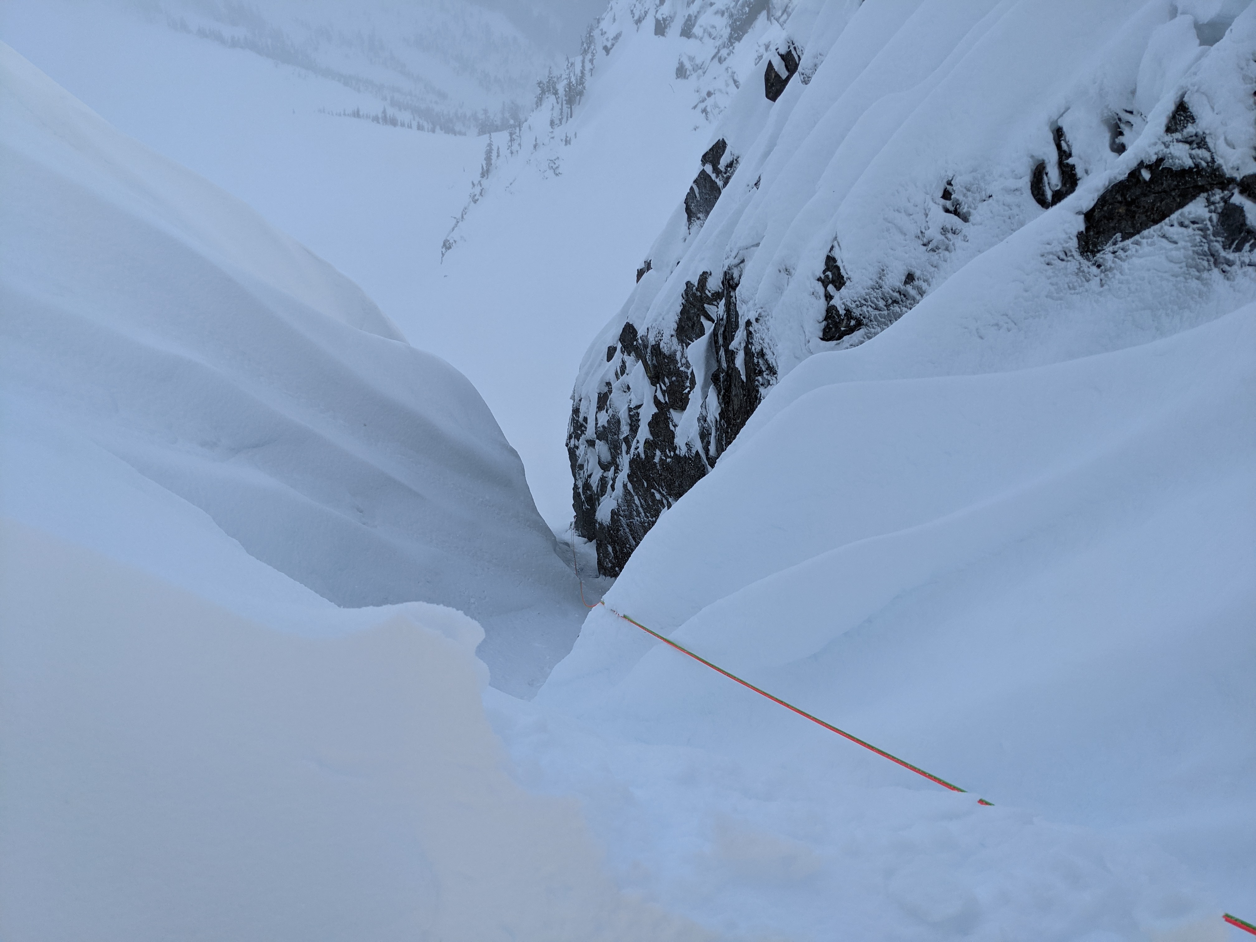
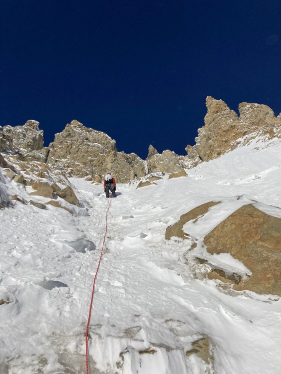
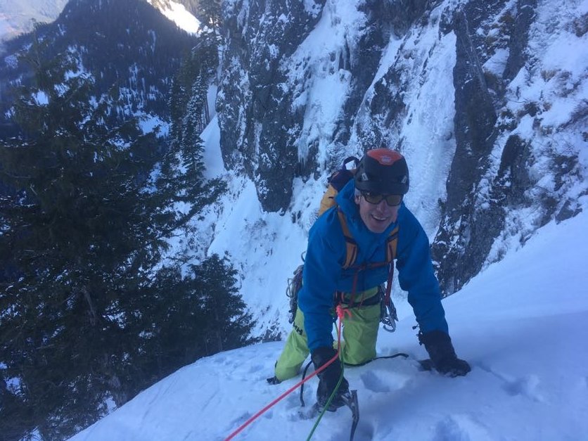
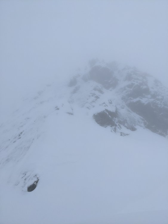
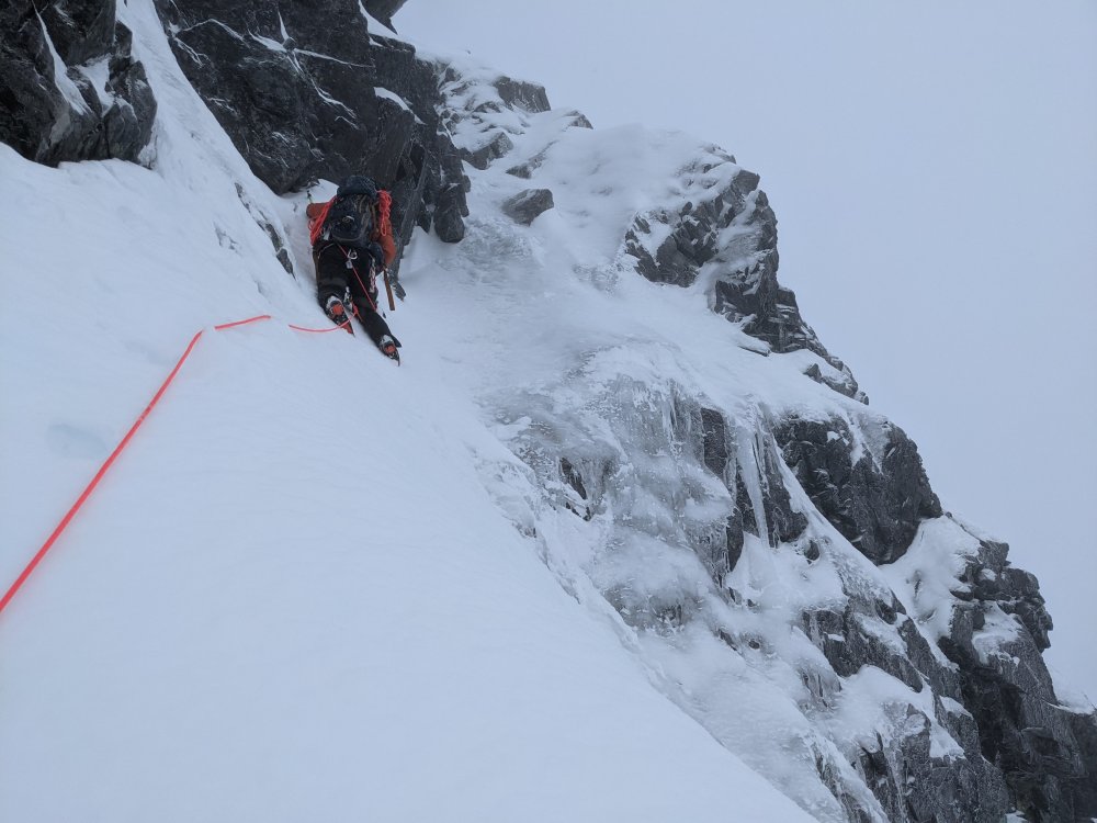
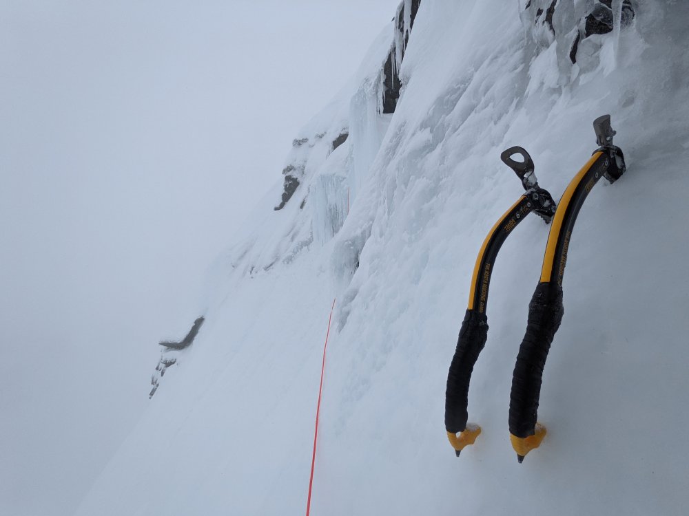
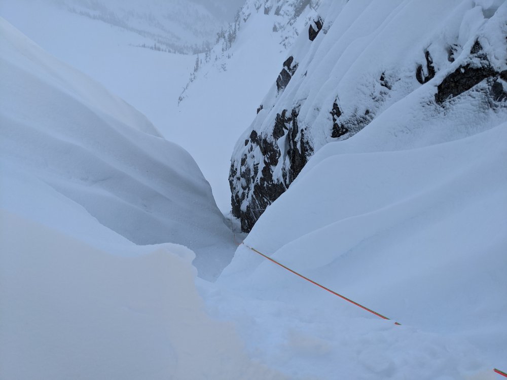
Trip: Chair Peak - NE Buttress Trip Date: 01/17/2021 Trip Report: Climbed NE Buttress of Chair Peak on Sunday 01/17/21. Snowshoe approach with headlamps was warm and wet, with a persistent drizzle. This led to the avalanche slopes along the Snow Lake approach shedding copious roller balls. Despite this, the slopes showed no sign of worrying instability in an impromptu pit test. Roller ball trails clearly visible The snow was well consolidated and rather deep from the recent storm cycle and freezes, so we were optimistic about route conditions. This held true, but the weather wasn't as good. Chair basin itself was in near whiteout conditions with relatively strong winds when we stashed our snowshoes at Thumbtack rock, but with an 11am storm break in the forecast we hoped the flurries would be gone for the higher pitches. The approach ridge to the climb itself was okay snow with some cornicing on the north side. Base of NE Buttress route from ridge The first pitch was fat with both ice and snow, but the ice was weak in many places and would not always take a screw reliably. The tree anchors for the p2 ridge and p3 belay were almost entirely buried, but the snow was solid enough 2 or 3 pieces of pro a pitch felt adequate. The p4 ice step was in and seemed to be in good condition both for climbing and placing screws. P1 ice conditions P4 Ice conditions P5 went easy, and we decided to forgo the summit scramble in favor of making our way down early, not wanting to get benighted on such a low vis day. Needless to say, the 11am storm break predicted never came. We made our way to the correct rap gulley with the help of @DPS's beta, using a double rope rappel to get quickly to the mouth where the snow slope begins. This was a good call, the anchor cornice was rather large and using a single rope would have left us exposed to it in the gulley while pulling the rope. Either there were no anchors from that point, or they were buried. We drove a questionable piton underneath a rock overhang skiers left of the gulley mouth for a second rap to avoid some of the steep snow downclimbing at that point. Partial view of descent gulley with cornice in foreground Descent went as planned. Summary: As of 01/17/21, the route is in good condition, with high snow levels and decent ice higher up on the mountain. Rock gear was used for reliable belays, while many usual rock protection spots were somewhat buried along pitches so ice screws were placed often, even if questionable ice quality was encountered. Gear Notes: Cams .3 to 1 taken, only .4 used. Small and medium nuts used. Ice screws of various lengths used. One snow picket placed, but snow conditions made for bomber pickets if one took the time. Double 60ms for the rappel. Approach Notes: Approach on snowshoes unpleasant due to extensive avalanche debris fields at the time.
 1 point