Leaderboard


Popular Content
Showing content with the highest reputation on 12/18/20 in all areas
-
So for this winter, as @Doug_Hutchinson alluded to, I present to the ice community a new observations page: https://cascade-ice.com/observations. I think that we could record observations of ice in the field in a more organized, easy to search manner, with location pins. Over many years, I believe that this format could have a lot of value because of its clarity and searchability. My dream would be to display historical weather patterns that led to certain observations and awesome insight like that. Facebook posts get buried after a few days. CC Threads are great, but can be tricky to search through and it can be challenging to describe exact locations. This isn't meant to replace CC or anything, more augment it. It's an experiment. I welcome feedback. This observations page I will maintain with submissions from the community. To make development easier, there's no form for user submissions, just send us an email at cascadeiceguide@gmail.com and I'll get it up as quickly as possible. There are instructions on the page of what information to include in submissions. Think cold thoughts and hopefully it'll be a good season!1 point
-
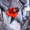
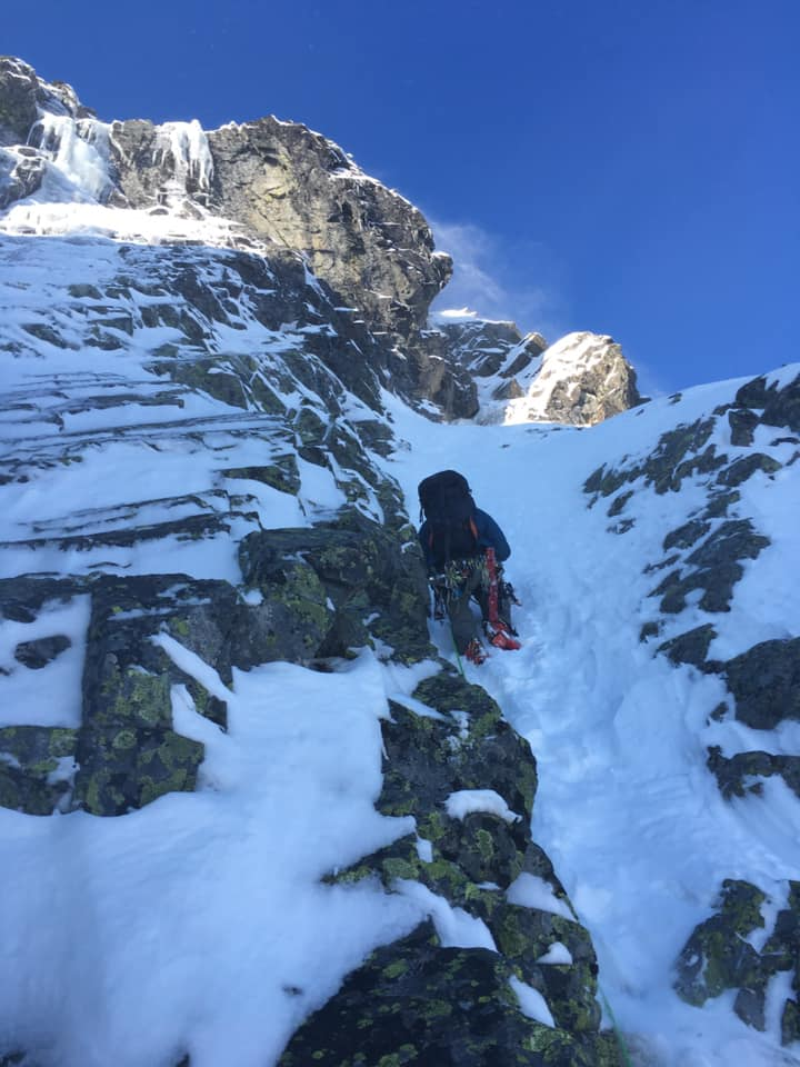
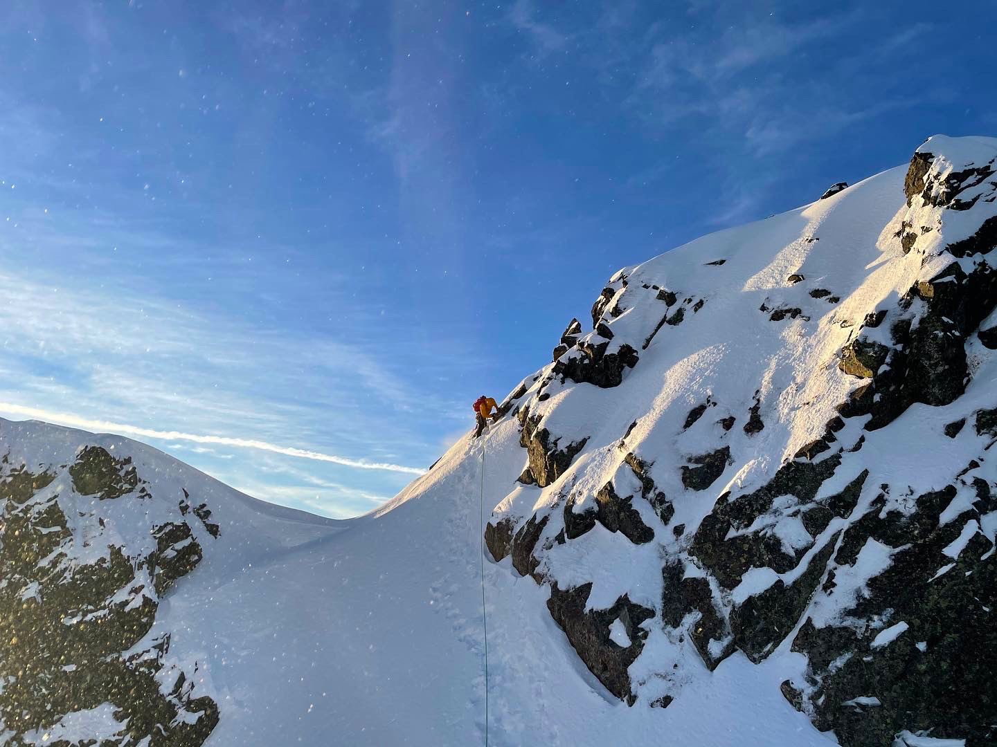
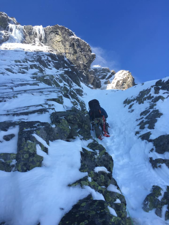
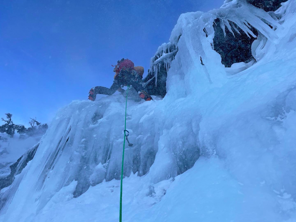
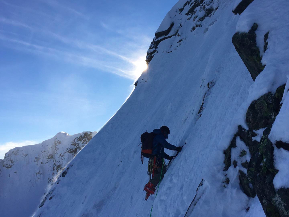
My partner and I climbed the NE Buttress of Chair Peak on December 12th. The route was in really climbable condition, with some enjoyable mixed climbing in the S-couloir. The route was mostly snow climbing, but the ice step was in good shape at around WI2+ (steep but short). We pitched out the entire route which made upward progress on the slower side, and we reached the summit around 4pm, which was later than we intended. A strong northerly wind caused for blustery conditions with significant amounts of spindrift. We accidentally descended down the wrong gully from the summit. The route description we followed said to descend the obvious gully for 200 feet until you turn left at a notch to find a rappel anchor. We descended the gully for about 400 feet looking for the left turn and notch before realizing we were in the wrong gully. We located some rap tat and were able to cut into the correct notch from below with a rappel, some up-climbing, and then some down climbing. Because we had to rap sideways, the rope was pulled over a rock band and got stuck. I had to solo up to free it. At this point, dusk had fallen and the rest of the descent was done in the dark. From the notch, we located the chains (nice looking bolts) on skier's right. I rapped 200 feet, passing 3 intermediate anchors. There was no rap tat or rappel station at the 200 foot mark, so we decided that my partner would rap to the 3rd rappel station, a single bolt with a rap ring at about 150 feet down, and set up the last rappel for us. I was unroped, standing on a ledge in the corner of the gully. My partner rapped, and while pulling the rope to set up the last rappel, the rope got stuck and he had to climb up the couloir for a significant distance to free the rope. We could have down climbed from there, but I was worried about the avy danger and wanted to rap as far out of the couloir as possible. We did the last rappel and realized that the strong winds from throughout the day had created wind-loaded slopes in the bottom of the descent couloir. Despite the avalanche hazard being forecasted as "moderate" for that day, the hazard had certainly moved into the 'considerable' or even 'high' range. I pulled the rope and began to coil it while my partner started down climbing the rest of the gully, looking to remove himself from the loaded slope as quickly as possible. While I was coiling the rope, my partner triggered a windslab about 10 feet below me. I heard him yell out "avalanche!" and could make out debris pouring down the slope. The slab was 40 feet wide and 8" deep. He slid for about 30 feet but was able to self arrest by swinging his ice tool into the hard snow beneath the slide/debris. I watched the debris pour over him and shoot down the rest of the slope. I carefully stepped below the crown to avoid triggering any more loaded snow, and made my way down to my partner. He was thankfully uninjured, but both of us were shaken from the close call, and exhausted from the arduous day. We continued down safely the rest of the way, and were extremely cautious of travelling on wind-loaded slopes until we reached Source Lake. While this route is fun and in good condition, it should not be taken lightly, as the objective dangers are serious. While it is satisfying to complete a route, it is better to do so in good style. Avy gear should be considered mandatory on the approach, descent, and on route. Consider another objective if heavy wind loading is present. This was definitely a learning experience as I am relatively new to winter alpine climbing. I'm sharing this information both to acknowledge the mistakes we made, and to give a heads up to other parties interested in this popular route. Our rack: Avy gear, two pickets, a large set of nuts, singles of cams from .3-1, a few KB's, a short LA, a small angle, and 6 screws from 10-17cm. We used all the gear except most of the nuts and two screws. Here are a few photos from the route:

 1 point
 -
"Intravenous"- someone should do a direct finish For Aint over motherfuckers I can loan warthogs to whoever wants to repeat that rig. Big prize in the range should be NE face of Triumph1 point
-
ALPINISM!! FUCKIN A!!1 point
-
Nice job kids!! Looks awesome. Not to be a rug pisser, but in my limited experience, the R grade seems to be redundant for winter climbs in the Cascades.1 point
-
Super job! Doesn't matter if you summitted, only that you accurately report what you did and have fun with it all!0 points