Leaderboard


Popular Content
Showing content with the highest reputation on 08/21/20 in all areas
-
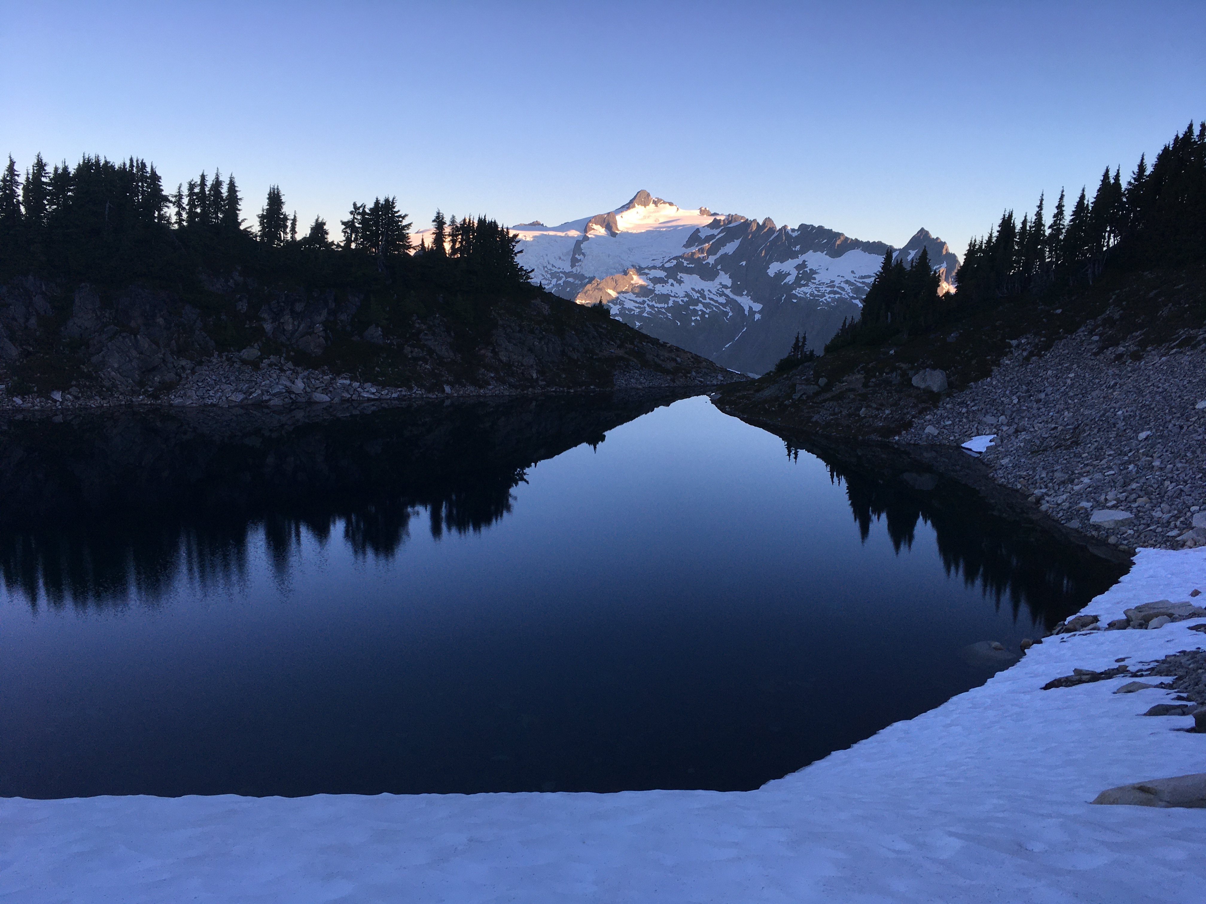
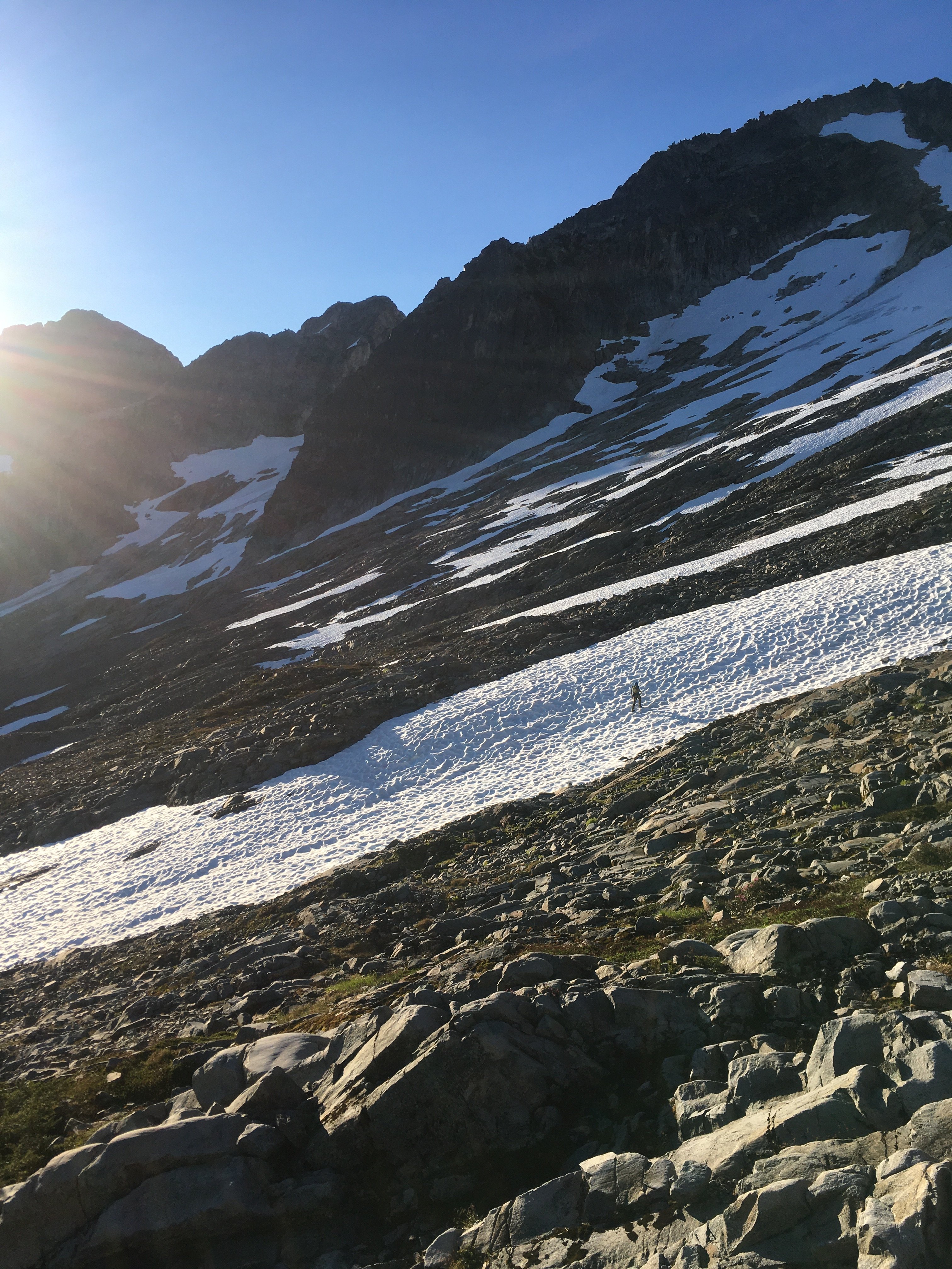
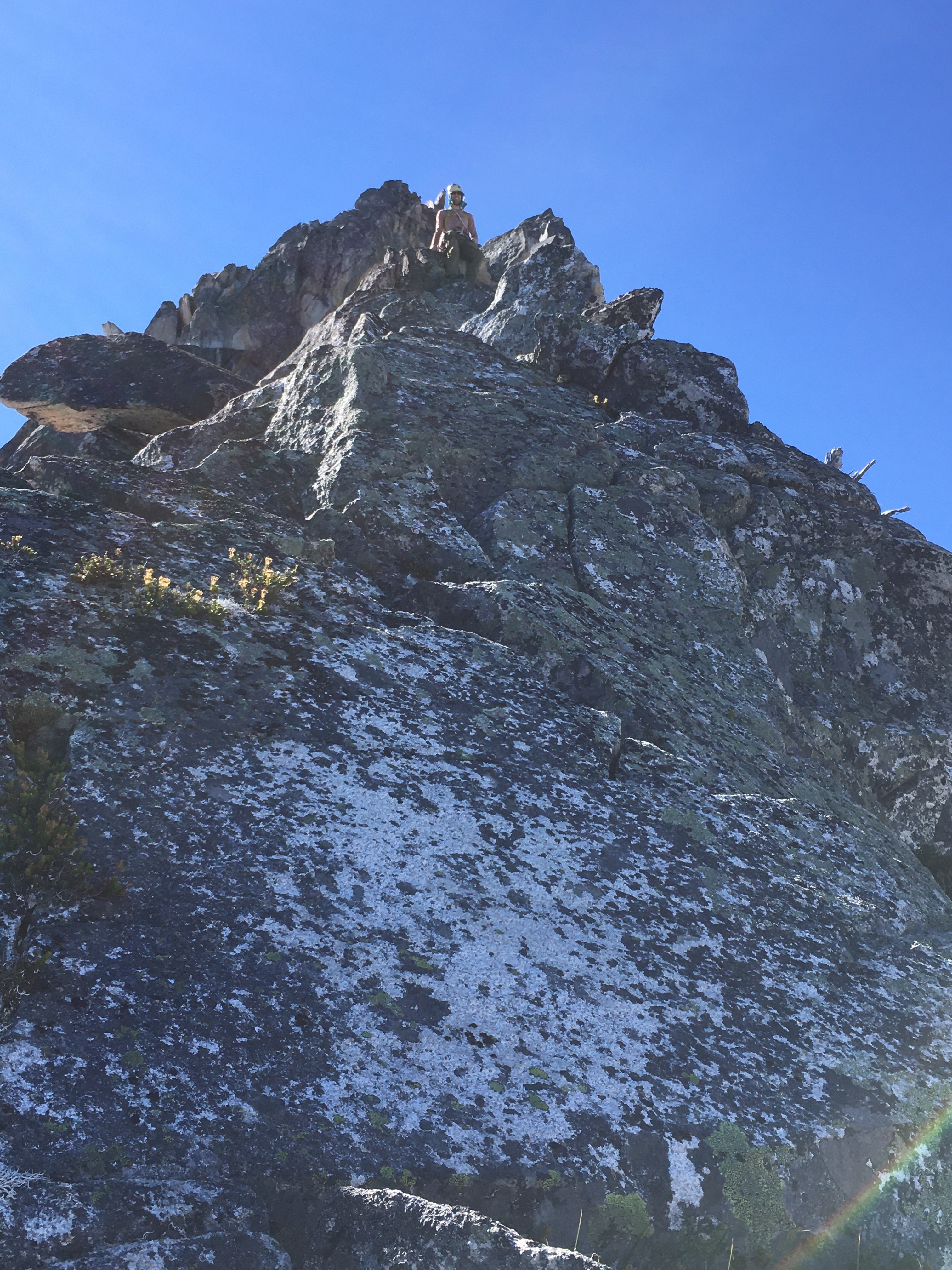
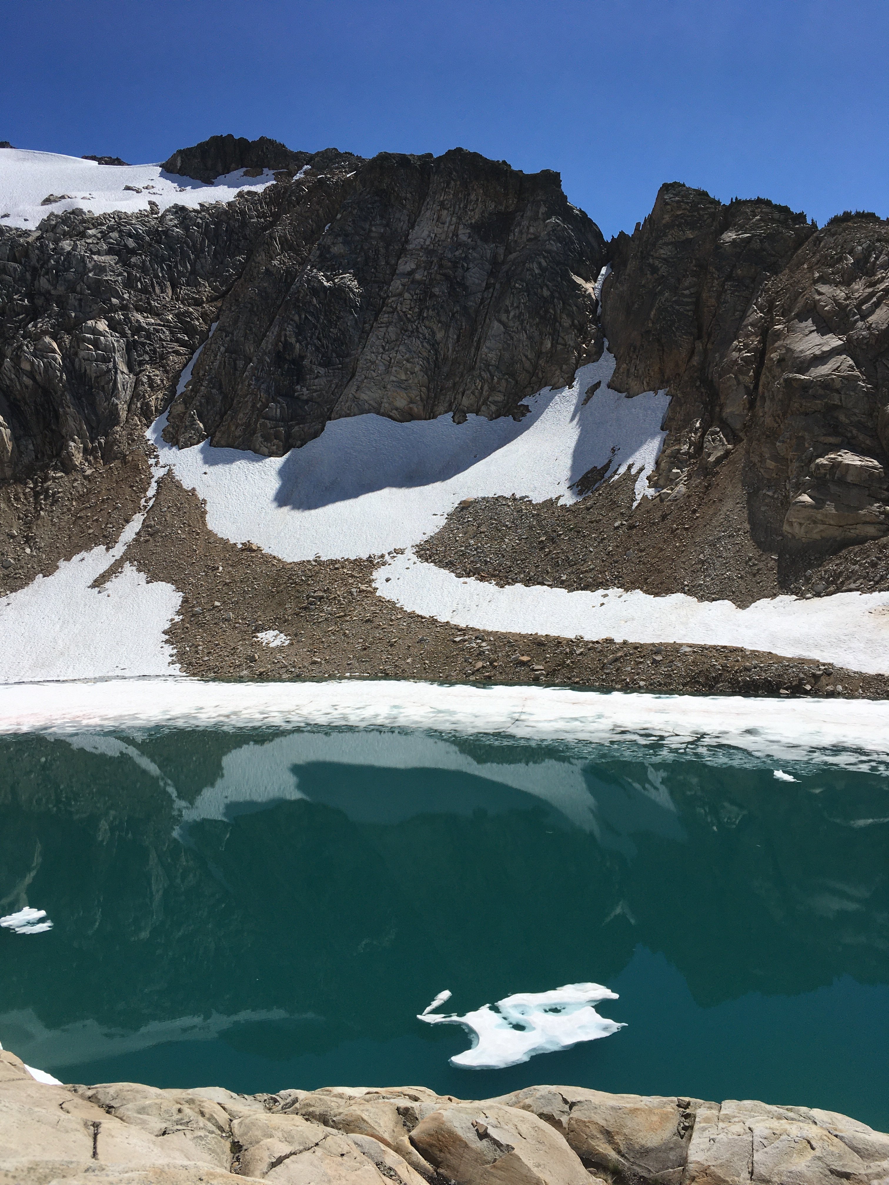
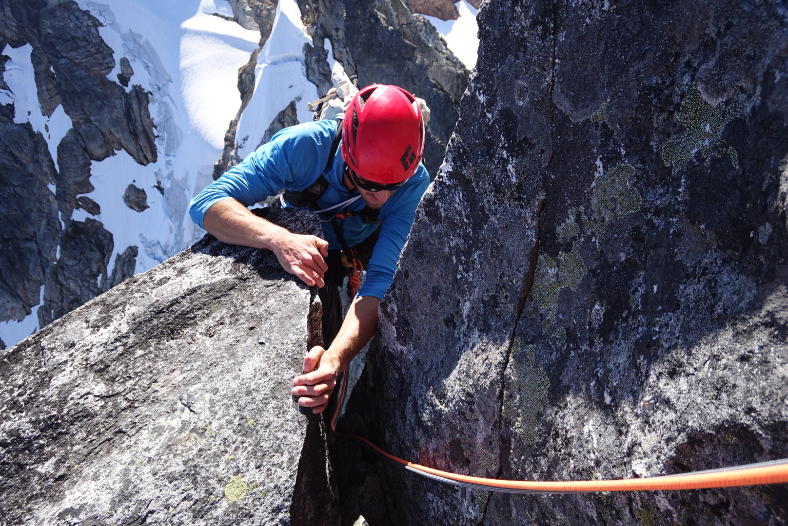
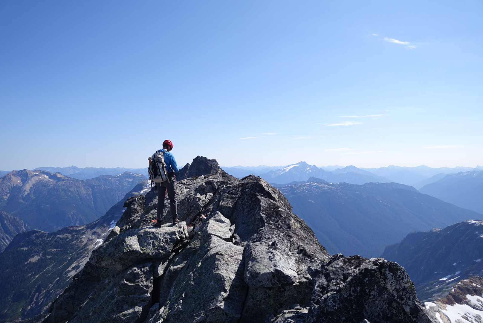
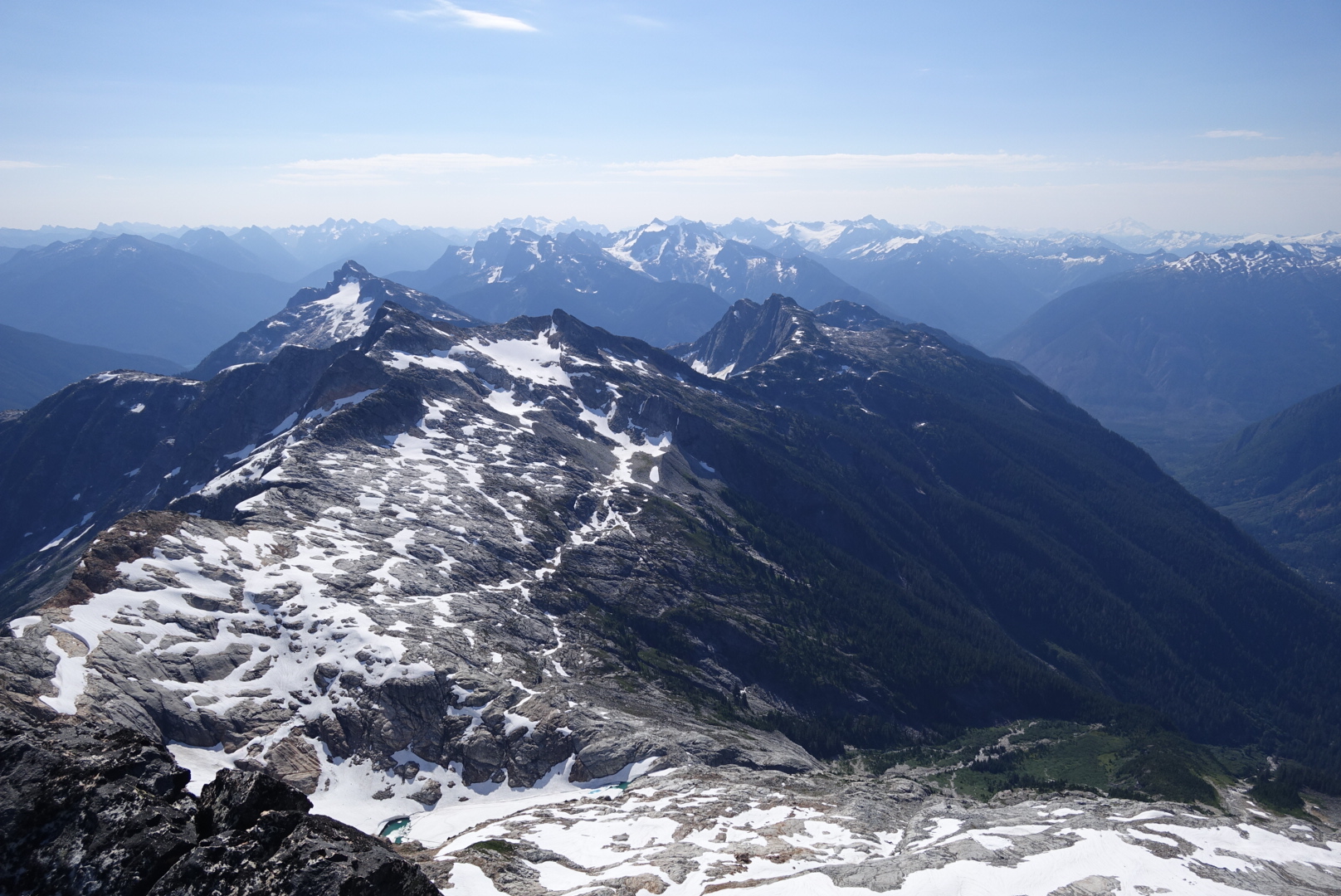
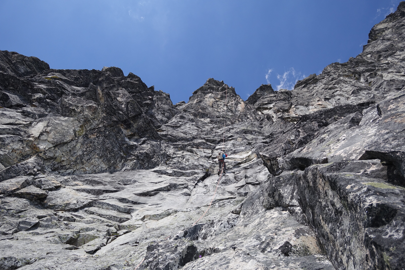
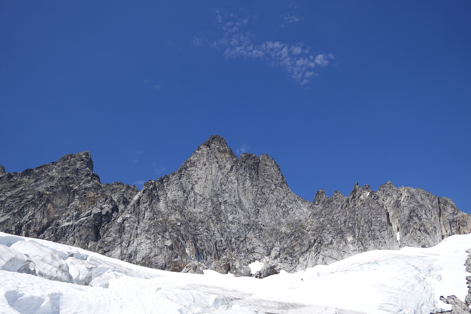
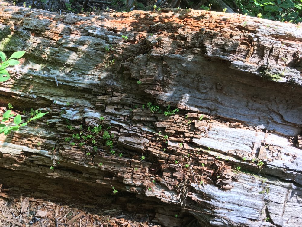
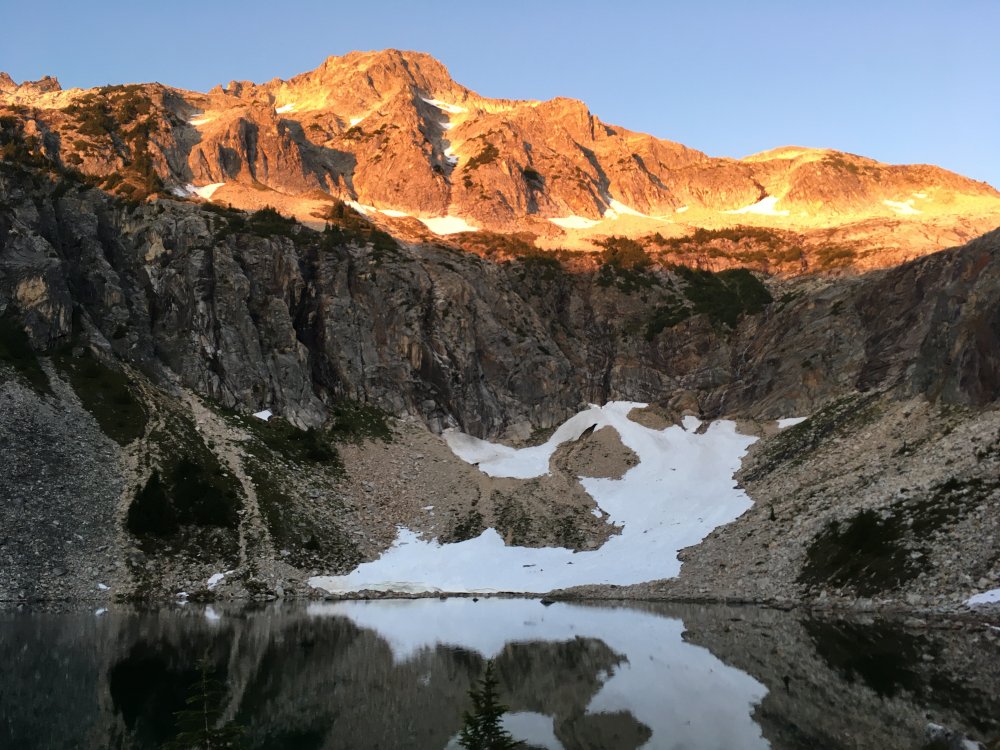
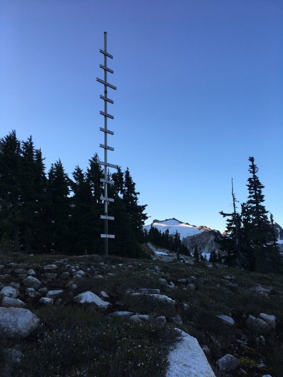
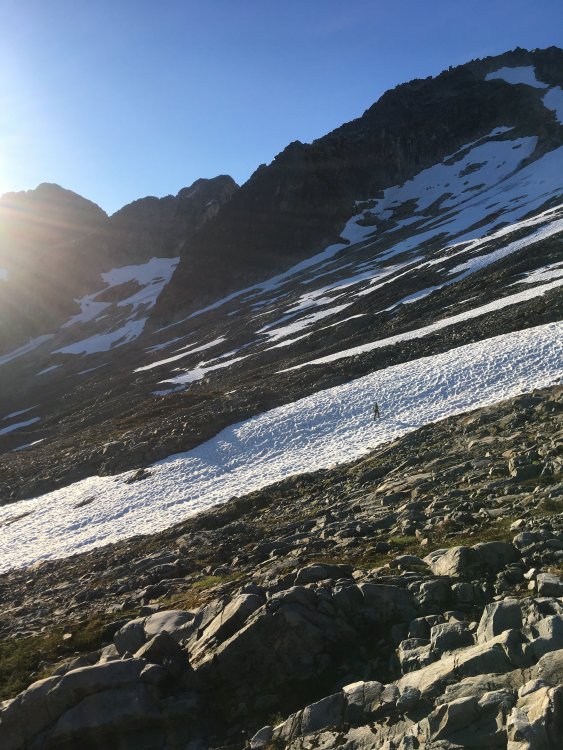
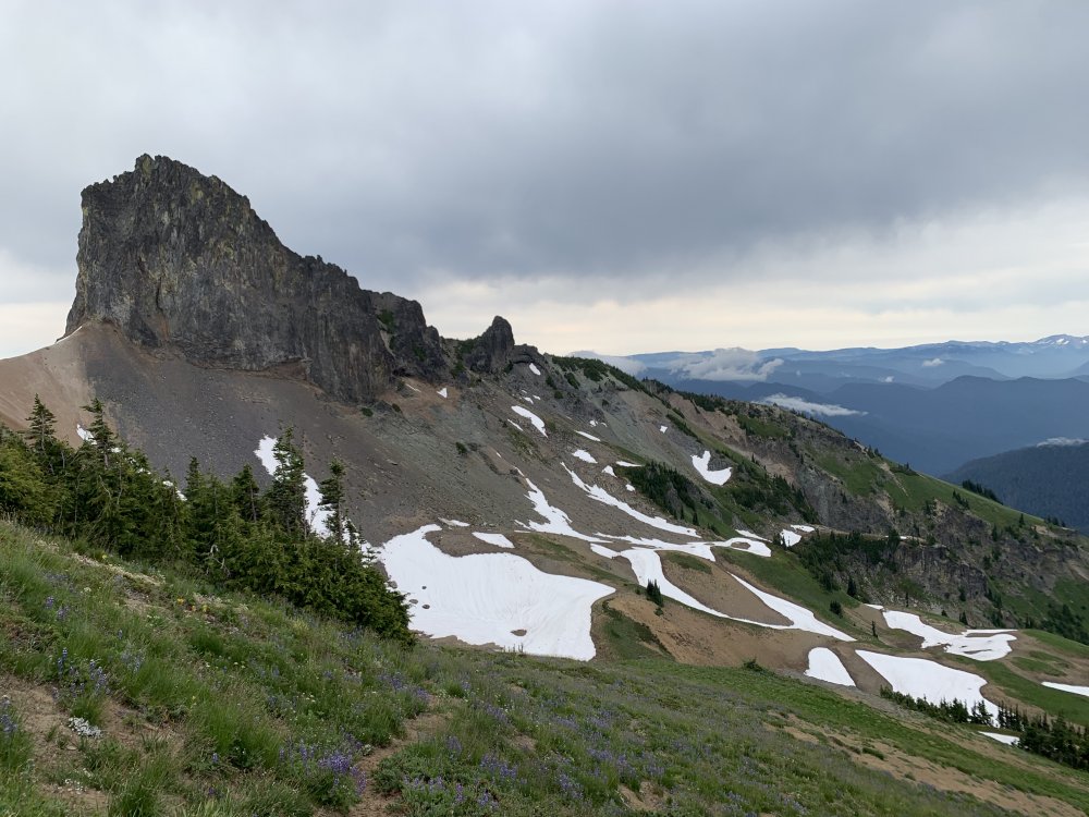
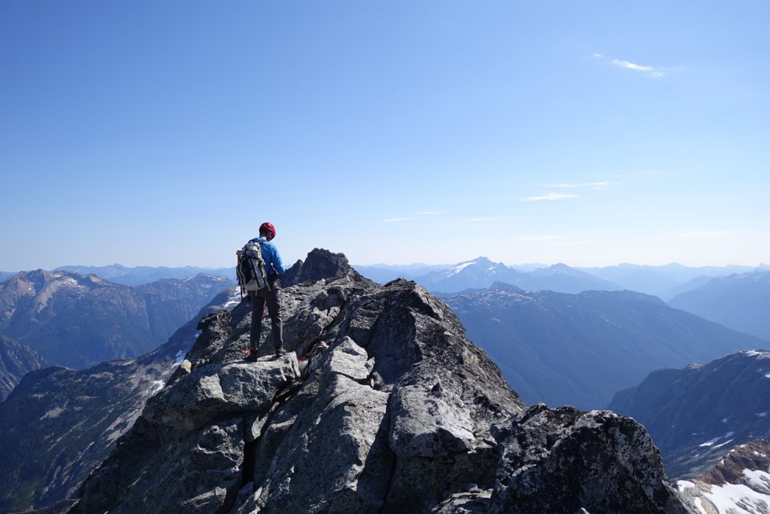
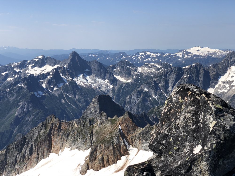
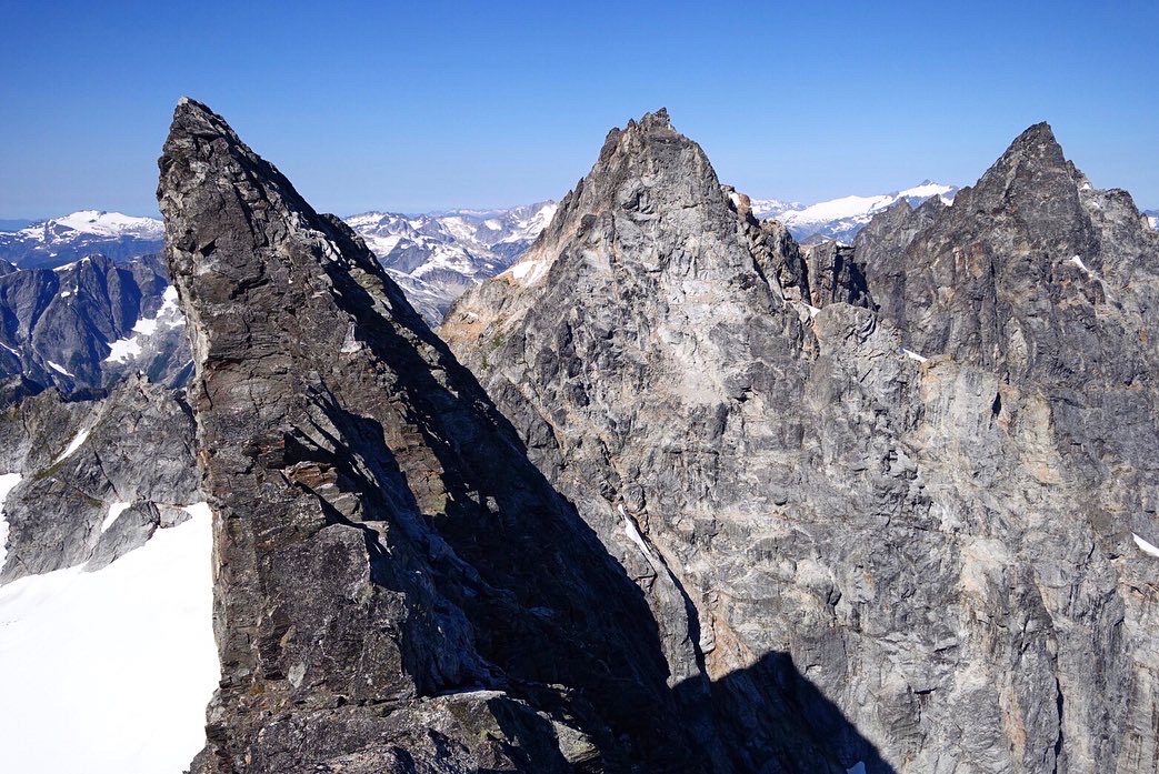
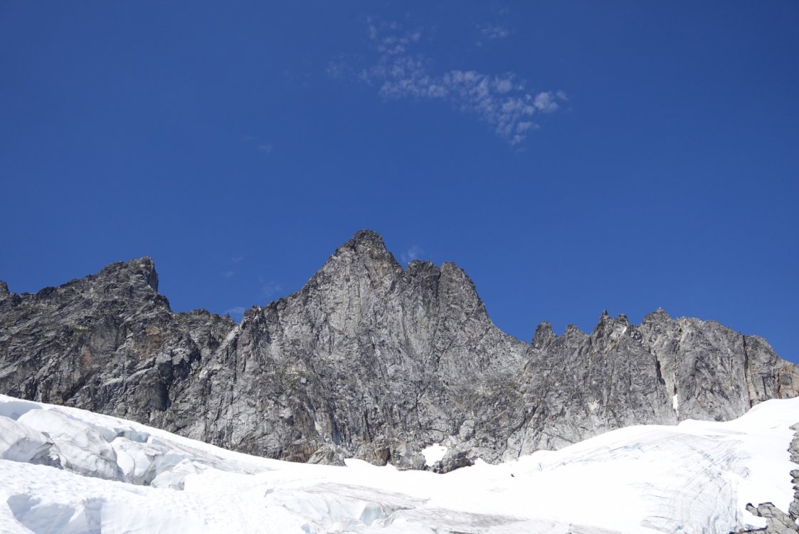
Trip: Blum - North ridge Trip Date: 08/15/2020 Trip Report: A few thoughts from our climb of Blum’s north ridge last weekend. Arrived at the ranger station around 10:30 on Friday, with a budget of about an hour for waiting for permit. I started about 30 places back in line and made it to about 24 places behind in that hour. Doing the math it was an easy call to just head out to the unpopular Blum zone sans permit rather than wait another 2+ hours. Would be nice if NCNP got their shit together with the permit situation someday. The approach hike is short on views but it’s a beautiful forest. Its shade was much appreciated this hot weekend. It’s very difficult to keep on the climbers trail. A lot of it is pretty faint but distinct enough, but it seems to abruptly disappears in several spots only to reappear later. Especially during the relatively flat traverse around 4400-4800’ I never noticed a path. At least the forest is more open in that part. Impressed by the determination and passion of those who found their way up these hills without gps or any trail. I was glad to have screenshots of tracks here for reference https://www.nps.gov/noca/blogs/mt-blum-north-glacier-july-12-2016.htm Bivy at the lake was lovely except for the voracious mosquitoes. We got an early start next morning in the hopes of avoiding groping around the bush in the dark on the way back to the cars. Headed off a little before 6am. Passed a beautiful reflection lake and what looks like a remnant of an antenna or something? This, one piton, 1 chewed up piece of tat, and the summit register were the only evidence of humanity that we saw past the bivy lake. I had assumed the start of the N ridge would be more obvious. There were actually 3 distinct ridges coming down the the glacier. The first one furthest west was clearly not the right one. We took the second one but there was more further left that we didn’t really explore. I took the first lead up and diagonally right. There was one long runout but plenty of jugs in that area. I encountered a difficult move with a wide crack roof just above and right of a finger crack. There was a piton nearby and the crack took cams well, so this crux seemed like it could be on route and was reasonably well protected. It could be 5.9, maybe harder, especially if you’re short. Anchored off a boulder up and right after nearly a full 60m. After this it was some scrambling up the ridge, ending in a dirty gully. We started to wonder if we were off route then. But this led to a really nice low 5th ridge traverse that we sailed up. We passed a nearly flat polished section of rock and arrived at a tower that seemed too tall and featureless to down climb (10-15’). So we backtracked past the flat spot and took an exposed traverse climber’s left into another gully. The traverse ended with a handrail into a low angle wide crack right facing corner. Pretty sure this wasn’t standard because it would take a #3 to protect it. We didn’t have a #3 but the crack wasn’t very long. Including it we did 2 short meandering pitches up and left to gain another ridge, which we took to its end. There was another tower that seemed to block the way and we surveyed a sketchy looking down climb left into another gully but found instead that the tower could be bypassed on its right. Cresting here we took off the rock shoes for the last ridge section leading to the summit. The summit views are . . . Real nice. We were the 4th party to sign the register this year. Always nice to descend without having to do any raps. More beautiful scrambling on the way down, passing a jade lake still holding some snow, and rusty polished granite slabs everywhere. The first gully after that lake’s outlet stream was unappealing so we continued west but found uglier options. One at a time we picked our way down a rotten sandy gully before crossing back over into a better one to get back to the bivy lake. We cooled off in the lake and hit the ‘trail’ a little before 5, which didn’t leave much time to get back before dark. Route finding was generally a little better on the way back, but my phone died at the last inscrutable section after I pocket dialed a long video of the inside of my pocket. So we no longer had a track to follow. We thrashed down and right after the trail disappeared at a flag around a little cliff and stumbled upon a faint path again. We could follow this down to Blum creek before it vanished again and we traded back and forth between boulder hopping adjacent to the creek and being forced back into the bushes. We reached the wooden bridge and gravel path that marked the end of difficulties. Well, almost. From here back to the car seemed so much longer than the day before. The last hour of hiking down the hills in fading light had sapped all my energy. It took 4 hours from the bivy to the cars. And although it wasn’t a terribly long day as far as these things go, I was truly spent. Worth it? Yes, amazing scenery and plenty of good rock. In no rush to repeat that hike though. Gear Notes: Crampons (didn’t use due to laziness but would be useful) Ice ax Cams in the .4-.75 range were most useful. Single #1, #2 was fine Approach Notes: Good luck


 1 point
 -
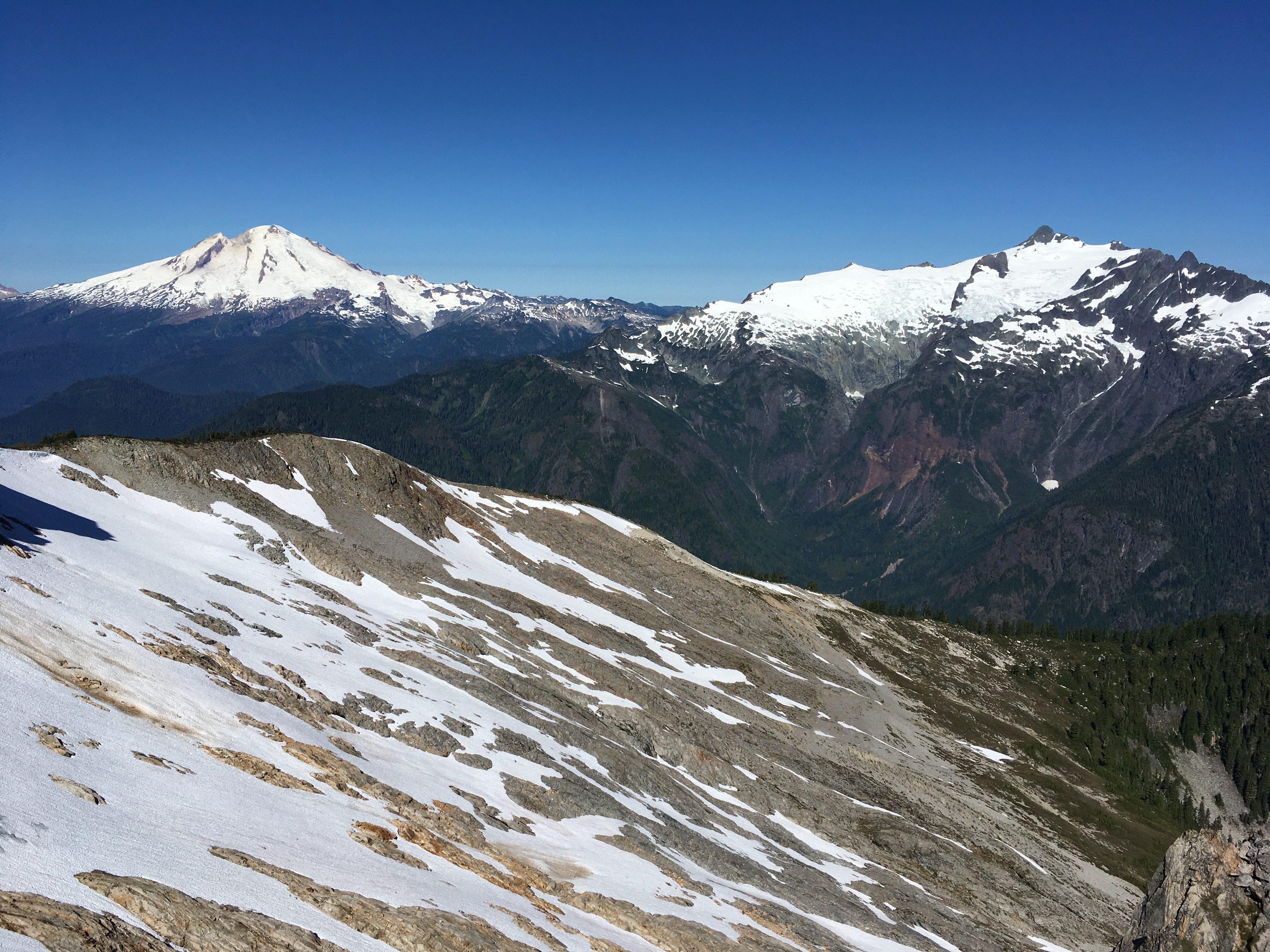
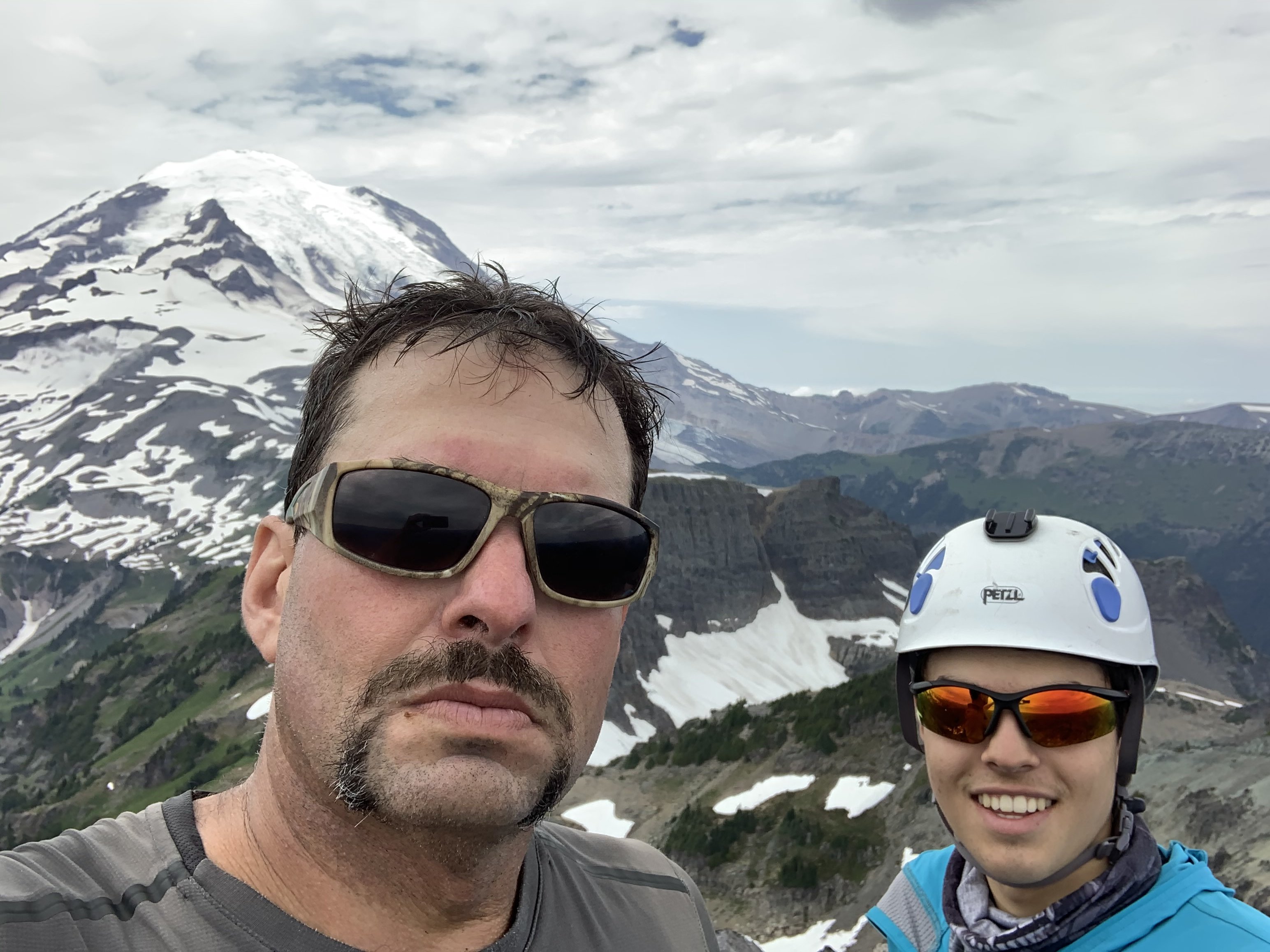
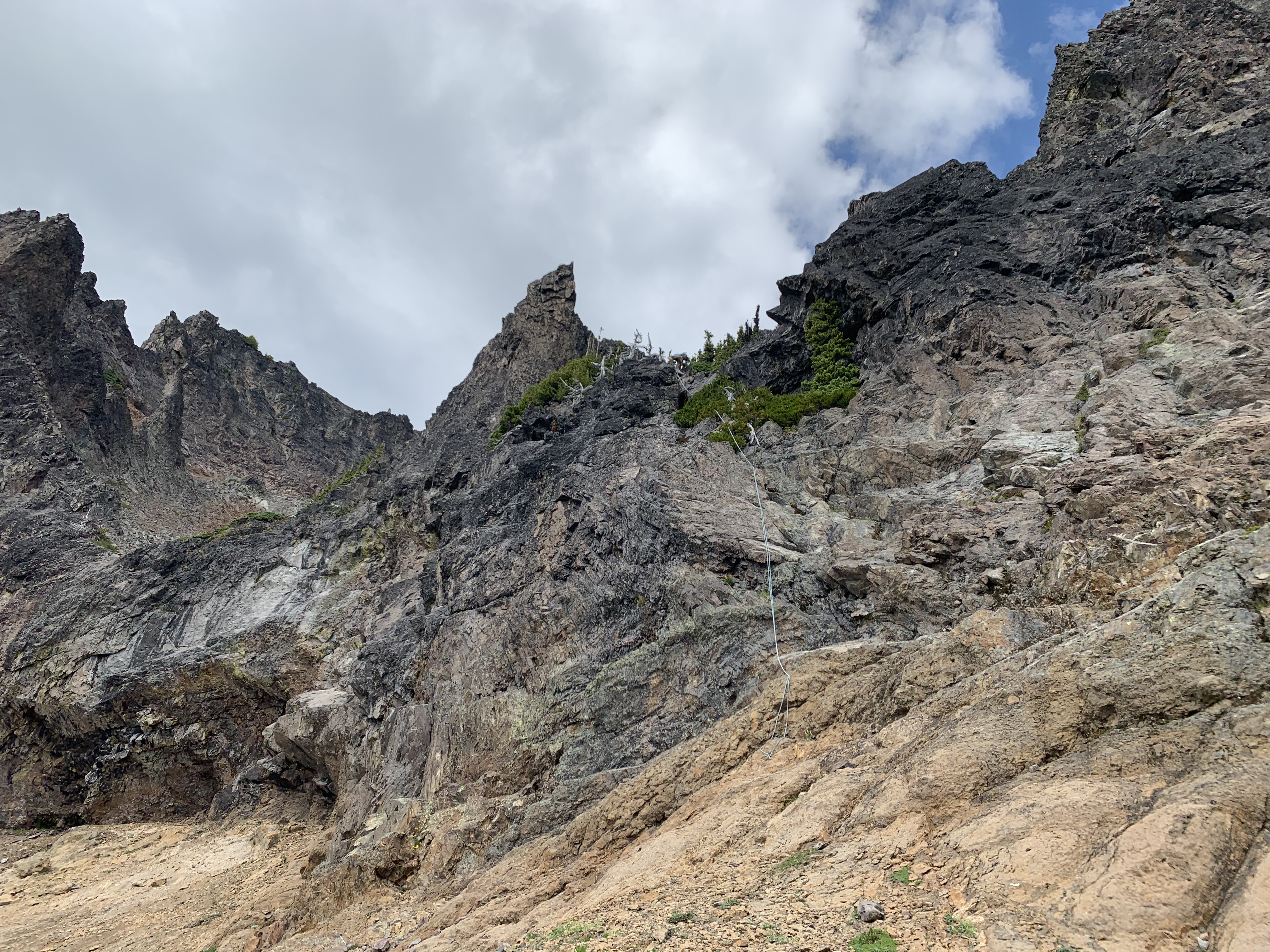
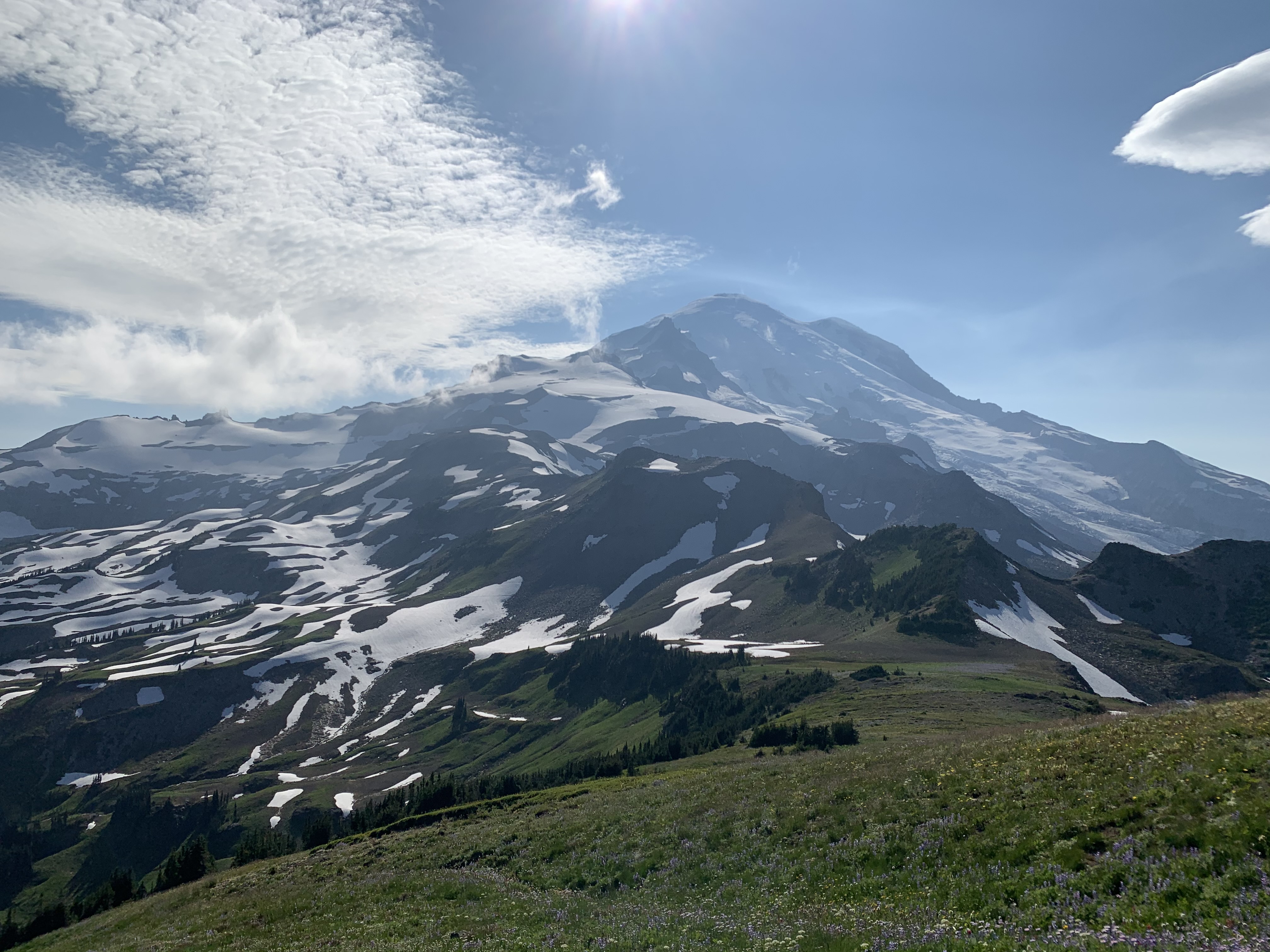
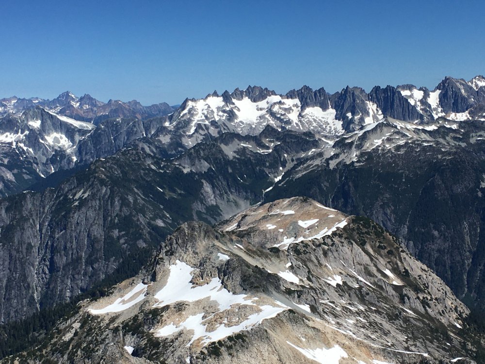
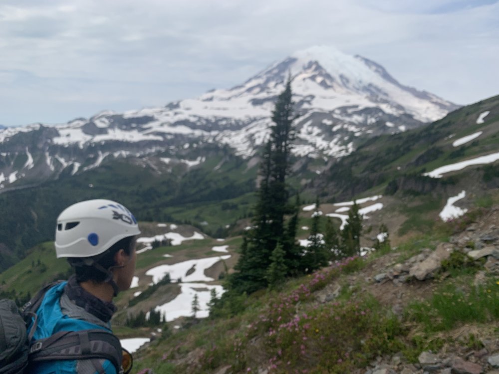
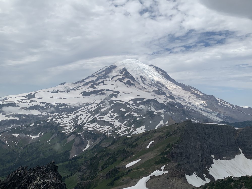
Trip: Cowltiz Chimney - Standard Trip Date: 08/01/2020 Trip Report: Seems like it's been nothing but a summer of Smootin'. Save a solo trip in the Teanaway, I've strung together a contiguous streak of getting me lots of Smooty (and following in the footsteps of the Choss Dawg Millionaires). This past weekend I set my sights on Cowlitz Chimney. I attempted this scramble about 5 years ago on a weekend when weather looked "meh" pretty much everywhere that I looked except for MRNP. Unfortunately, despite blue bird skies from the trailhead we hit fog between Summerland and Panhandle Gap - fog that never let up. So, we settled for finding our way up Banshee and Middle Cowlitz Chimney on that trip. While looking for recent beta I saw a comment that the Summerland TH parking lot was filling up by 6:30 am. So, we timed it to arrive just shy of that time. Despite that plan we arrived to a full lot and parked on the side of the road right across from the lot - the second car to do so. Within 10 min another 5 cars or more followed suit. The mountains are getting way too crowded! We made good time up to Summerland and I made use of the toilet. There was a ranger there with a shot gun as a last resort to ward off a bear family unit who is apparently frequenting the area. We continued on towards Panhandle Gap and decided to pop over the col just shy of the proper trail. I don't think we saved time doing that, but whatever. Next we crossed glorious meadows with flowers in full bloom and only a few snow patches. Soon we were on the summit of Banshee Peak with views of our objective. Views from Summerland: Views en route to Banshee Peak: The objective: By this time some fog appeared in surrounding meadows and some clouds looked like rain. WTF? We began dropping into the basin below Main Cowlitz. Right about when we got to our low point, fog came in. Total whiteout. We launched our peakbagger app and downloaded a track just in case we needed it. Fortunately as we completed our traverse and were roughly below the "solitary tree" the fog blew out and we were golden. We followed this guy's excellent route description: http://ericsbasecamp.net/trips/CowlitzChimney/CowlitzChimney.htm. The trip is 18 years old and evinces the utility of long-lived trip reports. His came up in the first page of Google hits. We found no problem finding the key landmarks: the solitary tree, the fence of trees, the exposed traverse, and the class 4 slot. For the latter two we had brought a rope. I protected the traverse with two cams and plugged a third before topping out on the slot. At the rap station we left our rope and pro and scrambled up. There was scree, there were loose holds. It was a Smoot. We picked the obvious gully near the top which felt like class 4. Definitely not a good place to fall. Yep, that's a solitary tree. Well, sort of: Summit views were great! Another Smoot in the books: #83 On the descent we retraced our steps, did a rappel to avoid downclimbing the slot and traverse (60 m rope barely reached), and hiked out. It was super hot by then and we felt the effects of sun. So we slowed down and enjoyed the way out, stopping for one long water break before the final trail back to Panhandle Gap. On rappel: Rainier as majestic as ever: Gear Notes: 60m rope, helmet, X4s .3 and .4, C4 .5 Approach Notes: Mostly snow free. Wildflowers in full force.


 1 point
 -
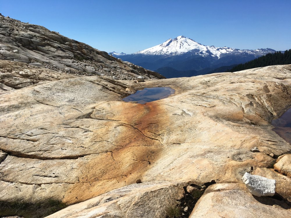
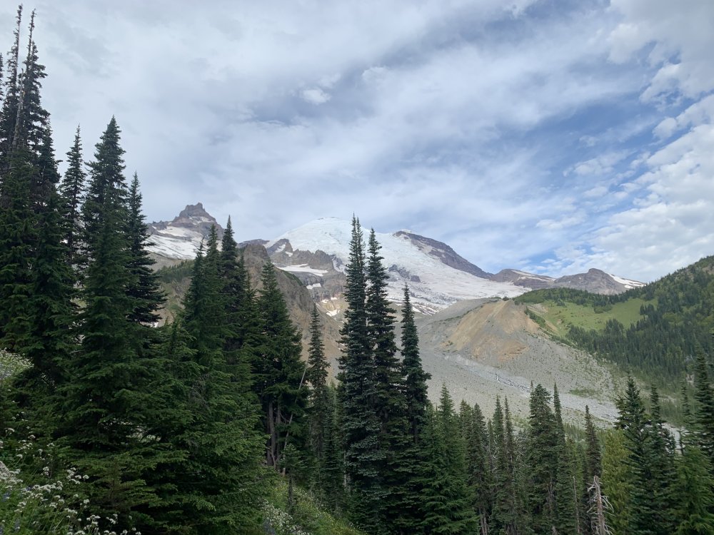
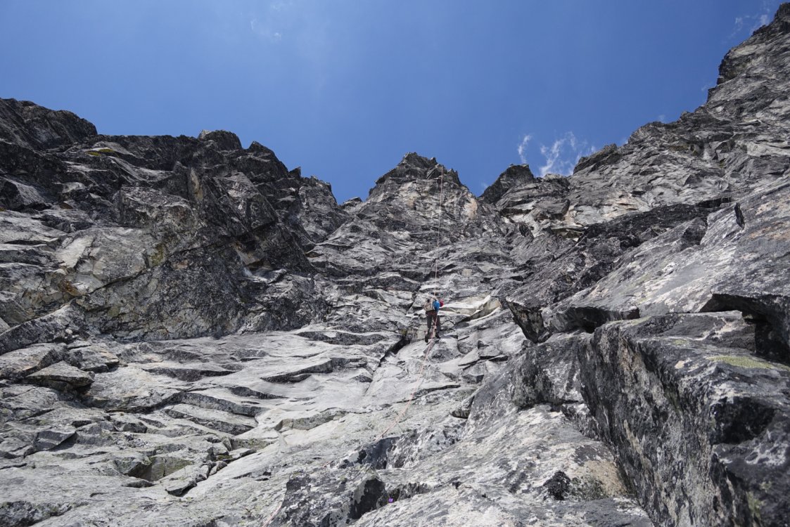
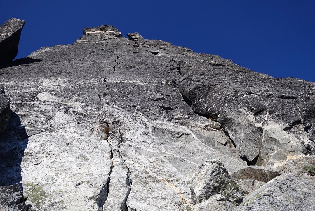
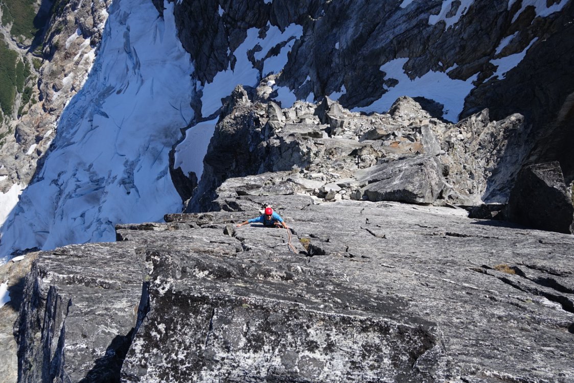
Trip: Inspiration Peak - East Ridge Trip Date: 08/16/2020 Trip Report: This weekend @willgovus and I climbed Inspiration Peak's East Ridge. We got started hiking from the trailhead around 11:30 or so Saturday. The trail up to terror basin is very straight forward, but boy is it steep. That coupled with the heat had me cramping quite bad towards the end and had to just lay down for a bit with my legs elevated. I was soaked with sweat for almost all of the way up the ridge before the trail starts traversing. Made it over to Terror Basin camp late afternoon. What a pleasant place to camp. Many flat spots, running water and an incredible view. We woke up around 3am Sunday morning and picked our way across the climbers path and slabs in the dark. Travel across the glacier was very straight forward with no complications. Reaching the start of the route up to the ridge was just a small hop down from snow to the base of the route, no problem. We did a mix of pitching out and simuling to gain the ridge, staying just climbers right of the major rightward trending ramp and gulley. After three-ish pitches we did a leftward traversing pitch that started off with just bit of down climbing to the East Ridge notch. A vertical step followed by some easy ridge scrambling gets you to the base of the lie back pitch and then the crux pitch. The crux pitch was pretty damn awesome! After that it was a few simul blocks on the north side of the ridge crest to the summit. The decent went well and ended up doing 7 double rope rappels with a bit of crazy exposed scrambling between the West Ridge and South Face. That first rap onto the south face is wild! Was very glad to be done rappelling and back onto the glacier to start the hike out. The hike down the Terror Basin trail is punishing but it goes quick, its really just controlled stumbling and running. At first I was glad to reach the part of the trail on the old road bed, but quickly found it miserable for some reason. Overall I'd say this is a good route in and incredible setting. Some great climbing sandwiched between some loose, forgettable climbing. Gear Notes: Single rack from .3 to 3, double 1 & 2. Some stoppers, useful for anchors before and after crux pitch. 6 alpine draws, 5 double length runners. 60m twin/half ropes. Ice axe, crampons. Bringing rap tat is a good idea. Approach Notes: Terror basin trail


 1 point
 -
How much is reintroduction going to cost? I would rather the money be spent on trail and road maintenance to keep people spread out in the hills, not concentrated where the access is the best. And while you're at it, take the NPS money spent on killing fish in alpine lakes and put that towards road and trail maintenance too. I'm in the minority based on the poll, but that is true on pretty much everything in life.1 point