Leaderboard


Popular Content
Showing content with the highest reputation on 08/08/20 in all areas
-
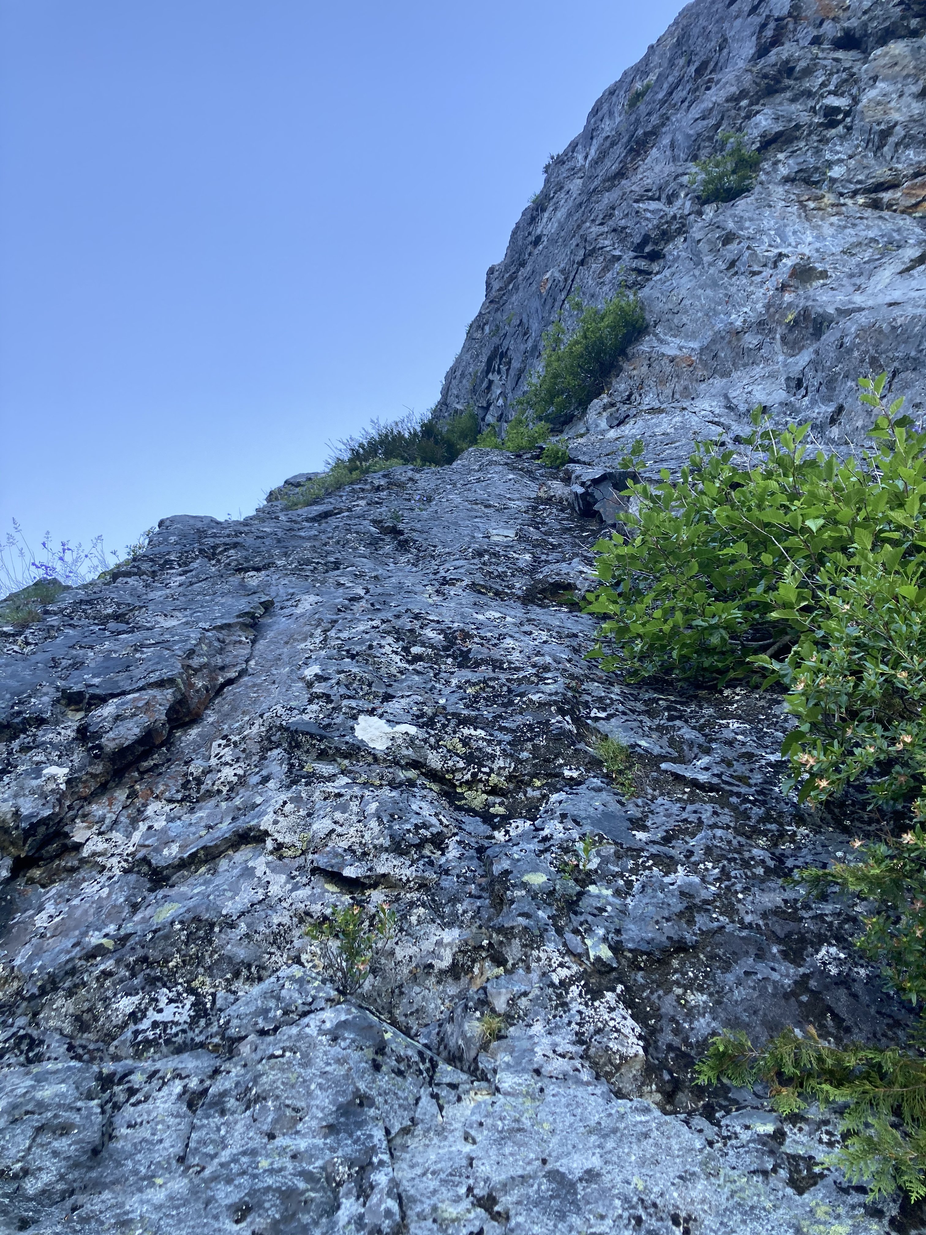
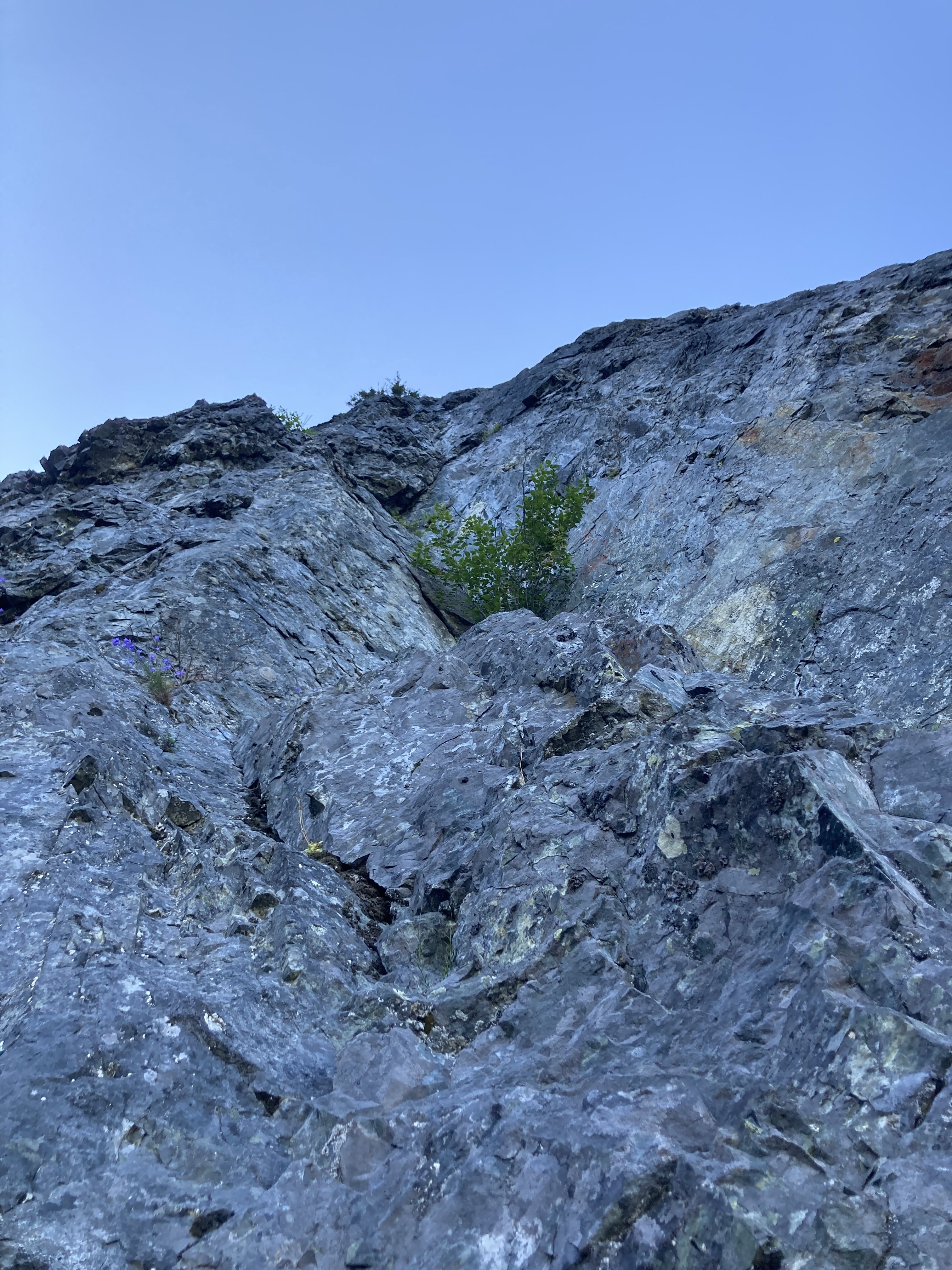
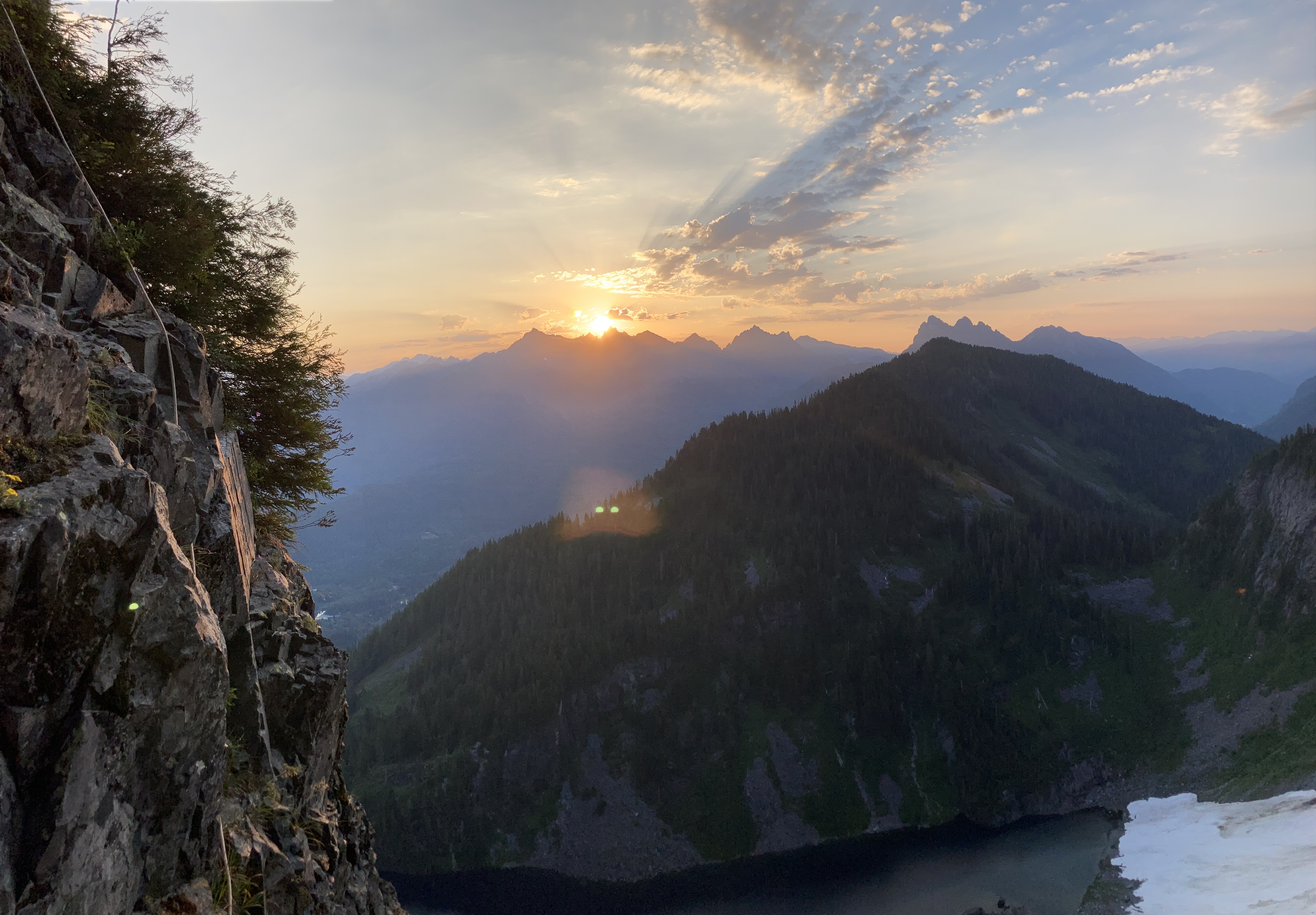
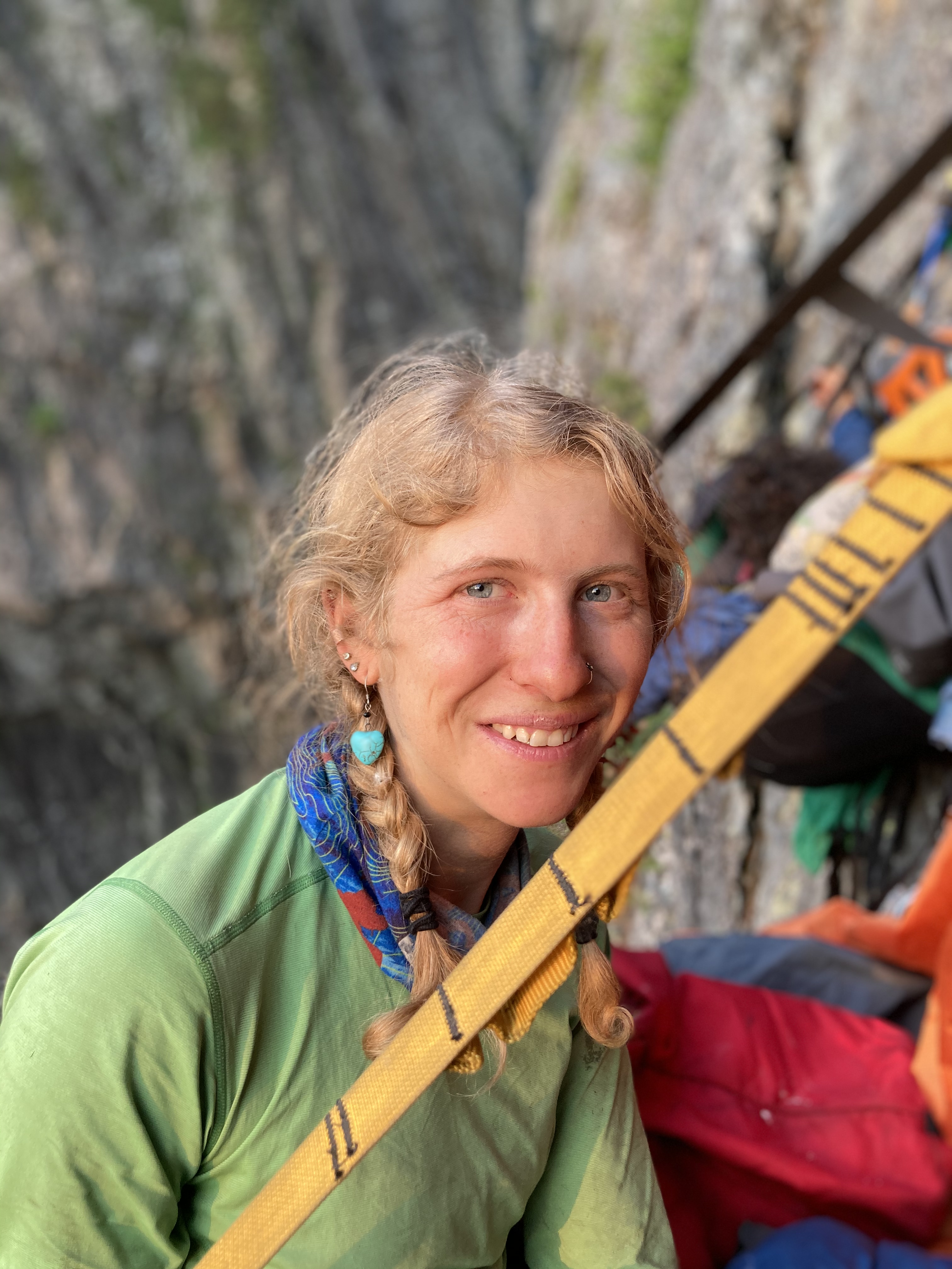
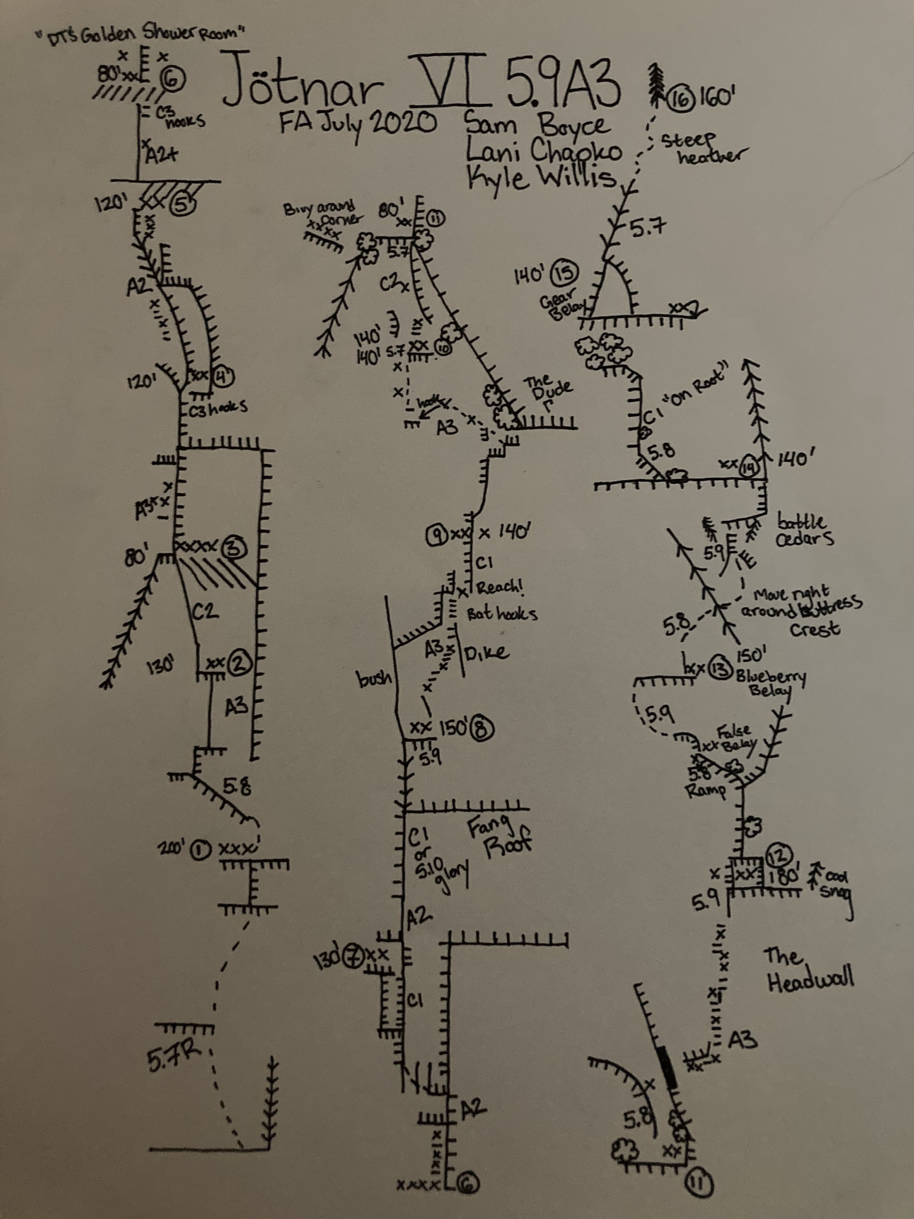
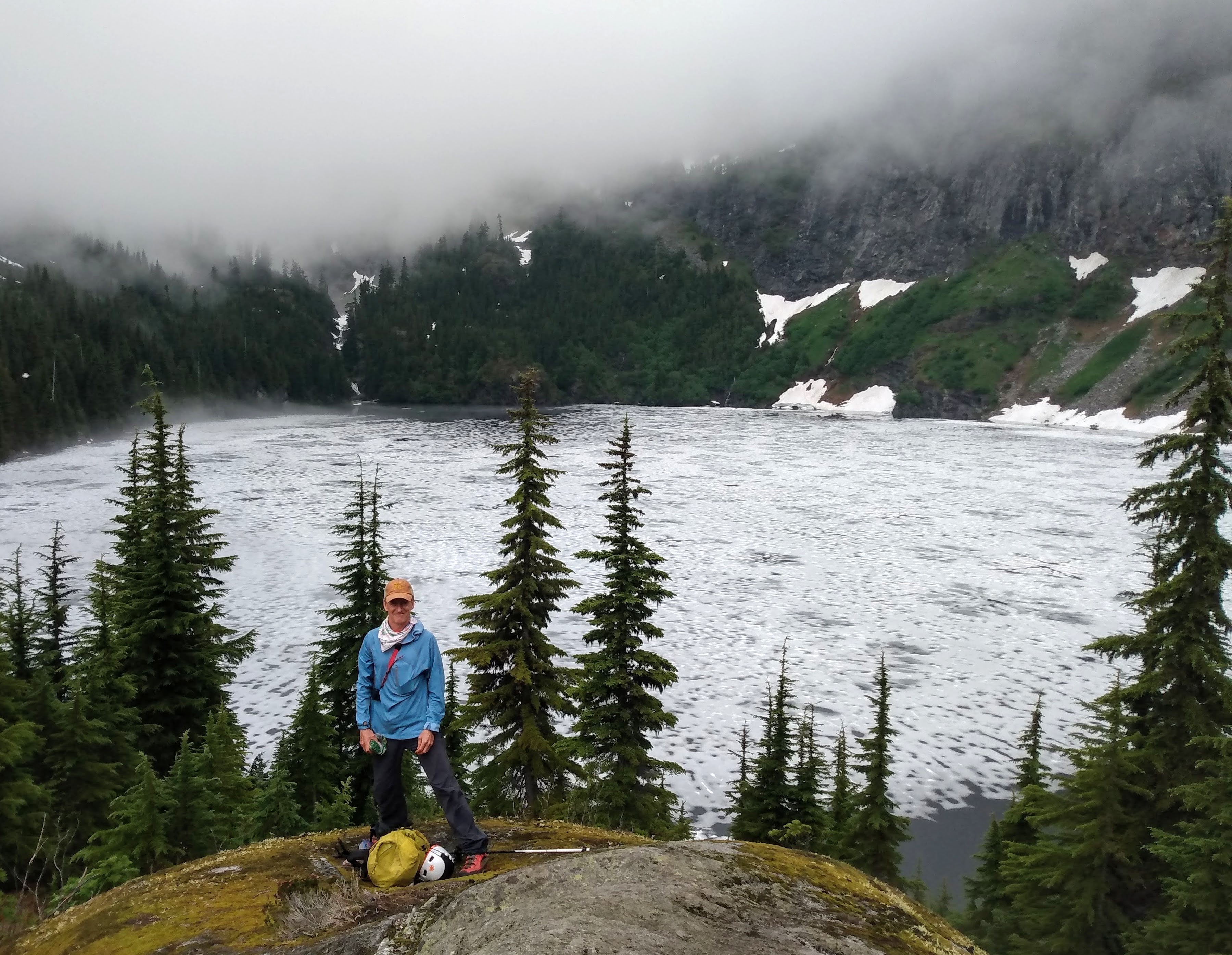
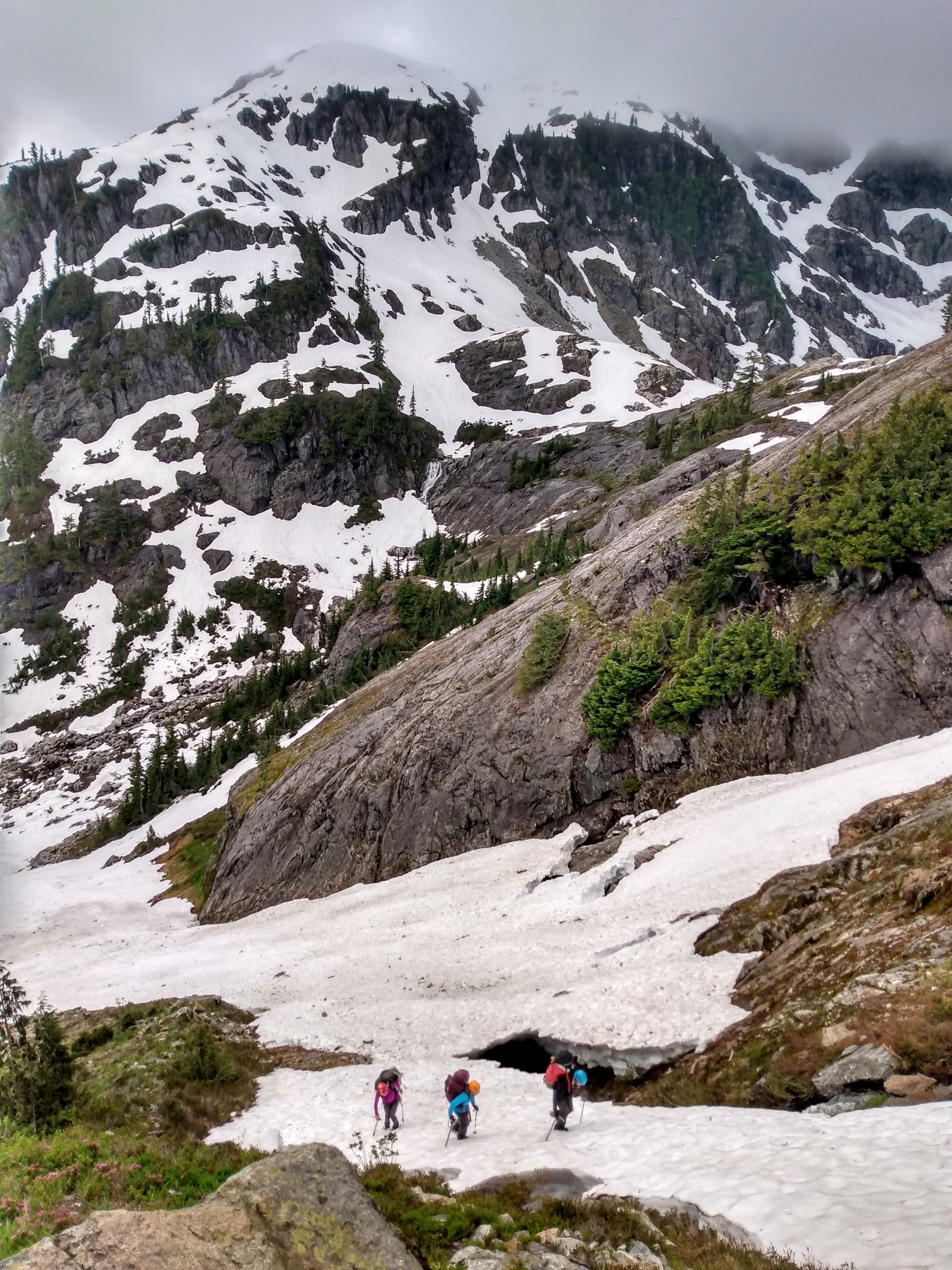
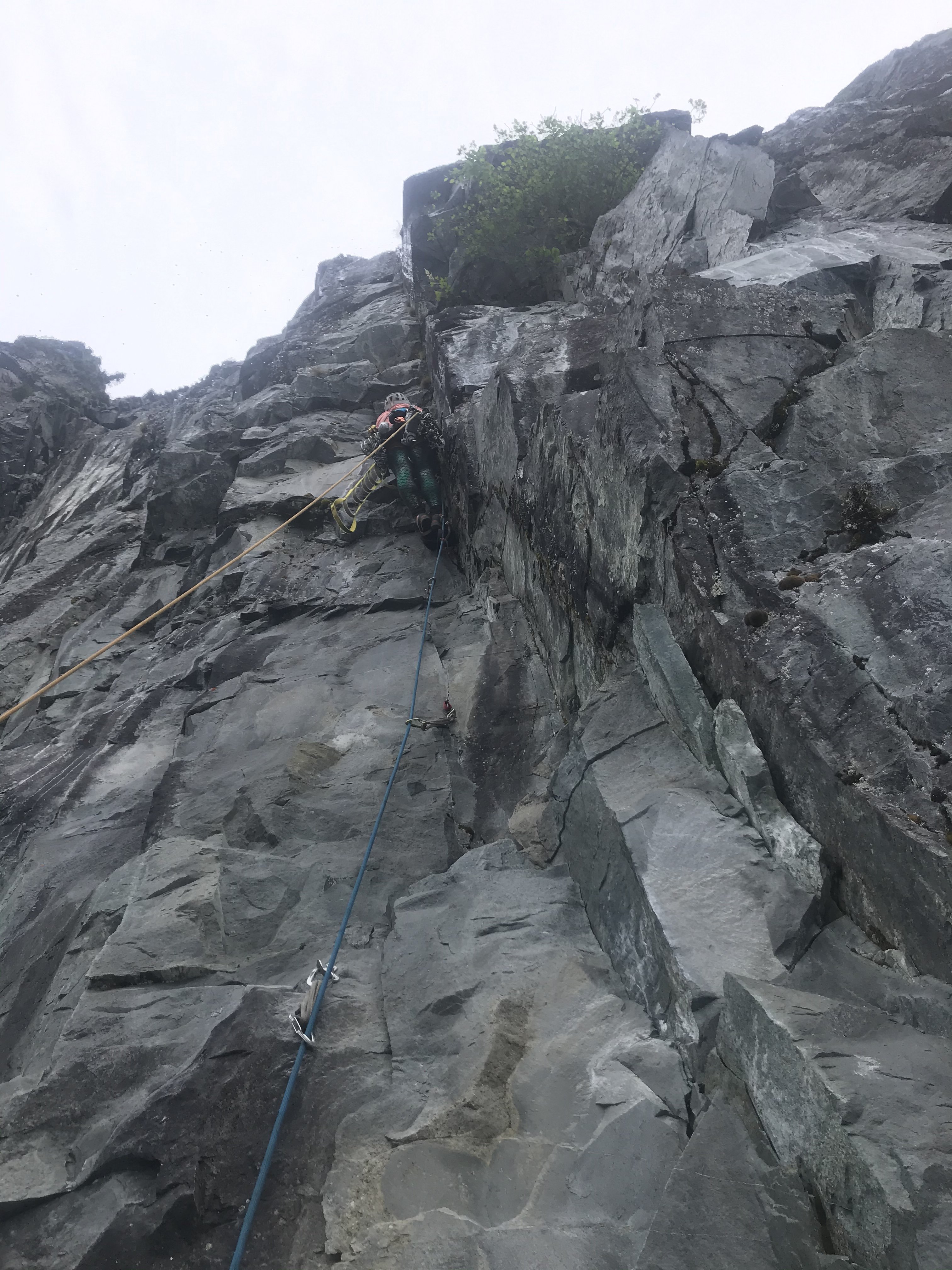
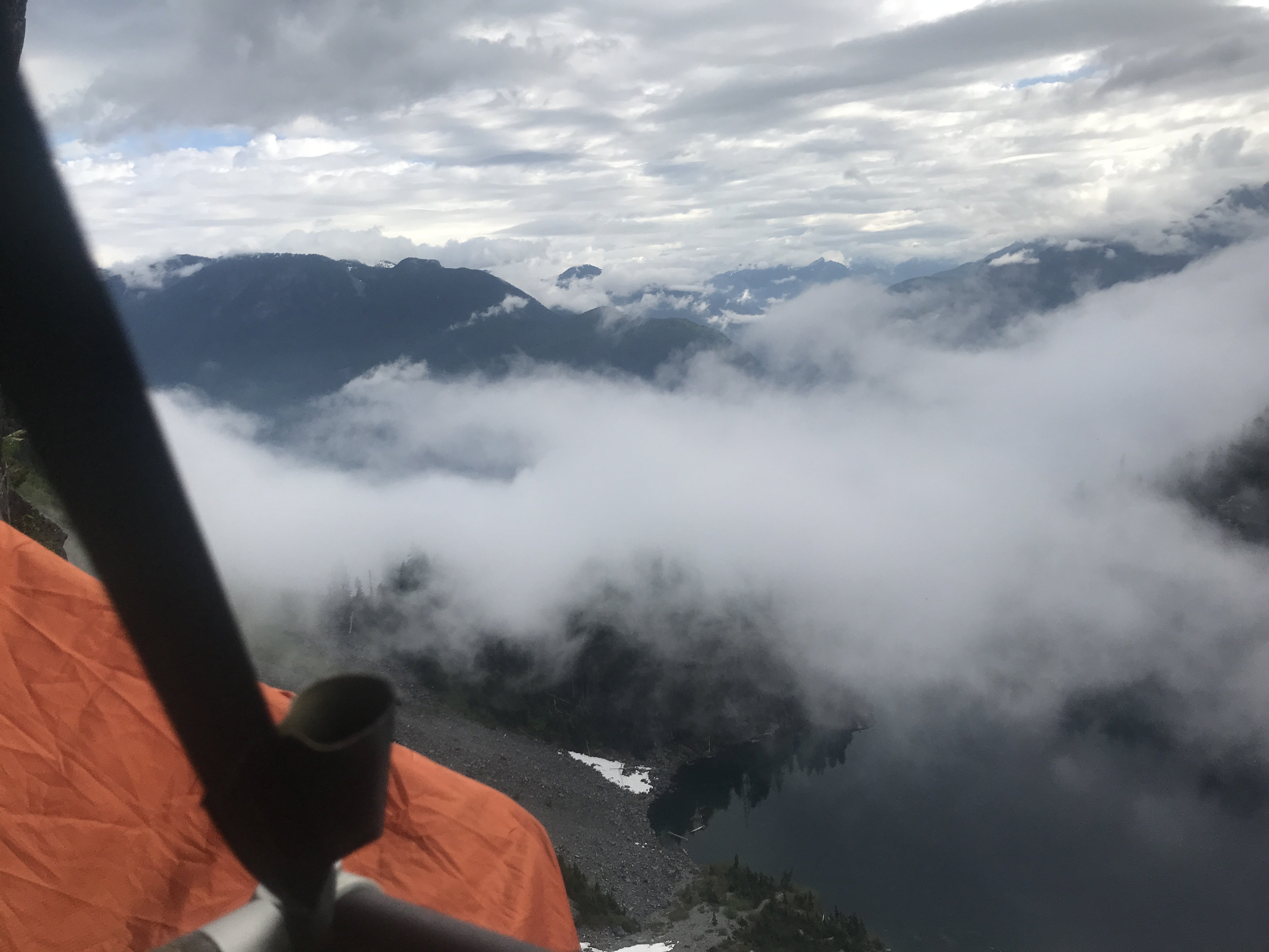
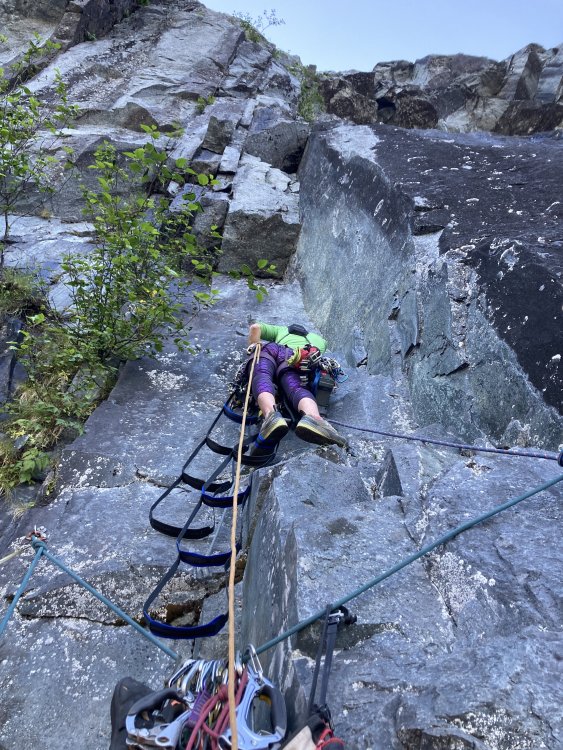
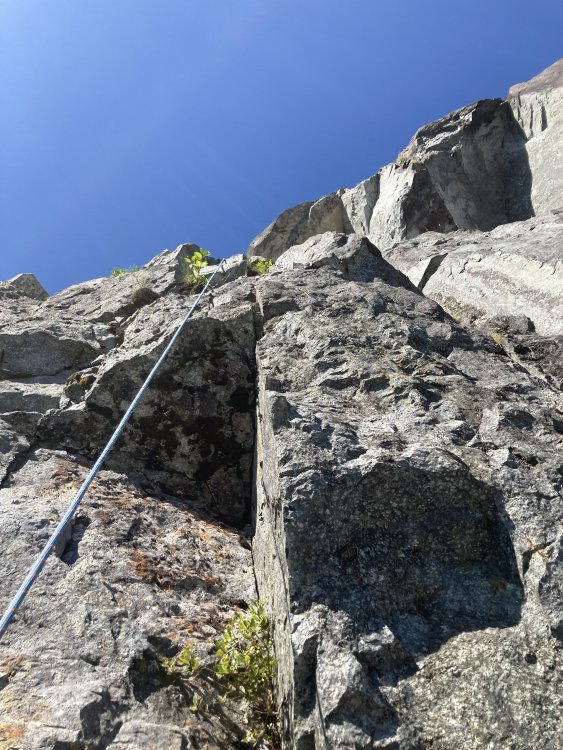
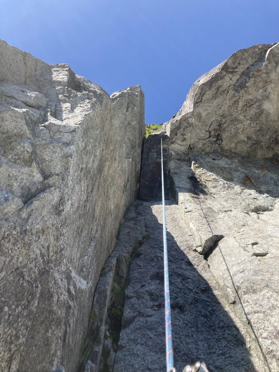
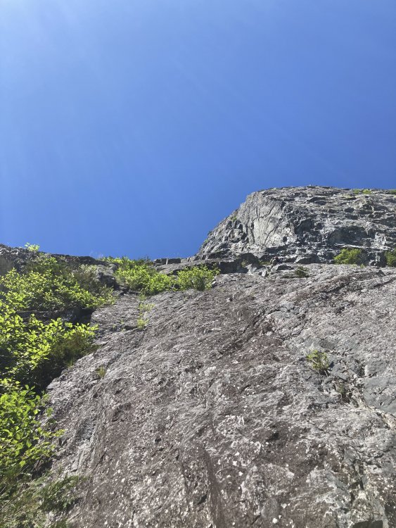
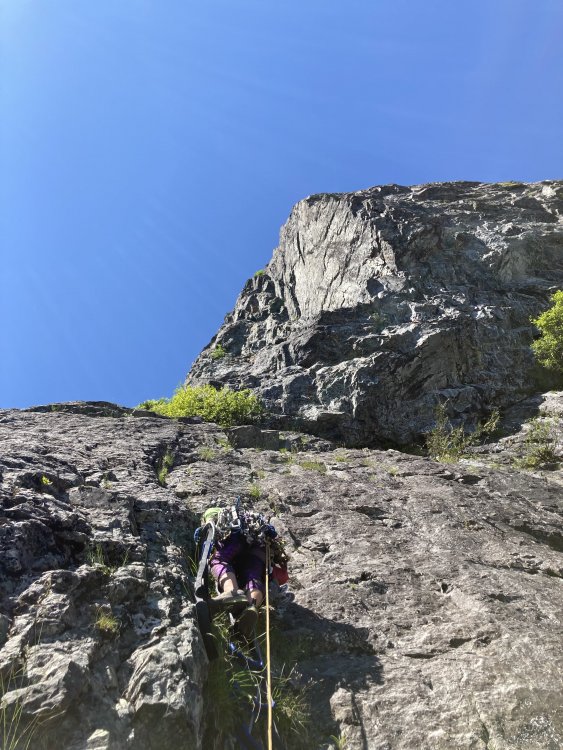
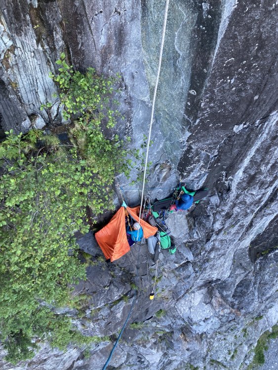
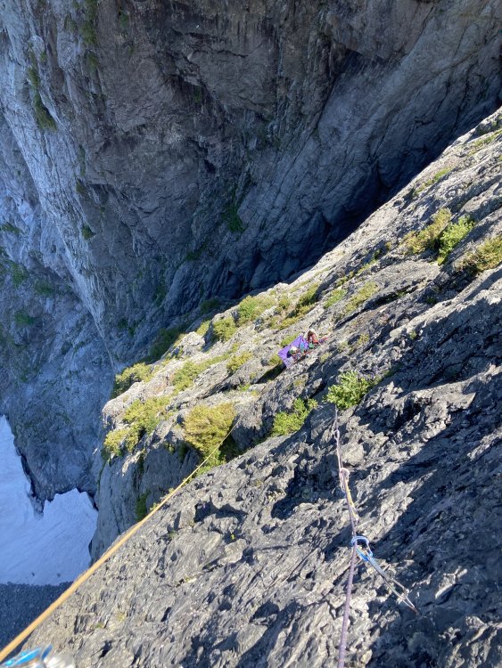
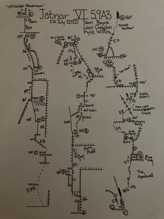
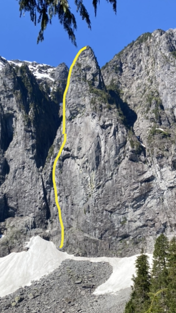
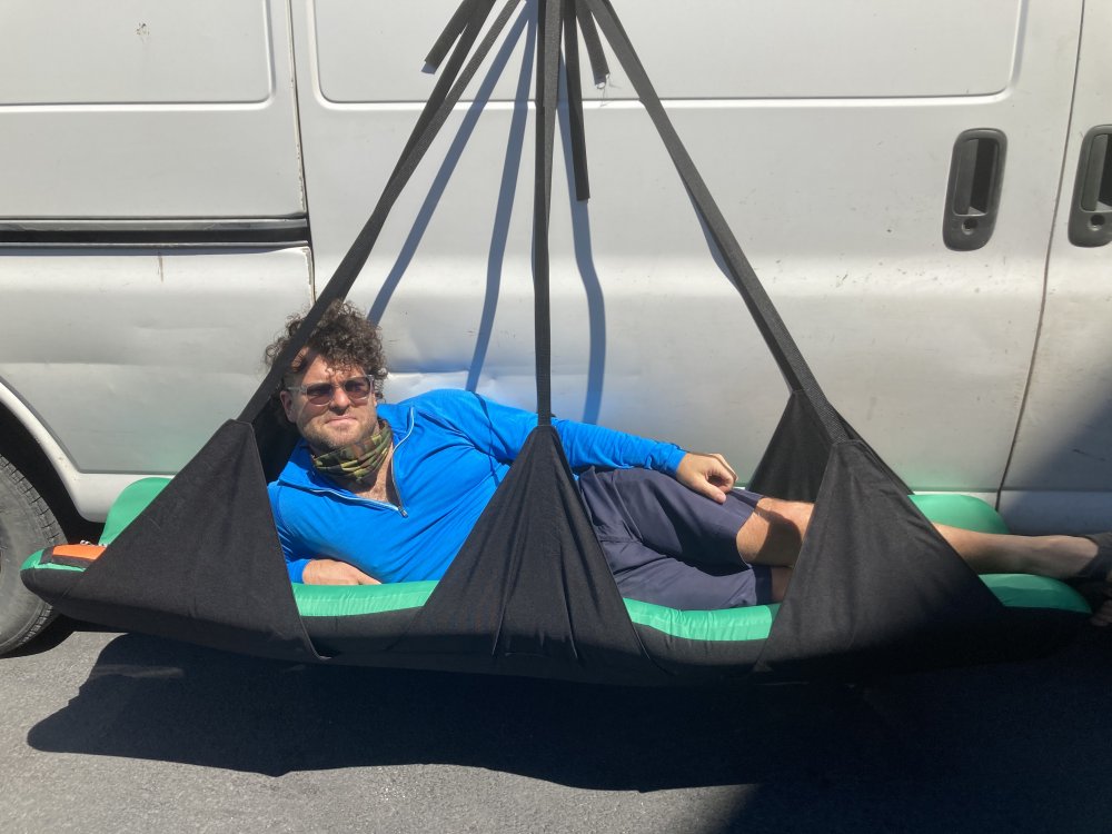
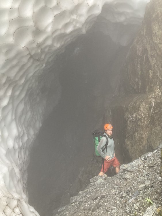
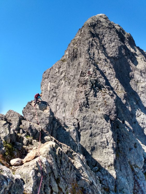
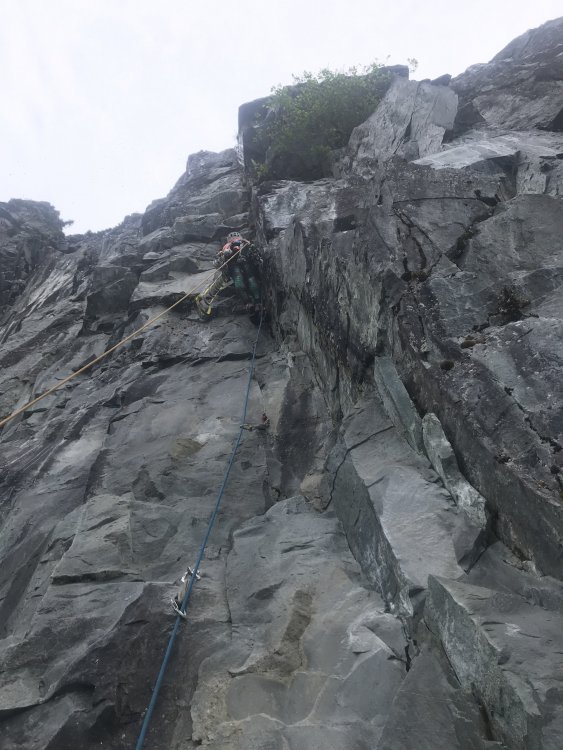
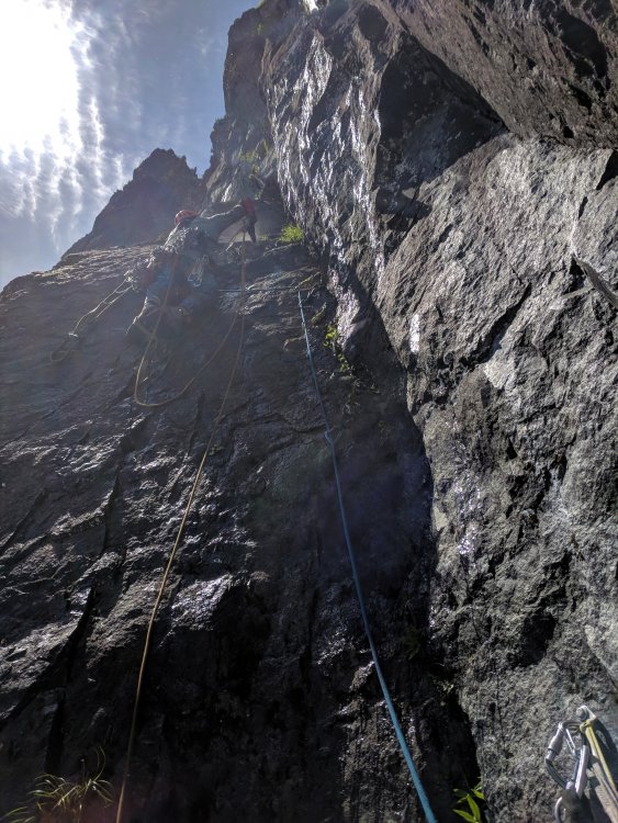
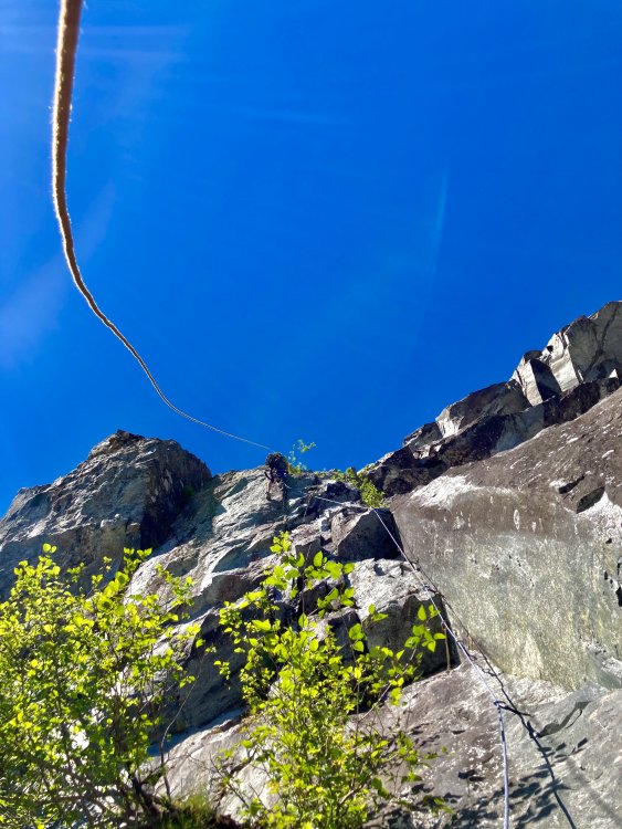
Trip: North Norwegian Buttress - Jötnar VI 5.9 A3 Trip Date: 08/01/2020 Trip Report: Whaddup maggots. The crew of vagrants and miscreants just got down yesterday from north Norwegian round 2. We completed our line to the top of the buttress. We spent 1 day fixing back to the high point then 6 days on the wall climbing in capsule style to complete the route. We are naming the line “Jötnar”, the race of god-like giants in Norse mythology. We unofficially started calling the Norwegian cirque Jötunheim, “the realm of the giants”. While only having one line up there might not give us “authority” to name something, I’m enamored with the zone and like the name, and no one else has to call it that... anywho, here’s a brief report of our experience, hopefully this inspires someone to follow in our footsteps, as it’s an incredible route. In June, we made our first foray onto the wall and found soggy conditions as our route runs through a water streak for a good portion of the lower buttress. Poor weather lead to poor conditions, if you read my previous trip report, you’ll remember we did not get far. In 4 days of climbing we completed about 700’ of the line. We left gear stashed with the intent on returning. Our window of time off about 3 weeks away. Prep for the route started a few days before our departure date. I headed over to kyle’s studio (For his gear business “high mountain gear and repair”) in Ballard to make some various things. One of those being an inflatable big wall hammock that we had been discussing in recent weeks. Kyle would test it out on this wall, likely the secret weapon for big wall alpine routes in the cascades. Kyle came up with the name “Taco” as a mockery of conventional portaledges. After making various things for the wall we set out on our own errands the next day then reconvened to shuttle a load up to lake serene. Fetching water was considerably easier than last time, the moat had opened enough to walk inside, being a whiteout day we decided it was safe enough to brave for 15 min to get water (better than hiking back to the lake!!) After unwrapping our gear stash we discovered a snafflehound gnawed on a rope! The backup lead line nonetheless. Another rope was needed, the volume of rope was becoming absurd. We told Lani to pick one up on her way down from Bellingham. Logistics here got weird. Kyle had commitments in the form of a bike packing trip during the start of the window we had to climb. So when Lani and I started climbing we would have to leave lines fixed to the ground for Kyle to use to join us two days into the climb! On the first day we got a ride to the trailhead early morning and moved with motivation all Day to fix lines the the high point on our route. The line climbed substantially better because of the cleaning we were able to do previously. Fixing high on the wall we descended to the base that evening to sleep on the ground and prep the load to haul. We woke up early again and started the manual labor. Moving faster that expected we were able to haul to the high point and get camp set up around mid afternoon. Plenty of time to start up new terrain. Lani started up the next pitch which would prove the steepest on route. She got about halfway up the pitch before deciding it was time for dinner. On day 3 she headed up the pitch and pulled through the massive steep band that blocked our view of the upper buttress. This would prove to be the only pitch that requires a fixed line for descent. I took over the lead on the next pitch and found cool expanding beak cracks that lead up to a surprise! We pulled into a band of bulletproof skagit gneiss that would run the whole middle part of the route, immaculate stone. I climbed up into a massive right facing corner and up an amazing #2 crack through the second massive roof on the route “the fang” as we had pre named it. Continuing up an easy flare I found a good stance at the base of a large slab. Lani was still feeling mega tired from the steep lead and told me to keep going, I quested upwards on the slab utilizing a mixture of hooks and rivets to reach a dike that proved discouragingly shitty. The dike however led to a good flake that rapidly turned not so good, the whole corner was a Jenga stack. Being on lead I reluctantly bat hooked the face around the choss. These bat hooks could maybe be avoided post cleaning, still chossy and expando in there though. I eventually put a bolt in to reach far and tension to the next small corner, which proved to be cruiser C1 to a good stance for a belay, post dirt removal this would likely be sweet 5.9-10. Here I called off belay while placing the anchor bolts and Lani zipped down to camp to start dinner. Meanwhile Kyle had started up the wall hauling the second half of the load solo, having to haul twice he only got to the bivy at pitch 3 and would camp here. Day 4 started with shenanigans to situate the ropes where they needed to be in order to fix higher. After we were able to snag an independent rope Lani and I again began the commute up the fixed lines to push the line higher while Kyle hailed up to camp. From the high point, Lani led up Inobvious but moderate aid to the crest of “the dude”. The biggest roof on north Norwegian, and an intimidating mega overhang. Incipient and creative low angle A3 led up and left under the roof and around the bushy corner to a small ledge. Reaching this ledge we figured we were far enough up to move camp, and thus Lani went down to assist Kyle in starting to haul while I started soloing the next pitch to the intended next camp. About halfway up my pitch I got a call saying there were technical difficulties at camp, we decided to reestablish camp and fix to the top my pitch. Day 5 would start super early with the big move. Myself and Lani would double counterbalance sky haul the pigs while Kyle cleaned the line below and brought up fixed lines. A few hours of hot manual labor brought us to the high point ledge. A grassy inset which seemed suboptimal for two portaledges, we spotted a good spot left of the buttress crest and concocted a creative plan to swing the bags over. I free climbed up to the top of a flake and put a good bolt in and lowered down (clipping the haul line to the bolt) to the intended spot. I drilled while Kyle and Lani prepped the bags. Once ready I took tight on the haul line with my gri gri and they kicked the bags over top rope style to me where I lowered them in place and docked them at the anchor. Shenanigans. After setting camp up I hugged up to my high point on the pitch and continued my lead. “The head wall” proved to be wicked exposed but I had to fight the features pulling us left into the chossy chasm and drill my way to a stunning corner on the buttress crest. Kyle and Lani came up to join me and Kyle started up the next pitch. Moderate free and aid led up through a tree to a roof. An inobvious ramp cut out left through some chossy bush. Kyle bulldozed his way up eventually running out of patience and drilling around some dangerous choss. Running low on daylight Kyle threw in a belay and called it a day. Day 6 started with a poor decision, only one gallon of water came up the wall... after jugging we were already dehydrated but didn’t think too much of it. We started on the e face and got good afternoon shade but the upper part of the route climbs the crest of the se ridge, and gets blazing sun all day. I got the the high point first and in the spirit of decluttering the tight stance I started free climbing. 50 ft up I hit an awesome ledge too good to pass up, so I added an anchor and moved the team up. Kyle in the mean time cleaned the previous bit to a state of being semi pleasant climbing!! At this belay our peril became evident, we were already spiraling into gnarly dehydration. Kyle was getting loopy, Lani unstoked, and myself crankerous. I would continue up with inobvious route finding. A long circuitous pitch of steep 5.9 led to another good albeit sun exposed ledge. We were closing on the summit, Lani encouraged me to keep leading while Kyle cleaned the route. A blueberry filled corner provided passage to the next tier, a pitch likened to the tree climbing on j berg!! One more mega ledge and we could smell it! A casual pitch of 5.7 led up to a short bit of heather clawing onto the summit of the buttress. We had read that it was easy climbing to the summit of middle index from here and it looked so. It also looked like a bunch of cascadian bush mank that seemed like it would taint our experience in our state of dehydrated madness. We descended to camp to smoke the joint we found in the parking lot and contemplate our descent. One or two puffs in I had this idea to lower Kyle with the bags down the whole face. We all became (mostly) convinced it would work and put wheels in the motion the next day. After wranglin the bags back to fall line we descended two pitches to the intended “drop zone”. We delicately stacked 1000’ of rope joined with edk’s, we would would bump em all through a munter. Kyle and the bags were probably closing on 400 lbs, we needed a gri and munter to control the load. The lower went smooth, and we were amazed! Bags were down!!!! So myself and Lani dropped all but two ropes down the face and Kyle started managing the clusterfuck. Our new friend River had responded to a Facebook call for porter help and met Kyle at the lake to take down 50-60 lbs of our load while me and Lani rapped the face and cleaned our gear. We touched down not too long after and started the soul crushing hike down, we had about 70-80 lbs a piece. I had called my parents again as it seems like all our friends are busy this time of year, they met us at the parking lot with a cooler of cold bubbly, fucking great climb. Shoutout to Lani for stoke, Kyle for his undying willingness to suffer and commitment to the manual labor and route creation, and River! For being willing to come up and help total strangers hump our stinky clusterfuck around. This route was certainly the effort of a village, and a wonderful big wall line that I hope people enjoy. Gear Notes: Double Rack micro to #4, Single 5, Single set of offset nuts (didn’t use rp’s), 4-5 each beaks, 2 small lost arrows, 10 rivet hangers. All bolts and rivets are stainless, one or two bolts didn’t take well in the wet mud, but could potentially be reset with a funk and tightented (all anchors have at least 2 good bolts). Some may need to be tightened up again after initial loading. No ledges big enough even for 1 to sleep, good portaledges camps at the top of pitch 3,6,9, and 12. Do not haul above 12. Bivies at 3,6, and side of 11 take 2 ledges well. Rap the route, some directionals need to be placed on a handful of pitches to get down, pitch 7 needs to remain fixed with an extra 35-40M rope (it could be possible to down aid the roof on rappel to get back to the previous anchor) Approach Notes: Scamper to Lake Serene while the tourons ask about your “paraglide” or “boats”. Easy talus walking to near the waterfall between the buttresses. Enjoy your stay in Jötunheim!


 1 point
 -
Trip: South Sister - Up-Down-Swimmin' Around Trip Date: 08/05/2020 Trip Report: Tyler and I had a really fun day out on and around South Sister, full of: walking, trotting/cantering, scree pawing, scree skiing, boot skiing, serious-ass-abrasion glissading, lake swimming, shoe-emptying, and only a small amount of shivering. We went up the south side trail in good time, did the apparently-mandatory loop around the crater rim, slid down the NW side, and swim-traversed* nine lakes. Carver Lake, our last one, numbed our throats and we were very very glad it wasn't wider to cross. We got back on trail on the NE side of the mountain and looped back around to the car (distant thunderstorms with lightning provided some entertainment). A bit under 11 hours round-trip. *Depending on size of lake, air and water temperatures, and level of stoke, we fully swam across a couple of the lakes, while we swam across sizeable or not-sizeable corners of others. Photos that don't have Tyler in them: photo credit to Tyler. Also, route name: credit to Tyler. First lake, pre-summit, was fantastic! Gear Notes: Dorky running vest was pleasant to hike/run and swim in, but dry bag was essential for electronics and jackets. I opted for no poles, so gloves were great for the scree descent. "Crossover" pavement-trail running shoes actually worked well, not too much sloshy foot stuff or any hot spots. Goop was key. Ankle/baby gaiters would have been great for the scree.... Approach Notes: South side/Devil's Lake TH1 point
-
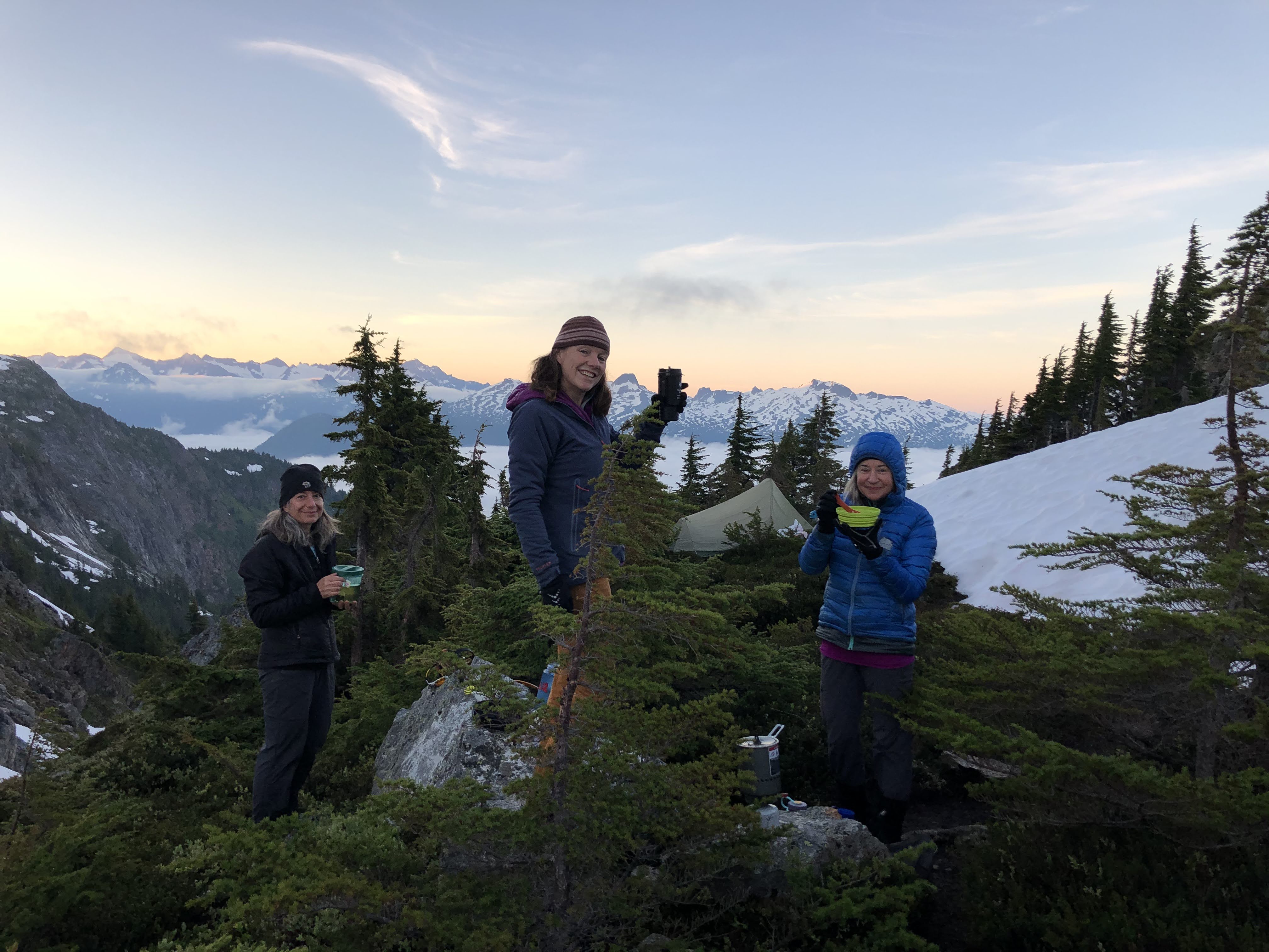
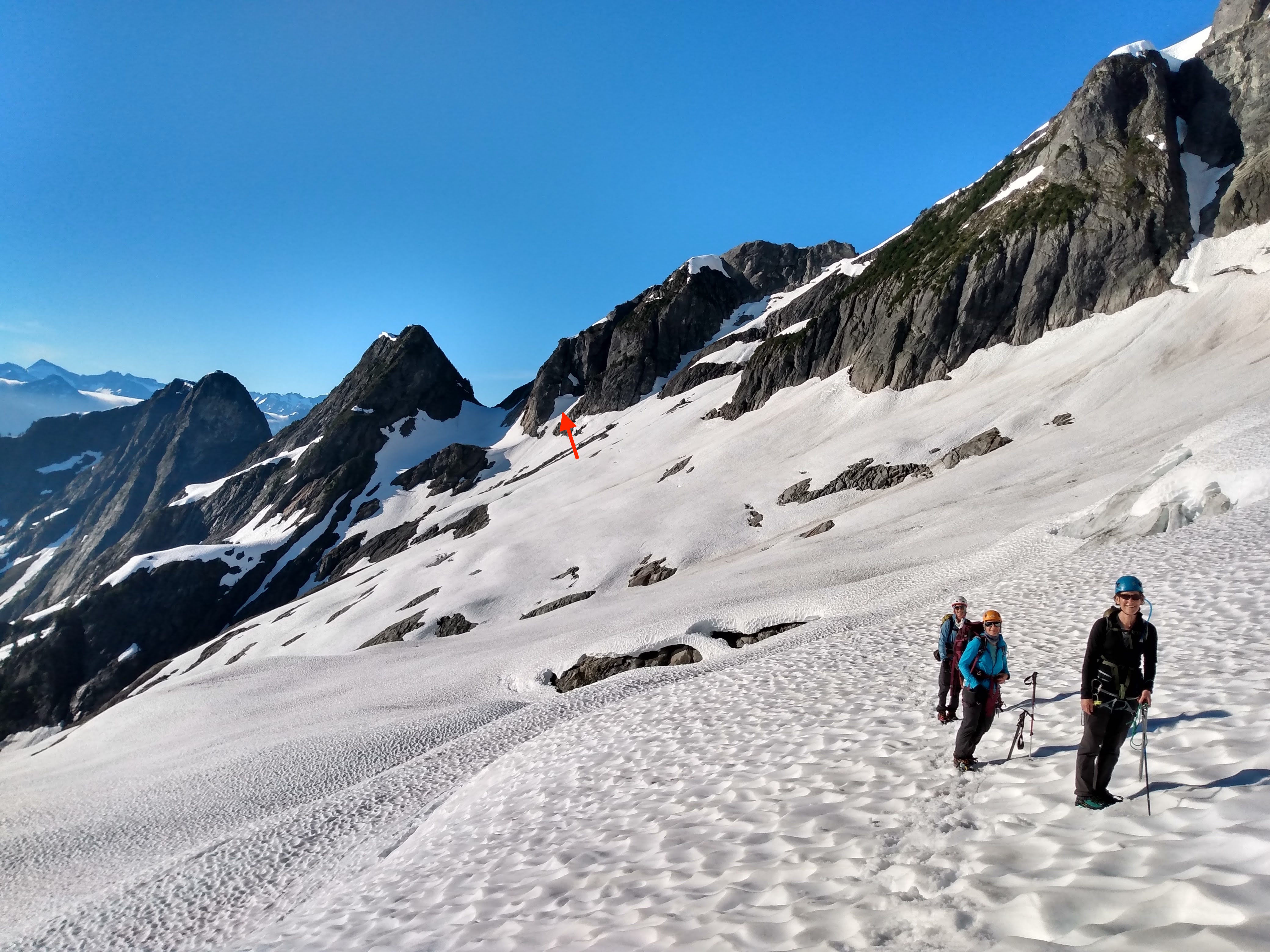
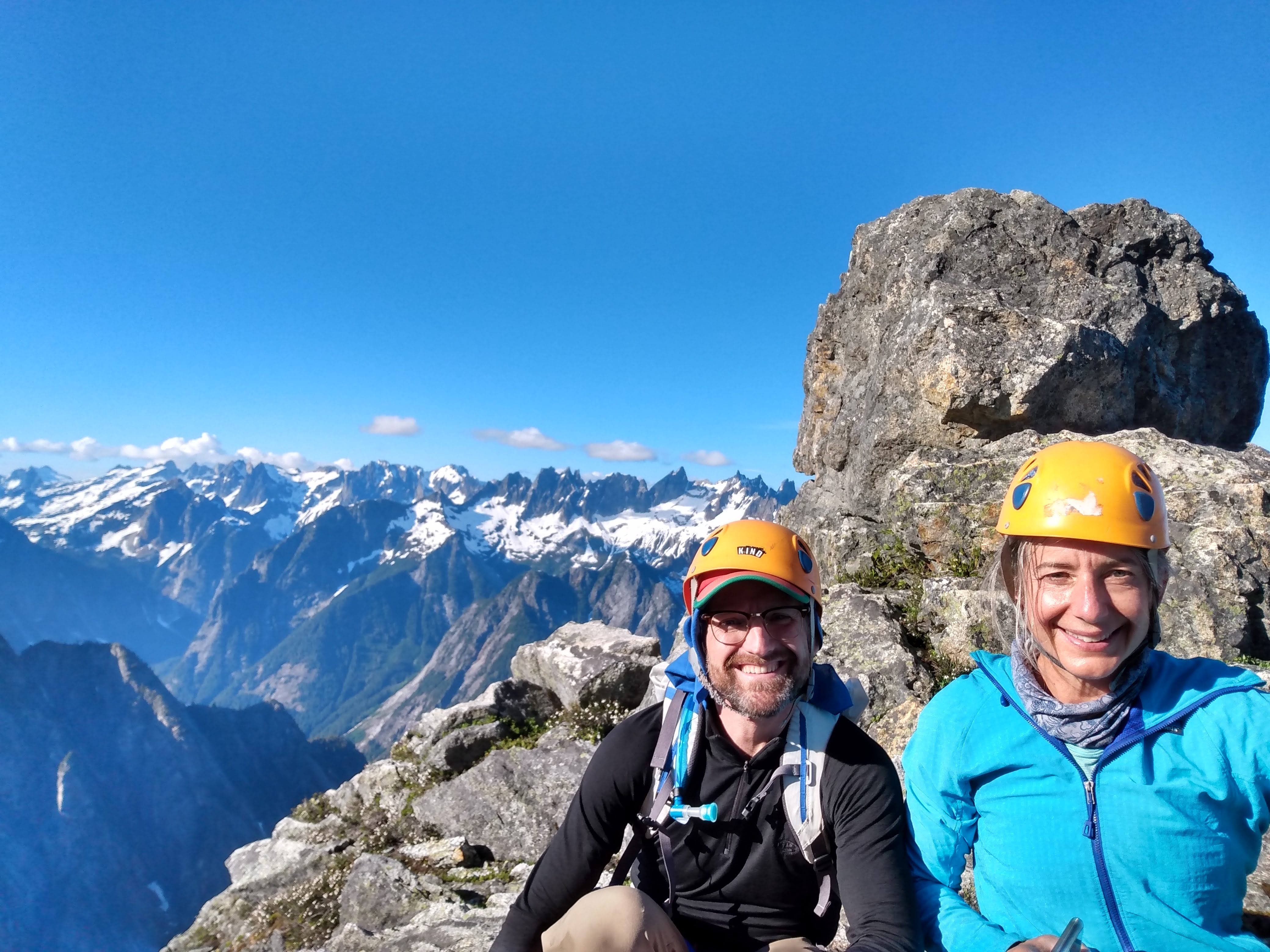
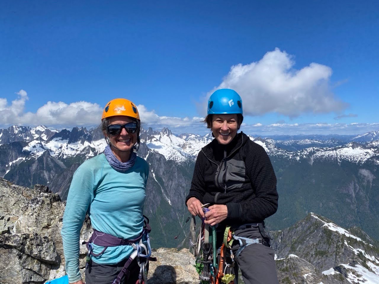
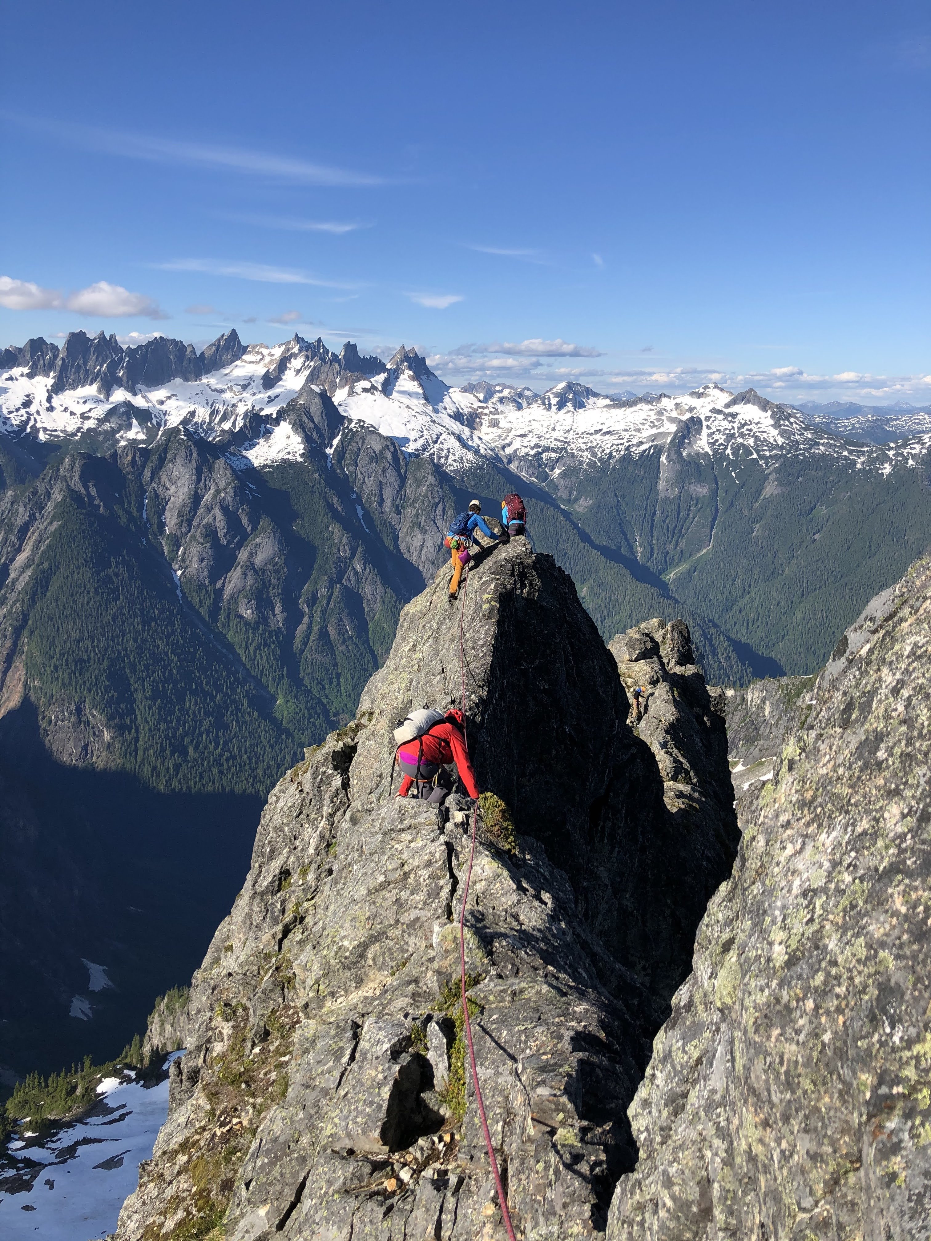
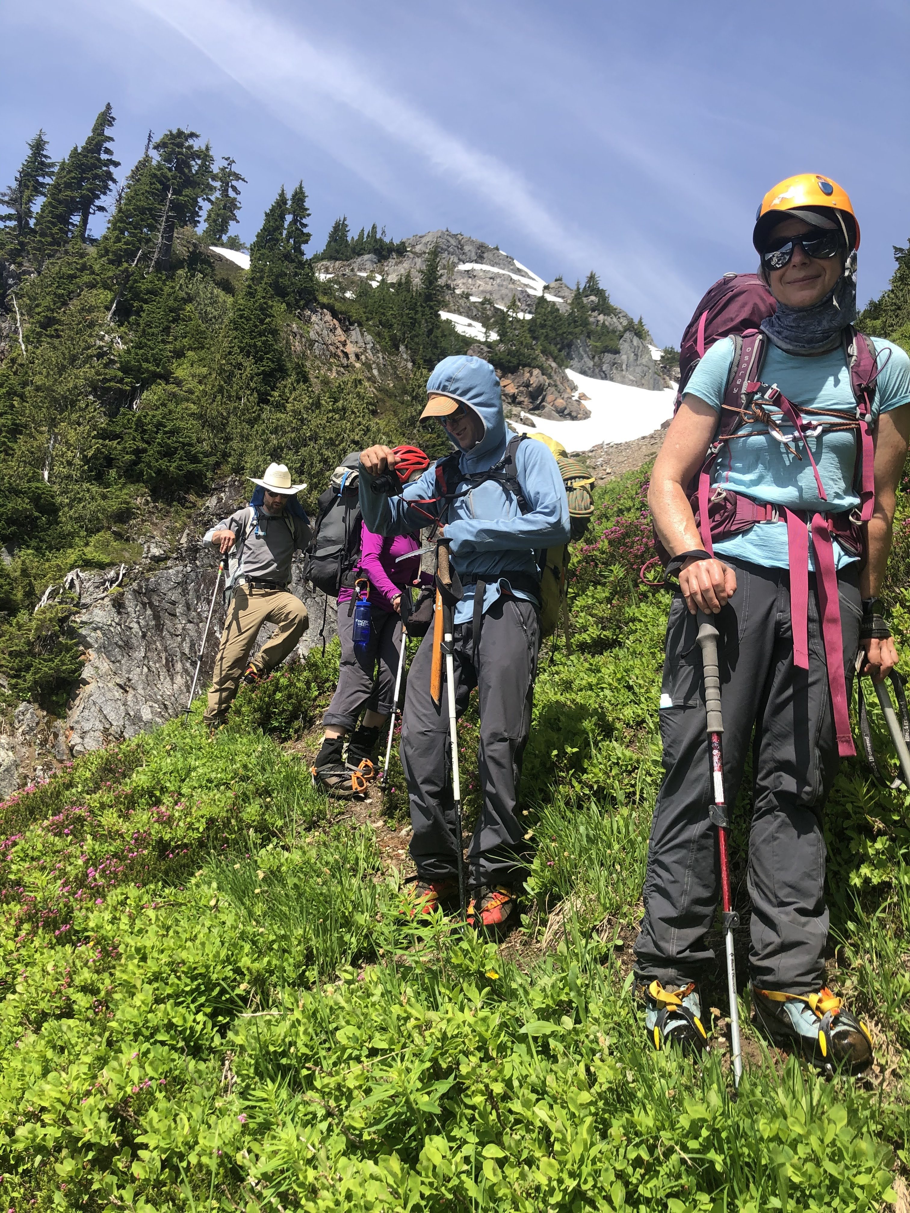
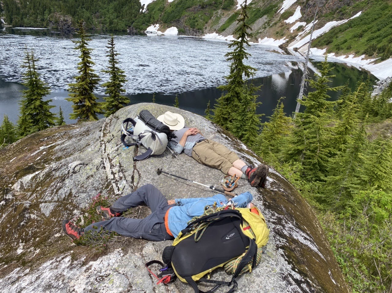
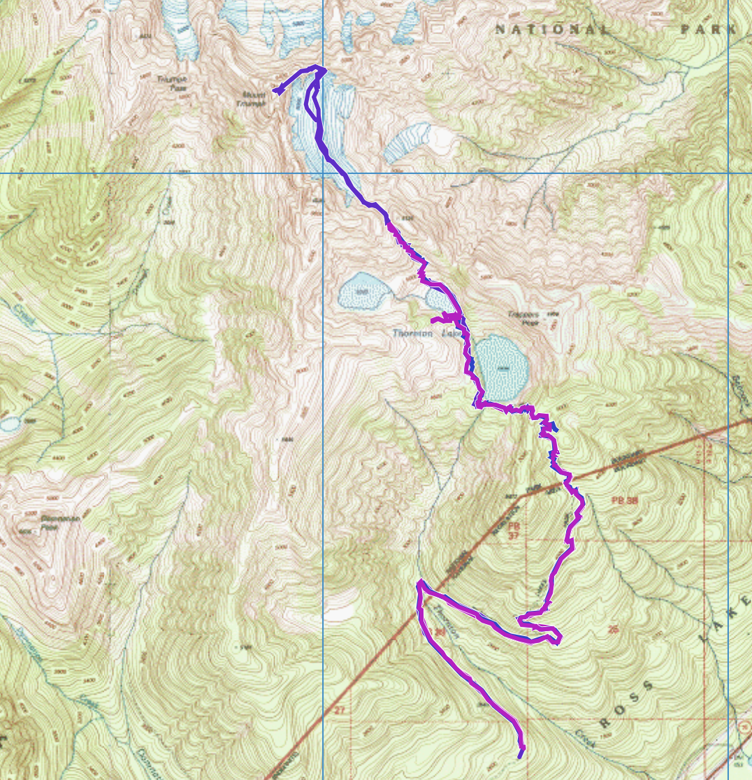
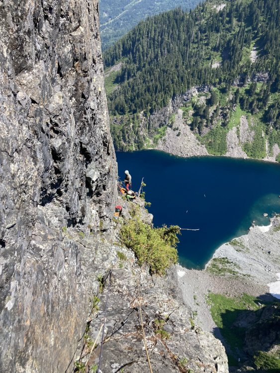
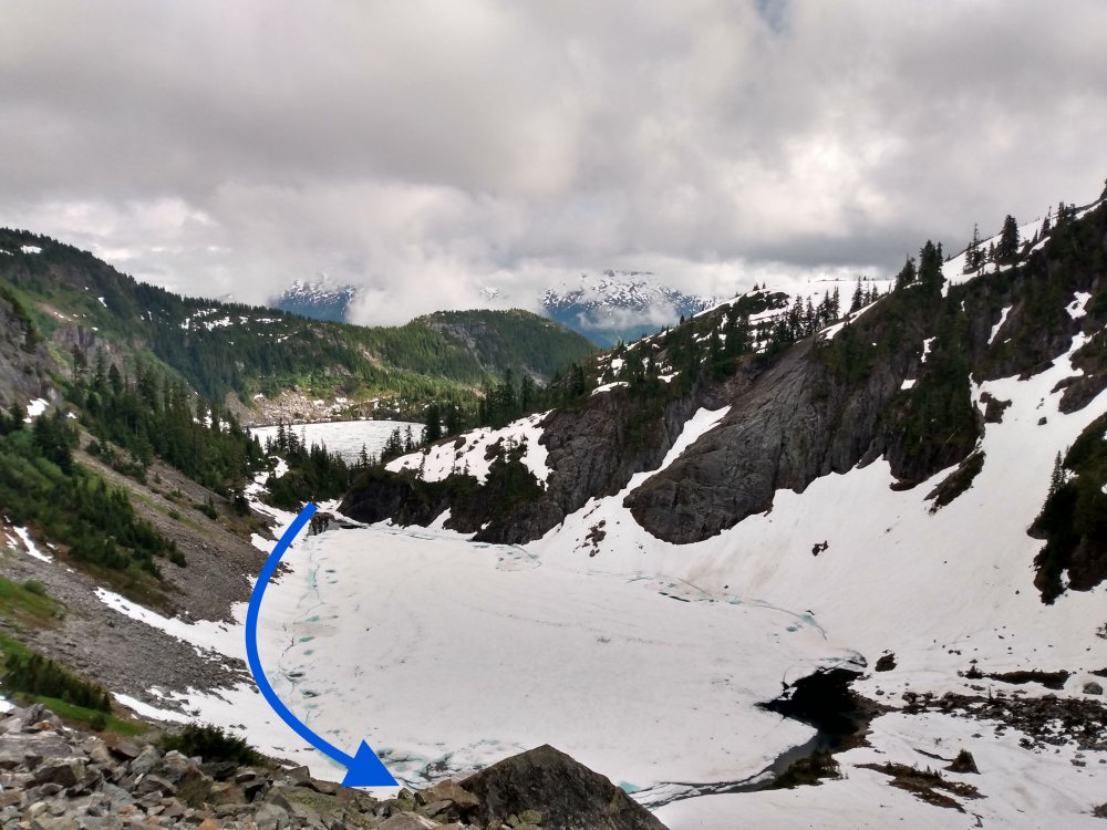
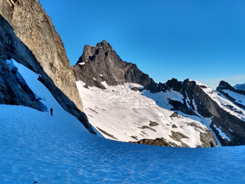
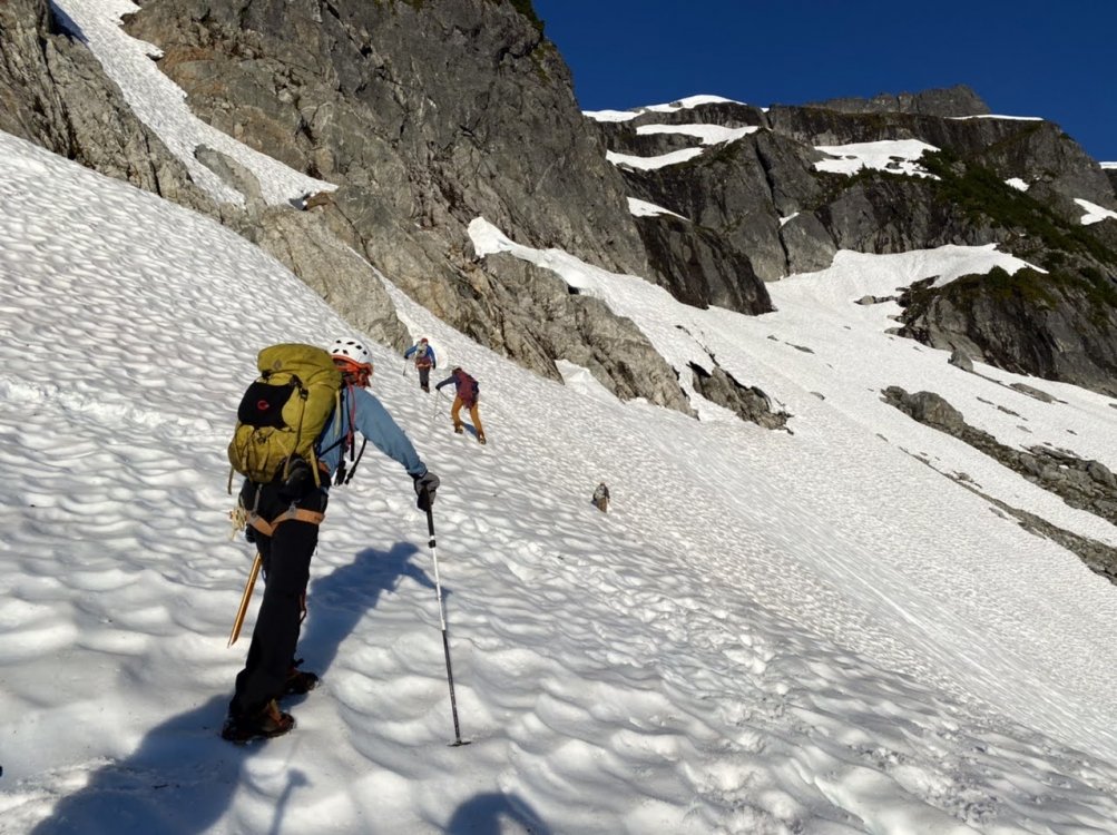
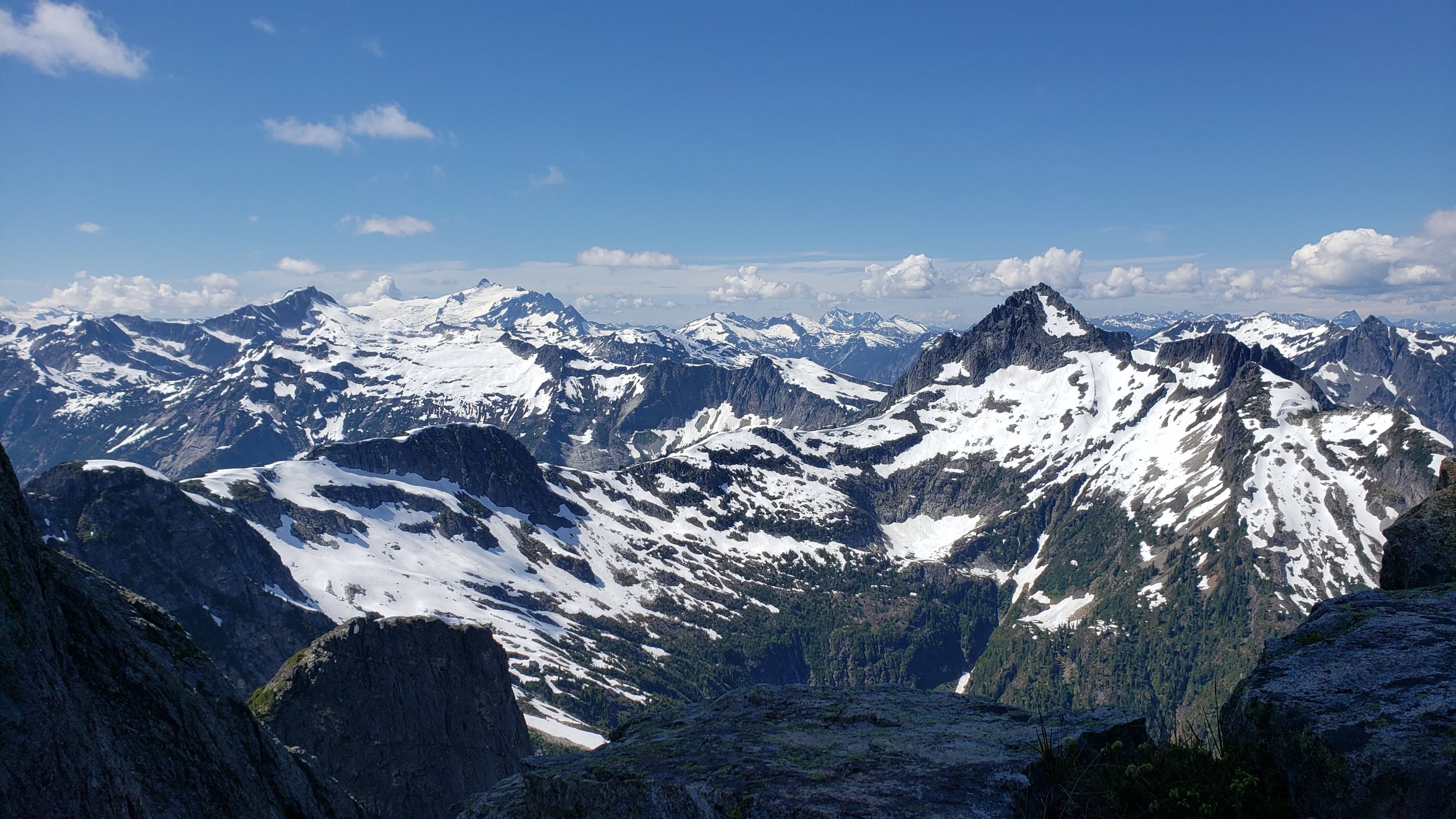
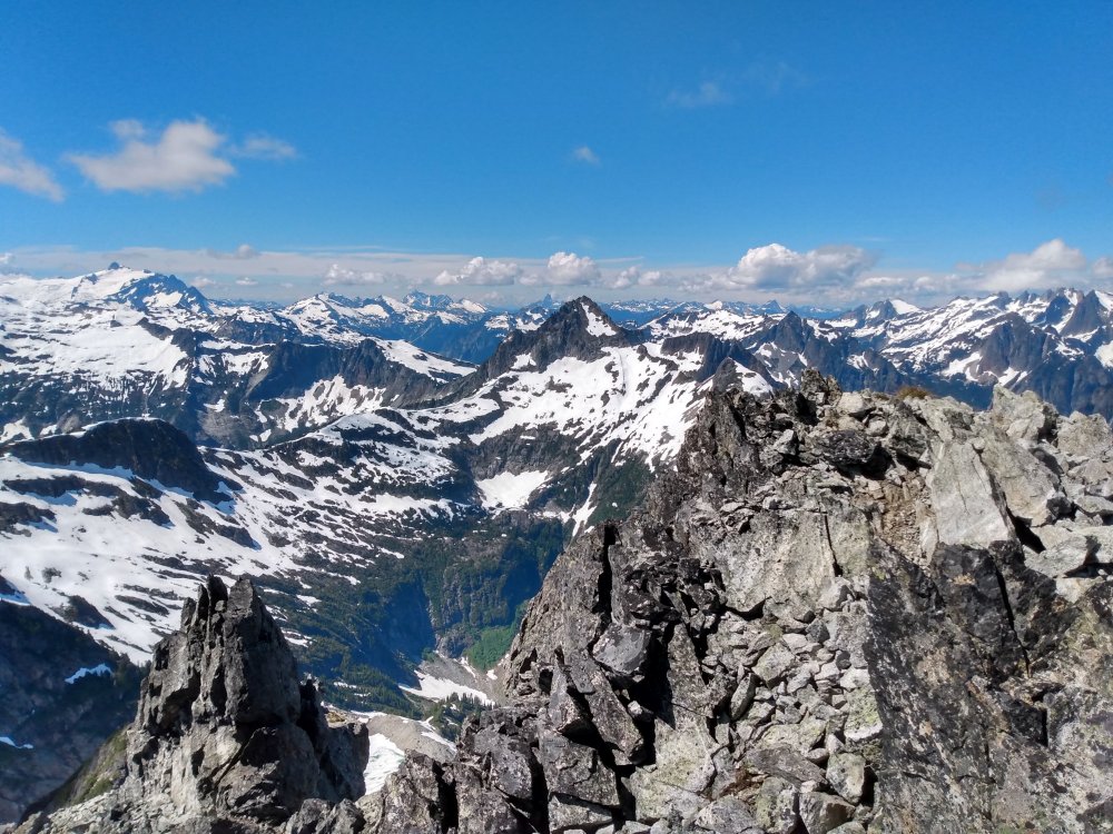
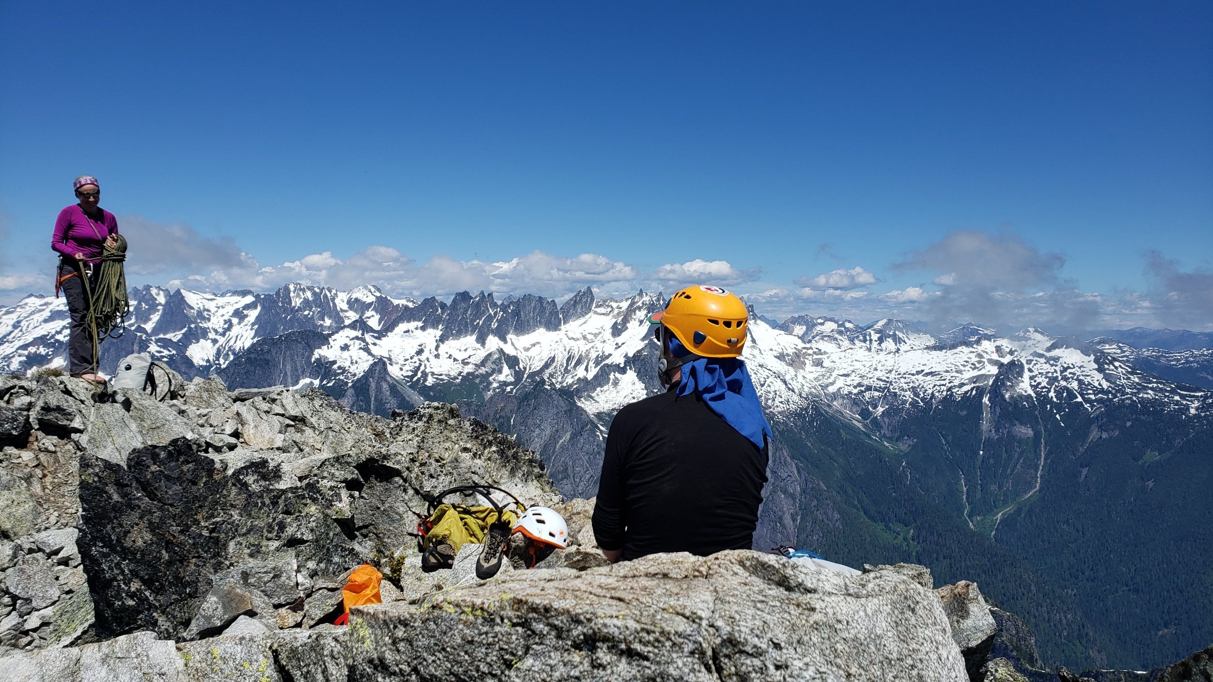
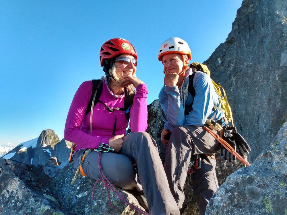
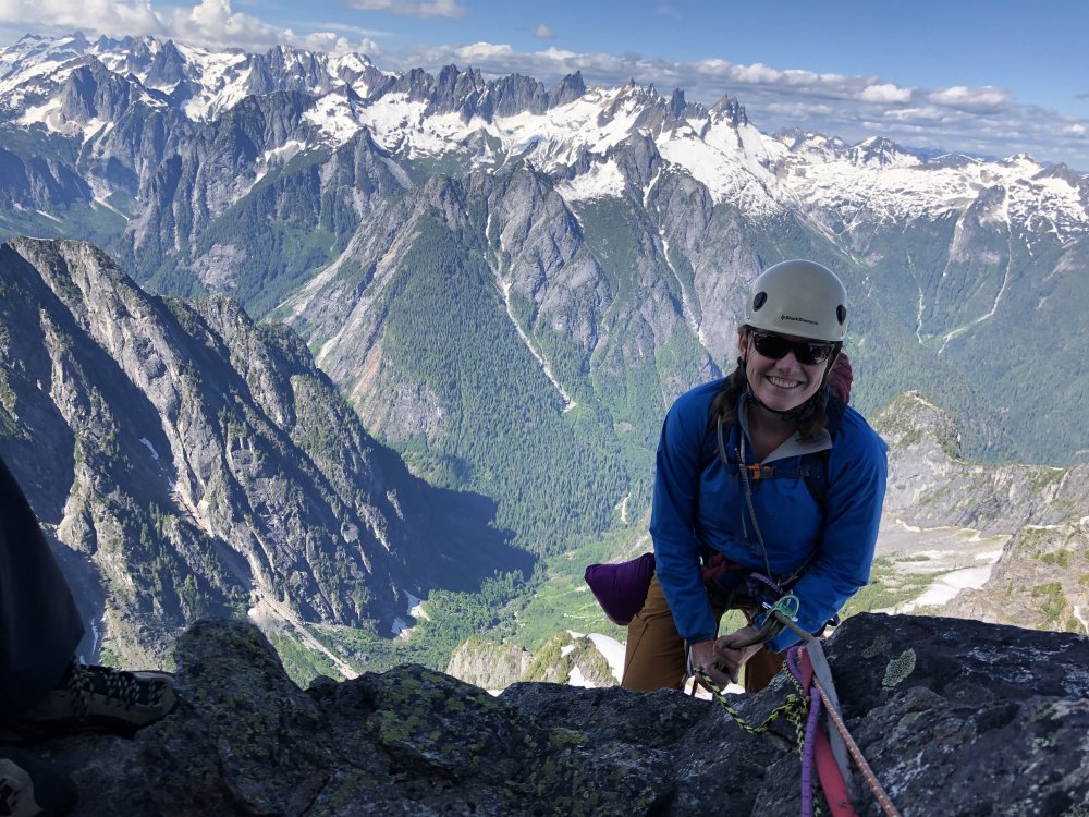
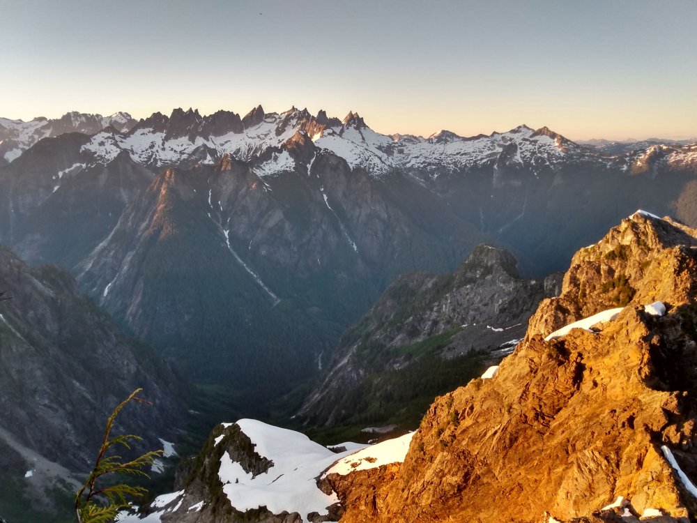
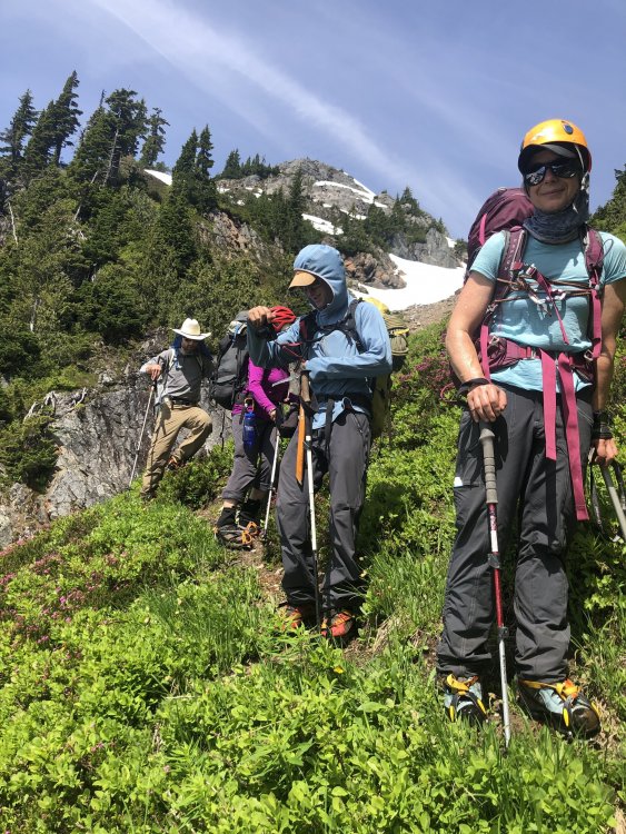
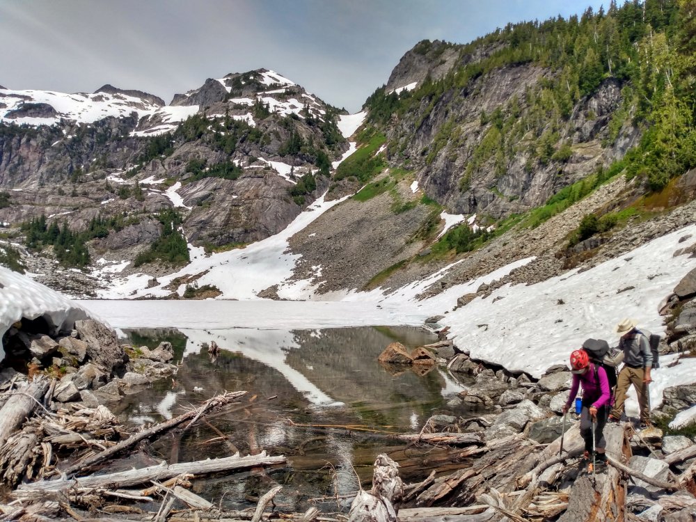
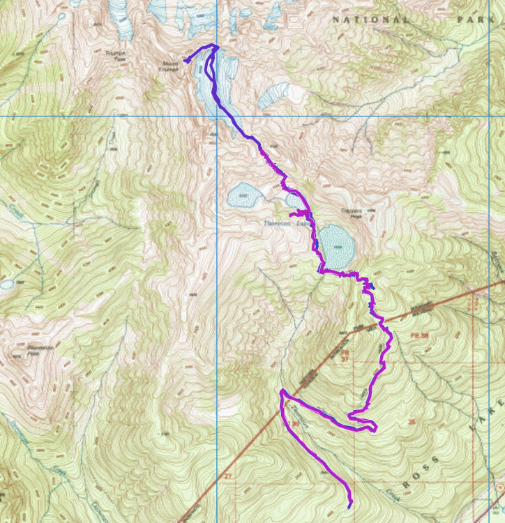
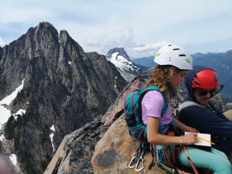
Mt Triumph, NE Ridge (5.7), North Cascades July 17-19, 2020 Back in February, I emailed Nancy, Kari, and Karen a list of Cascade climbs to consider for the summer. But as the months went by and COVID-19 numbers increased, a summer climbing trip started to feel harder to pull off. We wanted to climb, so decided to choose something moderate that could be done ‘off the couch,’ so chose the NE Ridge of Mt Triumph. Preston and Chris joined in and soon there were six of us excited to get out and climb. But as we all knew, climbing ‘off the couch’ in the North Cascades can still be a lot of work! There was some bushwhacking, criss-crossing steep slopes of heather, walking across floating logs in crampons, and route-finding challenges… and that was just Day 1. DAY 1: Thornton Lakes Trailhead (2,700 ft) Col (5,700 ft) The first part of the trip is a straightforward 5.3 mile (2,200 ft) hike from the trailhead to Thornton Lake. From lower Thornton Lake, it is 1.5 miles to the Col, but as another trip report put it, “it feels like 3 miles.” And it does. You follow a vague climber’s trail—that is really easy to lose in the snow—on the left (west) side of the lake, which then leads to the next lake (Middle Thornton lake). Though it was late July, the middle lake was mostly covered in ice. Our first delicate moves were walking across the loose logs in crampons at the outlet of the lake. Chris at lake Line shows route along east side of Middle Thornton lake and lower Thornton lake below. We walked along the right (east) side of the lake, which took us to the base of a steep slope, where it was a combo of climbing up snow, talus, and heather, which eventually gets you to the Col. (Jen: “thanks Nancy for that extra trekking pole!”). The Col has beautiful views in both directions, but limited bivy sites. We barely managed to find spots for 3 tents. However, we did have a bubbling brook running through the heather, pretty perfect for good nearby water. Hiking up to the Col. Sunset at the bivy. The morning views of Triumph from the Col weren’t too bad DAY 2: Col (5,700 ft) climb Mt. Triumph (7,240 ft.) Col (5,700 ft) After the requisite coffee, we left the Col at 6:30am and began traversing across the glacier to get to the base of the NE ridge (6,080 ft). It took us about an hour and a half to get there. The temps had warmed up considerably overnight and the snow was pretty soft. Crossing the glacier Red arrow is where the serac collapsed. At the rocky toe of the ridge, we stashed crampons and ice axes. A little higher up, we changed into climbing shoes. Nancy opted to do the route in approach shoes, good for comfort but not so good for climbing slabs or traverses. We simul-climbed the route as two groups of 3, which saved us weight and gave us two ropes for rapping. Lots of easy ridge climbing Preston & Kari Views were pretty great! The climb is easy and fun, with ample places for gear. We did pitch out the 5.7 “off-width,” but it’s easy, short, and has a fixed piece of gear you can use. After the 5.7 pitch, you go past the “grassy bivy” into the notch between the ridge and the steeper final section of the route. The Beckey variation goes left of the notch (with better-quality rock) though there’s another option right (from the notch, descend 30 feet and go around right). Chris, Preston, and Karen went left, going up a mellow wildflower-laden scramble to the summit, with Preston singing Tom Petty’s “Wildflower” song. Sounds lovely. Jen, Kari, and Nancy went right, which was easy enough climbing but more plant vegetation than pro. Going right sucked up time, as the first group waited over an hour for us on the summit (sorry!). We all were descending by 3pm. Karen & Preston on the summit Kari & Nancy Descent The descent is a combo of rappelling (single and double rope raps) and downclimbing. If you had one rope, you would have to do a bit more downclimbing and you could downclimb more of the route if you felt comfortable. There’s plenty of rap stations, with lots of webbing, but because it’s a ridge climb with features to get around, the descent takes more time than the ascent! While the quality of the rock was decent, there were a few places with loose rocks, so be careful pulling your ropes (Karen & Kari gingerly pulled the rope near a large loose block that’s just about to go). We did the last rap as it was getting dark, so with headlamps on we scrambled down to our boots, ice axe, and crampons. Karen & Chris guessing how long the descent will take How many raps have we done? Traverse, downclimb, rap. Repeat. Great view of the Pickets....next time While it’s never ideal to be descending in the dark, you do get to see the stars. And lucky for us, we also got to see the Neowise comet, which will not be coming back to Earth for another 6,500 years! (Thanks Chris for taking pictures!) Tired and happy, we began to walk across the glacier (at 11:30pm) back to the Col. The snow had certainly softened up in the warm weather. We were most of the way across the glacier when there was a loud CRACK! BOOM! as a huge serac broke right in front of us, sending down ice blocks that were the size of cars. Kari was leading and the ice chunks were probably about 70-100 feet in front of her. It was terrifying. Some of us were silent, and some of us were saying things like “shit shit shit” or “oh my god, that would have killed us.” After the ice chunks blew down, there was still some ice hanging precariously. And we still had to cross below it, as there was no way we could climb above. We decided to cross—one person at a time—and all of us moved as quickly as we could, thrusting the ice axe into the now sheared snow with hearts pounding. Once we made it back to the Col, we turned off our headlamps to take in the clear night sky—stars, planets, a comet, and the Milky Way—all shining down on us. As Karen put it: it was a full-value day in the North Cascades! DAY 3: Col (5,700 ft)àTrailhead (2,700 ft) We woke up to a sunny day and encountered some other climbers on their way in. Packing up, the descent down the snow slope and heather was fairly quick but we somehow missed the ‘climber’s trail’ along the lower Thornton lake so had to bushwhack and avoid snowy tree wells. Crampons on heather, scree, and snow Look how much snow melted from Day 1! Perfect afternoon nap Eventually, we were back on a wonderful trail, heading back to the trailhead. Celebrating the climb the way we often do—sprawling on the pavement, with mountaineering boots off, eating chips and drinking beer. Decadent. The trip was great—it’s a fun climb, Cascade views are gorgeous, and we had great teamwork. Most importantly, the collapsing serac didn’t kill us! We learned an important lesson about being extra careful with warm weather softening up the snow so quickly. It was great to be back in the mountains again! Gear Notes: Small rack: cams .4-#3; small set of nuts; 10-12 slings; Trekking pole, ice axe, crampons Conditions: Because of the pandemic, there was no recent trip report on Triumph and little info available on recent conditions. There was much more snow than anticipated, which meant that you definitely needed crampons and an ice axe. Another party with microspikes made it to the Col but turned around when they saw the amount of snow. Approach: Hike 5.3 mile (2,200 ft) hike from the trailhead to (lower) Thornton Lake. Follow the climber’s trail on the left (west) side of the lower lake, which then leads to the next lake (Middle Thornton lake). Try to stay on the climber's trail, you'll be happier if you do! Then go around the right (east) side of the middle lake, climb up the snow/heather/scree slope to the Col (bivy). Approach the climb by traversing the glacier to the toe of the ridge, where you'll start climbing.


 1 point
 -
I beat the ever living fuck out of that route to get it clean. I have never bled from so many places, nor inhaled so much dirt, or heaved that many blocks in such a short period of time. I don’t think Sam mentioned that all of the bolts, hangers, and rivets are 3/8” STAINLESS STEEL. We did this climb with the intention that others should and will repeat it. There are nicely placed portaledge bolts at camps, and there is in fact genuine Unobtainium around pitch 13, if you are looking for it. You’ll find an SDS bit sticking out of the rock. Most memorable was ripping car engine sized blocks off and watching them hit the moat. The moat would explode and drop pieces the size of a house. Also memorable was riding the pigs 1000 ft down the face. Would not have trusted any other climbers to do that for me. River was also very cool about helping, and has cool dogs! He is interested in dry tooling and ice climbing if you’re looking for a partner! picture 1 Sam leading crux A3+ pitch picture 2 Rainy day on first push at DT’s Golden Shower Room Picture 3 Me drilling a rivet after digging out sticky mud and rocks to find a shattered crack. Dry, the section probably goes at 5.9ish but the gear mostly iron.

 1 point
 -
Back at it! Got back to the high point and settled into camp yesterday, starting up the next block of the wall today. It is STEEP!
 1 point
 -
Such a fun route and great info on the climb. Thanks Rad. I've now taken my daughter twice on this climb - once at 9 yrs old and this year at 10 . She loves it!
 1 point
 -
Yep, all photos are gone now.1 point
-
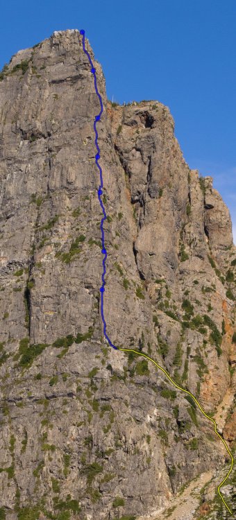
Route overlay. Dots are belays. Yellow is approach ramp.
 0 points
 -
Hey! So sad, the route overlay and other photo links seem to be broken for me. Is it just me?0 points