Leaderboard


Popular Content
Showing content with the highest reputation on 08/04/20 in Posts
-
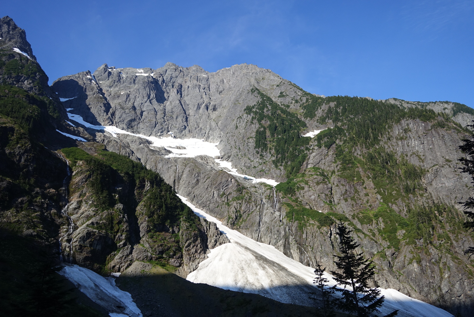
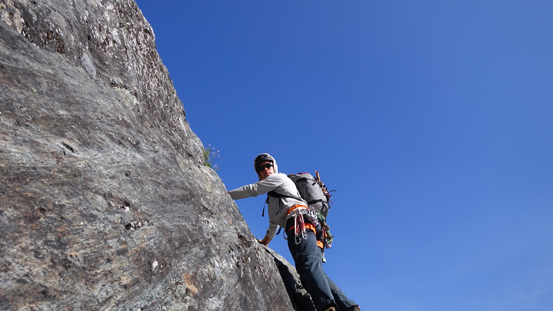
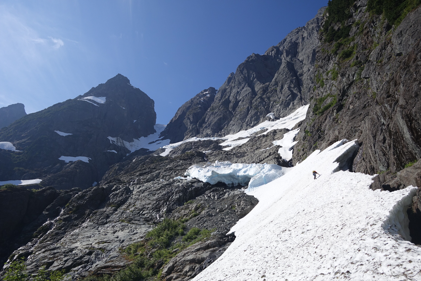
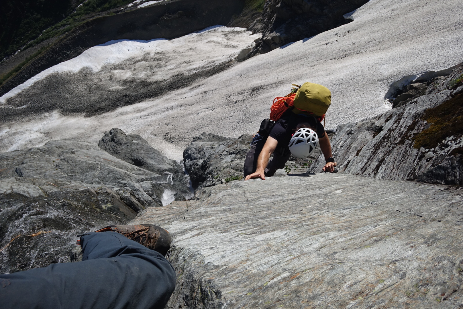
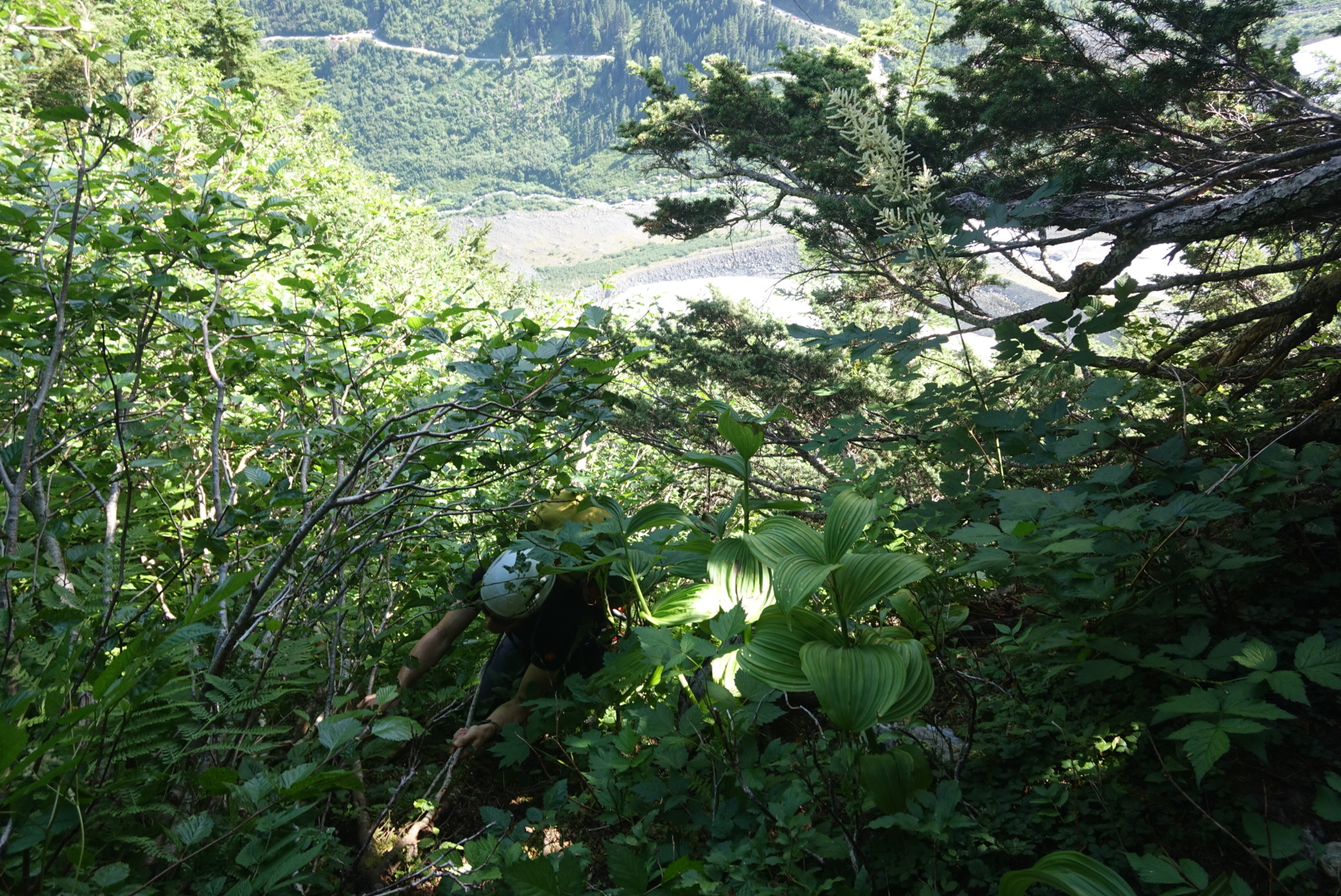
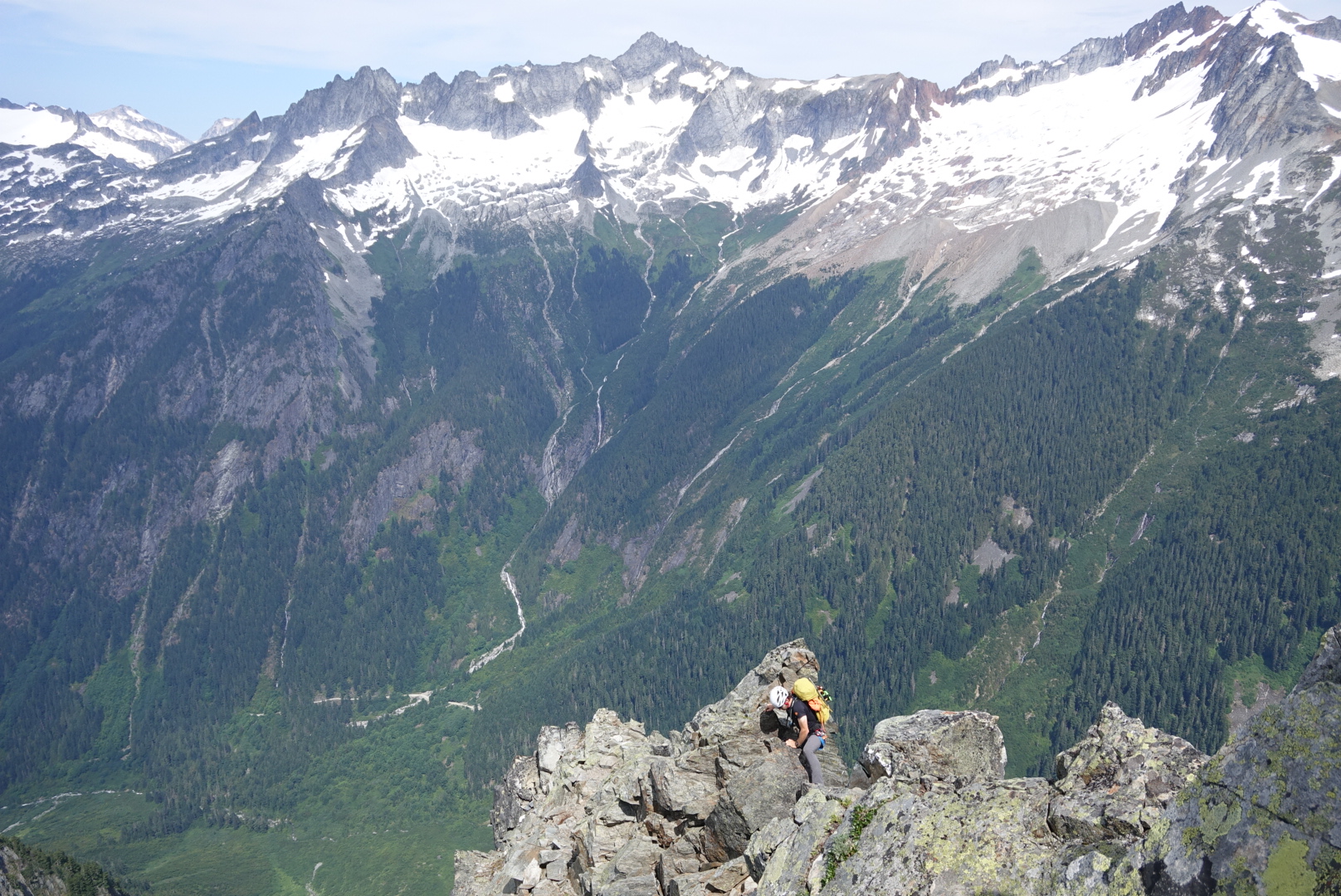
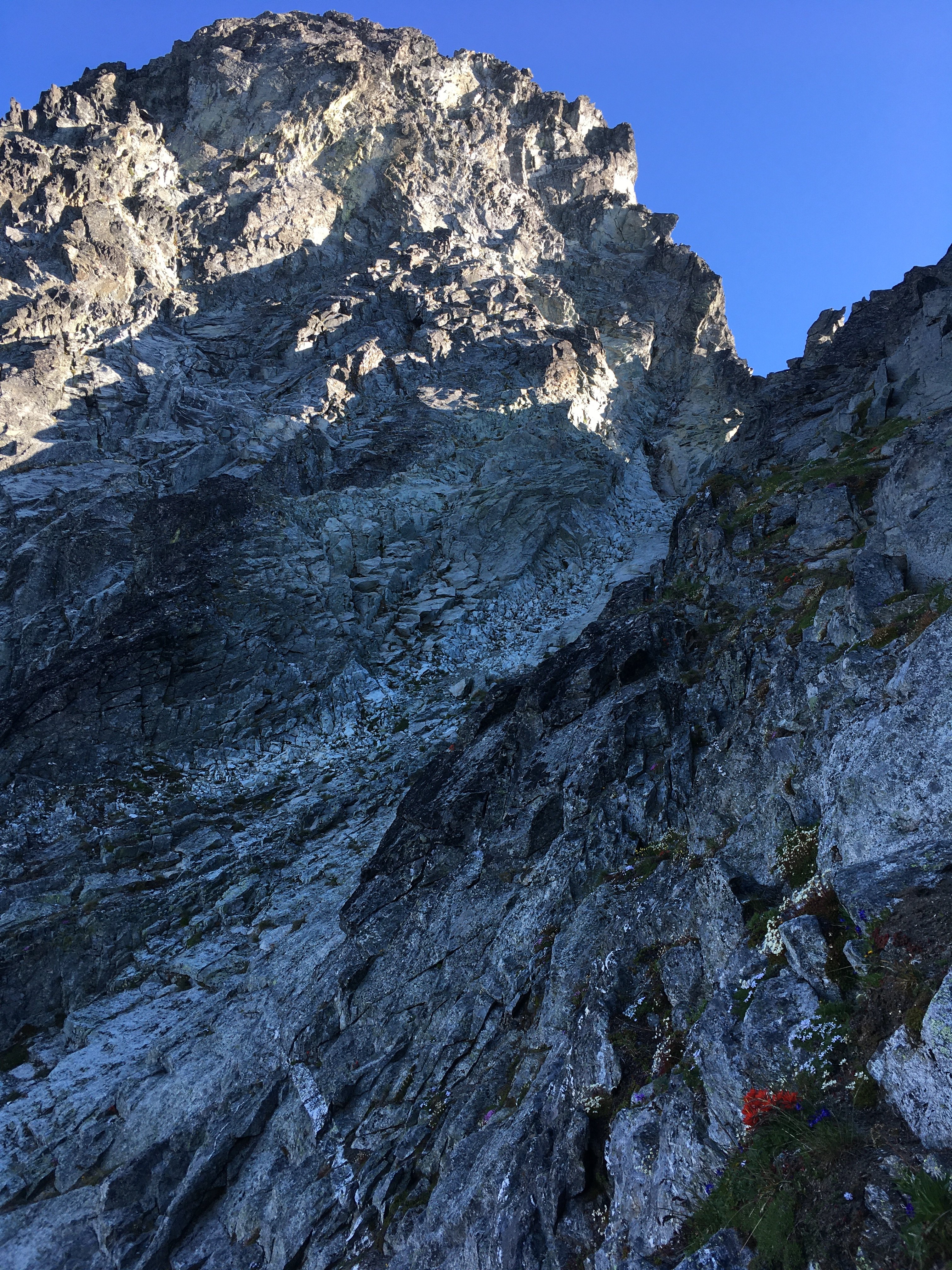
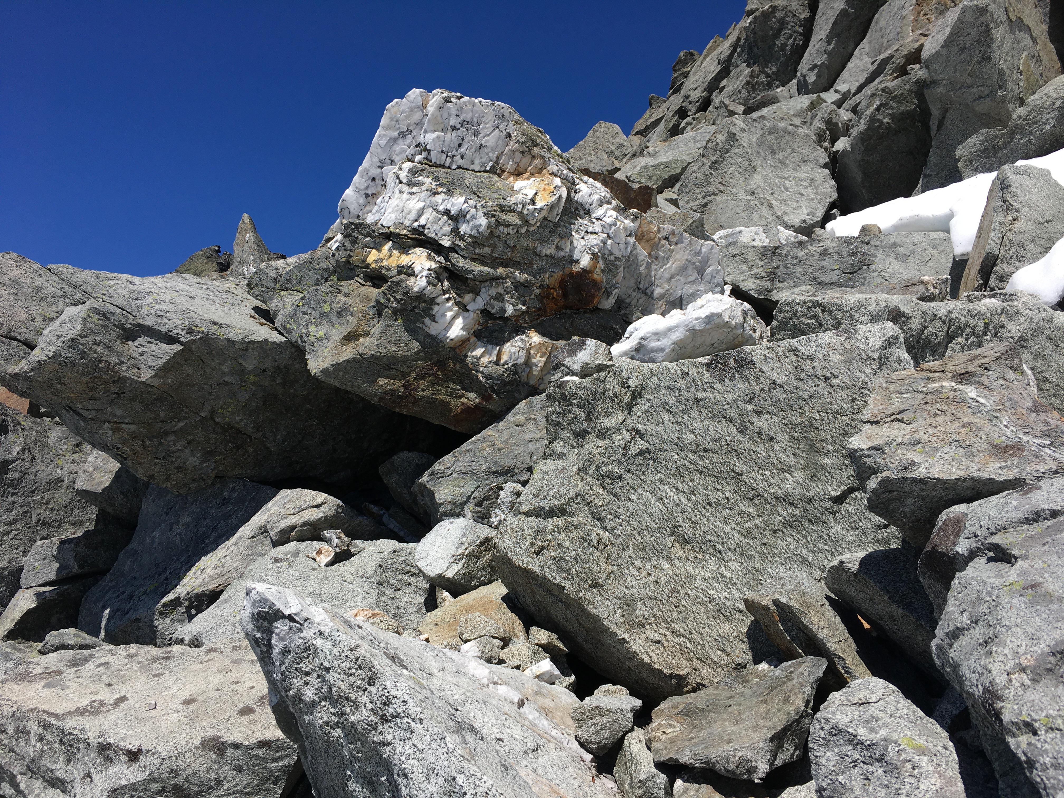
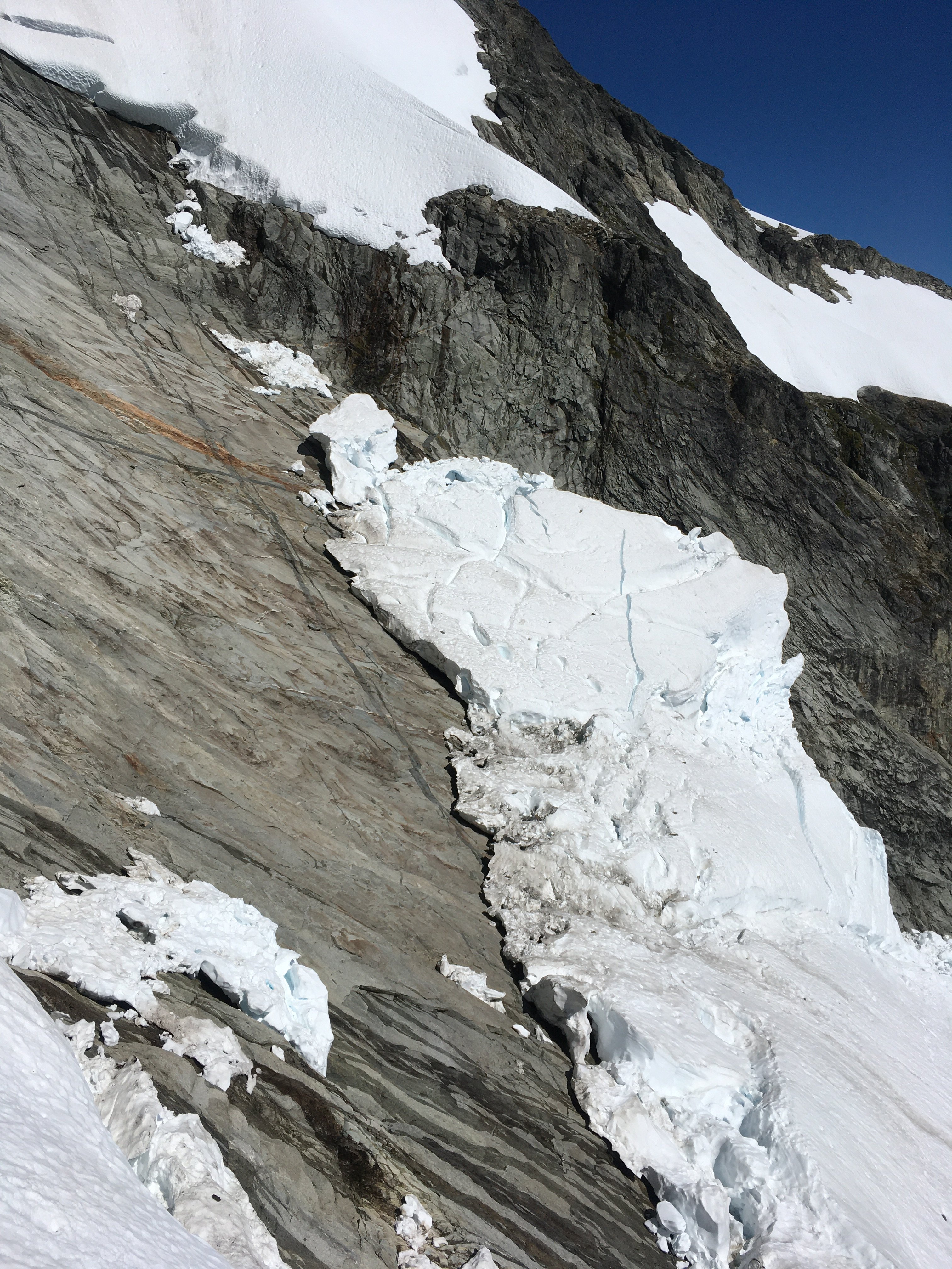
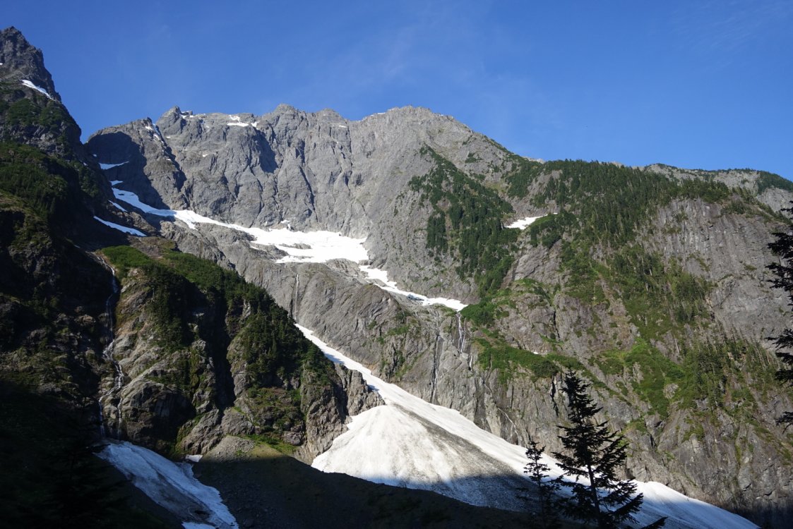
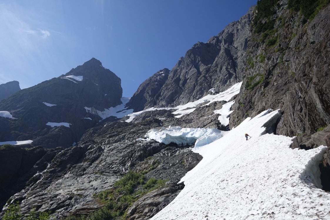
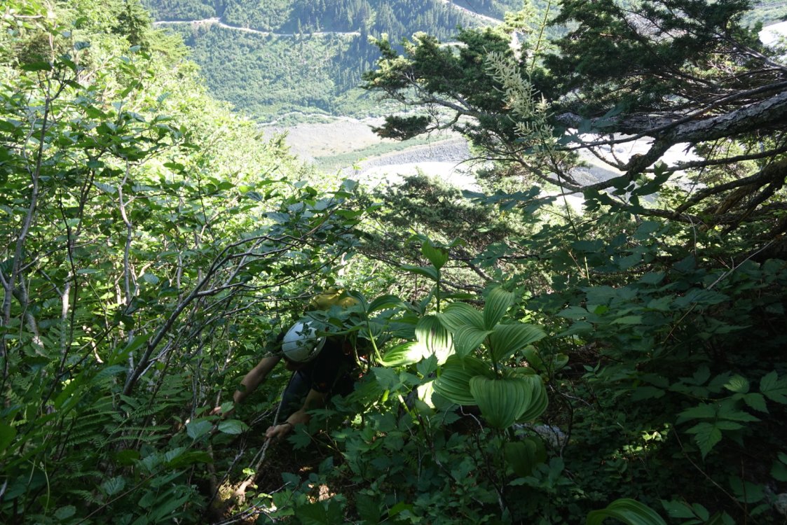
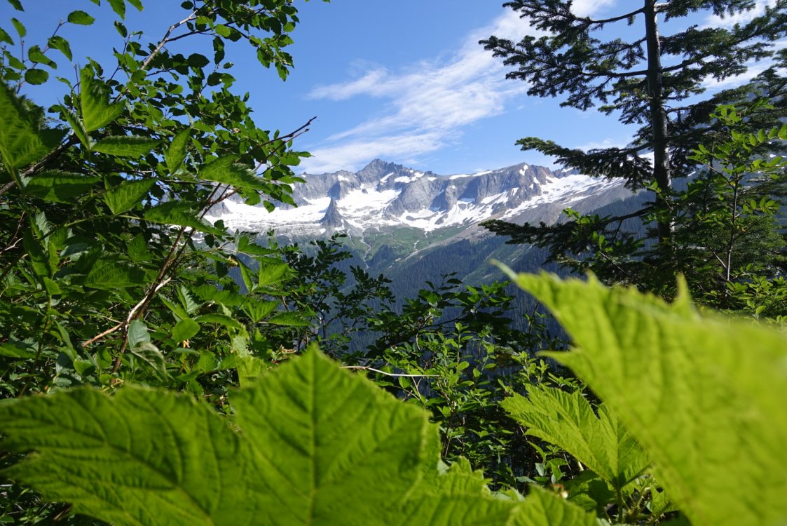
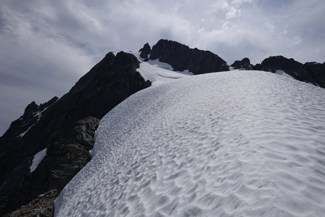
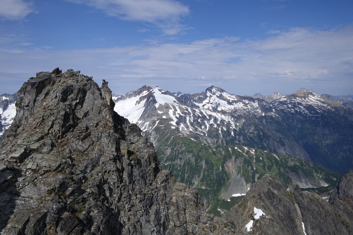
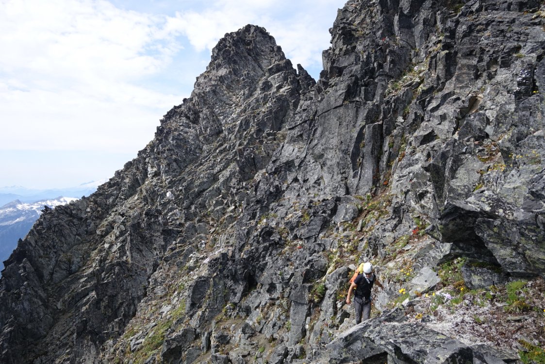
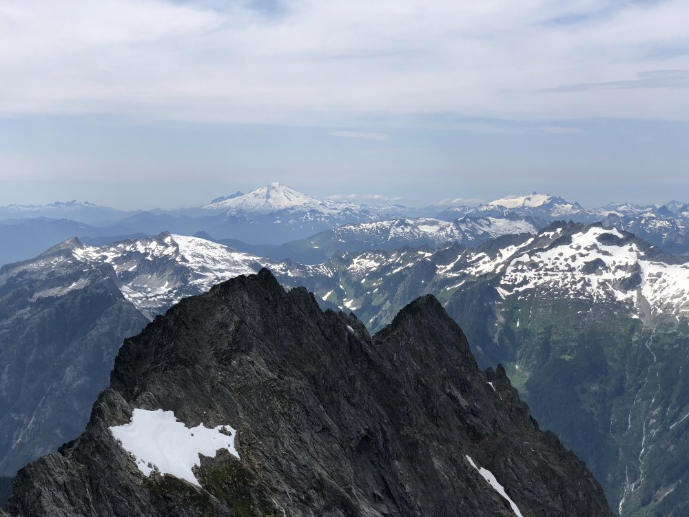
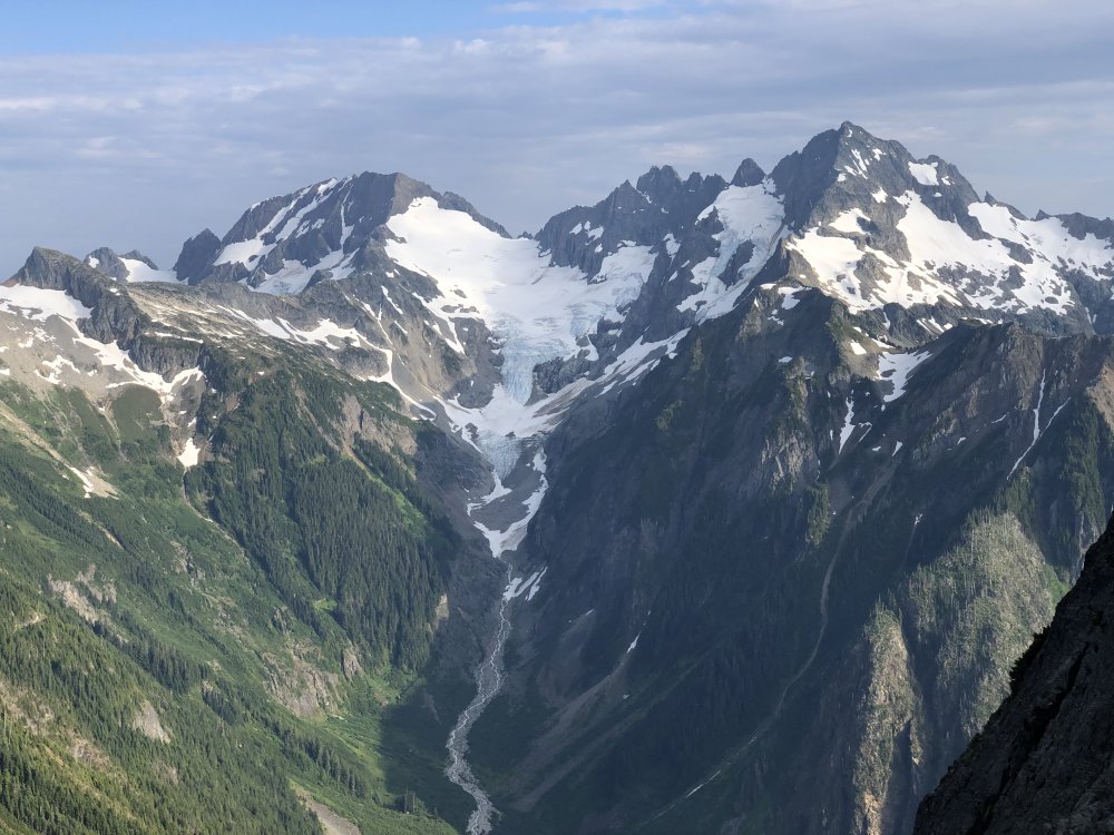
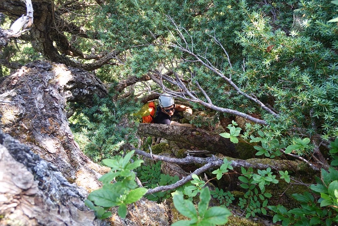
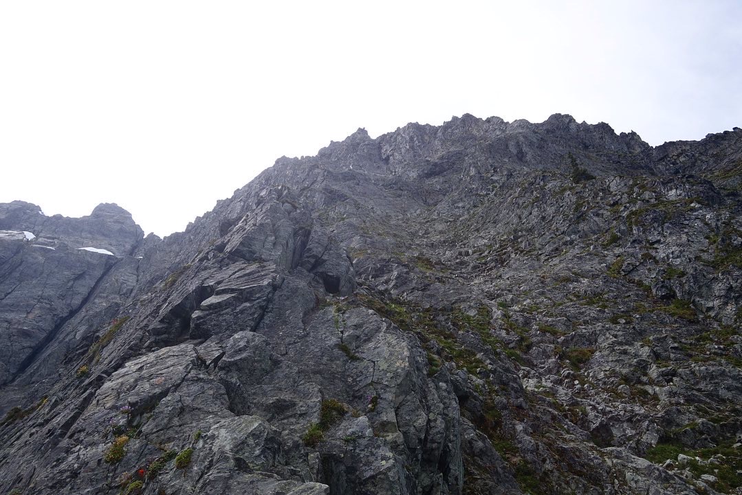
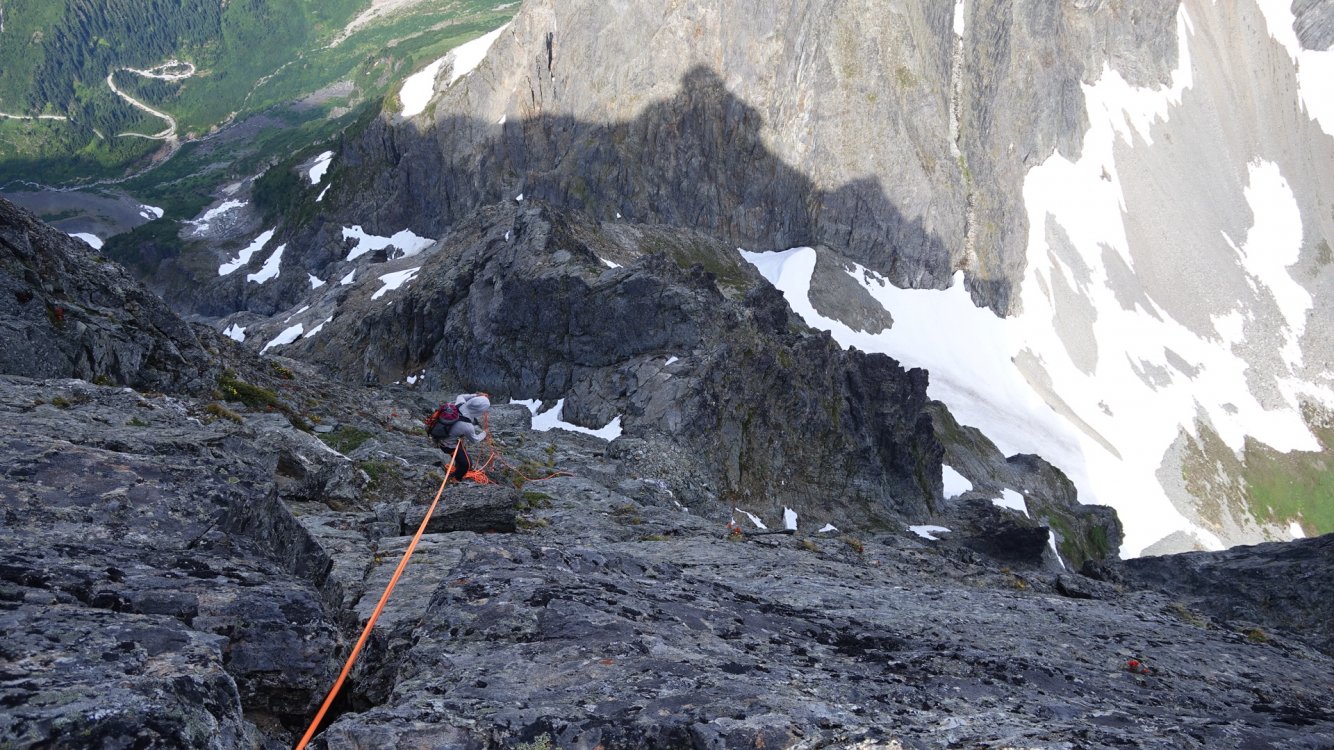
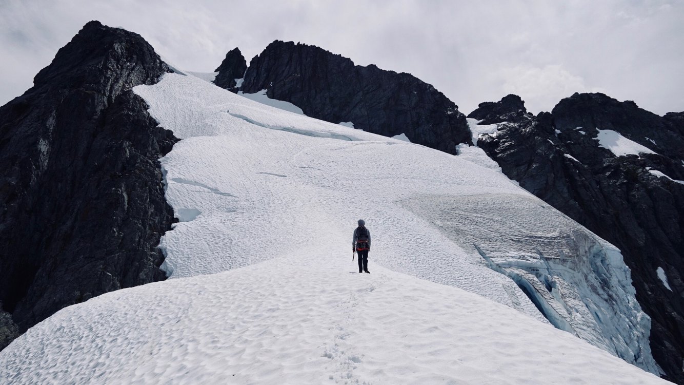
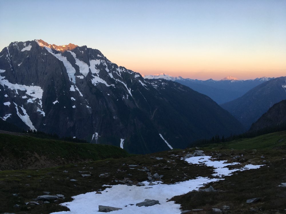
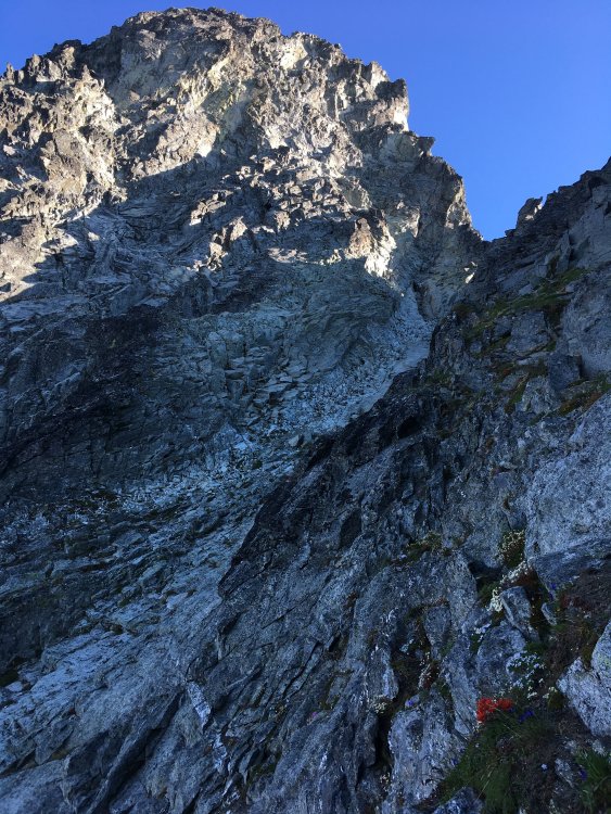
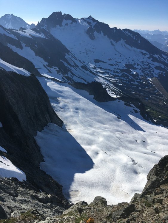
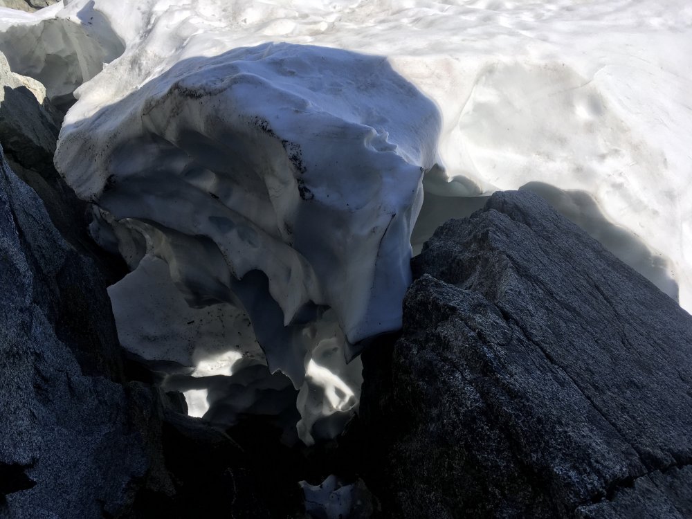
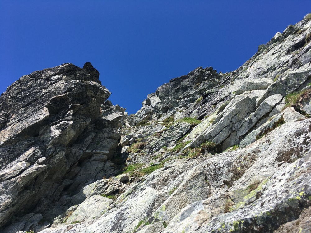
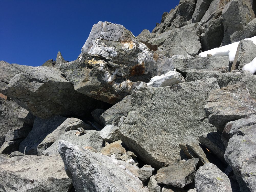
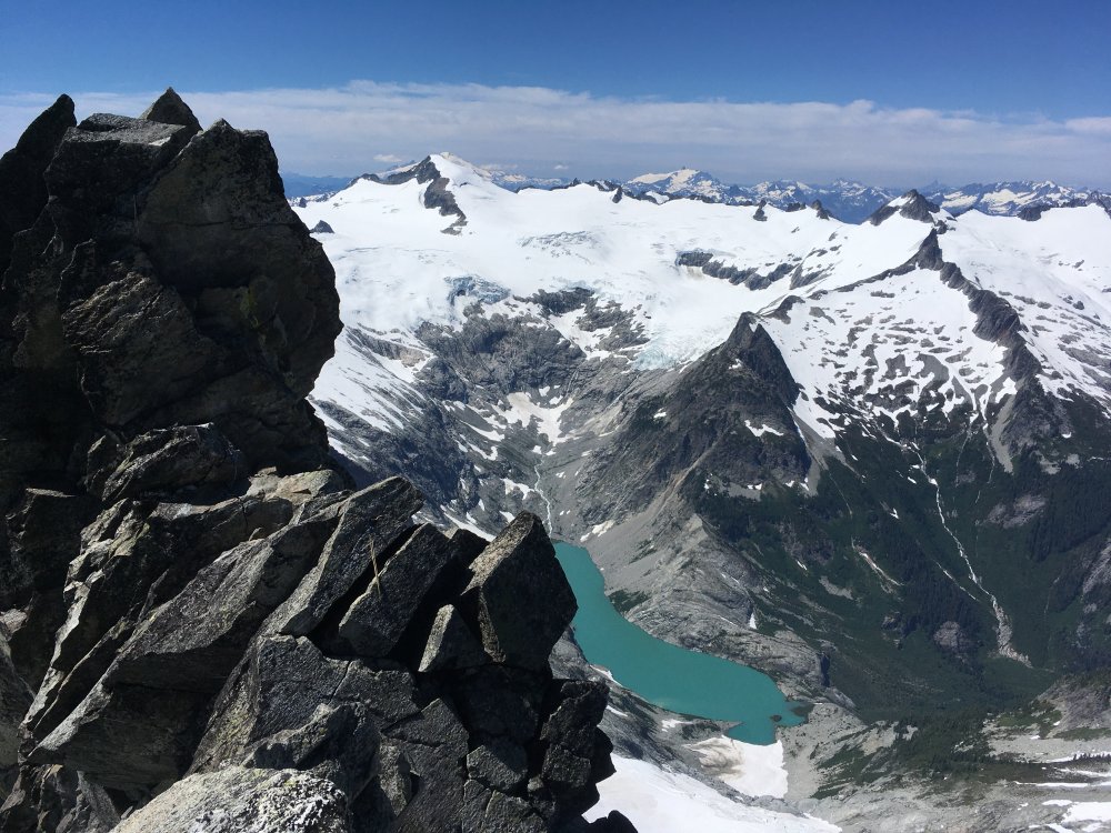
Trip: Johannesburg Mountain - NE Buttress Trip Date: 08/01/2020 Trip Report: Over the weekend my friend Matt and I climbed the NE Buttress of Jburg. I won't add too much beta-wise since theres a decent amount out there, and I wouldn't want to take any adventure out of it for those of you wanting to climb it. I'll just emphasize some key points and warnings, but Steph Abegg's write up is as comprehensive as it gets (as usual). I'll try and keep this chronological but expect some tangents and pauses for reflecting. We left Seattle around 5:30 and got to the Cascade Pass trailhead around 8am and started walking to the base of the route. We followed the slabs to the left of the left most waterfall at the constriction of the CJ couloir, per Steph's write up. Solid secure scrambling with a step of sketchy 5th class gets you up to the first snow patch. We then downward traversed over to a brushy bench to start the vertical schwack. We more or less found a route through the trees that felt relatively well traveled. It stayed More or less on the left side of the '51 rib. If you can see the CJ couloir faintly through the trees, you're doing fine. Some interesting moves through chimneys formed by krummholz. At any point you find yourself getting pissed off through the trees, just remember it the density of the brush thats your protection from tumbling off the mountain. We busted through the trees and into the steep heather and then finally onto the rock. Luckily it was all dry, I couldn't imagine doing this route a day after a rain. The initial scrambling was very secure and kind of steepened, became a bit more loose as we did a upward traverse to the '57 rib. We encountered nothing harder than 5.6 but simul soloed all of the rock. This being said, we didn't regret bringing the rock rack. We got up to the 7100' bivy a bit after 1pm and just decided to keep moving. I know, I can feel some of your rolling your eyes. We had perfectly soft snow through the ridge and headwall, which was nice since we were in trail runners/ approach shoes and universal crampons. We summited around 3pm and took some photos, signed the register (I don't always, but felt like I needed to on this one). The descent down the E ridge went smoothly thanks to the occasional cairn. We stayed about 40-50' below the crest the whole time until we got to the first rap station. We did about 5 or 6 raps with some down climbing to get us to the top of CJ couloir. The rap stations were looking a bit weathered and tired so we backed them up with gear on the first rap off of them or added slings. We were making great time so we thought to just try and c2c even though we had bivy gear. This would prove to be a bad idea. The traverse to Doug's Direct went a lot slower than expected. Side hilling through herbs. In the fading light we mis-identified the wrong location for DD. I was going off Steph's map, which I think has DD a bit too far up the ridge. Go off her photo/overlay, its spot on. The steep heather and loose scrambling up to the ridge is very time consuming as well. We got up to where we thought DD was and it was getting dark. I pulled my pack off to get my head lamp and I forgot I had my ice axe quick stowed through my pack shoulder strap. I heard one clink and I knew exactly what had just happened. I turned around to watch my ice axe tomahawk down the north side of Mixup. I was so angry at myself. We didn't feel we were at the right location so we investigated some near by notches. It was only getting darker. At one point a hold I was grabbing dislodged and sent me sliding down heather. I thought I was going to go for a long ride. Somehow while keeping the block off my head as I was sliding I was able to grab a fistful of heather and arrest my fall. I was okay. Things we spiraling out of control and we decided to just descend down to the lower angle heather and just bivy like we had planned. I consider myself a pretty calculated person, fatigue can strip that away from you no problem. We found a decent spot to bivy around 6300' directly under the actual DD late into the night. I mostly tossed and turned under a very bright moon and just thought about how I got a relatively cheap lesson on sticking to a plan and not forcing descent in the dark. Other thoughts were, "This trip was supposed to be about climbing a new mountain in a familiar place and get back to why you started getting out into the alpine in the first place." "Why were you trying to blast through it and force a car to car?" "How are you going to get out of here without an ice axe?" When I awoke I looked at the photo/overlay I had saved to my phone and saw the exact point for Doug's Direct. I felt so dumb. We ate and packed up and started heading up to DD. Miraculously, Matt found an old rusty pick axe head for me to use as an ice axe. Going down Dougs direct is mostly secure but I ABSOLUTELY wouldn't have wanted to do it in the dark. Then you're on the snow below Mixup and then the Ptarmigan Traverse route. Luckily the snow was low enough angle that I didn't have to use my trusty new axe. I was looking for my lost ice axe the entire time. It was so nice to be on low angle snow and then a trail finally. This was an incredible trip on an impressive mountain. Just enough asterisks/ near misses to have it permanently seared into my memory. Very humbling. Scrambling low on the route. Downward traverse to the trees. Shwacking. East ridge descent. Rapping towards CJ. Looks like "Sound of Music" but all I can hear is my feet sliding and ankles twisting. Gear Notes: Ice axe, Crampons, Approach shoes. 60m rope. Small rock rack. Work Gloves. Approach Notes: Spitting distance from the Cascade Pass trailhead.


 1 point
 -
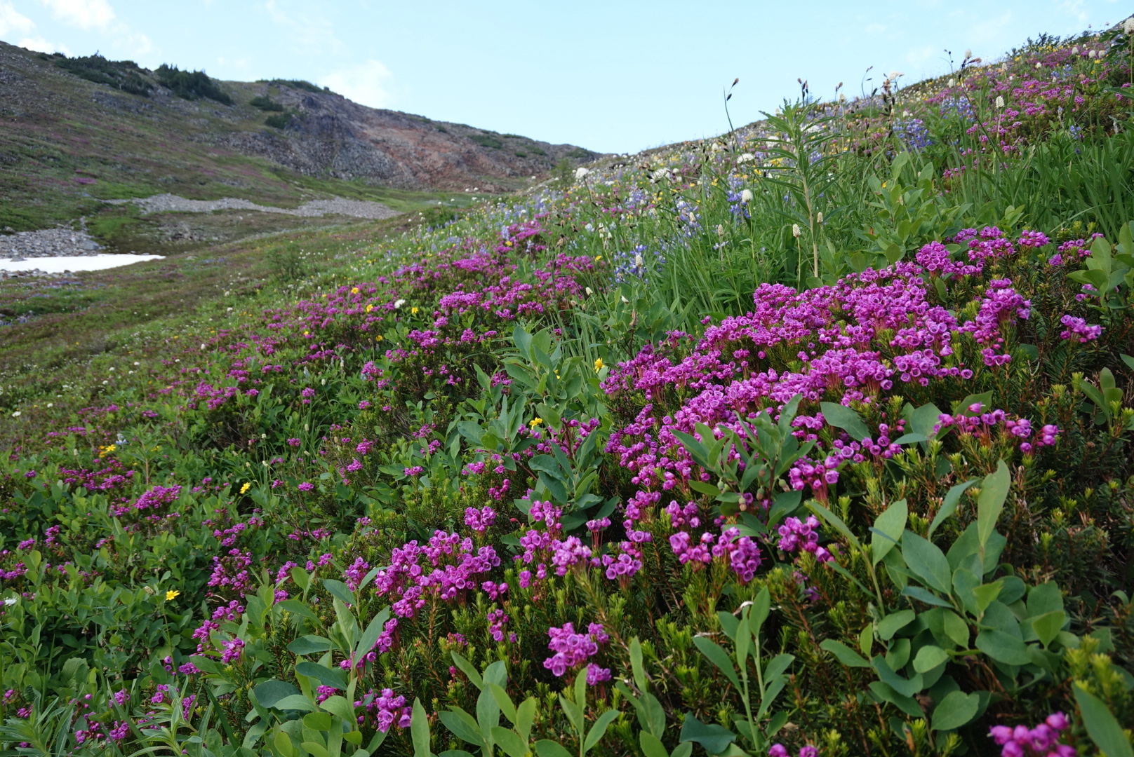
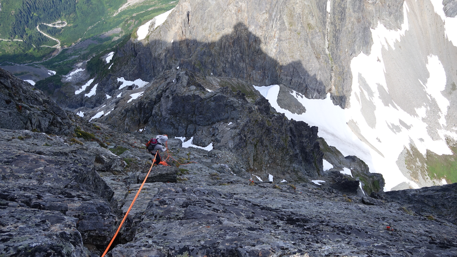
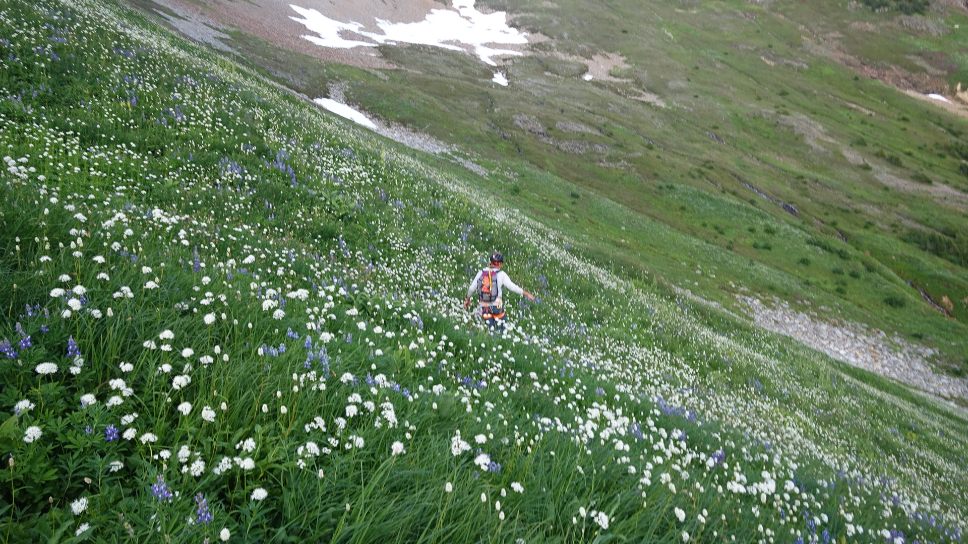
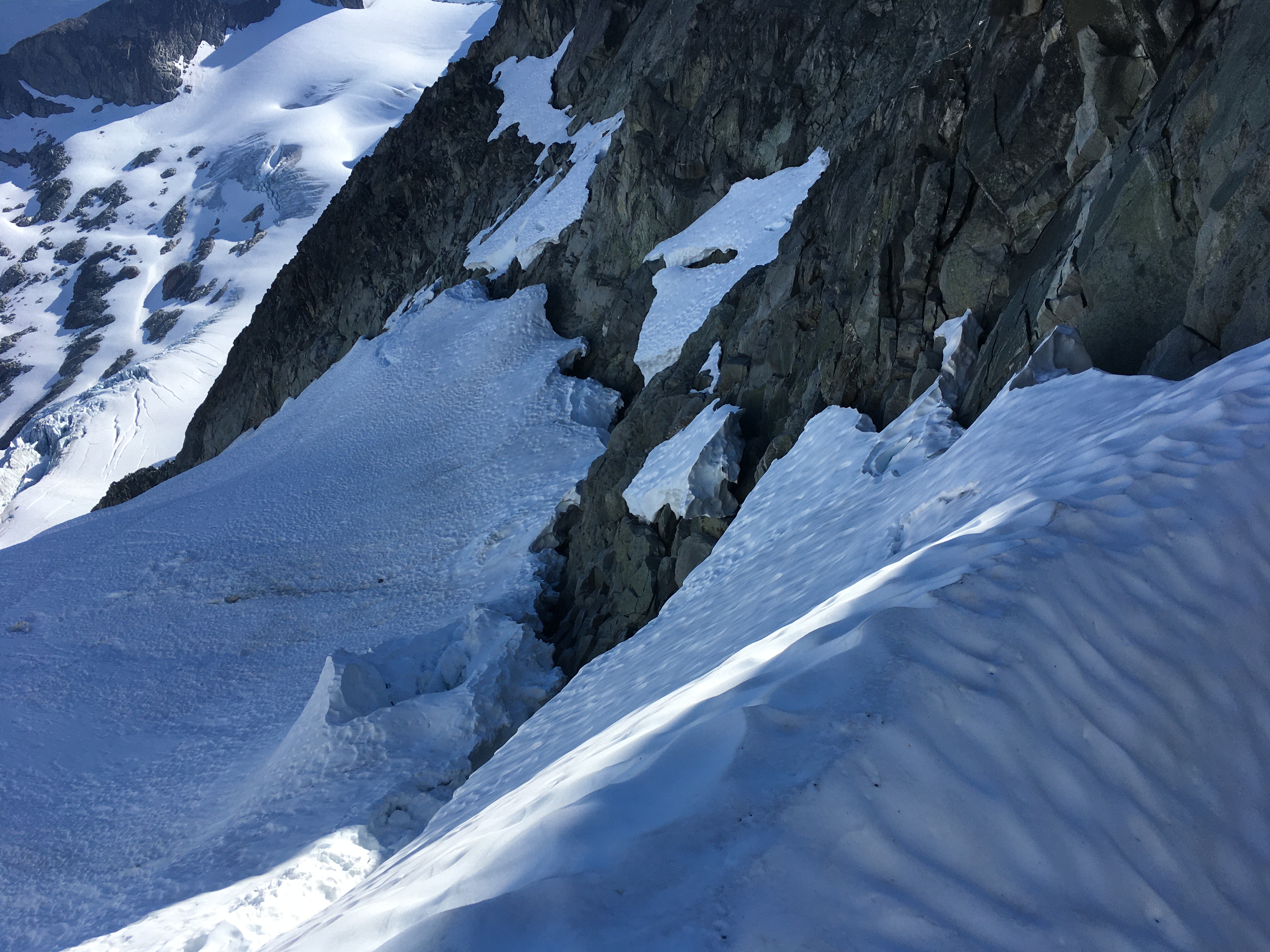
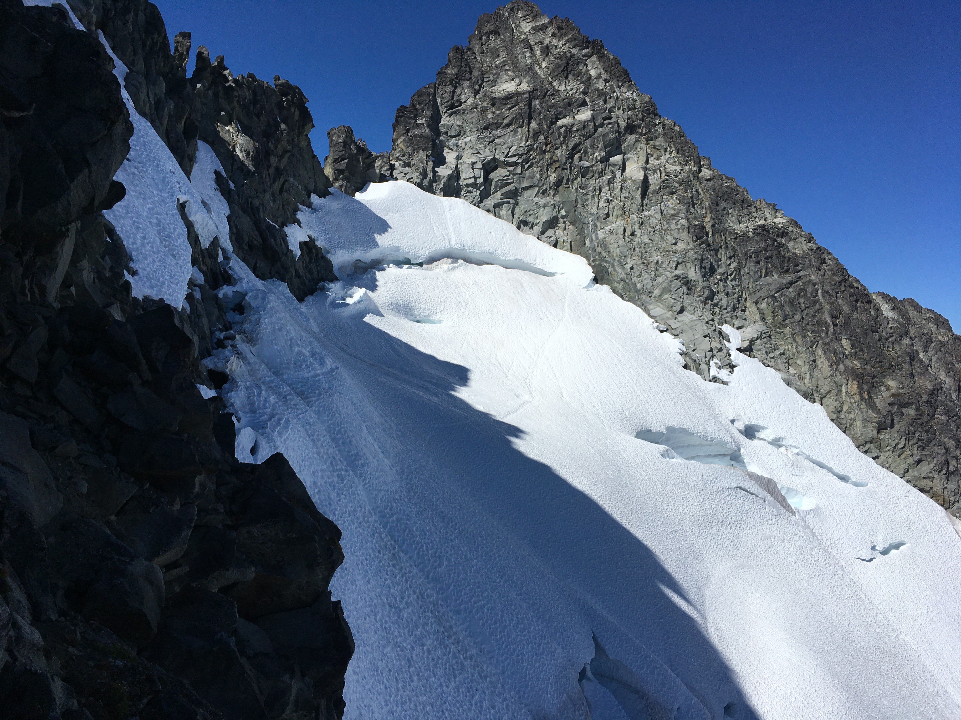
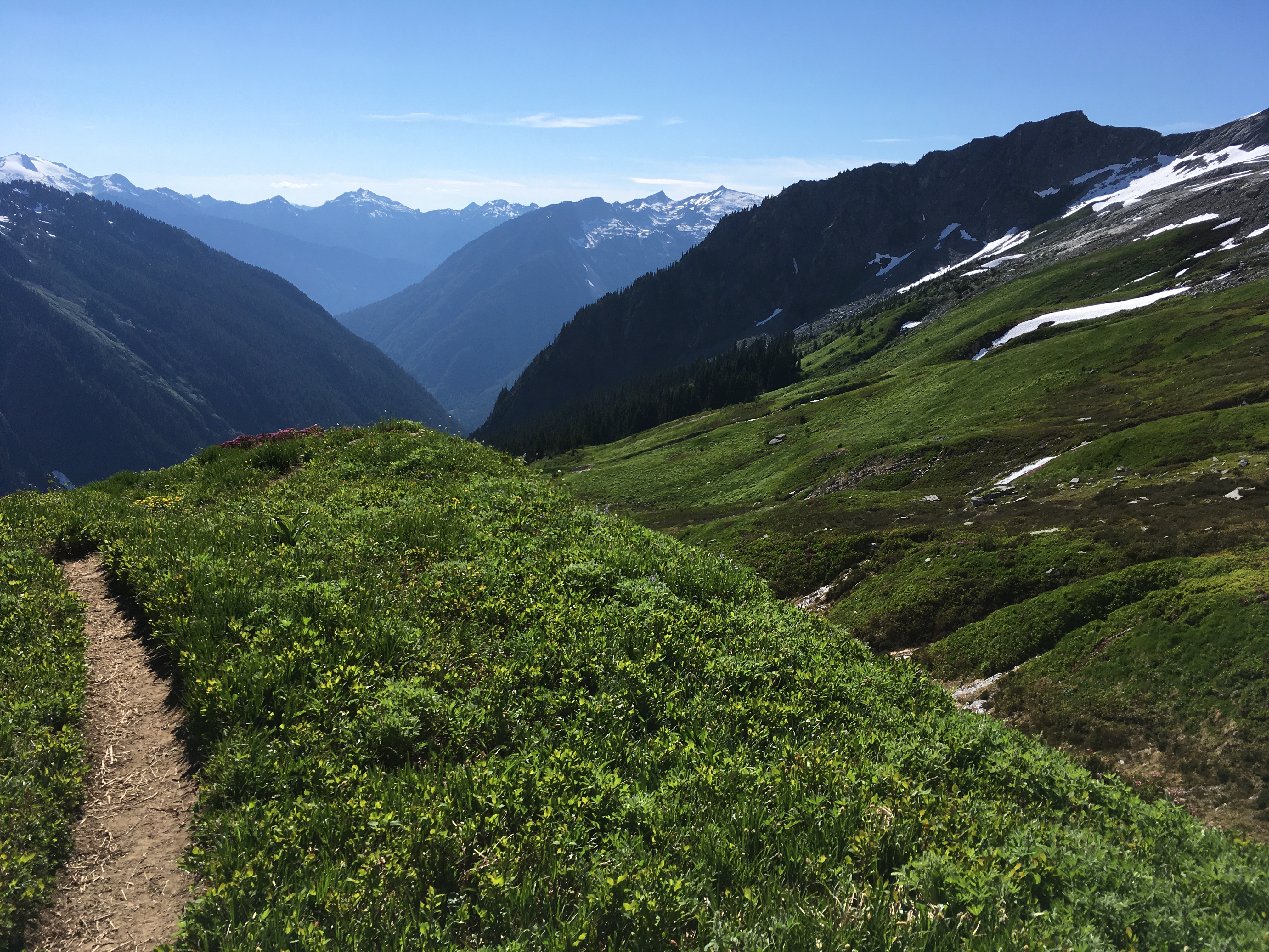
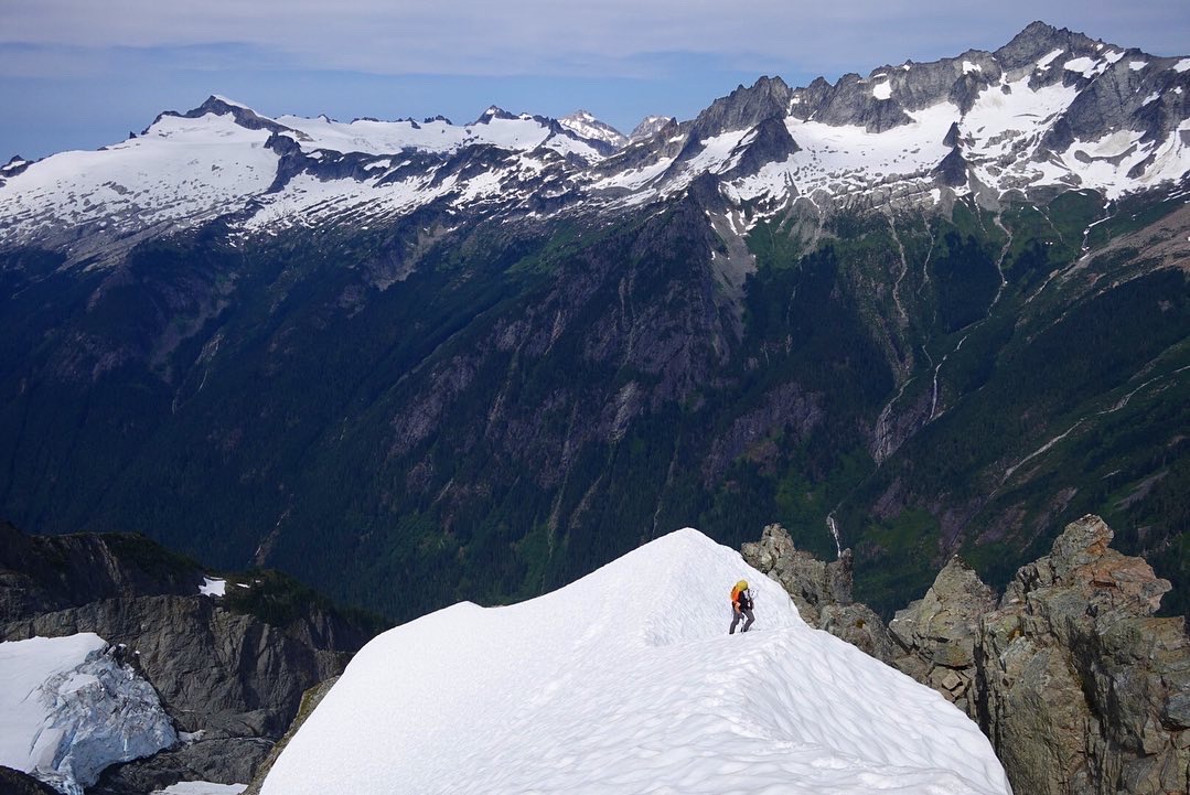
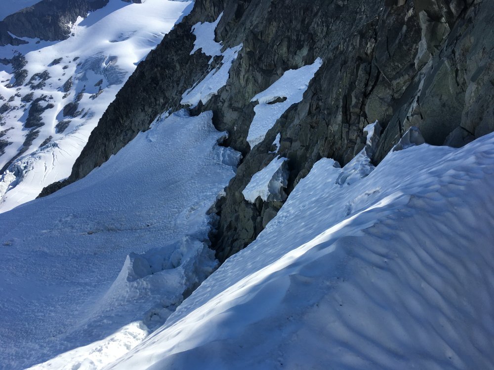
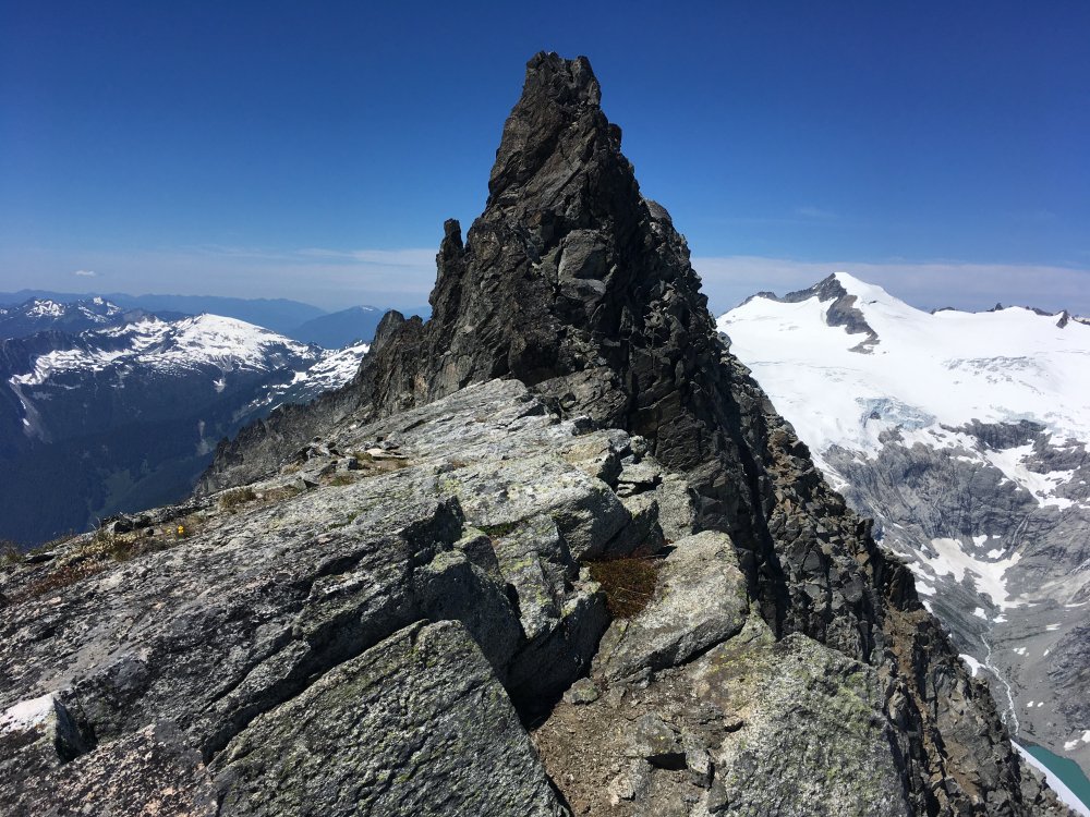
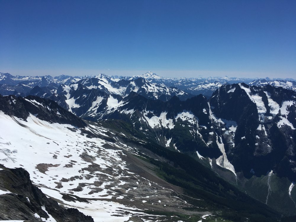
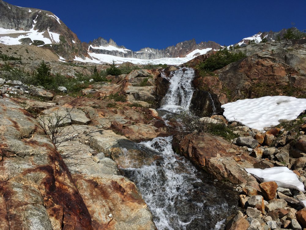
Trip: Torment forbidden traverse - Tft Trip Date: 07/28/2020 Trip Report: While driving to the cascade pass trailhead Monday night I noticed that I didn’t seem to care about climbing. So I was a little unsure about why I was going but part of me knew I would be having a great time the next day. Arriving in the night, the sound and sights of Johannesburg (snow glowing in the starlight) rekindled my stoke. I slept about 4 hours, then rolled down to the boston basin trailhead and hit the trail just before 4am. Even in the early morning the creeks were raging. I’ve always beenable to find a dry route through these creeks, but not so on Tuesday. I took time to remove my shoes and dry my feet afterwards at 3 crossings. It was going to be a long day and I didn’t want to start out with wet shoes. At Boston basin I started ascending too soon but fortunately realizedthis without getting too far off, descending 200 ft or so to the SW around cliffs to get to the slabs leading to Torment. I stocked up on water at the last flow I saw a few hundred feet below the notch. I noticed another party nearing the top of Torment, which was a little surprising for a weekday. I would later pass them on the steep snow traverse while they were doing the rock bypass. The first thing I was worried about for this route was the moat at the notch. It wasn’t too bad. Snow was pretty hard there. Could get dicey soon. Moving across the moat the gully was steep and muddy. I squirmed up the gully using my axe in the ice to my left for leverage and getting a bit of a mud bath in the process. Didn’t feel super secure here given the steep mud. At the top of that snow+ice I was able to move from the mud to rock and was soon at the top of the gully. The first couple moves off the deck were harder than I expected, maybe 5.6. It was all pretty easy from there. The two keys to the route finding are to take the ledges down and left after that first steep 15 feet, and then to go left when you get to the gully that’s around that corner, instead of entering the gully. It’s all pretty intuitive after that, and there are rap anchors along the route to help you keep your bearings. I thought Torment was quite fun actually. The rock isn’t terrible and the Johannesburg and Eldorado backdrops are excellent. Would be worthwhile on its own, and makes for a nice warmup for the traverse. After descending Torment, at the notch with the rappel to north side snow I saw there was a block of snow bridging the moat that will probably be gone in a few days. But since it looked like there was a bergschrund below I did the first rap anyway, heading skier’s right toward another rap. Unfortunately that one wouldn’t reach a safe spot on the snow, so I kept rapping skier’s right along rock ledges. Finally on the 4th rap from the notch I got to a flat spot on snow. Looking back I saw the bergschrund was actually still closed at skier’s left. I could have avoided all the raps if I had gone that way. But it was very steep there, almost vertical. Pretty intimidating from above. I wasted some time with all the raps and scouting the terrain, but it felt safer than the skier’s left option. After you get to the next rock ridge the terrain is indistinct. I followed the path of least resistance, hoping I wouldn’t get cliffed out, and it worked ok. After crossing over, the route then goes straight up the ridge on its east side. I was pleasantly surprised with a lot of wildflowers in this section just before the steep snow traverse. I brought two ice tools and steel strap-on crampons. This was probably overkill. Snow was pretty soft, so a single regular ax and aluminum crampons would have been ok for these conditions. It was almost too soft. Occasionally the snow would collapse a few extra inches under my feet while shifting my weight to the left. Would have been worried about getting mushed off the face if it were much warmer. Not sure that pickets would have been any help, so going solo here wasn’t necessarily more dangerous than pitching it out, maybe safer (faster). The traverse doesn’t look very wide, but carefully side stepping took me about a half hour. It was a little tedious. Next time I’d like to do the rock bypass instead. I took my first real break of the day afterward, digging into lunch and trying to dry out a little. Then I continued on the south side. There is a snowpatch dripping into some slabs that requires a little care. I was traversing the top of the slabs near the snow and got sketched out for the last 10 feet, backed up, and found a better way a little lower. Next came some nice granite boulder hopping and then another vegetated flowery area. Did some more boulder hopping from there to regain the ridge. Exposure along the ridge was pretty fun, but not quite as good as the E ridge . The rock was quite good, reminded me of the upper part of the NW ridge. My decision to climb the route despite low motivation was being validated with every step. I stayed mostly on the ridge, with a little bypass on the north side at one point. In at least one place I did some steep downclimbing instead of rapping. Near the end of the traverse I headed south on sandy ledges to reach the base of the west ridge notch. At this time there was one party that had just descended, one still descending, and one probably just arriving at the summit. Busy, but not terribly crowded. I hadn’t found much info about doing the climb c2c beforehand, so was a little worried about squeezing it all in. Would have been ok skipping the W ridge if I was short on time. And I had been moving cautiously throughout the day, at times even timidly. Even so, it was still early afternoon at this point so I felt I had the time. I put on rock shoes and put a rope on my back. I had downclimbed the route in the past (after NW ridge) so it was familiar. But I had not yet ascended it. Was nice to see it again. I like the first wide step across a gap at the start, and the last slightly overhanging block that you have to downclimb right before the summit. It was a warm, clear day and summit views were obviously wonderful. I downclimbed the ridge except for one rap at the 5.6 tower, where I had stashed the rope I brought. The other party on the traverse was arriving at the base of the W ridge when I got back to my pack. Changed back into approach shoes and downclimbed most of the gullies leading to boston basin, with one rap at the end onto the snow. From there, some approach shoe skiing, passing through boston basin, then marmot metropolis, and then another nice break after crossing the E fork of Boston creek. For all its thunder there was a way through that was only about knee deep. It wasn’t clear to me how long to expect the different portions of the climb to take. I had guessed it would be 15-18 hours total. It ended up being a little less than 15. I noted the time for various points along the climb, in case it helps anyone planning a c2c trip. Of course snow+moat conditions could make things faster or slower, belaying any of the route would make it slower, and trying to get off Forbidden on a weekend is a guaranteed traffic jam. That said, I took my time, didn’t race. 3:50 leave trailhead 7:10 moat crossing start of Torment 8:30 summit of Torment 8:50 first rap to Forbidden glacier to begin traverse 10:05 done rapping 10:50 begin steep snow traverse 11:20 finish steep snow traverse, lunch 11:45 resume traverse on S side 12:40 start of sidewalk 1:10 base of Forbidden W ridge 1:25 start climbing W ridge 1:50 summit Forbidden 2:05 start W ridge descent (including one rap) 2:40 back at the start of W ridge, start descending gullies 3:40 out of the gullies onto snow 6:35 back at car This is a fantastic route, one of my favorites so far. Especially everything east of the steep snow traverse. Would do again Gear Notes: Rope, tools, crampons Approach Notes: Creeks are high


 1 point
 -
Amazingly, my partner and I climbed the 1957 route from bottom to top from 8/1-8/2 and never even saw Karsten and Matt, despite starting only one hour earlier! The 1957 start adds a few hundred feet of rock and jungle climbing, and we did belay three pitches before reaching the snow bowl where the 1951 and 1957 almost intersect. During the time it took us to reach that point, Karsten and Matt must have overtaken us. Nice work guys. I’ll be posting up my own report this week. Congrats to you guys and all who have climbed this face... I have new respect for anyone who takes on this challenge!1 point
-
Thanks Curt! It looks good, will have to check it out!1 point
-
They'd think you're soft, Bronco. =;-) There are two things I wish I'd had on that route in July1999: heavy-duty garden gloves and a cell phone. One of these wishes has been well documented. Big Jim Nelson wishes he'd had more cans of grape soda. Way to move fast on a route that can really sap your energy and mess with your head. I'd like to think that Doug Walker was smiling from above and watching over you.1 point
-
That mountain doesn't mess around. My partner pulled off a hold and took a long fall, severely injuring his ribs. It took us many hours to come out the second day, limping along, followed by a trip to the ER. Glad you escaped unscathed, at least physically!1 point
-
Classic J'Berg TR, you are in good company. Well done.1 point