
Leaderboard


Popular Content
Showing content with the highest reputation on 07/31/20 in all areas
-
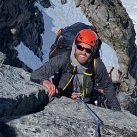
Trip: Cabinet Mountains - Multiple Trip Date: 03/21/2020 Trip Report: I just wanted to share some photos and descriptions from the last couple ice seasons in the Cabinet Mountains. Anyone who got the 2019 AAJ or Alpinist 64 might have already seen pictures of the area. There have been a handful of Spokane area climbers putting up routes over the last couple seasons. All the climbing has been done out of Granite Lake which is near Libby, MT in the Cabinet Mountains. The climbing is quite varied, from single pitch WI3 to 1000ft hard ice and mixed routes. The area has been divided up into 3 big areas….A Peak, The Thunderdome, and Three Tiers. A picture is worth a thousand words so I will just resort to numerous pictures instead of more text……let the stoke begin for next season!! Looking across Granite Lake with A Peak towering 4000 feet above. The Thunderdome is the large sub dome in the center of the picture. The Thunderdome!! Some of the best ice routes anywhere around. Scott Coldiron and Matt Cornell on the first ascent of Mad Max, WI5+ (8 pitches). Nate Kenney climbing a steep skinny pillar called War Boys, WI5+. Scott Coldiron climbing a crazy pitch called Underworld, WI3. This route is 20m long and entirely inside an ice cave 500 feet up the Thunderdome! Another view of the spectacular A Peak and the upper wall of the Thunderdome. The big ice in the center of the wall is Road Warrior, WI5, M5 (8 pitches). Looking up the huge gash on A Peak. Scott Coldiron and Jess Roskelley put up the route Canmore Wedding Party AI5, M7, 750m, which ascends this central gash. The climb got nominated for a Piolet d'Or in 2019. Note: the large sheet of ice on the bottom rock band is still unclimbed as of 2020. Looking up the wide start to the "Blaster Routes". Blaster, WI4 is five pitches of ice while Master Blaster WI4, M5, (10 pitches) continues to the top of the Thunderdome. Looking up from the lake at the "Three Tiers". These cliffs have about 20-25 ice and mixed routes that have been done. A closer view of the the ice (during a fat season) on the center of the 2nd Tier with the 3rd Tier above. Scott Coldiron on the first ascent of Toast, WI5 on the 2nd Tier. Zach Turner leading The Dag, WI3 on the 2nd Tier......a super fun mellow corner. A shot of some of the 3rd Tier routes. Gyro Captain, WI4, goes up the ice on the right while Pig Killer, WI3, takes a line up some of the ice on the left. Multiple possibilities exist for mixed routes connecting the lower ice flows in the center up through the rock to the hanging ice above. Zach Tuner rappelling off Max's Bloodline, WI4, with the impressive routes on Thunderdome in the background. Jonathan Klaucke climbing funky ice on Cheedo, WI3-4, on the 2nd Tier. Looking across at the right hand end of the Three Tiers from the Thunderdome. The wide flow in the center is the start of Tomorrow Land, WI3+, 3 pitches, while the ice up on the right is Devil's Brownies, WI4, 2 pitches, and then farther right is Scales of Justice, WI4/5. Zach Tuner on the skinny pillar start to Splendid Angharad, WI5. The flow farther left is called Capable, WI4. Looking up the 2nd pitch of Tomorrow Land, WI3+ on the first ascent. This fat climb called Nightrider, WI4, 3 pitches, is on the far left of the Thunderdome. It is a bit longer of a hike from the lake but the route is a stellar moderate! Scott Coldiron climbing the crux 2nd pitch of Nightrider, WI4. Brian White starting up the classic Toast, WI5 on the 2nd Tier. The ice beyond him is the route Cheedo, WI3-4. Zack Turner on the sharp end during the first ascent of Grease Rat, WI4....a really fun route on the 3rd Tier. Matt Cornell working through the crux of Sarcophagus of Lies, M6. The route continues up and left until you can stem between the rock and the ice dagger above. This is a stellar line on the 3rd Tier with "quality climbing as good as Come and Get It" according to Matt. Brian White putting up a short route called Mystery Gas, WI3 on the 3rd Tier. Syd Atencio and Nate Kenney climbing up Devil's Brownies, WI4, on the Three Tiers. Granite Lake and the surrounding basin in the background. I think one of my favorite things about the climbing here is the views....it just never gets old!! Every time I walk across Granite Lake I have to pause and just look up. Hopefully this will get some people stoked about climbing up there because it is a beautiful spot with fantastic climbing. Happy to answer any beta questions or run them through Scott. Gear Notes: Ice screws......rock gear for mixed routes. Approach Notes: All climbs are best accessed from the Granite Lake trailhead. In winter it is a 9 mile hike/skin into the lake with about 2000 ft of elevation gain. Count on 4-9 hours depending on conditions. From downtown Libby, take Highway 2 east one mile to Shaugnessy road. Take a right and follow this for .7 miles before turning left onto Snowshoe road. After 1/2 mile take a right turn onto Granite Lake road. In .8 miles stay left on Granite Lake road and continue for 4 miles. This is the end of the pavement and where the snowplows stop in the winter. The Granite Lake trailhead is still another 3 miles but you will have to walk/skin/snowmobile that distance in the winter. There is usually plenty of room to park several cars just be mindful not to block the road or any of the neighbor’s driveways. From here follow the snow covered road for 3 miles to the actual Granite Lake trailhead. The road is mostly level with a few gradual climbs (400 feet of elevation gain in 3 miles). From the trailhead hike/skin the trail 6 miles up to the lake.1 point
-
Trip: Glacier Peak & Mt. Pilchuck from Puget Sound Round Trip in Single Push - Standard from South (N. Sauk) Trip Date: 07/25/2020 Trip Report: As the "location" description states, this was a "single push", all human powered, sea-to-GP-to-Pilchuck-to-sea, 27 hrs and 44 min. I reached the Glacier Peak summit from sea (Puget Sound) level in 11 hrs and 7 minutes, starting at 10PM on Fri, 7/25/2020 from a point on the water a few miles west of I-5 and Marysville, after a 60 mile combination paved and unpaved bicycle rides via Barlow Pass, then heading out on foot from the North Sauk River TH. My time from the TH to the summit was 6 hrs 49 min, and that includes the windy/cold 14 min transition to some different gear (but still minimal/light) and a concentrated downing of food at a lower/base camp on the White Chuck Glacier a bit off from the beaten path because of the great rock to sit on, so it was worth the travel extra time. I did have a physical problem during the bicycle ride that caused a collective delay for me that was timed as over 12 minutes, so without that snafu my sea to summit time would have been sub-11 hours. Round trip from the TH to summit was 13 hrs 24 min, including both that 1st 14 min trans and a second 16 minutes one on the way back, and also enjoyed 9 amazing minutes on the summit. Glacier Gap (high camp) to the summit was 2 hrs 2 min. which included the time to put on Kahtoola light crampons (not their Microspikes, which I did use also but on the lower glaciers, etc.). So travel time was sub 2 hrs. I Did a bit of running on the river trail on the way out, but not on the way back because it would have compromised the sizable amount of work I still needed to do after returning to the TH. This was a supported trip, including my super talented guide, Aaron Mainer, that I've worked with on these projects over a period of 13 years, who I met up with at the White Chuck Glacier transition point, and he expertly paced me from there to the summit. Even when I lead on the exposed lower rib scree stretch, he monitored me closely. Pacing is important, but even more so is the safety aspect. On ult-high endurance endeavors my wife appreciates that I have a skilled guide to climb with who knows how to maximize safety (as well as speed and fun all at the same time). Back at the TH, I bicycled back down to the Mountain Loop Biway, then back up to Barlow Pass (tough), then back down again to 1,000 ft before starting up the Mt. Pilchuck road. Anyone who has been there knows how bad the road up is, but on an off round bicycle you can wind your way through the potholes so it's manageable (and exciting on the way down). TH at 3,000 ft, and then hiked the remaining 2,300 ft to the fire lookout (5,341 ft). Summit-to-summit was 12 hrs 12 min. Sub 12 would have been nice but let me tell you that after almost 24 hrs on the move, one does what they can. It was at about 9:30 PM and there was a party going on in an around the lookout, with people putting up decorations inside. This was troubling to me both because I don't know it that's allowed to be taken over, especially during a pandemic (...but whatever...), and also because I was tired and just wanted to enjoy the bit of emotional peace, quiet I was expecting to have, plus solitude (except for Aaron, who hiked out and then drove to the TH to go up with me and make sure I was safe coming down the bouldery/hazardous upper have of the trail when coming down in the dark fairly fast). People surely wondered why I was wearing a helmet, but I didn't care that they had no idea what I'd done before getting there. After the wild night ride back to the hwy passing cars along the way, and then back to the start, the total time was 27 hrs and 44 min. So I finally finished all 5 WA volcanos, round trip single-push from sea level, with extra peaks included for extra challenge. Before this I did Columbia River (Kalama/Woodlind) to Mt. Adams/St. Helens summits single push and back, in 2018. My Cascade Climbers post for Shuksan/Baker in 2011 is: https://cascadeclimbers.com/forum/topic/82364-tr-mt-shuksan-and-mt-baker-in-single-push-fisher-chimneys-shuksan-and-park-glacier-baker-8132011/?tab=comments#comment-1026406 And before that in 2008 was Puget Sound/Rainier Summit/Puget Sound in 19 hrs 57 min. Like all the other things, like video from NWCN, etc. It's all disappeared. So much for documentation on the internet (frustrating ) But here is an important remaining reference to me on this site. Someone gave me credit:https://fastestknowntime.proboards.com/thread/54/mt-rainier-wa That's it. Shuksan/Baker made it onto the front page of the Sunday Bellingham Herald with a big picture, but they long ago purged all their old stories because the parent company wanted them to. I begged them to bring it back, and they did, but then it disappeared again. Same with Tacoma News Tribune (top 10 adventures of the year article). I'd like to get the Seattle Times to pick this up, but we'll see. I'm generally private about my endeavors, for various reasons you can imagine, but now that I've finished the 5 volcanos (and I'm deep into 57 yrs old now) I want to write out them. Not a big social media guy, but have considered YouTube, Outside Mag., etc. Any other ideas? -Randall Nordfors, Woodinville WA. Washington native. I also go by "Randy" sometimes. Gear Notes: Went light. Short pants, Kahtoola microspikes and Kahtoola lightweight crampons. Poles, and light boots with gaitors, minimal pack. No ax or helmet. Knew from experience on GP that it was an okay gear choice on a perfect day (which it was). Approach Notes: West of Marysville by bicycle to North Sauk River TH, then standard route from south.1 point
-
Way to go. Nice work. I enjoyed your report site. Big respect for your climbing discipline. It's not my approach to climbing mountains (I'm a basic volcano alpinist as part of my high endurance activities) but wish I had time to add rock climbing to my activities. I'd have good teachers I know, and it looks like a blast. Really beautiful scenery.1 point
-
We were right behind you guys. 3 parties in 2 days is pretty crazy. We had a small hang up after the knife edge, when it steepens before the crux. It seemed like going up the tower led to a more spicy alternative, instead we descended climber's left then up a series of 3rd class rock up to the crux. It seemed like there was rock fall that took out a section of what should have been cruiser 3rd/4th. How did you guys approach that section, if you remember?1 point
-
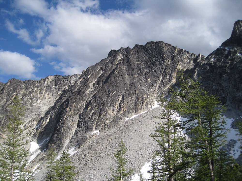
Trip: Corax Peak - North Face Trip Date: 07/05/2020 Trip Report: Not a single TR for this route to be found anywhere; does everyone just do the scramble to tick off their Bulger lists? Rolf and I climbed the NF of Corax Peak this weekend, 6 pitches of 5.7 starting from the left side of the chimney above the crescent shaped snowfield in the photo, going up to the ridge and thence to the summit. Mostly fun blocky ridge climbing, though the first pitch was more "interesting" as Rolf would say, featuring lichen and some loose/suspect rock and excavation of placements and some thoughtful moves. It doesn't appear that it's gotten much traffic since Rick La Belle did the FA in 1991; though of course we could have been off route. Stellar day out though and only saw three people at camp and maybe five on the trail. Gear Notes: 60 m rope, single rack to #3 Camalot Approach Notes: Libby Lake trail
 1 point