Leaderboard


Popular Content
Showing content with the highest reputation on 07/28/20 in all areas
-
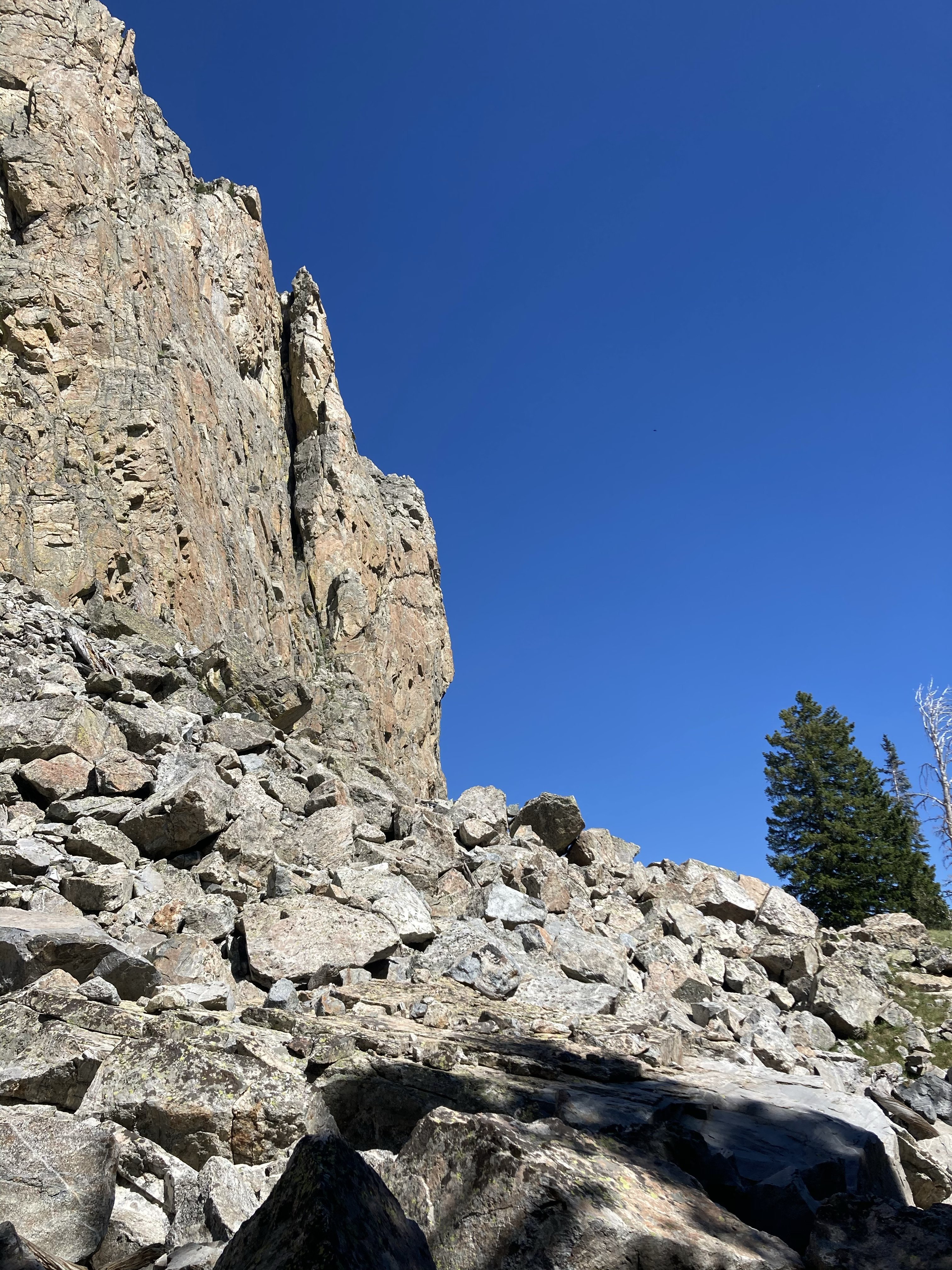
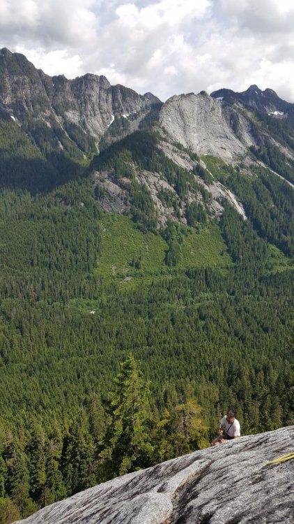
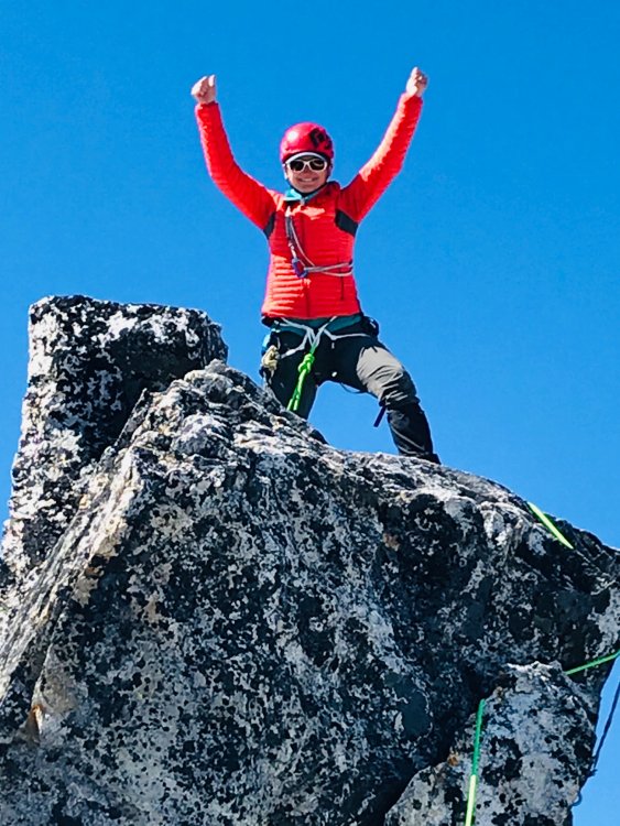
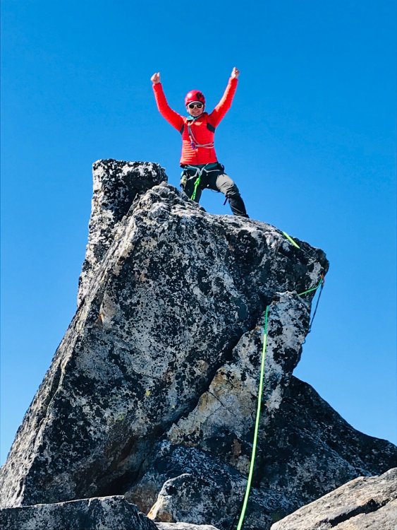
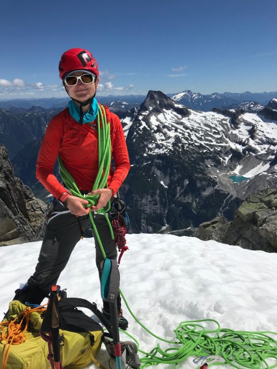
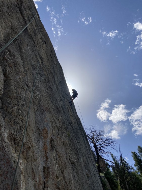
Trip: Three O'Clock Rock - Silent Running Trip Date: 07/25/2020 Trip Report: I've been working 60 hours a week lately and really really needed a day out to just maintain sanity; so der Rat and I scampered up Silent Running this weekend. I was cheered to see that people apparently still get out to Darrington, though I never seem to hear anyone but Otto talk about it anymore. There were a *dozen* cars at the trailhead and we got scooped on Total Soul, our intended route, as two parties were just starting up it when we arrived. There wasn't anyone else on the North Buttress though so we went ahead and did the route in front of us instead. NIce and clean so obviously it's still getting climbed, unlike some of the obscurities to the right and left. It was an Alzheimer's first ascent -- we did it together seven years ago but neither of us could even remember which pitches we led. Still seven pitches of good fun and it was such a beautiful day that I, the woman who is always cold, was comfortable in a t shirt and cotton pants rolled up. In contrast, all four climbers on Total Soul were wearing matching long sleeve hoodies with the hoods *on* all day long. Maybe they were all from Arizona or something and found 70 degrees to be cold? Here's to more and better climbing and much, much less work for the rest of the summer. Gear Notes: two ropes, one small rack, ten draws Approach Notes: hike up the trail3 points
-
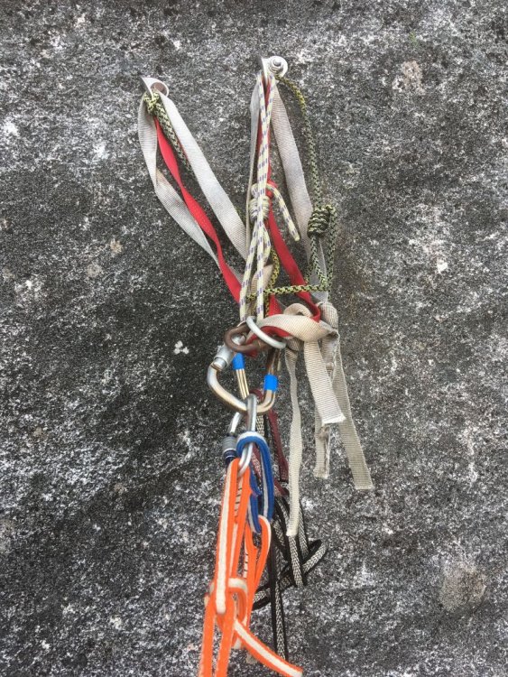
The tat loaded on the anchor of pitch 3 has been removed, replaced with SS chains and rings. This is the higher of the two anchors, up and right of the dihedral containing most of the pitch. Sorry I didn't take a photo of the new steel. Also, the pitch above the Big Tree has received new bolts, 3/8" SS of course, with Mad Rock hangers. No pictures of them either, sorry. Two weeks ago I looked over at this pitch 5 after reaching the nearby top anchor of Shake, Rattle and Roll. I could not believe seeing a beautiful slab with Leeper hangers still on it. And a couple of SMC hangers, all on quarter-inch rusty bolts. Doesn't anyone go up there? So the next week I returned with Robin who sat patiently while I drilled out four of them. There were more to do, so I returned yesterday via rope solo to get the last one out. While I was there, I tested my new uAscend and Microtraxion to top-rope the pitch (worked great, and safely!) and found it to be delightful, knobby climbing. It seemed to have some 5.9 at the start, and eases to 5.8 the rest of the way for a good 55m pitch. Thanks DavidW and MattP for putting this up.
 1 point
 -
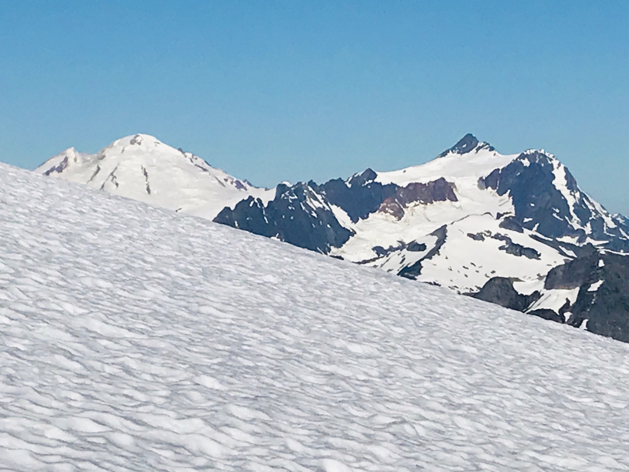
Trip: Glacier Peak & Mt. Pilchuck from Puget Sound Round Trip in Single Push - Standard from South (N. Sauk) Trip Date: 07/25/2020 Trip Report: As the "location" description states, this was a "single push", all human powered, sea-to-GP-to-Pilchuck-to-sea, 27 hrs and 44 min. I reached the Glacier Peak summit from sea (Puget Sound) level in 11 hrs and 7 minutes, starting at 10PM on Fri, 7/25/2020 from a point on the water a few miles west of I-5 and Marysville, after a 60 mile combination paved and unpaved bicycle rides via Barlow Pass, then heading out on foot from the North Sauk River TH. My time from the TH to the summit was 6 hrs 49 min, and that includes the windy/cold 14 min transition to some different gear (but still minimal/light) and a concentrated downing of food at a lower/base camp on the White Chuck Glacier a bit off from the beaten path because of the great rock to sit on, so it was worth the travel extra time. I did have a physical problem during the bicycle ride that caused a collective delay for me that was timed as over 12 minutes, so without that snafu my sea to summit time would have been sub-11 hours. Round trip from the TH to summit was 13 hrs 24 min, including both that 1st 14 min trans and a second 16 minutes one on the way back, and also enjoyed 9 amazing minutes on the summit. Glacier Gap (high camp) to the summit was 2 hrs 2 min. which included the time to put on Kahtoola light crampons (not their Microspikes, which I did use also but on the lower glaciers, etc.). So travel time was sub 2 hrs. I Did a bit of running on the river trail on the way out, but not on the way back because it would have compromised the sizable amount of work I still needed to do after returning to the TH. This was a supported trip, including my super talented guide, Aaron Mainer, that I've worked with on these projects over a period of 13 years, who I met up with at the White Chuck Glacier transition point, and he expertly paced me from there to the summit. Even when I lead on the exposed lower rib scree stretch, he monitored me closely. Pacing is important, but even more so is the safety aspect. On ult-high endurance endeavors my wife appreciates that I have a skilled guide to climb with who knows how to maximize safety (as well as speed and fun all at the same time). Back at the TH, I bicycled back down to the Mountain Loop Biway, then back up to Barlow Pass (tough), then back down again to 1,000 ft before starting up the Mt. Pilchuck road. Anyone who has been there knows how bad the road up is, but on an off round bicycle you can wind your way through the potholes so it's manageable (and exciting on the way down). TH at 3,000 ft, and then hiked the remaining 2,300 ft to the fire lookout (5,341 ft). Summit-to-summit was 12 hrs 12 min. Sub 12 would have been nice but let me tell you that after almost 24 hrs on the move, one does what they can. It was at about 9:30 PM and there was a party going on in an around the lookout, with people putting up decorations inside. This was troubling to me both because I don't know it that's allowed to be taken over, especially during a pandemic (...but whatever...), and also because I was tired and just wanted to enjoy the bit of emotional peace, quiet I was expecting to have, plus solitude (except for Aaron, who hiked out and then drove to the TH to go up with me and make sure I was safe coming down the bouldery/hazardous upper have of the trail when coming down in the dark fairly fast). People surely wondered why I was wearing a helmet, but I didn't care that they had no idea what I'd done before getting there. After the wild night ride back to the hwy passing cars along the way, and then back to the start, the total time was 27 hrs and 44 min. So I finally finished all 5 WA volcanos, round trip single-push from sea level, with extra peaks included for extra challenge. Before this I did Columbia River (Kalama/Woodlind) to Mt. Adams/St. Helens summits single push and back, in 2018. My Cascade Climbers post for Shuksan/Baker in 2011 is: https://cascadeclimbers.com/forum/topic/82364-tr-mt-shuksan-and-mt-baker-in-single-push-fisher-chimneys-shuksan-and-park-glacier-baker-8132011/?tab=comments#comment-1026406 And before that in 2008 was Puget Sound/Rainier Summit/Puget Sound in 19 hrs 57 min. Like all the other things, like video from NWCN, etc. It's all disappeared. So much for documentation on the internet (frustrating ) But here is an important remaining reference to me on this site. Someone gave me credit:https://fastestknowntime.proboards.com/thread/54/mt-rainier-wa That's it. Shuksan/Baker made it onto the front page of the Sunday Bellingham Herald with a big picture, but they long ago purged all their old stories because the parent company wanted them to. I begged them to bring it back, and they did, but then it disappeared again. Same with Tacoma News Tribune (top 10 adventures of the year article). I'd like to get the Seattle Times to pick this up, but we'll see. I'm generally private about my endeavors, for various reasons you can imagine, but now that I've finished the 5 volcanos (and I'm deep into 57 yrs old now) I want to write out them. Not a big social media guy, but have considered YouTube, Outside Mag., etc. Any other ideas? -Randall Nordfors, Woodinville WA. Washington native. I also go by "Randy" sometimes. Gear Notes: Went light. Short pants, Kahtoola microspikes and Kahtoola lightweight crampons. Poles, and light boots with gaitors, minimal pack. No ax or helmet. Knew from experience on GP that it was an okay gear choice on a perfect day (which it was). Approach Notes: West of Marysville by bicycle to North Sauk River TH, then standard route from south.1 point
-
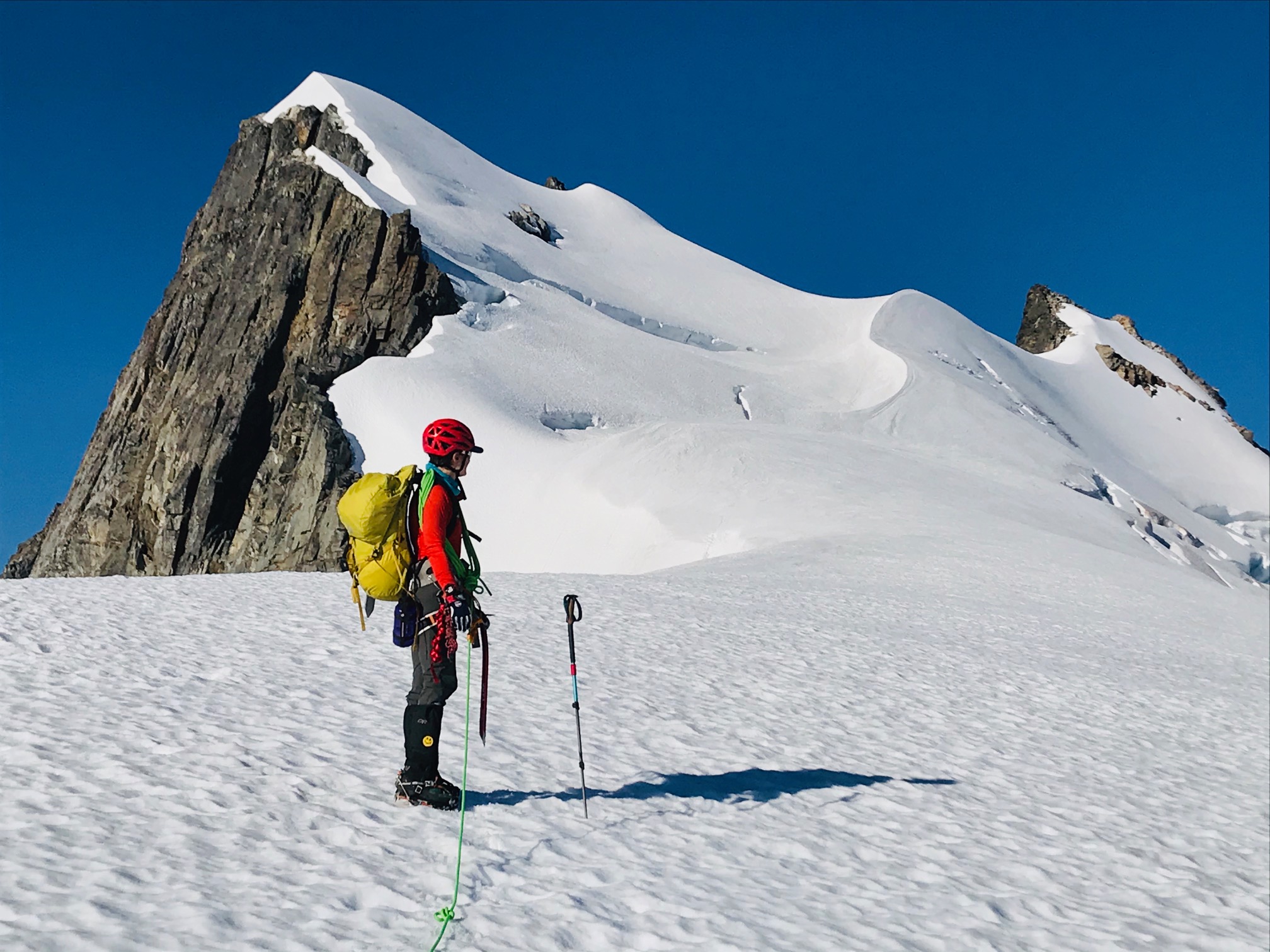
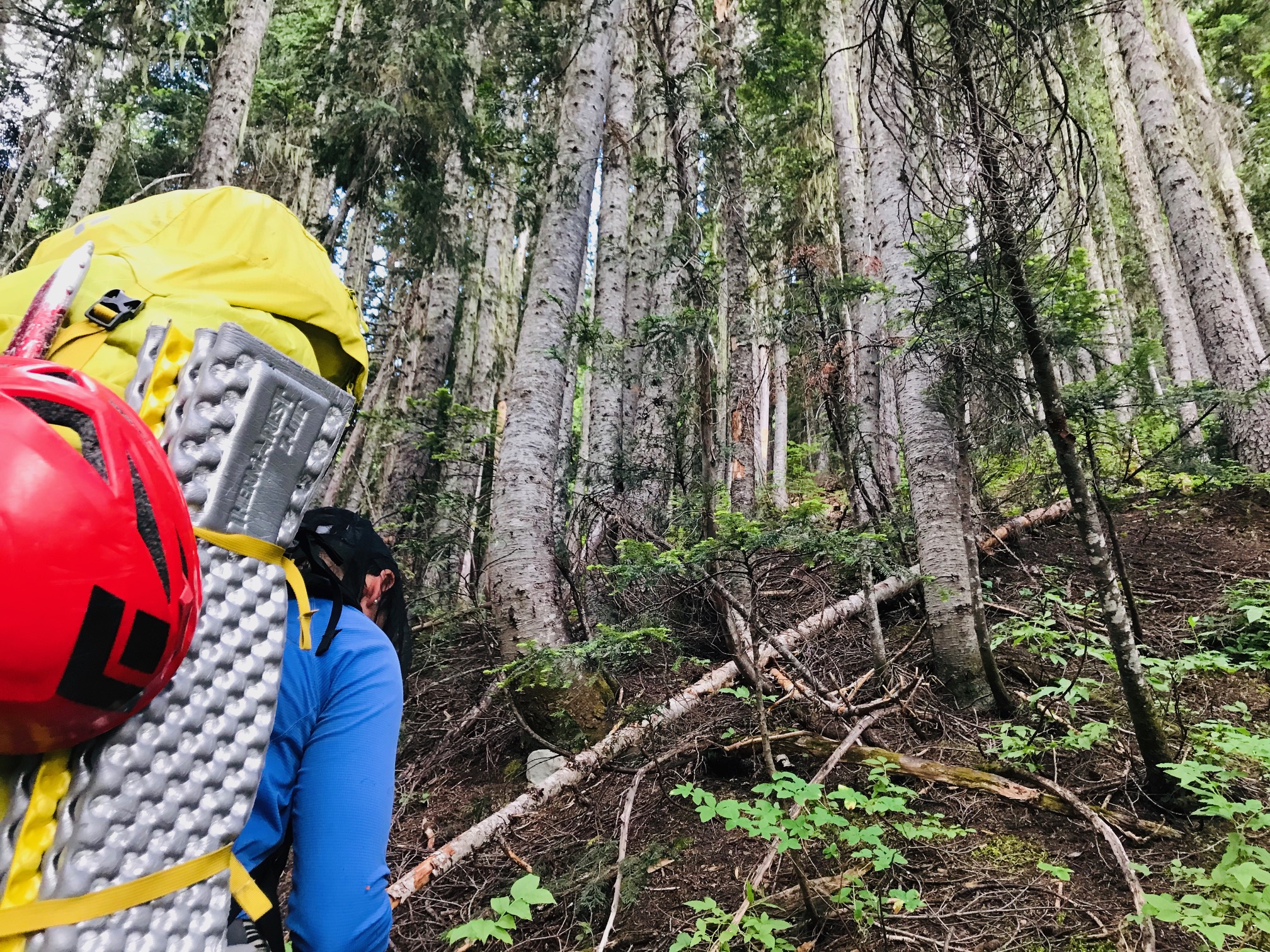
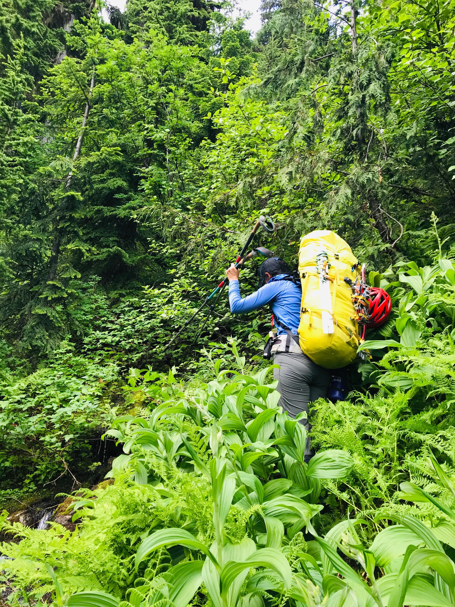
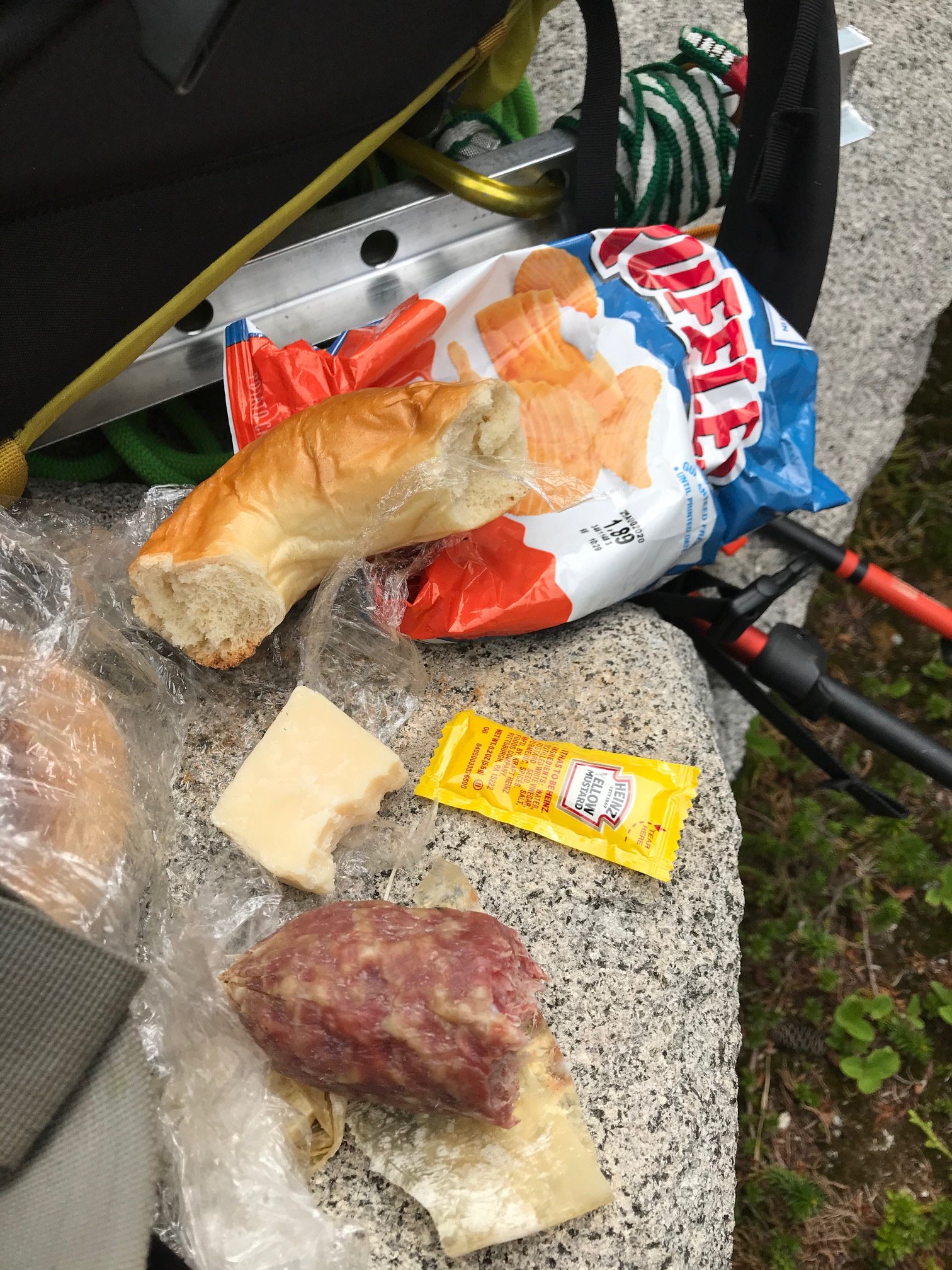
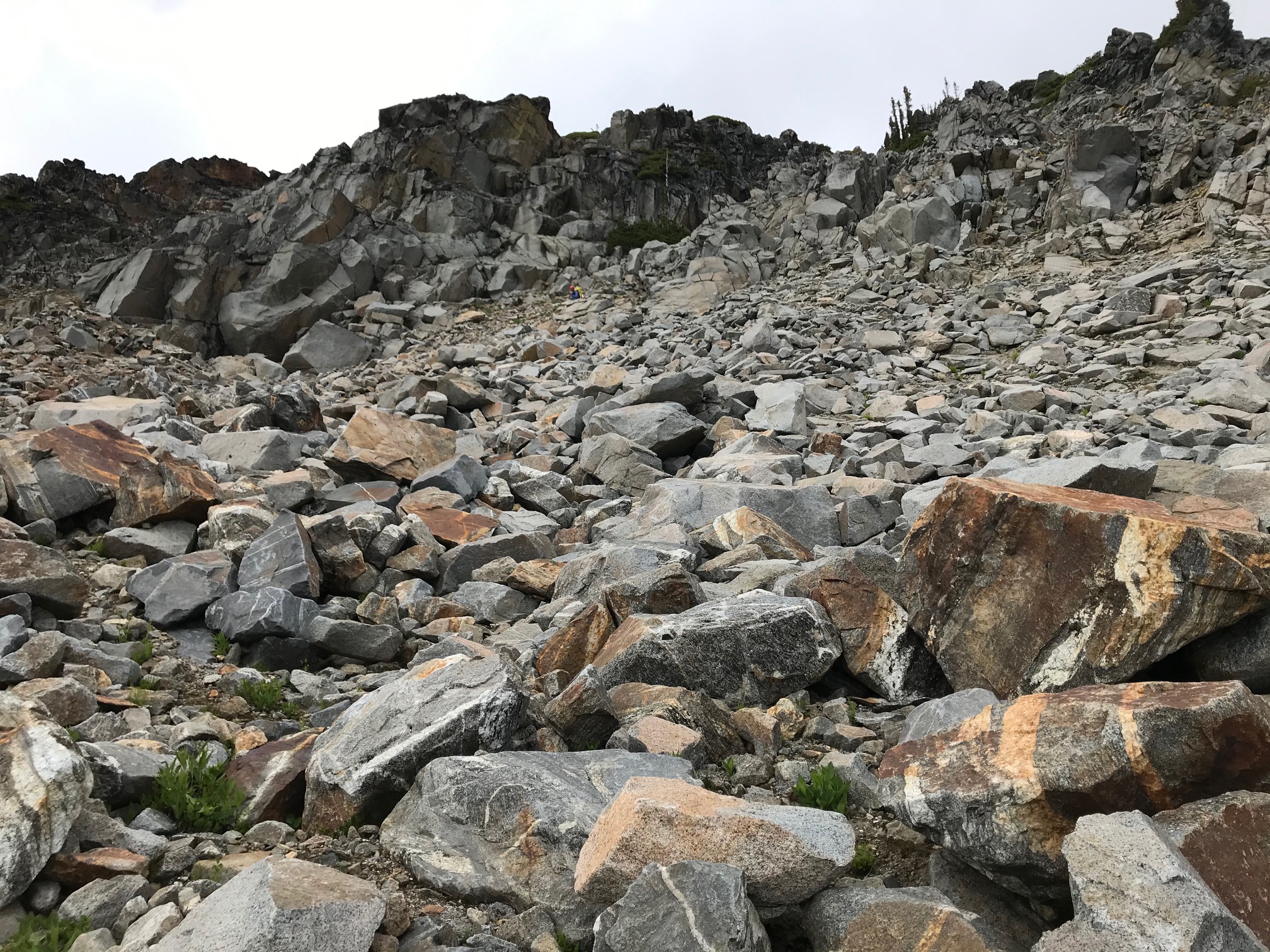
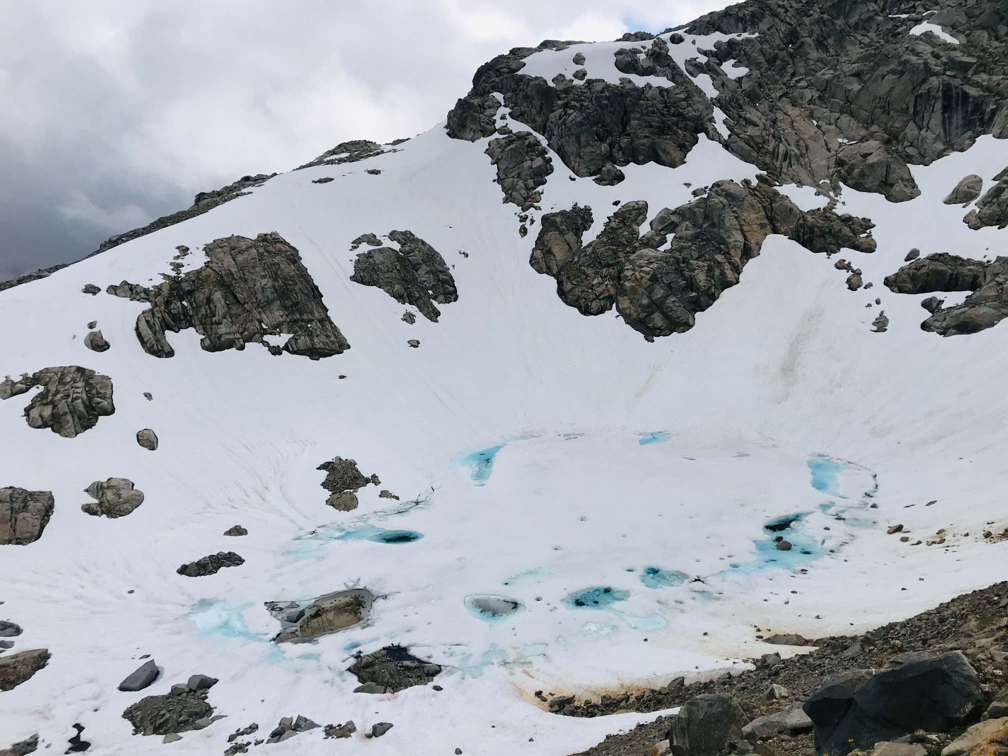
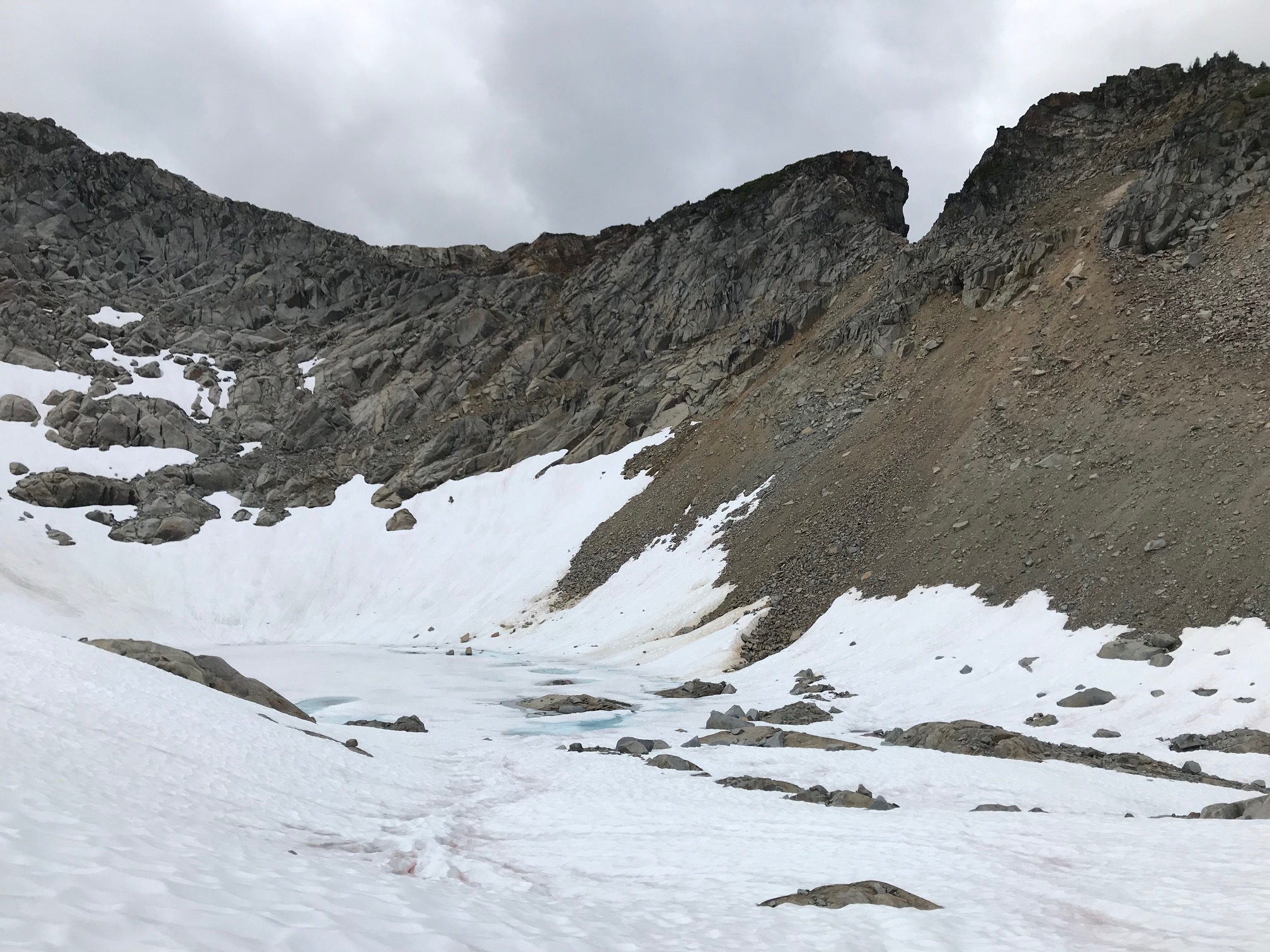
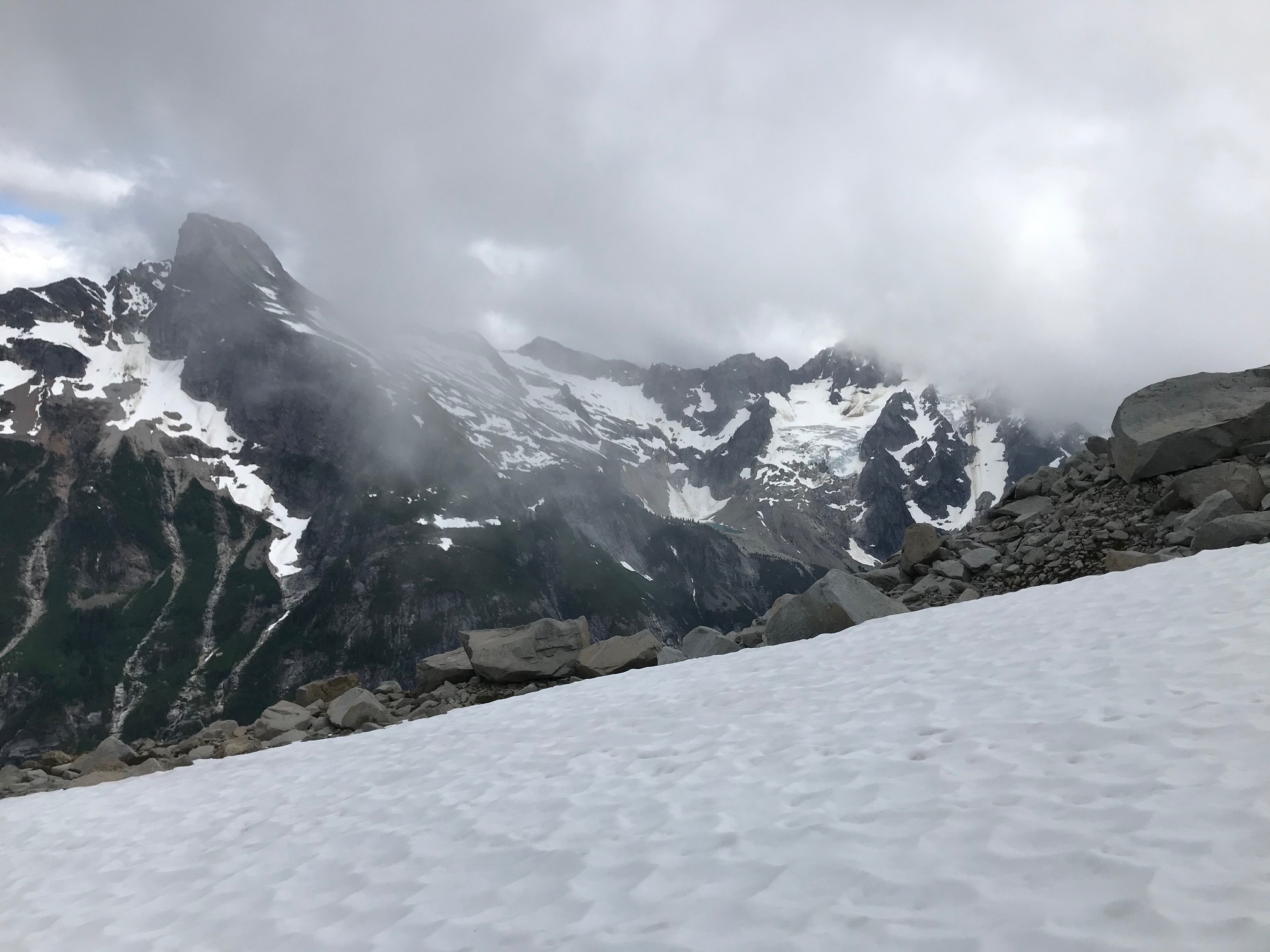
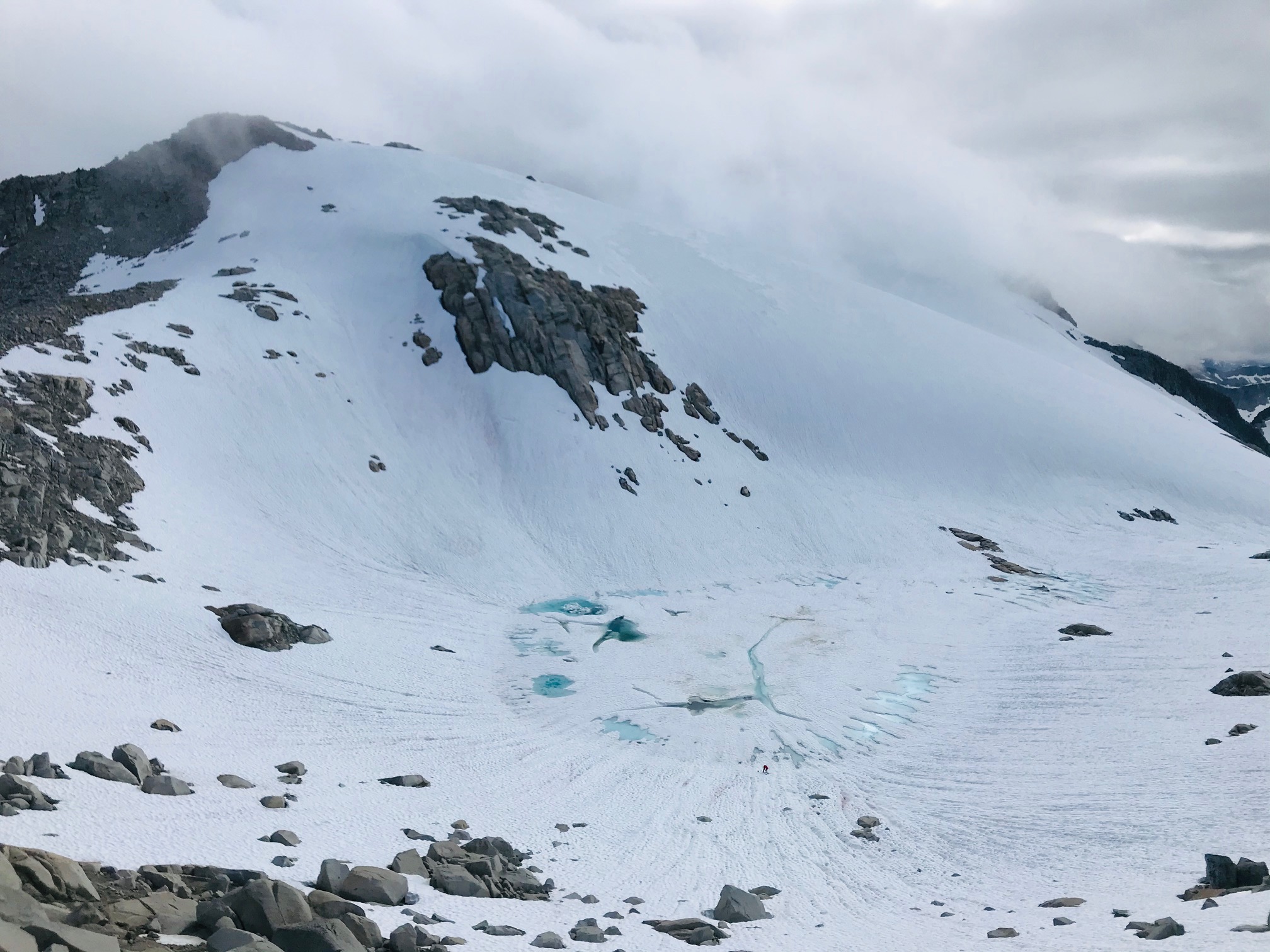
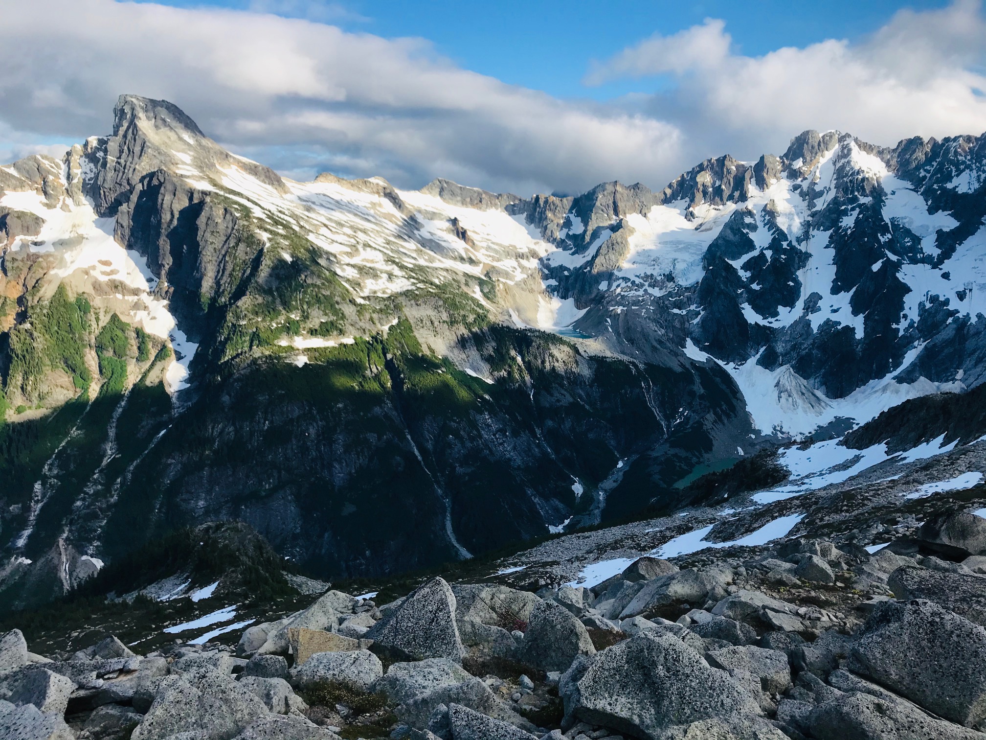
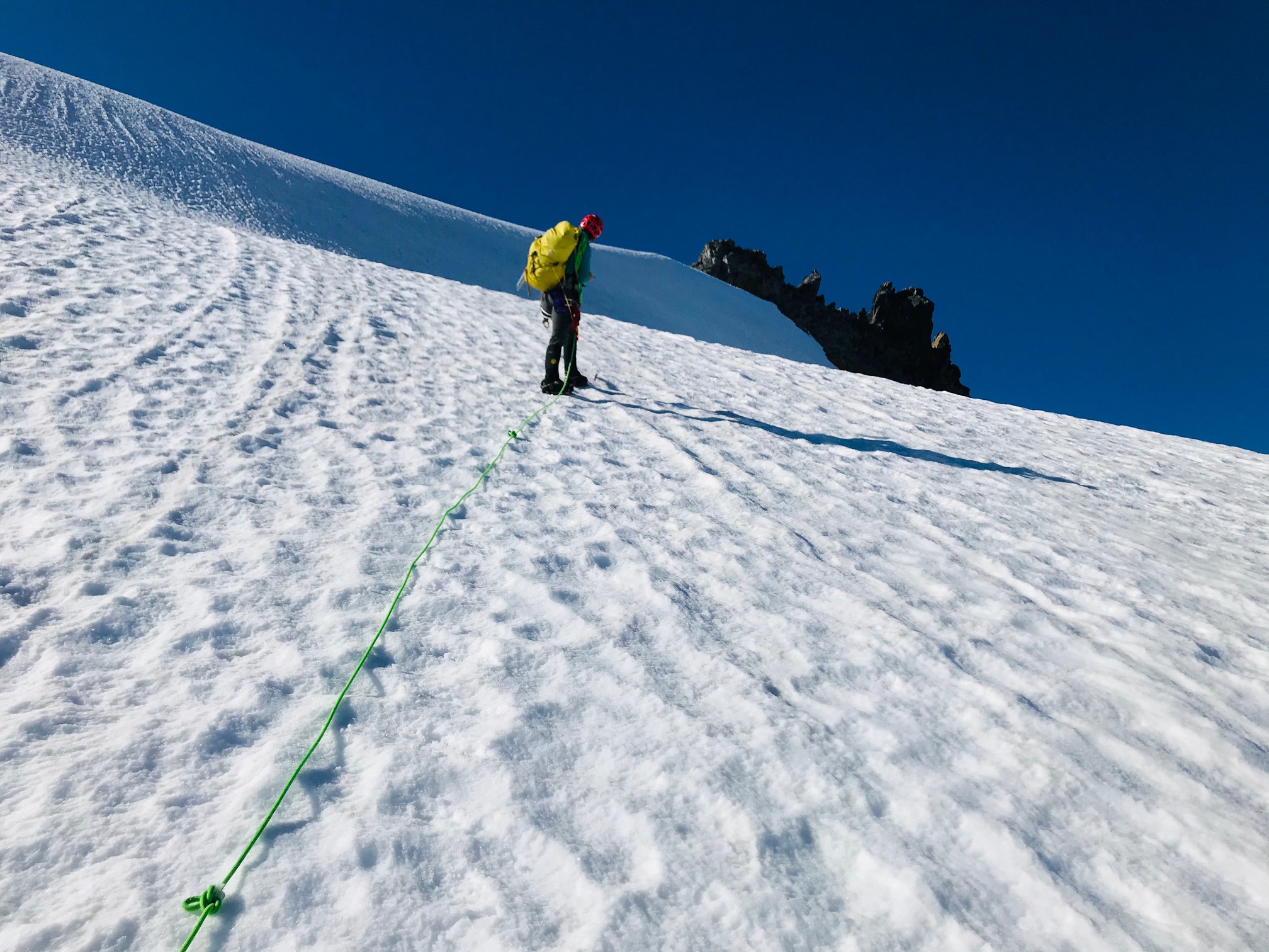
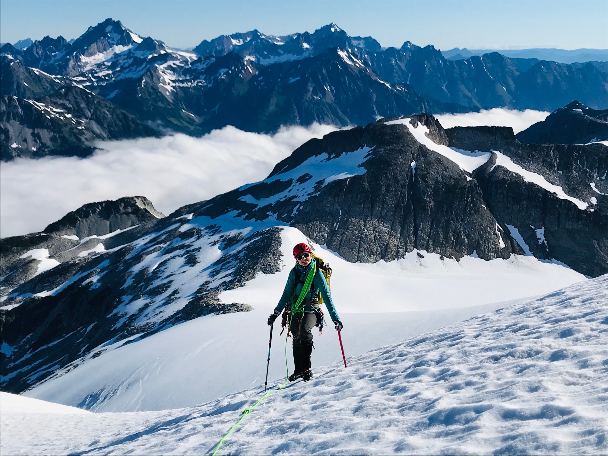
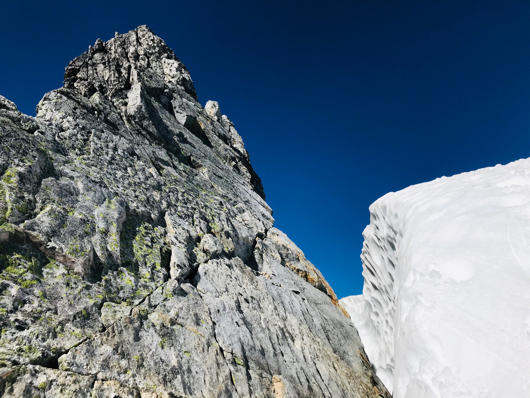
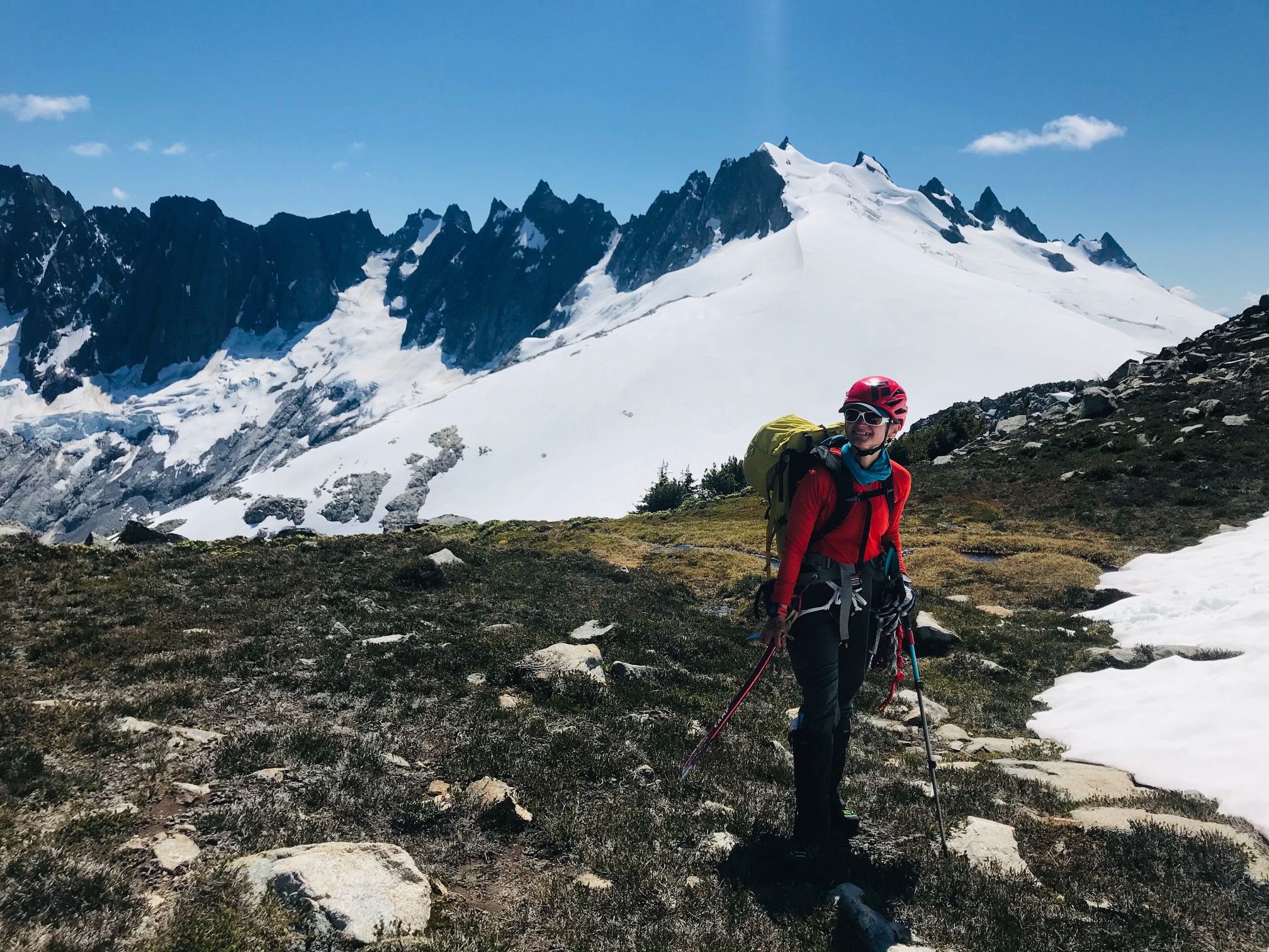
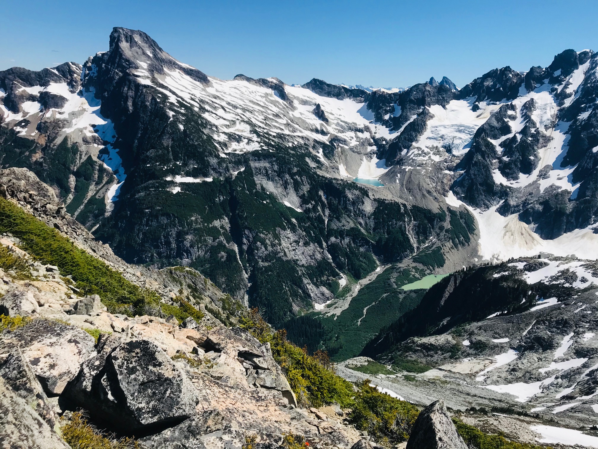
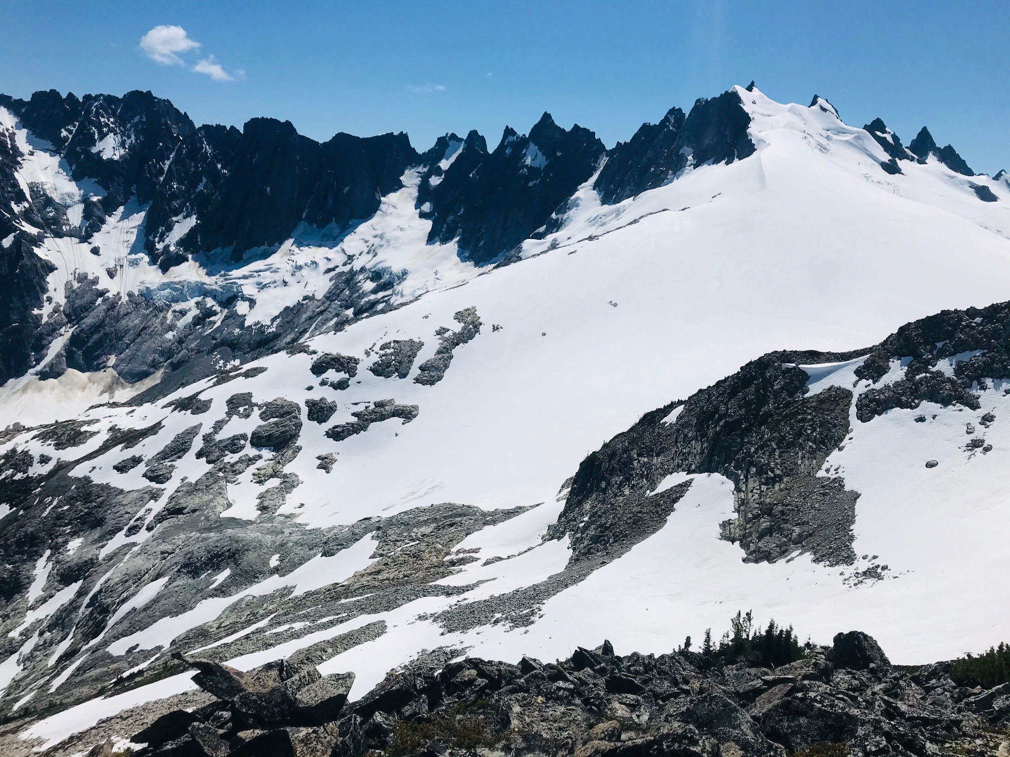
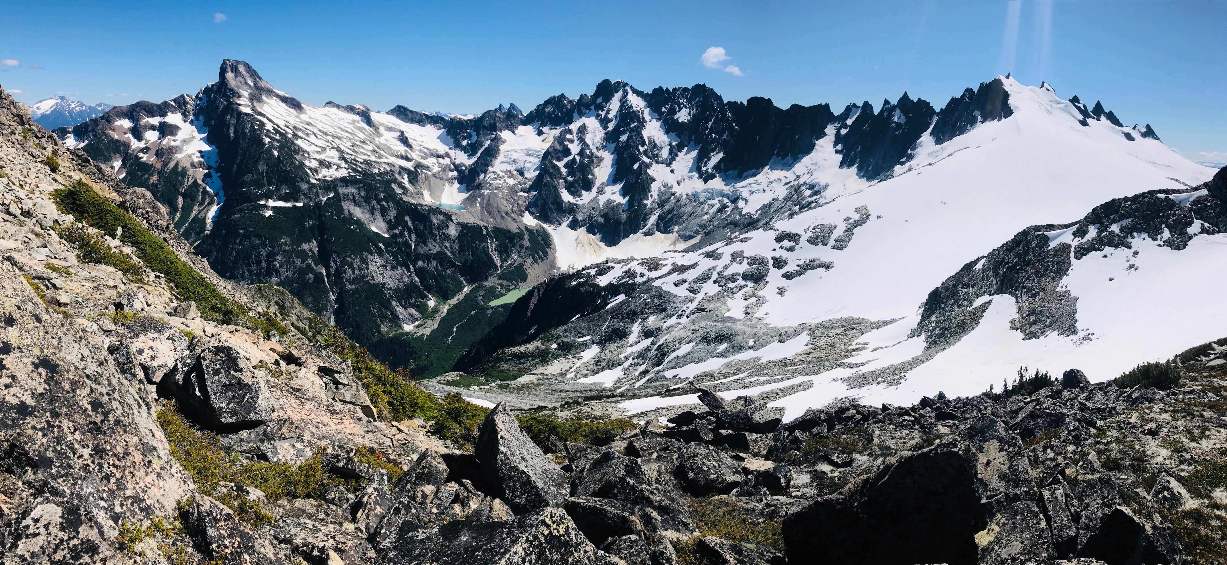
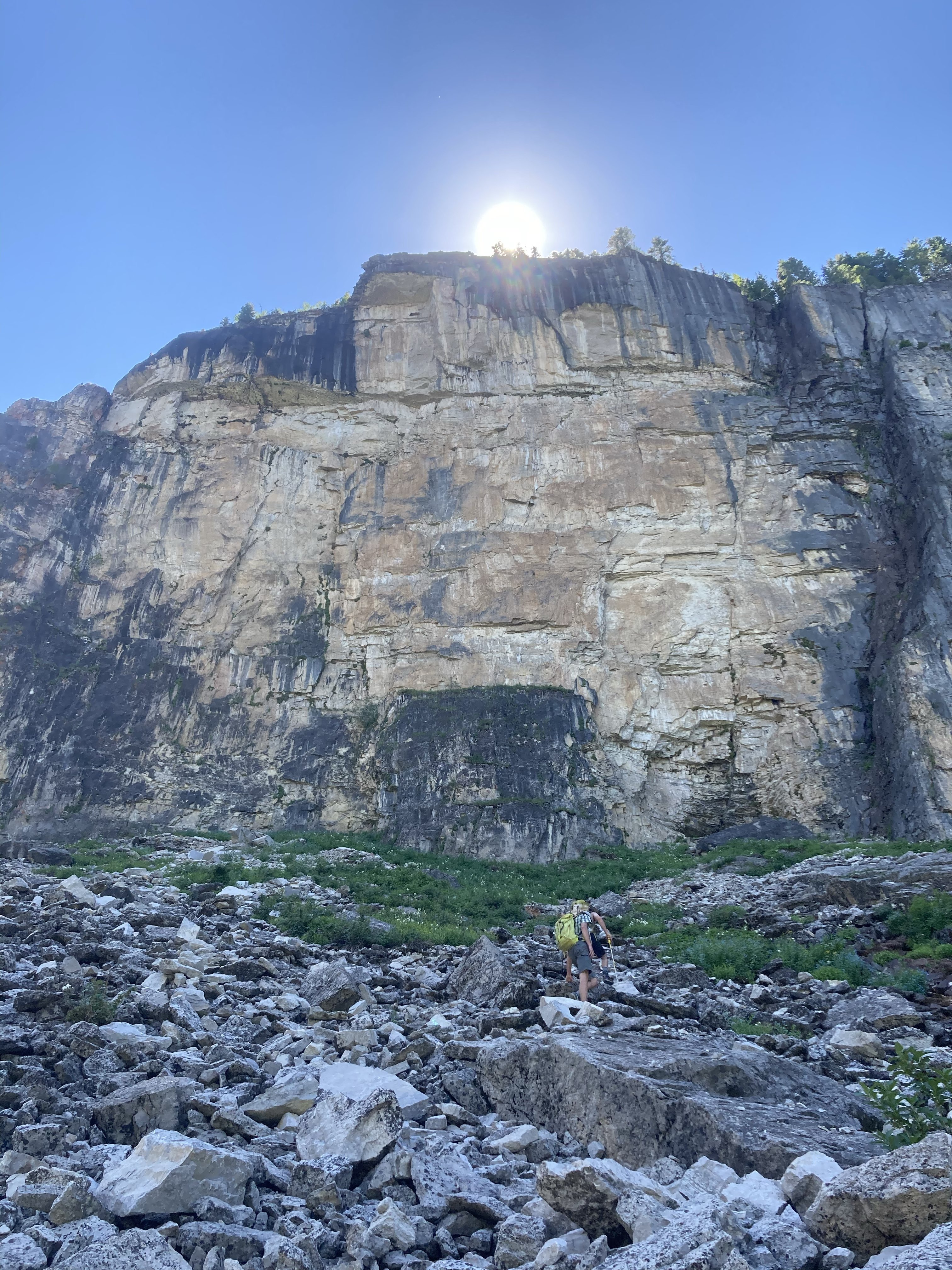
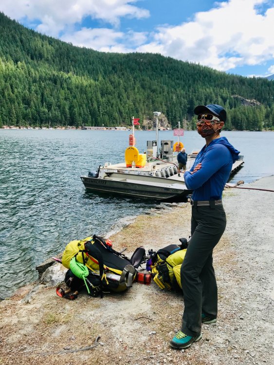
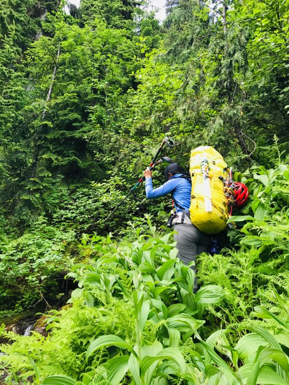
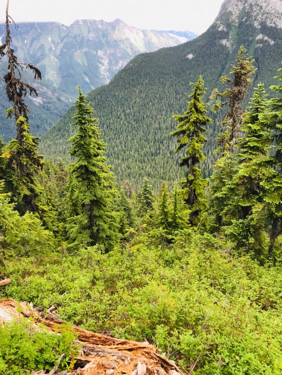
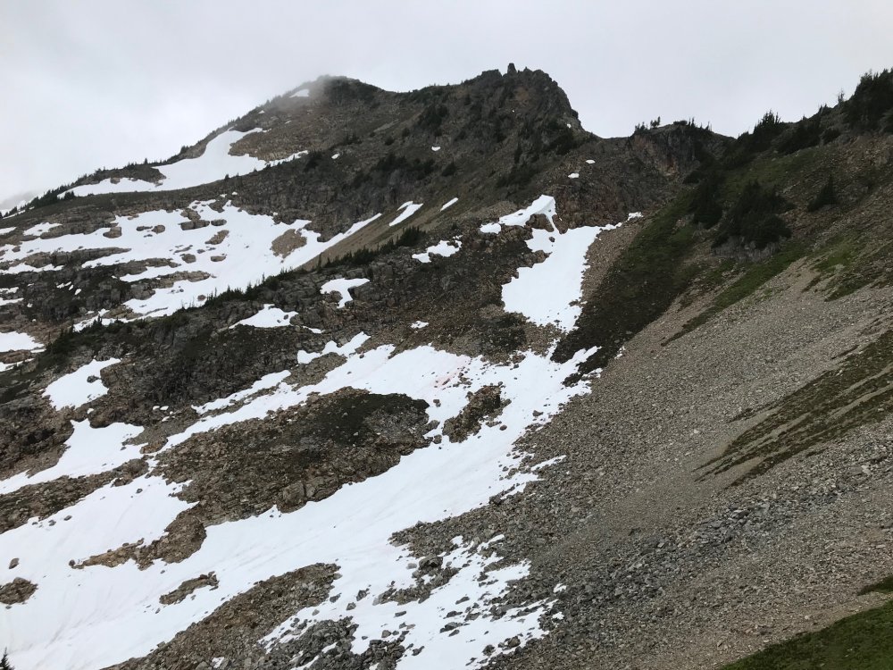
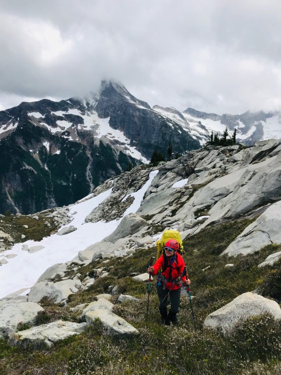
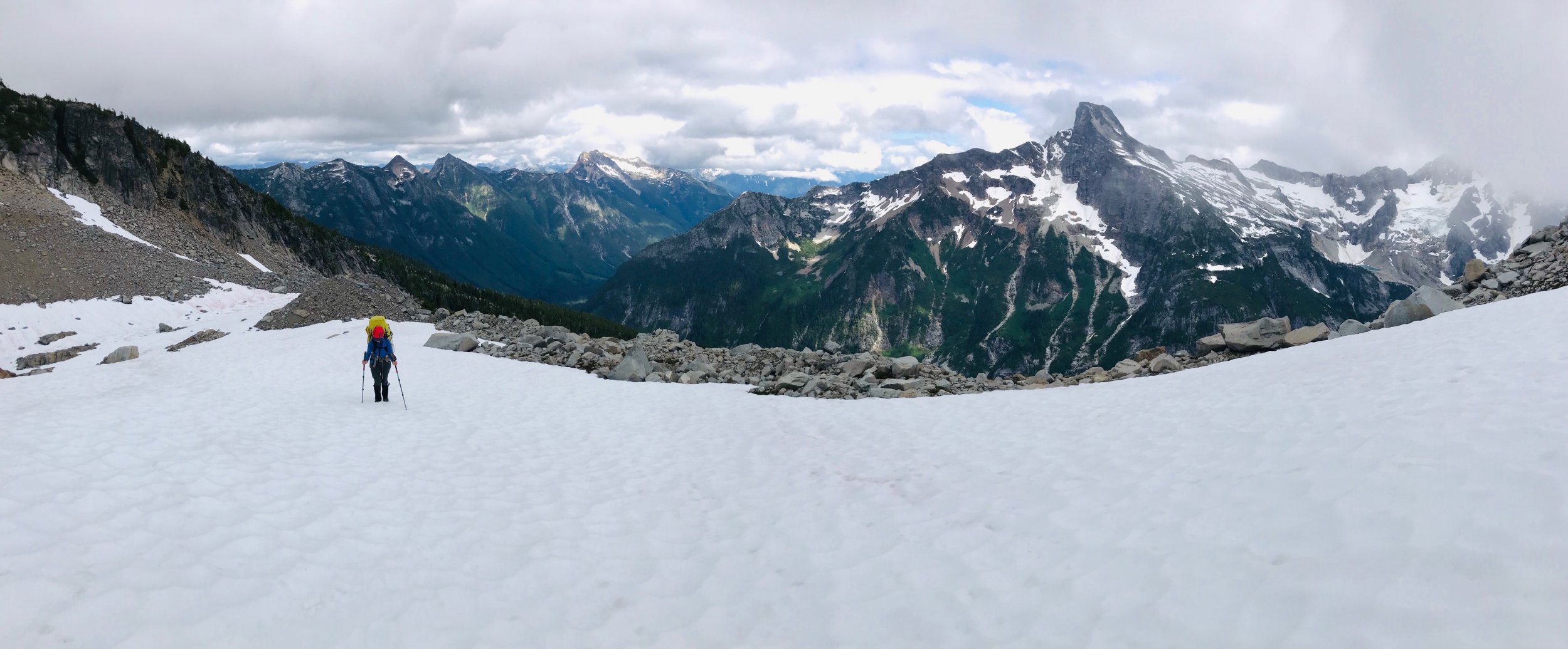
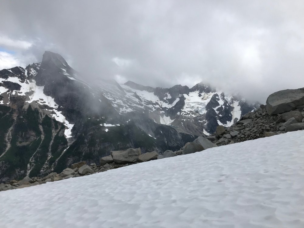
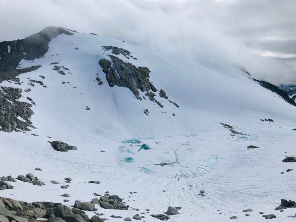
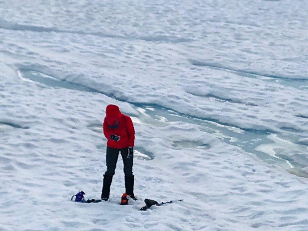
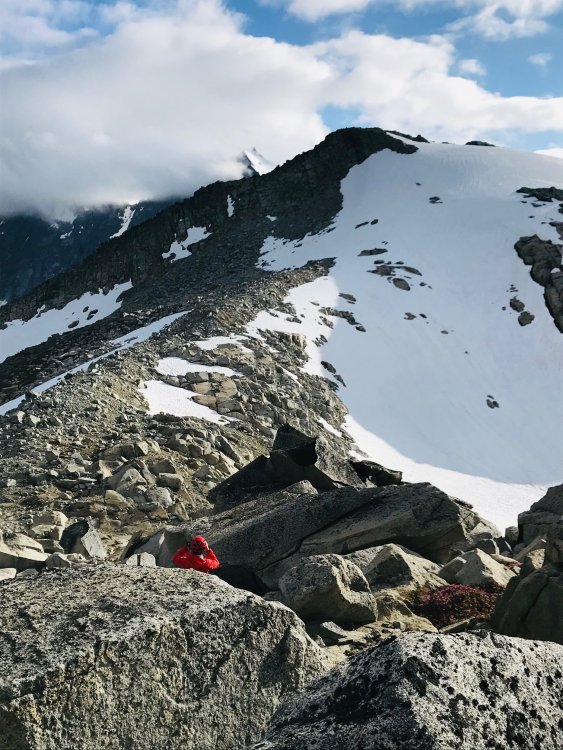
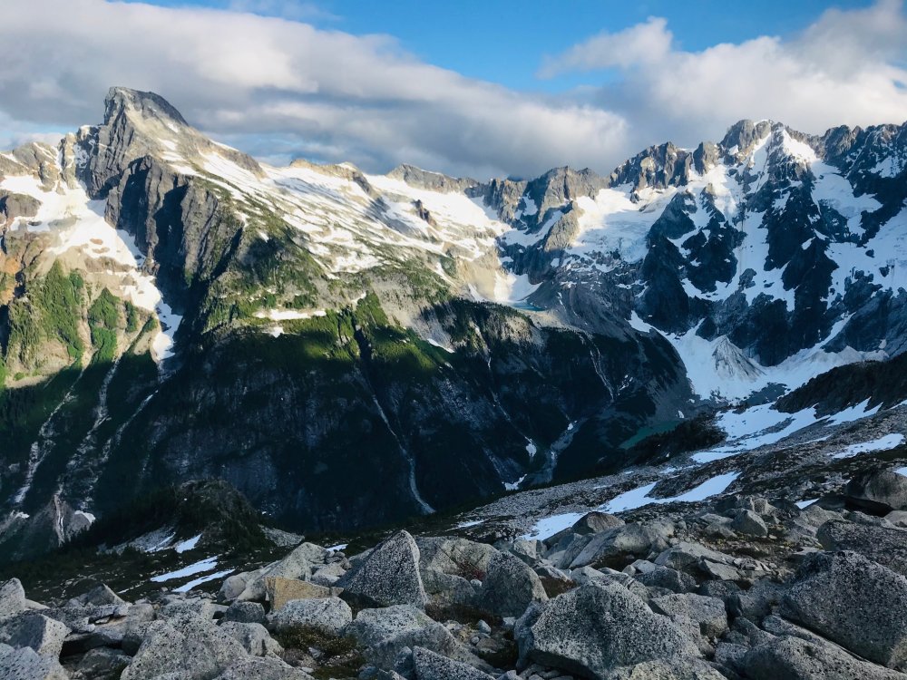
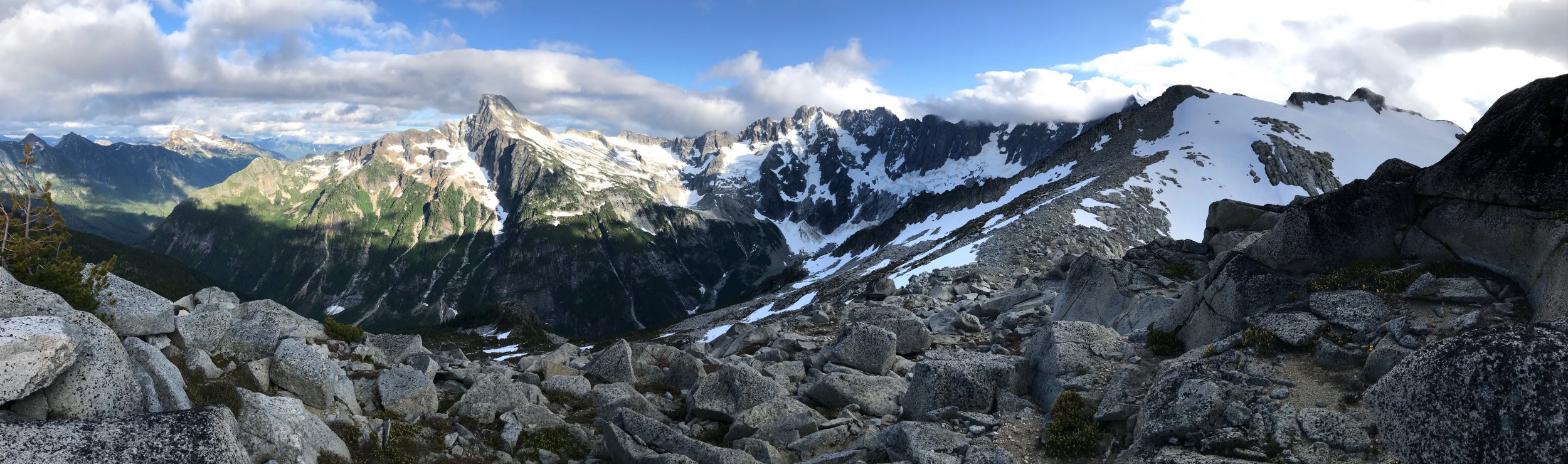
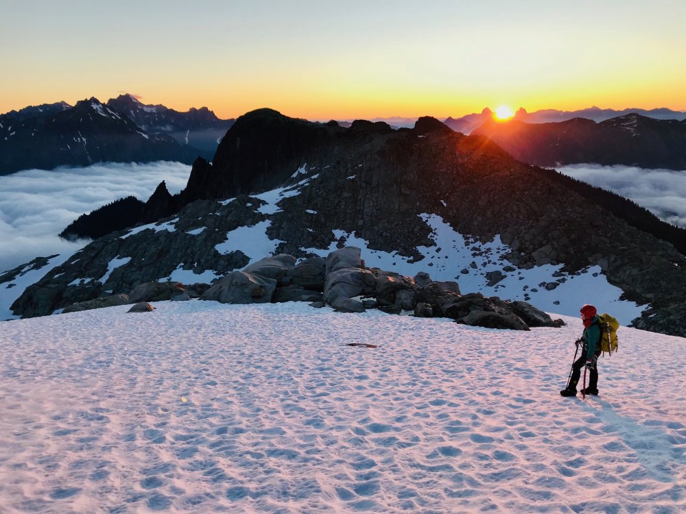
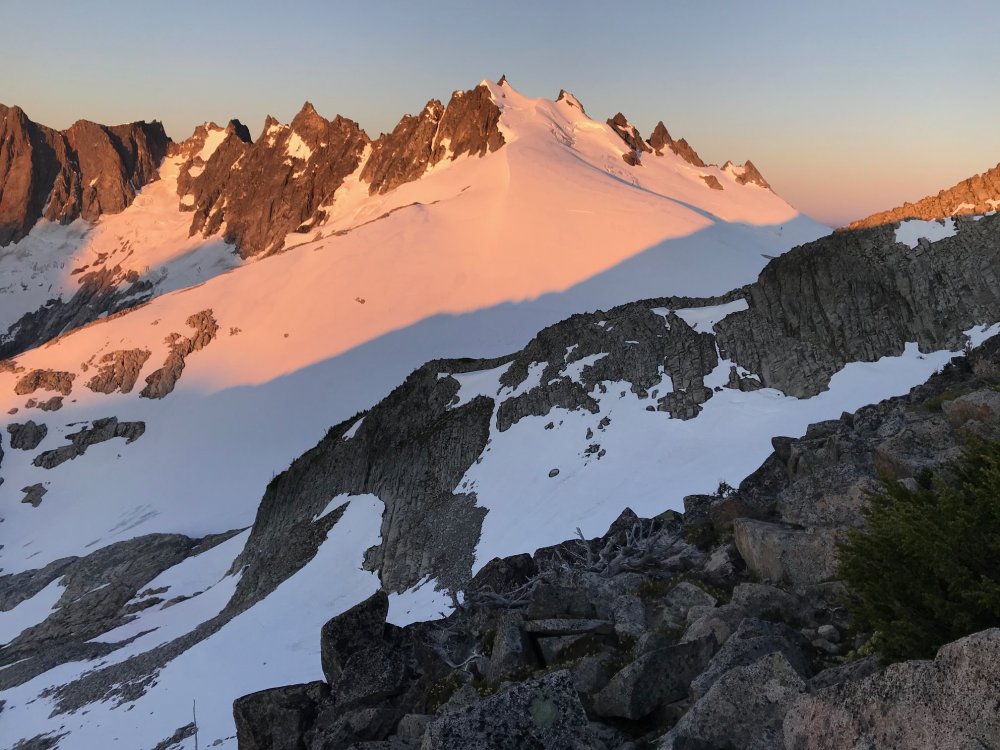
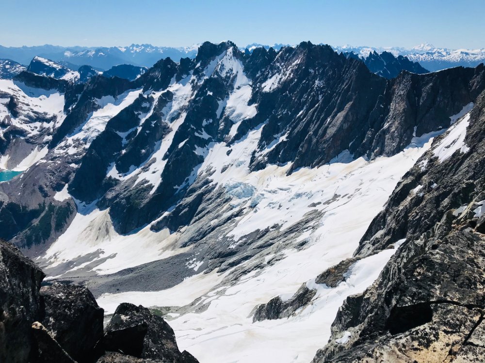
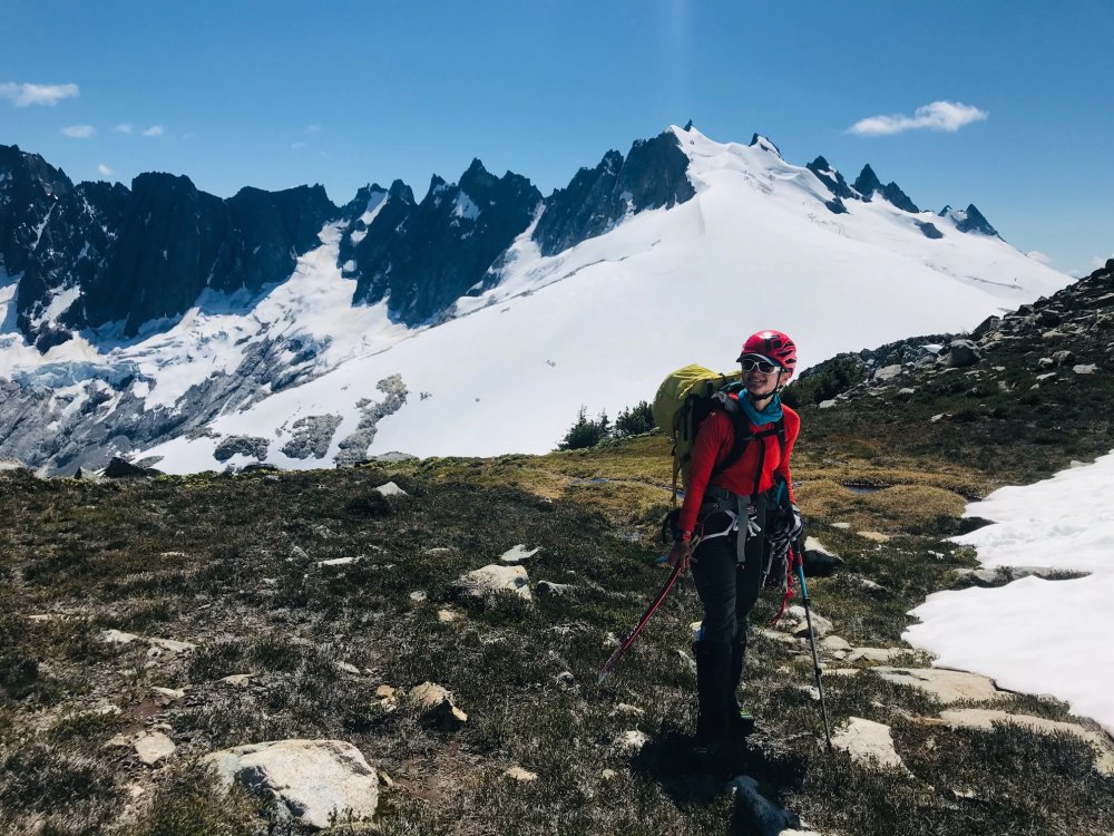
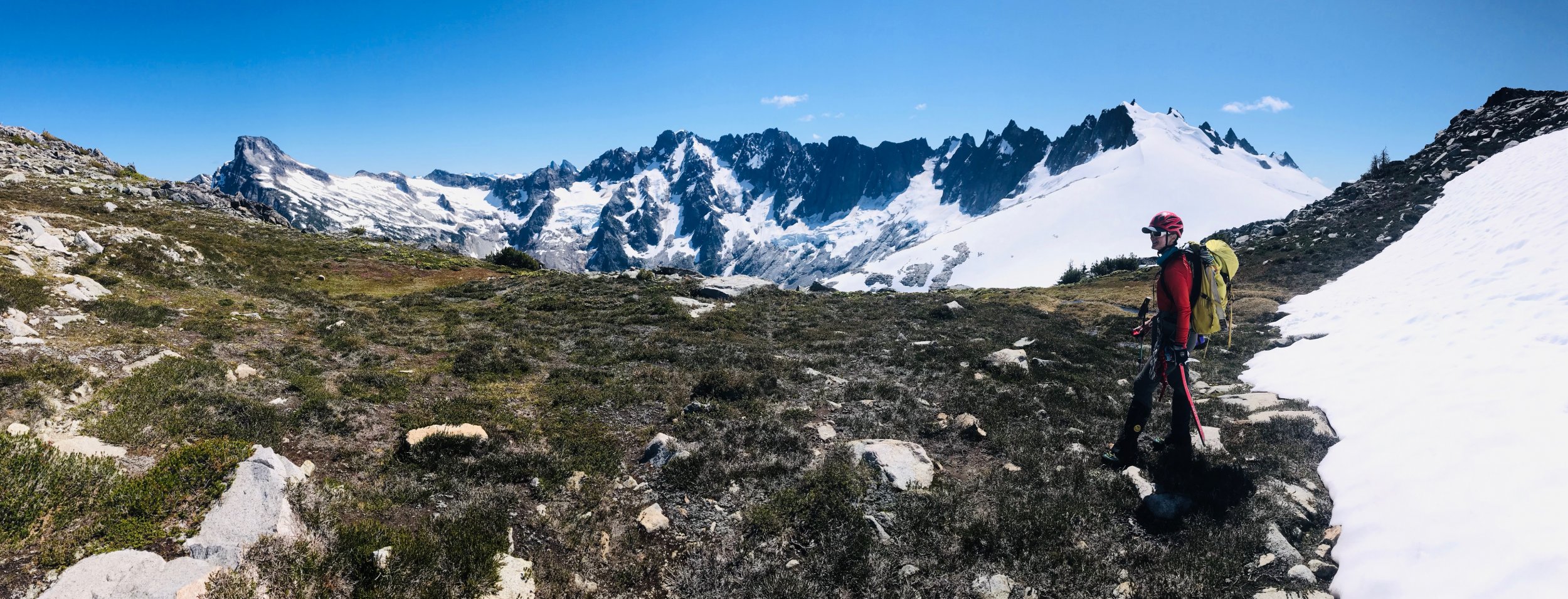
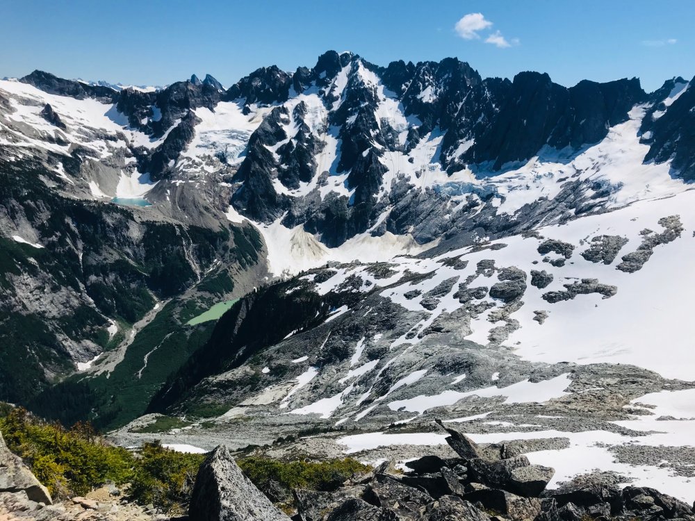
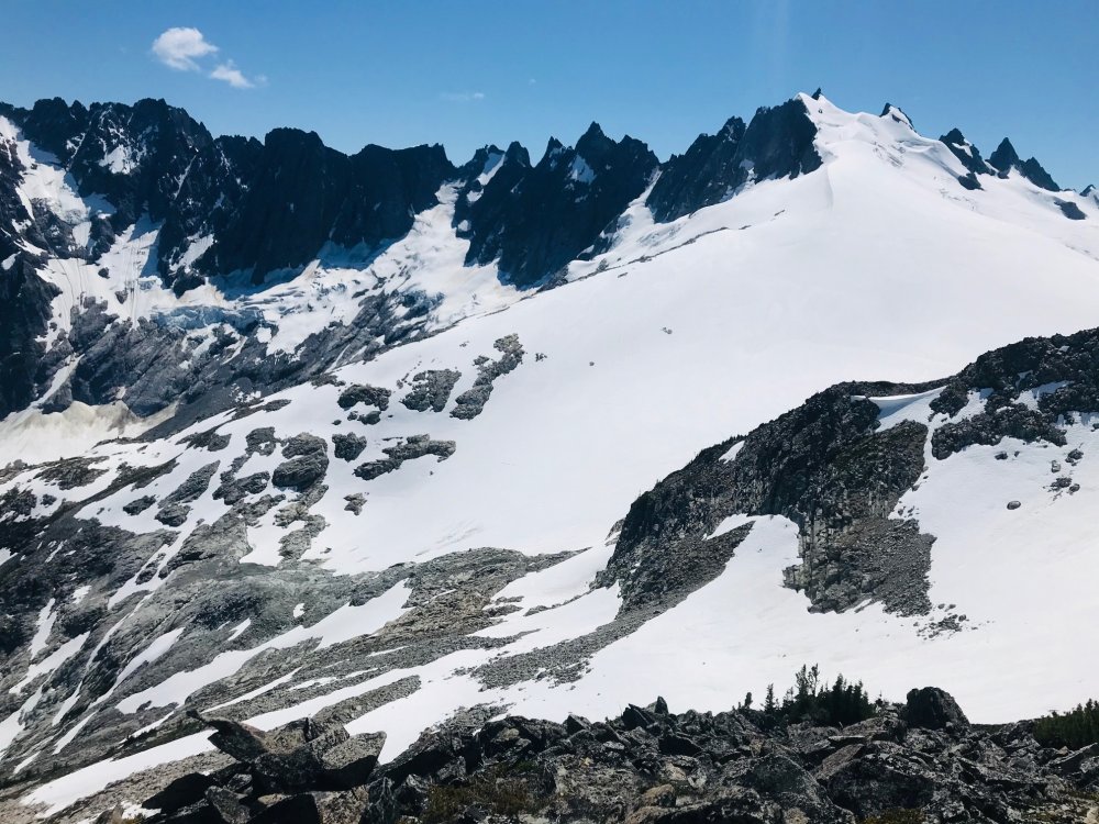
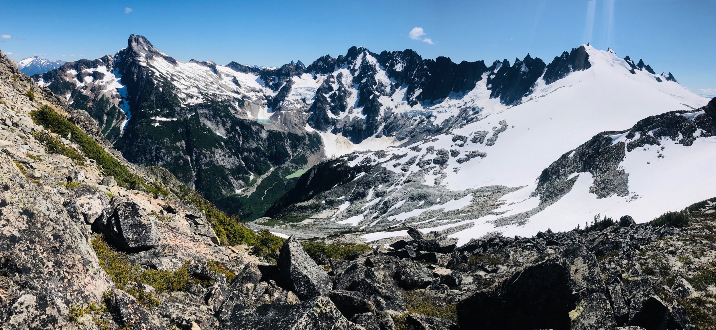
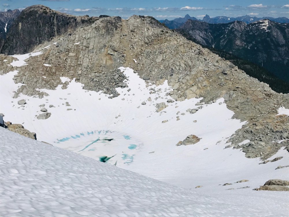
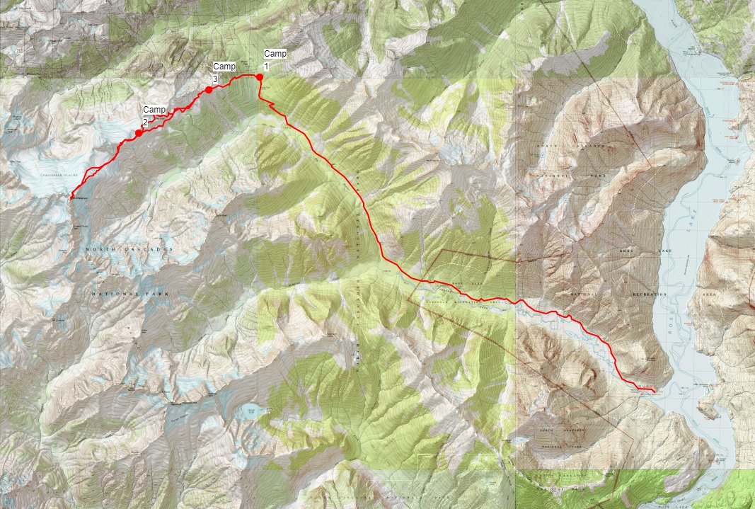
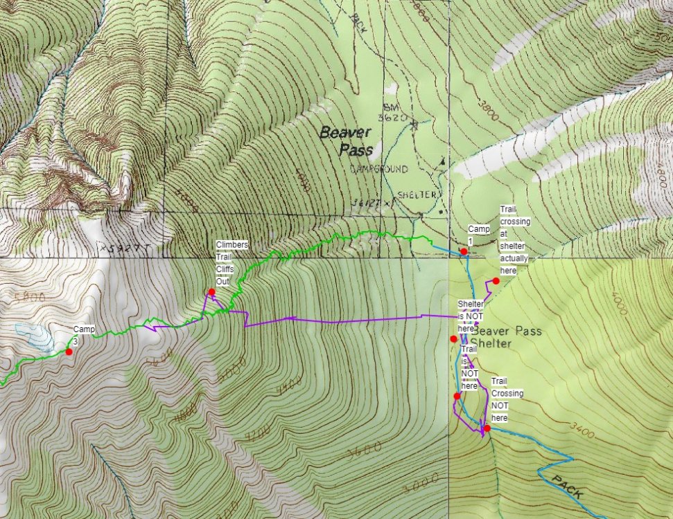
Trip: Mount Challenger - via Eiley Wiley Ridge Trip Date: 07/25/2020 Trip Report: YouTube Video (so the video does have a couple clips out of sequence in the rock climb section and it ended abruptly due to all the GoPro batteries and chargers having run dry at the last clip). Hot off the NF of Buckner and barely recovered we had a weather window for Mount Challenger but only for a 4-day trip. Our full Pickets traverse we have had planned the last couple seasons keeps either getting weathered out or life gets in the way. So, to do it in 4 days we planned on doing it from the Big Beaver trailhead with a boat shuttle then via the Eiley Wiley Ridge knowing that this was also going to be the harder approach option. Day 1 - Thursday Got to the Marblemount ranger station at 6:30am to get permits which was good timing, the crowds showed up shortly after. Picked up the boat shuttle which dropped us off at the Big Beaver trailhead saving an extra 7-mile walk from the Ross Lake parking lot. From there an uneventful 13 mile and 3000ft gain hike to the Big Beaver campground. In bed around 8pm for an early start. Day 2 – Friday This was going to be the hard day. Up around 3:30am and a leisurely 5am start. We knew from beta to expect some awful bushwhacking to gain the ridge. While we did pickup the odd climbers trail in key places throughout the trip where anyone who goes through the ridge seems to funnel through the same few spots there always peter out shortly and you are left to your own navigation for 95% of the ridge. So, we started out full-on dense brush bushwhacking from camp and I think we picked more or less a fairly good line. But as you get higher there seems to be no way around hand over fist veggie belay climbing and bushwhacking through about 500ft worth of the 2000ft gain. Its all steep and virtually no sign of any climbers’ trails till you hit the very top. That took about 2+ hours and our clothes were full of pine needles inside and out. From there we spent another 6 hours getting across to the end of the ridge which was about 3 more miles after the 2 miles of bushwhacking. Mainly because we kept a middle line across the ridge until getting close to Eiley Lake. From there it looked like you could gain the ridge and do a high traverse over a large wide ridge. The topo map showed a relatively flat and wide ridge as well with only a single contour line and large bump. So, we gained that ridge only to find it ended in about 200ft cliff and wide chasm that was more than a few contour lines deep that did not show on the topo map. But from there looking back could spot what looked like a gulley down to the lake. That gulley was very steep, loose dirt/scree/boulders but it got us down to Eiley Lake. We blew a couple extra hours here. Had to exit that basin then took a line around another slope heading towards Wiley Lake. Once we popped over the boulder field looking down at Wiley Lake and across to the last half-mile of where we wanted to be it was getting late and very windy and the rest of the approach to our planned camp was in a whiteout so we found a small sheltered ledge in the boulder field with a great view of Luna Peak and setup camp. The weather was supposed to be clearing by late evening but had gotten worse. By the time we had camp setup and ready to turn in the clouds started lifting enough we could get some views of Mount Challenger in the distance. Day 3 – Saturday Another 3:30am wakeup call to calm weather and blue skies just as forecast. We figured we had a shot at it if the route was in. Dropped down the boulder field and up the knoll on the other side of Wiley Lake and started to decide our options for getting around Big Beaver Peak. The right-hand side was supposed to be a horrible traverse, so we ruled that out. The topo showed that a notch just to the left of the peak may be doable, but we did not want to get suckered into another cliff. Poking around the top of the knoll we spotted a heather gulley that looked like a wider and longer version of the descent gulley getting to Eldorado so we headed down that which was about 1000ft loss taking us down a large snow field and around the buttress to the base of the Challenger Arm. The route looked like a straightforward walkup, but the summit block and bergschrund are hidden from view, so we roped up and headed up. No issues all the way and the bergschrund had not started to open. Once we got close to the summit rocks there was a steep snow slope with a large moat. We had beta that showed you could scramble the first set of rocks or go around them. So, we split the difference and scrambled up a bit to clear the first part of the moat and then dropped back down into the moat and traversed around and found the base of the rock climb. The 5.7 rock climb was straight forward. We’ve read reports pegging this move at between 5.5 and 5.7. After doing it I think the rating depends on how long your arms are. Only 50ft long and 4 rusty pitons. And brought a .5 cam to backup the crux move. Past that the rap slings are a couple easy moves up and another 30-foot scramble to the summit block which we belayed and set a handline. The 40m rope was long enough for the rappel with just a few feet to spare. Easy scramble and walk back down from there then the 1000ft slog back up the gulley and back to camp. We wanted to get back down to the Big Beaver camp before dark so we took a more straight forward line back which still was a lot of mini-navigation stops and a lot of little meandering through the terrain and a bit of solid bushwhacking through the trees in a couple places. Camp is about halfway up the right side of the boulder field in the pic above of Wiley Lake. Tucked into a little ledge looking out at Luna Peak. We did not hit the ledges at the far end of the ridge till about 9pm and there was no way we wanted to navigate the descent in the dark. So, we pitched camp on a snow patch at the ledges. Day 4 – Sunday Another early start and picked up the bit of climbers trail at the very top of the Eiley Wiley Ridge. There were climbers trails heading both left and right here so we went right and that trail stopped in about 40 feet. We then checked the left trail and figured we had found something that we missed on the way up. It probably descended a couple hundred feet as it got fainter and fainter till it stopped at a cliff. And then began the hand over fist veggie belay bushwhacking and tree climbing again. Having to move back left, up 100ft over a rock band, more bushwhacking and side hilling for maybe a tenth of a mile. Eventually we were able to start moving back down and found lines that keep us more or less moving straight back towards the Big Beaver camp doing our best to navigate around fields of devils club. Still took just as long to descend as it did to go up. Once down took some navigation and finally realizing that the GPS was not matching up with what was on the topo map. Turns out the GPS was putting us accurately on the map but the trail and shelter locations on the topo maps are not correct. Our GPS was showing us on one side of the trail then the other in multiple places we checked where we took long hikes in both directions crisscrossing where the trail was on the map. We finally gave up trying to pinpoint the trail by GPS and topo and found the large stream we knew intersected the trail and passed by the Big Beaver camp and followed the stream back uphill. Turned out the GPS and topo had us going in the opposite direction. So, word of caution, have your navigation skills through dense brush where you cannot see any reference points down and you can only see 50 feet in any direction. The 2nd topo screenshot below shows where we were looking for the trail and stream crossing and where they are actually located. Once we got back to the Big Beaver Camp, we had to calculate how fast we had to move to make the boat pickup. So, for 13 miles out with short water/snack breaks we had to do about a 3mph pace with the heat going up to at least 80 to make the boat. At one-point Rodica thought she was hallucinating seeing things jumping all over the trail. I looked down and at first glance though we were standing in a swarm of spiders. Looking closer the trail for about 100ft was full of tiny frogs jumping all over the place. We made it at 3pm on the dot in 5 hours. Thankfully, the boat was about a half hour late so we could soak in the lake for a while. With all the camera and phone batteries dead by Day 4 didn't have any more pics or video. It was just a mad dash to the finish line. Overall, some of the most rugged, remote, and scenic wilderness we have been though. Awesome trip at times brutal and almost demoralizing gaining and descending the Eiley Wiley Ridge (and we had a high bar already for horrid bushwhacking). Even with a lot of preplanning, gathering beta on the ridge and getting some tracks from others it was a lot of navigation work and on-the-fly decision making doing the ridge approach. ~11,000ft gain and 46 miles over 4 days. Gear Notes: 4 alpine draws, .5 cam, 40m rope, basic glacier gear Approach Notes: The climb itself was easy. The bulk of the work and trip report are on the Eiley Wiley Ridge approach.


 1 point
 -
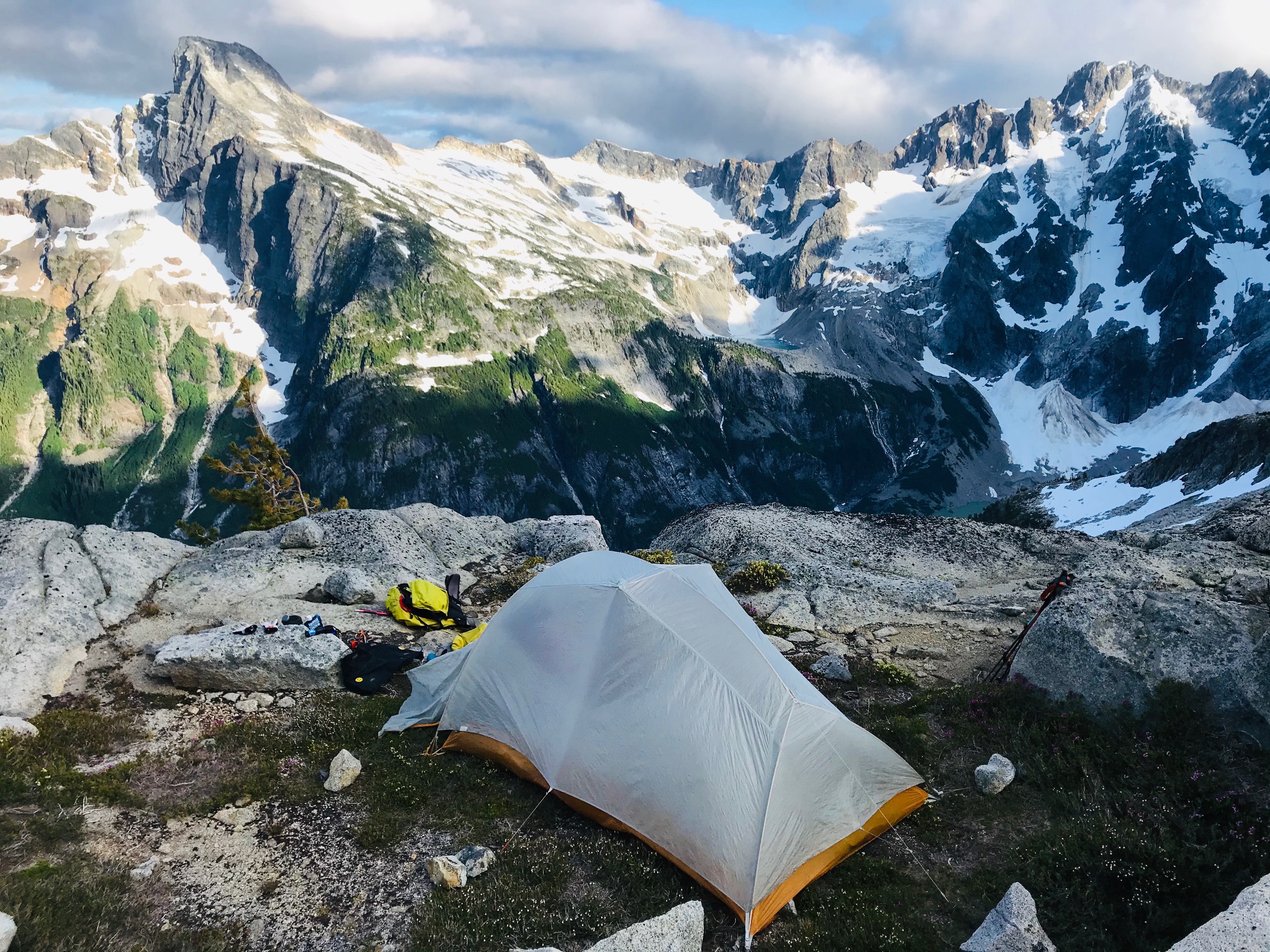
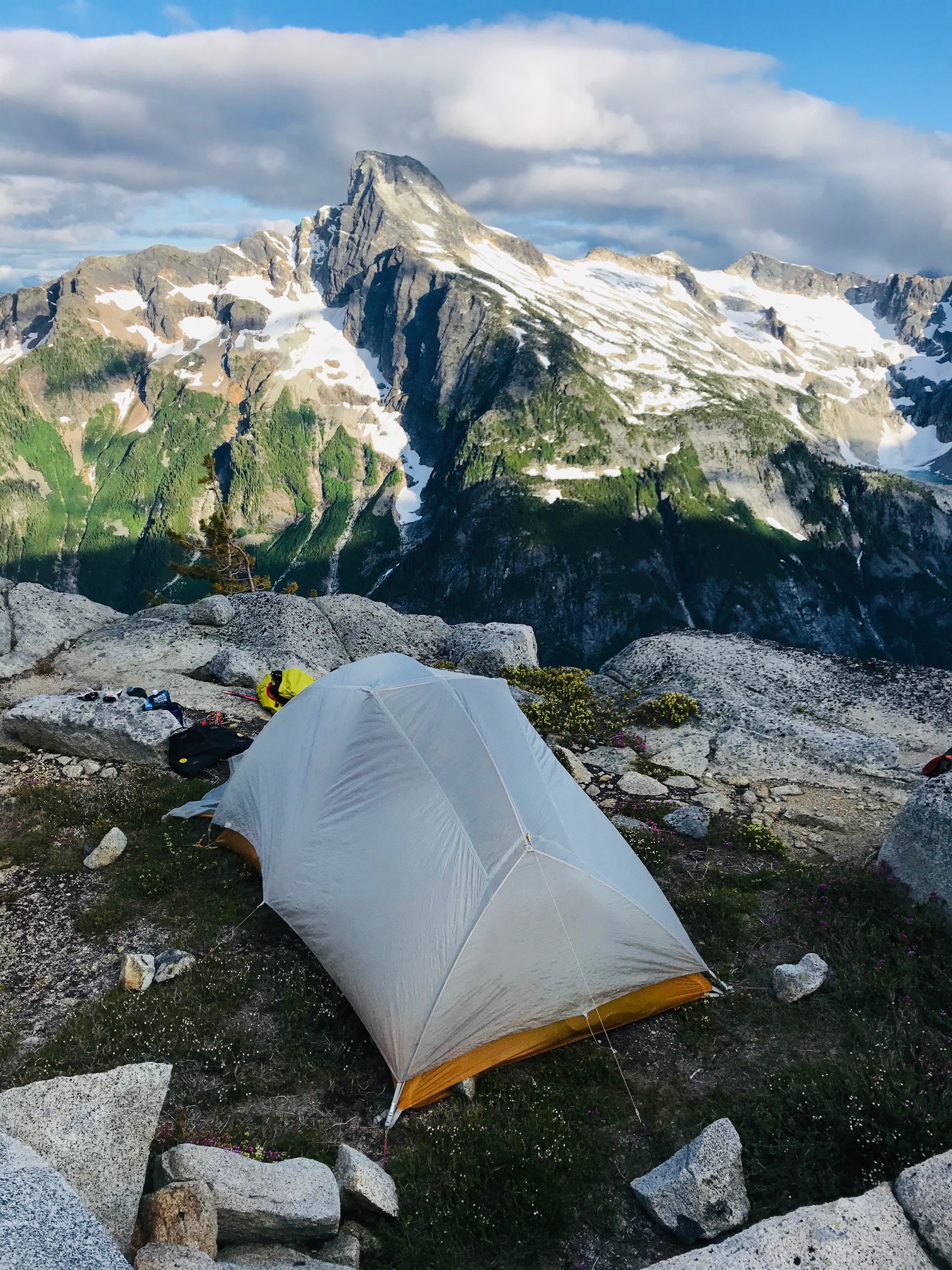
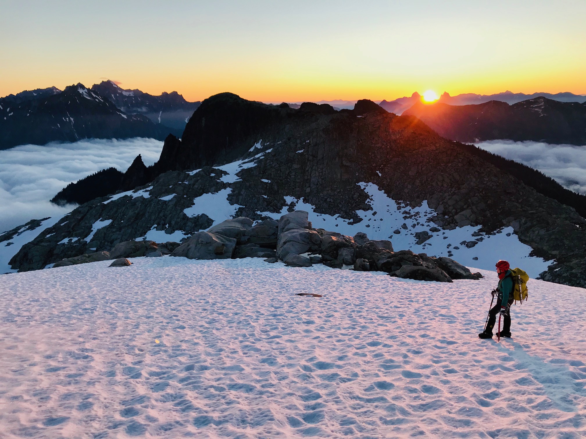
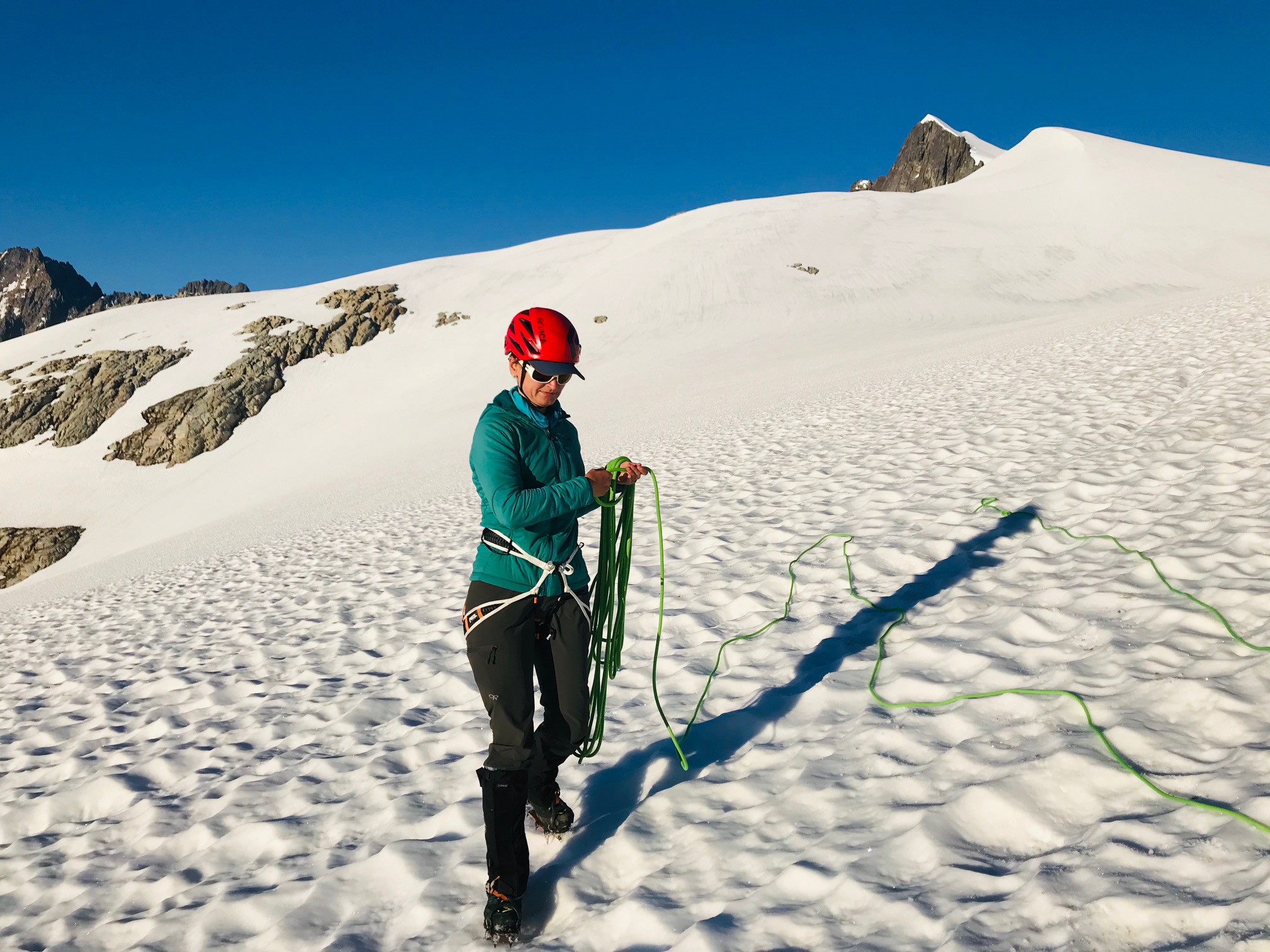
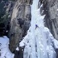
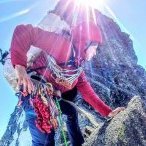
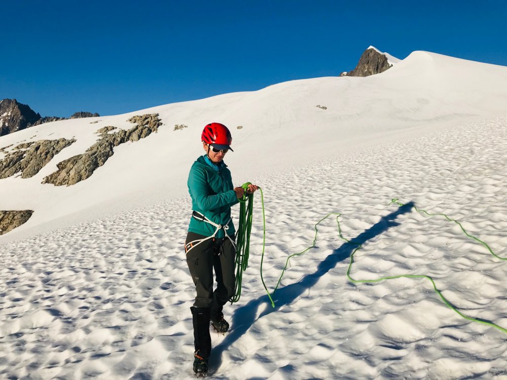
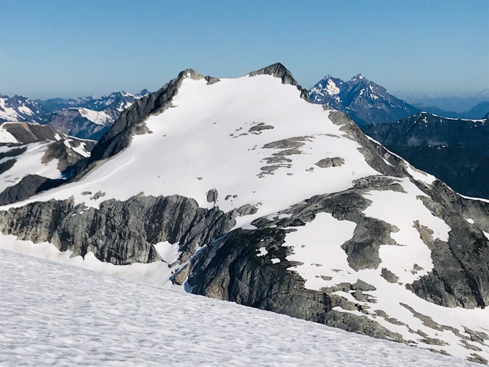
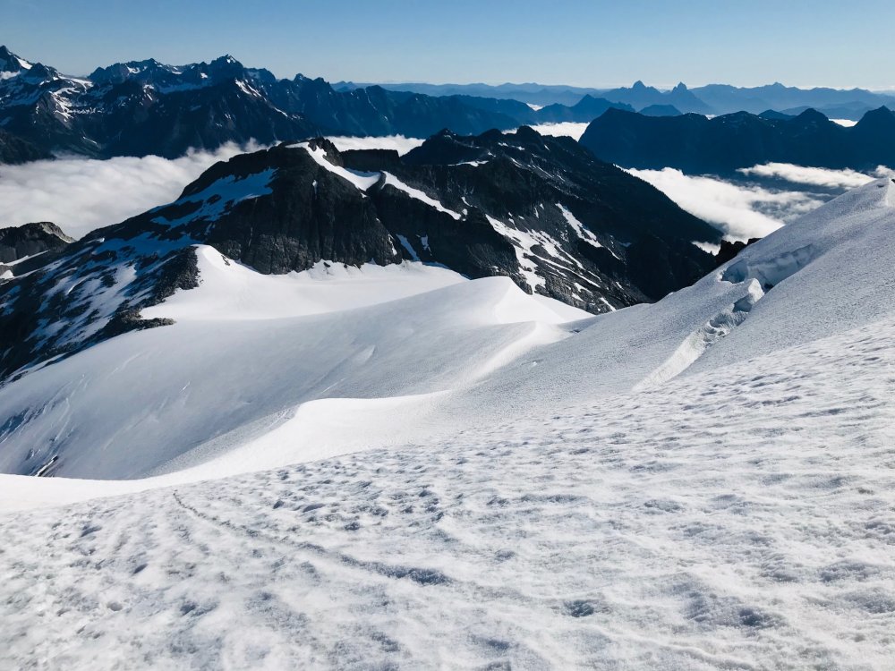
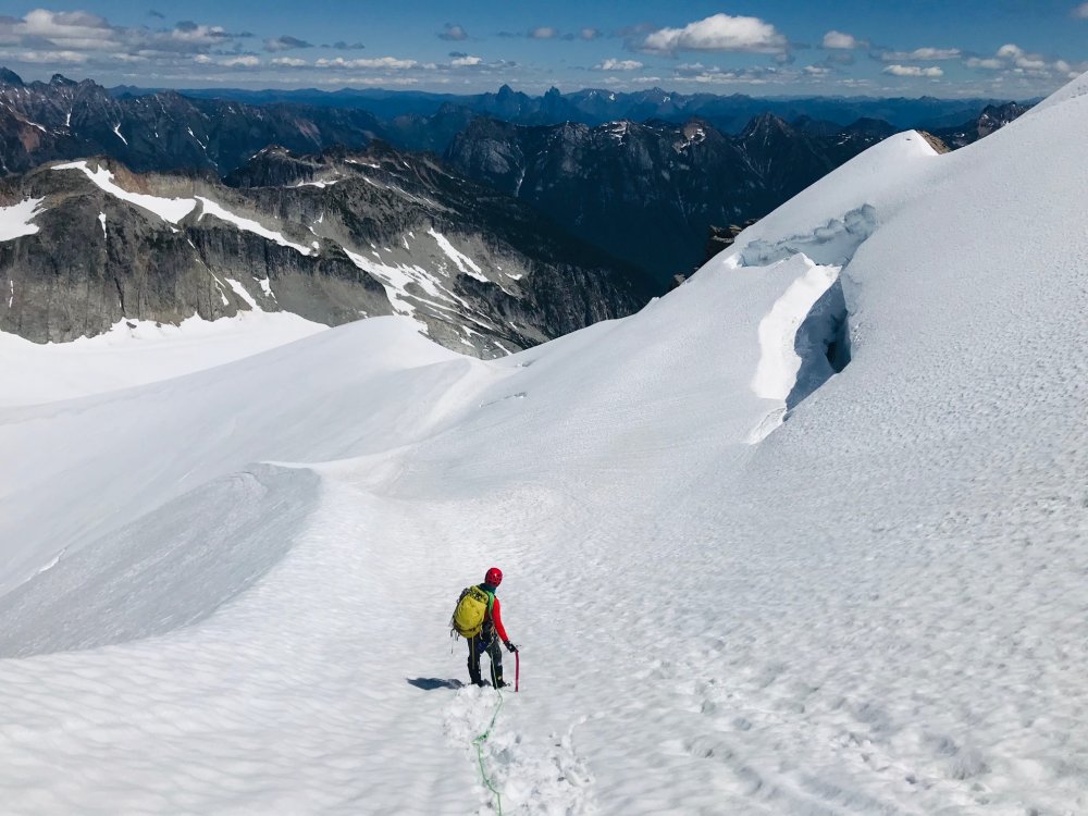
Trip: Mt Baker - North Ridge Trip Date: 07/18/2020 Trip Report: From a week ago. TR with nice formatting lives here (still figuring out how to get copy-paste to play nice without reuploading all the photos): https://www.natexploring.com/tripreports/north-ridge-baker-tr Longest approach for a single pitch of ice I’ve done in a while Bare Bones Route: WI3- Ice, Snow, Alpine, 3000 ft, Grade III* Ascent via North Ridge. Ski down the Coleman-Deming Length: Two days with an overnight at Black Buttes to catch that alpenglow and sleep Dates: July 18-19, 2020 Climbing Gear Here’s my regular PSA that just because someone on the internet used a certain rack (or lack thereof) does not mean it’s the right rack for you. Grivel G20 Plus Crampons monopoints (cause I’m too lazy to switch em out) 2x Carbon Tech Machine 5x screws ranging from 13-17cm (with 1 token stubby) 5 draws; 2x double-lengths Beal Joker 9.1mm 60m dry-treated rope 1 picket (not used, classic) The Details We took a leisurely time approaching from Heliotrope trailhead and heading up to Black Buttes Camp. It was my first time on Baker since I did a mountaineering course when I was 15 (shout-out to Lakeside School for putting on the best outdoor trips). So instead of a typical c2c, I wanted some extra time to get acquainted with the mountain, routes, crevasse fields, and savor the sunset alpenglow of course. Small humans, big packs We made high camp with plenty of time to spare to do a few crevasse rescue refreshers, drink tea, eat ramen and relax. We brought two tents and a bivy bag for the 3 of us (guess who had the bivy bag and was envious of the other two…). Views were incredible and weather window was ideal. We had no wind, sun and just slightly below temps overnight to firm the snow up. We went to bed around 9pm with a planned 3am wake-up. I like my sleep and if there’s no reason for a super early alpine start, I’d rather let my body rest and reconstruct itself. Layers upon layers. Classic PNW Bivy bag life I lost my blow-up sleeping pad somewhere, so for this bivy I used a foam z-rest, a Mountain Hardwear Phantom Alpine 30F sleeping bag and my down belay puffy. Stayed warm all night and even slept through a couple of the groups making noise at midnight and 1am for the Coleman-Deming ascent. 3am came. We boiled water. Downed some oatmeal and suited up for glacier travel to the tune of Rise Up (highly recommend for a morning pick-me-up) A note about route-finding: I don’t recommend camping where we did. It’s ideal for the CD route, but not for the North Ridge. We ended up descending about 900', crossing some very large crevasses to gain the route-proper. Would’ve been faster to camp lower down. Blurry alpenglow morning shots as we descended and then navigated onto the route (how I usually feel at 4am). Some pretty large crevasses to get over across the main drag Hitting the morning sun rays after some tricky crevasse meandering. Soon we were on the approach to the crux of the route (the part I was most excited for): the ice headwall. Kinda Games of Thrones-looking. We caught up to 4 other parties at this point that presumably got less sleep and were more ambitious in their alpine-starting. The easiest way up is on the left through a lower-angle section of ice, and is where the other parties were clustered in a bit of a climber traffic-jam. Not wanting to get cold and also because I was excited to get a real pitch of ice in, I took a line up to the right (to stay out of the way of the other climbers and not hit anyone with delaminating dinnerplates). It had an overhanging ice bulge that was fun to climb with skis on the back. Got my hips as far in as possible to keep my skis and pack from pulling me off. Went up and over the overhang without a hitch and the climbing was stellar. Gotta love glacier ice. Worth the thousands of feet of elevation gain and crevasse slogging. Note to self: when climbing an overhang with skis on your back, figure out a way to do a diagonal carry, because the tips kept hitting the ice anytime I so much as thought about looking down to find good feet. Live and learn. From here it was cruiser ice. I soloed another 2 pitches of low-angle ice and set anchors to keep my partners safe. Pro was meh up here, and I cursed at the picket and ended up using my tools and an ice screw for anchors where I could find solid enough ice. It’s not like this is a bad anchor, but it’s not like this snice is very good either. It held and was solid when my partners weighted the rope, I’m just used to my pure blue waterfall ice. Bringing my partners up the last two technical pitches. I was envious of Randy’s diagonal carry which would’ve made the ice climbing easier. Some more crevasse and snow slope navigation was required from the technical crux to reach the summit. Definitely a no-fall zone One of my dreams is to climb in Antarctica. This frozen tidal wave of pure power is what I anticipate that landscape to look like: minimalism at its best. Mountaineering is a lot of walking. We reached the summit uneventfully, snacked, lounged, summit selfied and FINALLY took those skis off our backs. A note about my skiing. I’m a climber who skis, not the other way around. The skiing was by far the crux of the day for me. I get tense, anxious and feel like I can’t control all the variables. But this is why you bring partners with complementary skillsets. Randy and Tyler were patient and coached me down the Roman Headwall and navigated us safely back to camp through the crevasse fields. “Can I take the bunny slope guys?” Some crazy seracs and yearly layers in the glacier pack that you can see top right. Back at camp. Quick break, pack up, ski to where the snow ends, throw the skis back on the packs and run down the trail to some beers and water. Why does the pack always feel and look bigger on the way down? It’s a mystery of the universe. Hiking back out through wildflower meadows. No mosquitoes this time around! Was that one pitch of ice worth it? Hell yeah it was. Was it worth carrying skis up and over? Yes. So much faster to get down that way. Good people, good climbing, good weather. This smile says it all Gear Notes: Grivel G20 Plus Crampons monopoints (cause I’m too lazy to switch em out) 2x Carbon Tech Machine 5x screws ranging from 13-17cm (with 1 token stubby) 5 draws; 2x double-lengths Beal Joker 9.1mm 60m dry-treated rope 1 picket (not used, classic Approach Notes: Don't do what we did and camp at high camp for the CD, cause you'll have to descend ~900' to gain the route proper across a crevassed section1 point
-
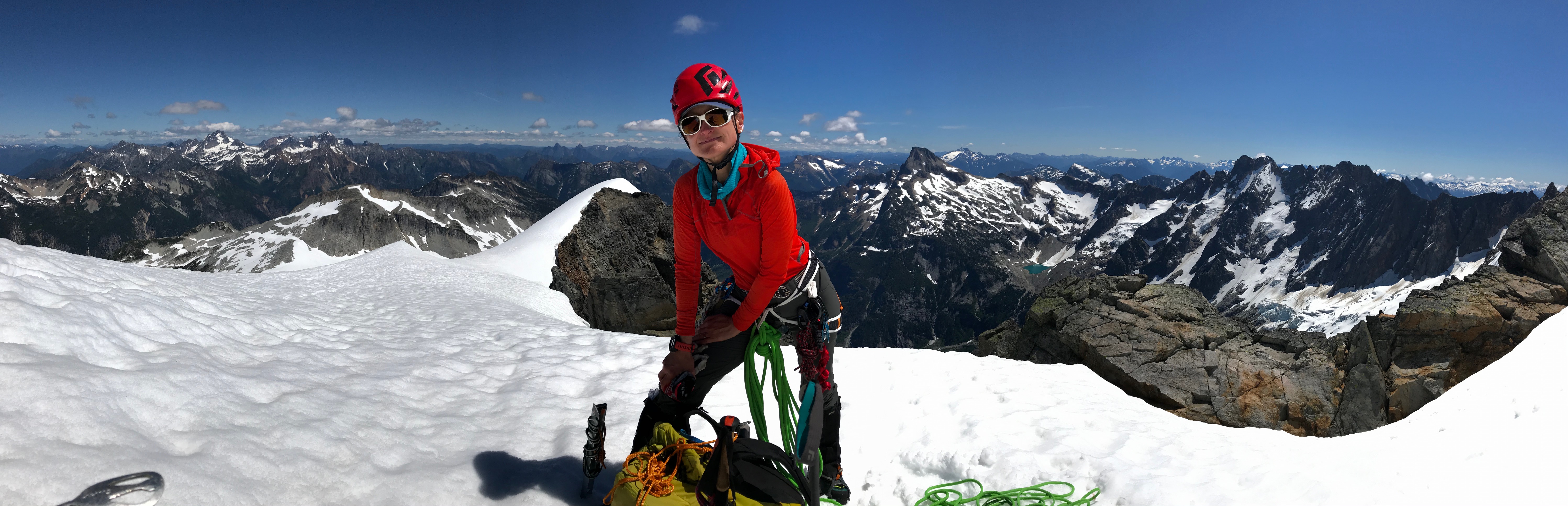
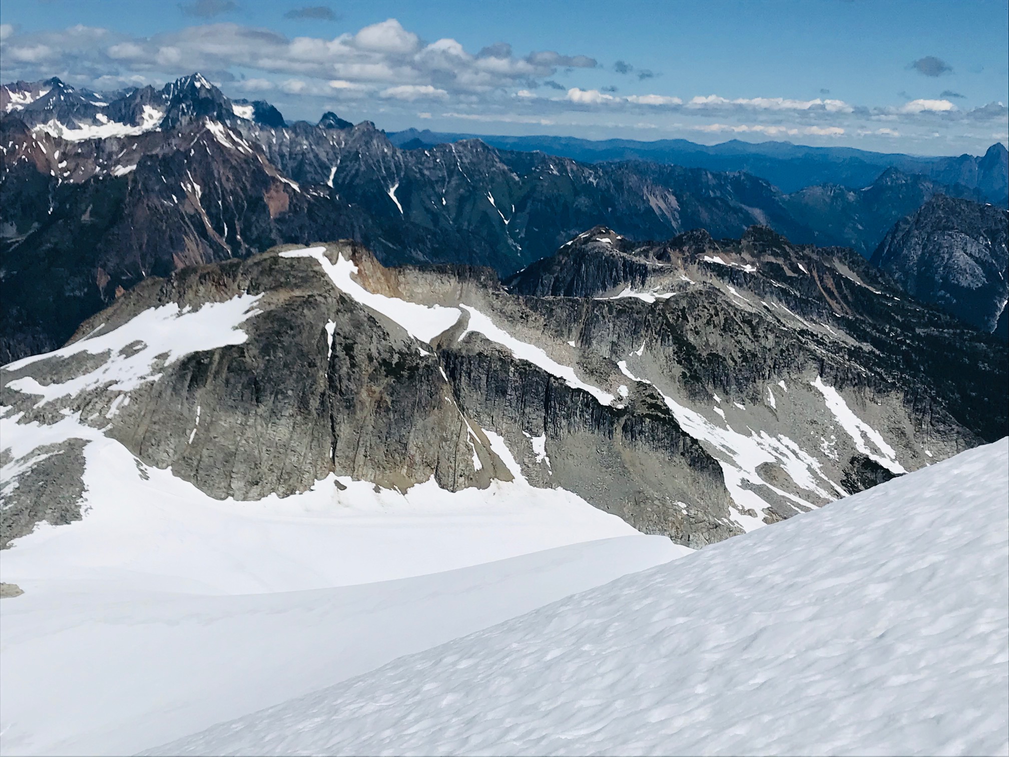
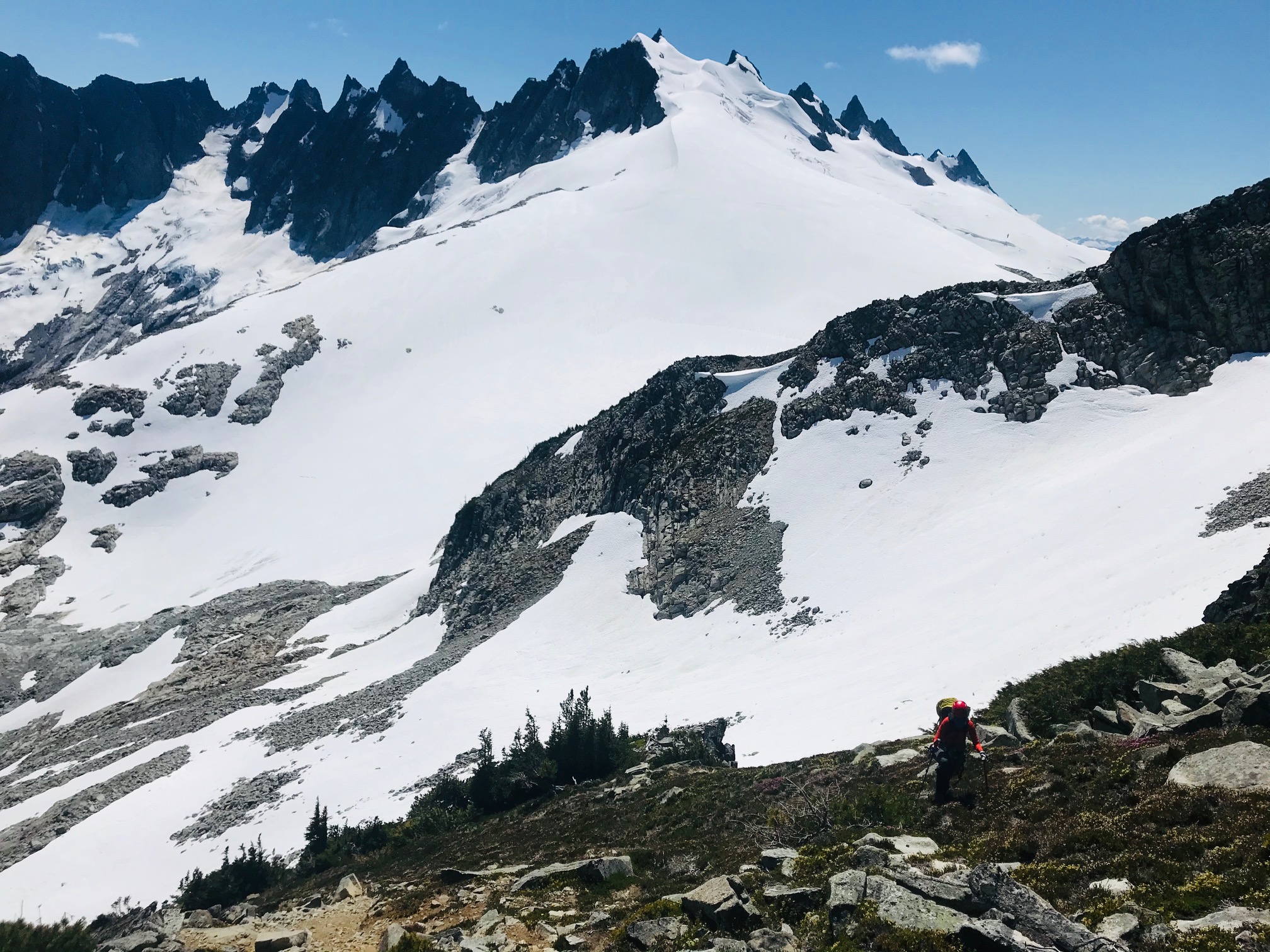
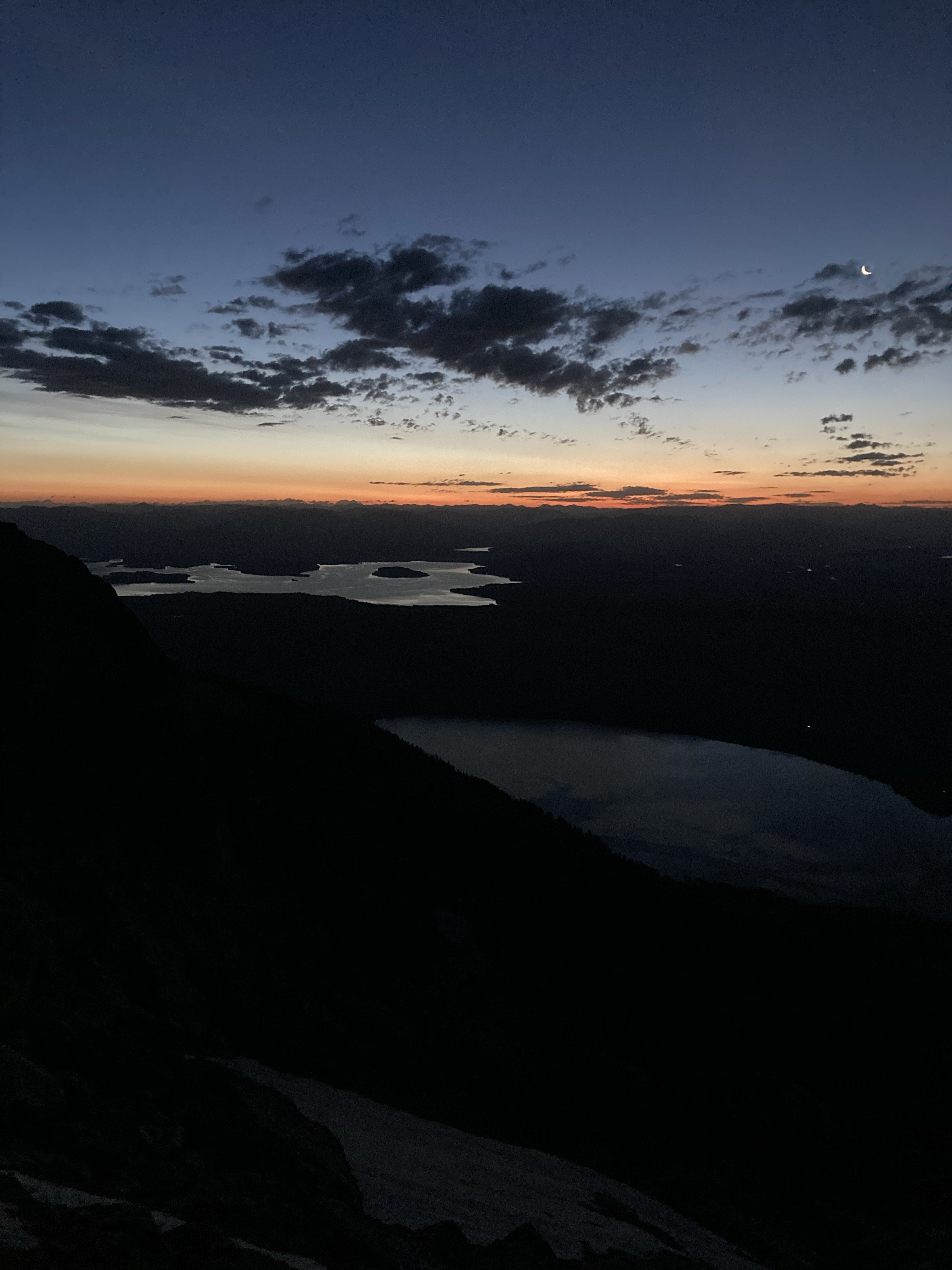
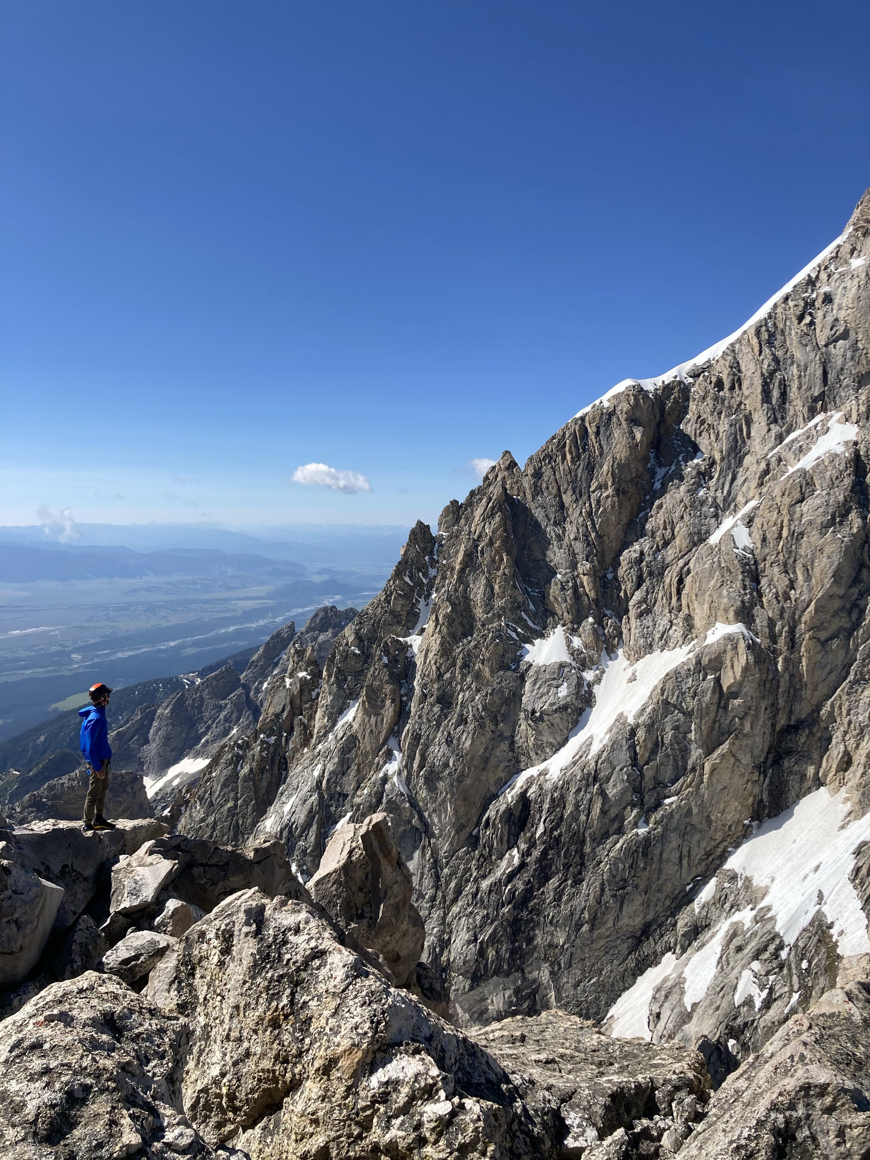
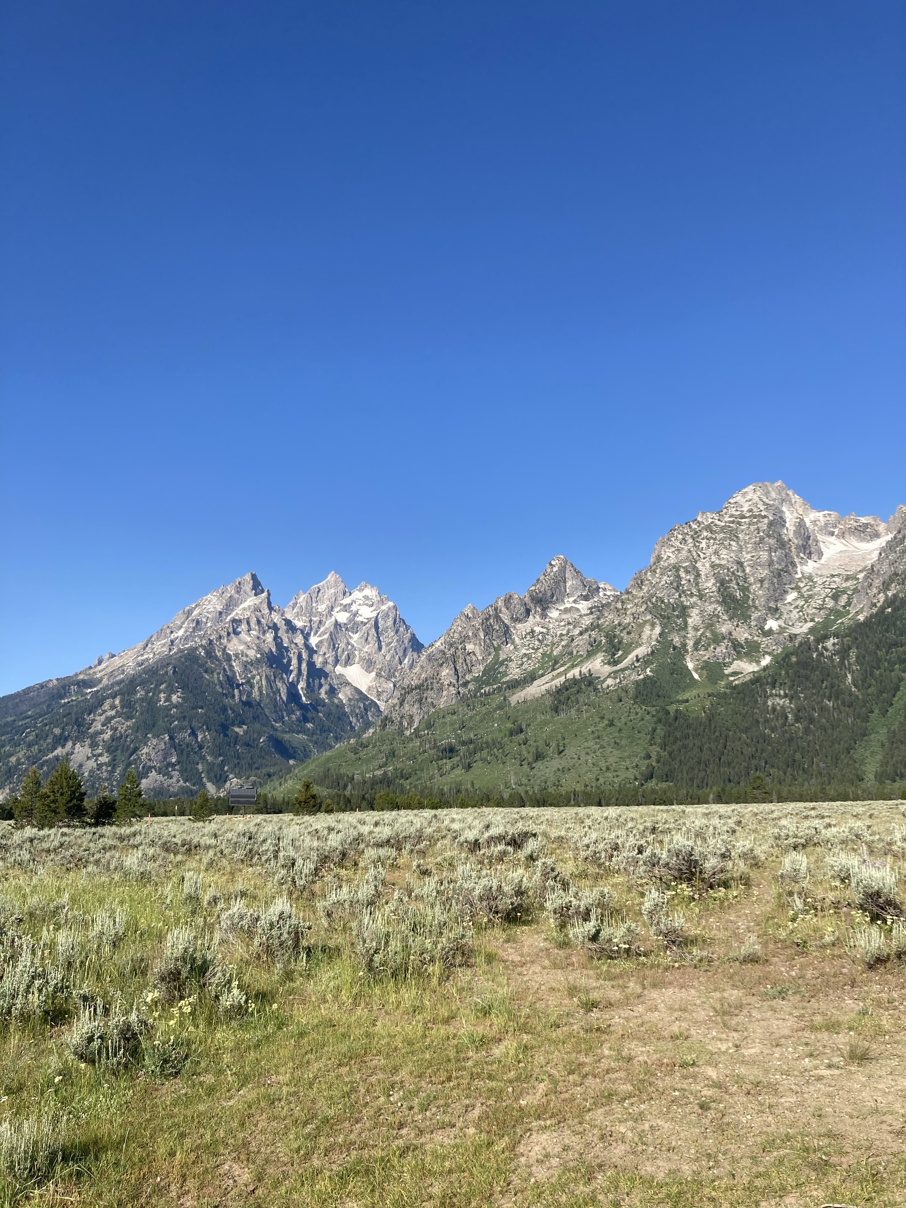
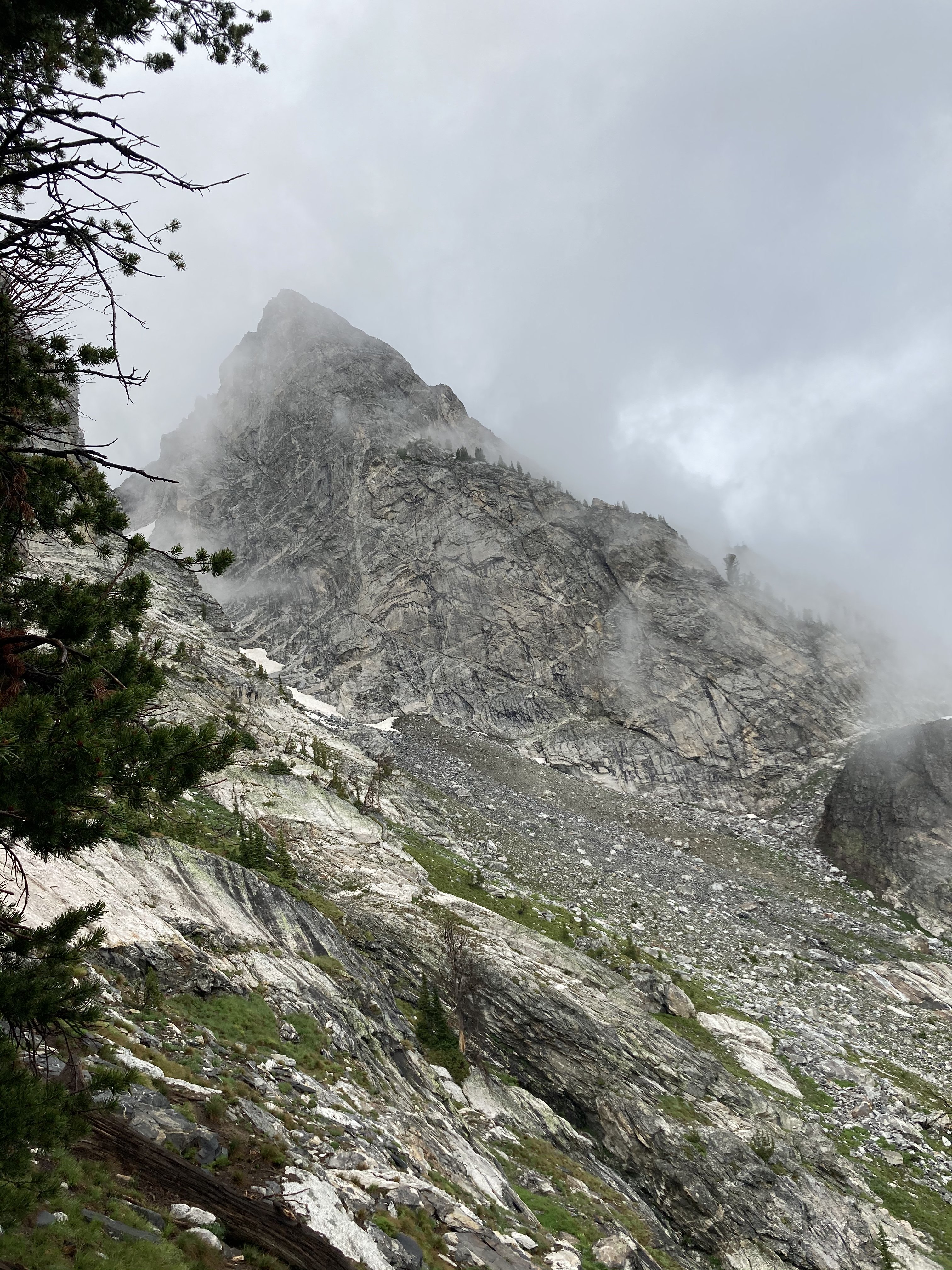
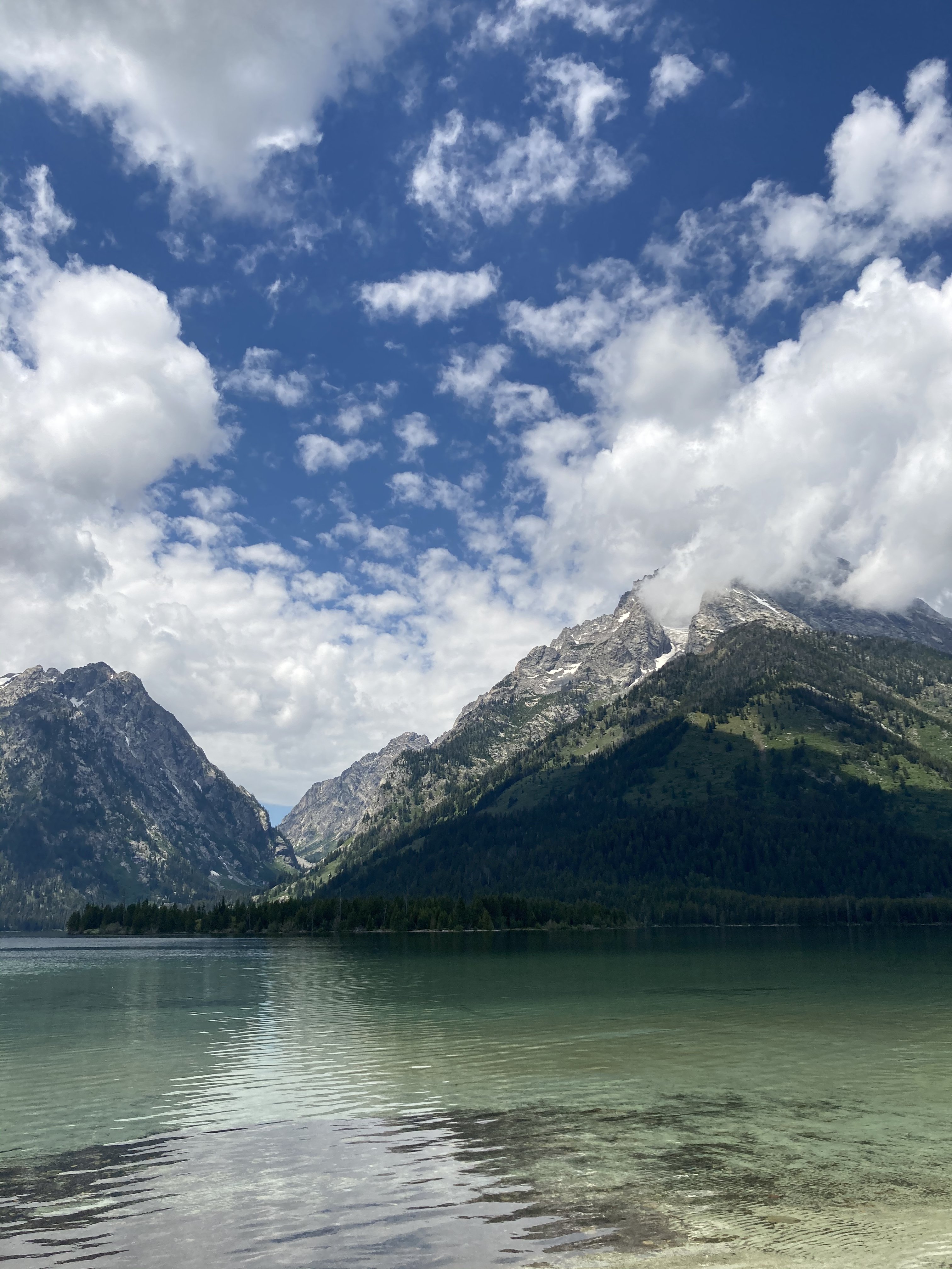
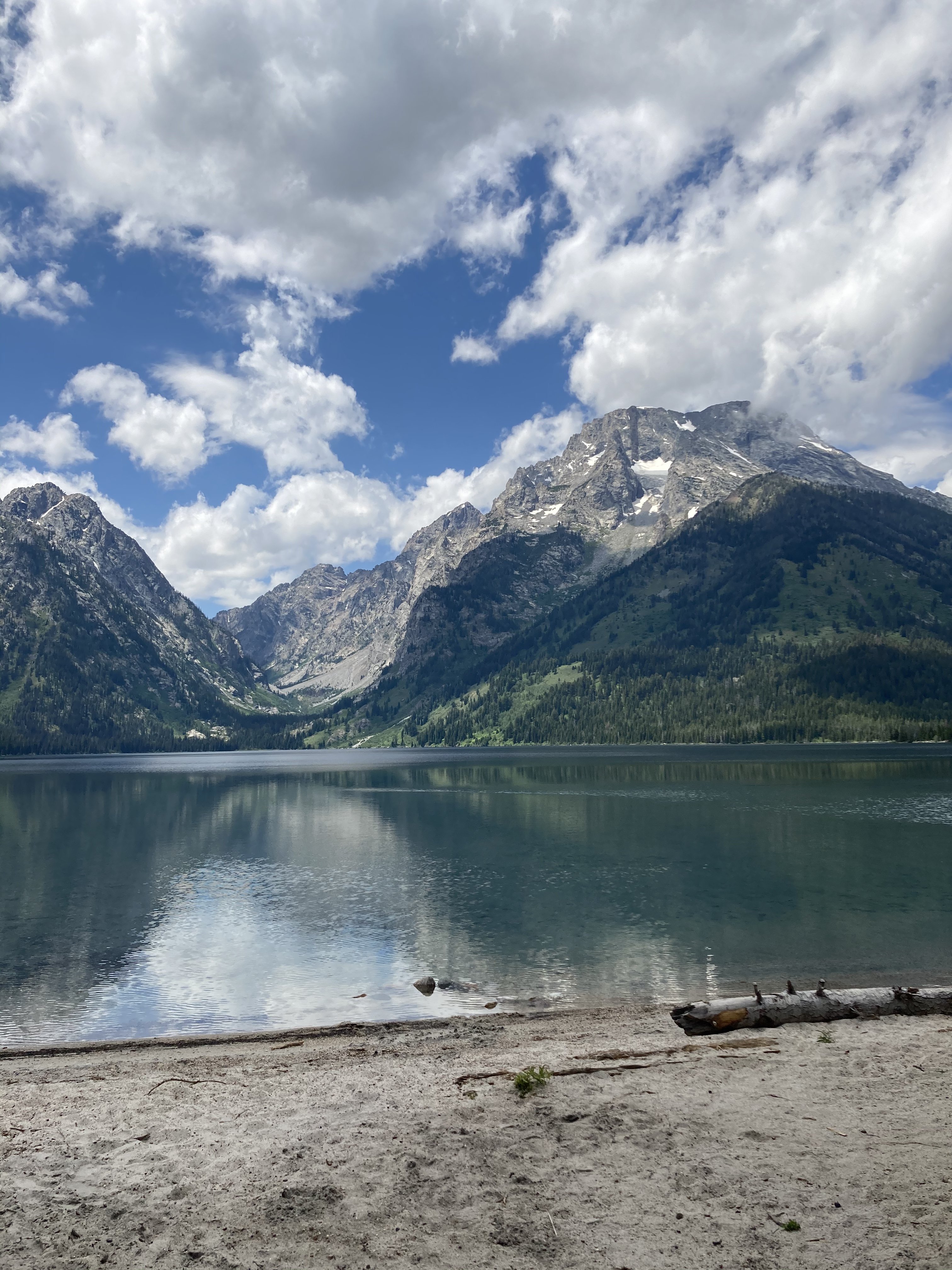
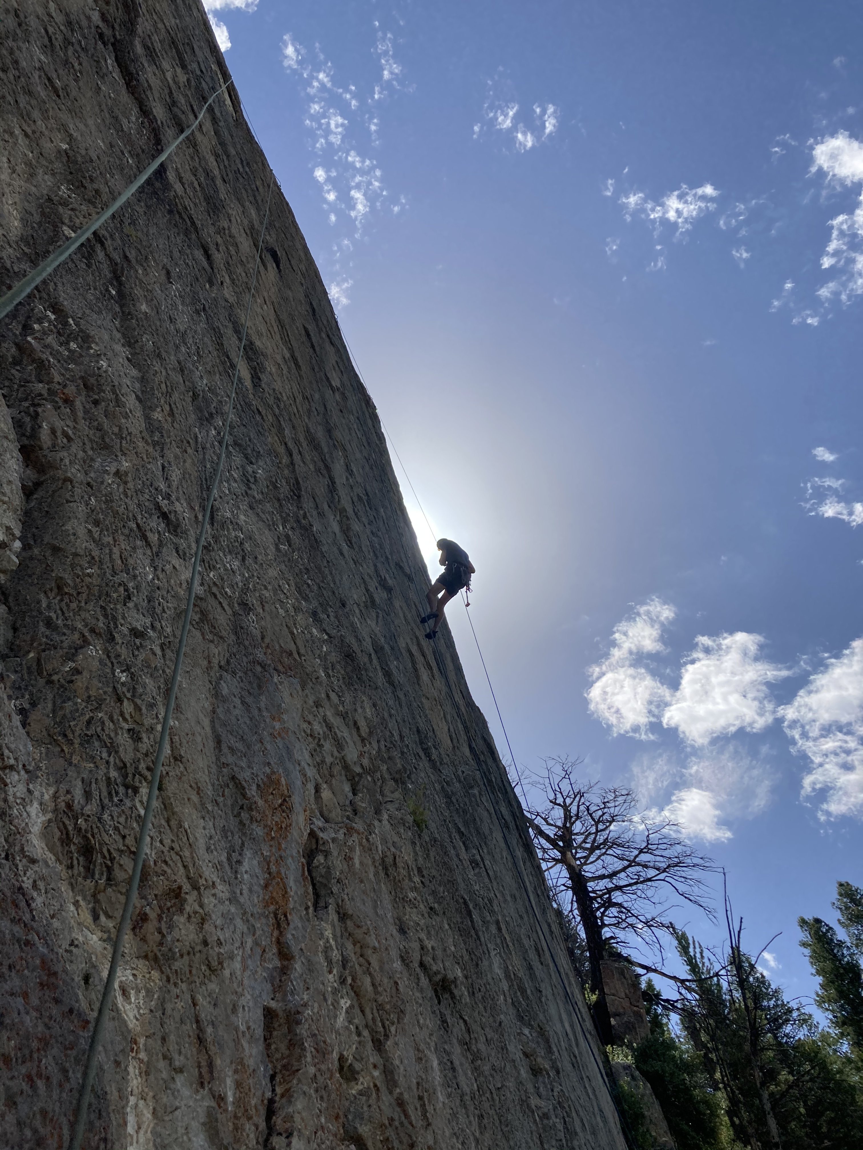
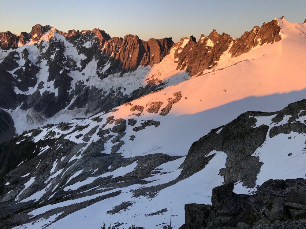
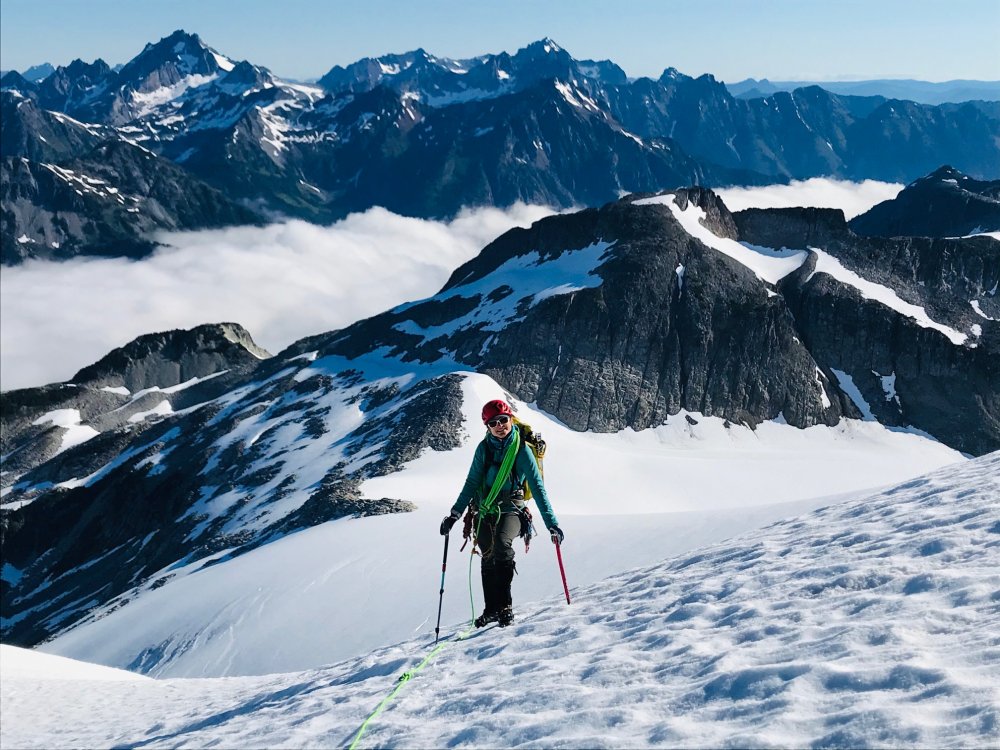
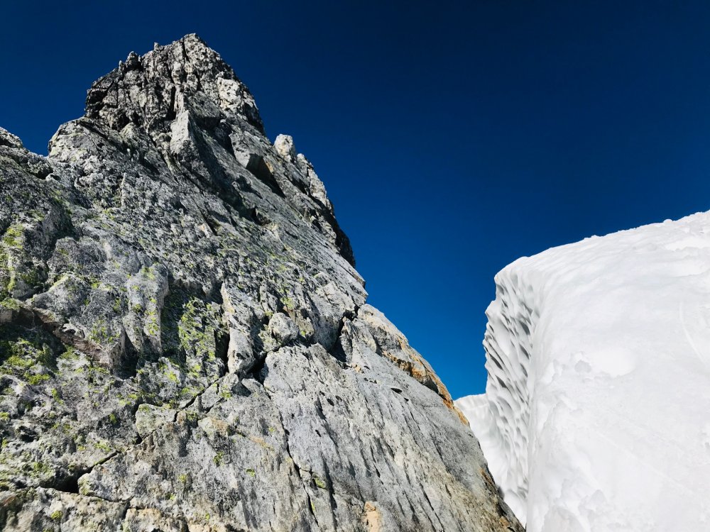
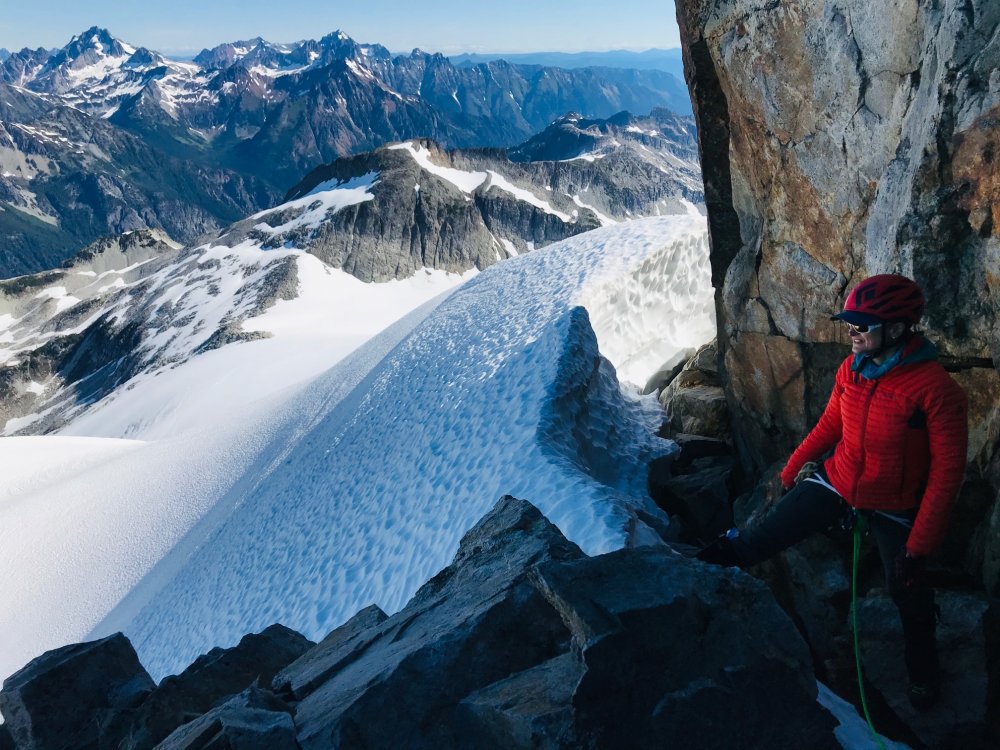
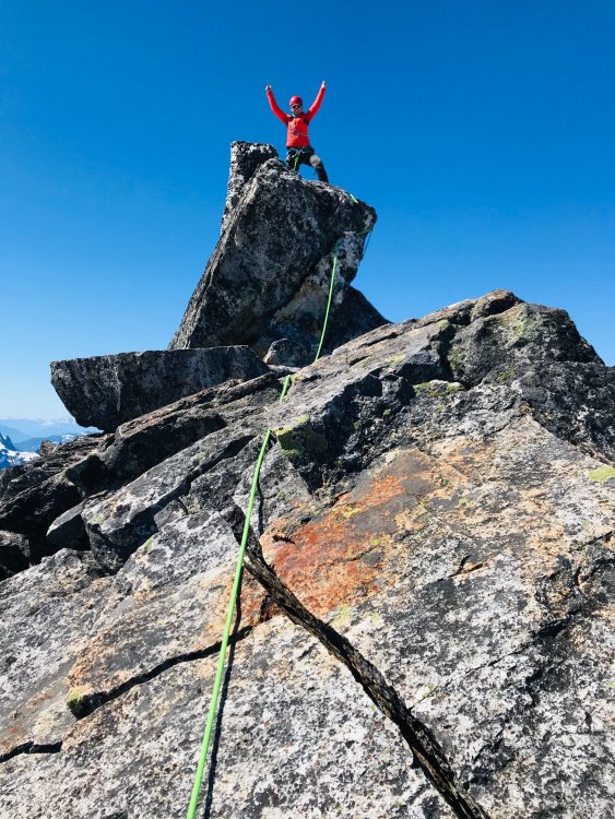
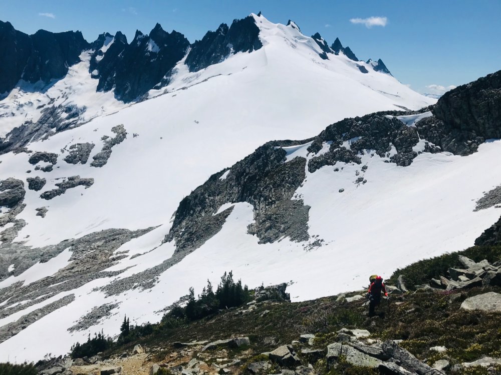
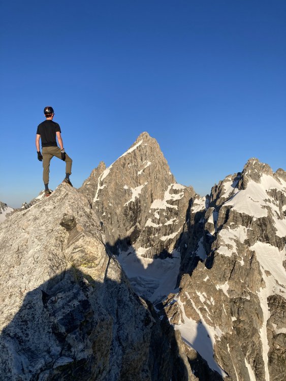
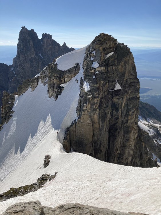
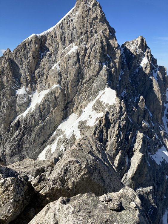
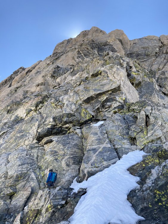
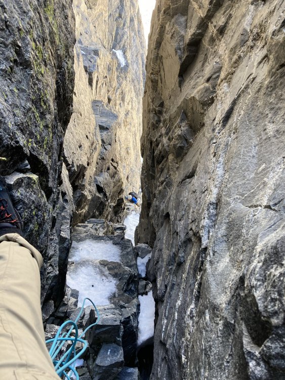
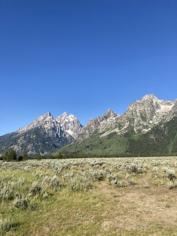
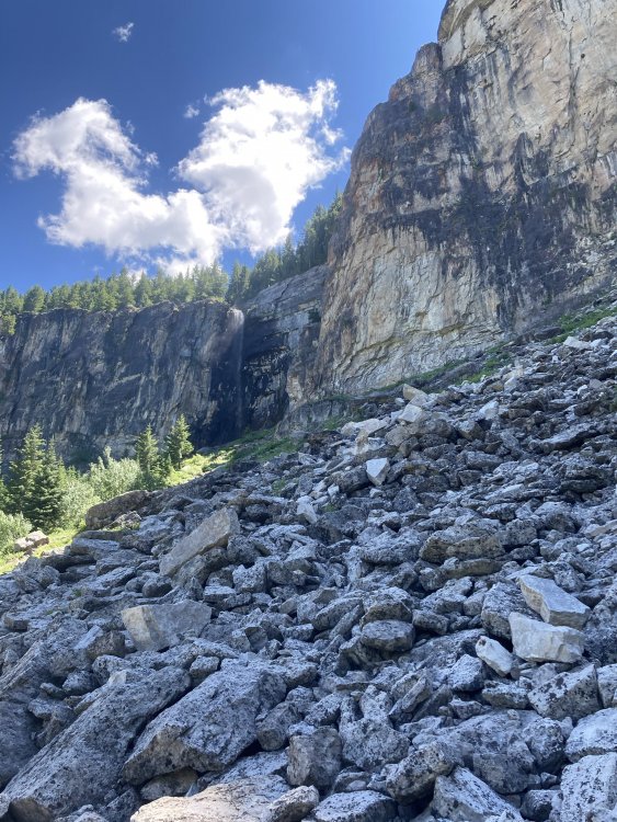
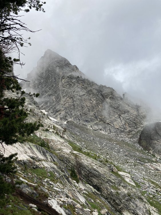
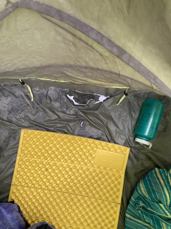
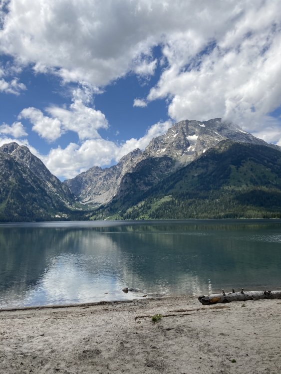
Trip: Tetons - Cathedral Traverse + some other stuff Trip Date: 07/18/2020 Trip Report: I spent the past week in the Tetons. On Saturday my friend Lucas and I attempted the Grand Traverse in snowy early season conditions. We did fairly well, minus a route finding snaffu on Owen, but were slowed down a lot by snow/ice and route finding difficulties on the North Ridge of the Grand. We had bivy gear but opted to bail from the Lower Saddle. A couple thoughts for would-be suitors... If you want Sierra-esque conditions this is a mid-August to early-September objective. Rolo's beta page on the Pataclimb site is good but not super detailed and would be worth looking up some more pictures if you are trying to onsight like we were (I'd been up the Grand before but never on the North and Lucas had skied Garnet Canyon once). Italian Cracks and N Ridge in general is not obvious splitter climbing, be prepared. You need to be super stoked if you want to walk right past an easy trail down and continue up Middle and the rest of the traverse, or don't be cause you've already done the best parts (so I was told, and tell myself to soothe my battered ego ). The next few days were spent climbing at various crags (all have directions on MP, but identifying routes isn't always easy)... Rock springs buttress is AMAZING and also an amazingly sustained steep long hike for a crag. I took 2 hrs and was worked. I think camping up there would be sweet and the rock is awesome but S/SW facing so its really a morning-only venue. You can also take the tram or gondola from Teton Village but that costs a lot of money. Teton Canyon's Shady Wall is a short approach and shady all day (big surprise). It's also HARD (sandbagged 10+ warmup, 1-2x hard 5.11, several 12s/13s) and on weird rock (featured granite with flowstone (like limestone) over the face in places). There are other cool crags in Teton Canyon, we did a cool multipitch limestone sport route in a wild location one day but its hard to describe the location and kind of a locals' secret, maybe ask around? Blacktail butte in the NP is also nice limestone sport cragging on vertical edges. People talk sh!t about it but given that I don't get to climb limestone often I thought it was nice and had some good routes. I also went to solo the CMC route on Moran with a leisurely overnight at the CMC camp. I bushwhacked instead of canoe'd, which was a nice mini-cascades flavor, and ended up going in one way and out the other to see both options for going around Leigh Lake. The guidebooks all say to go out the Valley trail and on the East side of Leigh Lake and then bushwhack around the N side of the lake to the gully/creek leading to the the CMC camp, but on a map it looks much better to take the Paintbrush trail around the West side of the lake and then bushwhack in from there. Turns out the guide books were correct (who'da thunk?) and going the E side of Leigh is much more efficient although longer mileage (it's still a pretty decent shwack with neck high ferns, steep side hilling, and downed trees). Anyway, all the jungle blundering was for naught as I got rained on all night at CMC camp and was socked in by cloud all morning. I hiked out only to have things turn perfectly bluebird for the entire afternoon... c'est la vie. Will post some pics later this week. Gear Notes: Approach shoes and an extra pair of socks for when they wet out with the snow travel and post-thunderstorm shwackage. Approach Notes: What the guide books say...1 point
-
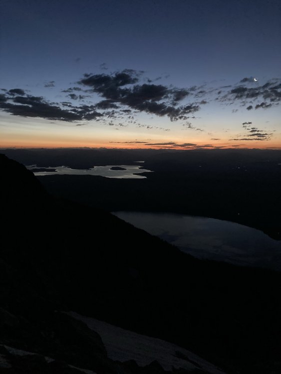
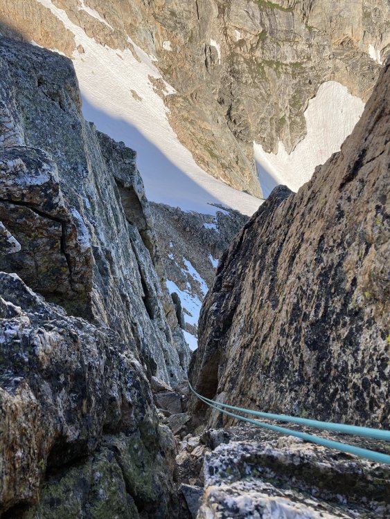
Pictures: Sunrise near top of Teewinot Lucas on Teewinot Raps on 11,8XX Lucas descending from East Prong on very firm snow. North side of the Grand from Owen Lucas scoping the Grand Start of N Ridge of the Grandstand, separate team ahead of us... Icy chimney pitch on the N Ridge, dude below is pulling an overhanging chockstone with minimal ice-free hand holds (not your typical 5.8) Looks like easy traversing to OS but an ice gully separates us from that route and we end up going straight up after some faffing. Peaks on L are the Cathedral Group (Teewinot, Owen, Grand) Rock sporings buttress... very cool featured granite, long approach, tons of routes secret Teton Canyon Zone Dog Wall (4p, 5.12+ or 3p 5.11) goes up the edge of the black just above Matt's head and traverses L on a ledge a little before following bolts straight up and finishing on the giant roof just L of the sun. Morning clouds at CMC camp Standing water post-storm in the tent Of course the day just cleared perfectly after I'd retreated and shwacked my way to the trail... at least the sun was out for some swimming. TR soloing the shiite out of Blacktail Butte


 1 point
 -
Sweet. An amazing mountain and route. Great photos!1 point
-
0 points