Leaderboard


Popular Content
Showing content with the highest reputation on 07/09/20 in all areas
-
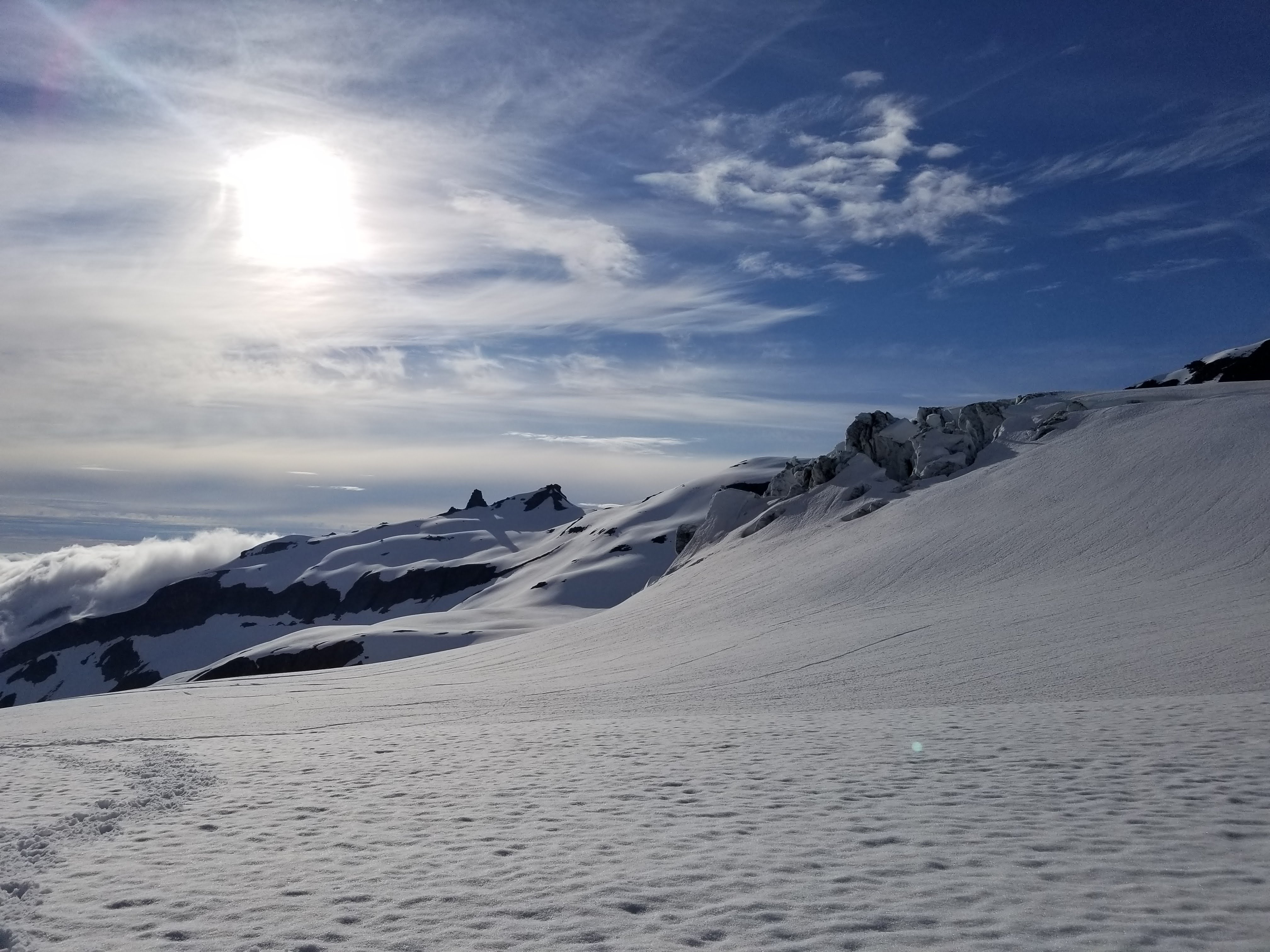
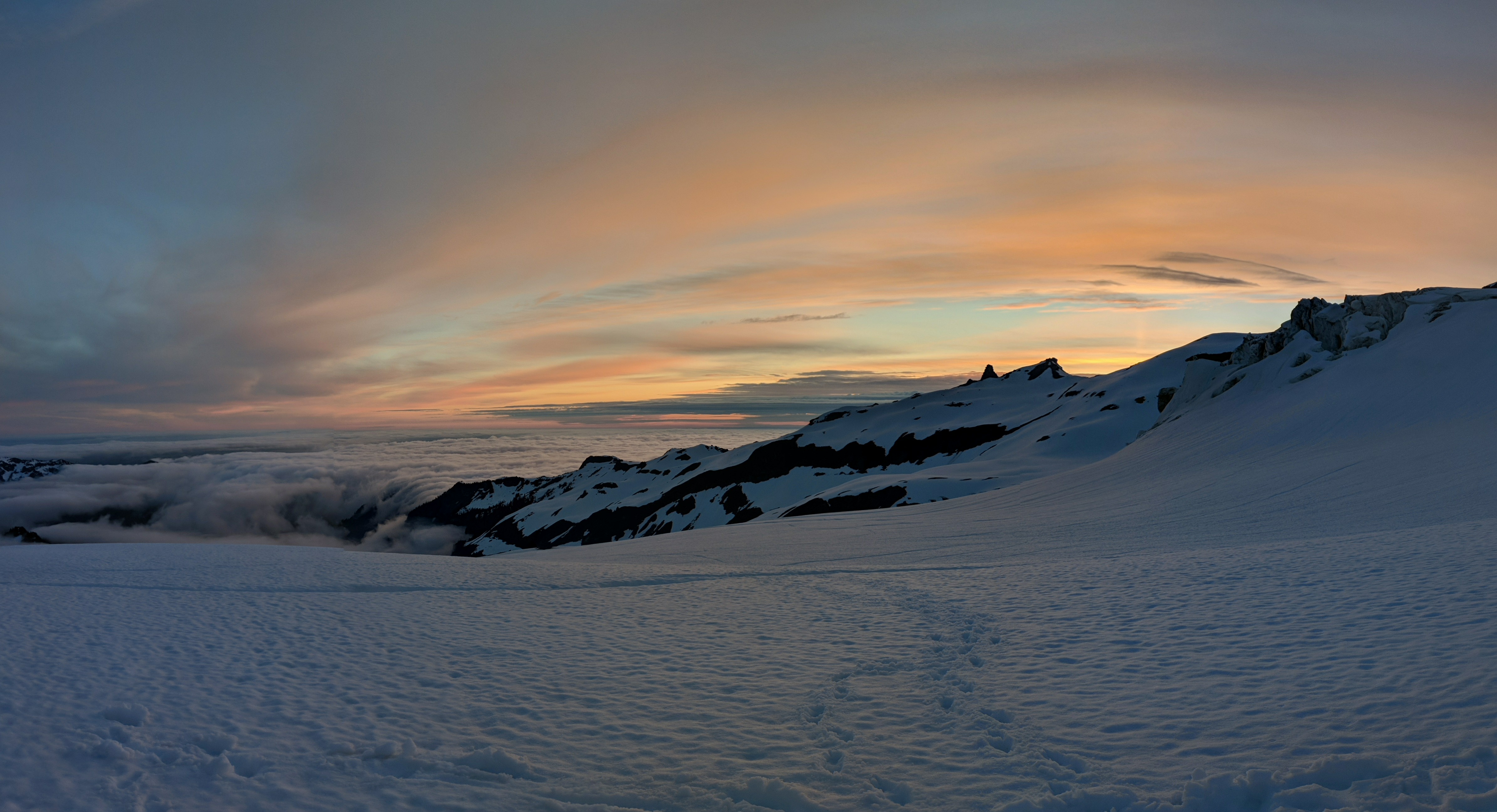
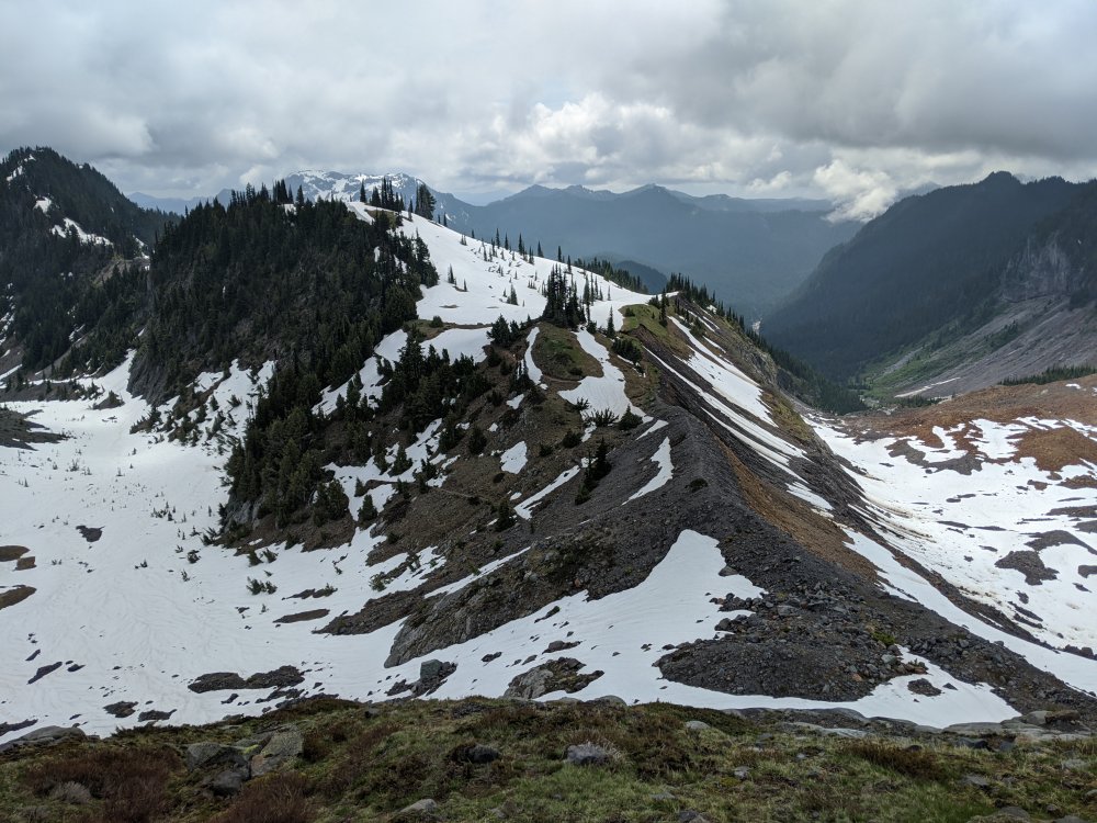
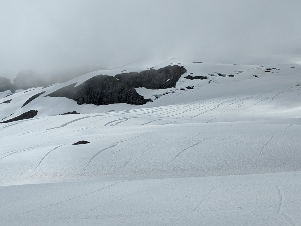
Trip: Mt. Daniel - Daniel and Lynch Glaciers Trip Date: 07/06/2020 Trip Report: I had a great couple of days out in the Alpine Lakes Wilderness with my skis, getting about 3800' skiing, a new summit, blue skies, and lots of peace and quiet. Scatter Creek was still flowing enough that I didn't want to see if my Civic could drown/be swept away. So I started my Sunday by walking the road for three miles, to the Cathedral Pass trailhead. The views started early. Cathedral Rock and some of Daniel behind, from the road! I couldn't really start skinning until about ten minutes from Cathedral Pass. Ah well... the views from the west side of the pass were incredible, down into Deep Lake. Deep Lake Wow, what a beautiful basin! I skinned up the boot track to 7000' and peeked over at views of Rainier and the Chimney Rock group, then got some pretty fun turns down to my camp near Peggy's Pond at 5500'. Pretty good view from where I set up camp... Cathedral Rock and STU! The next morning I went up and over and down and up and down and up the summit of Daniel. More carrying... So dang nice! Hinman. I'll be back for you earlier in the year, next year... and then skiied the Lynch Glacier -- super fun, great snow, not a soul anywhere all day. It was a sea of clouds to the north of Daniel, and I could barely see Baker and Glacier out there. The top of Forbidden was poking out, too. Oh yes, this will be excellent... Pea Soup Lake under the cloud layer Skiing the Daniel "glacier" (is there actually a glacier here?) had less than awesome snow, as expected, but it wasn't sticky, so..good enough! Beautiful, beautiful... About the slay the slush A soul-satisfying time. Gear Notes: I brought whippet, light axe, light pons, and ski pons. Definite overkill... Approach Notes: Up and over and down and up and down and up!2 points
-
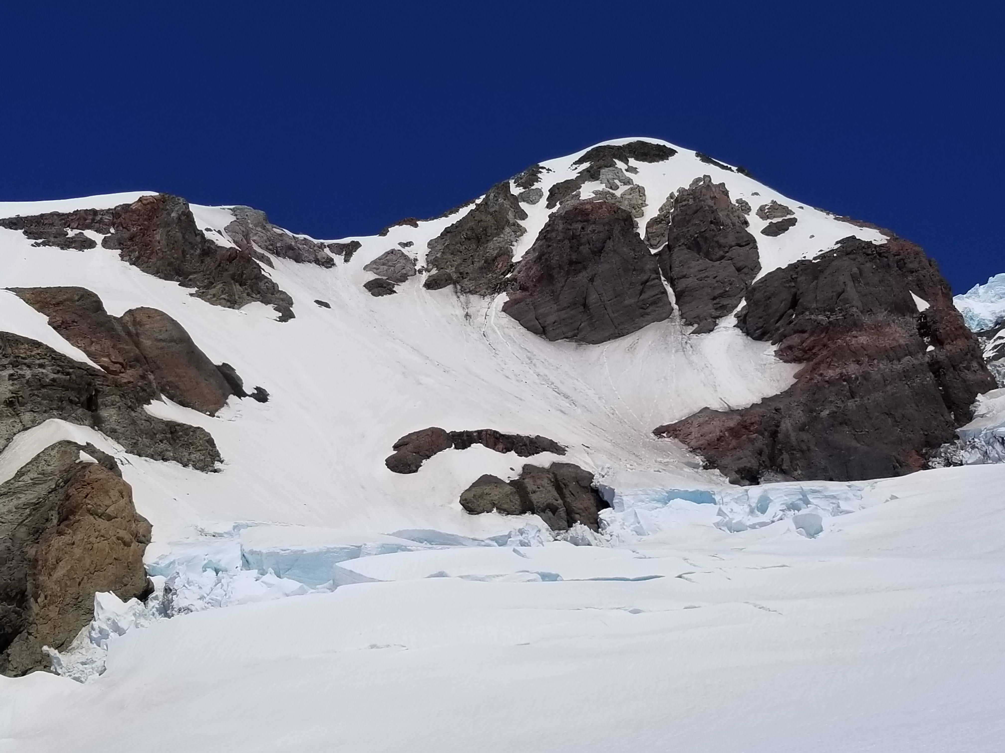
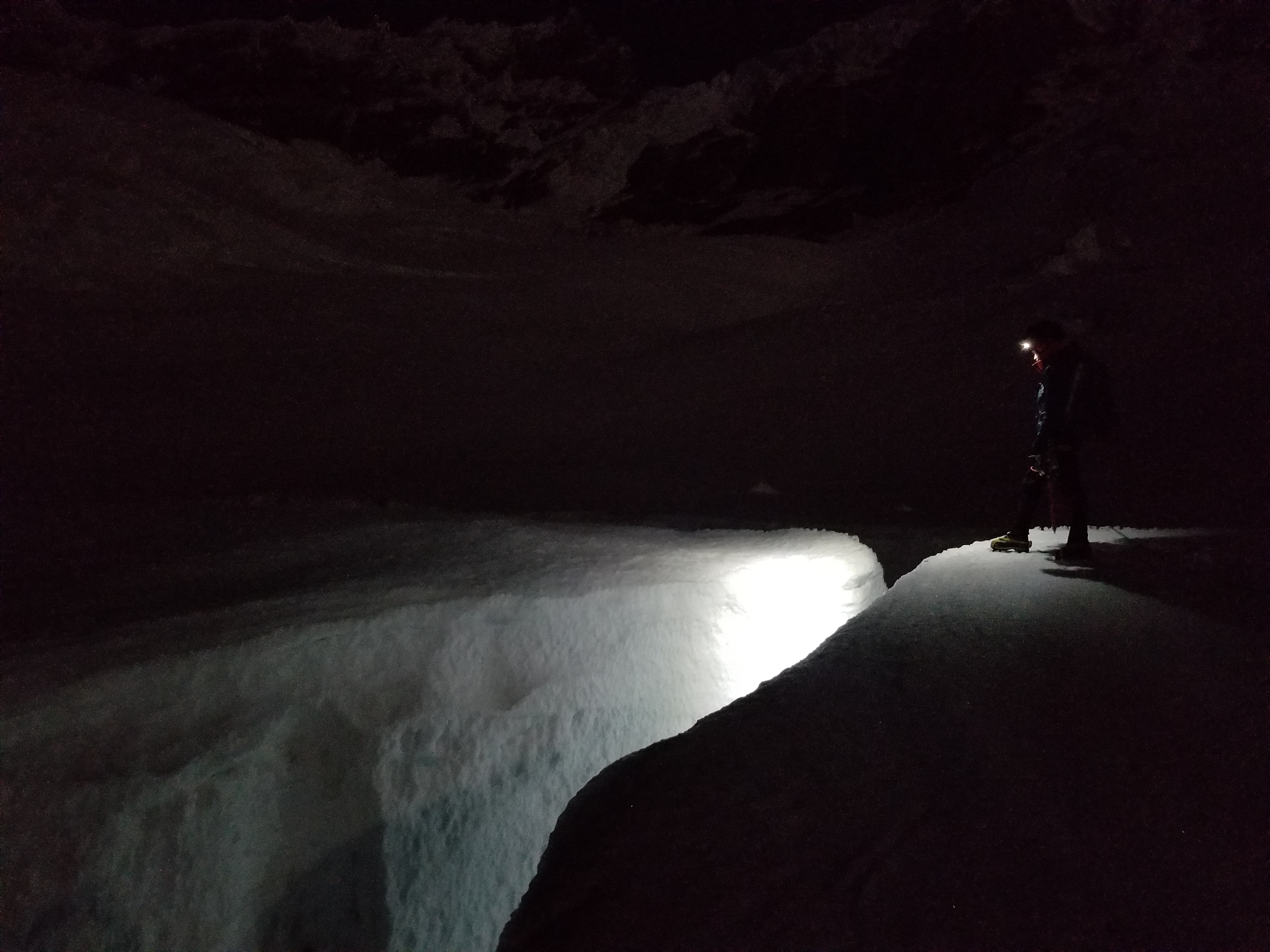
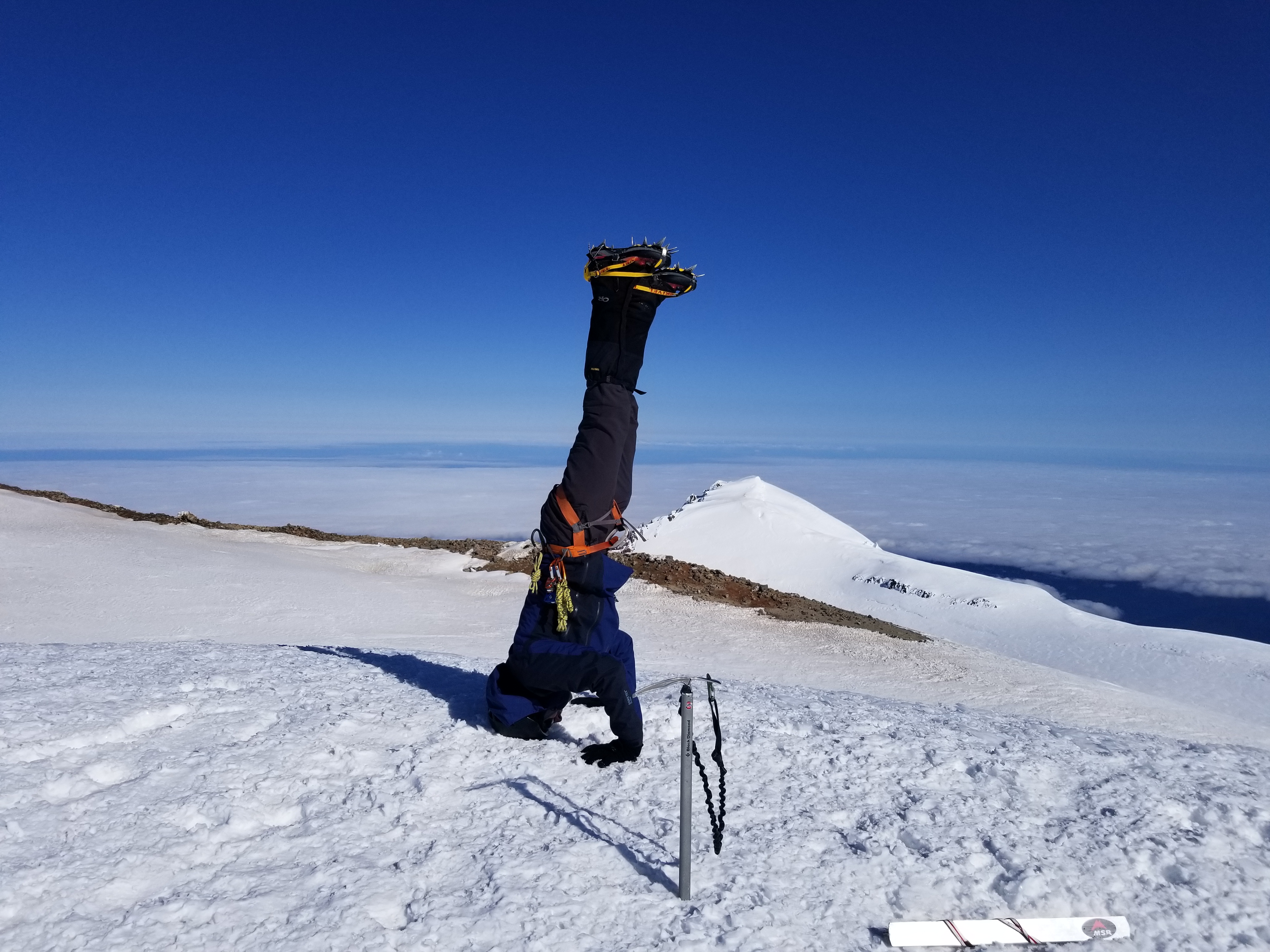
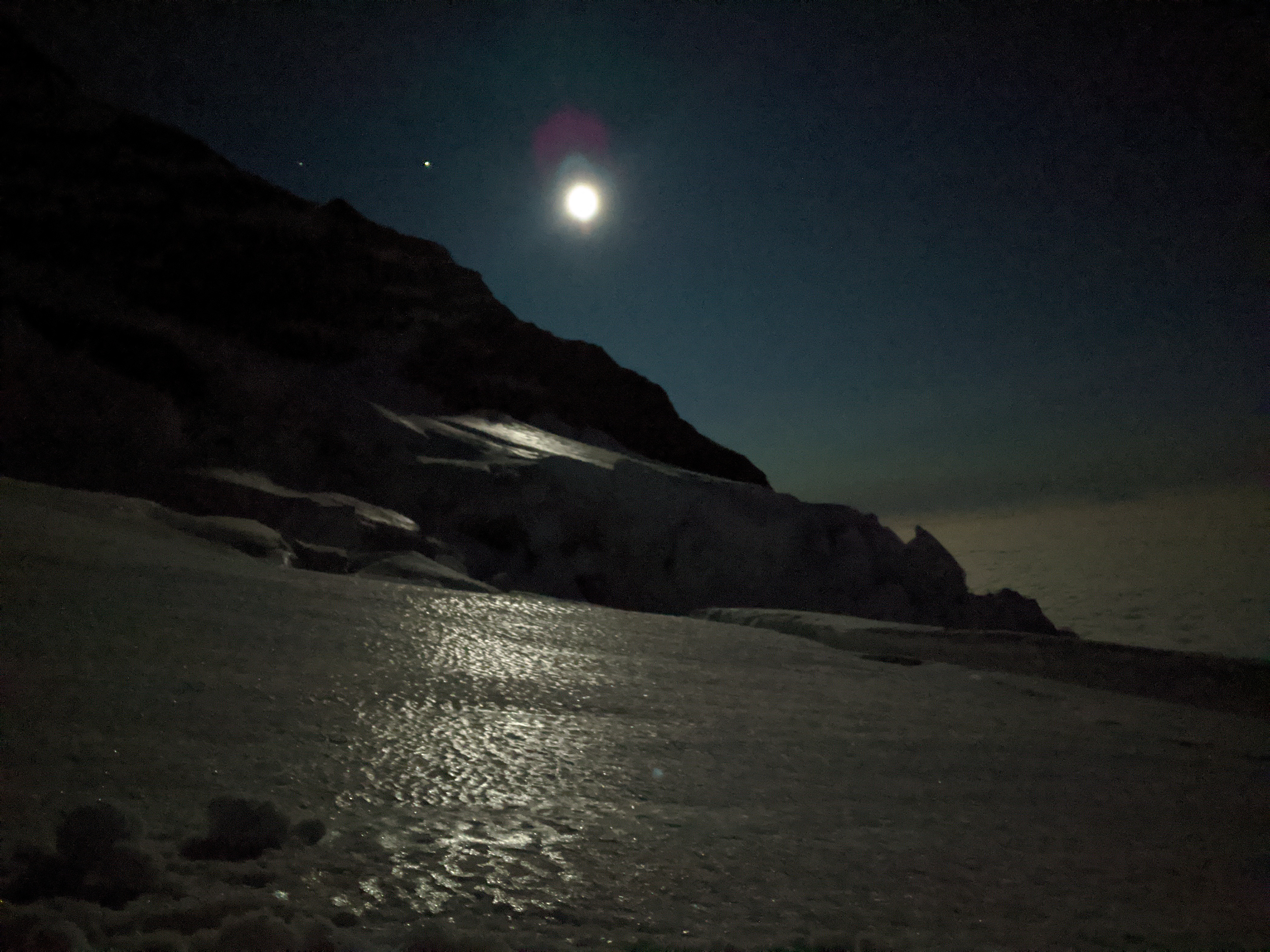
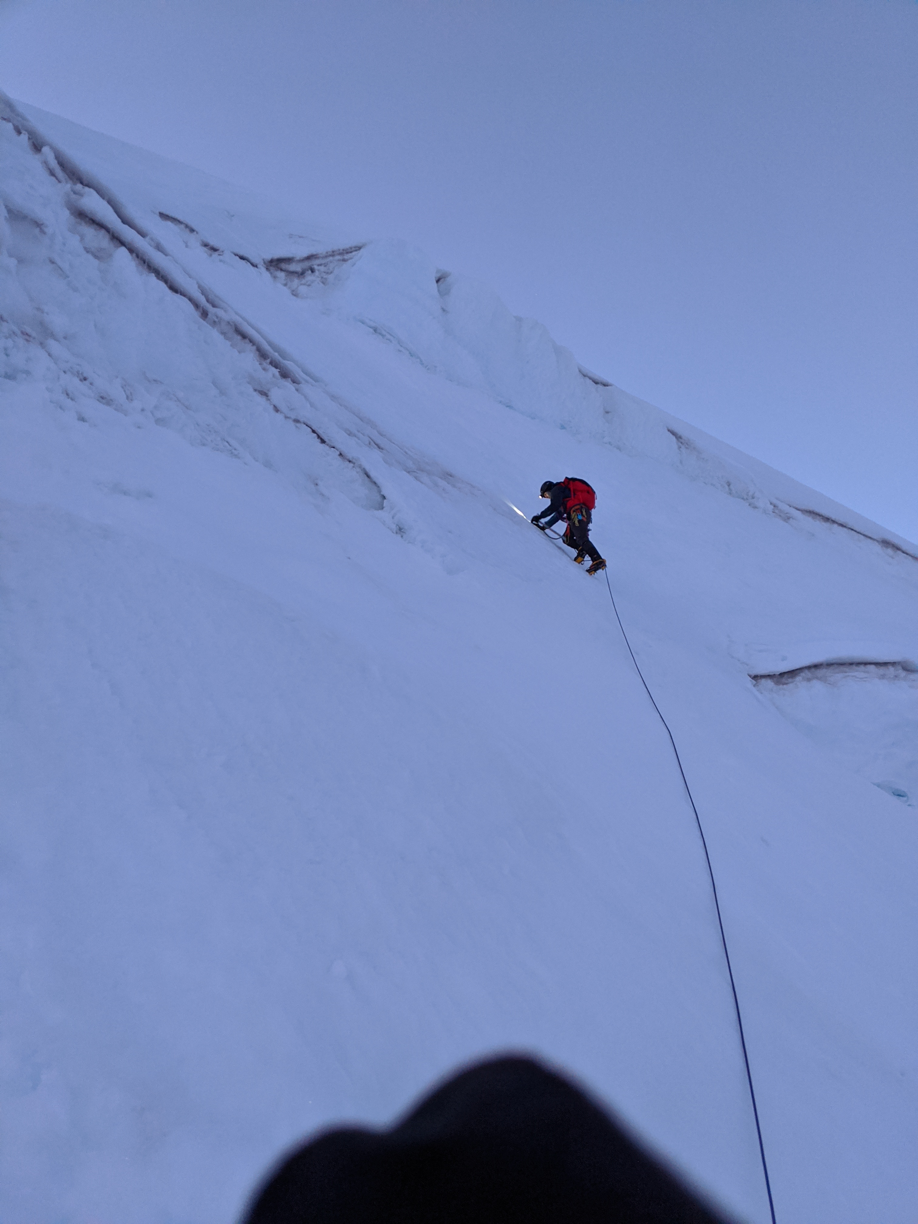
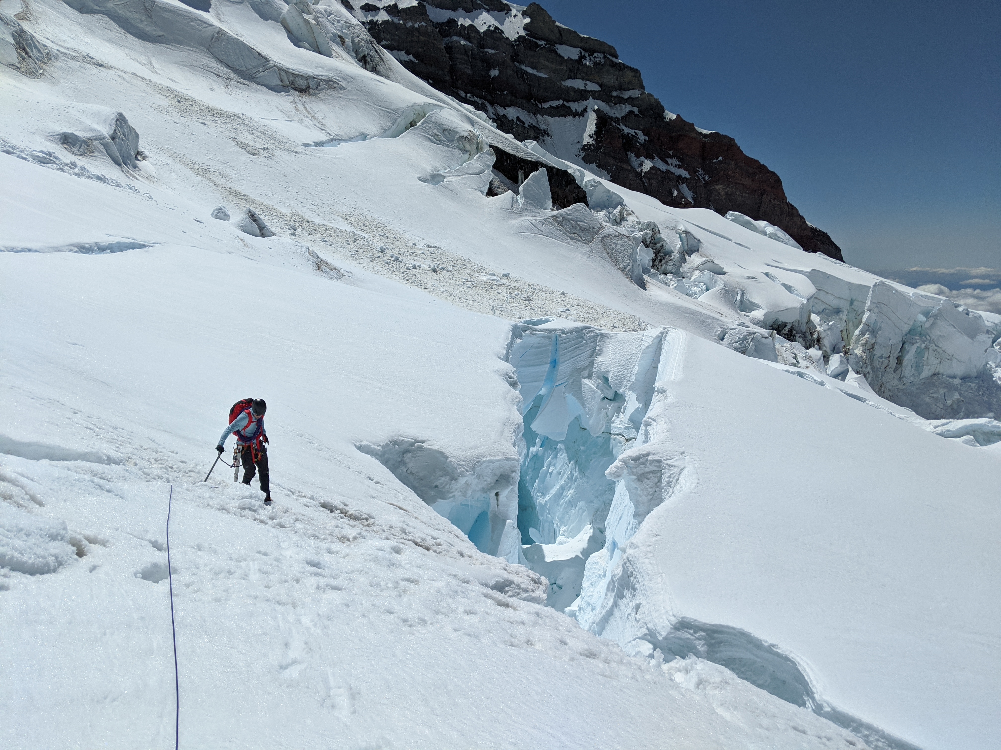
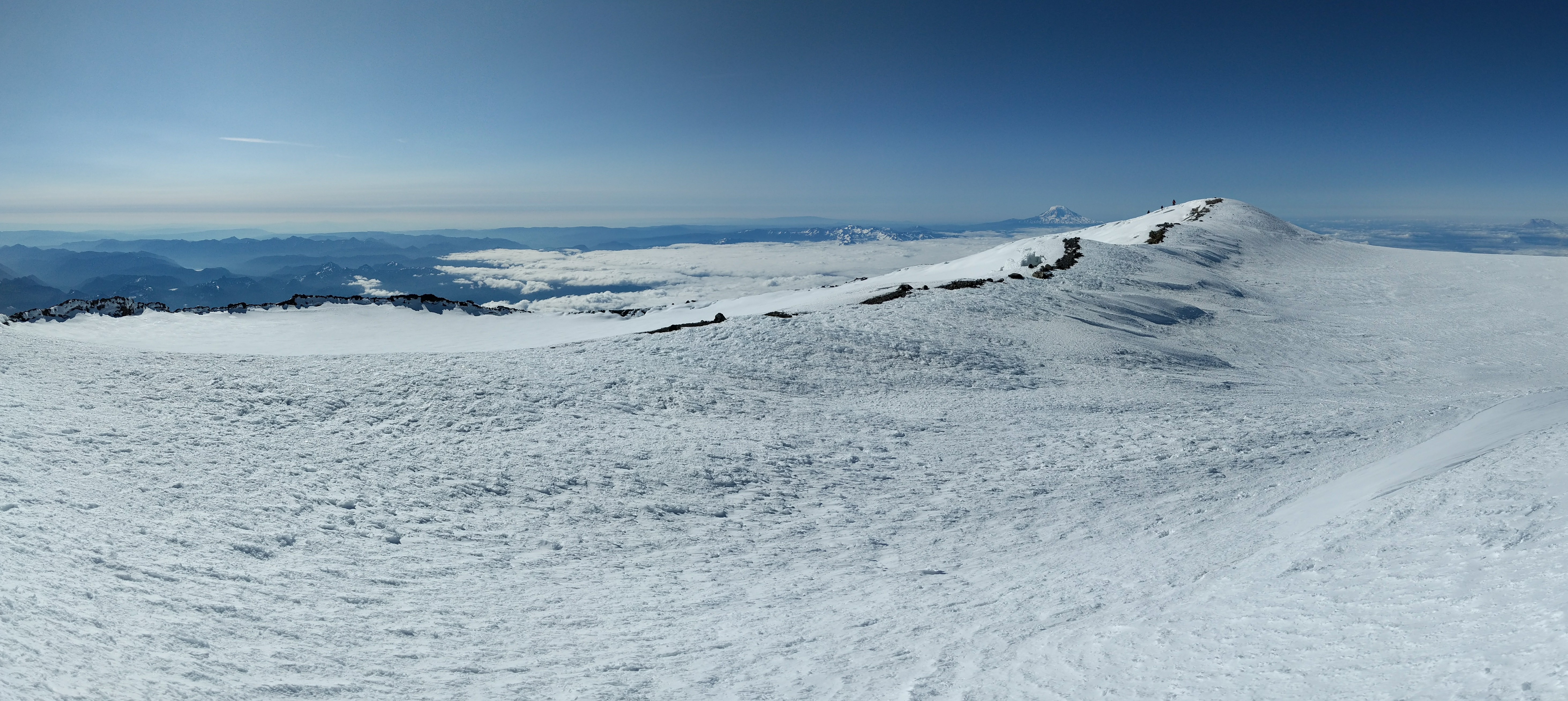
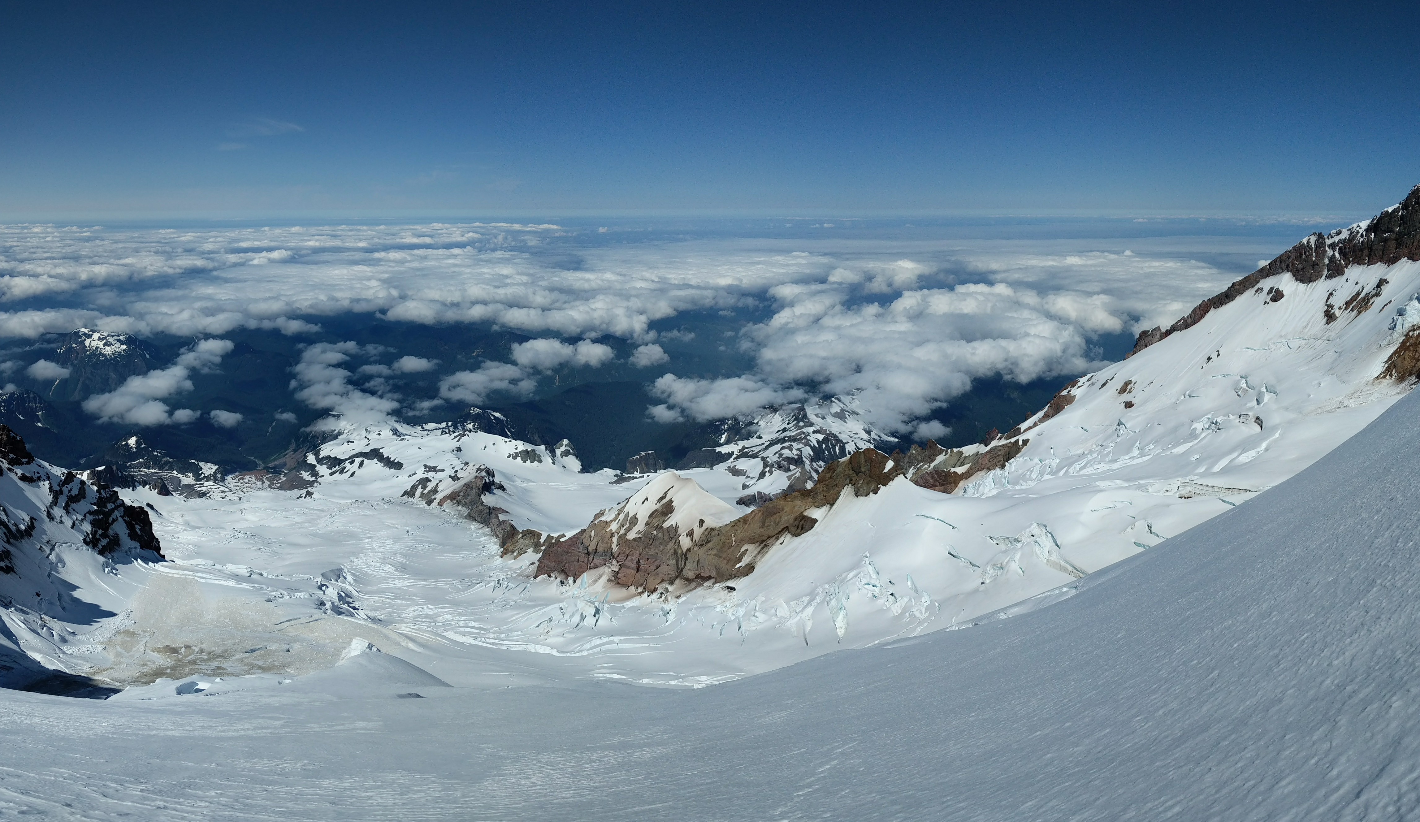
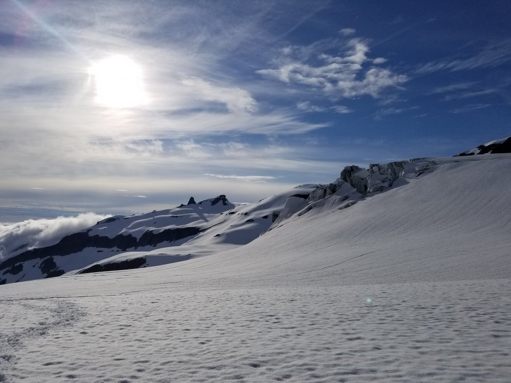
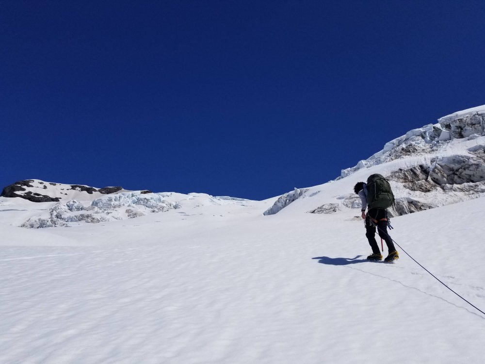
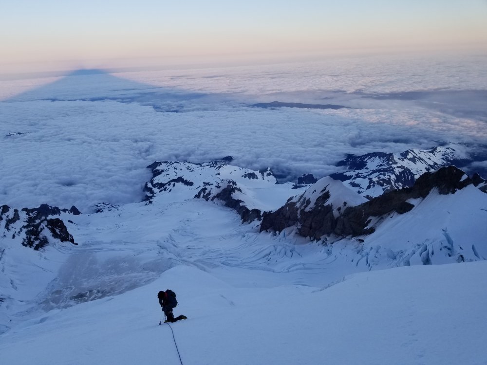
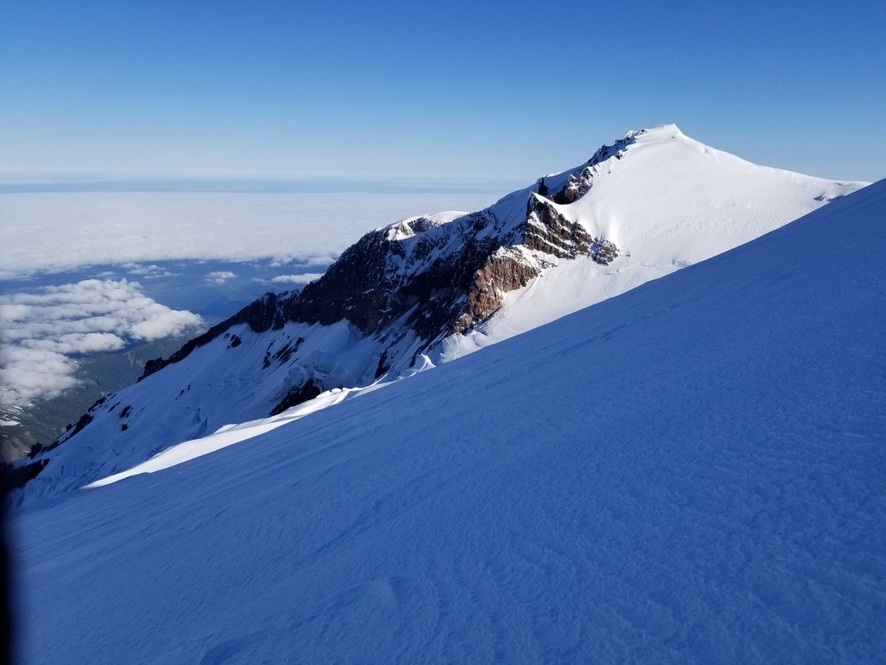
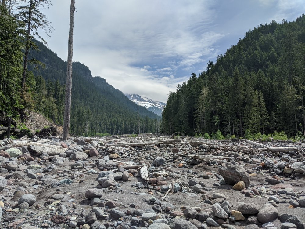
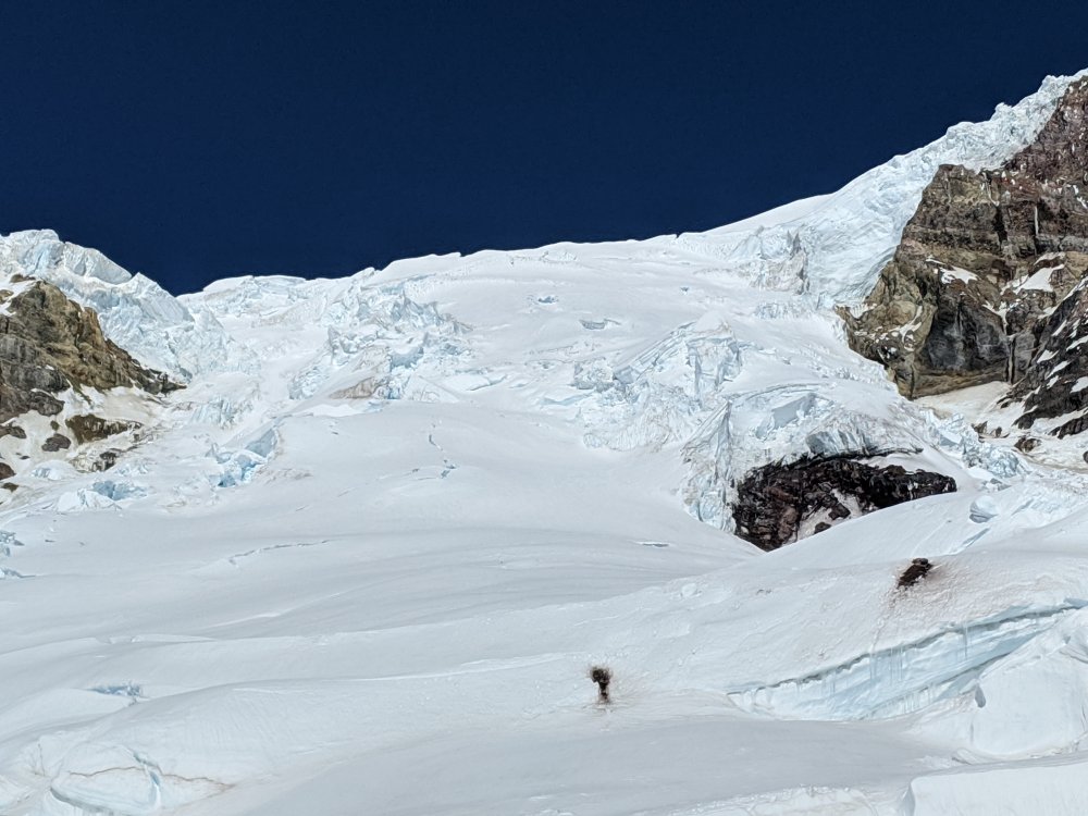
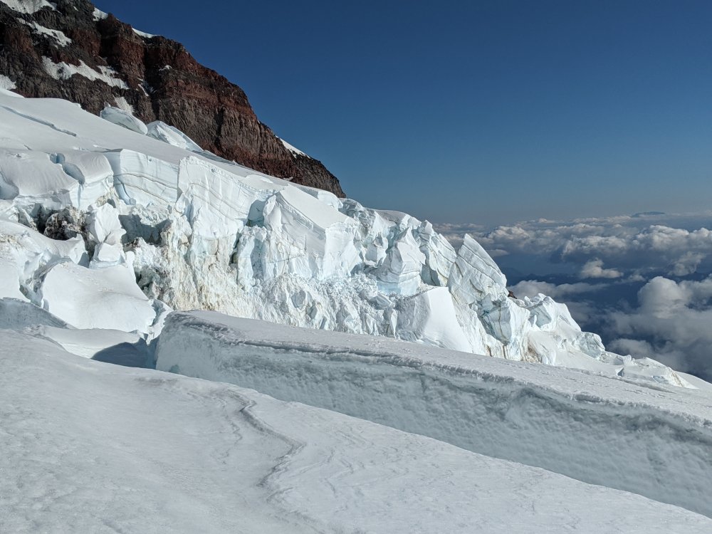
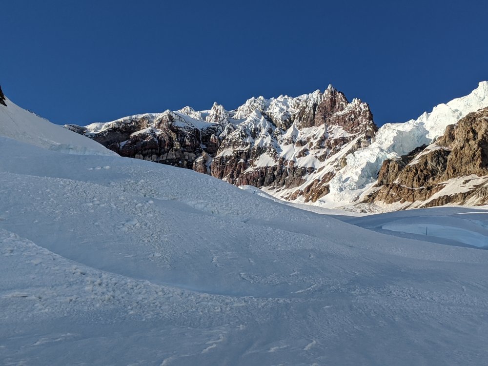
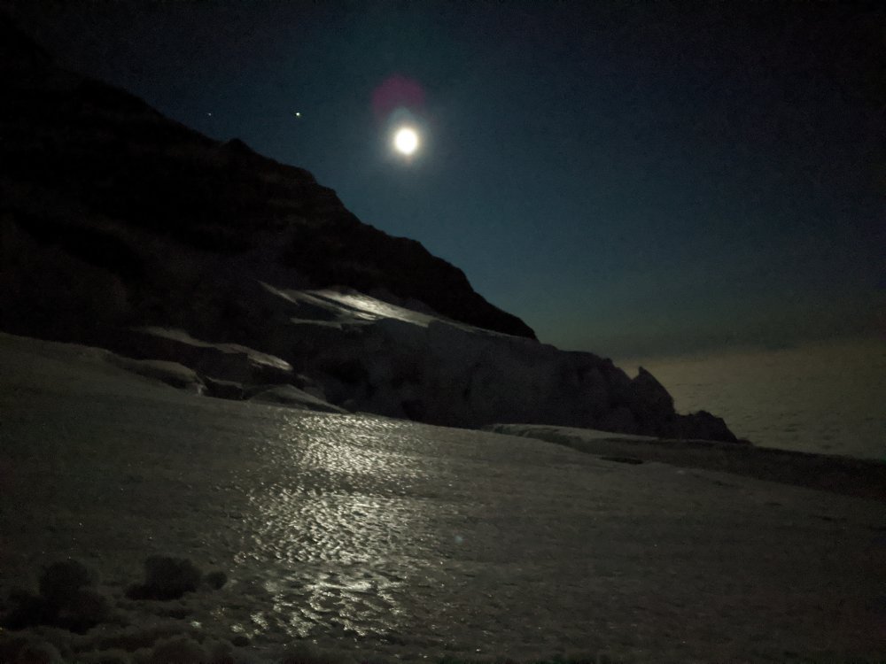
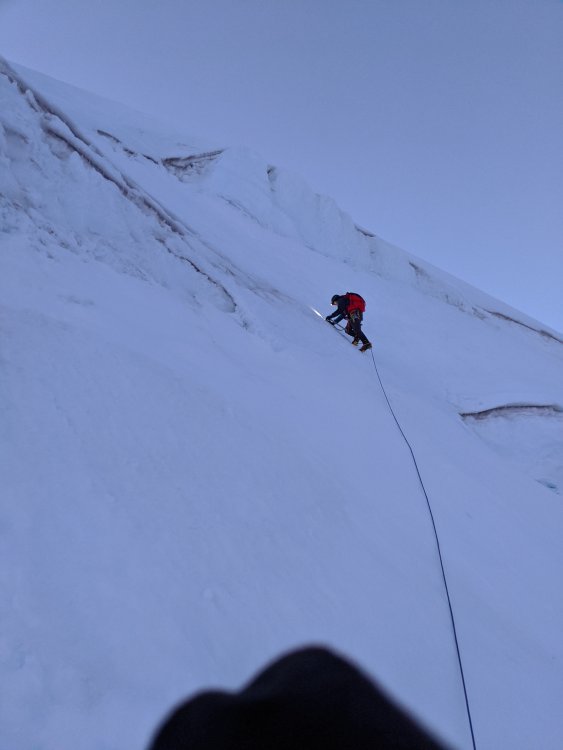
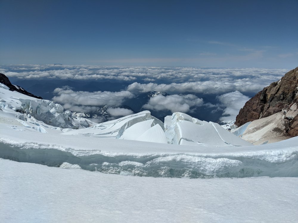
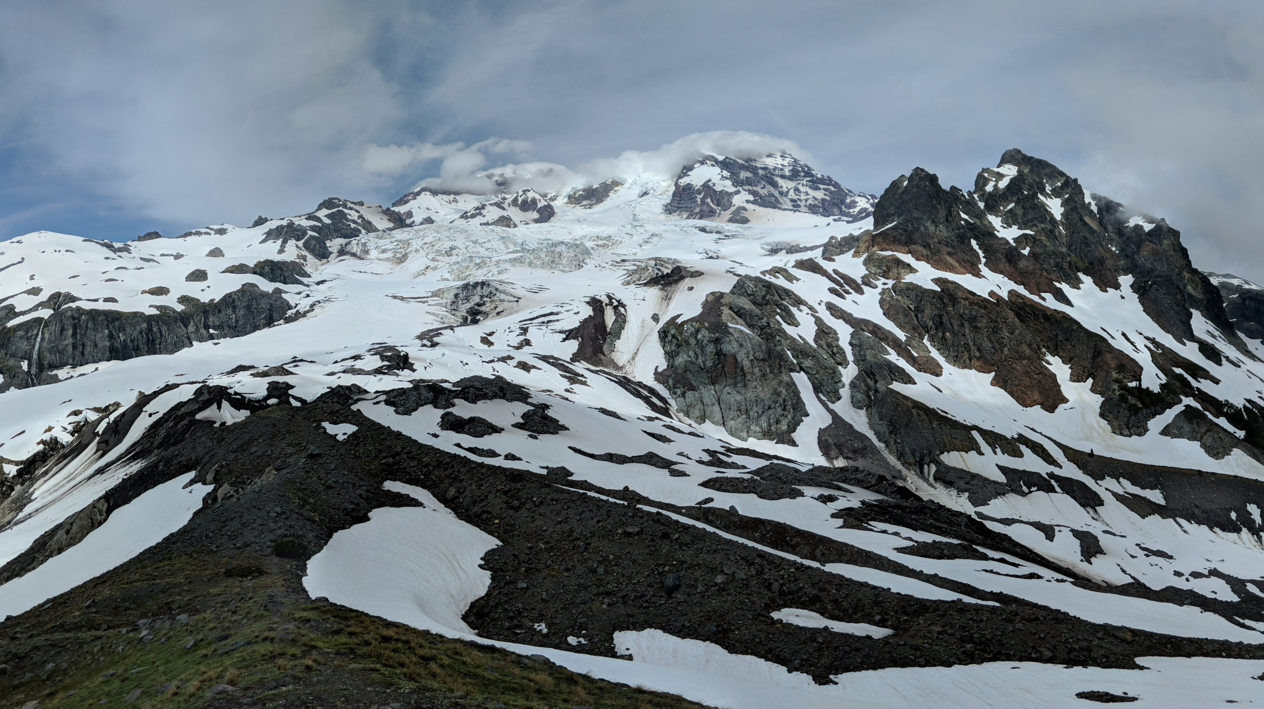
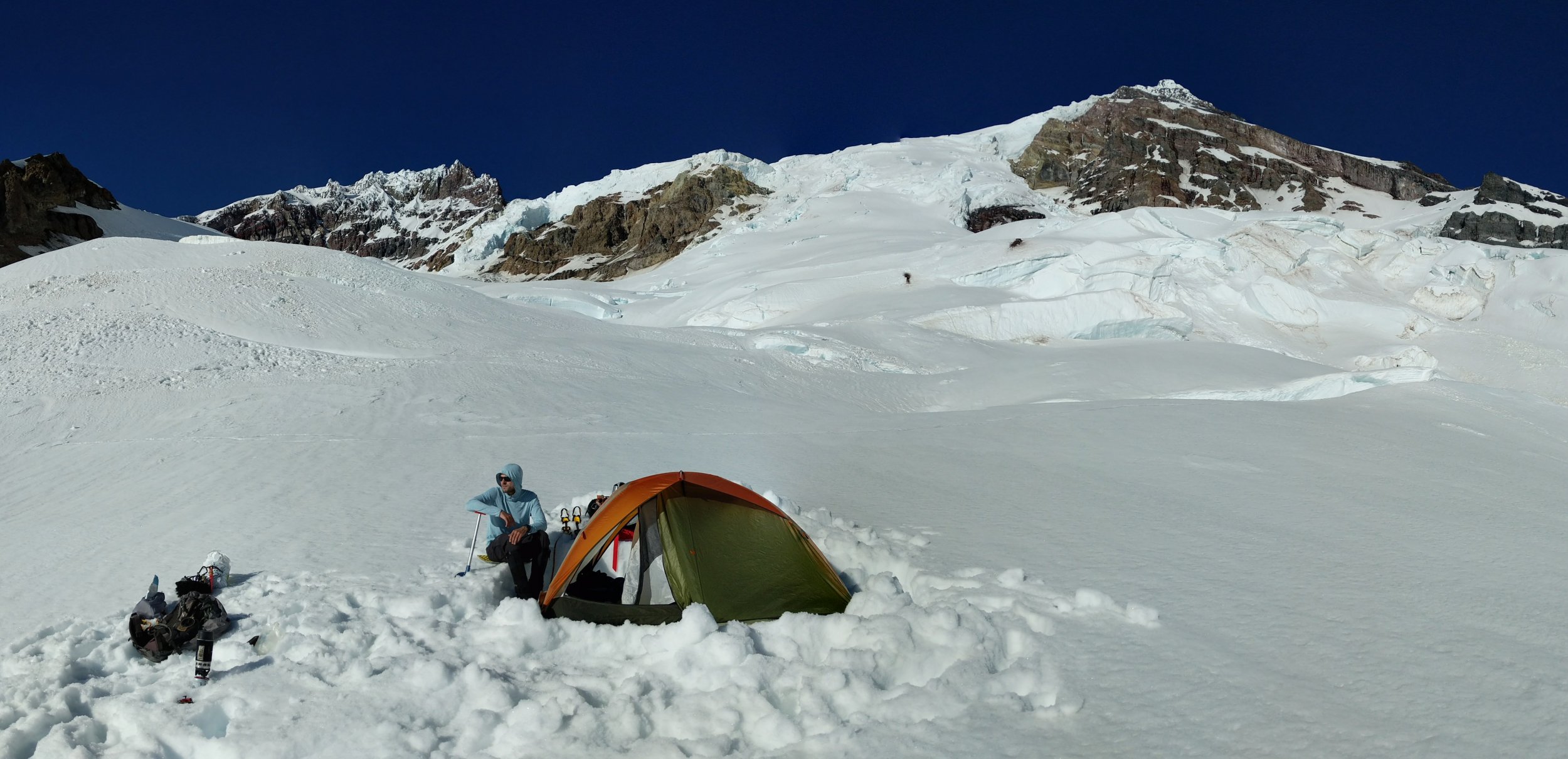
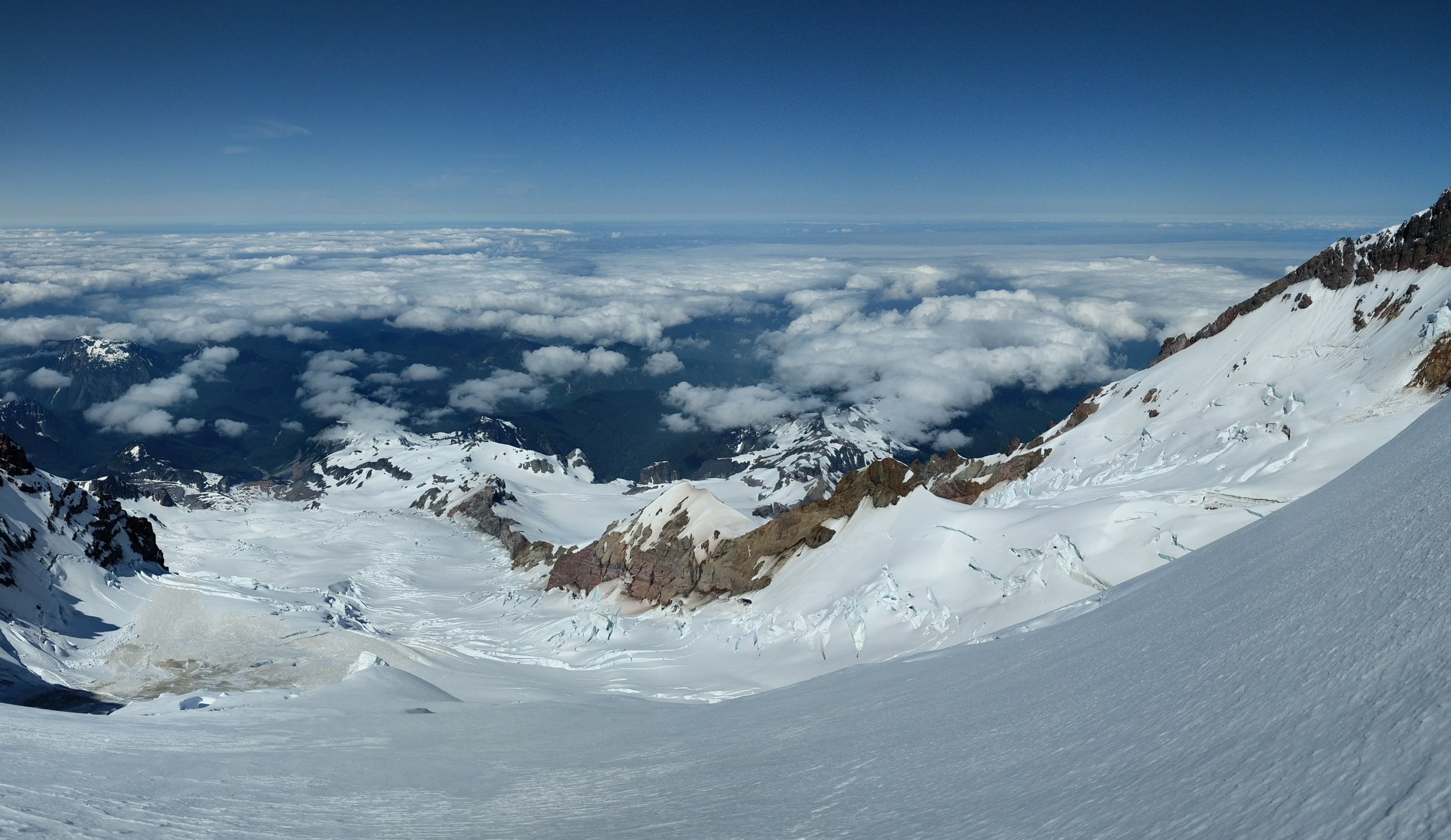
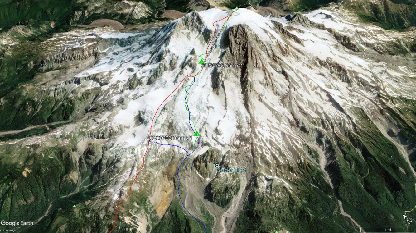
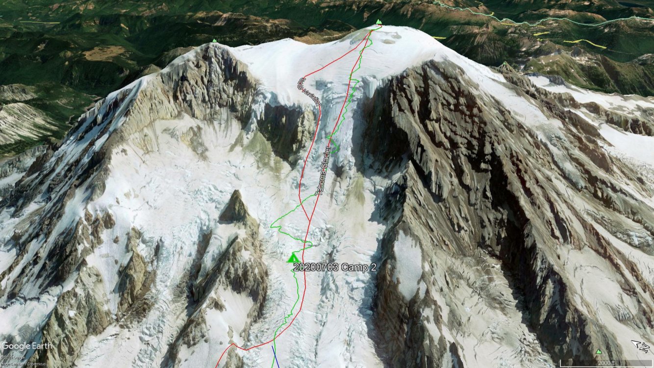
Trip: Mt. Rainier - Tahoma Glacier Trip Date: 07/03/2020 Trip Report: The Tahoma Glacier piqued my interest the last couple seasons as I explored new routes for my next Mt. Rainier climb. The low starting elevation, long approach, and remoteness of the route was especially appealing to me. Covering that distance and elevation on a route that receives very little traffic would be a fun challenge and great test of mountaineering skills. I was also excited to experience the mountain up close from a different perspective since I had only been on the west side of the mountain once before during a Wonderland Trail hike. However, with the park shutdown due to COVID-19 we were uncertain if we would get a shot at the Tahoma Glacier before it was too late in the season. We planned the climb for the weekend of June 19th and were excited when MRNP announced they would reopen that very weekend. Unfortunately, as the date approached the weather was not looking too promising. Reluctantly, we postponed the climb to the 4th of July weekend when we both had time off work. This time the weather forecast was looking stellar: clear, light winds, and cold (~11000' freezing level). And we would have a full moon. Game on! Our plan, which we later learned would be a bit ambitious, was to reach high camp (~9600') on day 1 (Friday), summit Saturday morning, and either exit the same day or stay one more night and hike out Sunday morning. For the approach, we decided on the more direct Emerald Ridge/Tahoma Glacier approach over the St. Andrews Park/Puyallup Cleaver approach. We knew we were getting into the tail end of the season for the route, but with our good snowpack this year we were optimistic that we could navigate the lower Tahoma without too much trouble. Also, there seemed to be an option to bail to the Puyallup Cleaver shortly after gaining the Tahoma Glacier if we found the glacier to be too broken up. The two of us set off from the West Side Road parking lot (2850') at 10:30a with cool temps and a partly cloudy sky. After a short hike on the road we arrived at the beginning of the Tahoma Creek Trail, marked by a drum for disposing of blue bags and a "trail closed" sign not far off the road. The Tahoma Creek Trail follows the Tahoma Creek until it joins with the Wonderland Trail at the impressive suspension bridge across the creek at 4200'. From there, you continue on the Wonderland Trail to the top of Emerald Ridge where you can gain the lower Tahoma Glacier. We followed the Tahoma Creek trail and other tracks the best we could, but with parts of the trail washed out we eventually lost it and ended up hiking along the edge of the floodplain. We kept our eyes peeled and in time we saw some cairns and orange marking tape at around 3500' which led us back to the proper trail. From then on, the trail remained intact and joined up with the Wonderland Trail where we continued on to the top of Emerald Ridge, passing by the occasional Wonderlander. Consistent snow began around 5200' which is where we stashed our trail runners and booted up. Tahoma Creek Floodplain: We parted ways with the Wonderland Trail at 5600' and made the short scramble to the top of Emerald Ridge and the toe of the Tahoma Glacier (6000'). Here we took a break and donned our glacier gear while taking in the views of Glacier Island and the true size and length of the Tahoma Glacier. Getting onto the glacier was straightforward and the cracks were small and manageable all the way up to a flatter area of the glacier at 7200'. Top of Emerald Ridge, looking back at the Wonderland Trail: Toe of Tahoma Glacier, Glacier Island on the right: At 7200' we stopped to assess our progress. It was already 6:00p (7.5 hours from the car) and we still had a good amount of glacier to cover to get to high camp. We were also low on water so we would need to melt some snow to replenish our bottles before continuing. At our pace, it didn't seem feasible to reach high camp that night at a reasonable hour and be ready to summit the following morning. We discussed our options and ultimately decided to establish a low camp at 7200' for the night, move up to high camp the next day, and summit on Sunday morning instead. We were due back home Sunday night, so that would leave us with a long hike out after summiting Sunday morning, but this plan would give us the best chance for success and make the trip much more enjoyable. Luckily the weather for Sunday was supposed to be just as good as Saturday. We set up camp and called it a day. Lower Tahoma Glacier: View from Camp 1, looking toward Tokaloo Spire: Sunset from Camp 1: On Saturday we woke up to clear skies and a great view of the upper mountain that was covered in clouds the day before. We took our time getting going and scoped out a route up the lower glacier. It was definitely more crevassed than what we had already traveled and the best looking route was in the direction of the Puyallup Cleaver and the looker's left side of the glacier. We broke camp and set off around 10:30a. Morning view from Camp 1, looking toward the summit: On the way up to Camp 2: The crevasses we encountered on the way up to high camp were growing in size but were still easy to cross with a short hop or snow bridges. Nothing too sketchy even with the sun beating down and snow quickly softening up. Our route did meander a bit as we searched for the most efficient way up the glacier, so it did take longer than expected. We reached 9400' at 2:00pm where we thought about setting up camp. This is where we would have joined the Tahoma Glacier had we taken the St. Andrews Park/Puyallup Cleaver approach; however, the ramp to get off of the Puyallup Cleaver did not look to be in the best shape. There was likely a path off the ramp onto the glacier, but we were glad we chose the approach that we did. Ramp at 9600': After a long break we pushed on a bit further through ankle and shin deep slush up to 10400' where we found a good spot for a high camp. I had read about other parties camping at this location as well. It was 4:30p at this point, 6 hours after leaving camp 1. From here we finally got a really good view of the upper glacier and the potential routes. Earlier in the day we saw that the looker's right side of the glacier may be a good option, but now we could see right up the center of the glacier and the Sickle variation. The Sickle looked to be in good shape with not a lot of evidence of icefall, but the seracs at the top of the route were intimidating. We decided against the Sickle and to attempt one of the other routes. We would make that decision in the morning under the full moon light once we gained some more elevation. We set up camp, ate, melted snow, and tried to get to sleep as the sun was setting. I fell asleep to the very faint sounds of 4th of July fireworks way off in the distance. Upper Tahoma Glacier: Camp 2: Sunset Amphitheater: Tahoma Glacier: The next morning we set off at 2:00a under a very bright full moon that lit up the mountain. It was right around freezing with no wind and the snow had firmed up nicely. We were excited to start the journey up the main route, but less than 30 minutes out of camp we thought the trip was over. We found ourselves on an island of ice with a pretty sporty jump to continue on. We contemplated it for a while but just didn't want to risk it, especially on the descent when the snow would soften up. Damn! That jump seemed like the only way, but we backtracked some and skirted around where we got stuck and luckily found a crossing! Phew! We wondered if this was going to be the theme of the entire ascent. We continued on and at this point chose to continue right up the center of the glacier rather than traversing over to the far right side option we saw. Full moon: Contemplating the jump.: The snow conditions were great and took crampons very well which made for very efficient stepping. We took the path of least resistance and just crossed our fingers it would go. There had to be at least half a dozen times when we thought our luck ran out, but a lone and thinning snow bridge (which probably wouldn't last another week) was there to let us continue on. Besides the first obstacle we encountered we didn't have to do much backtracking, but we did have to snake our way around the crevasses to find acceptable crossings. We each carried a traditional axe and had a few screws and two pickets between us. We contemplated bringing a tool, but from all the beta we could gather a tool wasn't really necessary on this route. Turns out that was the right call. We did encounter a couple short sections of solid ice compared to the rest of the route which was a nice sun crust. Front pointing and a low dagger axe took care of the ice sections, but we did protect them with a screw and picket while simul climbing. Short ice section: Soon we found ourselves at the top of the glacier where the slope begins to ease up at around 13000'. With the main part of the climb behind us it was just a slog up to the summit! We ascended directly up the west side onto the summit plateau and reached on Columbia Crest at 8:30a, 6.5 hours after leaving camp. Sunrise: Liberty Cap: Summit Crater: Summit Headstand! After getting some pictures on the summit and saying hello to a party of 4 that came up the Kautz, we dropped off the summit for a break and then took off back down the mountain at 9:15a. Being western facing, the Tahoma Glacier doesn't get sun right away in the morning which is good since we wanted to be down off the bulk of the upper glacier before it started to warm up. The descent went well and we followed our tracks down. We did downclimb one of the ice sections with some protection, but other than that we moved fairly quick down the glacier. We returned to camp at 12:15p, 3 hours after leaving the summit. Tahoma Glacier, Puyallup Cleaver, St. Andrews Rock: Tahoma Glacier: Tahoma Glacier: It would have been nice to take it easy and stay another night, but we still had a long road ahead to get back to the car that day. We made some water and packed up camp, then took off down the glacier at 2:00p following our tracks from the day before. The hike out was uneventful and we covered the 9 miles and 7500' back to the car in 5.5 hours, descending a total of 11500' for the day. Success! What a climb! We both felt really proud to do this route. It was a true test of our endurance and mountaineering skills, especially with navigating the very crevassed glacier. Oh, and we had the entire glacier to ourselves...we didn't see a single person between leaving the Wonderland Trail and the Summit. Being on our own without any tracks to follow made the trip even better. Day 1, Car to Camp 1, 6.7 miles, +4400', 7.0 hrs Day 2, Camp 1 to Camp 2, 2.5 miles, +3200', 6.0 hrs Day 3, Camp 2 to Summit, 2.8 miles, +4000', 6.5 hrs Day 3, Summit to Camp 2, 2.8 miles, -4000', 3.0 hrs Day 3, Camp 2 to Car, 9.0 miles, -7500', 5.5 hrs Total Mileage = 23.8 miles Total Elevation Gain/Loss = 11500' GPX track can be found here: https://caltopo.com/m/7M3P Gear Notes: Light glacier rack, a couple screws. Used screw and picket on icy section. No need for a 2nd tool. Approach Notes: Approached via Emerald Ridge/Tahoma Glacier.


 2 points
 -
Snowfield pictured in this report https://turns-all-year.com/trip-reports/march-15-17-chiwaukum-traverse2 points
-
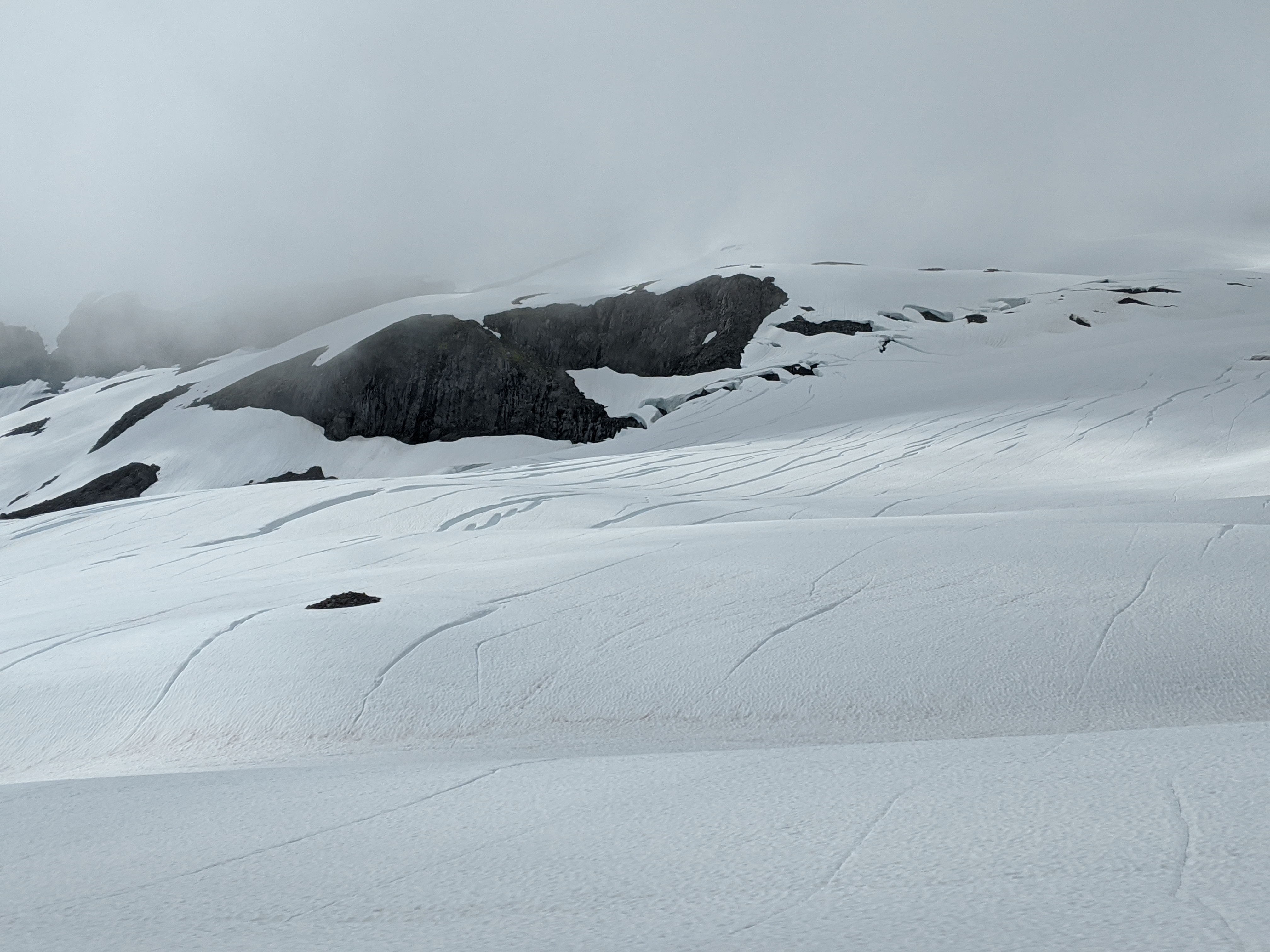
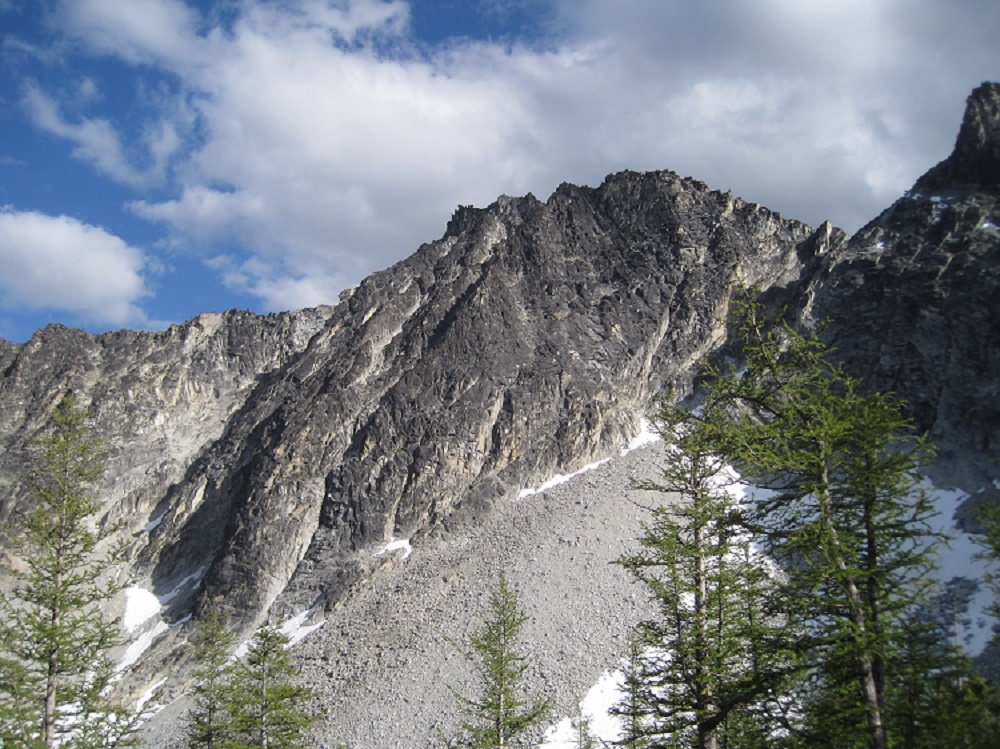
Trip: Corax Peak - North Face Trip Date: 07/05/2020 Trip Report: Not a single TR for this route to be found anywhere; does everyone just do the scramble to tick off their Bulger lists? Rolf and I climbed the NF of Corax Peak this weekend, 6 pitches of 5.7 starting from the left side of the chimney above the crescent shaped snowfield in the photo, going up to the ridge and thence to the summit. Mostly fun blocky ridge climbing, though the first pitch was more "interesting" as Rolf would say, featuring lichen and some loose/suspect rock and excavation of placements and some thoughtful moves. It doesn't appear that it's gotten much traffic since Rick La Belle did the FA in 1991; though of course we could have been off route. Stellar day out though and only saw three people at camp and maybe five on the trail. Gear Notes: 60 m rope, single rack to #3 Camalot Approach Notes: Libby Lake trail
 1 point
 -
It seems to be getting a nice revival of activity @JasonG. Of course, spring & early summer is peak TAY season!1 point
-
1 point