Leaderboard


Popular Content
Showing content with the highest reputation on 04/22/20 in all areas
-
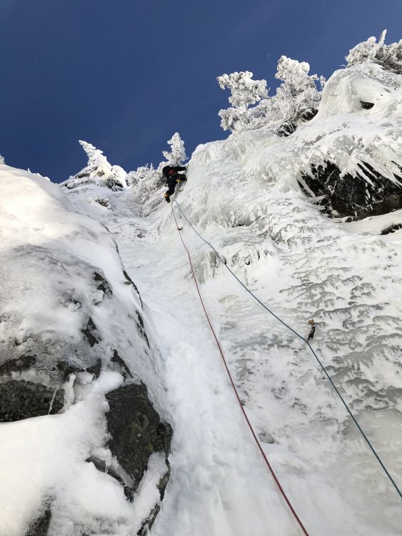
Trip: The Bugaboos - Pigeon Spire - W Ridge / South Howser Tower - Beckey-Chouinard / Bugaboo Spire - NE Ridge Trip Date: 08/02/2019 Trip Report: Aug 2-8, 2019 Our initial plan was to head down to The Bugaboos a week earlier, but according to a weather forecast, a storm was coming, so we decided to wait it out. Luckily, several days later we saw another window of good weather. I’ve heard some people plan a trip months ahead only to sit in a wet tent with snow all around . We used https://www.meteoblue.com/ for the weather forecast. Itinerary: Aug 2: Meet after work. Drive as far as we could. Spend a night at a campground along the way. Aug 3: Drive the rest of the way. Hike to the Applebee campground and setup tents. Aug 4: Leisure morning. Climb Pigeon Spire W ridge. Aug 5: Alpine start. Climb South Howser Tower. Aug 6: Rest day. Aug 7: Alpine start. Climb NE ridge of Bugaboo Spire. Aug 8: Hike down and drive home. We did not bring chicken wire. There will be plenty. I’m not sure if it helps – I saw porcupines walking behind it, or make sure it's solid and there are no holes between the wire and ground. TH to the Applebee campground – 2.5h. The campground has tap water and plenty of toilet paper. The place is swarming with rodents. Don’t leave any food in a tent or a backpack – there are metal boxes and hangers for it. Pigeon Spire - W Ridge The route is longer than I anticipated. I’d call it three-summit traverse (the last is the true). We simul-climbed on the way up. On the way down, we did two rappels from the summit and down-climbed the rest unroped. I was wearing mountaineering boots. Timeline: 9:25 – Start 10:25 – Top of Snowpatch col 11:20 – Base of the climb About 13:15 - Summit 14:30 – Back to the base Pigeon Spire on the right as seen from the summit of South Howser Tower: South Howser Tower – Beck-Chouinard route I did wear boots until Pigeon col, then switched to approach shoes. For the rest of the approach we had one pair of crampons and an ice axe for both of us. There was stream water after descending the col. We were lucky to have only three parties total on the mountain and we left the first at the base. We simul-climbed until the forth (5.10-) pitch. First few pitches after the bivy site seemed shorter, and watch for loose rock. For rappels, we used 60m and followed instructions from Steph Abegg supplemented by @JeffreyW’s comments. Here are my additional comments: #3 - stay on the ridge, at the end where will be a step down with a small ledge. When standing on the ledge bolt anchor is about climbers 1pm o’clock. Silly I were standing on the ledge, did not see bolts, swung left, and had to ascent a rope after. #6 – after finishing #5 use nearby bolts. Rappel (walk) left (climbers) along the ledge, i.e. what Jeff describes as “rappel parallel to the handline down the scrambley ledge”, until find next bolts: #last – the first person got lowered and extended rappel with a cordelette just in case. Timeline: 3:40? – Start 7:10 – Base of the climb 11:15 – Big ledge 18:10 – Short rappel 19:40 – Summit Shortly after pitch-dark – Finished rappels 1:20 – Back to the campground Not as big, huh: Standing on the summit: North and South Hoswer towers: Bugaboo Spire – NE Ridge Scrambling up Bugaboo-Crescent col was fine, but there was one insecure move, that made my back chill. I tried to link first two pitches with 60m, but end up short 3-5m. Make sure to well extend the third pitch, because of its nature. Left variations and 5.10 to gain South summit were great. Scrambling down Kain route was endless. There are multiple paths, generally marked with cairns, do not drop down too fast and keep traversing skiers right. I can see why parties descending in the dark often get in trouble on this route. Timeline: 5:00? – Start 5:50 – Base of Bugaboo-Crescent col 6:20 – Top of Bugaboo-Crescent col 7:00 – Base of the climb 11:00 – North summit 12:30 – South summit 15:40 – Top of Snowpatch col 17:00 – Back to the campground Traverse from N to S summit (looking forward): Traverse from N to S summit (looking backwards): Bonus 1. On the way home, we stopped by Kinsmen Beach at Windermere Lake to wash off all sweat and dust. It was delightful. 2. Below is my food plan. All food was portioned into zip-lock bags. What worked well: none left with no starving. Instant potatoes with tuna was the best meal. Egg noodles and cheese was the worst. Fri Dinner Grocery/Restaurant take out Sat Breakfast Buy a sandwich Lunch Buy a sandwich/etc Dinner Couscous 363 cal Turkey Jerky 105 cal Pita bread 140 cal Chocolate 150 cal Sun Breakfast Instant oat + powdered milk 300 cal + dried blueberries (oatmeal) Granola bar 130 cal Lunch Gummy bears 180 cal Pita bread 140 cal Trail mix 250 cal Snickers 250 cal Tailwind 400 cal Dinner Instant potatoes 392 cal Tuna 160 cal Pita bread 140 cal Garlic oil Mon Breakfast Oatmeal 300 cal Granola bar 130 cal Lunch Couscous 320 cal Salami 200 cal Pita bread 140 cal Trail mix 250 cal Dinner Egg Noodles 381 cal Cheese 170 cal Chocolate 150 cal Tue Breakfast Oatmeal 130 cal Granola bar 300 cal Lunch Gummy bears 180 cal Pita bread 140 cal Trail mix 250 cal Snickers 250 cal Dinner Mountain house? Wed Breakfast Oatmeal/Bars/leftovers 300 cal Granola bar 130 cal Lunch Stash some food at the car Gear Notes: A tent, two 8 oz fuels (we ended up using only one), jetboil, water filter. 8 singles, 6 doubles, 2x cordelette, BD cams .1-.3, doubles in .4-4”, 60m rope, grigri, set of BD nuts. Approach Notes: Some comments in TR1 point
-
Wow!! Another awesome TR, thanks for posting! Great diversion for the isolation!1 point
-
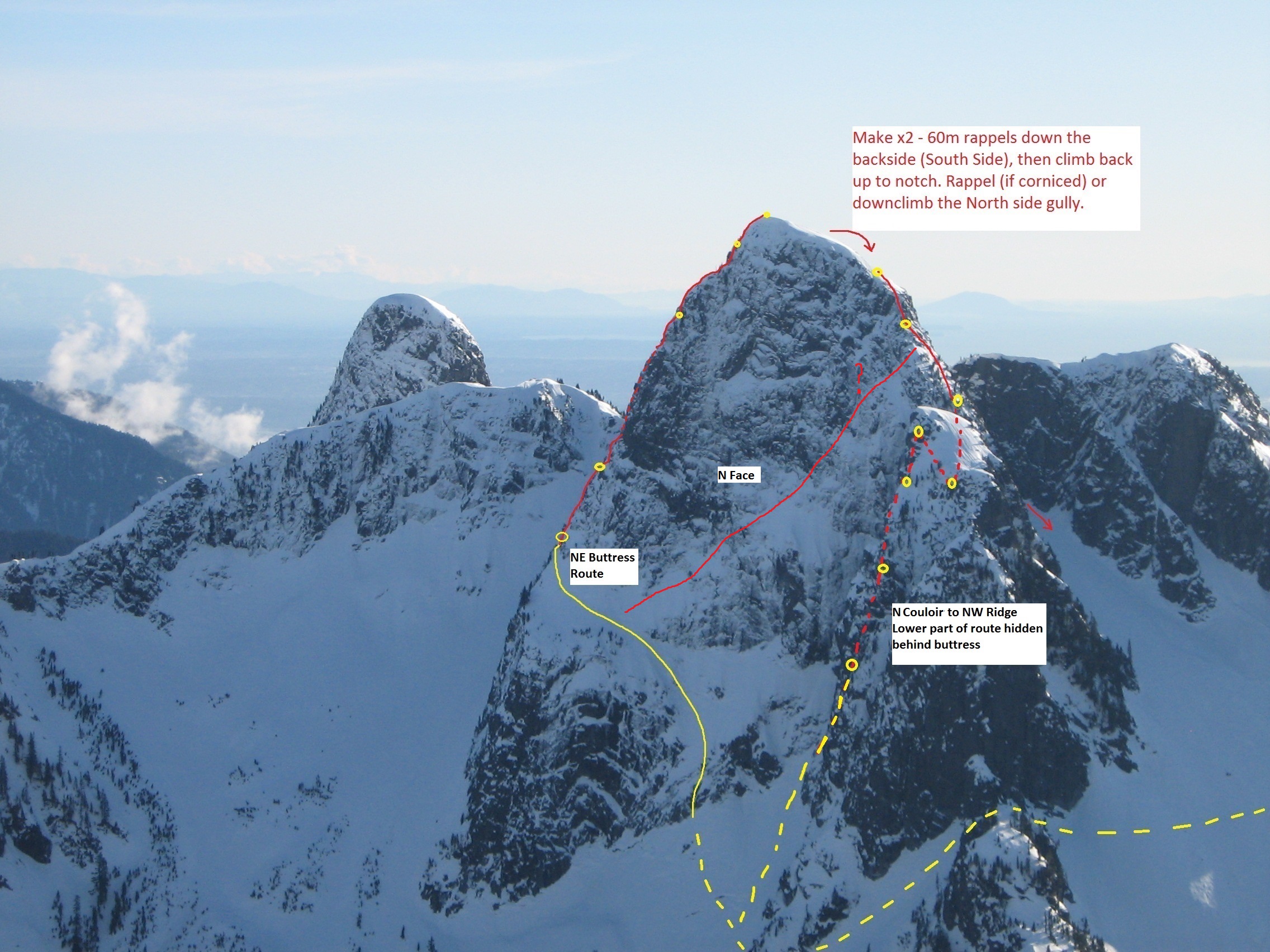
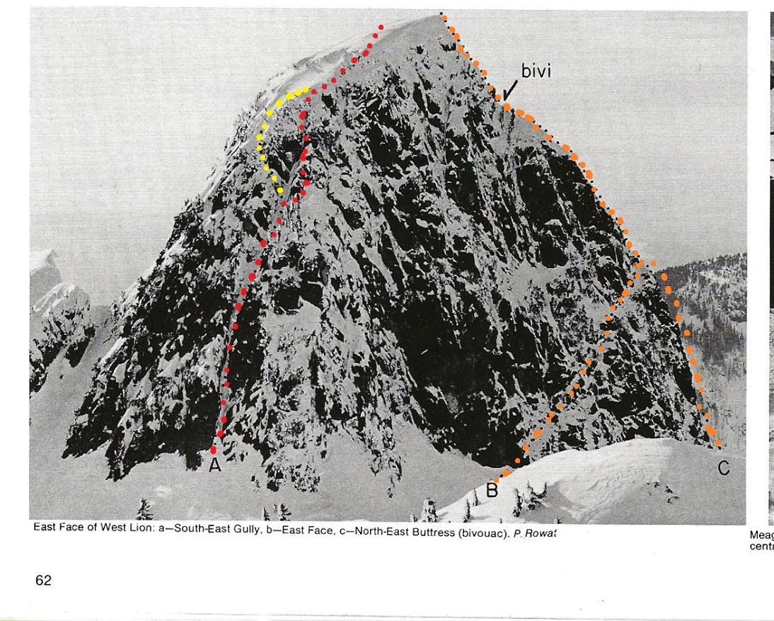
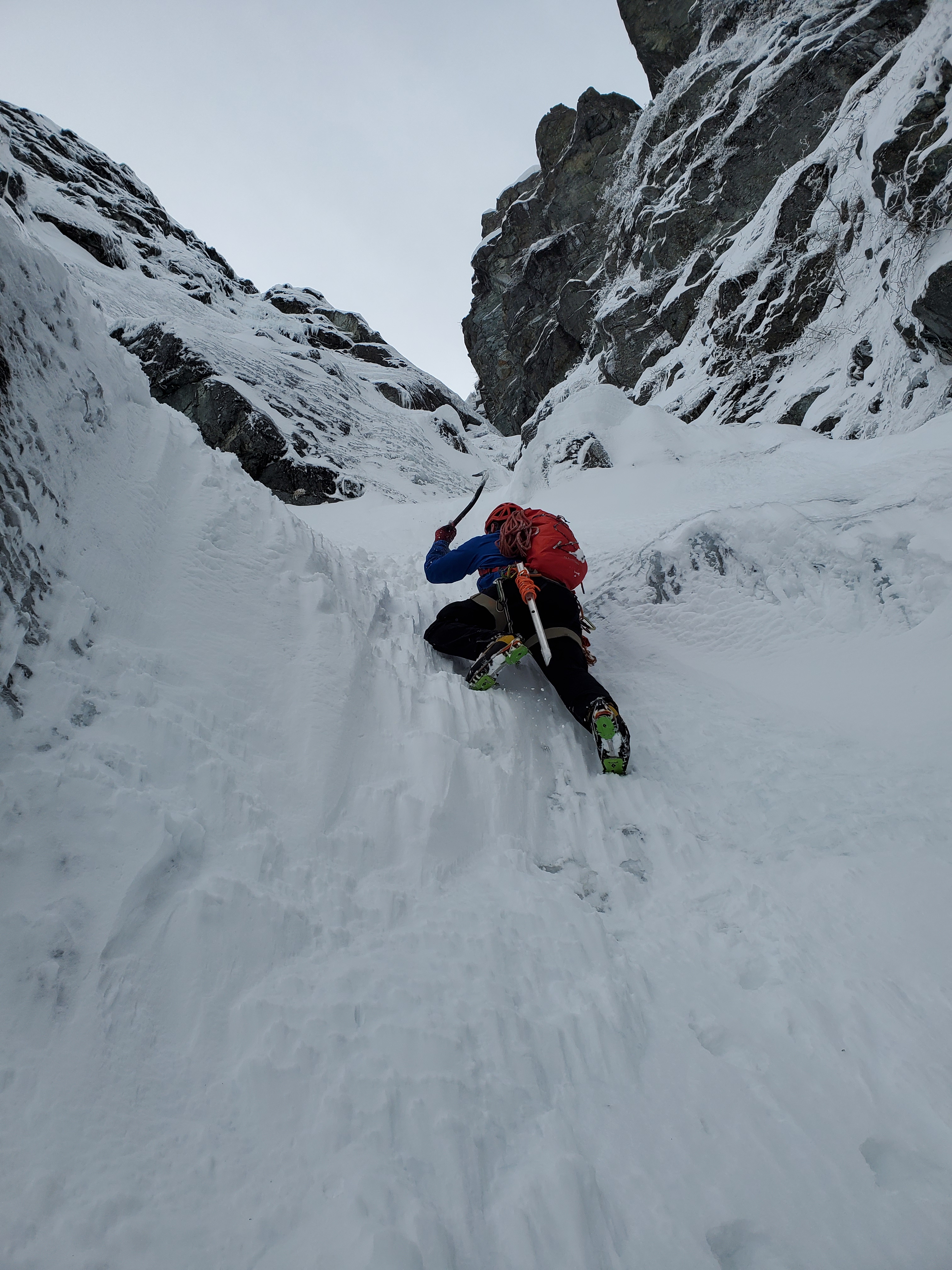
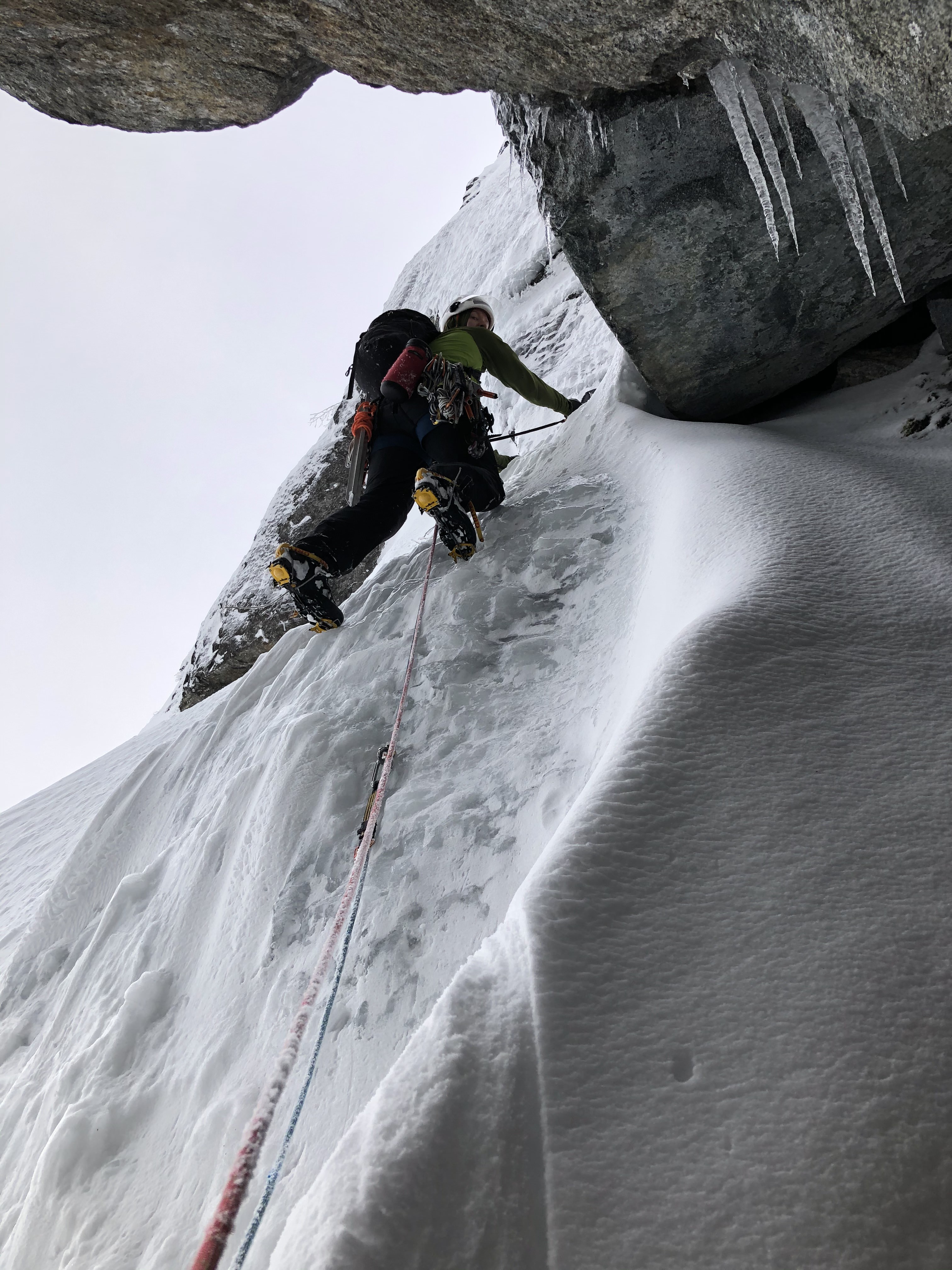
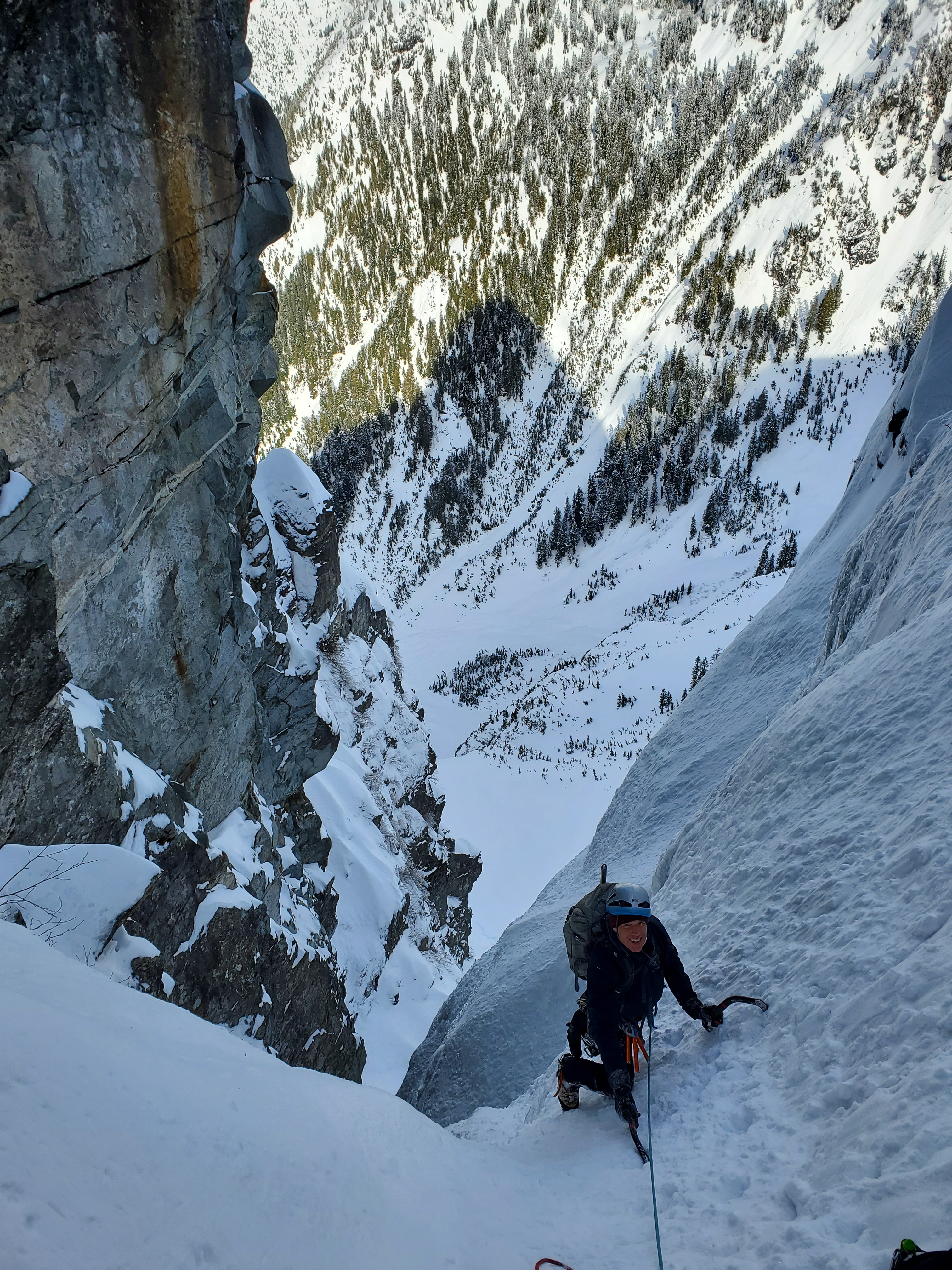
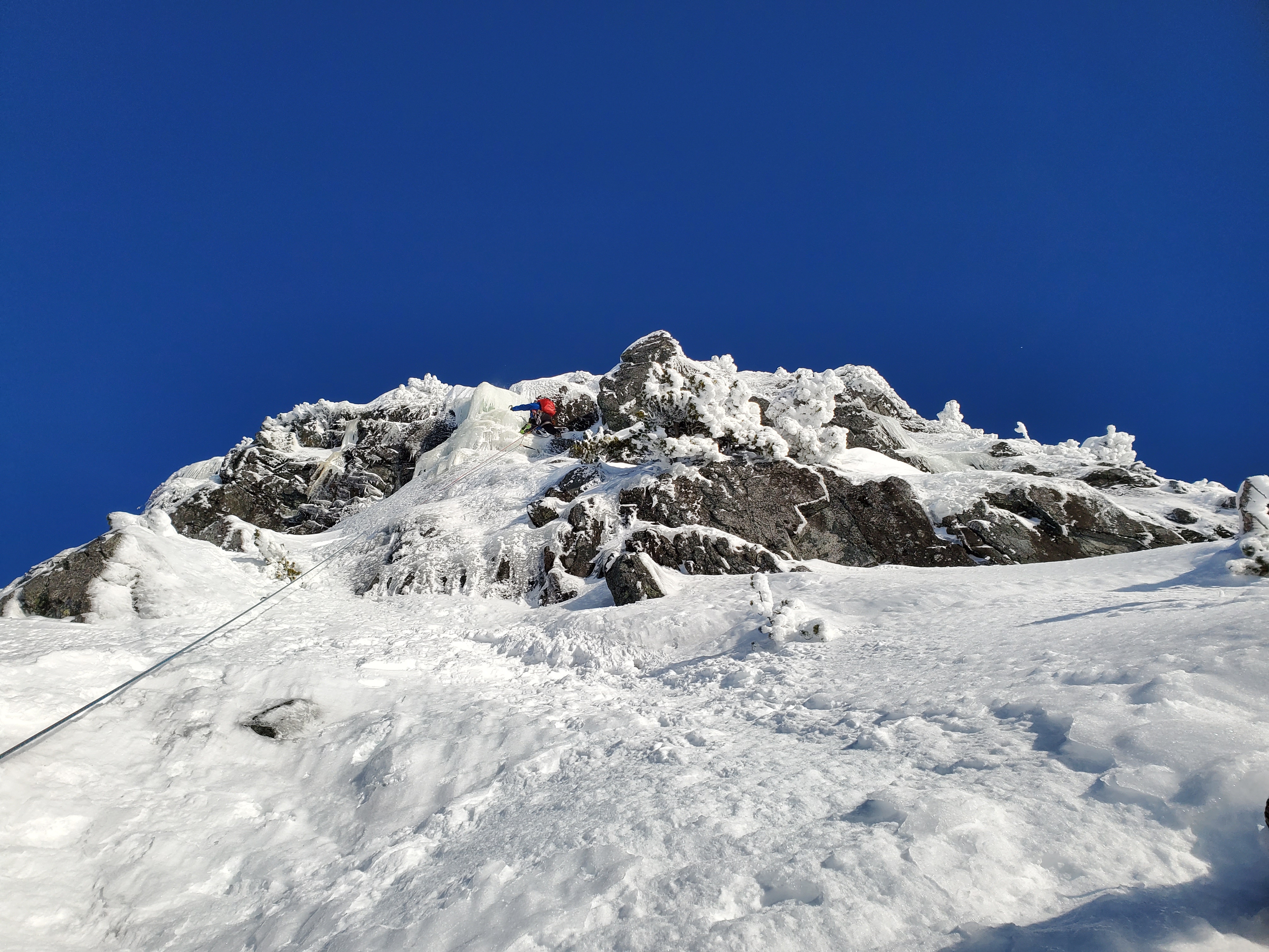
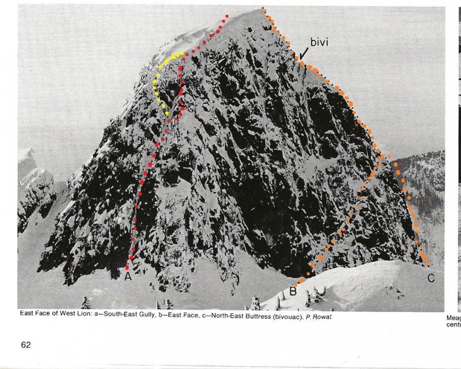
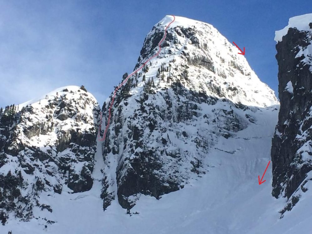
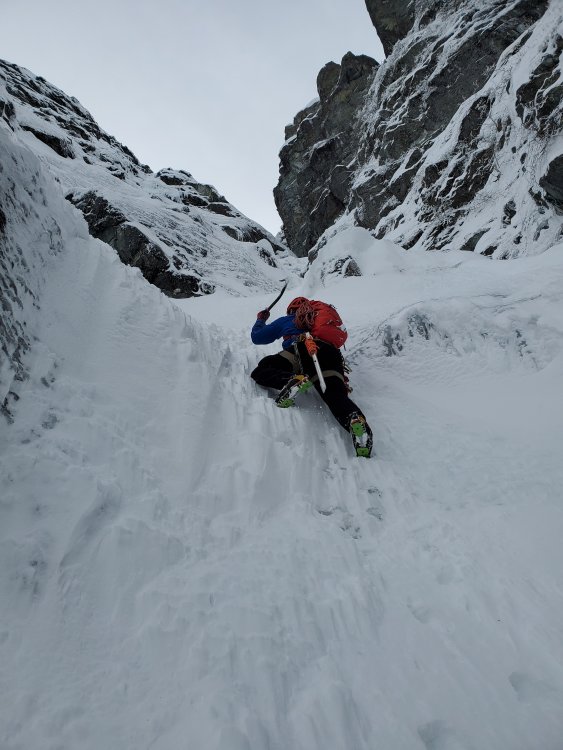
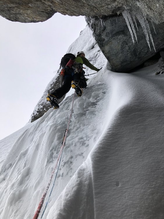
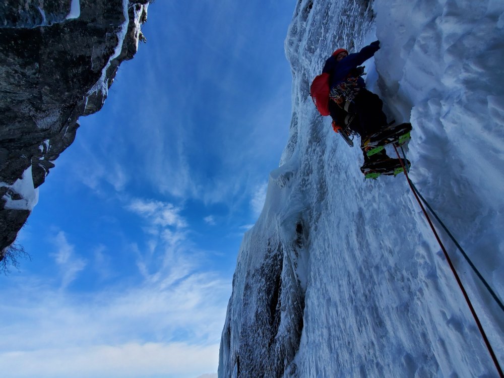
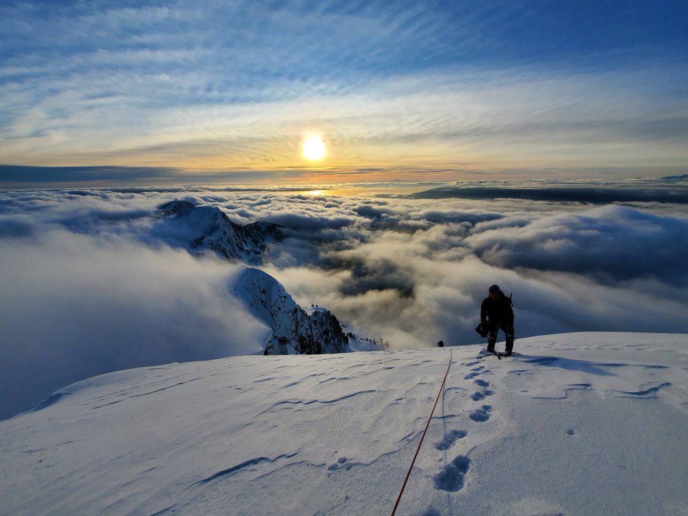
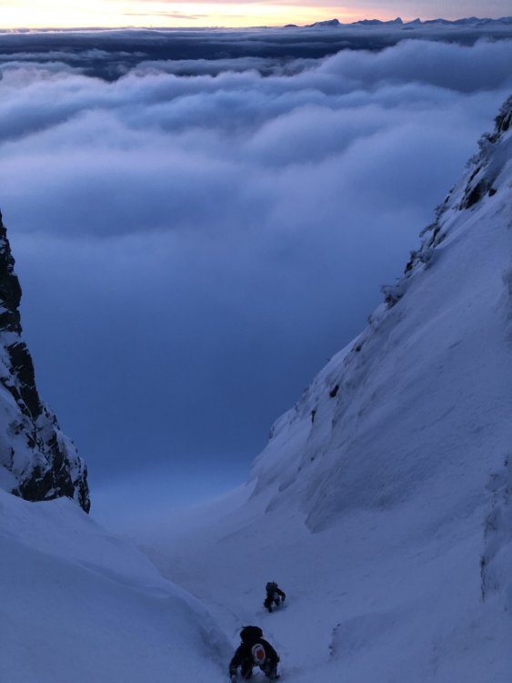
Trip: West Lion - Winter - North Couloir to NW Ridge Trip Date: 02/09/2020 Trip Report: This trip report is 2 months late but wanted to post this for folks in the future looking for info on this route/or the West Lion in general. On Feb 9 Richard, David and I Climbed the the West Lion via the N couloir and then the NW ridge. We were around 14hrs car to car which seems pretty average for winter routes up on the lions. Some faster groups do achieve 8-12hr range c to c. Nevertheless winter routes up here are always a longer day. For general info I'm aware of the following winter routes on the West Lion, there could be more... SE Gully - WI4- - 140m NE Buttress - AI3/M4 - 400m NE Buttress with East Face Approach - Difficulty Unknown North Face - Hard (Line below is approx) North Couloir to West Ridge - AI4- - 400m North Couloir to West Ridge Direct (no rappel) - M4/M5 addition? Photo topo of the North side routes and approach on West Lion Photo posted by Don Serl on Westcoastice Facebook group, outlining the East side routes on the West lion including a variation entrance onto the NE buttress in orange. I climbed the SE gully via the Red line, although I notice the original line in yellow goes out left. North Couloir to NW Ridge. Upper part of the route as viewed from the approach basin. Descent gully noted on the right. Looking up the North side of the West Lion while approach the North Couloir. Richard soloing up the lower portion of the North Couloir. Photo of me leaving the comfortable cave on Pitch 2 in the Couloir Dave coming up pitch 2 in the Couloir. Richard on pitch 3 in the Couloir. Photo of me on the 4rth pitch just after rapping from the notch Richard leading the last section of ice on pitch 6. Dave and Richard walking up the last portion to the summit with epic views that evening toward Howe sound/Strait of Georgia. Descending the gully back to the approach basin in fading light. On Feb 9 no flotation was needed on the approach, although the north side had much deeper penetration (crotch deep coming into gully). After being up to the lions area well over a dozen times in the winter I have concluded it is more likely then not, that flotation will be needed/helpful on the approach to the basin. FYI I have found that the approach trail up is too steep to skin up efficiently, and offers a very short (not worthwhile) ski descent. Conditions are very fickle for north shore alpine ice. When routes come in shape they seem to last only a couple weeks per season. I feel this line is similar in overall difficulty/ exertion as the winter NW buttress but this has more full length ice pitches then the NW buttress. I don't recall reading the route grade for the N Coulior/West Ridge but these are my thoughts on the difficulty (certainly conditions dependent): Pitch 1 - AI2+ - 70m P2 - AI3 out of cave - 60m P3 - AI3 step with vertical snow just below the notch - 30m (40m Rappel from notch on shrub to next continuous ice flow) P4 - AI4-/3+ - 50m P5 - Steep snow to base of last ice pitch - 70m P6 - AI3 - 60m Walk to summit 14hr car to car Cheers, Henrik Hinkkala Gear Notes: x2-60m half ropes, 10 extendable slings/runners (used all), 4 nuts (didn't use), 9 screws most 13-17cm (Used 7, many got rocked), 3 pitons + spectre (used all), 5 cams (blue/ yellow/ orange metolious, red ultralight, red link cam- used all but blue/ yellow), 1 picket (used twice) Approach Notes: Follow Lions Trail up to Lions Basin


 1 point
 -
Okay the third time will be the charm. Get Kyle when he is healed and git the damn thing done to the top!!1 point
-
i'm sure there some people that post here or used to that are into spanking....1 point
-
Damn, we are few and far between as are my posts on cc.com. miss you all1 point
-
I took some more time to reflect on the whole experience with Sloan: the mistakes, the aftermath, the criticisms, and ultimately, what this climb means to me. If you want to get real deep: https://climberkyle.com/2020/03/25/life-after-sloan/0 points
-
Nice work! 👍 Oh, wind slab... Backing off sounds it was the smart choice. Your wisdom will carry you into old age in the alpine!0 points