
Leaderboard


Popular Content
Showing content with the highest reputation on 07/02/19 in all areas
-
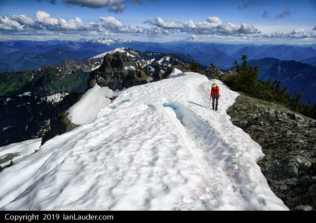
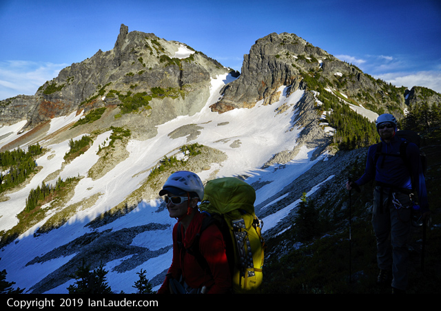
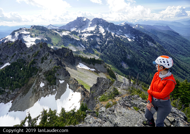
Trip: Tatoosh Range - Tatoosh Traverse Trip Date: 06/30/2019 Trip Report: 12 peaks with 2 rock climbs in 2 days. 25 hours moving time. About 18 miles and about 9000ft gain. So, this isn’t one of those “fastest time” kind of trips, no trail running involved. Just 3 climbers with 25-30lb overnight packs and climbing gear. With our 9-day Pickets Traverse plan weathered out we kicked around ideas for the weekend and decided to roll the dice on the slight thunderstorm forecasts around Rainier to do the full Tatoosh Traverse. Picked up a camping permit at 7:30am on Sat at Longmire and were on the trail by 8:50 at the Snow Lake trailhead having left a vehicle back at Longmire. 4 hours in we tagged Stevens Peak after having done a long off trail traverse below Unicorn, some thick bushwhacking down into a snow filled basin that took us up to the saddle between Stevens and Boundary. Saw a fox right at the col as we popped up. From there ran the ridge back to the saddle and on to Boundary peak, from Boundary we were at Unicorn by 5pm and climbed the 2nd 5.6 route. From there went up and over Foss. Thought we spotted a boot track in some snow on the way to Castle and went to follow it, but it was a fresh bear track. Got to the base of Castle by 8pm and setup camp. 4 down on day 1. So, we would have to hustle to get 8 on day 2. Found running water at this point only in the basin on the way to Stevens, running off a wall on the backside coming off Unicorn and a convenient little stream right at the top of Castle near our camp. Rest of our water fills had come from stuffing water bottles with snow along the way. Up at 6am and on our way to climb Castle before 7. Finished off Castle, packed up camp and had knocked off Pinnacle within 2 hours. 6 down 6 to go. From Pinnacle headed over to Plumber then Denman and had those knocked off within an hour each. 8 down and 4 to go. Up next was Lane Peak which was a little trickier. We wound up scrambling up the narrow gulley that we remembered having ice climbed up last winter right to a tree that had a rappel sling on it. The gulley seemed to be 4th class or 5.0, easy climbing but really exposed but good rock (as opposed to the rest of Lane). Then we found a scramble path down climbers left of that gulley for the way down. #9 down and 3 to go. Had lunch and it was about 1pm at this point. Took longer to get over to Wahpenayo having to do a long traverse side hilling over heather and screen slopes then turning upwards about halfway to gain the ridge. On the other side it was a mix of snowfields and ridge running to get to the summit. #10 down and 2 to go. Some more steep heather and grass slope travel to get to the climbers trail between Eagle and Chutla and some more bushwhacking through trees. Right about when the predicted thunder would be starting, we were hearing some thunder nearby and started getting a little rain. But still had sun and blue sky to our South and we knew the thunderstorms were predicted more over Rainier to the North. At the trail we dropped packs and cruised up Chutla Peak crossing our fingers the thundercloud wouldn’t get worse. #11 down and 1 left. Cruised back down to our packs and did the short traverse over to the saddle and dropped packs again. Had a quick discussion about how we felt about the thunder and decided to get in the trees and start heading up Eagle as we still has some blue sky and sun to one side. #12 of 12 down and by the time we were back at our packs the storm clouds had moved off and we were back to blue sky. Long trail back to Longmire and back late evening before dark. After picking up the car shuttle and back to Ashford found the only place open to eat anything was the Highlander where we got a big pizza that was a combination of a little overcooked and undercooked but was everything we needed. Too tired to drive home we crashed in the cars in the parking lot across from Whittakers Bunkhouse. I must have been low on salt from sweating buckets for 2 days all I wanted for breakfast the next morning was a salty French dip and a bag of chips which I found at the bakery in Eatonville. According to the beta we read after the fact a full Tatoosh Range traverse of all 12 peaks with overnight gear takes about 2.5 days and involves hiking in the night before the start and finishing at twilight the "3rd" day if you count hiking in early on Friday for a Sat/Sun traverse. So, we did it 2 days flat without an early hike in. We started at 8am after getting permits on Sat. Did the longer and harder initial approach to Stevens. And finished at 8pm the next day before dark. And we didn't cut corners on the technical climbing where some people only do the easy pitches or the scramble routes. So, way to go team Rodica and Philip. Beast Mode. We just grabbed some gpx tracks we found somewhere and what we collectively remembered from having done most of the peaks individually or in small groups at one time or another in the past and winged it. Gear Notes: 40m rope, light alpine rack, ice axe, crampons Approach Notes: Snow Lake trailhead, lower traverse under Unicorn to basin up to saddle between Stevens and Boundary. Then after Stevens and Boundary did the standard traverse hitting all 12 peaks. Plenty of snow and water sources available for water. No bugs out. Great conditions.
 3 points
 -
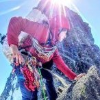
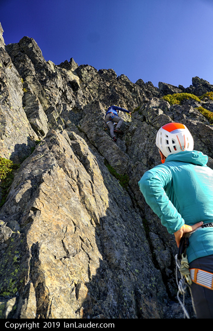
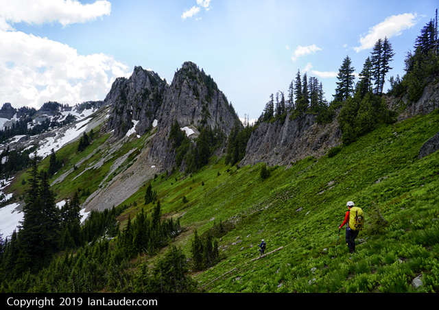
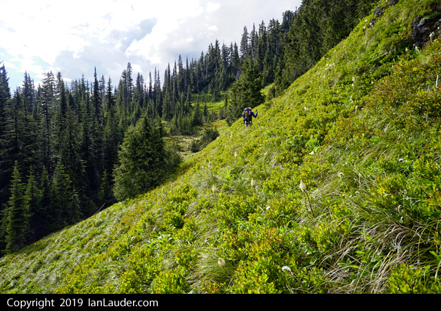
Trip: South Twin, Jaw's Tooth, Skookum (Kloke), Little Sister, Cinderella - Green Creek Circuit Trip Date: 06/30/2019 Trip Report: Me and Dylan climbed the Green Creek Circuit per the "Cascades Rock" guide: Green Creek Arete to South Twin, NW Face of Jaw's Tooth, NE Ridge of Skookum, central arete on the NW face of Little Sister, then the west ridge of Cinderella. It was amazing. Lots of fun mostly easy travel on varied terrain with soloing, simul-climbing, downclimbing, snow, loose gullies. My kind mountaineering and classic Cascades style. I would say that the left arete on Little Sister might be better due to a section of scary detached blocks on the right one that we climbed. On the left one you would get more ridge scrambling which was amazing. 14.5 hours car-to-car, 7800', 13.4 miles. More terrain to be explored past Cinderella at left: Dylan on the final scramble to Cinderella: Looking back up Green Creek after a great day: Dylan in the upper Green Creek basin: Dylan eschewed my offer of a trekking pole in favor of looking like a doofus crossing the Middle Fork: Gear Notes: 30m rope got us off Jaw's Tooth with some easy downclimbing and was perfect for simul-climbing axe small rack Approach Notes: Per Darin, the Forest Service has actually cleaned up their part of the trail and it is getting moderate use to Elbow Lake.1 point