Leaderboard


Popular Content
Showing content with the highest reputation on 02/04/19 in all areas
-
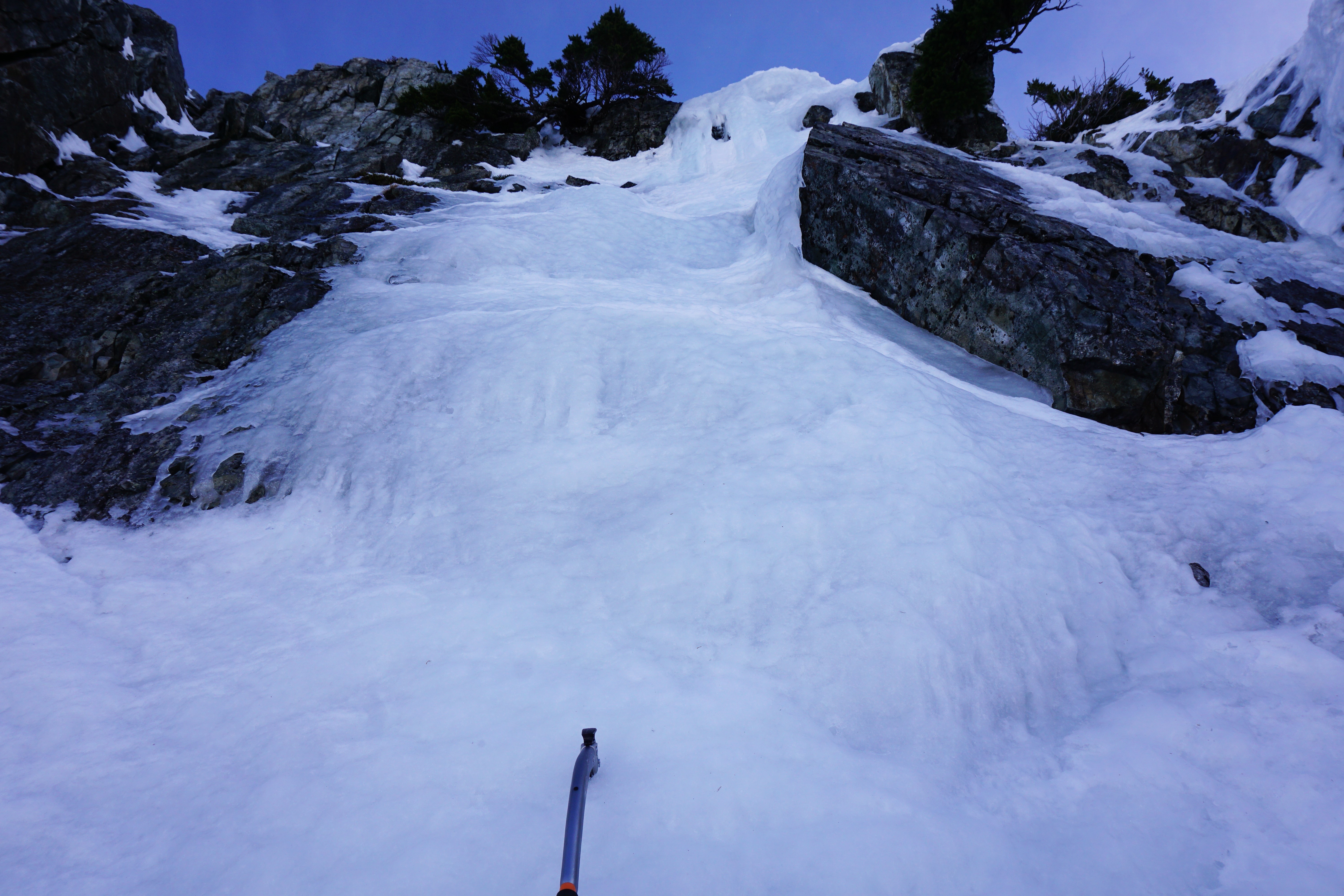
Trip: Three Fingers Lookout - Meadow Mountain Trail Trip Date: 01/26/2019 Trip Report: Me and Fred took advantage of the prolonged crappy skiing to do some mountaineering for a change. We had thought about biking the closed road to the summer trail, but it didn't look that much shorter and I remembered the lower portion of the trail as being pretty crappy from years ago when I did it. With the high snow line it seemed like a good choice... not too sure now. We shouldered our snowshoes and walked from the road closure to 3900' on the Meadow Mountain Trail before we needed to put on snowshoes. The abandoned trail was in great shape, better than some maintained trails I've been on. The snow was pretty soft in the old growth and icy in clearings, so side-hilling was tough with snowshoes on, but we toiled upward. The route it turns out is circuitous in three dimensions... up and down, side to side, all around the map we went, mostly upward. At Saddle Lake we were astonished to learn it was 1 pm. Thoughts of camping early flashed through my mind - and oh yeah, I forgot a pot for the stove, so anywhere but the lookout means no tea, coffee, or mountain house dinners. Bummer. We assumed there would be some kind of pot at the lookout... If we can get in. The north side traverse was thought-provoking on firm sun crust. No-fall terrain for sure. We missed most of the sunset traversing on the north side. At dark we were within 600' of the summit. The rimed rocks of the summit area threw perspective out the window in the headlamp's beam. We seemed to fly upon rocks that seconds earlier appeared hundreds of feet above. It would have been eerie if it hadn't been for the tiredness and the ever-present thoughts of what if. What if we can't get in? What if there is no pot? We had watered up so there was little chance of death by thirst, but it would have been decidedly unpleasant. We dug for an hour and a half through multiple hard ice layers interspersed with sugary snow. It was hard work, and we didn't really know where we were digging. For future reference, the door is on the far lookers left of the building, not near the middle. In short, we figured it out, got in, and spent a lovely night lying about in luxury. Thanks to all the volunteers that keep this place together. Sadly one of the window panes in the door was broken out which let in a bunch of snow that piled behind the door. This made our entry tricky. We removed all the snow, but it will just come back. We couldn't figure out a way to block up the window with the supplies we had. If you go there take a bunch of duct tape or something. The hike out was uneventful, though footsore with wet socks. Next time I'll try the shortcut listed in the comments here: Fred checking out a huge log across the road: Our entry into the lookout: The view from the front door in the morning, photo by Fred: Tricky downclimbing for the first steps of the day, photo by Fred: Looking back at the summit from Tim Can Pass in the morning. The lookout is on the middle peak in the photo: We hiked down into the sea of clouds we saw from the summit: Gear Notes: Axe, crampons, snowshoes. Approach Notes: Meadow Mountain Trail from road closure.2 points
-
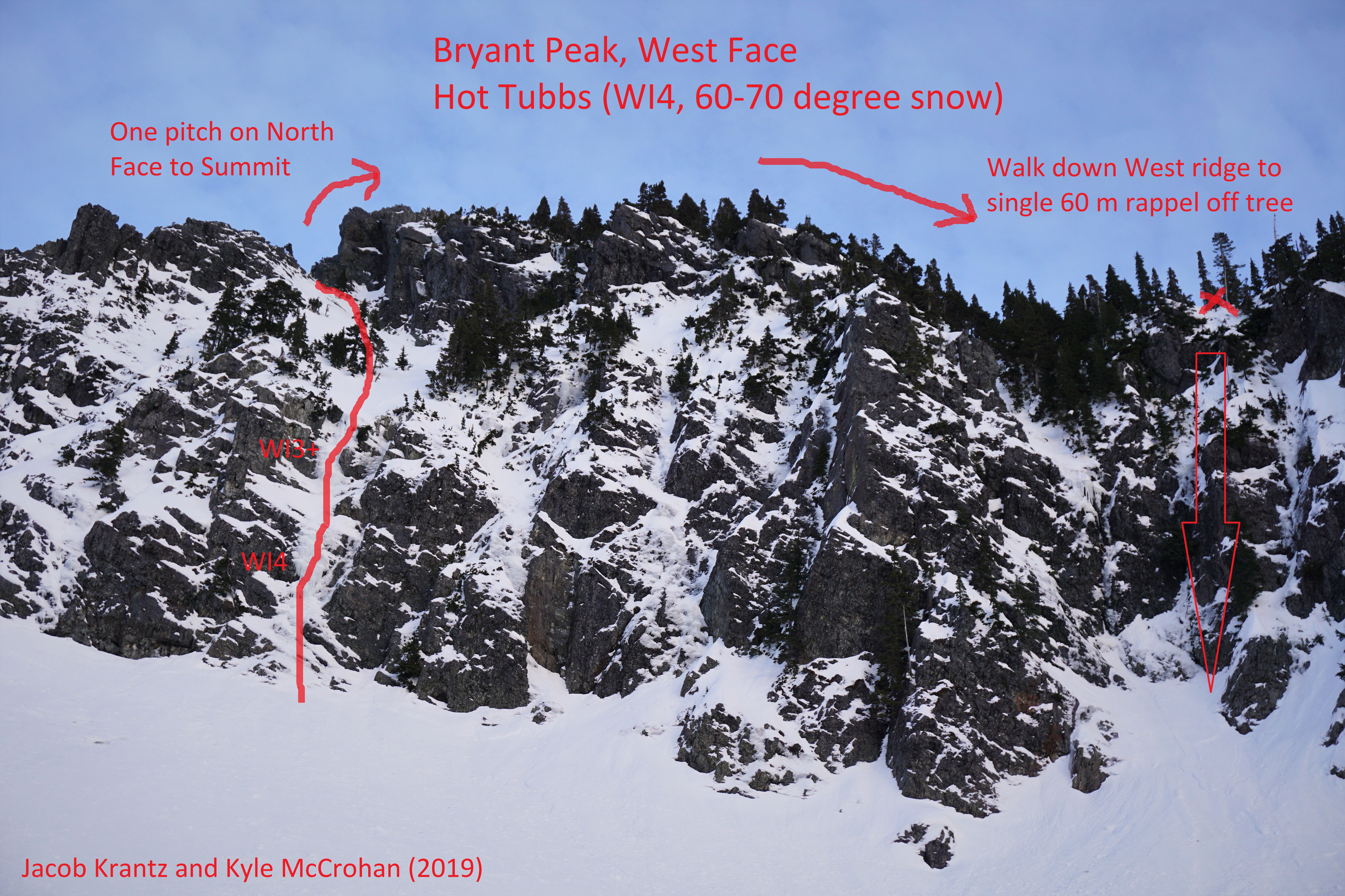
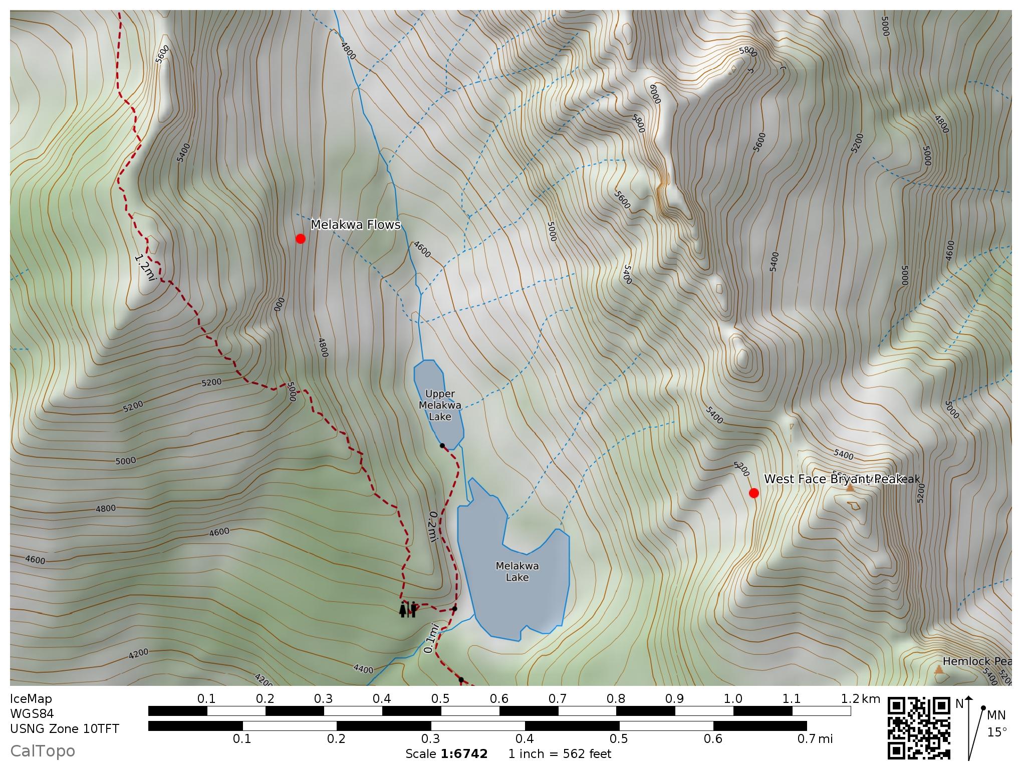
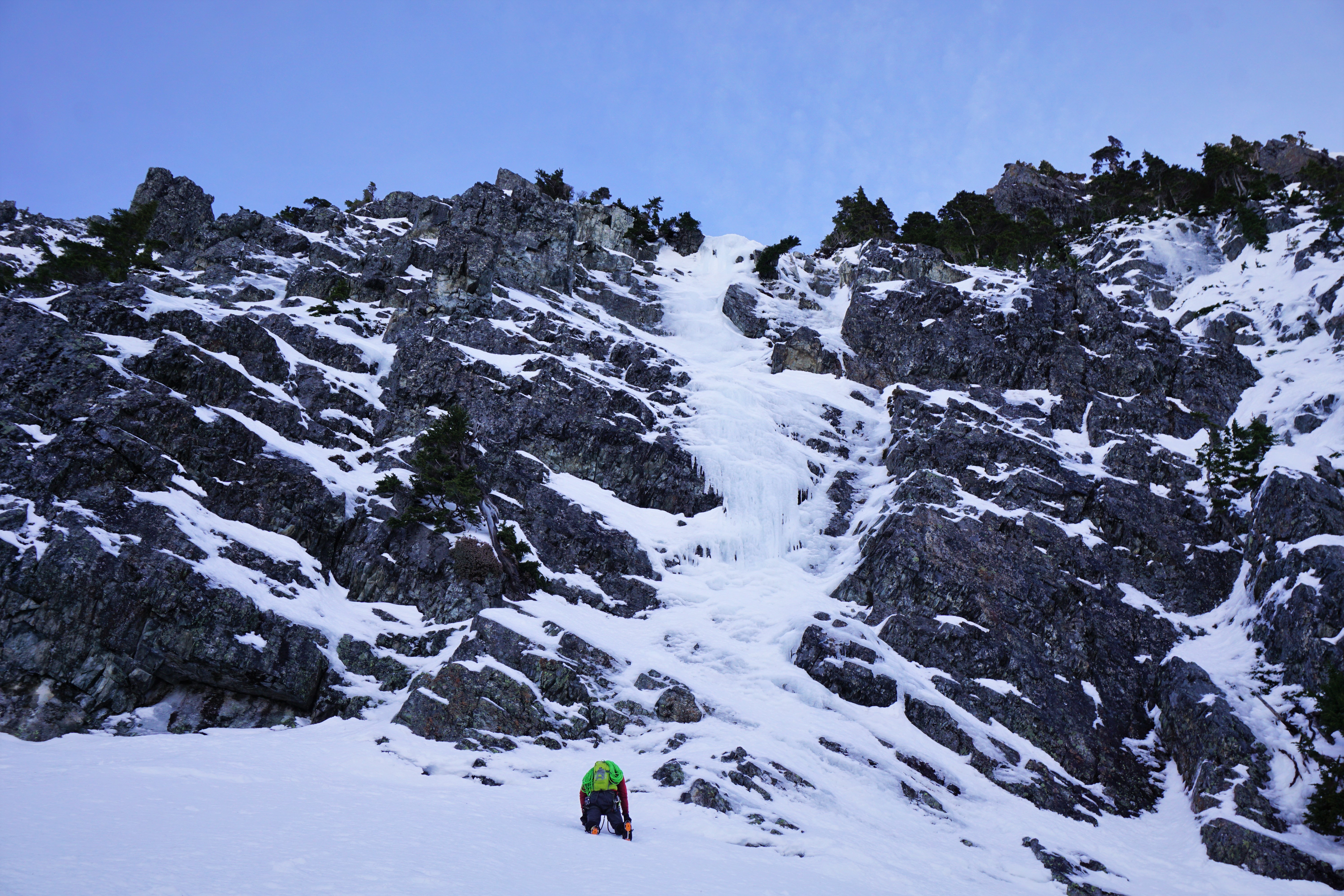
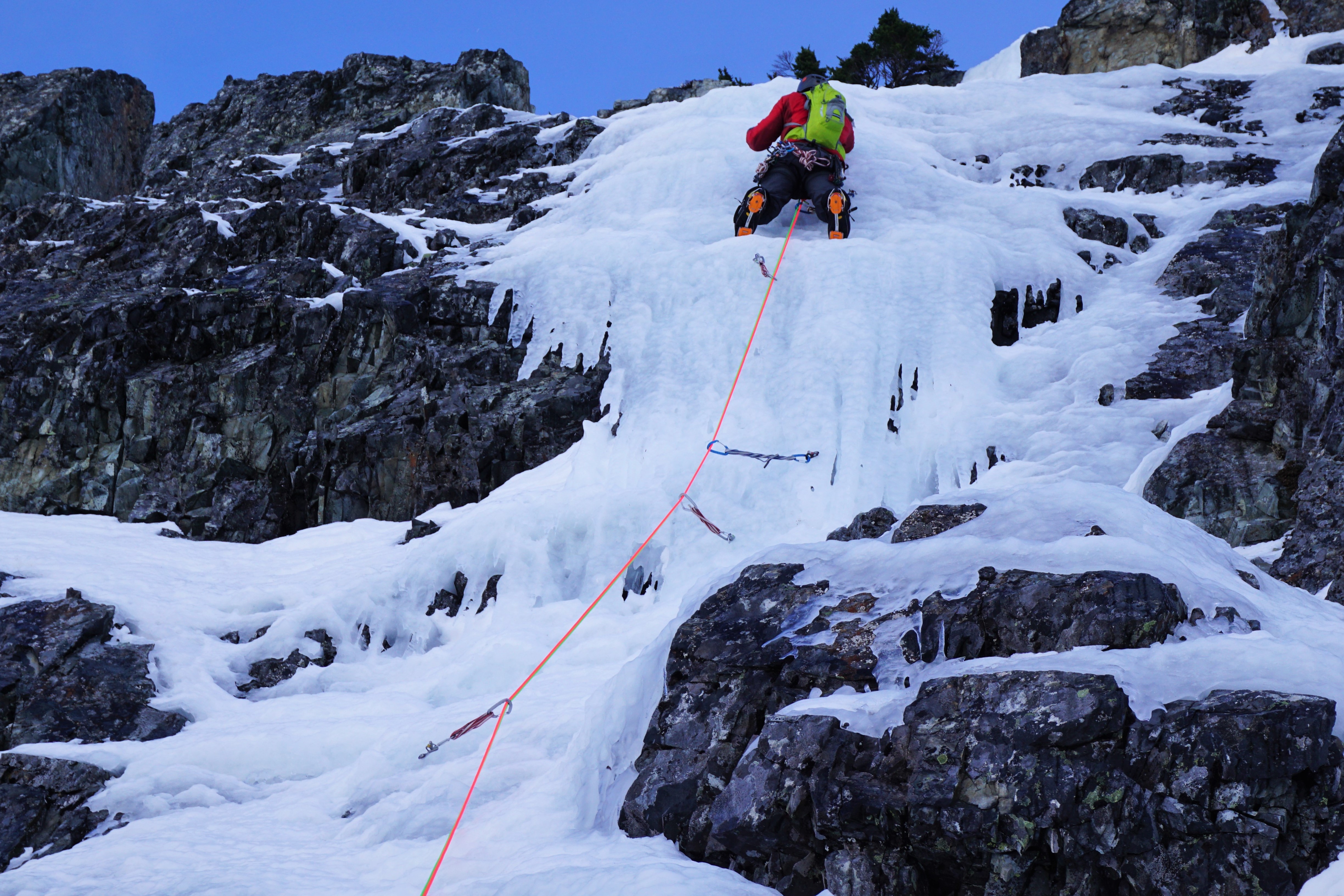
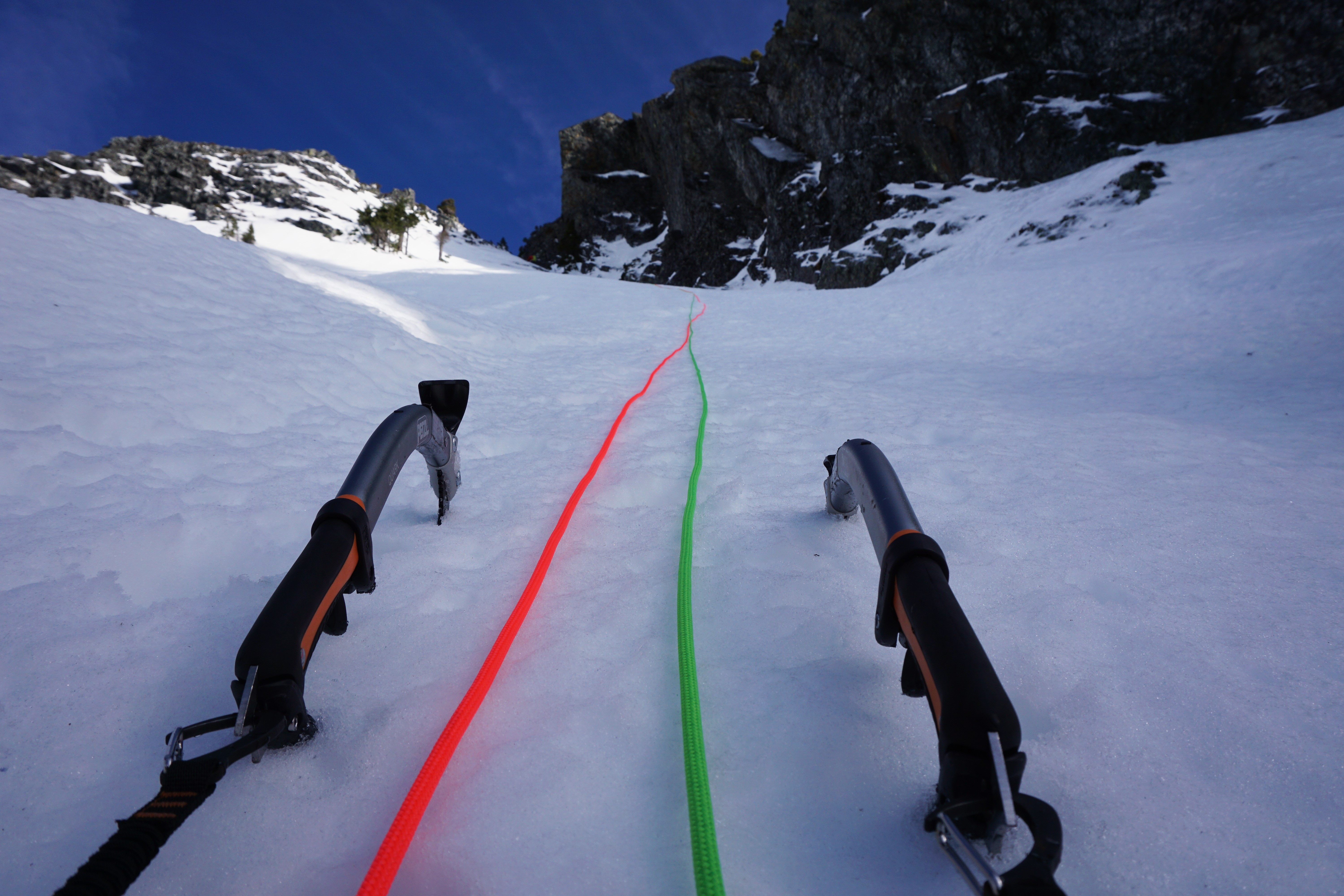
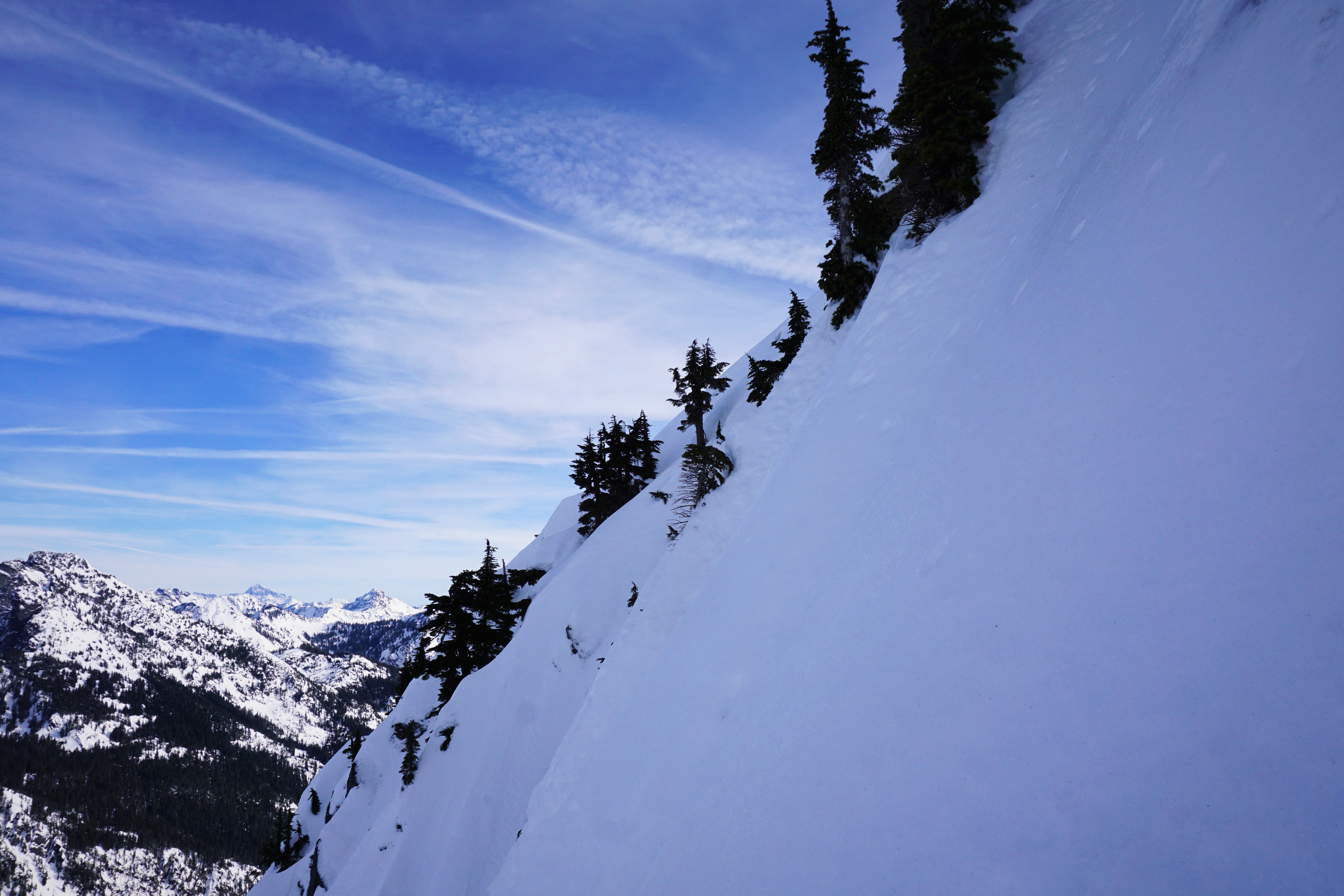
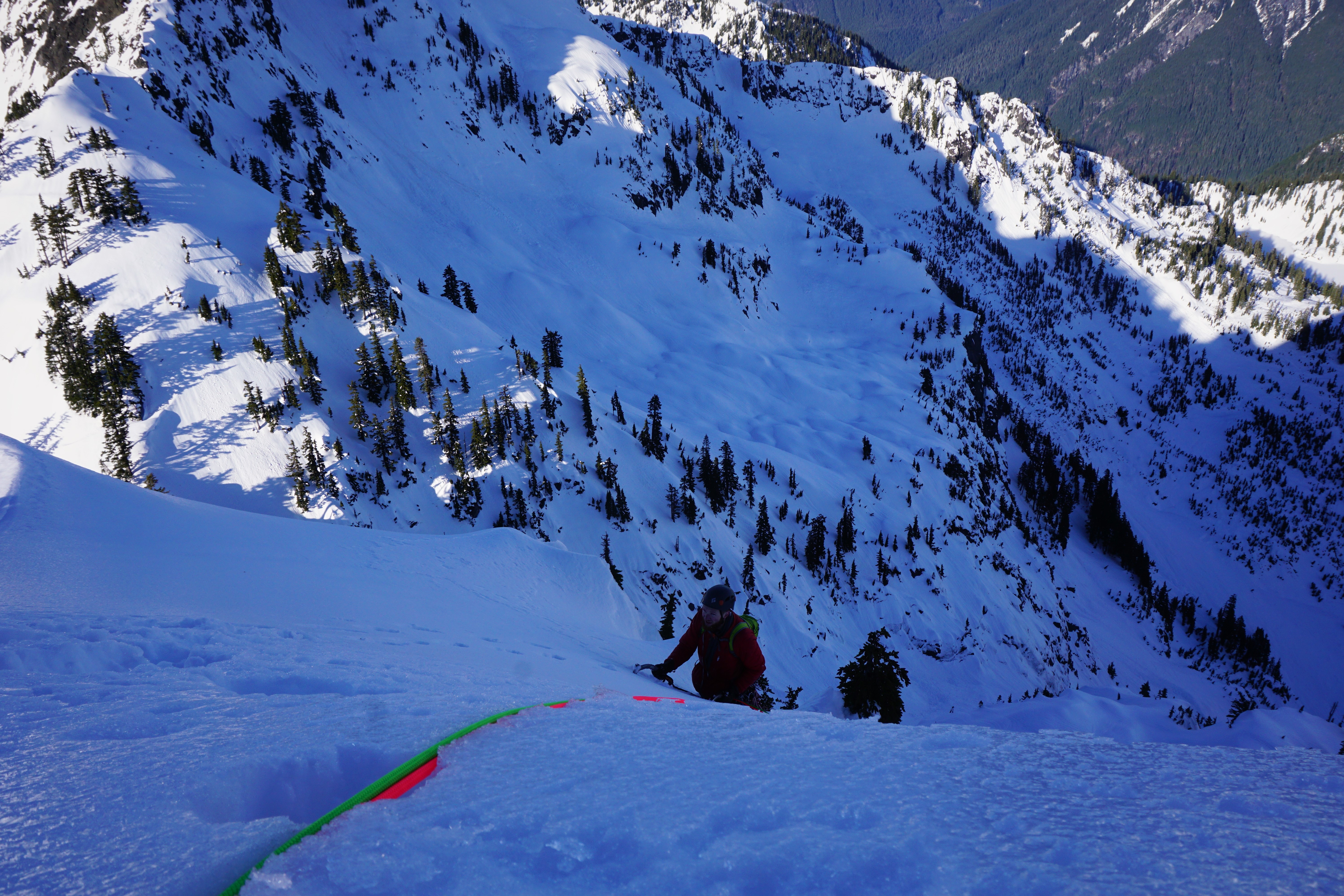
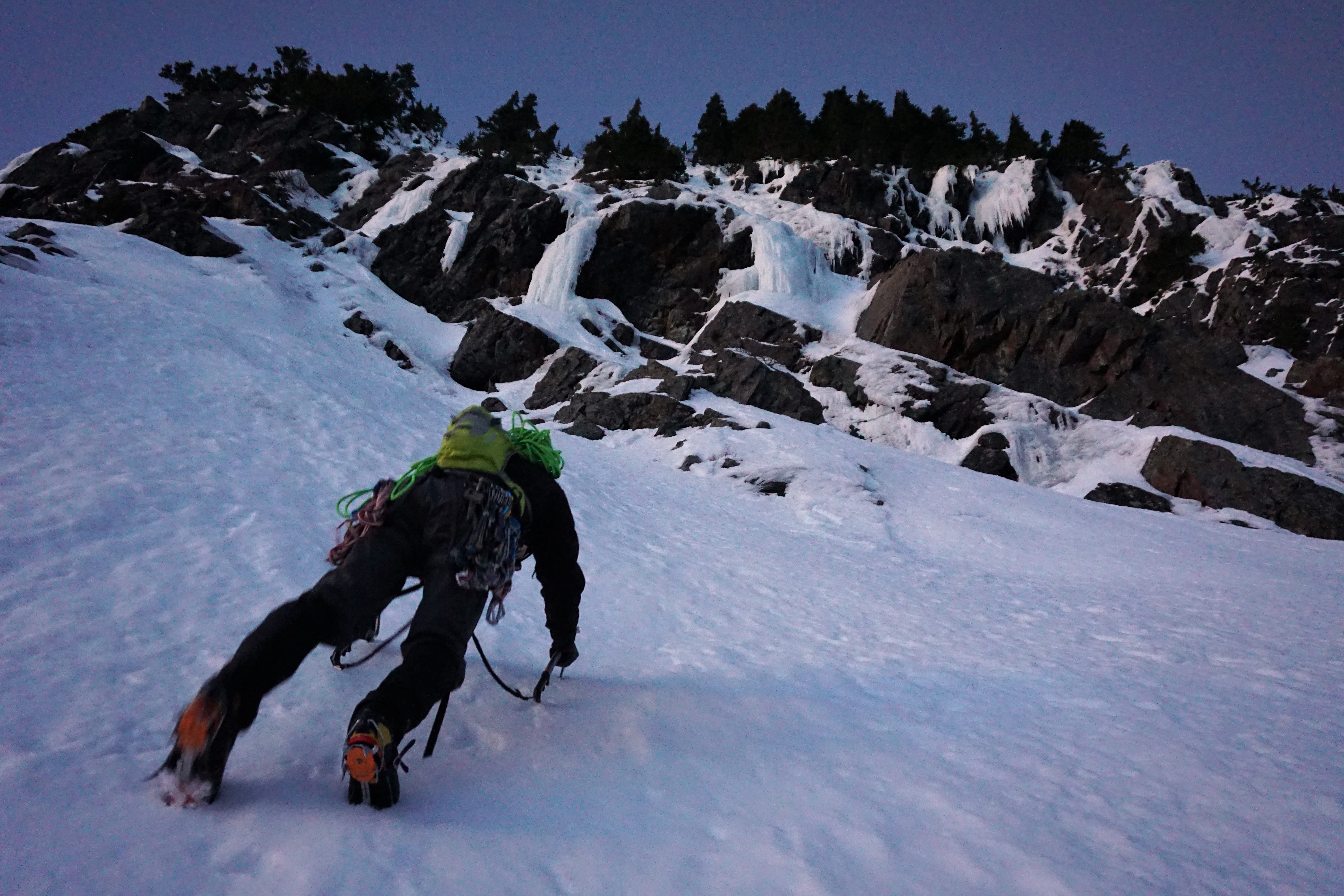
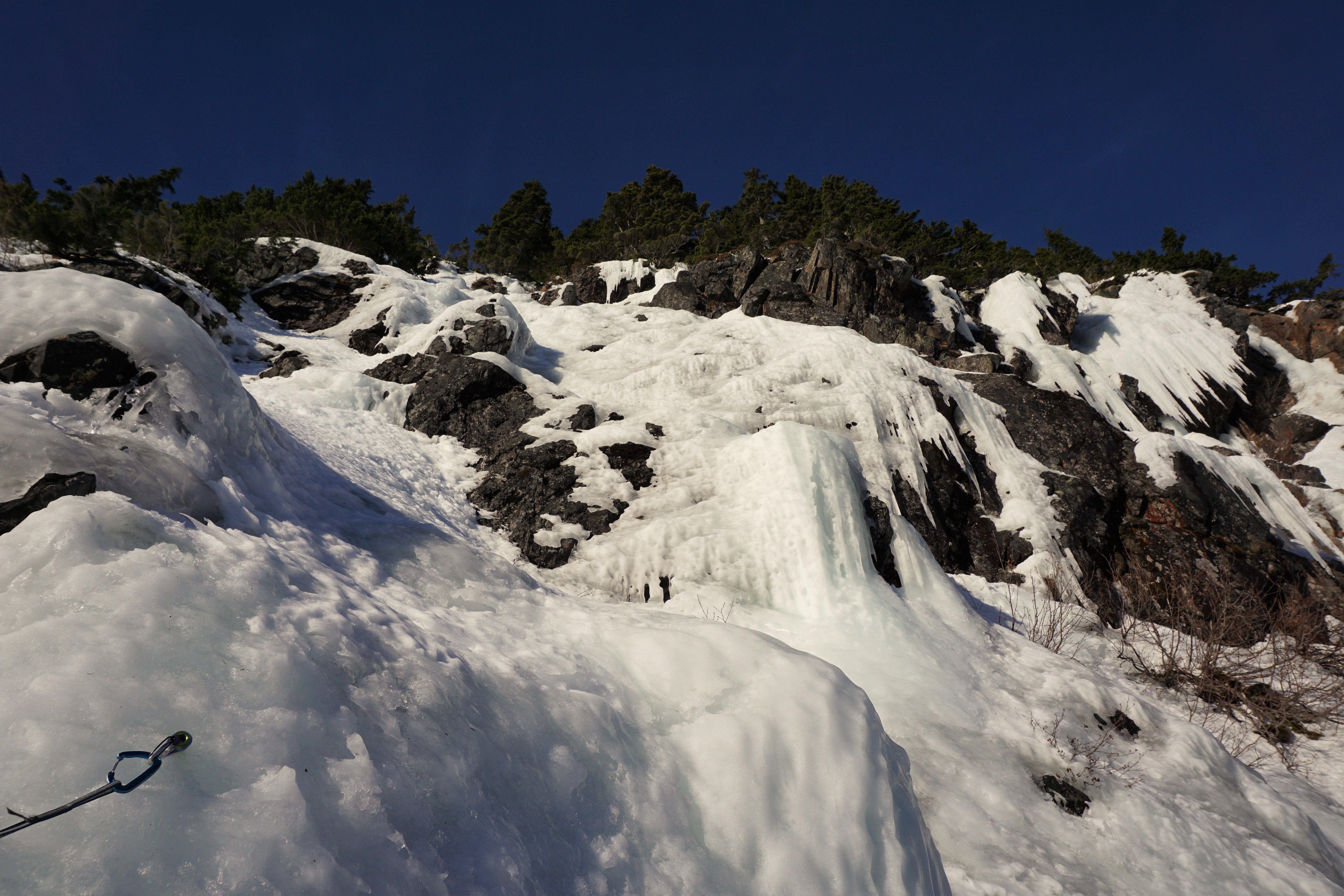
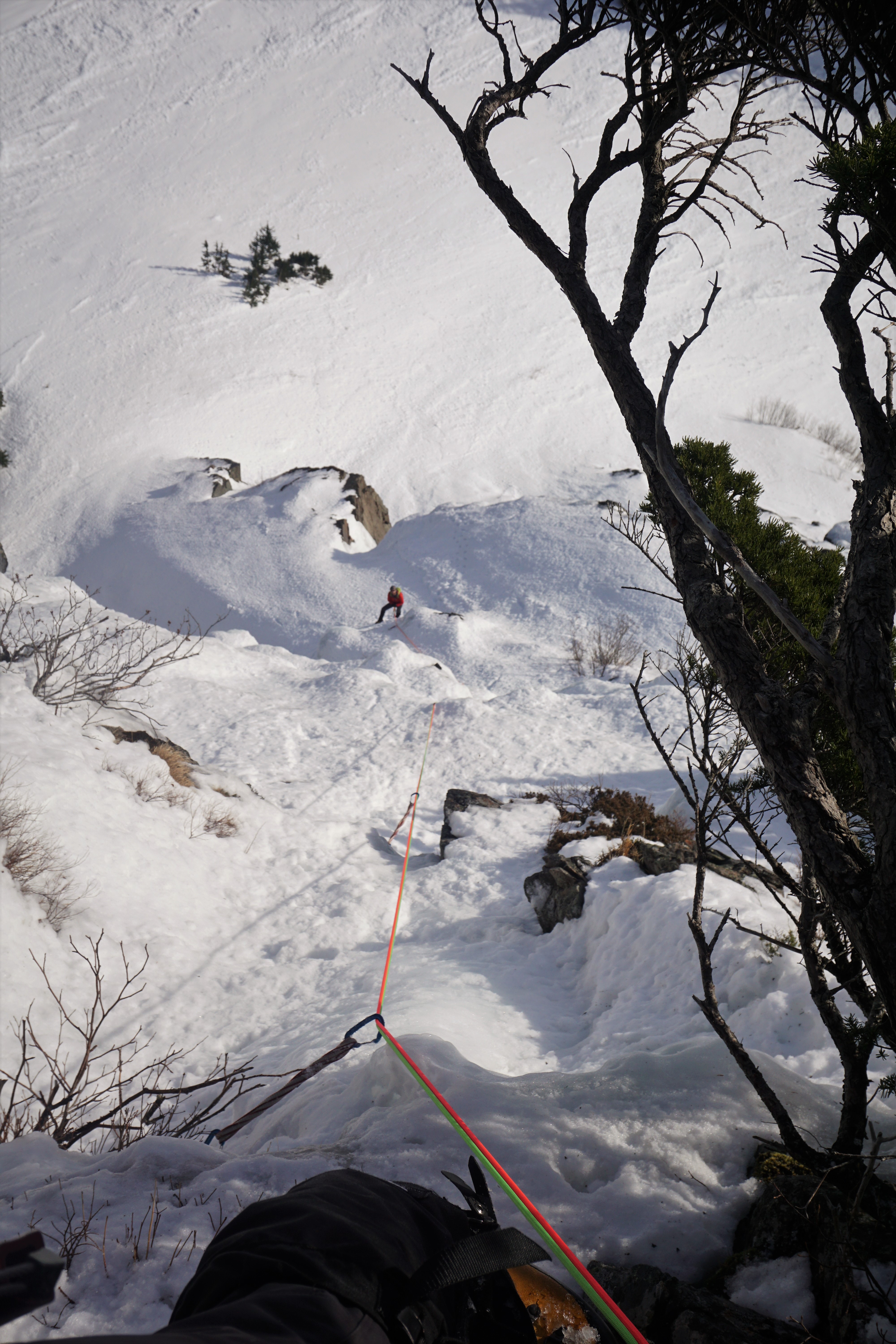
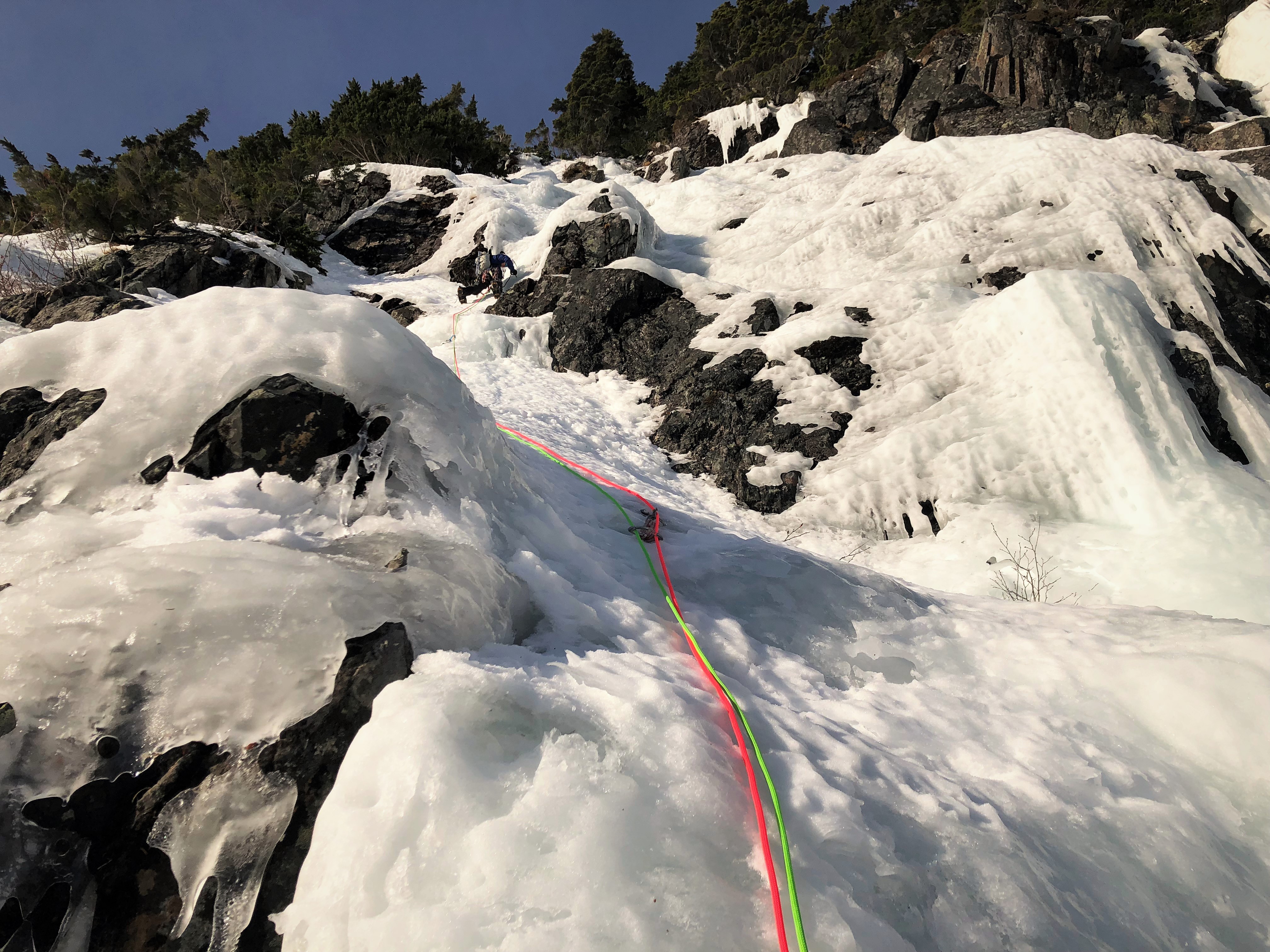
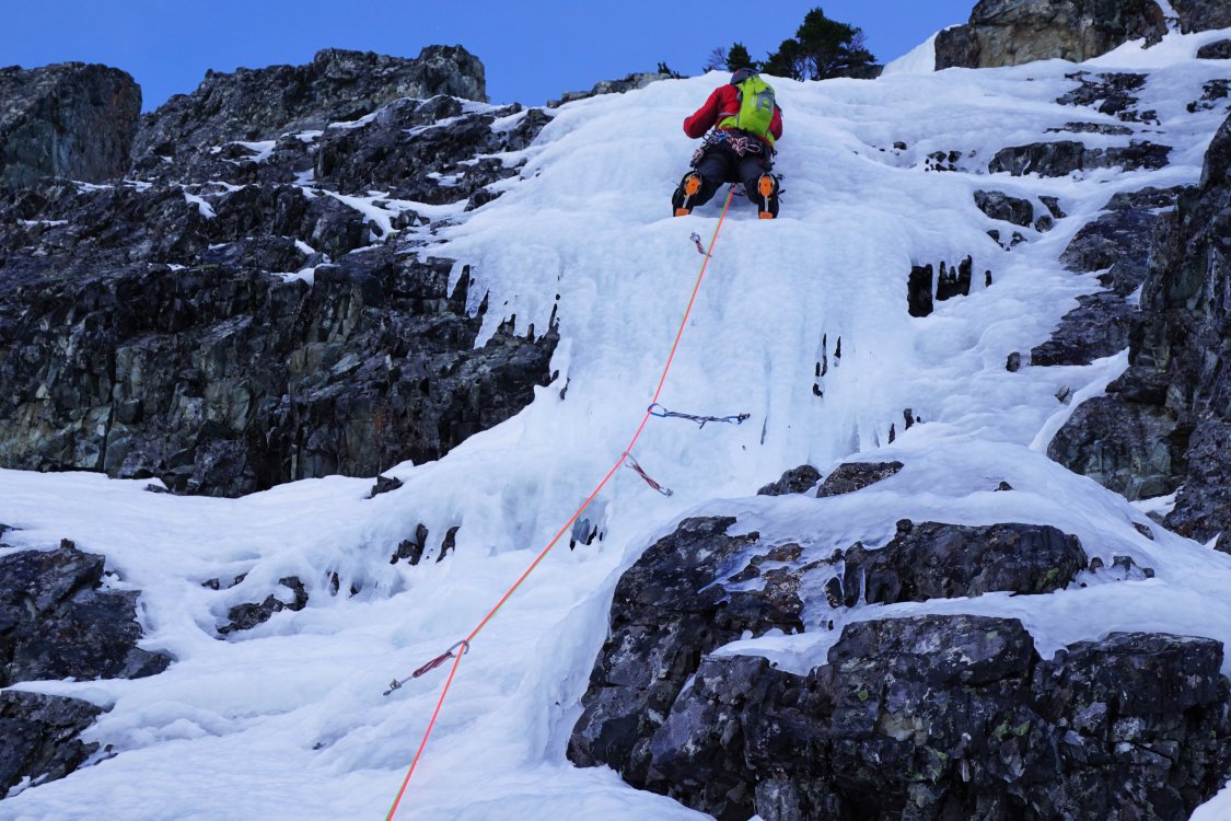
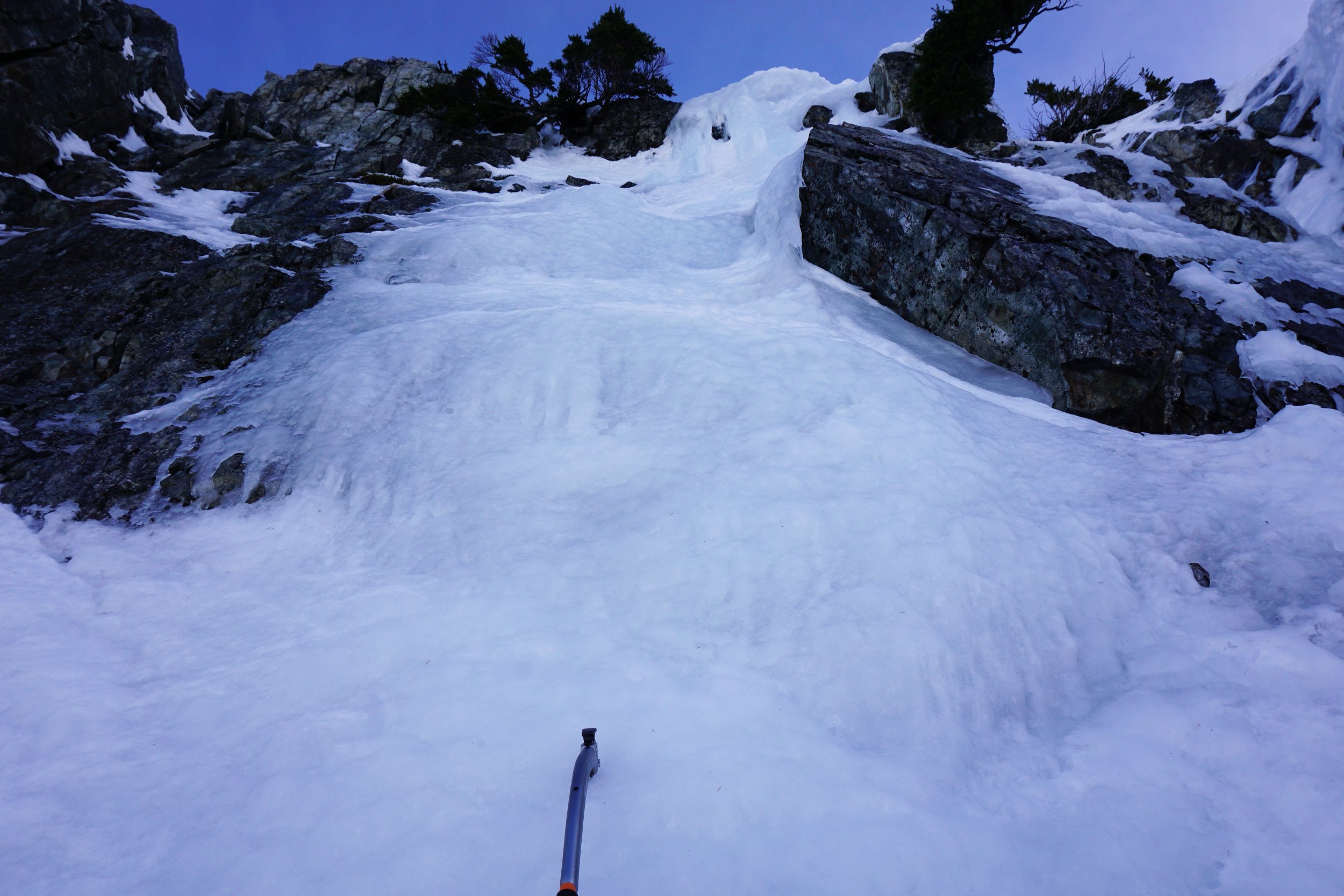
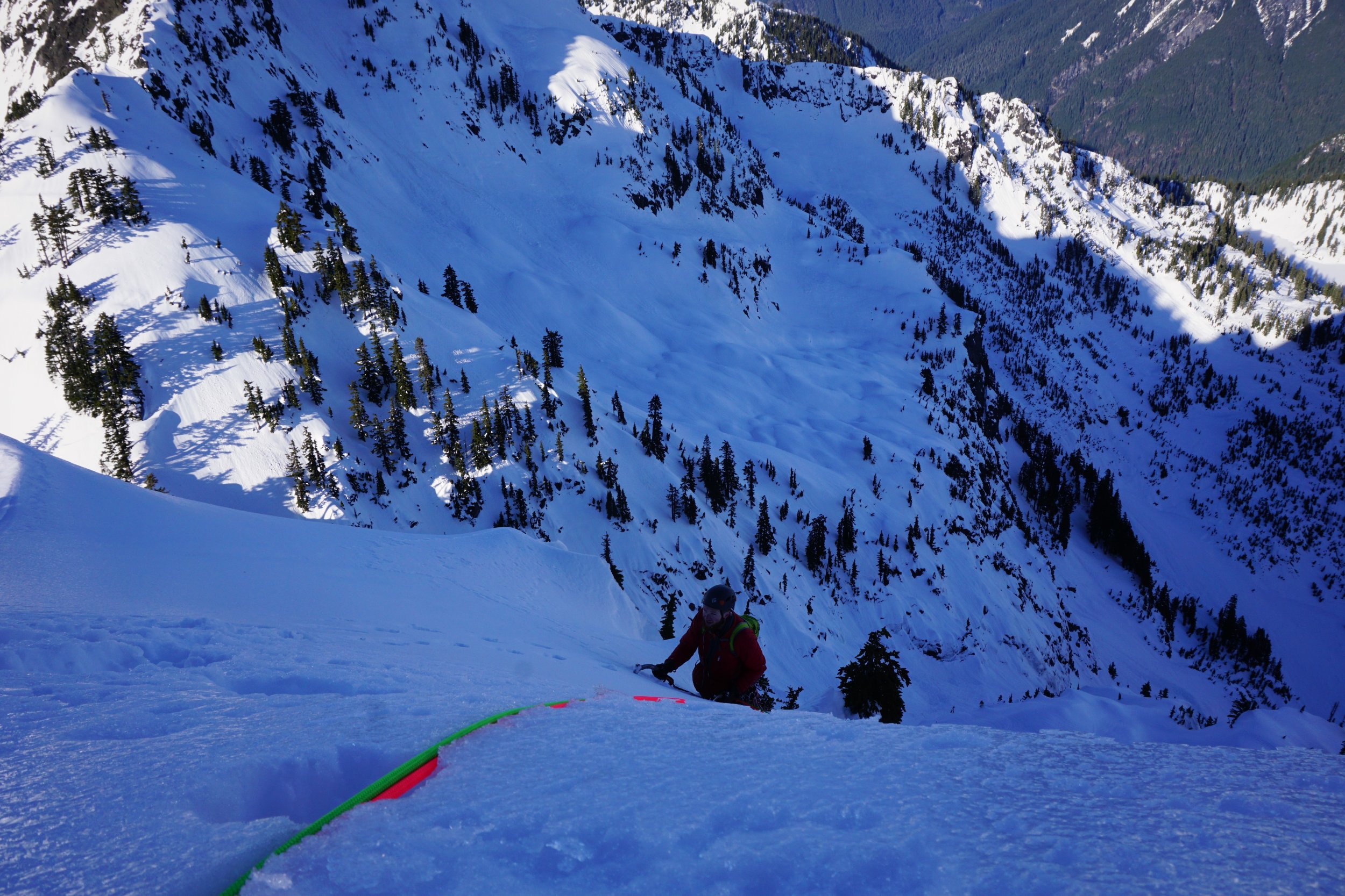
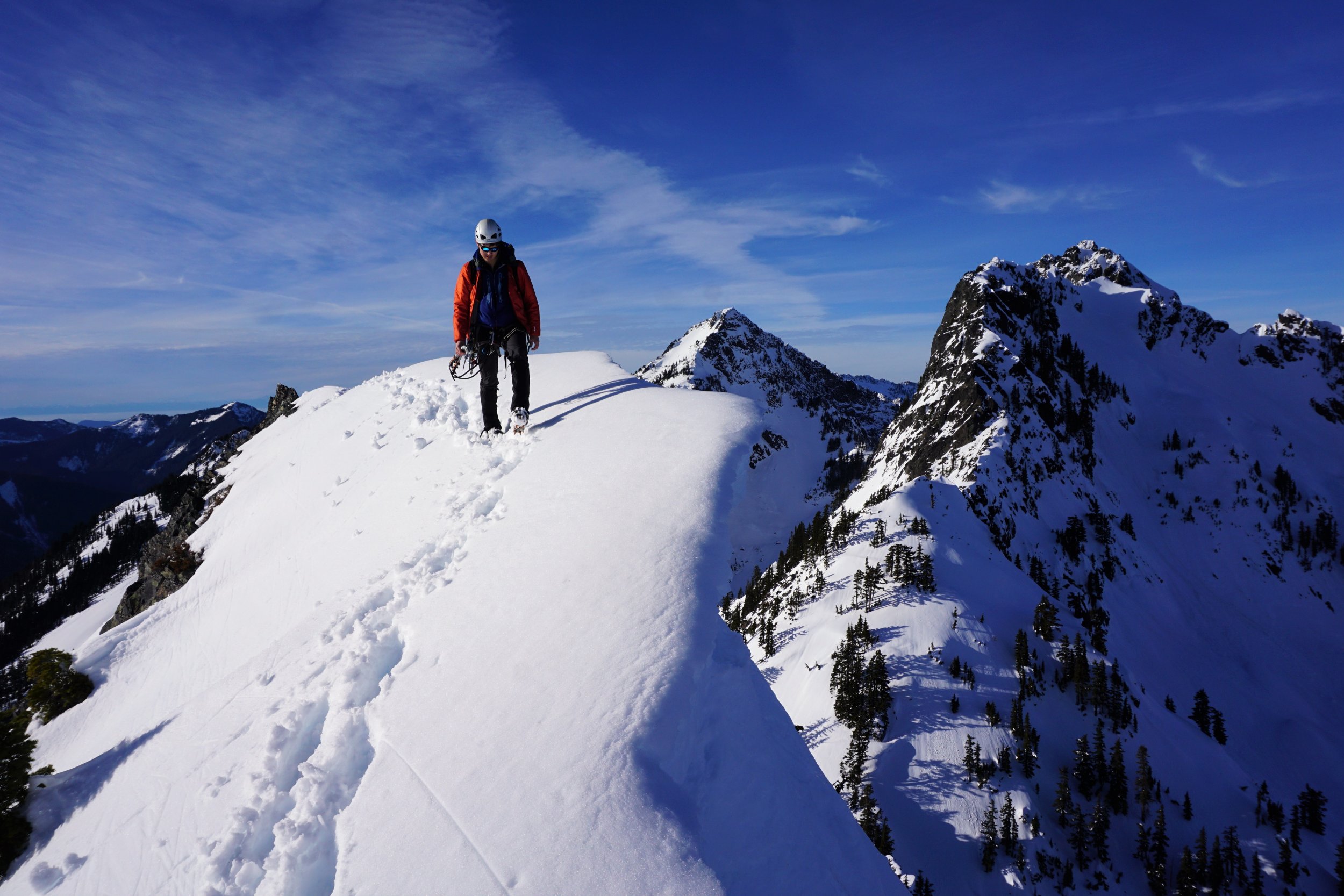
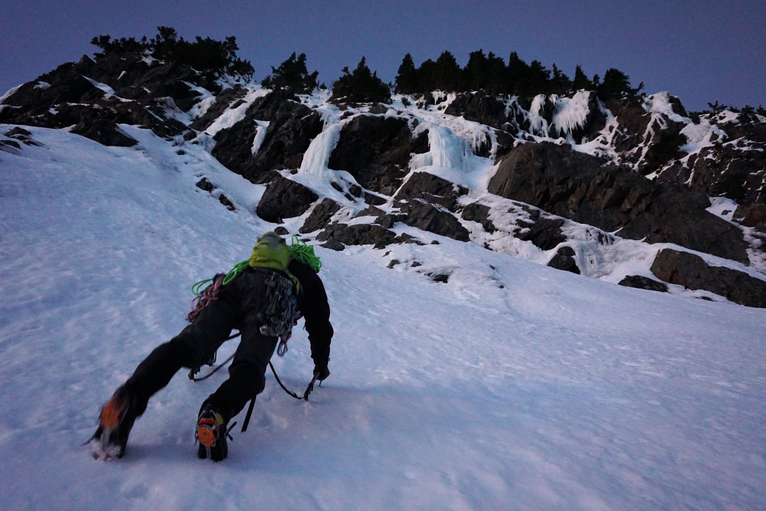
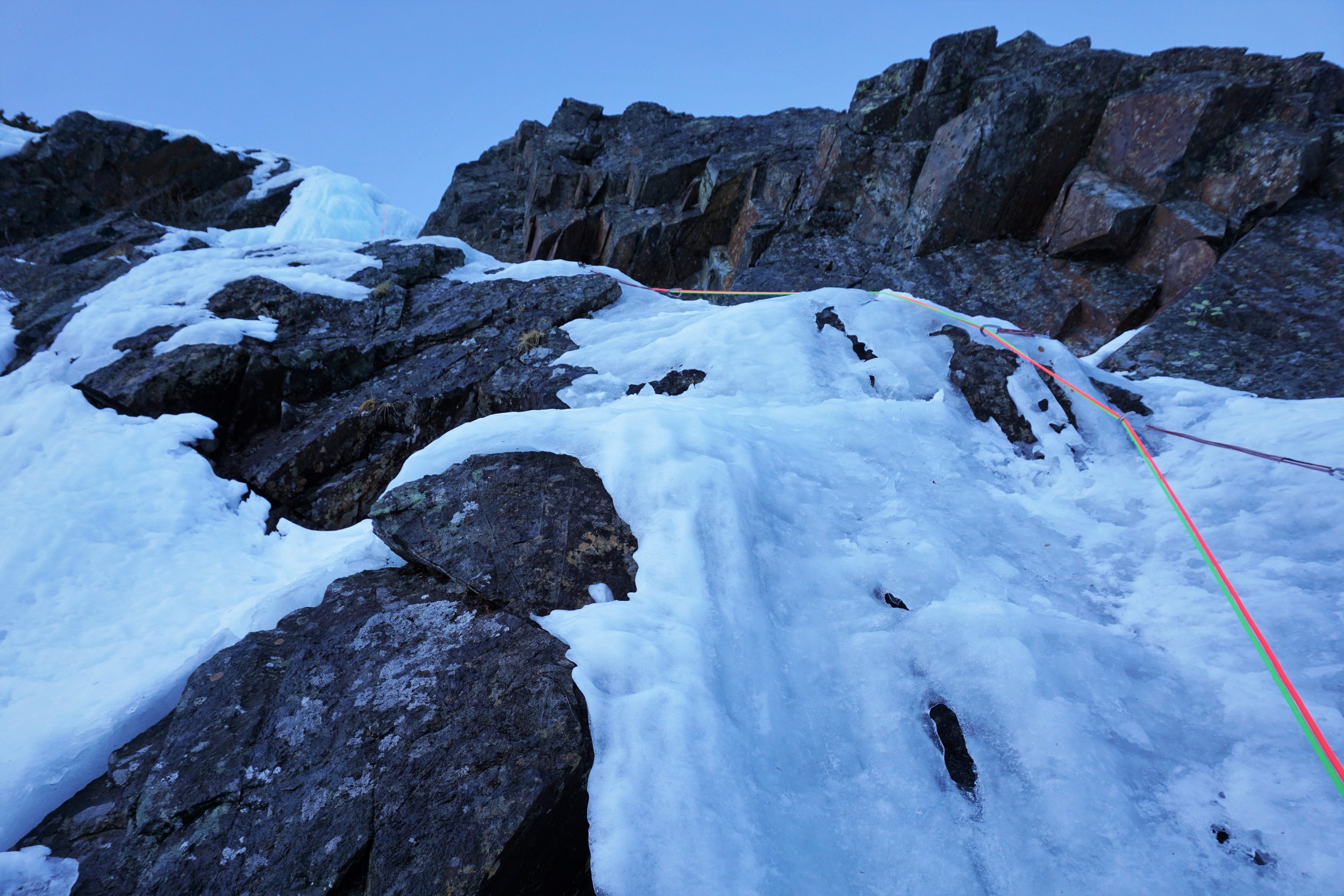
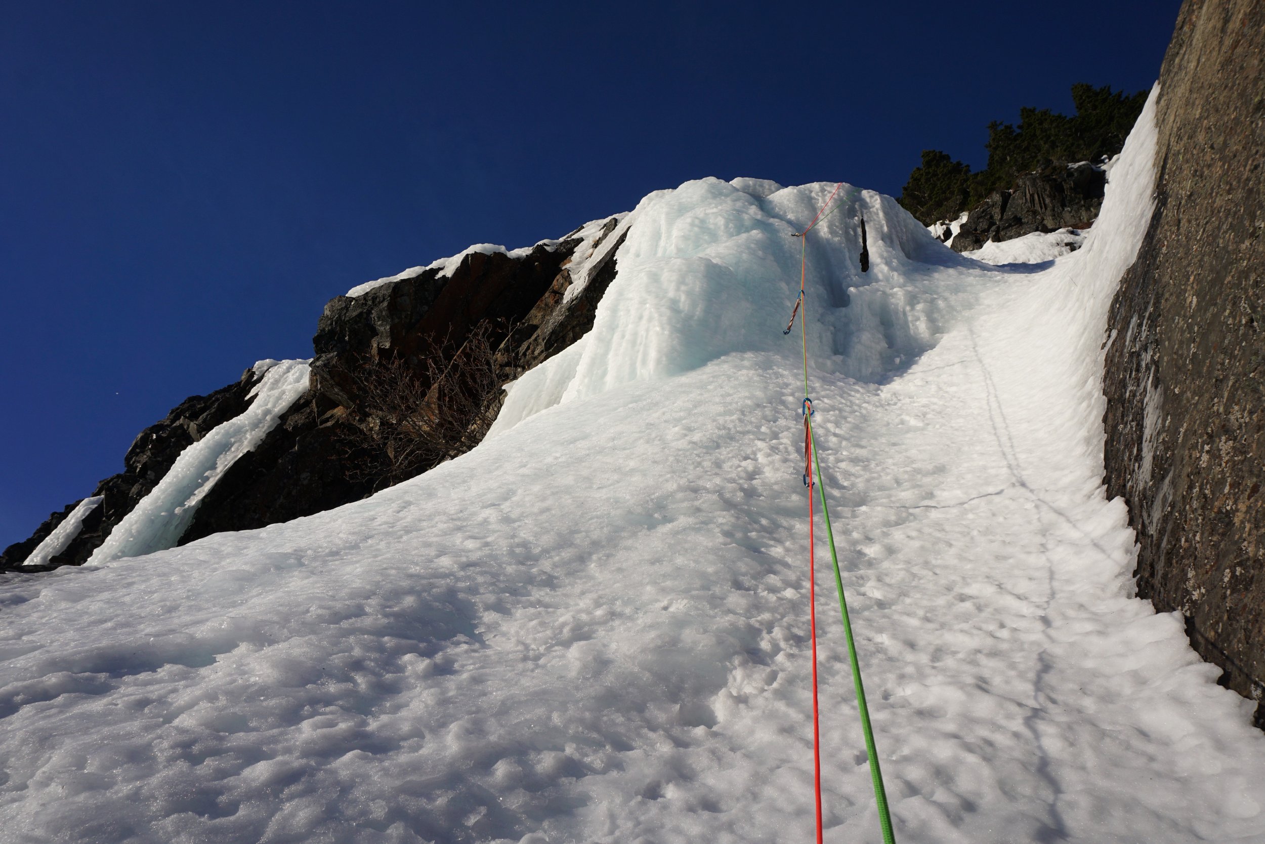
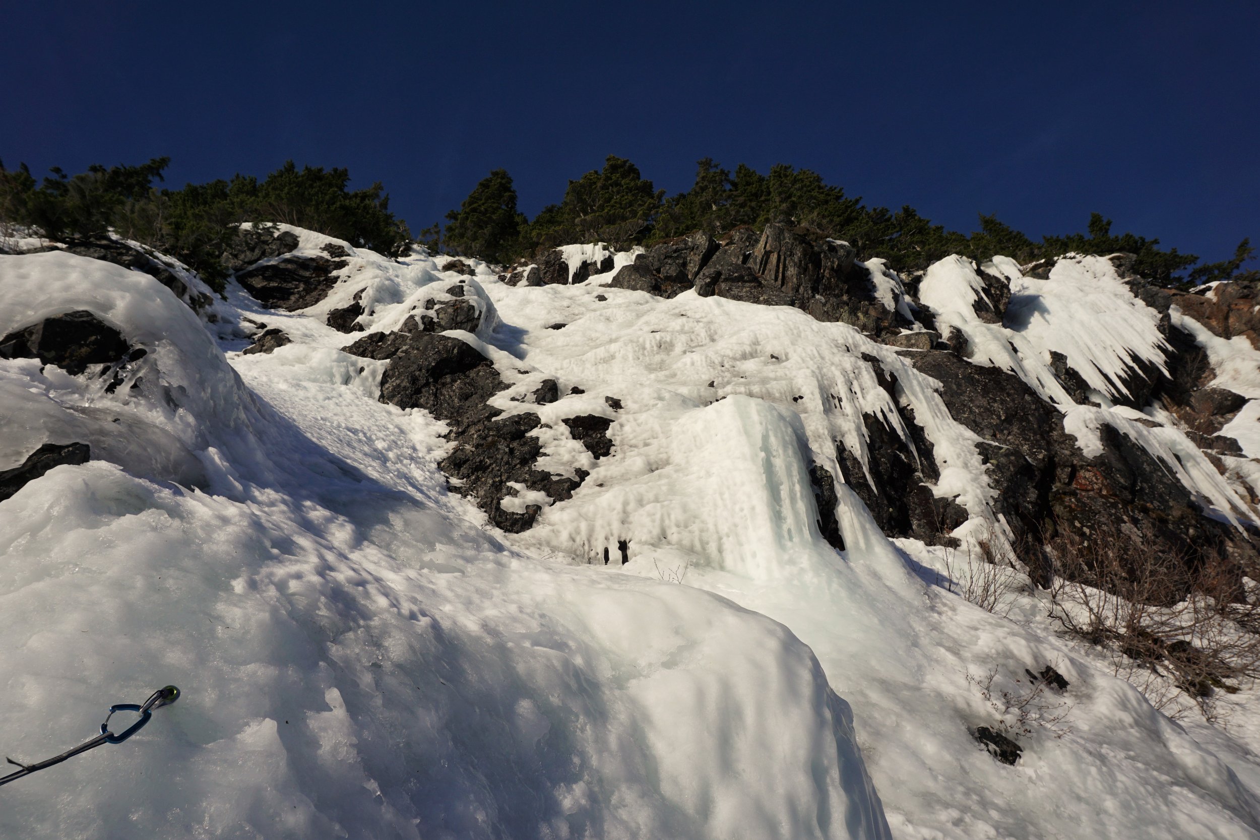
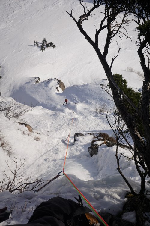
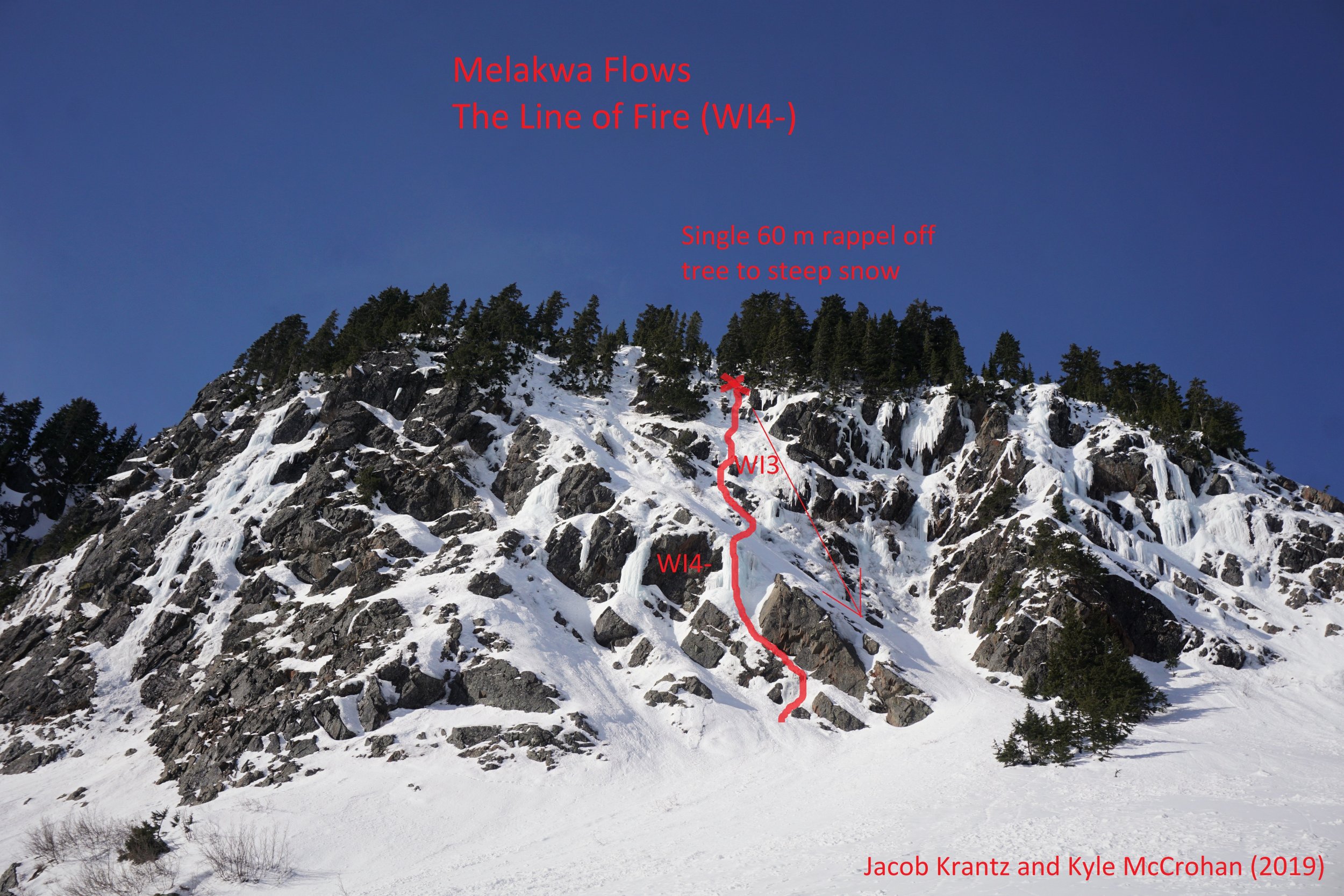
Trip: Bryant Peak, Melakwa Flows - Possible FAs: Ice routes on West Face Bryant Peak (WI4, 60-70 degree snow) and Melakwa Flows (WI4-) Trip Date: 01/27/2019 Trip Report: On the warmest weekend of a warm winter here in Washington, Jacob Krantz and I set out to explore some undocumented ice lines near Snoqualmie Pass I had spotted earlier in the winter. We did some research on the internet, Beckey Guide, and WA Ice guidebook but found nothing about these climbs, so these are possible FAs or FRAs at least. We climbed an awesome 4 pitch route on the West Face of Bryant Peak to the summit and a fun 2 pitch route in an area I've been calling the Melakwa Flows. The Melakwa Flows are an incredible group of ice flows of varying grades near Melakwa Lake. It's mind boggling to think we could not find anything about climbs in the Melakwa Flows, considering they are probably one of the densest concentration of reasonably accessible ice climbs in WA, especially impressive considering the warm temps lately. Hot Tubbs (WI4, 60-70 degree snow) West Face Bryant Peak Although only 4-5 pitches, we thought this route was awesome, offering a substantial amount of moderate ice, steep snow, and wild exposed summit pitch. It packed a lot of punch for such a short and accessible route. We also managed to stay in the shade the whole time, starting around 10 am. We'd love to see others get after it and some other possible ice lines on the west face! P1: Climb thin low angle ice to the vertical WI4 curtain. Send the curtain then continue up easier terrain to set a belay in fat ice. P2: Climb up progressively steepening fat ice to a WI3+ bulge. Above, continue up another 20-30m on 45 degree snow to a group of trees for the belay. P3: This is a long pitch (~80 m). Simul climb up snow, trending left as the cliffs force you. Establish a belay on a snag at the notch on the spine of the North Ridge. Watch cornices here. P4: Traverse right across wildly steep and exposed snow (60-70 degrees) on the north face, using trees for protection. At the third and tallest tree, make a few thin ice or mixed moves up a slab and continue straight up another 10-20m to the summit ridge. Descent: hike down the west ridge a few hundred feet until it flattens a little, then make a single 60 m rappel off a big tree down to the bottom of the west face. Approaching the first pitch. Top of the flow is part of the second pitch. Jacob crushes the WI4 crux. Looking up at the second pitch. Navigating between the two pillars at the top felt like WI3+ to me on lead. The ice here was FAT! Simulclimbing bomber snow on the third pitch. Steep exposed snow traverse to start pitch 4 out onto the north face. It was super unconsolidated and unsupportive. Would have been terrifying if it wasn't for all the trees! Jacob finishes the last bit of steep snow to the summit ridge. Walking along the wonderful summit ridge of Bryant, Kaleetan and Chair in the background. The Line of Fire (WI4-) Melakwa Flows These routes are on a cliff band just north west of Upper Melakwa Lake, easily visible from the upper lake. They look like they have considerable avalanche danger above, so beware. Even though we approached in the dark from our camp Sunday morning at Melakwa, we still only got in one two pitch route before this face got blasted by the sun and snow started coming down. The ice was often pretty soft to take screws, but I imagine if you hit this area in a cold snap or even just normal temps it would be incredible! It is a total ice playground, with easily a dozen routes 150-300 ft long ranging from a rambly WI3 to free standing WI5 pillars! There were incredibly fat sections of ice by WA standards. We hope this inspires others to go explore this gold mine of WA ice climbs! P1: find your way through mixed terrain or thin ice up to the base of the FATT pillar. The pillar is vertical or near vertical for 15 feet and super bomber, WI4-. Make a belay in some thick ice across the snow ramp above. You could skip this first pitch by ascending the snow ramp to the right. P2: A long pitch (~150ft) of rambling WI2-3 terrain, with at least half a dozen WI3 steps one to two body lengths in height. It's choose-your-own-adventure here. Total type 1 fun. Except for at this point, I was on lead getting pummeled by huge clumps of snow. It was still awesome. We ended at a big tree anchor. Descent: Single 60 m rappel down to the steep snowfield ramp, down climb as quickly as possible to get out of the line of fire. Climbing steep snow to the base. We took the pillar in center right of the photo. Jacob led up this thin section to gain a ramp leading to the pillar. We don't recommend this start. There were other options to the left. Approaching the beautiful pillar. So big and wide. An abundance of options on the second pitch. There's even more rambly ice to the left out of this photo. Me leading some awesome WI3 fun. This was right before I started getting pummeled I believe. Looking down from the top of P2. It looks like mostly snow, but you cannot see all the little ice steps from above. It was very high quality. Approximate location of the flows. As temps cool down next week, I think these climbs will just get better and better. If there's awesome WA ice on a blistering hot weekend like this, it ain't so bad! So get out there and send, WA ice climbers! Want more beta and photos? Check out my full trip report at https://climberkyle.com/2019/01/27/new-snoqualmie-pass-ice-climbs/. Gear Notes: We used 9 screws of varying lengths (much of the ice is quite thick actually, but still bring the stubbies), 1 picket, 8 slings, a few nuts. Double 60 m ropes are nice for the rappels, but there are walk off options also. Prepare to make you own rap anchor if you don't fine ours. We brought cams and pitons also but never really used them. Approach Notes: Either approach up the Denny Creek Trail to Melakwa Lake or over Bryant col (north saddle of Bryant) via Great Scott Basin from Alpental like we did. It took us 3 hours with overnight packs from Alpental to the West Face of Bryant, and about 3 hours from the Melakwa Flows back to Alpental with similarly heavy packs. Note there is considerable avalanche danger on these approaches, so proper gear and training is recommended.


 1 point
 -
shit! yesterday I cancelled an alpine trip after monitoring two days of consistently deteriorating weather forecasts. woke up this morning to graveyard calm bluebird day. Appears the goat whose entrails the meteorologists were reading was a mutant... so re-introducing the most infallible weather instrument ever discovered/invented: the Weather Rock! used by every culture from pre-neolithic to present, and still the most accurate meteorological instrument in existence! not to mention inexpensive, and dead simple to use, both at home and in the field. no power, batteries, satellite, nor internet service required. instructions: 1) obtain a sexstone (critical - for optimum performance, the Weather Rock must be an authentic high-quality uncontaminated sexstone) 2) locate the sexstone in an easily accessible outdoor place, exposed to air & sky 3) to use, simply observe: if sexstone is warm & dry expect fine weather; if sexstone is wet expect rain; if sexstone is white, expect snow or volcano has blown again; if sexstone is icy, expect roads to be slick; if sexstone is not visible expect fog or dark; if sexstone is rolling/bouncing execute earthquake protocols caution: as with any tool, the value/function of the Weather Rock can be no greater than the proficiency of its user -- for best results, practice often1 point