Leaderboard


Popular Content
Showing content with the highest reputation on 09/11/18 in all areas
-
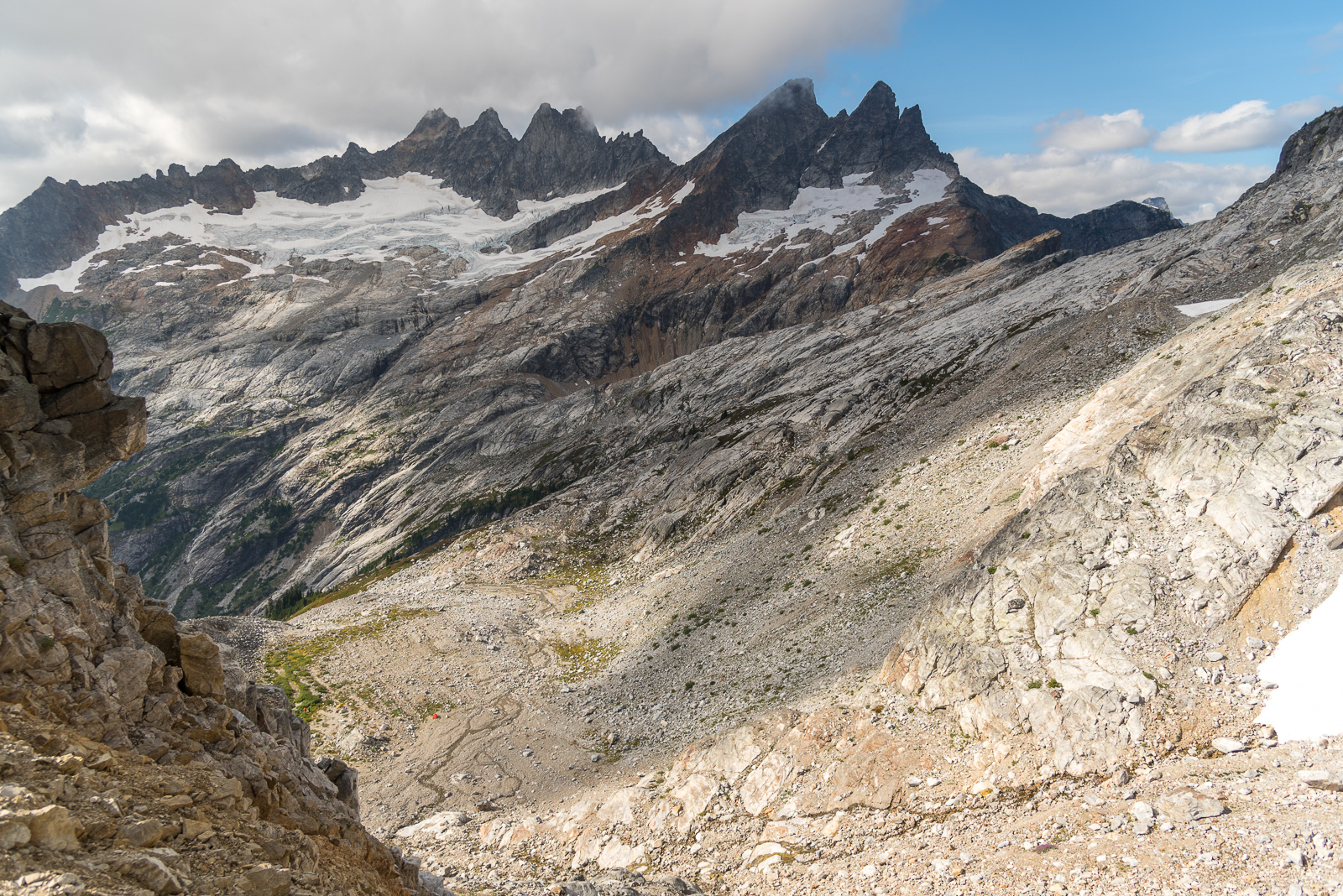
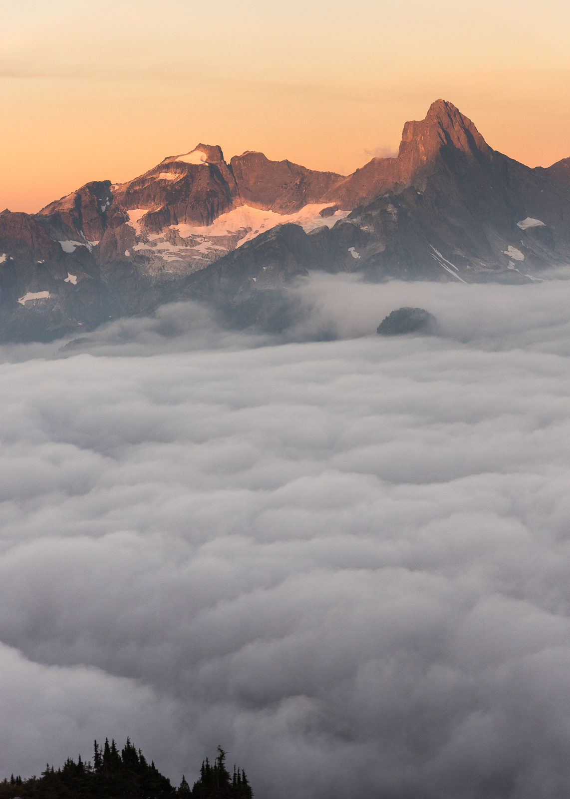
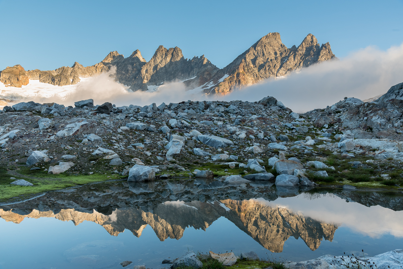
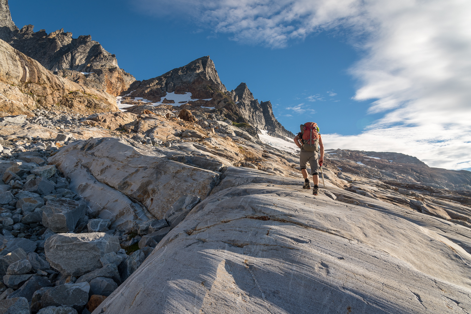
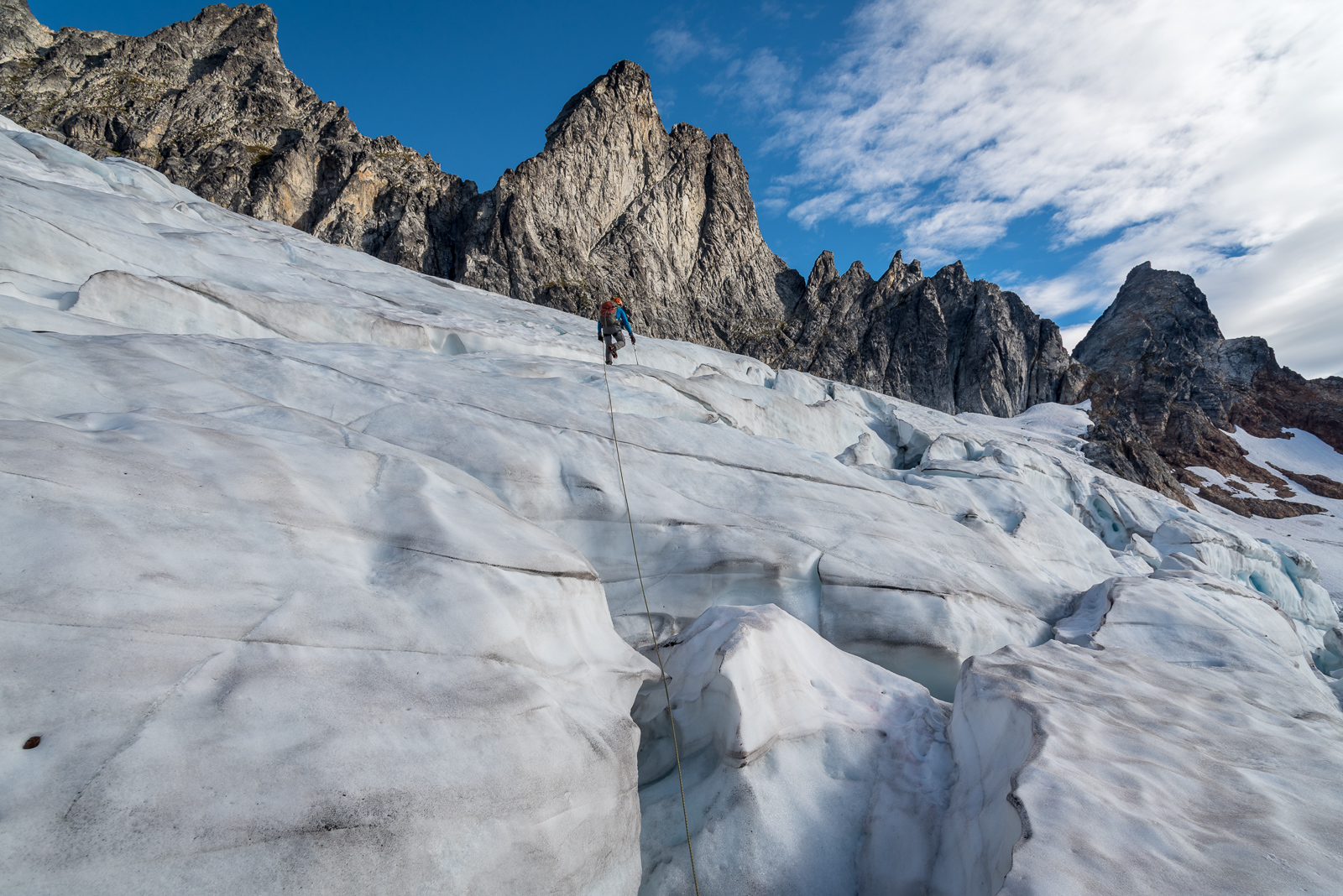
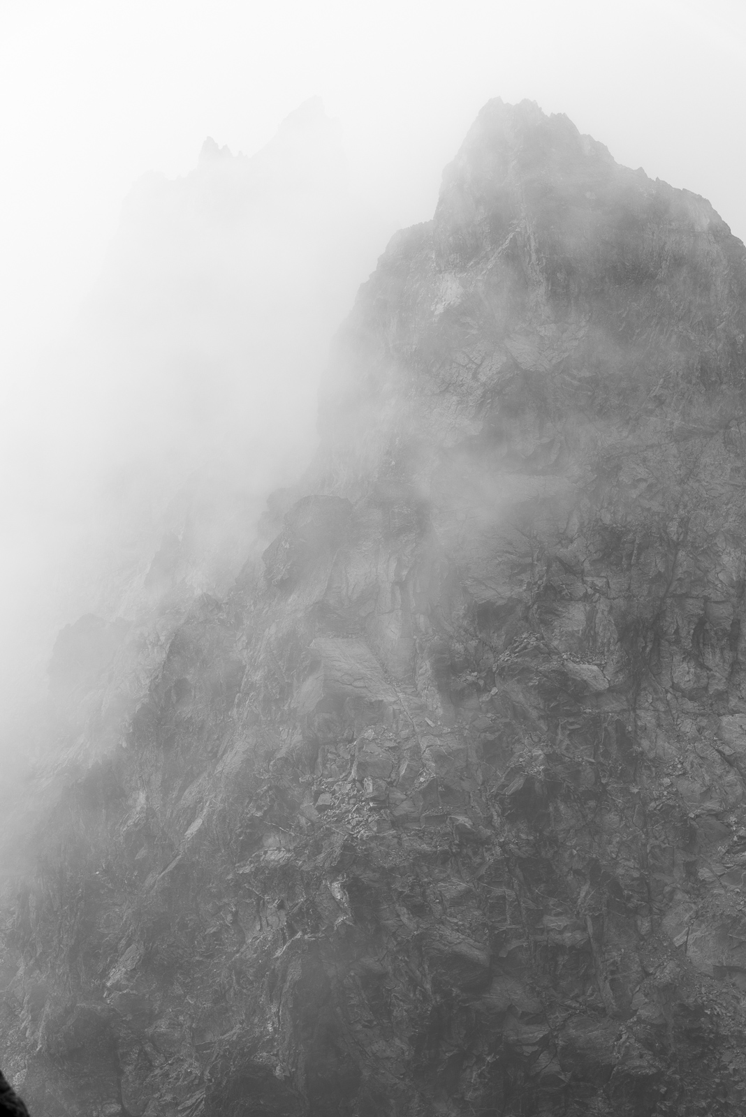
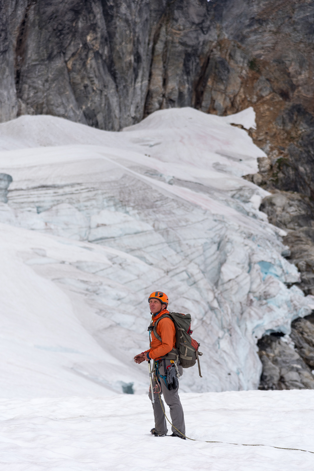
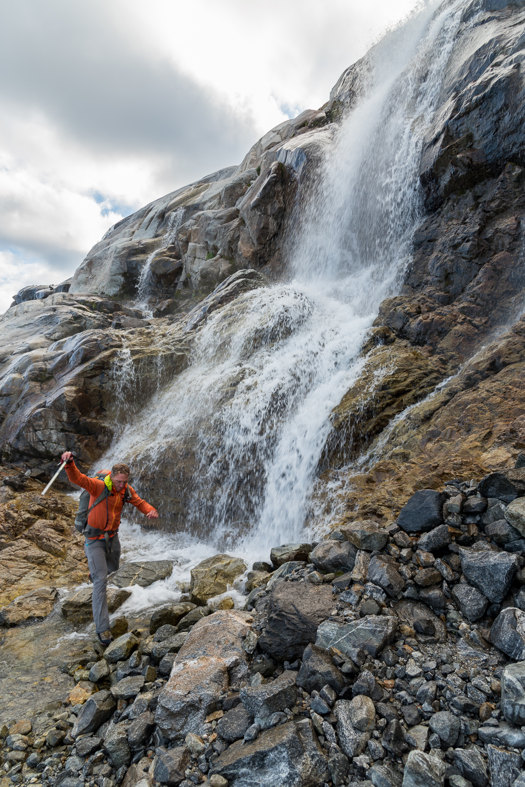
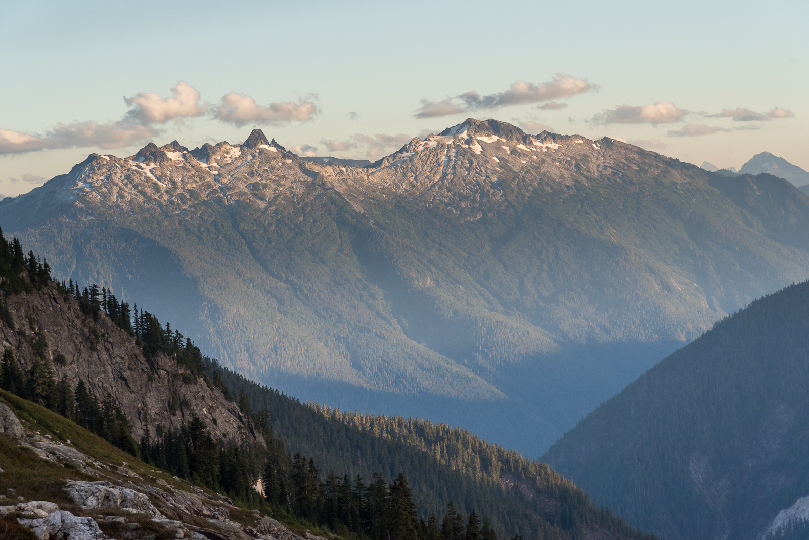
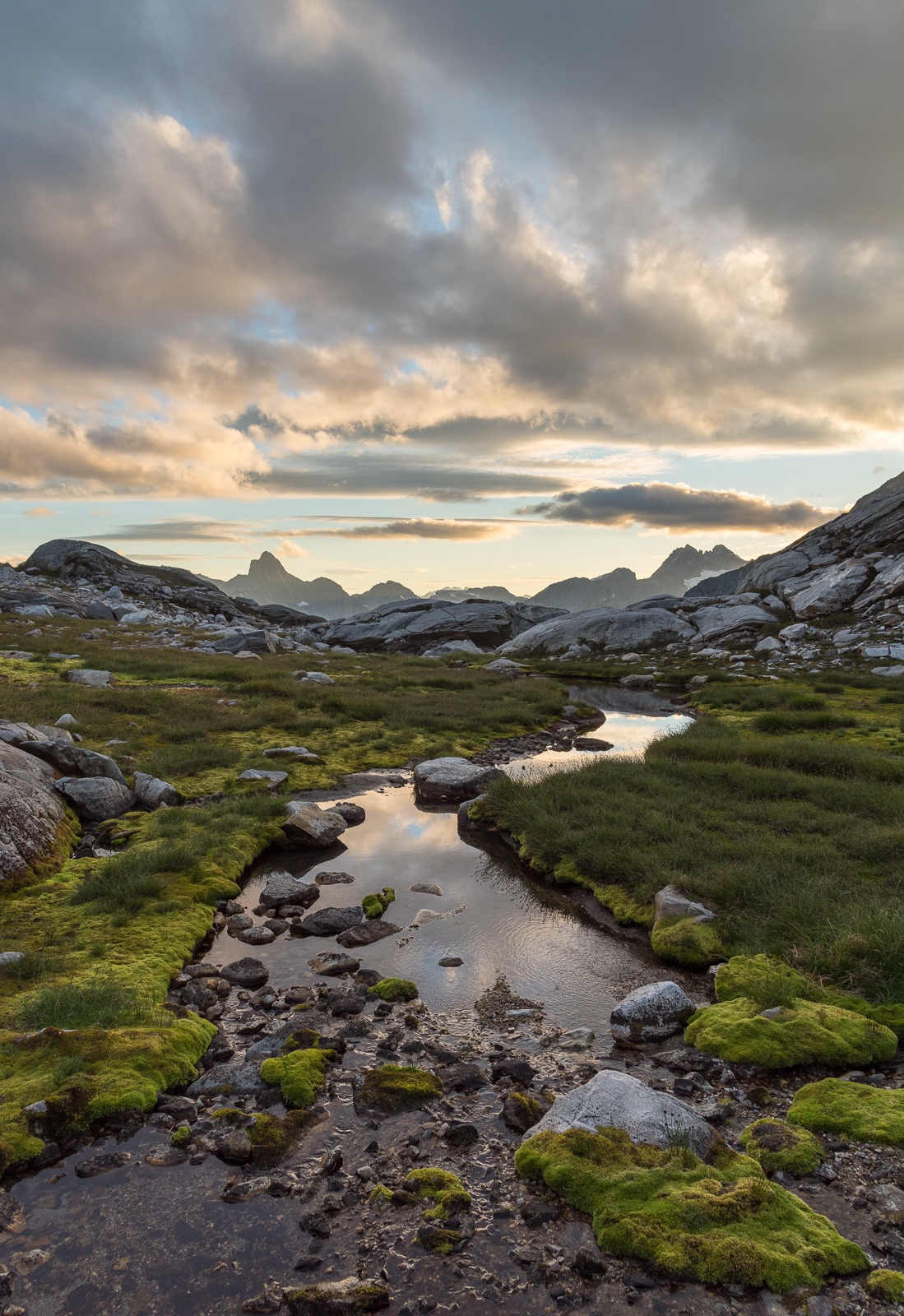
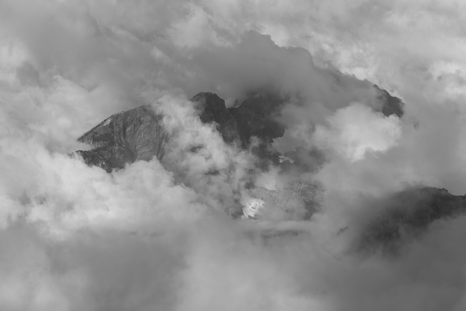
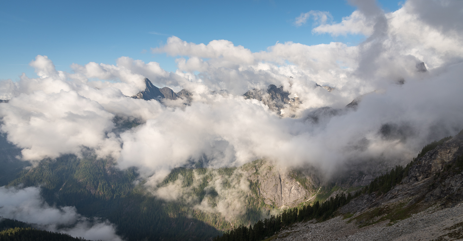
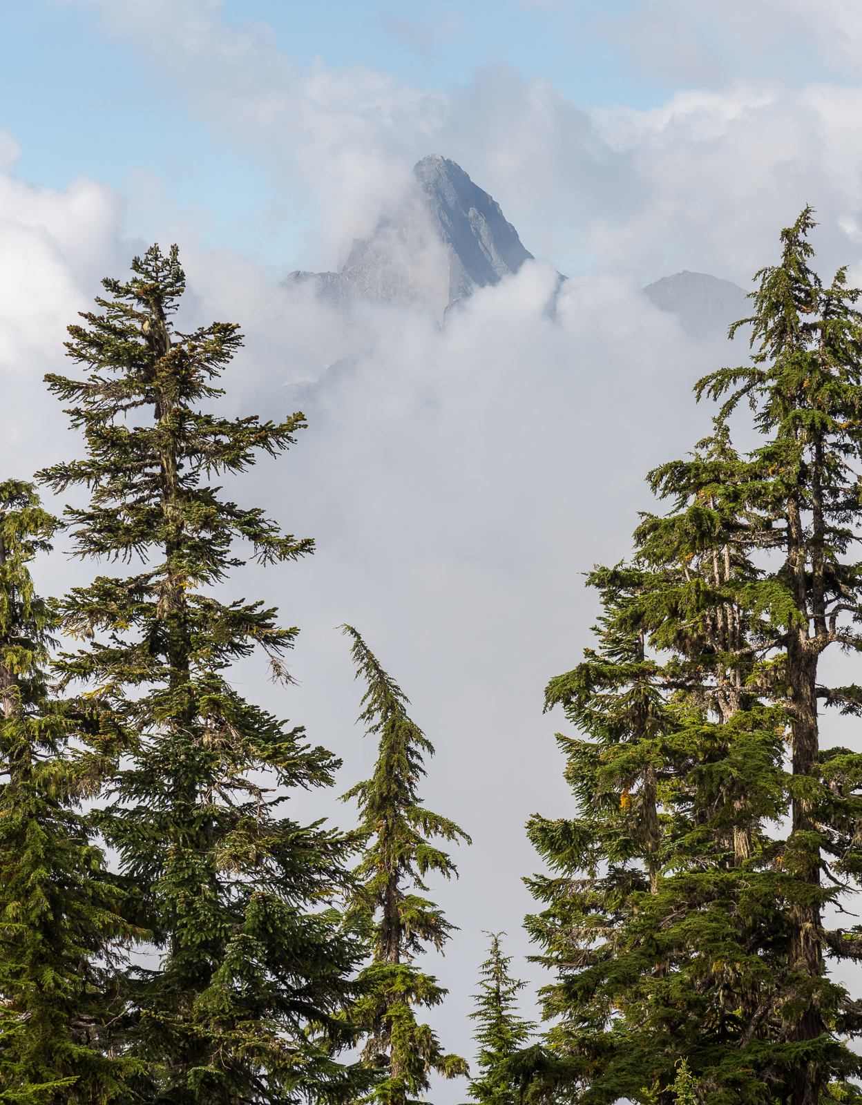
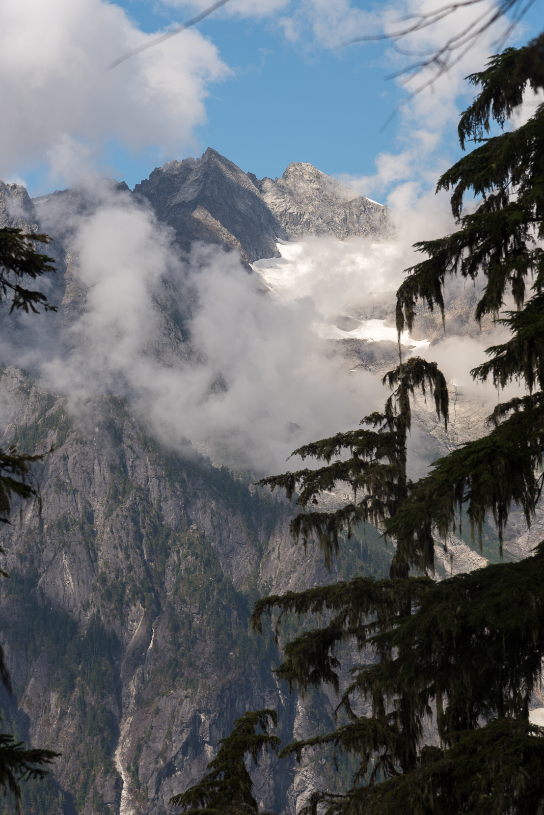
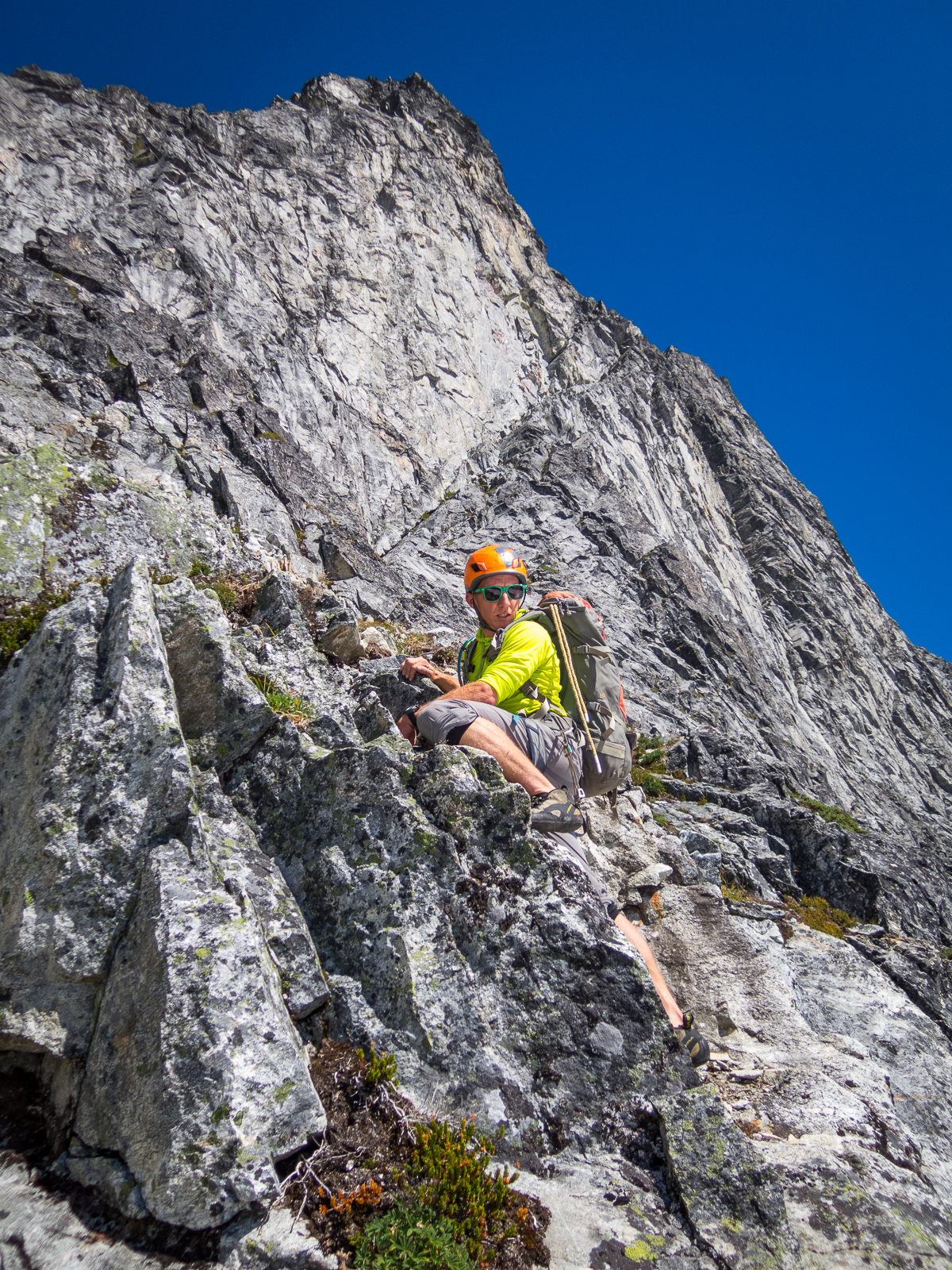
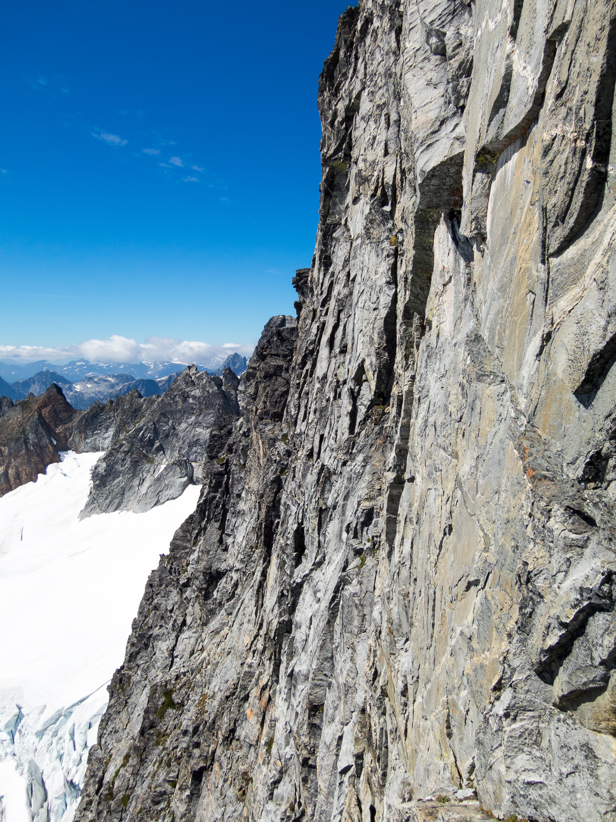
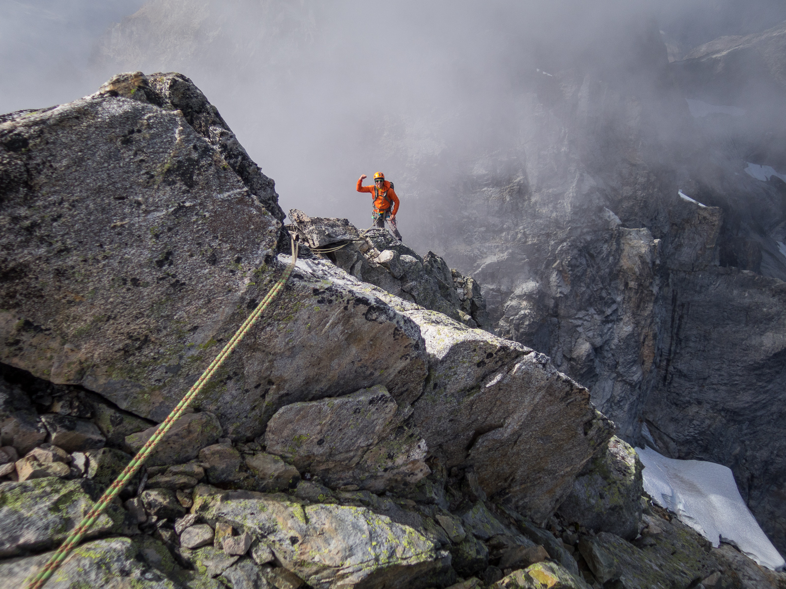
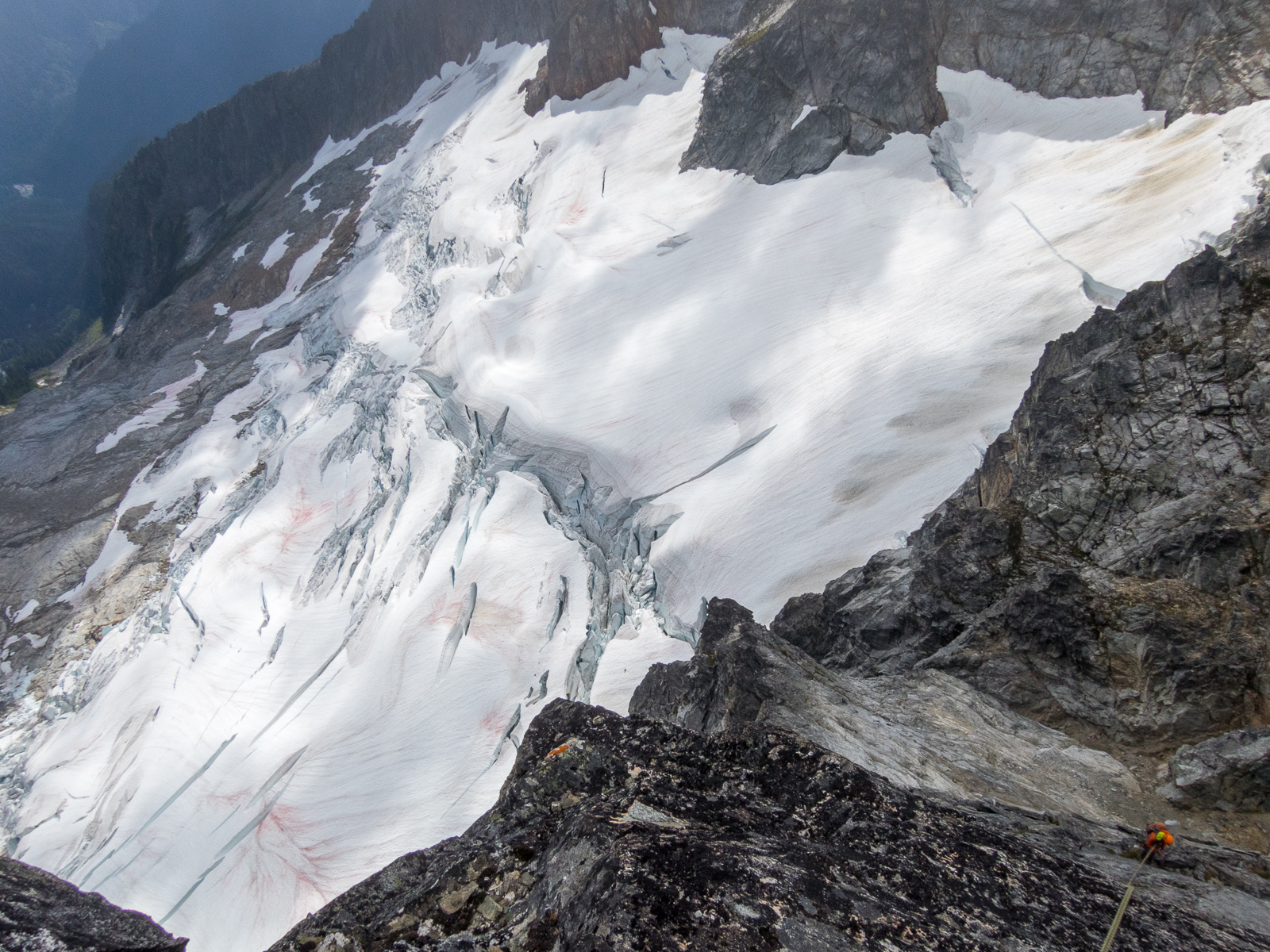
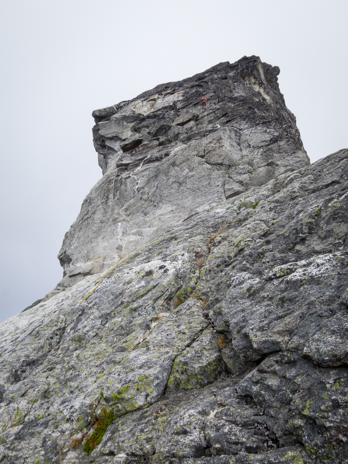
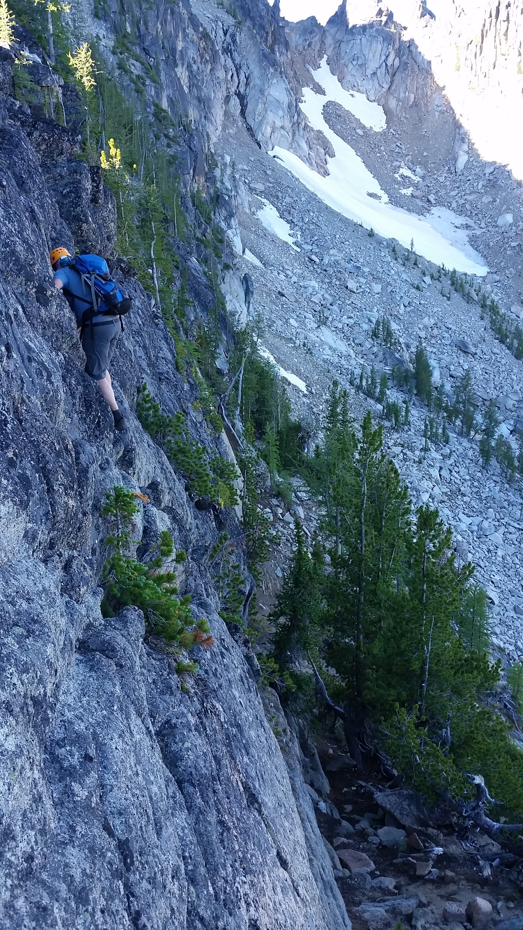
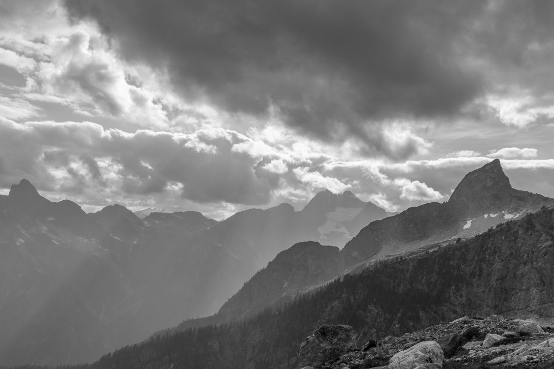
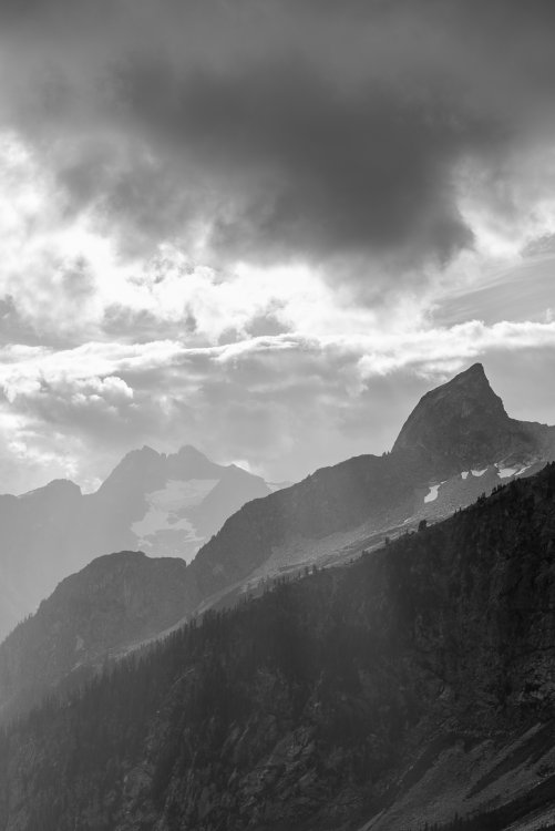
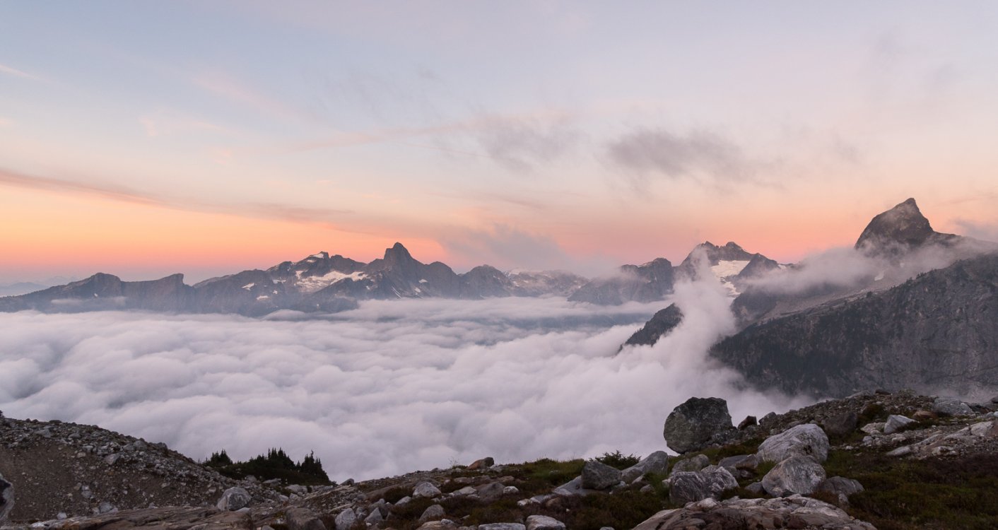
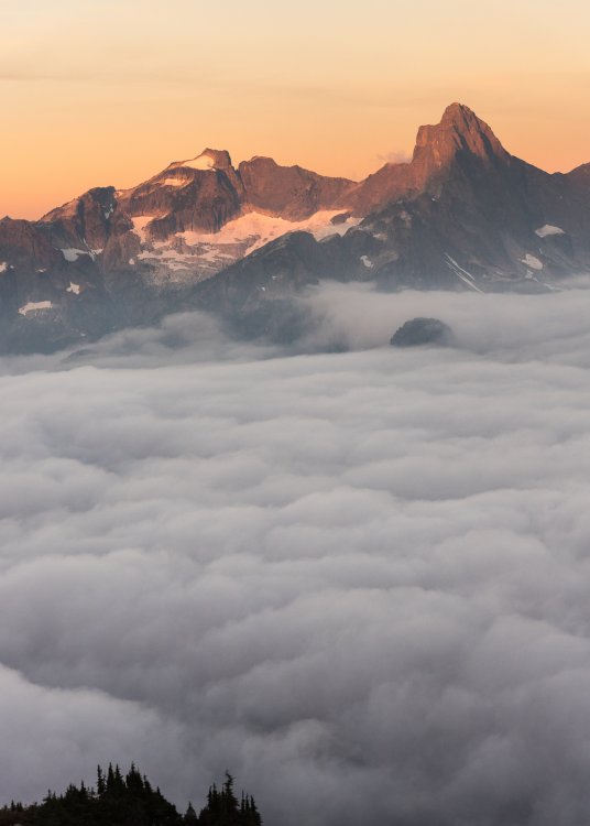
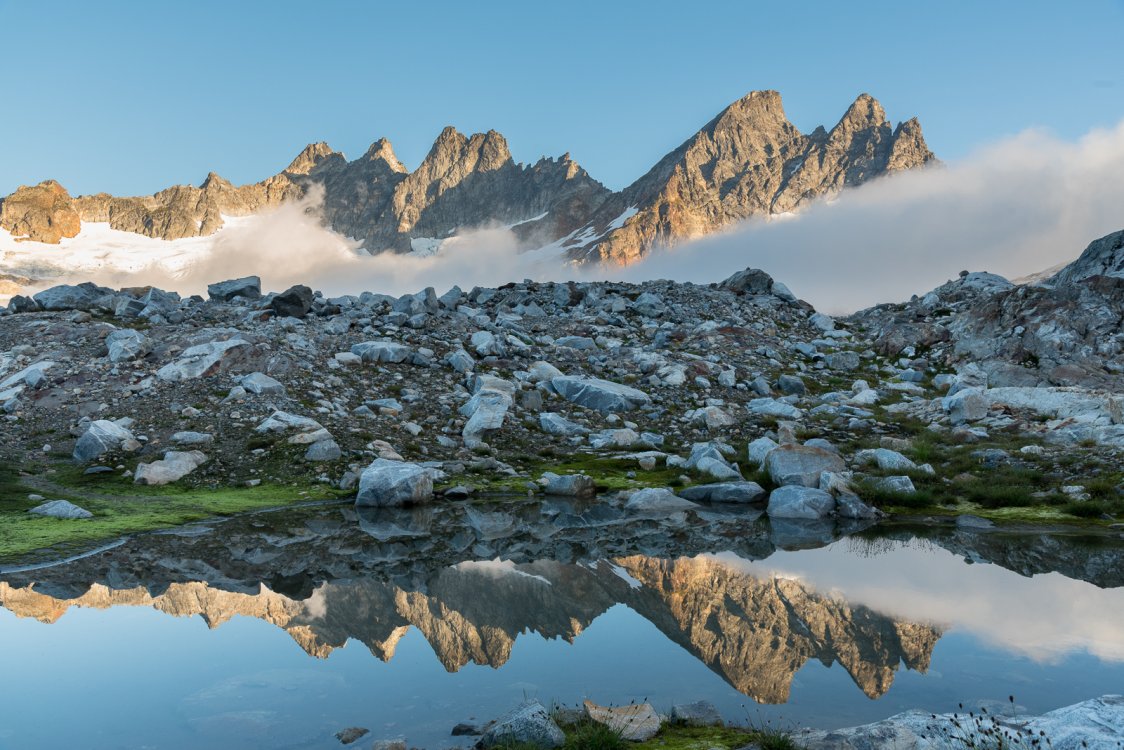
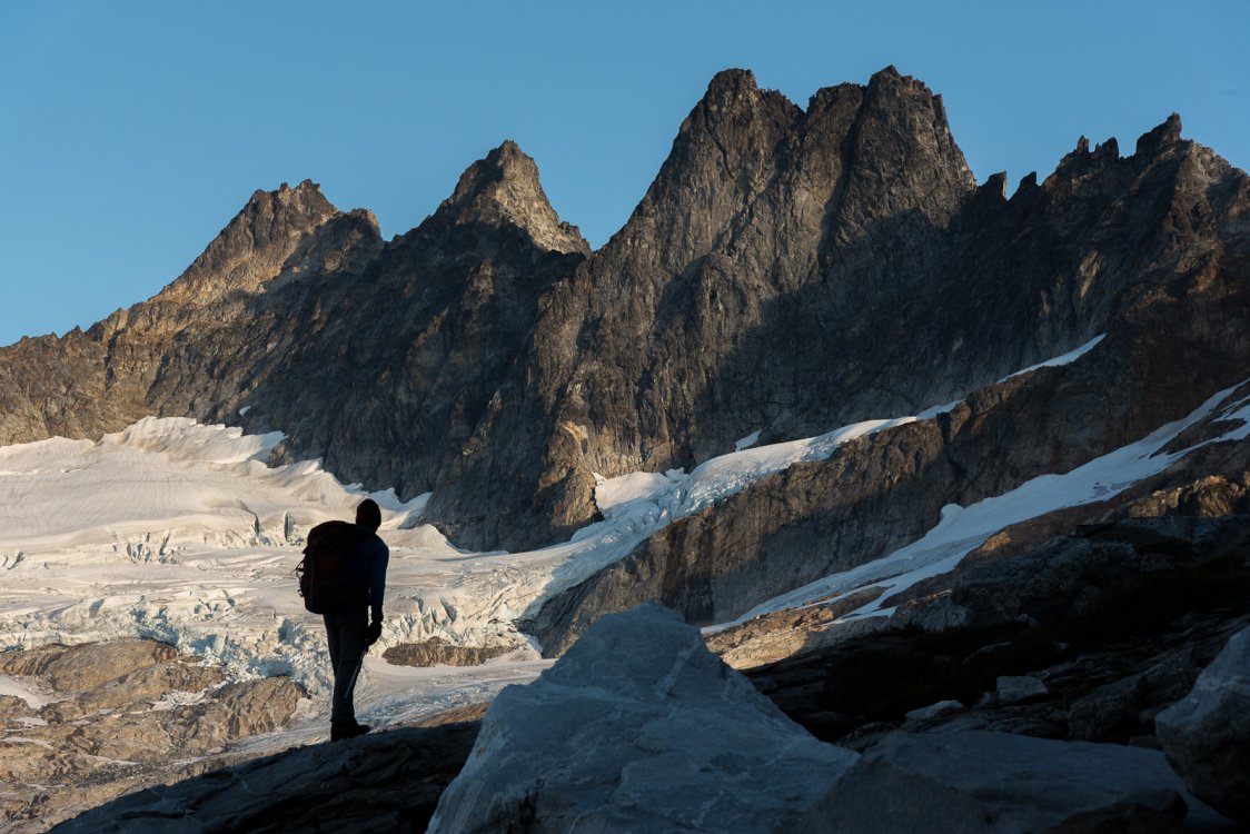
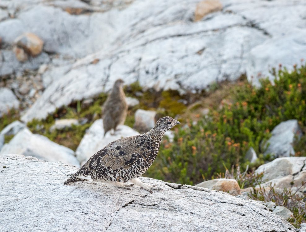
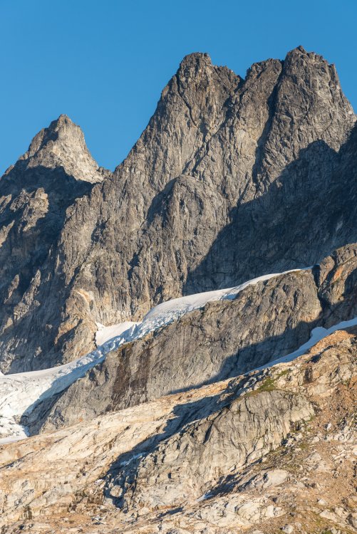
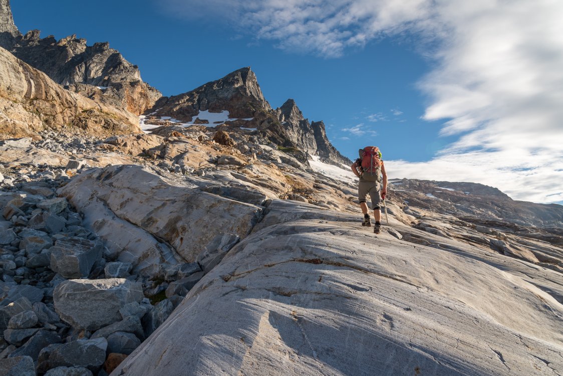
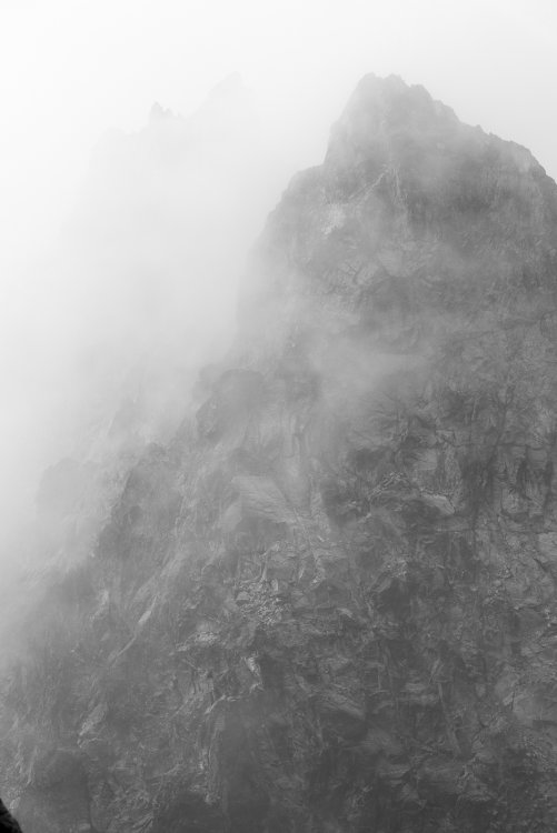
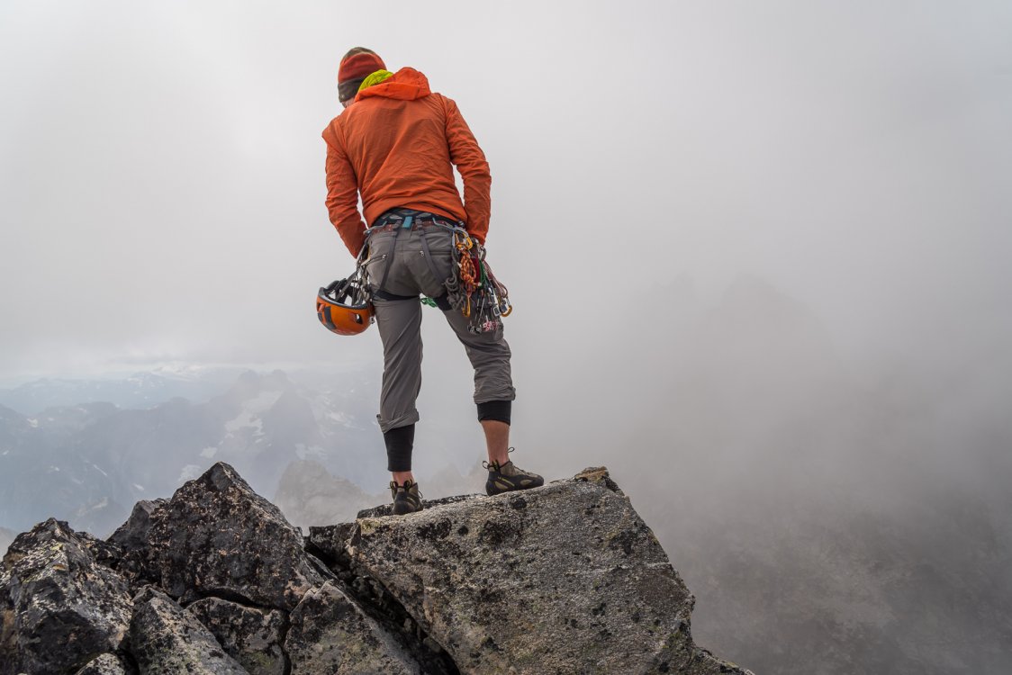
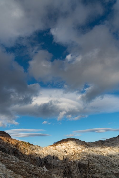
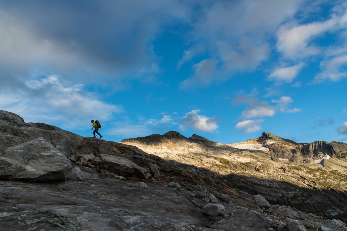
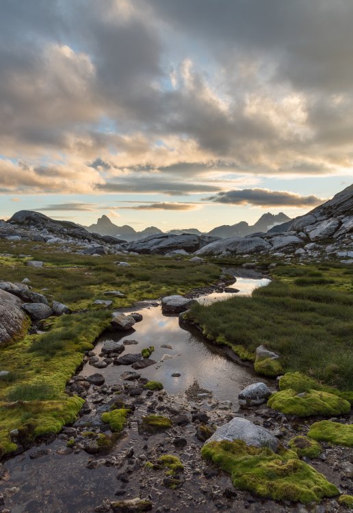
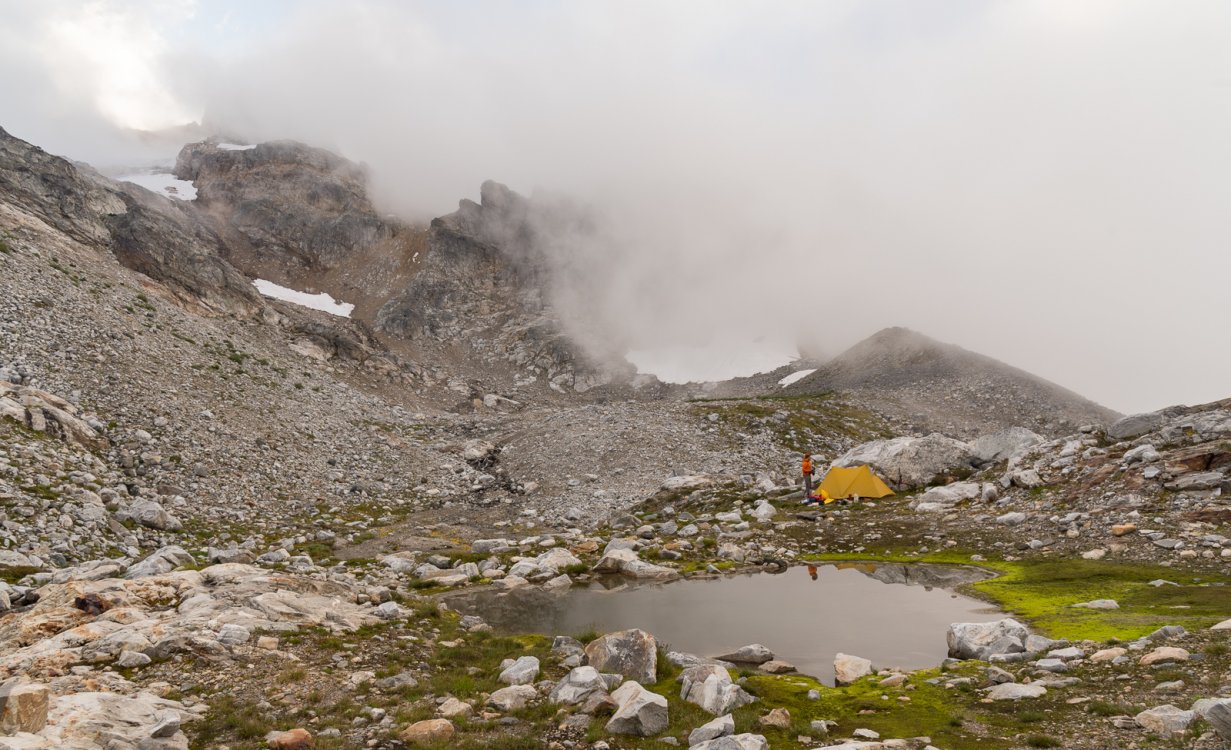
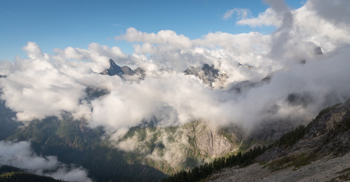
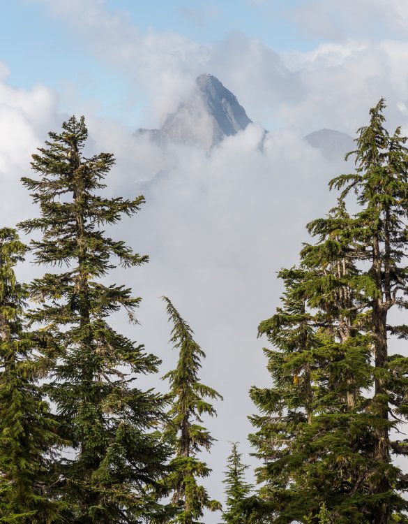
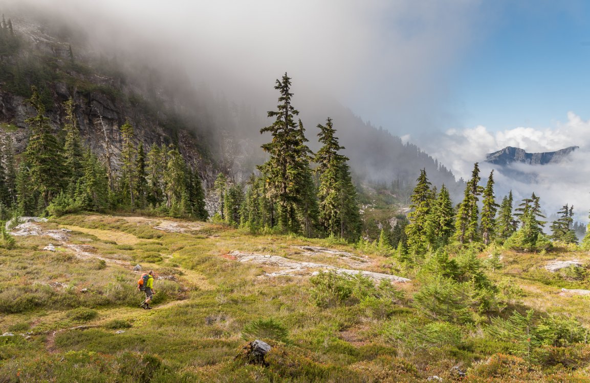
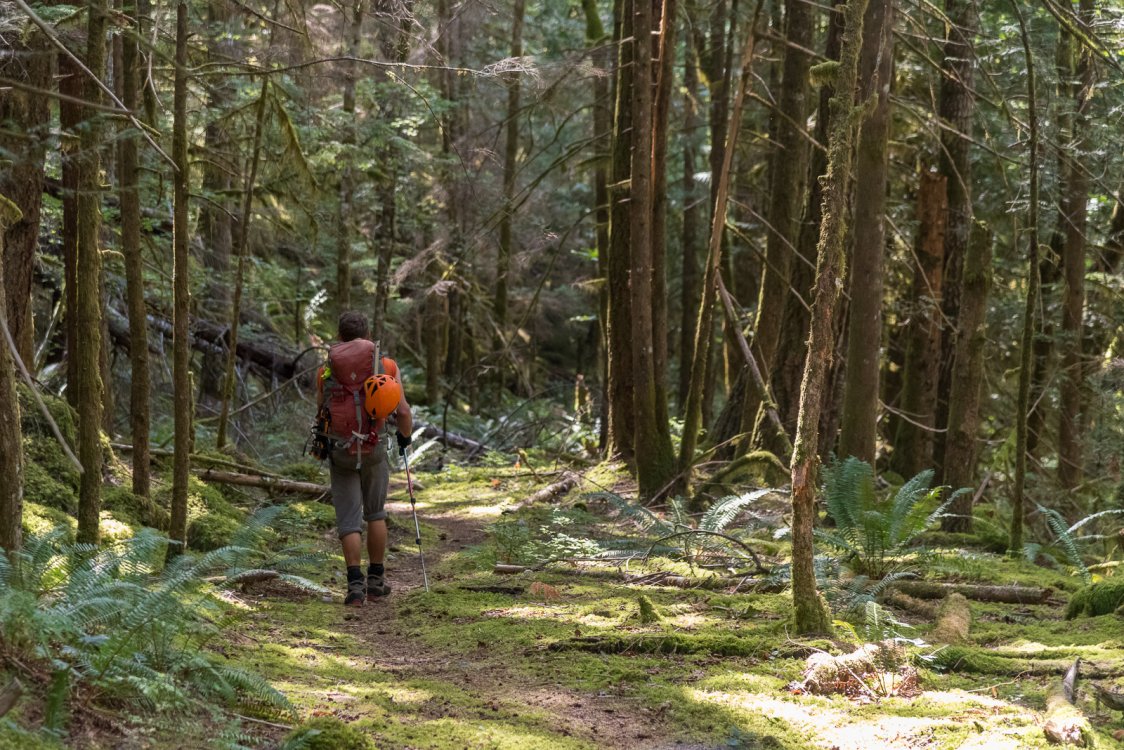
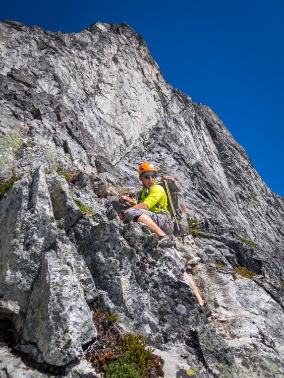
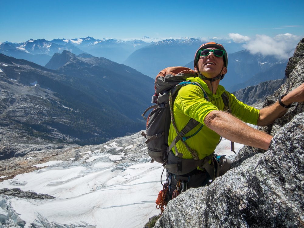
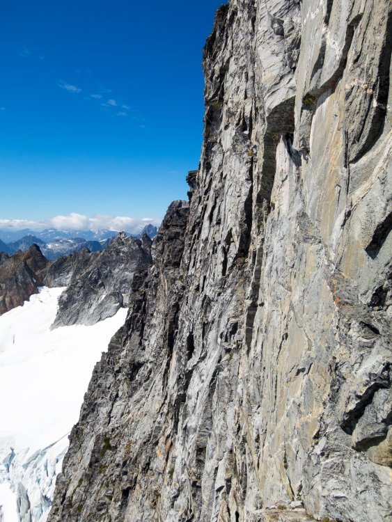
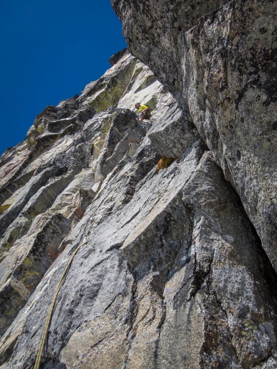
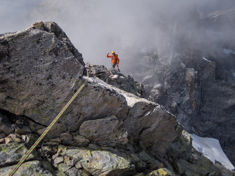
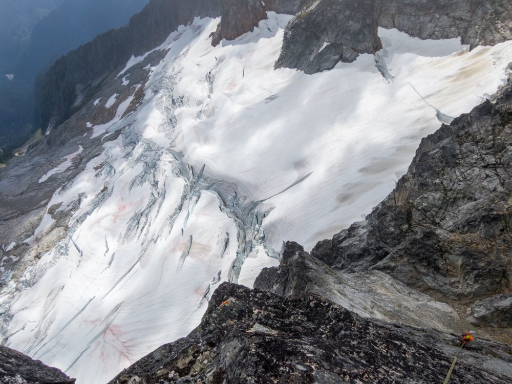
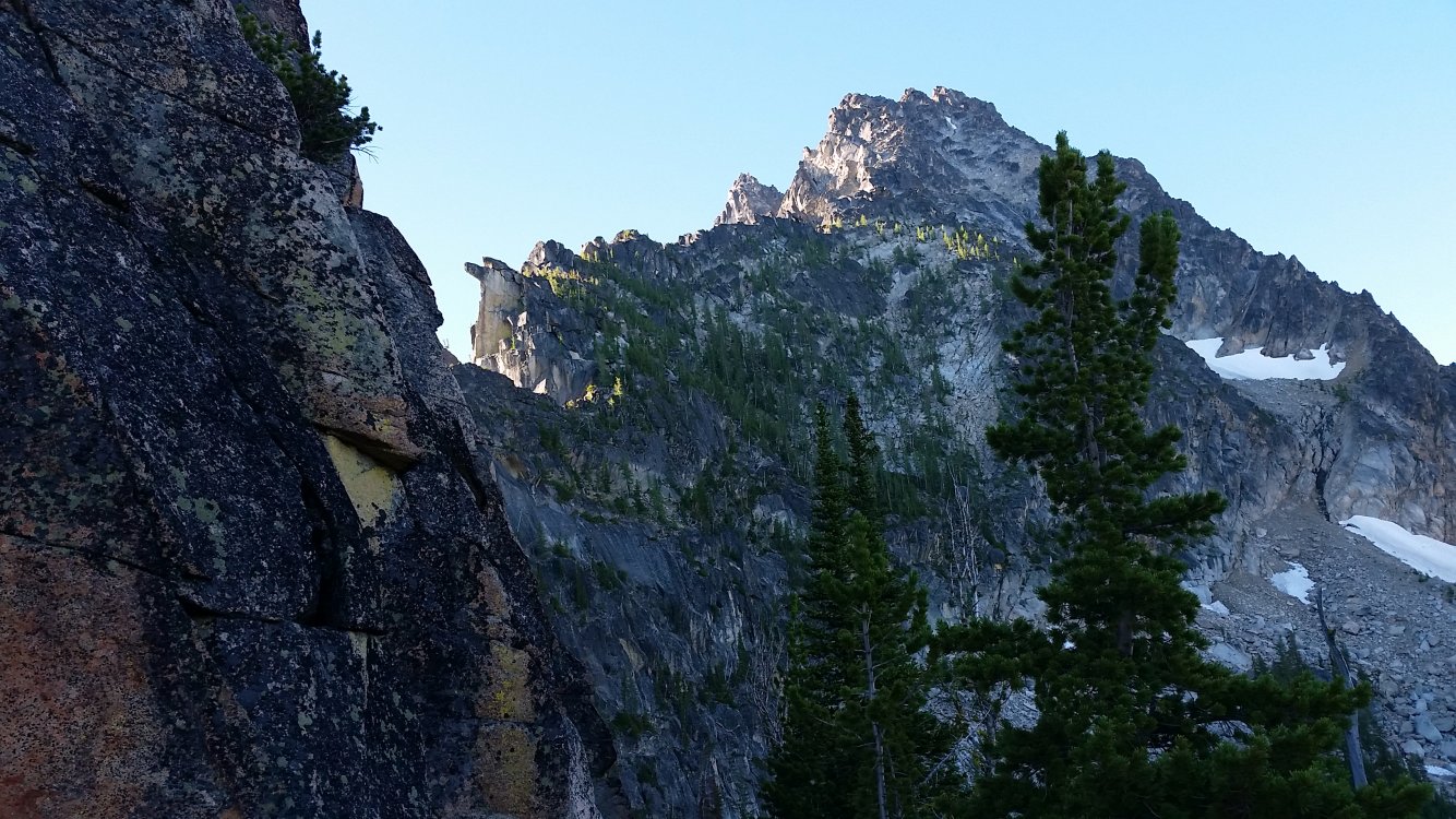
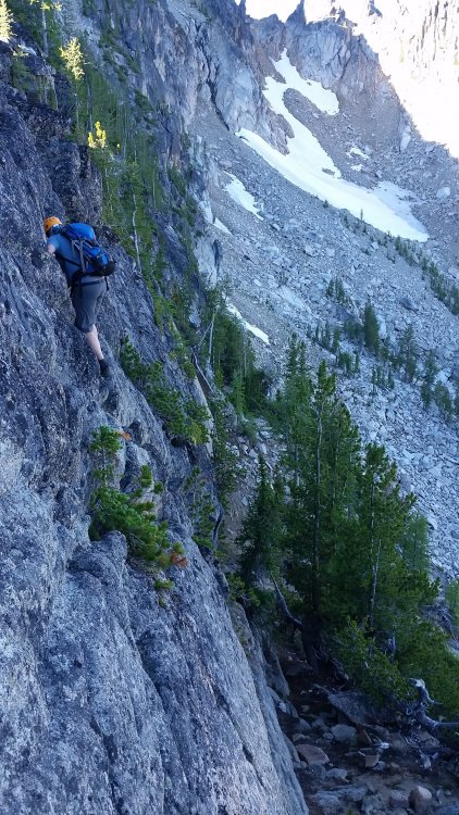
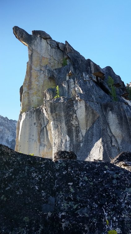
Trip: Inspiration Peak - South Face Trip Date: 09/02/2018 Trip Report: Before last weekend I hadn't been to Terror Basin in almost 10 years. Back then we had spent a week in the Southern Pickets, only seeing one other party in Terror Basin. How times have changed! This past weekend there were three other parties for a total of a dozen people in Terror Basin. Thankfully all the others were headed for West McMillan Spire so we had the decidedly unpopular South Face of Inspiration all to ourselves. However, like Alan Kearney, I really think it should be more popular. It is quite a route! But it is also not for the faint of heart. Steep, intimidating, with a bit of scruffy rock and so-so pro - it would have been a challenge back when I was in good rock climbing shape. And I am most certainly not in good rock shape these days! Luckily I had @therunningdog to gun my sorry ass up it. And gun he did, leading all the gash pitches. But there was plenty to keep my mind humming below- a chaotic glacier with some delicate bridges, slabby rock right off the glacier (should have put on rock shoes earlier), and an increasingly exposed 4th/low 5th class ramp that terminated in the intimidatingly steep "Great Gash". And thenn once you are on the summit, the involved descent awaits. 4-5 raps down the West Ridge, some ridiculously exposed scrambling, and then more steep rappels down the south face. It was about 12 hours camp to camp. But what a place. Even more beautiful than I remembered, perhaps due to the changing weather and swirling mists? The best pictures are never during the best weather, perhaps the same is true of our memories? I'll be back, but I won't wait another 10 years this time. Looking down into Terror Basin from the "trail" in: Looking out to Triumph, Despair, and the Chopping Block (L-R): Despair and the Chopping Block: Thornton Peak and Triumph at sunrise: The Southern Pickets!! Morning light on the South Face of Inspiration: Ptarmigan and grown chick: I should draw the line on this but basically you climb up the buttress to the left of the face to the prominent ramp that is followed right a long ways to the start of the "Great Gash", which shoots steeply up and left to the upper West Ridge. A pitch on the ridge finishes the climb. The Descent follows the left skyline to the col then down the steep face/buttress to the glacier: The glacier approach proved challenging, but we found a way that will go into the fall this year: No super dad friendly. Scrambling a lot of 4th and low 5th to the belayed pitches up the gash. I should have taken more photos but I was pretty focused on not screwing up! @therunningdog in his element! Did I mention that the South Face of Inspiration is steep? @therunningdog coming up the final bit to the summit: It is an exposed descent as well. Rapping the West ridge: On the first set of raps, before you drop off the South Face: Whew. Down on the ice! Or should I say gneiss? TEEBOOOOOOOOOOOOOOOOOOOOONE! Despair in the mists: Triumph: Despair: This felt good after the punishing descent: Gear Notes: 60m half rope, medium rack to 2", ice axe, crampons, helmet Approach Notes: Terror Basin trail from Goodell Creek. 6 hours to camp. From camp follow the climber's path toward Inspiration and West Mac, picking the best line up the glacier to the toe of the buttress just west of the South Face. We roped up here for a bit until we gained the prominent ramp where we packed the roped and scrambled. It seemed about 5.6-5.7 for one ptich to gain the ramp, with low fifth below that. The "Great Gash" is about 3, 30m pitches, to ~5.8. I think we did about 12 rappels down the west ridge and west edge of south face right back to our boots. Stations are established for a single 60m rope. Bring tat since the route isn't climbed regularly.


 1 point
 -
 Hi Eric, Almost exactly a year later I finished my TR from the trip. Still think about it often, thanks again for the line and the beta! https://nicholasfranko.com/bike-tour-1/2018/9/3/no-acting-required1 point
 -
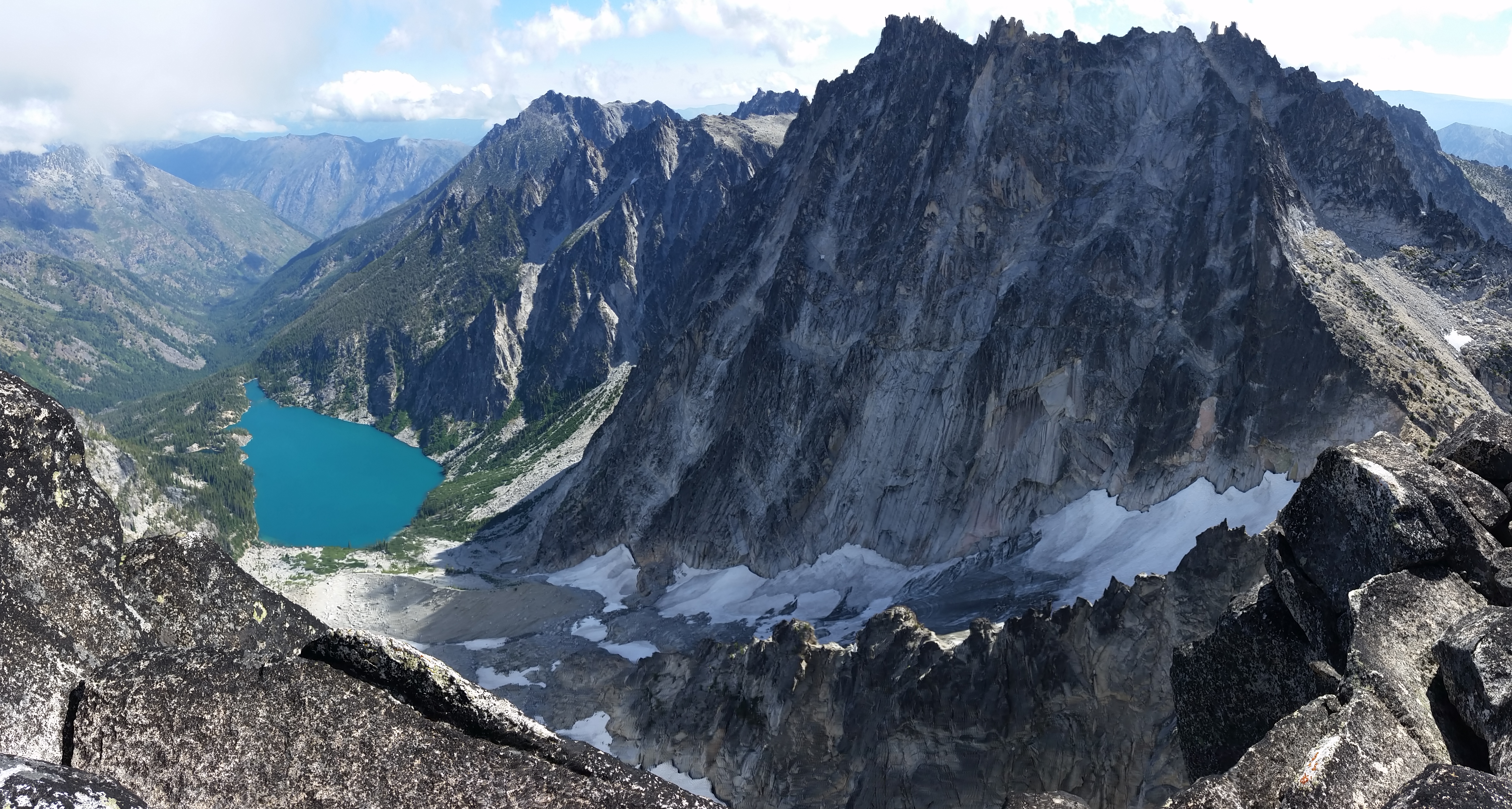
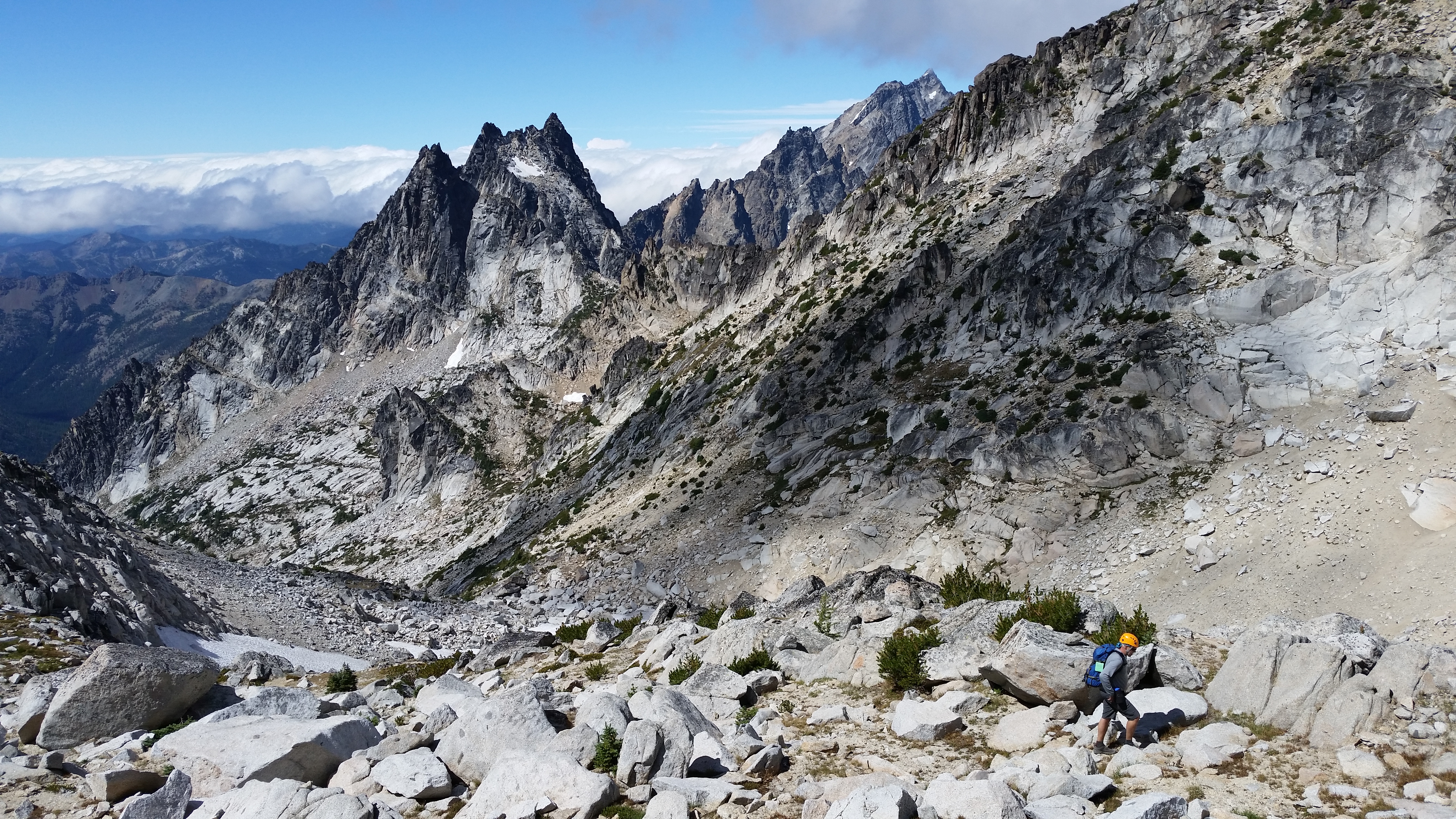
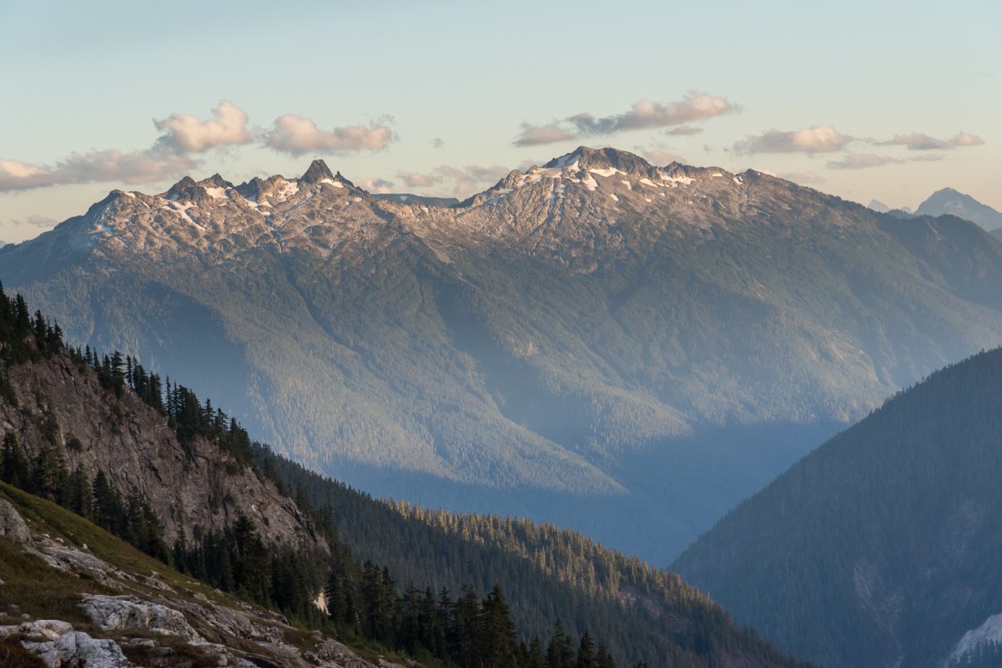
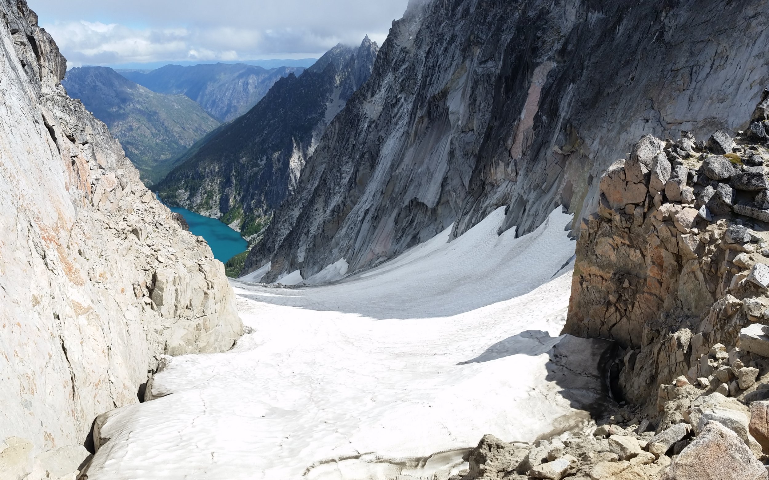
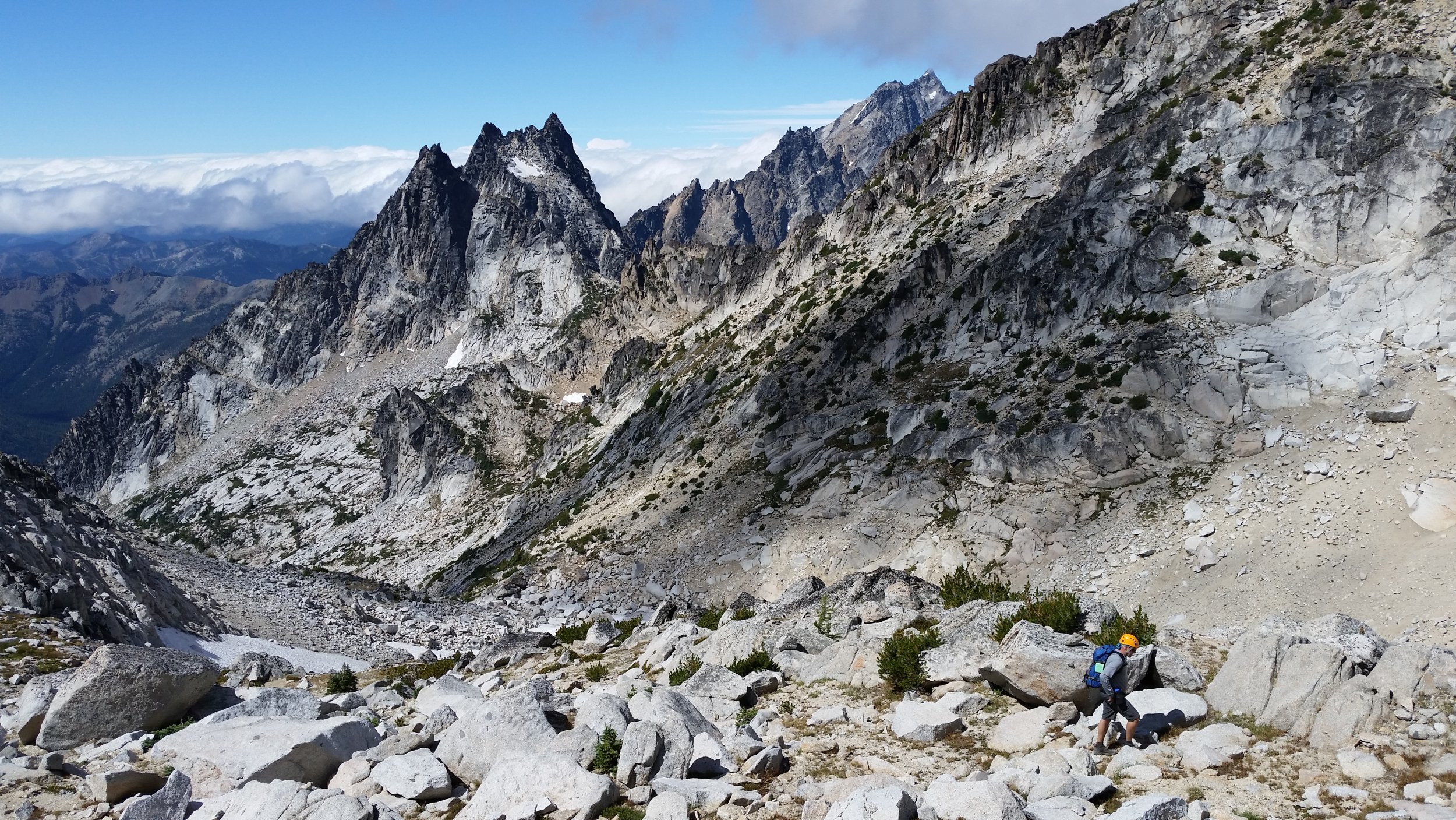
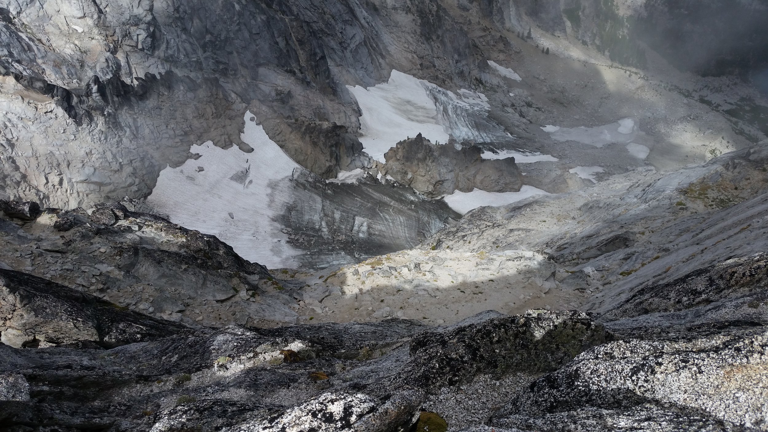
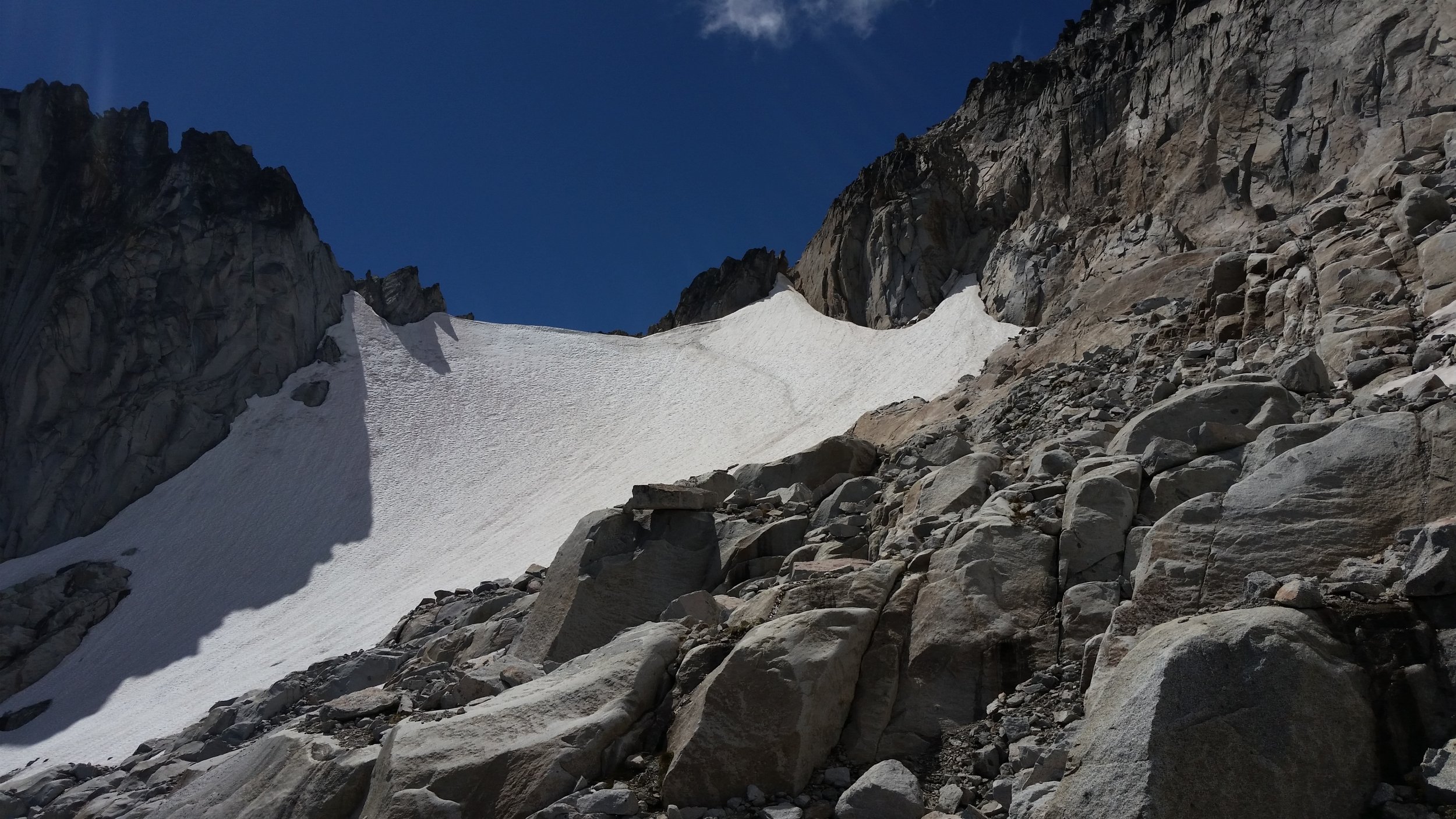
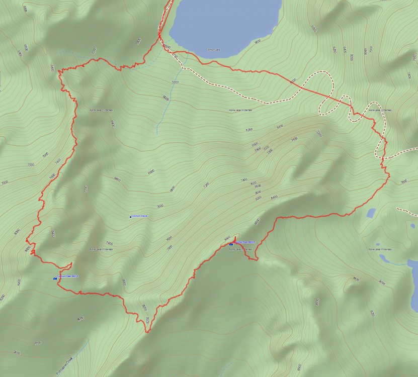
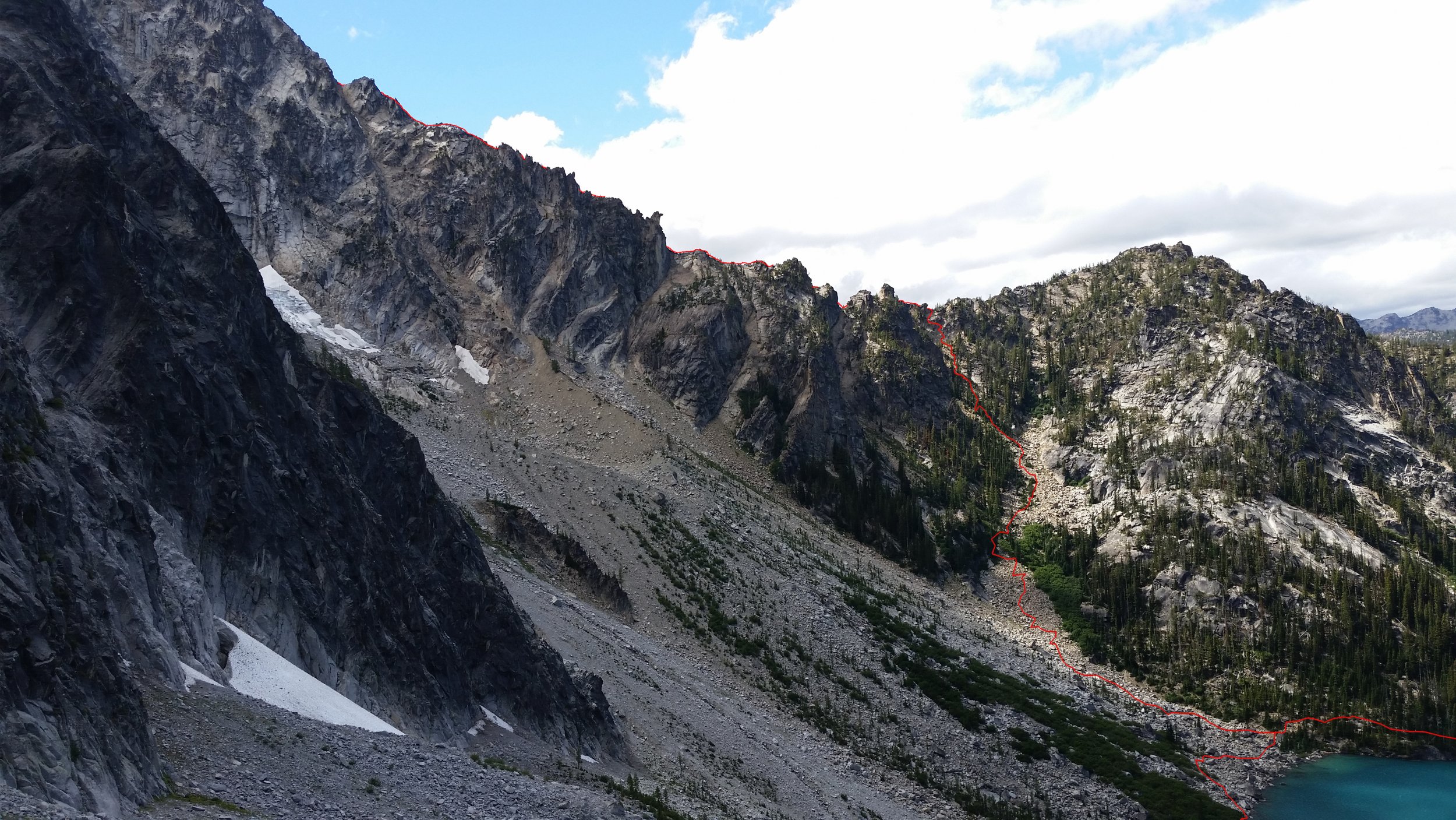
Trip: Colchuck Peak & Dragontail Peak - North Buttress Trip Date: 08/11/2018 Trip Report: After thru-hiking the Enchantments a couple years ago, it has been on my list to get back in the area and tackle some of the surrounding peaks. I'm not sure why it took so long! Just looking for a scramble, we decided to do the North Buttress route on Colchuck Peak and then hit Dragontail on our way to Aasgard Pass and back down to Colchuck Lake. From a bit of reading it seemed that staying on the west side of the ridge would make for some class 3/4 scrambling, while staying on top of the ridge would give some low 5th class climbing. We had some awesome weather, great views, and fun climbing. We arrived at the trailhead Friday night and after a quick bivy we were on the trail shortly after 4:30am the next morning. We cruised up to Colchuck Lake in a couple hours and arrived at the southwest corner of the lake where the approach toward the Buttress begins. It was light out by then and we were pleasantly surprised to see clear blue skies. It was quite hazy the day before due to the wildfires but the incoming weather system must have pushed the smoke out. We stopped at the lake edge to filter some water and then off we went up the talus field toward the notch/col on the route. The scramble up to the notch was straightforward, basically just hugging the right side of the lower talus field and before crossing over some of the vegetation to the upper slope which contained more scree. From there we just made our way straight up the gully to the notch. It took about 45 minutes to ascent the 1,100' to the notch (6,800') where we could finally get a good view of the route, as well as views off to the west where Sherpa Peak and Mount Stuart sit. View of Colchuck Peak and the North Buttress. From the notch we could see a couple options. There was what looked like an easy traverse but it seemed a bit far off the ridge. This may be a way to the Northwest Route but we decided to stay as high as possible on the ridge which turned out just fine. The first couple hundred feet of scrambling was a bit slow. There was definitely come class 4 mixed in and at points we were directly on the crest so we had nice views of Colchuck Lake, Colchuck Glacier, and Dragontail Peak. A little exposed. Eventually this beginning section was over and we started to really gain some elevation. At this point the route turned into an easy class 3 scramble where we followed goat trails most of the time. At points where the trails began to traverse more and deviate off the ridge, we abandoned the trail and went up where more fun and interesting climbing was. A bit of exposure in spots but the holds were easy and plentiful. One great part about this route is that you're in the shade the entire time! The weather definitely cooled down from the day before, but not being in the direct sun was sure nice. It was clear during the climb up to Colchuck with some clouds off in the distance past Mount Stuart. We also got to see a helicopter circling Mount Stuart multiple times. It sounds like a hiker broke their leg, according to the Seattle Times. The rest of the route up until just below the summit was easy going and fun. About 200' below the summit we ended up heading directly up the south side which probably had the most exposure so far in the climb, but we felt comfortable on the rock. There may have been a way around the west side of the summit at this point but we didn't investigate because the route we took looked doable. After that section of climbing we hit the summit! It was 10:30am, a little over 3 hours since leaving the lake. We were moving at a comfortable 1000' an hour. Colchuck Lake, Colchuck Glacier, and Dragontail Peak from the summit of Colchuck Peak. After a quick break we were on our way down to the col between Colchuck and Dragontail, then on our way back up toward Dragontail. Easy scrambling up the gully before we gained the ridge and traversed over to the summit just as a party of 3 was on their way down. At this point we were getting some light cloud cover which gave us some shade. We were on the summit by 12:30pm. Looking down Colchuck Glacier. Argonaut Peak, Sherpa, and Stuart. Colchuck Glacier seen from the ascent up Dragontail. Summit of Dragontail Peak. Looking toward the upper Enchantments. Pano at the top of Dragontail. We had some lunch on the summit and then off we went down and towards Aasgard pass. At this point I realized I forgot about the snow traverse. Luckily the snow was soft and there was already somewhat of a boot pack so getting down wasn't too bad. And we were glad we decided to bring trekking poles as they helped some too. If the snow was harder I think an ice axe would have been nice to have. Looking back at the snow traverse. We made our way down Aasgard pass and back to the lake. A quick break for some water at the lake and we were back on the now very busy Colchuck Lake trail. We arrived at the car at 5:00pm, just shy of 12.5 hours. Here are some stats: Splits (excluding breaks at lake and summits): -Car to Colchuck Lk. - 2:00 -Colchuck Lk. to Colchuck Peak - 3:15 -Colchuck Peak to Dragontail Peak - 1:30 -Dragontail Peak to Colchuck Lk. - 1:40 -Colchuck Lk. to Car - 2:00 Car-to-Car Total Time: 12.5 hours Mileage: ~13.3 miles Elevation Gain: 6'800' Bluetooth Speakers on the Trail: 5 Here is our route and the approach to the North Buttress from Colchuck Lake: GPS Track. North Buttress Approach (track drawn on ridge is not exact). We had a great time on this route! Fun scrambling with options for more exposed terrain. And you can't beat the views! I'd recommend this route to anyone that is looking to get off the beaten path and would prefer a scramble over one of the true rock climbing routes in the area. Gear Notes: Helmets. Trekking poles were useful for snow traverse and descending Aasgard. Approach Notes: Obvious trail that splits off (right) the main trail at SW corner of Colchuck Lake. Follow talus field up and to the climber's right, which leads to a gully below the notch.


 1 point
 -
they got rid of the bad apples. somehow I'm still here1 point
-
Awesome trip report, Jeff! I was on the Kahiltna about the same time, trying (unsuccessfully) to solo Foraker. Your route overlay of the West Rib and Cassin is informative but slightly wrong. That is "Kahiltna Notch" not Pass (Pass is between West Buttress and Mt Capps). And the top of the West Rib goes left of that rocky rib instead of to the right like you have it (going right leads you up to that huuuuuge cornice). I did the upper rib last year, aiming for Cassin next year. Well done!1 point