Leaderboard


Popular Content
Showing content with the highest reputation on 08/19/18 in Posts
-
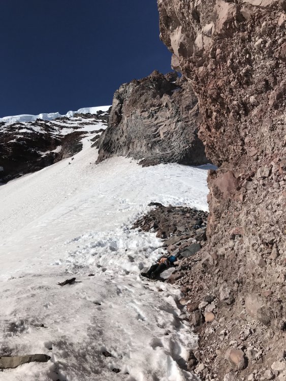
Trip: Bugaboos - Beckey-Chouinard and Surfs Up Trip Date: 08/07/2018 Trip Report: My wife and I took a quick trip to the Bugs last week, primarily to get on South Howser’s Beckey-Chouinard which has been on my dream list for years. We also climbed Snowpatch spire via Surfs Up. Both were great routes, and we had a blast! The crux was leaving the one year old at home with the grandparents, but I think that was just on our end. We were also lucky to have stellar weather and great travel conditions for the duration of our short trip, though I expect this to change very quickly. The Bugaboo-Snowpatch Col was melting fast, and may already be a bit sketchy from a rock fall perspective. I won’t share a ton of beta, since it is all over out there. We decided to camp at East Creek so that we could check out the approach/descent the day before and potentially get a jump on the multitudes (and there were a lot of folks!) marching in early from Applebee Dome. I think this worked out pretty well, but it’s a bit of a hump carrying a heavy pack over the BS col and down the Pigeon-Howser col. The PH col has some unpleasant loose scrambling which is a bit unnerving when there are multiple parties tromping around. BS Col PH Col and East Creek PH Col We woke up early and scrambled up to the split rock (a bit tricky in the dark). We headed up a bit too early through blocks, where I think you are supposed to continue traversing on slabs, but it all worked out. We simuled 3 pitches, then climbed pitch after pitch of 5.8-5.10- awesomeness that was both fun and tiring. The dihedral pitches are really fun. We did the standard squeeze chimney, which was a bit of a thrutch with a pack/ice axe on, but was well protected and certainly doable. The 5.10 cracks to the left looked inviting, though I heard from other parties that that are a little rounded and sustained relative to the other splitter cracks on the route. Pick your poison. I’ve never really done tension traverse purposefully, and I’m not really sure how the leader would avoid the 5.10+ traverse on the last pitch before the rappel. Luckily it is just really one short committing move and you’re to easy ground. I’m sure you could figure out a way to aid it, but it wasn’t that bad, and it is very easy for the follower to tension across if you wait a while to place your first piece in the easy chimney/gully after the traverse. The rappels are great, and get you down fast (single 70m). I would stick to the descriptions for the rappels that are available online and posted at the Kian Hut. They are right on, and very literal. We got down to the snow as light was fading and romped back to the Pigeon-Howser Col. I did not bring crampons, which was fine with the exception of a glacier ice traverse just above East Creek Camp. This was a bit spicy, but probably avoidable earlier in the year. We got back to camp around 11:00, which felt relatively civilized, though I was certainly a bit tired. It was a great route, and worthy of the hype! Of course this has led to route crowding, and most days there were several groups that retreated because they were too far back in the conga line. We took a rest day, and then humped our heavy packs over to Snowpatch Spire on the way out. We decided to go for Surfs Up, as it made logistical sense and we had heard good things. The first few pitches were meh by Bugaboo classic standards, but the following pitches were stellar! The position from Surfs Up Ledge onward is really amazing, and the climbing is fun! Again, the rappels are great (single 70m) and get you down fast. A beautiful place that is now very popular! I’ll be back! Gear Notes: Doubles to 3" single 4" Approach Notes: Up BS Col, Down PH Col to East Creek2 points
-
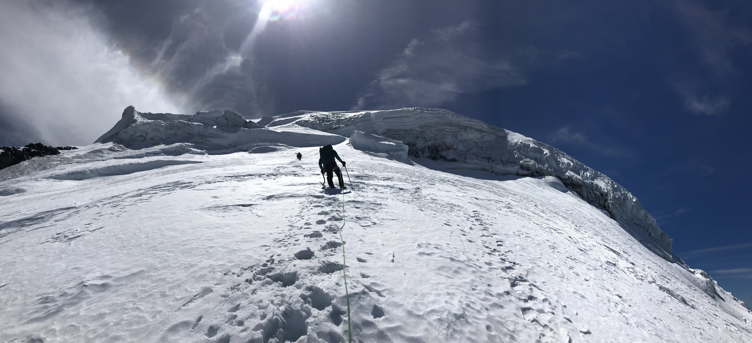
Trip: Mt. Fury - North Buttress Date: 6/23/2017 Trip Report: Summary: We climbed North Buttress Fury over a three day weekend (July 23-25), approaching up Access Creek on day 1, climbing the buttress on day 2, and descending on day 3. Definitely one of the best routes I've climbed in the cascades. Pictures and Details: We were happy to be at the Ross Lake dock for a 8 AM ferry ride to the Big Beaver trailhead. I would have liked to leave earlier, but 8 AM is the earliest they will do. Call ahead for a reservation, and be prepared for the high cost: $65 per boat ride, $130 there and back. The ferry ride only took about 10 minutes. We arranged a pick up time on Sunday for 6 PM, which is the latest they would do. After hiking up the Big Beaver trail for 10 miles, we arrive at our turn off for Access Creek. We dropped our trail runners here, put on our boots, and headed towards the river ford. After searching around for a bit through the devils club, we found a feasible ford (located here: 48.844834, -121.217546), which involved thigh deep water. Elsewhere and we would have been swimming because the river was quite high. The bushwhack up Access Creek was fairly pleasant. Certainly one of the easiest bushwhacks I've done, and there is even a faint trail most of the way if you can stay on it. Perhaps in later season, when the new growth comes in, it becomes harder. Free of the bushes in upper Access Creek, just about to head up steep snow slopes. Traversing over to Luna col. Setting up camp at Luna col. It was a long and tiring day. We started with the ferry at 8 AM and got to camp at 9:30 PM. We slept in and only got up at 6 AM to start our climb. The North Buttress looms. From Luna col we descended down to Luna and Lousy Lakes. We had heard about people getting cliffed-out above Luna Lake. To avoid this, we traversed aggressively skiers left from the col, keeping just below large rock buttresses. We got down to Luna Lake this way with no problems. We then traversed beneath the northern aspect of Mt. Fury, making our way quickly beneath several bands of hanging ice cliffs and rock-fall zones. It would probably have been a better idea to get up earlier and avoid the objective hazard. We heard rock and ice fall all day. The access couloir for the North Buttress. 50+ deg snow in places. We accessed the buttress via a couloir on its eastern flank (as described in Beckey), which avoids rock and icefall danger associated with the access on the western flank. This couloir was continuous for us, but will probably involve several rock transitions as it melts out later in the season. There was a lot of snow on the route this early in the season, which made for tricky route finding at times. But there was usually a way to avoid it. The climbing difficulty was 5.8 in two places, not the 5.6 advertised. Otherwise, mostly 4th to low-5th class. We climbed in boots, but the rock was very textured, so it would have been more fun and faster to bring rock shoes. The exposure on this route was great the whole way. The final snow arete on Fury, puts the one on J-berg to shame. The arete was quite steep in places (near the start, and at the top), up to 50+ deg. Snow was fairly soft, but it made for good steps. The start of the arete was a disturbingly narrow fin of snow, with incredible exposure to both sides. After that the arete was nice and fat. The final bit of steepness before the arete was over. And there she is in all her glory. A few more rock scrambles brought us to the top. Contemplating the Southern Pickets at the summit. After that, it was a lot of steep snow traversing and up-down travel back to the tents, which we made at 10 PM. A long day. The next day we slept in again, and only got moving at 9 AM. The descent down Access Creek was hot and buggy, but went without major trouble. At the trail, we realized that we had 3 hours to hike 10 miles to the ferry, so we hoofed it. A sting in the tail, but we made the ferry, and at least a beer came with it. Gear Notes: Single twin rope. Small rack of 5 cams and a few nuts. Boots (rock shoes would have been nice). One ice axe, maybe bring two later in the season. Approach Notes: Access Creek.1 point
-
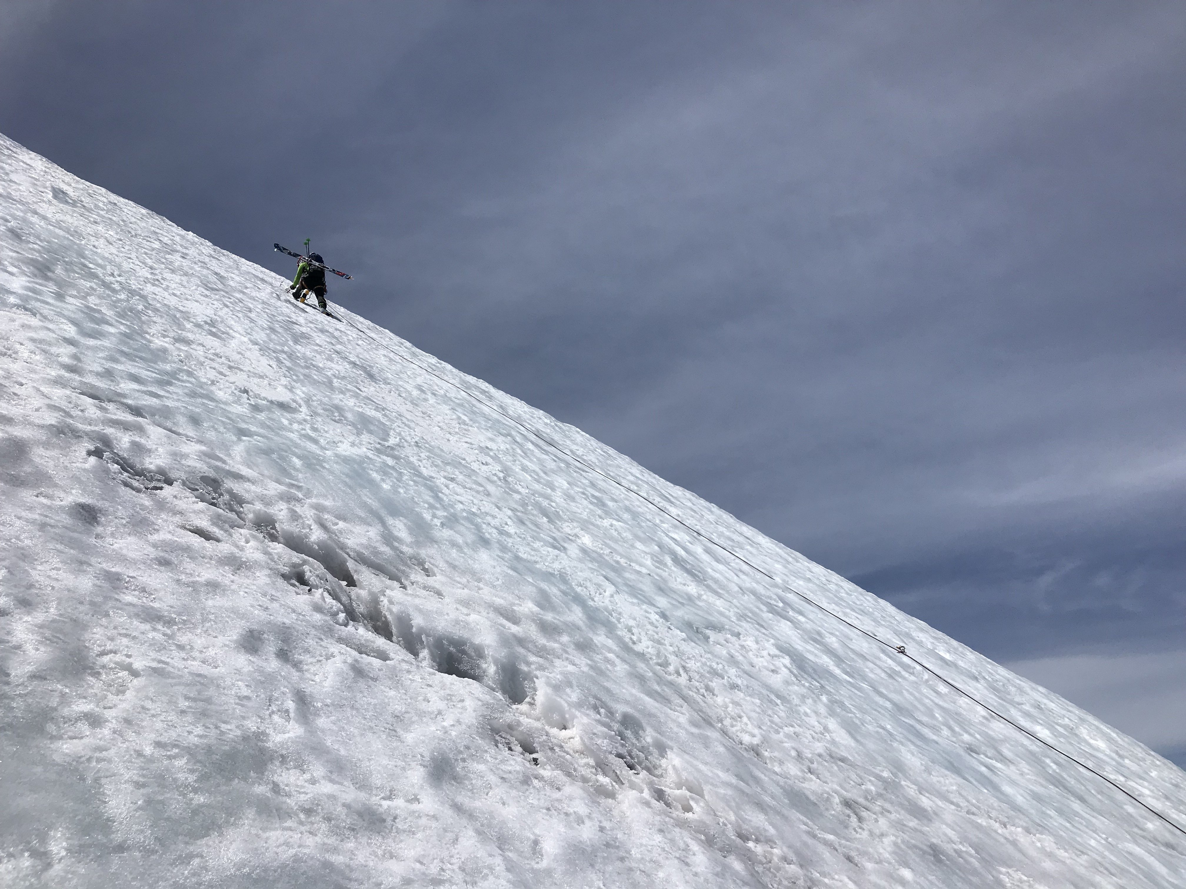
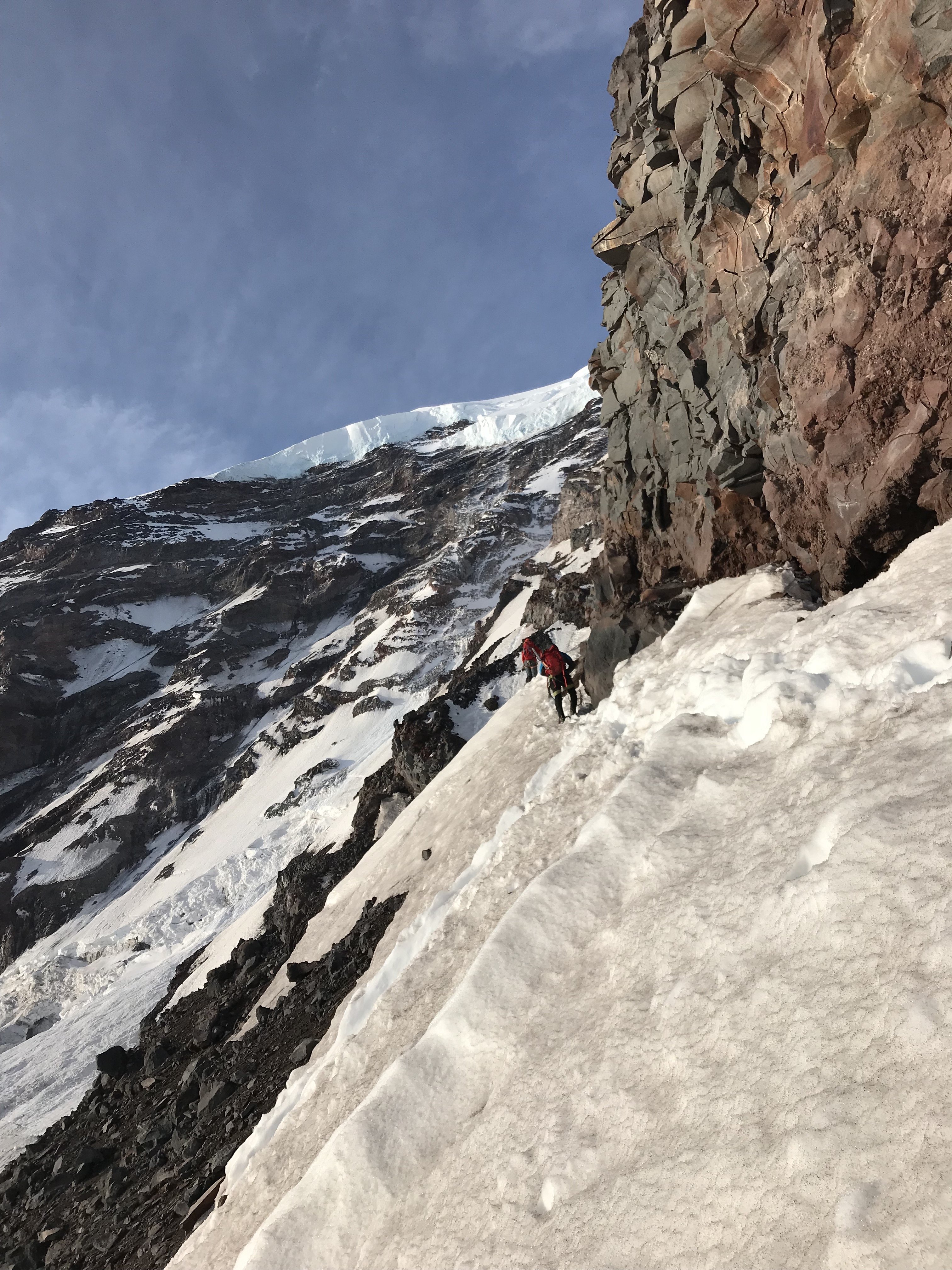
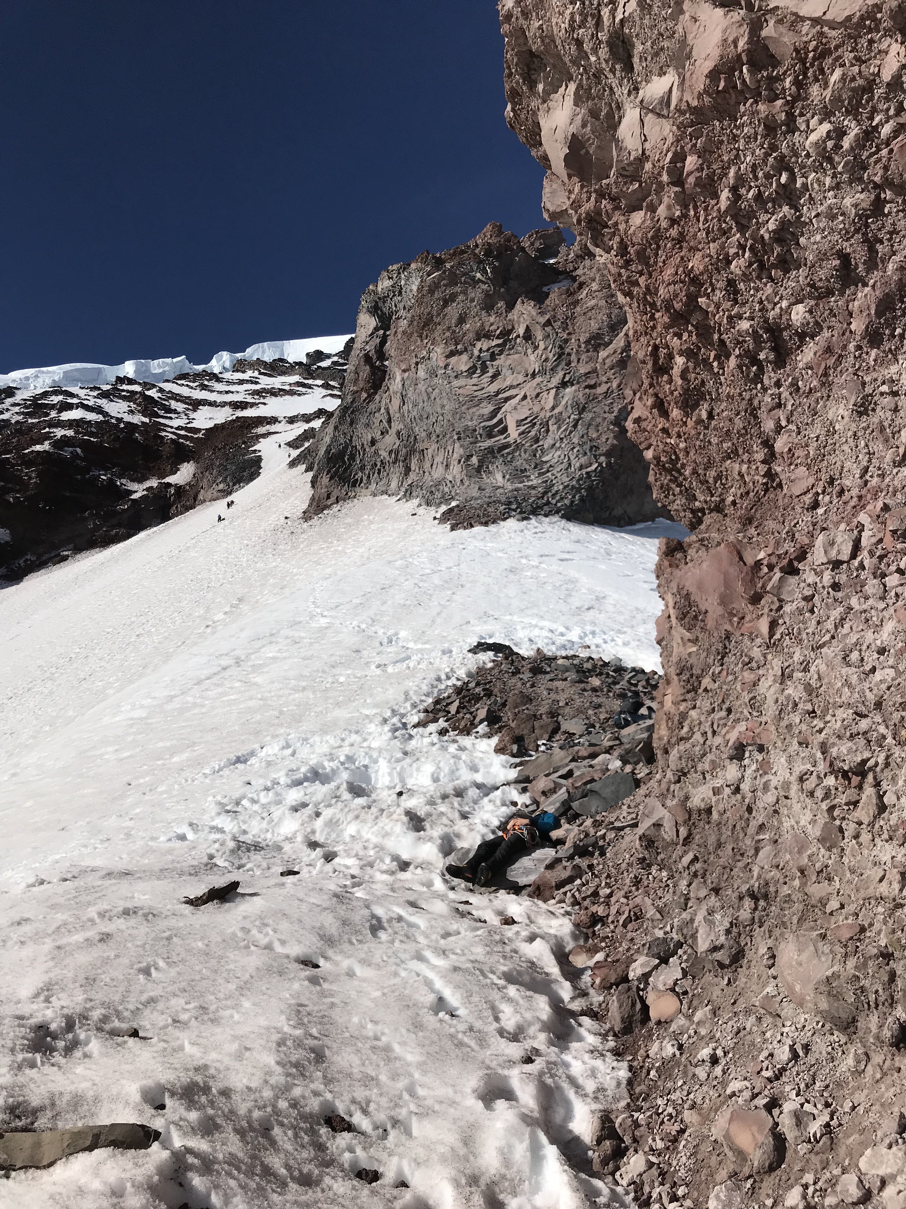
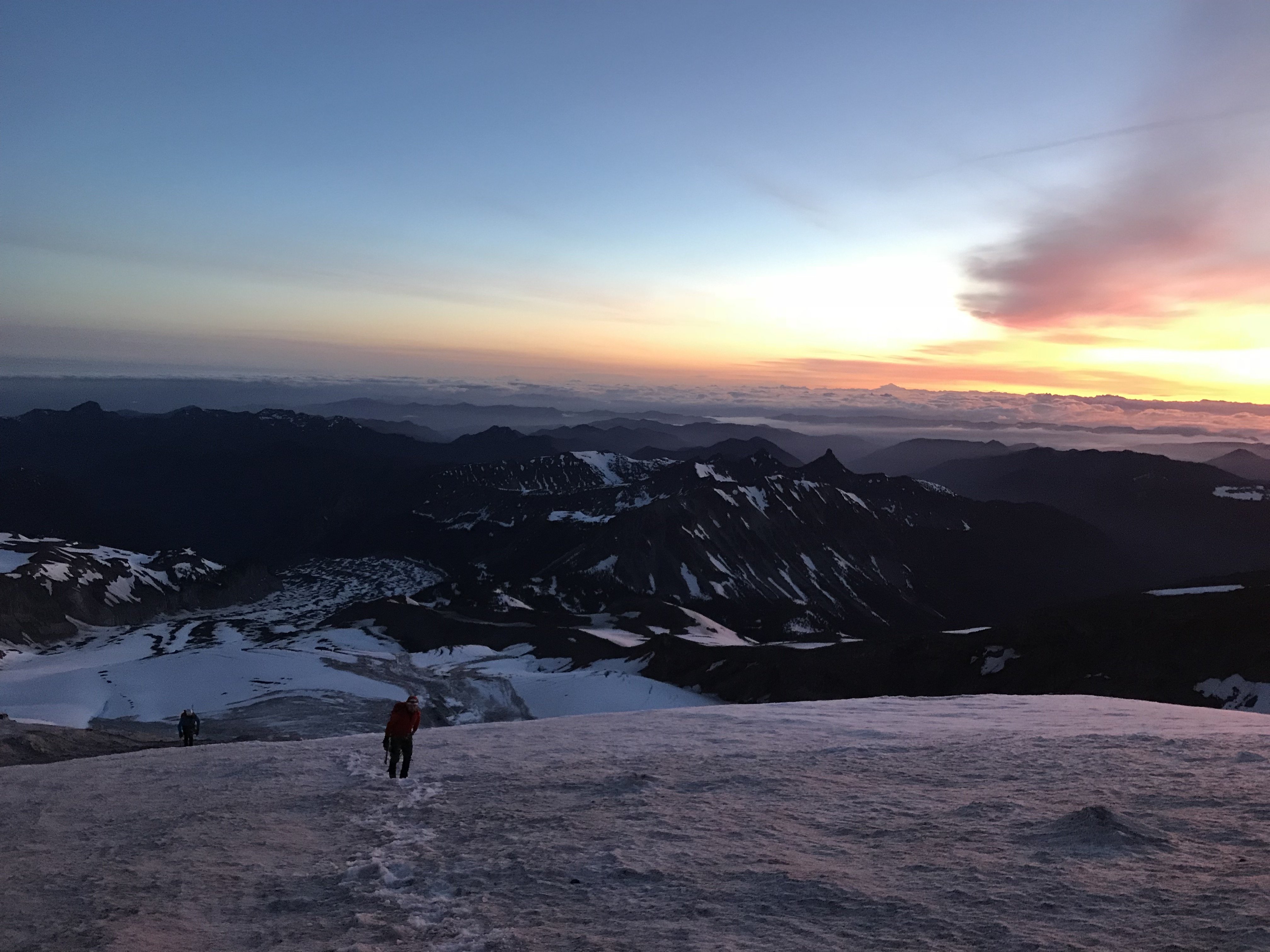
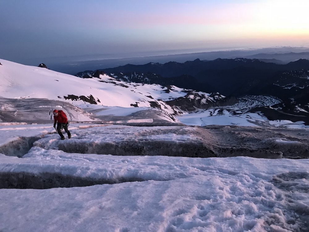
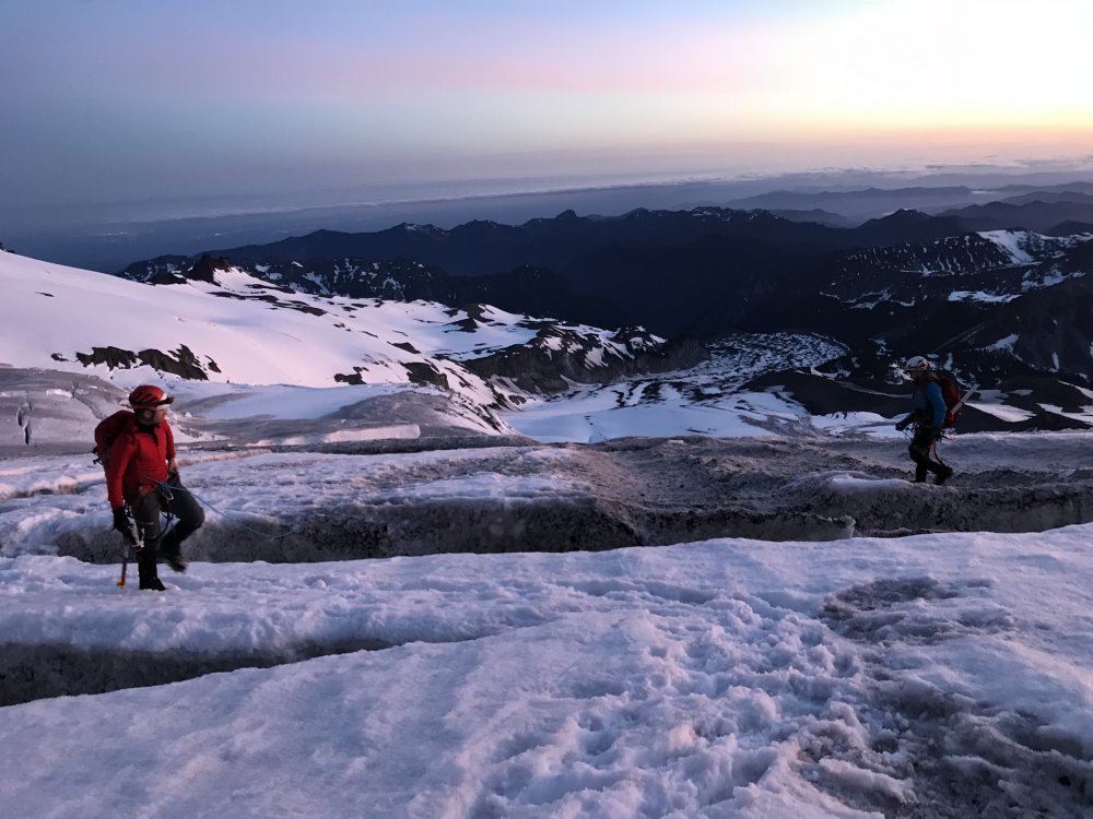
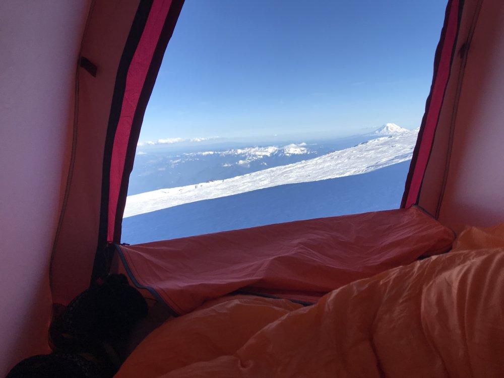
Trip: Mt. Rainier - Sunset Ridge Trip Date: 05/25/2018 Trip Report: Geezers on the Go or Fading into Sunset Ridge. Having done routes from Carbon River, White River, and Paradise I have always wanted to do a west side route. Two of my partners from many years joined in on the fun. The average age was 62 with a combined over 120 years in the hills. We did the usual hike from the West Side Road via the no longer maintained Tahoma Creek trail. From the along Emerald Ridge which we never saw cause we ascend into the clouds we gained the terminus of the Tahoma and crossed it somewhere. Eventually we broke out of the clouds and camped below Puyallup Cleaver at around 6800 feet. In the morning we gained the cleaver and followed it to around 8500 at which point we bailed left and crossed until the South Mowich. We roped up but the crossing was very straight forward and we headed up initial lower slope to 9500 feet. At this point there is a bergshrund across the whole of the lower apron/ridge. We crossed more to the left. Again straight forward but sloppy snow. We bivied at the bergshrund. The next morning hoping to have an overnight freeze which did not occurred we launched upwards. The climbing was at around 45 degrees. The higher up the firmer the snow got. We pretty much side stepped the vast majority of the route. We stayed mostly to the climbers left and found several places to rest. Including one great spot with 60-70 foot high conglomerate walls just waiting to pitch bowling ball sized rocks down. From here a few hundred feet more of climbing and we gained the ridge proper and had great views of Sunset Amphitheater. Until this point we had climbed roped or unroped sans any gear. Once on the ridge proper we followed it until we need to down climb around a short 30 foot section of bare rock (by passed via snow). This lead to the finial pinnacle which forces one out on to the Mowich Face. Here again the climbing was straight forward we stayed more climbers right (two pitches), traversed left (~one pitch), then gained the ridge (~one pitch). Overall 45-55 degree climbing with pickets. My one partner did most all of the leading, my excuse for not contributing was being tired having climbed S. Sister a few days before. Our other partner is just a geezer. After that we traversed the ridge to Liberty Cap which was good fun cause we could see where in the past we had topped on either the Central or North Mowich headwalls, Ptarmigan (including an infamous bivy), Liberty and Curtis Ridge. So it was a bit of nostalgia for all. Especially for me since Sunset Ridge was my 10th different route on the hill and exactly 35 years to the weekend since my first attempt on Rainier. Overall conditions were a bit soft at the mid elevations. The approach was manageable even in the clouds. Route finding was straigtforward. On the other hand, we slept warm - including the last night less than 100 feet below Columbia Cap. I'll add some photos soon. Oh, being from out of the area we stayed at Gateway Inn and Cabins which is right before the Park entrance before and after our climb. The folks are very accommodating so I'll give them a plug. Gear Notes: 3 Pickets and 3 screws (the later not used). Two tools 60cm axe and 50 cm hammer. Approach Notes: West Side Road via Tahoma Creek1 point
-
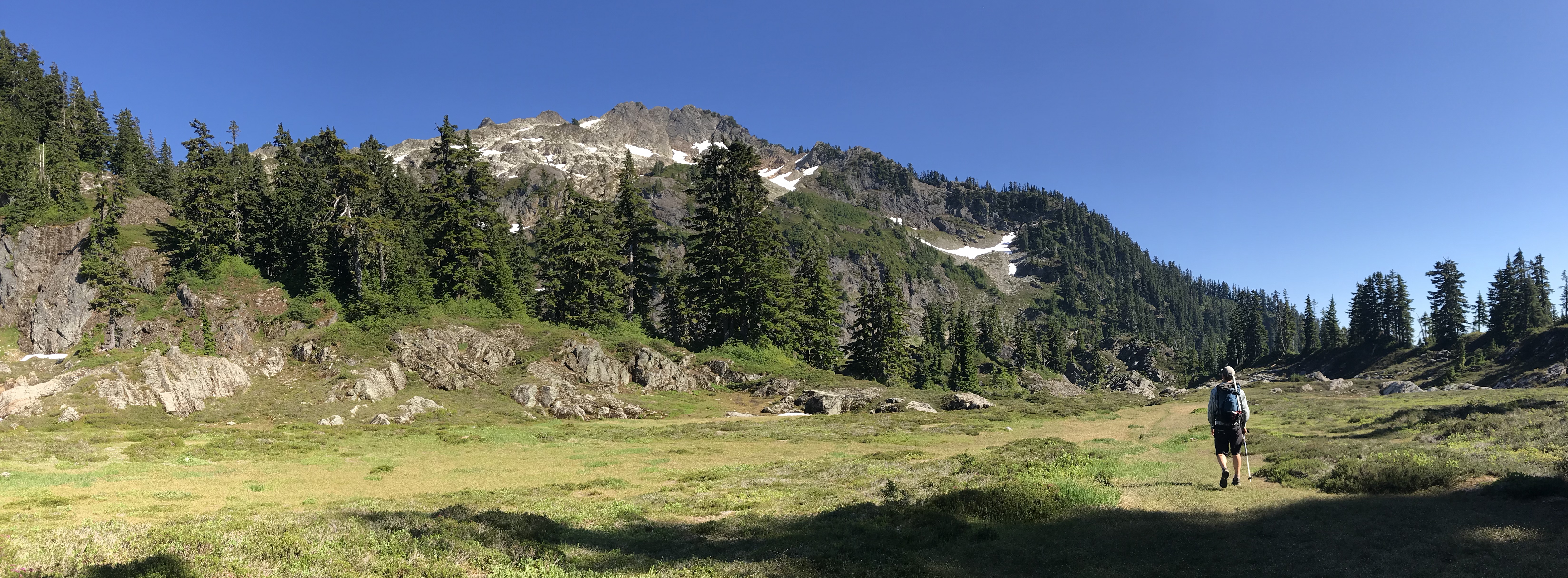
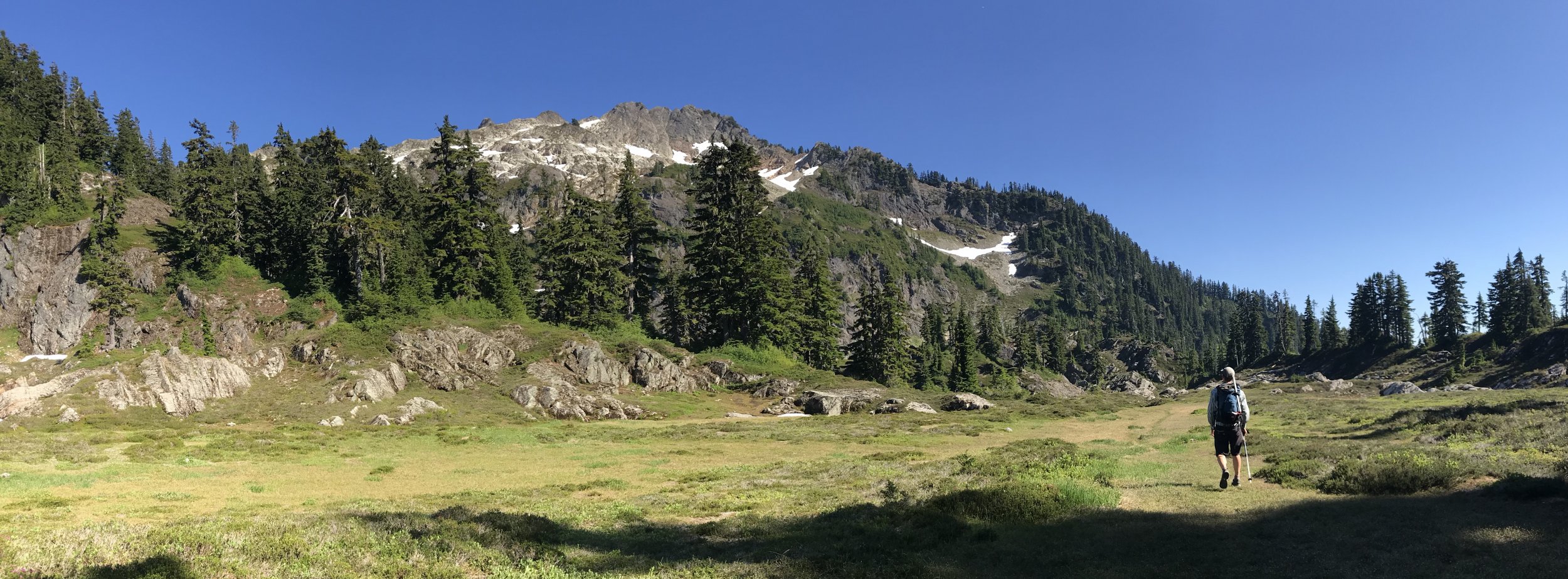
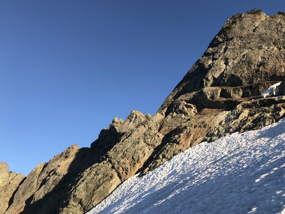
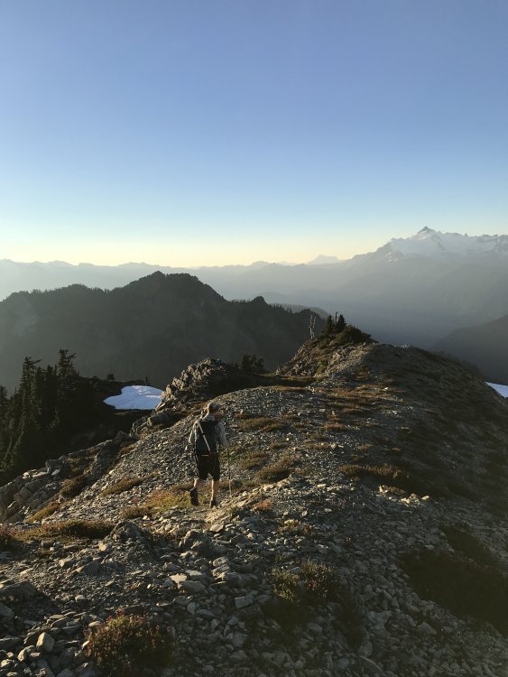
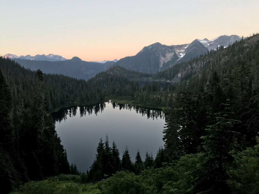
Trip: Watson - North Ridge Trip Date: 08/07/2018 Trip Report: Obscure, short and slabby with one of the mellowest approaches you’ll find in the North Cascades. Gloriously beautiful as well. Maybe not the highlight of your summer but possibly of your Tuesday evening. From the buttress toe a 150’ of 3rd or maybe 4th class rock leads to a more pronounced buttress. The original route climbs the obvious corner system on the north side (5.4 Kloke 1970’s). It’s also possible to move up left to the very crest and climb a full rope length of 5.6 on ridiculously clean and solid rock. A bit runout but gear (and/or fixed pins) show up where you need it. Continue on the crest, slightly dirtier rock, to the summit in one more pitch or wander off to either side. We descended east which involved some downclimbing, a rappel, a loose gully, a moat and some moderate snow. Supposedly a more straightforward descent might exist to the west if you carry over. Gear Notes: Small rack to 2.5”. 60m rope. Ice axe and possibly crampons. Approach Notes: Find you way to Upper Anderson Lake then faint path up gully at east side of first lake.


 1 point
 -
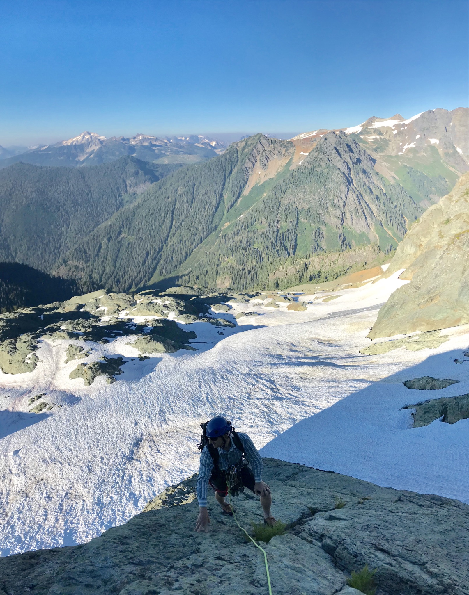
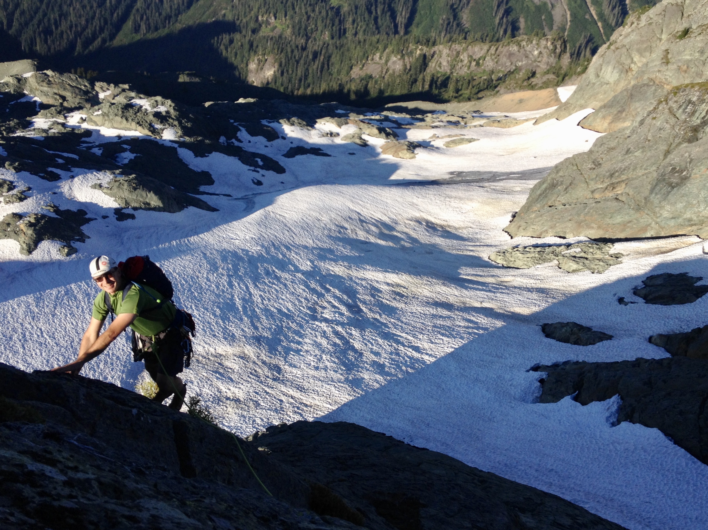
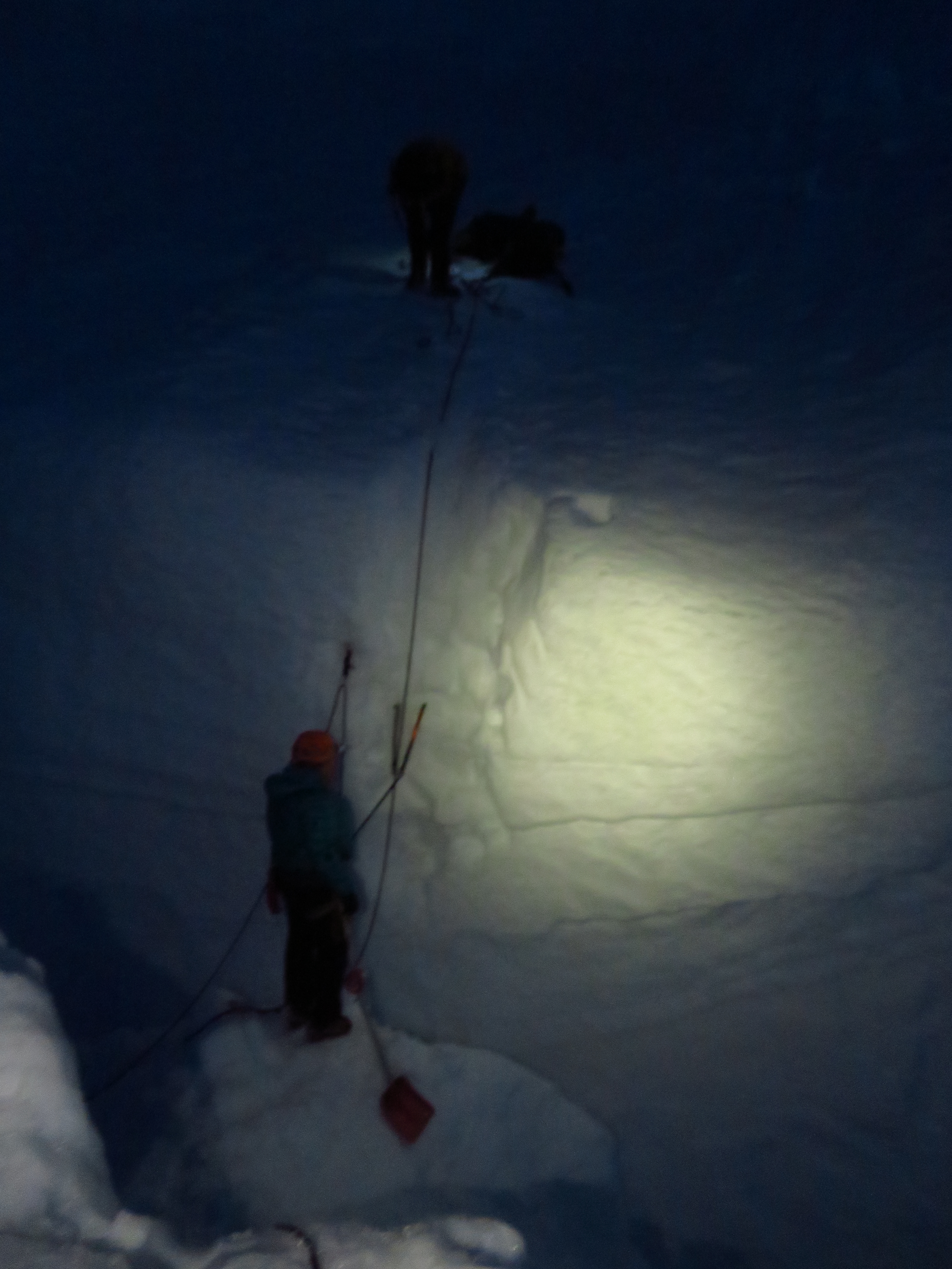
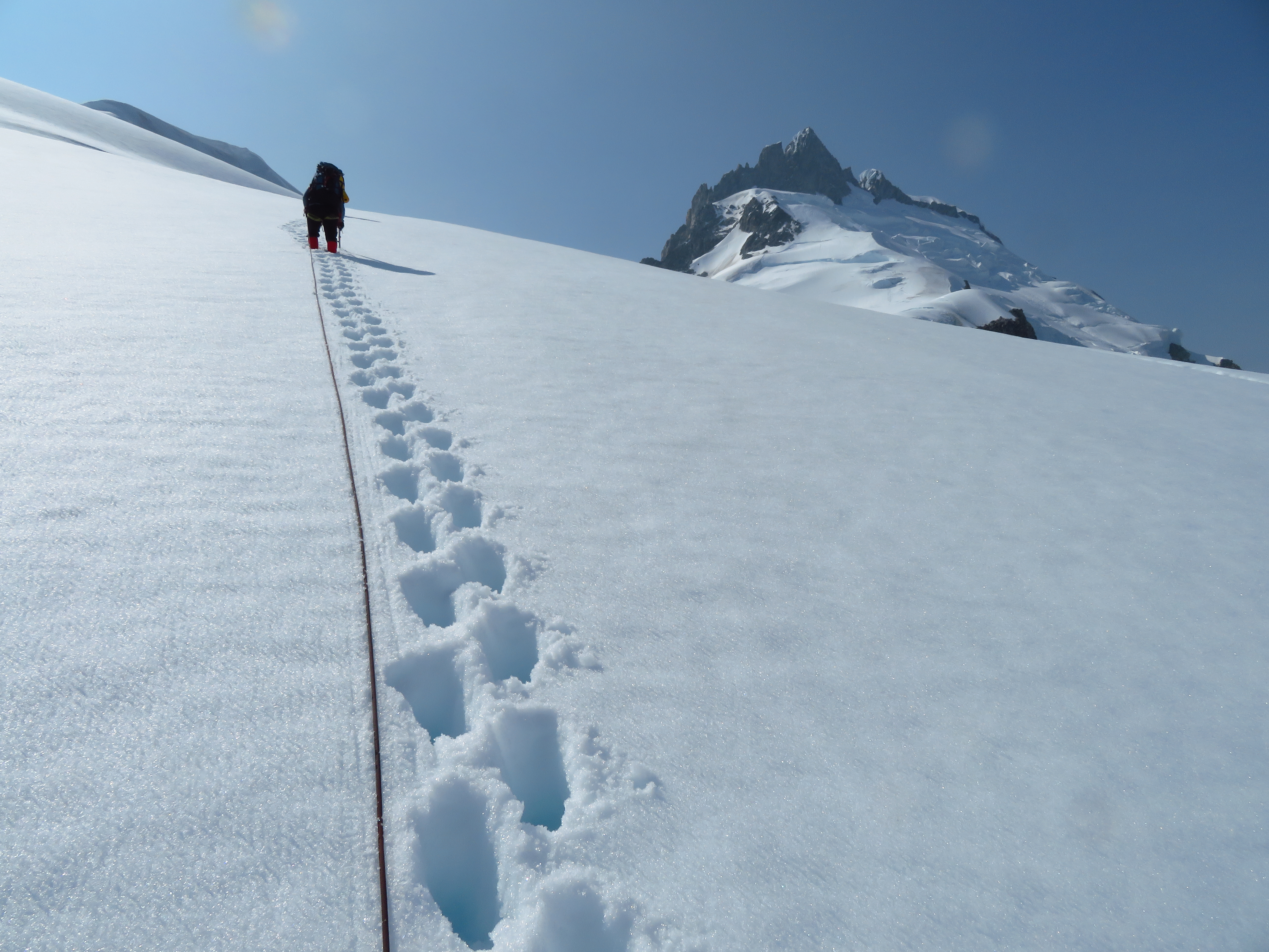
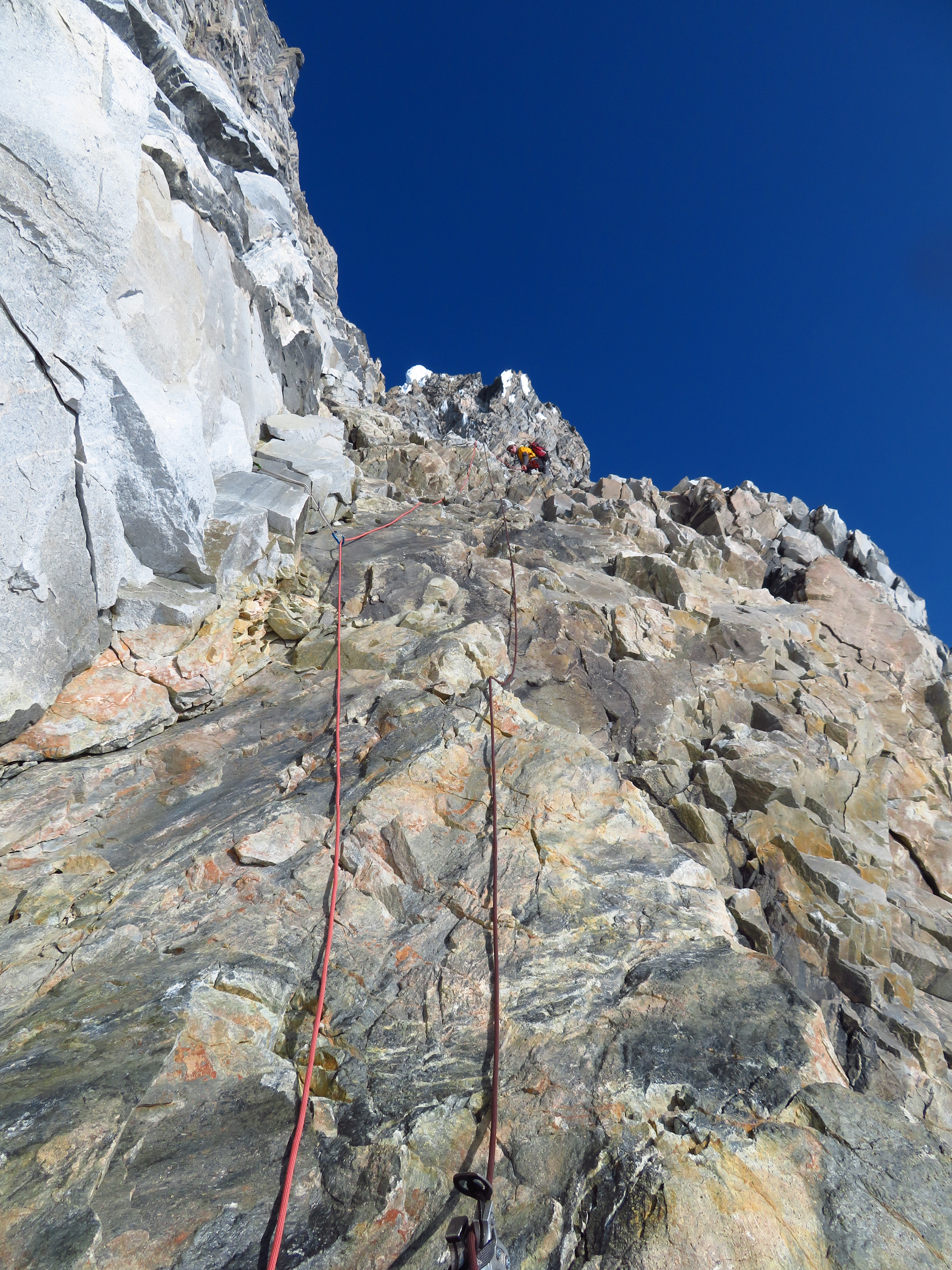
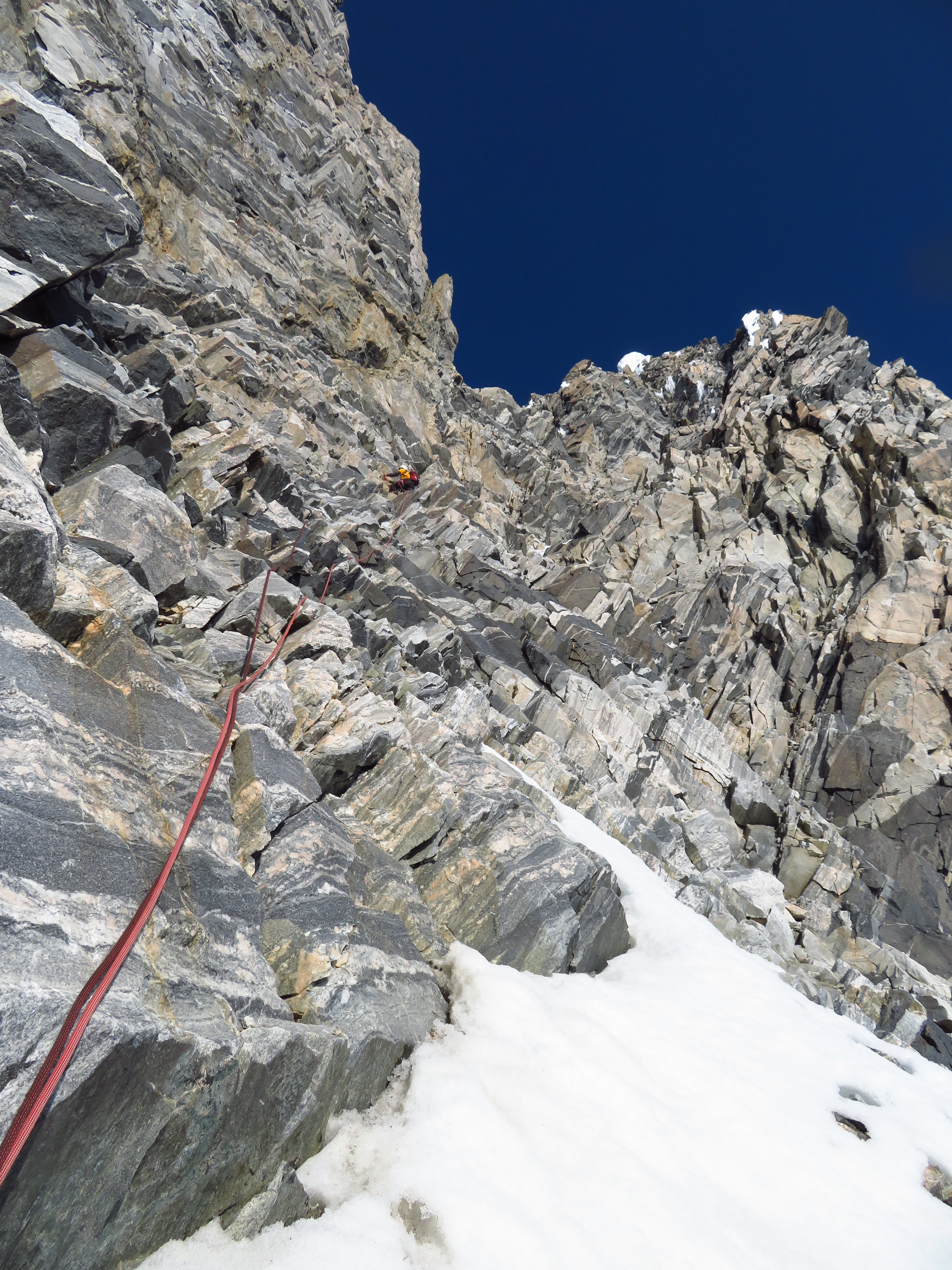
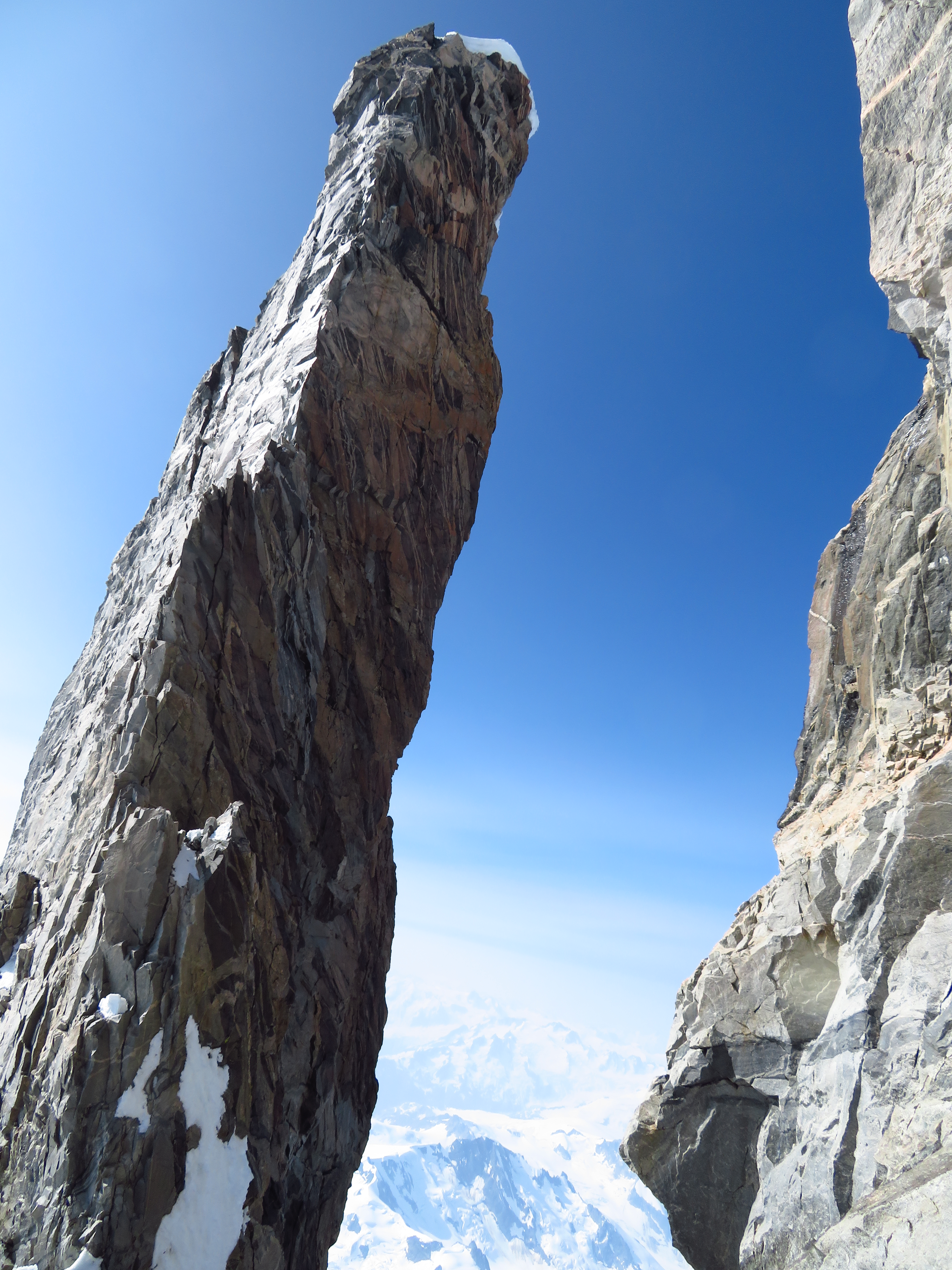
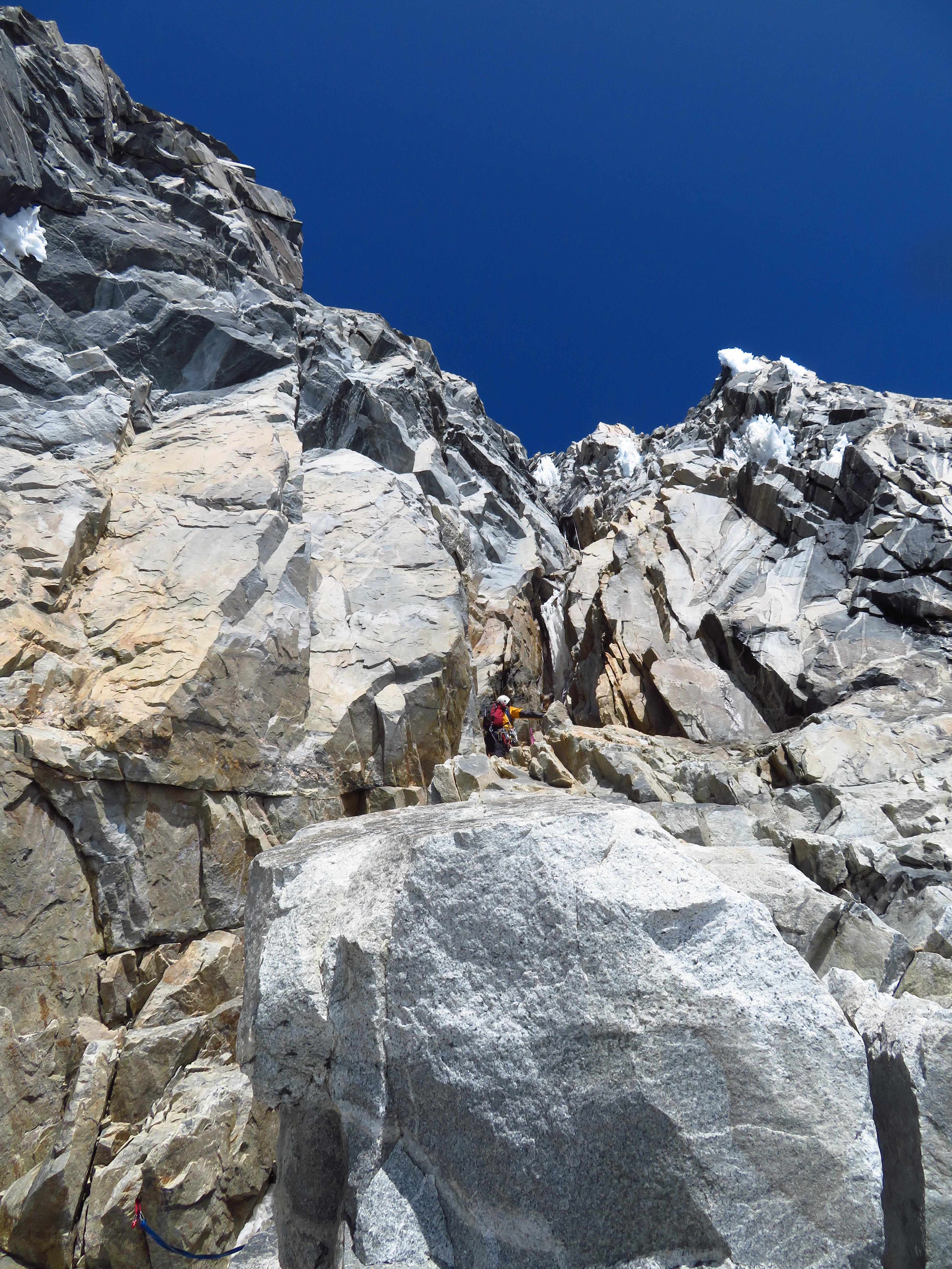
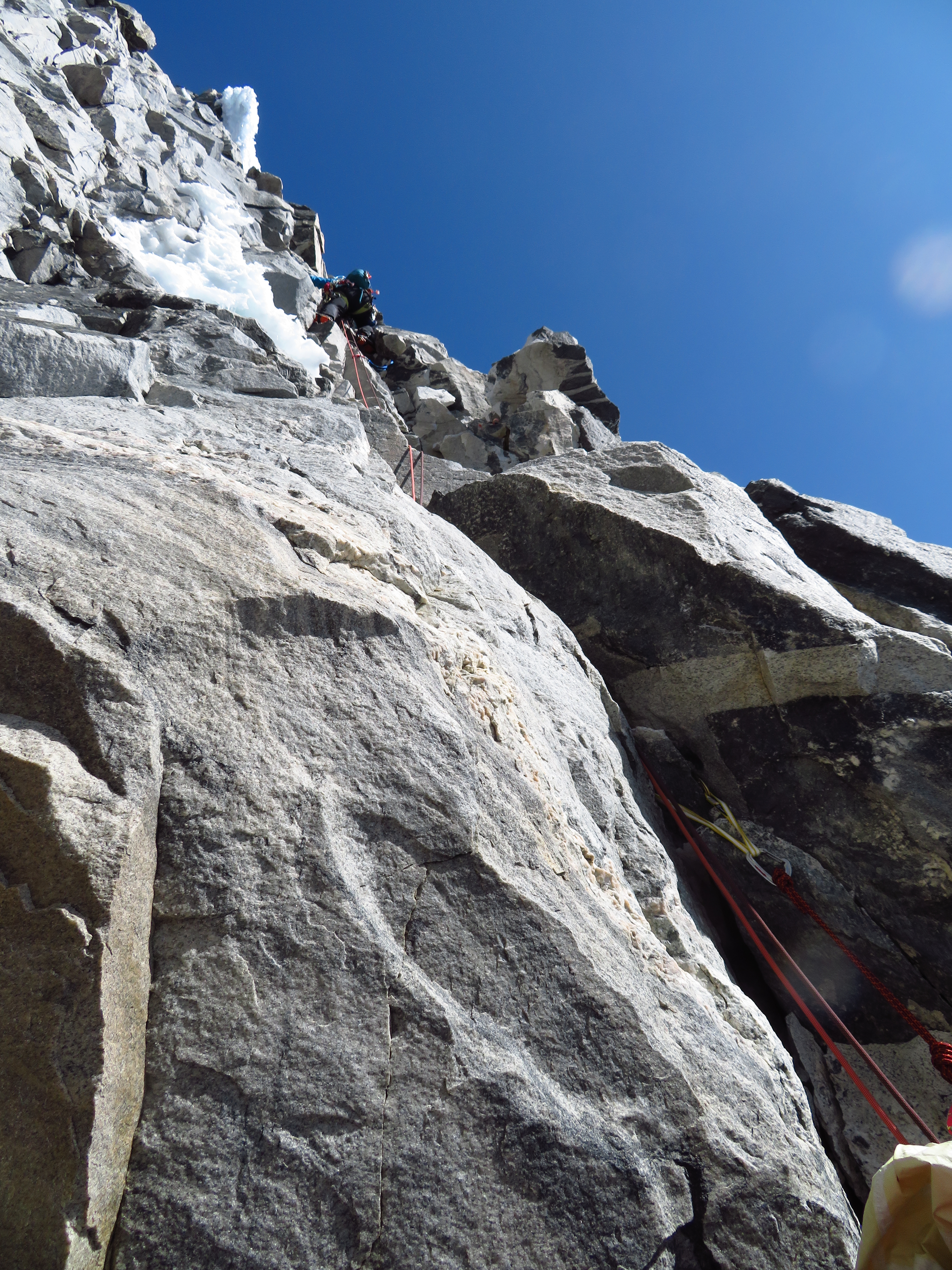
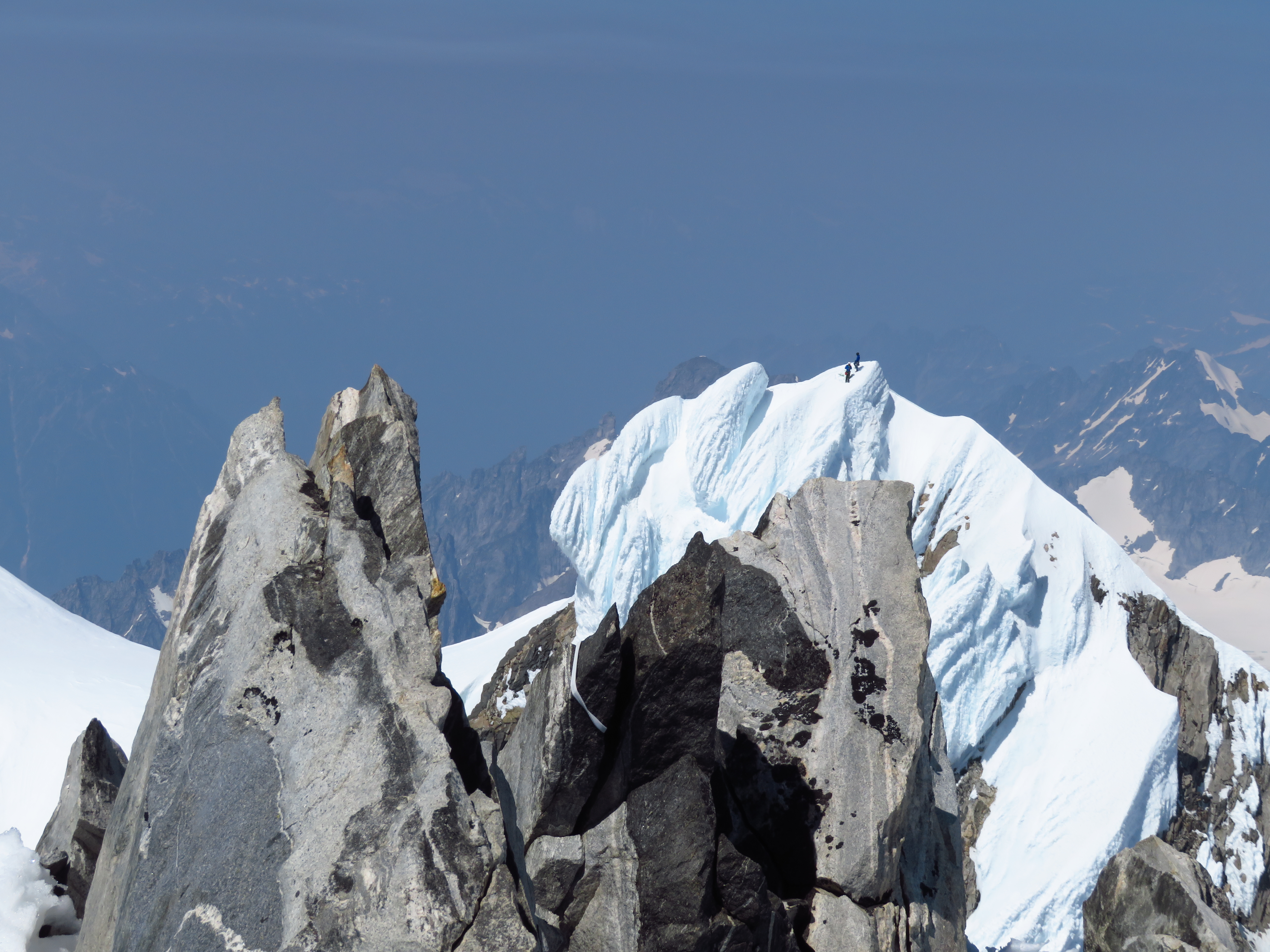
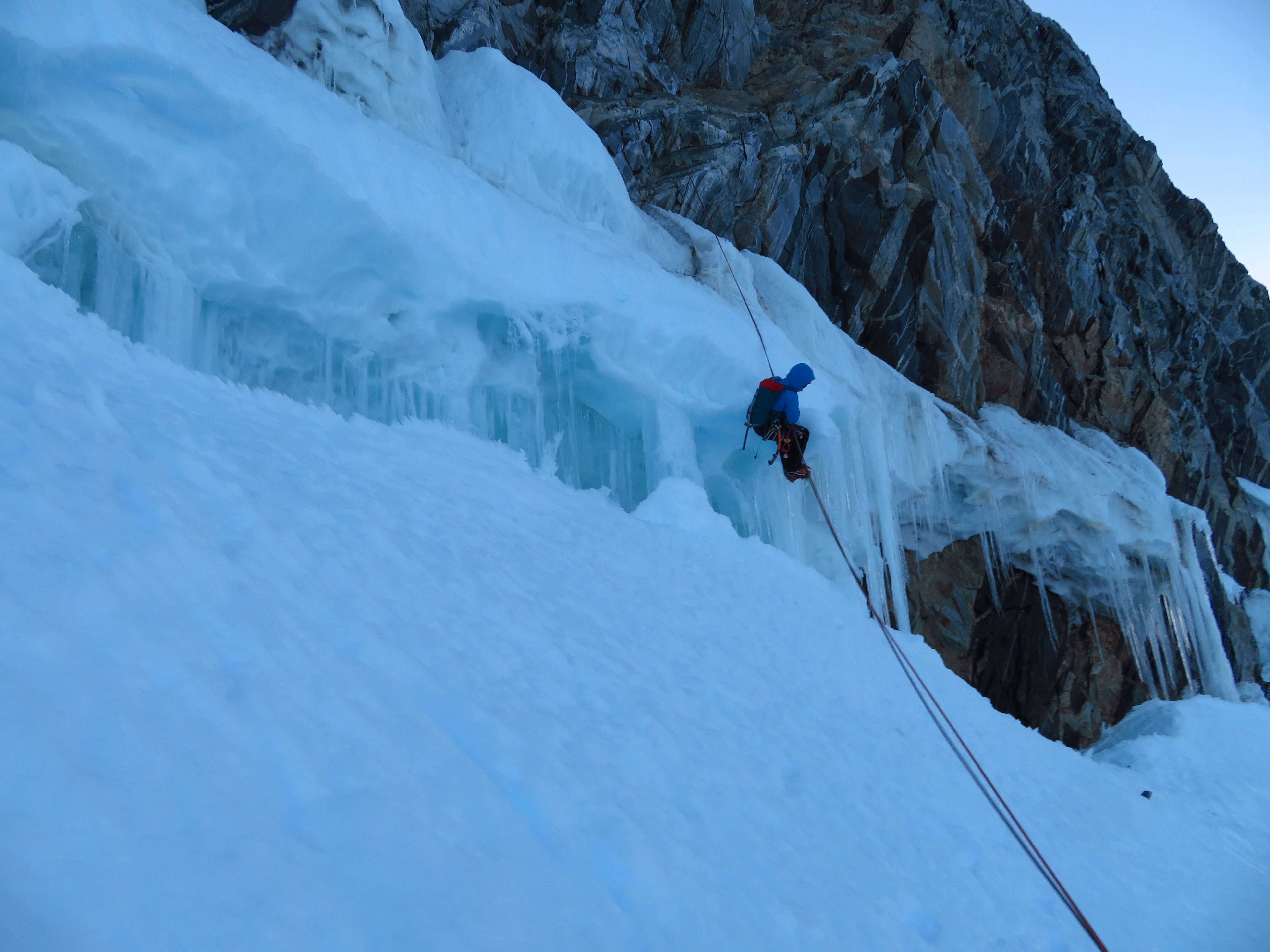
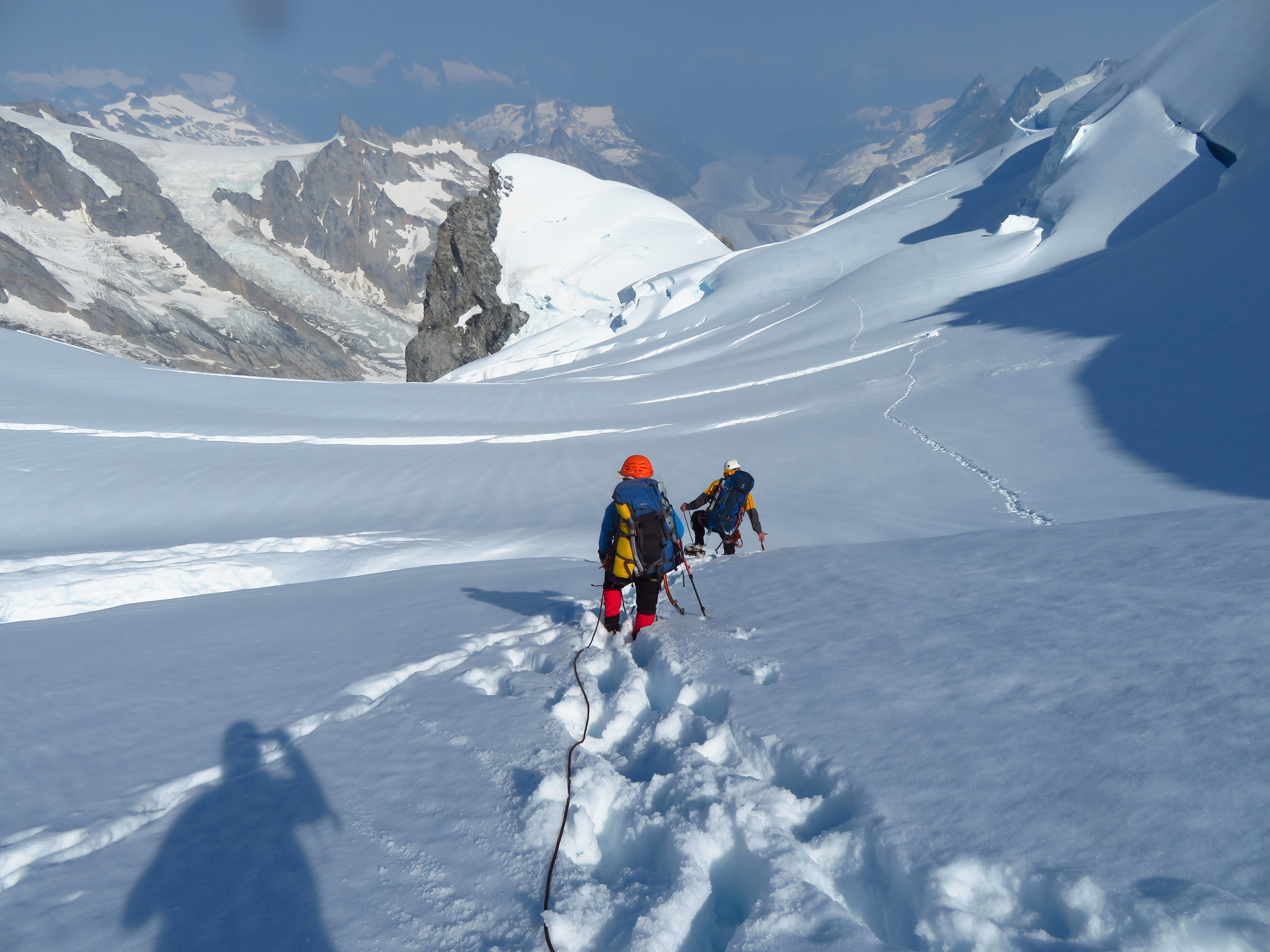
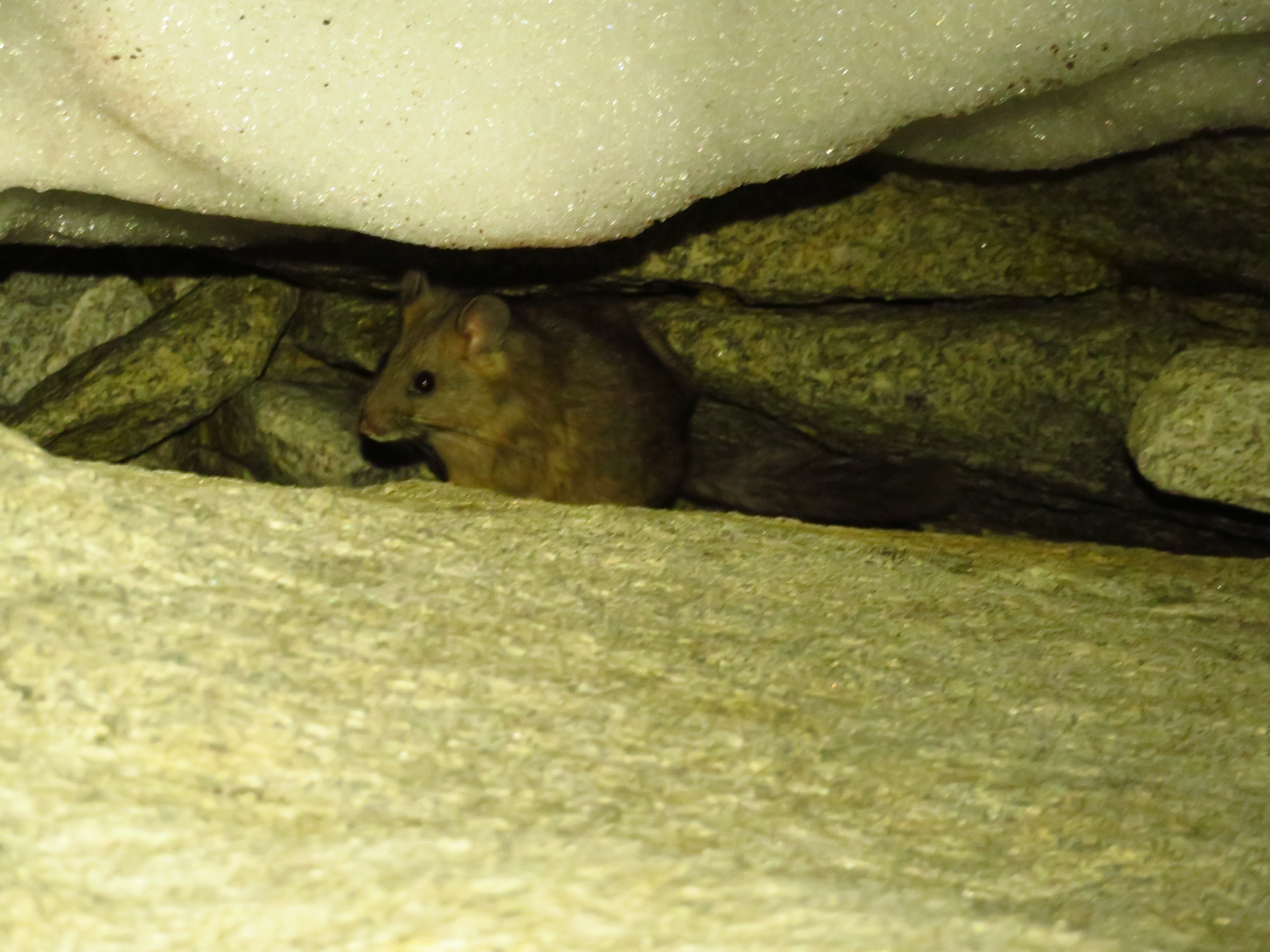
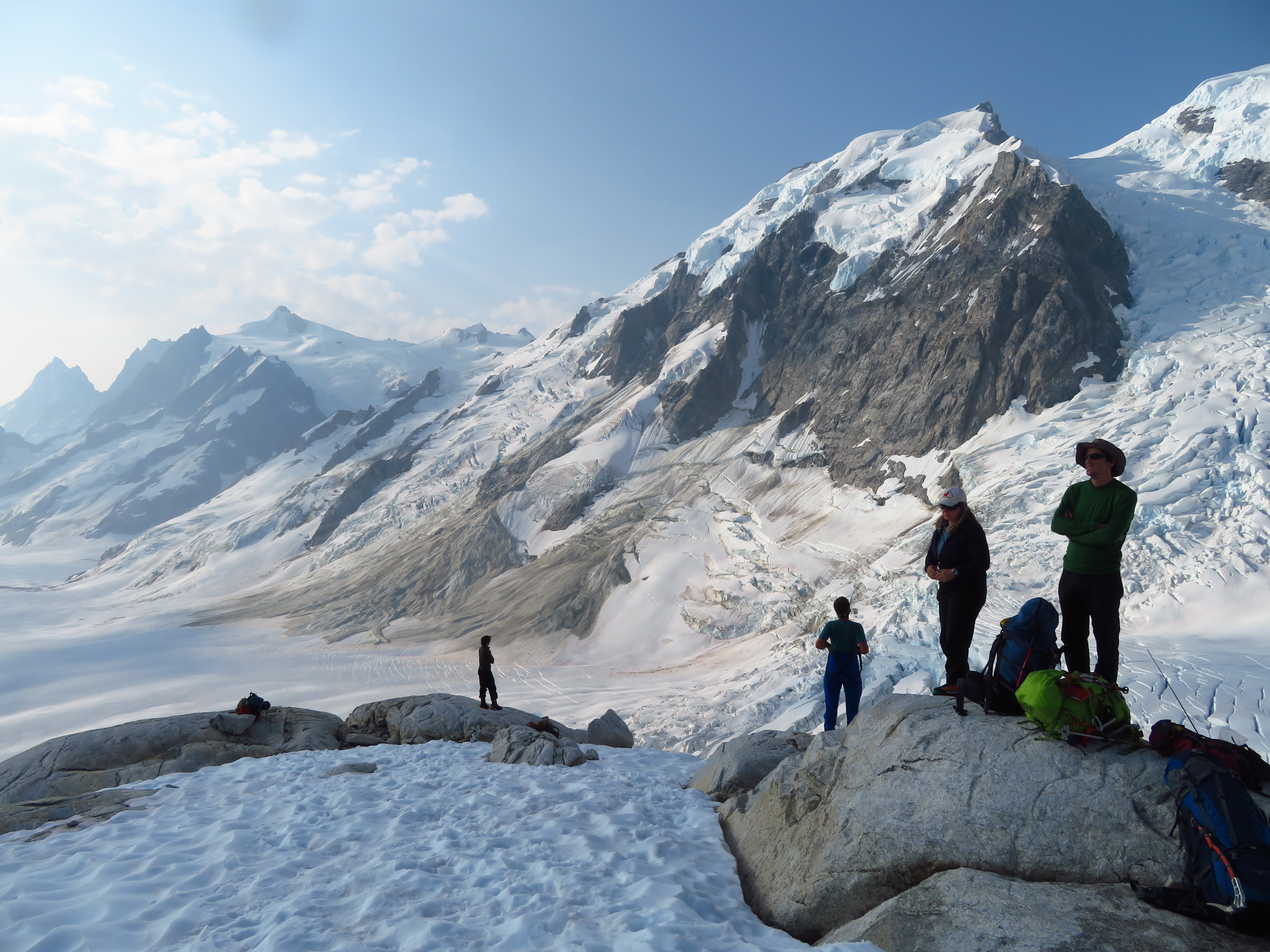
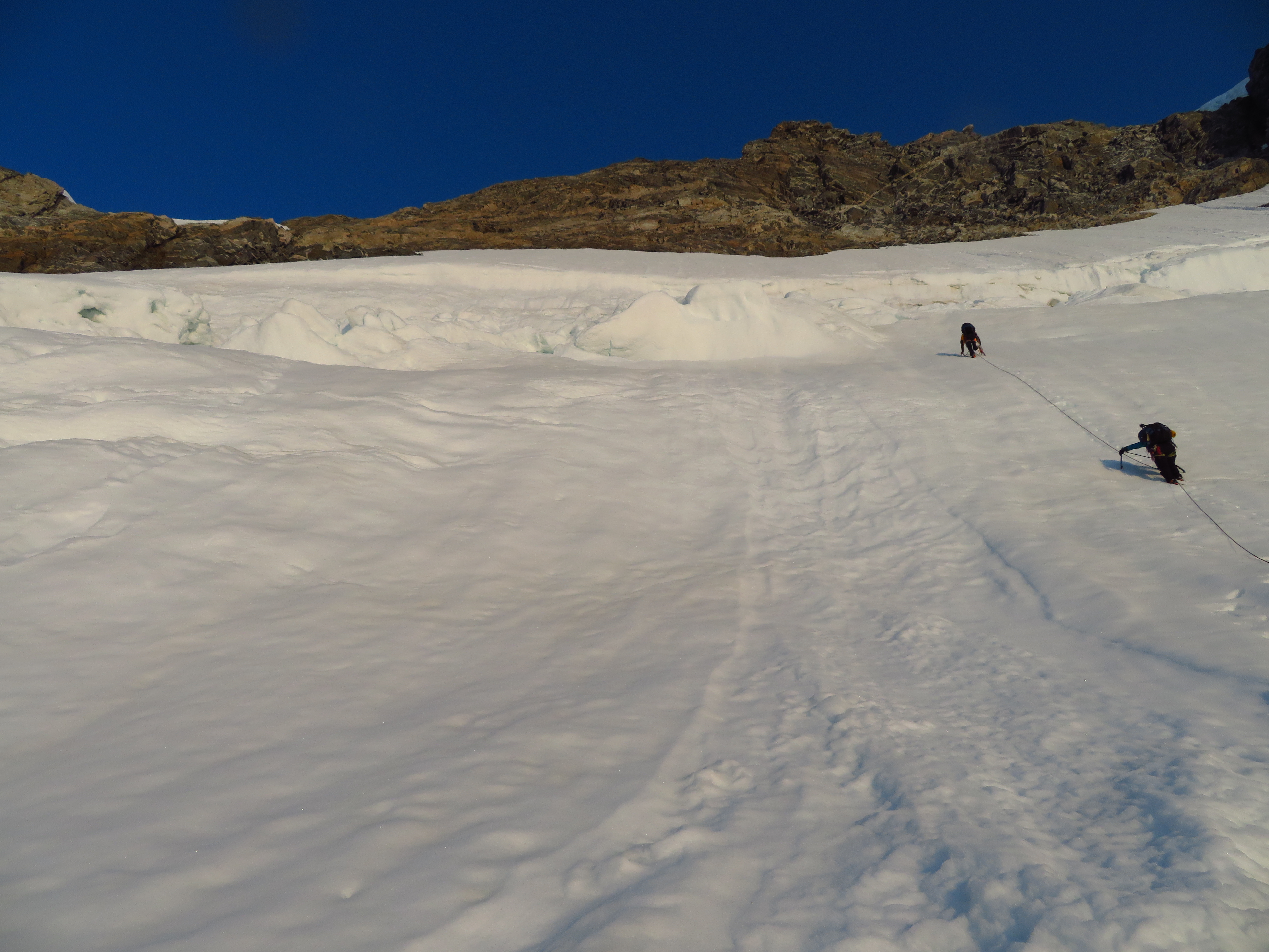
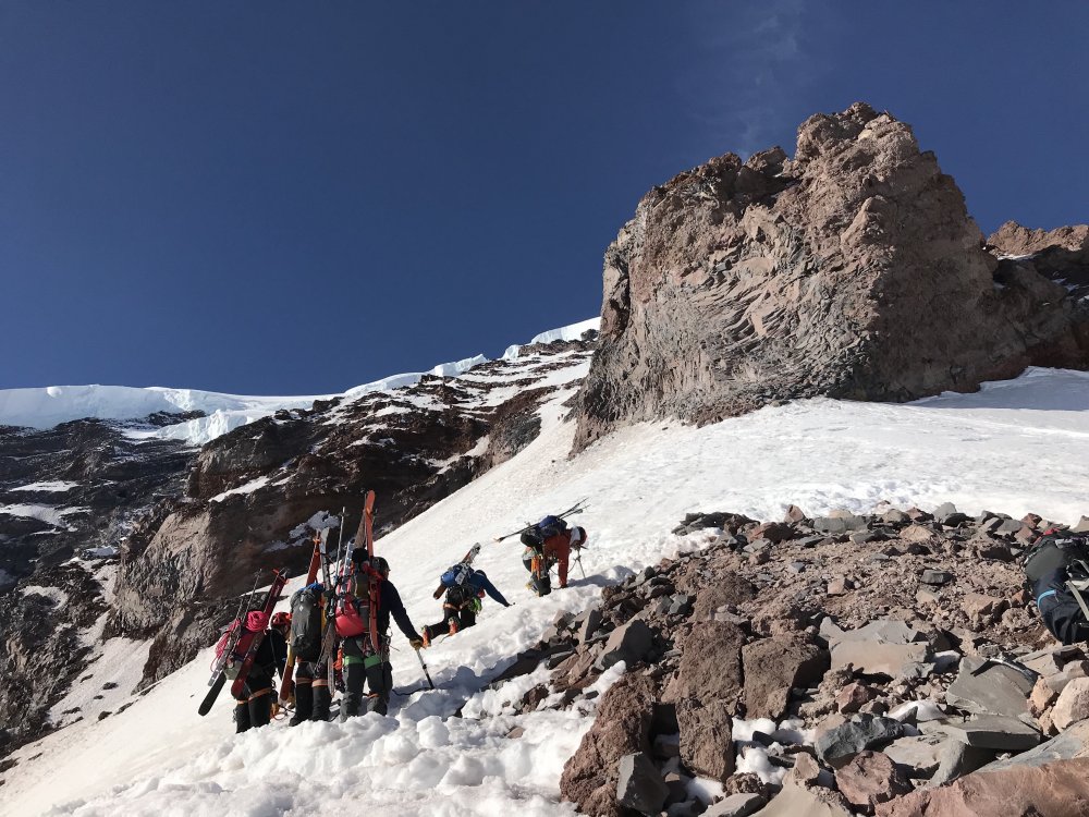
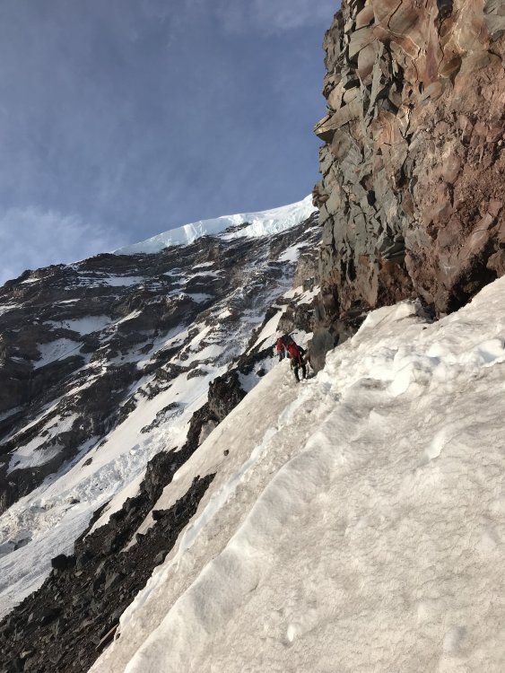
Trip: Waddington - Bravo Glacier to SE Chimney w/ Right Flank Trip Date: 07/24/2018 Trip Report: Fern, Vance and I climbed the standard route (& official Beckey Favorite) over the July 24 to 29 interval. We drove up on July 24th and spent the night camped at the end of the Whitesaddle airstrip at Bluff Lake. On July 25th we got an early morning flight to Rainy Knob. Conditions were ideal. We built a basecamp, stashed unneeded gear, ate, and spent the afternoon reading and kibitzing. We got an early night, got up at 11 PM, and started the climb, carrying three-day packs. Negotiating the Bravo Glacier at night required some intuition as well as info gleaned from a quick overflight while coming in to Rainy the day before. We got around most crevasses. One near the base of the east spur of Bravo Peak required some extensive overhead shovelling at its lowest point , on a mound of recent debris, by Vance to turn it from a slushy overhang to a more solid vertical wall. We hauled the packs on that one and got on top just at sunrise. Several hundred meters higher, we had to make a long horizontal traverse across a 65-70 degree shelf above another crevasse, where the lip had sheared off, to reach the upper snowfield. Easy scrambling and a snowslog got us to Bravo Col by about 9 AM. The snow had started to turn from firm to breakable crust by then, so after some crawling and knee-walking, we gave up, dug a snow hole, and spent a few hours napping and watching jet fighters do loop-de-loops up and down the Tiedemann and thru Combatant Col. Zoom, zoom. The sound of freedom! Around 4 PM we figured the crust was all gone, so we roped up once more and slogged through the slop to Spearman Saddle, where we set up ABC. The next day the alarm went off at 1:30 and we left camp by 3:15, not wanting to start the rock climbing in the dark. We had firm snow up to the base of the Tooth and found a traverse across the lip of a randkluft to get onto the actual Tooth traverse ledges at a prominent brown slabby scar. There wasn't much snow on the ledges, just lots of loose rock, so we pitched it out to the notch, and to the base of the actual SE chimneys. The actual chimneys had lots of loose rock and a little wet slush masquerading as ice pitches under the chockstones. We chose to take the Right Flank variation (169B in Don's guide) which provided mostly solid rock climbing with two avoidable rime gargoyle remnants to add spice. Two pitches of the Right Variation (which felt like 5.8 to me btw, but then again, we were climbing in boots and crampons, but mostly with bare hands) led to one more long easy pitch up the scree- and snow slope above the Chimneys and a 2 PM summit. There was a Seattle/Colorado party on the NW summit at the same time, which was entertaining because they gave a sense of scale to our photos. We hung out on top for almost an hour (complete with a horsefly - where do these things come from?) before heading down. The first rap was 60 m to the top of the Chimney. We made another 60 to below the first chockstone but managed to get the knot stuck. Vance tiblocked up the stuck rope, unstuck it, and made two shorter raps - 30 m to above the second chockstone and then 30 m back to us. We elected to continue back down the Tooth ledges rather than the Harvard Notch line because it was so dry that there was substantial loose rock visible down that route and you rap in the fall line there whereas rapping and downclimbing the ledges traverses, giving one some protection. We made a couple 30 m raps here, then tried a 60, hoping it would reach the snow, but it didn't and the rope got stuck again, this time just due to slab friction near the anchor. Fern freed it up, and we made one more 60 m over the schrund and were down on the snow by sunset. We got back to ABC around 11 PM, for around a 20 hour day. The next day we lazed until 3 pm and then set off down the Bravo. We rapped twice (from rock anchors) on the Cauldron headwall to avoid the serac-lip traverse, and once more at the overhanging serac, where we used a bollard plus picket to take a 30 m rap/cimb/rap shortcut through two overhanging crevasse walls and an intervening tottering ice fin. We got back to Rainy Knob basecamp at sunset. There is a ferocious snafflehound at Rainy Knob. She tried to eat my socks but I'd worn them for three days straight in my boots and they stank so bad she not only gave up, but left our Mountain House dinners alone too! On Sunday, we got a morning pickup by Mike King and were back in Bluff Lake by 9 and back in the Lower Mainland by dinnertime. Gear Notes: Three pickets, crampons (dual horizontal front points worked best), two tools each, nuts and cams to 3" (doubles 1" and 2"), six tricams, six pins. Many slings and webbing. Left pins, nuts, tricams and slings behind on the descent. Took four screws and didn't use them. Superlight 3-person tent for advanced base camp. Two stoves (one canister, one white gas). Double 60s. Four or five light jacket layers, softshell bibs. Temps varied from below freezing at night to 25C in the day. Approach Notes: Save yourself the extra two weeks of walking in and out and fly Whitesaddle. Vance had previously kayaked and skied from Vancouver to the NW summit so he had a fair comparison of means. He says the helicopter is much faster.1 point
-
1 point
-
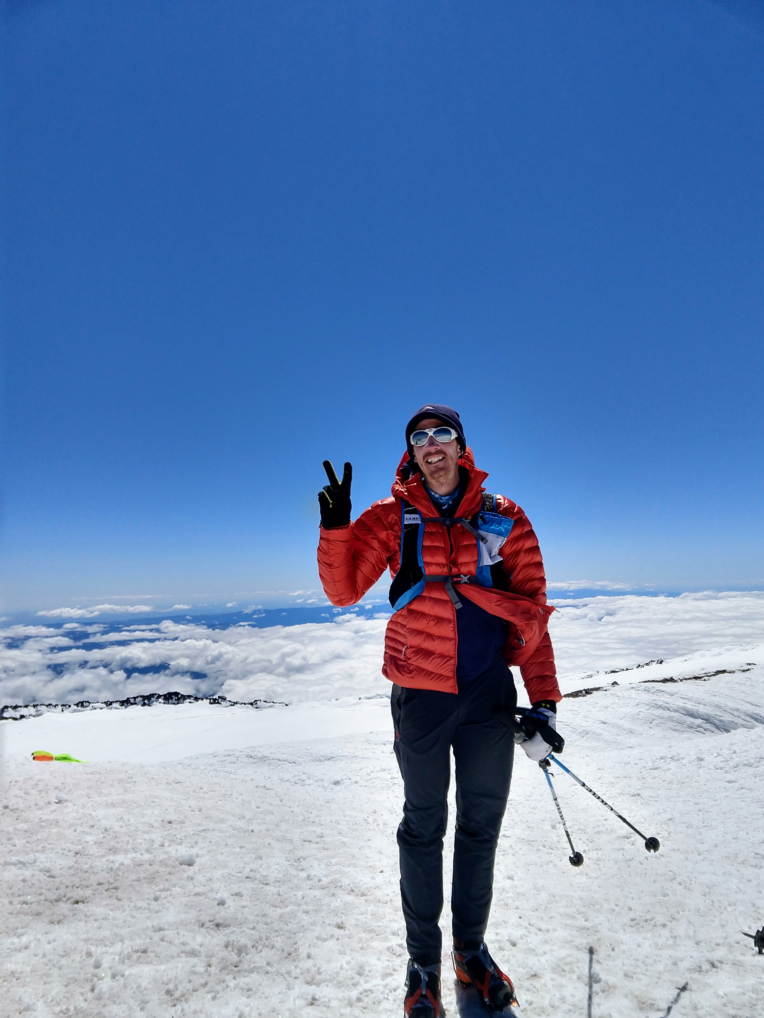
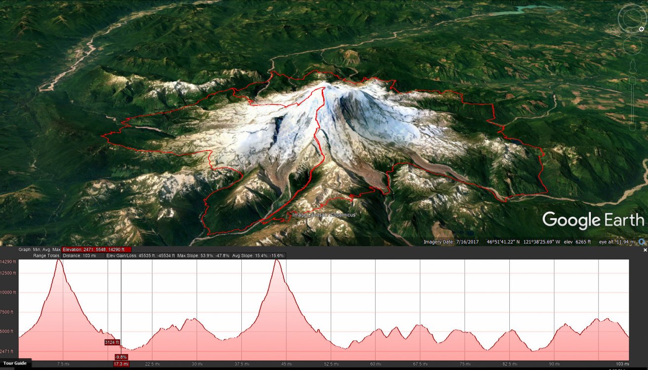
Hey all! Before this week I'd never climbed Tahoma, but after traversing the summit three times in five days and running all the way around the base, I can say I understand the special place this big mountain has in the hearts of all Cascade climbers. The combo of insane vertical relief, great access, well-established routes and stunning scenery make this one of the unique mountains of the world. A great way to experience this place, I thought, would be the "infinity loop". It's been done a couple times so far, and deserves more attention from the many dedicated mountain runners of the world. Though its certainly not a race, I think it's interesting to post times, to give others a sense of what might be possible and encourage motivated folks to train harder. Start (White River): June 22 3:23am End (White River): June 24 9:45pm Total: 66 hours and 22 minutes Mileage: 130ish Vertical gain: ~45 thousand feet Routes: up Emmons, down DC. Twice. One full lap of the Wonderland trail. Here's my trip report of the adventure: https://ropeandsummit.wordpress.com/2018/06/27/rainier-infinity-loop/ And my Instagram if you wanna follow along on future shenanigans: @ropeandsummit Thanks! Scott
 1 point
 -
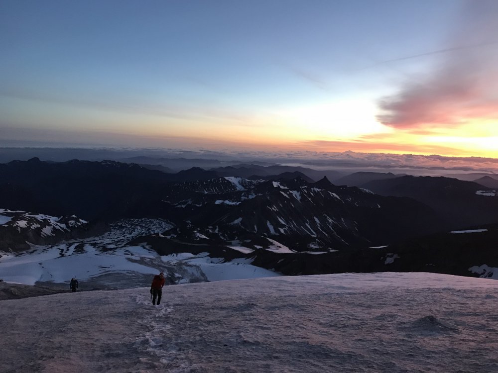
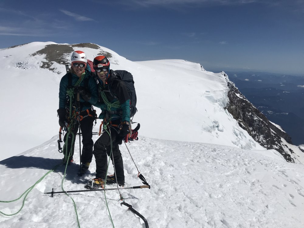
Trip: Mount Rainier - Liberty Ridge Trip Date: 05/27/2018 Trip Report: We were also on Liberty Ridge this Memorial Day weekend, climbing from Winthrop Glacier to the summit on Sunday. If you were climbing it on Sunday, there might be some photos of you here! Posting in case y'all are interested! Us: Summit camp: GPS tracks: topoMapsExport.gpx Gear Notes: IPhone Approach Notes: East side to gain Liberty ridge


 1 point