Leaderboard


Popular Content
Showing content with the highest reputation on 07/30/18 in all areas
-
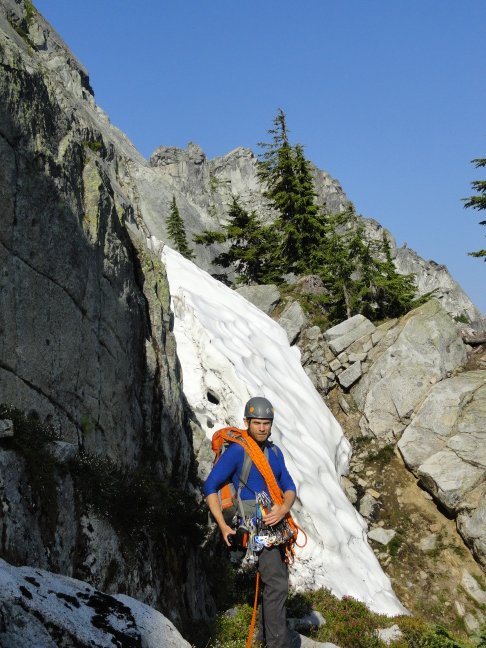
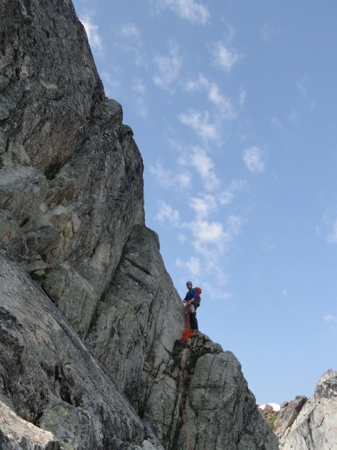
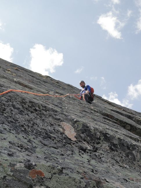
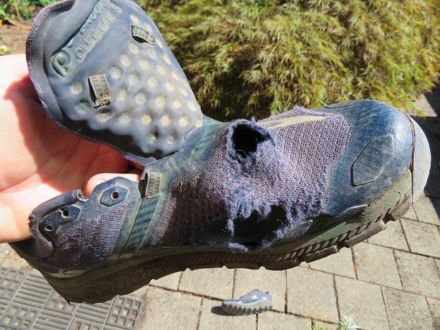
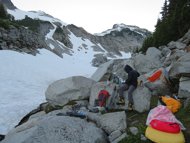
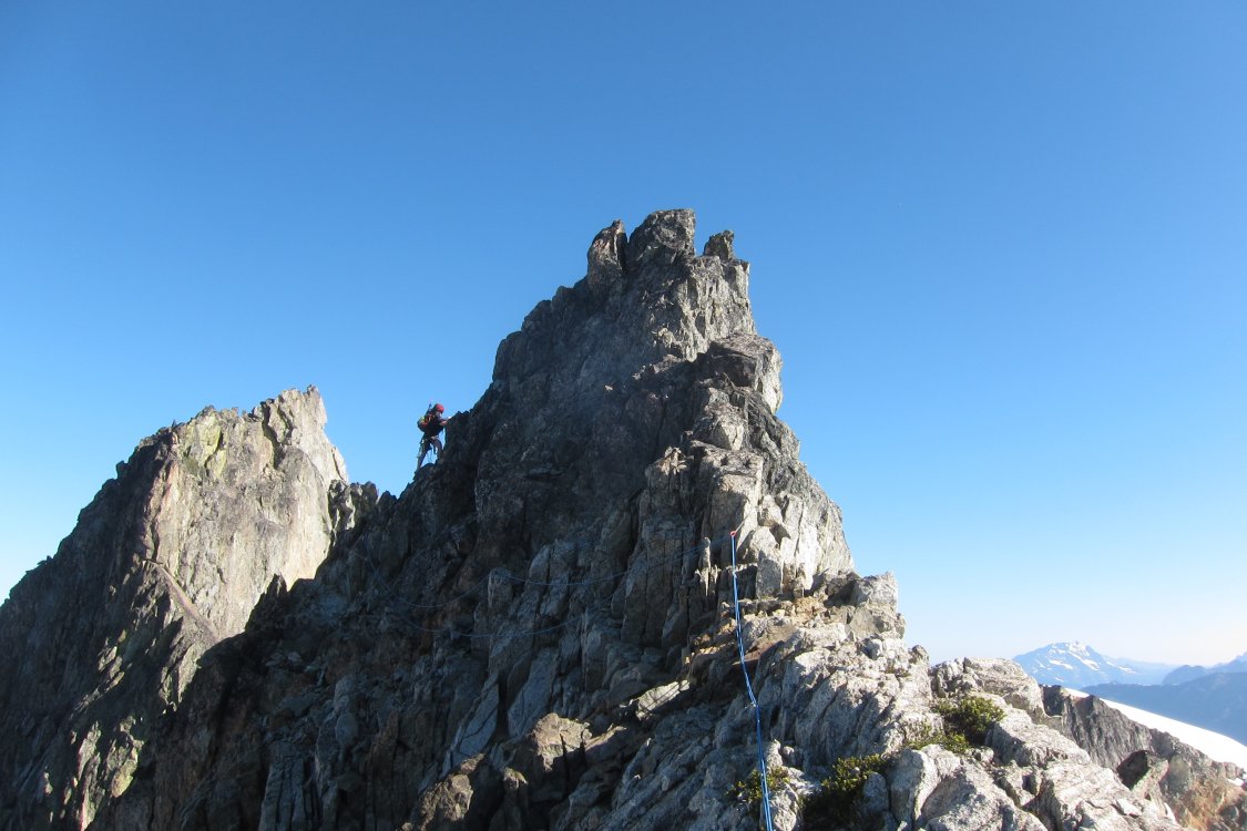
Trip: Vesper Peak - No Colusion with the Russian on Ragged Edge Trip Date: 07/27/2018 Trip Report: OlegV (The Russian) and I climbed Ragged Edge (Original start) on Vesper Peak Friday. Thanks a lot to Darin and Gene for putting up such an enjoyable route in a truly splendid setting. They are wonderful, tremendous, people! We had debated whether to bring ice axe and crampons. Our man Tom came to us and emailed us saying he had gone in there in June, and there was still a lot of snow. Tons of snow in June, folks! So we would want to take the axe and pons. But the Russian was very powerful in their assertion that there would be no snow, and that we'd want to go light. Now, my sources are very good people, and I trust my sources very much, but I can say this for sure. I didn't see why there would* be any snow up there! But the Russian tore his old trail running shoe on the approach. SAD! (image by the Russian) When we got to the lake in the bowl below Sperry and Vesper on Thursday, it was still covered with snow. There was just about one small patch of dry flat ground by the side of Vesper creek for us to bivy (image by the Russian): We were worried we'd be screwed by the snow. Lots of snow up there still, folks! Lots of it! But we had made the best approach from the trailhead - of all time! No one before us has made such a tremendous approach!! *I wanted to make a small clarification about my previous statement. I meant to say "I didn't see why there wouldn't be any snow up there". That should clear it all up, folks. I was in my Nepal Evos (don't have a lighter shoe that's as comfy ).That came in handy the next day to deal with the snow. We followed the trail up the East shoulder of Vesper. Where we wanted to cut across to the gap, the snow angle was not too bad. I cut steps, and the Russian was able to follow just fine. Luckily, the North side was all snow free! Who would've known?! Nobody knew, folks, nobody knew! There was just a small patch on the approach ledge, which we bypassed easily: Since we wasted enough time dealing with the snow, we decided to go for the original start as soon as we came up to it. The climb was a lot of fun. Thanks much for the bolts and the fixed anchors - just at the right places! And we could get a bunch of gear in otherwise. Here are some pics from the climb: The last pitch, with Copper Lake in the background: (At) The Summit with the Russian. Notice the Russian looks a lot more calm, composed, and in control ! The Russian made a bunch of video recordings. Who would record their partner? SAD! But in all the recordings, my voice is there in only one of them! It was great to get my fat ass up in the hills again after two years. But trust me folks, it's all a witch hunt, and there was no collusion with the Russian! Your favorite CC.com-er has done nothing wrong! We took our time lingering in the 'pine (wanted to avoid traffic driving back to Portland). But then we got delayed for almost an hour by construction on I-5. SAD! The 24-hr espresso drive-thru in Everett, and lots of fun conversation with the Russian kept me awake for the drive home. Among other things, we talked about obesity, epics in the mountains, Dan Smith, Maria Butina, etc. But there was no colusion! Gear Notes: We brought too much, placed much. Leave the axe and pons at home. Approach Notes: The 2.2 miles of dirt road to the trailhead (from the Mountain Loop Highway) is in bad shape for compact cars. I had to be super careful not to bottom out my Impreza! A highe(er) clearance vehicle is recommended.
 4 points
 -
Trip: Monte Cristo Area - Columbia, Kyes, Monte Cristo & Cadet Peaks Trip Date: 07/21/2018 Trip Report: Last Friday evening and Saturday I explored the Monte Cristo area by connecting four of the major peaks in a big full value alpine loop. I left the office early afternoon on Friday and found myself biking the old Monte Cristo road around typical quitting time. First view of Columbia set my spirits sailing: Couple hours later below the upper mountain: I made quick work of the scramble up Columbia and scouted Saturday's peaks. I wasn't sure if Kyes was going to be on the itinerary tomorrow, but the 5400' west face snow ramp was mostly connected and it all looked like it would go. Better yet, it looked as though their would be a snow traverse to Monte Cristo Peak high on the west side of Kyes: After descending down to 6000' on the west shoulder of Columbia I settled into my bivy for the night: I was up and moving across the 76 glacier towards Wilmans Pass and then Monte Cristo Pass early on Saturday morning. Looking down the Columbia glacier and Blanca Lake from Monte Cristo Pass: I descended to the glacier and on towards a large right facing gully and made my way up to the South Ridge of Kyes. Cresting the ridge gave this view of Kyes summit: Class 3 scramble on the left got me to the top. View towards the next course, Monte Cristo Peak: I descended the Kyes summit block back to the south ridge and found a short cliff leading down to the west face snow slopes. Two loose 15m raps got me over the cliff and traversing the steep snow of the west face, eventually leading to some rock scrambling and finally to the Kyes/MC col and then the north side of Monte Cristo Peak. From there I found the short fifth class pitch leading to class 3 scrambling above. A large moat blocked access to the rock, but the moat had caved in ~100' north of the rock pitch and I was able to scramble down in the moat and get to the rock pitch, now an extra 20' tall out of the icy hole. I self belayed the short fifth class pitch: And scrambled to the top. Immediately looking forward to my next peak, Cadet: Another couple raps and I was back on the snowy north face of MCP. Traverse to the north col, descend towards Glacier Basin. At ~EL 5800 I started a hard traverse towards the south face of Cadet. A perfect goat path led me across the bottom of the face where I eventually picked up the climbers trail to the top. The first trail of any kind I'd seen since Friday evening on the way to Columbia. Up the trail to the summit of Cadet, then reversing the trail down and into Glacier Basin with a view back up towards Monte Cristo Peak: Finally hustling back to the ghost town, my bike, and my truck, my home, and my family. Passing this on the way out. James Kyes was an interesting man. His memorial deserves some maintenance: The Monte Cristo area is a great compact alpine playground! Gear Notes: 30m rope, a couple pieces for Monte Cristo Peak Approach Notes: Bike the Old Monte Cristo road with the log crossing. I took the new old Wagon Road on the way out and it just adds extra mileage and worse, extra elevation gain.2 points
-
Slesse's pocket glacier is way less dangerous than this though:1 point
-
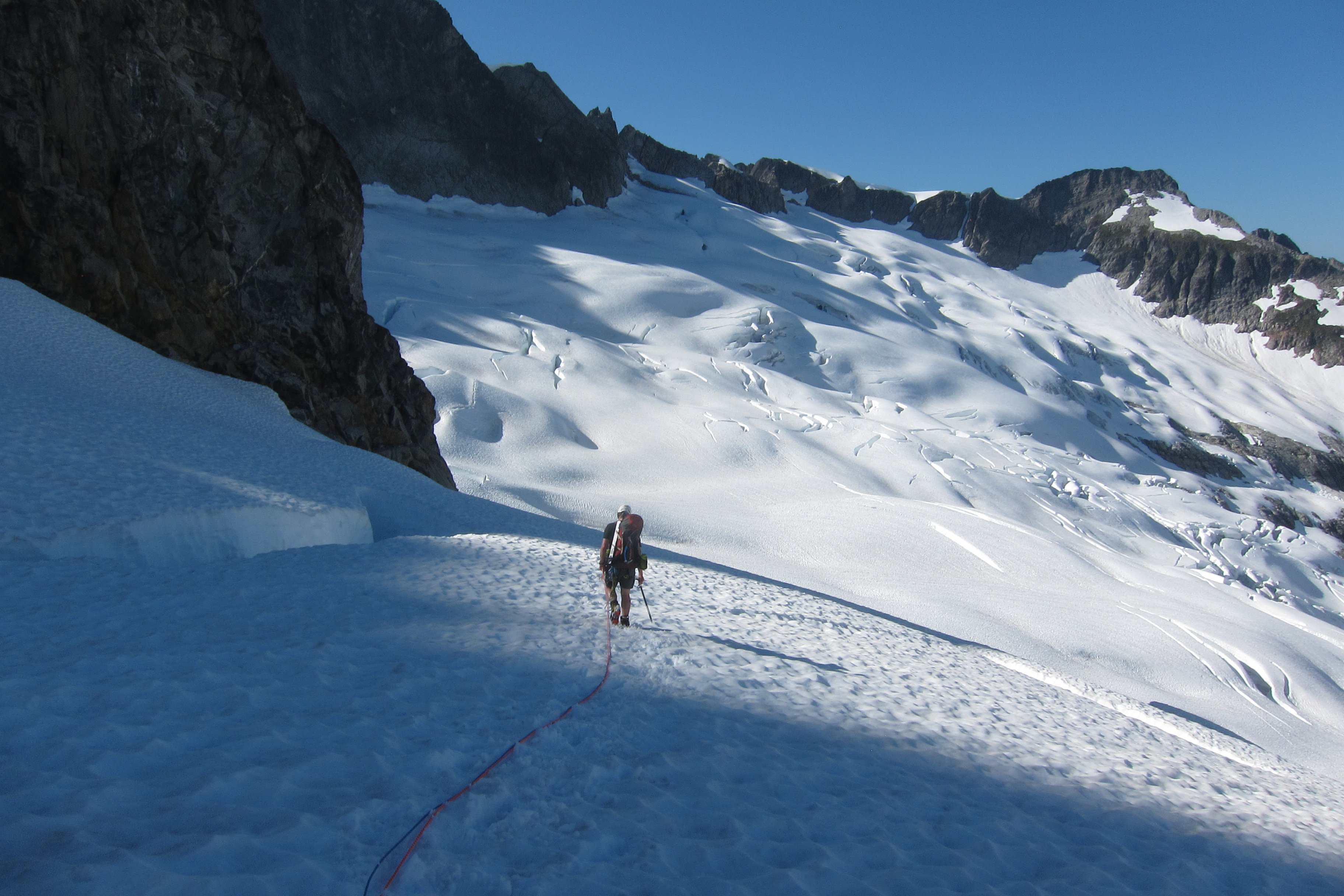
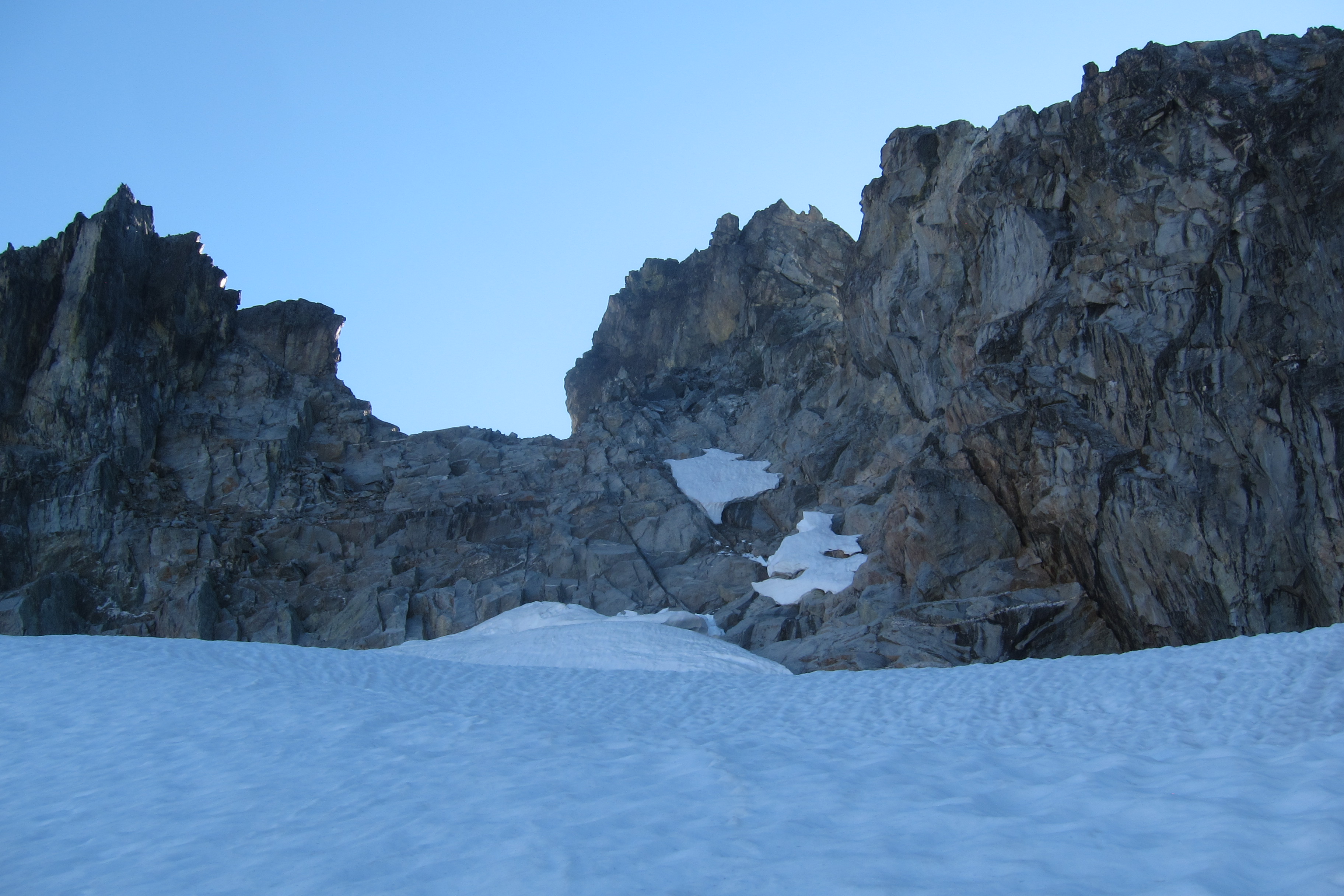
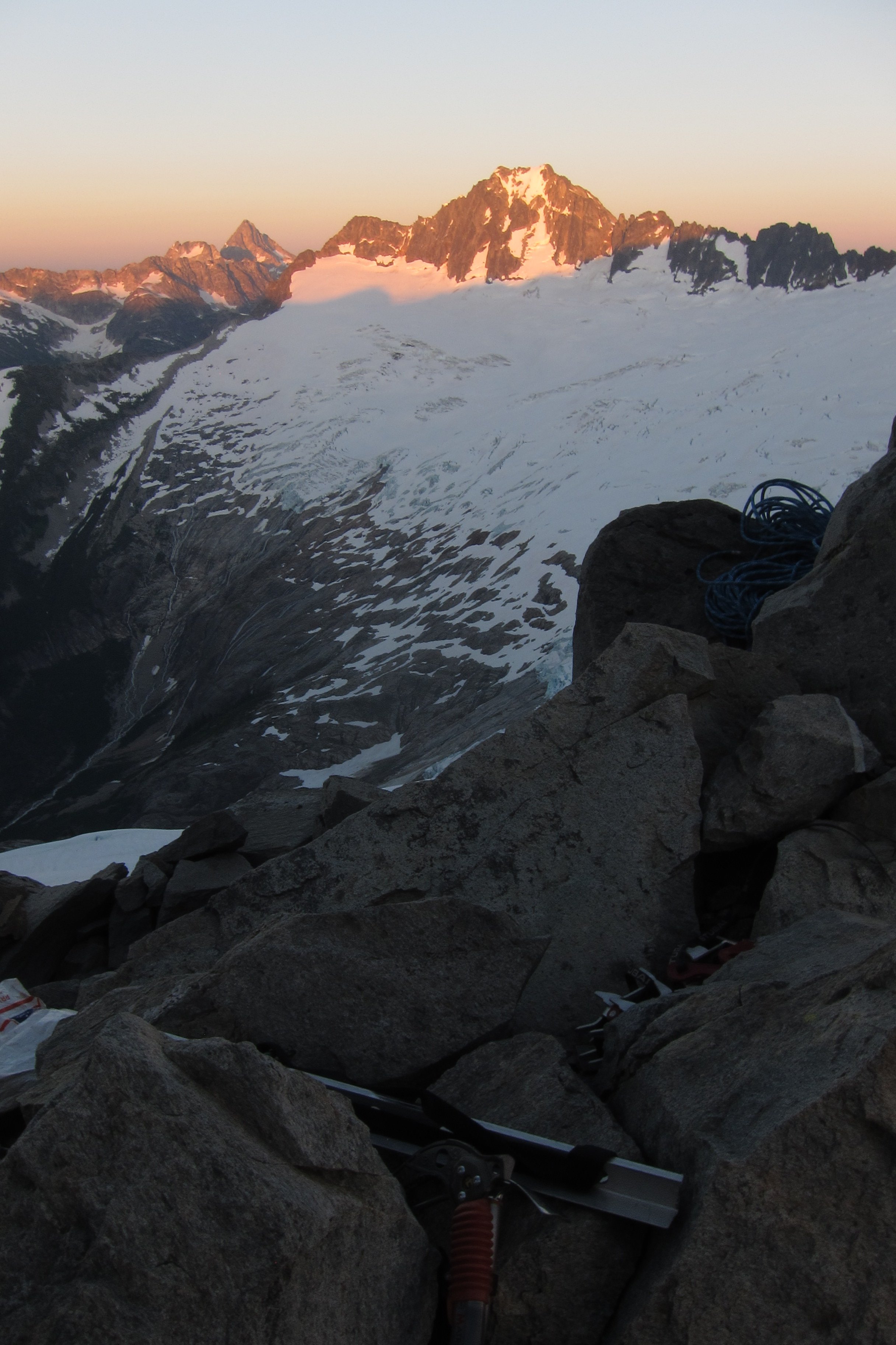
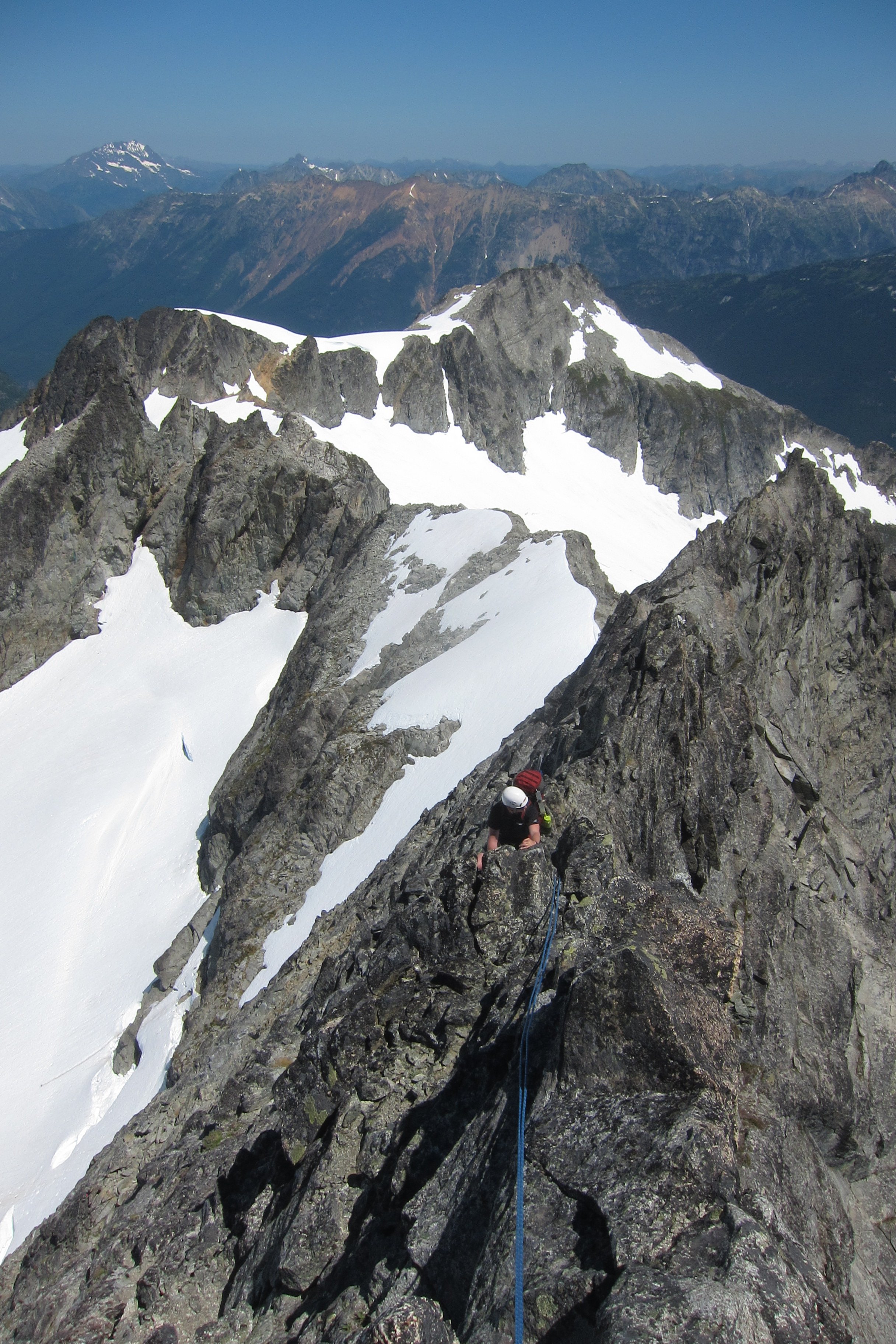
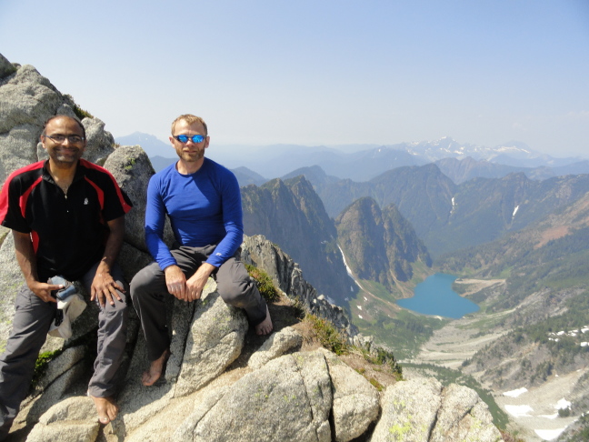
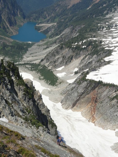
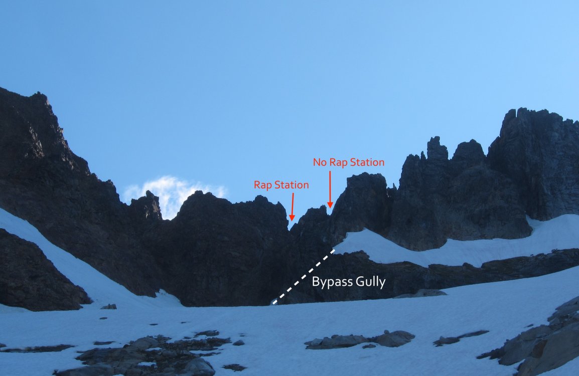
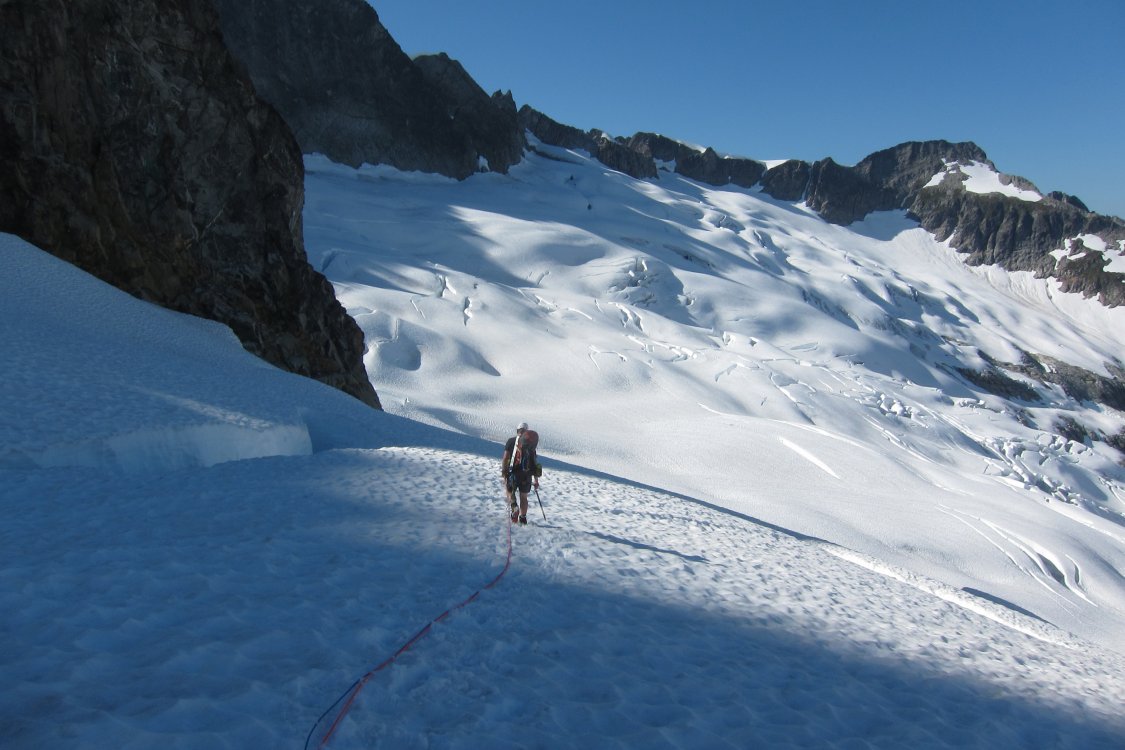
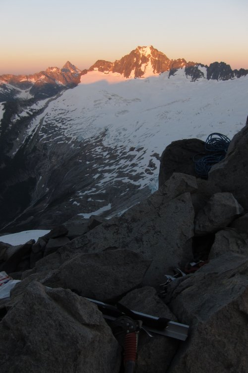
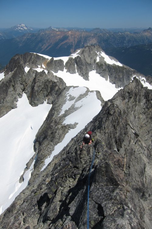
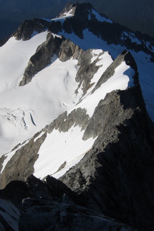
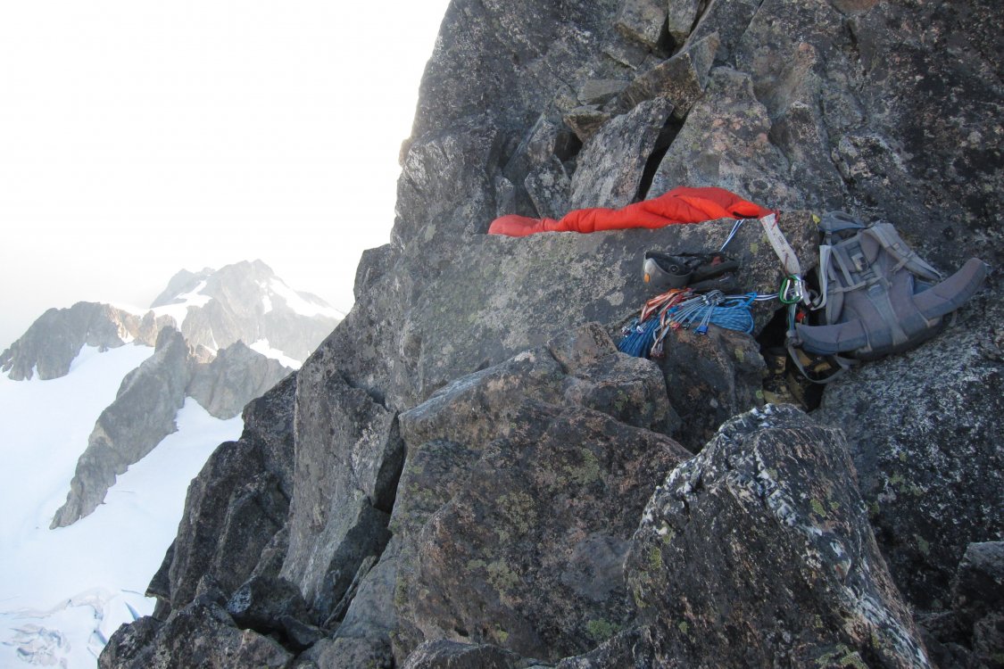
Trip: Forbidden Peak - North Ridge Trip Date: 07/15/2018 Trip Report: From July 15-17, Tom and I climbed the beautiful North Ridge of Forbidden in a slow but safe/deliberate fashion. The ridge was the longest alpine rock route either of us had attempted yet but we hoped to be able to pull off all the technical climbing in two days. We left the Eldorado Creek parking lot around 9 AM and reached the base of the Sharkfin Col bypass gully around 1:00 PM. The gully is in great shape, still filled with lots of snow. We crossed to rock below the top of the gully and made the mistake of climbing to a notch that was too high and too far east along the ridge. We found no sign of a rap station and had to downclimb to the notch to climber's left of this higher one to find a spot to rap over to Boston Glacier. The Sharkfin Col notches & Bypass Gully Right now a single rap brings you safely to a large pile of icefall debris that you can navigate to get onto the Boston Glacier without difficulty. There were multiple other rap stations along the way down to the debris from the notch. The traverse to the North Ridge from the rap was easy and took us about an hour. The Boston Glacier is in great shape. The gully to access the bivy notch on the North Ridge is almost completely melted out but the moat is still passable. We crossed to the rock and found a third class move and then a short second class scramble to gain the notch. Bivy Notch center-left We found another pair of climbers enjoying the afternoon at the notch. Their goal was the NW Arete and we had a great time watching them fly up that route the next day from our positions on the NR. Great meeting you guys! After a quick dinner and a birthday cookie for me, we settled into the two smaller bivy spots for the sunset and sleep. I did wake up around 2:30 to find a snafflehound gnawing away at the brim of my hat so be careful out there with your salty things, kids. We think the same little guy took a pair of socks that mysteriously disappeared overnight. Sunset on Buckner from the bivy notch We started off the next morning at 7:50 AM and quickly moved through the 5.6 crux left-leaning corner that rises almost straight out of the bivy notch. It was just fine leading it in mountaineering boots with an (overly) heavy pack. From there we encountered mostly moderate, super fun third class scrambling all the way to the lower snowfield. We simul-climbed to the lower snowfield, but there were stretches where the rope didn't feel necessary. Tom follows shortly after leaving the bivy Both snowfields are still completely covering the ridgeline, so a bypass on rock on climber's left isn't available. We put crampons on to cross the first snowfield, which was pretty flat and easy to get across without an ax. The climbing above the first snowfield felt harder than the lower ridge and we climbed mostly on the left (east) side of the ridge on ledge systems and in gullies. We almost exclusively simul-climbed and placed a lot of cams and slings. I felt there was at least one low/mid fifth class move to get back up onto the ridge crest from the left side of the ridge. Once back onto the ridge crest we found lovely, exposed, knife edge climbing on solid rock all the way up to the second snowfield. The ridge between the lower and upper snowfields We reached the upper snowfield around 12:30 PM and stopped to melt snow to refill our 6L of bottles. This turned out to be a good move because we didn't encounter snow again until midday the next day. The upper snowfield has a much steeper angle and an ax and crampons were definitely nice. The climbing above the upper snowfield felt like a significant increase in difficulty from what we'd encountered along the ridge between the lower and upper snowfields. We slowed down and pitched out the climbing in short pitches several times. We carefully considered our route-finding decisions. Teams with more simul-climbing experience in fourth class terrain could move through this section much faster than we did but we felt better with a belay on several occasions. We climbed on both sides of the ridge as well as on the ridge crest itself following good cracks and solid rock. The climbing was steep but mostly third/fourth class with a few moves that felt like low fifth. We watched the pair we'd met at the bivy notch dance up the upper pitches of the NW Arete which was great entertainment as we slowly but surely moved up our ridge. Just below the summit we left the ridge to scramble up a third class gully on the right (west) side of the ridge before reaching the top at 6:20 PM. The North Ridge from the Summit We quickly began our descent of the West Ridge with three single rappels from obvious rap stations. After the third rap we lost all sunlight and stopped to bivy for a second night about halfway down the West Ridge. We found two relatively flat spots to lay out our packs and some rocks to make for a surprisingly enjoyable night in a relatively precarious spot. Some trail mix and beef jerky served as dinner but we fortunately had plenty of water left. We watched a beautiful moonset and headed to bed. West Ridge Bivy We were up by 6 and could already see several teams starting off up the West Ridge from the notch. After a Clif Bar, we made one more rappel down to ledges that we could scramble along to get down to the West Ridge notch. Two full 60m rappels got us down the Cat Scratch gullies to Boston Basin. Gear Notes: Two half ropes (only used one, except in the Cat Scratch rappels) 9 cams from 0.3 to 2 with alpine draws (used every one) Rack of nuts (used two, didn't need them) 8 slings (used every one) Mountaineering boots Approach Notes: Don't climb to the highest notch in Sharkfin Col

 1 point
 -
This TR is filled with truth and greatness!1 point
-
Lovely. We were on a family backpacking trip that weekend around Stehekin and the weather was perfect. Thimbleberries are the bestest!1 point
-
For future info @samueleley...I've found that putting everything in a large, heavy duty, plastic bag deters most . It appears that they don't like to chew on that type of plastic. Just a few days ago I watched one crawl all over my plastic bag (with salty clothes and food in it) before losing interest and going off into the night to terrorize something else.1 point
-
Having done White Chuck, I would have to disagree. One of the scarier class 3 routes I've done (sloping ledges with loose pebbles is what I recall) and not particularly interesting climbing, either. You have a great option with Hidden Lakes Peak, as the views are as good as most summits I've been on. It's exposed and improbable, but not technical. If you can't stay in the lookout, there are spectacular tent sites about 3/4 of the way on the right. Seems like the best goal would be to get your girlfriend a great mountain experience without getting spooked or overwhelmed. Trying to find a compromise destination is likely to miss the mark for both.1 point
-
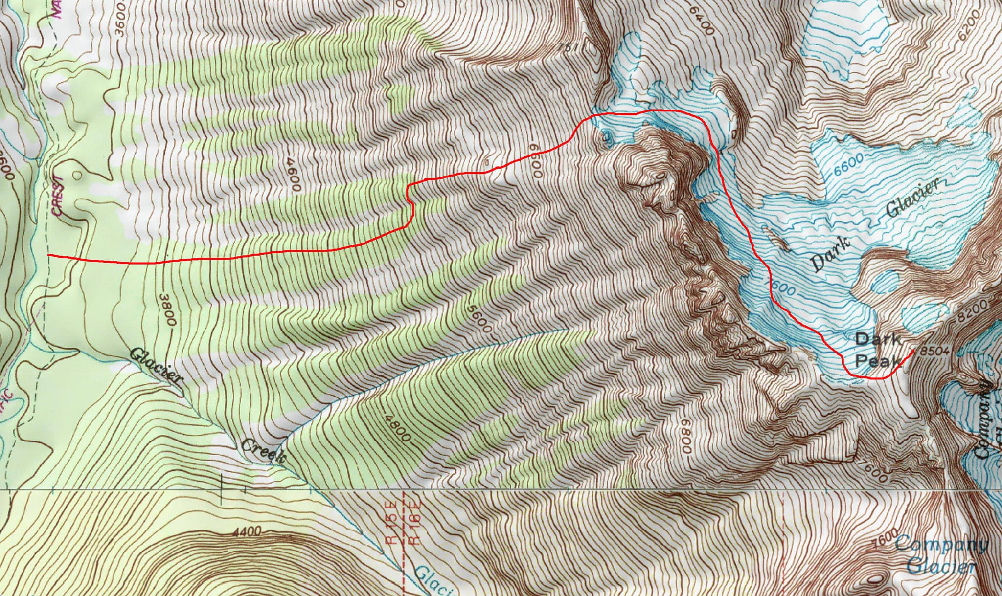
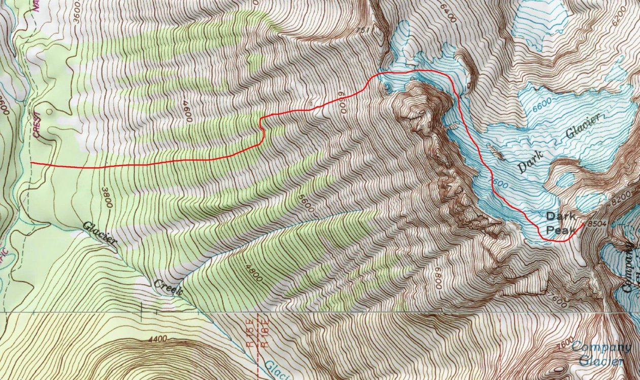
For the sake of future googlenauts, I thought I'd bump this with info on an alternative approach (not discovered by me) that avoids the swamp creek schwack, and is thus strongly recommended. The attached picture is really all you need, but: continue past swamp creek for a few miles, turning left off trail at a distinct opening/flat spot where the trail abuts the river at a gravel bar, with many very large chainsawed logs strewn about, and a very large boulder on the right (river) side. Head more or less straight up hill, following your nose and sticking to the largest trees, and there's essentially no bushwhacking or scrambling (the red line is approximate). Upon reaching the col you could presumably cut left in order to start at needle, as above ^, but I can't say for sure.
 1 point