Leaderboard


Popular Content
Showing content with the highest reputation on 06/25/18 in all areas
-
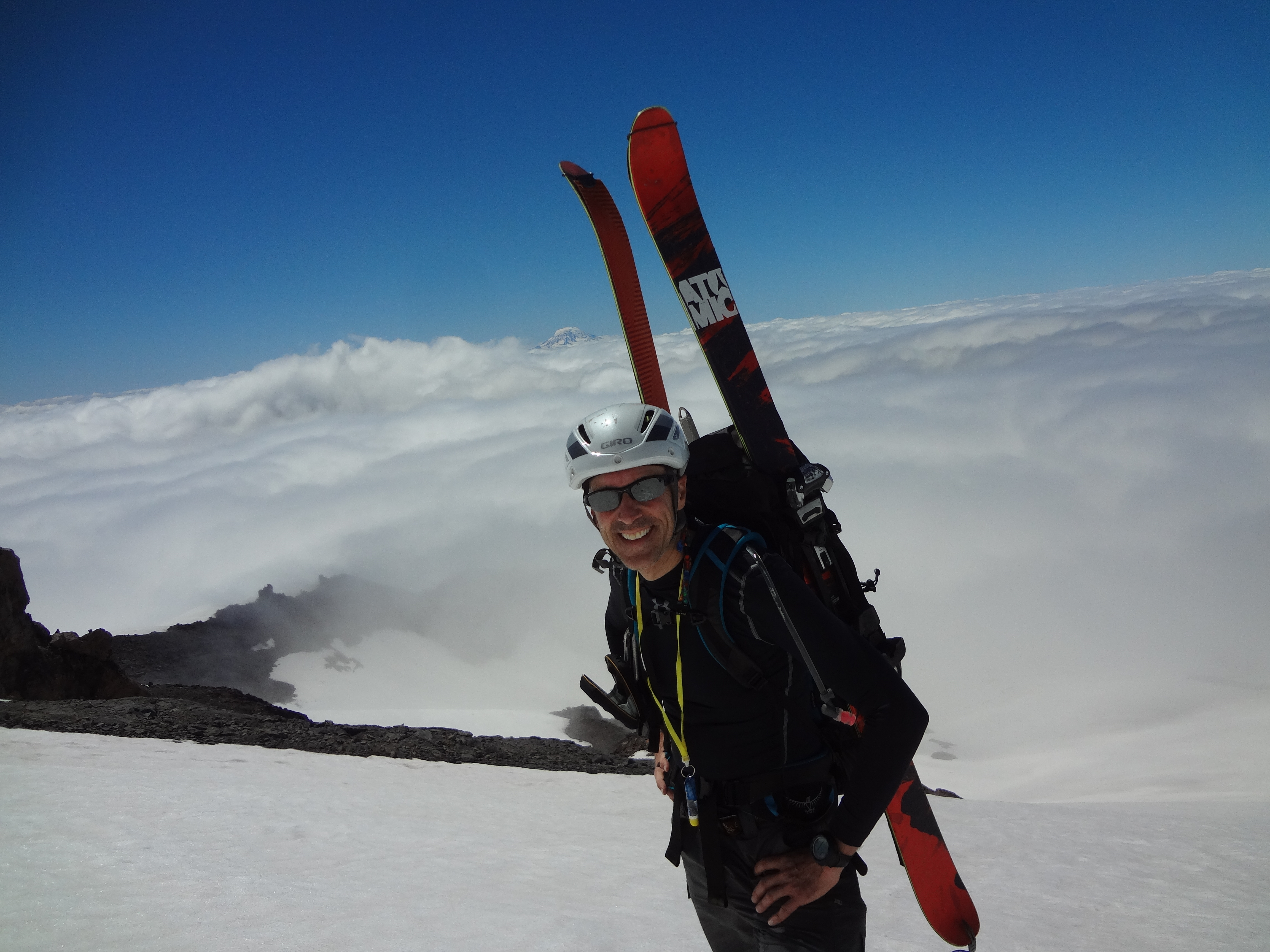
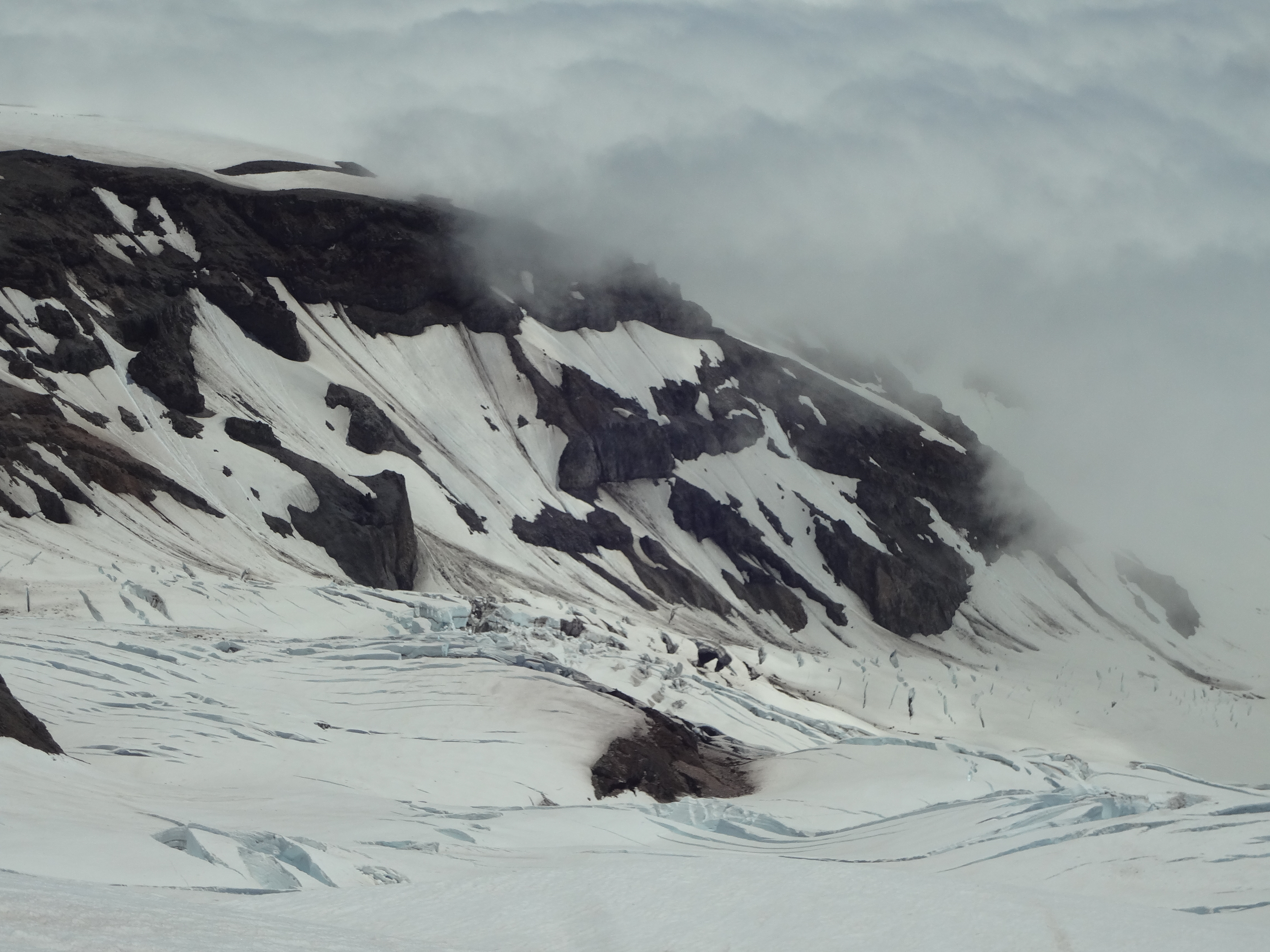
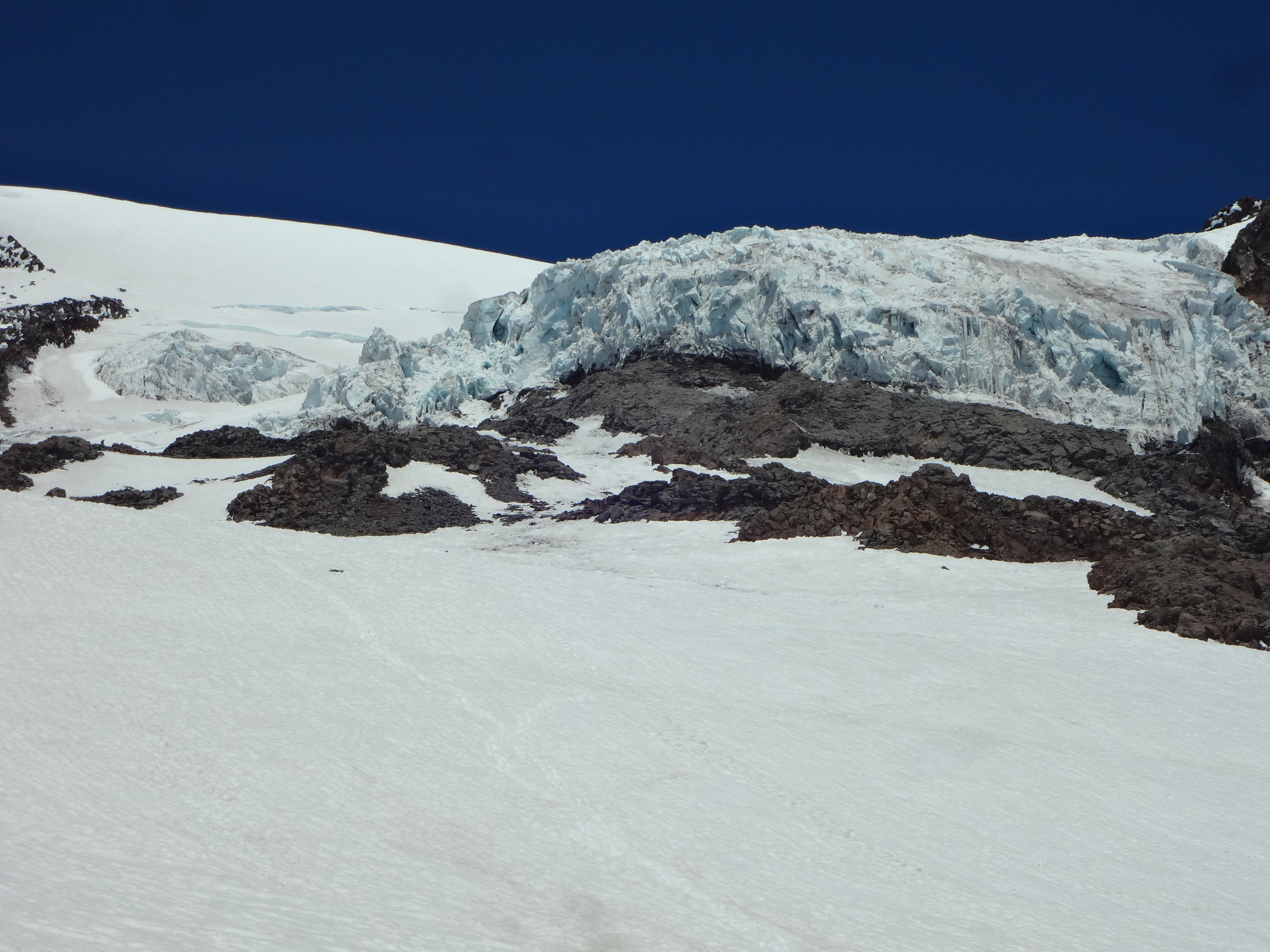
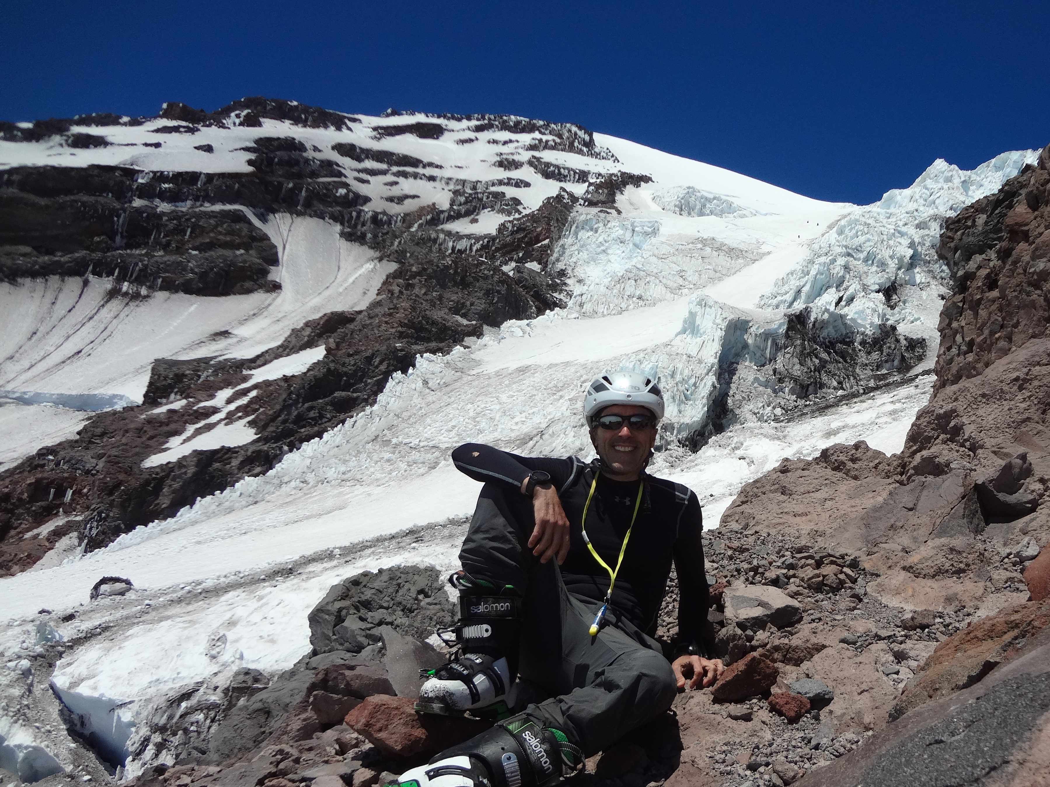
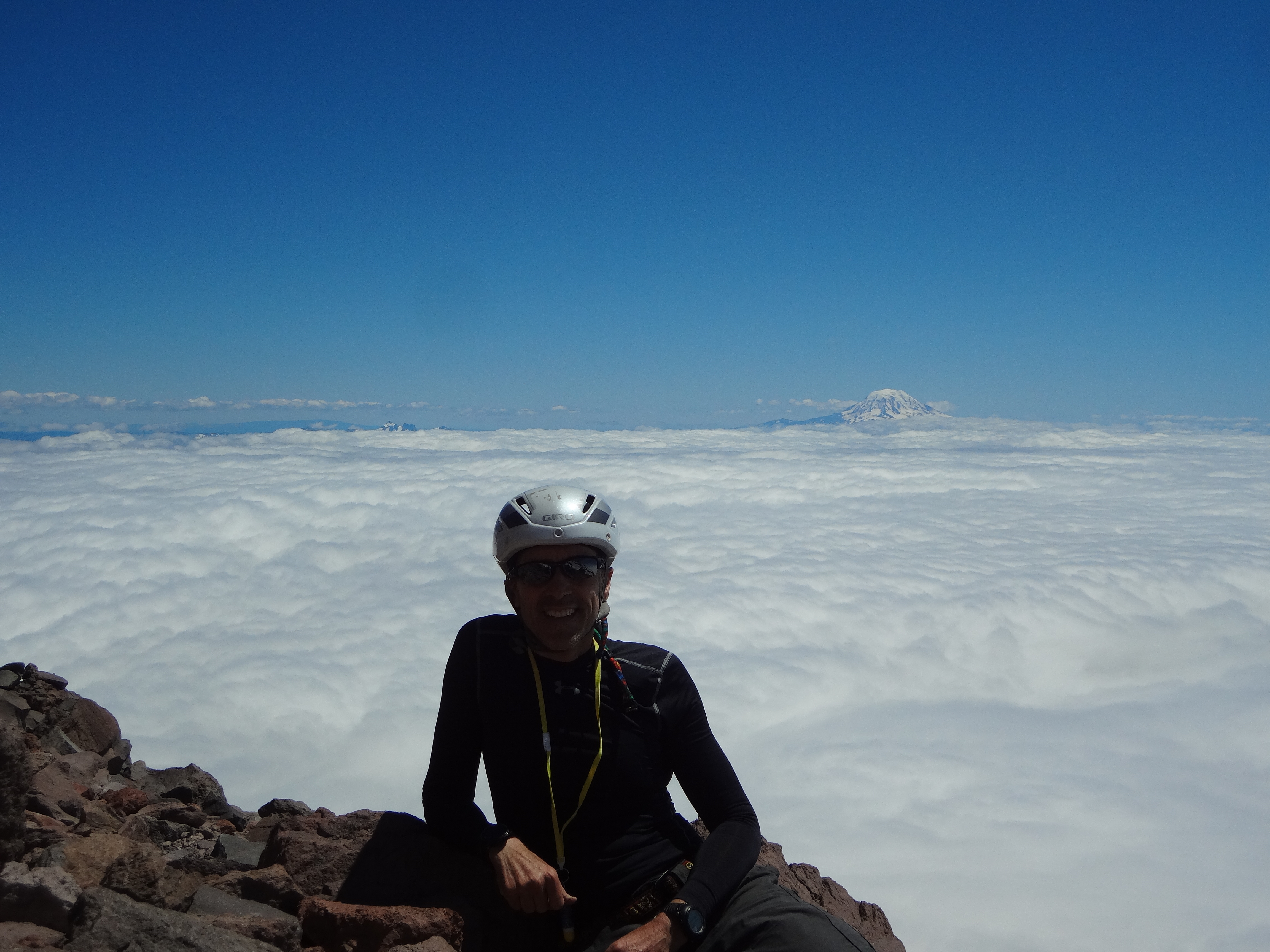
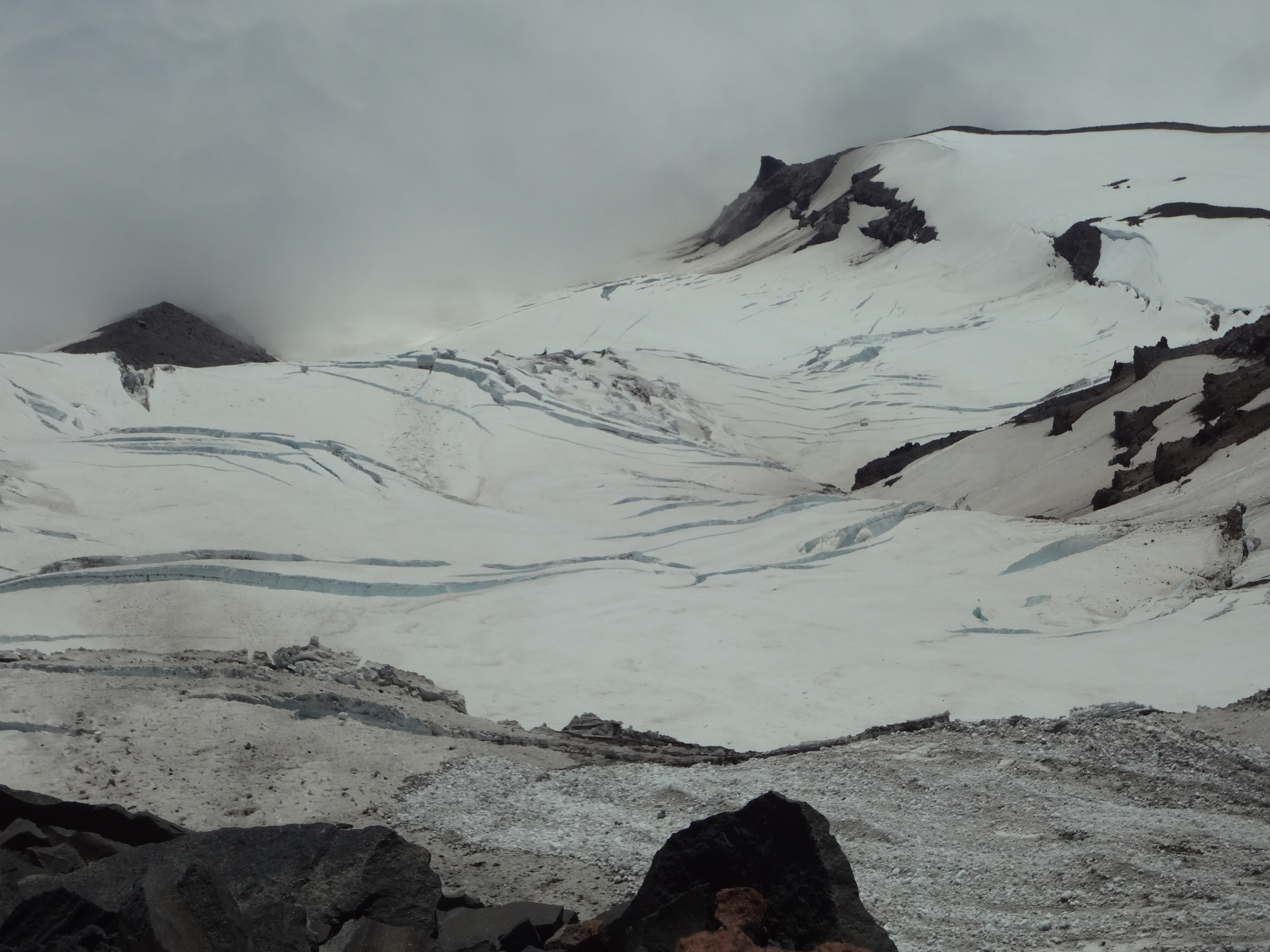
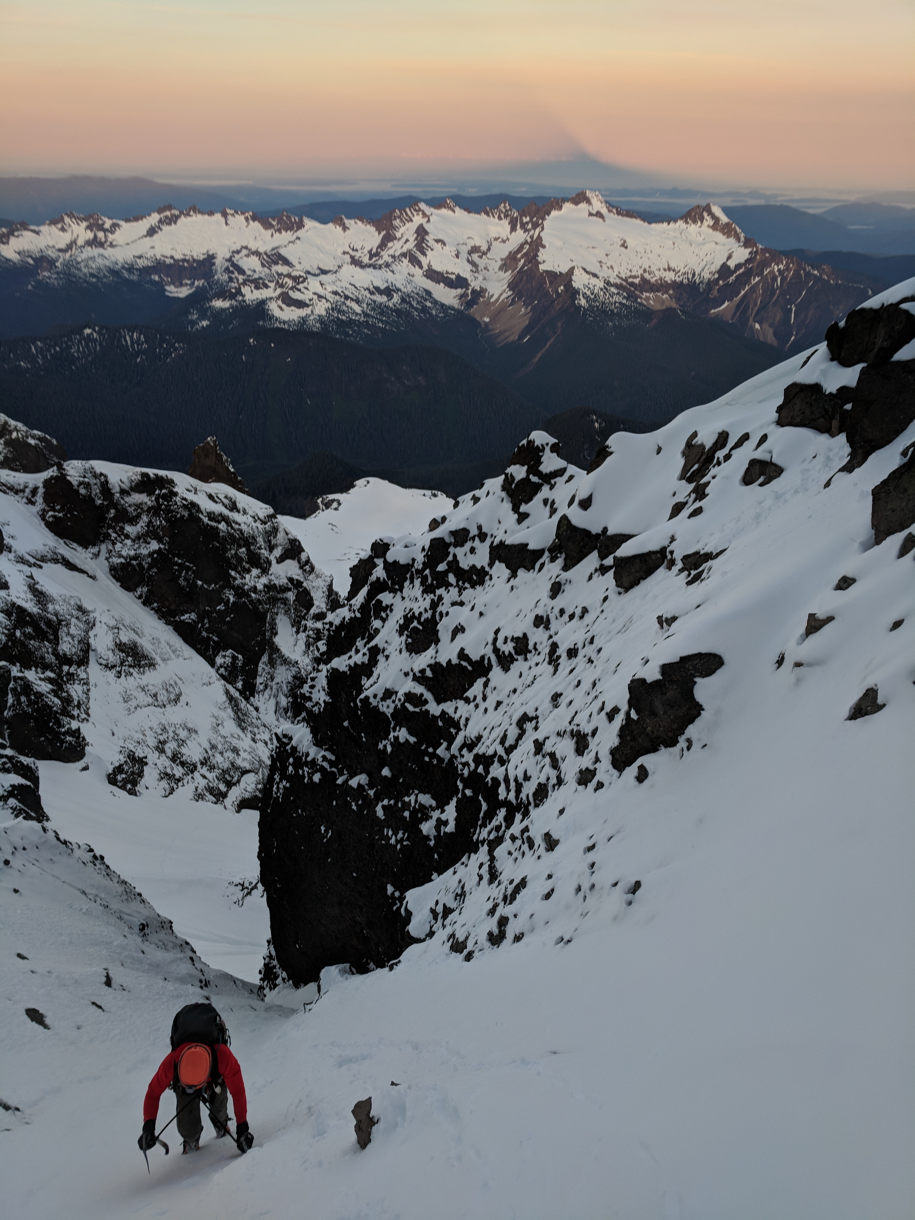
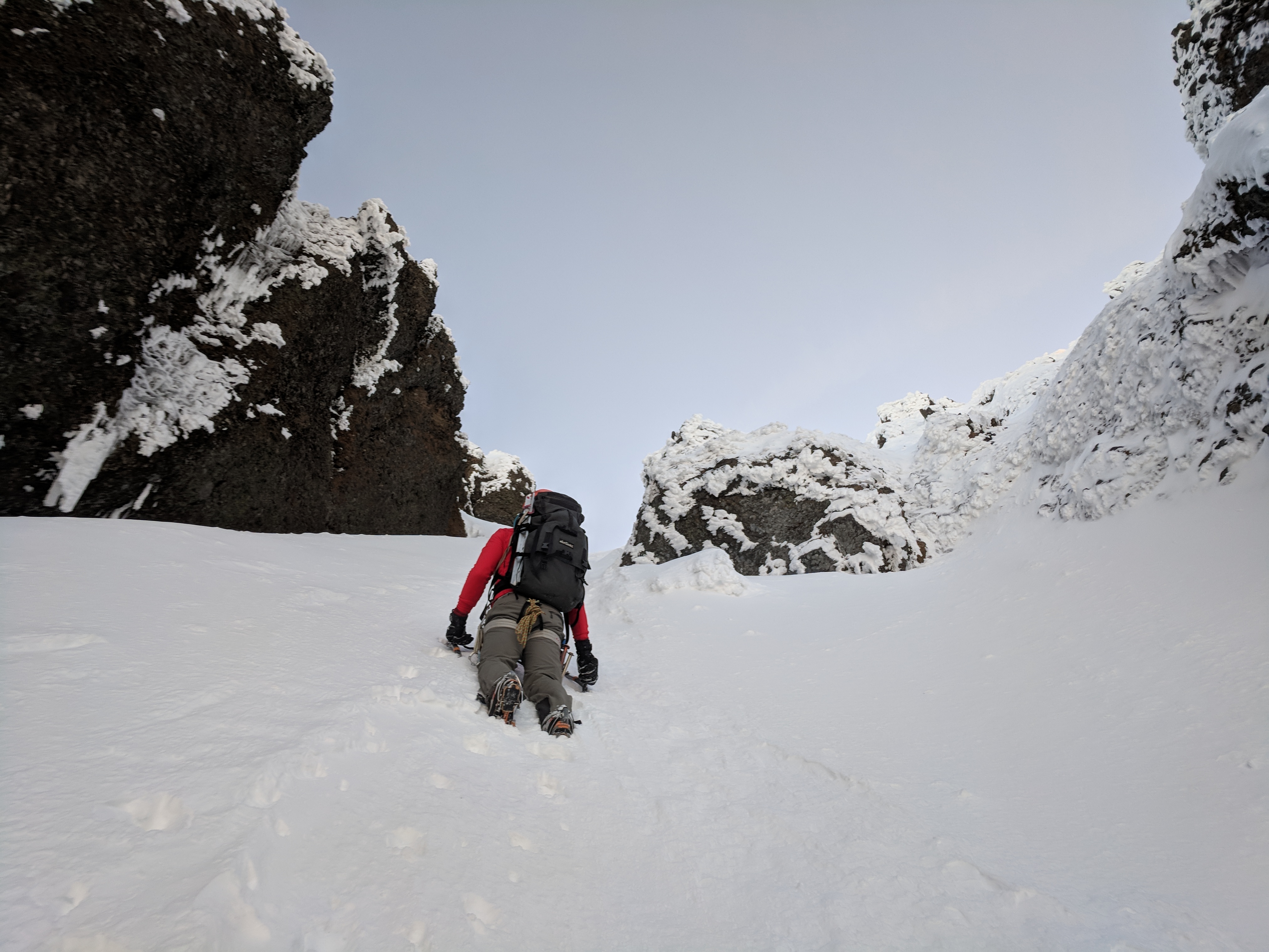
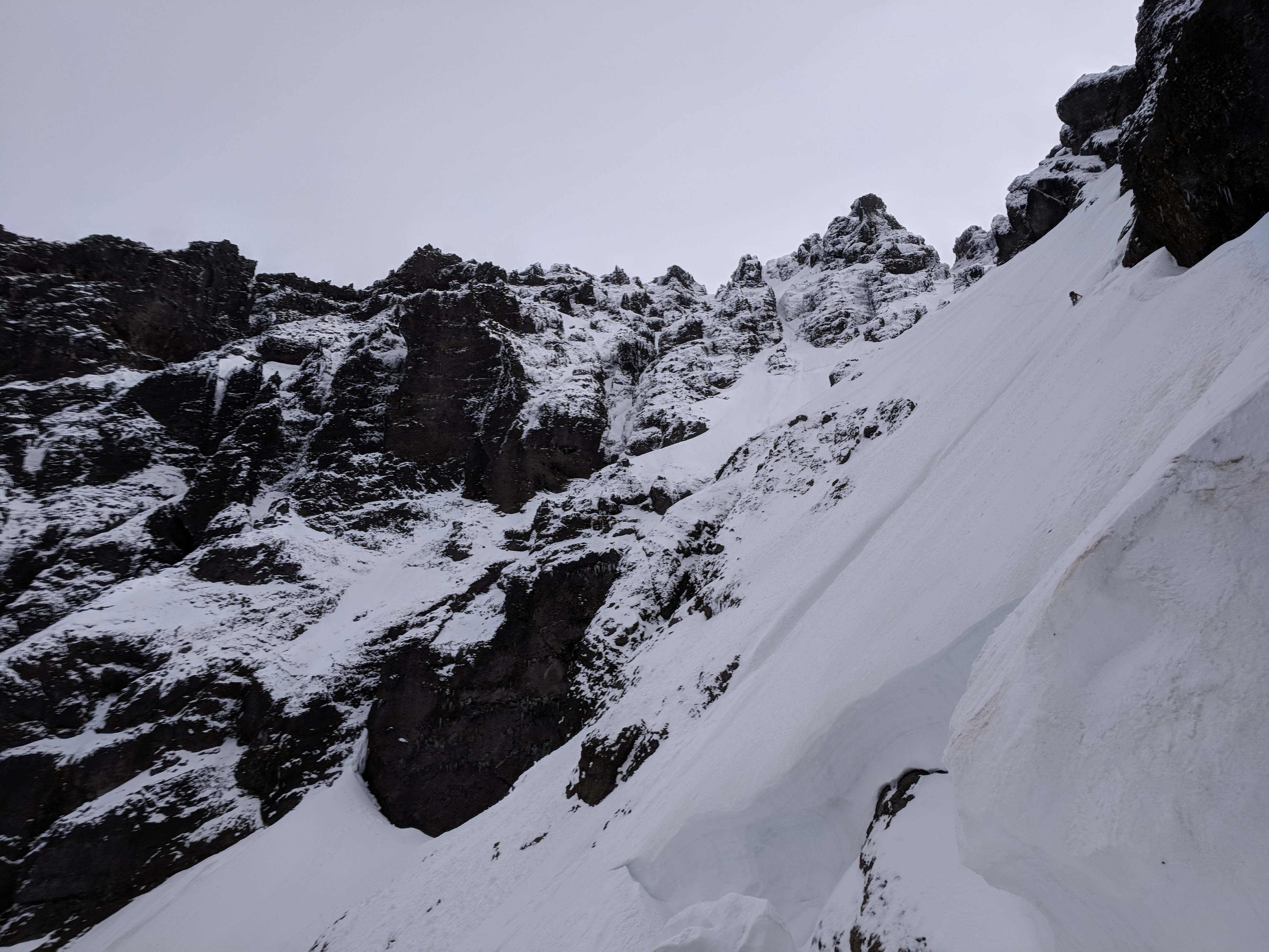
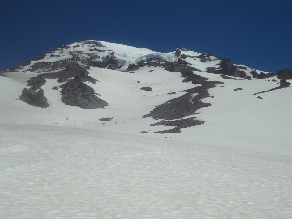
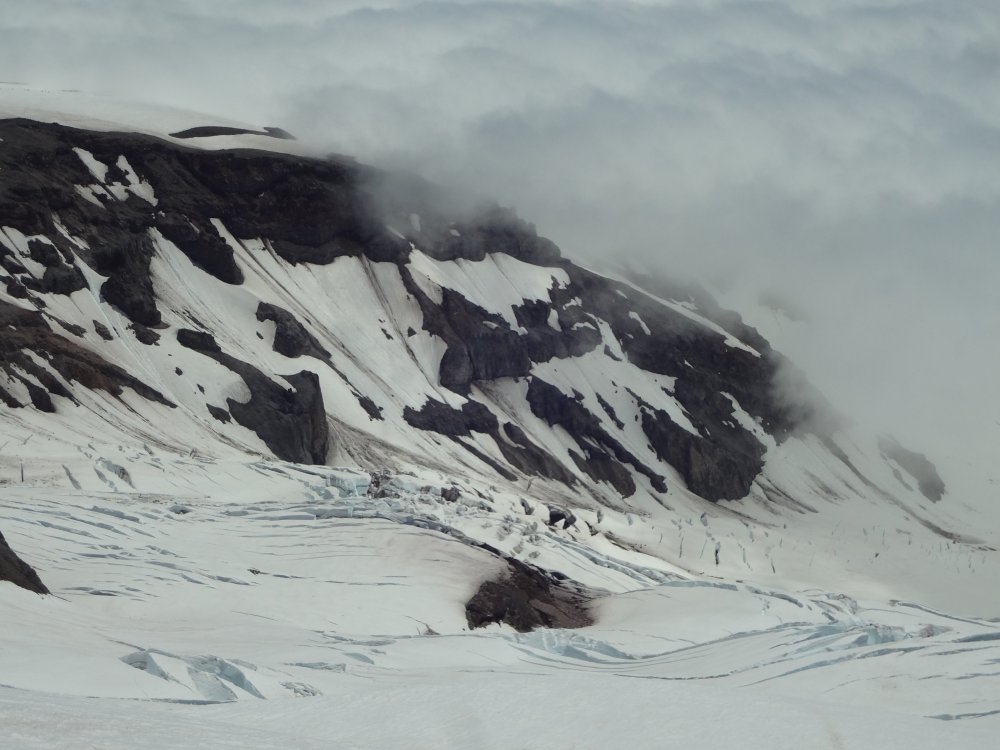
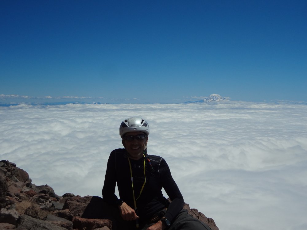
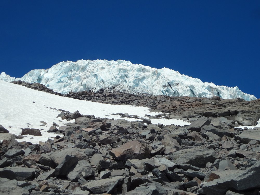
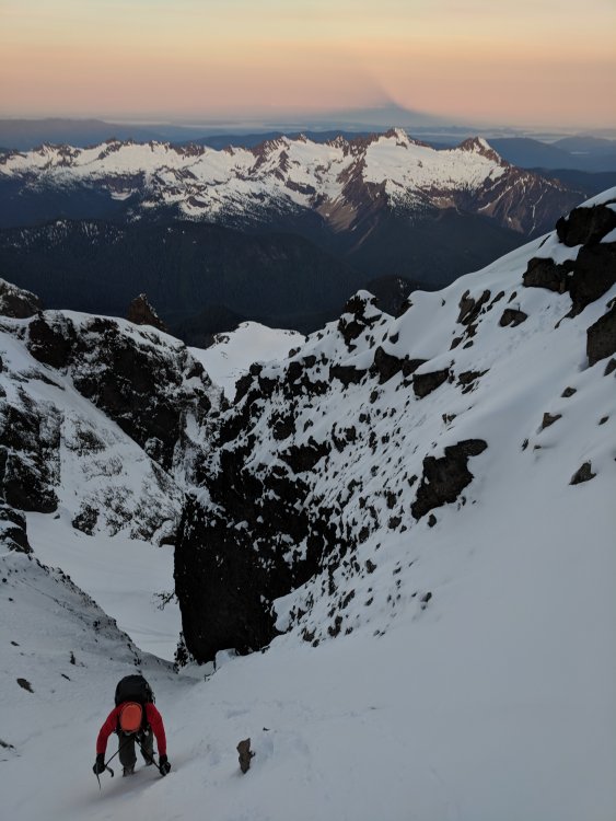
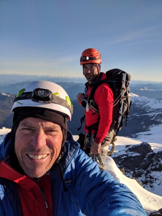
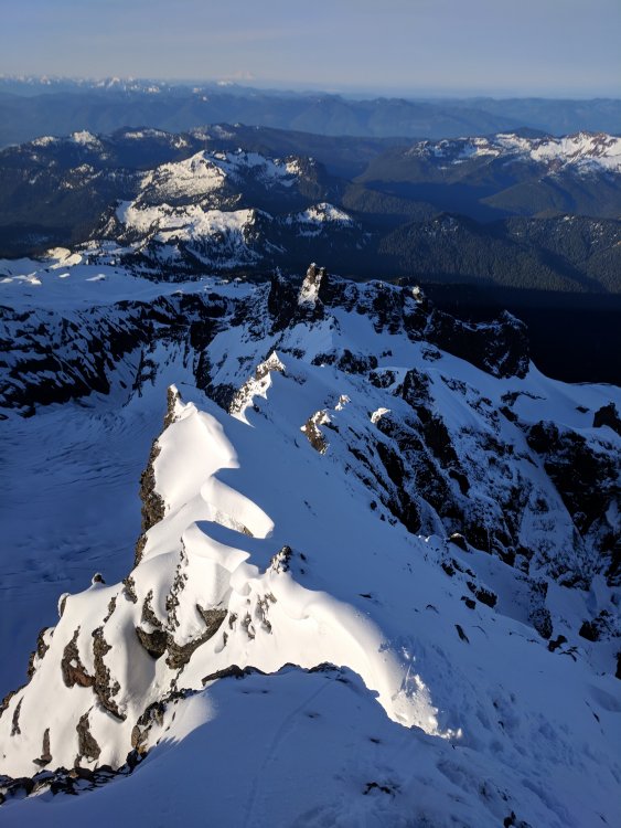
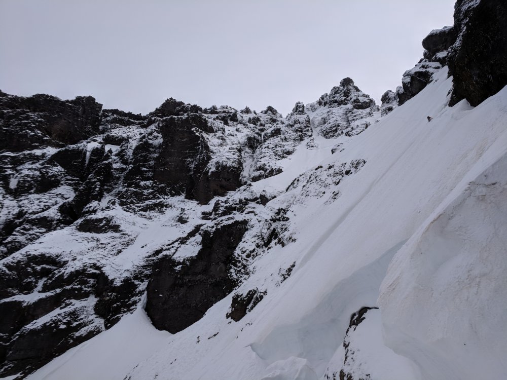
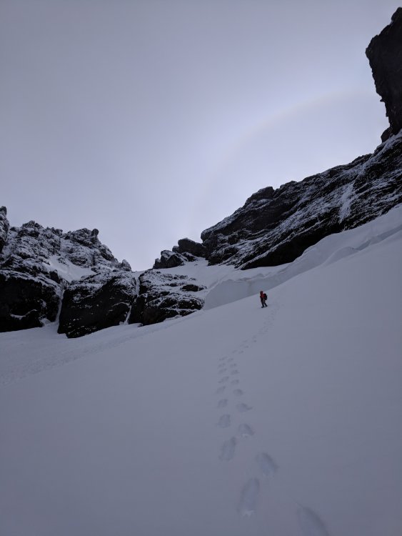
Trip: Mount Baker - North Ridge Trip Date: 06/22/2018 Trip Report: We started off on a bad note with Robie arriving at the Park n Ride 45 minutes late. Sean had just returned from a leisurely trip to Italy the day before. I haven't slept for more than 4 hours since my baby was born 2 months ago. We were all exhausted, and we hadn't even started. And yet, spirits were high. It was both Robie and Sean's first time on Baker and I had only done the standard route. Quickly we ran into some hairy creek crossings in the dark. Water was running hard. It had been 90 degrees in Seattle this week so lot's of melt to be expected. With skis on our back, 45 lbs each, the approach was tough. I had worn ultralight running shoes, and only brought one pair of socks. Well, they were soaked. Robie reassured me our feet were going to be wet all day anyways. We quickly rose above treeline, above the Heliotrope campground where we saw maybe 10 tent groups, slowly waking up. As we got onto the Coleman Glacier we could spot a group of 2 above us traversing towards the same route. The North Ridge, looking rather mellow from this perspective. The sun was rising, the sky was turning colors, Mt Baker was showing her face, we were on route and feeling good. And then we were on route. We thought we were going to follow an older bootpack up left but as we neared it, it looked cumbersome and out of the way, so we opted for a more direct route towards the other 2 parties ahead of us. Collective exhaustion was super high as we were running on 36 hours of no sleep (expect Sean had a 3 hr nap). We took a break below the ice pitch and made Ramen. A bit of back and forth and Robie agreed to lead the ice pitch. It looked steeper than the photos we had seen. After some solid sticks, we realized it was Hero Ice! We had 7 screws, so Robie went for it in one pitch. Baller. Then it was Sean's turn. Then I snagged this photo, which I really like. It captures the moment. Sea of clouds, North Cascades poking in the distance, sunshine, glory, hero ice, stoke was very high. Above the ice pitch we got into some mixed conditions. It was my turn to lead and it felt like about a foot of wet snow ontop of a delaminating shield of ice. If I smacked hard enough I could get to the ice for a screw, or if I hammered the shit out of picket it would go in. 50 meters each, Robie and I swapping leads up the upper ridge. This upper ridge section was glorious, for a moment at least. Team exhaustion/fitness was waning and we were moving slower and slower with each passing step. The sun was raging, our skin was burning, wind was picking up, and the day was passing. Then the white out came. Heavy winds, colder temps, all of the layers on. I couldn't see Robie, one step at a time. Unsure what time it was, or how long we had been on route, and wondering how we were going to ski down and get back to Seattle. Occasionally the clouds would move and the glacier's would appear. Like monsters with no rhyme or reason they tower above the world. And then we summited. Pure alpine joy. Now an 8000 ft ski descent. The ski down was quick and efficient. We got back to the main trail and cruised out to the parking lot just by dark. 10pm. 20 hour go. What a fabulous day. Found pizza in Belligham, pulled off the highway for an hour nap on the drive home but made it back to Seattle at 3am. What an alpine adventure! Gear Notes: 7 screws, 3 pickets Approach Notes: Good shape3 points
-
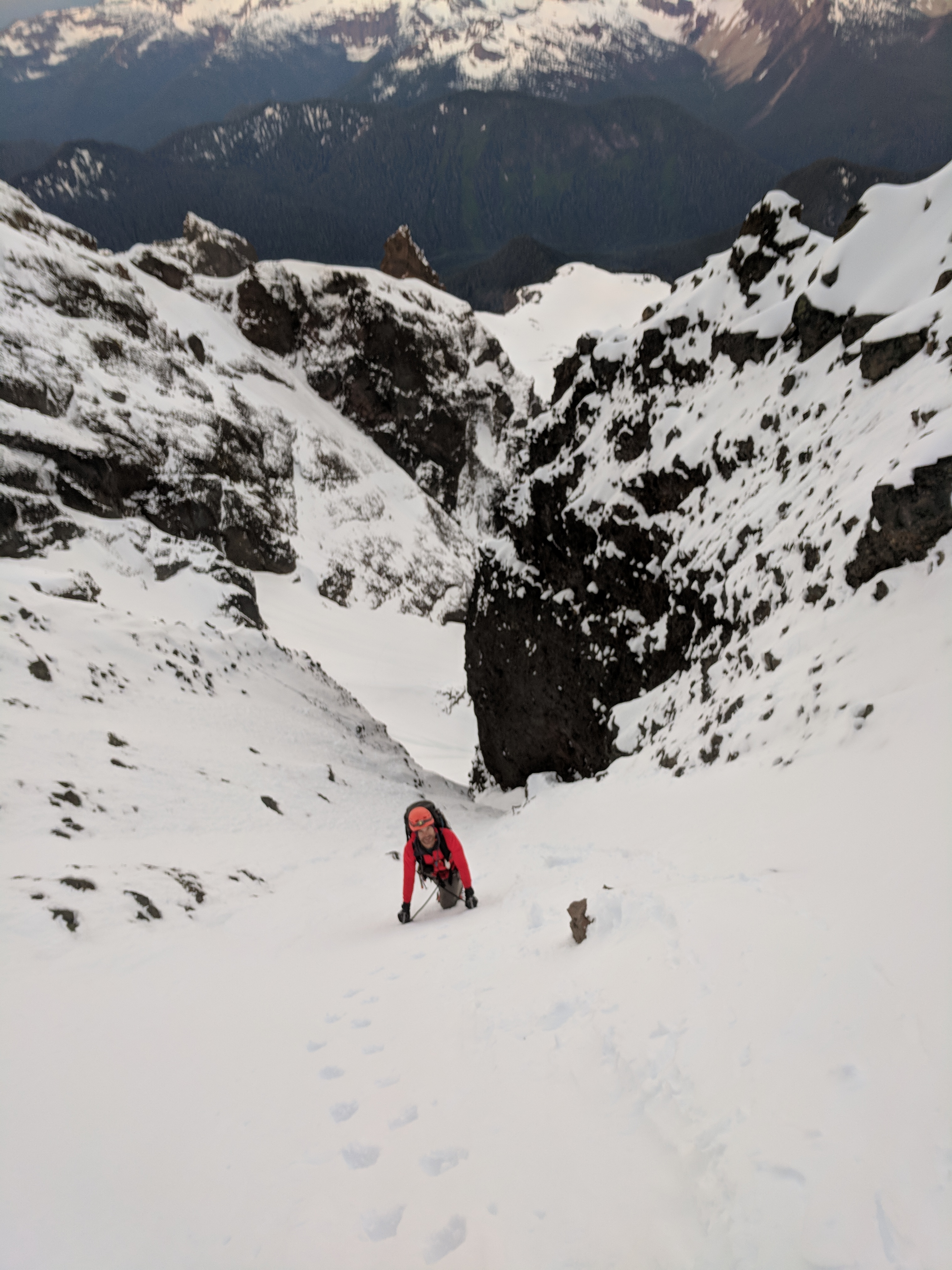
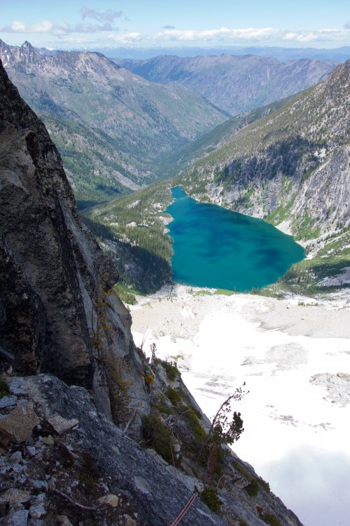
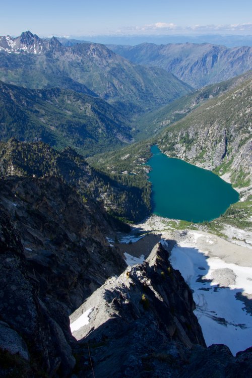
Trip: Boston - Buckner - Horseshoe - Boston - Buckner - Horseshoe Trip Date: 06/17/2018 Trip Report: Sean is always bitching at me to write up one of my adventures. So here it is, two day trip to tag Boston, Buckner, and Horseshoe. Happy?? I got a leisurely 930 am start at Eldo TH at MP 20 on Cascade River Road, up the Boston Basin climber's trail. Snow mostly melted out in the trees, almost complete snow coverage by 5800'. Brush on the old road grade at 3-4k made me glad I wasn't carrying skis. Continued up the Quien Sabe Glacier to reach the Boston-Sahale Col around 5 pm. From that vantage the S face of Boston looks improbable. I ended up ascending the ridge towards the false summit until the end of the snow and east-hanging cornices. Traversed around the east side but was continually nonplussed with descending or contouring. I opted to scramble back to the ridge crest near the saddle between the southern false summits which led me to a decent and short ledge system which deposited me on the upper reaches of the Boston Glacier. From this vantage the contours of the route on Boston became more apparent, and as I got closer I saw all the rap slings among the ledges. Dropped my pack and gave it a go, reaching the top a little before 7 pm. The exposure is unmistakable and thought provoking, especially with mountaineering boots. Due to all the choss reports on this peak I tested foot and hand holds extra deliberately. Fought my way past the plastic unicorn guarding the posh log and signed the first entry of this year. Whoever it was on CC or Peakbagger who said they downclimbed this route has balls of steel and the patience of a Thomas Pynchon reader. Rapped 3 pitches and headed down and across the Boston Glacier to bivy at 7300' below the N Face of Buckner, finally dropping my pack around 9 and dug in for the night. Up at 4:30 am and eventually moving at 5:40. There were a few cracks opening up, but as observed from Boston a clear route up the N Face. The snow had hardened overnight though was still a little punchy from where I started. When the slope steepened over 7800' it became more firm. It was quite secure on front points, with rest spots easy to kick in every now and then. Nothing like the bullet proof holy shit don't slip bowling alley lane that Sean and I encountered on the Nohokomeen Headwall 3 weeks prior. It was mostly straight up to about 8400' where I began a leftward ascending traverse along a snow finger to the main slope beneath the peaks. Then more straight up to the summit near the SW peak. Front dagger and front points almost the whole way. Glorious. Topped out around 745, fiddled around finding the ledge on the south side around the gendarme blocking access to the NE peak. Took a break at the top of both summits, both crawling with ladybugs. Oh my God am I glad I am here. If they had put these mountains in Texas it would be cockroaches instead. Following a boot track I believe may have been from 6-16 I started heading down to Horseshoe Basin around 10 am. I immediately regretted not leaving my crampons on since that aspect having only seen sun for a short while was still uncomfortably firm. More about persistence than safety I persisted, occasionally swallowing my pride and front pointing down the reasonably mellow slope. Eventually I reached more mellow terrain, contoured around 8200' over to the base of Horseshoe, dropped my pack, found the starting gully and ledge, and was quickly at the top. A rap got me back to the gully. Back across the Horseshoe Basin following the boot track to 6600' which again began ascending to a notch at the top of a steep snow finger. From here it is a quick ascending traverse along the rest of the big gully SE of the Sahale Glacier. This area is starting to melt out and there is some hang fire, so I was encouraged to move quickly. I found myself at the Sahale bivy sites around 3 facing a decision. Tag Sahale for extra credit, or reach my car 2 hours earlier to be reunited with my ice cold ciders? Down I went. I cut down across the Arm to around 6800', then continued down SW over continuous snow to find the sadistic Cascade Pass Trail. Back to the car by 6:30 pm where my love was waiting. Buckner (R) from top of Boston. Black center and Logan left. Buckner from Boston Glacier Forbidden Sunset Horseshoe Basin exit, crosses the rockfall streak to the wide snow finder at the base of the ridge, then crosses the bowling alley and up the steep snow left of the broken area. Gear Notes: Axe, ice tool, crampons, and rope for use. 2 pickets and a set of stoppers for character. Approach Notes: Trailrunners for the road and the trails below ~5k. Worth the weight.1 point
-
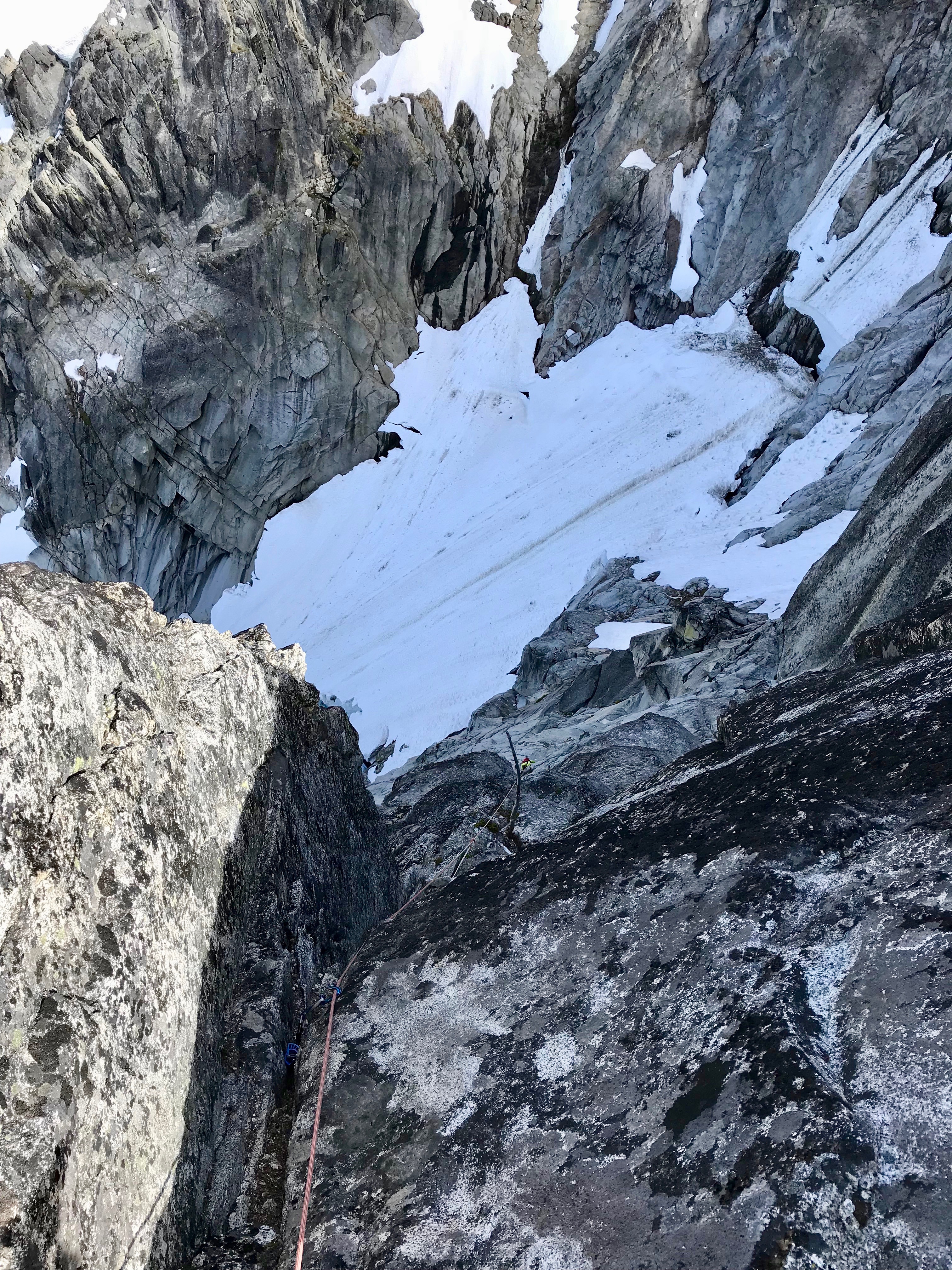
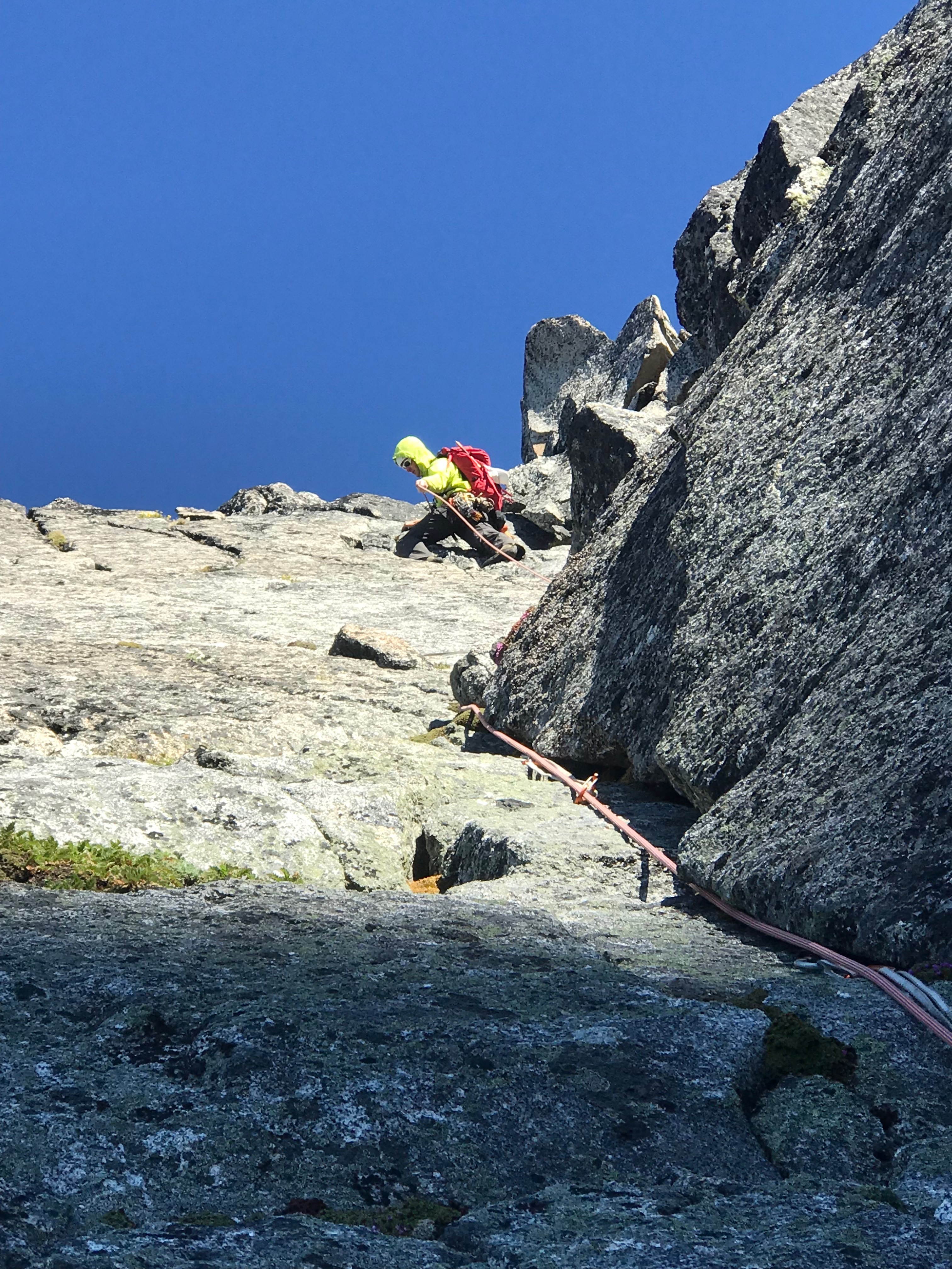
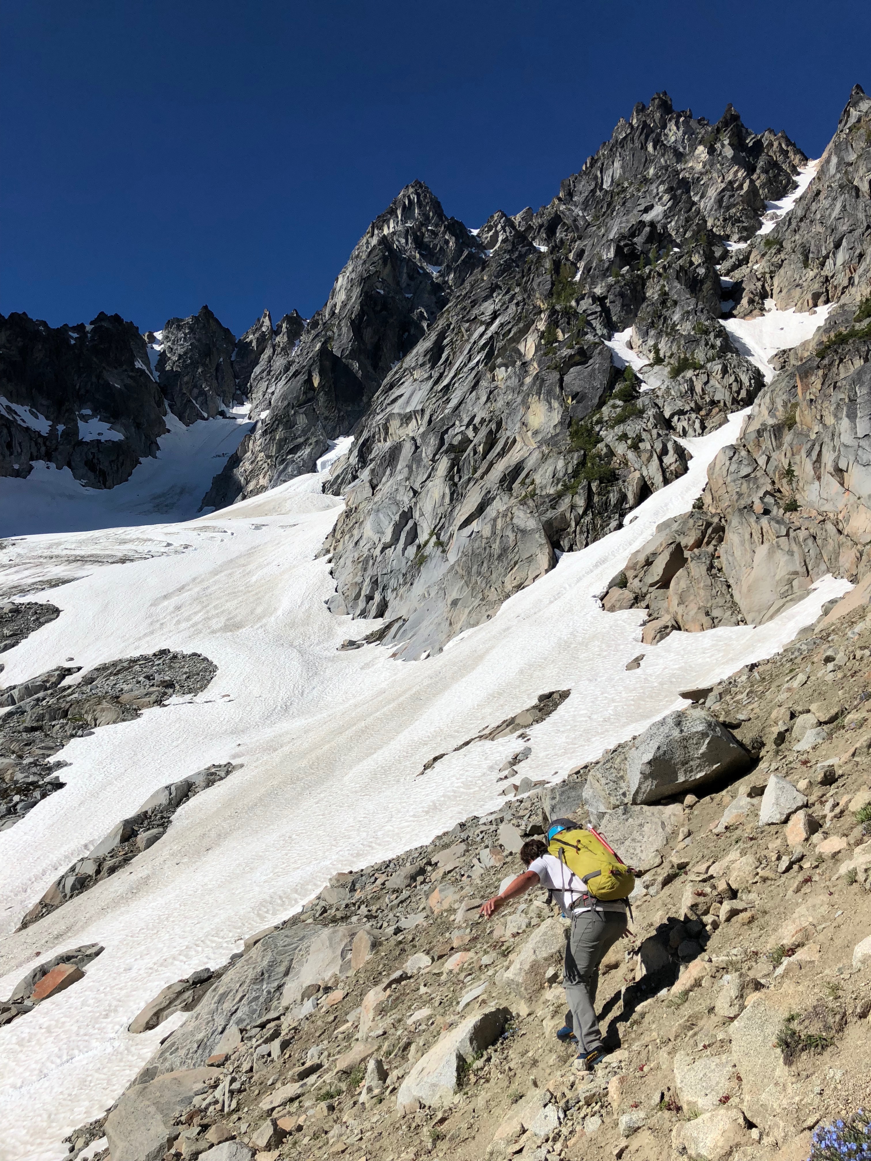
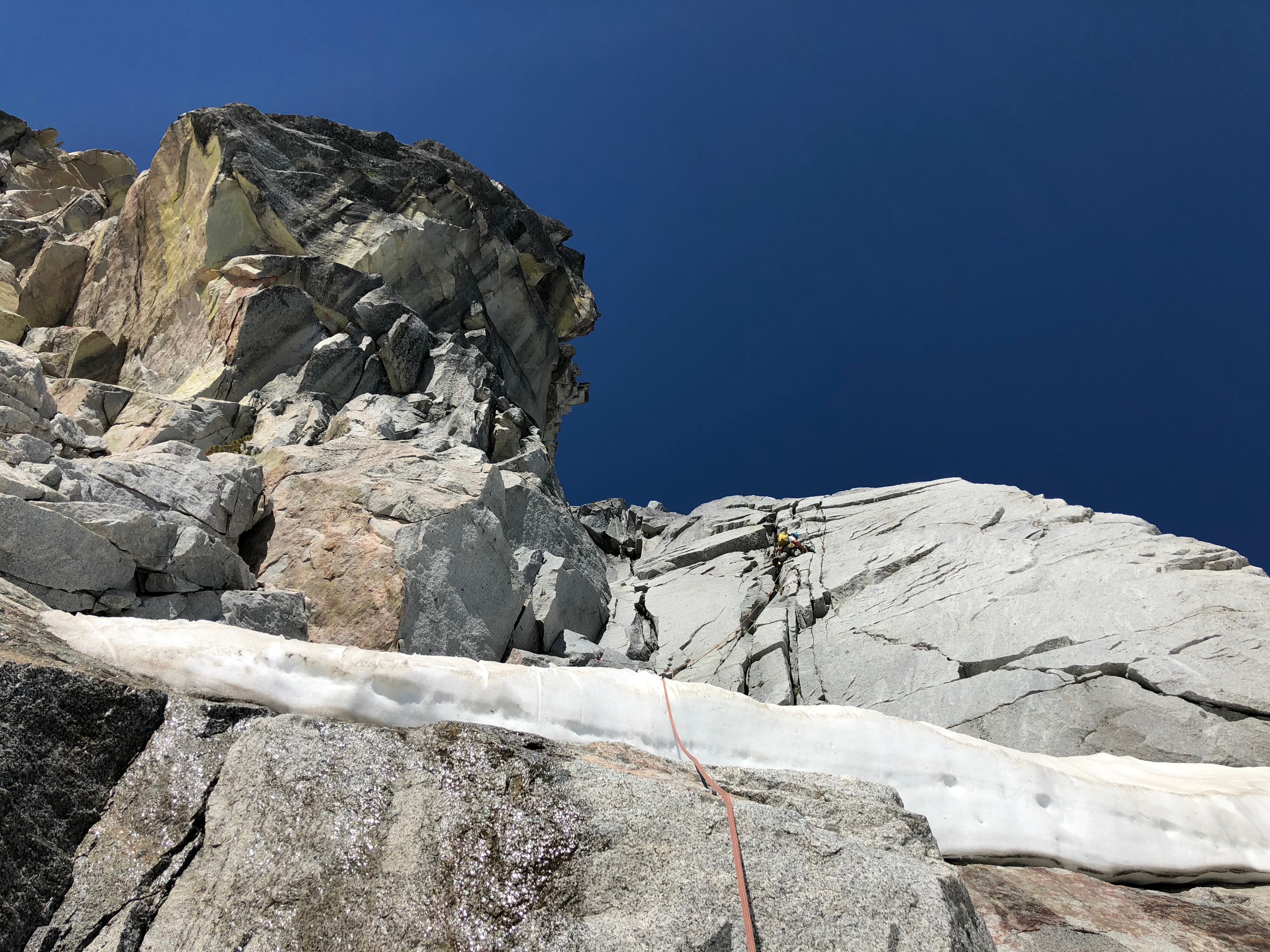
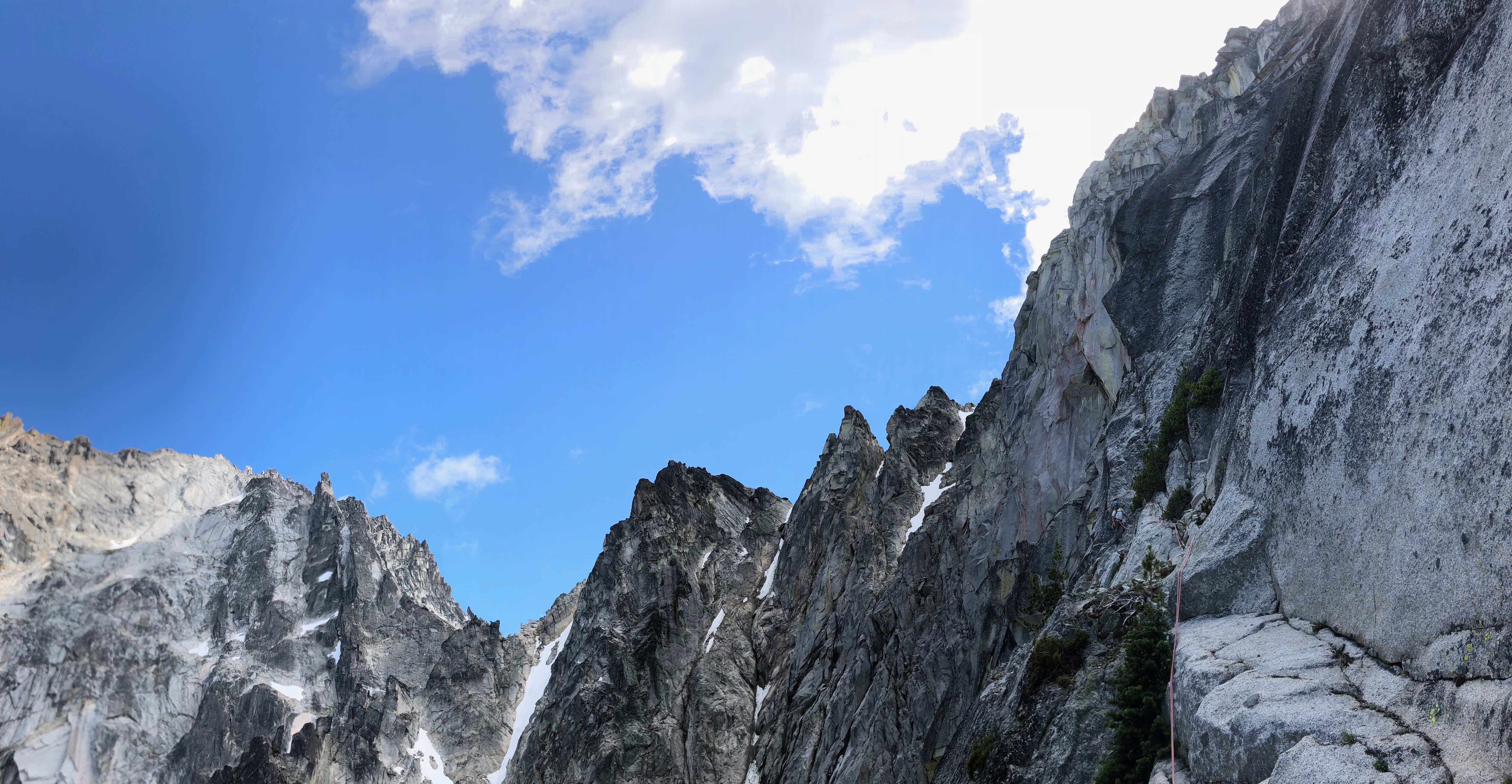
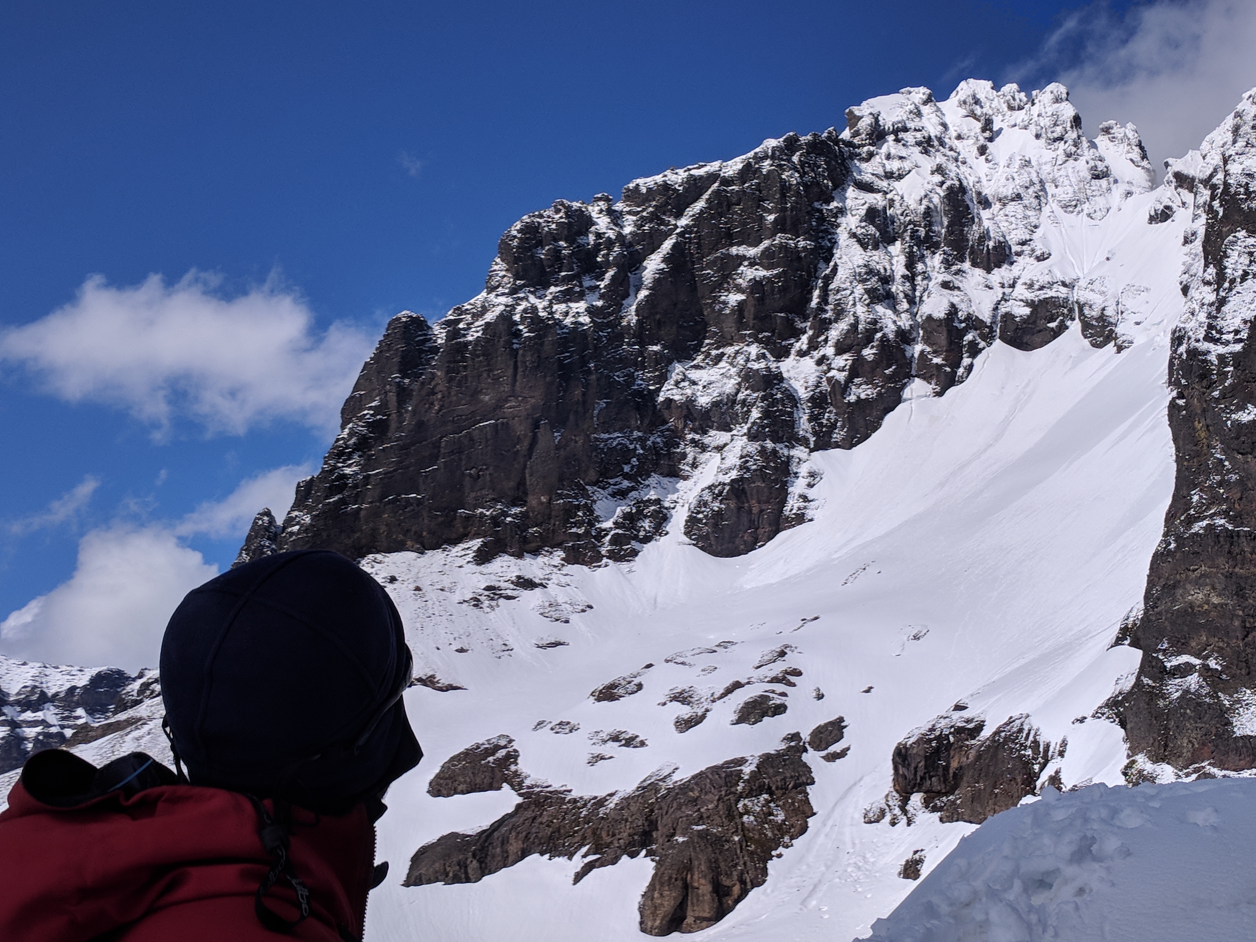
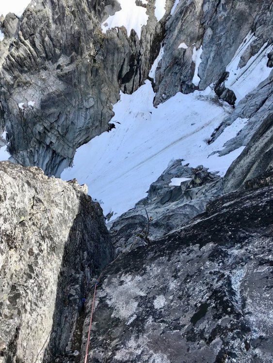
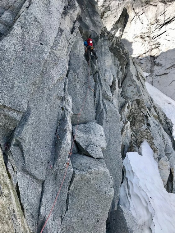
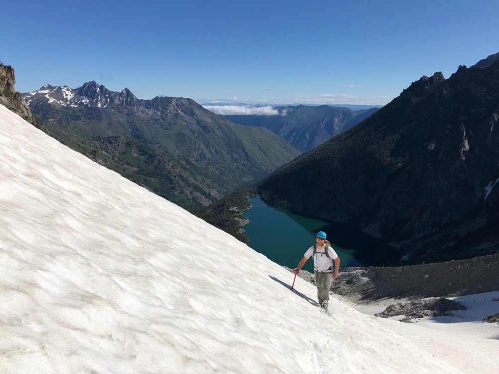
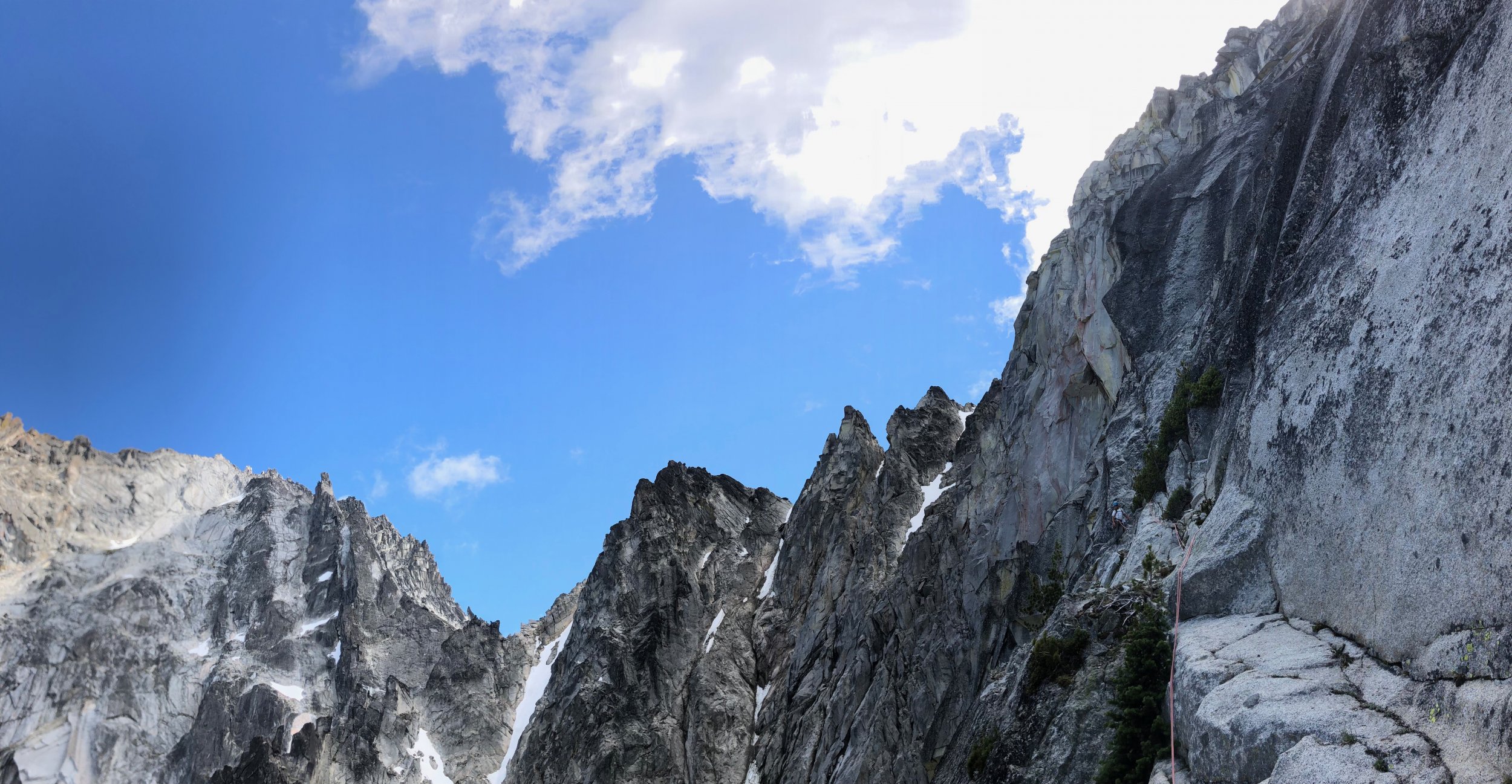
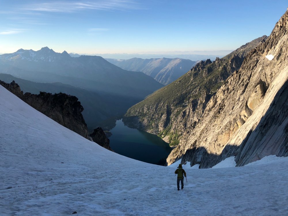
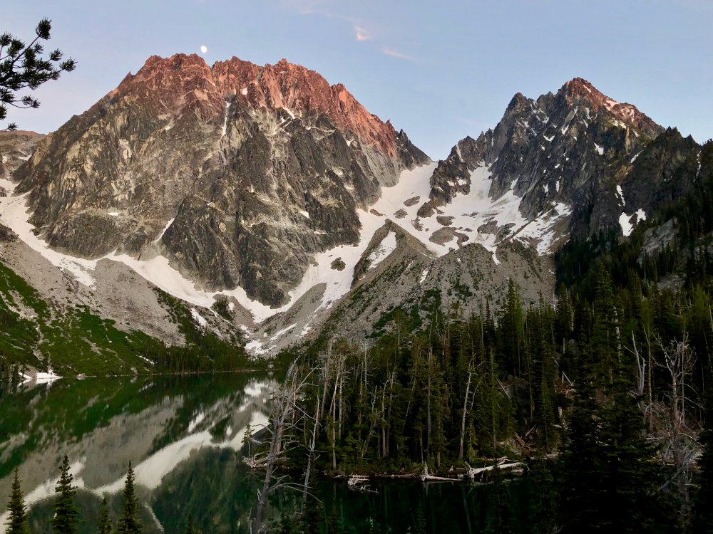
Trip: Colchuck Peak - NE Buttress (Kearney) Trip Date: 06/23/2018 Trip Report: A few years ago when I got Alan Kearney's Classic Climbs of the Northwest guidebook, I was a bit surprised to see an unfamiliar route on a familiar peak—the Northeast Buttress on Colchuck Peak made Kearney's short list of 51 routes, so it had to be good but I hadn't heard much about it. A bit of searching on Cascade Climbers yielded a mixed bag, especially when considering the original Beckey line. In either case, the route went onto my list. Adam and I had talked about climbing together many times before, but it hadn't yet come together. He reached out early this week and we hatched a plan to car-to-car the NE Buttress (Kearney version) on Saturday. We drove out to the Stuart Lake Trailhead late on Friday night and got a little sleep there with alarms set for 5am—we were guessing that we could do the route in about 14 hours, but also knew we had a lot of daylight in case things weren't so fast. We started the approach just before 6am and went pretty fast. 2 hours in, we were on the far side of the lake on our way up the moraine. A little shy of 3.5 hours at 9:15am had us at the base of the ridge after enjoying continuous snow from the moraine up. We each had strap-on crampons on our approach shoes and light axes. The approach After consulting the beta a little, we located the first pitch of Kearney's start and racked up below it at the toe of the buttress. We'd brought rock shoes and a rack to 3 with doubles of .5 through 2. Adam took the first pitch at 10am and had a great time on the wide, broken crack on solid rock after traversing around some snow on sandy terrain to get there. I then did a very short pitch to the top of the crest. From there, it looked like the line might go lower later in the season, but the couloir snow convinced me to stay on a ramp system just a bit higher. After down-climbing a little from the crest, I traversed over and made a fun, steep move to get onto more solid granite which I ran right, then up a seam, and then back left to a ledge for the belay. Pitch 1 and Pitch 3 Pitch 4 turned out to be a bit of a low point. Adam set off and quickly encountered some moss and dirt on his traverse to the main dihedral. Sections of the pitch were really fun while others had a bit too much dirt and loose gravel. We knew we were on the right track, though, due to a couple of fixed pins we passed along the way. It took quite a while for Adam to find the way and stay safe on this pitch and it was 1:30pm before both of us were on top. The ledges We switched to approach shoes and doubled our rope in half for the ledge systems. I headed across and found that the rock quality and number of trees in the way reduced after the first pitch or so. It was actually pretty fun to move fast and link 3-4 pitches in one block. On a nice ledge before the route turned up the wall, we put our rock shoes back on and tied into each end of the rope. Adam did a quick bump of our belay to the base of the crux pitch and then set off. With our 70m rope and about 15 feet of me simul-climbing at the end, he was able to reach the ridge crest, linking pitches 9 and 10. I followed the pitch and had a great time—the rock was solid and the movement was varied and interesting. It meandered left before traversing back right and then into a left-facing corner all the way to the ridge. We were both on top of the crest at 4:30pm. Looking down the crux pitches, the buttress crest, and the final pitch Back in approach shoes, I linked pitches 11 and 12, getting us up the buttress crest and onto some ledges below the headwall. Views back to the belay on the ridge crest and Colchuck Lake were stellar. Adam bumped us up to the headwall and, after a few minutes of searching, we found a rightward traverse under big blocks for 80 feet or so on ledges to the North-facing dihedral that would bring us to the top. I took this pitch, having a ton of fun in the early evening sun and finding edges and gear anywhere I wanted them. I ran out of rope and gear just below the top and Adam headed through and brought me up. One loose block that had seemed solid when I banged on it with my hand decided to go as I mantled to the top and I had to jump out of the way, spraining my ankle a little trying to land on a foothold—thankfully the rock sailed right by me. We topped out a little after 7pm for about 9 hours on the route—a bit longer than we'd expected, but we hadn't been rushing and instead had been feeling pretty casual throughout. We started down by 7:30pm on dirt and rock to the col and then continuous snow down the glacier (skier's right fork) until a few hundred feet from the trail. It was 8:45pm when we got to the corner of the lake at the end of the boulder field. We only stopped once on the way out to numb ourselves a bit with bourbon and take in the sunset hitting Dragontail and Colchuck. We were at the car a little after 10:30pm for a little less than 17 hours on the day. While there were a few moments on the route where dirt, moss, lichen, and loose rock detracted, so much of the route was good climbing on good rock with a great position and view. We agreed that it was more interesting and sustained than the Serpentine Arete on Dragontail (which did not make the Kearney guide...). This TR on my site: https://www.jeffreyjhebert.com/adventures/ne-buttress-on-colchuck-peak Gear Notes: Single rack to 3 with doubles .5 to 2 worked well for us to do link pitches and simul-climb Approach Notes: Approach shoes, strap-on crampons, and light axes were fine


 1 point
 -
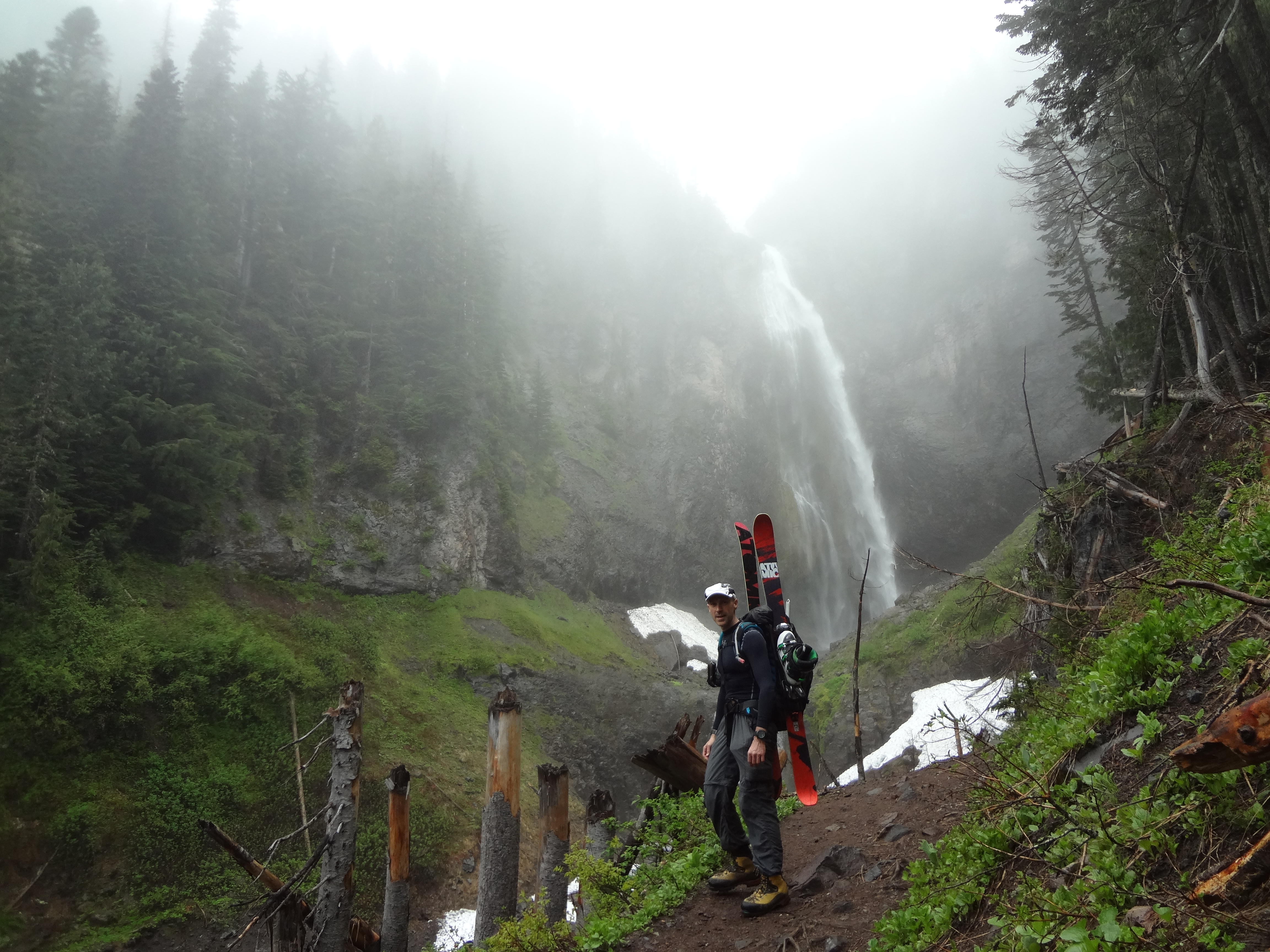
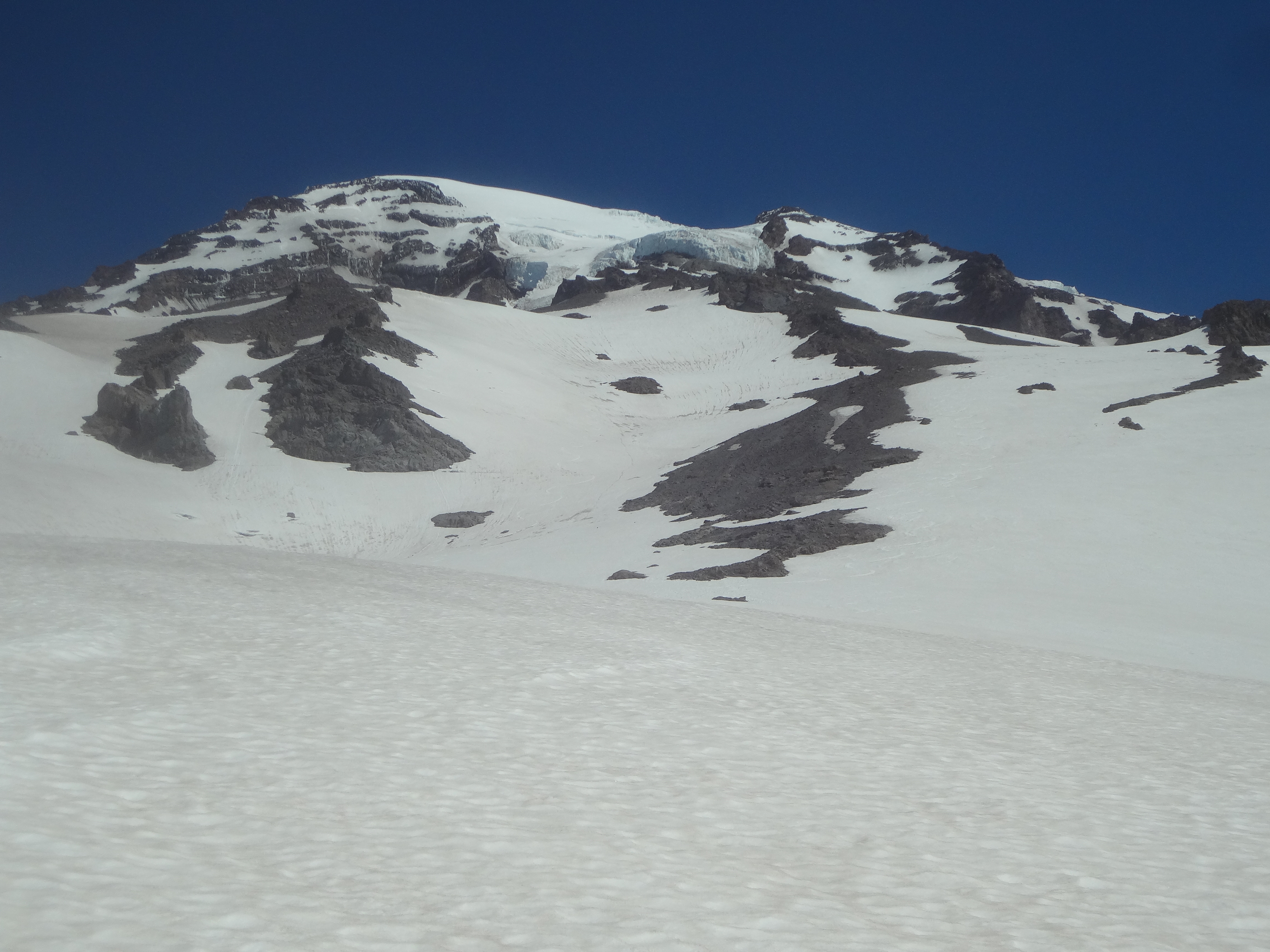
Trip: Camp Hazard - Comet Falls / Van Trump Glacier Trip Date: 06/23/2018 Trip Report: Climbed up to Camp Hazard and Skied the Turtle yesterday via Comet Falls and Van Trump Park. I've never been up to Camp Hazard this way before because it looked longer than Paradise / Nisqually. In reality I think it's about the same elevation because you don't have to drop down, and it's less hassle because there's no glacier to cross. Go in at comet fall trailhead. Comet Falls is reached in 2 miles from the TH. Ascend up into Van Trump Park. At 6000 feet things open into a meadow. Ascend the ridge separating Van Trump Creek on the right and Comet Creek on the left. Ascend to flats at 7100 feet. From the flats, ascend the right side snowfield to the crest of Wapowety Cleaver and a flat spot at 9000 feet. Water was available here. Turn left and ascend the Turtle below the Kautz Ice cliff. Camp Hazard sits below the ice cliff, but has been moved lower to offer protection from the receding glacier. Running water is available at Camp Hazard. Snap on the skis and WAHOO! 8000 foot descent to the car. 6.5 hours to Camp Hazard, 2.25 hours to the car. Here's the Relive: https://www.relive.cc/view/1657881348# Comet Falls Van Trump / Wapowety Cleaver Niscqually Glacier Camp Hazard / Kautz Ice Cliff Kautz Chute looks to be in good shape - thre climbers descending on rappell Looking down the Kautz glacier Kautz Ice Cliff Gear Notes: Skis. Crampons and axe if you think there will be hard snow Approach Notes: Great trail. Snow free until 5400 feet


 1 point
 -
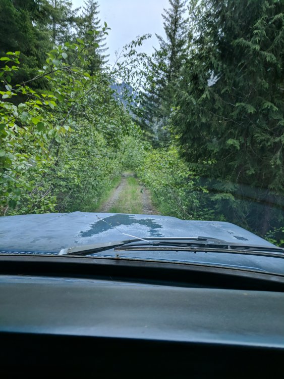
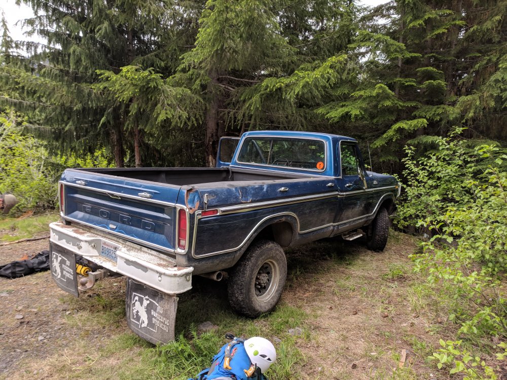
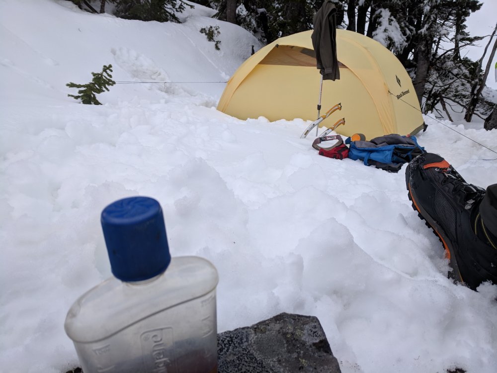
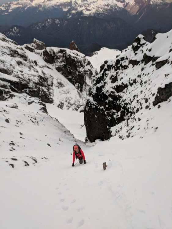
Trip: Lincoln Peak - Standard Route…I guess Trip Date: 06/11/2018 Trip Report: Trent texted Sunday night wanting to know if I was in for tomorrow. Uh, sure. For what? His partner bailed on his planned Lincoln Peak trip. Did I want to go. I haven't climbed any alpine in month's, out of climbing shape, drank all weekend with friends. Sure, I'll go. But I don't know anything about the route or approach, so Trent is the navigator on this one. We got a later start Monday so we didn't have to sit in camp for too long that afternoon. Left Burlington at 11am and drove up to the infamous FSR34. We had the secret weapon for FSR 34. Big Blue, a '79 Ford super duty beast of a truck. We drove up the road through brush and ruts to within 1 switchback of the end. Big Blue would not be denied. We then started the thrash up the old road bed. It is a thrash with plenty of slide alder, rock and an occasional trail. We broke off uphill after having enough of the road bed and enjoyed steep underbrush until finally breaking out onto snow. Surprisingly there was a fairly substantial layer of fresh snow, but travel was easy from there to high camp at the end of the ridge. We got from the car to camp in under 3 hours thanks to Blue. Great views of Lincoln and the route were enjoyed while sipping some whiskey and trying to stay warm. It was breezy and colder than we expected for the evening with clouds moving in and out. A 2am start got us to the top just after 6 for a cool sunrise. The shrund was negotiated with about 40' of steep s'nice climbing, then some crappy snow climbing with a 2" breakable crust with 4-5 inches of sugar underneath. We did have the occasional front pointing, but the large part of the climb was popping through the crust, unless you're bantamweight Trent who seemed to dance on top way more than clydesdale me. Route finding was pretty straightforward and the climbing consistently steep and enjoyable without being hairy. We broke out the rope for the final 10ft onto the summit. Great views with clear weather on top in fresh sunshine was perfect. One rappel off the summit and then we down climbed the entire route with the exception of the schrund, where we did one 30m rappel off of a picket. The steps I bitched about on the way up made for easy down climbing and back to camp. The thrash back down to Big Blue made us cuss and spit, but we made it back in 2 1/2 hours and licked our wounds with IPA spittle. All in all a great day out with Trent. The climb is really enjoyable with a bit of Rockies taste to it. If someone cut a path through that hell of an approach I think it would be a regular classic for its short climbing window. Some crappy cell phone pictures. No Jason G on this trip to capture the great images. I suck at photos. Gear Notes: 2 tools, rope, pickets, Hunters Approach Notes: Big Blue. Shwack, thrash, swear


 1 point