Leaderboard

Popular Content
Showing content with the highest reputation on 05/23/18 in all areas
-
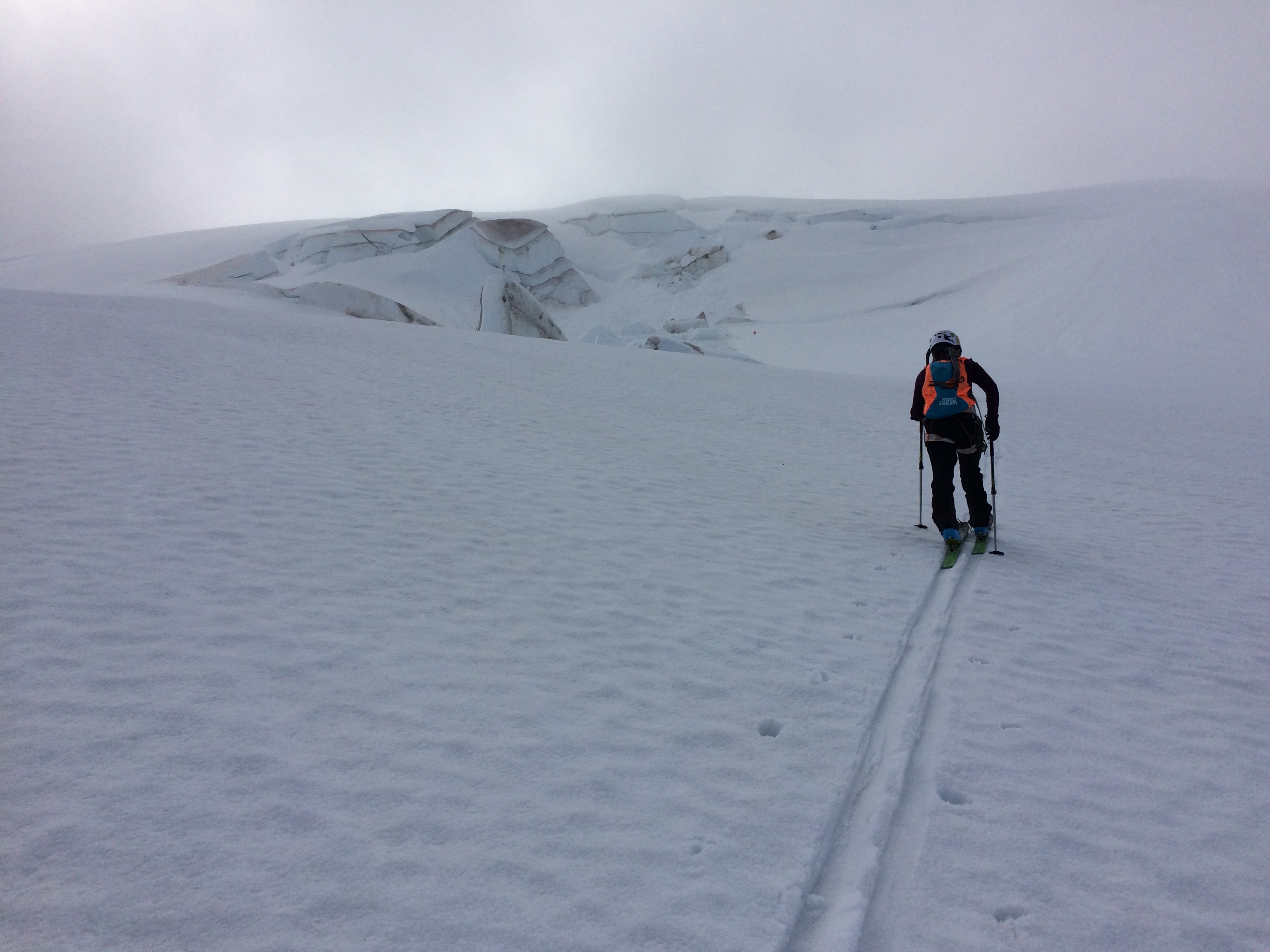
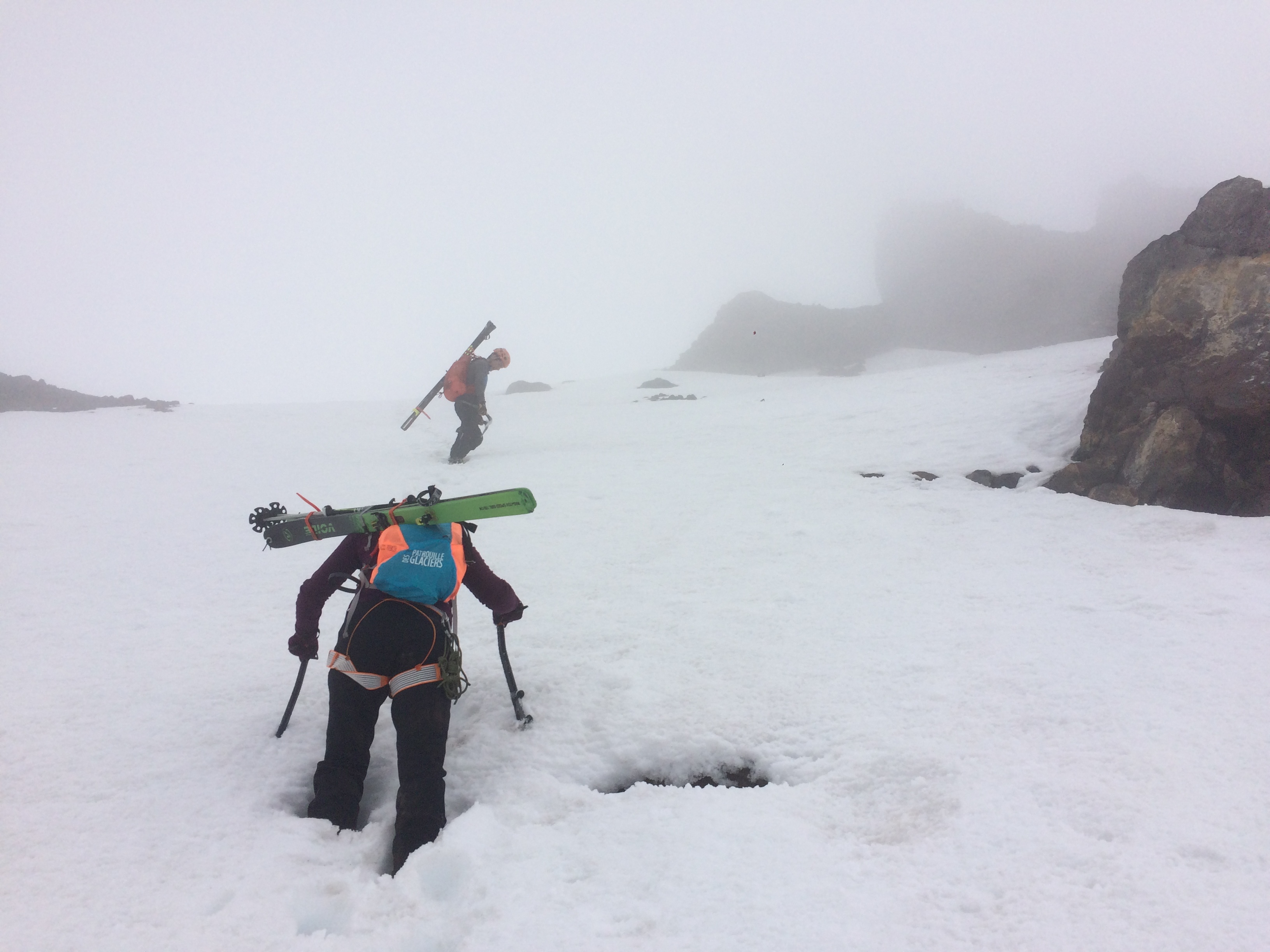
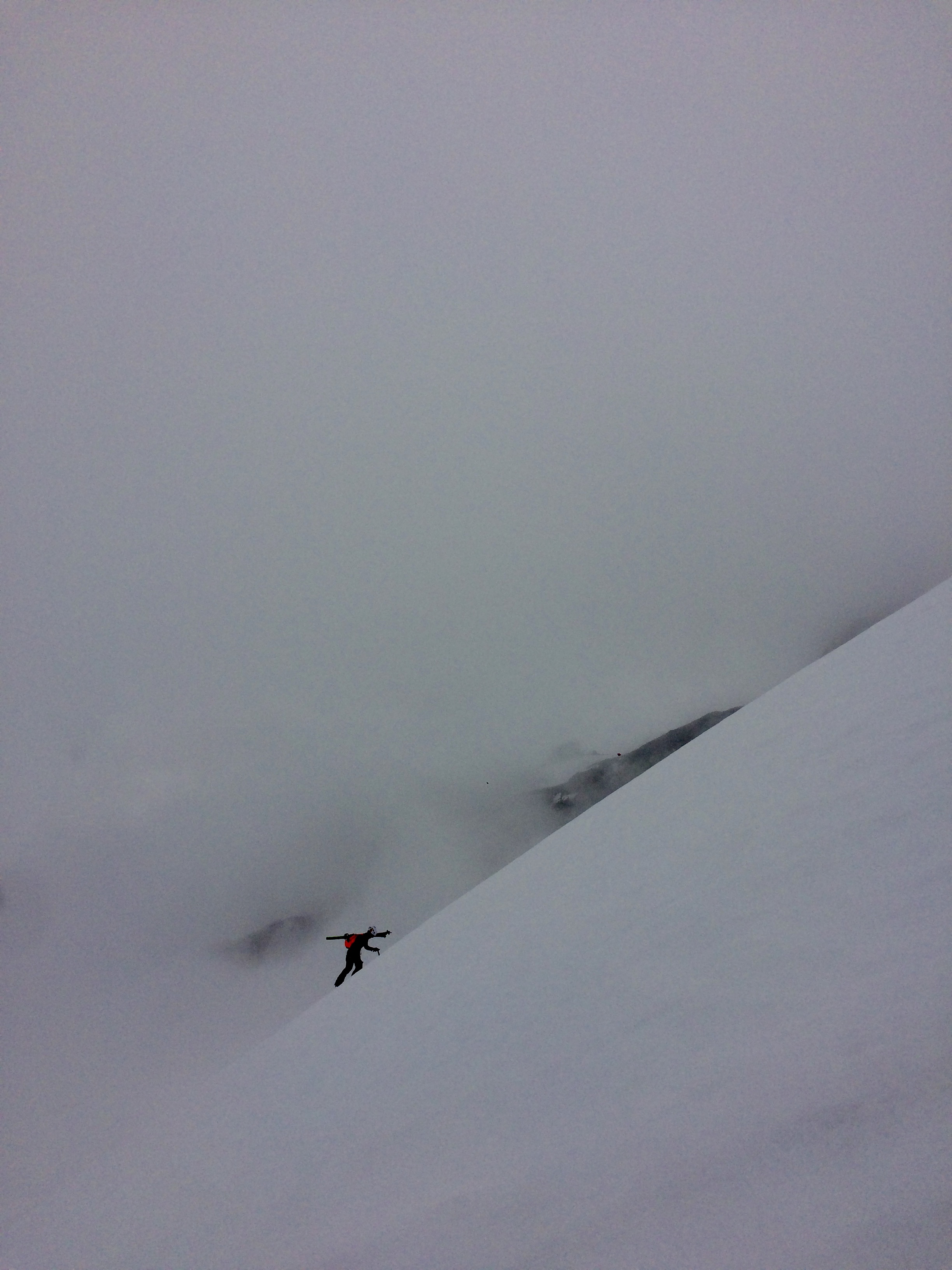
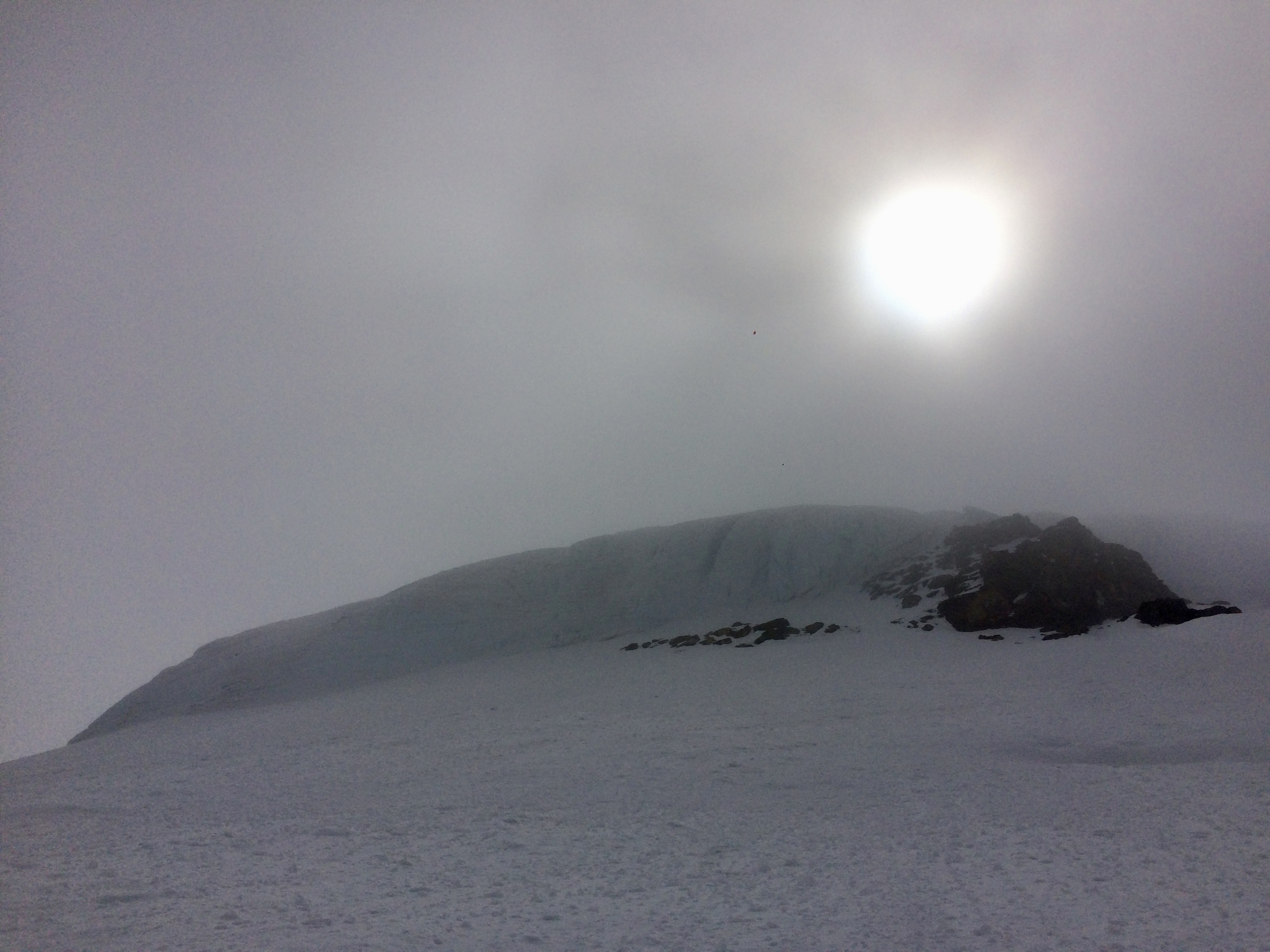
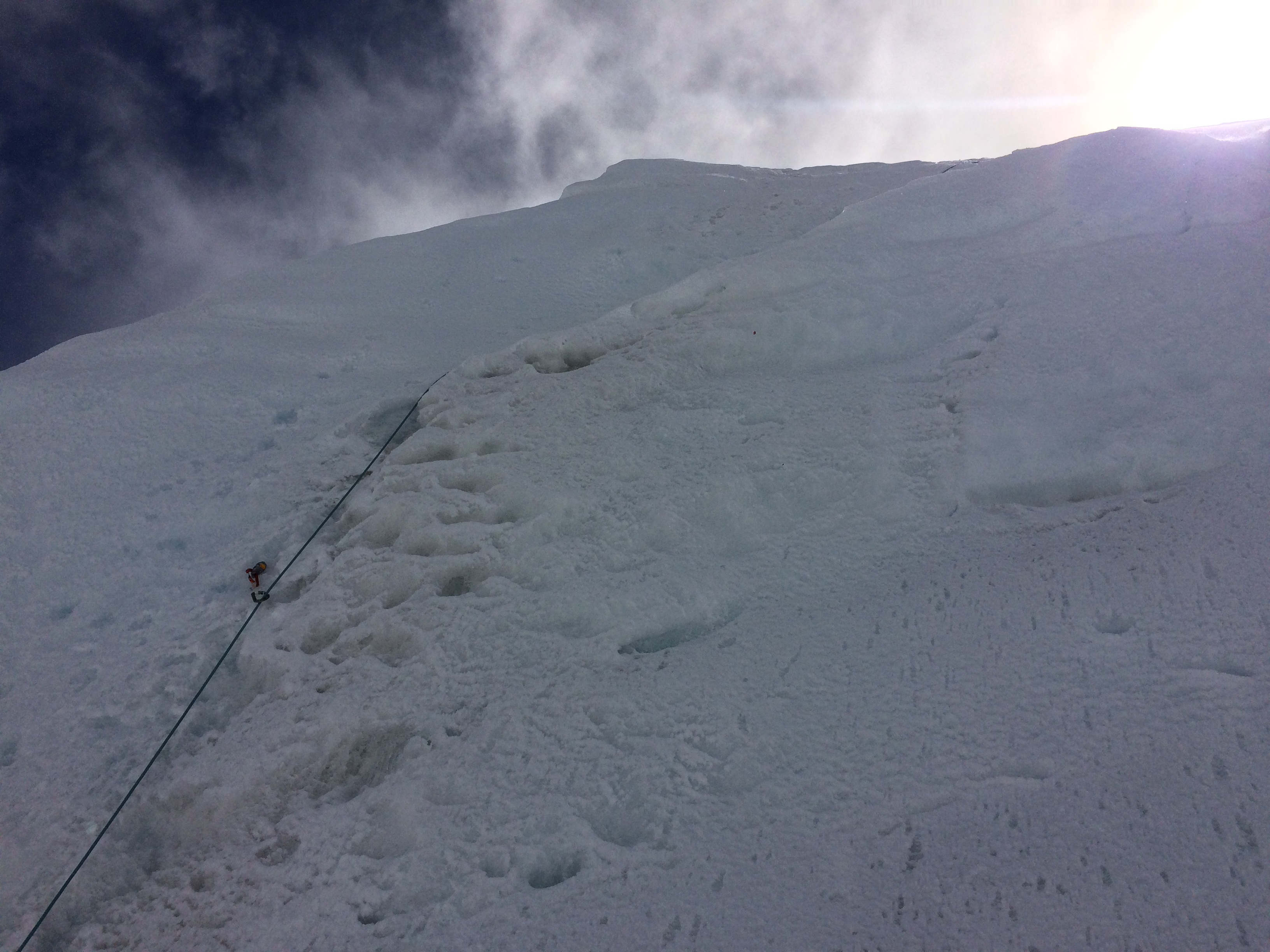
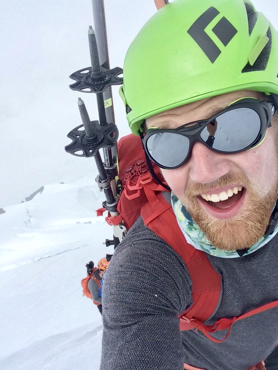
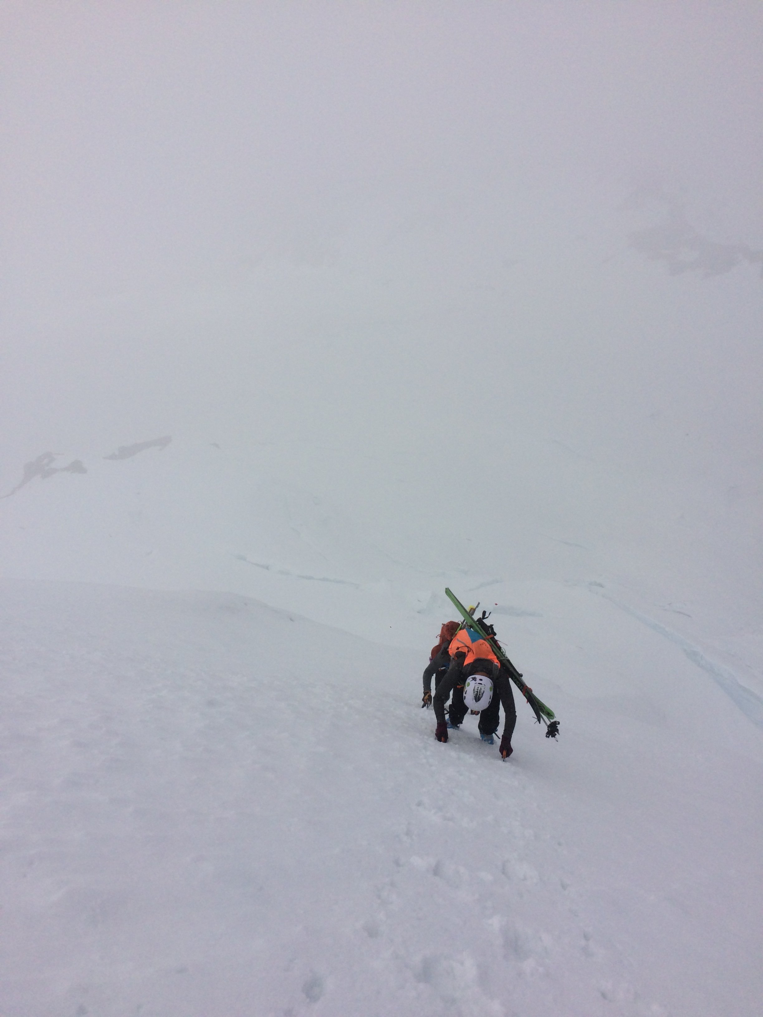
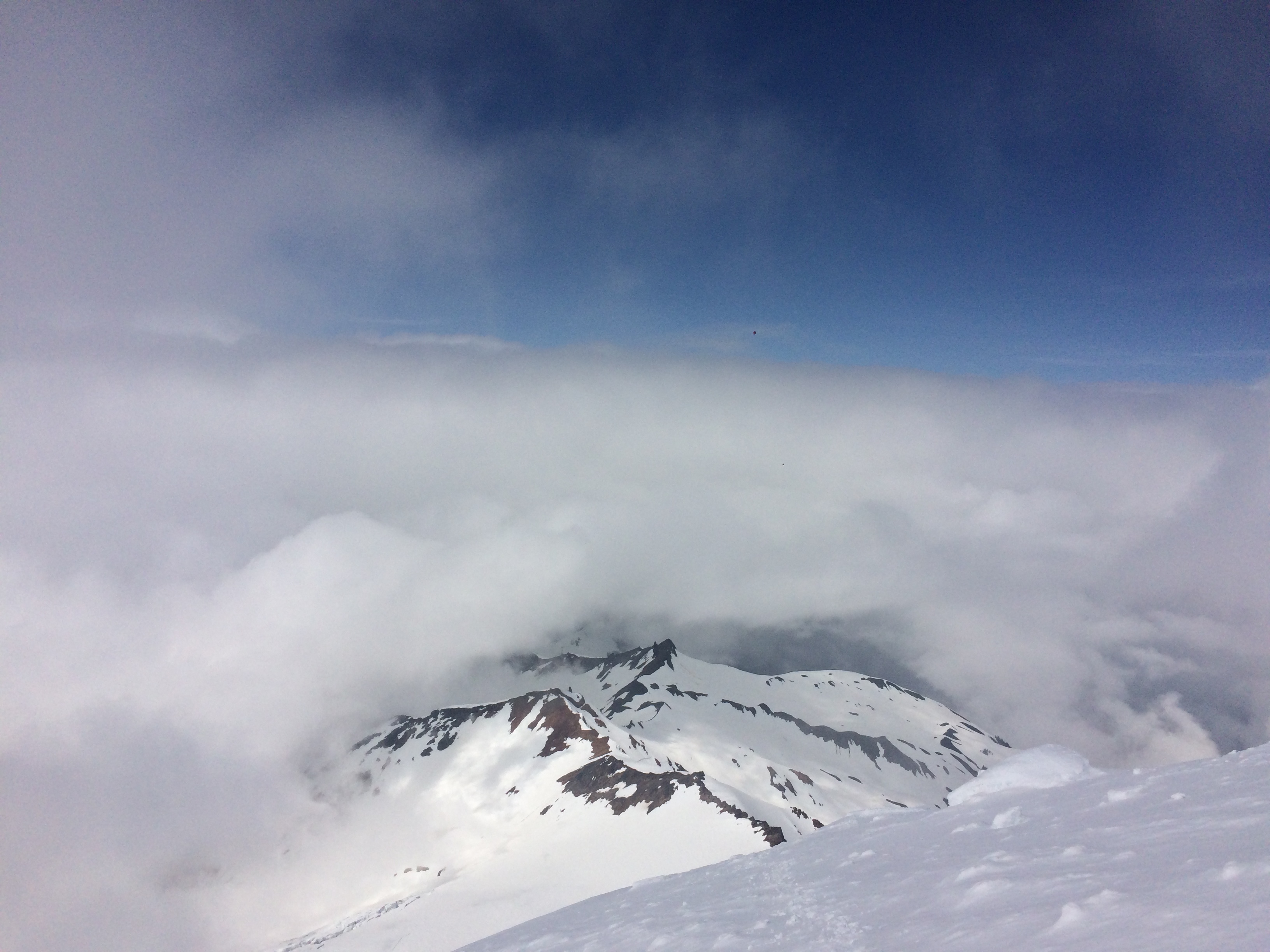
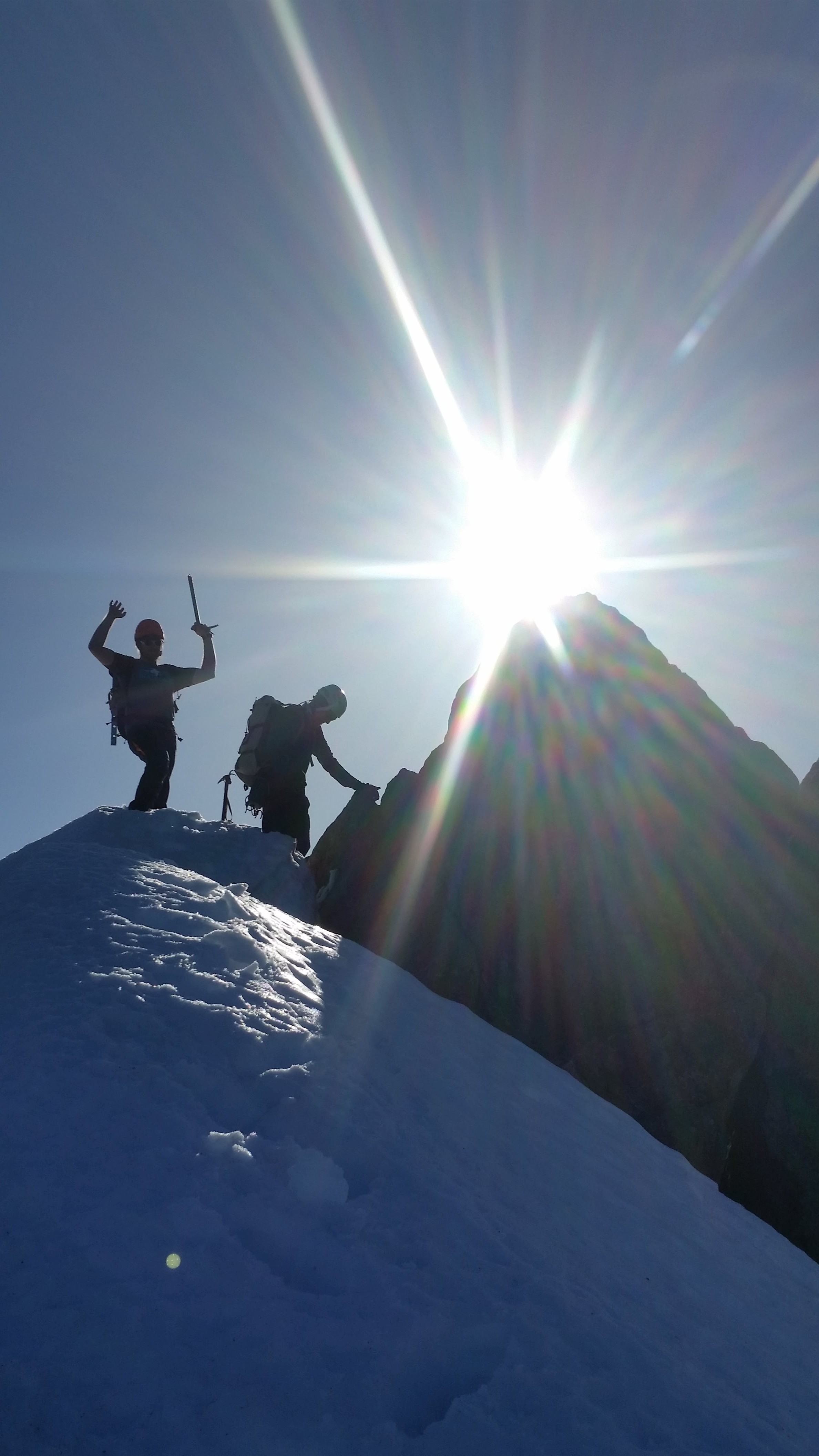
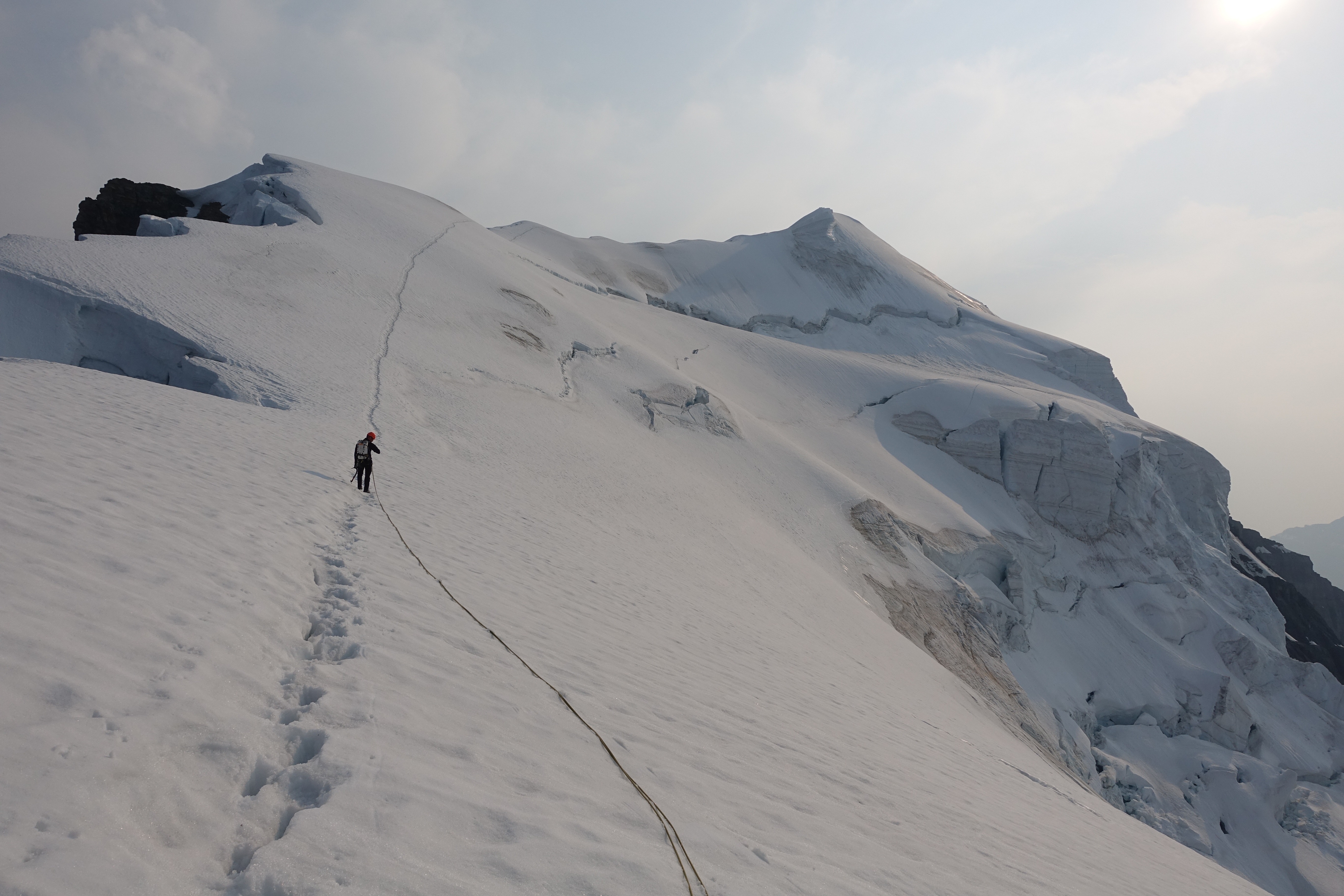
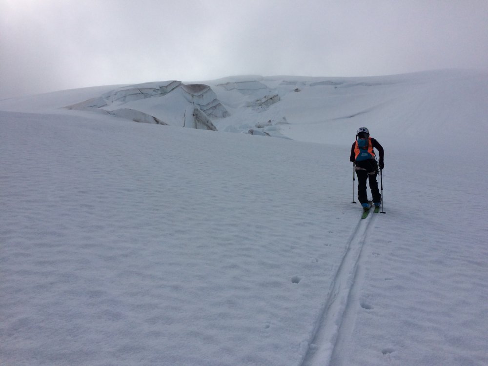
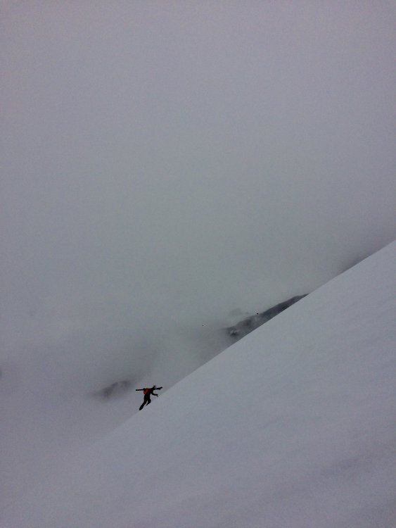
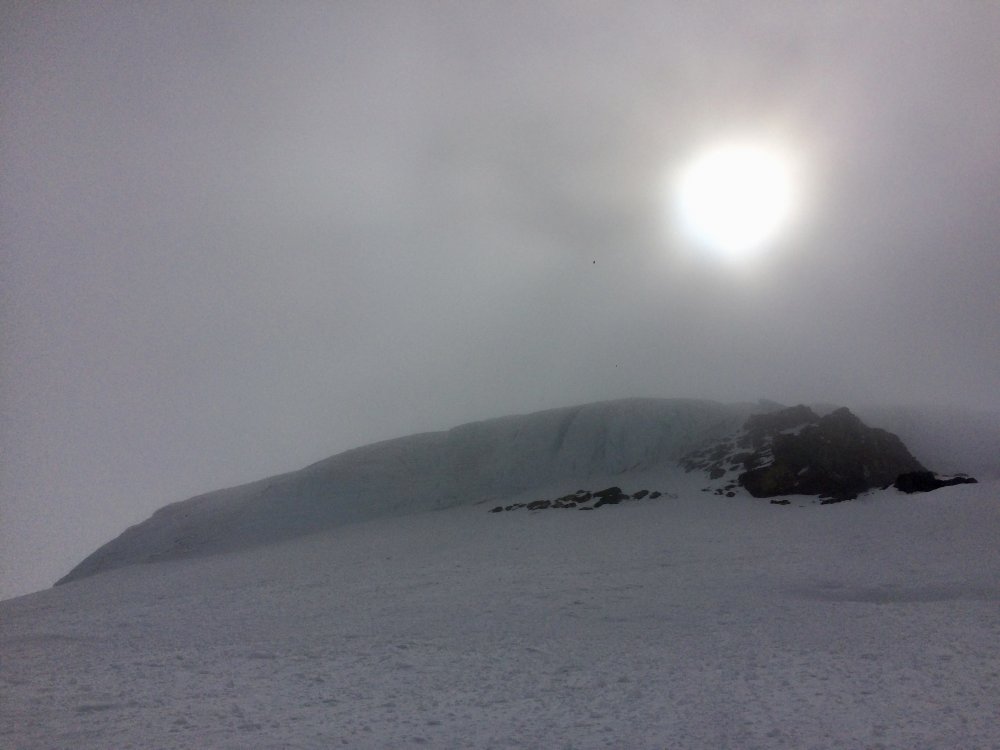
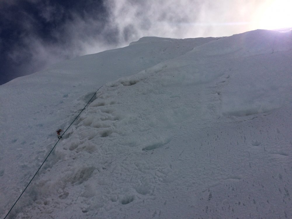
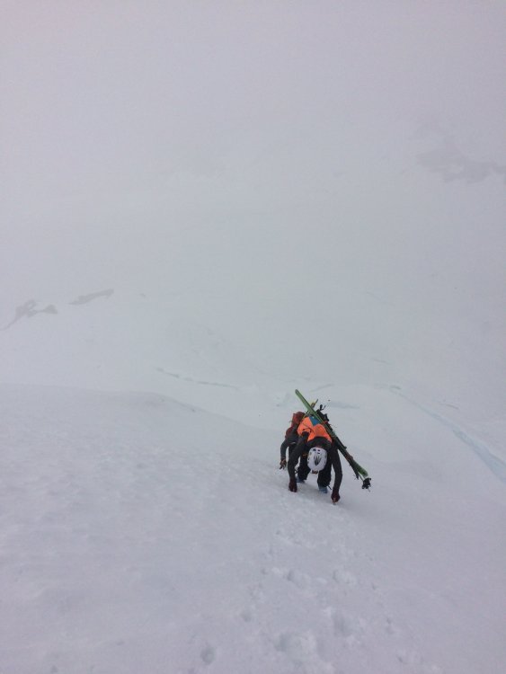
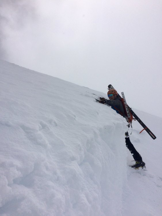
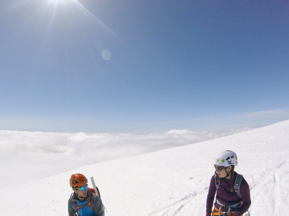
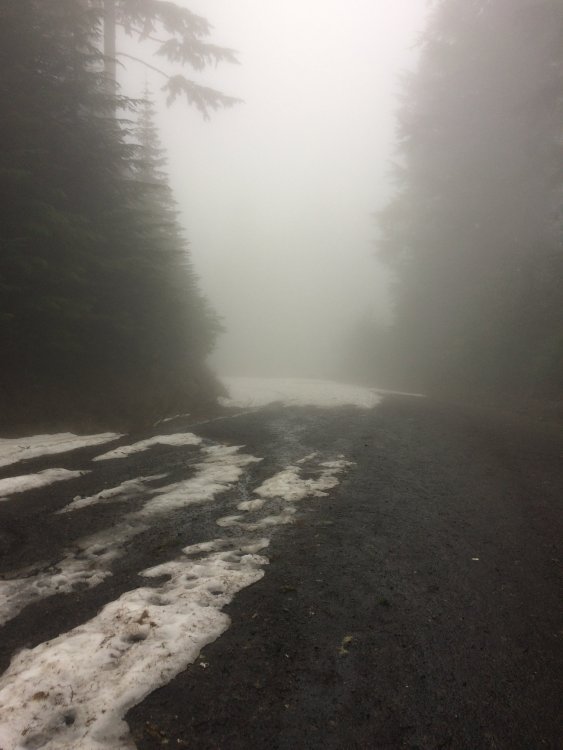
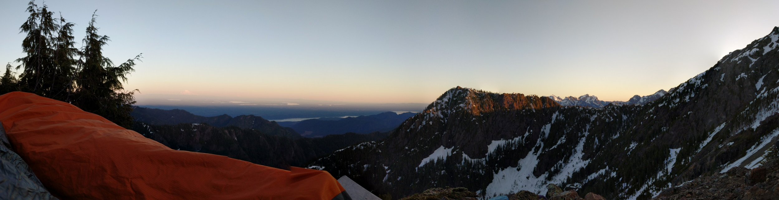
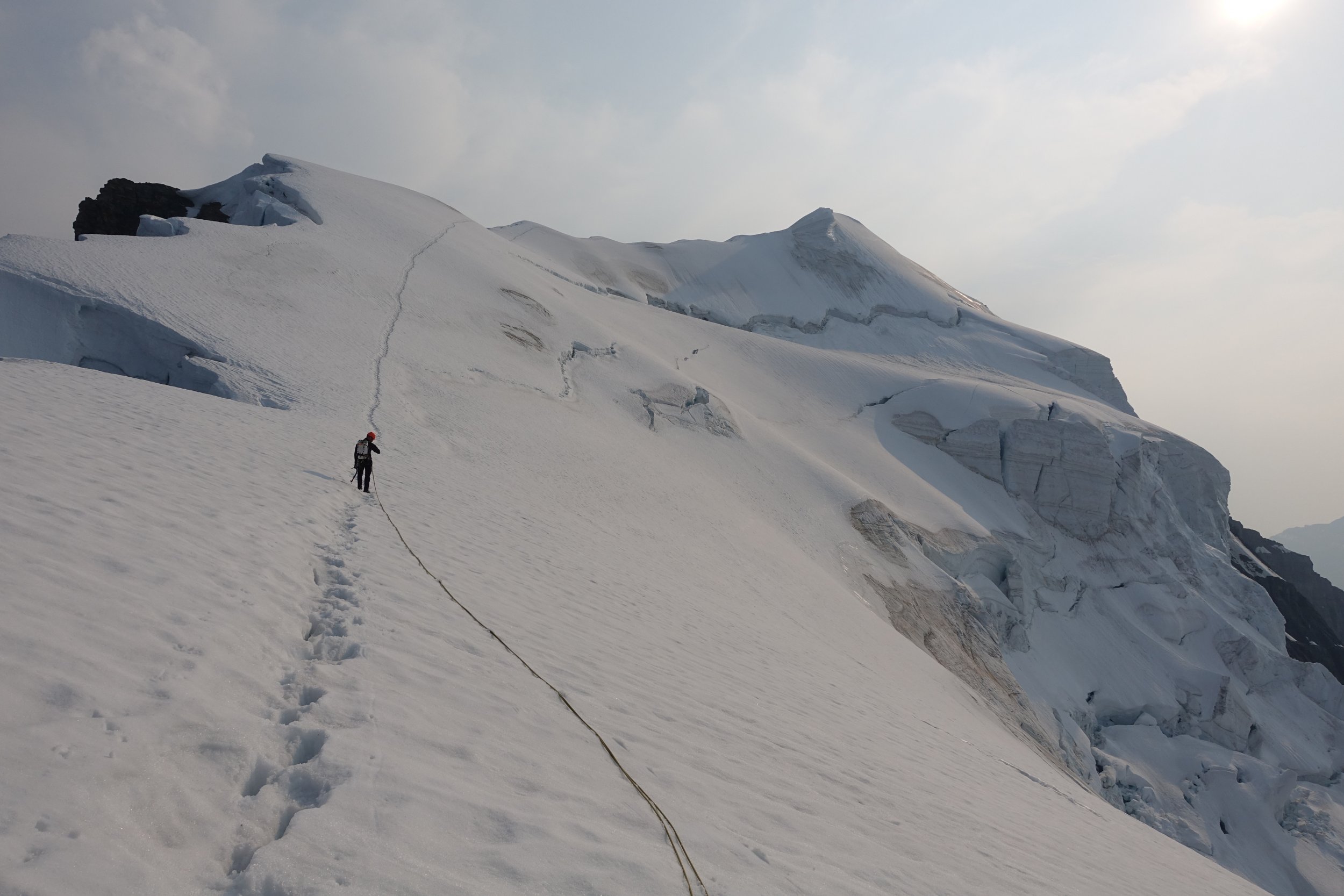
Trip: Mt Baker - North Ridge Trip Date: 05/20/2018 Trip Report: Quick conditions update for Mt Bakers North ridge for anyone interested. Peter, Lael, and I left Bellingham, skimo gear in hand, at 4:15 Sunday morning. We left the car (.5 mi from trail head) in running shoes at 6:00am and cruised up to heliotrope, past a big group of guided skiers. We continued in our comfy shoes (in the rain) up the snow to the last flat before the steep face leading to heliotrope ridge. Here we left the shoes and booted up to the start of the Coleman glacier. With light skis on our feet and rain only getting harder, we zipped across the Coleman, motivated to stay moving quick by crashing in the fog above as seracs fell from the Coleman headwall. After crossing by an unnervingly fresh debris field we were at the base of the north ridge and threw the skis back on the packs. It was decision time and with a few sucker holes in the clouds (and a knowledge of the forecast) we decided to continue moving upward. Our choice proved fruitful (despite post-holing in the deep slush with no boot pack) and we began to feel ourselves nearing the top of the clouds as we approached the ice step. Peter led a full 30 meters and made an ice screw belay at the top of the ice step, he then dropped the rope so I could lead it too. From the belay I pushed upward in the first firm snow of the day (more on this later) as Lael followed up the ice. We gained the ridge proper and were living large as the sun came out. We the saw what appeared to be another ice step which was confusing because Peter soloed the route the week before and saw no such thing. Upon closer inspection the 5ft high vertical face that stretched across the North West face of the ridge was clearly an avalanche crown (probably several days old). With no where to go but up we chopped a step and bouldered up this small face onto snow we now knew was somewhat unstable so we stuck to the ridge proper from then on. Again post holing we pushed for the summit, anxious that we would be too late for firm snow to ski. We arrived at the summit around 1pm and wasted no time skinning over to the top of the roman headwall. Skins ripped. Boots locked. Dropping in! Slushy mank... The skiing sucked but it sure beat walking. We skied back into the clouds and cruised down as fast as our quads could to heliotrope ridge then back down to the trail. Skis back on the pack and running shoes on, we jogged down the trail to the car. Whole ordeal took just a bit under 10hrs. Lael hauls up the Coleman Post Holing up the Ridge Cruising up... Ice pitch near the top of the clouds Ice Pitch Ridge Selfie! Steep ridge after the ice pitch Spicy crown proved to be a V3 boulder move Clouds Breaking Sunshine on top! Back in the fog after the ski Thanks for reading, hope this helps someone! Gear Notes: 5 ice screws, glacier stuff, 2 tools each Approach Notes: Road is open almost to the parking lot


 2 points
 -
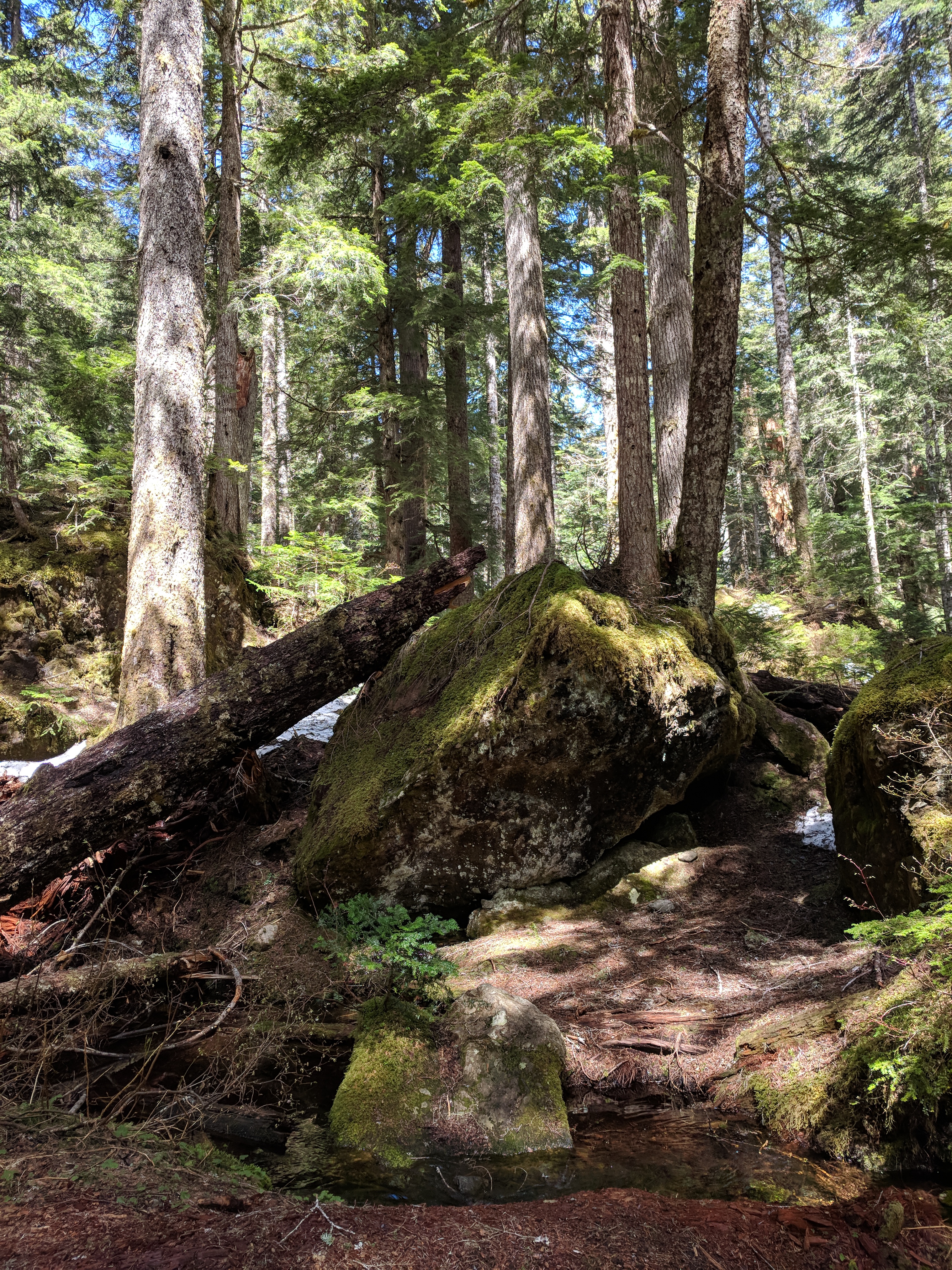
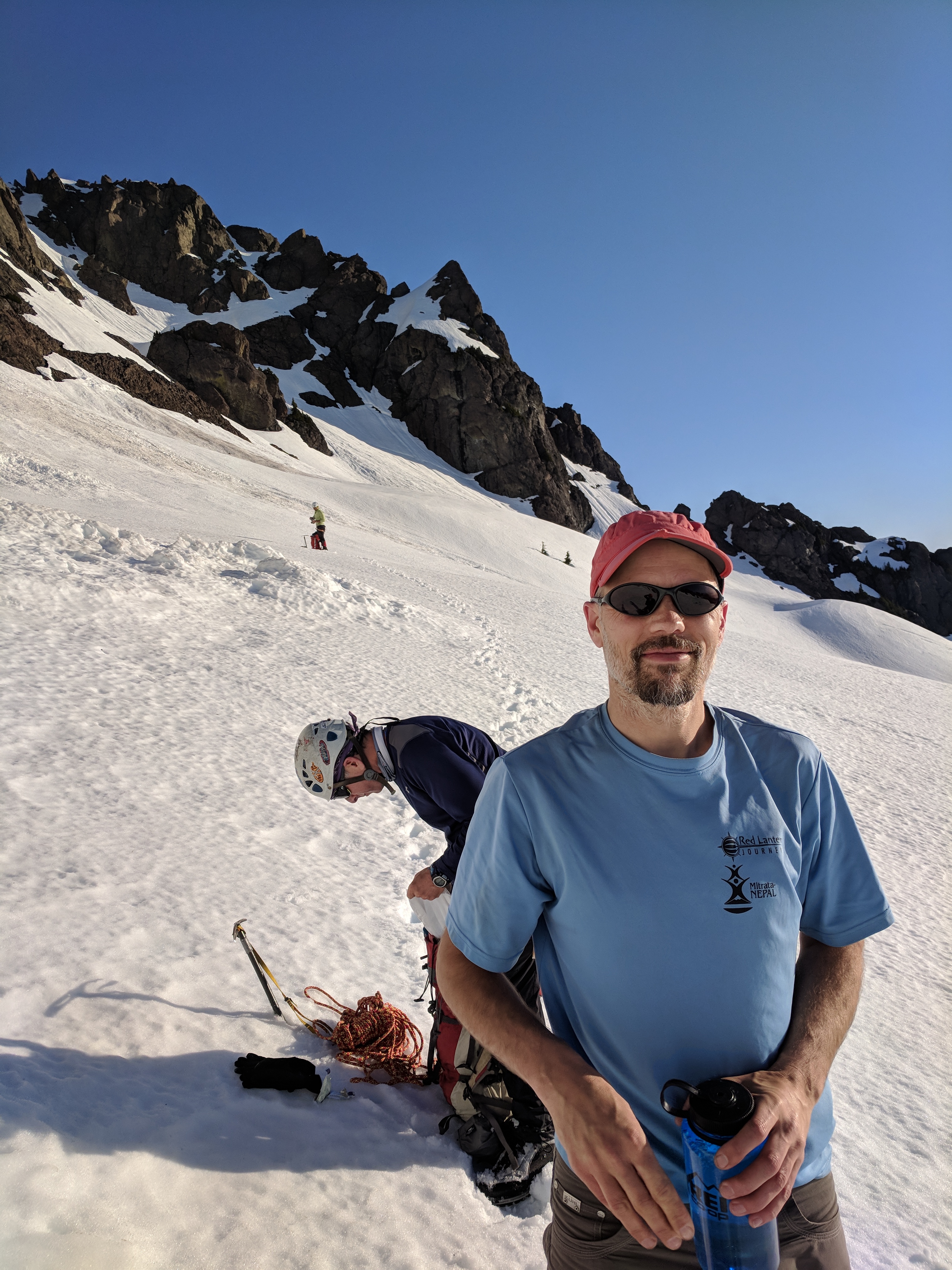
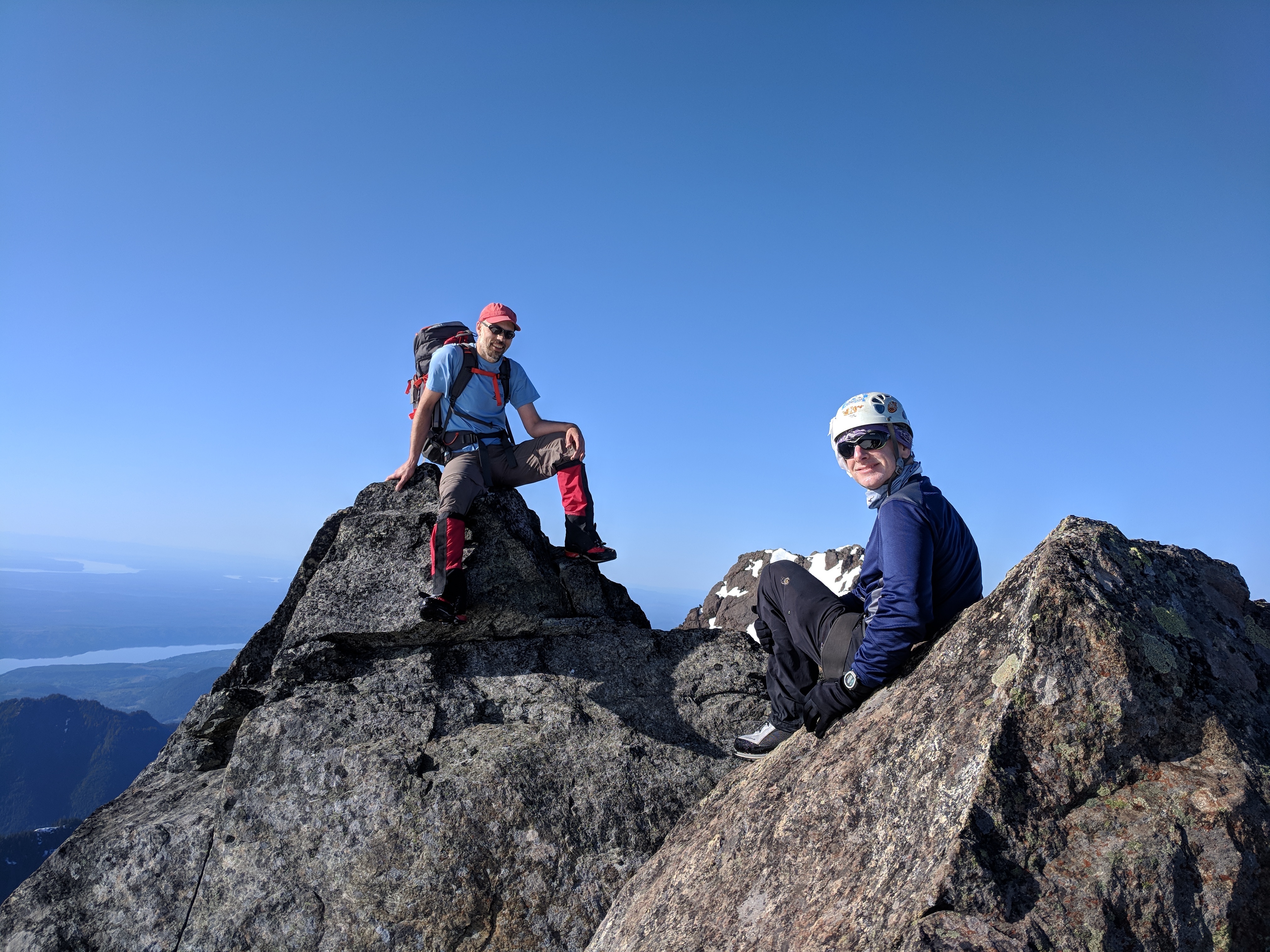
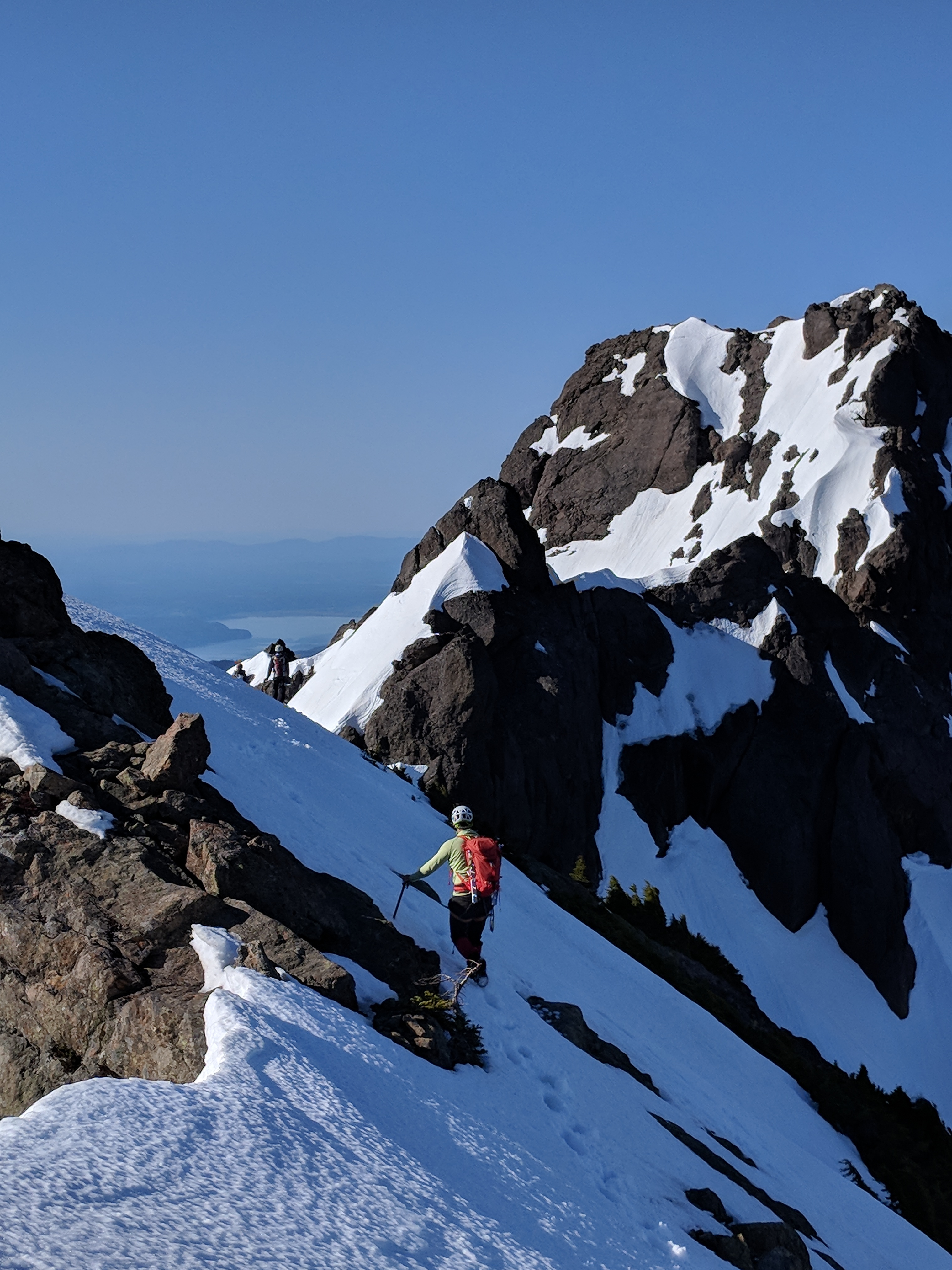
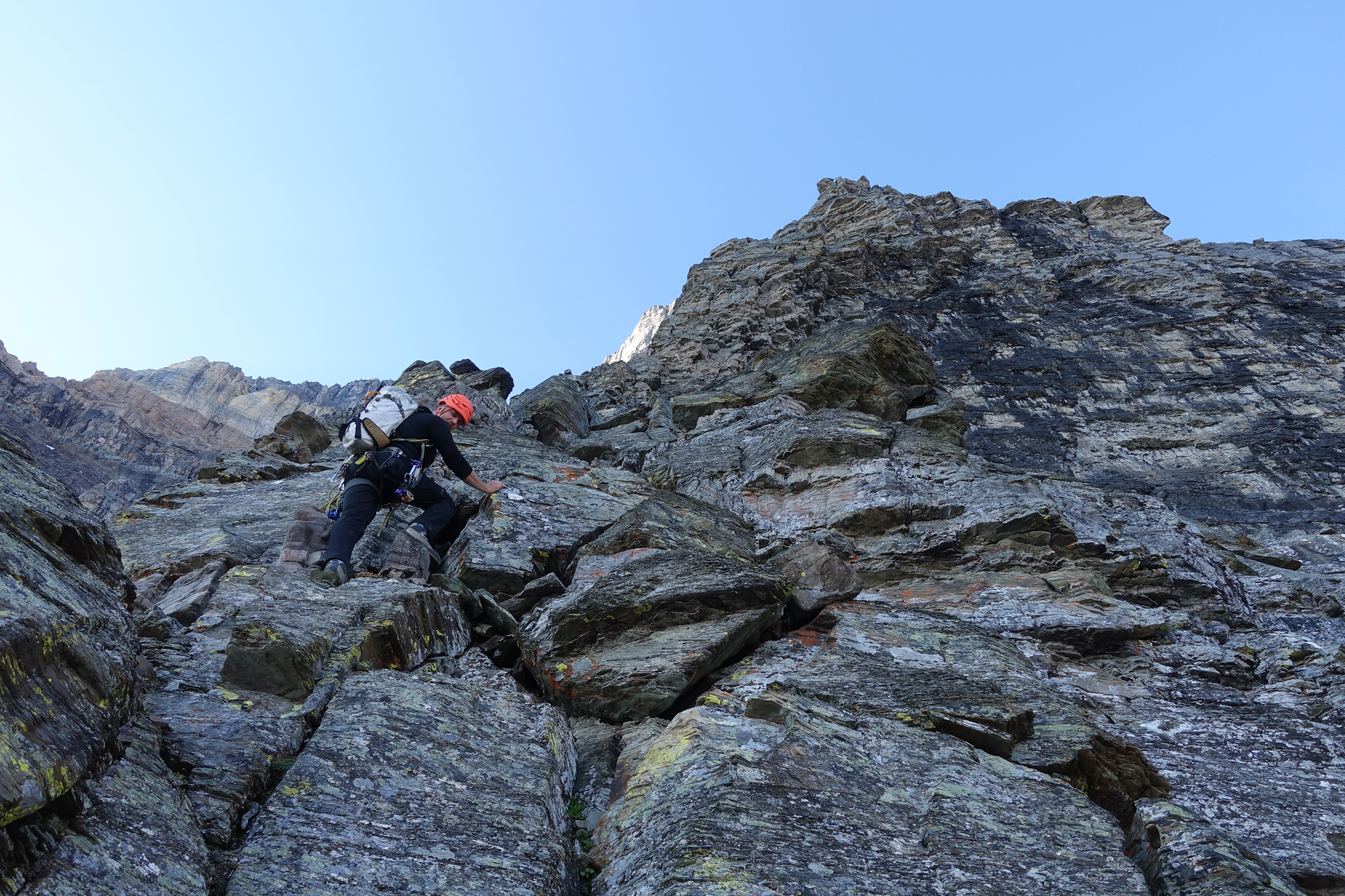
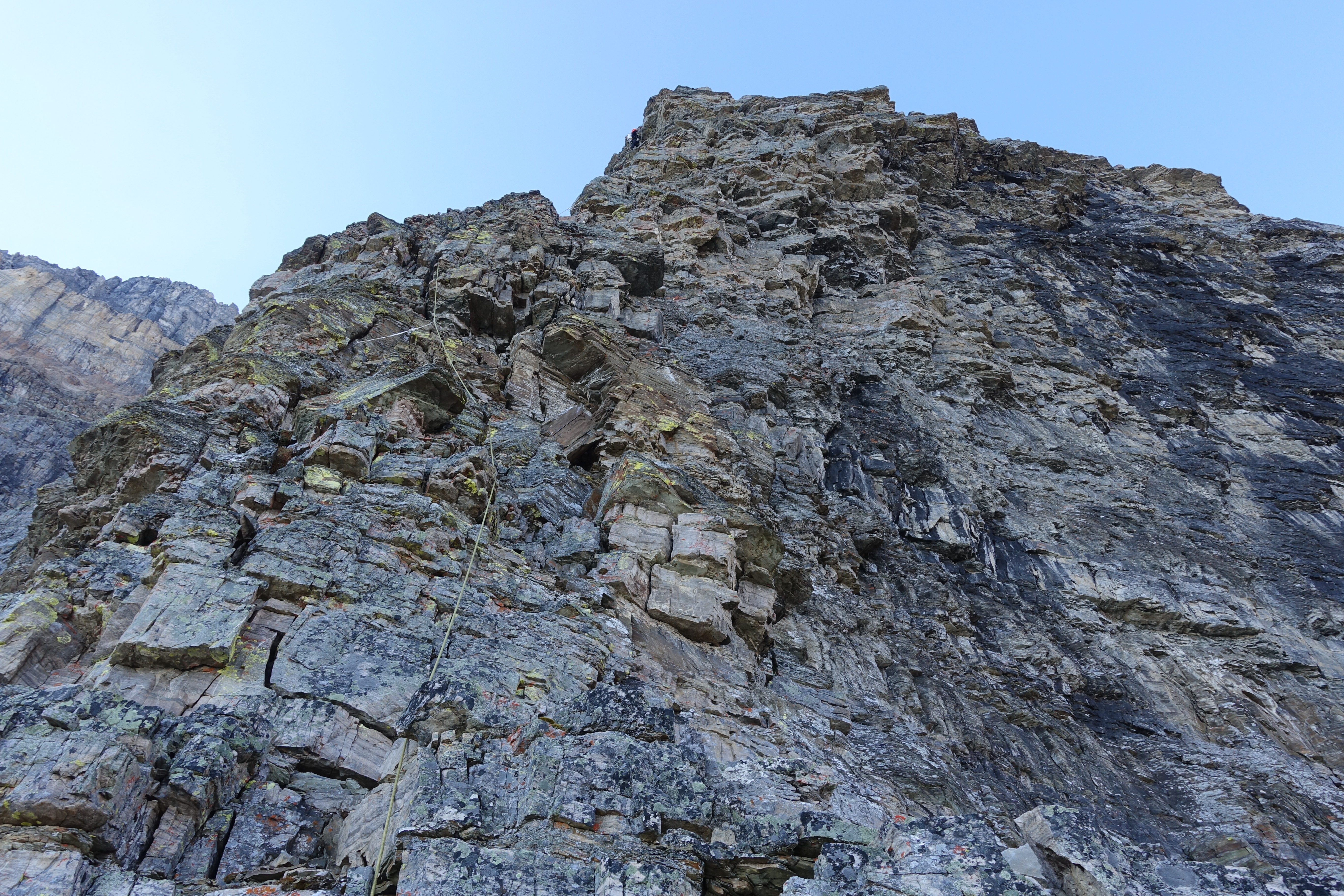
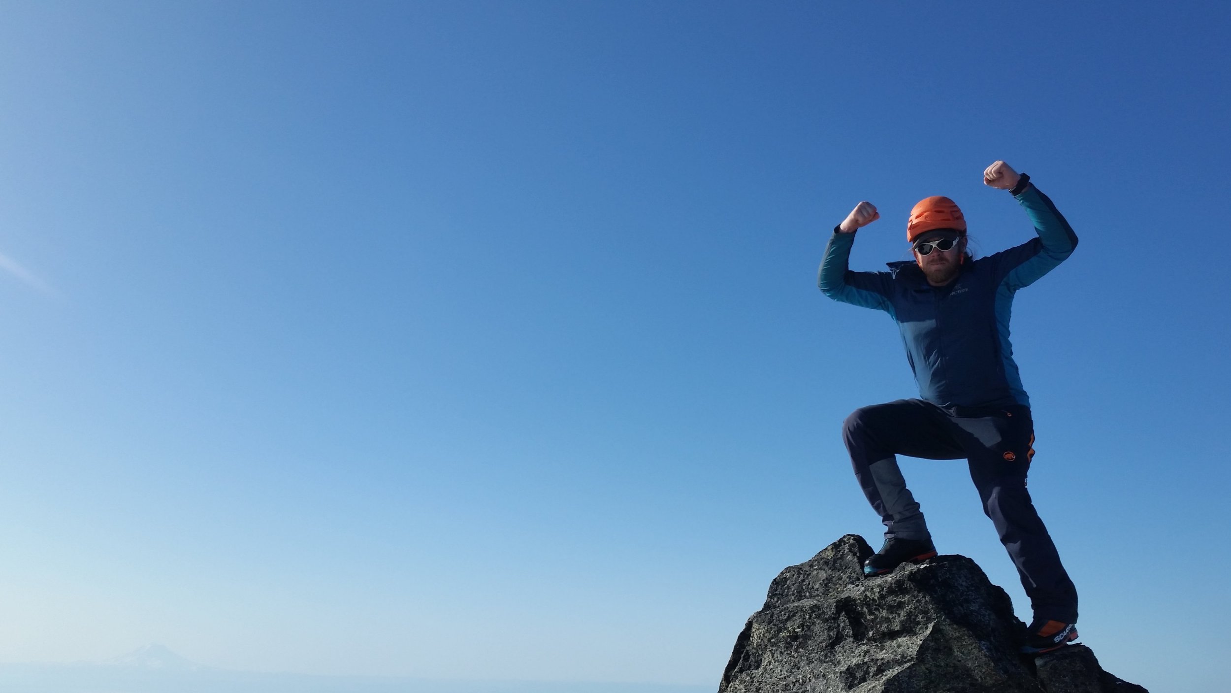
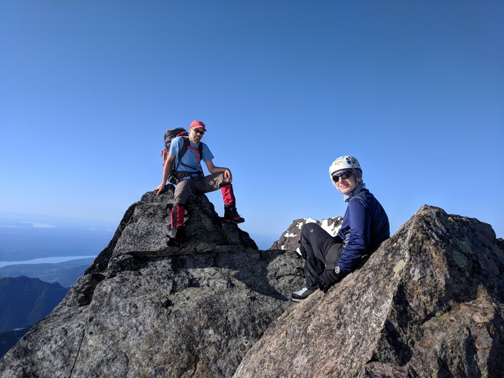
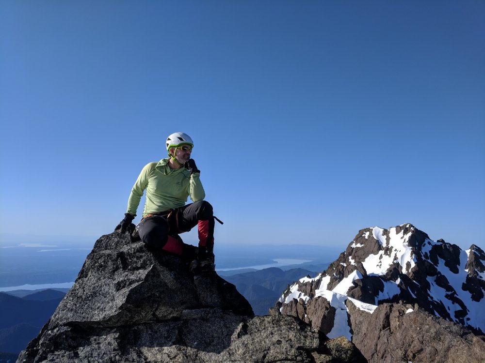
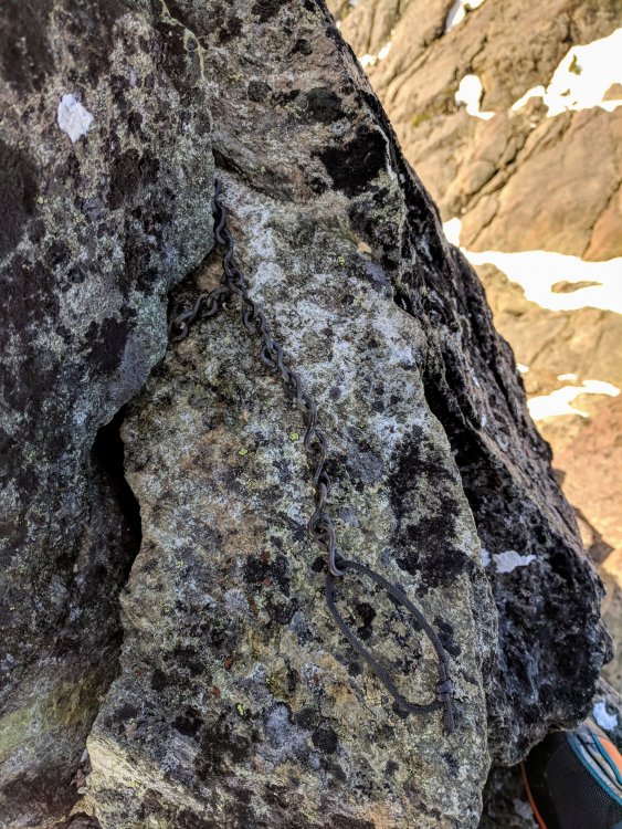
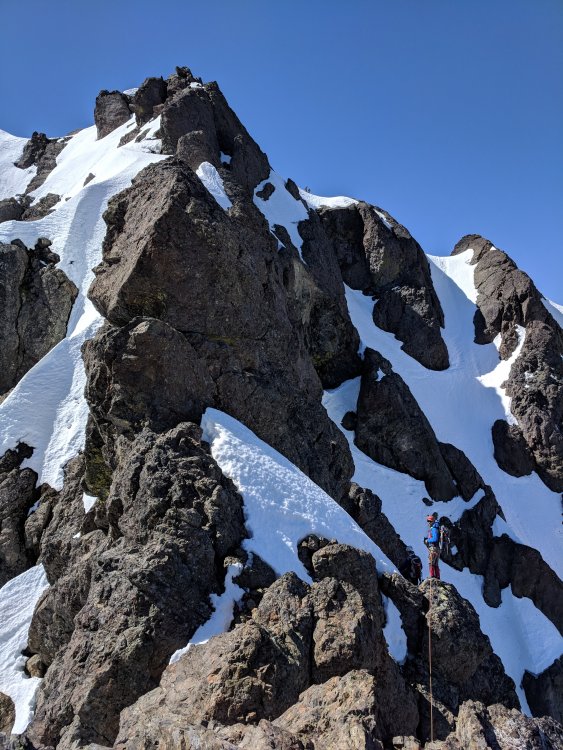
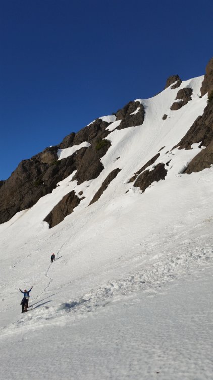
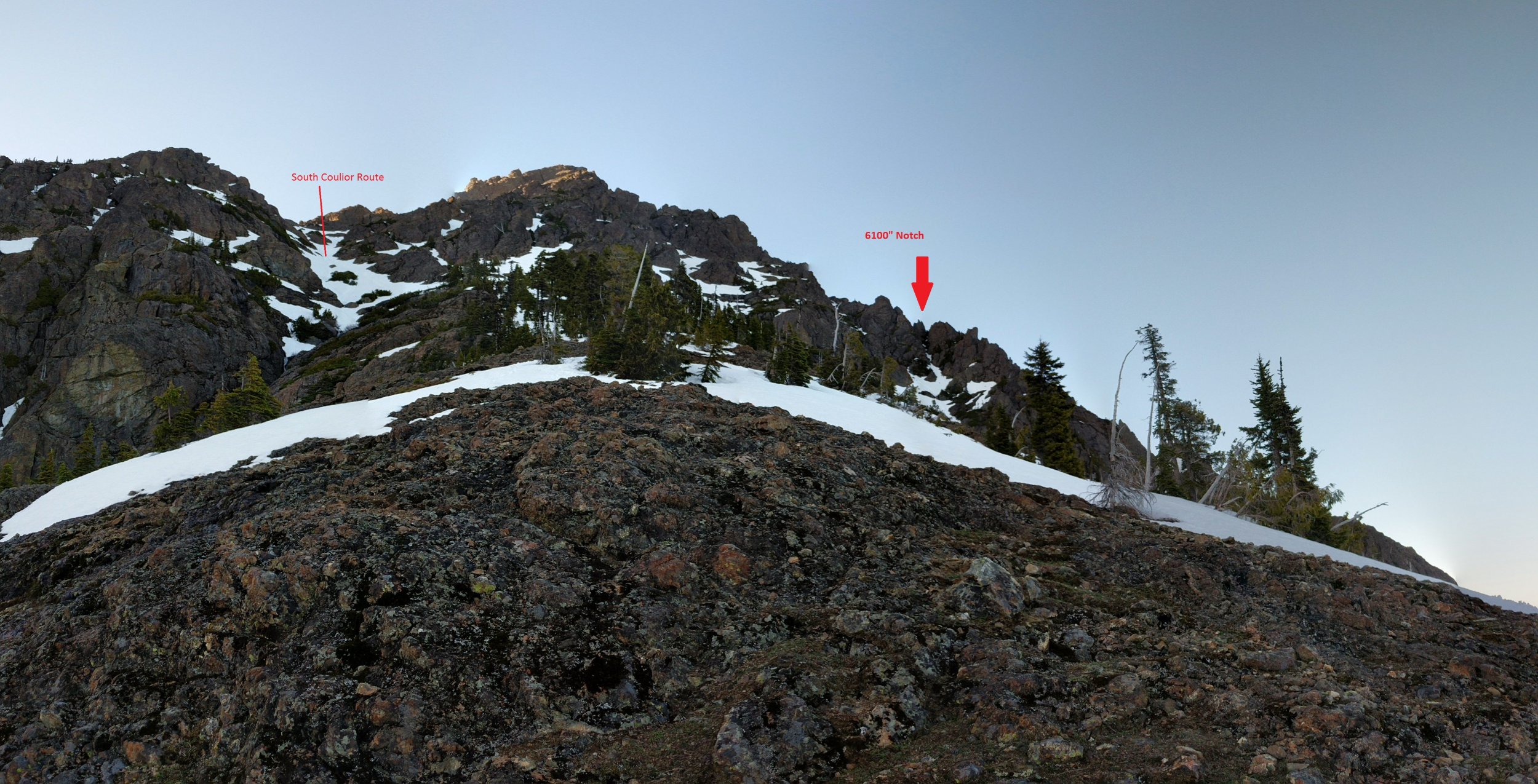
Trip: The Brothers - Brothers Traverse Trip Date: 05/13/2018 Trip Report: Our merry band of chosstronauts climbed both of the summits of the Brothers on the 13th of May to celebrate Nathan successfully completing another trip around the sun. There’s enough beta out there already on the traverse, so I won’t get much into blow by blow of the climb, but I wanted to share some pictures and info I would have found helpful to know before doing it. The trail up to the lake is a highway and very well maintained. On our way up, we passed a friendly WTA work group who was working on blocking switchback cuts. If you haven’t hiked this trail, there are 19 switchbacks in the first 1700ft vert. We were thankful for them on the way up, only to curse them on the way down. Such is the duality of climbing… The next few miles through the Valley of Silent Men was just as memorable as the first time I hiked up the S. Brother 8 years ago, and even more so! There’s a section of fierce blowdowns and mandatory schwacking for about a mile shortly after leaving the lake. Lots of log hopping and trying not to fall into the river all while fighting devil’s club and other pointy foliage. There is a “path” that is flagged through the wreckage, but it’s pretty much a choose your own adventure affair. I didn’t remember this section from my last ascent, so I wonder when all of it occurred, or if it’s just been a deteriorating trail for many years? Anyway, once navigated, the trail again becomes easy to follow to the Lena Forks/climbers camp. We stashed our trail runners and swapped into mountain boots here, but you could probably belay that for another mile or so until after you get through the burn. I’m sure there’s a path through there somewhere, but we didn’t find it. There is a snow finger that follows climber’s left of the burn that we used to bypass some of the bullshit, but this is melting out fast and should be trodden with care. It’s quite thin in places and the river flowing underneath is cold and fast. I punched through on the way down, but was lucky to land upright with my feet on a big rock and my hands out of the hole, keeping me from being swept underneath too far. Be careful! Don't fall in a hole The snow eventually widens into the large south couloir at the top of the burn, and it’s easy going and continuous up the slopes. We chopped a bivy around 5500 ft at some relatively “flat” spots and settled in for the night. In all, from TH to camp was about 5000 ft of vert and 10 miles. Not having done this sort of approach in quite a while, we were all pretty knackered and settled in pretty fast. The night was uneventful, save from the massive stomach cramps my dinner gave me. I usually don’t do dehydrated meals anymore for these climbs, but I found one in my kitchen and the convenience of it won out over going to the grocery store. All I’ll say is that there was a very different sort of alpine aire happening all night in my sleeping bag, which made for a very restless night. Good night south sound Woke up at 430AM the next morning to aim for the 6100” notch in the S Brother SE Ridge with the goal of gaining the Great Basin, the North peak, and then traversing to the South peak. There’s no real good description of what to aim for, and each TR seems to gain a different notch. So here’s a picture of what to shoot for, unmistakable marked. This notch seemed to match the approach notes on the Mountaineer’s website, and we found some rappel tat while climbing it, so I think it’s the correct way to go. There was only a thin finger of snow up the gully when we did it, so it may be gone by now. I’m not sure what climbing up the rock of the gully would be like, but the short sections we had to do were attention grabbing. The backside is steep snow down to the Great Basin, but nothing five minutes of face-in down climbing can’t dispatch. The great basin is quite beautiful, and it’s a really cool feature to traverse across. This is the prominent snow slope visible from far across the sound. It’s amazing to be able to look at from far away and know that you walked across there. Decent to the basin from the notch The ascent couloir to the North Brother was dispatched quickly on slightly mushy but continuous snow all the way to the ridge top. The snow will probably last for a little while longer at least. This deposits you almost right at the summit; a quick few rock moves away. The summit register on the North Brother is gone, but the anchor chain is still there. Wonder what happened to it? From here the traverse begins. Follow all the other beta that’s out there along with your own intuition and you won’t go awry. Every feature that looks impassable or sketchy from afar has options aplenty when examined up close. The climbing was all very straight forward and wasn’t difficult; if you’re doing 5.7+ moves you’re off route. I will note that we went an alternate way to finish the traverse. Instead of going through a cave/moat, and then up the steep NE face of the South peak as described in the beta, we continued to traverse to the NW face, over a rock rib, and up the NW couloir. The route described in other TRs wasn’t in for us; the snow was too unconsolidated and thin at the steepest section and it would have been asking a little much of it to hold on for 4 climbers to pass through. Our alternate way worked well with an exposed move or two of 5.choss. There’s a semi-decent crack to build a quick anchor to protect the leader during these moves here. Be careful if going this way; the snow traverse is quite steep and the rock is very loose and not trivial. There are a few very large loose blocks on this portion waiting to take out a careless climber and a fall here would be catastrophic. It goes though! From the top of the exit couloir, a short 100” scramble puts you on the summit. The traverse took us about 3 hours from the time we roped up to the time the second rope team topped out (2:15-2:30 moving time for each group). We simul climbed almost the entire route, with one static belay over the 5.choss rib. From the South summit, we were back at the TH in 6 hours, including picking up our camp on the way out and lounging around at Lena Forks swapping shoes. Overall, it was fun and a great first climb of the season. The route holds a lot of alpine challenges which all felt real, but never felt too sketchy. It’s a long way back in there though, so bring strong legs and good shoes. Gear Notes: 30m rope 2 pickets 2-3 small cams deez nutz Approach Notes: Too many switchbacks.....


 1 point
 -
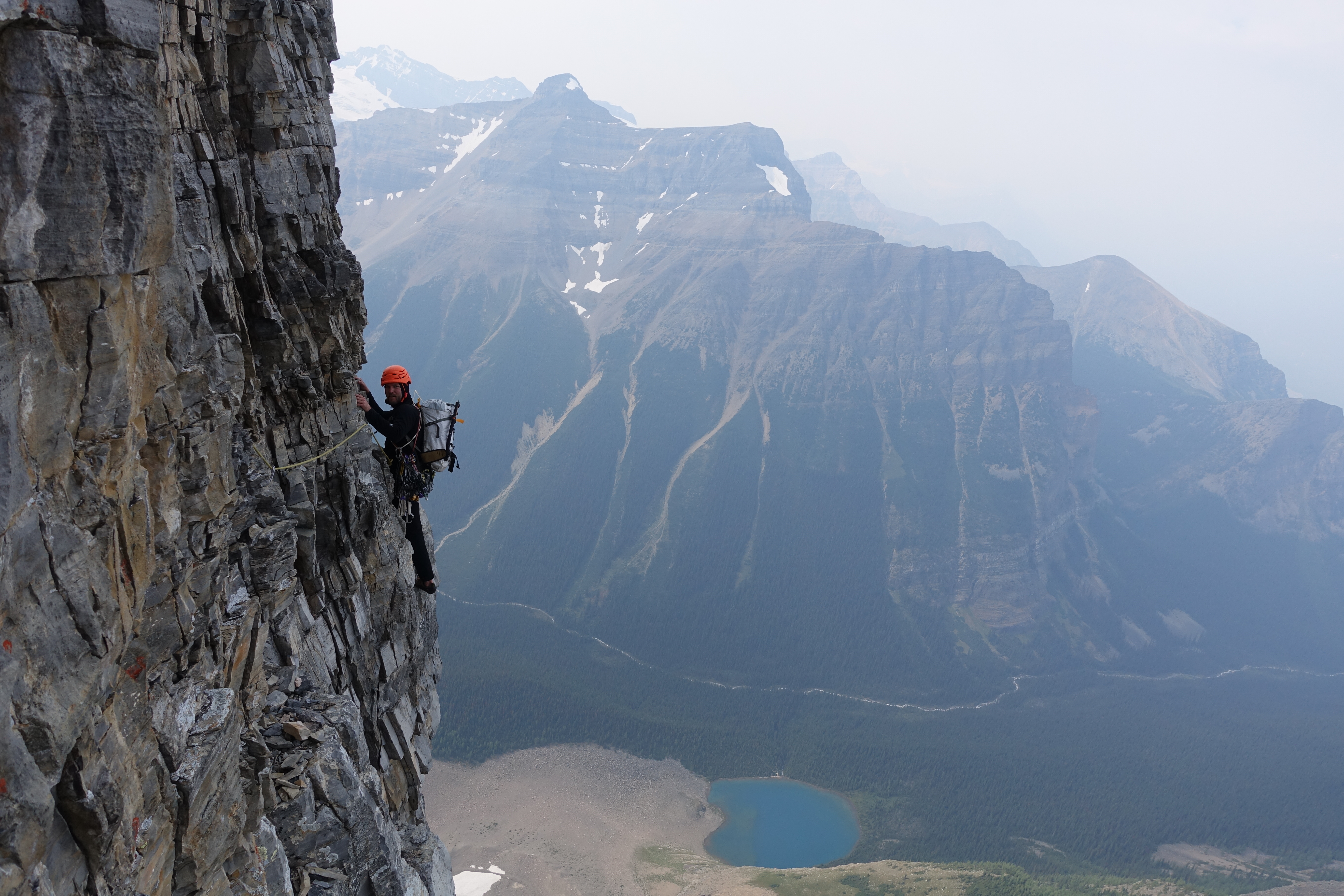
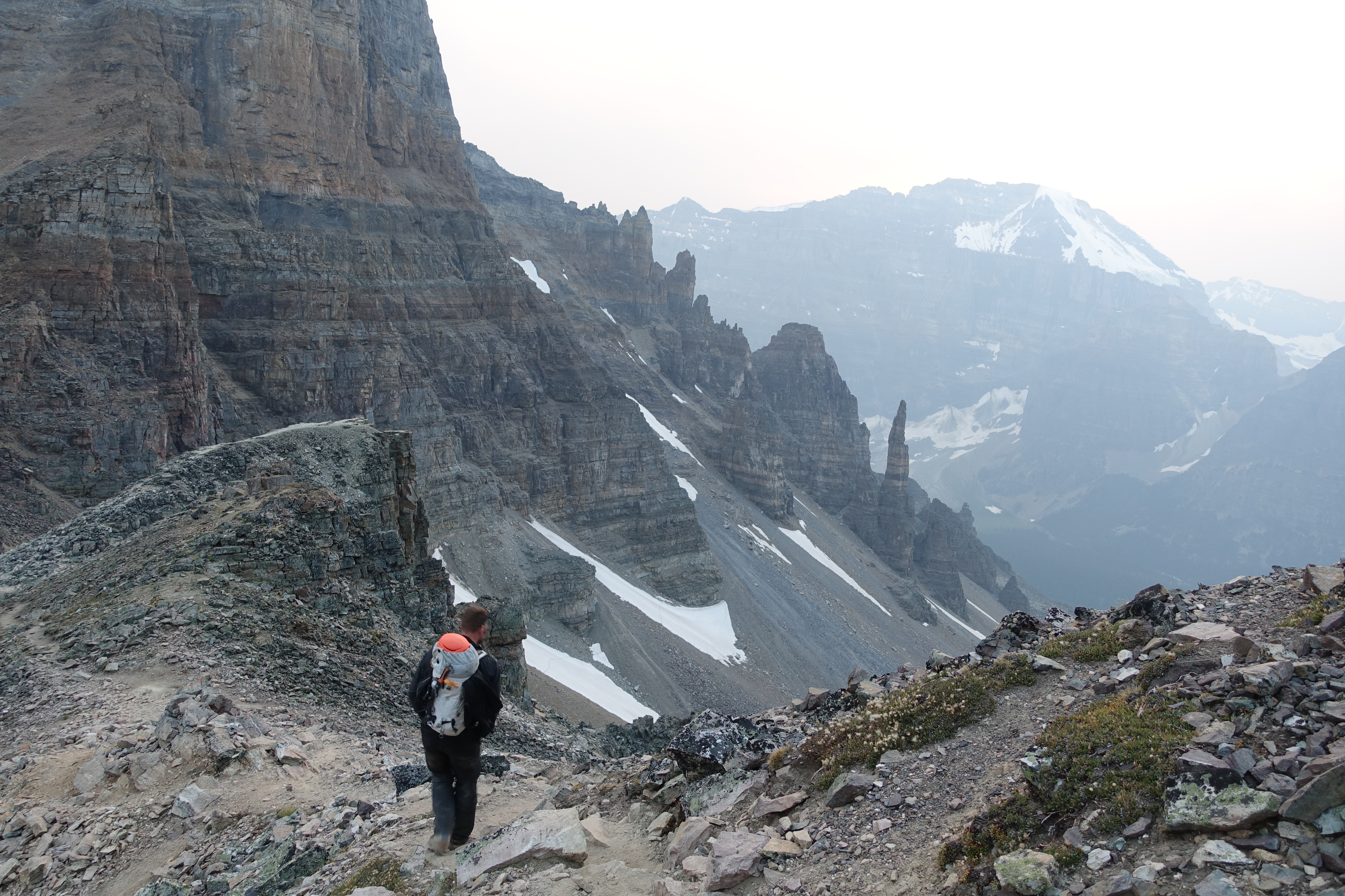
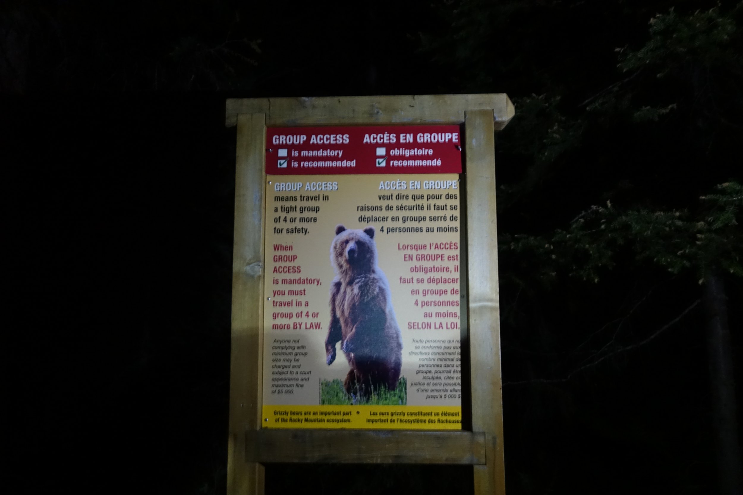
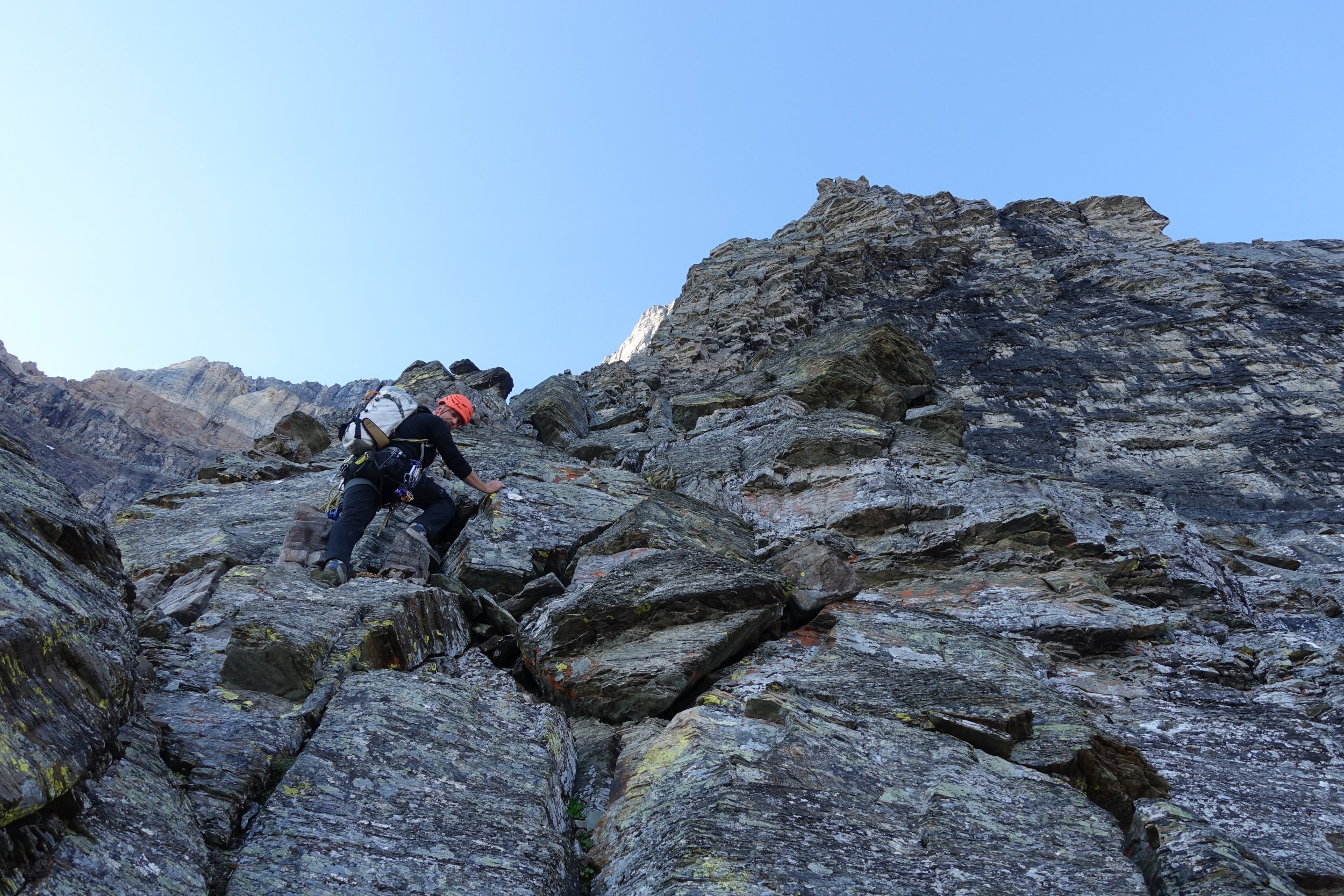
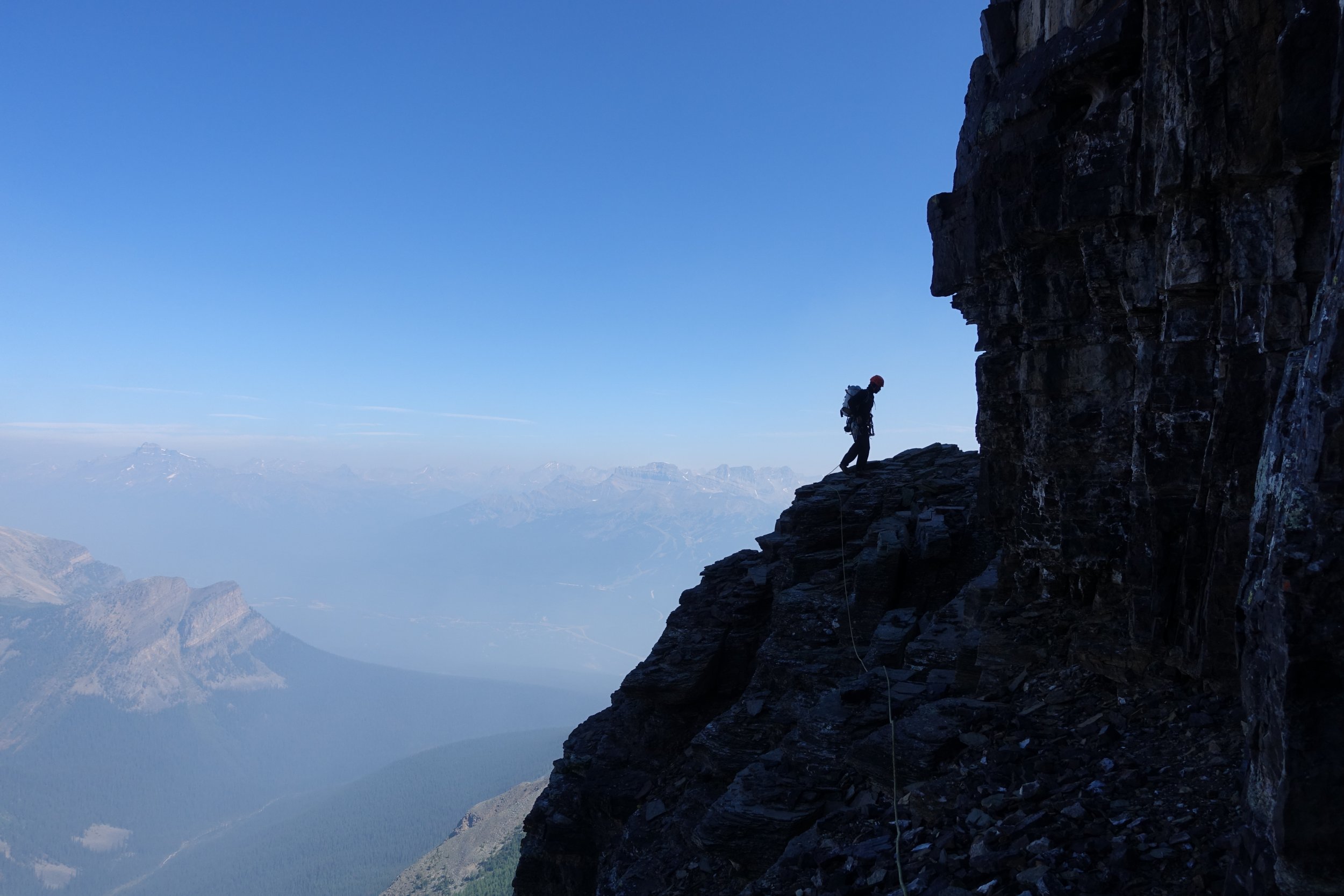
Trip: Mount Temple - Greenwood Jones Trip Date: 08/03/2017 Details: Given the reputation and lore select Canadian Rockies north faces hold I've always wanted to climb one but never had the opportunity minus a failed attempt on GCC on Kitchner way back in the late fall of 2008. High my list was/is any route on Mount Temple but avy conditions in the winter and grizzly conditions in the summer/fall had prevented me from ever trying. My understanding is most years the CAN parks require (communists ) a minimum party size of 4 for anyone entering the area below the north face or risk BIG fines (and possibly a grizzly encounter ). As finding another team of 2 keen on an alpine start that was also willing to climb a different route was pretty much impossible I never have had a chance to try. However in August of 2017 I heard they made the party size a recommendation and not a requirement. Lucky for me Daniel Harro was also keen so we pointed it north. Based on dawn & sunrise times and our plan to filter water at the lake we settled on a 3:30 departure. We started the face slightly later than I had hoped and wandered around trying to make sense of the beta before settling into the route. Everything you heard is true: choss to perfection and everything in between. Not the worst rock I have climbed but Oregon volcano climbers have a high threshold. Managed to climb it without placing pins but we definitely clipped a few along the way. All in all an awesome route and deserving of the status. I definitely want to come back for Greenwood Locke (in colder temps) and the Cardiac Arete on the Grand Sentinel looks awesome. We found this TR in conjunction the most useful for route finding but even then we scratched our heads more than once and I had to reverse/downclimb a few false starts. Pins can show the way as well as get you way off route If you try to do it in a day (which I recommend as it makes the packs more manageable) you need to save as much daylight as possible for the descent; I would expect attempting to follow the cairns down in the dark even with a headlamp challenging at best especially if you go back to your car via Paradise Valley. A google search will turn up more than a few TRs that detail a night spent out high on the mountain. Gear Notes: Standard rack. Took pins but didnt use them. Crampon and mini ice axe. Approach Notes: Opted for the car to car option


 1 point