Leaderboard


Popular Content
Showing content with the highest reputation on 05/15/18 in all areas
-
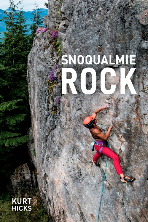
Hey CC.com! I'm proud to announce the release of Snoqualmie Rock. After 5 years of research, writing, and review, this comprehensive guidebook for the I-90 corridor is finally complete. It covers well over 700 routes from Issaquah to Snoqualmie Pass at over 60 crags. You'll find it in stores this June, but you can pre-order your own copy now at www.snoqualmierock.com See you all at the crags!
 6 points
 -
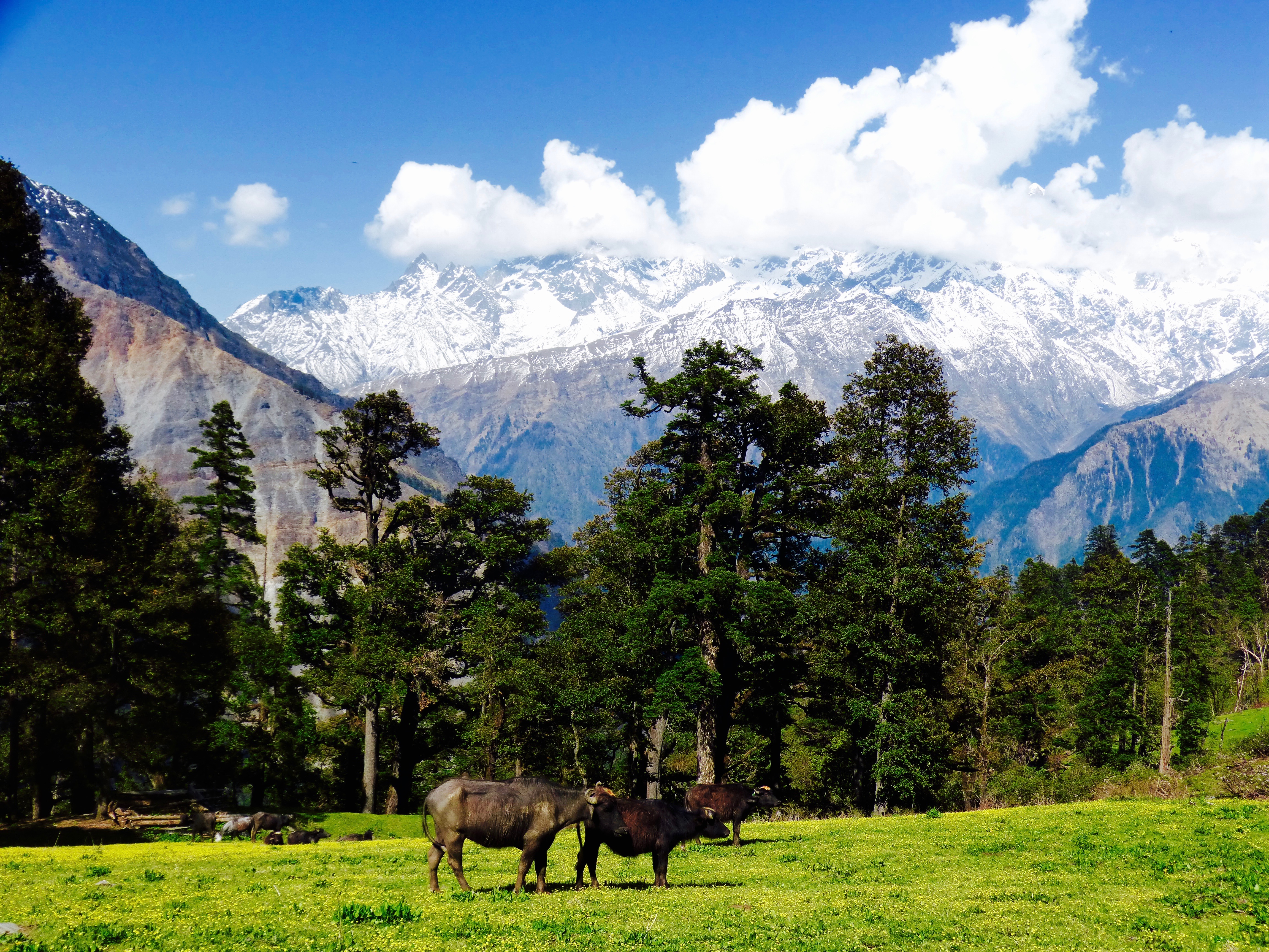
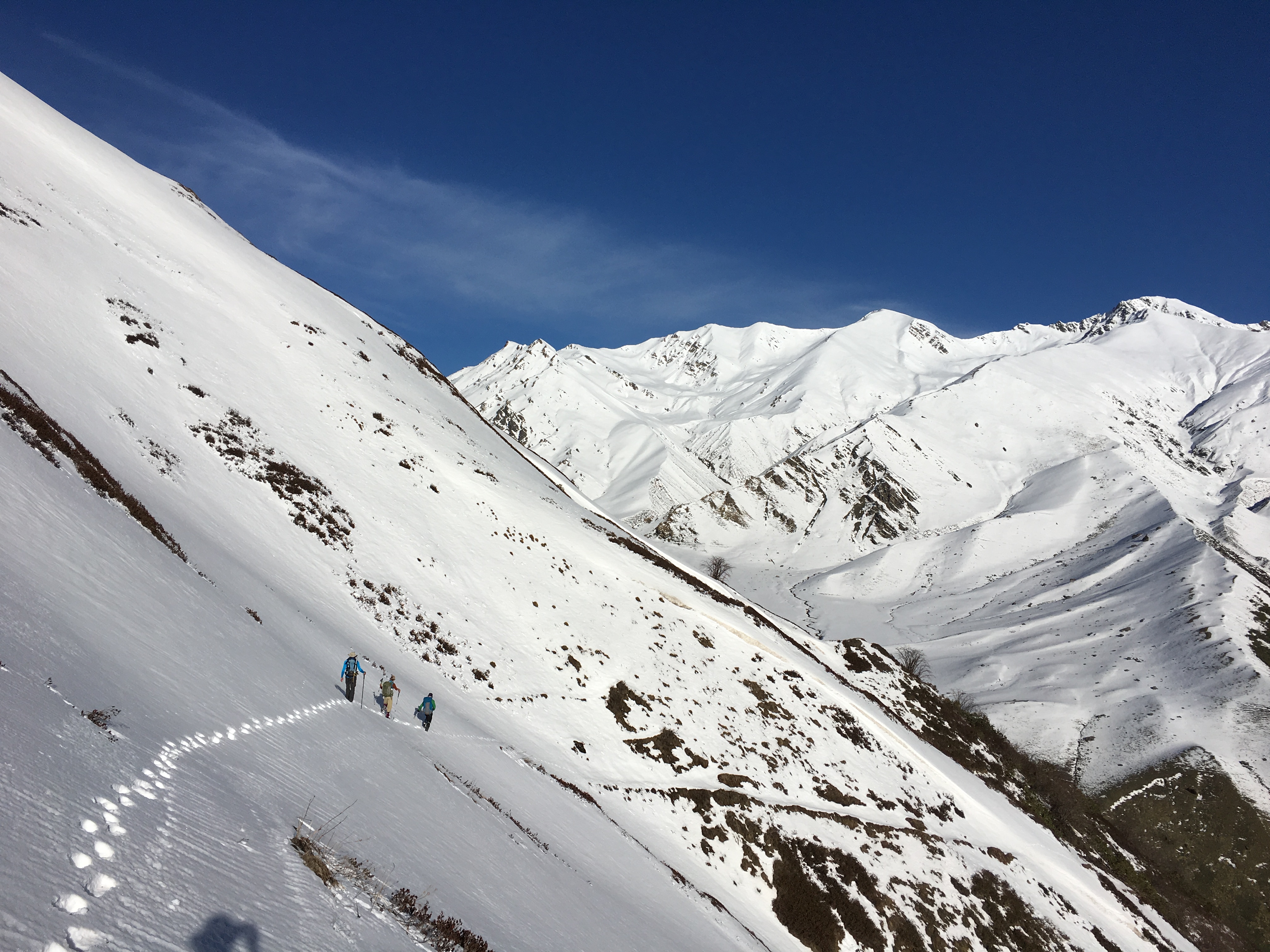
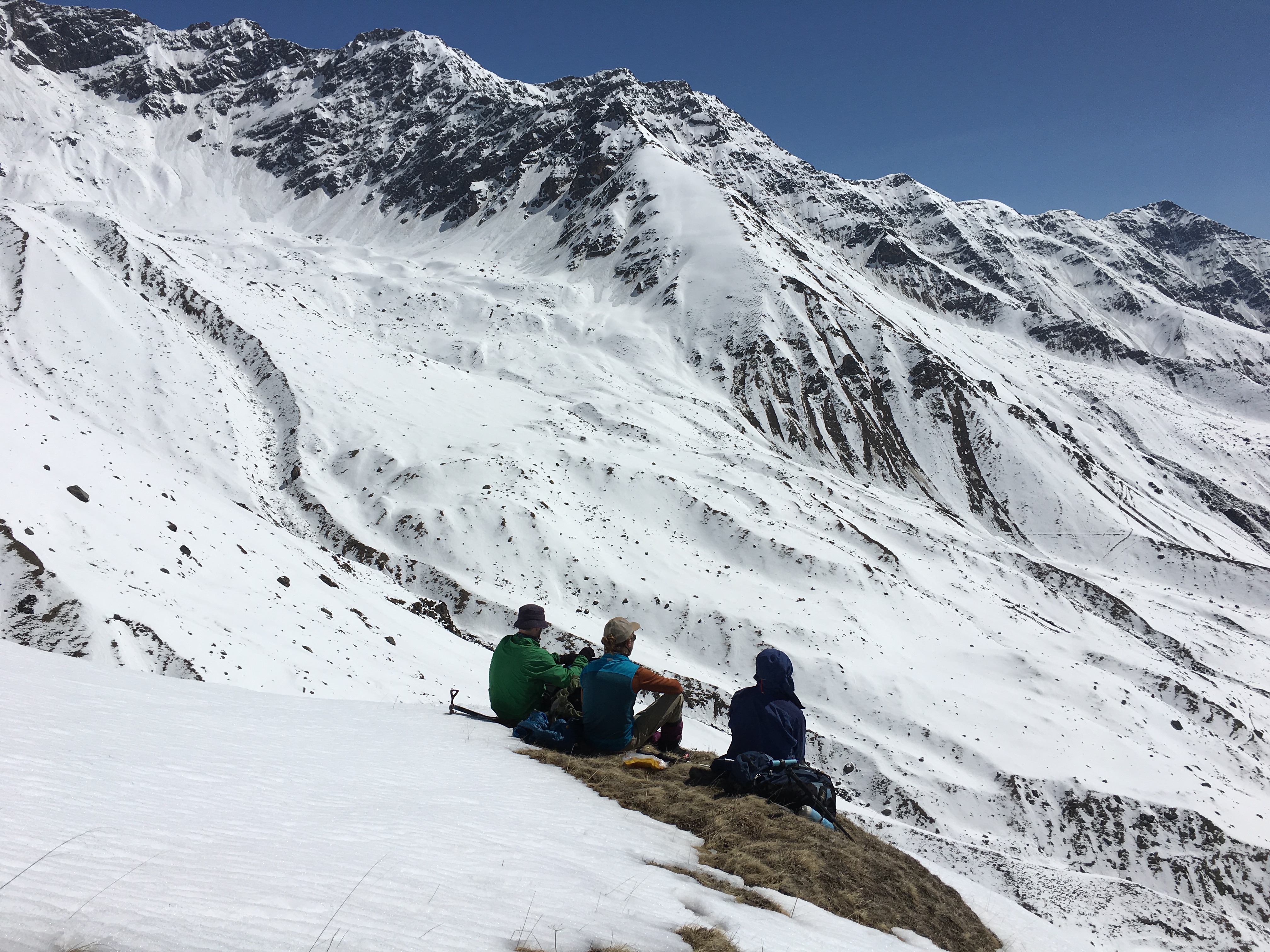
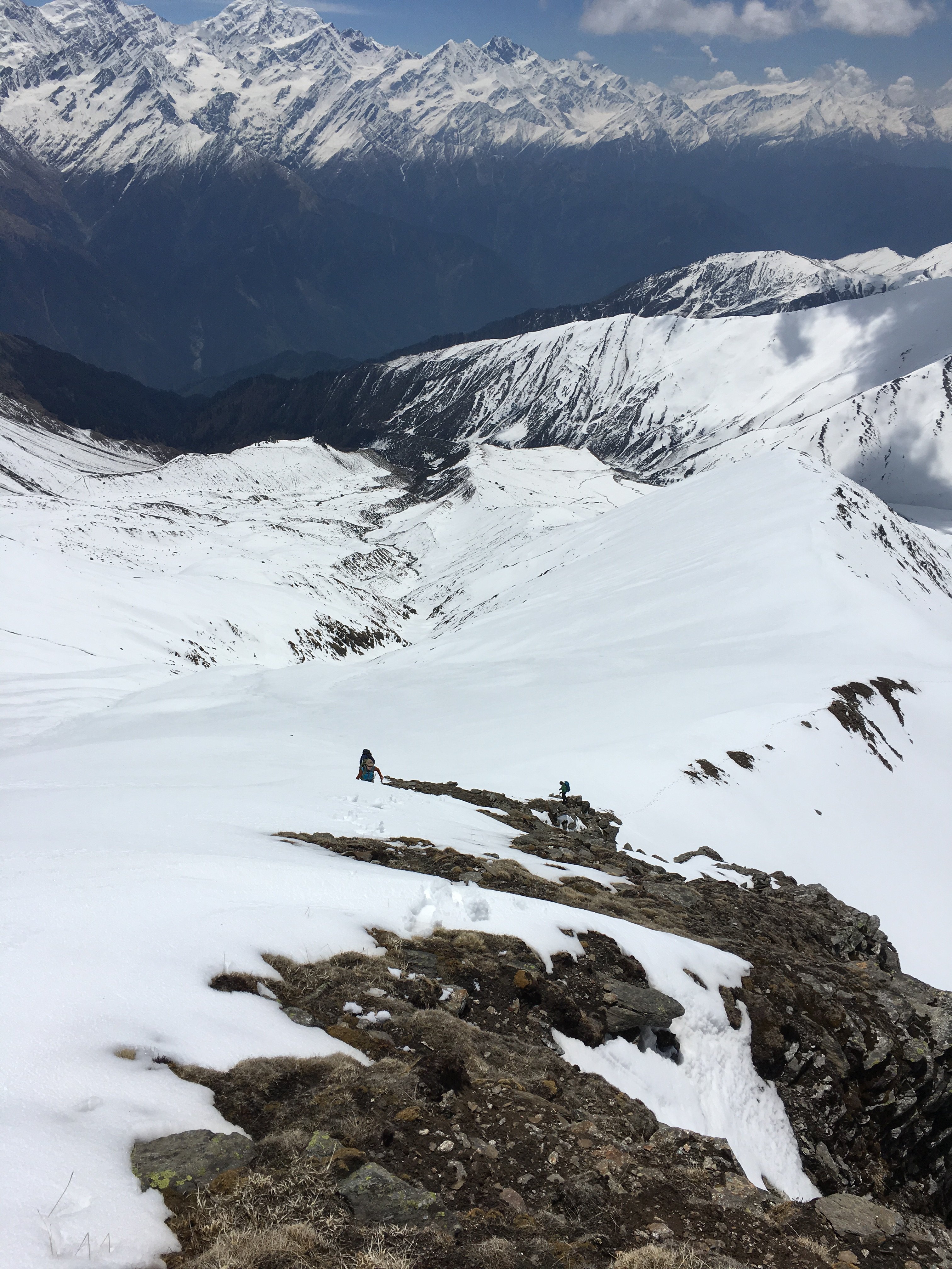
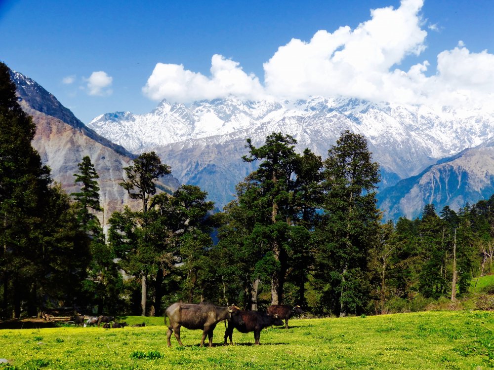
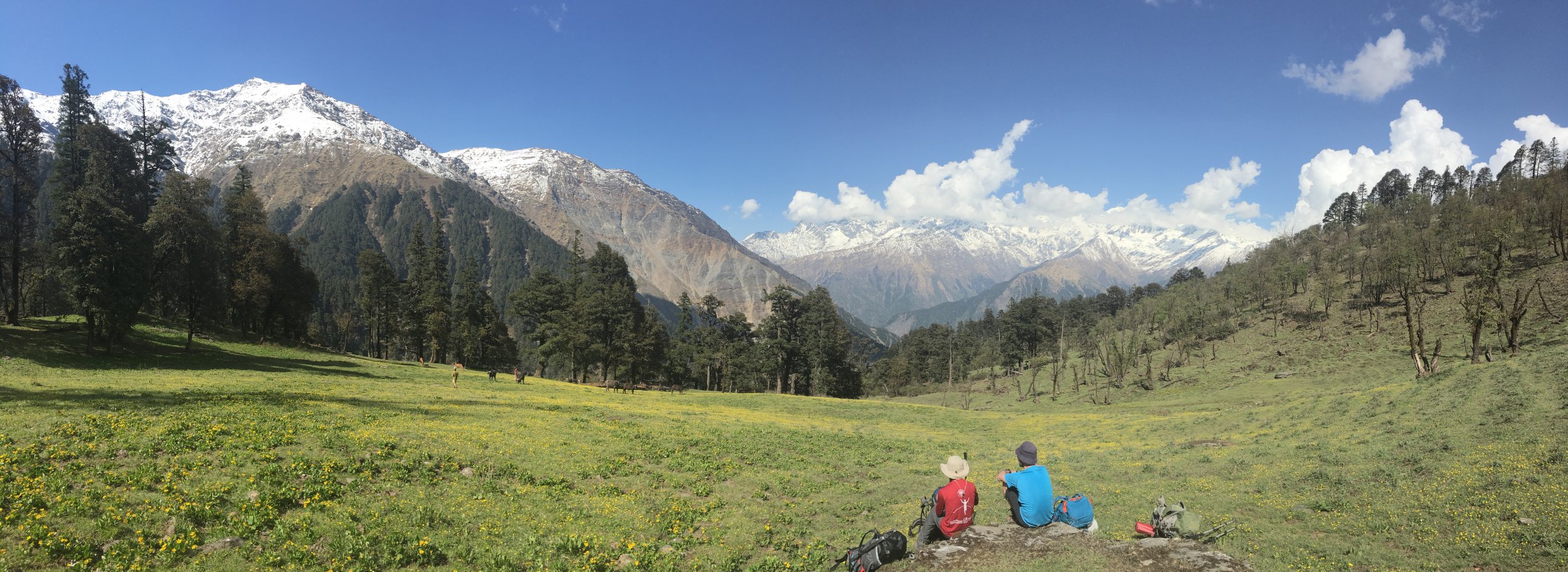
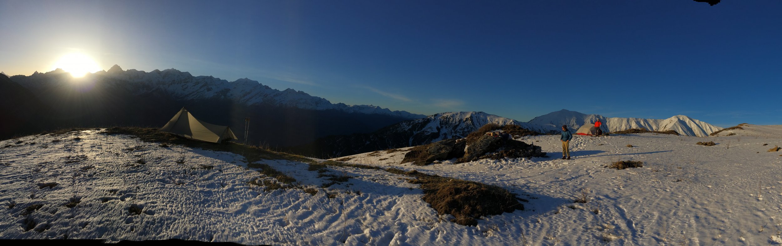
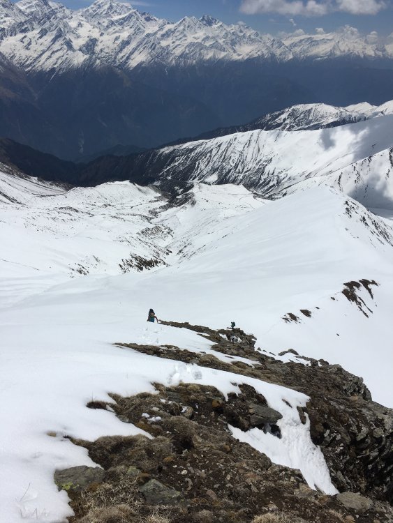
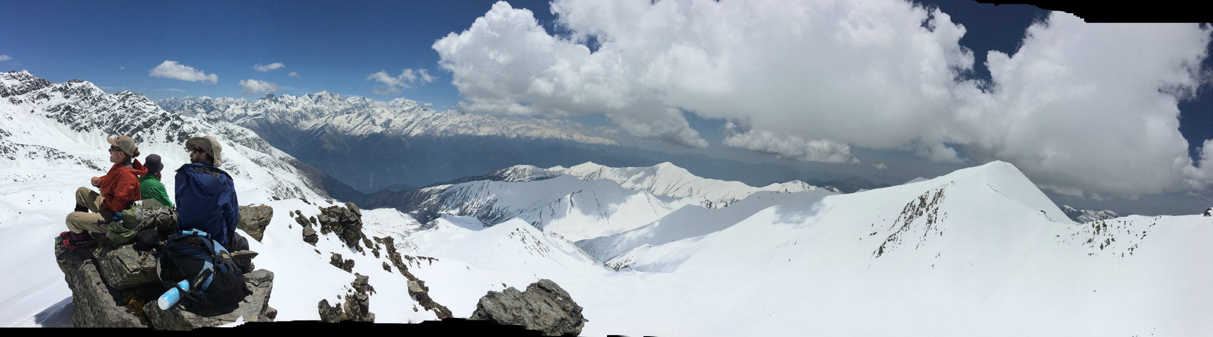
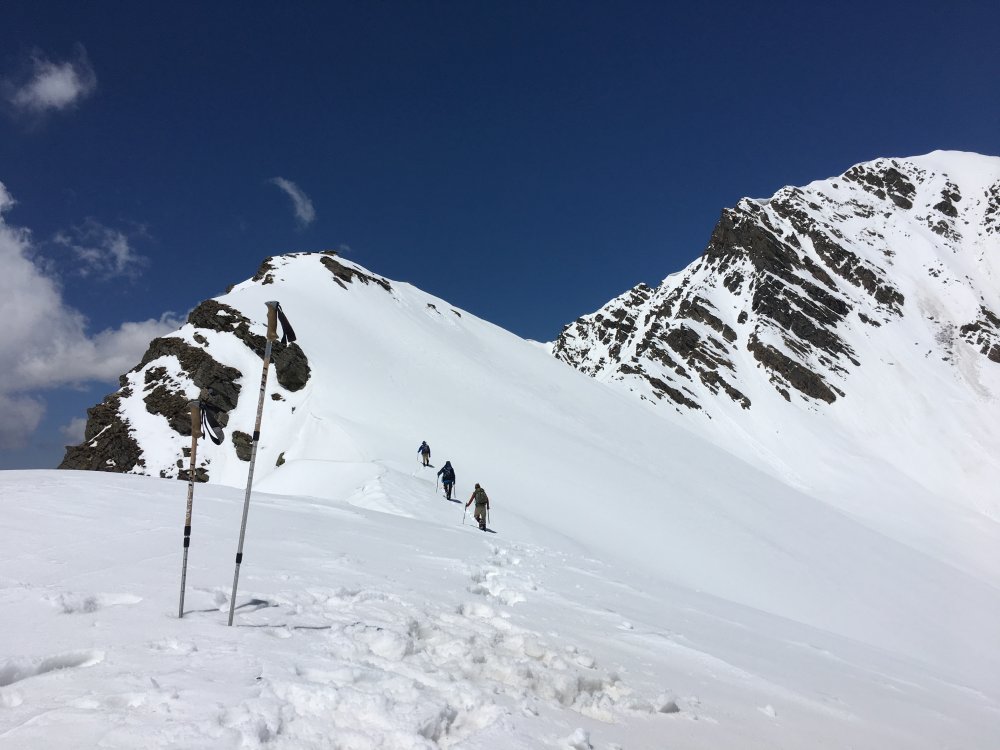
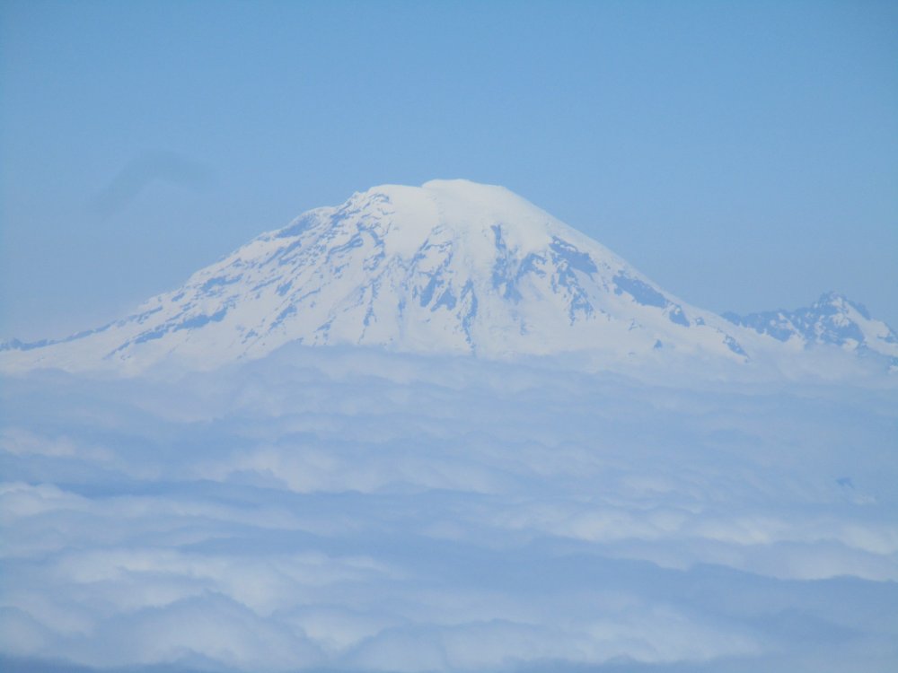
Trip: Indian Himalaya - Unicorn Bugyal Trip Date: 05/13/2018 Trip Report: Have you ever wondered if that huge meadow at 13,000 feet below Bandarpunch peak and across from the Gangotri range had a sheep trail access to it? Probably not, as you're likely still in the Pacific Northwest, where I used to be, and still miss desperately, but as I'm here in the foothills of India I have been putting some effort into finding mountain experiences reminiscent of the Cascades to pass the time until I can be back. One would think it would be easy to get into the mountains when living in the Himalayan foothills of India. It is not. Permits are required even for hikes, they are not easy to get, and neither are maps. Trails are not marked, and trail heads are many thousands of feet below the talus. Permits for actual peaks are amazingly expensive and complex. All of these barriers to entry, as well as working on weekdays, make me miss the North Cascades something fierce. I would rather schwack through a mile of devil's club than to endure again the 6-hr drive to the mountains, so I thought I might share my latest trip here as you all are my long lost mountain people. We left our home in Mussoorie at 5am, arriving in the hill town of Bhengali at 7500' at 11, where we secured for 5 dollars a guide to show us the correct trail to the big meadow. He turned back after 2 hours and left us with general directions. We found seasonal herders of goats and buffalo luxuriating in this amazing setting on the way up. After some wandering, about 6000' of ascent, and trail finding guesswork we arrived on a ridge above our destination at 13000' where we set up camp. This is not a place frequented by tourists, and the few herders, Muslim Gujjars who migrate seasonally from the plains, give us directions and buffalo milk. The next morning we dropped into the meadow on fresh snow, crossing a drainage and proceeding up an elegant looking ridge. How invigorating to be kicking steps again. We, two Americans, a Kiwi, and a Colombian, all felt relatively strong up to our summit, really more of a high point, which we coined Forman Top at 16000'. The new snow softened through the day, and we made the final scramble to the "summit" just before authentic slogging would have set in. We sloshed our way back down hill in giant loping steps and tumbles, descending the 3000 feet to the drainage which bisects the meadow in about 45 minutes, arriving back at our tents at about 2 pm after a rewarding 8 hour day. We made some coffee then observed that our water source, a tea-colored collection on a grassy depression, had almost entirely drained. What was left would be suspect in any country in the world, let alone a place of such diverse intestinal fauna as ours, so we decided to descend the 2000 feet to a green meadow below us. This turned out to be a good idea, as some powerful afternoon convection arrived around 5pm and all hell broke loose over our heads, right on the ridge where we had been set up. The next morning we followed the same route out, more sure of our bearings, and saw some of the same Gujjars and buffalo, had some milk. We were advised by the Gujjars that the ranger had followed us up. When we ran into him he gave us his phone number so we can call next time, let him know, and get a permit. We mapped the whole route for future travelers in our position, and now seem to at least have part of the permit puzzle identified. All this just to keep a cultural thread from me here to the PNW community and to remind everyone, even with the fickle weather, what an amazing place the PNW is to live. Maphttps://drive.google.com/open?id=1ZLXZZrtswVDsgDV3WZiqgwki6-IBdod4&usp=sharing Gear Notes: Skilled driver, Vomistop, passport copies, water treatment, basic Hindi. Approach Notes: about 3 hrs from Uttarkashi


 2 points
 -
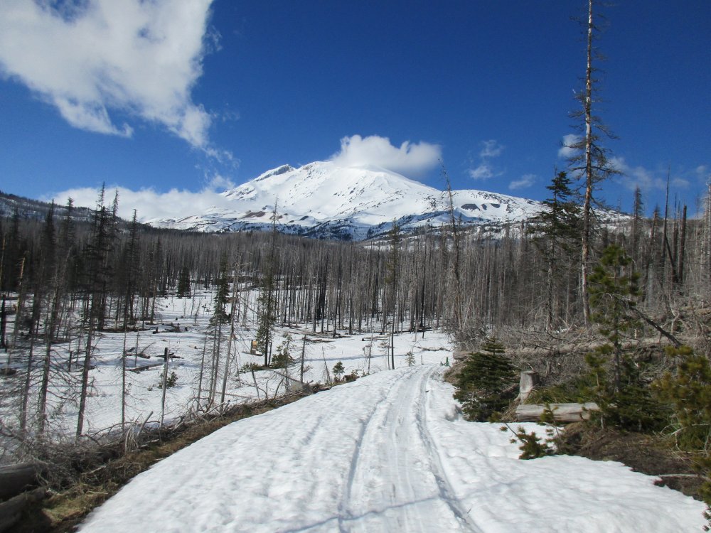
Trip: Eldorado - Standard (Eldorado glacier) Trip Date: 05/13/2018 Trip Report: Went up Eldorado this past weekend (05/13-05/14) with one partner. First time for both of us. We had planned on giving the NW couloir a shot, but ended up bailing after an unexpectedly tiring approach day and late night getting to bed. Log crossing is quite in, look right after coming across the first bit. You'll know you've found the trail on the other side when you see the signpost. Trail is easy to follow (albeit steep and full of down trees) up to the boulder field. At the boulder field you more or less just go up. Starts being snow covered around 4800ft. The snow coverage is quite spotty with lots of holes forming. Crossed the arm into the Eldorado basin at 6,200ft - there is a clear path and two trees marking the crossing spot. Not sure how much longer it'll be in for. Crack is starting to break through at the bottom of the chute. Long, long, slog up all the mushy, slushy snow to the inspiration glacier. Ate dinner, melted snow for water and headed to sleep around 9:30pm. Took us just shy of 9 hours to get from the car to the camp: 2 hours on the trail, then a slow time through the boulder field, stopped for lunch and then pushed up, kicking slush the rest of the way. After a loud night of tent-flapping-in-wind, we woke up at 5:30 to harder, but not solid snow (didn't need crampons, wore them anyways / just in case) and followed the boot pack up towards summit. When we came over the ridge right before the knife edge, the wind hit us much harder than lower down, literally knocking my feet out from under me. We both wound up crouching, in self belay with axes to avoid being blown all the way over. We tried to find a route out of the wind, hmm'd and haa'd for a bit, and decided to turn around. Very frustrating, but when you need to balance on a ridge, you can't have wind knocking you off the ridge. Heading back down to camp I fell through to a crevasse (one leg and just hip deep, was able to roll over onto stable snow) which runs parallel to the boot pack. Watch out! Walking parallel to a crevasses does not give your rope team much opportunity to arrest your fall. The crevasse is somewhere between 20 and 30 feet deep, probably. There is another one open, but perpendicular to the path, just above the rocks. After all that adventure, we packed up and headed home, after screwing up the exit to the boulder field. All together a disappointing but fun, and beautiful weekend. Gear Notes: Rope for glacier travel and gear for (thankfully not-quite-necessary) crevasse rescue. Approach Notes: Snow starts just below 5,000ft. Boulder field is annoying. Snow bridges are failing and crevasses are opening above high camp.2 points
-
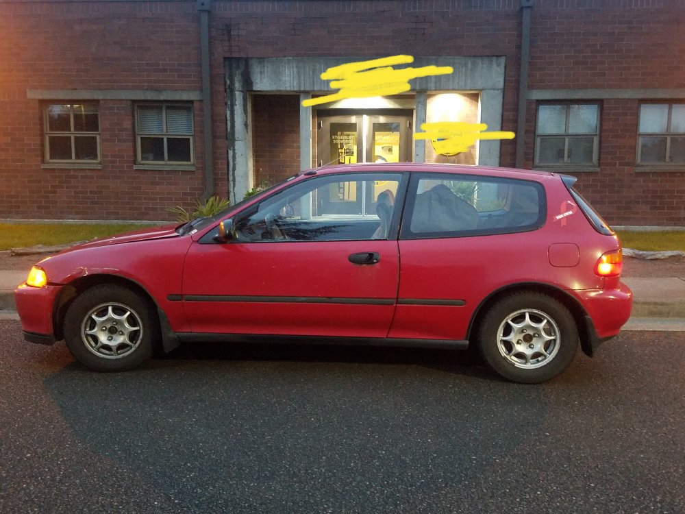
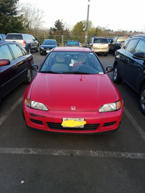
Free 1993 Honda Civic VX Red Hatchback 5 speed manual 285k miles Carfax report provided Gets between 40-50 mpg, depends on how fast you drive ; ) Light body damage and clear coat gone on top Comes with winter and summer tires on rims and chains Thule roof rack and ski rack if you want it The car has a little bit of life left in it. Runs strong, timing belt, oil change, various other maintenance recently finished. But let’s be honest it’s 26 years old and has 285k on it. It’s due for retirement. I could just send it to the junk yard or sell it on Craigslist. Or I could give it to you. Somebody out there needs a high mpg semi-disposable car to complete their bucket list western state climbing trip. Want to ski every resort in Colorado? Thinking about fly fishing all summer in Montana? Want to drive to Alaska one way? Here’s your chance. Rules -500-1000 word essay on what you want to use the car for. Essays should focus on your trip, activity, sport, etc. and its importance in your life. -Whichever group you find the ad in will possibly post your essay. -You meet me at a DOL convenient for both of us and complete the transfer paperwork and registration on site. -Send a pic of you and the car on your trip to post on the site/page -No kids in the car! It was made before side impact pillars and side impact airbags. It’s safe, but not a daily driver with a baby in back safe. I thought about making it available to single individuals only but I’ll trust the judgment of parents who want to use the car for themselves. -Have fun Judges include former local print and radio journalists so the contest will be as fair as I can make it. Pm me your essay. Request entries by May 21st. Cheers
 1 point
 -
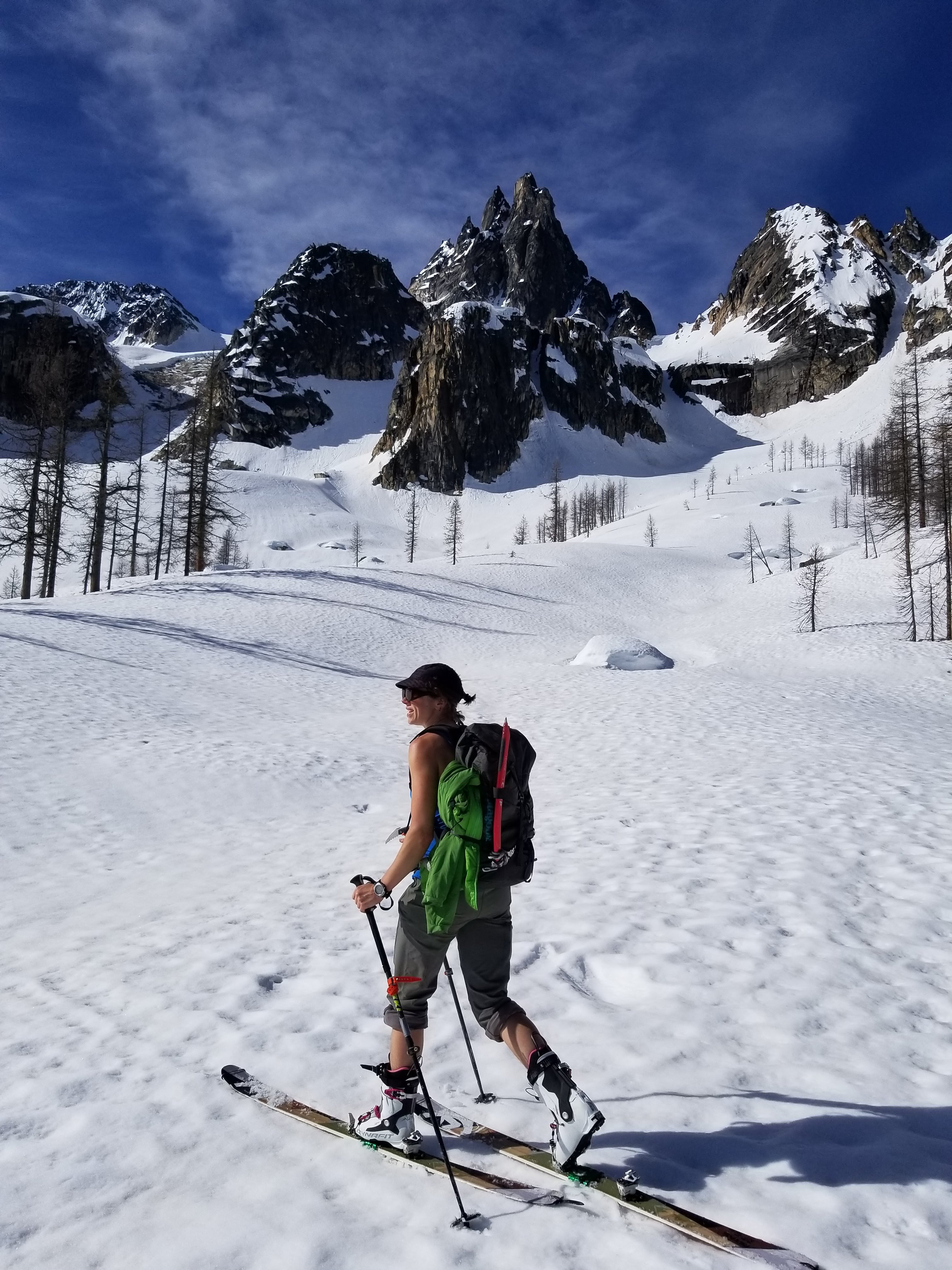
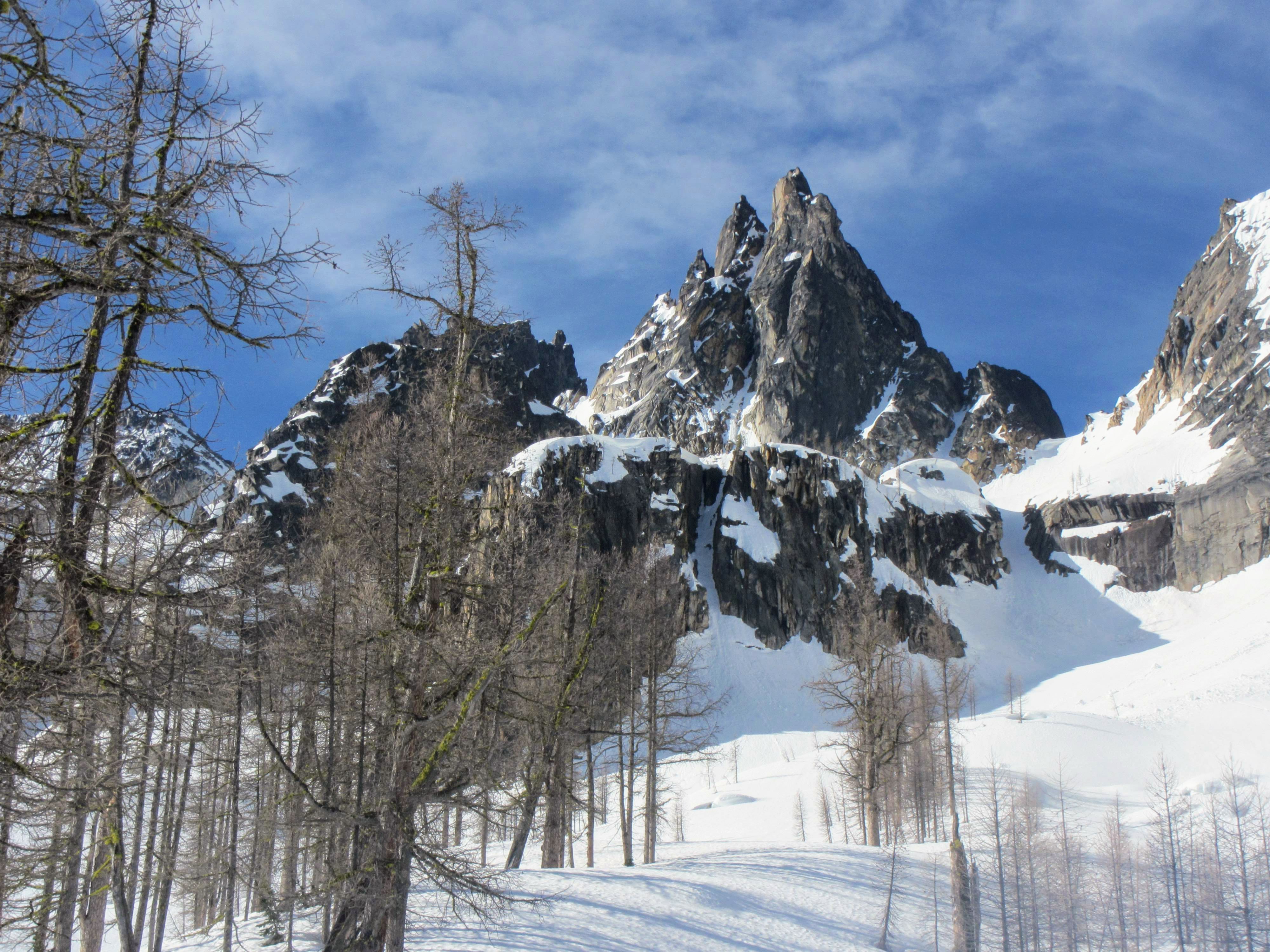
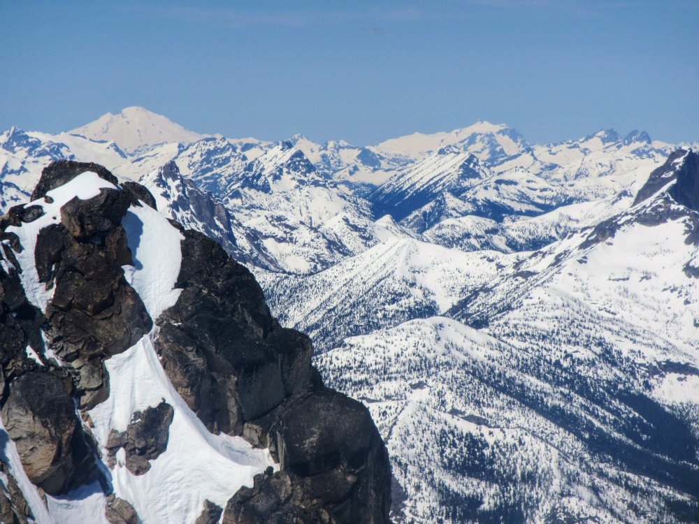
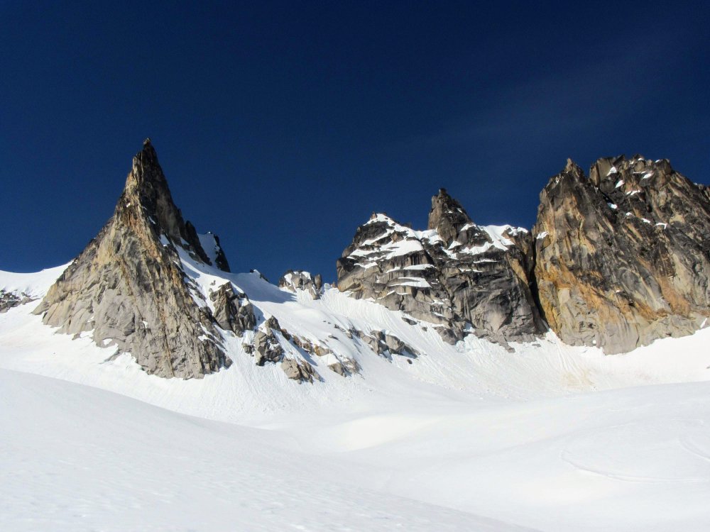
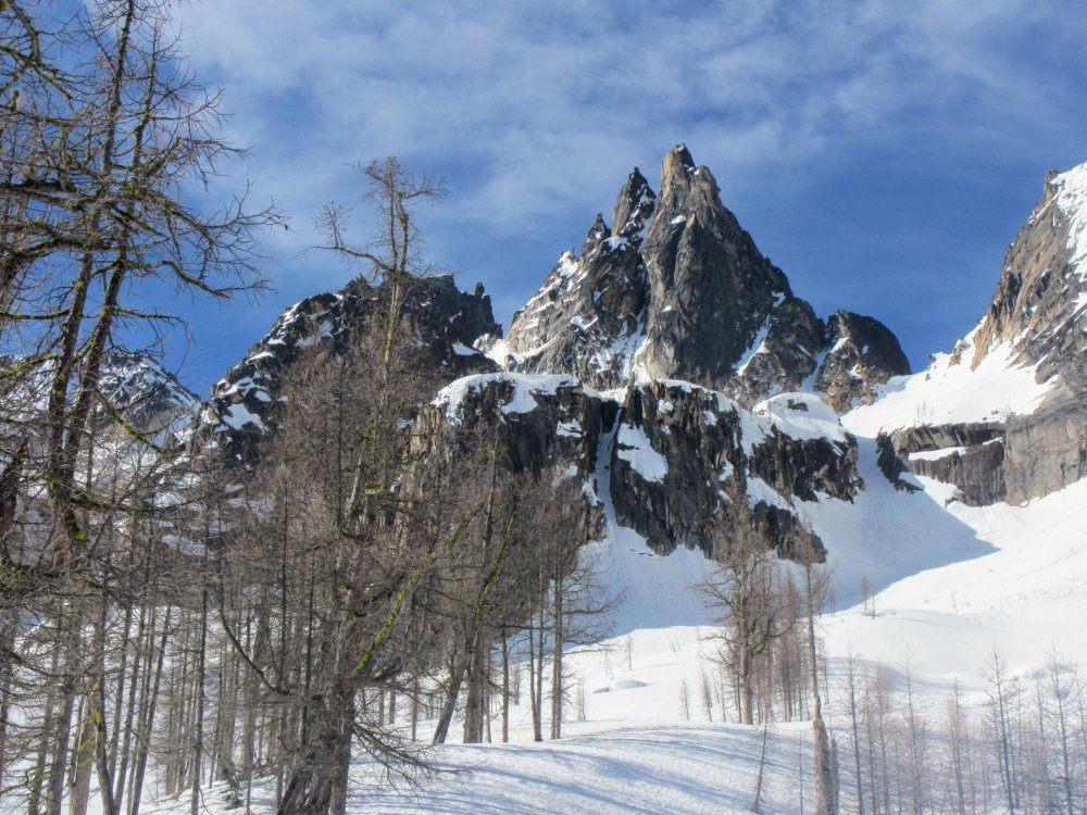
Trip: Silver Star Mt - North side Trip Date: 05/12/2018 Trip Report: Celebrated Hwy 20 opening by heading east for a wonderfully beautiful trip up Silver Star! Had to carry skis for ~40 minutes from the pullout but then great skinning conditions all the way up! Put on the ski crampons around 5200' and kept them on until the col. Ultra mega hyper super happy place Views just got better and better and it was fun and interesting seeing Vasiliki Ridge, Burgundy Col and the Wine Spires from the east -- I'd been on that side just once in an aborted attempt to climb the East Face of Chablis in July 2014 (meeeemories....🎶), it was very cool to be on skis this time! Booted up on snow from the col to the final summit block, a chimney move with a useful rap station to yank on. Fantastic views, I think I saw the Twin Sister Range? And Black and Goode and Glacier and what I think was Dome? Oh yeah, then the skiing. Skiied from the summit block (ok, mostly side-slipped but did make a few turns between rocks).. The snow was AMAAAAZING, truly, for most of the descent, and then it got heavy and slushy. I kept my skis on for perhaps too long, having fun in the woods trying to stay on snow and avoiding logs and dirt. Finally after I hit the second rock I decided to give up. A wonderful day in the mountains, love the blue skies and sweet snow! 😍 Gear Notes: Ski crampons and whippet 👍 Approach Notes: Follow the creek!


 1 point
 -
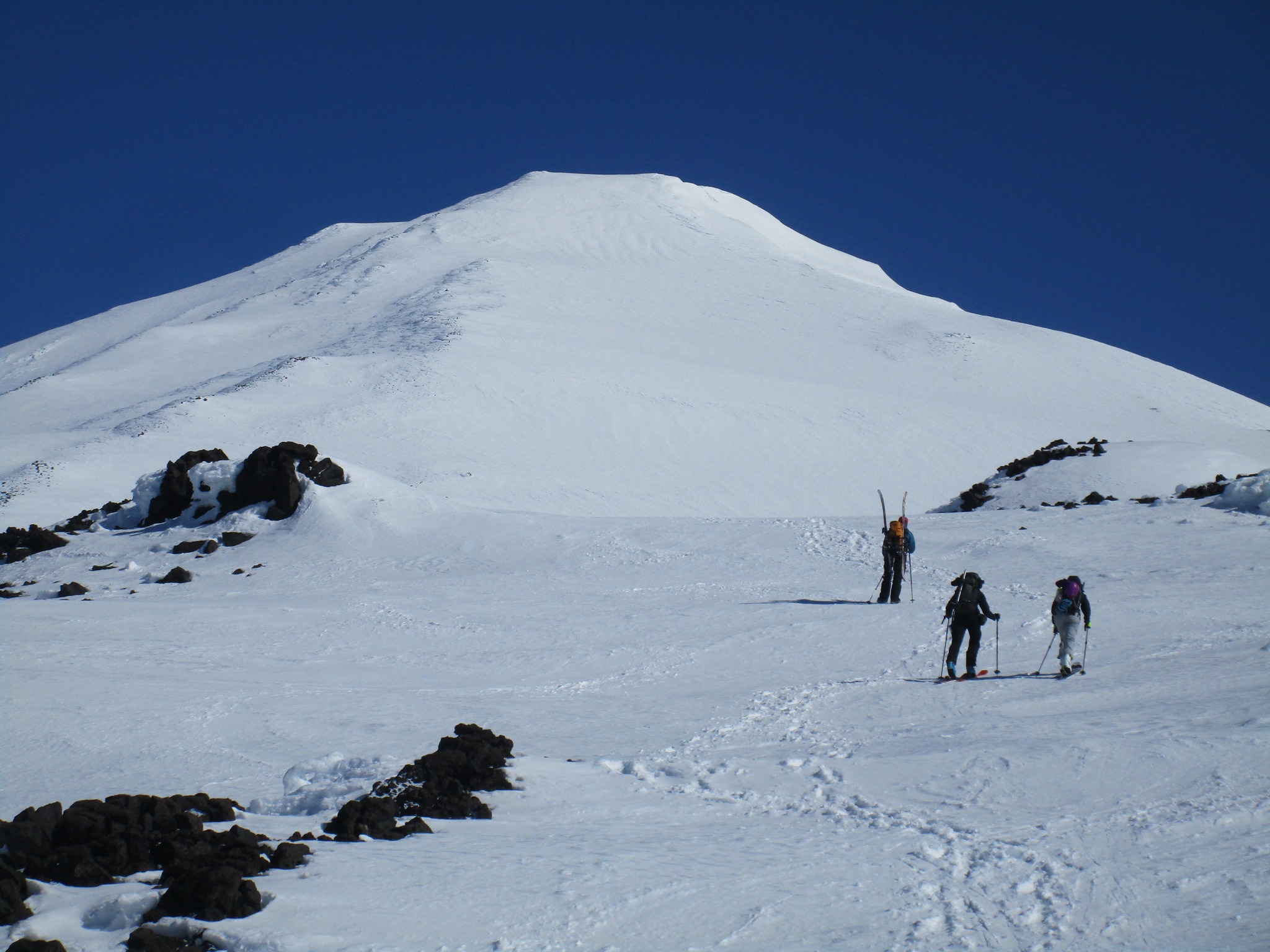
Thanks all! Here's some pics from the day's events PS. 8,000 feet in a day...let's just say I was a little more wobbly than usual on the skis! ha!


 1 point