Leaderboard


Popular Content
Showing content with the highest reputation on 04/04/18 in Posts
-
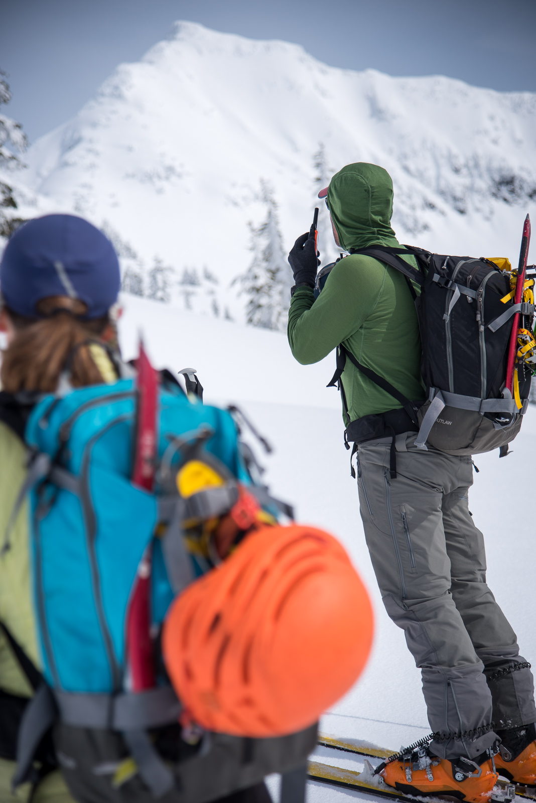
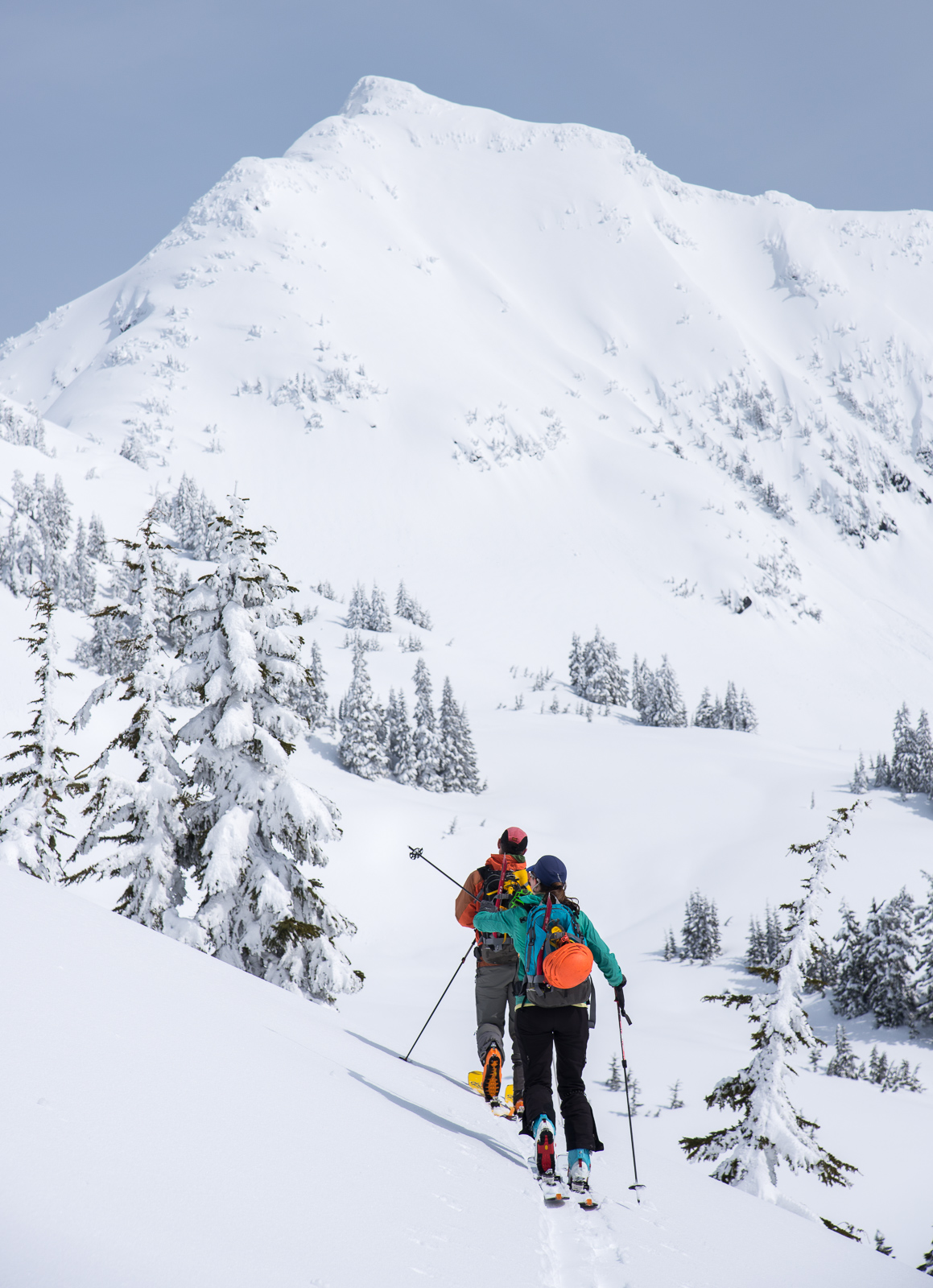
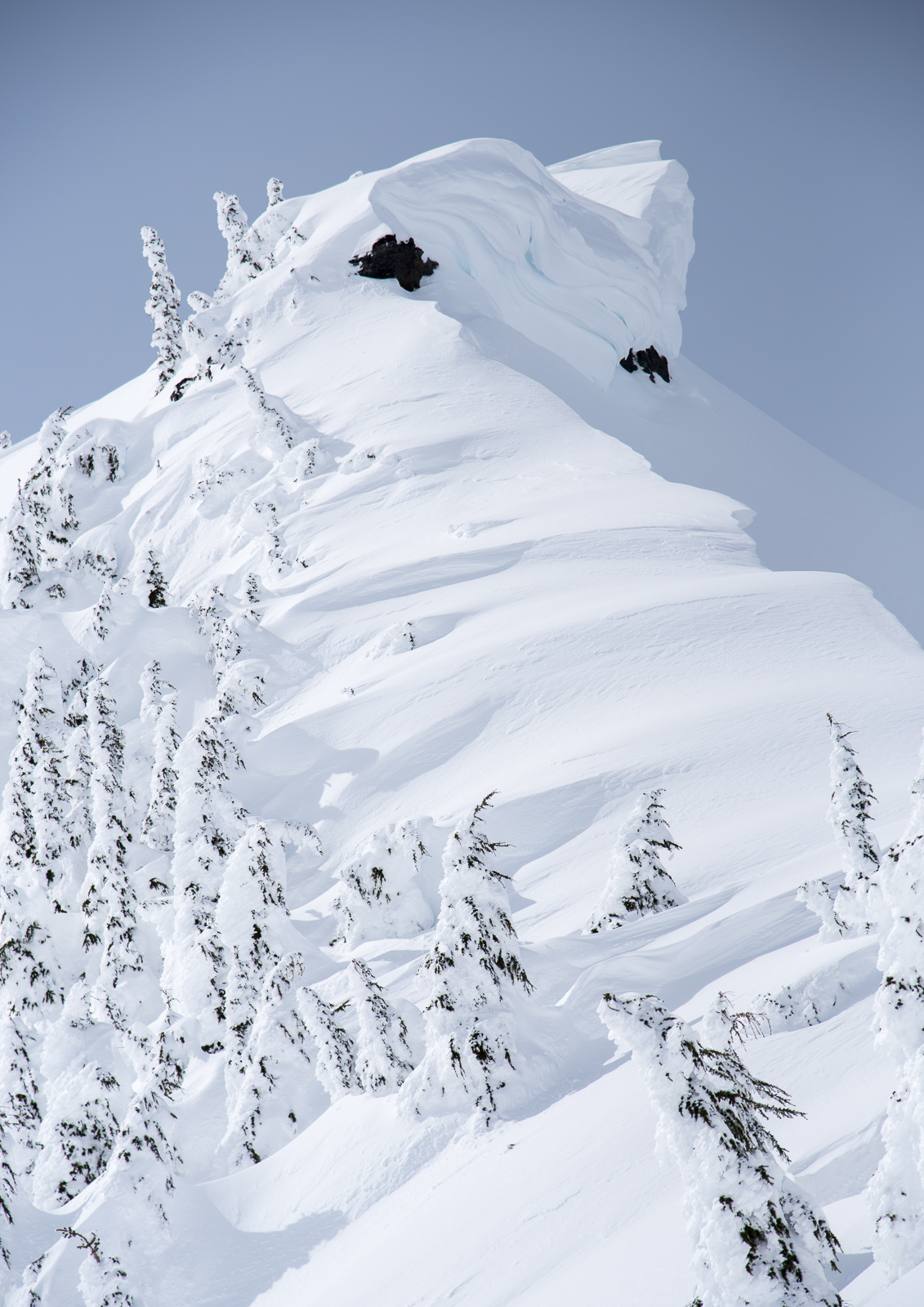
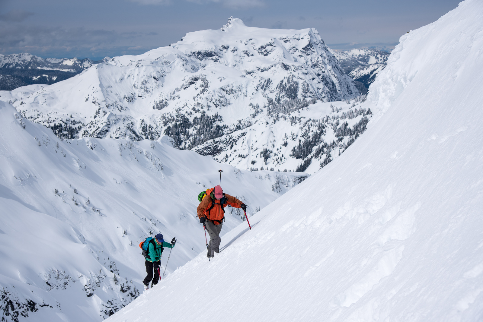
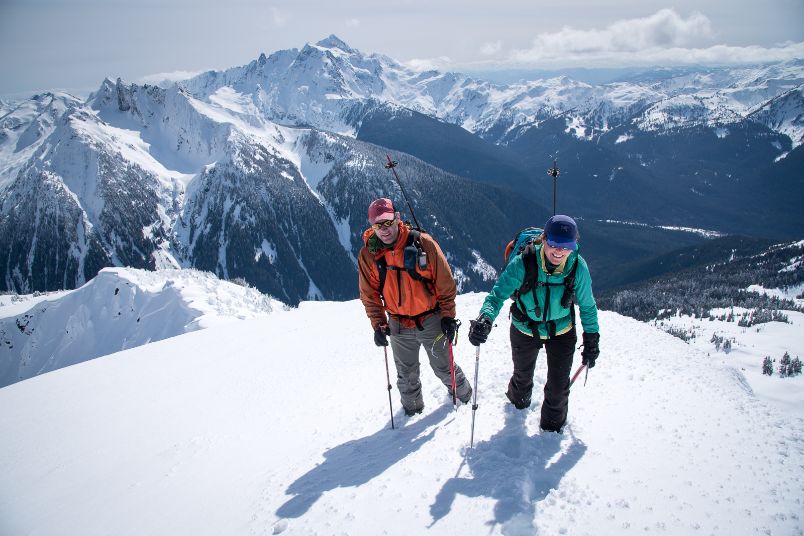
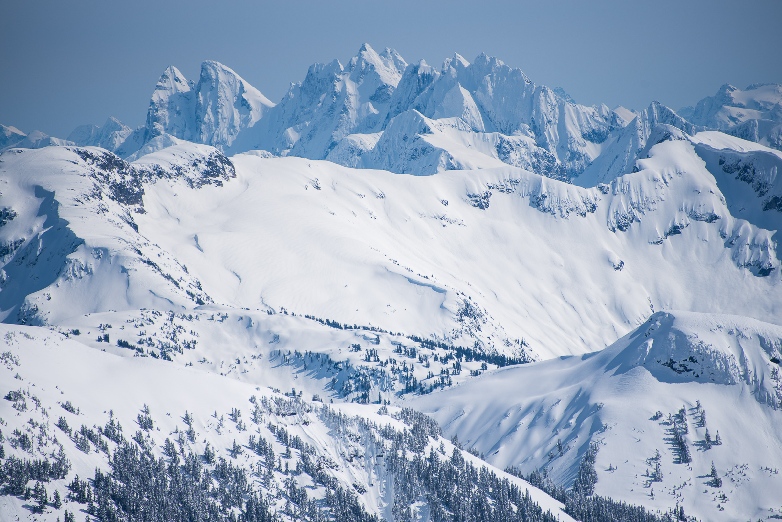
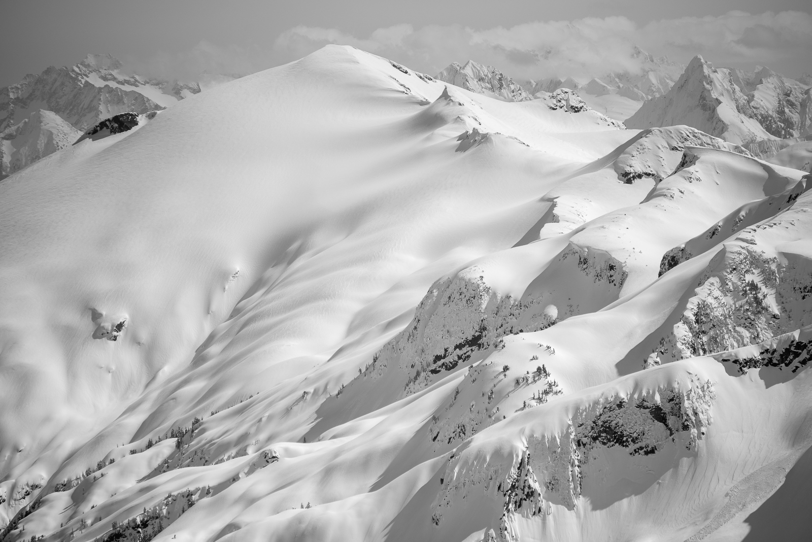
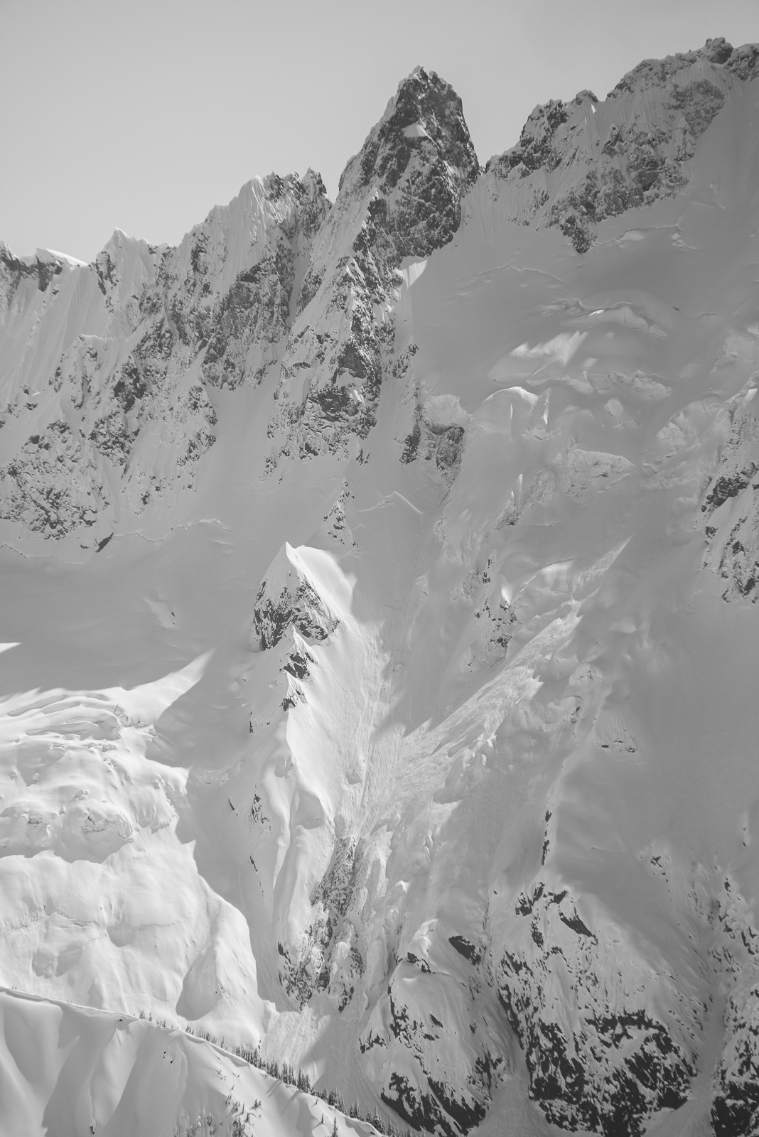
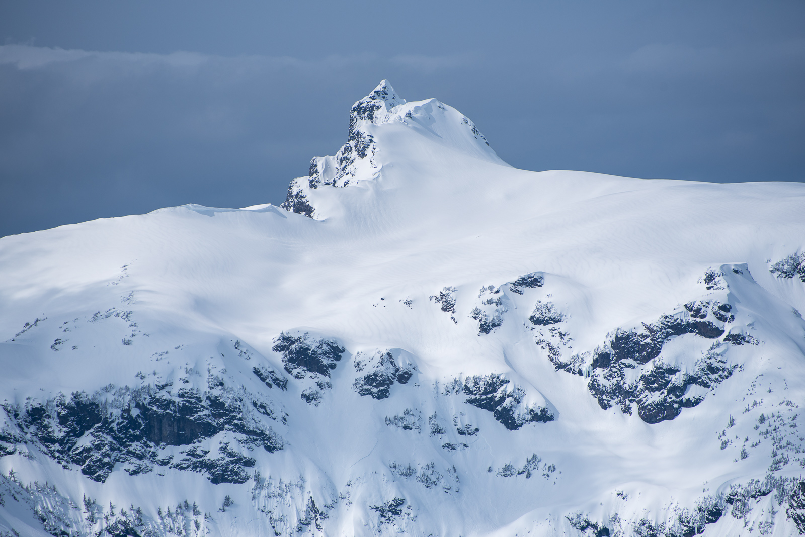
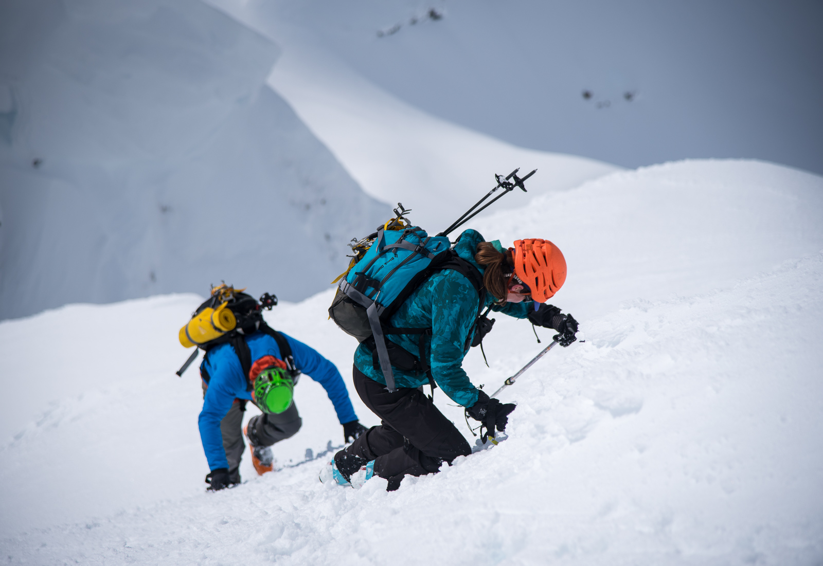
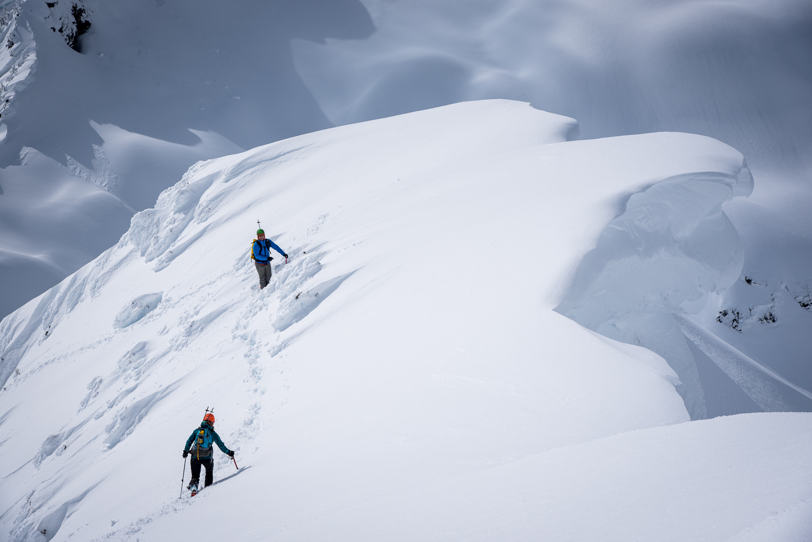
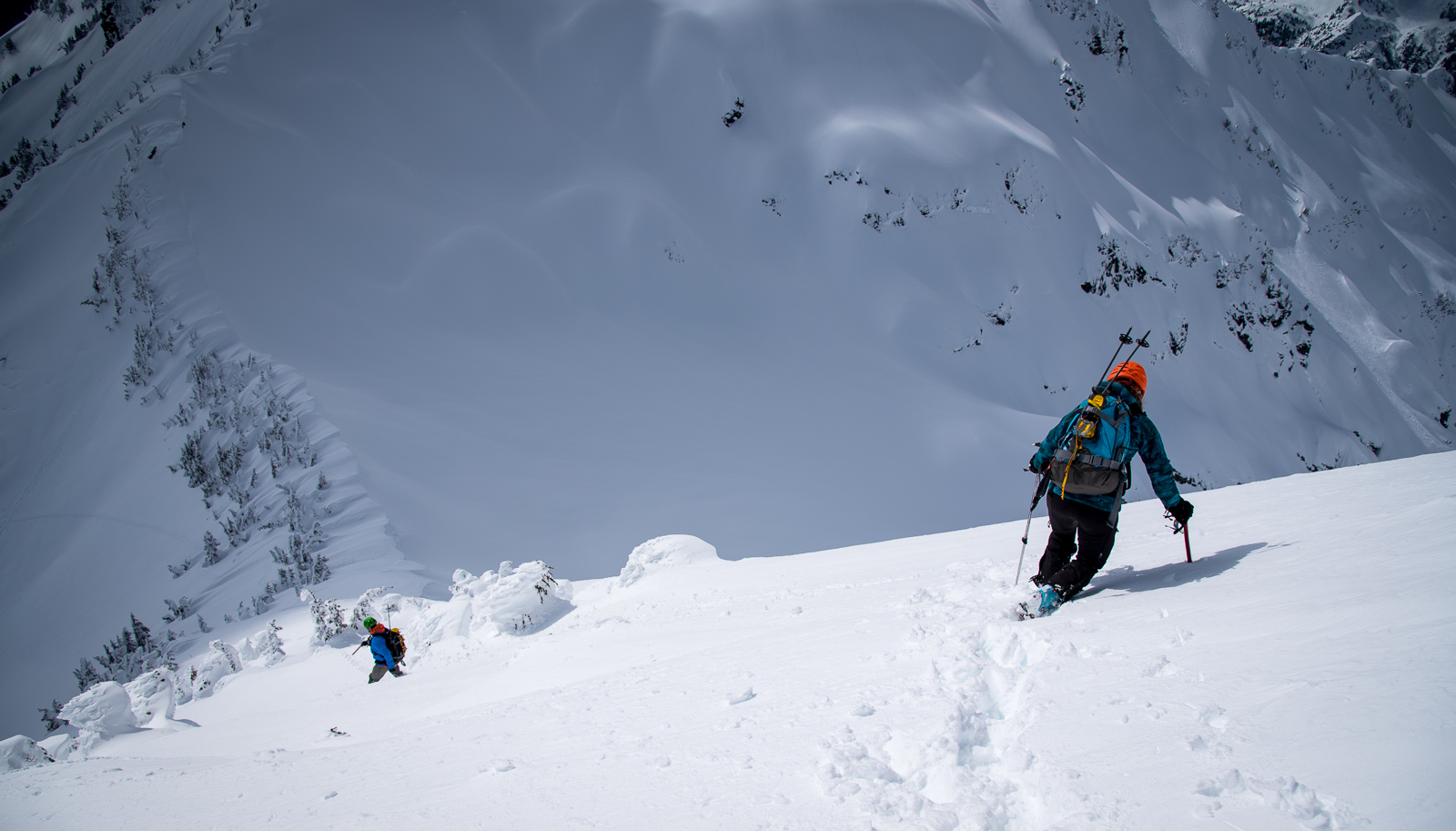
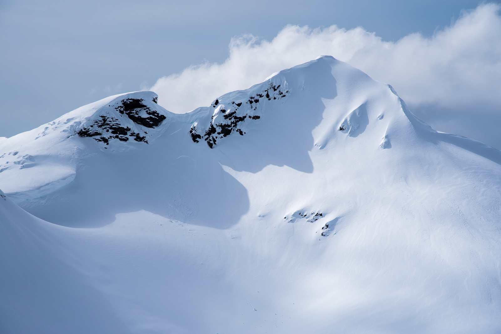
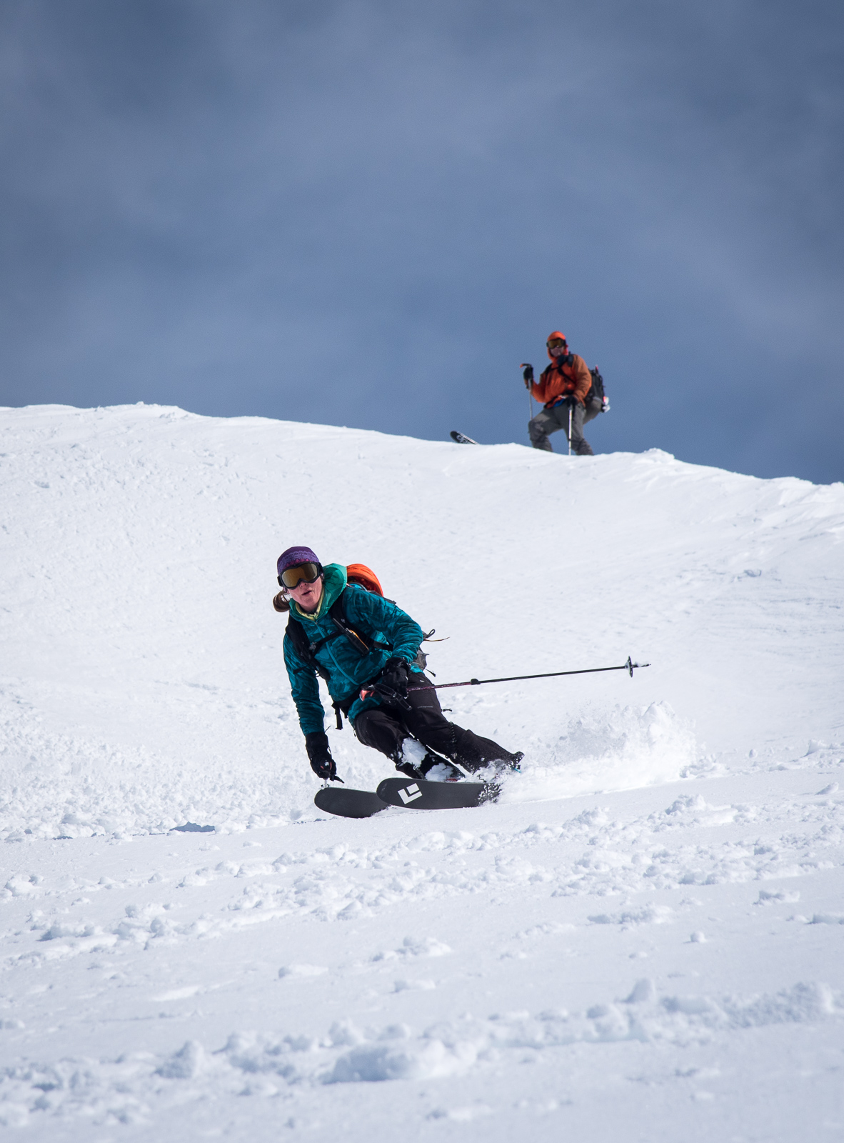
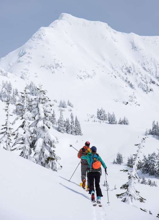
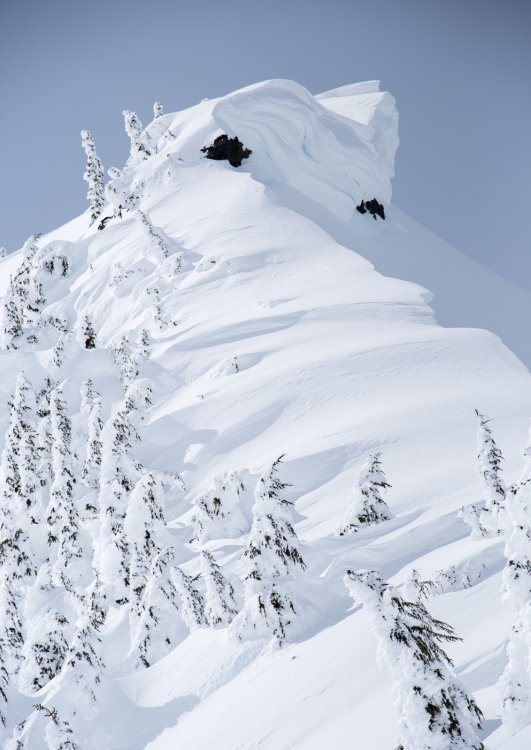
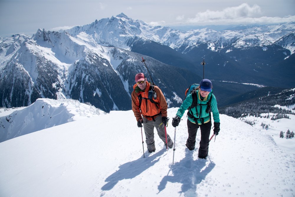
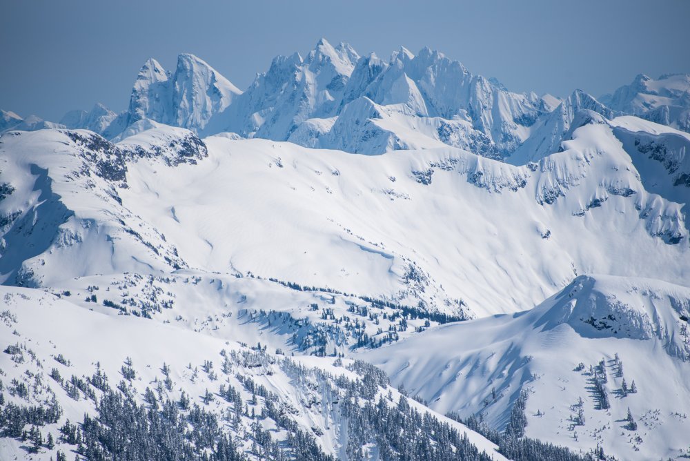
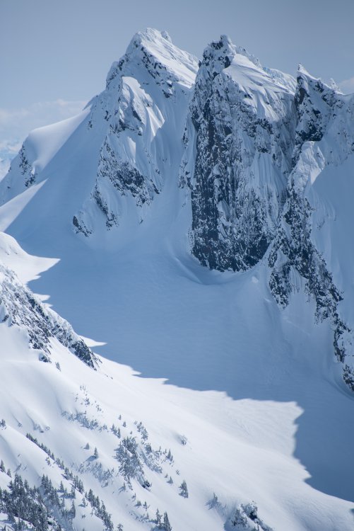
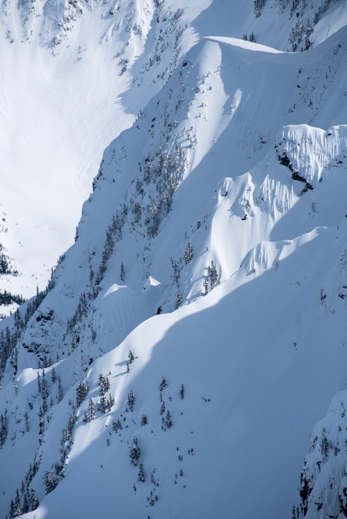
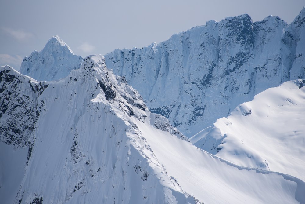
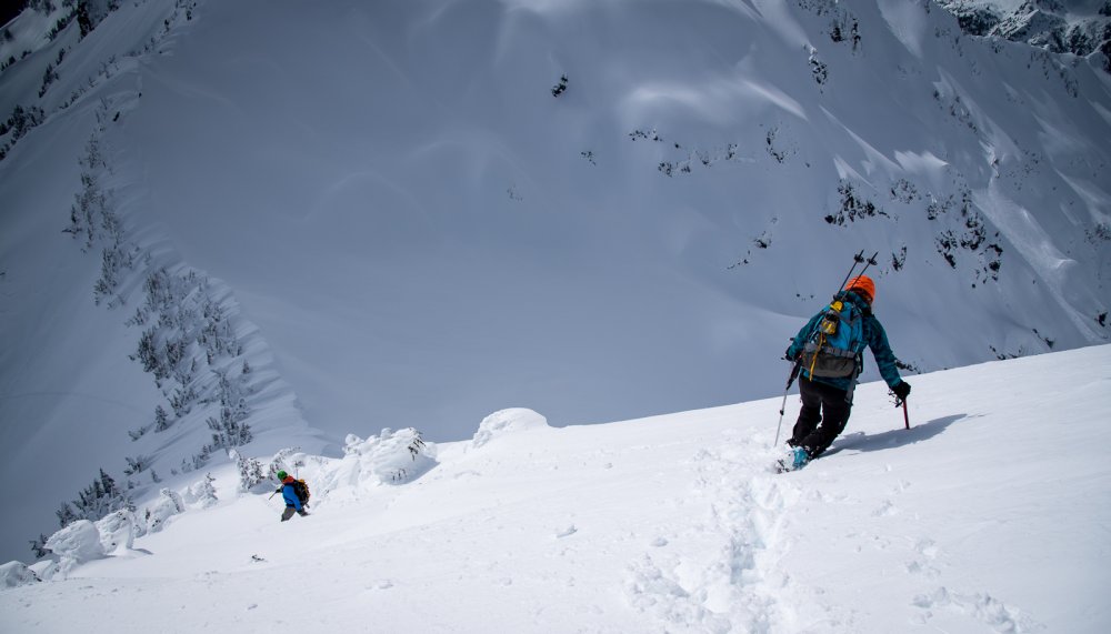
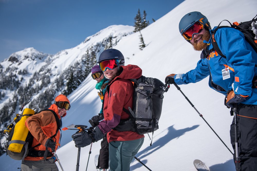
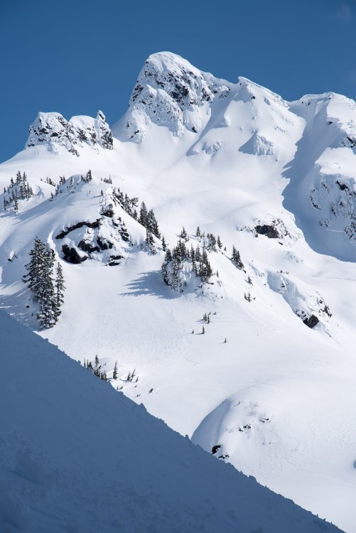
Trip: Goat Mountain - SW route Trip Date: 03/31/2018 Trip Report: The last hall pass before our Canadian Hut trip was put to good use this past Saturday. Goat has mocked me for decades as I've gazed north from the ski area and tours out of Heather Meadows. No longer! In the winter a Goat tour starts pretty low. So, with the cold breath of the GRAVEDIGGER on our backs, we skinned from the start of the Hannegan Road a bit over two miles to the start of the Goat Mountain summer trail. Toiling upwards on a fine day we ran across cougar tracks from the day before, a few minutes before Shuksan burst into view at treeline. Those would be about the only tracks we would see until we gained the Twin Lakes Road on the north side of Goat. Sefrit: We reached Goat col about 4-5 hours after leaving the cars and started to skin the final 600 feet to the true summit of Goat, which is the eastern one marked on the USGS quad. Soon, however, we realized that skis were going to be a liability with the wind slab cooking on the south aspect of the peak and dropped them in favor of booting to the summit. The proved to be a smart move, as significant wet slides swept this face below the ridge between the time we ascended and descended. We were able to effectively mitigate the hazard by sticking to the ridge in the trees and rocks. Tomyhoi watching us on the ascent: The summit was glorious on this still spring day and we spent a half hour snapping pictures and admiring the view. Unfortunately we couldn't linger long, since half of our party waited at the col and we had a long slog out the Twin Lakes Road ahead of us. Downward! The final few feet to the summit: Southern Pickets: Ruth and Triumph on the right: Sefrit again: Nooksack Tower: Tomyhoi again: Seahpo and Jagged Ridge: West Goat: Then it was time to ski! The lower we got the worse the snow was (and it didn't start out that great), until it was horrific breakable crust. At least we had nice views of Goat: The happy(ish) crew, minus me, before things got really ugly: One last look at GOAT: Gear Notes: skis, ski crampons, light axe if going for true Goat, a slogging attitude. Approach Notes: Hannegan Road to Goat summer trail to Goat col to Twin Lakes Road to ruin.


 2 points
 -
I spent the last four summer working on a USFS trail crew. Our district has about 750 miles of trail (including many that never get maintained), and 5-7 people working on the trail crew depending on the year. Making abandoned trails a little more passable has always been my favorite thing about the job, but that doesn't happen often. In the last couple of years we've struggled to maintain even the most popular trails due to employee turnover and budget issues. The list of unofficially abandoned trails gets longer every year even though there are more people out in the woods than ever.2 points
-
Start world war three, end it with nuclear holocaust, no more crowding on the trails, and no more government that funds military instead of conservation! Seems flawless1 point
-
A war seems to be the most efficient way to both reduce population and available munitions, not to mention to cause a bone spur outbreak in ranks of the upper class.1 point
-
You're right @KirkW, we should just all kill ourselves now.1 point
-
Seriously, the shit we could do if we dropped a few less bombs...1 point
-
That is something I haven't thought much about in a while, honestly. The forest service, like much of the federal government, runs in such a convoluted way that it's hard to understand what's going on even when it's all around you. I get too focused on the job in front of me to look at the big picture these days. Most of the money that my crew runs on comes from state grants. The rest comes from the NW Forest Pass and other recreation fees, and allocated funds from the federal government. If it was up to me I'd say we should drop a few less bombs so that we could cut out a couple hundred more trails, but they never ask me. Maybe I'll try to think about it and get back to you.1 point
-
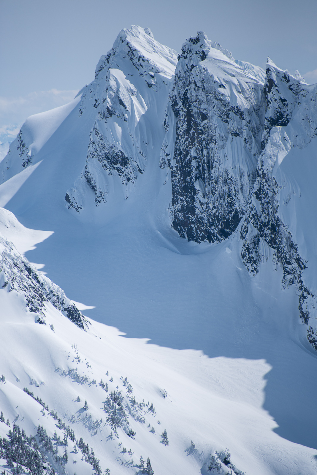
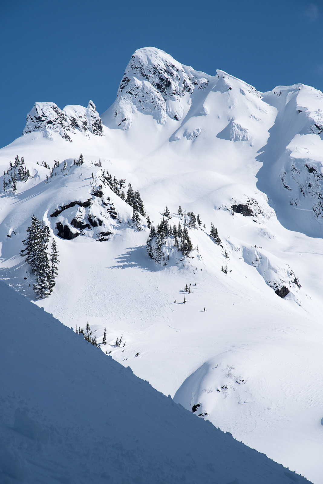
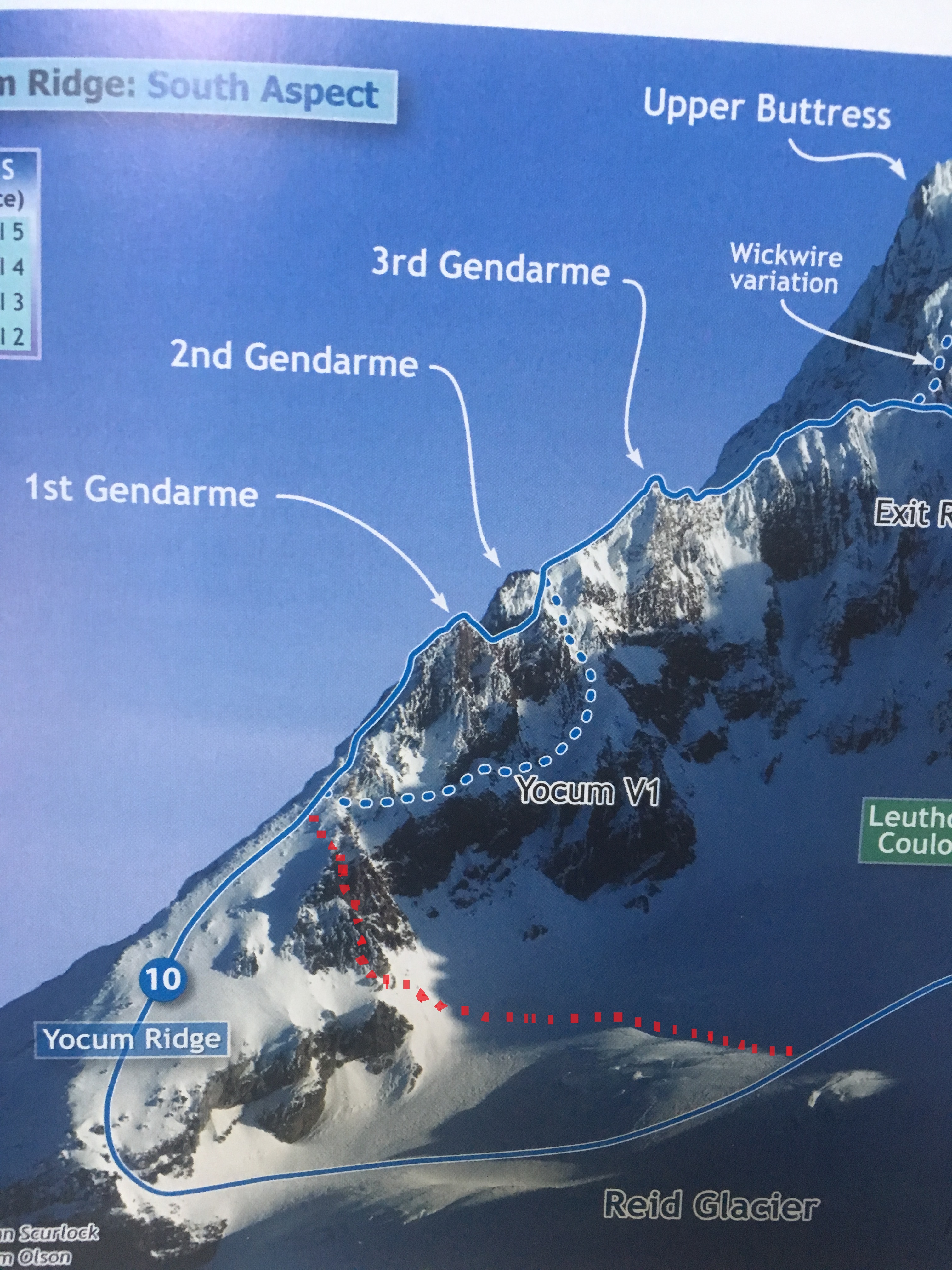
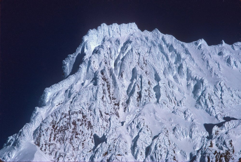
Trip: Mt Hood - Not Yocum Ridge (New Variation) Trip Date: 02/10/2018 Trip Report: I had to share this one for entertainment value.... Jacob and I have been poking at Yocum for a couple years now with very little (read none) success. After a very thorough study of weather patterns that lead to climbable conditions in the past, and a close look at my own weather notes over the years etc, I had determined that yesterday (Saturday) was the perfect day. We set out at a leisurely pace from the parking lot a bit after midnight and dropped our skis at the top of Palmer. The entire mountain was covered in a thick sheet of ice. It was PERFECT conditions for the more eccentric Mt Hood routes and we thought we finally had it in the bag. The slope going down from Illumination Saddle to the Reid would have taken bomber ice screws. It was nuts! As we crossed the glacier and looked up at the ridge, Jacob pointed out what he thought were the first, second and third gendarmes barely outlined against the few visible stars on a moonless night with intermittent cloud bands whipping through. I very confidently corrected him and showed him the first gendarme a little lower down the ridge. We soloed up to the base of what I thought was the first gendarme, hacked our a little belay ledge, and racked up. Ready to head-lock this beast, I confidently cruised straight up the gut of the feature in a steep mixed gully. The climbing was moderate and I had run out about 70 feet to a vertical mixed step above which I had spotted what looked like a good cam placement. Just as I was testing a pick placement (that of course failed and pulled a large chunk of rime off), my fancy, fully-charged Petzl smart headlamp died out of nowhere. Dark doesn't even do justice as a description. After about 3 minutes of positive self talk (read "calm the f*&^ down Mike") I blindly grabbed a sawed off 18" picket off my harness and started alternating between hitting it and my thumb. With unsettling ease, I placed it, clipped it, and started down climbing. Back at the belay, after a robust bout of barfies and armed with a working headlamp, I headed back up into the maelstrom. The pitch ended up being superb. Were it on a route, it would be a classic. It was complex and technical climbing on good rock with a wide variety of required skills and decent gear if one is a bit creative. The crux was an overhanging mixed sequence onto fragile thin ice but was reasonably well protected. After about an hour and a half and 65 meters, I set up a belay and brought Jacob up. Thinking we were near the top of the first gendarme, Jacob lead through around a corner to find a 500 foot low angle snow slope...leading up to the bottom of the first gendarme. In my haste, I had charged up the head wall on the south side of the ridge thinking it was the first gendarme. How I did this after years of studying this route is completely beyond me. I pride myself in good route-finding and in being well researched and prepared. But I made a rookie mistake by charging straight up when had I peeked around a corner 30 feet to my left I would have seen the whole route clearly, even in the dark. By the time we got up there the sun was out and the rime was falling. We new we were too far being schedule to send, so we soloed down the easy slope back to our start point. Before you head up, ALWAYS LOOK AROUND THE CORNER! Lucky for me Jacob has a sense of humor and headed back to Seattle satisfied to have done some interesting climbing while wasting a perfect weather window for a coveted objective. Good times! Anyway, I would like to add this new route variation to the annals of Mt. Hood climbing history. It goes at roughly 65M, 100 Degrees, WI-Silly, M-Notpayingattention. We'd like to call it the "Not Yocum Ridge" variation to the start of Yocum Ridge. Gear Notes: Pickets, Pins, Cams, Screws Approach Notes: Across the Reid
 1 point
 -
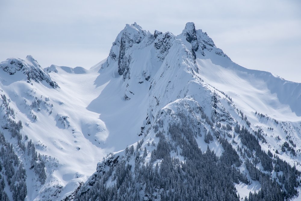
Here's the Yocum Ridge in fatter conditions, January 1980.
 1 point