Leaderboard


Popular Content
Showing content with the highest reputation since 03/18/24 in all areas
-
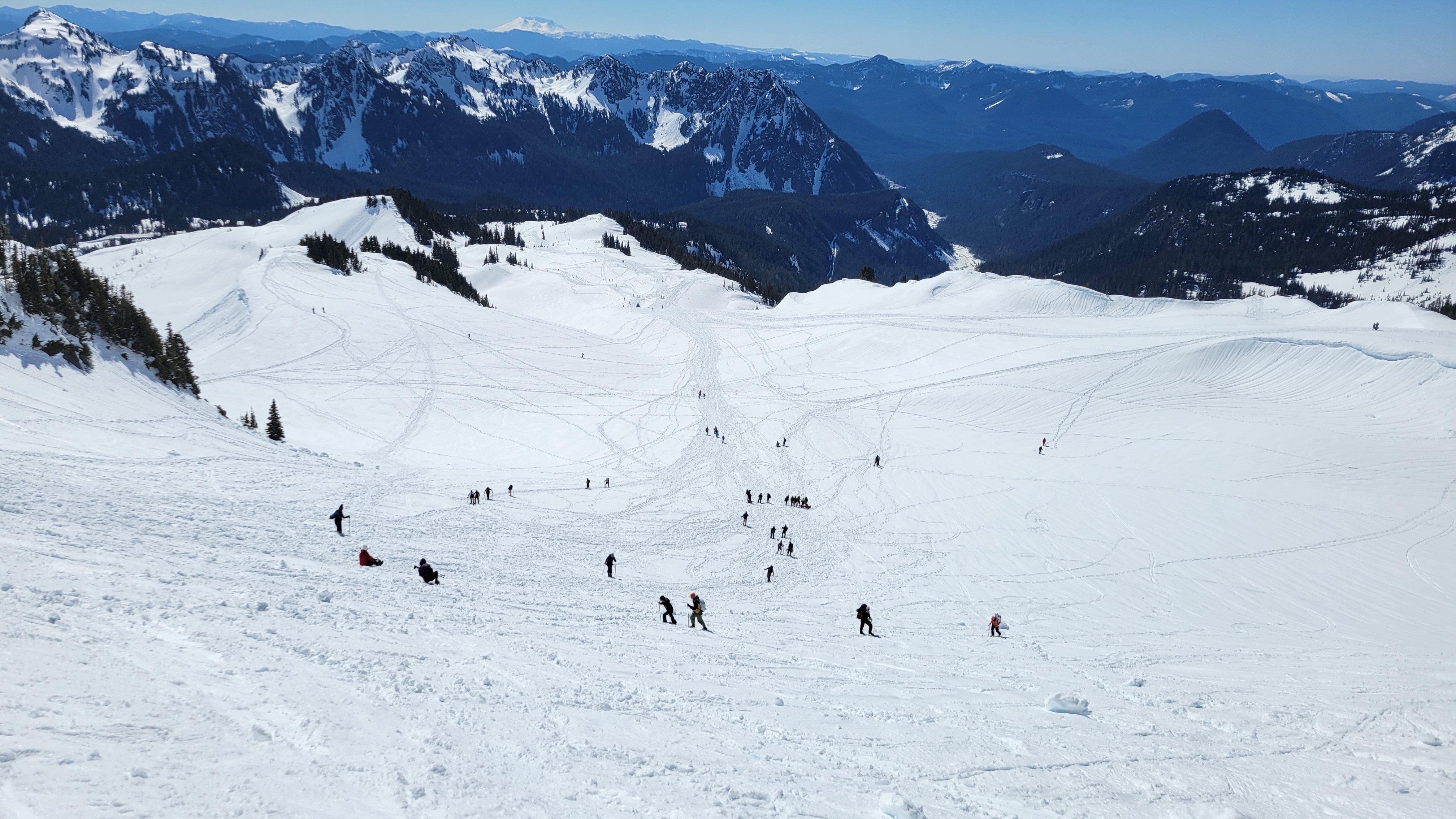
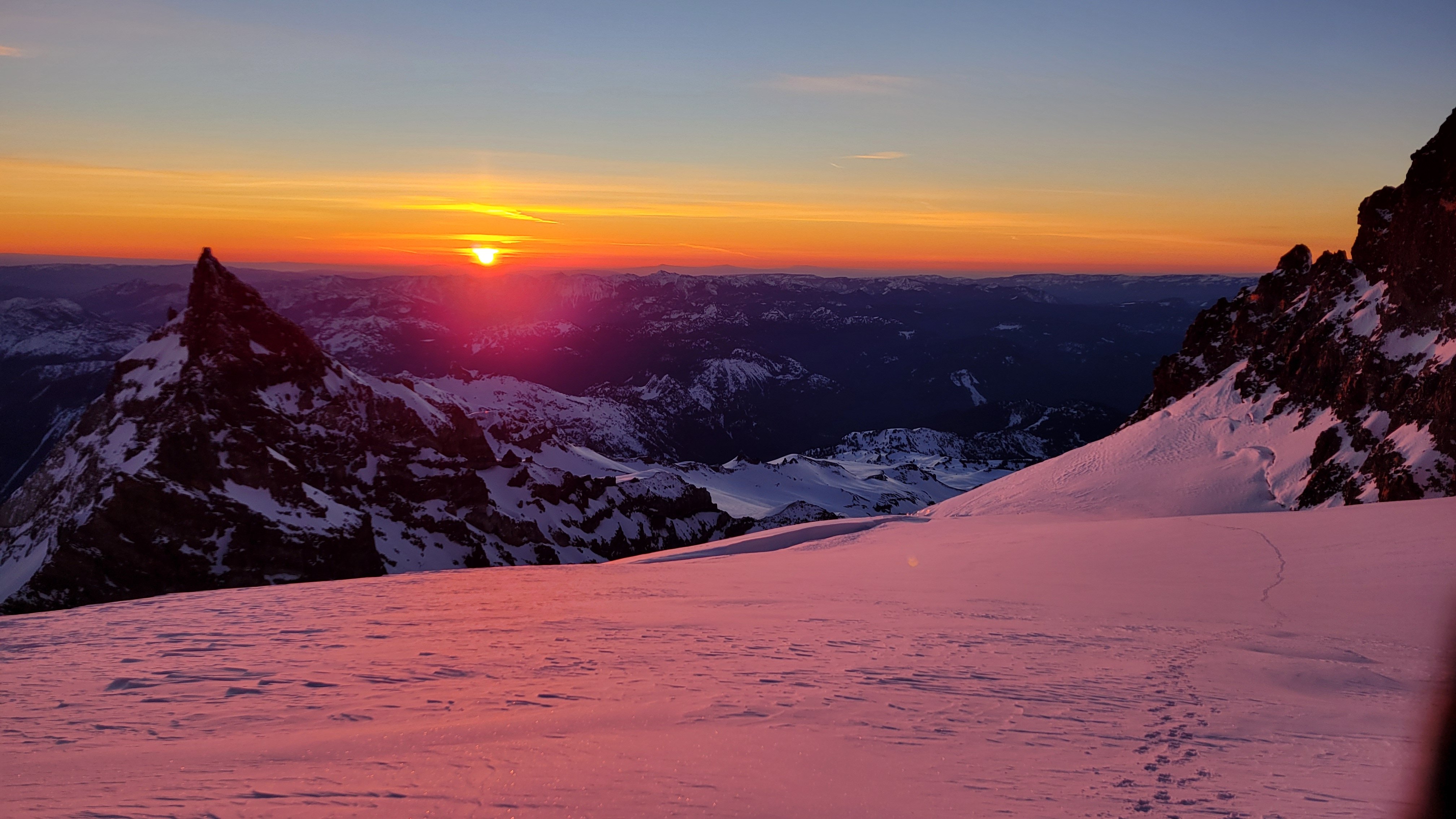
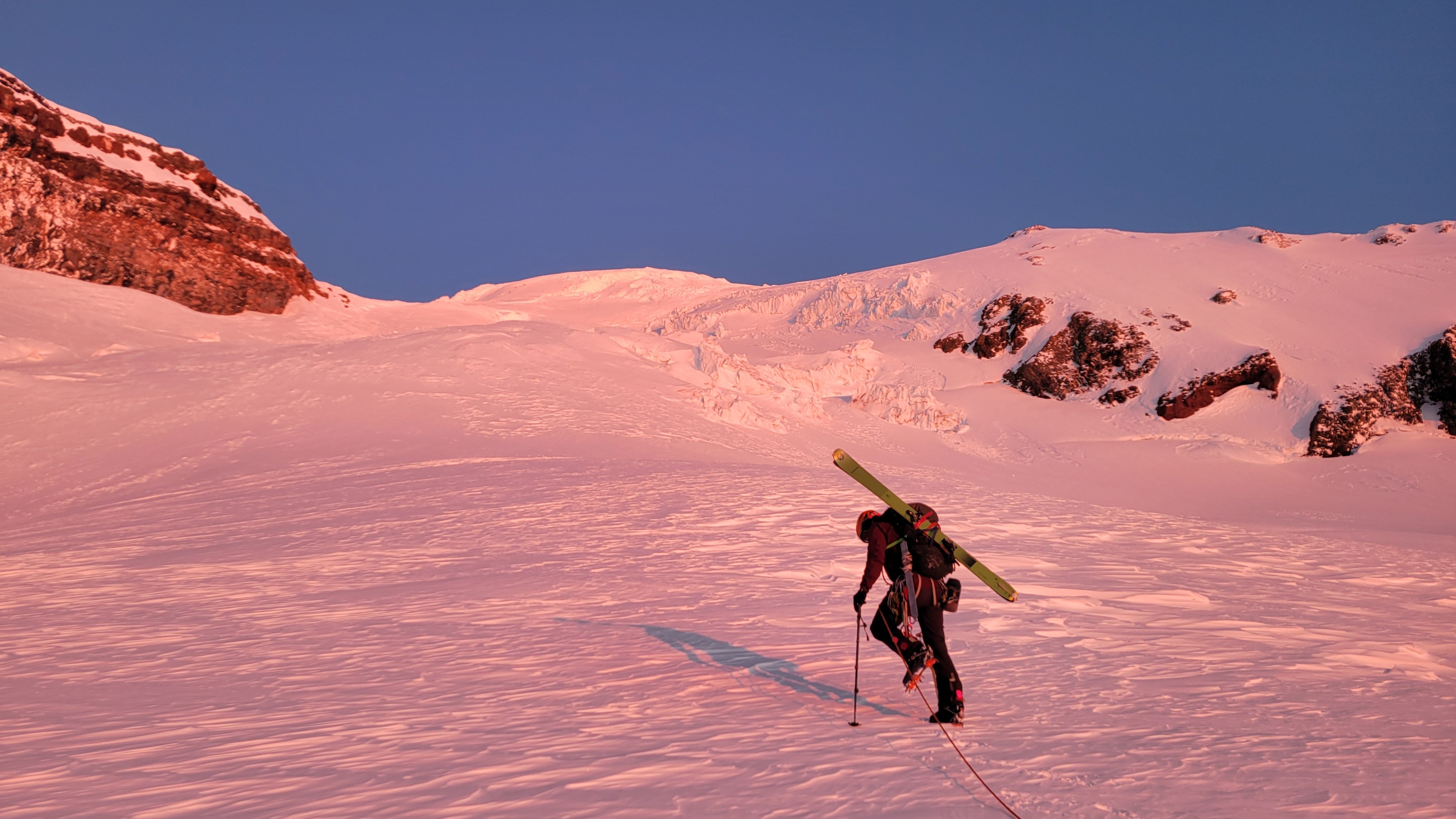
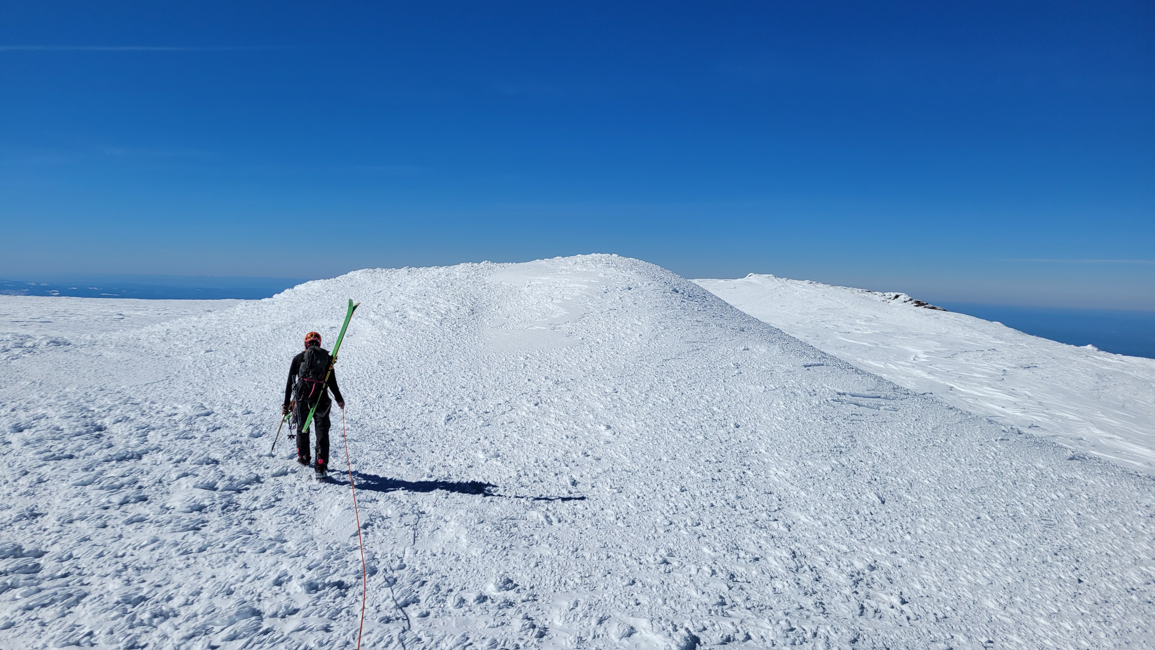
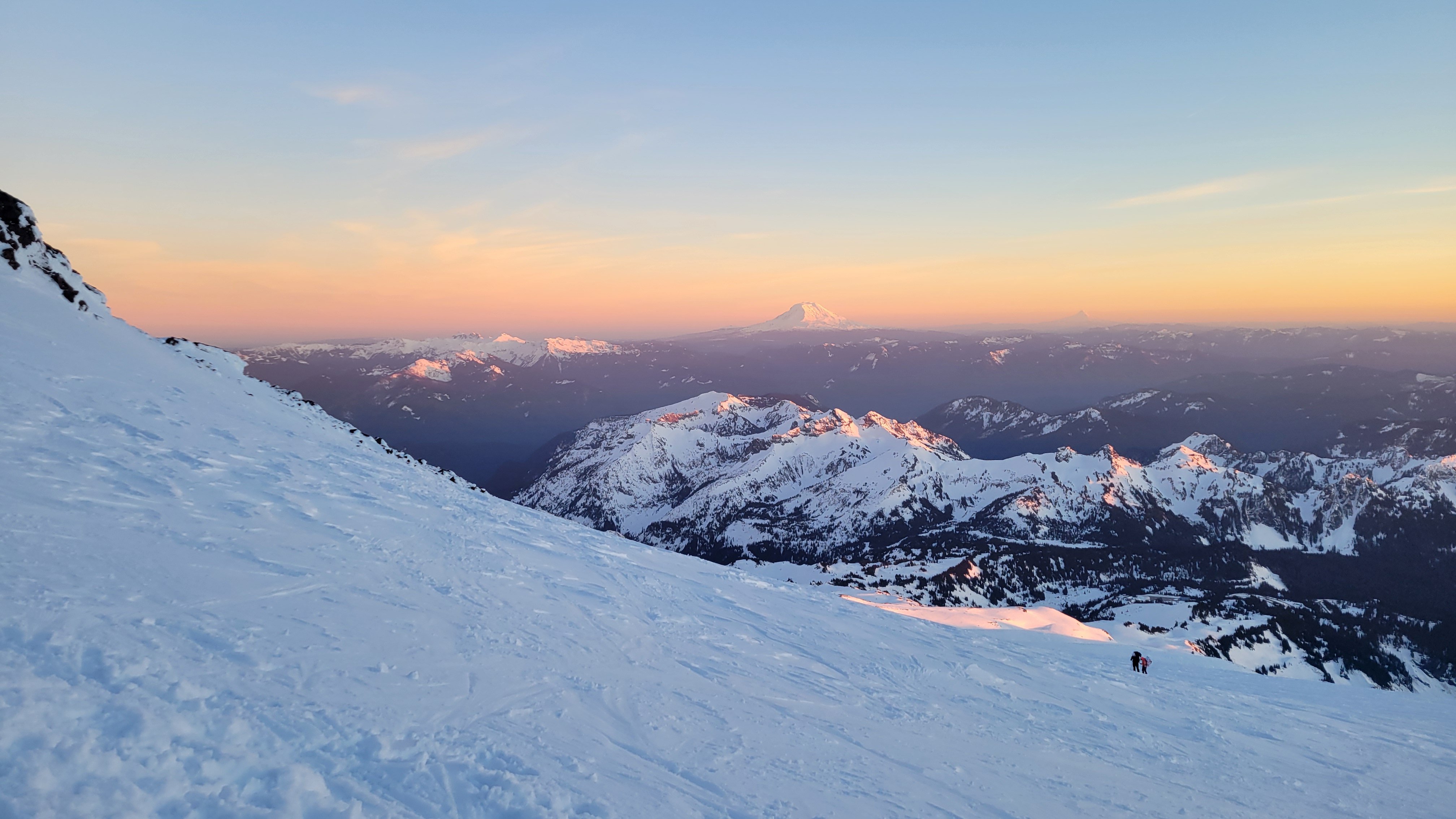
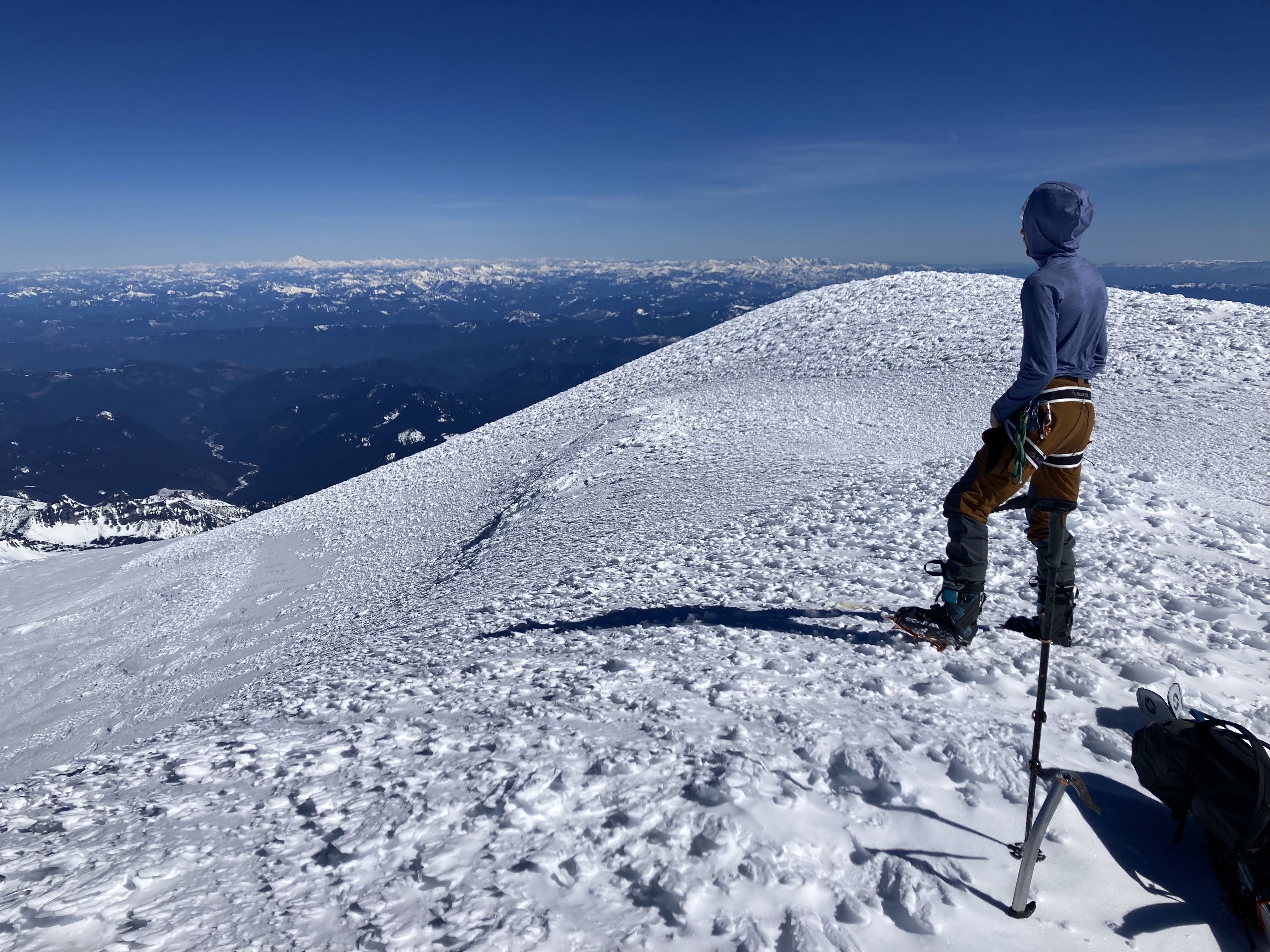
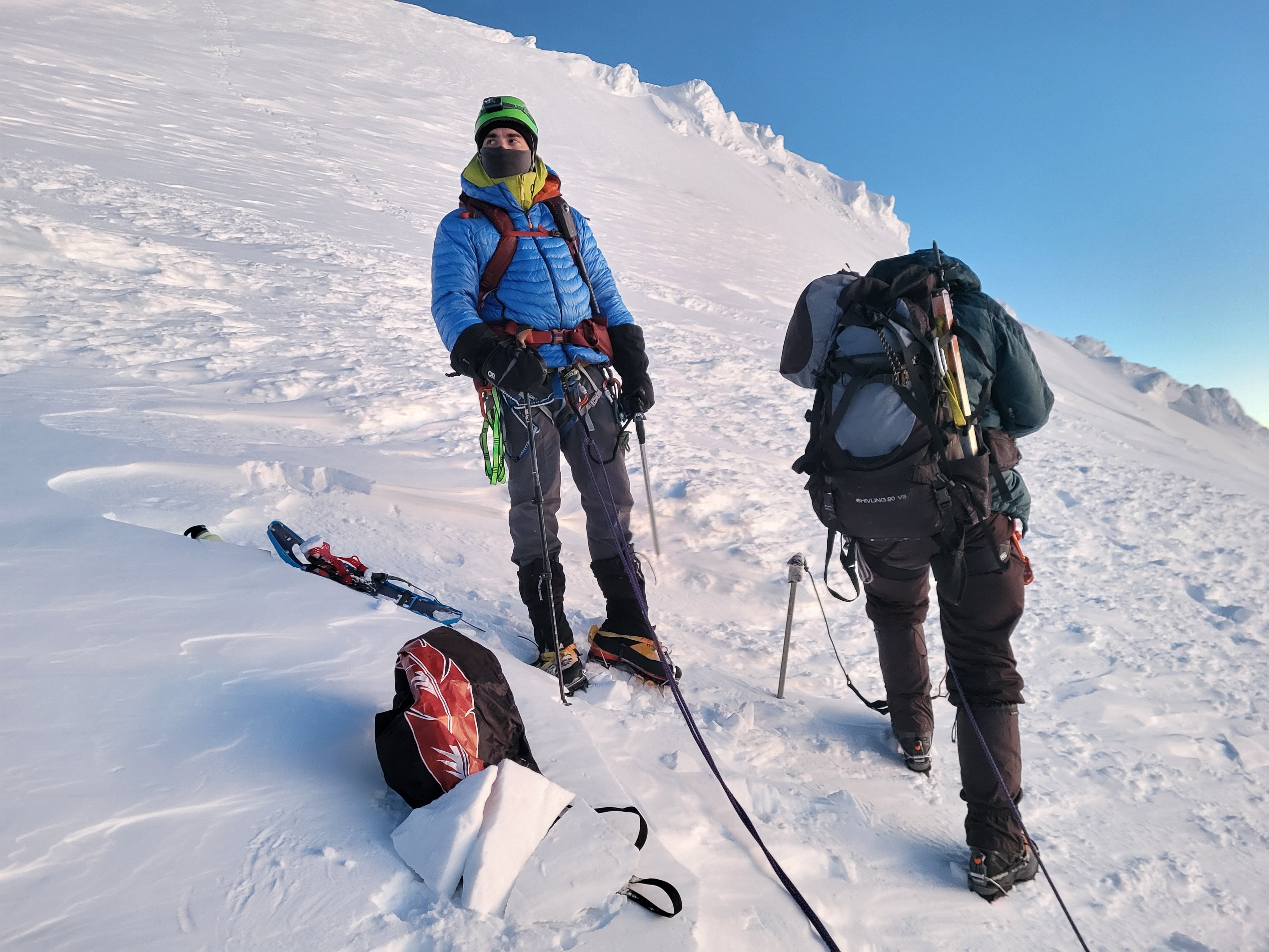
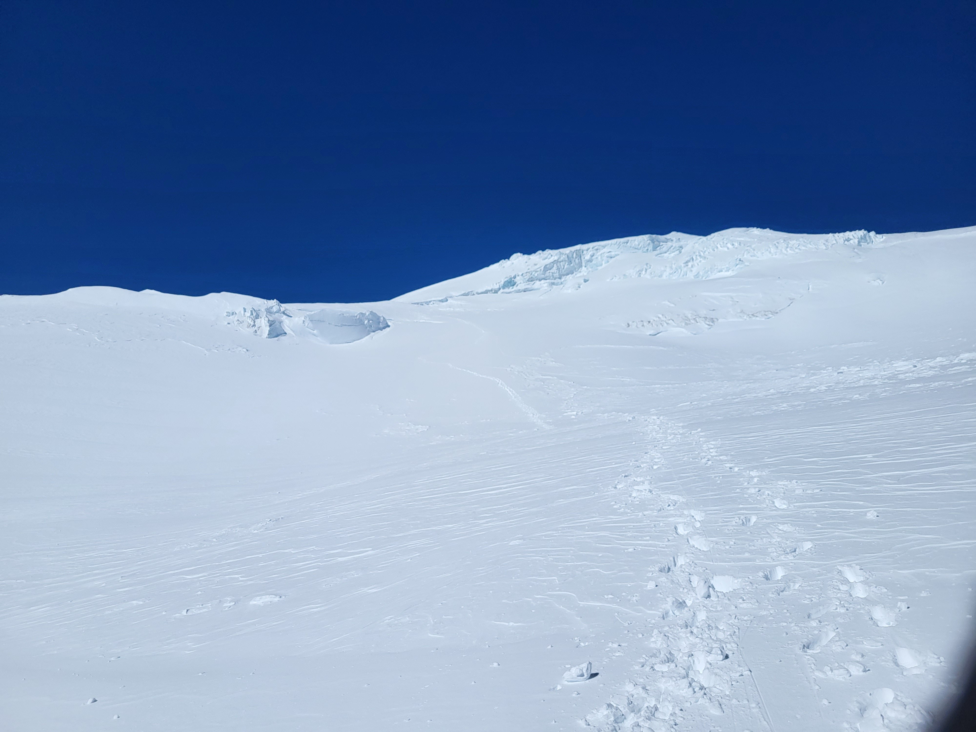
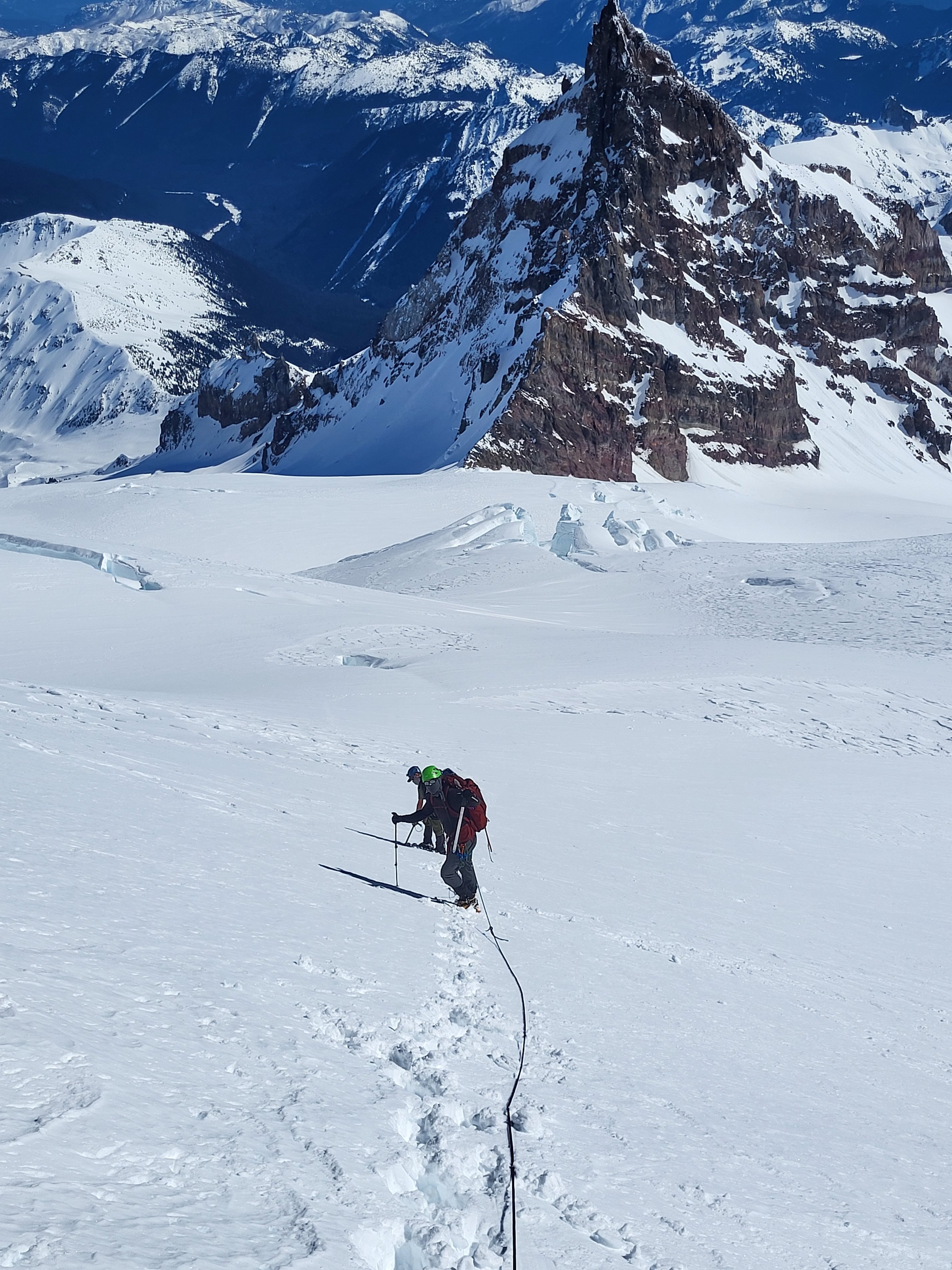
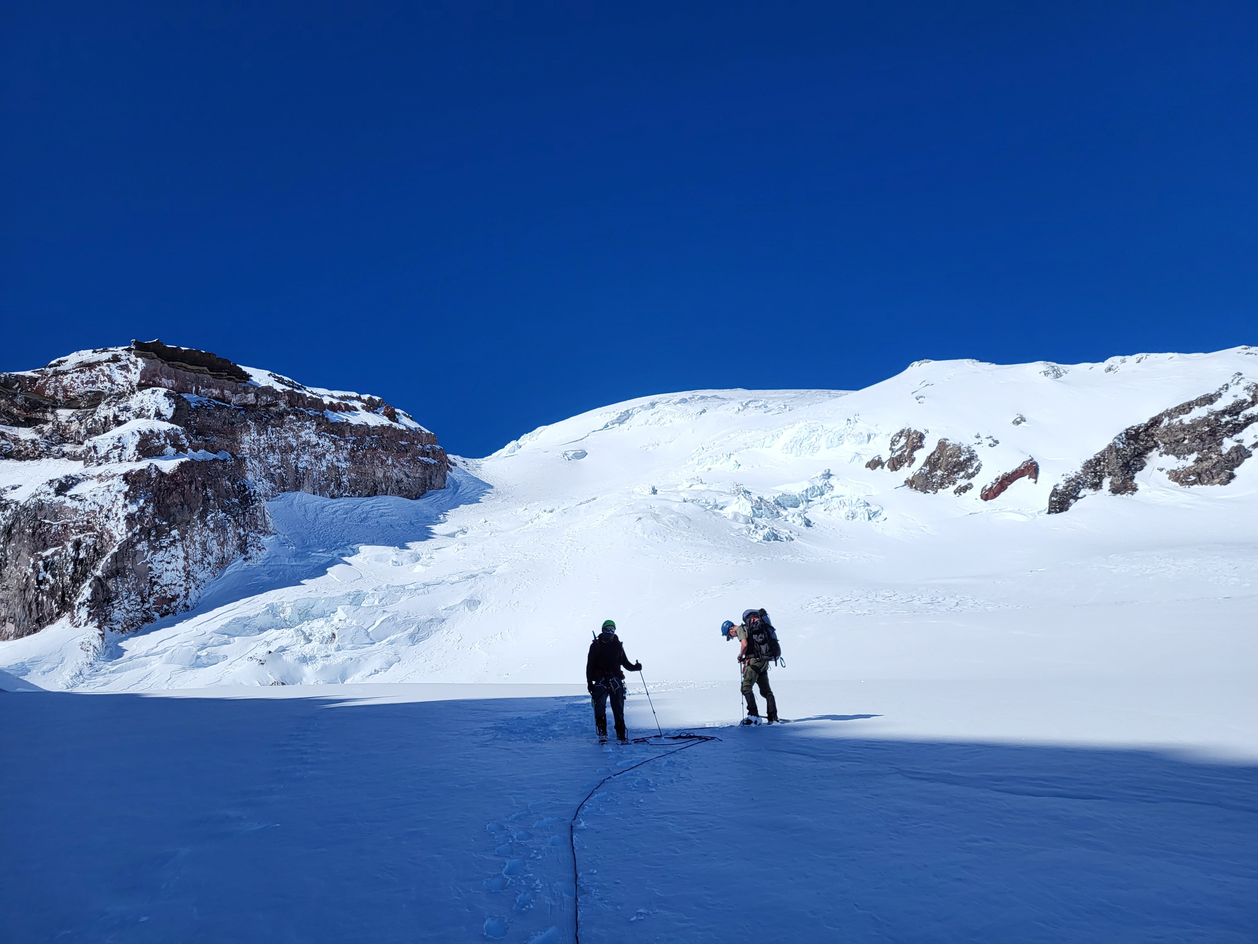
Trip: Mount Rainier - Ingraham Direct Trip Date: 03/17/2024 Trip Report: Mount Rainier in calendar winter... 👻👻👻 Whooooo oooo ohhhhh 👻👻👻 Scarry Well, this wasn't like that. With the big first warm-up of spring predicted, NWAC was saying considerable at all elevation bands everywhere due to wet slides. This actually made a calendar winter climb of Rainier seem spot on for the weekend of St Patrick's Day. Me and @Albuquerque Fred headed out hoping for an easy nab. So that I could get some extra sleep and to let the gate opening crowds thin out we left Seattle at 9:00, getting to Paradise close to noon. The ranger at Paradise (where we self-registered) literally said "you should have no problems"! This was extremely surprising after getting used to rangers telling you how scary and dangerous everything is, assuming that you are getting in way over your head. I think this may have had the opposite effect and made me nervous. It was 68° in the parking lot at 12:30 p.m. We slogged uphill passed about 400 people, mostly snowshoeing in jeans, good for them getting outdoors though. I think it was due to the heat but we felt like we made awful time getting to camp Muir but upon further reflection it took 4.5 hours which seems respectable with overnight packs. There was one other party of four staying at the shelter that night, they were going to bed extremely early for an Alpine start, so we hung out outside in the warm weather making water and cooking and eating and watching the sunset. We turned in at a halfway reasonable hour for a 4:00 a.m. wake up. At 4:00 it was indeed quite cold, especially after my pad went flat and I had to blow it up like five times. The prediction was for low 20s° weather, that seemed about right. We started hiking at 5:15 with our skis on our backs in the pitch black. It was cold, but calm. Booting up Cathedral Gap got me mostly warmed up, and it started to get a little light by the time we crested the ridge. I was taking diamox for the second time on Rainier (the second with diamox that is), and I didn't realize it but tingling in your fingers is a side effect, I thought they were very cold all morning but I think there was just extra blood flow. It felt a lot like light duty screaming barfies though. The sun rose right when we hit Ingraham Flats right around 11k, it was stunning. The going was hard, punching through breakable crust while booting, but it seemed like skinning would just be icy and scary, and the crust was intermittently supportable. The perfect conditions for disheartening travel, right when you think you are making headway on top of the crust you start breaking through, then you have to put extra effort into stomping the crust down so you don't pitch forward. There were two crevasses, one we stepped over, and the other had a nice stable bridge/plug. We went straight up the gut although I think climber's right is actually more filled in. We made slow progress up to 12,200' where we briefly tried to skin, but it immediately was supportable and icy and steep and scary, once I got to a place I could get out of my skis I did so with gratitude. Due to the hard going we decided to hang a left off the Ingraham Glacier to gain the upper part of the Gibraltar Ledges route and follow the other party's boot pack. There was some minor crevasse dodging here at the ridge crest but nothing challenging, then we followed the boot pack to the summit passing the other party on their way down. The head wall above 12800' above Gibraltar Rock was easy cramponing. As soon as the sun came up it had started to get extremely warm, the bowl of the Ingraham Glacier was absolutely roasting, I was wearing long underwear and couldn't really take it off so I was down to just a sunshirt on top with no gloves and no hat all the way from about 12K to the summit. I summitted in a sweat soaked sunshirt, there was basically no wind the whole way. The crux of the entire climb was definitely the heat, it sapped us pretty hard and made for slow going. This was also very unexpected so it was hard to convince yourself you needed to shed a layer. We were very far behind schedule after almost 7 hours camp to summit, so we didn't linger, we stripped skins, put our skis on for the first time in hours and headed down. I found the skiing to be very challenging for the top 1000 ft on hard packed sastrugui, with the occasional hard-packed smooth pocket that made for easy turns. At about 13,000' there was a long smooth steep head wall that made for great linking turns, though very fast and icy. From here down I found all of the skiing to be quite excellent all the way back to camp Muir and below. With the heat the snow from about 12,800' and below was creamy on top, but still supportable. I made it to Muir with my skis on. Fred is less into sketchy, bumpy, icy, exposed turns, so he found the whole thing much less enjoyable. I guess it's just a matter of taste. We packed up camp and headed down. The snow below Muir was excellent until 6700' were a bad case of mashed potatoes set in. It didn't really matter anyway as this was boot packed out 50 ft wide, so we just survival skied the boot pack back to the sign-in hut, and eventually the car. From summit to car with 30 minutes of packing was 3 hours. It all goes to show you that "calendar winter" is total BS and everything should be based on conditions rather than man-made dates. I found this trip to be a more challenging ascent than the Emmons Glacier was in the spring last year, due to the hot conditions and punchy crusty snow. Gear Notes: Avalanche gear, crevasse rescue gear, 2 30m ropes, sleeping gear (no tent, but a pad with a hole in it), way way way too many clothes, not enough water. Approach Notes: Show up late and skip the gate line, it only takes a third of a day to get to Muir, and what are you going to do before it's reasonable to go to bed anyway? It was a bust day on Saturday: Nice sunset though, views all the way to Jefferson: Fred slogging on the Ingraham: Sunrise: Fred finishing it off: Warm summit break:
 6 points
 -
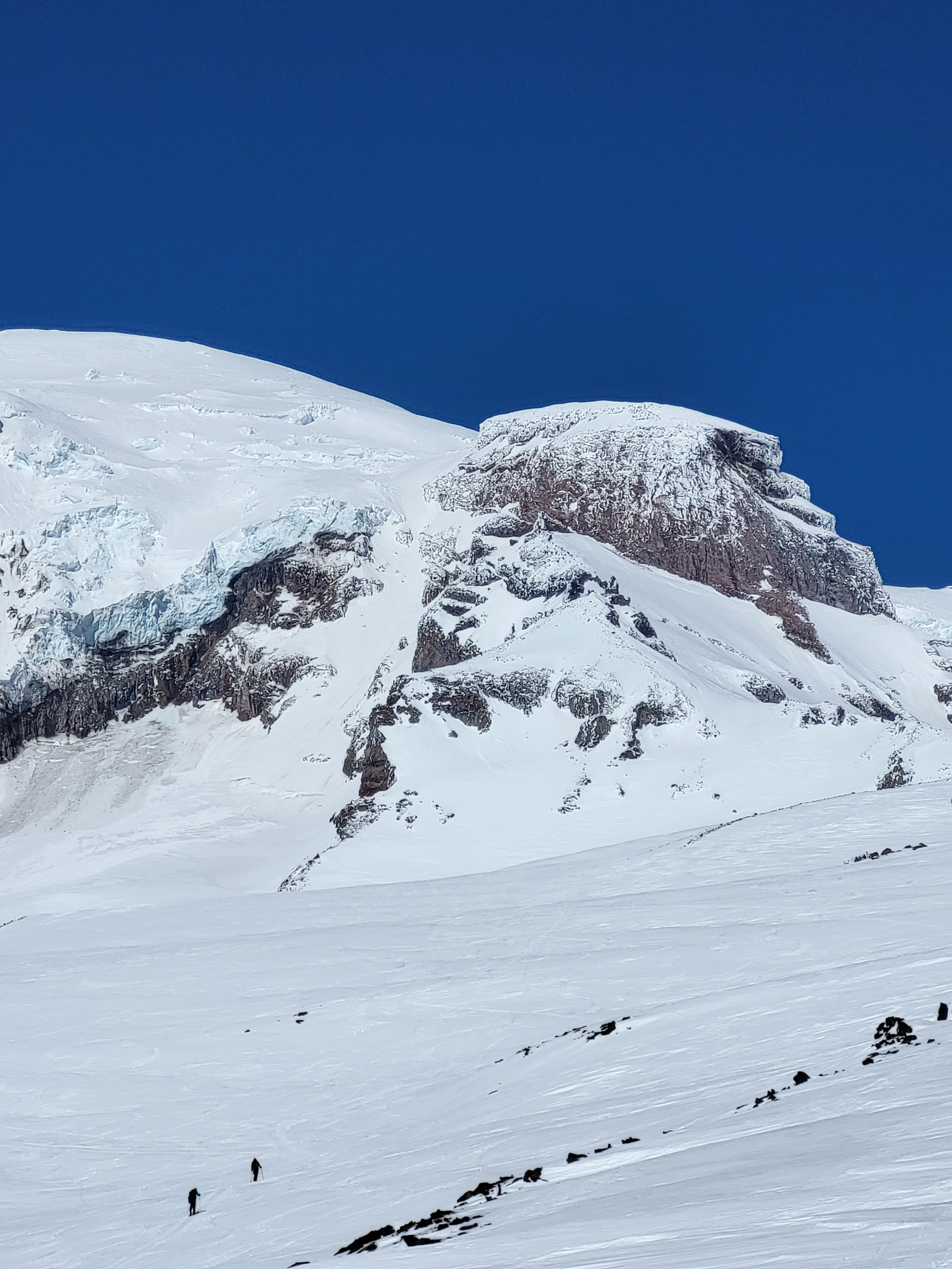
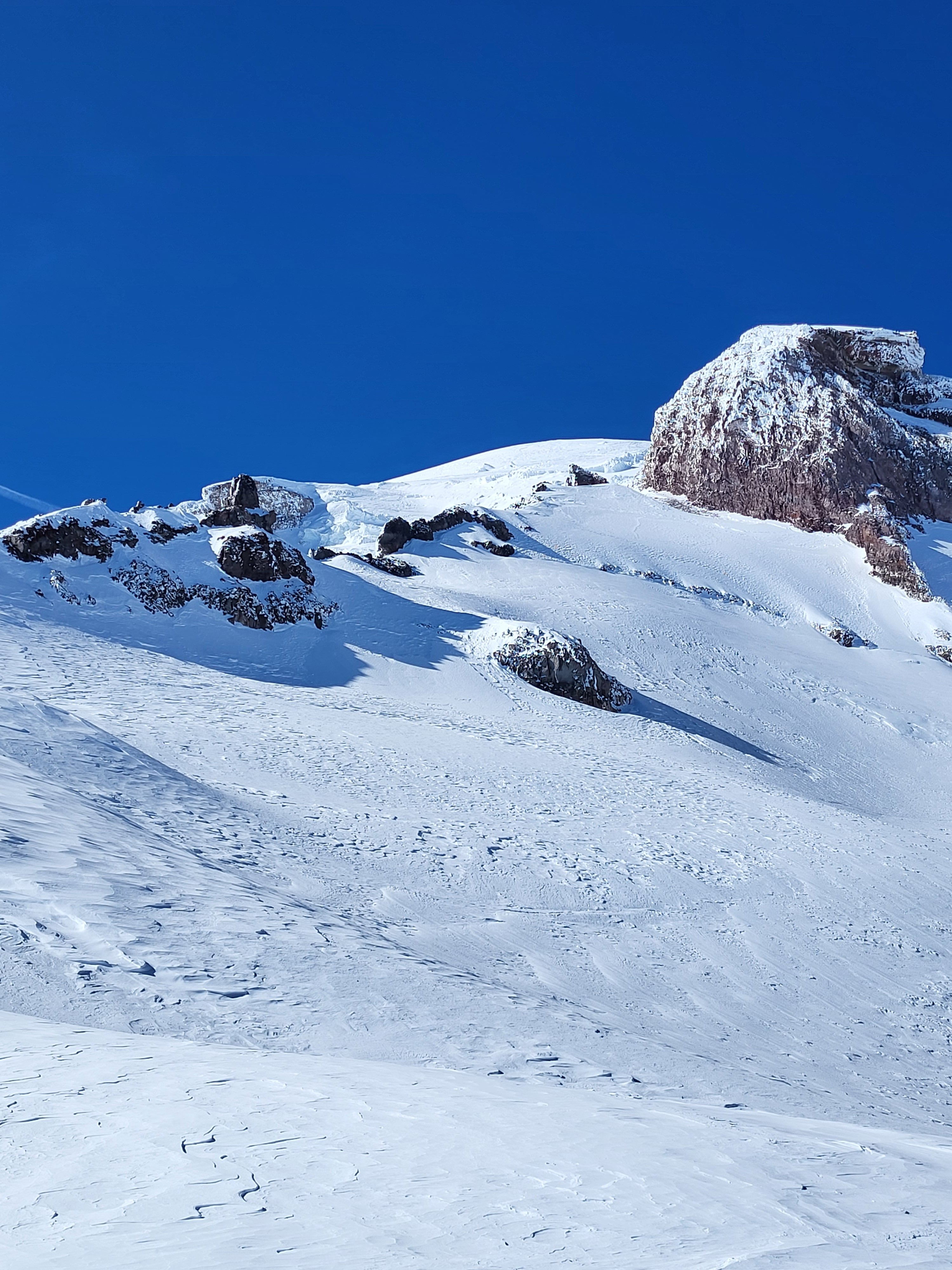
Hello climbing community! Three of us climbed Rainier this past weekend via Gib Ledges on ascent and Ingraham Direct on descent. Gib Ledges were in good condition - adequate snow; however, in few spots with exposure snow cover is thinning out. Hopefully this weekend will supplement what is there. On Ingraham Direct I counted seven crevasses that we crossed - stepped over, with bigger one of them 2 feet wide. This route will be intact for a while. Above 12500, crevasses are well filled in, making for direct climb up. Besides our team, this past weekend another two groups of two on skis summitted. Good luck!
 5 points
 -
Trip: Kangchenjunga - SW Face Trip Date: 06/01/2023 Trip Report: Kangchenjunga (28,169ft/8586m) Highpoint of India Third highest mountain in the world June 1, 2023 Eric Gilbertson On the summit (photo by Anna Gutu) May 27 – Heli from Kathmandu to Lukla, delayed by bad weather in Lukla May 28 – Heli to Tapethoke village, delayed there by bad weather May 29 – Heli to Kangchenjunga basecamp May 30 – Climb to camp 2 May 31 – Climb to camp 4, start for summit 7:30pm June 1 – Summit 5:30am, descend to basecamp June 2 – Heli to Taplejung, jeep to Suryodaya June 3 – Jeep to Bhadrapur, flight to Kathmandu June 4 – Flight to US Location of Kangchenjunga Kangchenjunga is the third highest mountain in the world and straddles the border between Nepal and India. It is officially the highest mountain in India, but is closed to climbing from the India side for religious regions. So it is only climbed from the Nepal side. The name means “The five treasures of the high snow” and indeed the peak has five sub summits. This very often leads to confusion with climbers taking routes to a summit that is not the true highest point. Aside from routefinding issues, the normal route to the summit is technical with steep rock and snow sections. I was in Nepal for the spring and my goal was to climb Mt Everest and Kangchenjunga. I’m working on climbing country highpoints and this would theoretically get the highpoints of China, Nepal, and India. The normal climbing season for both peaks is mid/late May, and it is difficult for me to get time off this time of year due to my teaching schedule. So if I could get time off for one peak I might as well try to squeeze them both in. The route I officially got time off to climb Mt Everest, so I needed to go for that one first. Then if I happened to finish that climb early enough, was still feeling ok, and the monsoon and high winds hadn’t yet started yet, then I could give Kangchenjunga a shot. I would theoretically already be acclimated so Kangchenjunga should only take a few extra days to climb. I arranged logistics with the cheapest company I could find, Seven Summit Treks, and paid for basecamp services for each peak and helicopter transportation between basecamps. I was planning to climb both peaks without supplemental oxygen and without personal sherpa support, just on my own above basecamp. This was mostly to save money so I could afford both peaks in the same season. I had previously climbed K2 this way in the summer of 2022, so the strategy seemed feasible. Climbing with supplemental oxygen and personal sherpa support significantly increases the price. Flying out of Kathmandu Three partners – Matthew, Steven, and Darren – would join for Everest, but I would be on my own for Kangchenjunga. On May 22 I made my solo no O2 summit attempt on Mt Everest, but had to turn around at 8500m after showing signs of HACE. I had been troubled by a dislocated shoulder in the Khumbu Icefall, two weeks of being sick from a respiratory infection, and not enough time for all the rotations I had intended. Unexpected wind had then delayed my summit push making me spend 40 hours above 8000m without oxygen and pull two consecutive all-nighters before moving up from camp 4. It seemed like luck was not on my side that attempt, though I did make it back down unscathed to basecamp with just a bit of sunburn on my nose. The Khumbu Icefall was effectively closed a few days after I descended (ie all ladders across crevasses were pulled), meaning there was no time for another attempt, unfortunately. After hiking two days down to Lukla I caught a late-morning flight to Kathmandu May 26 and considered my options. Flying to Lukla I was using weather forecasts from professional meteorologist Chris Tomer, and he told me there was still a summittable weather window on Kangchenjunga in late May and early June. It appeared the weather on Kangchenjunga was a bit different than on Everest, since the Everest season effectively ended May 26 due to increasing winds. I had already paid for permits, transportation, and logistics support for Kangchenjunga. And I was already acclimated. The elevation I had reached on Everest was approximately the elevation of the summit of Kangchenjunga. The only potential reasons not to go were that I was still exhausted from Everest and the hike out, and I might end up being alone on the mountain. But I had heard that a group from Elite Expeditions was planning to head from Everest directly to Kangchenjunga, so I wouldn’t be alone. And perhaps if I rested a few days I could regain some energy. I met in person with Dawa and Thanes from SST shortly after landing. It turned out there were currently two solo no-O2 clients of SST in trouble on Everest and Kangchenjunga and rescue teams were being sent to help. Suhajda Szilard, who I knew from basecamp and some of my rotations, had attempted to climb Everest solo with no O2 two days after me on May 24 but had not made it down. He was last seen laying down below the Hillary Step. SST was scrambling to send a rescue team to find him (the search would end up being unsuccessful). Also, skier Luis Stitzinger had failed to return from his solo no-O2 summit bid on Kangchenjunga also on May 24. SST was currently organizing another rescue team to look for him (he didn’t survive and his body was later found at 8300m). With this situation unfolding, understandably SST did not want another solo no-O2 client up on one of those mountains. I was told I needed to go with sherpa and supplemental oxygen. I was confident I was acclimated enough to summit without oxygen, but it appeared my options were to either summit with oxygen and personal sherpa or go home and lose all the money I’d already spent on permits and logistics. Grounded in Tapethoke village It would cost another $11k to hire sherpa and oxygen for Kangchenjunga, and I could just barely afford that if I zeroed out my bank account. That would be cheaper than losing all the money I’d already invested and then paying more a future year to come back, so I reluctantly agreed. Dawa made some calls and indeed a team of four clients and eleven sherpas from Elite Expeditions was planning to helicopter to basecamp the next morning and start a summit push. I would have the highest chance of success if I went on the same schedule as that team. I would go with Pemba Sherpa and he would bring three oxygen cylinders for me to use on summit day. He would bring a spare regulator and he knew how to fix any issues with the system. Approaching basecamp So I had that afternoon and evening to quickly cram in some resting and eating before heading out at 5am the next morning. Most of the SST climbers were back from Everest now and everyone was at the Fairfield or Aloft hotels. It appeared I was one of the few cheapskates who hiked out and most other climbers helicoptered back from basecamp. I met up with Matthew and Steven for a big Indian lunch, then Steven and Elena for a buffet dinner at the Aloft hotel. I tried to cram in as much food as possible since I’d lost a lot of weight on Everest, but it’s not possible to make up for all that in just two meals unfortunately. Made it to basecamp After dinner I quickly repacked one duffle worth of gear for Kangchenjunga. Unfortunately one of my bags of gear was still stuck at Lukla, but Steven lent me crampons, harness, and helmet just in case I couldn’t recover my gear. May 27 The next morning I left the hotel at 5am and met up with Pemba and a three-man rescue team at the airport. We would all head to Kangchenjunga together. We crammed our packs and gear into a helicopter and soon took off. The plan was to stop at Lukla, which was on the way, then change helicopters and continue. It was a scenic one-hour flight, and we soon made it to Lukla in increasing clouds. I found my duffle in a pile of bags under a tarp outside the airport, and switched out my crampons/harness/helmet from the bag for Stevens. I was soon ready to go again, but the weather had different plans. The clouds got thicker and it started raining. I hung out in the helipad terminal with a bunch of other climbers killing time. I’ve found that basically all expeditions are characterized by the “hurry up and wait” situation. That morning I had rushed to make an early morning flight, only to wait and kill time the rest of the day. Indeed, the weather never improved, and I spent the whole day milling around the terminal killing time. In basecamp By 4pm Pemba made the call that it was too late to fly out and we needed to spend the night in Lukla. We walked over to the Everest House Hotel, ate dinner, and soon went to bed. I was instructed to be back at the terminal ready to go by 5:30am the next morning. May 28 I got to the terminal a bit early at 5:15am, and was of course the only one there for the next hour. The weather was still socked in, and I suppose I could have easily slept in a lot longer. Over the next few hours some climbers trickled in, until the terminal was full by 11am. The clouds gradually started lifting and a few helicopters flew in and out. By mid afternoon the SST helicopter made it to the helipad. It had to make a few trips before it could take us last, though. It made a shuttle trip to Namche first. Then they removed all the seats to save weight and headed up to Camp 2. The rescue team looking for Szilard on Everest had made the summit but found no trace of him, unfortunately, and had descended back to Camp 2. The Khumbu Icefall had been closed by then with all ladders removed, but the team got extracted by the helicopter from Camp 2 back to Lukla. By mid afternoon it was our turn. I loaded up with Pemba and the rescue team and we finally took off. We headed due east in marginal weather, zipping above jungle and villages. We went for around an hour, starting to head up valleys to the northeast, but then the pilot suddenly descended and landed on a small helipad at Tapethoke village. The pilot had been on the radio with a pilot from an Elite Expeditions helicopter up ahead of us and the weather was too bad to make it to basecamp. The other helicopter had been stopped at Tseram, so we decided to stop there. In basecamp A few locals got out to help direct the landing, then they showed us to a small guest house. The village was pretty small and I bet they don’t see too many outsiders. There was a very rough jeep track going through, so it is accessible, barely, by road. They killed a rooster and we had chicken soup with dahl bat that night. The sherpas tried to convince me to eat sherpa style with my bare hands but I managed to find a spoon to eat with. It seems a lot cleaner to eat rice with a spoon to me. May 29 The next morning the skies were clear and we took off at 5:45am. It was a short and scenic flight up the valley to the edge of treeline at Tseram at 3700m. The helicopter couldn’t go fully loaded all the way to basecamp at 5400m so had to make shuttle runs from there. We unloaded everything, then Pemba and I got in with our gear while the rescue team waited. We helicoptered up to 5400m and landed on a small pedestal of rock sticking up from basecamp. The view from basecamp The basecamp location was amazing. It was a peninsula of rock jutting out between two glaciers and sticking up enough that it was sheltered from any avalanches from above. Even at its height there were small patches of grass growing on it. Kangchenjunga loomed above behind camp, and yellow tents were scattered all over the peninsula. It appeared only Seven Summit Treks and Elite Expeditions still had camps there. A handful of climbers were milling around, having recently successfully summitted. I got out and soon ran into Flor, whom I’d met on K2 last year. She’d summitted a few days earlier and had known Luis, the climber the rescue team would be looking for. There were a half dozen climbers all getting ready to fly out on the same helicopter. Lots of Sherpas would stay to run the camp while we were there. I was ushered into the dining tent and served a great breakfast. I stuffed as much food down as possible since I was still kind of in recovery mode from Everest. The helicopter did one more shuttle run and got the rescue team in, then shuttled a bunch of climbers out. More basecamp views The rescue team quickly packed up and started up, but it didn’t seem like Pemba was in much of a hurry. It was only 7am and there was plenty of daylight left, and the weather was perfect. My forecast from Chris was for great weather today, and sunny for the next four days, but increasing summit winds each day. It seemed to make the most sense to me to summit as soon as possible before the winds got too high. I told this to Pemba and he went and talked to the Elite Expeditions team, which had just arrived. Their plan was to take a rest day in basecamp and start up the next day. This didn’t make any sense to me. All packing could be done within an hour and we would have plenty of time to make it up to camp two or three. We had just rested the past two days with the bad weather delays. The rescue team had just started up and they were planning to make it to camp 3 that night. But since the Elite Expeditions team wasn’t going up we had to also wait. This is one reason I like going unguided, so I can make all decisions on my own. But I was basically obligated to go with everyone else. So I reluctantly unpacked my gear, found a tent, and tried to nap the rest of the day. I suppose one good thing about all these delays was that I actually got three unexpected rest days, which I probably needed anyways. And the delay in Tapethoke village gave me another night at low elevation, which probably helped with recovery. Hiking up to camp 1 The Elite Expedition Sherpas were planning to move to camp 2, then camp 4, then summit June 1. Chris’s forecast was for summit winds 25-35mph on June 1, which seemed marginal. Generally I want winds less than 20mph for summitting without O2. With O2 I’ve heard a common threshold is 30mph. Supplemental oxygen warms the body up so you can tolerate more extreme wind chills. So June 1 would be marginal while May 31 would have been acceptable in my view. But the Elite Expedition Sherpas said the route up the southwest face is generally sheltered from the winds, so you really just experience them briefly on the summit ridge. Chris confirmed the winds were indeed from the WNW and that ought to leave most of the route sheltered. The sherpas had done this mountain plenty of times so I had to trust they knew the conditions. May 30 The next morning we got ready early and by 8:30am the Elite Expedition team started up. So we started up behind them. Pemba and I split the group gear (tent, stove, fuel) and he said the rescue team had taken up a few extra oxygen cylinders. Still, my pack was around 65 pounds with the down suit, -20F sleeping bag, and tent strapped on. Nearing camp 1 I noticed the clients with Elite Expeditions didn’t seem to be quite as loaded down. They just had small day packs. It appeared there were a lot more sherpas in that team to help carry gear. There was even a professional photographer along and a few guides! I’m quite certain I paid a lot less than they did, though, and I was fine with carrying all my own gear. Despite this, Pemba and I still somehow managed to pass most of the climbers and ended up near the front of the pack. We started out hiking through a talus field, then went up a gradual snow slope and eventually hit a set of fixed lines. The slope was steep enough that you didn’t want to fall, so I was happy clipping my ascender on. It made me a little nervous that most of the sherpas tended to just clip a beaner on but not their ascender. This meant if they slipped nothing would stop them and they would run in to the climber below. In fact, I’d heard on Dhalguiri earlier this season a sherpa in this situation had slipped, crashed into the climber below, and broken his leg! Traversing to camp 2 Luckily no incidents like that happend on this trip. We made steady progress up the snow slope, which eventually got quite steep. We then made a long traverse and hit camp 1 at 6100m on a ridge. I’ve heard camp 1 is really just used on early acclimation rotations, and indeed there was no evidence left of a camp there. We stopped briefly for a snack break, then continued. From that ridge the route actually descends a bit to the glacier below and very soon reached camp 2. We dropped down the opposite side of the ridge and arm-wrap descended a gradual slope. I rappelled one short and steep dirt section down lower, then made a short and flat hike to camp 2 around 2pm. It was only about an hour between camps 1 and 2, so I can see why camp 1 soon gets skipped. Camp 2 was on a large flat section of glacier at 6200m and looked very safe from any rock or ice fall. There were already three tents set up there from Satori Expeditions and 8K, and I think Elite Expeditions had arranged for those to be left there for them. The other climbers jumped in those tents while Pemba and I set up ours. I’m glad we brough the SST tent because it weighed about the same as mine but was 50% bigger! Camp 2 We soon threw our stuff inside and Pemba started melting snow. A steep icy headwall loomed above between us and the summit and I could make out an orange tent on a bench near the top. That was camp 3, where the rescue team had made it the previous night. Higher up in the distance we could make out a snow gully leading up towards the summit, and there were a few climbers in it. That appeared to be the rescue team searching for Luis. We rested the remainder of the afternoon, and after an early dinner went to bed at sunset. May 31 The sun woke us up at 4:30am and we were soon packed up. This time we all started out in down suits and I left some extra gear to try to save weight. Pemba advised that I could just wear a base layer under the down suit and leave my jacket, snow pants, and extra layers behind. On Everest I had worn absolutely every layer and been barely warm enough, but I guess breathing supplemental oxygen would take care of keeping me warm. Climbing up to camp 3 The thought had crossed my mind to just hang the oxygen mask off my neck and not use it so I could still get a no-O2 ascent. But the more I thought about it the worse that idea seemed. We were already planning to go up in conditions that were too windy to safely go without O2 in my mind. Pemba said the group planned to start at 7:30pm that night to summit at sunrise. That gauranteed going mostly at night, when I was at most risk of getting frostbite with no O2. I would really want to start more like 1am to minimize time at night, but I had to go with the group so that was not possible. Also, I would be carrying two oxygen cylinders, which each weighed 10 lbs. It would be silly to carry 20 lbs of unneccessary and unused weight on my back if I didn’t use the O2. I couldn’t just leave the O2 and go on my own schedule because SST had told me I was required to go with O2 and sherpa. So I was basically cornered into going with the group with the O2. At least it increased chance of success, even if a bit less honorable than I had hoped. So I ditched the unneccessary gear, and since I wore my down suit my pack was considerably lighter. I kind of wanted to leave my sleeping bag too, since we only planned to rest a few hours in the daylight and not sleep at camp 4. But based on my experience on Everest pulling all-nighters at camp 4 there without a sleeping bag I figured it was wise to bring it just in case plans changed and we ended up needing to sleep at camp 4. Above camp 3 By 5:30am we rolled out of camp and started up the flat glacier. As before, Pemba and I soon found ourselves near the front of the pack. As we reached the base of the steep headwall we saw the rescue team of four sherpas coming down. They were dragging something in the snow and that didn’t look good. As they got closer I could tell it was the body of Luis wrapped up in a tarp. It had been nearly a week between his accident and them arriving due to the weather delays, so I suppose it had always been unlikely they would find him alive, unfortunately. We jugged up the steepening ice and snow slope, and it soon leveled out just below camp 3. A small ice avalanche had wiped out part of the fixed lines there, so we had to unclip briefly. Higher up I took a few ice screws from a sherpa and built some new anchors for the rope and did some re-directing to make improvements. We soon reached the small bench that is camp 3 and took a break. By this point some of the Elite Expedition clients had already started using oxygen, I think starting around 6500m. The plateau at 7100m There was a single tent there and some Elite Expedition sherpas took it down to move it to camp 4. They had really planned things out well, having tents left on the mountain for them so they didn’t have to carry as much from basecamp. The route got quite steep just above camp 3, but then did some traversing and climbing over small shoulders. Eventually Pemba, I, and Dawa were far in the lead and Pemba took over breaking trail. The rescue team had been up there that morning but the wind had drifted their tracks over. When we hit 7100m the slope leveled out to a big bench and I mistakenly thought this was camp 4. But Pemba said it was the next higher bench. We took a brief rest then continued. The route dropped down into a small valley then ascended up a steep ice slope. There were no steps kicked in and we took turns on the rope. Just around the corner from the ice slope we finally arrived at camp 4 at 7300m by 2pm. The short descent before camp 4 As before Elite Expeditions had an 8K tent already set up waiting for them. Dawa jumped inside while Pemba and I kicked out a platform and set up our tent. The slope wasn’t too steep, but it did still take a lot of effor to kick out the platform without ice axe or shovel breathing the thin air at 7300m. More Elite Expedition crew soon showed up, and everyone except me, Dawa, and Pemba was breathing supplemental oxygen. I was feeling pretty good at that elevation. I’d already spent about 48 continuous hours above 8000m without oxygen on Everest a week ago so 7300m wasn’t a problem. Dawa had been very generous to melt us some snow while we were making our tent platform, so we threw all our gear in the tent and laid down to rest. Pemba put his oxygen mask on and started breathing, but I thought I should save any oxygen for summit push emergencies. And I was breathing fine anyways. Arriving at camp 4 Pemba then gave me a lesson in how to use the system. I’d never used oxygen before so had no idea what was going on. He had brought a third regulator as backup, which comforted me. We tested that two cylinders fit in my backpack with the pressure valves visible. He showed me how to put the mask on, and said I shouldn’t wear a helmet since that made taking the mask off to eat or drink difficult. I said I didn’t care and I was definitely going to wear a helmet. There’s always risk of rockfall or icefall in the mountains. I said if I was thirsty I’d just take the helmet off then take the mask off. The regulator went in increments of 0.5L/min up to 4L/min flow rate. I’ve heard more expensive setups go up to 8L/min and lots of Everest climbers use that flow rate. But that means they need to have more cylinders brought up. Pemba said 2L/min would be a good rate and that should last 6-9 hours. We would start that immediately and that would probably get us to the summit. Then we would switch to a second bottle for the descent. I would carry both bottles, and he would carry a third as spare just in case. Then he would just use two. I think the plan was each of us would just use two but the third was a spare for either in case of emergencies. Testing out the mask I’ve had multiple friends have their regulators break on summit push on Everest. I also heard Darren had his oxygen run out before his sherpa noticed on his Everest push and he was feeling pretty crappy and starting to black out before it got switched. These stories make me nervous about relying on a mechanical system like that when unacclimated. I was comforted by several facts, though. I was already acclimated enough to summit without oxygen, so would be perfectly fine if the system didn’t work. I just might move slower and get colder. Pemba had a spare regulator that we verified worked. And, we were with a big group so among all of us there were plenty of spare components and cylinders. We took naps in the afternoon, then had an early dinner. I had a very strong appetite and had no problem finishing my two packs of Ramen noodles and quarter pound of extra sharp cheddar cheese. I don’t often have that strong an appetite above 7000m, so this tells me I was in fact very well-acclimated. By 7pm the sun set and we started getting ready, and by 7:30pm we were out of the tent and moving at the back of the big pack of 15 other climbers. Starting out just after sunset This was the first time I had breathed supplemental oxygen, and I was very curious how it would affect me. I’ve heard people say it lowers the apparent altitude by a few thousand meters, so I expected to feel like I had down at basecamp. It was still kind of hard work walking around down there with a pack so my expectations weren’t too high. Maybe it would help an extra 20%. What I actually experienced felt like an extra jolt of energy with each breath. After a few steps I’d get a little tired, then I’d suck in a breath and instantly be back up to full strength with energy ready to power forward. I kind of thought of myself like a cyclist on EPO in the Tour de France. I basically had unlimited energy, and something felt not quite right about that, like I hadn’t earned it. Hiking up with the EE team I could basically go twice the speed as I could without supplemental oxygen, and never got tired. And this was on a modest 2L/min. Could people on 8L/min on Everest be getting 4x the extra energy boost as me? I’m not sure if it scales that way, but no wonder oxygen use is common 8000m peaks. I think the only people that truely understand this advantage are the ones that have climbed 8000ers without oxygen and also tried it with oxygen. (I’d previously climbed Broad and K2 without O2 and gotten to 8500m on Everest without O2). As an added bonus, my fingers and toes never got cold. Not even a hint of being numb. If I was without O2 like on Everest I’d have to be stopping every 10 minutes to warm things up. But now I could just go continuously for hours, never needing to rest or warm up appendages. In my experience it is an order of magnitude easier to climb with supplementary oxygen than without. For better or worse, I was definitely going to make the summit this time. Looking back towards Jannu in the moonlight We generally stayed together as a big 17-person group down low, and I commend the sherpas in the front for breaking trail. Fortunately the tracks from the rescue team were still around so I don’t think it was quite as bad breaking trail. As we got higher the team started spreading out, with two EE sherpas and client in the front, then me, Pemba and Dawa all making up the lead group. Behind us the remaining climbers started slowing down more. Progress was slow and steady, and we didn’t stop for any breaks for the first five hours. That’s the power of supplemental O2 for you. By 1am we took a 5-minute break to eat some snacks, and then a few hours later we stopped again for a quick water break at the base of the rocks. Navigation can sometimes be problematic on Kangchenjunga I’ve heard, but an advantage of us coming at the end of the season was that other climbers had already figured out the route and left the fixed ropes there for us. We just had to jug up them. Sunrise on Yalung Kang June 1 The steep snow slopes got a bit tedious but then around 3am the climbing got more interesting when we hit the base of the rock band. There was a little bit of a traffic jam going up but when I got to the rocky section it just seemed like fun scrambling to me. Maybe that’s since I do a lot of mixed climbing in the winter in washington that I knew exactly how to wriggle up the features. We crested one rocky section, then started a traverse. We were then stalled a bit as the three lead climbers figured out a way up a tricky section. By then it had been 8 hours and I was worried about my oxygen canister running out at in inconvenient spot. Since we were already stopped I asked Pemba to check, and indeed it was about empty. He quicky switched the hose to the other canister and we continued up. Hiking up the final snow slope We scrambled up one final rock section then topped out on a snowy ridge just as the sun was coming up around 5am. From there it was a short snow traverse, then climbing up another short steep snow slope to the final summit pyramid. We traversed on rocks around the base of the pyramid, passing one old dead body lower on the rocks. Up until that point the wind had been mercifully light, but above us on the summit it looked like it was ripping very fast. Maybe Chris’s 25-35mph forecast was actually an underestimate! Though he did say it would be at its lowest at 6am, and it was almost that time. The group of three in front of us crested the ridge and I soon followed. Amazingly, once I poked my head up over the ridge the wind seemed to die down and was almost calm! I had feared it would be a knife-edge rock ridge but, while my side was all rock, the other side was a gentle snow slope. The final rocky bit before the summit I easily marched up the snow slope and reached the summit at 5:30am, ten hours after starting. I was the second one up there. The photographer for Elite Expeditions had gotten their first and was waiting to take pictures of the clients. Conditions were perfect. Only partly cloudy with great views around, almost no wind, and not even too cold (probably because I was breathing the oxygen). I got a few pictures and a brief video, then Anna Gutu from EE made it up and I took some pictures of her. She returned the favor for me, but then my camera froze and wouldn’t turn on! I thought keeping it warm in my inner pocket would help, but I guess it was actually kind of cold up there (forecast -15F) and it had gotten too cold. The only way to salvage it in this situation I’ve found is to plug it in to an external battery. But I didn’t want to fool around with that on the summit so I called that good enough for pictures. I yielded the top to the other climbers coming up and stood off to the side admiring the view. But I soon started getting a little nervous. More and more climbers were trickling up and it seemed risky somebody would knock another person over the edge with all the jostling for pictures. So I told Pemba I was good and we should head back down. On the summit Ten minutes had been plenty up there to admire the view, plus if we were the first ones down we could rappel all the steep lines and not have to wait in a queue. This would be especially important if the weather turned sour, and it was indeed supposed to get windier over the day. We made fast progress down, and took turns rappelling the steep lines and arm wrap descending the others. Pemba was much faster so he went first, and we soon spread out enough that I didn’t have to wait at all to rappel. At the base of the rocky section I noticed a pack sitting by itself in the snow with a set of skis sticking up next to it. This must have been from the climber Luis that the rescue team found. Way lower on the slope I had seen a few stuff sacks earlier, also likely from him. I arm wrapped down the snow slope, though managed to rappel a few of the steeper sections. By 8:30am, three hours after summitting, we both staggered back into camp 4. It felt good to pull off the oxygen mask and finally be breathing normally. It turned out we had a lot of extra oxygen. I had only used a little over one canister and Pemba the same. So we had a few extra canisters. There was no need for any oxygen going down, and empty canisters are much lighter, so we opened the valves and released the extra gas. It felt kind of wasteful, but didn’t make sense carrying so much extra weight down. Back at camp 4 Pemba proposed a two-hour break, then we would descend back to basecamp. So I repacked everything, then laid down for a brief nap. We had just pulled an all-nighter so both appreciated the rest. By 10:30am we got out of the tent and started taking it down. There had been a suggestion that we just leave the tent there, but there were no other teams coming up that season that could use it, and it would just become trash. I volunteered to take it down since I’d carried it up. By 11am we were all packed up and heading down. My pack was now monstrous again since it was too hot to wear the down suit and I had to put it in the pack. By then some of the EE team had made it back, but most were still working their way down from the summit. I think our time of 3 hours down was kind of fast. Descending back down We made good time down from camp 4, again enjoying the benefits of being first since there were no queues to wait in and we could rap down any line we wanted. (For reference, two people can climb up a rope at the same time but two cannot rappel down a rope at the same time – they must take turns, which can slow things down descending). We passed through camp 3, then took an extended break at camp 2. It was getting hot and I was out of water by then. The rescue team had been in camp 2 the previous day and was hoping for a helicopter extraction, but for some reason conditions weren’t good and the helicopter couldn’t land. So they had moved everything to camp 1 and would get extracted from there. Meanwhile, they had generously melted a pot of water and left it for us, and left a bag of coke bottles for us! Last look at the upper slopes I chugged the water and Pemba cracked open some cokes. I don’t really like carbonated beverages, but I was low on energy and liquid and figured the sugary beverage might help. Pemba passed out more cokes to EE sherpas coming down and everyone was in good spirits. Some clients came down and took naps in the three tents remaining there, and Pemba and I soon packed up and headed out. I really was not looking forward to the uphill to reach Camp 1 after already putting in a big day. I think the coke didn’t agree with my stomach since I don’t usually drink carbonated bevereages. At any rate I was not feeling 100% approaching that hill, and it took me twice as long as it should have to make it up. Descending below camp 1 I eventually made it and caught up to Pemba resting at Camp 1. From there it was easy arm wrap descending down. A few sections of the route had been hit by small loose wet avalanches, likey earlier that day. It was indeed kind of hot there in early June. But by the time we got there evening clouds had built and the slopes were stable. We dropped back down and eventually staggered in to basecamp around 530pm for a 22 hour day. We had an excellent chicken and spaghetti dinner, and I even got to take a warm bucket shower before bed. June 2 Back to basecamp for dinner An Elite Expedition helicopter arrived at 6am and immediately started shuttling climbers out. That would be the only helicopter and it had to service everyone. I quickly packed up and took my turn to shuttle down to Tseram. There we all waited for a few hours drinking tea at the local teahouse. When all the climbers and sherpas were out the helicopter then started shuttling us all to the Taplejung air strip. This was the closest village with a paved road to basecamp. I had been told the whole SST crew would get flown to Kathmandu that morning. This was important since I had purchased a flight out of Kathmandu for that evening. I had purchased it just before heading in to Kangchenjunga, and thought building in four buffer days would be enough. But with the weather delays and the delay in starting out of basecamp it had eaten into my buffer time. The flight could still work, but then Pemba told me we would not in fact be going to Kathmandu that day. The one helicopter would take the elite expedition clients back, but the sherpas and I would be taking a 10-hour jeep ride to the nearest major airport at Bhadrapur and taking a scheduled fixed wing flight to kathmandu the next day. Flying out That was a little frustrating, but I guess it was my fault for not building in enough buffer days. I called up the airlines and it turned out the flight cancellation fee was almost exactly the price of the flight. So I basically lost $1000 by that mistake. However, I decided I’d rather stick it to the airline and just not show up instead of cancelling. That way they couldn’t resell the ticket to make more money. I lost an extra $30 or so but it felt worth it to me. I figured I basically gained $1000 by hiking out of Everest basecamp instead of flying out, so maybe now I was even. That afternoon Pemba and I hopped in a jeep with the rescue team and we started the long, windy drive out. We crossed mountain passes and dropped way down to cross river valleys. Basically the whole way was blind turns on the side of cliffs down in the jungle. Eventually we reached Suryodaya eight hours later and stopped there for the night. June 3 The next morning we drove two more hours to Bhadrapur, then got on the 9:30am flight to Kathmandu. In Kathmandu I took a taxi to the Fairfield Hotel, and Thanes brought over my bag that SST had gotten from Lukla. I had enough spare time to meet a friend Sandro for dinner, then made my 2am flight back out for Seattle. Gear Notes: Standard 8000m gear Approach Notes: Helicopter to basecamp3 points
-
I have climbed Ice cliff and stuart col. west ridge a few years ago in prime condition in middle april. I went in yesterday for a C2C and summited Colchuck to get a eye on things. Dragon tail has triple Col coming in the ice step is just starting to form, I would attempt it in the next few weeks. As far as Stuart goes, the end of april would probably be better. As of now the ice cliff and Stuart Glacier faces are loaded and probably full of loose dry sluff with a crappy crust. The summit block and ridge lines are in there winter state also. Gerber sink is not in a condition for screws. Hopefully this weather system keeps up and forms some better route conditions. Be prepared for the spring time afternoon high winds and crappy fronts that roll in this time of year. The gate at 8mile campground is still closed and will be for some time, I hit snow at about 1.5 mi in. It was about 1ft deep and consistent at the 2 mile mark. The trail is packed to the Colchuck intersection and easy travel in the cooler hrs. If you need a second reach out and I might be able to make it work, best of luck. will load pictures soon.
 3 points
 -
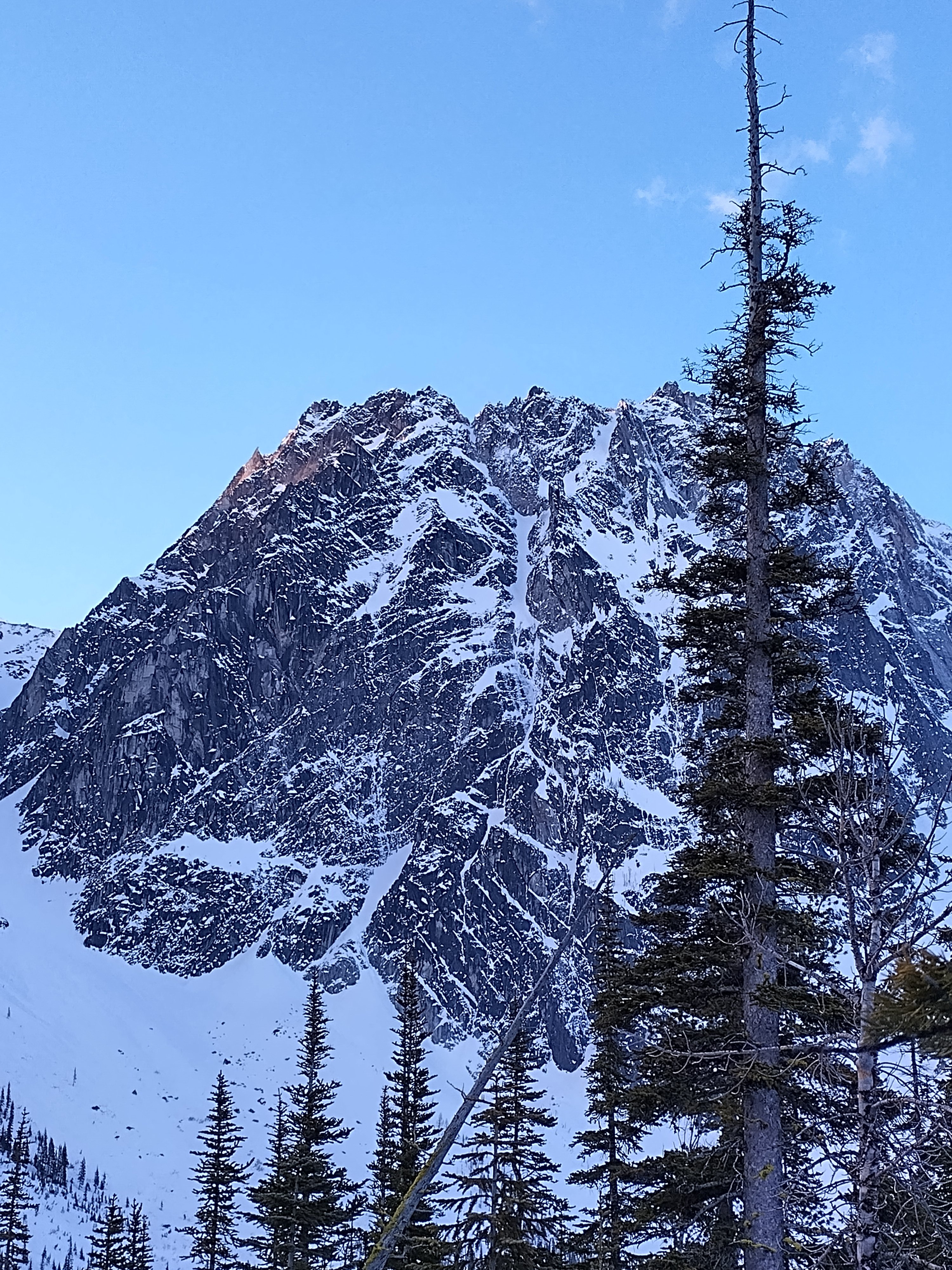
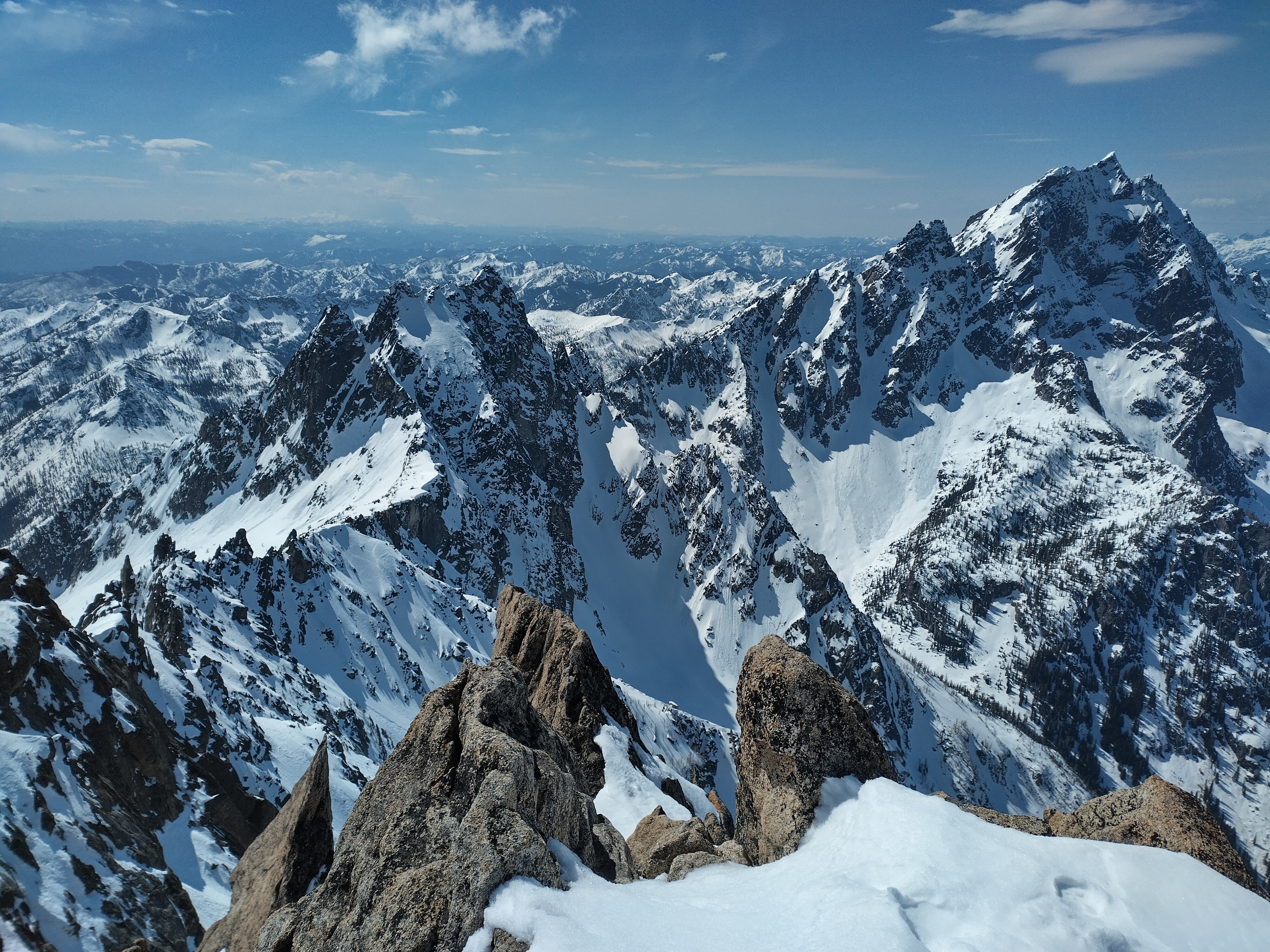
Trip: Argonaut Peak - East Ridge/NE Couloir Trip Date: 03/09/2024 Trip Report: Argonaut Peak (8,455 ft) March 9, 2024 East Ridge/NE Couloir 18 miles skiing/climbing, 10 miles snowmobiling, 8300ft gain 73/100 Winter Bulgers Eric and Nick On the summit The weekend looked to be stormy but the Enchantments zone seemed to be getting hit the latest. I’d previously bagged all the Bulgers peaks in the Enchantments in winter except Argonaut, so we decided to go for it. The route I’ve previously climbed Argonaut twice via the south face route (May, August), which ascends a steep gully to the summit ridge followed by a class 3/4 scramble to the summit. This is not necessarily the best winter route, though. In February 2022 Nick and I had been camped near the base after climbing Sherpa and planned to climb the south face route, but my updated NWAC forecast on my inreach made us too nervous about snow stability. So we bailed that time. Our East Ridge/NE Couloir route (drawn on picture taken by John Scurlock from the north) This weekend the snow stability conditions didn’t look great for that route either. But Argonaut has many different route options, generally all technical. I noticed we could ascend gentle slopes up the Porcupine Creek drainage on the south side to gain the Argonaut-Colchuck col at 7700ft keeping the slope angle low. From there we could climb one of the technical routes up to the summit. The routes might require crossing short snow slopes, but we would be roped up clipped in to gear in the rock so would be protected. We would bring a 60m half rope, hexes, nuts, cams, and technical tools. I would bring one technical tool with a hammer (for the hexes) and one ultra-light corsa straight shafted axe with a custom 3D-printed adjustable pinky rest Nick had just printed. This would allow me to plunge in snow and save some weight. We’d also each bring our custom carbon fiber ascent plates Nick had CNC milled. Unloading the sled The main route options from that col appeared to be the East Gully, the East Ridge, and the NE Couloir. Neither of us had done any of these routes but we figured we could see what looked the most reasonable based on conditions and climb that. The first record I could find of a winter ascent of Argonaut was via the NE Couloir (Lurie, Feb 2006, NWMJ). But climbing the full couloir seemed too risky with the snow conditions since it’s a ~3,000ft long snow gully and I wouldn’t want to be in the bottom if it slid. Worst case we would just cross the top of it, roped up, which would be much safer. At the Beverly Creek trailhead The shortest approach would be from the Beverly Creek trailhead, which is accesible by snowmobile. In order to beat the incoming storm we wanted to summit by noon, so that meant leaving very early. We decided to do a car-to-car push to avoid carrying overnight gear over the fourth creek pass. Friday evening we got to the Twentynine Pines staging area on Teanaway River road, unloaded the sled, and went to bed. Saturday we were up and moving by 12:30am. The road had just been groomed and we made excellent time, hitting 40mph in places. The Beverly Creek turnoff was a bit rougher, but we reached the trailhead 20 minutes after leaving the truck. Interestingly, there was a nice skin track already going up from the trailhead. This is very unusual for winter Bulgers trips. Crossing Bean Creek We followed the tracks across Bean Creek, but then they diverged west after a few miles. It looked like they might have been heading for Iron Peak. We then broke trail up to the Fourth Creek saddle, and transitioned to ski mode. We had fun turns going down fourth creek, then transitioned to skins as it flattened out. We skinned down to Ingalls Creek, trying to set a good track for our return trip. Ingalls Creek The creek was too high to rock hop across, but we found a nice fallen log across near the trail crossing. It was 8″ wide with a foot of snow on top and lots of branches sticking out. I strapped my skis on my back and started over au chaval. I karate chopped the icy snow off the top, then used an ice tool to bang off the branches. Progress was slow but this worked and made for a nice smooth crossing on the return journey. On the other side we skinned up to the Ingalls Creek trail, followed it east for a half mile, then left the trail heading up the Porcupine Creek drainage. The slopes were nice and mellow angle and the forest was mostly open for easy travel. As we got higher to more open areas the snow had a firm sun crust. We started on the west side, then crossed over to the east side and ascended into the large bowl flanked by Argonaut, Colchuck, and Dragontail. Conditions were pleasant with no wind and great views of the summits. We knew that would change by afternoon, though. Approaching Argonaut in the upper Porcupine Creek drainage We noticed the East Gully route looked like it might go, though was kind of steep. We decided to head to the Argonaut-Colchuck col to scope out the East Ridge and NE Couloir to see which one we preferreed. As we crested the ridge the wind picked up from the south, and we noticed the north side would be much more sheltered. It looked doable to ascend the East Ridge then cross over the top of the NE Couloir to gain the upper north face of Argonaut. That sounded appealing given the wind direction, so we went for that route. At the col We ditched skis at the col, then roped up. Nick started first and we shortened the rope to 30m and simul climbed. The East Ridge started getting steep soon so we dropped onto a snow ramp which we traversed across to enter the NE Couloir. We got good gear in the rock to protect a fall in case the snow slid. On the opposite side of the Couloir Nick built an anchor and we swapped leads. I kicked steps up the right side of the couloir for 30m then when the couloir dead ended at a rock face I exited up and right. Crossing into the NE Couloir This section was the crux of the route. The snow got thin and steep on a rock slab except for a thick wind deposit about 3ft deep. I had to tunnel through it Cerro-Torre-style, digging down to the thin icy layer on top of the slab to get good purchase with my front points. I kind of wished I had the custom wings on my ice tools. Eventually I excavated out an old rap anchor, clipped it, and tunneled the last bit up to the low-angle north face snowfield. In the upper NE Couloir I belayed Nick up there with a solid hex anchor and we swapped again. Nick led up the left side of the snowfield, getting a few gear placements in the rocks on the side. We eventually simul climbed up to the summit ridge, and swapped leads again. I traversed the ridge, weaving the rope around horns and getting a few intermediate pieces in. I had to make a few mixed climbing moves getting over one rock step. At last, I saw the famous tunnel under the summit boulder, and luckily it had a big enough gap to squeeze through. Nick on the summit By 1pm I made the final short mixed scramble to the summit. I belayed Nick up off the summit horn, and we were soon both on the summit. It was windy, but luckily not snowing yet. It appeared the storm was coming in a bit later than forecast, which was great news. There was no view in the whiteout, so we soon regrouped and headed down. I led the way back as we simul downclimbed the ridge and retraced our exact track back down the snowfield. We regrouped above the crux, and we decided to simul downclimb that as well. Now that the snow was excavated and good steps were kicked it wouldn’t be too hard. I put the exact same gear placements in as on the way up, and we simuled back down to our previous anchor point. There Nick took over and led back across the ramp to the Argonaut-Colchuck col by 2:30pm. Descending the summit ridge Now the storm had hit with full force, and it was extremely windy and snowy. I was jostled off balance a few times. Back at the skis we put goggles on, and decided to crampon down in the whiteout until it got more sheltered. I followed the track on my watch since our up tracks were drifted over. After 10 minutes we got back into intermittent trees and the wind died down. Unexpectedly, it then cleared out and was partly sunny! It appeared to be a brief break in the storm, and came at the perfect time. We switched to skis and had fun turns down the big open slope. Though, lower down we hit sun crust which made skiing challenging. Hiking down in the storm We switched back to crampons and descended down into denser trees. Back in the trees the sun crust disappeared and we again skied back down. The icy lower sections had changed to a small layer or corn and made for excellent skiing. We eventually reached the Ingalls Creek trail as the sun gave way to heavy graupel and snow. There we skinned back to Ingalls Creek and scooted back across the log. Last view of the south face of Argonaut We then followed our tracks back up fourth creek as darkness set in. At the pass we switched back to ski mode and made a high traverse back down the Beverly Creek drainage. Interestingly, we encountered a set of snowshoe tracks that had followed our tracks up to 5000ft. This appears to be a relatively popular area in winter! I guess the road approach is only five miles, so a snowmobile isn’t really necessary. Though I certainly appreciated being able to sled in and out instead of walk. Sledding out It was fun cruising down the drainage, and we made it back to the sled by 8:45pm. We then strapped our gear on and got back to the truck around 9:15pm for a 21-hour push. Gear Notes: Snowmobile, 60m rope, skis, technical tools, hexes, nuts, cams, ascent plates (unused but we probably should have used them) Approach Notes: Sled to Beverly Creek TH, ski to Argonaut-Colchuck col3 points
-
21 year thread bump to post a 7 year old complaint. Bravo!2 points
-
Trip: Mt Everest No O2 Attempt to 8500m - SE Ridge Trip Date: 05/22/2023 Trip Report: Mt Everest No O2 Attempt to 8500m Eric and Matthew Gilbertson, Steven Song, Darren V May 22, 2023 Me and Matthew on Kala Pattar with Everest in the background March 26 – Depart Seattle March 27 – Flying March 28 – Arrive Kathmandu March 29 – Fly to Lukla, hike to Phakding 2800m March 30 – Hike to Namche Bazaar 3400m March 31 – Hike to 3800m, sleep Namche 3400m April 1 – Hike to Tengboche 3850m April 2 – Hike to 4600m, sleep at Dingboche 4350m April 3 – Rest day at Dingboche 4350m April 4 – Hike to Lobuche 4900m April 5 – Hike to Gorak Shep 5190m Map of the route April 6 – Rest day Gorak Shep 5190m April 7 – Hike to BC 5300m April 8 – Hike Kala Pattar 5640m, sleep BC 5300m April 9 – Rest BC 5300m April 10 – Hike to Pomori BC 5720m, sleep BC 5300m April 11 – Rest BC 5300m April 12 -Rest BC 5300m (khumbu icefall closed due to accident) April 13 – Rest BC 5300m (khumbu icefall closed due to accident) April 14 – hike to Lobuche high camp 5200m April 15 – Climb Lobuche East false summit side slope 5950m, sleep Lobuche 4900m April 16 – Hike to BC 5300m April 17 – Rest BC 5300m April 18 – Rest BC 5300m (khumbu icefall still closed) April 19 – Hike to C1 6100m April 20 – Hike to C2 6500m April 21 – Rest C2 6500m April 22 – Rest C2 6500m Flying to Lukla April 23 – Hike to C3 7100m, descend to BC 5300m April 24 – Rest BC 5300m April 25 – Rest BC 5300m (got sick, respiratory infection) April 26 – Rest BC 5300m (sick) April 27 – Rest BC 5300m (sick) April 28 – Rest BC 5300m (sick) April 29 – Hike to C2 6500m, throat constricted, lost voice, descend to BC 5300m (sick) April 30 – Fly to Namche 3400m (sick) May 1 – Rest in Namche 3400m (sick) May 2 – Rest in Namche 3400m (sick) May 3 – Fly to BC 5300m (sick) May 4 – Rest BC 5300m (sick) May 5 – Hike to Pheriche 4200m (sick) Approaching Lukla May 6 – Rest Pheriche 4200m (sick) May 7 – Hike to BC 5300m (finally recovered) May 8 – Rest BC 5300m May 9 – Hike to C2 6500m May 10 – Rest at C2 6500m May 11 – Bad weather, Rest at C2 6500m May 12 – Move to C3 7100m May 13 – Hike to South Col 8000m, descend to BC 5300m May 14 – Hike to Pheriche 4200m May 15 – Rest Pheriche 4200m May 16 – Rest Pheriche 4200m May 17 – Rest Pheriche 4200m May 18 – Hike to BC 5300m May 19 – Hike to C2 6500m Trekking to Phakding May 20 – Hike to C4 8000m May 21 – Bad weather, stay C4 8000m May 22 – Summit attempt, Bail 8500m with signs of HACE, descend to C2 6500m May 23 – Descend to BC 5300m May 24 – Hike to Namche 3400m May 25 – Hike to Lukla 2800m May 26 – Fly to Kathmandu 1500m Mt Everest is the highpoint of both Nepal and China, so we had to go for it as part of our country highpoints project. I wanted to save some money and climb it as honorably as possible, so planned to go without oxygen or personal sherpa support. I’d previously climbed K2 this way so figured it was possible. Matthew, Steven, and Darren would climb the more conventional style with supplemental oxygen and personal sherpa support to increase chance of success. Namche bazaar I started planning the trip about a year in advance, in March 2022. Mt Everest is not a mountain you can just show up and climb on your own. You basically have to go with a company, at least for logistics support to pay for permits and permission to use fixed ropes. There are two main climbing routes, the south col route from the Nepal side and the north ridge route from the Tibet side. China was still not issuing climbing permits this year so the only option was to climb from Nepal. The Nepal side has one advantage that there are no major bottlenecks on summit day. The Hillary Step basically fell off in 2015, and that was the major bottleneck. The upper route is south facing so it is generally warmer and sunnier. Unfortunately the lower route passes through the Khumbu Icefall, which is dangerous due to constantly shifting ice blocks. The route from the Tibet side does not have any dangerous lower section like the Khumbu Icefall, but does have three bottleneck ladder sections on the upper mountain that can lead to traffic jams on summit push. First view of Everest I found a list compiled by Alan Arnette of all the companies guiding on the Nepal Side along with median prices. I contacted the cheapest four companies, to ask for 2023 prices, and then tried a little bit of negotiating. I would bring a few other climbers along (Matthew, Steven Song, Darren), and I also wanted to climb a second peak, Kangchenjunga. Kangchenjunga is the third highest mountain in the world and the highpoint of India. I figured I could potentially take advantage of my Everest acclimation to make a quick ascent of Kangchenjunga afterwards. It is illegal to climb Kangchenjunga from the India side, for religious regions, and it is thus only climbed from the Nepal side. By asking for a deal including multiple climbers and multiple mountains I was able to haggle the price down from multiple companies. The cheapest was seven summit treks. They also had the resources to helicopter me directly from Everest to Kangchenjunga. They could also offer me basecamp services for each peak, which is what I wanted. This meant they would take care of permits, permission to use fixed ropes, getting all my gear and myself to basecamp, and providing food and tent in basecamp. But above basecamp I’d be completely on my own with carrying gear. And I wouldn’t have any oxygen. Yaks near Namche They could provide full service for my climbing partners Matthew, Steven, and Darren for Everest, meaning supplemental oxygen and personal sherpas. In June 2022 I paid a 20% deposit, then I paid the full remaining balance in February 2023 as a wire transfer. In the summer of 2022 I actually met Dawa, one of the owners of Seven Summit Treks, at K2 basecamp, and I met many of the sherpas working for the company on the upper slopes of Broad Peak and K2. Everyone seemed super friendly and it seemed like a great company to go with. For training for Everest for the year in advance I didn’t really do anything different than normal. In summer of 2022 I spent two months in Pakistan climbing Broad Peak and K2. Then I rested a bit in the fall before continuing my normal weekend warrior routine of mountaineering trips in the Cascades. In the winter I generally climbed one of the WA top 100 bulger peaks every weekend in Washington. These generally involved 20-30 hour continuous pushes breaking trail and climbing technical peaks over one or two days, and I figured this was excellent training for 8000m peaks. Often summit pushes on 8000m peaks can be around 24 hours I’ve found. By mid February I stopped skiing and instead only snowshoed for approaches, since skiing has a higher risk of injury. I then tapered down my activities the last two weeks of March. Snowy morning in Namche My plan for acclimation on Everest was to exactly replicate my acclimation strategy for K2. Everest is only about 240m taller than K2, so I figured a similar acclimation schedule should work. Everest is farther south, which lowers its apparent altitude (based on air pressure at summit), but the season is earlier (May instead of July) and cold temperatures raise a mountain’s apparent altitude. It would still likely feel higher than K2, but not by too much. The spring climbing season on Everest is generally dictated by when the jet stream moves off the summit making winds low enough to allow safe climbing. This generally happens for about a week in mid/late May. It’s a short season and you must be ready to push for the summit whenever this happens. My plan was to finish all my acclimation rotations by the beginning of May. This would give me at least a week to rest at low altitude to recover before summit push. If I applied my exact K2 acclimation itinerary and worked backwards this meant arriving in Kathmandu late March. I assumed (incorrectly) that I would be able to do the exact same acclimation schedule on the south route on Everest in this amount of time. I paid professional meteorologist Chris Tomer to give me daily weather forecasts for Everest sent by satellite to my inreach. I’ve found having an accurate weather forecast is perhaps the most important element for success on big peaks like this, and Chris has also forecast for me for big peaks like K2 (2022) and Pobeda (2021). Tengboche March 28 Matthew, Darren and I arrived in Kathmandu March 28 in the morning. Steven planned to arrive 10 days later. He was going with supplemental oxygen so didn’t need to do as many acclimation rotations as I did. Darren and Matthew would also go with oxygen, but figured some extra time at altitude would still be helpful. We got a pre-arranged taxi from the airport to the Aloft Hotel. There we met Dawa, Thanes, and Tashi, who were in charge of Seven Summit treks. We sorted out last minute details and arranged to fly to Lukla a day earlier than scheduled since we didn’t have any delays to make us need our built-in buffer day. March 29 Yaks at Tengboche We shuttled to the airport at 5am and got the first flight out to Lukla. The flights to Lukla are very often canceled due to poor visibility. The airport at Lukla has been rated the most dangerous airport in the world. It is at an 11.7% grade on the side of a mountain and visibility is often bad from clouds and rain. Conditions have to be perfect for it to be open, and I’ve heard stories of it being closed for up to two weeks straight! Thus it is important to take advantage of good weather to get on a flight when possible. Our flight landed no problem and we soon got started. We had left most of our gear at Kathmandu to be shuttled by helicopter or yak to basecamp. That would be much faster than us hiking so didn’t need to go as soon. When we landed we met Kami and Raj. Raj would be a porter to carry some of our gear and Kami would be our guide. The Nepal law was set to change April 1 that a local guide is required for any treks in Nepal. Though, there was some confusion whether the everest basecamp trek was an exception or not. Either way we were covered having Kami as our guide. Nearing Dingboche From Lukla we made an easy trek a few hours downhill to the village of Phakding at 2800m, where Kami arranged a hotel for us for the night. I discovered the whole trek to Everest Basecamp is full of tea houses and hotels every few miles. So you can get by bringing practically nothing, just buying food and staying at hotels along the way. Hotels are only around $5-10 a night, so very cheap. I actually am not sure if it is legal to camp. I didn’t see any tents. March 30 The next day we hiked along the river and officially entered Sagamartha National Park. We then made a steep climb up to Namche Bazaar, the largest village along the trek at 3400m. Along the way we crossed one of the highest swinging bridges along the route over the Dudh Koshi River. I later heard a porter was crossing at the same time as a yak train and one of the yaks got startled and pushed the man off the bridge! But luckily some rope on his pack got hooked on the side and he survived without falling. Acclimating above Dingboche In Namche most buildings in town are hotels so it wasn’t hard to find a place for the night. We stayed at the Mountain View Lodge, arriving around lunch time and resting the rest of the day. Hiking to Thukla March 31 The rule of thumb for acclimation is to ascend at most 400m per day and take a rest day after ascending 1000m. For the everest basecamp trek this generally means taking a rest day at Namche and at Dingboche. Another good rule of thumb is to climb high and sleep low. So this day we hiked up to 3800m where there’s a good view of Everest at a restaurant. This restaurant at the Everest View Hotel is popular with people helicoptering from Kathmandu. They heli up there, stop for lunch, then heli back. After stopping for lunch we hit a few peakbagger dots as side trips (Lapcha and Chhorkung Ri) then hiked back to Namche and spent the night. April 1 Gorak Shep with Kala Pattar and Pumori in the background We got fresh snow the next morning but slept in enough that some yak trains had already gone out and broken trail. We descended down to the Dudh Koshi River at 3300m, stopped there for lunch, then climbed steeply back up to Tengboche at 3850m. The snow was deeper there and we stopped there for the night. Unfortunately the famous monastery there was closed for tourists. Maybe it was still early season. I think we were a week ahead of the main trekking crowd. This was kind of nice because no hotels were crowded yet. Kami said a week later it would be hard to find a room. April 2 The next morning we had more fresh snow and we hiked back across the river a few times, eventually reaching Dingboche at 4350m by lunch time. After lunch we went on a short acclimation hike behind the hotel up to 4600m along the way to Nangkartshang Peak. It was a bit ambitious to go up to the peak, so we turned around at a good viewpoint and returned to the hotel. Everest Basecamp April 3 As recommended, we took a rest day at Dingboche, reading in the hotel and walking around the small village. April 4 We next had a short day hiking to Thukla for a hot chocolate break then up along the toe of the Khumbu Glacier to Lobuche village at 4900m. There we stopped at the Himalaya Eco Resort for lunch and to spend the night. April 5-6 From Lobuche it would make sense to hike all the way to basecamp, since it’s only a few hours. But we were very early in the year and SST hadn’t yet completely set up basecamp. So we just hiked to Gorak Shep at 5200m and spent the night and the following day there. April 7 Looking at Everest from Kala Pattar Basecamp was finally set up, so we were able to finish the last leg of our trek. After a few hours we reached the start of everest basecamp and saw a huge tent city in the process of being built. There was a huge boulder at the entrnace of camp with “Everest Basecamp” spray painted in red. All the trekkers were getting pictures there and we waited in line to get ours. Then we proceeded to hike a full mile through camp to the Seven Summit Treks area at the far end. This location was nice for moving up the mountain since it was the closest to the start of the route through the Khumbu Icefall. They had individual tents set up for each of us, and the tents were large enough to stand up in and had thick mattresses. All our gear had made it in on helicopter and we soon got set up. We were the first clients in camp, though more would be trickling in over the next few weeks. On Kala Pattar April 8 In order to replicate my first K2 rotation I needed to tag 5600m and return to BC. There was a peak called Kala Pattar near Gorak Shep that was an easy hiking peak and was at around 5600m. So the next morning we made the hike back down to Gorak Shep and then up to Kala Pattar. There we got a nice view of Everest. We saw a lot of helicopters landing on the side of the peak, and I think people fly up from Kathmandu to there to get a view of Everest. They are unacclimated, though, so can only stay a short time before flying back. April 9-10 We rested the next day in BC, and then my next rotation would ideally be to drop a cache of gear off at camp 1 on Everest at 6100m. But we weren’t allowed in the Khumbu Icefall yet because the sherpas had not yet done a special Puja ceremony believed to allow safe passage. We would need to wait a few more days. Sunset over basecamp So after resting a day we decided to do the one other remaining easy acclimation hike, to Pumori basecamp. Pumori is a 7000m peak behind everest basecamp, and has an easy trail up to 5700m before the route becomes technical. After breakfast Matthew and I hiked up with an SST sherpa to 5700m just before the route turned 4th class. Supposedly I later learned to go any higher we would need a Pumori climbing permit, but that location was permitted. We took in a nice view of Everest before returning down in time for lunch. April 11-13 At Pumori basecamp looking down the khumbu glacier We rested one day, then were hoping to hike up to camp 1 to drop a cache of gear and tag 6100m. But we learned on the morning of April 12 that a team of three sherpas had been killed in the Khumbu Icefall when a serac collapsed on them. The plan was search and rescue teams would be going in to look for them, then the route would be modified to avoid that zone. All of that would take time, and no climbers would be allowed up the icefall for a while. We decided the best way to still acclimate would be to climb Lobuche Peak. The peak is around 6000m and is a common way for climbers to get in a rotation while avoiding a trip through the dangerous Khumbu Icefall. Unfortunately Lobuche is tall enough that it requires a $700 permit. I was also told you must have a sherpa accompany you, and if you make the summit you must pay them a $300 summit bonus. This is much more expensive than just hiking up and tagging camp 1, but appeared to be the only option short of waiting perhaps up to a week killing time in basecamp. Looking back towards Everest By this time Matthew had gotten sick in basecamp (something that would happen to all of us at various times). He decided to descend to Pheriche to recover while Darren and I would go to Lobuche. Steven had just arrived and would take a few rest days first. April 14 Darren and I with sherpas Mingma and Pasang hiked down after breakfast to Lobuche village and stopped there for lunch. We then continued outside of town to hike steeply up to Lobuche high camp at 5200m by mid afternoon. There we stayed in some SST tents overnight. April 15 Ascending Lobuche That night at 3am we left camp going for Lobuche. The route involved steep icy snow slopes down low for which we used crampons and ice axes. Up higher we encountered some fixed lines and passed a group camping around 5600m. We then started jugging up the fixed lines as the sun rose. By 7am we reached the end of the fixed lines, though we weren’t quite at the summit. My watch read 5950m and we were on the slope on the side of the false summit of Lobuche East. Near the false summit of Lobuche East We had great views of Everest and Mingma and I topped out at the same time as a Chinese climber Carmen and another sherpa. We soaked in the views for a while as Darren caught up. If I had brought my 30m rope and a few pickets we could have made it to the false summit of Lobuche East, but getting to the true summit would have been more technical. It was just an acclimation hike anyways, so we considered that spot good enough. Note: I would be skeptical of anyone claiming to have climbed Lobuche East. Most likely they just went to the spot I went where the fixed lines end on the side slope of the false summit. We made quick time back down and had a late morning meal back at high camp. We then descended to Lobuche village that afternoon. I had originally thought of hiking back to basecamp, but it was probably actually best to stay lower in town like we did. That allowed our bodies to recover better from the new highpoint reached. Descending from Lobuche East April 16-18 The next morning we made the leisurely hike back to basecamp, and then took two rest days. April 19 The re-route through the Khumbu finally got completed and regular climbers were allowed to enter. Seven Summit Treks still hadn’t done the official Puja ceremony, though, so no sherpas would agree to go through. Most climbers paying for the full service trip were thus not permitted to go up yet since they needed a sherpa accompanying them. Since I had just paid for basecamp service and was on my own above basecamp, though, I was allowed to move up. Starting up through the Khumbu Icefall I convinced SST to allow Darren to accompany me as long as he didn’t need a sherpa helping him carry gear. They agreed it would be safer if I weren’t solo, so Darren and I were allowed to start our first rotation. We were told it was safest to pass through the icefall at night, so started out at 2am that morning. The plan was to stay up above the icefall for around five days, sleeping at camp 1, then camp 2 a few nights, then tagging camp 3 and returning. This would combine several of my K2 rotations into one rotation, but that is important on everest to minimize trips through the icefall. In fact, for climbers using oxygen that is the only rotation needed before summit push. Though, I would try for a few more since I was going without oxygen. Sunrise looking back at Pumori As we left camp we saw a string of lights already going up the icefall. It was likely sherpas ferrying loads up. They generally go up to camp 1 or camp 2 then come back down to basecamp shortly after sunrise. Some sherpas even manage to get two loads hauled up to camp 2 in a day! We walked through some morain, then put on crampons at the base of the icefall. At the bottom was a near-vertical ice section we jugged up. From there it was continuous fixed lines the entire way. The route wove around quite a bit avoiding crevasses and weaving around seracs. There were a few places we had to cross ladders bridging deep chasms, but I heard these were pretty infrequent compared to previous years. I ended up being a bit faster than Darren so got a bit farther ahead. I would occasionally get passed by sherpas going up or down, but never saw any non-sherpas. Tough wall to jug up with a dislocated shoulder At one point the rope above me was wrapped around a serac on the side. I tried flicking it off but had no luck, so I ventured over to the serac to remove it. This required walking briefly off the main track on some big ice blocks. They appeared stable and frozen together, but when I stepped on one it slid out from underneath me. I got flipped over and landed hard on my right shoulder. I felt instant pain throughout my arm. I quickly tried to wiggle my fingers and found I still had sensation in all my fingers and my hand. But I had excruciating pain throughout my arm. I was solo and wasn’t sure what to do. My arm was no longer useful for holding any rope. I really needed help, like from a doctor, and I was pretty sure the expedition was now over for me. I was mostly through the icefall and it was already light out, so I figured it was safest to go up to camp 1 and look for help than to retreat. Rappelling down with one hand seemed riskier than jugging up with one hand. So I tied my lame arm up across my chest to get it out of the way and continued jugging up. It was kind of tricky with the big 50 lb pack on with my non-dominant hand (I’m right handed and had injured my right arm). Approaching camp 1 I slowly made progress, and eventually caught up to a sherpa and western client. I told them my situation and the client said it sounded like my shoulder was dislocated. He said he had personal experience with that and could help reset it. But he wanted to wait until we got to a nice flat area. I really wished he could have helped right there, but didn’t want to argue. Above us was a near-vertical wall to get up that looked very difficult for me one-handed. I had him hold the rope taught below while I jugged up one handed. At the top I was in a lot of pain but it was indeed a large flat area. I untied my arm, threw my pack down, and laid on the ground in pain. The climber then made it up and had me stand next to him. He held my arm and started twisting it as I nervously bit a wad of shirt in my mouth anticipating excruciating pain. But I felt a small pop and then the pain went away! He indeed knew what he was doing and had popped the shoulder back into place! At camp 1. Not too crowded It was amazing how the pain instantly went nearly back down to zero. It still felt very sensitive, though, and he advised me it was at a high risk of popping out again since the muscles were all loosened up. So I made sure to not touch any fixed ropes with that arm again. I waited around for Darren to catch up, told him what happened, and then proceeded onward. After one more tough steep section we soon made it to camp 1 in late morning. There was nothing set up yet, but regions were roped off for various operators. I found the SST region and we set up my Nemo Tenshi tent there off the side of the trail after probing for crevasses. We melted snow, ate some food, and hung out in the tent acclimating until dark when we went to bed. Camp 2 April 20 The next morning we were packed up and moving a bit before sunrise. Lots of sherpas had already passed us hauling gear up, and we’d heard it could get very hot between camps 1 and 2 once the sun came out. We each moved at our own speed and made good time up the trail. This section was much easier than the khumbu icefall and was mostly flat with only a few steep sections requiring jugging up ropes. I continued to jug up one-handed. The first section had fixed ropes to clip onto on the flattish glacier, and a few ladders over crevasses. But then the route mellowed out and the fixed ropes ended. I made good time up the route, reaching camp 2 after 2.5 hours. As in camp 1 nothing was set up yet from SST. I had some trouble locating their roped off section, but eventually found it and set the tent up. Darren arrived a bit later and we finished getting camp set up. We melted some snow, ate and rested. April 21 Camp 2 We took a rest day in camp but noticed the two other clients we’d seen in the khumbu were moving higher with their sherpas in the late morning. We went out to talk and they said they were going to try to tag camp 3. That seemed very ambitious. I definitely didn’t feel acclimated enough, and I’d read the normal schedule was to take a rest day. We watched them proceed, and the wind picked up and it started snowing. They all soon turned around, probably having just tagged 6700m, barely above camp 2. But I’ve heard this is actually sufficient for climbing with supplemental oxygen, so their rotation was likely complete. Darren and I hung out in the tent reading through the bad weather. Starting up for camp 3 April 22 The next morning we felt like we still needed more time, so decided to take one more rest day. The weather was nice, though, so we went up to scout out the route. Unfortunately the wind had blown over the previous days tracks. We went up as high as we dared, but at the edge of the glacier outside camp we couldn’t find any tracks or rope or wands. So we turned around. Our plan was to head up the next morning to tag camp 3, but without being able to find the route in the daylight we were nervous about being able to find it at night. Darren had brought his paragliding wing and was hoping to fly back from camp 3 to avoid descending through the khumbu icefall. The best flying conditions would be in the early morning, so he needed to leave before sunrise. I advised him not to fly since he didn’t have a permit and could get in trouble, but he said it was unlikely anyone would see him, based on his experience. To get help navigating we walked over to the 8K camp and found some sherpas going up the next day. Darren paid them a bit of money to leave early and let us tag along. Most requests are possible for the right price on everest, we found. Climbing up to camp 3 April 23 The next morning we met up at the 8K tent at 4am and after some tea and porridge were moving up by 4:30am. The sherpas expertly led the way and we soon clipped onto some fixed lines on the glacier. We made our way up, crossing a few ladders, until we reached the bergschrund around sunrise. From there it was fixed lines all the way to camp 3. In fact, they had just been fixed a few days earlier. The sherpas went off ahead there, since navigation would be easy. I was getting very cold fingers and toes so went off ahead also at my own speed. It was a little tricky getting over the steep bergscrhrund, but above the slope eased to a nice snow slope. There was an up rope and a down rope there to help ease traffic jams in the future. Though this day it was just me, Darren, and a few sherpas above. I climbed up the snow slope, and then the ropes went steeply up an ice slope. This early in the season there were no steps kicked in yet and I had to do a bit of tiring frontpointing. Finally the sun hit the slope and my cold toes warmed up. After about 3.5 hours I eventually popped out on the tiered snow slopes where camp 3 is placed. Windy camp 3 The slopes were icy and steep, and it looked sketchy to me to dig out a tent platform. I saw the remains of a few old tents frozen in ice lower in the camp. There was a small platform in the middle with two tents set up and sherpas standing outside. It was extremely windy and I saw a few sherpas at upper camp continuing up ropes towards south col. They said they were working on fixing ropes up to the col and might finish that day. It was very windy and cold and I didn’t want to stay long. The purpose of the day was to merely tag camp 3 and descend, so I snapped a few pictures and soon turned back around. I rapped back down the down line and met up with Darren part way down. Cold camp 3 I told him it was too windy to hang out and I would wait for him down at camp. Or he would text me on the inreach if he flew down. I gave this a very slim chance of happening given the wind, though. I soon made it back down, and spent some time hanging out in the 8K camp drinking tea before going back to our tent. I think Darren and I were about the only non-sherpas there. It was still very early season and camp was just getting set up. Back at camp I happened to glance up and saw Darren flying down! Apparently the wind had calmed at camp 3. That looked like an amazing way to descend. He would be back in basecamp in 30 minutes and completely avoid the dangerous icefall, while I would take hours and have to go through the icefall. Darren flying down I texted Matthew that he was coming, then I quickly packed up. I locked up the tent and headed down by noon leaving most of my gear at camp. It took me an hour to get down to camp 2, and then I met up with a group of ten sherpas going down the icefall. They said it was random when the ice shifted and afternoon was about as safe as night as long as you moved fast. So I descended with them and made it down in about 3 hours, reaching camp by 4pm. Unfortunately Darren had gotten caught by the nepali army when he landed and was now in trouble for flying without a permit. He would eventually be required to helicopter down to kathmandu to meet with the tourism ministry in person. Matthew was back from Pheriche by then and feeling better, and a lot more climbers had made it to basecamp. April 24-28 Hiking back down I planned to rest for three days before moving up for my next rotation. The next planned rotation was to sleep at camp 2 one night, then sleep at camp 3, then tag camp 4 and retreat. This would be approximately in line with my K2 acclimation schedule. Also, the sherpas said if I did this one more rotation I would be ready for summit push. I found a few other rotation schedules for climbers doing Everest without O2. One of my friends had his highest rotation as sleeping at C2 and tagging C3, which I had already done. David Goettler did his highest rotation as sleeping at C3 and tagging C4 once. Rasmus Kragh did more rotations and tagged C4 twice, sleeping at C3 multiple times. It was apparent different schedules worked for different people. Rasmus’s schedule was closest to my K2 schedule and I’d ideally like to tag C4 multiple times, like I had before K2. Crossing a few ladders Unfortunately on April 26 I started feeling sick. I later heard there was a respiratory infection going around basecamp, and most people in basecamp got it. It didn’t help matters that each meal for SST was held in a big 30-person tent that was full, and trekkers were passing in and out each day sharing meals. That was basically a recipe for disaster with most everyone eventually getting sick. I delayed my next rotation a few days, hoping to improve, and the camp doctor said I would probably be ok if I tried going up. So I decided to give it a try. I left camp 11pm April 28 heading up. April 29 I left before midnight to avoid crowds in the icefall, but unfortunately that meant I didn’t get much sleep. I started out the only one in the icefall, but soon groups of sherpas caught up to me and passed. They were all very fast. Climbing back up with a team of sherpas As I got higher I noticed my throat getting drier and eventually I lost my voice. I would try to say namaste to passing sherpas but couldn’t. I was feeling ok, though, so continued up. I made it to camp 1 in 4.5 hours, then to camp 2 two hours later, a bit after sunrise. Matthew and Steven were already there, having arrived the previous day on their first rotation. The SST camp was now set up and a bunch of other climbers were there. I met one other solo no-O2 climber, Roland, in camp and we exchanged ideas on which rotations to do. I then talked to the camp manager and he told me to move my tent to a different location. I was starting to feel crappy then and still could really only whisper to talk. Matthew helped me move my tent and all my gear over to the other spot, then I laid down to rest in the tent. After an hour I went to the big dining tent and hung out with the other climbers. I drank some water but was still feeling bad and it seemed like it was getting a bit harder to breathe, like my throat was getting constricted. Descending back down I had originally planned to move my tent up to camp 3 that afternoon, but that seemed like a bad idea. If I’m ever feeling bad, then moving up will only make things worse. I hung out for another hour and debated just sleeping there that night and seeing if things improved. But I knew I wouldn’t get a good sleep if my breathing was difficult like it was. I suspected the crappiness was related to me being sick, and I decided the best course of action was to descend. That was the only way things would improve, and there was a good chance things would get much worse if I stayed up high or tried to move even higher as intended. I told everyone I intended to descend that afternoon, then the camp manager told me he’d changed his mind and I needed to move my tent back to its original place. I got pretty frustrated since I was already feeling bad and low on energy, but Matthew said he’d make sure some people up there would do it for me. Someone offered I could helicopter down but I didn’t want to pay $3000 for that when I could walk fine on my own. Retreating to Namche to recover But I needed to get moving, so soon headed out by 2:30pm. I made good time to camp 1 and started descending the khumbu solo. By then my throat was getting worse and breathing was getting more difficult, so I tried to move fast. I managed to hack up some junk that cleared my throat a little as I got lower, and drinking lots of water seemed to help a bit. By sunset I made it back to camp, and people were surprised to see me. My voice was gone but I could whisper that I needed to see the doctor. The doctor gave me a shot in the butt and some medication and said that would help me breathe until morning, but then I needed to go down to Namche to recover. The loss of voice and trouble breathing had been caused by my respiratory infection plus going to higher altitude with drier cold air. Indeed the butt shot helped and I was finally able to breathe and talk that evening. April 30-May 2 The next morning I got on a helicopter out of basecamp. I made it to Pheriche but then had to wait for a transfer to a different helicopter. The weather turned bad and I ended up hanging out in a restaurant for a few hours. By late afternoon there was a brief clearing and I quickly got in a helicopter and took off. But it only made it to Phungi Thenga before the clouds closed in. We stopped at a small helipad on the edge of the cliff over the river and waited. We had tea at the trail crossing but then just before sunset the pilot motioned for us to get in. The weather still looked bad to me but he pushed through the clouds and soon emerged at Namche. They dropped me off and continued down to Lukla. I quickly walked down the trail in the waning light and found a room in the Mountain View hotel for the night. I stayed in town the next few days coughing a lot in my room. I took time to go down to the medical clinic the next day and the doctor gave me a bunch of medicine for the respiratory infection. He said I would have it for 7-10 days and a lot of people were getting it in the region. But the good news was I’d be immune to that particular strain once I got over it. May 3-4 It had been seven days since I’d started being sick and I was finally starting to cough less. I’d by then finished all the medicine the doctor in Namche had given me. The BC doctor had recommended three days in Namche and it had been three days. So I decided to fly back up. The hotel owner arranged a helicopter and I went out to the pad with him to wait. The best he could do that day was get me on a helicopter scheduled to go pick up some tourists from Kala Pattar. That was close enough and a little cheaper than a flight to BC so I agreed. I soon got on and we made a very rapid trip up the valley to land on the slope of Kala Pattar. It’s amazing how fast those helicopters are. I jumped out and a bunch of trekkers jumped in. I quickly hiked down the trail and made it back up to basecamp. I rested the rest of that day and the next, but unfortunately I was still coughing up a lot of junk at night and wasn’t yet feeling 100%. Based on the forecast there was a potential weather window starting May 10 and I really really wanted to be feeling 100% for that. I consulted with the doctor and decided to go down to Pheriche to rest a few more days. I could hike there and back so didn’t need to pay for the expensive helicopter. I was getting a bit nervous about summitting, though. With all the time lost being sick it was unlikely I’d be able to get two rotations to 8000m before summit push. I considered just going with oxygen and not needing any more rotations, and asked about the price. I could pay $3500 to have four oxygen cannisters deposited for me at camp 4, though I’d be on my own carrying them all up above camp 4 and operating them. Each weighs 10 lbs so it’s not a trivial weight for each. Supposedly I’d use one to sleep at camp 4 and have to carry up the other three for summit push. I got a lesson in how to operate the regulator, but that made me really nervous. If that regulator broke higher up and I didn’t have a spare and wasn’t acclimated I’d be pretty screwed. I’ve had multiple friends tell me about their regulators breaking on Everest in years past. The only safe way to use oxygen, in my opinion, is to go with a sherpa who is an expert at fixing mechanical issues with the regulator and brings a spare regulator. That would add $9000 to the price, so $12,500 total. I also wanted to give myself a possible chance of summitting Kangchenjunga after Everest. I talked to some sherpas and they said if I could summit Everest by around May 20 I’d probably still have time for Kangchenjunga before the monsoon came. Apparently the Kangchenjunga season lasts a little bit longer than the Everest season since it’s shorter and in a different location. It looked like there would be a summit window from around May 11 for at least a week or two on Everest this year. The sherpas said one rotation tagging 8000m should be sufficient to climb without oxygen in their experience (maybe that means sherpas can do that but not necessarily other climbers). I figured if I could tag 8000m at the beginning of the window, then rest down low, I could maybe summit at the end of the window and still have time for Kangchenjunga. More recovering in Pheriche It seemed feasible enough that it was worth going for and saving the $12,500 that I couldn’t afford anyways. So that was my plan. Attempt Everest without O2 still with the minimum acclimation that might possibly work, and still give myself a potential shot at Kangchenjunga. May 5 -6 After breakfast I packed up a few items in my small day pack and started out. It was a relatively easy hike down past Lobuche and Thukla and after four hours I made it to Pheriche. I decided to stay at the Pheriche Resort, since that’s where I’d hung out waiting for the helicopter. I spent the next day completely resting in town, having some good meals at the local bakery. Finally it had been over ten days since my respiratory infection started and I at last felt like I was over it. I was getting good nights sleeps with no coughing and feeling normal. May 7-8 I left town after breakfast and started slowly hiking back up. The doctor advised hiking up slowly would be better for acclimtion than helicoptering back up quickly. After five hours I got back to camp and was still feeling good. I was nervous about getting sick again, though. One climber announced during dinner time that he’d heard a lot of people around basecamp were getting sick and having to leave. Some teams had people with COVID. Others were quarantining sick members away from healthy members (SST was not). This made me eager to minimize time in the dining tent and get up the mountain as soon as possible. The forecast was for a potential weather window with low wind starting May 11. So I decided after one rest day at BC I’d head up. I’d wait out bad weather in camp 2 and continue up whenever it improved. This would get me out of basecamp as soon as possible and minimize chances of getting sick again. I preferred the risks of the mountain over the risks of basecamp. May 9 This would likely be my last rotation and I wanted to sleep at camp 3 and tag camp 4. I left camp at 2am and encountered a mostly empty khumbu icefall as usual. I made good time again, reaching camp 1 in 4.5 hours and camp 2 two hours later. By then it was extremely windy. I dropped my gear in the cook tent and went out to scout out my tent. Unfortunately the sherpas had done a very poor job moving it after I’d left. The vestibule wasn’t even staked out, and was instead limp in the front and frozen under a bunch of ice. I couldn’t even unzip it. The main tent was only partly staked out and the poles were poking out the corners. It was in tough shape. Reading a lot of books to kill time in camp 2 I didn’t want to work on it in the wind and in the frozen state since that would just make it worse. Luckily the camp manager saw my predicament and I think he realized it wasn’t really my fault. The camp was basically empty since all the climbers had gone down in the bad weather, so he offered I could stay in one of the vacant tents until the weathe improved and I could fix mine. So I threw my gear in a big Kailas tent, which was actually more comfortable than mine anyways. The manager very generously offered me some breakfast in the dining tent, even though I had only paid for basecamp services. I met Roland up there, and he was heading down to wait for better weather. I also met a German guy going for Lhotse and he was also heading down. Soon I was the only climber up there in the SST camp, and probably one of the few in any camps. That sounded like an excellent way to avoid getting sick! Interestingly, the camp manager said sherpas had been ferrying loads of oxygen to south col the past few days, even with all the wind. Unfortunately quite a few had gotten frostbite on their fingers, and some had gotten frostbite on their eyes from going without goggles at night! I saw a few sherpas being short roped back down, presumably with bad vision after the ordeal. The storm finally clearing at camp 2 May 10-11 I spent the next two days up in camp 2 riding out extreme wind that destroyed quite a few tents. Luckily my Kailas tent remained unscathed. I hoped spending so many nights at 6500m would help with acclimation. Indeed, the health stats on my watch (HRV, respiration, pulse ox, heart rate) all improved over those days. Eventually the wind died down enough that I went over to take my tent down. I brought it in the Kailas tent and used most of my gorilla tape to repair it. Later in the day Sajid from Pakistan made it up to camp 2 and he was planning to go for the summit the next window. He had already acclimated by climbing Annapurna in April so was a bit ahead of me. We agreed to move up to camp 3 together. Dr Jon also came up on an acclimation rotation and we hung out in the dining tent a while. May 12 Heading up the Lhotse face With my tent repaired I packed up and headed up at 7am. I had overnight gear for one night and my pack was pretty heavy. I slowly made progress up towards camp 3 and by this time there were excellent steps kicked out of the ice from some many climbers doing their rotation to tag camp 3. I noticed a lot of sherpas above camp 3 that morning and I think they were ferrying loads of oxygen to south col in preparation for summit pushes. Unfortunately some of them were also kicking rocks down from the geneva spur section. This was extremely dangerous. Rocks would come whizzing down like bullets and we’d yell to climbers below to watch out. There were a few sherpas behind me that were obviously faster than I was. I offered to let them pass but they never wanted to. It was clear they wanted to be below me in case rocks fell they would hit me instead of them. In Camp 3 with Sajid I did notice later in the afternoon one sherpa got hit in the arm and had to be helicoptered out unfortunately. After four hours I finally reached camp 3 and stopped for a rest on a small platform. Sajid soon caught up and sat next to me to rest. We hung out for an hour, then started trying to plan where we would dig platforms for our tents. There were a lot of sherpas from different companies already digging platforms, and we didn’t want to mess up their plans by digging one in the wrong spot. We asked the SST sherpas where we were allowed to make platforms, and they said there would actually be a bunch of empty SST tents there that night and we should just sleep in one of those. That was great news! We gladly accepted and threw our gear in a tent. It wasn’t super level but we made it work. We melted a bunch of snow and Sajid graciously gave me some lentil soup for dinner. His plan was to move to camp 4 the next night and summit on May 14, assuming the rope fixers finished the summit ropes on the 13th as planned. Sherpas digging platforms at camp 3 He offered for me to join, but I didn’t think I had enough rotations yet. I know one friend who summitted with no O2 after just touching camp 3, but I thought that was too risky for me. I at least wanted to touch 8000m and do a russian rest before going for summit push without O2. May 13 The next morning I stashed my overnight gear in my pack and went up light with just my down suit at 7am. I clipped one nalgene in an insulator to my harness and stored another in a pocket, then stuffed another pocket with snacks. That would be sufficient to just go up, tag south col, and return. The route was steep right out of camp, but then eased up a bit. There were good steps kicked in the ice, likely from all the sherpas carrying oxygen to south col. I don’t think there were too many non-sherpa climbers that had made it above camp 3 by that point. Approaching the yellow band I passed a lot of sherpas coming down after dropping off loads, but I was one of the few climbers going up. I did pass one climber on oxygen going really slow, and I think he was moving to camp 4 to get ready for a summit push. The route eventually cut left and I scrambled up the yellow band. Above that I caught up to another climber in just a down suit, and it turned out to be Szilard, also from SST. Like me he was also planning to climb solo with no O2 and no sherpa. He was doing the same rotations as I was and was also planning to tag south col that day before returning to basecamp. I told him I’d wait for him at the col. Looking down the geneva spur I continued on ahead a bit faster and made good time up to Lhotse Camp, which was still just the remains of last year’s abandoned tents. I then cut across a rock band and was very careful not to dislodge any rocks. The route traversed around and eventually went steeply up to the edge of the Geneva Spur at 7800m. After cresting the spur the route turned to complete rock and I took off my crampons. I traversed easy ledges until eventually reaching the south col proper at around 7950m by 12:30pm. There I got a great view of the upper route and even saw the rope fixing team descending from the south summit. It appeared they had indeed fixed the ropes to the summit that day. In the col were lots of remains of old tents, and just three tents set up by seven summits club. I noticed a few pyramids of oxygen cannisters, and that’s where all the loads had been dropped off. Though, interestingly, along the way nearly every anchor for the ropes had a bundle of oxygen cylinders tied to it also. This made passing the anchors quite difficult while staying clipped to the rope, and was pretty annoying. I think this means the sherpa ferrying those cylinders couldn’t quite make it to south col as intended so just tied them off as high as they got. Camp 4 with summit in the background I spent about 10 minutes taking pictures at south col but then headed back. I usually like to minimize the time I spend at a new high elevation since the longer I spend there the more likely I am to get altitude sickness. I made good time back to the Geneva Spur and then met Szilard there. He was taking a break and I think he was calling that good as his high point for the day. It was about the same elevation as south col anyways. We each took pictures of each other with Everest in the background and then descended down. On the way we passed a group of ten oxygen climbers on their way up, and they planned to camp at south col that night and summit the next day. Sajid was in the group going without oxygen and I wished him good luck. At the Geneva Spur with the summit in the background (photo by Szilard) I soon made it back to camp 3, packed up my bag, and continued down. By then camp 3 was extremely crowded with new climbers coming up. I think it was going to be a big summit push for May 15 and I was happy to not be a part of that. When going without oxygen it’s very bad to be stuck in a line up high since it’s much easier for fingers and toes to get cold if you’re not moving and thus much easier to get frostbite. (This is not a problem is you’re breathing supplemental oxygen since that warms your body significantly). My big goal for the whole trip was to be out of phase with the crowds, and I had so far achieved that. It looked a little weird for me to be the only person going down with a fully loaded pack and everyone else going up. A few sherpas asked me about this and I told them I had just done my last rotation for going without oxygen, and then they understood. I made good time rapping back down, and made it to camp 2 just before dinner time. By then more SST climbers were in the cook tent and I stopped to have dinner with them. I poured hot water in my mountain house, but then the sherpas offered me a hot dinner of dahl bat. I told them I had only paid for BC services but they insisted so I of course agreed. Killian Jornet was there and he was planning to also tag camp 4 the next day for his last rotation before descending. A few SST climbers were heading up to camp 3 on their summit push the next day. Looking back down towards the yellow band I wanted to get low as soon as possible to start resting up for summit push. So after dinner I continued back down solo in the dark. As usual I had the entire Khumbu icefall to myself, and I made it to basecamp a bit before midnight. May 14-17 The next morning after breakfast I packed a small day pack and hiked the four hours down to Pheriche. I’d read that most no-O2 climbers prefer to rest down there before summit push since it is low enough for the body to recover better. This time I stayed at the Edelweise Hotel, which appeared to be the nicest hotel in town and also the only one that accepted credit cards. This was important since I was starting to run low on cash. I also wanted to make myself as well-rested as possible before summit push. Descending one of the sketchier ladders I spent the next three days relaxing at the hotel and eating at the bakery across the street (that also accepts credit cards). Killian and his friends also stayed at that hotel, and we exchanged information from each of our weather forecasts. I was paying Chris Tomer to give me custom forecasts daily and Killian had a french meteorologist giving him forecasts. They seemed to agree that May 21 was a good summit day. May 18 I debated helicoptering back up to basecamp to save energy, but then considered that the doctor had advised hiking up slowly for better acclimation. So I ended up hiking back up to basecamp over five hours. People had been summitting every day starting May 14, and Sajid had already been the first to summit with no O2. Darren had summitted May 17. I was eager to get on the bandwaggon and reach the summit also before the window closed. Hiking back up from Pheriche Chris forecast the last summit window days would likely be May 23-24, and I’d read some big teams like Madison were targeting those days. Chris said May 20 and 22 were bad but 21 was good for summitting. It sounded to me like very few big teams would go for the 21 since it was between two bad days. Thus I planned to target May 21 to potentially avoid crowds. If the weather was a little bit windier but there were no lines to get stuck in that would likely still be safer for me going without O2 since I could keep moving. It’s an unfortunate reality that one of the main difficulties of climbing everest is dealing with other climbers, whether it be avoiding getting sick or avoiding getting stuck in lines. My schedule would thus be to move to camp 2 May 19, camp 4 May 20, and summit May 21. I usually skip camps like this on summit push on 8000m peaks, and this was consistent with what other no-O2 climbers had done. Though the more conventional guided schedule is to hit every camp and even take a rest day at camp 2 on summit push. One advantage of skipping camps is in theory I would only need to know a good weather window three days in advance instead of five or six days in advance. May 19 Moving up to Camp 3 That morning Matthew would make his summit push, though unfortunately he encountered very high winds when he reached the Hilary Step before sunrise and would have to retreat around 8800m, just shy of the summit. I left camp at 3am and soon caught up to a group of other SST climbers, including Steven. They were targeting May 23/24 for summitting on a conventional schedule. I managed to pass most of the climbers, tailgating behind some fast sherpas, and made it to camp 1 after four hours. Even getting stuck in traffic jams this was my fastest time yet, and I hoped this meant my rest down in Pheriche had been helpful. I soon reached camp 2 1.5 hours later and the manager let me stay in an empty tent. Darren was on his way down after a successfull summit, and Matthew soon came down describing his trouble with the high wind at the Hilary Step. Chris gave me the updated forecast and it no longer seemed like a slam dunk for the 21. The 22 sounded bad but the 23 and 24 sounded ok. The problem with those days was there would be crowds, and that would definitely be too late of a summit to give me a chance for Kangchenjunga. The 21st sounded almost as good as the 23 and 24 so I decided to go for it. Windy camp 4 May 20 I left camp 2 at 6am going light with just food, stove, and warm layers. Dorche said there would be empty SST tents at camp 4 that night and I could stay in one. That was another advantage of going for the 21 to summit – I didn’t have to carry a tent up. I just planned to rest a few hours then start up in the evening, so decided to save weight and not bring a sleeping bag. I made it up to camp 3 in three hours, again beating my previous times and giving me hope that I was well-acclimated. I stopped for a rest and saw my friend Paul heading up. He would be going for Lhotse without O2. I soon headed up also and made good time up the slope. It was a little windy but that was true to the forecast. I even passed some oxygen climbers, which also gave me confidence I was well-acclimated. The route wasn’t very crowded and I hoped that not too many groups would be going for the summit the next day. I knew no SST groups were targeting the 21, but I had heard a few other teams were, so I wasn’t the only one thinking the weather would be doable. I made it through the yellow band and then up to Lhotse camp 4. On the way I passed one no-O2 climber with a sherpa moving slowly, but I’m not sure which peak they were going for. I was moving a little slower there than the previous time, but that was likely since I had a pack that time and not the previous time. I caught up to a pair of elite expedition oxygen climbers and kept up with them most of the rest of the way. I eventually traversed over to the Geneva Spur then climbed up to and over the crest. By 3pm I rolled in to camp 4, taking seven hours from camp 3. This was an hour slower than before, likely because I was carrying a pack. It was extremely windy in South Col and I was happy to have a tent waiting for me. In fact, there were about eight SST tents and I chose one that appeared to have nothing wrong with it – no rips, no snow inside, good condition. I threw my gear inside and was happy to get out of the wind. I soon got my stove out and melted some snow, then cooked up some dinner of ramen noodles. That’s one meal I’m certain I can eat at altitutde even if not acclimated, since it tastes so good. I had brought a few very light items to help me stay warm – my inflatable pad and my vapor barrier liner for my sleeping bag. I inflated the pad then crawled in the liner and tried to relax. Chris said the wind would start dying around 8pm and I hoped it would eventually get low enough that I could start up. The general strategy for oxygen climbers is to leave camp 4 around 7:30pm and hope to summit around sunrise at 4:30am. A nine hour summit push is pretty standard. This allows most of the climb to be at night when winds are generally lowest, and gives enough time to descend back to camp 2 before dark. However, the schedule needs to be a bit different for no-O2 climbing. The problem I’ve found is before sunrise above 8000m my fingers and toes get cold very easily when going without O2. I have to be very diligent to stop frequently to rewarm them. This is much harder for the feet than for the hands. Sunset at camp 4 I’ve tried to modify my setup to improve the situation over what I had on K2. For my feet now in addition to Olympus mons boots I brought overboots and electrically-heated socks. For my hands I had trigger finger electrically heated liners and an extra pair of overmitts to go over. I’d tested this setup in the winter in washington and it seemed to work. But I still wanted to maximize time in the daylight when I don’t have a problem with my fingers and toes. So, instead of targetting summitting at sunrise I would target summitting at noon and getting back a bit before sunset. Then descending from camp 4 in the dark would be ok since it’s below 8000m by then. I’d read other no-O2 climbers generally take around 12 hours to summit. So I would start at midnight, summit around noon, and be back by sunset hopefully to camp 4. Sajid had said he started at 1:30am and summitted at 1:30pm, then was back by sunset. However, the forecast was for the wind to pick up by mid afternoon on May 21 and I wanted to beat that. So I would hopefully just have a few hours in the dark and most of the time in the daylight. I put on all my layers, crawled in my liner, and tried to take a nap after sunset. Though, I couldn’t actually fall asleep. Aside from nervous anticipation, the air was too thin. My breathing rate would drop and I would just about fall asleep, but then it would drop too low and I would jolt up momentarily gasping. I tried this for a few hours but then gave up. The highest I’ve actually legitimately slept before was at about 7600m at camp 4 on K2 where I managed to take a 2-hour nap before summit push. But I was now at about 8000m, which was too high, and I was less acclimated than on K2. I think the only way to sleep at that elevation is to breathe supplemental oxygen. May 21 Eventually midnight rolled around but it was still very windy. I had seen a few oxygen groups leave earlier moving up, and I saw their lights high on the route. But they could tolerate colder windier conditions using oxygen since that makes the body much warmer. I needed low wind. I said I could at latest leave at 1:30am like Sajid had but after that it was too late. I waited until 12:30am and poked my head outside again. It was still super windy and by now one of the groups had bailed and was returning to camp. If it was too windy for them it was definitely too windy for me. I was worried if I made it up a few hundred meters and bailed then I’d expend too much energy to give it another shot, since moving up high without O2 takes so much energy. I texted Chris and he said the models showed the wind should be dropping, but it wasn’t. By 1am another group bailed and by 1:30am the last group I’d seen also bailed. It appeared the forecasts were wrong that day. By then time was getting too tight to squeeze in a summit before the afternoon winds picked up. I really don’t like rushing to beat a storm in the mountains. It can end up bad if the storm comes in early, which often seems to happen. Trying to stay warm with my legs in my pack So I reluctantly gave up for that day. This was unfortunate since I hadn’t really come prepared to sleep at camp 4, and indeed spending a lot of time at camp 4 at 8000m was not super beneficial without oxygen. There’s a reason they call it the “Death Zone.” I bundled back up in my liner and laid back down. It was pretty cold for the next few hours and I got through it with forced shivering and situps. I occasionally ate some snacks since sugar also helps me keep warm. Finally the sun came up around 5am and things started to warm up. I ate some more bars then walked around outside. I talked to some sherpas and they said it was too windy last night, though a few sherpas had continued up. I think they might have been depositing oxygen bottles at the balcony and not going completely to the summit. As the sun got higher the tent warmed up a bit from the greenhouse effect and I tried again to sleep. This time I took off my boots and just kept my liners own. I then crawled in the vapor barrier liner and stuck my legs inside my pack, pulling it up to my chest. This setup was actually warm enough that I could theoretically fall asleep. I tried again, but annoyingly could never completely fall asleep because I would always wake up when my breathing rate got too low. I eventually ran out of snow to make water so took a bag outside and harvested some nearby freshly-drifted snow that looked clean. Of course, just after I finished a climber walked over and pooped right there in the snow. There are plenty of snow-free places around camp 4 so it’s pretty inconsiderate to go to the bathroom in one of the few places people can harvest snow for drinking water. Luckily I had harvested enough for the rest of the day. Hanging out in camp 4 I spent the rest of the day melting snow, eating, and trying unsuccessfully to sleep. I texted with Matthew and he suggested descending to camp 3 and then climbing back up to climb with Steven. But that would take way too much energy and I’d probably have to bail on the summit bid. Chris said now the 22nd looked like acceptable weather. He double-checked with another of the top everest meteorologists and they concurred. Also, I knew one SST team was planning to go for the summit that day. So I figured if I stayed at camp 4 into the evening I could get one more shot at summitting. That would be my very last chance. The forecast for the 22 was decreasing wind throughout the day into the evening, which I liked. There would be no race to beat the weather. A few more teams arrived that evening, but the SST team was ok with me staying in that tent. I wanted to stick with my same plan of starting at midnight to minimize time in the dark and cold. May 22 I shivered in the tent until 11:30pm, watching a few other teams start up. Then I started packing up. I considered going up with just my down suit, but my nalgene clipped outside on my harness would likely freeze too easily. And two nalgenes in my down suit was too much. So I brought my pack and put inside it my extra nalgene and a spare pair of mittens. I stuffed snacks and a primary nalgene in my pockets. Then I turned on tracking on my inreach and put that in my pack. I switched on the batteries in my socks to the lowest setting and hoped this would last five hours until sunrise. By midnight the wind had calmed as predicted and I headed out. I saw a string of lights up the route all the way to the balcony. As expected I was the last one up. I followed fresh tracks through the snow and soon located the red rope at the bottom of the route. There happened to be a frozen dead body right there, and I’m not sure if it was from this year or a previous year. I clipped on and started up. The bottom section was icy but there were snowed-over tracks kicked in the ice and progress was no problem. Sunrise below the balcony I soon crested the first hill and the terrain leveled out. I started catching up to a group ahead of me, and then got passed by a sherpa from behind. He caught up to the group ahead and then five climbers turned back around. I asked and they said “no problem,” so I’m not exactly sure what happened there. By then the terrain started to get steep again and my fingers started getting cold. I switched on the battery packs and tried putting my overmitts over top. But it was too annoying to deal with the ascender and the overmitts. So I ended up pushing the ascender up then pulling up on the rope to avoid touching the metal. I’d wrapped the ascender in duct tape to make the metal less cold, but it was still cold. In the end I had to stop every ten minutes and ball up my hands to skin-on-skin inside my mittens to warm them up. Luckily my feet were doing fine inside the overboots with the battery packs going. I made steady progress this way, though slowed down a lot by warming my fingers. I was breathing fine, though. A few more sherpas came down, and I suspect they had dropped more oxygen at the Balcony. Everyone but me was breathing supplemental oxygen. As I got higher one client and sherpa came down, and I suspect they had bailed on a summit bid. The client warned me I was still very far from the balcony and I wouldn’t summit until the afternoon. That was basically my plan anyways, so I’m not sure why he was telling me that. I’m also not sure why he thought he could estimate my speed. I was still feeling fine and told him thanks. Eventually a group of seven oxygen climbers caught up to me and passed, and then I got in line behind them. It was kind of nice to have them breaking trail, since the descending climbers had all destroyed the up track. In general I kept up pace with that group, though was slowed down every ten minutes to warm my hands and they sort of pulled ahead. The team of seven passing me below the balcony By 5am the sun started popping out, but by then my sock batteries had worn out and my feet started going numb. It’s unfortunately much harder to warm up toes than fingers, but I knew I had to try to avoid frostbite. I’d previously gotten frostbite on my fingers on Peak Pobeda in Kyrgyzstan and didn’t want to repeat the experience. For my feet I would kick them out for a few minutes, then shake them back and forth, and this usually momentarily helped. Luckily the sun eventually got higher and I gradually had less and less trouble with my toes, until I stopped worrying about them at all. Up higher I had to scramble through some rock sections, and I got through one section where the fixed ropes had been cut. Then I reached a final long slope below the obvious balcony. I was slowing down by then but still making good progress up the tracks from the previous team. But then a group of sherpas came down and destroyed the up tracks. That was demoralizing, though one of them was nice and gave me a fist bump. Progress got much more difficult when I had to kick my own steps up, but by around 8am I at last reached the balcony and stopped for a break. I took a swig of my tang water from my pack and forced down part of a cliff bar. I was surprised I was able to hold the food down this time, since I usually have trouble eating above 8000m. That’s why I brought the tang. I can actually injest calories if I drink them. There were a few oxygen canisters laying around and I could see the seven-person team making slow progress above me. I could clearly make out the South Summit above and it didn’t look too far away. If I could just get there it seemed the true summit would be close. I was starting to slow down, but this was consistent with how I had felt on K2 at 8400m, which was the elevation of the balcony. There was still plenty of daylight left and conditions were breezy but manageable. I slowly started up the ridge from the balcony making steady progress. A few sherpas came down, and I steadily started catching up to the seven person team. By about 8am I reached a level part of the ridge at 8500m just before it started climbing steeply up to the south summit. The big team seemed to be taking a break and a few more climbers came down. I wasn’t sure if they’d bailed or just summitted very early. By then I had slowed down a lot more and stopped to try to eat part of a cliff bar. I drank some water and then continued. But something felt off. My balance didn’t seem quite right and I felt much slower than before. I knelt down again, forced some more food down, and tried again. But I again had trouble balancing even on the flat terrain. This was very troubling, and hadn’t happened to me on K2 at that elevation. This wasn’t just a symptom of fatigue. It seemed like a symptom of HACE (high altitude cerebral edema). Looking up from the balcony to my highpoint near the south summit in the background I recalled my friend Ben had tried to climb K2 without oxygen and had collapsed around 8400m and only made it down because a sherpa had given him his own oxygen. I didn’t want to get to that stage, and I already knew there was a chance I hadn’t done enough rotations to be fully acclimated. Rather than wait until symptoms got worse I decided to bail. If something happened to me up there when I was solo I knew most likely nobody would help me and I’d be totally on my own. So if things weren’t going perfectly I basically needed to bail. And it seems the only way to get a no-O2 ascent of a peak this high is for everything to be going absolutely perfectly. By that time I had already spent 40 continuous hours above 8000m without O2 and had pulled two consectuive all-nighters up there. It’s not clear to me if this contributed to the HACE, or if it was purely since I hadn’t done enough rotations. But the sleep deprivation and extended time in the death zone certainly didn’t help matters. I quickly took a dexamethasone tablet out of my chest pocket, swallowed it, and descended. Dex is the medication of choice to treat HACE. I stumbled a bit going down but took my time and eventually got to the balcony where a group of climbers was taking a break. For some reason right then my breathing got more labored and I started breathing quickly and forcefully. That was definitely a bad sign, and I was happy that hadn’t happened higher up. I popped in another dex tab, then quickly started rappelling. The safest course of action was to get down as quickly as possible. Luckily for me the next section was steep. I quickly rapped down 100m and symptoms started gradually improving. I finally got my breathing back under control. I carefully downclimbed the section with the cut rope, then continued rappelling. The sherpas and clients caught up to me and we took turns rappelling, eventually making it to the flat section at 8100m. Then I slowly arm wrap descended back to camp 4 and staggered back to my tent by early afternoon. By then camp 4 was very crowded with climbers coming up for the May 23 push. That was the crowd I had successfully avoided, though I hadn’t made the summit. I found some sherpas had taken my liner and gear out of the tent, and somebody had stolen my stove! They would have had to untie my liner, sift through all the gear inside, and consciously steal the stove from my stuff. It definitely wasn’t a casual mistake. But that meant I couldn’t melt snow for water. Matthew had paid to have a sherpa carry his spare sleeping bag up so I could use it to sleep that night if needed, and it had supposedly arrived that morning. I asked around but the sherpas told me there was no sleeping bag for me. They also said there was no available tent space and I needed to descend. I was worn out and really wanted to sleep there, but I knew it was not possible for me to fall asleep at 8000m without supplementary oxygen, and it would be bad to pull a third consecutive all-nighter. So going down seemed like the only option. But I didn’t have water left and couldn’t make any since my stove got stolen. I finally convinced one sherpa to give me a half liter of water to get me down. Then I packed up my remaining unstolen items and started down slowly. Many climbers were still trickling up, and I anticipated a lot of traffic jams the next day. I met Dorche coming up and told him what happened. He said there was a tent with sleeping bag and stove available for me at camp 3 and I should sleep there. That sounded great and I told him that was my plan. I had to wait for some traffic jams to clear but eventually rapped off the geneva spur and arm wrapped down farther. It started snowing below the Lhotse camp 4 and that wiped out most of the tracks. I rapped down the yellow band, and by then the fixed lines were covered in new snow and the route invisible. I was able to rap down some sections and arm wrap descend others, and eventually reached camp 3 shortly after sunset. An SST sherpa caught up to me then and showed me the SST tents. He said I should just knock on tents until I found an empty one, then he went on to descend to basecamp. Of ten tents only the very last one was unoccupied. But it didn’t have any sleeping bag or stove, just an empty tent. Apparently somebody had taken the sleeping bag and stove Dorche had told me about. I guess I wasn’t too surprised at that point. I took a break and considered my options. I ate a snack, took a last swig of water, and rested a bit. If I stayed there I would have no water and would basically have to pull another all nighter since I probably wouldn’t get any sleep without a sleeping bag. A third consecutive all-nighter did not sound appealing. I was a little concerned that the fresh snow had covered the tracks below Camp 3. That section didn’t have ropes or wands but wound through crevasses. That sounded dangerous with no tracks to follow going solo. However, the other sherpa had already headed down and I presumed I could follow his tracks. And there would likely be other sherpas coming up since it was still a super popular time on the mountain. So I decided to head down. If I could make it to camp 2 I could reach my stashed sleeping bag there and there would likely be leftover water in the dining tent of SST. I soon rapped down and made quick progress. I saw two climbers coming up and the one sherpa going down and was confident I could follow tracks back to camp. When I reached the bergschrund I noticed a headlamp up on the west ridge of Everest making its way down. That had to be Killian, and it appeared he had delayed his summit push a bit like I had but was now retreating. When I got lower another climber caught up to me and it was Bertrand, who was planning to film Killian from camp 4 and down. He said Killian had gotten caught in an avalanche in the Hornbein Couloir and was retreating, unfortunately. Bertrand was much faster than me and cruised down to camp 2 quickly. I eventually caught up, reaching camp around midnight for a 24-hour day. Killian arrived shortly after and we all split the small amount of remaining water in the dining tent. I munched on my few remaining bars and then we all found empty tents to crash in for a few hours until sunrise. I guess it was a little comforting to know I wasn’t the only one to not complete my objective that day. I sent an inreach message saying I was ok, and realized that the inreach had been off. Apparently it got too cold after about an hour of being in my backpack on my ascent and hadn’t sent any signals all day. In the future I now know to store it in an inside pocket of my clothes so it will stay on. May 23 The next morning we all packed up our gear and headed down. My pack we enormous but everything just barely fit. I was a little slower than usual but managed to make it down to basecamp by mid afternoon. I heard Steven and sherpa Nima made the summit around 3am that morning and descended back down to camp 2. Basecamp was already getting dismantled since the season would be over in a few days. Unfortunately I didn’t have time to give Everest another shot, even with oxygen. The last summit day would be the 25th, in two days, and then the ladders would all get removed from the khumbu icefall and the mountain would effectively close down. The window is really only at most a bit more than a week, so there’s really only time for one summit attempt. I packed up all my gear and went to bed early, exhausted from two consecutive all-nighters followed by a night with only a few hours nap. May 24 Hiking out from basecamp The next morning Matthew took an early helicopter back to Kathmandu and I was the only one left in camp eating breakfast. At that point I figured the season for Kangchenjunga was probably also over, and I was too worn out to think about trying it anyways. The helicopter flight to Kathmandu was $1000, but hiking out to Lukla and taking a fixed wing flight from there would be free since I’d already paid for that cheap flight. I was exhausted but really did not want to lose another thousand dollars. I figured if someone told me they’d pay me a thousand dollars to do the everest basecamp trek out in two days I’d gladly accept. So I decided to tough it out and hike out to save the money. Then I’d see if I could get some portion of my Kangchenjunga payment refunded (unlikely) and just fly home. I packed up all my bags and they got sent to Kathmandu on helicopter (this had already been paid for in advance). Then after breakfast I packed up a small day pack and headed down. I made it to Pheriche for lunch at the bakery, then continued all the way to Namche by sunset for a 22-mile day. The small up sections were exhausting and I clearly hadn’t yet recovered yet from my summit push. But I powered through and made it to the Panorama View hotel. Hiking out below Tengboche May 25 The next day I hiked down to Phakding for lunch and decided to check the weather. It actually looked like sunny skies and low wind on Kangchenjunga for the end of May and beginning of June. It looked like very summittable weather, surprisingly. I texted Chris to see what he said about the forecast. Then I messaged Dawa from SST on whatsapp to ask if I was still able to try for Kangchenjunga. I started thinking it would be a shame to be in Nepal, at the right time of year, with a summittable weather forecast, fully acclimated, with permits already purchased and logistics arranged, to go ahead and bail on Kangchenjunga. Sure, I was still exhausted from Everest, but maybe after a few days rest I could go for it. I remembered reading that Grace Tseng, a mountaineer with Elite Expeditions, was planning to climb Kangchenjunga after Everest. So maybe there would still even be other people there to help break trail even very late in the season. If I could get Kangchenjunga that would still make the whole trip a success. Some people spend two months and just get that peak. Back to Namche I continued hiking and made it to Lukla by noon and messaged Thanes to see if I could get on a flight. But by then the weather was socked in and it was raining. I would need to wait until the next morning to try to fly out. I found a room at “The Nest” hotel, with a view of the airport just in case planes started coming, and slept there for the night. May 26 The next morning I managed to fly back to Kathmandu and set up a face-to-face meeting with Dawa and Thanes to discuss possible Kangchenjunga logistics. If possible I really wanted to salvage the trip by getting at least one of my two objectives. I knew I would eventually return to try Everest again, and if I could get Kangchenjunga on this trip it would make the next one logistically much simpler to just be going for one mountain. I met in person with Dawa and Thanes from SST shortly after landing. It turned out there were currently two solo no-O2 clients of SST in trouble on Everest and Kangchenjunga and rescue teams were being sent to help. Suhajda Szilard, who I knew from basecamp and some of my rotations, had attempted to climb Everest solo with no O2 two days after me on May 24 but had not made it down. He was last seen laying down below the Hillary Step. SST was scrambling to send a rescue team to find him (the search would end up being unsuccessful and his body is still up there). Also, skier Luis Stitzinger had failed to return from his solo no-O2 summit bid on Kangchenjunga also on May 24. SST was currently organizing another rescue team to look for him (he didn’t survive and his body was later found at 8300m). With this situation unfolding, understandably SST did not want another solo no-O2 client up on one of those mountains. I was told I needed to go with sherpa and supplemental oxygen. I was confident I was acclimated enough to summit without oxygen, but it appeared my options were to either summit with oxygen and personal sherpa or go home and lose all the money I’d already spent on permits and logistics. It would cost another $11k to hire sherpa and oxygen for Kangchenjunga, and I could just barely afford that if I zeroed out my bank account. That would be cheaper than losing all the money I’d already invested and then paying more a future year to come back, so I reluctantly agreed. I would later go on to summit Kangchenjunga in the last window of the season in early June. In retrospect, I’ve thought of some recommendations for a no-O2 ascent of Everest from the Nepal side (I’ve heard it’s illegal from the Tibet side now): 1. Acclimate on a different 8000er first. Maybe Dhaulagiri since it gets climbed in April. Too many factors make acclimating on the Nepal side of Everest difficult. The Khumbu icefall is often closed, the khumbu icefall is very dangerous (I dislocated my shoulder there and three sherpas died there in a serac collapse), winds at and above camp 3 are often too high for rotations there, sickness is basically gauranteed in the crowded basecamp (I lost 2 weeks being sick), and sleeping at 7000m at camp 3 is sketchy/exposed/dangerous. 2. Tag 8000m twice before summit attempt. It's unclear if once is enough for me or not. The only data I have is that before climbing K2 with no O2 I had tagged 8000m twice (on Broad peak). Maybe my acclimation on Everest was sufficient, but spending 40hrs in the death zone with no O2 and pulling two back-to-back all-nighters was just too much for me to then push on to the summit. (I don't think this has been done by too many other climbers, so not much data out there). 3. Minimize time in the death zone. This was my plan, but the weather didn't cooperate. On K2 I was in and out of the death zone in 8 hours and my body did fine. That was the goal on Everest, too, of course. 4. Avoid going solo above south col if possible. Nobody will help you if you get in trouble. Maybe this means highering a sherpa with oxygen to accompany just in case. Or finding a climbing partner to accompany. 5. If possible leave any gear at south col with another climber who is staying there. Otherwise it will likely get stolen. 6. Find a higher-capactiy battery for the lenz heated socks. This setup with the overboots worked well to keep my toes warm, until the batteries ran out. 7. Find a warmer glove setup. This could be a slightly bigger overmitt over the trigger finger mitts, and a higher capacity battery for the lenz heated liners. 8. Use a plastic or better-insulated jumar. The cold metal, even insulated with duct tape, caused my fingers to go numb. Gear Notes: Standard 8000m gear Approach Notes: Flight to Lukla, hike to BC2 points
-
Never heard this before, seems like something everyone should know about:2 points
-
Wow, "reservable overnighting facilities operated by three private commercial entities" is exceedingly vague about who gets to use it. I feel like if you're going to allow any kind of development on public land it should be publicly accessible. The way I understood it last time was that the huts were going to be for private guided groups. I don't want more access for the rich pay to play crowd at the expense of any portion of the public trust. Cheap public huts like in Canada... maybe.1 point
-
28 Aug 2023 @Tom Beirne @Doug_Hutchinson Jason Niebler A survival climb, with interesting moves masquerading behind a feral crag, unwilling the be tamed. You can go in with all the iron and cams you want, but the flakes will flex and handholds turn to kitty litter. We were lucky to depart the falls before dusk, when it's rumored that Tin Cup Joe emerges with hatchet in hand and menaces trespassers. This rock appeared visually the cleanest in the area, especially compared to the rock immediately above the lower falls. The higher we trespassed, the lower the quality. This TR is intended to serve as a placeholder for the curious, and in our case, the stupid. This applies to the visible cliffs above the first falls all the way up to the upper slabs: don't bother. Picture below: first rock cliff above Tin Cup, lookin' sus. Approach. Don't approach. Turn around, do something else. Take the standard trail shown on Gaia up to the falls, then cross just prior to the first falls. A very faint trail can be barely followed left of the falls for a few hours. Cross both falls climber right and head towards the upper slabs, which you glimpses of during creek crossings. P1 5.7 40m to gear anchor belay on decent ledge. Begin up easy 5.7 slabs, through some shrubbery, and turn the lip of an awkward layback to the belay. P2 5.9+ 40m to hanging tree belay. Move belay to on top of tree with #1,2,3 crack directly above. Trend up and right through balance ledges through the green patch, and into the chimney for fun short boulder problem. Protects well in the chimney. P3 5.6 30m left trending diagonal traverse to visible tree. Couple pro options down low, none after about 15m. Mind the house of cards. RAP: Two Successive double 60m raps, each from stalwart pines. Apologies to the mountain gods for this transgression, we will seek absolution through worthy missions ASAP. Ps, Happy Birthday Jason, hope you liked your gift.
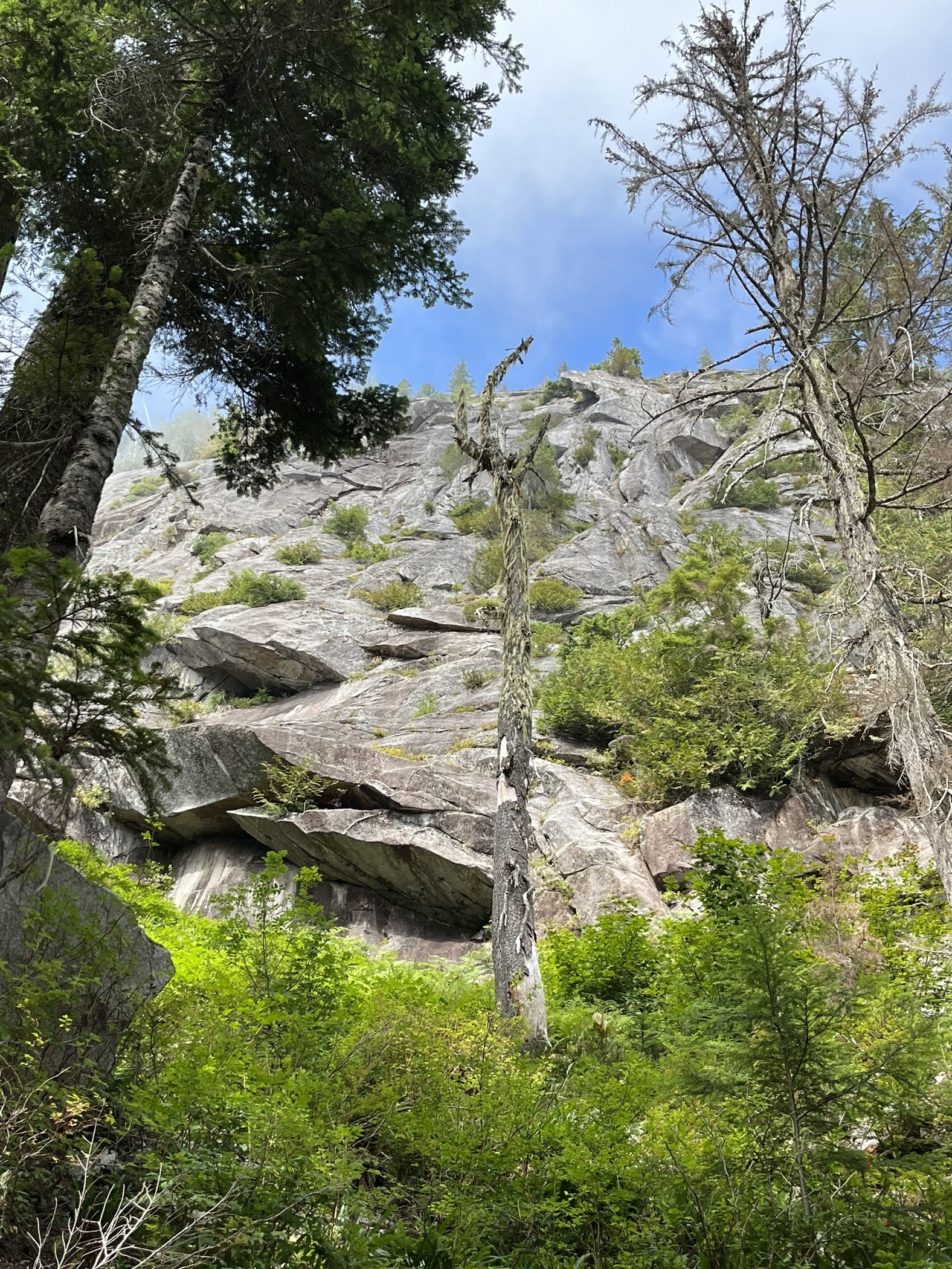
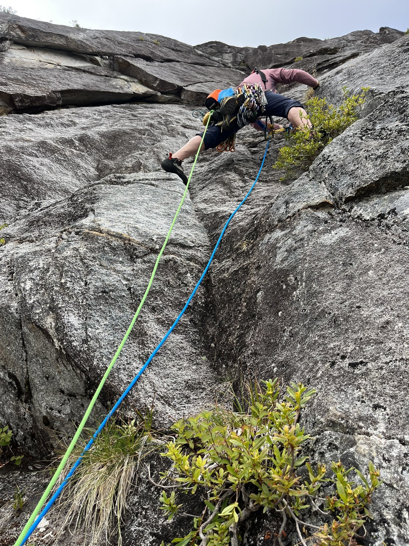
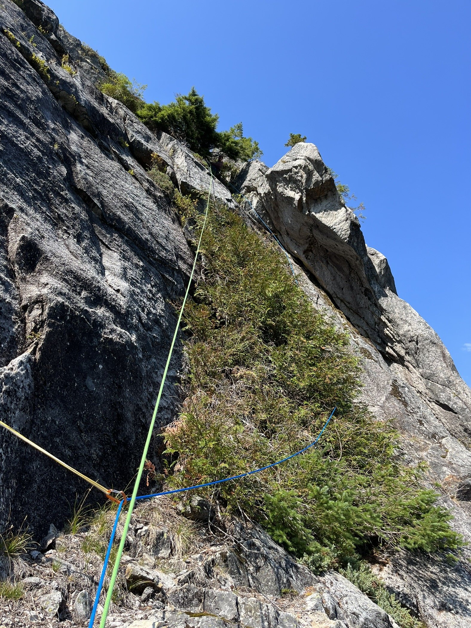
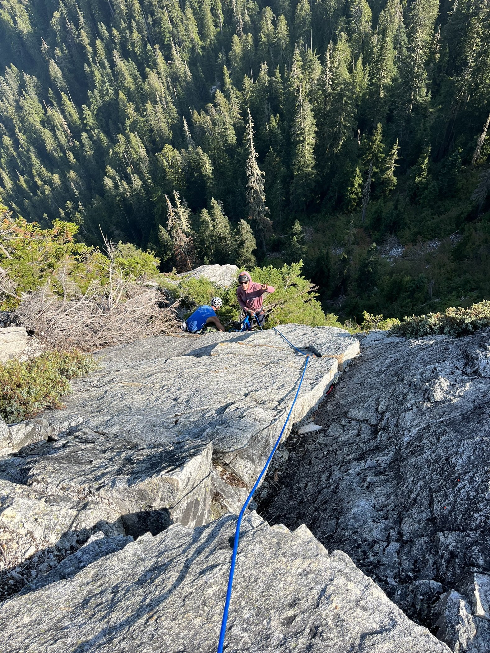
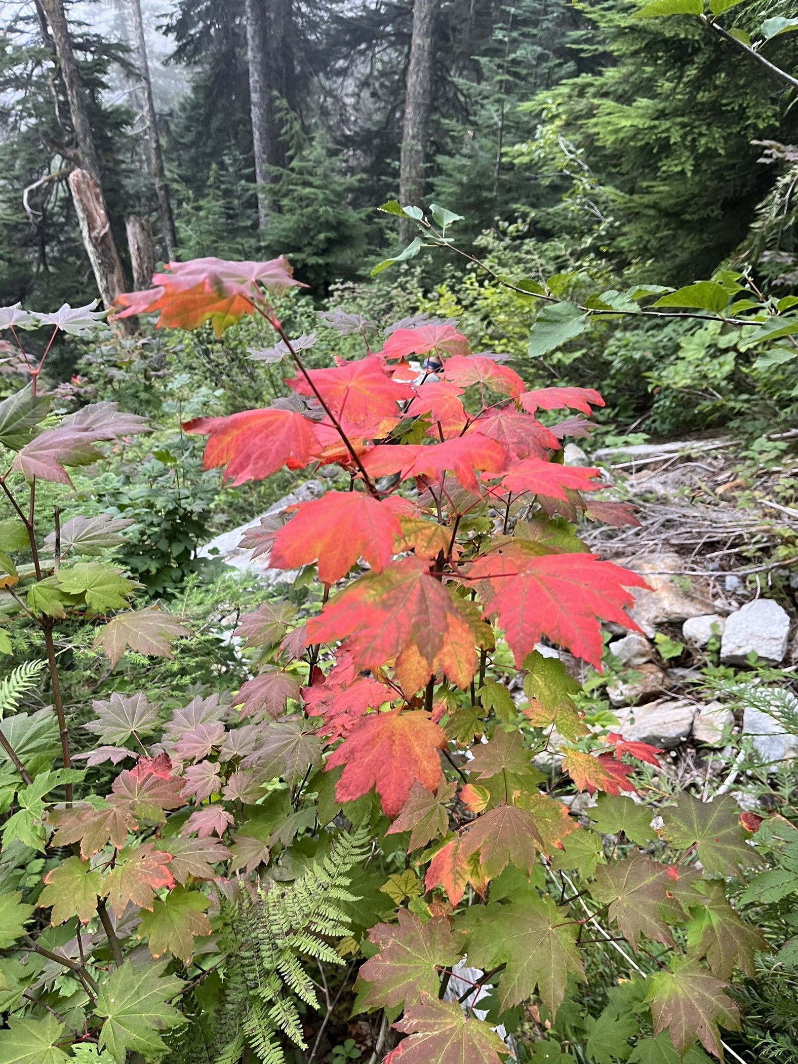 1 point
 -
well that makes it a moral conundrum. bought with private funds but sits on public land. seems like it could go either way. would be cool if let unlocked and accessible when not occupied by the guide services. or of fee required, it would be fairly cheap like the Canadian BC hut systems, but I think the alpine club runs those so the motivation is different.1 point
-
Conflicted on this. if the structure was completely paid for by the guide service then i can see that they have control over it. but then it is also on public land. But then if some jackass leaves the door open in the winter and the inside fill up with snow. in the description "provide temporary winter shelters for the recreating public (both commercially guided and unguided). Three of the shelters would provide reservable overnighting facilities operated by three private commercial entities. One of the shelters would provide a free warming shelter day-use for the general public. All of these shelters would provide safe locations for the recreating public during the winter season." it doesnt say who is paying for it.1 point
-
I would love to see the Enchantment lottery run more like hunting tags. Your chances go up the more years in a row you try and don't get a permit, and if you get one, you have to wait years before you can get it again (maybe once per lifetime even).1 point
-
"something felt not quite right about that, like I hadn’t earned it." Hahahaha, nice. I wouldn't have expected anything less from you Eric! Glad you made it at least even if it wasn't exactly your style. I bet Pemba was thrilled to have you as a client on that one! I assume you're way less work and more helpful and self reliant than basically everyone else that uses Sherpa support. Thanks for the great read, I loved it.1 point
-
That is an incredible turn around time for this mountain. Amazing logistics. I guess you are Eric Gilbertson--you have gained a mastery for this.1 point
-
Imagine the Enchantments “opened up” by instead of a lottery….an auction. Highest bidder gets to camp. ‘Merica! Fuck yeah!1 point
-
"These range from a two-night weekend hike that includes a night at Phantom Ranch ($2,599) to a seven-night trip that starts at Grand Canyon and also includes Lake Powell, Monument Valley and Canyon de Chelly National Monument ($4,299)." Seems reasonable. At $2600 for 2 nights of "camping", maybe we should give them the Enchantments too. Accessible prices like that would open up the lottery.1 point
-
Awesome read, thanks for positing this! I was unaware of your project until now, that makes turning around on Everest all that much more frustrating I bet! Here's a link to Eric's climbing project: https://www.countryhighpoints.com1 point
-
Sigh, that really is lame. Not really much else to say at this point. But, moving on... https://ascentoutdoors.com/ ...is great! Locally owned by a climber friend of a friend of mine. Also, I will be forever a fan of https://featheredfriends.com/ If you are up north, make sure to support Chris and the crew at https:// backcountryessentials.net/ along with our flagship sponsor, https://shop.alpineinstitute.com/ For just ski gear in Seattle.... https://www.proskiseattle.com/1 point
-
Awesome work!! Thanks again, Eric, for continuing to post your TRs here on CC! Here's Ryan Lurie's TR from the Feb 2006 trip.1 point
-
On gib ledges above the head it was frozen, run down ice - thick. That i can see sticking around for few weeks. I hope snow coming down today will deposit to add thickness to snow at climbers feet - that is was getting this in most exposed locations.1 point
-
Nice! Isn’t that the nature of rime? That it barely supports itself? Haha!1 point
-
A reminder of continued gratitude to @Jason_D_Martin and AAI. They continue to be the sole business sponsors of CascadeClimbers. So its between them and user support that keeps us going. Thank you!1 point
-
Always a lot of good rime adventure climbing up in the crater!1 point
-
Whatever sort of bouldering ice climby thing you did up there, congrats and thanks for sharing!1 point
-
I've climbed Gerber-Sink end of March before in good conditions. I've also bailed off of a few things in there during that same time window. (End of March is my spring break, work in education.) I think the most important thing is to be flexible, as mentioned. You can get out in pretty marginal weather if avy hazard is low and you are prepared. Some other spots that should be on your list to check depending on budget/travel time available... Rogers Pass, Canadian Rockies, Glacier NP, Bitteroots, South-central Idaho Ranges, Tetons, Rocky Mtn NP, Oregon Cascades, Elkhorns, Sierra, Wasatch, Great Basin NP. I've had great luck in the Canadian Rockies that time of year. Ice is fat and sticky, huge variety of routes, alpine is just coming into condition depending on the year, cheap hostels and lots of partners to be had if you're solo or your buddy needs an extra rest day. One year I climbed 4 days of ice including routes up to 1,000 ft of climbing, then did an 800 ft limestone sport climb on a south aspect, then did a solo ski tour to scope an alpine face which wasn't in, so went mixed cragging the last day... pretty fun. Also, very different from the Cascades in-terms of rock, avy/snow, types of routes. A great contrast to what we get here.1 point
-
Nick this looks fantastic! Definitely going on my list. I really enjoyed the sawtooths last year and look forward to getting back to see more of Idaho!1 point
-
No bites? Well, does anyone know these two peaks @Kit is pointing at? We got avalanched off the one on the left. I guess I'll need to go back.1 point
-
I wear 48 in basically all Sportiva mountain boots (Nepal, G2SM, older yellow Trangos) and I'm a 14 in every running shoe or US brands. However, I fit in the TX4 in 47.5 pretty well. A lot will depend on the shape of your toes, but I would try them before you decide they don't fit. For reference, the TX4 47.5 fits better than the Boulder X in 48 for me with more room! I also do OK in the older Trango Silver Bullets in 47.5 since that was the biggest size they ever made.1 point
-
Trip: Ruth Gorge - Kuriositeten and Mount Bradley plus others Trip Date: 04/26/2021 Trip Report: I am a little late in posting this because I had a 3 week Denali expedition right after this trip. So I am just now getting back into the swing of regular life and unpacking. Anyway I figured I would post up a trip report from the Ruth Gorge. We flew in on April 26 to the Ruth Glacier just below the East Face of Dickey. Man that is a face to dream about!! We were a team of 4 that functioned as 2 teams of 2. We just changed up partners a few times based on people’s route choice. The Ruth Gorge was Plan B and we didn’t know we were going to the Ruth until about 4 days prior to flying in. So we were pretty ill prepared with route research and overall beta (with the exception of the classic lines). Grosvenor, Johnson, and Wake (left to right), from the flight in. Talkeetna Air Taxi on the Ruth Glacier with Peak 7400 and London Towers in the background. April 27 - Our first full day on the glacier. It was warm and sunny and I teamed up with Robbie to head for Cobra Pillar and just see how the climbing was. We got up to the top of pitch 5 when the sun disappeared behind the mountain and it started to get cold. We were also less than impressed by the first 5 pitches. When the guidebook says “C1+ rotten or 5.11” you should probably just avoid that pitch! I led it and was literally kicking new footholds into the large granite crystals and hoping they wouldn’t crumble under my bodyweight. Needless to say we had no desire to go back with so much other good looking rock. Robbie on the 2nd pitch of Cobra Pillar. Robbie just after the traverse on Cobra Pillar April 28 - We scoped several lines and tried to generally figure out what lines had been done. Thankfully we had used our phone to screen shot several AAJ articles so we were able to figure out some of it. Our efforts were mostly focused on Dickey and Peak 7400 since they were the closest to camp. Scoping a potential ice line. April 29-30 - weather days. Snowed about 18 inches. May 1 - We scoped lines going south on the Ruth Glacier. Looked at stuff on Bradley, Wake, Johnson, and London Towers. We were starting to get a good sense of snow conditions based on aspect and finally figuring out where everything is. We did climb the opening 2 pitches of The Escalator on Mt Johnson. It was really fun alpine ice and it gave us a good excuse to use the ice tools and screws. There were a couple of steeper smears to the left that we hoped to climb but the ice was only about 2-3 inches thick and there wasn’t any rock pro available. Scoping "The Escalator" on Mount Johnson. Climbing up the first couple ice pitches on The Escalator on Mount Johnson. Great alpine ice! May 2 - Based on the conditions we found yesterday we deemed it prudent to give the mountains one more day to shed snow and get some freeze/thaw going so it wouldn’t be a postholing nightmare. We had brought a telescope so we looked very closely at a couple of lines that interested us and talked about what line to do tomorrow. A couple people of our group went over to check out the first couple pitches of “The Wine Bottle” on Mt. Dickey. Man that is an inspiring looking line! We watched them through the telescope. May 3 - I teamed up with Duncan to climb Kuriositeten (AI5, M3+, 800m). It is a “smaller route” that was first put up in 2008 on peak just left of 747 Pass. At 2500ft it isn’t really a small route but when you see how it looks sitting between the giants of Dickey and Bradley it appears small. The route follows a couloir splitting the east face of the peak. It is a lot of snow climbing but also contains some mixed steps and 3 distinct ice steps ranging from 15m to 70m tall. Honestly it reminded me of some of the climbing in Cody, WY, where you follow a twisting canyon/couloir always excited about what might be around the next corner. The crux is the final step. It is about 70m+ and the first half is pretty dead vertical. Thankfully the ice quality was great and we throughly enjoyed the position deap inside the slot. We had very little beta about this route so had only brought 7 screws. We were able to find rock gear for the beginning belay and then I just ran it out as far as I dared between screws. We still had to break it into 2 pitches as I found myself with only 2 anchor screws left after 35m. Duncan took the upper half and soon we found ourselves on the snow slopes above. This is a fantastic route in the Ruth and should see more traffic! One of the reasons we wanted to climb this route was to recon the decent from Bradley. One of the reports we had regarding Bradley, was to descend the “standard west ridge” but that party bailed down a face after not being able to descend the west ridge. Another report talked about descending to the Backside Glacier and walking way back around through 747 pass. Another report talked about descending the Bradley/Wake Col. To complicate matters CalTopo and Gaia both showed some weird topography anomalies on their topo maps. In fact both showed a 800-1000ft cliff coming off the back side of Bradley that looked very complicated to navigate around. The problem was the topo lines didn’t seem to match what we had heard in reports. Needless to say we were very interested in looking at the descent from the top of Kuriositeten. In the end we discovered that both Gaia and CalTopo were very wrong in their topography. In places it was off by 1000ft. What appeared to be a huge cliff was just a small snow slope that was easily walkable. We couldn’t see the whole decent but we felt much better about things after this day. Skiing over to Kuriositeten. It climbs the big gash on the peak in the middle back. Even though the line is 2500ft tall it looks small in comparison to Bradley (left) and Dickey (right). Duncan starting up Kuriositeten. Looking up from the belay at the top of the first ice step. Approaching the 3rd ice step crux. It is the narrow looking ribbon of ice way up in the slot. Duncan climbing up through the crux pitch on Kuriositeten. A fantastic route in the Ruth. From the summit of Kuriositeten looking over towards Mount Bradley. Descending the back side of Kuriositeten in the late evening light. May 4 - Rest day. May 5 and 6 - For the big goal of the trip we picked Mount Bradley. A couple of our party had started up the East Ridge of Bradley the day I had climbed on Cobra Pillar. They found deep unconsolidated snow on all northern aspects. Even though it is called the East Ridge the first 1/3 of the route is mostly on the north side of the ridge. So with no desire to go up that unconsolidated snow we searched for a new route. While looking through all of our screenshots from the AAJ we found John Frieh’s report about a linkup on Mt. Bradley. He and Dylan Johnson had also found bad snow on the start of the regular East Buttress. So with high hopes we set our eyes on their Link of “Season of the Sun" and the “East Buttress”. They rated it M5/6 and the route is 4500 feet tall. It was warm so our plan was to leave camp in the late afternoon and start the route in the evening. We were hoping that by this time the snow might start freezing back up from the day and we could avoid some nasty postholing by climbing through the night. We left camp at 4pm and but 5:15pm we were in crampons working our way up the initial snow slopes. The Season of the Sun route climbs on the right side of the SE face of the mountain and was originally put up by the Giri-Giri Boys. We were a little concerned about the reported M6 offwidth crux but figured we would take it one step at a time. After about 1000 ft of snow with short steps of rock and ice we arrived at the “crux”. We were pleasantly to find it full of ice (AI3). So after a quick romp up great ice and another pitch of low angle rock we arrived at the 2nd couloir. From here route goes up right then back left across snow slopes and around the end of a big buttress. This leads you into the big central gully about mid height on the face. The original Seasons of the Sun route cuts up and back left to stay on the face while we followed Frieh/Johnson’s variation back towards the East Buttress proper. It was somewhere in here that it got dark. Not pitch black but dark enough to warrant a headlamp when technical climbing. Several mixed pitches in the dark brought us to the East Buttress proper. From here another 2 long fun mixed pitches deposited us underneath a huge boulder. By this time it was getting light again and we were out of water. So we spent an hour brewing up and resting. The rest of the east buttress went by in a blur of simul-climbing including one section where I ran out of carabiners and slings and literally clipped the carabiner with all my nuts to a piton just so I could clip the rope in. We topped out on the summit about 10am. The decent was pretty straight forward although with more uphill than we liked. We just followed the main ridge to the west and then cut down and south to follow a different ridge line back towards the Bradley/Wake Col. Unfortunately this led us to wallow up several northern aspects of unconsolidated powder snow. Nothing like trenching in the afternoon sun when you have been up all night! We finally reached the col and took a short break to drink the last of our water and finish up our food. Then it was 2000ft of easy walking down to the last obstacle…the icefall between Wake and Bradley. From the top of the col it appeared to be less broken up on skiers left. But when we arrived skiers left there was only sagging “snow bridges” and open crevasses. We were able to end run everything far left and then rappel over the last bergshrund by leaving a bomber fixed nut in the rock. Finally home free we trudged wearily back towards the base of the route. The snow was like a trap door. Most steps you were fine but every few steps the door would open and suddenly you would be postholing to your thigh. We were excited to be back to our skis were the going suddenly got easy! Rolled back into camp at 7:30pm for a 27.5hr RT time. Starting up Seasons of the Sun. The M6 offwidth crux....we got lucky with fat ice conditions and easy climbing. Typically route conditions...soloing steep snow. About 1/4 of the way up the route now. Nearing the top of the East Buttress proper......during one of the long simul-blocks. The route up Bradley's 4500ft face. This is a linkup of Seasons of the Sun and the East Buttress first done by John Frieh and Dylan Johnson. Descending back down from the Bradley/Wake Col after climbing Mt. Bradley. May 7 - Weather day. Snowed off and on all day. May 8 - Snowed a bit then cleared up in the afternoon but wasn’t enough time for much more than a casual ski. It was warm again. We watched several ice lines we had been looking at fall off the walls. Our camp below the east face of Mount Dickey. Mount Bradley is just to the left of center in behind. May 9 - With the warm weather we opted for rock climbing. But the sun didn’t burn the clouds off until noon so we got a late start. We decided on Goldfinger which is on the Stump. We started climbing and were happy to find good quality rock. The rock quality was WAY better than the first few pitches of Cobra Pillar. Unfortunately due to our late start we lost the sun and our warmth about the top of pitch 6. We contemplated going a few more pitches but opted to just call it since it was unlikely we would top out anyway with such a late start. The climbing was very good though and it would be a classic anywhere in the lower 48. Coming up to the belay at the top of Pitch 2 of Goldfinger. Climbing pitch 6 of Goldfinger. It is fantastic climbing on very good quality rock! May 10 - With bad weather in the forecast for the next several days we opted to fly out. Several of the team members had flights out of Anchorage on the 13th so we didn’t want to be stuck on the glacier and miss flights. TAT here to pick us up. The ever changing clouds giving Mt. Bradley a moody look as we departed. Gear Notes: Alpine rack, heavy on screws for ice routes, heavy on cams for rock routes. Approach Notes: Fly in with Talkeetna Air Taxi, then ski/hike to climbs.
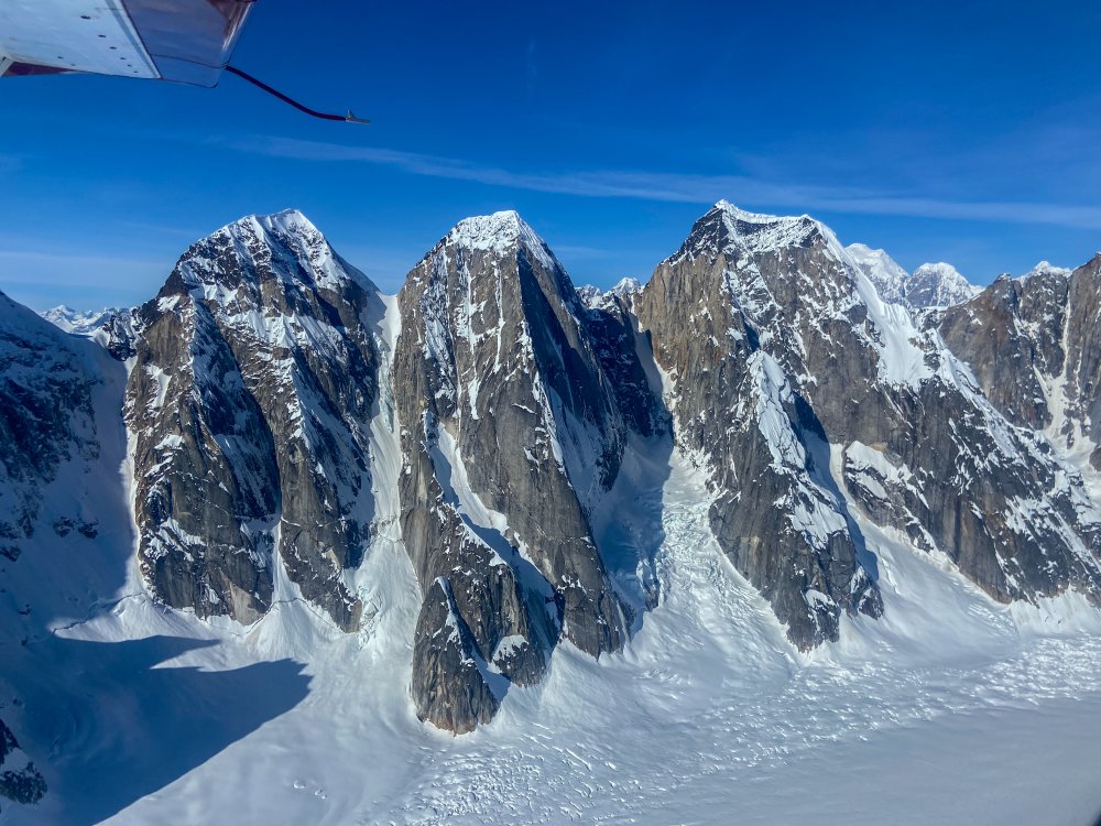
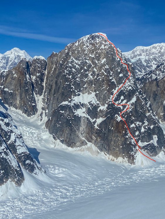

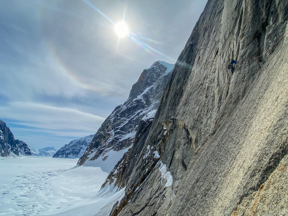
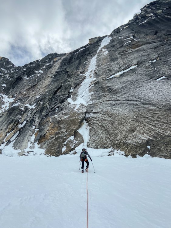
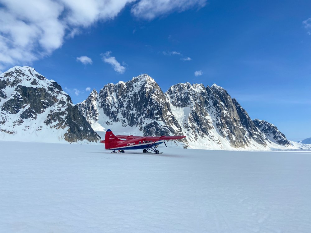
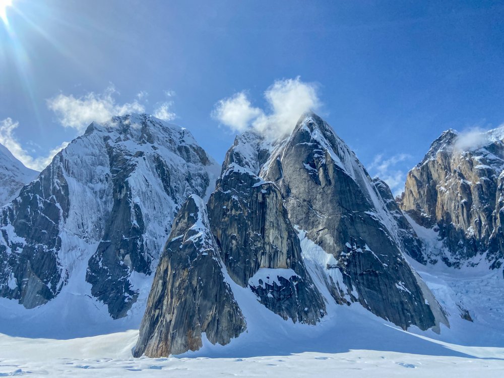
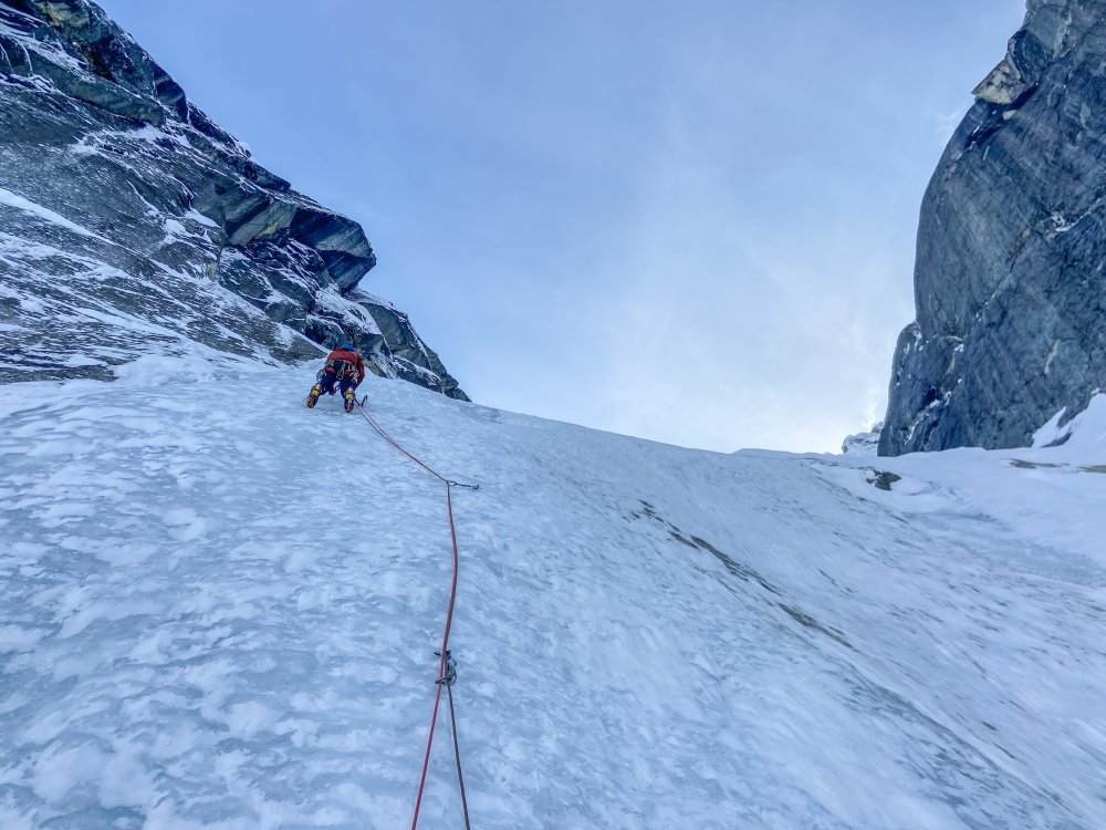
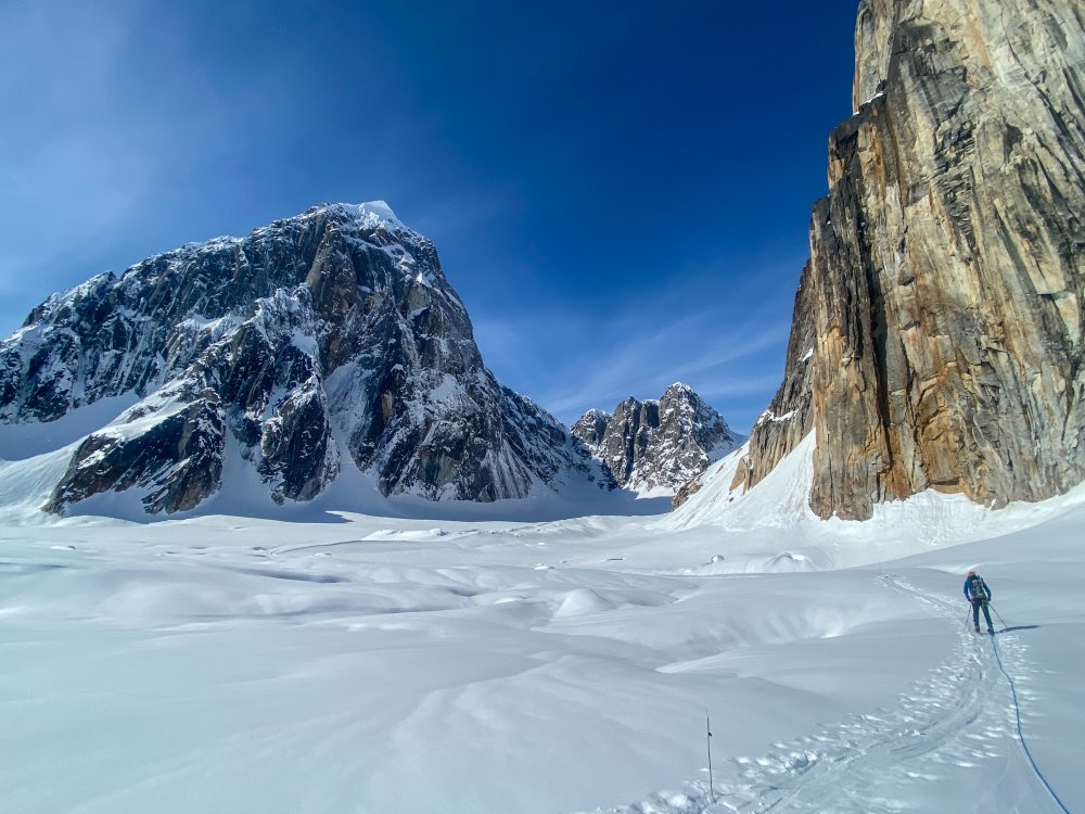
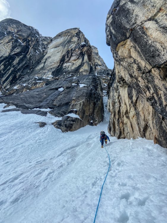
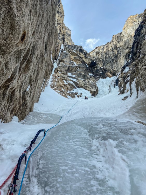
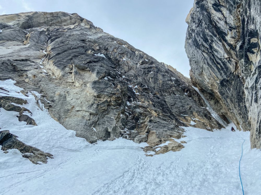
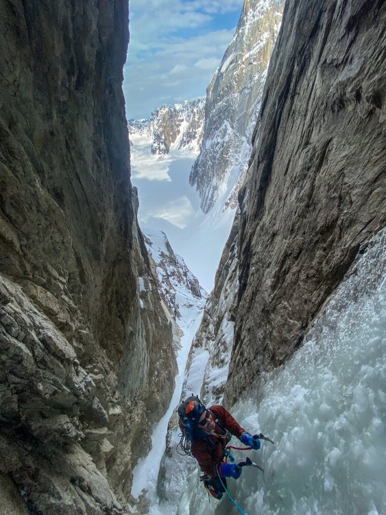

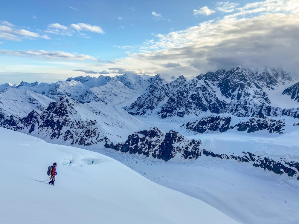
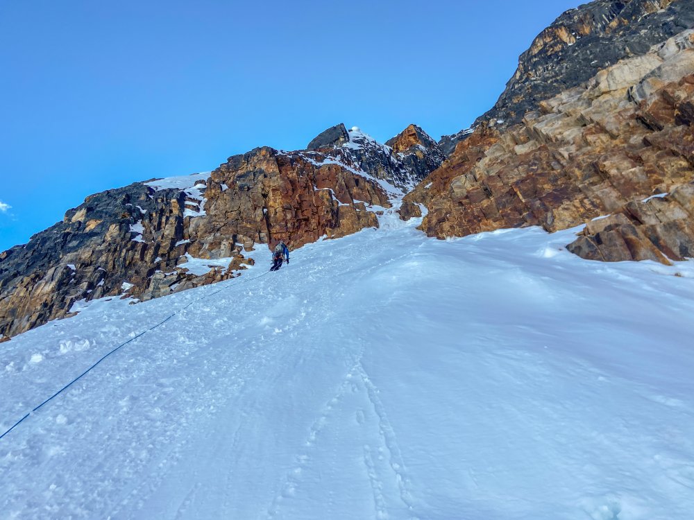
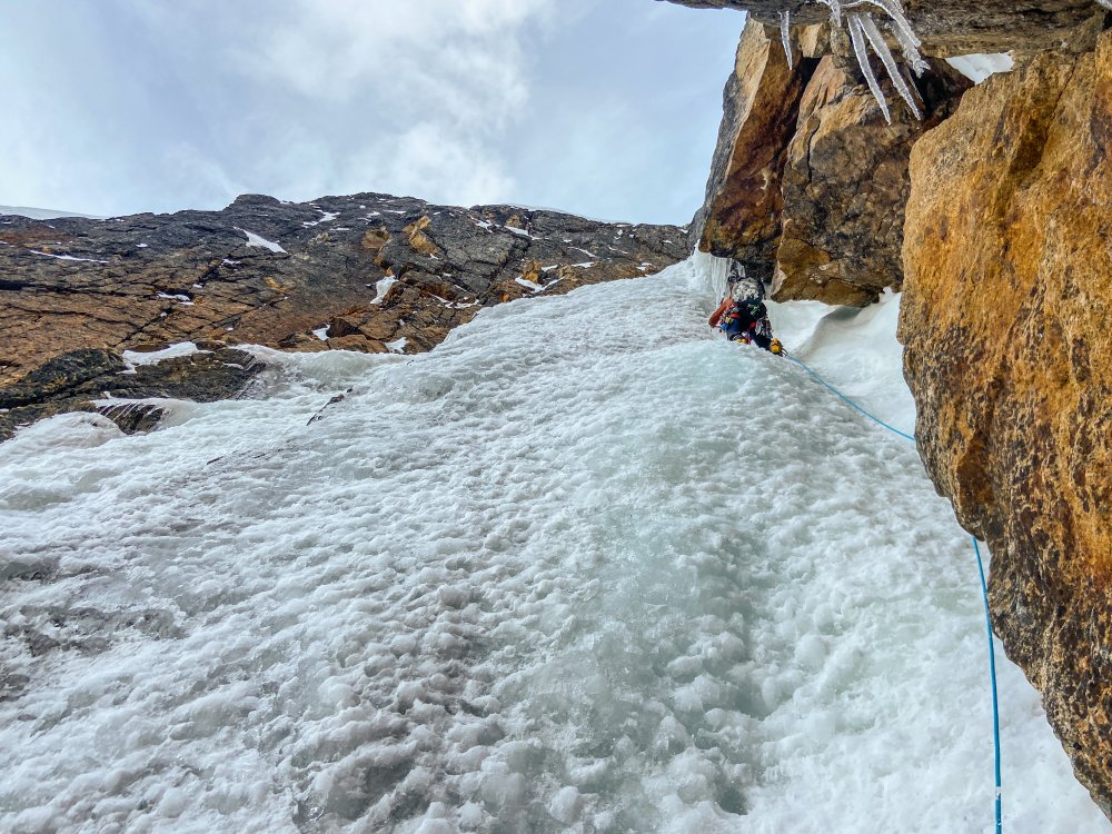
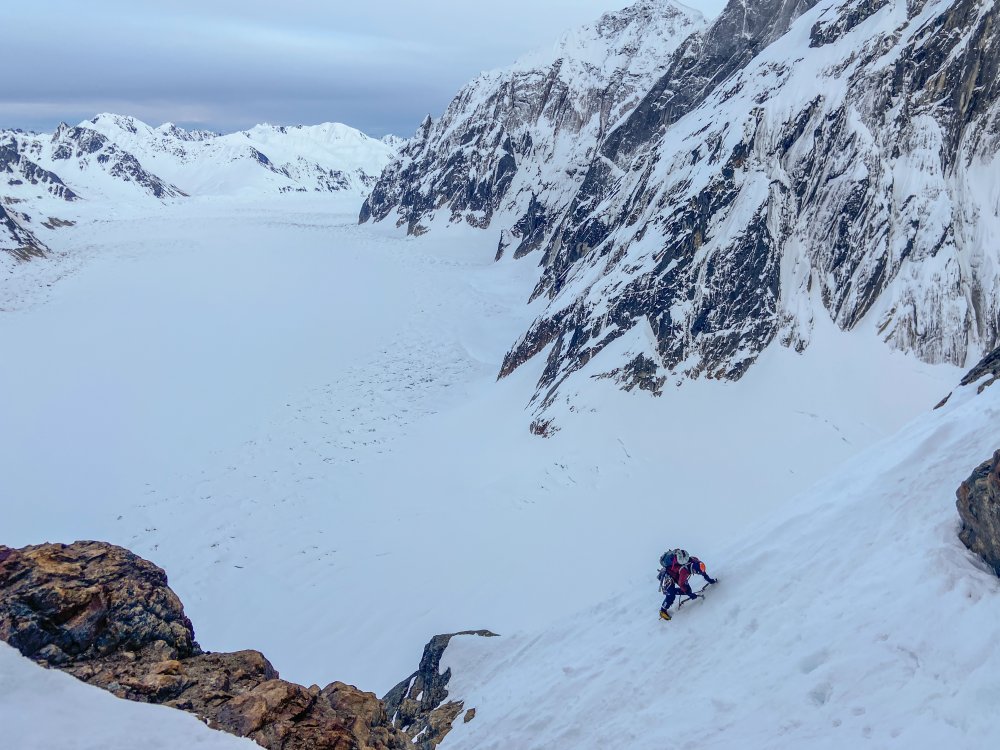
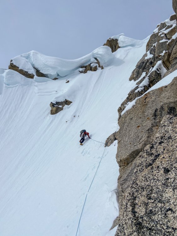

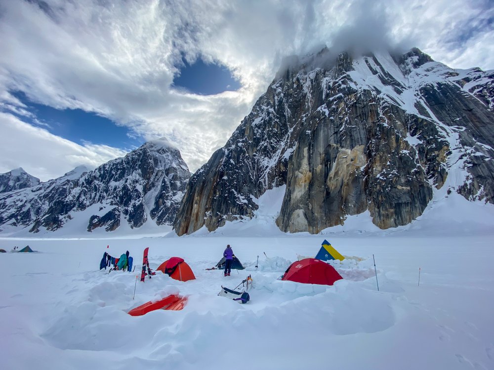
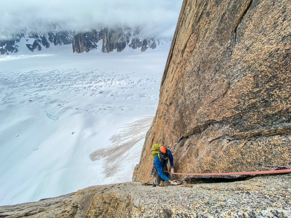
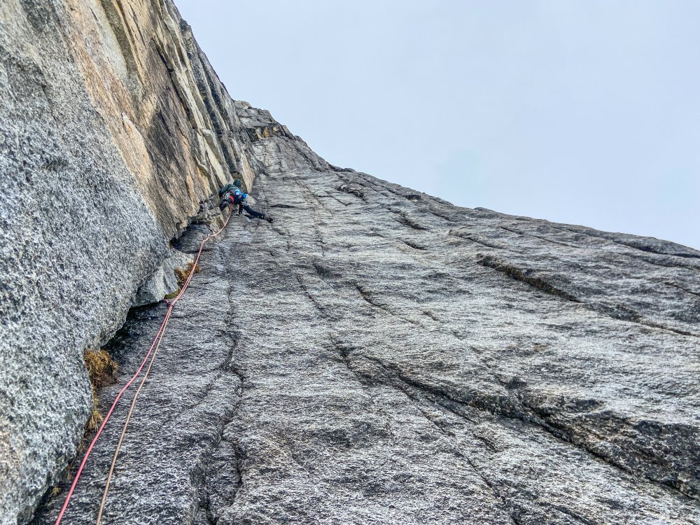
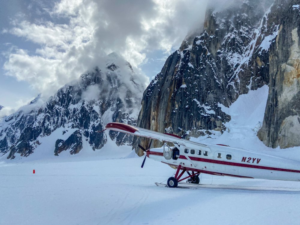 1 point
 -
Trip: Lundin - Southeast Ridge Trip Date: 11/17/2018 Trip Report: Ahhhhhhh......... Smooting. Is there ever a better fall activity? Wait, don't answer that. Just look at the photos below and don't feel so sad that the ski season hasn't really started yet (have you bought your Smoot copy yet?). And get a warm fuzzy feeling knowing that @cfire, @genepires, @Kit, and myself all had a very nice friendship hike to the top of a snowy ridge. "Congratulations! it wasn't terrible."- @cfire #moderatealpinism Gear Notes: half rope, ice axe, crampons, helmet, light rack (this time of year). When the rock is dry you can probably scramble it all at a grade of exposed Cl. 4. Snow and ice made it a bit more exciting. Approach Notes: Commonwealth Basin trail to the end and then follow the ridge up.1 point
-
Trip: Dragontail Peak - Direct North Buttress "Iceline Bling" WI5+ M4 (FA) Date: 4/3/2016 Trip Report: Climbers: Priti Wright-led 1st pitch (WI4) Jeff Wright-led 2nd pitch (WI4) (scribe/photos) Craig Pope-led crux 4th pitch (WI5+ M4) (photos) Went up to Dragontail Peak looking for some new ice! Camped at Colchuck Lake and got the bino's out. We spotted a nice-looking line just climber's left of Dragontail's toe. Ended up being 5 pitches (most were 60m) with 2 sustained pitches of WI4 and one thin crux pitch of WI5+ M4. After the crux pitch, easy snow leads to the first couloir of Triple Couloirs just below The Runnels. Super fun route! We've done lots of research and found no evidence that this line has been climbed. If anybody *knows* that this line has in fact been climbed before, please *respectfully* leave a note (with evidence, if possible), and we will definitely correct this TR. Thanks! Priti leading up the first pitch (WI4) Following, higher up on the first pitch Jeff leading up the second pitch (WI4) Craig and Priti following the second pitch Craig moving the belay on easy snow (P3) to the base of the crux pitch Happy Jeff Priti following the gnar on the crux pitch (P4, WI5+ M4) Craig on an outcrop where "Iceline Bling" meets Triple Couloirs Gear Notes: Took rock pro and pitons pretty well. 6 screws (10cm, 13cm), small alpine rock rack, KBs, Spectre Approach Notes: No snow on Eightmile Rd 3/4 of the way1 point
-
Trip: Pleiades, Larrabee, Mt. Shuksan - southside couloirs, eastside, nwc Date: 1/13/2012 Trip Report: On the 11th I booted and skied the NWC on Mt. Shuksan. Encountering mostly good but slightly wind affected snow. In a spot just above the first cliff band there was a questionable slab... I did some tests - finding that there indeed was a slab there but it did not propagate well with an extended column test, so I traversed a little to the left, and no more slab. The high traverse to the entrance chute was very icy, with a thick breakable ice crust and a bit of solid water ice here and there. Mostly good snow in the upper chute with maybe a 10' section of hard ice crust near the top. There was also a short section of rime ice above the couloir entrance that I made a point to remember for the ride down. I'm finding that I like to boot pack more thank skin, something about the movement speaks to me. The next day, after some grocery shopping in kendall, I parked my rig a quarter mile or so past the DOT on Twin Lakes Road... Skinned in, then booted up the gully to the west of Winchester, I descended and set up a bivy at the headwaters of Tomyhoi creek, I fell asleep under a canopy of stars, Orion directly overhead. In the morning I ascended the west ridge of Larrabee which had me kinda skered because it was mostly hard rime ice with serious exposure -- my intended descent route. At the summit I questioned my original intention, after some thought I decided to descend the south face route instead of the west ridge. Cautious turns down hard rime ice off the summit led me to the entrance of the south face, but on a whim I dropped into the east face instead, thinking that I would just skin back up and ski the south face too... But instead, once at the base of the face, I traversed out to the Pleiades couloirs and climbed and skied both of them. The first (the west one) was longer than the second, and held a hidden top portion, it held mostly good-variable conditions, the second held terribly crusty conditions necessitating jump turns to bust through the crust. On the way up the second I developed a painful leg cramp in my lower right quadricep, but being pretty close to the top, and having a hunch that the pain was just coming from a muscle cramp, I pushed on, I felt the pain during the skiing, but I had to ignore it because a fall was not an option. The angle mellowed once out of the rock walls, and I skied the phatty lower couloir/gully ALL the way to the valley floor(a long way down) it got dark. I massaged my painful leg a little, melted some water, ate some hot food, then began the long ascent up to the col between Winchester and Larrabee eying the way in twilight before dark. My leg started to feel a little better, but I was gimping it very slowly, staggering awkwardly to avoid stressing the muscle. I was booting up somewhere in some trees, and snow began to fall, it grew steadily heavier as did the wind. Reaching the col, I got lost for a bit before I dropped into Tomyhoi basin where I recovered my bivy gear, then ascended towards Winchester hut in heavy winds and snow, feeling stupid for forgetting my gps. I was surprised to find the door of the hut locked, I knocked... no answer, then bellowed an awkward "hello" ... "hello" in return came from inside. It was apparently around one o'clock in the morning, limping up from the valley had taken me quite a while... The peoples inside were super cool and cooked me a hot meal, I told them that I had intended to descend after an hour or so rest in the hut, but I ended up spending the night. The storm pounded the hut all night. In the morning, I set out in the still stormy whiteout and proceeded to descend - ski cuuttin slabs left and right, flushing my intended descent route( a gully) occasionally ski cutting a slab off the side of the gully, deepest crown was probably around 2 1/2 feet... Amazing powder skiing lower down... The ski on the road out was slow cause the deep damp snow stuck to my skis, and the leg cramp returned. After about six miles I found my motorhome and road-out under two feet of snow, shit... I am a dumbass for sure, for throwing away my rusted chains and not getting another pair, for not respecting the unpredictability of the weather, for parking up the hill instead of at Hannagen pulloff... To make the story short, I took some advice from a passerby, who said that I should coast down in first gear and to "lay off the brake" After digging out and turning around I ended up loosing control a couple hundred feet down, with my front driver side tire half hanging off the steep embankment, truck tilted, I remained calm as it went down, but I am really glad I didn't loose my transport and home in the rollover into trees below that would have resulted if I stopped a foot two later. This morning, the BP pulled me off tha' cliff and I gingerly drove down with ebrake half applied/sometimes more, front brake applied accordingly, and clutch and first gear in necessary transition. Looking back on my time there on the road -- there was little hardship, I was well provisioned and warm enough - except some shivering at night that I am used to -- in hindsight, I see that my experience was a positive one, since I had some high quality times playing my guitar -- I think I finally broke out of that plateau that I've been stuck on. some video clips of the variable conditions -- nooksack tower ice on tha traverse alpenglow larrabee ABP Skagit Range -- *edit* Cheam Range Tomyhoi! oh shit stay away view from west couloir Does anyone have a shot of the Pleiades couloirs? Would shurley apriciate...
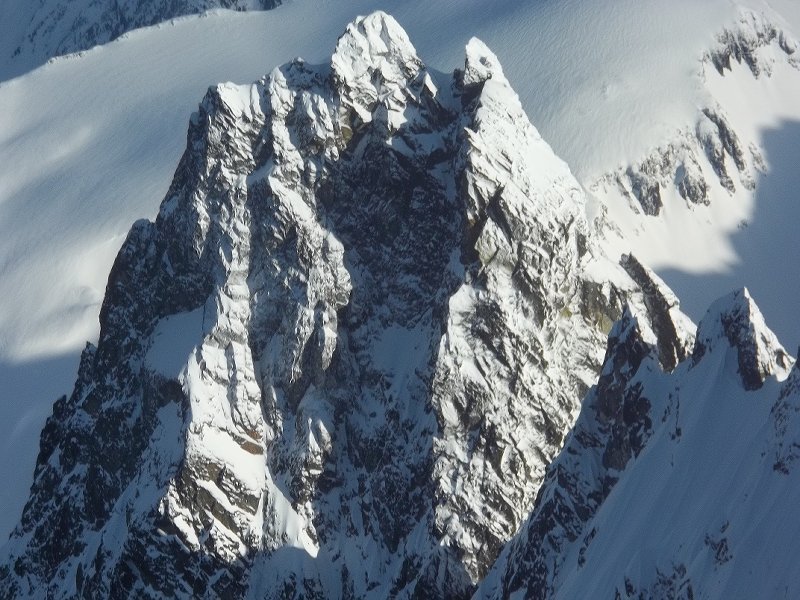
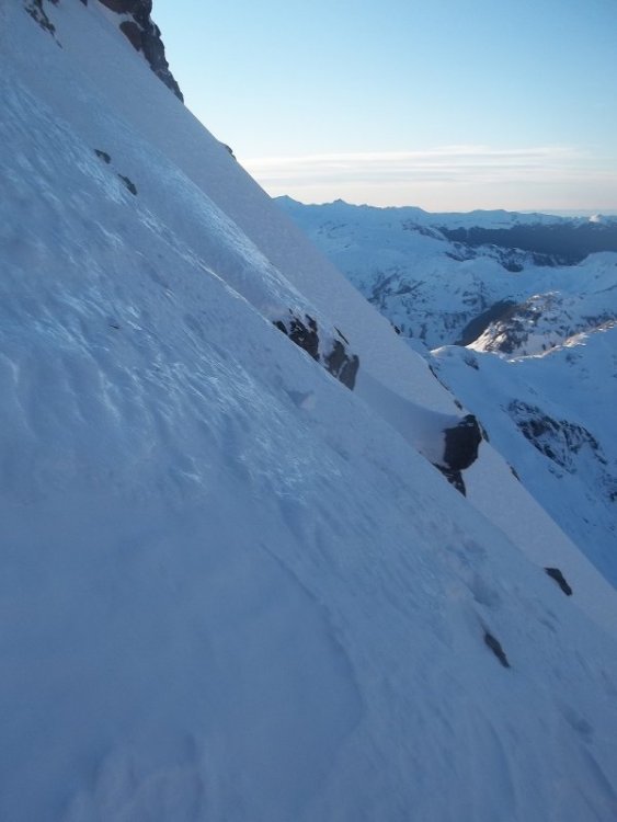
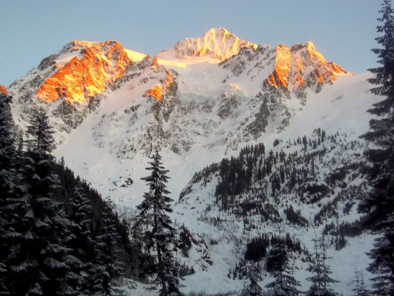
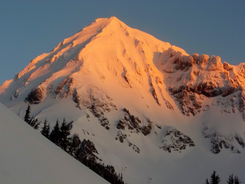
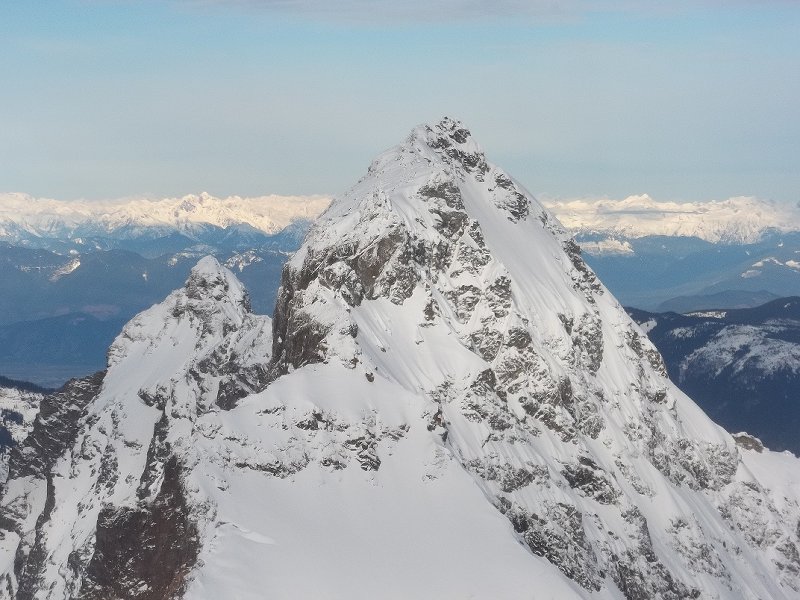
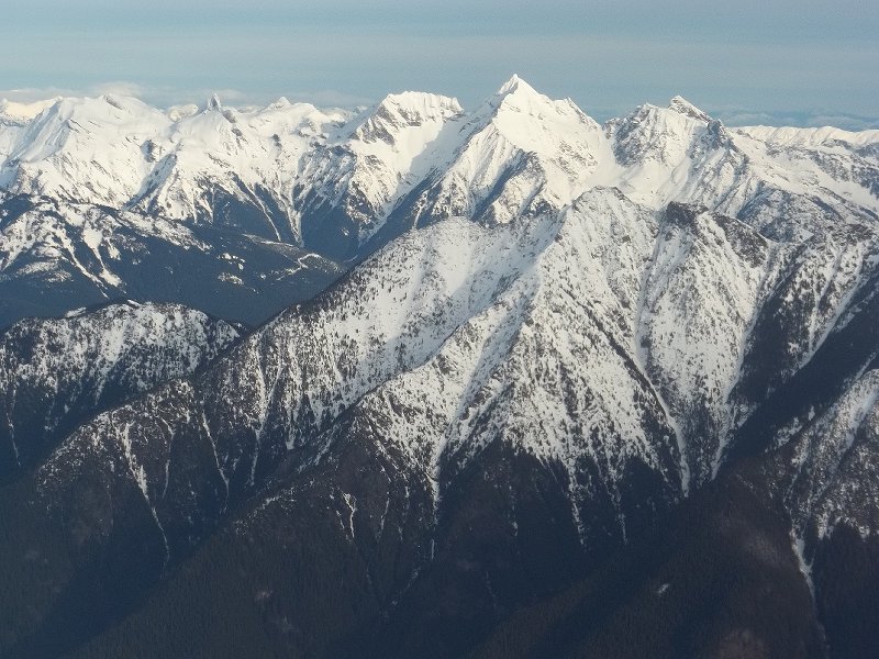
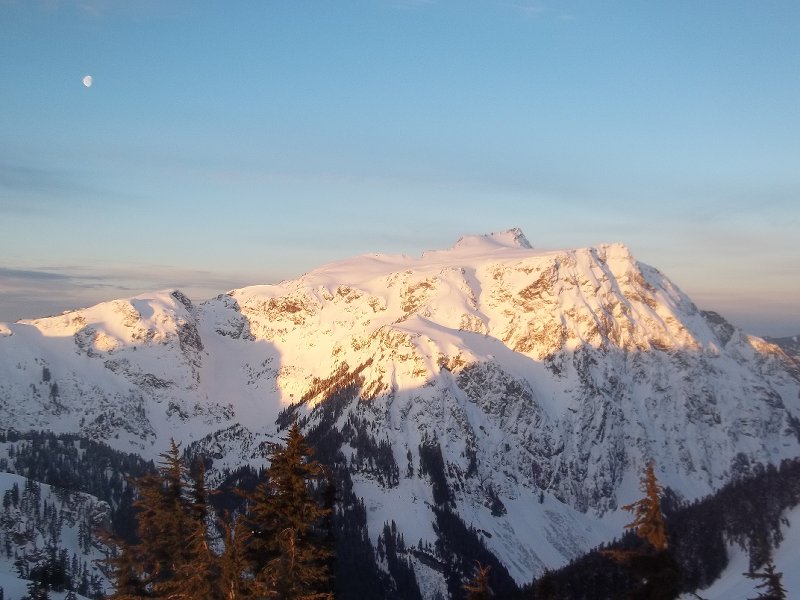
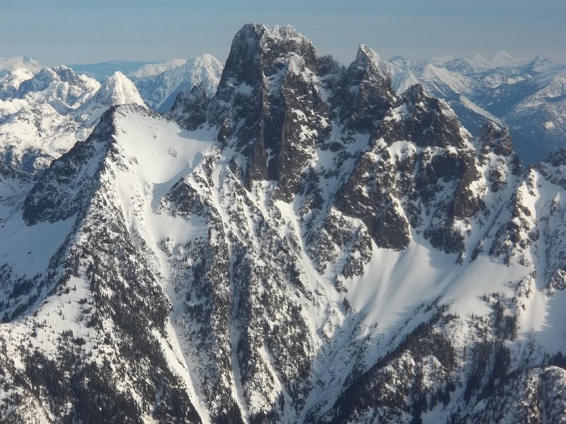
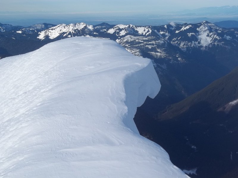
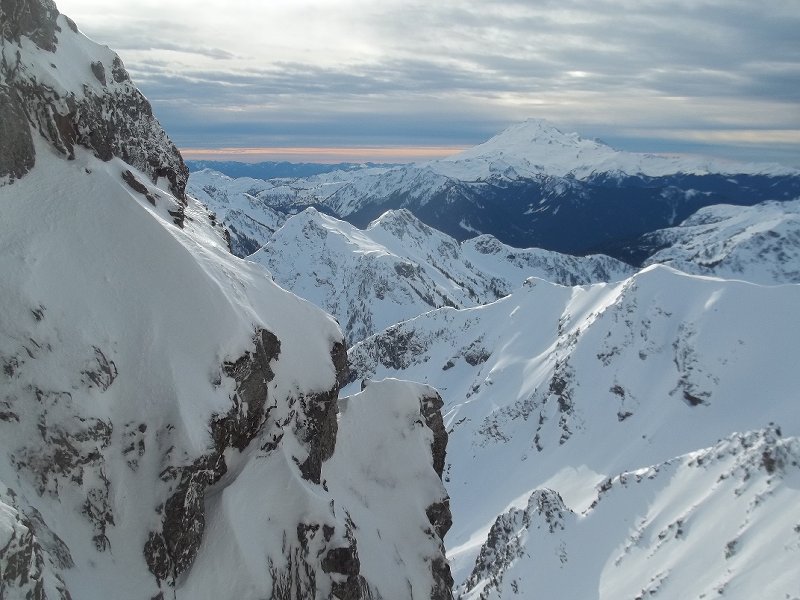 1 point
 -
check out the american alpine institute www.mtnguide.com an excellent company, and im almost certain that all of their courses are not full next summer.1 point