All Activity
- Today
-
 Love it! And really, the entire report top to bottom. I took two different ways to get back and forth over the Challenger E-W ridge line. The further east one was definitely harder. I think the west one is Solar pass, and wasn’t technical.
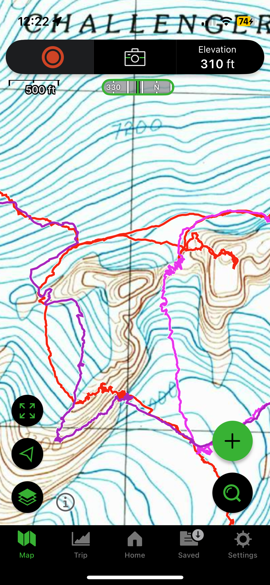
-
It’s a matter of personal preference. Chikamin is big and deep, there are some house swallowers there. But I think you’ll find 2 person parties are not rare.
-
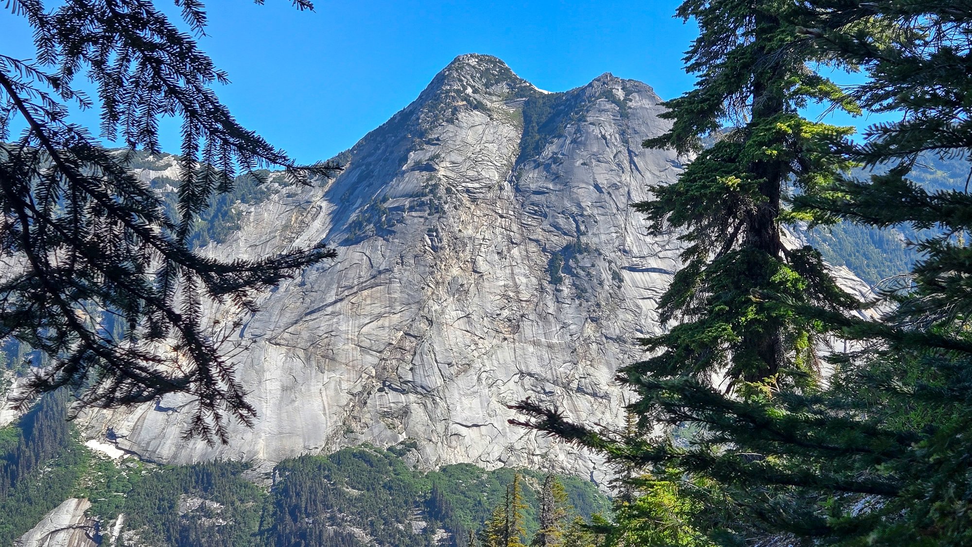
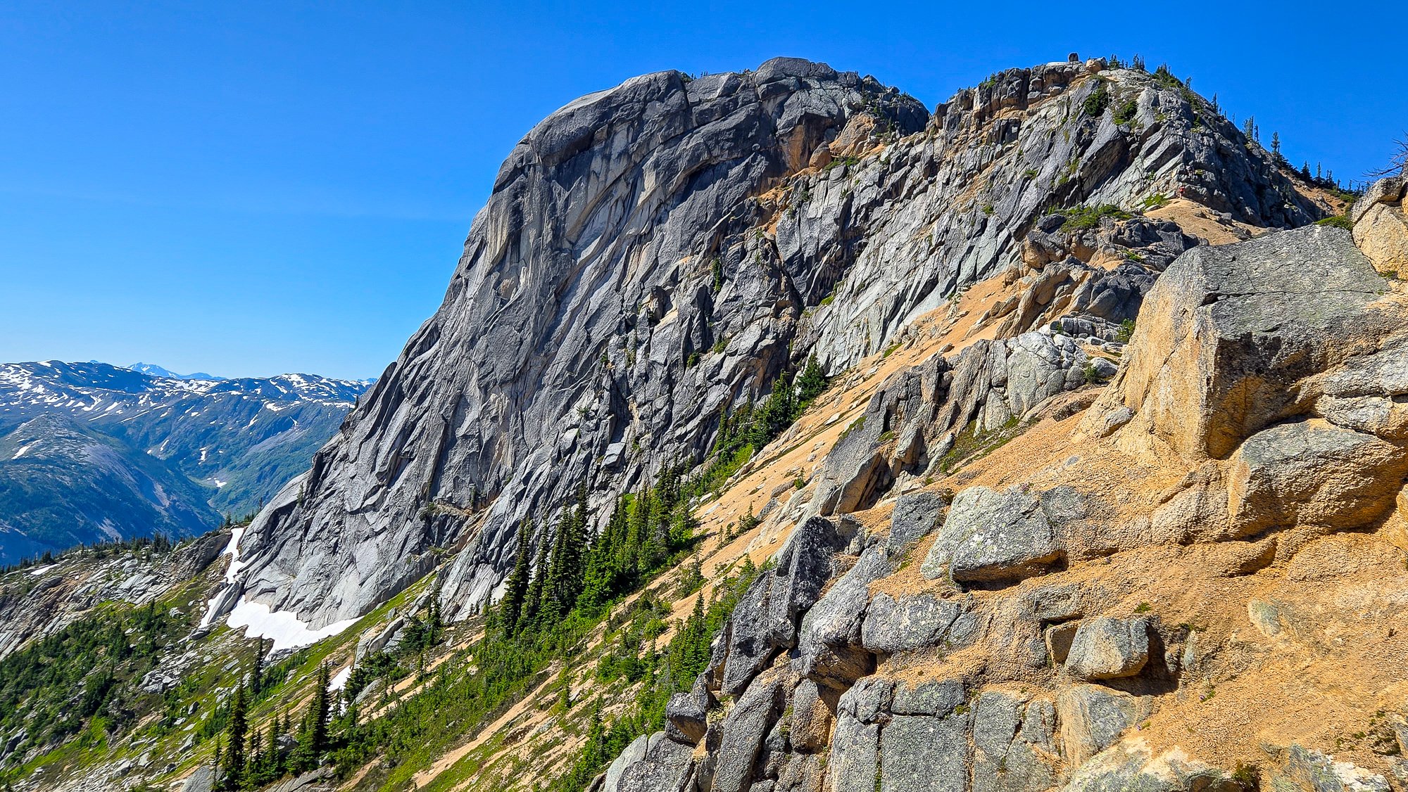
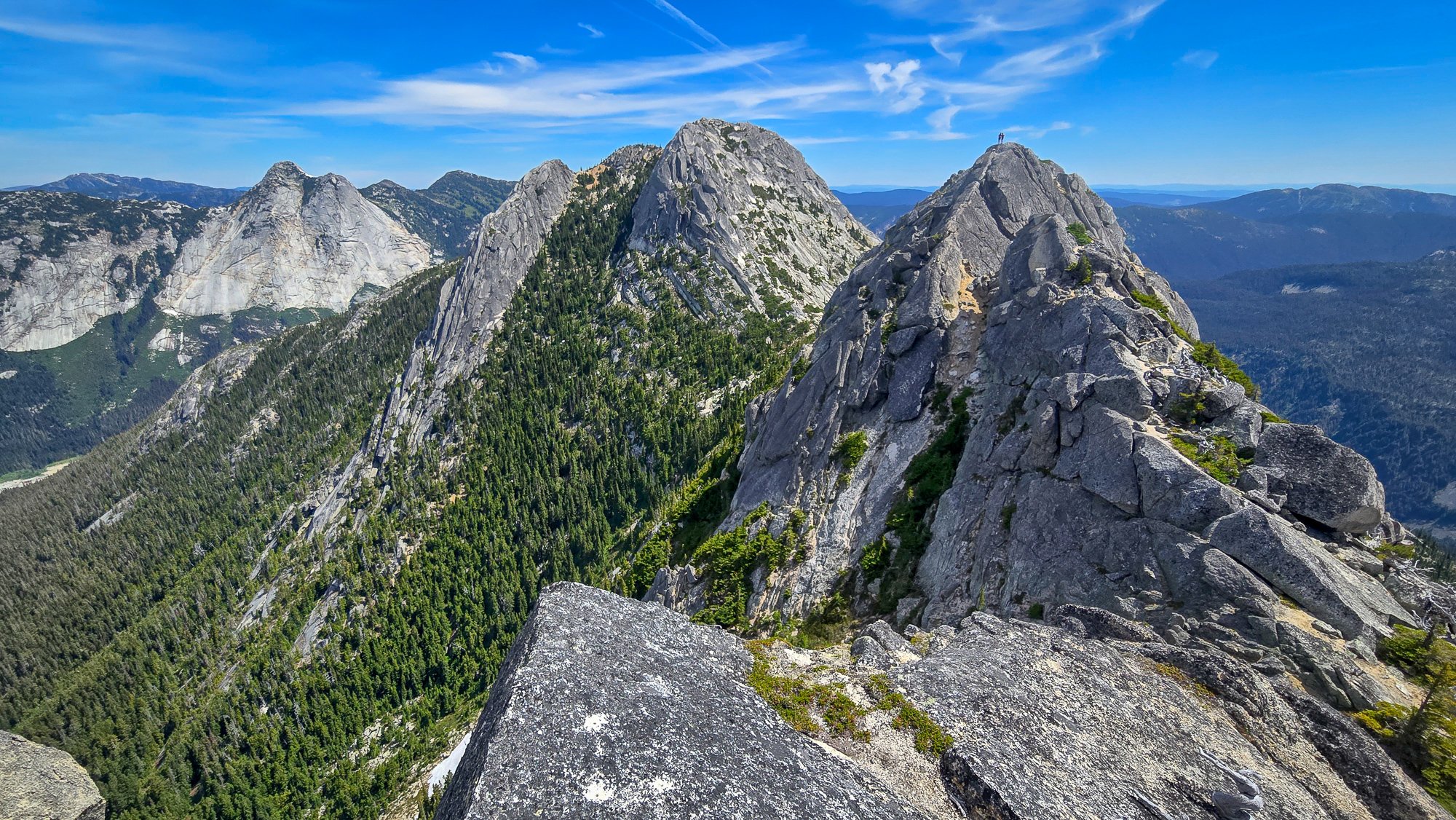
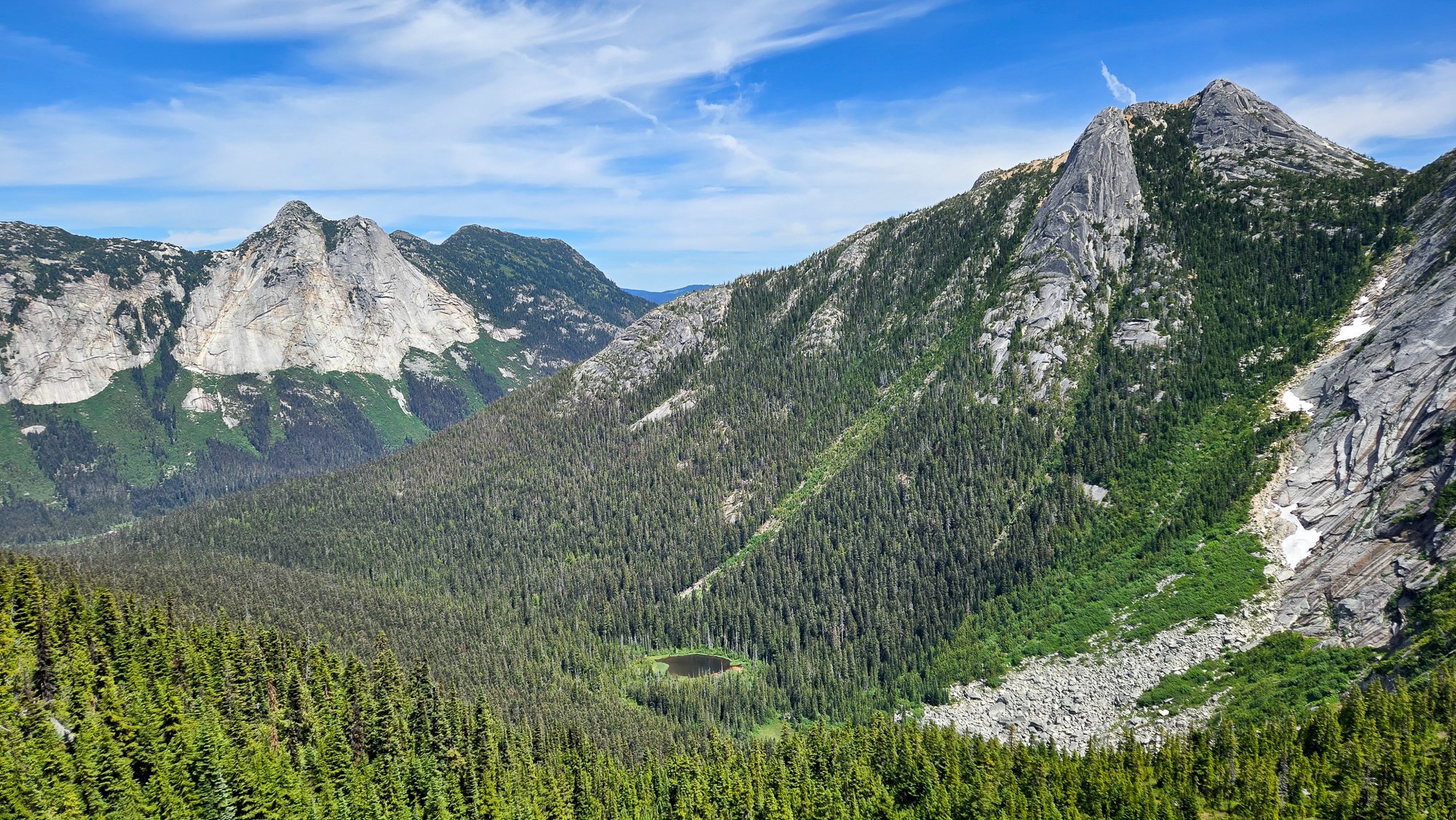
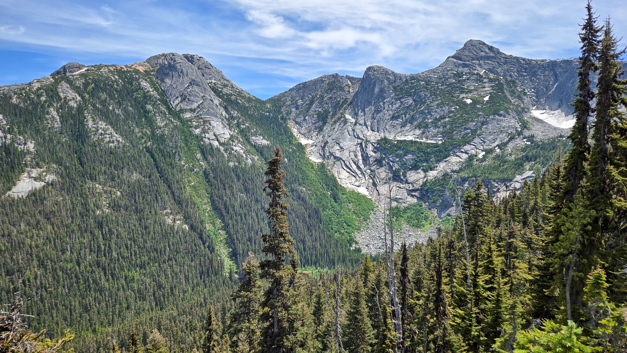
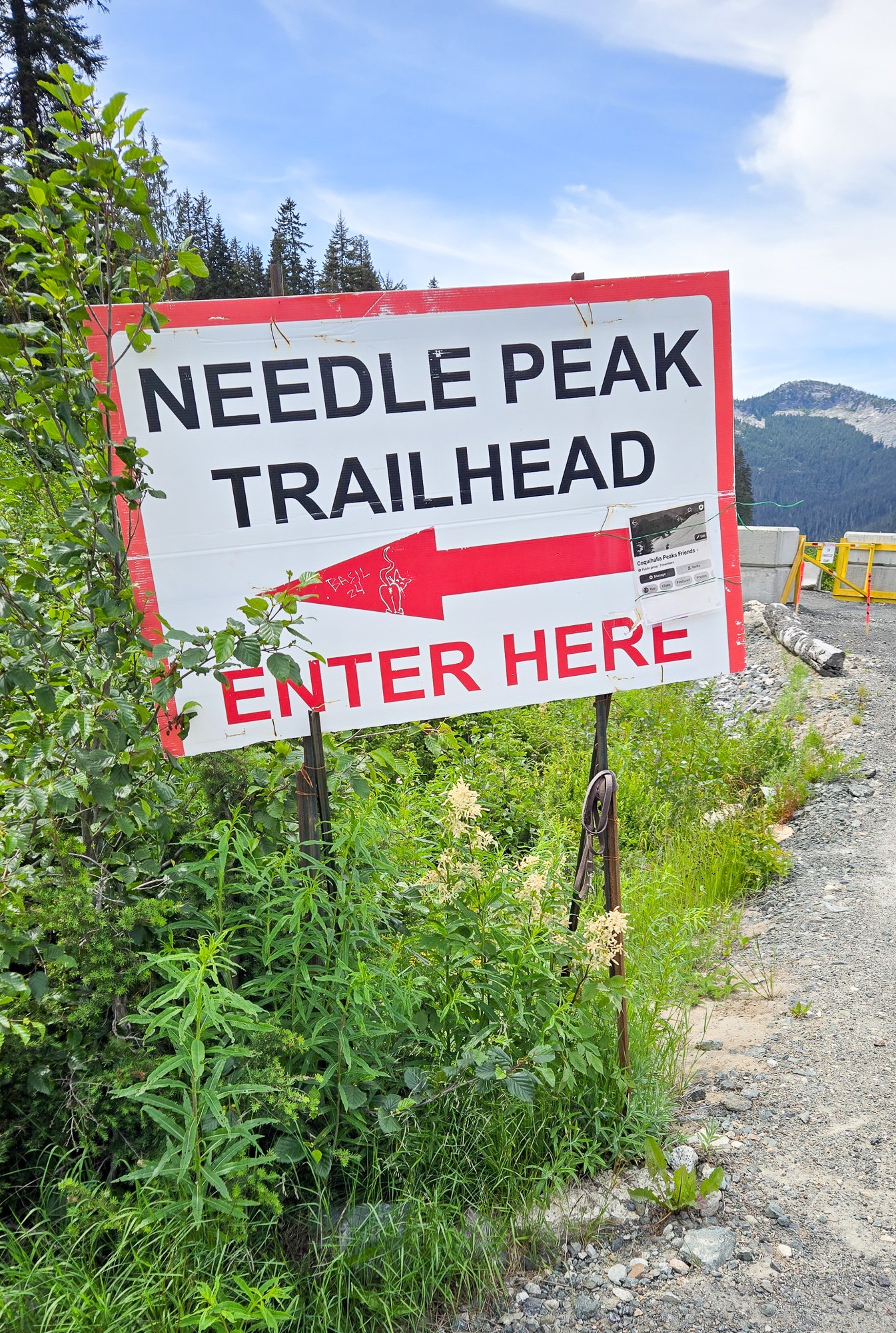
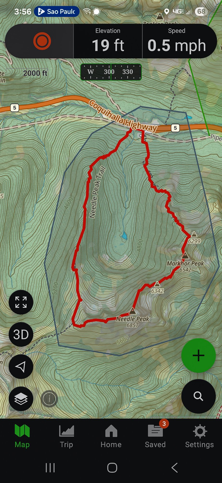
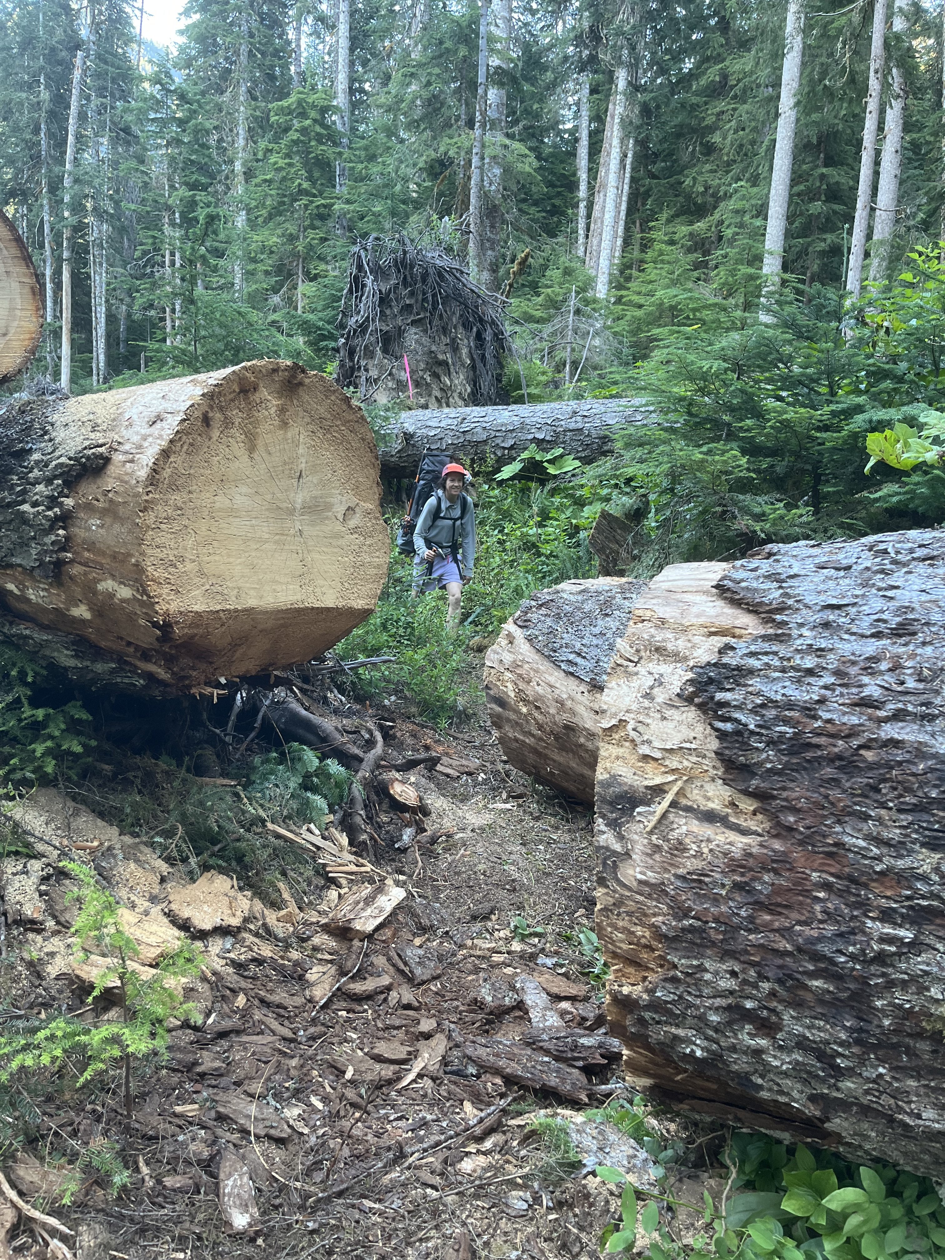
Trip: Markhor and Needle Peak - Traverse Trip Date: 07/07/2025 Trip Report: I am too behind on everything right now to write much, but I figured some of you may be interested in a lesser known romp across the valley from Yak Peak off the Coquihalla. It is quite the scenic and reasonable outing for the mature mountaineer, but I think most would enjoy the lovely ridgeline between Markhor and Needle Peaks. It starts with a steep grunt up the climber's trail up Markhor, with expanding views of Yak Peak across the way: Within an hour or two, the summit of Markhor comes into view, with nothing more challenging than some exposed class 3 standing between the car and the summit: The view expand greatly, with the shapely Needle peak beckoning across a kilometer (we're in Canada, eh) or two of ridgeline: The bugs were a bit on the bad side so I didn't waste much time picking my way down Markhor to a rap station and fixed line which greatly aided the descent down a slabby section. I wrapped a prusik around the thin line which was a nice hand hold as I slid it down and scrambled lower. Here's looking up at the slabby bit below the summit of Markhor after clearing it: And then the really good stuff lay ahead. Always scenic, often exposed, sometimes a bit on the kitty litter side, it was nonetheless "distinctly alpine and a pure joy" to quote Fred from some peak or other in the North Cascades (Logan?). It was usually pretty easy, although a few sections edged into exposed 4th class where a fall would end very badly: I caught a glimpse of another couple behind me as I scrambled along: And soon was on the summit of Needle, alone with the festive summit register: The bugs here were terrible as well so I didn't stay long, mosying down the well trod Needle Peak trail that was very scenic the entire way. Yak Peak on the left and Markhor on the right: Partway down there was a nice viewpoint where I could take in the entirety of the Markhor to Needle ridge traverse: And soon was spit out at the well marked Needle Peak trailhead: I think it took me about 5-6 hours for the loop, including stops, which was a bit longer than the drive, thankfully. The only bummer is that it isn't longer! Gear Notes: helmet and approach shoes. Brought a 30m RAD line to rap but fixed line in place on slab downclimb Approach Notes: Park at Needle Peak Trailhead and find flagged route up Markhor to the east, starting in pipeline swath. Descend well marked Needle Peak trail after traverse
-

[TR] Gunsight - E and SW faces of Middle, S ridge of South 07/13/2025
JasonG replied to JonParker's topic in North Cascades
Quite the difficult adventure climbing way back in there @JonParker, way to keep it safe and somewhat sane! Less sane is solo broken ankle dude. To say he won the lottery is putting it mildly. Good on you guys for helping redeem what likely would have been a very bad outcome. - Yesterday
-
 Absolutely fantastic trip report and photos. I'm hoping to visit the Gunsight range later this summer. I noticed that you mention that you found two climbers who "wanted to check out the Gunsight range using a rope team larger than 2 for the Chikamin." Is the Chikamin particularly broken up? I was planning on just one partner but maybe I'm missing something.
 -
 Just read your blog...wow what a great season!! You have been getting after it this spring. Thanks for the post.
 -

[TR] Gunsight - E and SW faces of Middle, S ridge of South 07/13/2025
Grant789 replied to JonParker's topic in North Cascades
Very cool seeing gunsight getting climbed! Nice work and glad you all were able to get the hiker a rescue! -
We went up to the right of that arete under the col: Tim scrambled it and dropped a rope to Steve and I and we were glad for it!
- Last week
-
I haven’t been to that area yet, but it looks incredible!! One of these trips I’d love to invite myself with you 3 (+ Kurt). Ya’ll really seem to enjoy your time up there in good style.
-
 Dude! That was awesome having our last person we saw on trail give us some picket stoke. I appreciated the additional reminder about choss from pulling rope, it was a particularly cautious choss dance up there at times. Also, stellar work on that trail, we were really admiring all the hard work that went into it as we marched our wet feet home on blissfully easy trail miles 🫡 🙏 We’ve got some schemes and dreams, but who knows, the route serendipitously chose us the week before we went out this year. The more we explore the nooks of this range, the more options seem to arise! I’m always astounded by the sheer magnitude of ridges and towers particularly in the northern pickets (look at this crazy tower!!). Each time we go to the pickets it’s overwhelming at first, but then we get enchanted and can’t imagine not coming back. This one was Umami 🤤
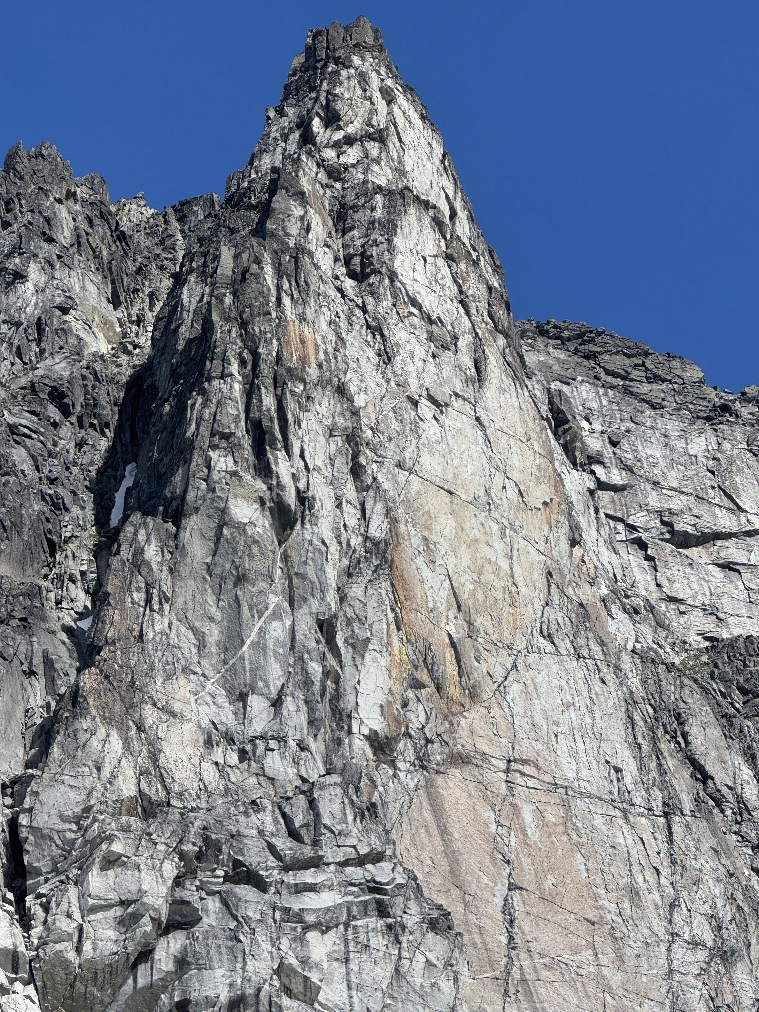
-
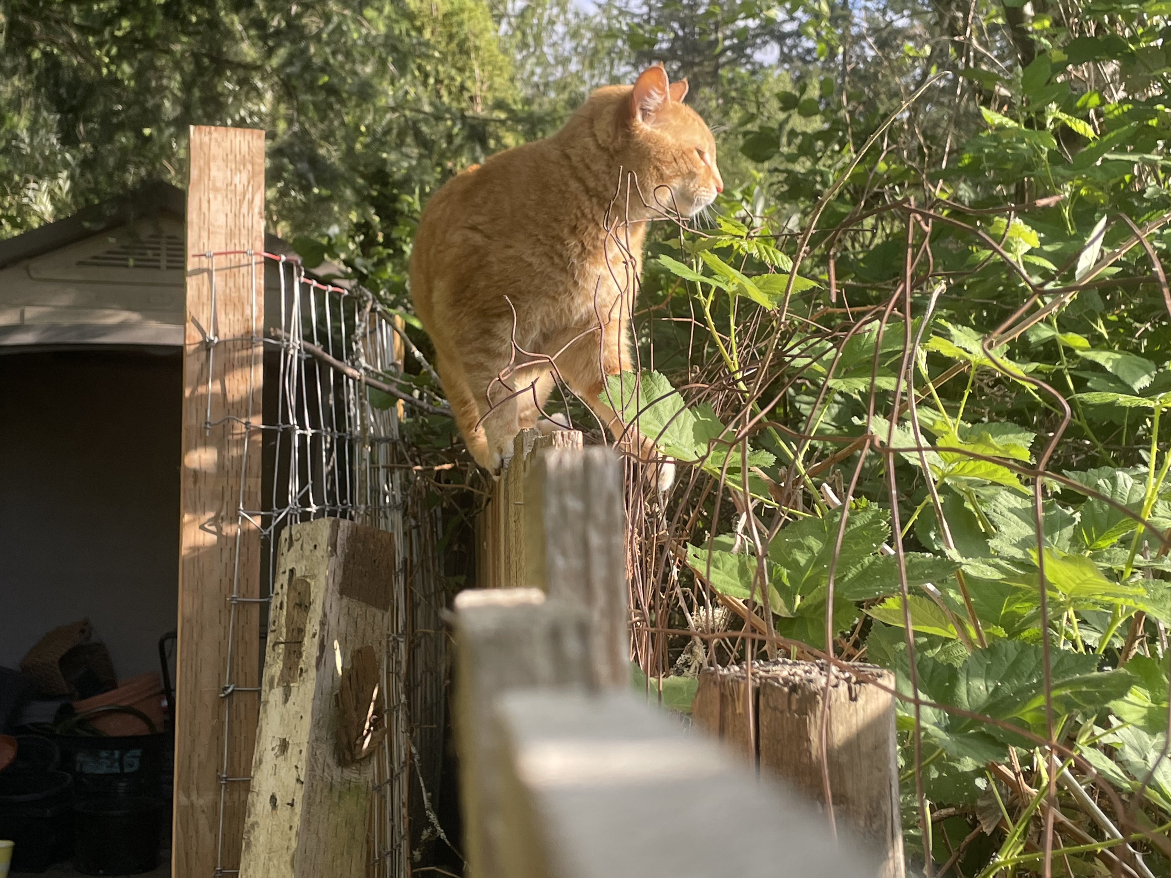
Thanks for the love ya’ll with the climb, and the kind words with Teemo. I think our pattern of traverses has got to be partly inspired by his tendency to walk and chill on fences.
-
 teson joined the community
 -
Yeah 5 people in the vicinity within an hour or two of the event, on a Monday at least 1.5 days from a road (for most). Would have been game over otherwise. While remote, the ptarmigan traverse does seem to be blowing up.
-
 Damn!
Damn! -

[TR] Mount Index North Peak - North Face 06/29/2025
Stefan replied to Lucas Ng's topic in Alpine Lakes
Good to see you out with someone Lucas! -
[TR] Gunsight - E and SW faces of Middle, S ridge of South 07/13/2025
Stefan replied to JonParker's topic in North Cascades
So let me get this right. You came across a soloist. Who was injured. By Sinister Mountain? And then by chance another two people come? Whoa. -
Holy moly pictures I love it!!!
-
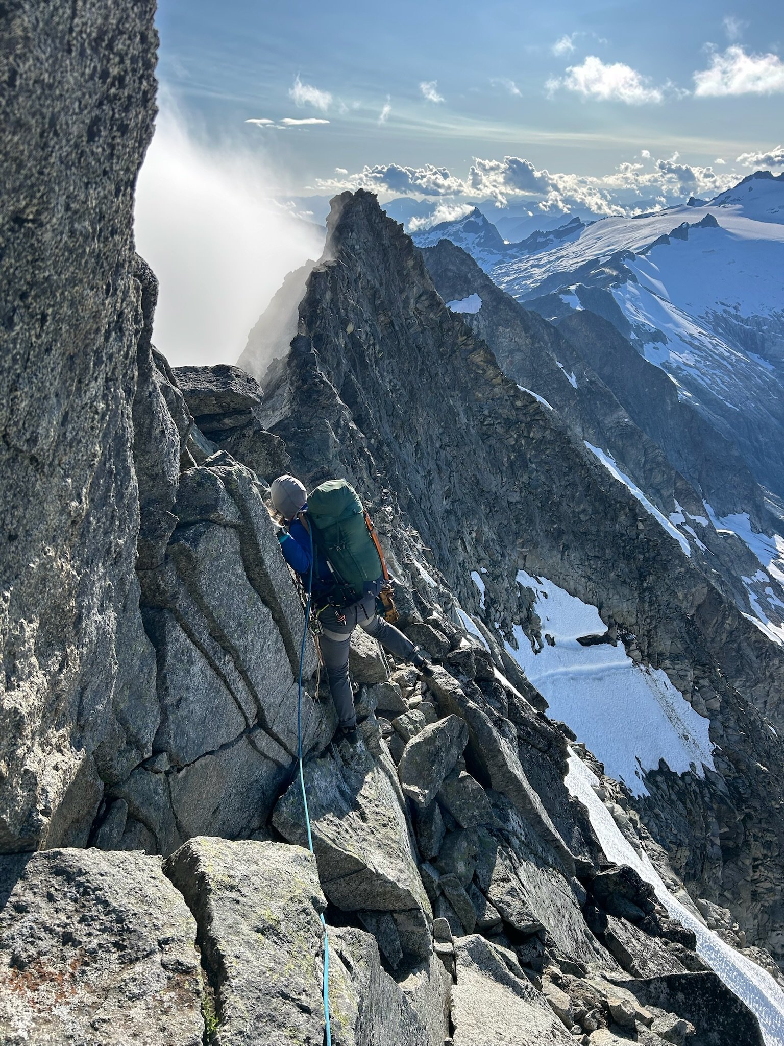
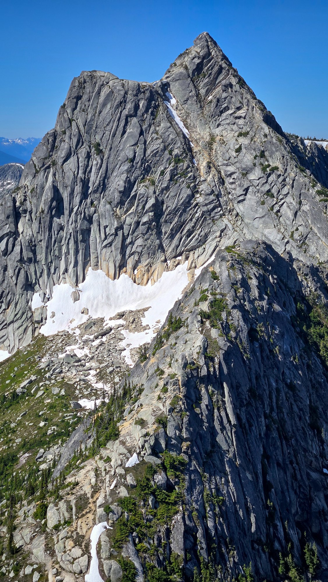
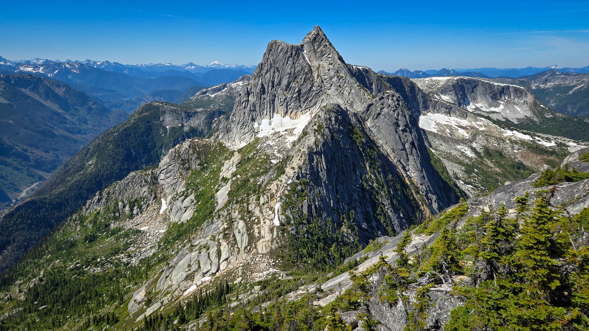
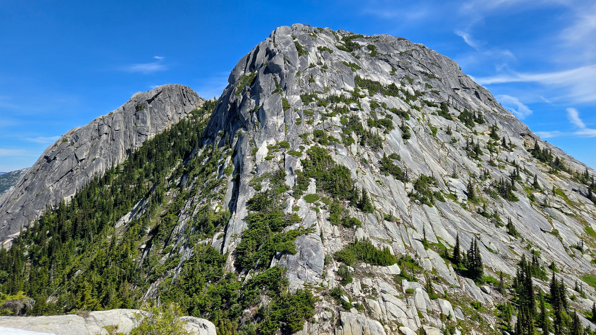
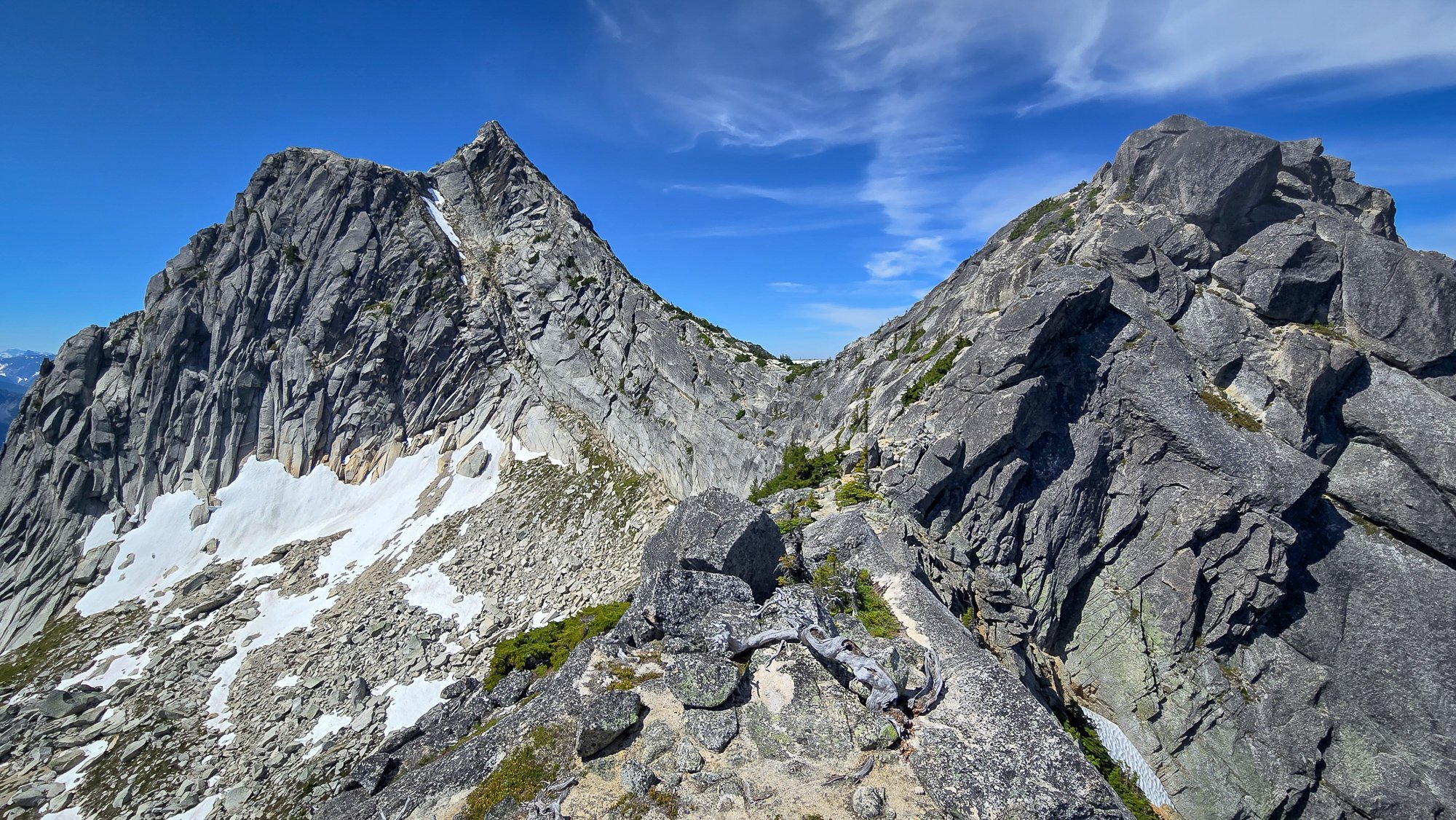
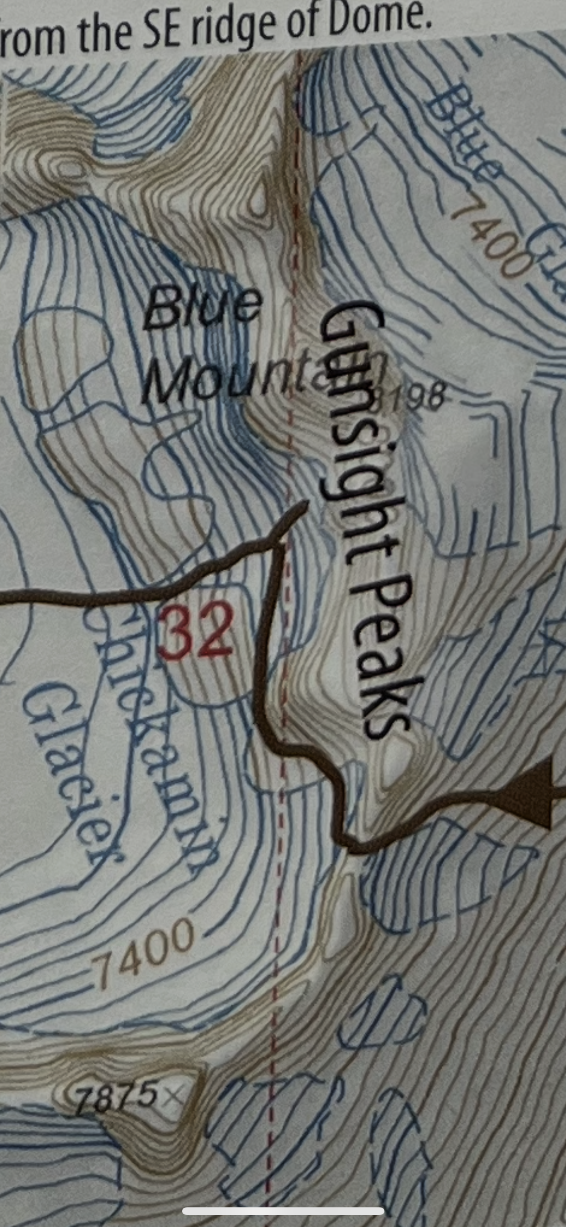
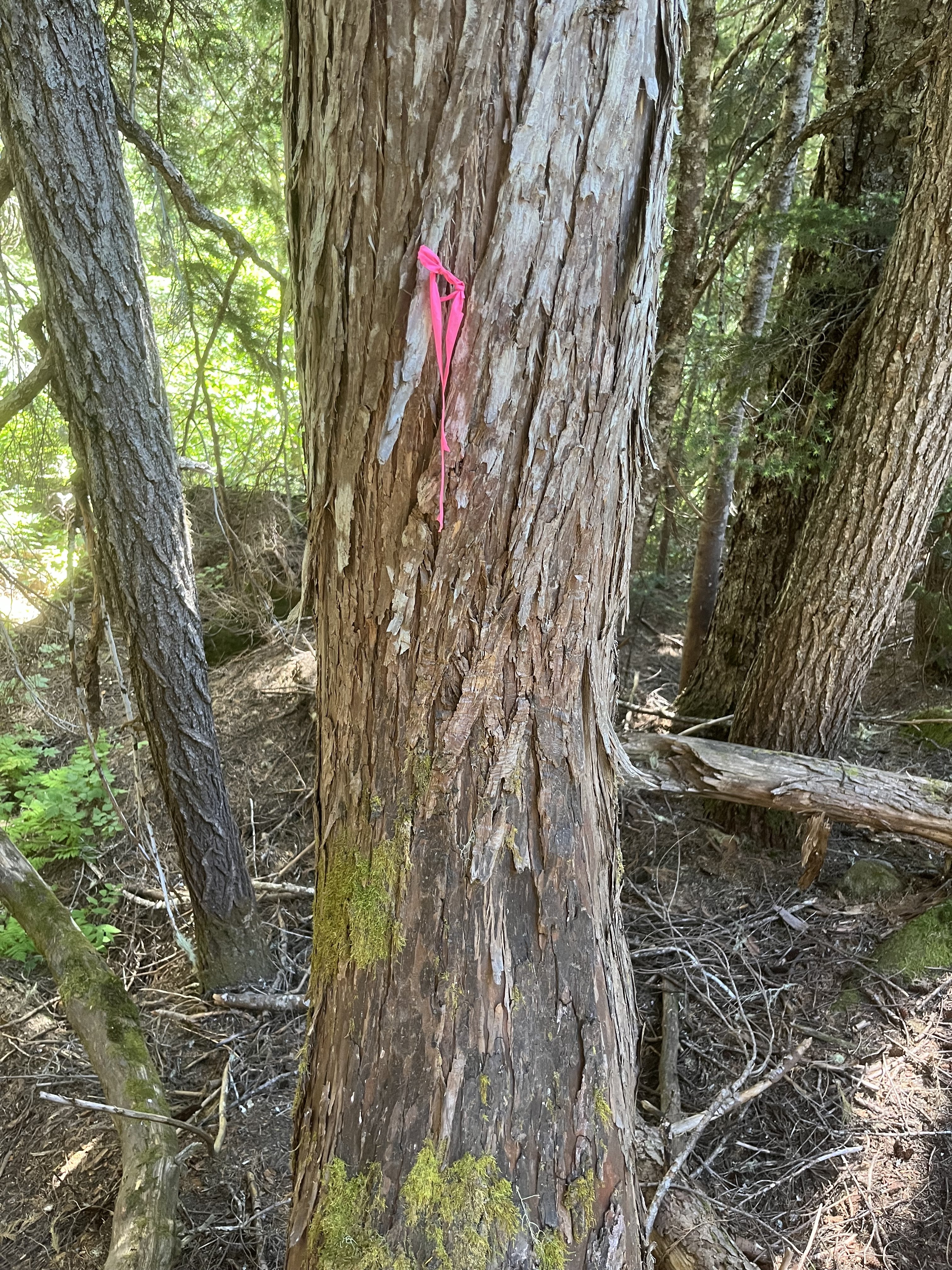
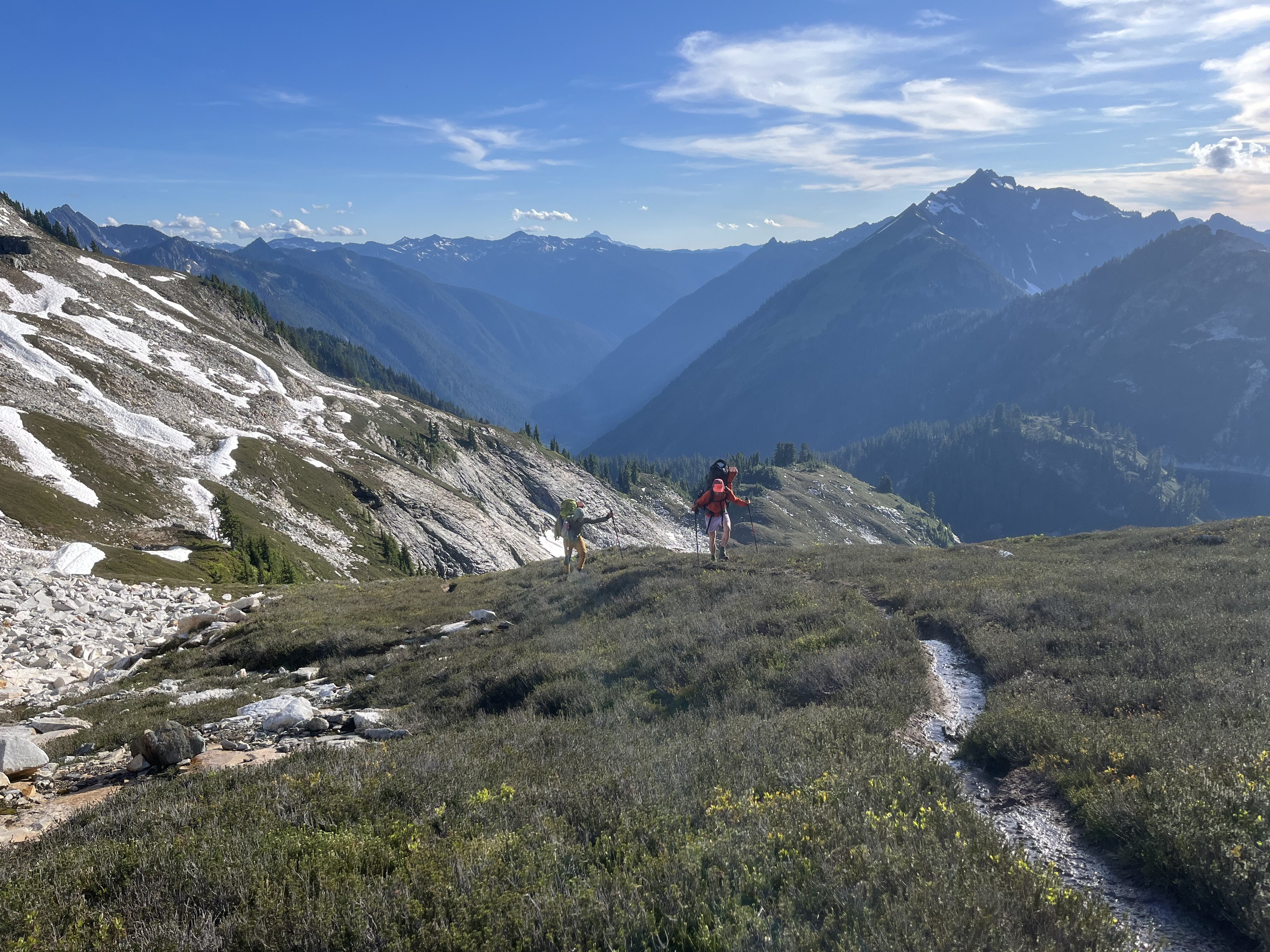
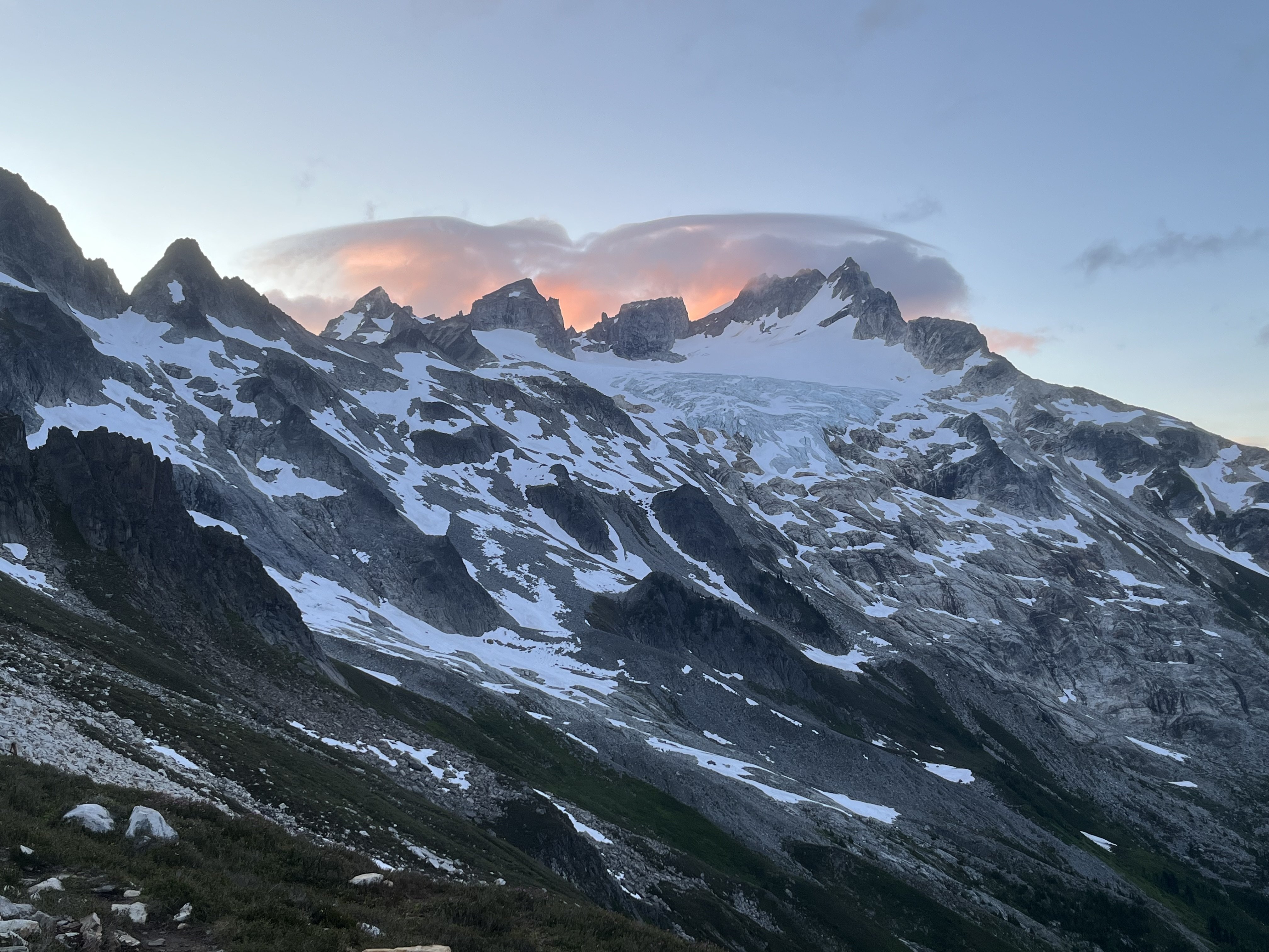
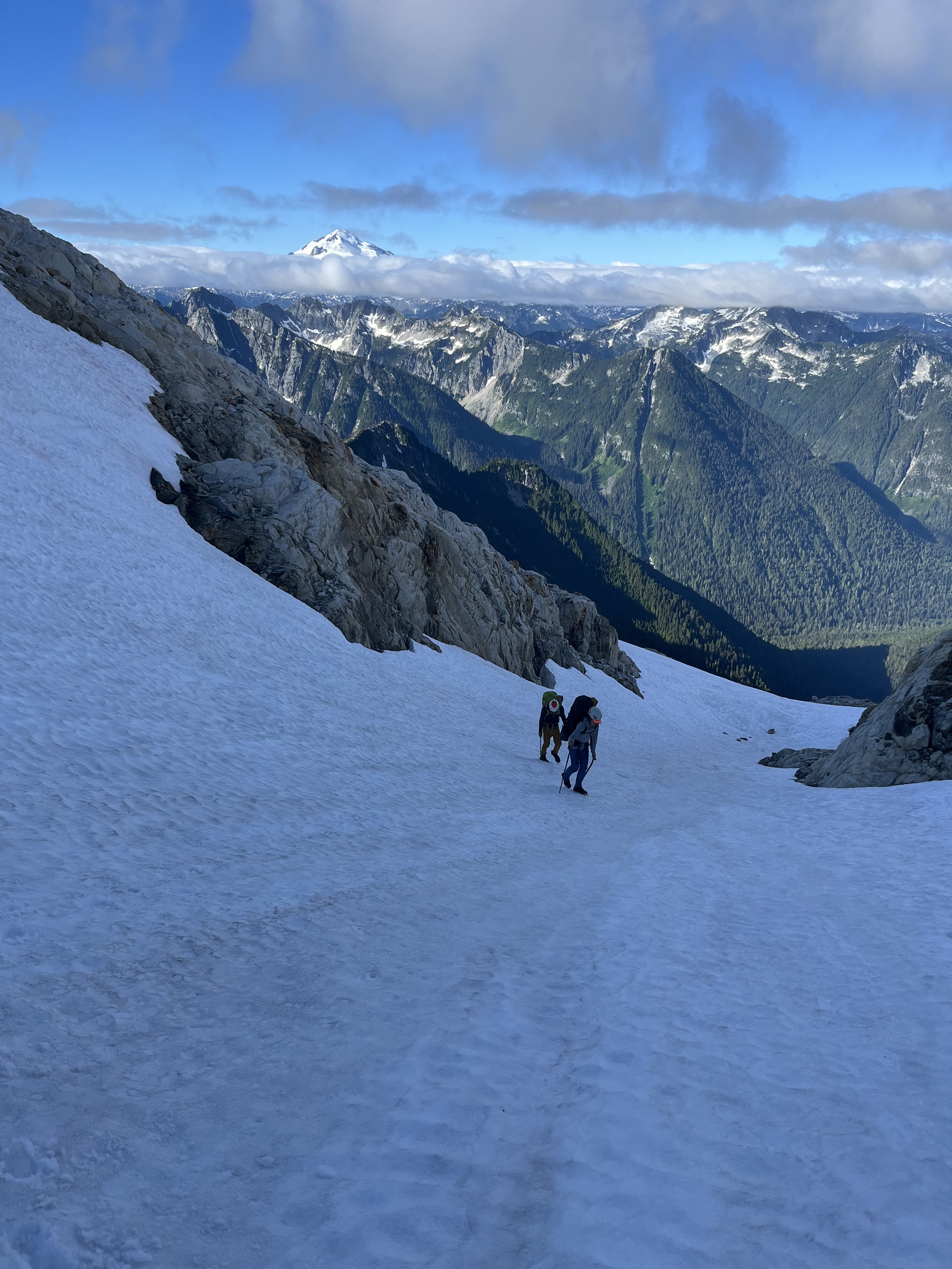
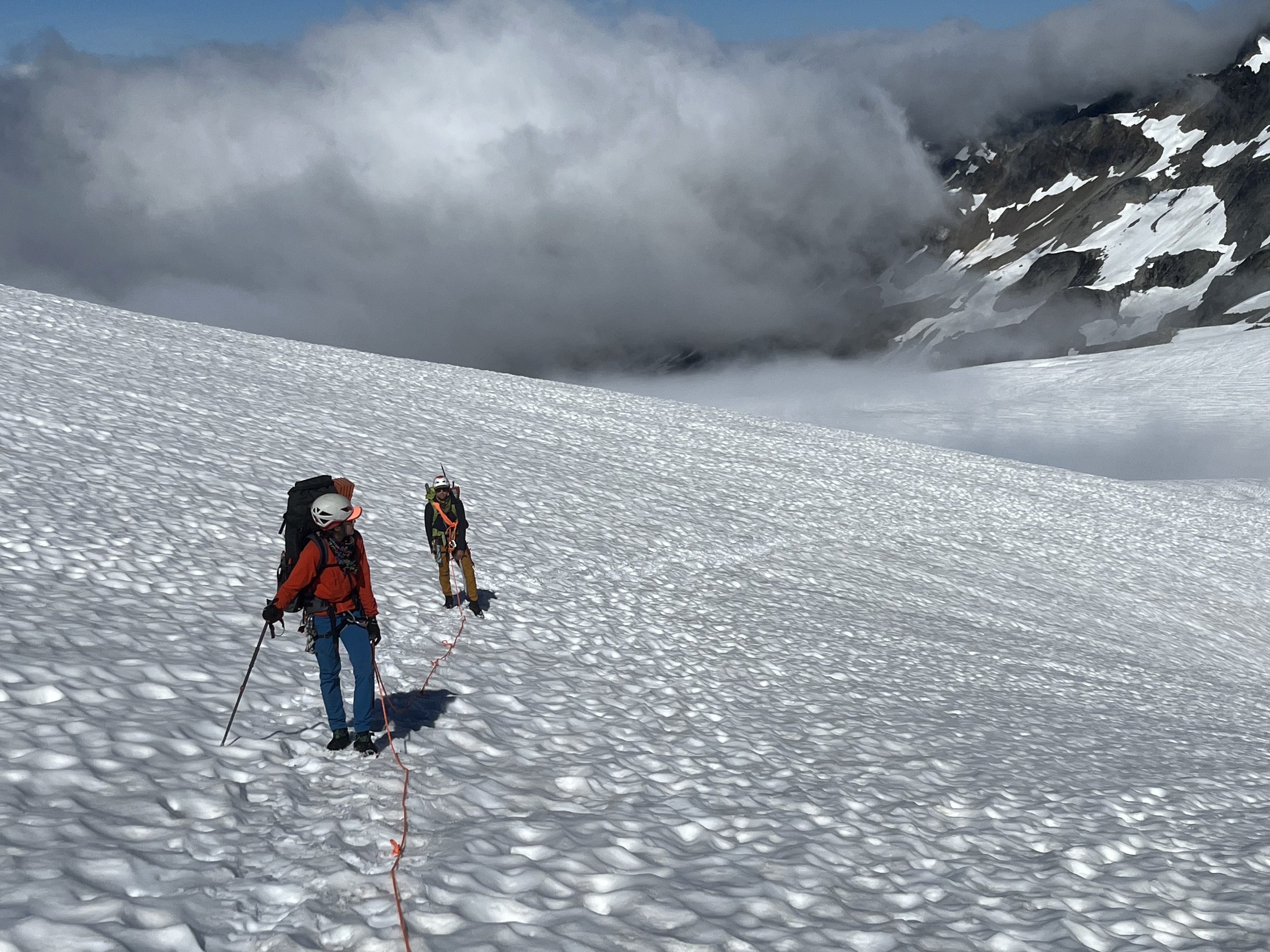
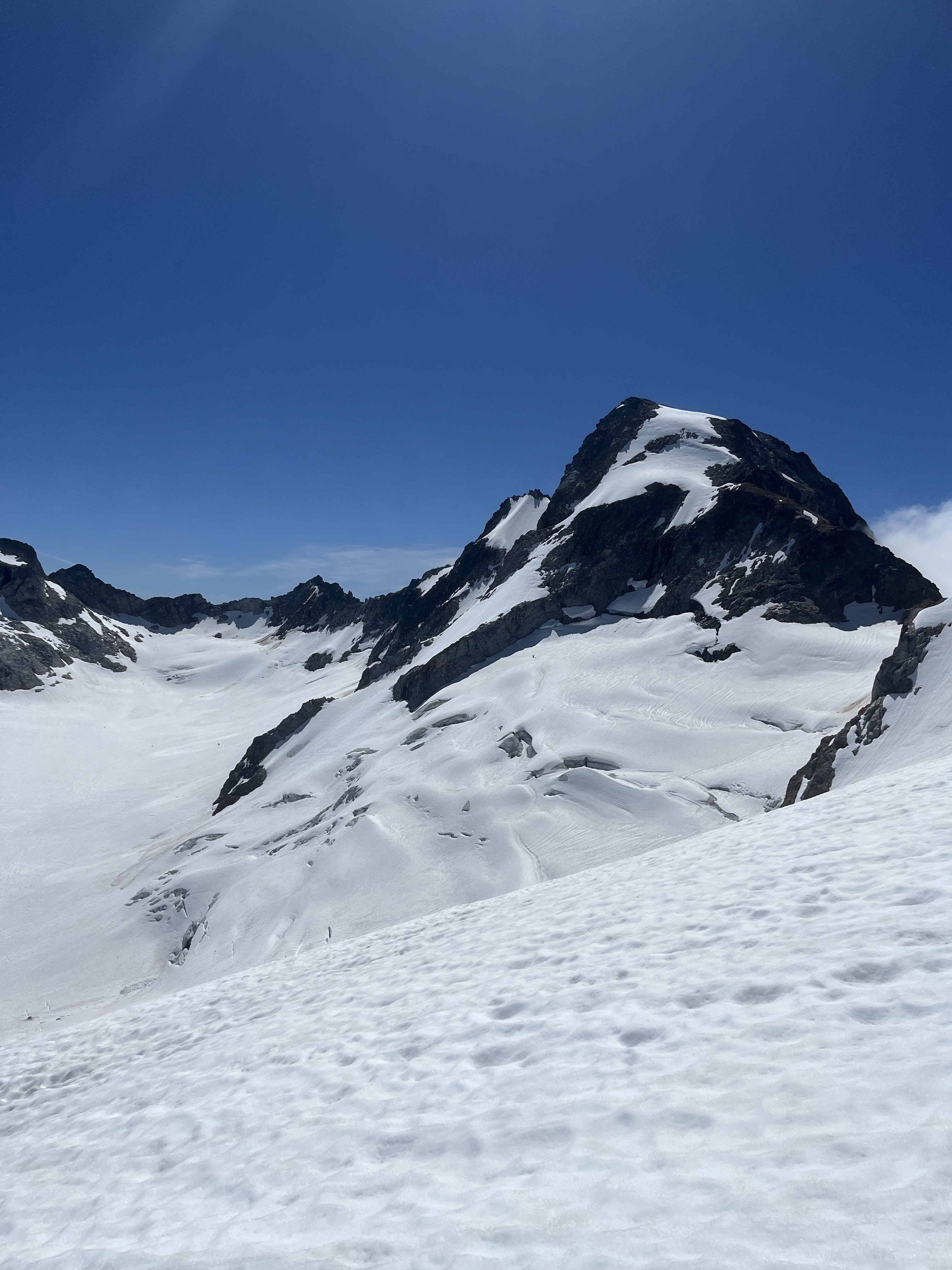
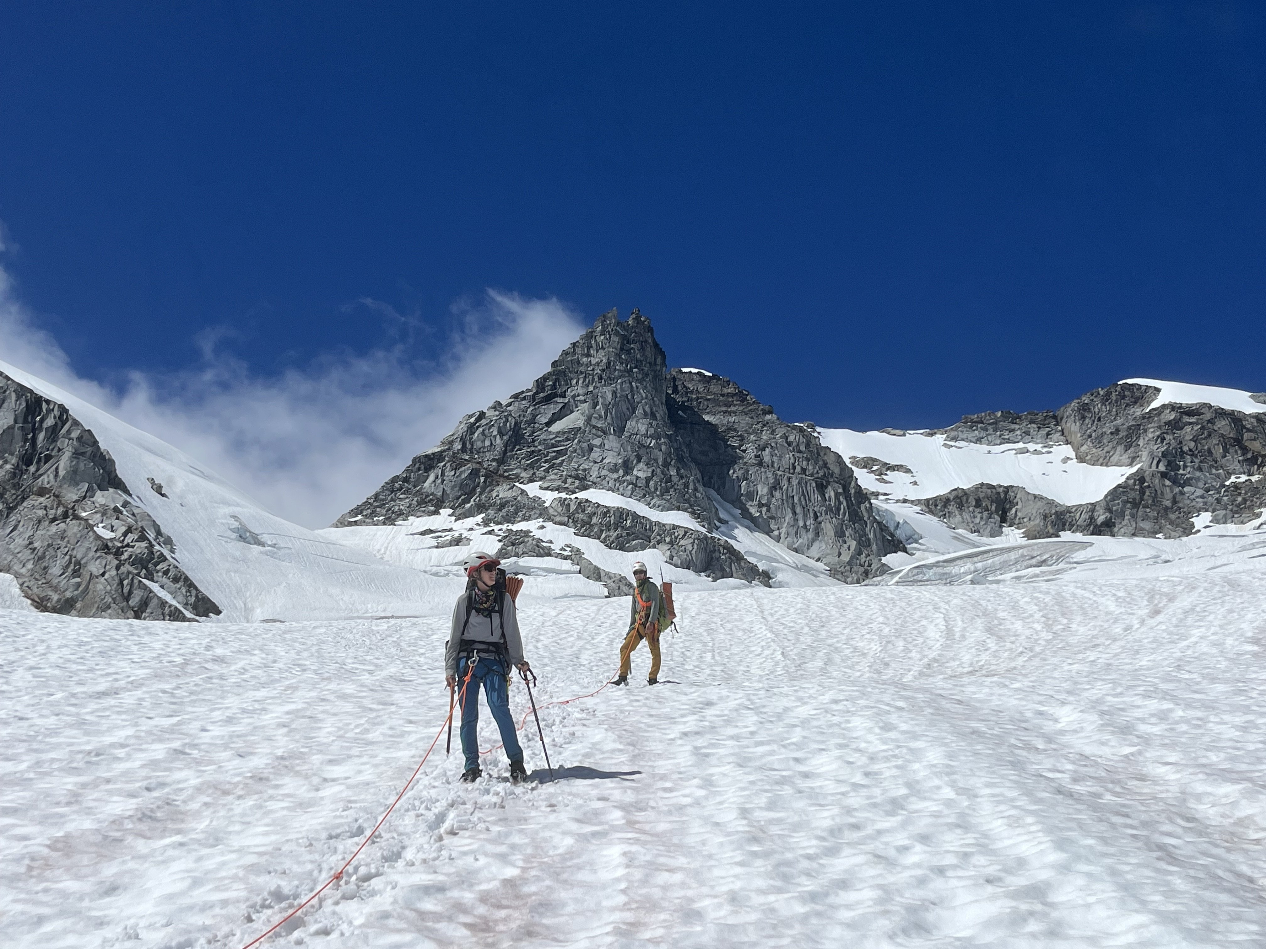
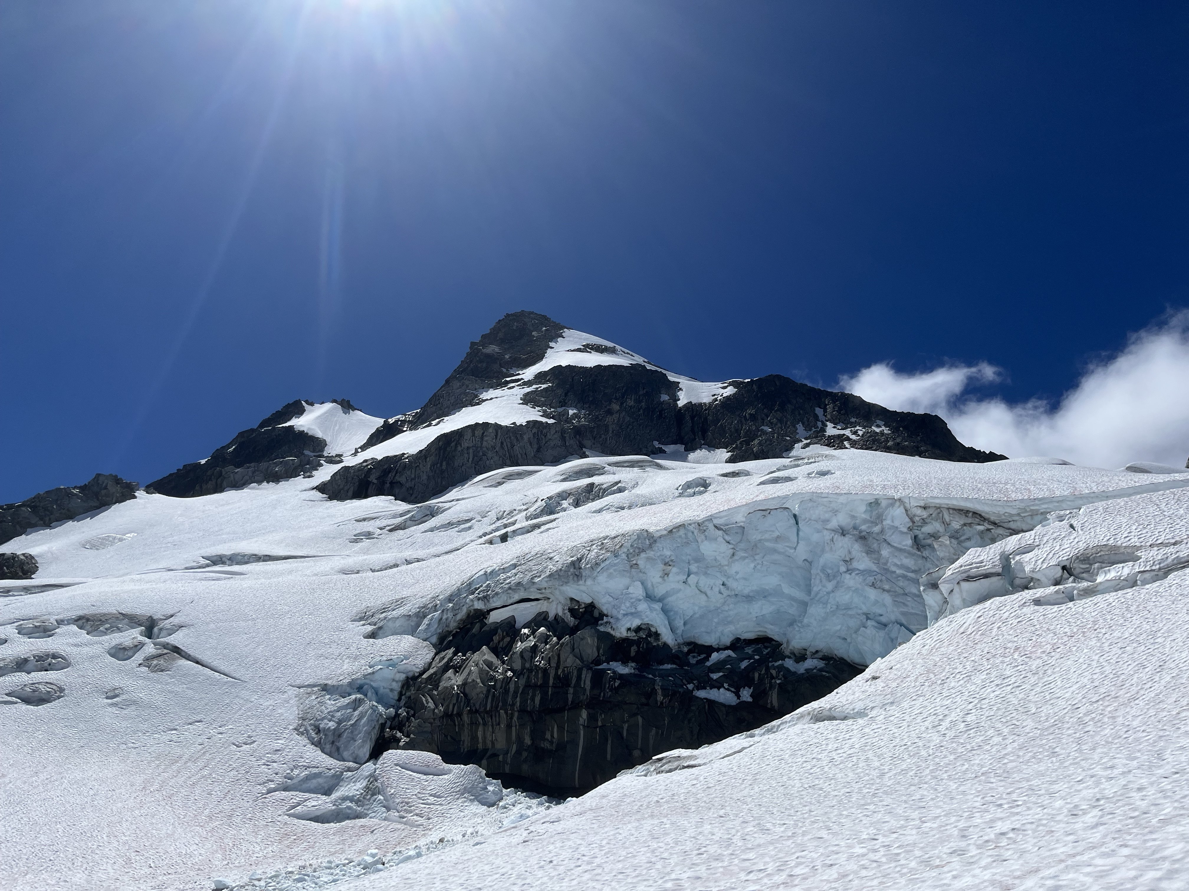
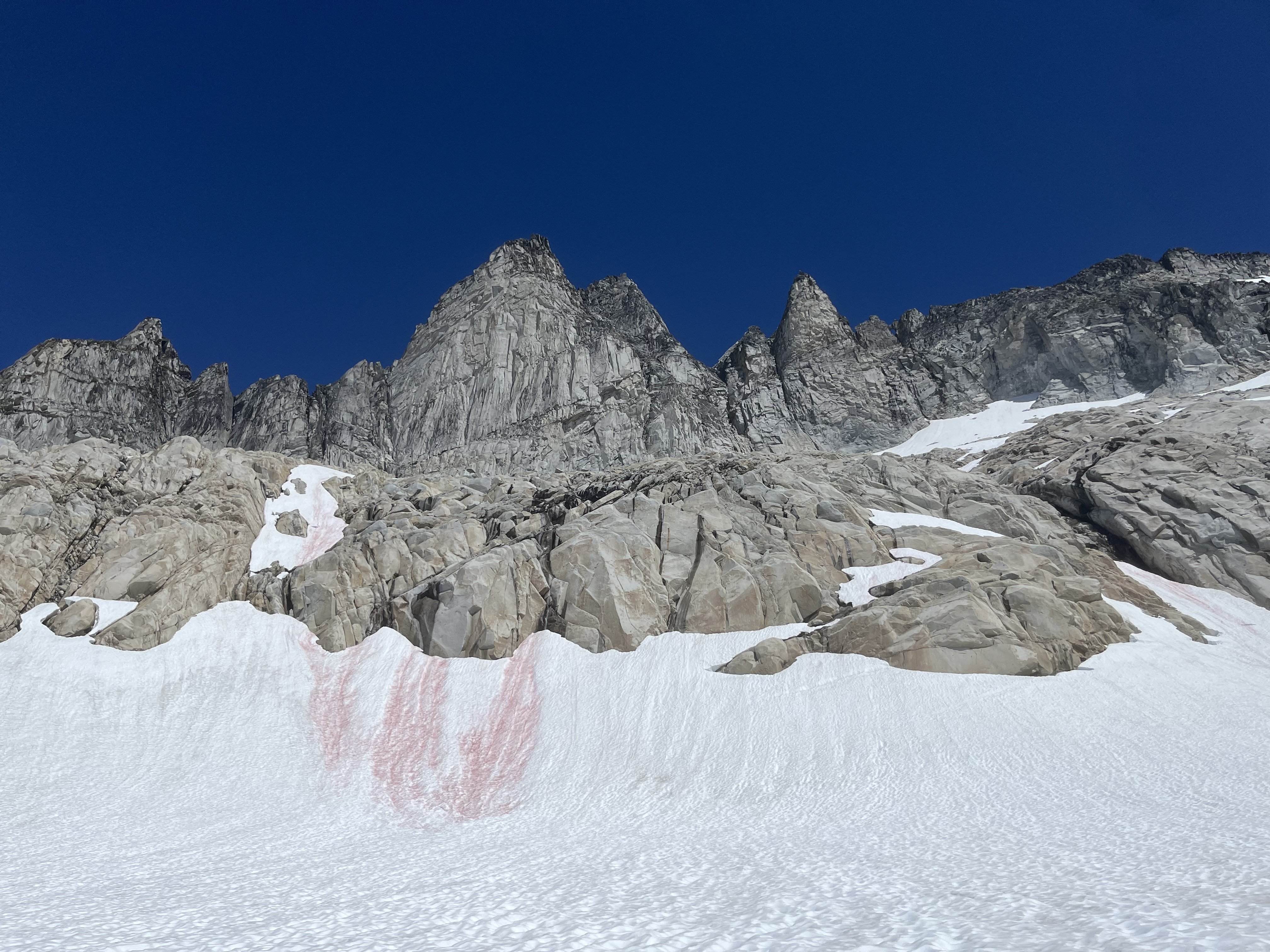
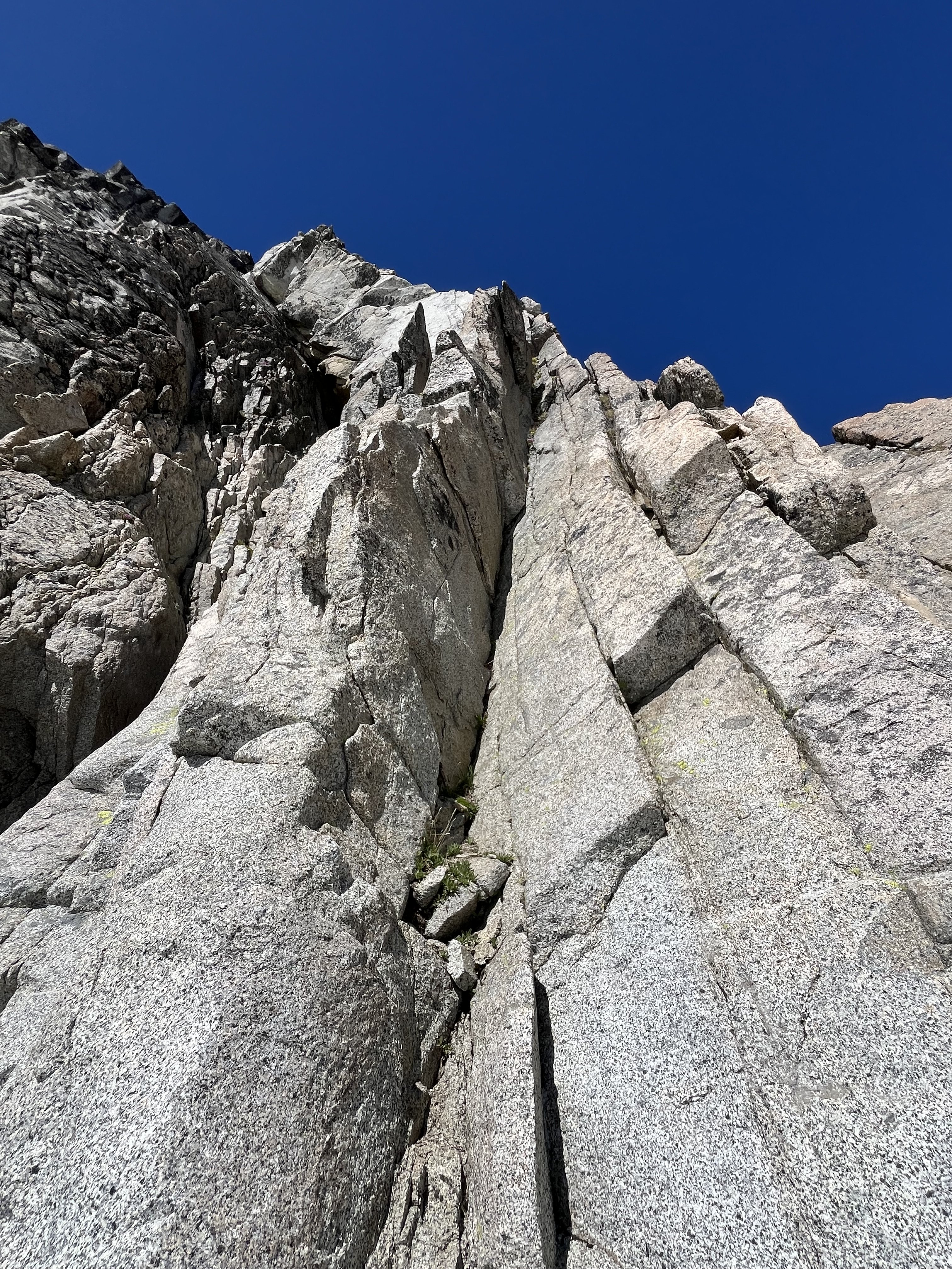
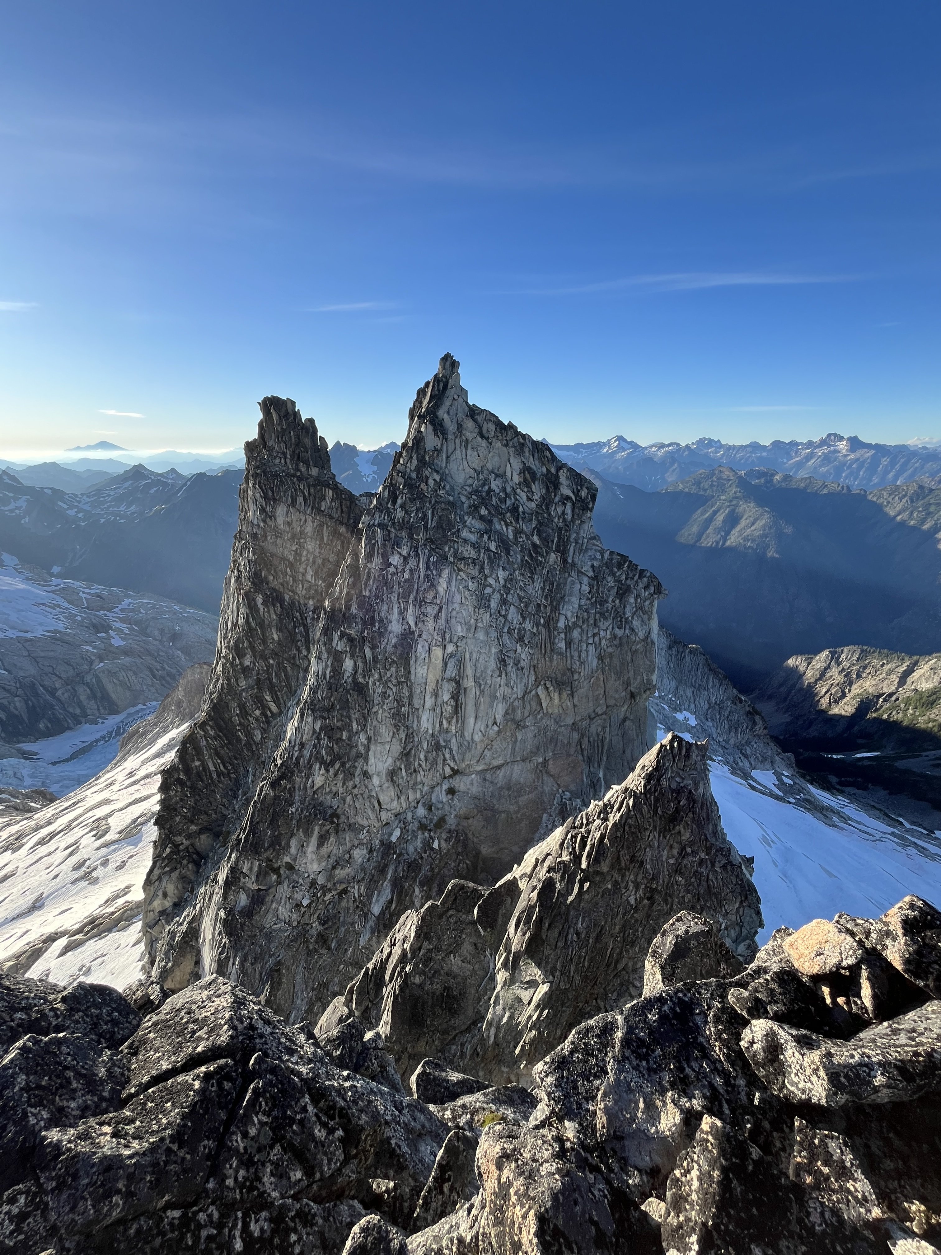
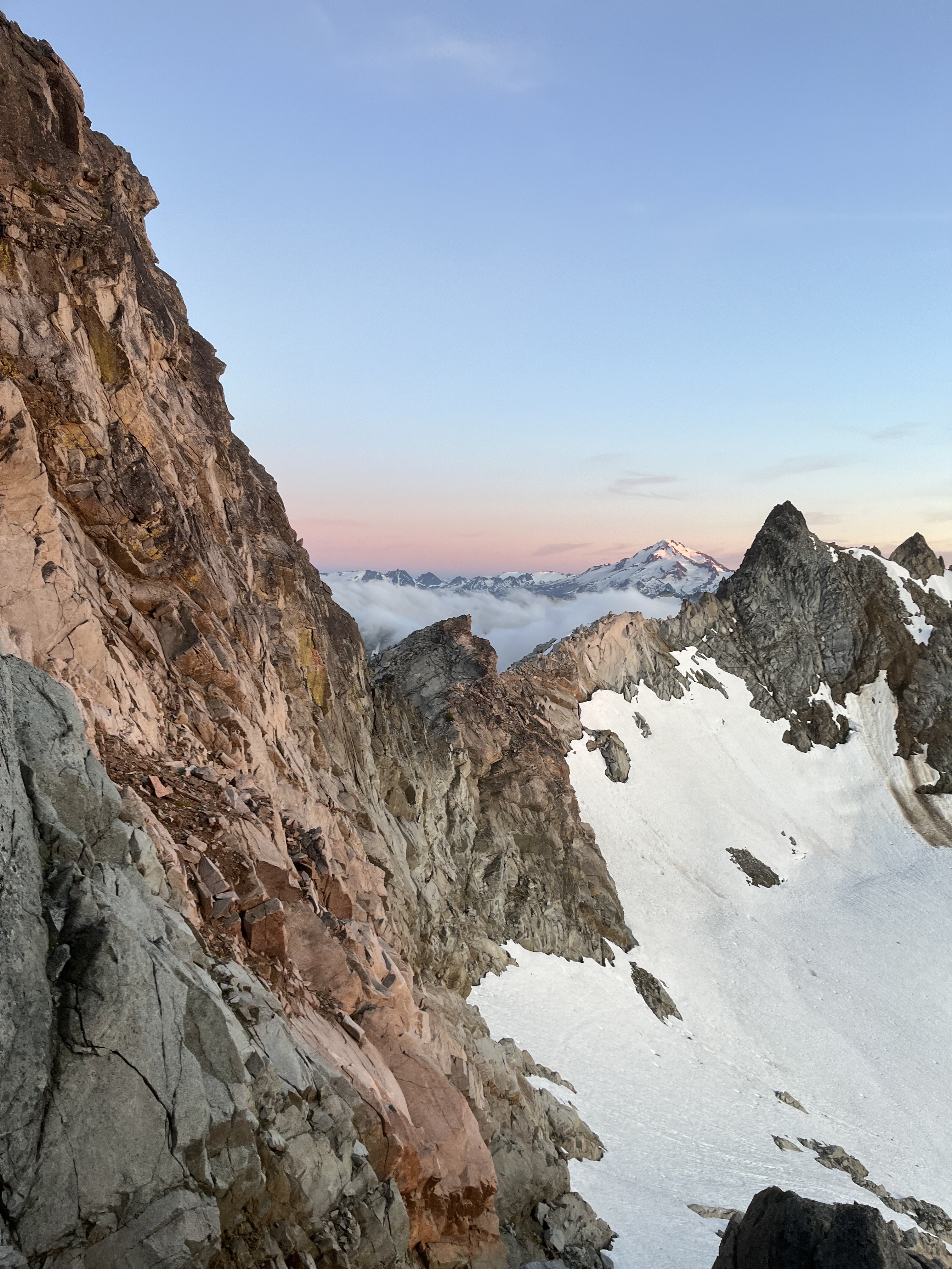
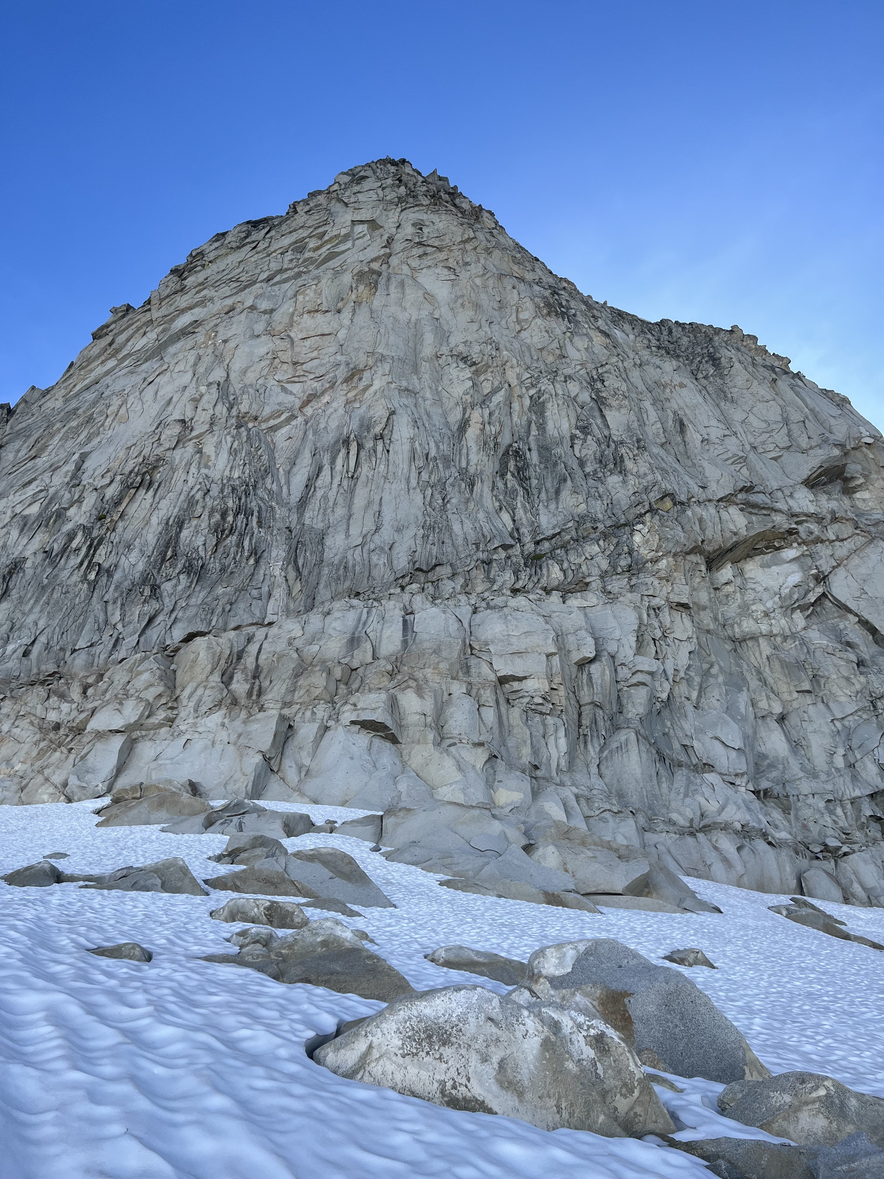
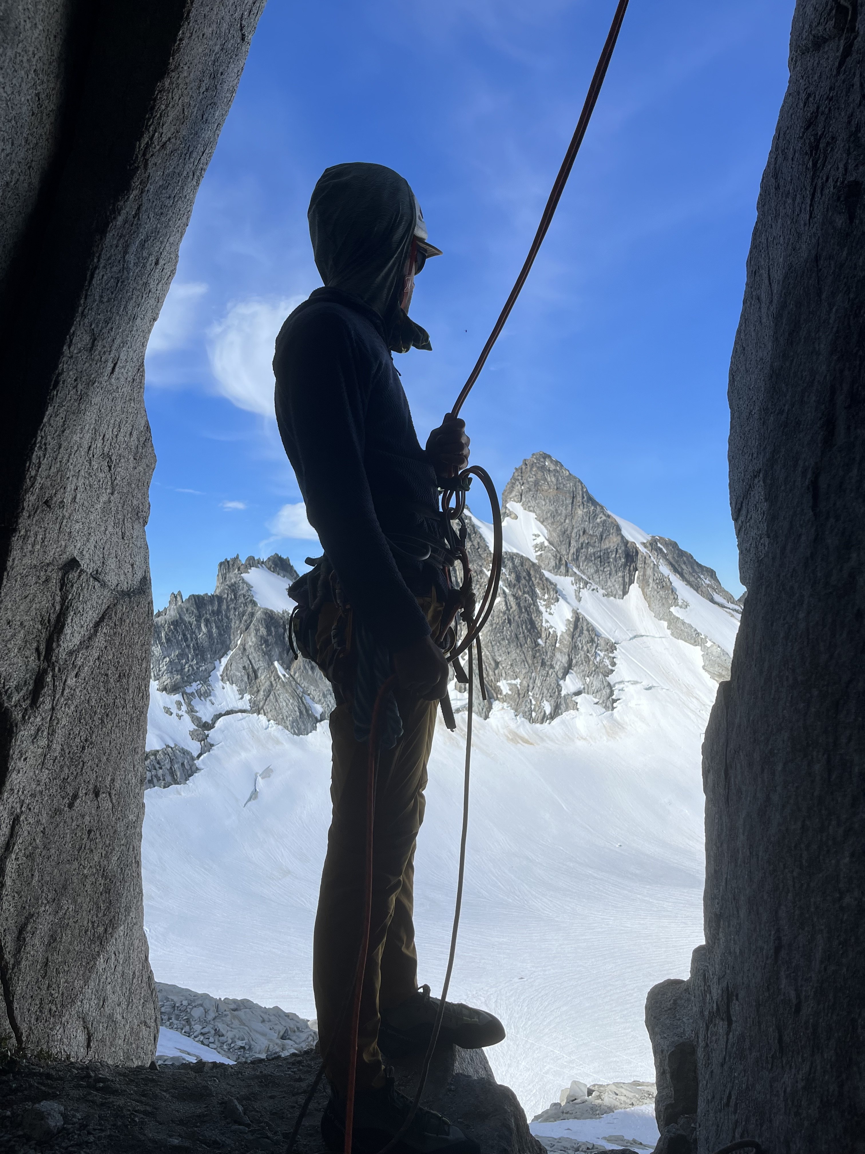
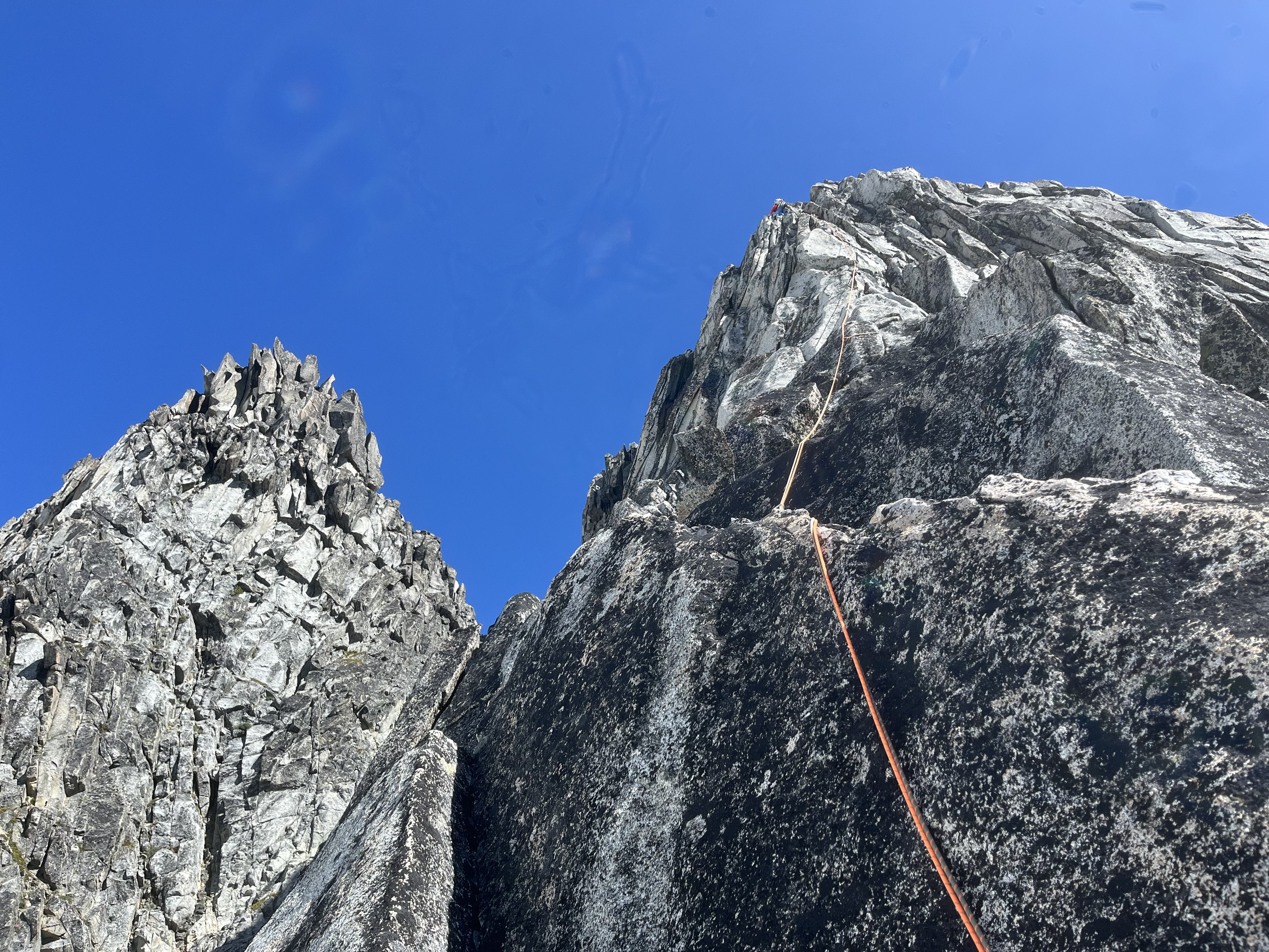
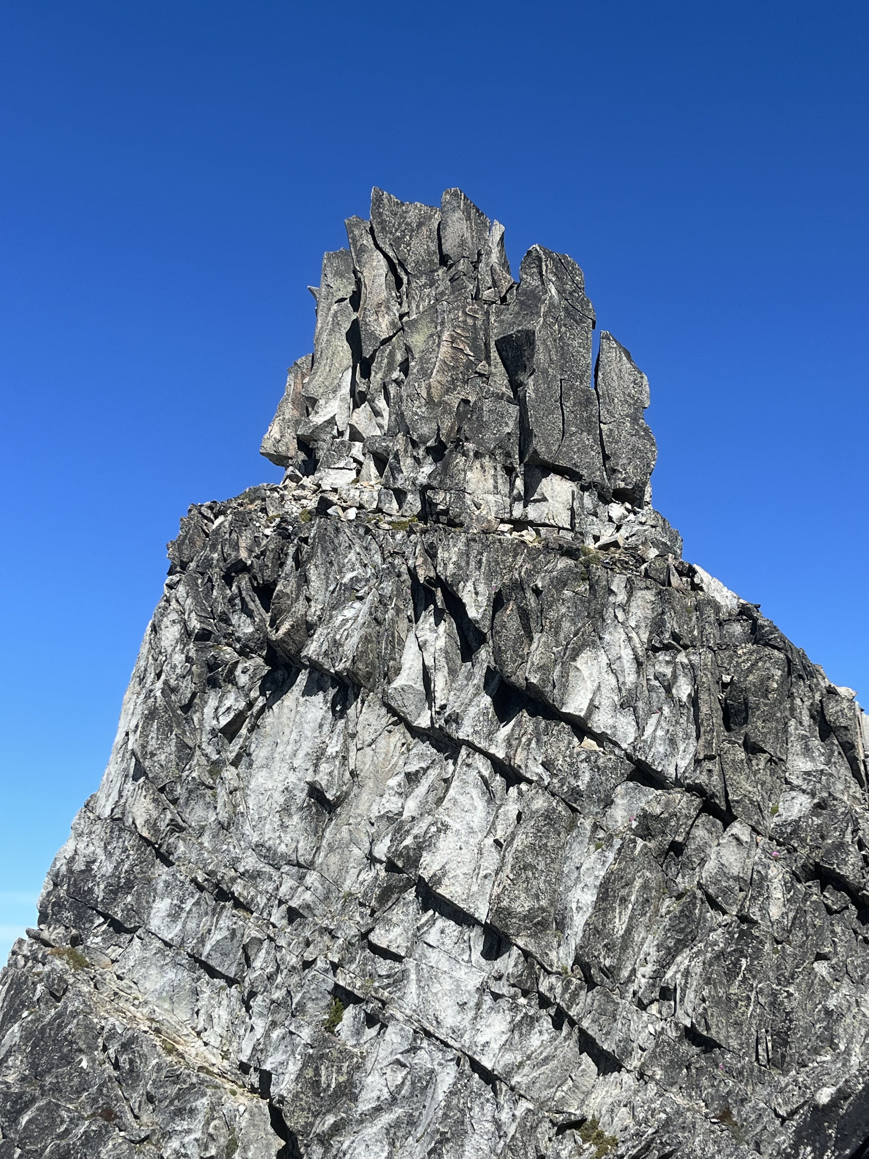
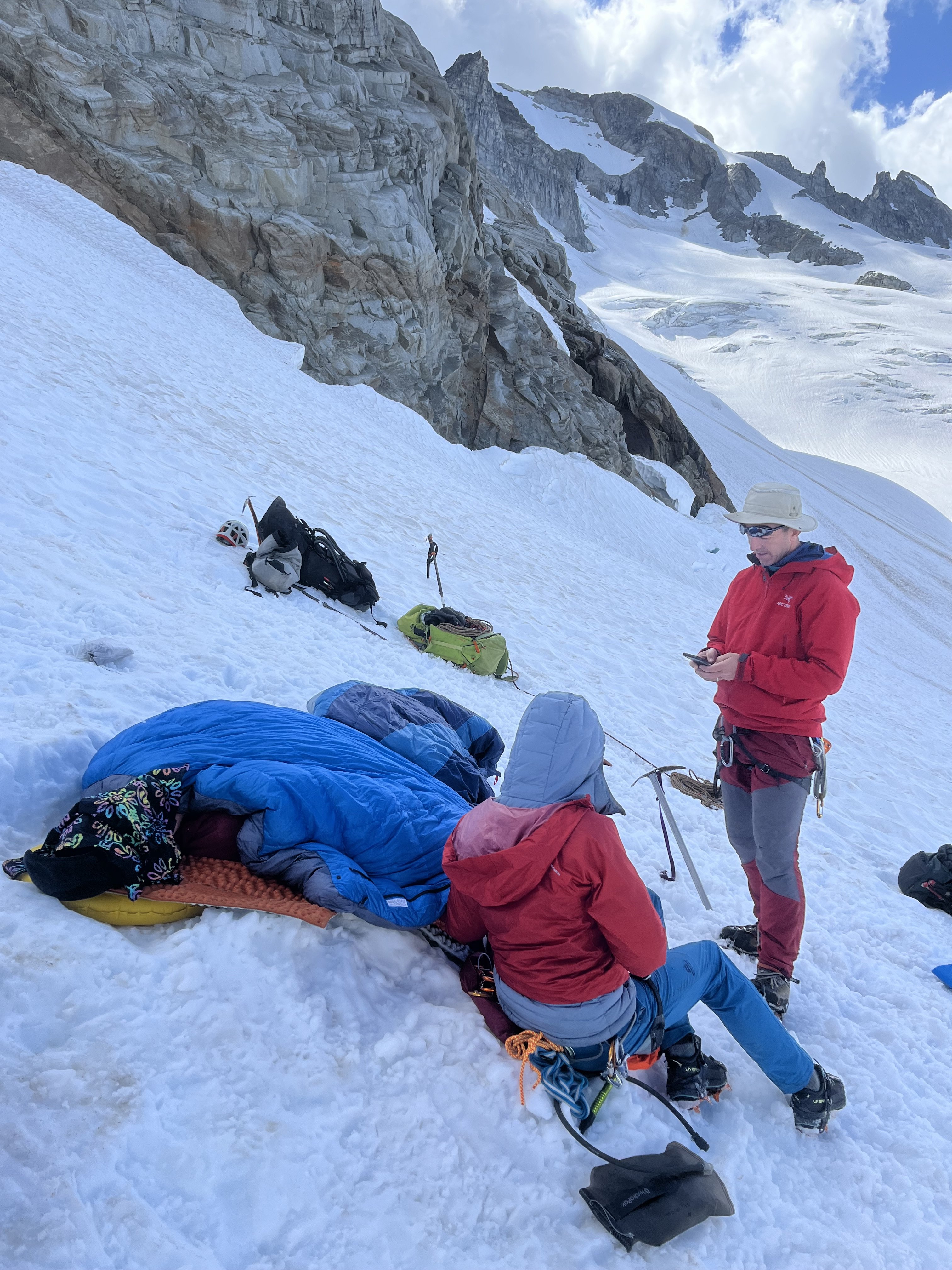
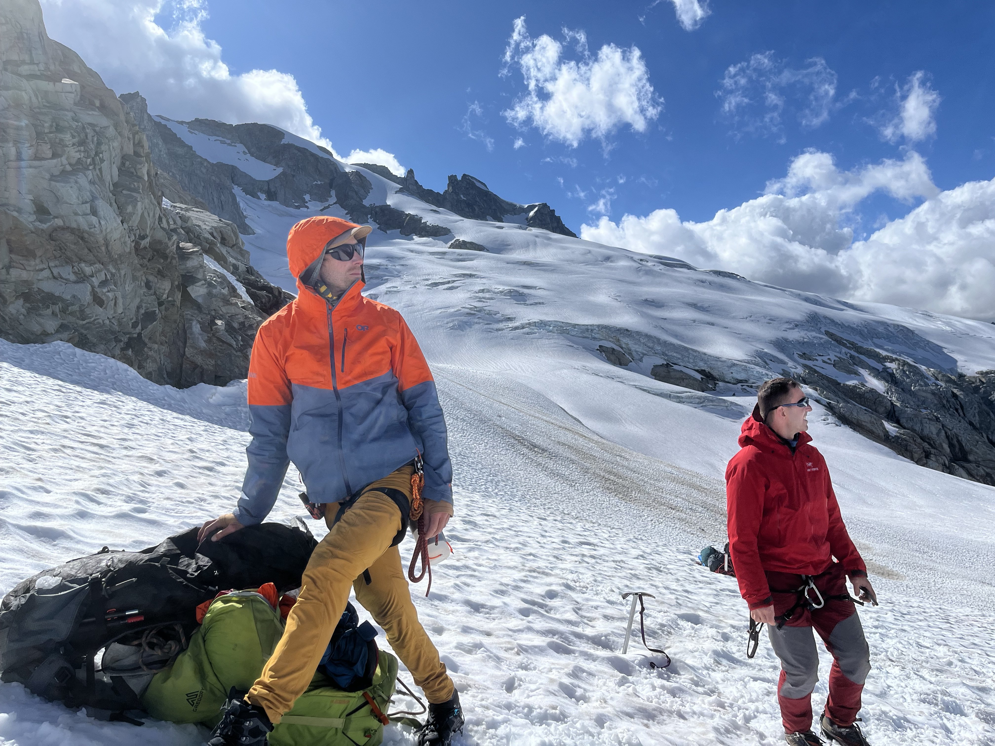
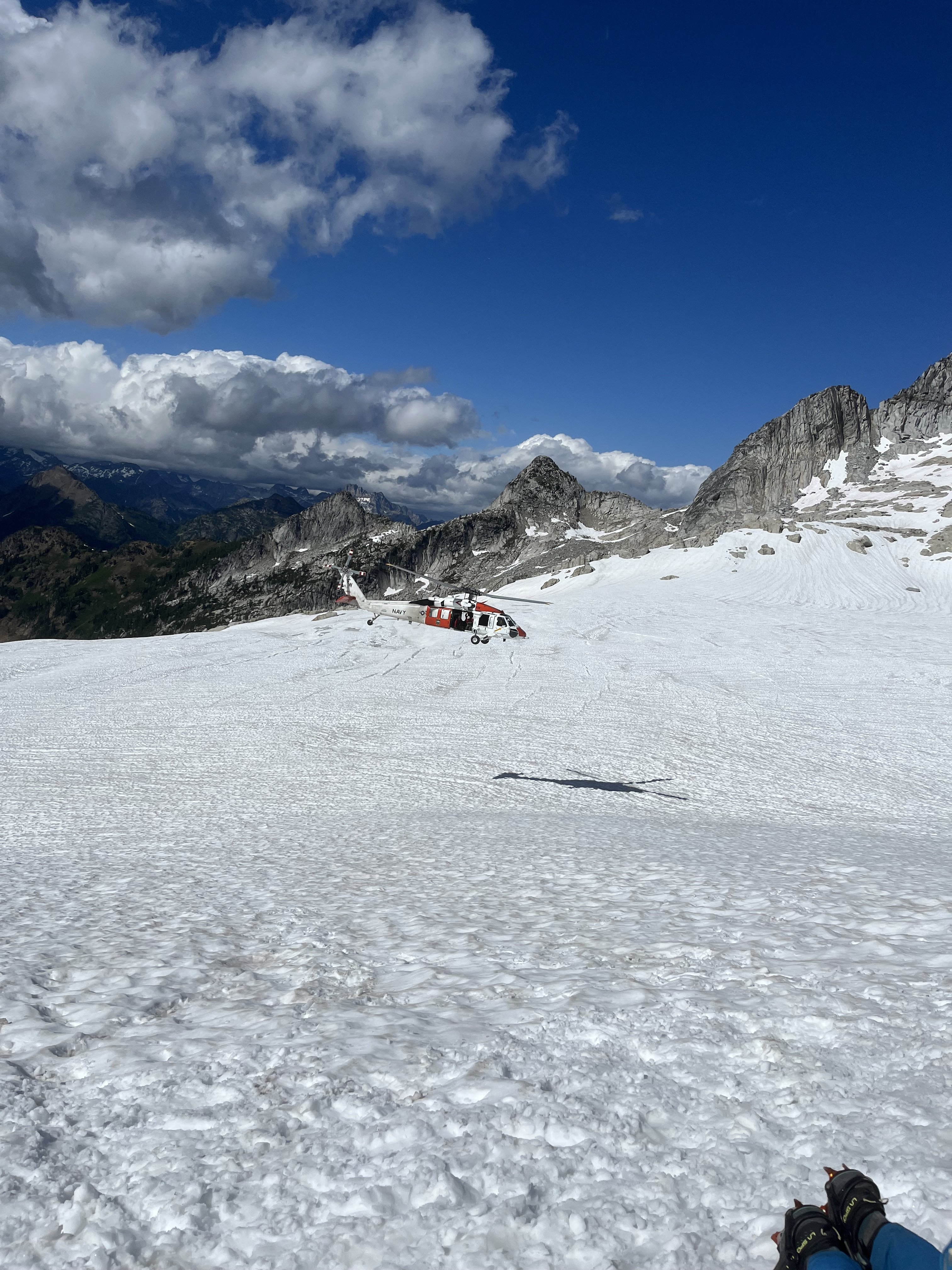
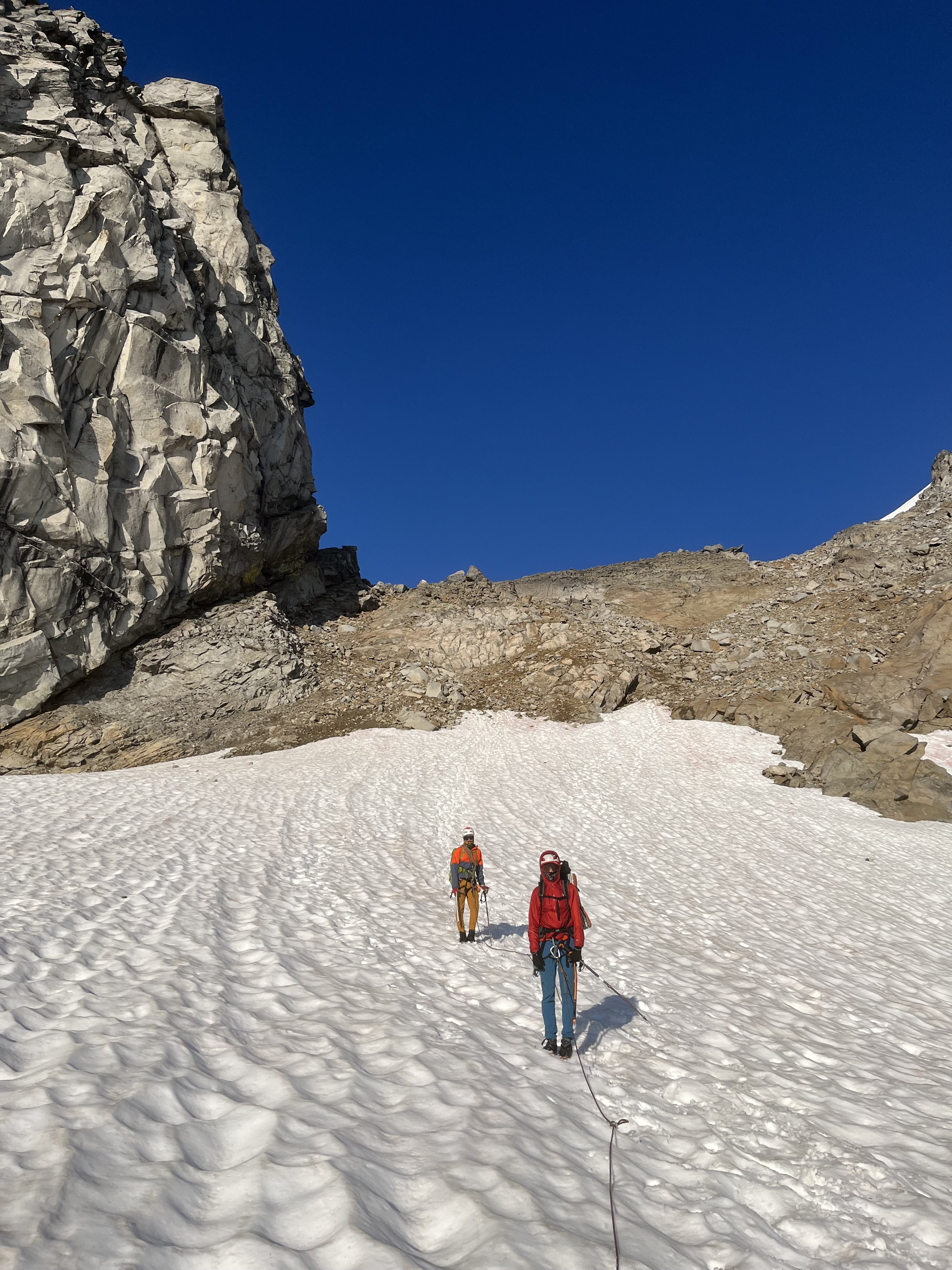
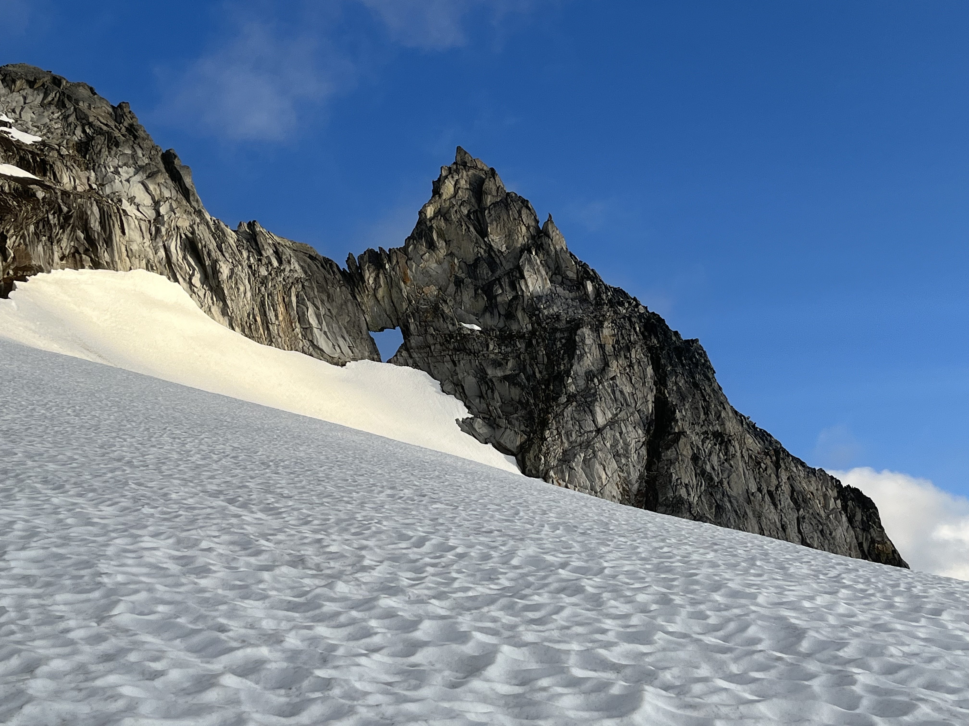
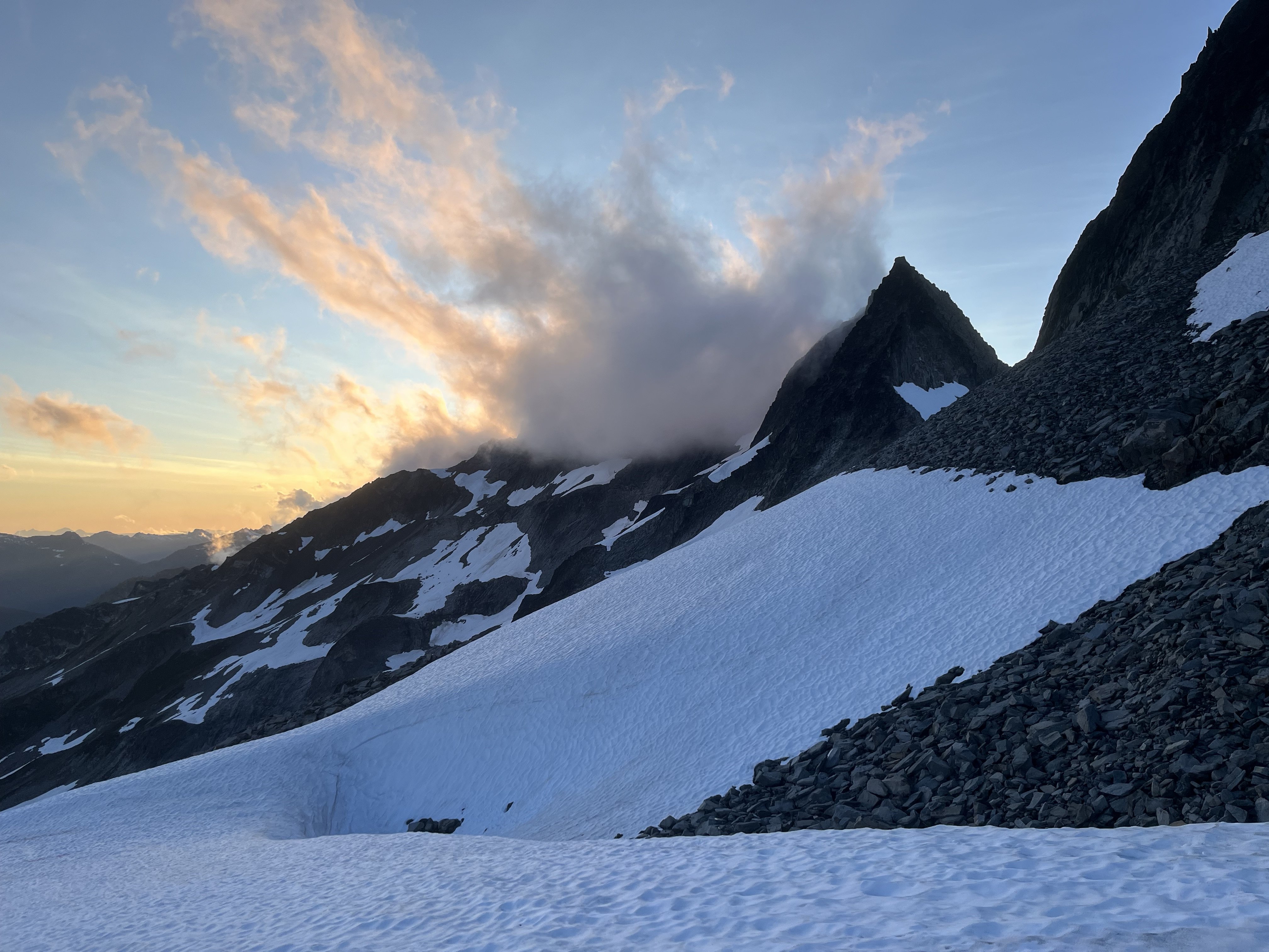
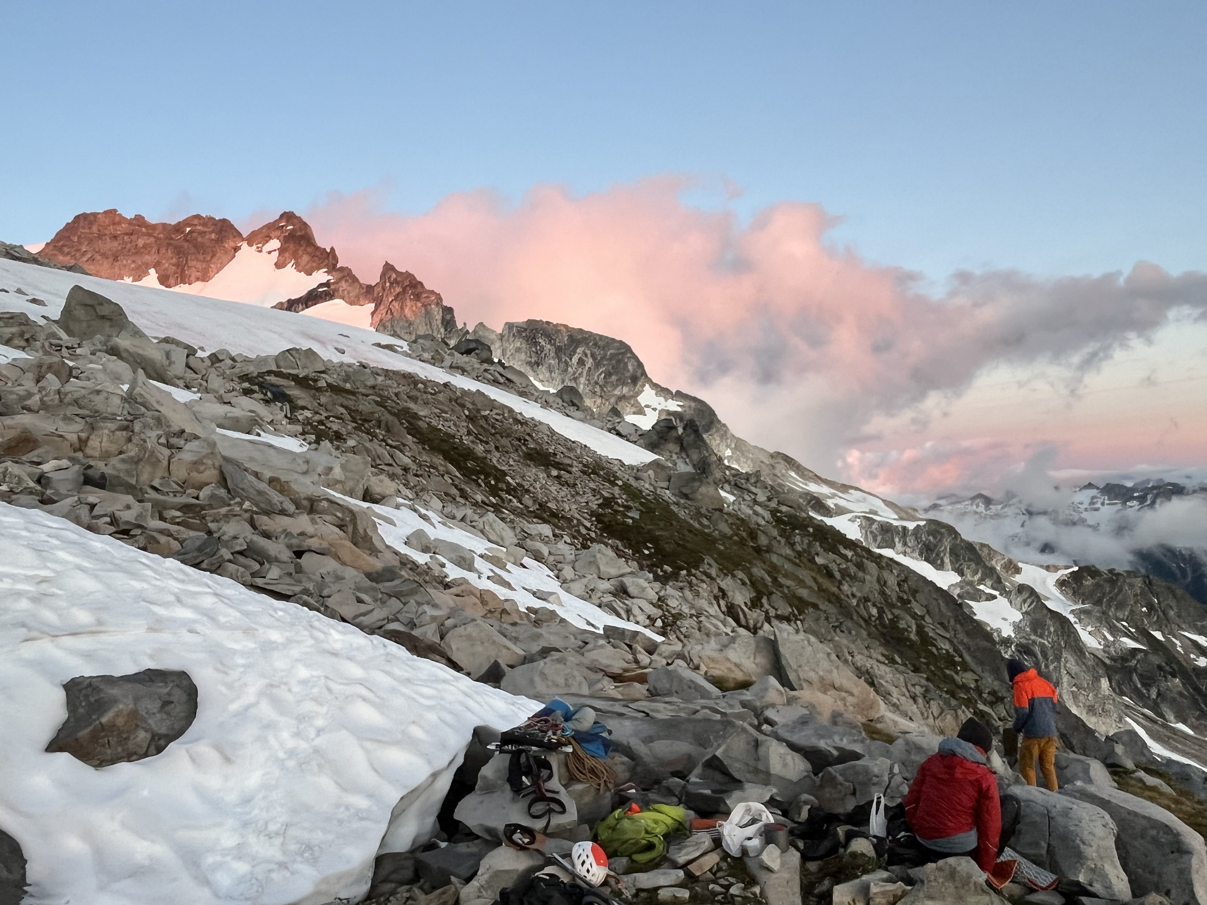
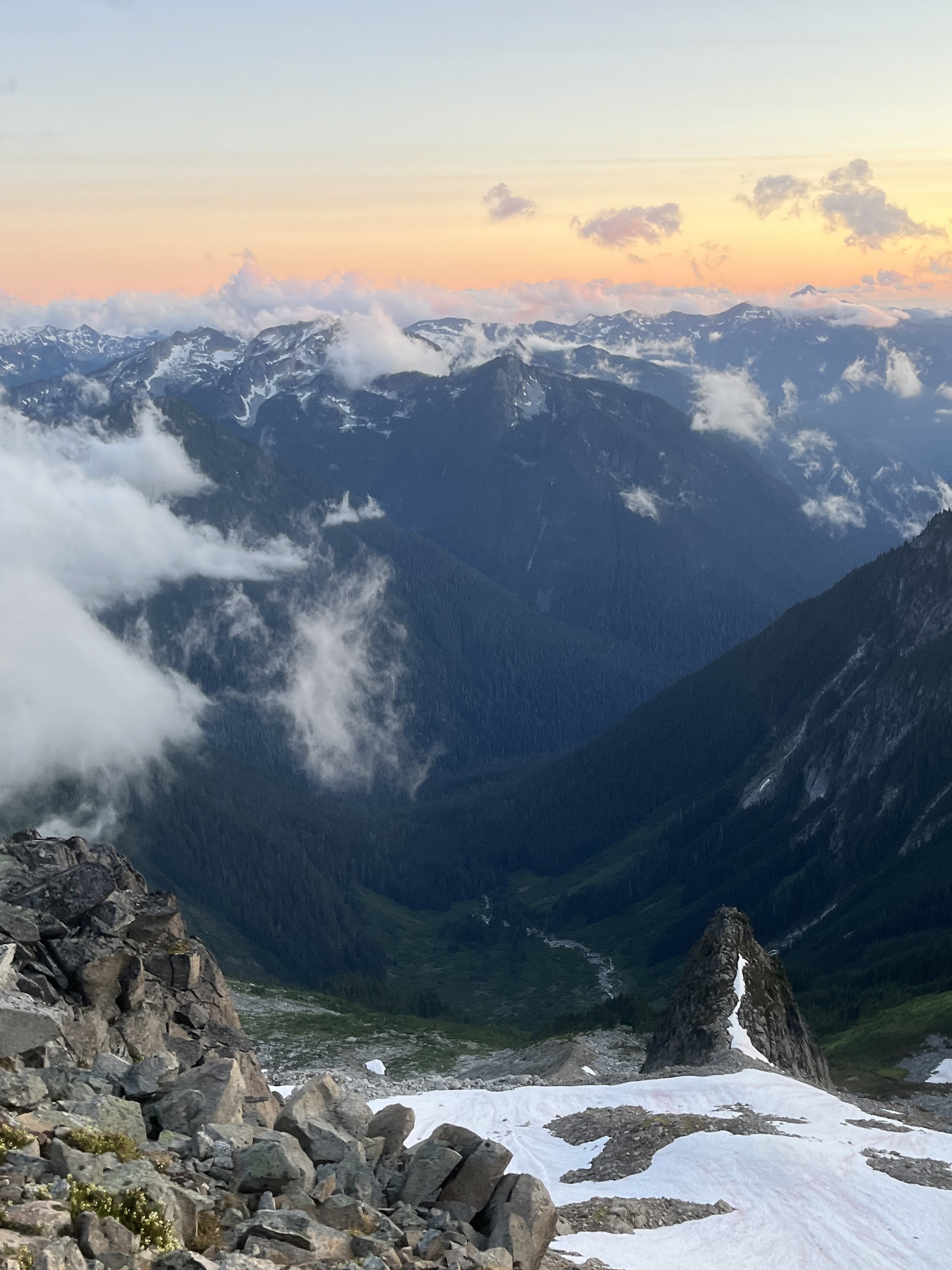
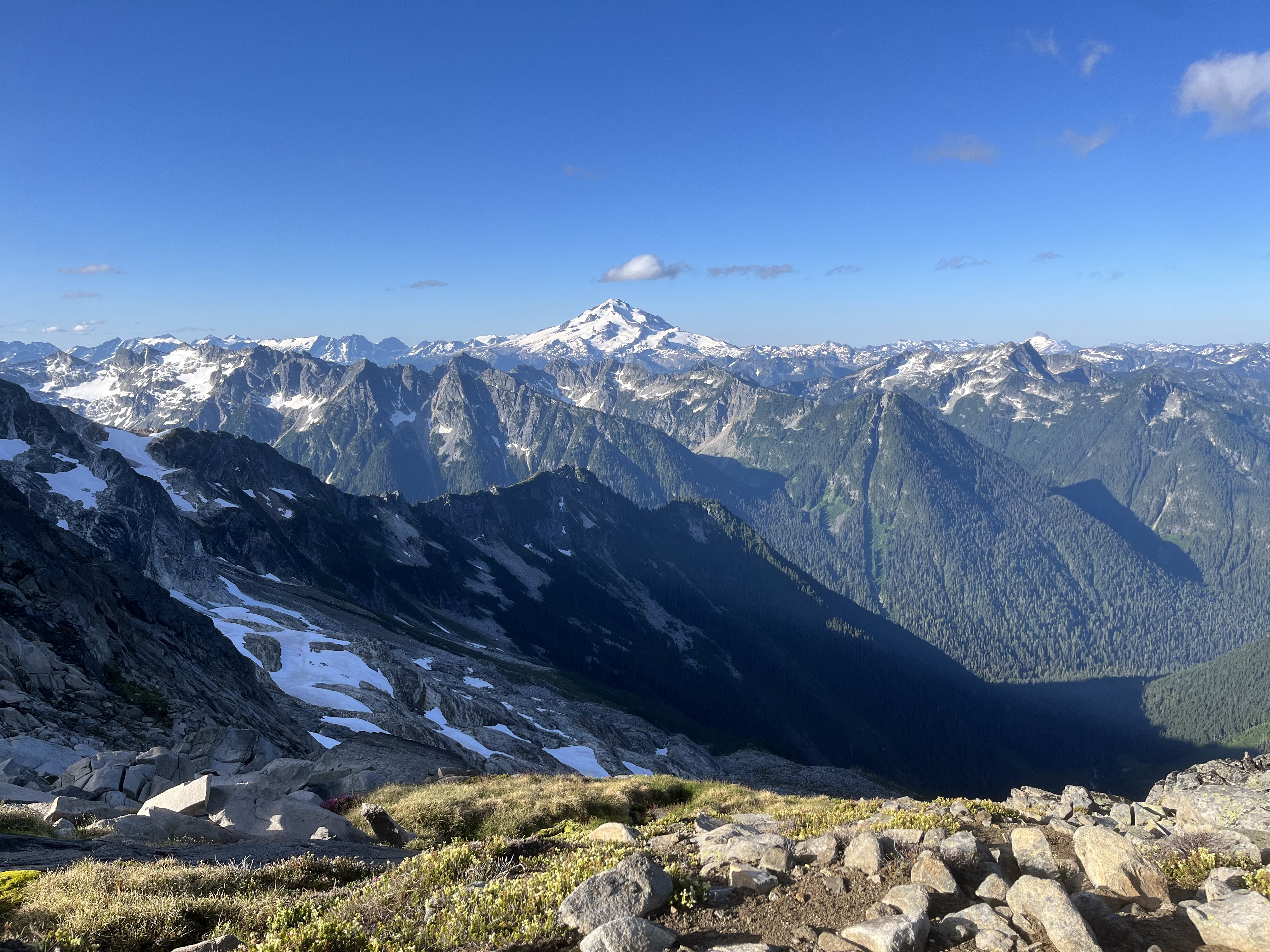
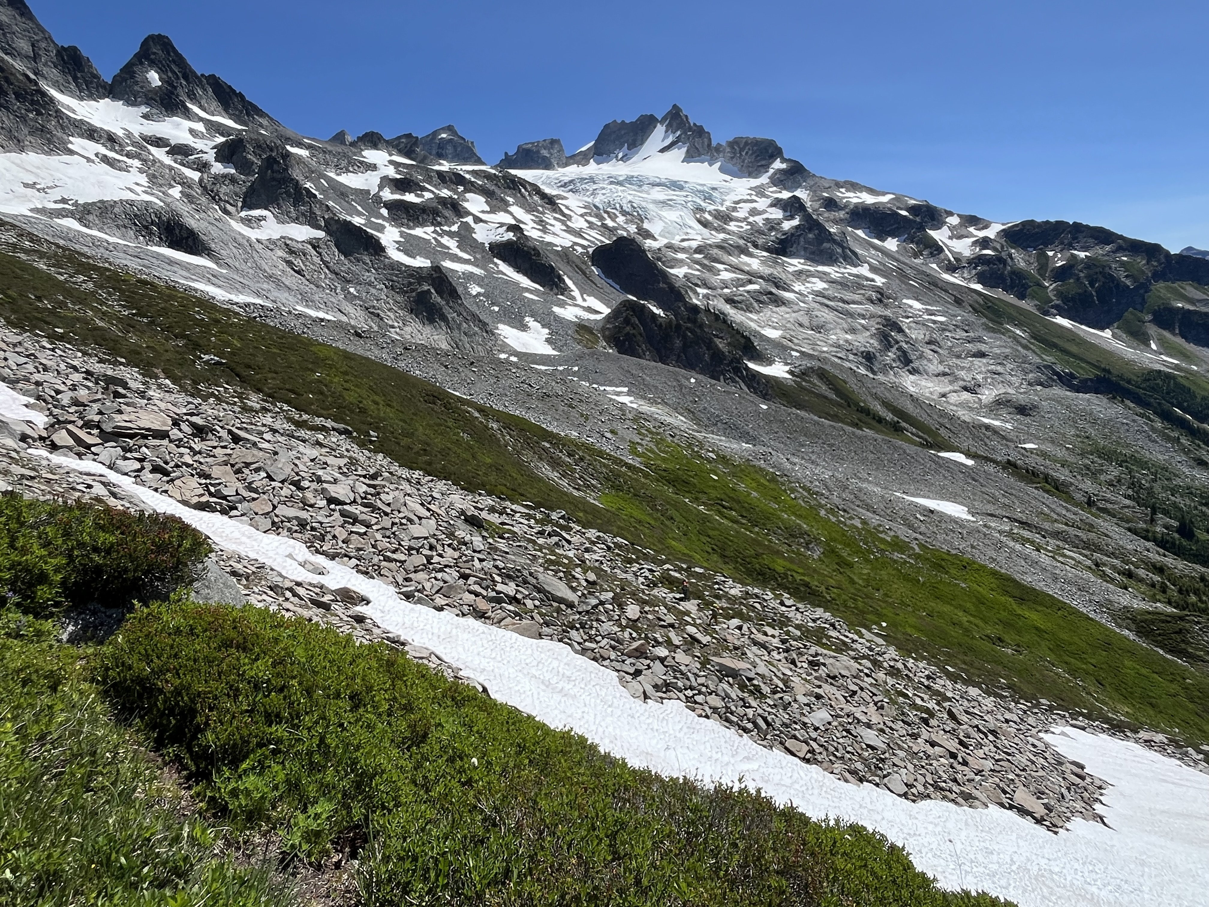
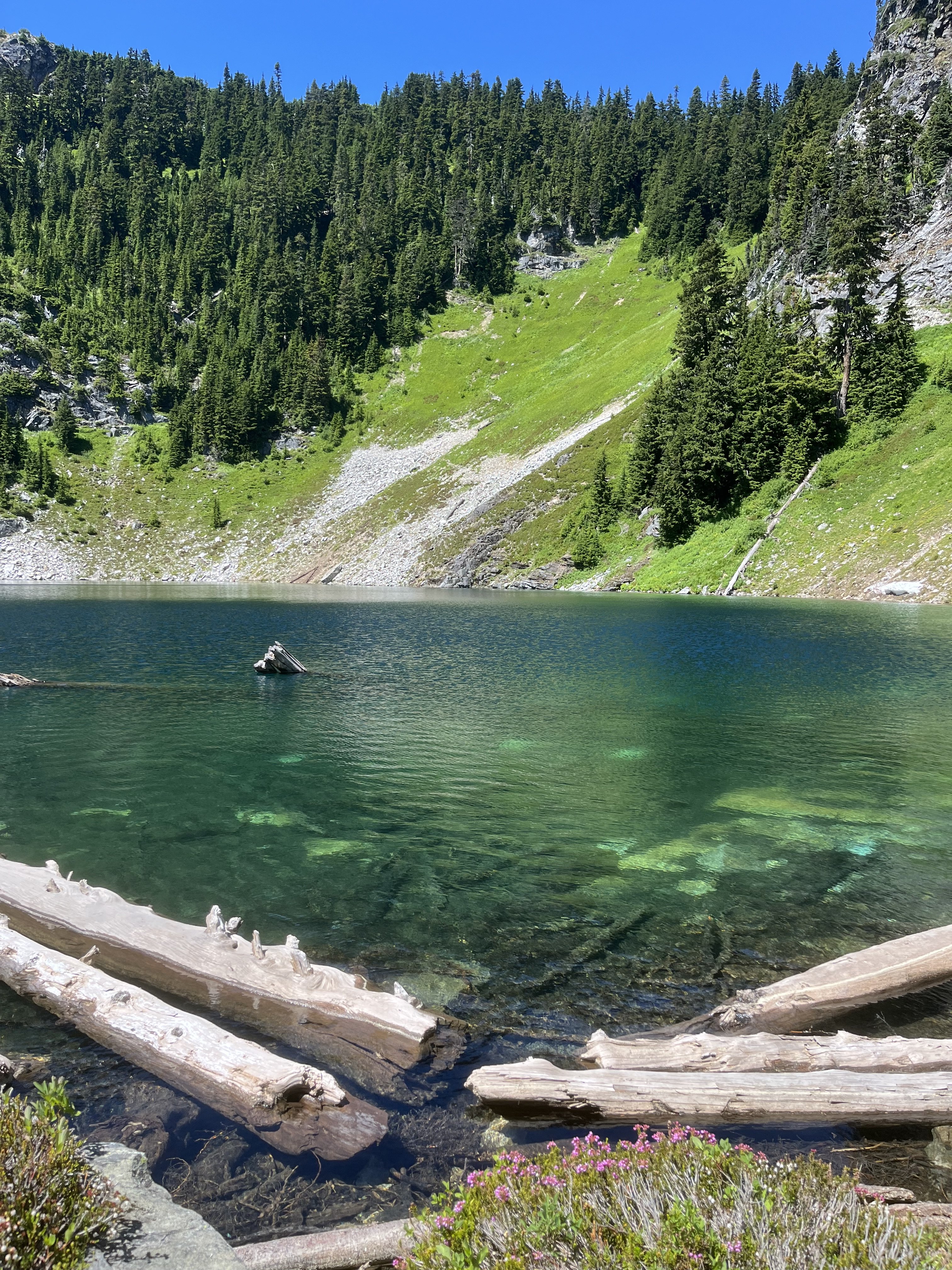
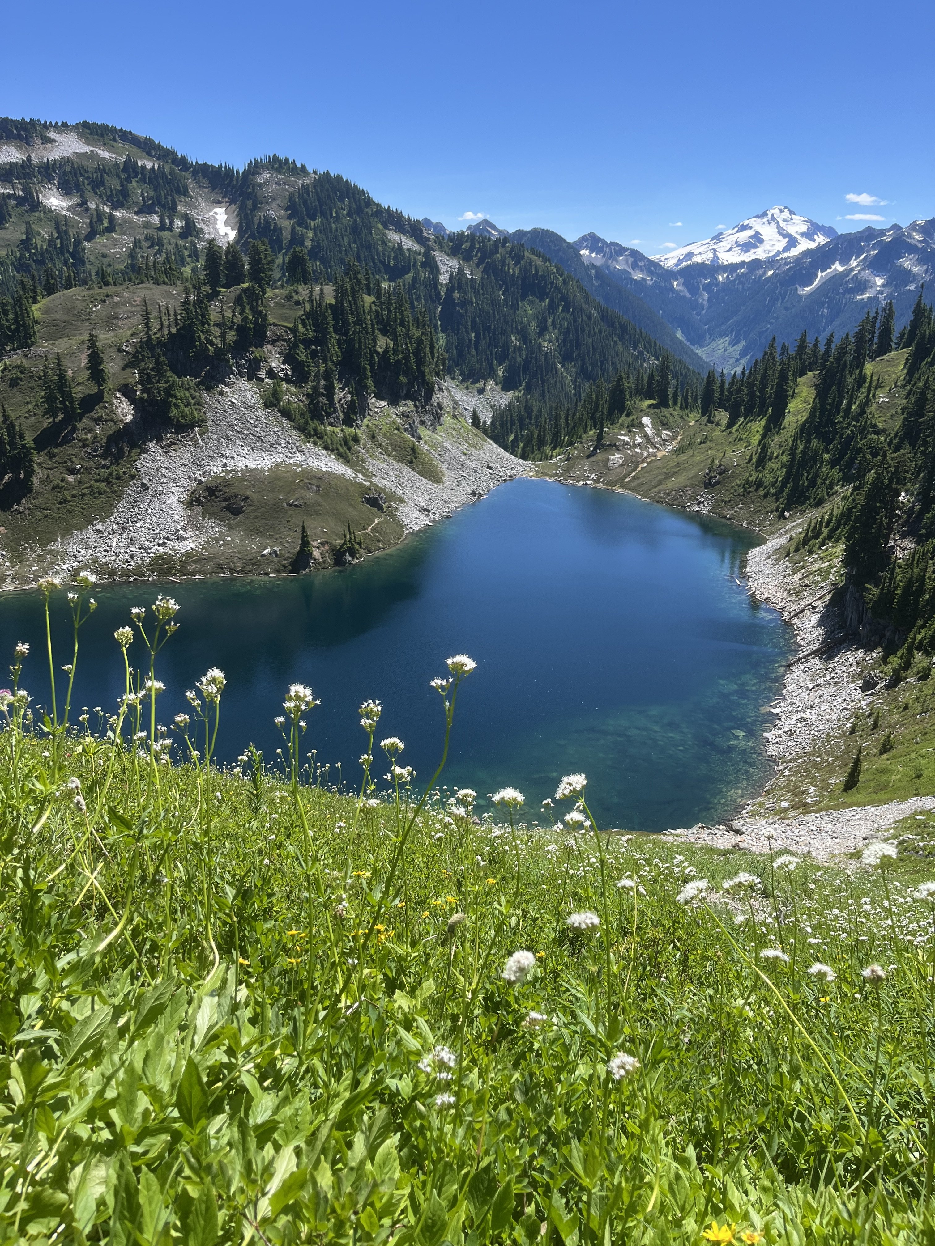
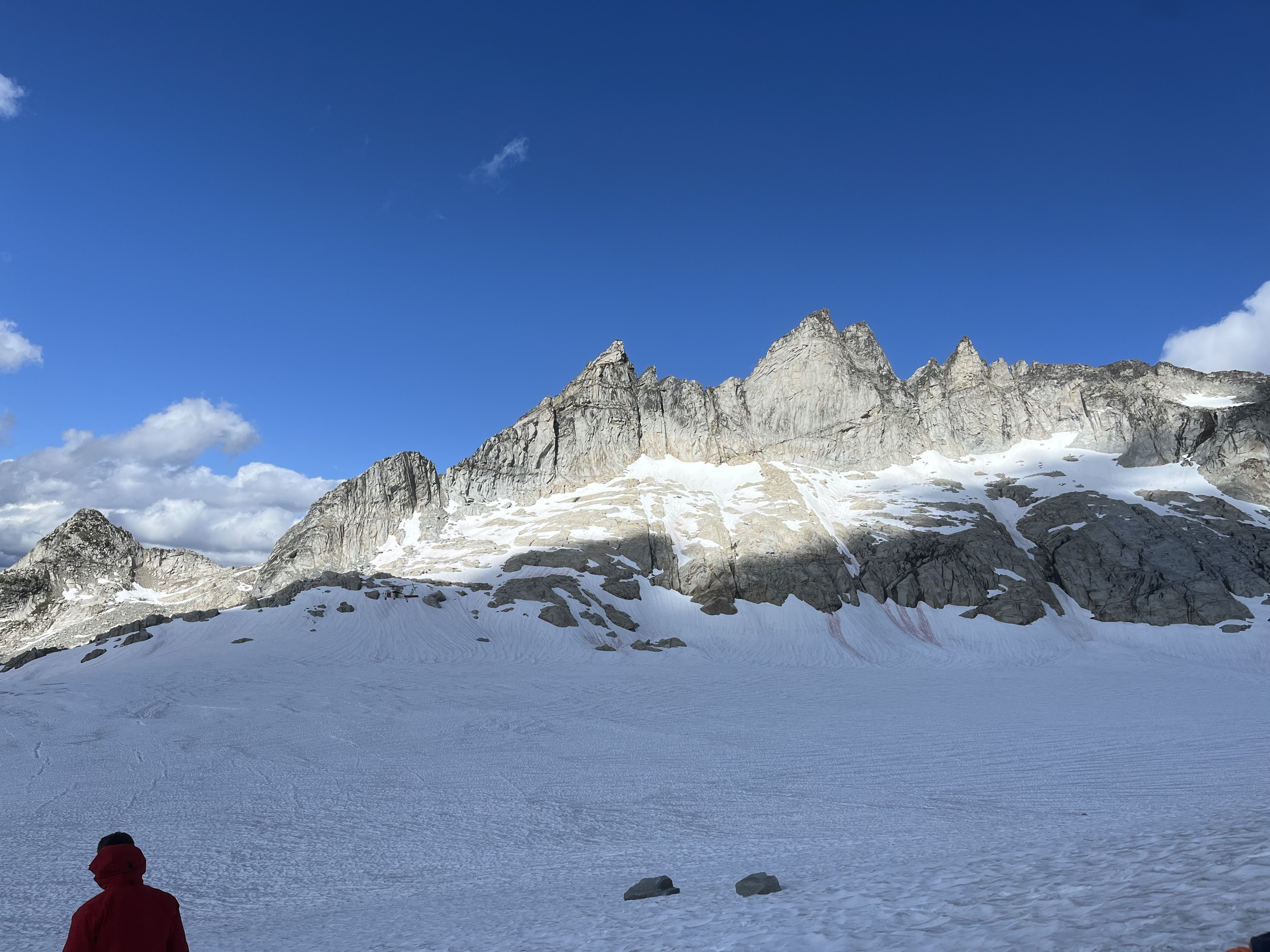
Trip: Gunsight - E and SW faces of Middle, S ridge of South Trip Date: 07/13/2025 Trip Report: I had the tremendous luck of finding a pair of climbers (Rebecca and Shane) who wanted to check out the Gunsight range using a rope team larger than 2 for the Chikamin. We climbed as a party of 3. They turned out to be excellent climbers and excellent company. First I’ll stick mostly to the things I wish I knew beforehand, inaccurate beta, etc. On our second day we blindly followed tracks of a party about a half hour ahead of us in the Chikamin which led to the lowest pass. Getting on the rock it seemed like possibly low 5th slab and too far south of Gunsight. We decided we were in the wrong place. I briefly scoped the next gully north which was terrible. We then found the right path, using mostly clean slabs. In Blake’s book the arrow isn’t quite in the right place, we were one notch north of his line, in the “s” in “peaks”. We had hoped to climb E face of Middle this day but with the lost time settled on S ridge of S peak. We would later find out that doing E face of Middle on day 2 is doable only if everything goes right, no route finding issues, climbing and descending efficiently. A better day 2 plan that I’d recommend to most coming from Downey is to aim for SW face of Middle for your day 2. P2 and start of P3 on S ridge S Gunsight: S ridge of S Gunsight is a garbage climb. The first pitch is not terrible but the face after an ok corner is covered in black lichen and any pro seemed worthless. Hard to find an anchor on top of the choss ridge. Much less than the reported 45m. The next very short pitch, again much shorter than in our description, has an exciting leap onto the top of the cannon hole (my first trad dyno I think). From there we expected 5.4 to finish the climb. I went back and forth, high and low, repeatedly dead ending near a notch with lots of tat. Finally I committed to a delicate and highly exposed 5.8-5.9 stem around a corner to get to a downclimb to the notch. From there I ran the rope out to the summit at somewhat dirty low 5th. Looking back I saw how the follower would be exposed to a big pendulum and deck, so I encouraged my partners to just rap that step off the existing tat. With a couple raps we were back on the east side retracing our steps to the notch. Numerous steep hard snow interruptions to the slabs involved time sucking crampon on-off transitions. I was grumpy about 2 days of effort to climb 3 pitches of choss but we caught a gorgeous sunset just as we reached the notch. From there we traversed high on snow and slabs below Gunsight to get to where we had stashed our bivies. The next day we tried again for E face of Middle. Rather than circle around the peak again Rebecca had the great idea of climbing the SW Beckey route, rapping S to the notch, then rapping E to get to the E face. The Beckey route was straightforward low-mid 5th choose your own adventure on fun solid rock with lots of knobs, which we began from a small cave just above the best moat crossing we found. The summit register’s last entry was from 3 years prior, a party doing gunrunner. We did one rap south beginning a little below the summit, backing up the slightly suspect block. From there a double rope rap from a higher confidence anchor got us to the notch. The anchor we found there wasn’t very great but we couldn’t find better options. I immediately found the e side to be mostly steep dirt. Angling slightly south I found an ok nut anchor maybe 45m down from the notch. A double rope rap from there got us down to the very dirty snow. This might have been the dirtiest gully I’ve descended up to that point. The high quality of the E face lived up to the hype, though misleading beta vexed us at times. Our first pitch was quite long due to low snow and glacial recession. Comparing our photos to some from 15 years ago there was some thing like 50-100 feet of rusty rock that had been covered in snow in the earlier photos. The pitch 2 crux is right off the deck and maybe sandbagged (or I was just tired). Awkward, tricky, exposed to decking, it took me about 4 tries to lead through it. I don’t think the pitch was more than 15m. This was another ledge where a good anchor was hard to find. Pitch3 (10c) was actually easier than pitch2. Shane had stopped one ledge short of the proper start of pitch 4. We worried about linking that step into pitch 4 because it’s supposedly 45m. In reality pitch4 turned out to be more like 30m. Oh well. The pitch 4 climbing was fantastic and its crux (10d) was another possible sandbag. I could not have led it. Very demanding powerful moves finally got me through it after a few attempts. By now the hour was late and we were looking at the mental crux of the runout 5.9 slab. Shane led this one too. Rebecca went second and I came last. I was glad to have watched them for beta on the subtle step down crux at the most run out point. Brilliant colors lit up the horizon while it was my turn but I could give it only fleeting attention as I concentrated at the crux. Once through I ran up the ridge (low 5th? Didn’t notice any 5.8) in the twilight, basically a full 60m rather than the 15m our beta advised. We repeated the rap sequence south to the notch as it grew dark windy and cold. The rope got stuck during the pull here. With much effort Shane finally freed the rope. The descent to the east was a known thing at this point but I argued that it was so bad that the descent to the west couldn’t possibly be worse. About this I turned out to be wrong. We did one short rap to an anchor south of the main gut/vomitorium of the gulley, with resident snaffles greeting us at both ends of the rap. From there Shane plunged into the unknown, over an overhang, choss diarrhea of all sizes being released. At a full 60m we went off rope and I took a clean slab ramp around a corner and found good cracks while they pulled the rope. Somehow that rap didn’t destroy us or the ropes. We placed a cam anchor and got past the steep icy snow onto lower angle stuff and began the traverse back to camp, arriving around 2am. We made dinner, celebrated, and tucked in around 3. Next morning I went back with the suspicion that our anchor could be reached on class 4 slabs that we couldn’t see well in the dark. It turned out to have a little low 5th, so rapping was definitely the right call for the circumstance. But I was glad to recoup our gear. Having encountered the worst and second worse gullies of my life on either side of middle gunsight I now think that the best way to retreat is probably down the SW Beckey route. It’s ledgey so it would be best to downclimb most of it with some raps where it makes sense. And best done in the daylight, after climbing it at least once so you know the way at least approximately. Faded from the unexpected epics our only goal for day 4 was to get back to Itswoot ridge, beginning around noon. But around 1:40 at about 7K’ we heard a voice from a distance. We stopped and listened. Heard it again. Could barely make out words like “broken ankle” “helicopter”, “alone”. We pressed the SOS. The voice seemed to be vaguely in the Sinister area but we couldn’t tell where. We started backtracking and did some Marco Polo every few minutes without success. Finally passing east of the north face of Sinister we saw what we realized was a person. He was not moving and covered in a gray sleeping bag so we hadn’t been able to tell him apart from a rock at a distance. Maintaining some privacy here, we found that he was indeed immobilized and in severe pain and needed rescue. His inspiration and his equipment were in disharmony and this had culminated in a long and presumably very rapid slide down snow NE of Sinister. Fortunately over cracks, unfortunately meeting some rock(s) along the way. A little while later a father and daughter were coming down the Chikamin. It was nice to have more help. We did our best to keep him warm and as comfortable as possible as we waited for SAR. When the helicopter came we were surprised that it took so many laps through the area (maybe 5?) before two rescuers finally were lowered down with a litter. The morning had begun mostly cloudy but the afternoon was quite brilliant. Some rain approached quickly from the north and reached us just as the helicopter took off with the victim and SAR people aboard. We restarted our ascent in the rain, reaching our turnaround point >4.5 hours after we had stopped. This guy was quite fortunate that several people happened to be in ear shot on a week day in such a remote area. The rain cleared half way up the Chikamin and gave way to that kind of really clear atmosphere that seems to come on the heels of misty alpine weather. We found a wonderful spot past Dome glacier, well before Itswoot and called it a day. The highlights of our last day included a brief swim in cub lake, the flora above cub lake, and the many berries along Downey. Less fun was stuffing our pockets full with entirely unnecessary flagging all along very obvious trail along Bachelor. Some of it quite haphazardly stuffed onto bark like so Gunsight delivered adventure in more ways than I could have anticipated. For people going there for the first time I’d advise to stay the fuck out of the gullies on both sides of Middle, bring lots of gear for rap anchors because there seems to be little traffic there, skip south gunsight, and expect everything to take longer than you’d think. Photo dump will go here: Gear Notes: Double to 2, one 3, one 4. 2x60m twin. In reach (please people). Knife for tape. Approach Notes: Downey approach is currently straightforward. Trail work has been done all the way to Bachelor

-

[TR] Mount Index North Peak - North Face 06/29/2025
Sidviscous replied to Lucas Ng's topic in Alpine Lakes
Great trip report. I’m looking at doing this route soon, but have a couple Beta questions: 1. Did you descend your climbing route or are there variations where you descended more directly? 2. Did you find the rappel stations to be in generally good condition? How much extra tat should we bring? Any other supplemental gear? 3. Approximately how long did it take you to ascend and descend? -

[TR] Forbidden Peak - NW Face 07/13/2025
Michael Telstad replied to Grant789's topic in North Cascades
Dream team 😍 -
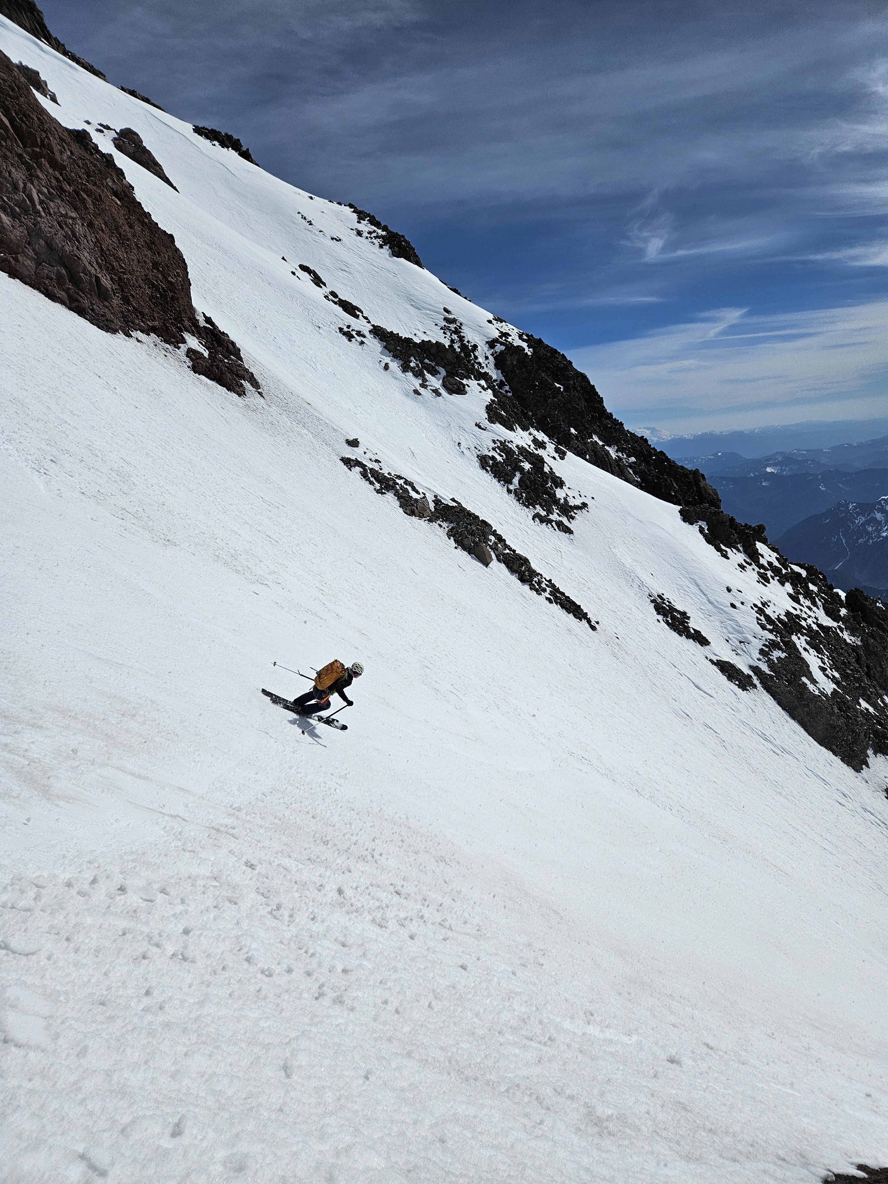
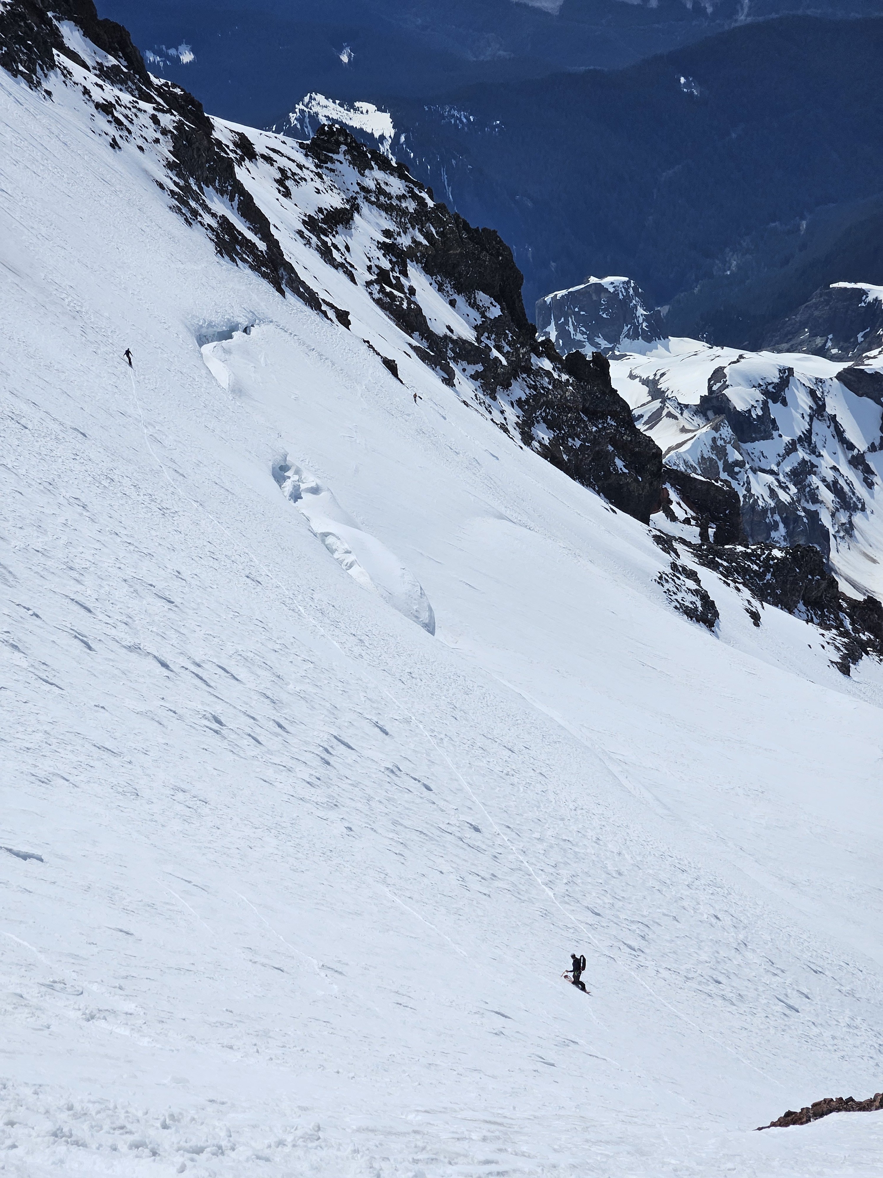
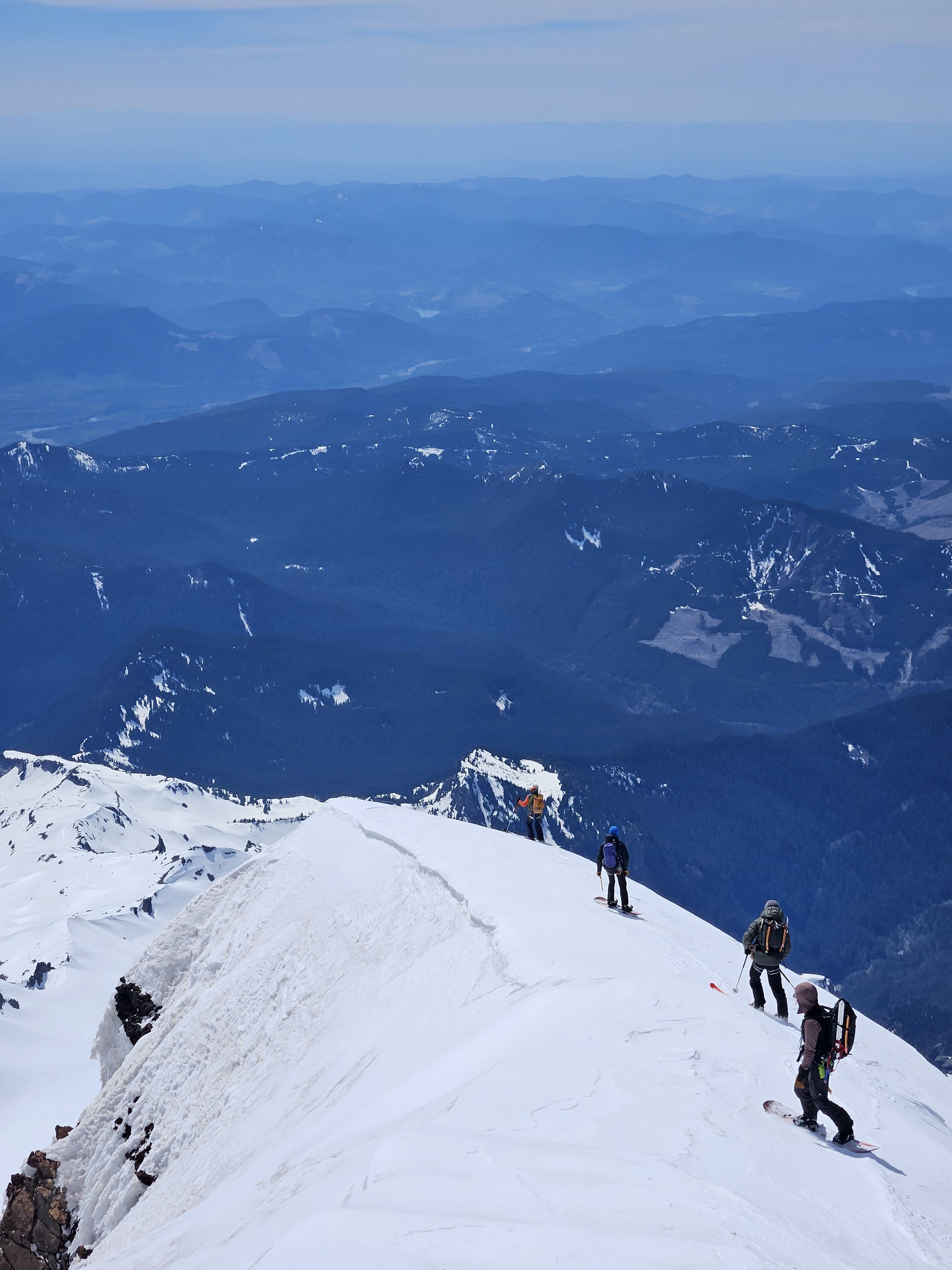
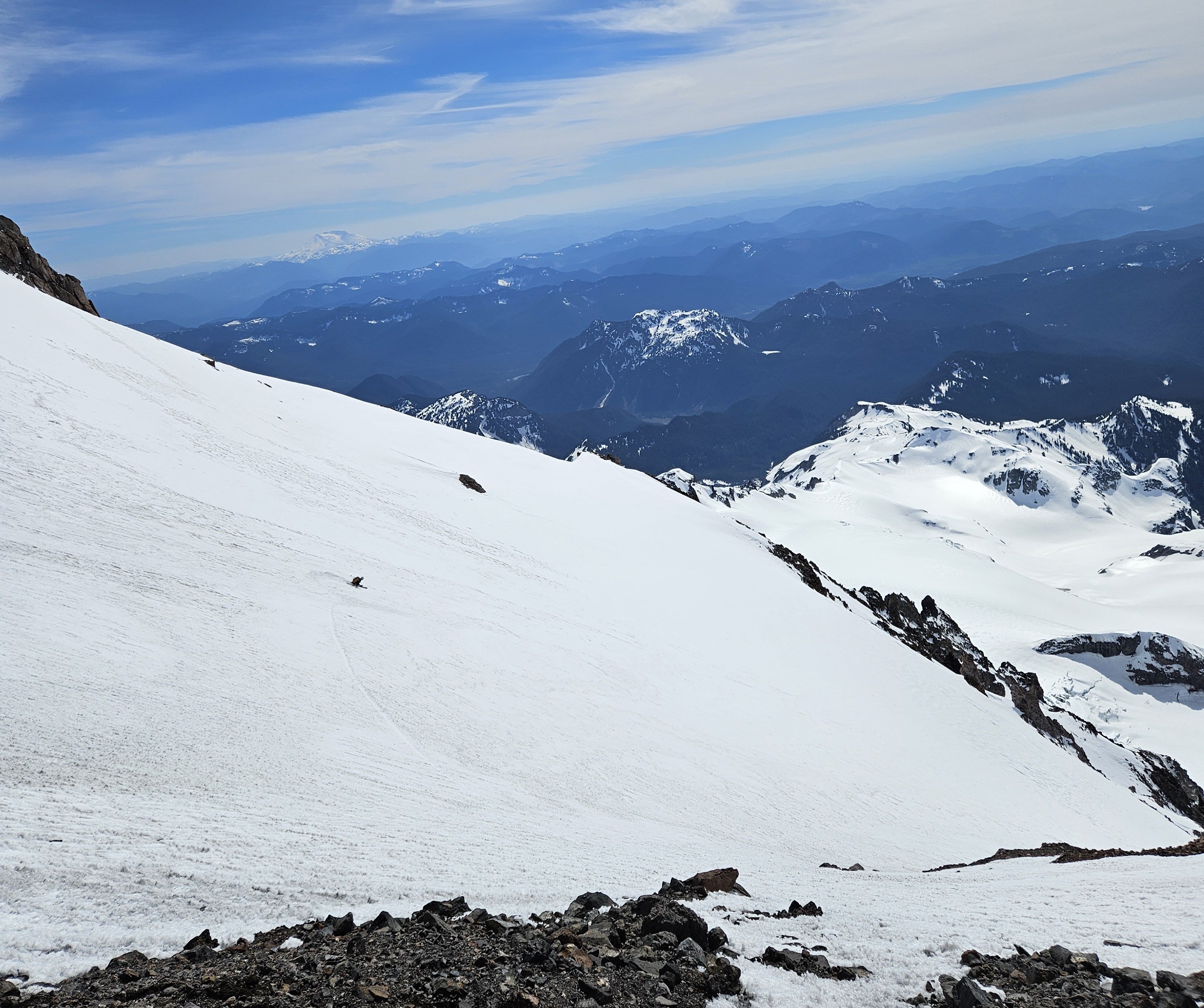
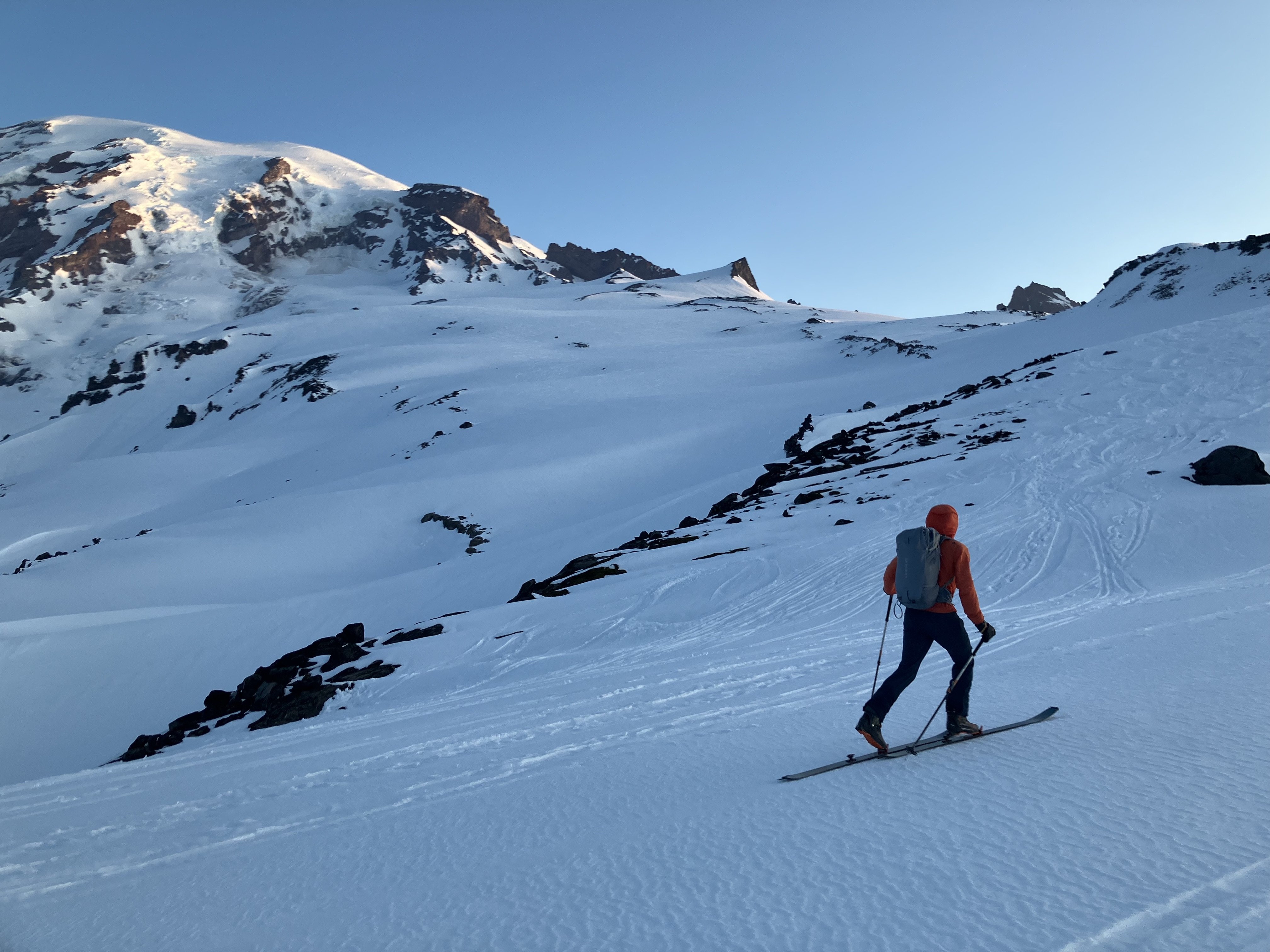
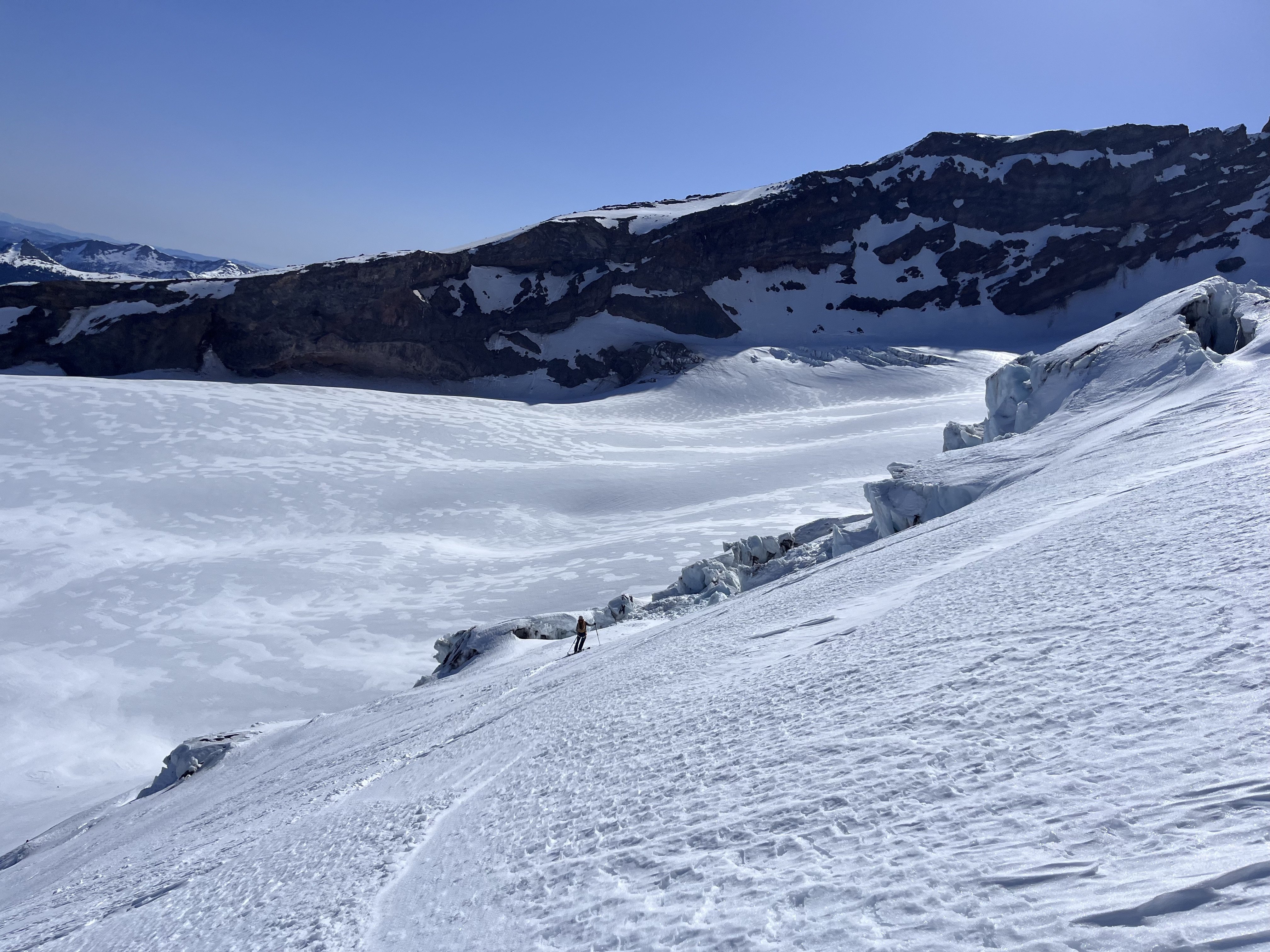
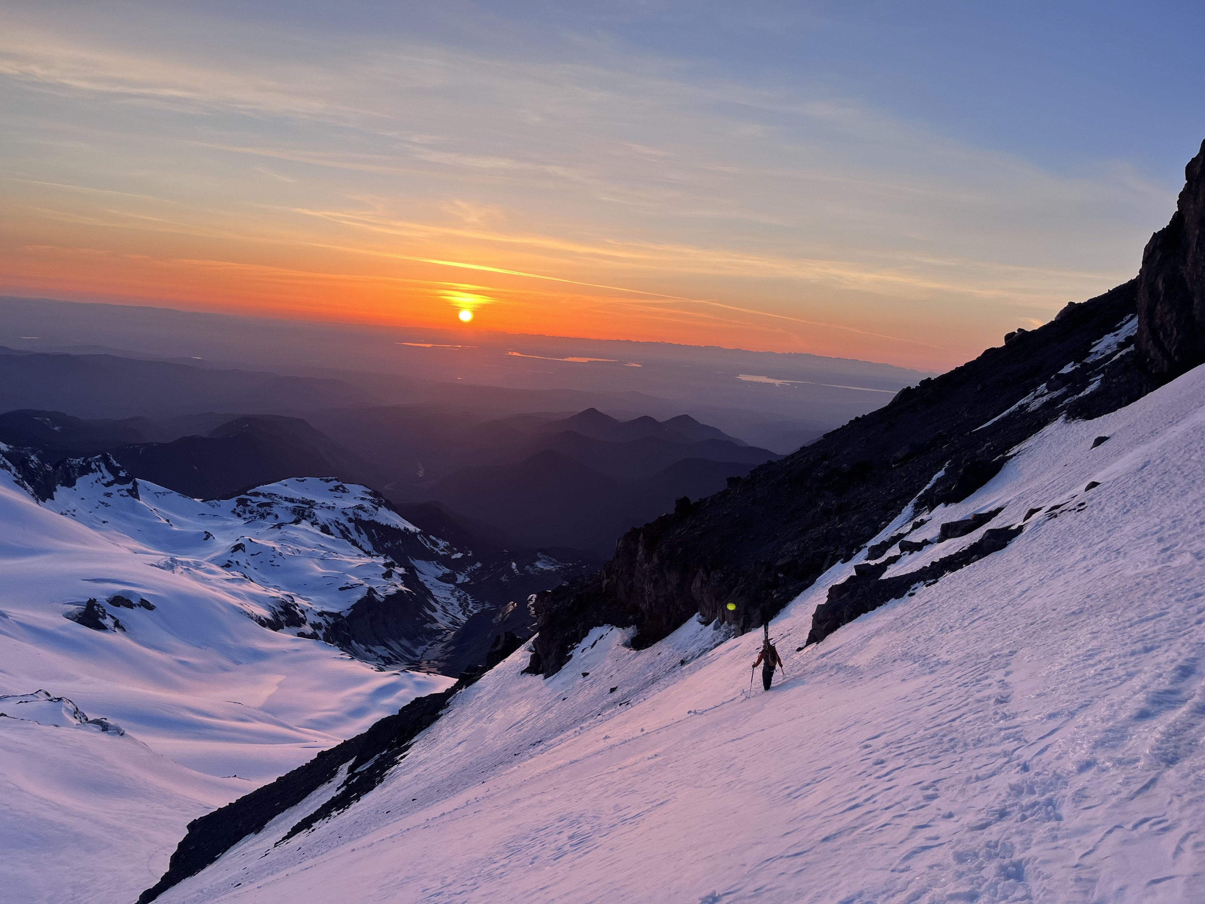
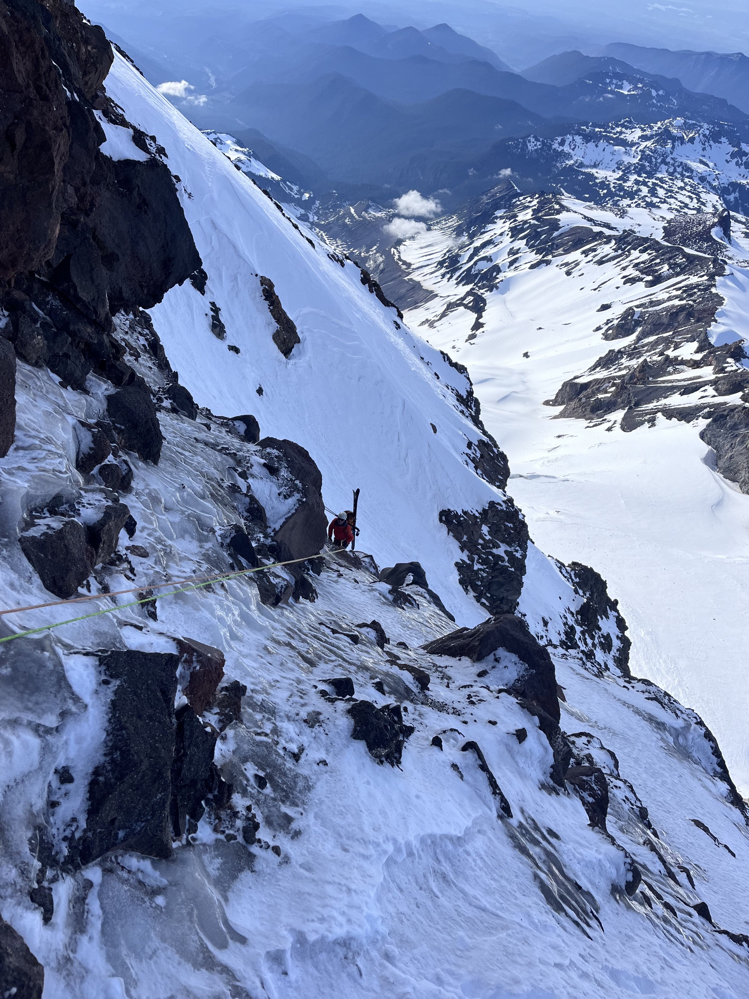
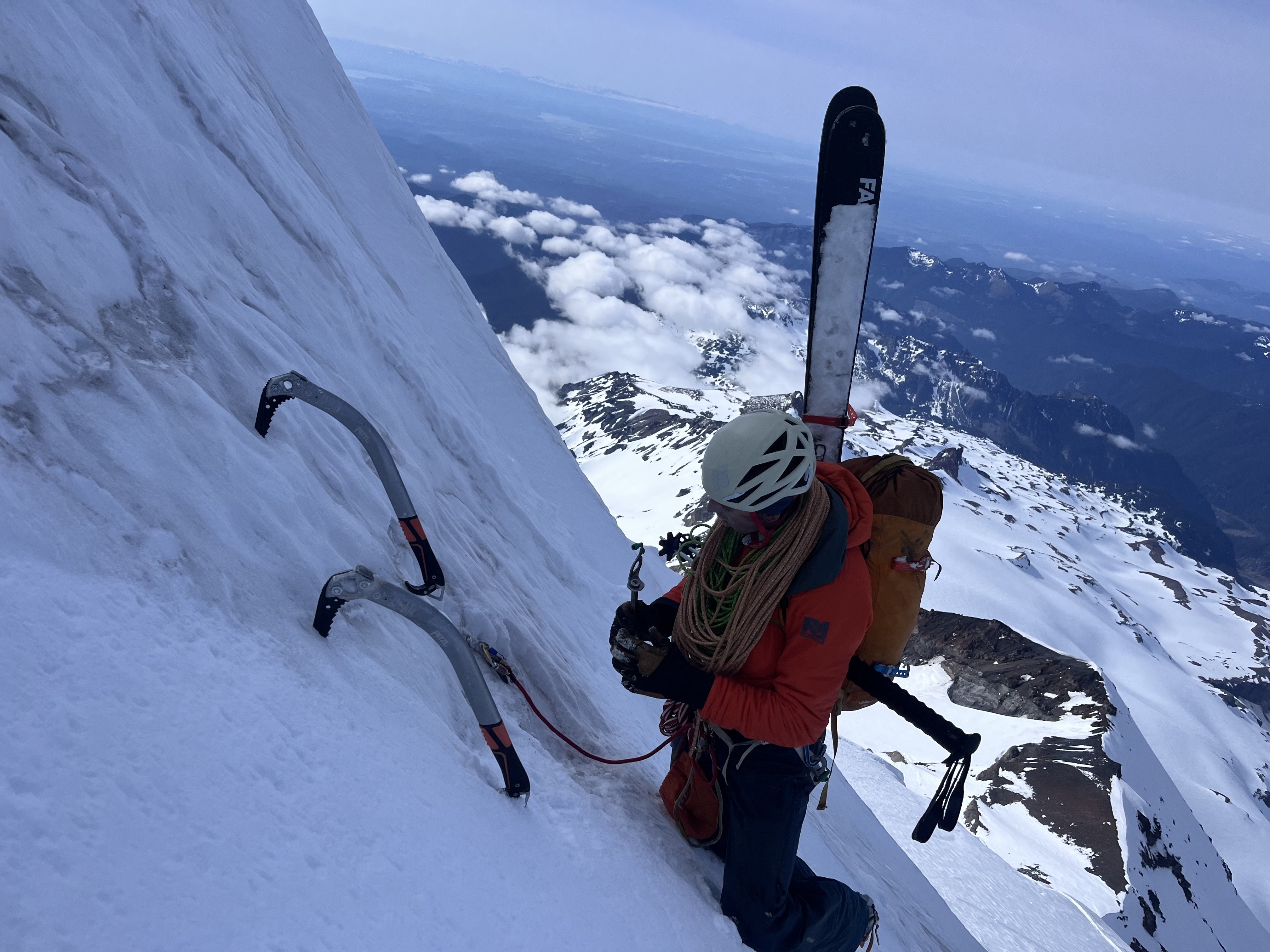
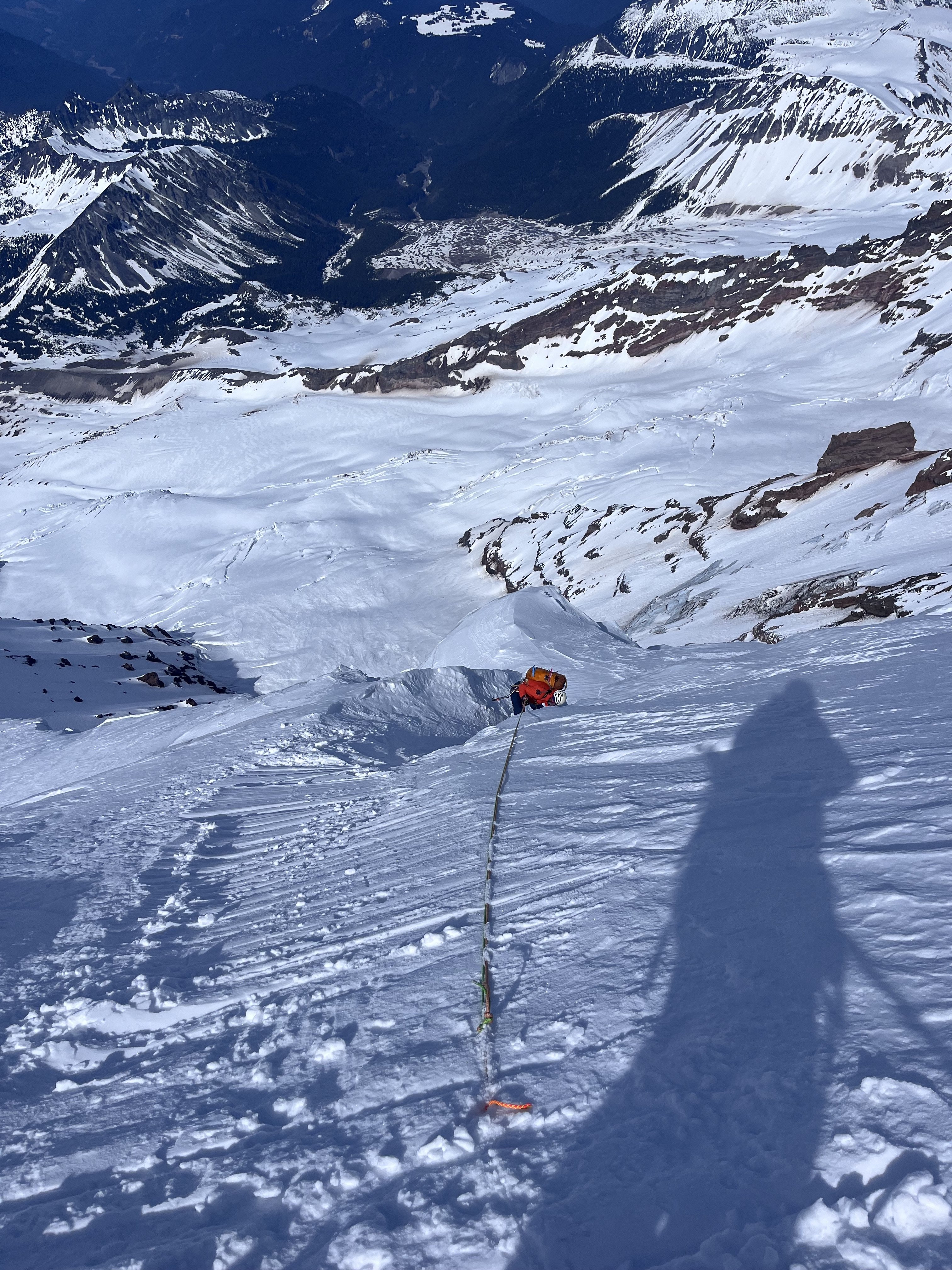
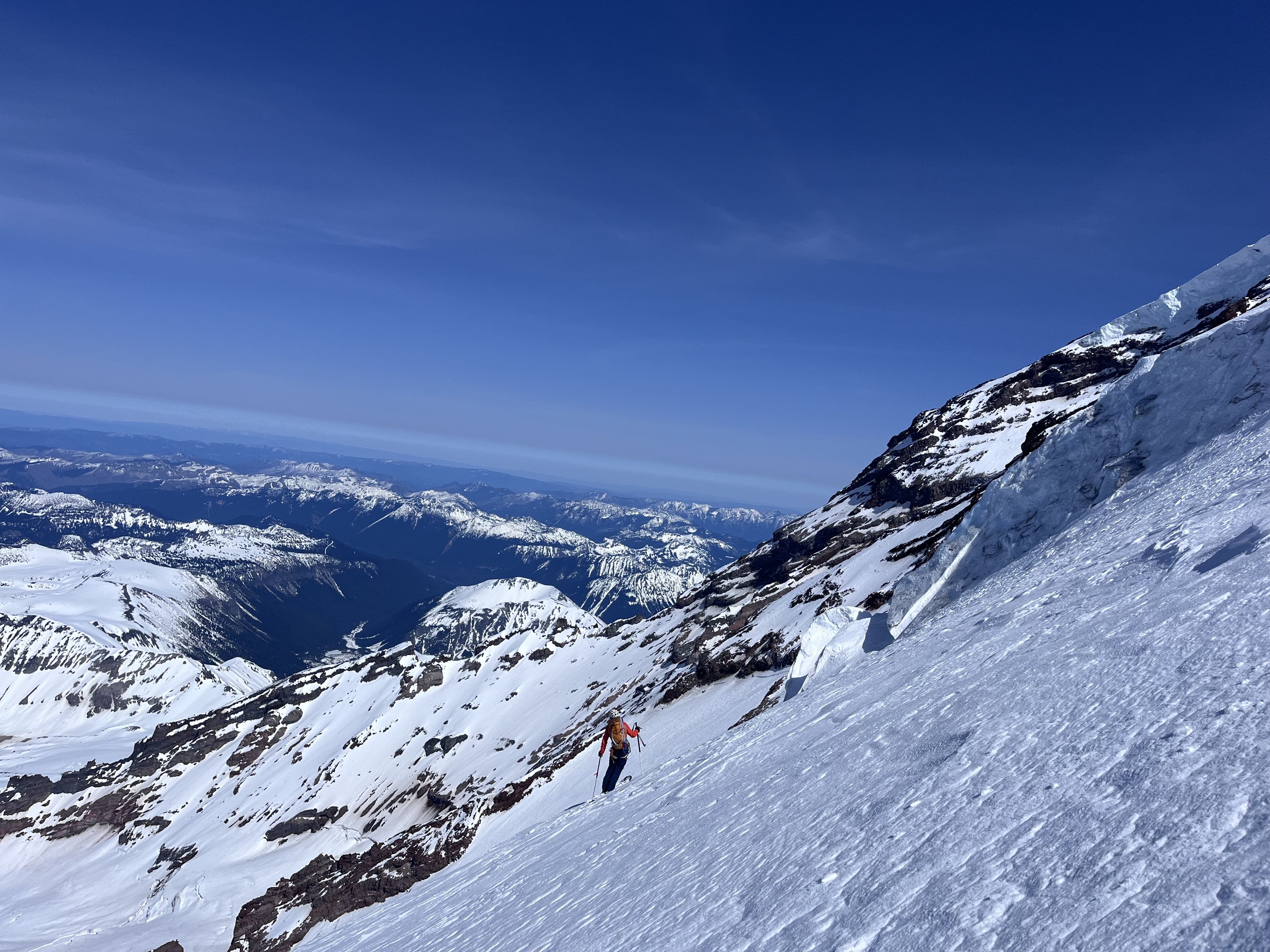
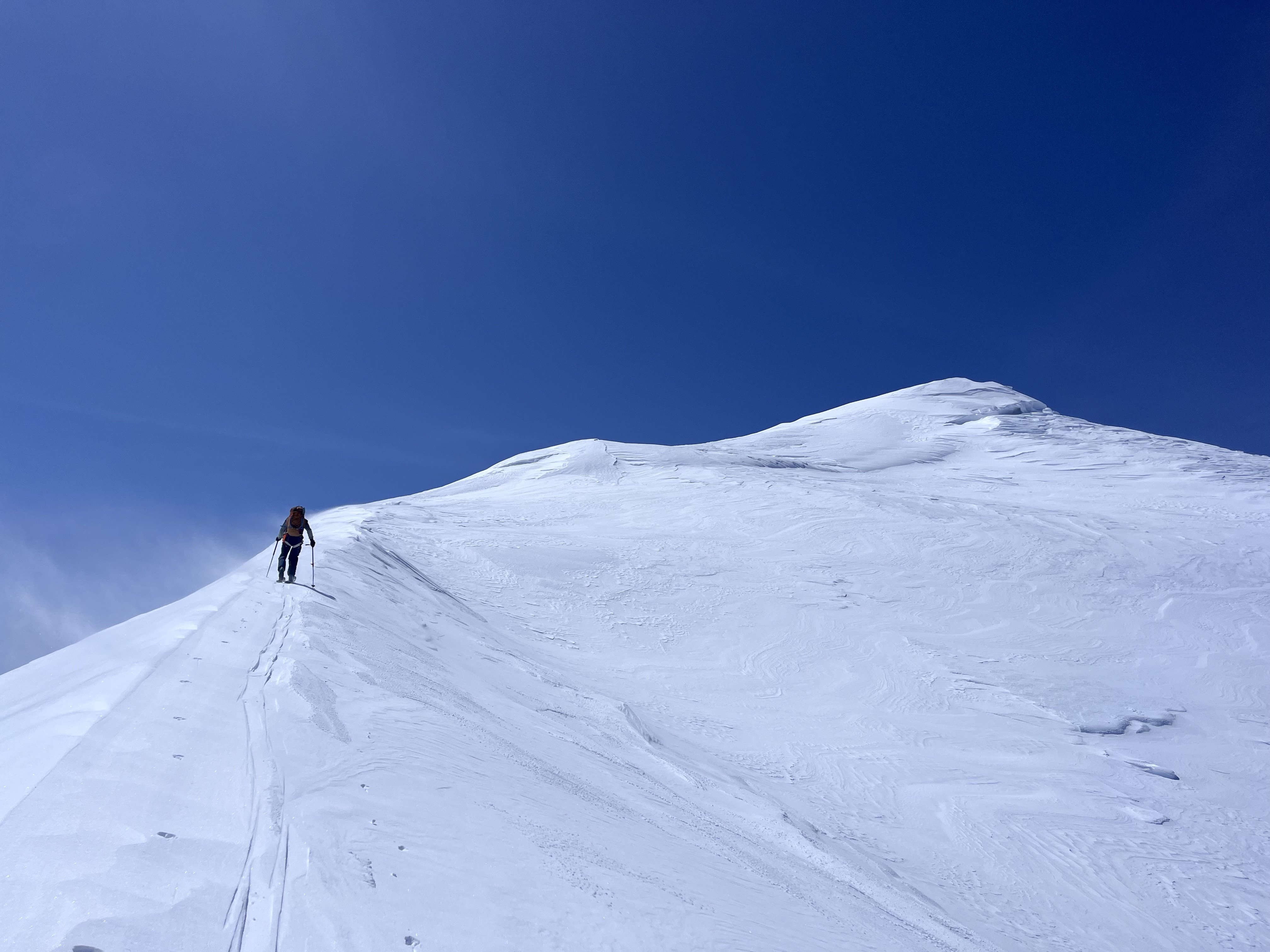
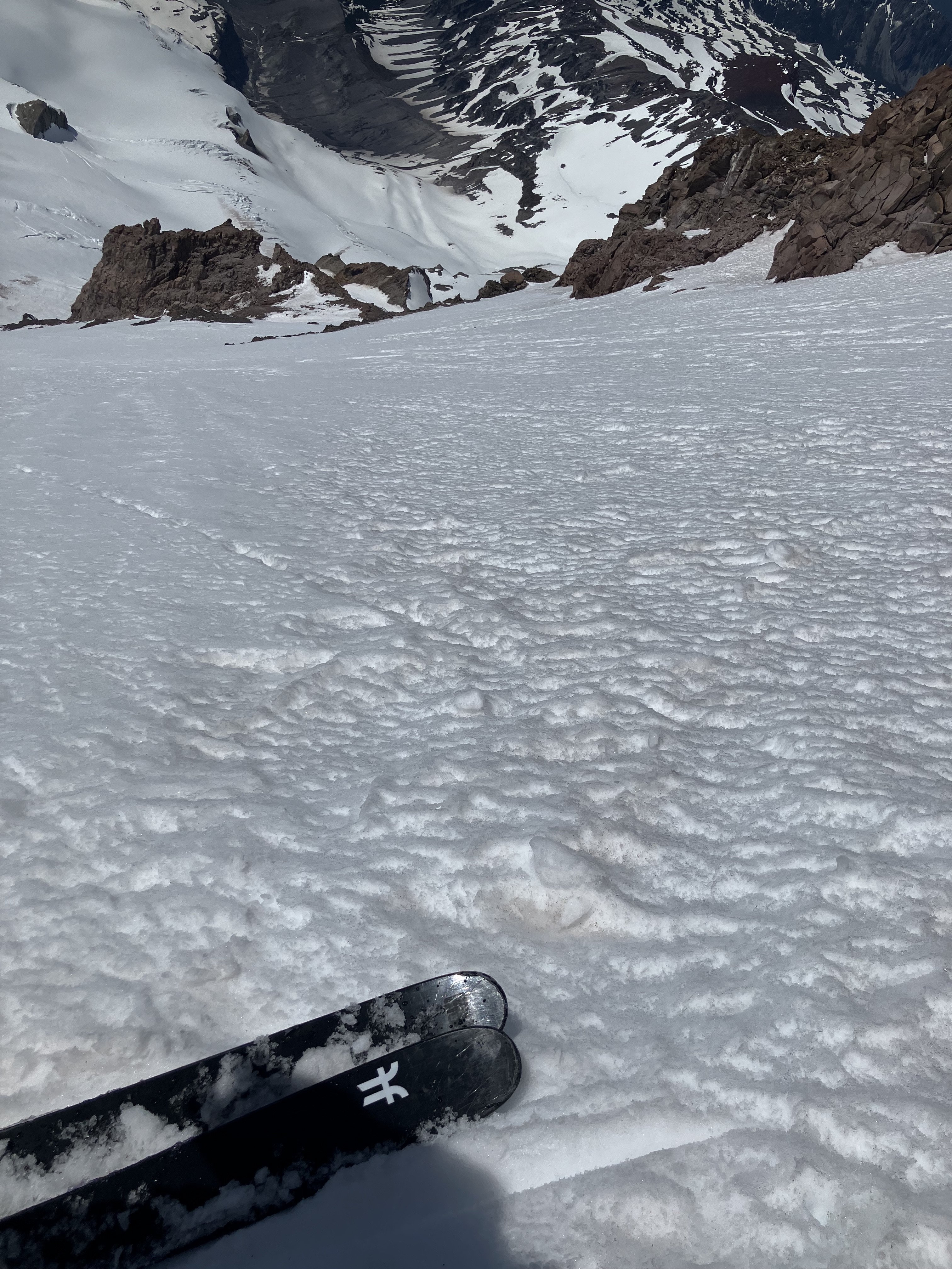
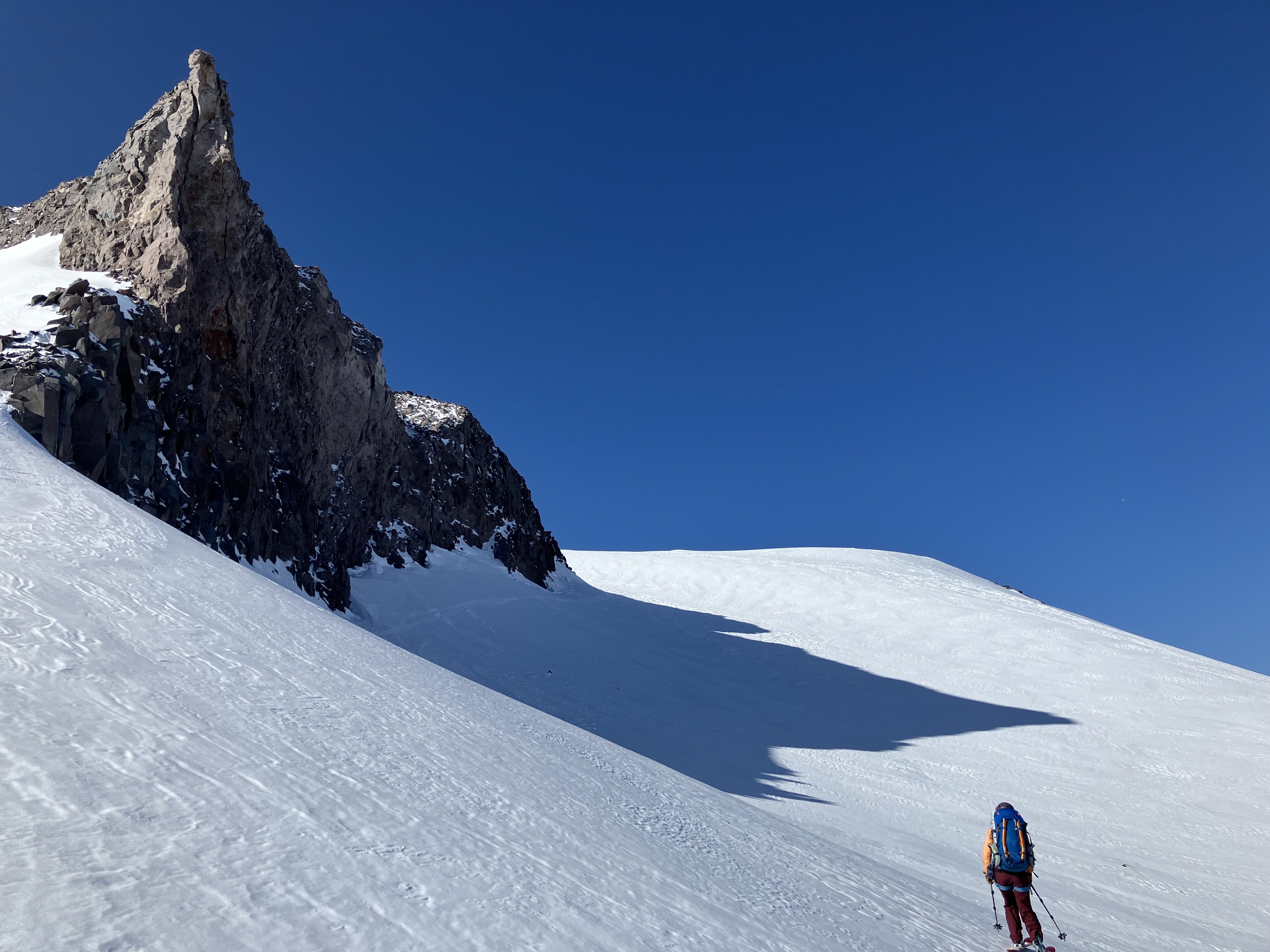
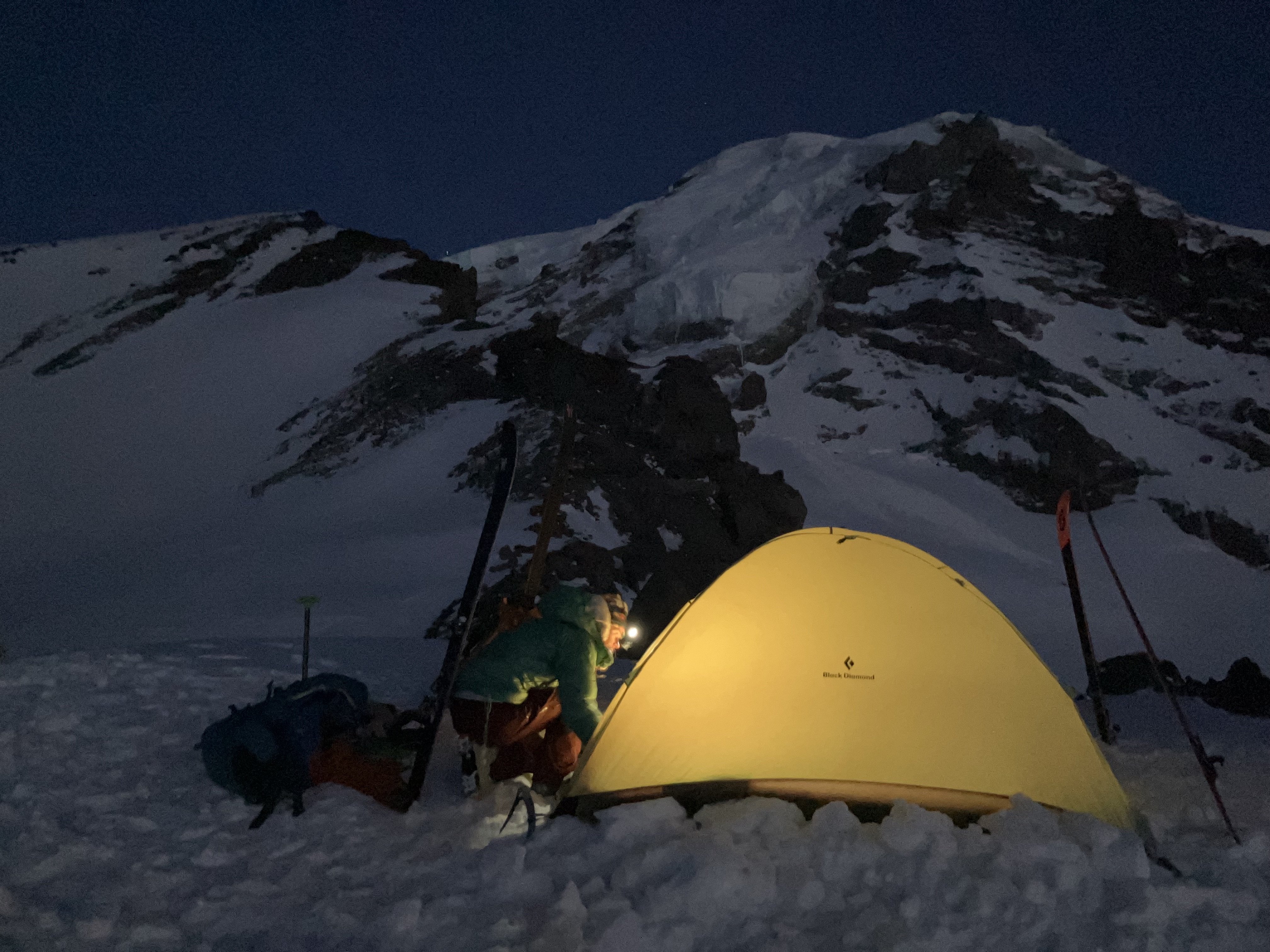
 This spring, I spent some time climbing and skiing up on Mount Rainier. I have gone back and forth on whether I cared to share any of my ski activity on Rainier this spring as it felt deeply personal, but I ultimately thought it would be fun to collect some of my thoughts and experiences as well as to provide some entertainment and inspiration. https://sam-marjerison.blogspot.com/2025/07/rainier-roundup-2025.html I'd like to give a huge thank you to everyone who has supported my spring ski season up here on Mount Rainier including Henry Coppolillo, Bailey Servais, George Hedreen, Sam Hoffman, Calvin Jirico and Kiira Antenucci. I'd also like to thank and recognize all of the people that have paved the way for big mountain skiing on Mount Rainier including Andy Bond, Sky Sjue, Aaron Mainer, Peter Dale, Eric Wherly, Dan Helmstedter and many, many more. Your style and vision for the mountains is incredibly infectious and we all aim to humbly carry on the legacy you have established here on Mount Rainier. I've attached some high res photos down below! On top of Sunset Ridge. Crewed out, heading over to the Edmunds Headwall (Upper Sunset Ridge). In the gut of Sunset Ridge. Skinning up to Liberty Cap. High on Ptarmigan looking over at Liberty Ridge. Rappel #1 on Ptarmigan Ridge. Rappel #2 on Ptarmigan Ridge. Rappelling into the traverse of Ptarmigan Ridge. Booting back up onto the Russell Glacier. Our camp below Ptarmigan Ridge on the Russell Glacier. Russell Glacier. Carbon Glacier. Central Mowich Face!
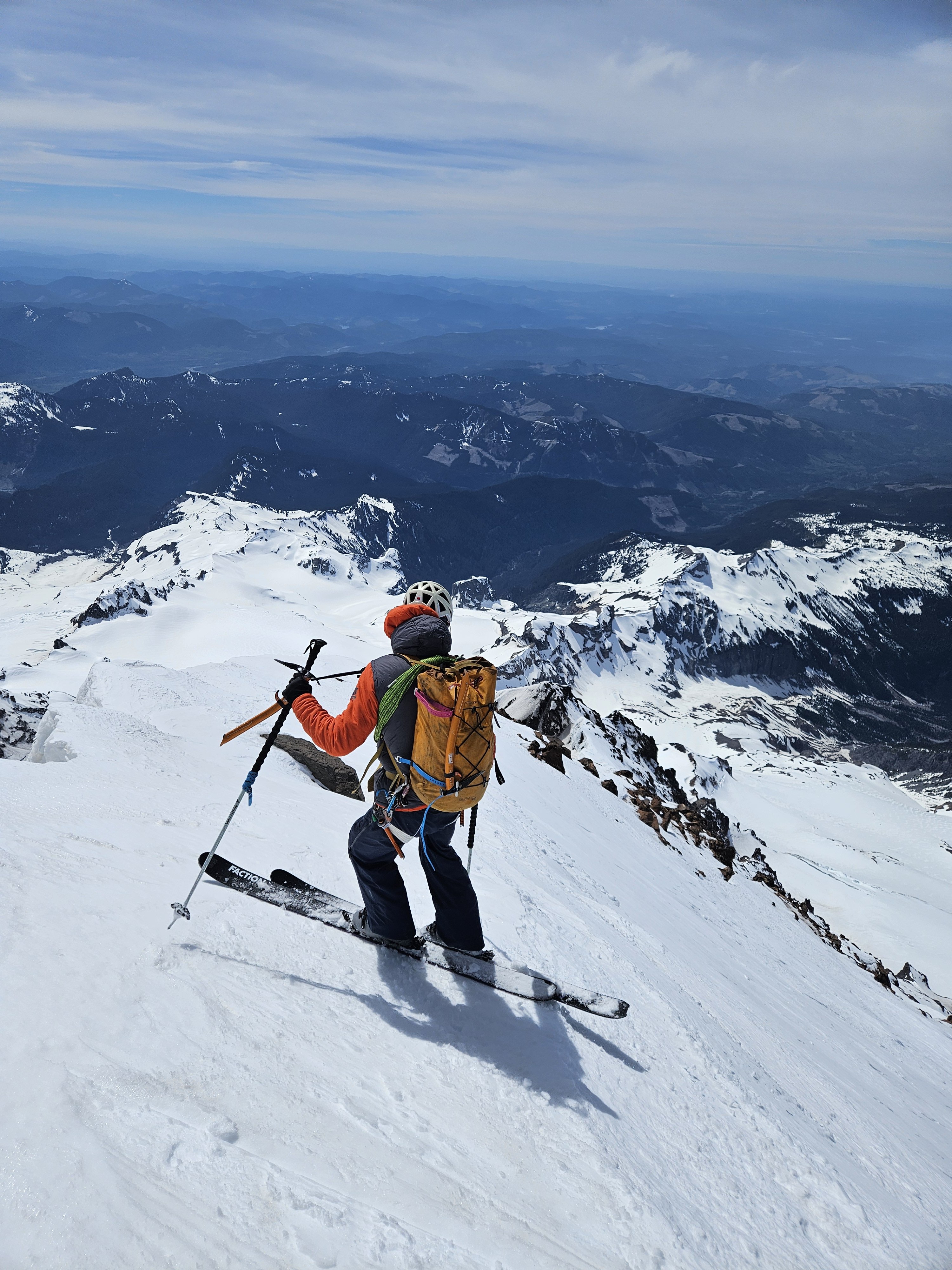
- 1 reply
-
- 4
-

-

-

[TR] Forbidden Peak - North Ridge 07/12/2025
Christopher Fisher replied to Christopher Fisher's topic in North Cascades
Happy to have helped! I believe it, those slab sections were no joke. I think I recall a trip report noting a fatality years ago on that section. Thankfully our navigation of it ended up being relatively straightforward. -
Thanks! It totally felt like something you would have done in the pickets!
-
Awesome climb and report! Glad you could leave those chossy death blocks sleeping. Solid adventure for a single overnight!
-
[TR] Forbidden Peak - North Ridge 07/12/2025
Grant789 replied to Christopher Fisher's topic in North Cascades
Ugh sorry about your car. Thank you for putting in those boot tracks, they were great to follow! Navigating the snow and slabs in the dark is a classic! We did the same 4 years ago on the West Ridge and didnt get to lower camp until 3am.... -
SMarj joined the community
-
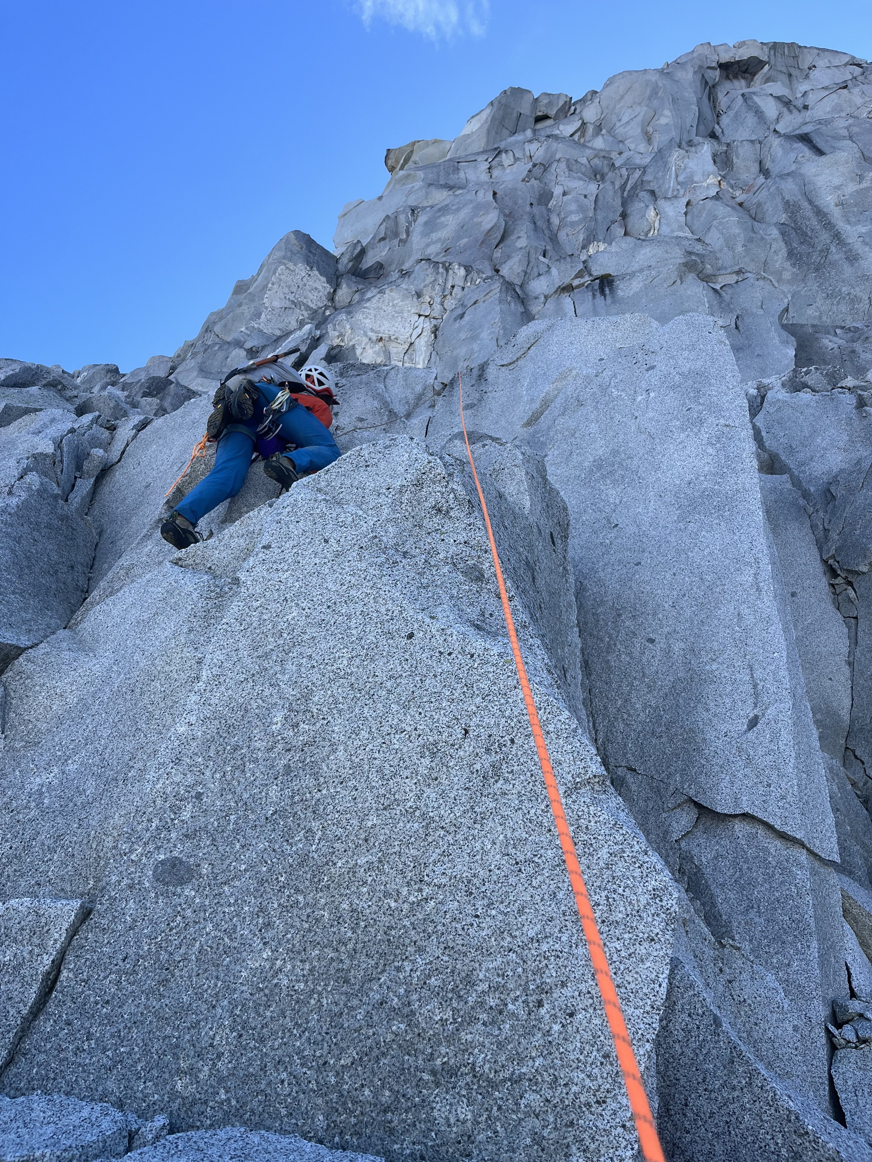
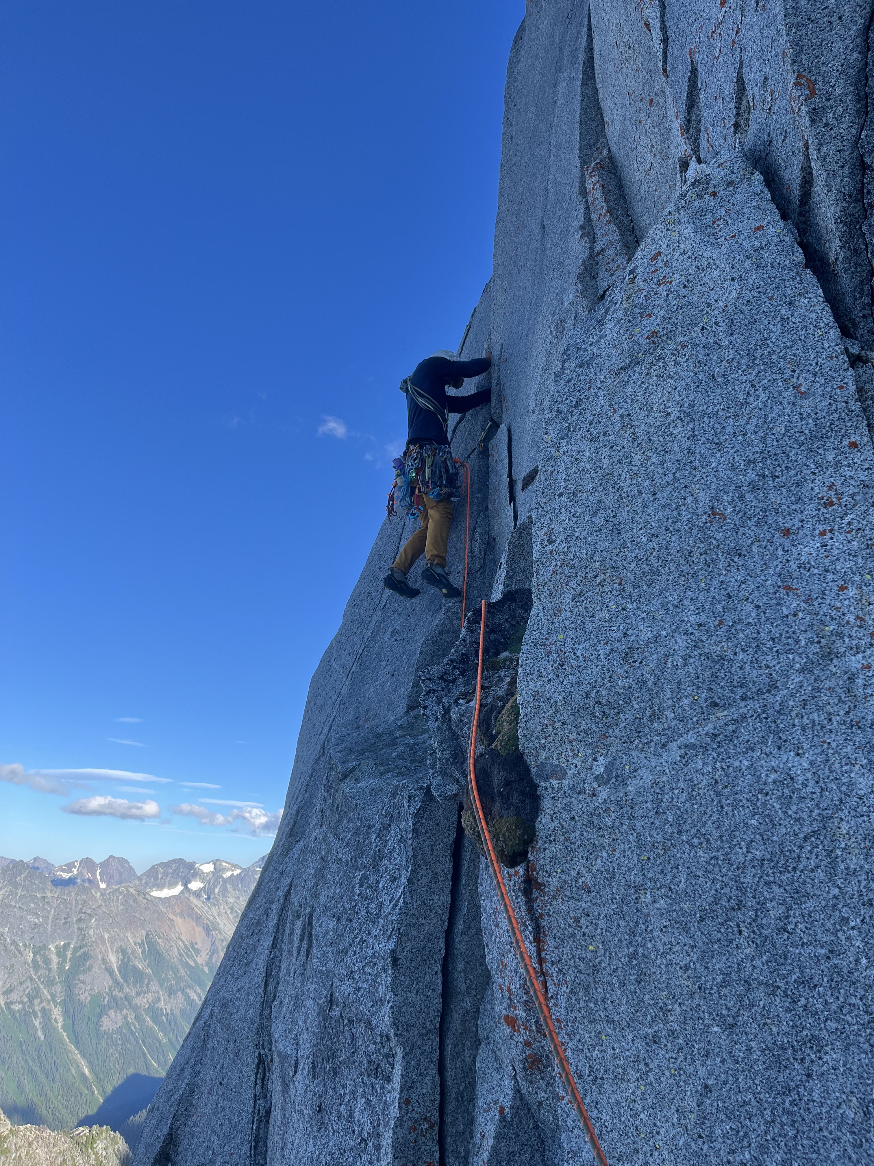
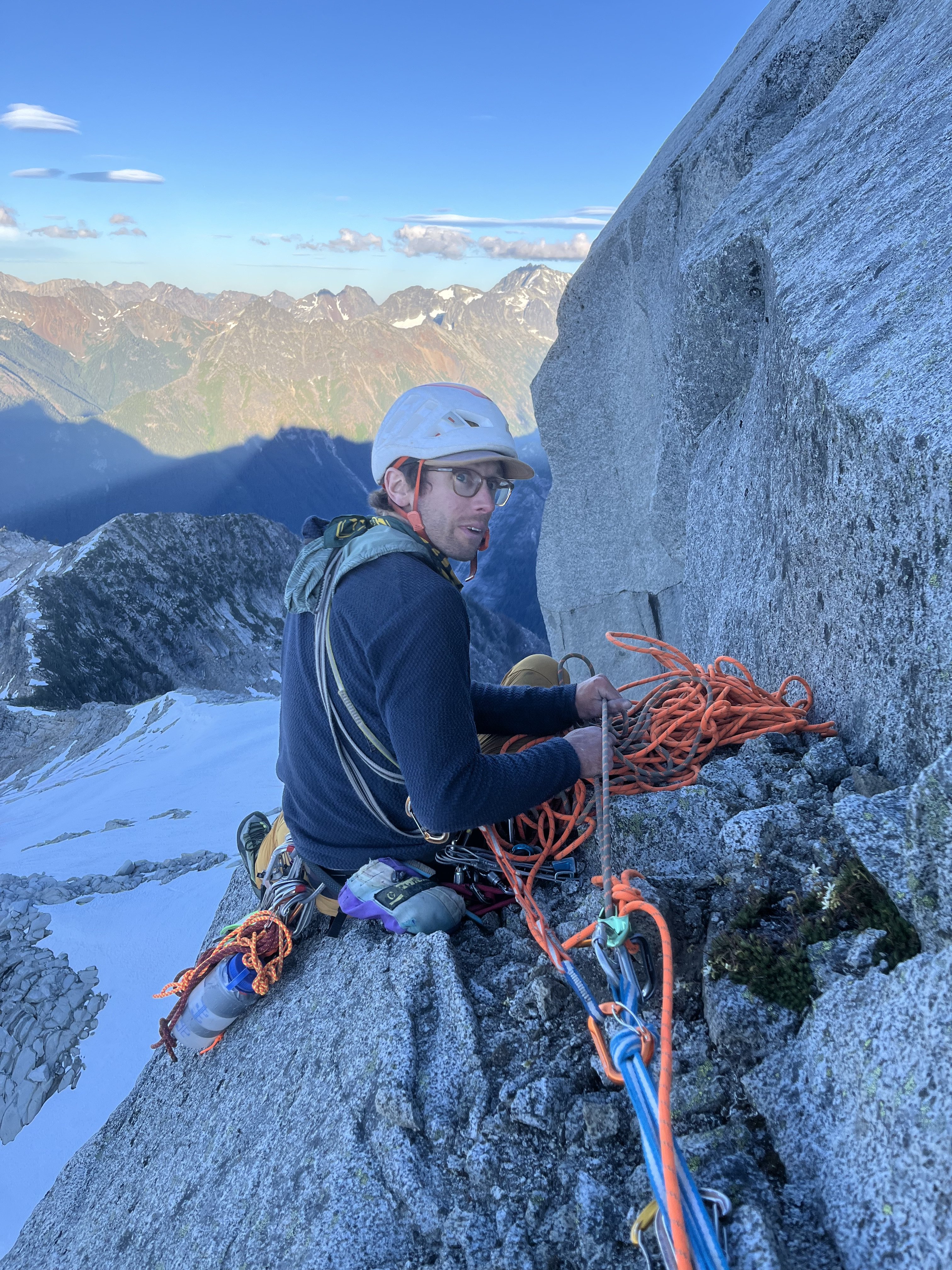
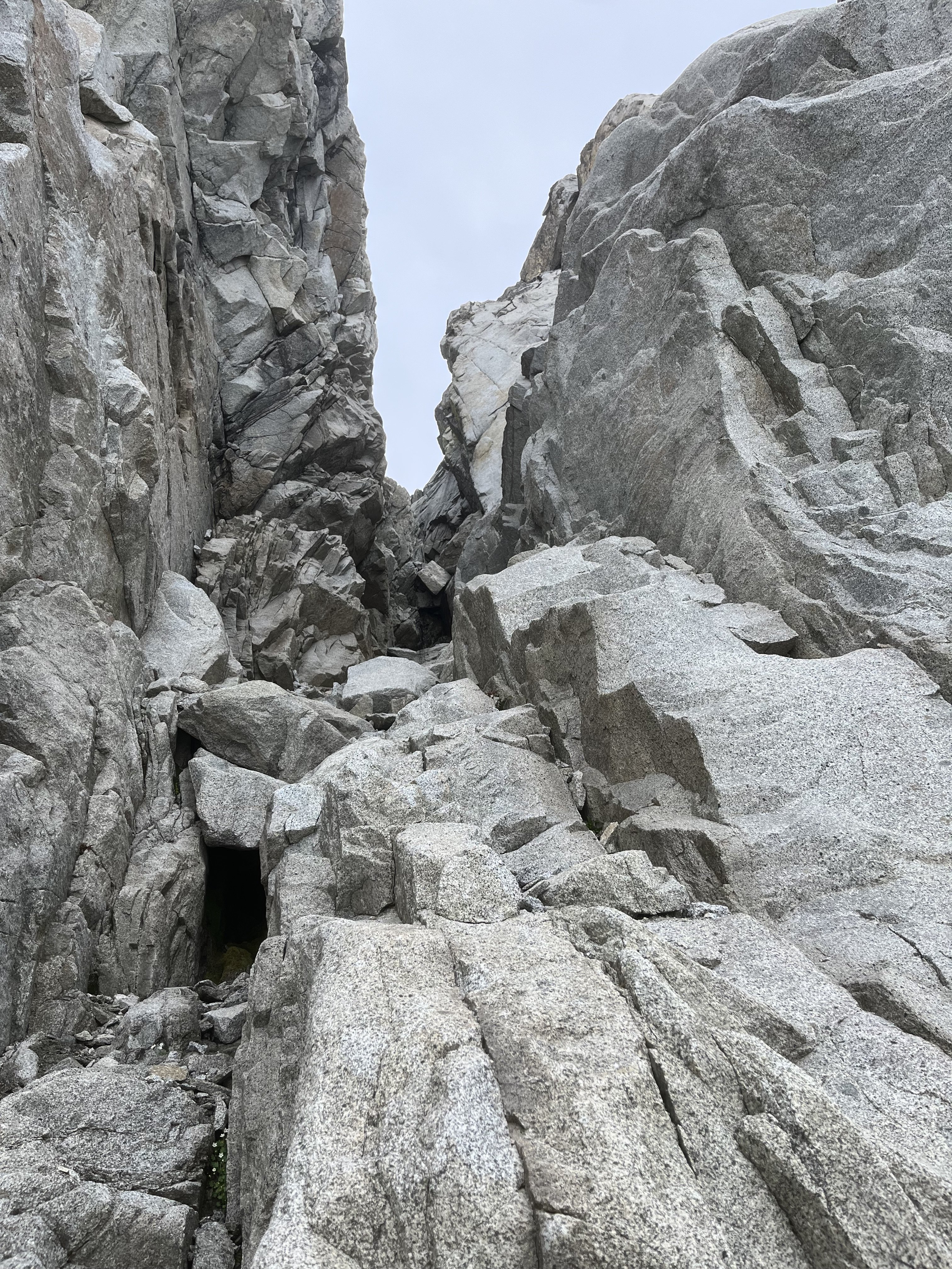
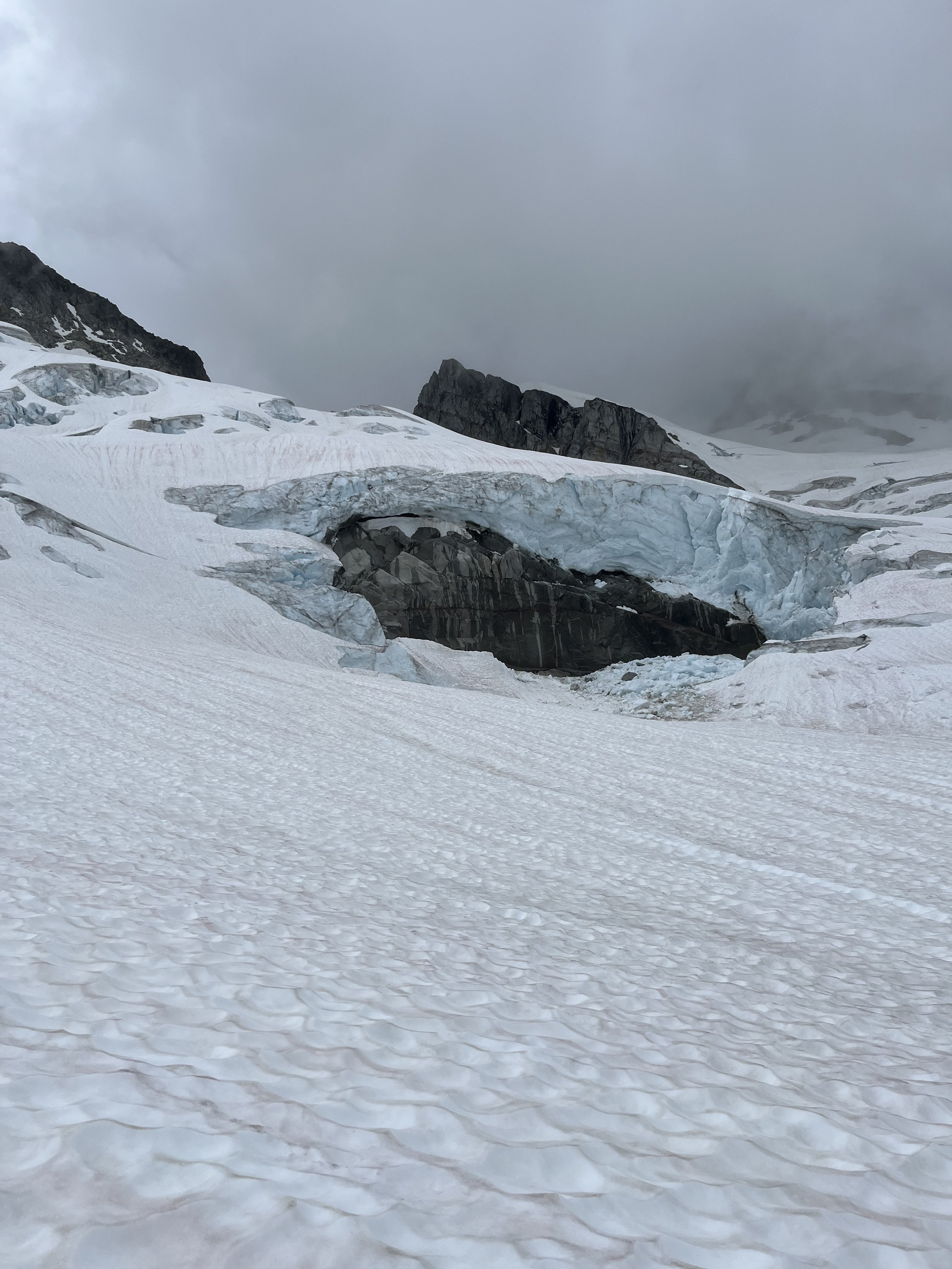
Trip: Forbidden Peak - NW Face Trip Date: 07/13/2025-07/14/2025 Trip Report: This has been on my list for a while given the high praise in guidebooks. Checking rec.gov on Monday, somehow permits to Boston Basin were available for this Sun-Mon that Alex, Liza, and I had saved for this route. With Liza and my previous experience on W Ridge, we figured this would go smoothly, but as is tradition with Forbidden, we were a bit slower than expected. Day 1: Approach to bivy on base of NW Face We left the Boston Basin trailhead at 8:45 am. The trail was brushy as usual and the river crossings had easy rocks to hop over. After a bathroom break at the lower boston we made our way to Sharkfin Col. We shot up a snow finger arching right towards Sharkfin and scrambled up and left in a gully about 200 feet before the big notch at the end of the snow finger. Two raps down to Boston Glacier over/in and out of the two bergschrunds. We made quick work of the Boston Glacier (thanks to some faint tracks likely from the day before) and scrambled the classic “potato chip” gully/col up to the Forbidden Glacier. With the crumbling rock/sand combination, this required the full body tension of precarious slab climbing with the added bonus of explosive holds that kept things spicy. Walking down the Forbidden Glacier was very chill and there were some rocks that were poking out in the middle that had water flowing over them which allowed us to fill up before crossing below the route and ascending the glacier on the other side. We saw tracks from a team that did the NW Face Var of the N Ridge (Scary!). We then navigated around crevasses on the west side of the rib to a snow ramp onto the rib at ~7,600 feet. This was smooth sailing for the most part, but the little snow finger to get onto the rock is thinning out so threw in a picket given the large bergschrund right below us to ease our nerves. The snow finger didn’t look like it would last much longer than a week or two, so additional shenanigans may be needed later in the season. By 8 pm we found a small bivy, which we adjusted to make decently comfortable for all three of us and set up camp under clear skies with views of Moraine Lake. Luckily we had no bugs or snafflehounds overnight, just very gusty wind and the occasional sound of rockfall echoing around the cirque. Day 2: Ascent and descent We woke up and made breakfast as the clouds came and went, occasionally completely surrounding us in grey. After breakfast we made a quick 4th/low 5th pitch to the base of the knife edge starting around 8 am. All of us were stiff from the day before and were grateful for the warmup. The knife edge was very fun and super chill! A short section of crumbly rock, but otherwise quite solid. Clouds rolled in and out making it hard to suss out the route above us. The crux pitch took some figuring out and I’m still not sure if I did it right. The first bit was one quick 5.8 move that was quite fun above the old piton and perfect finger-sized gear. The second bit was a weird overhanging hand/fist crack that felt burlier than I expected. I pulled up into the crack then switched to the face to make use of some great footholds. The chimney pitch was quite loose, with multiple death blocks that I stepped on to avoid the crumbly rock-sand. I did not enjoy leading that…. After the chimney pitch it was fun ridge romping up cleaner rock. I was a bit gassed so I handed the lead to Liza. Luckily the clouds cleared and we had some fun sunny climbing. Liza made the mistake of shooting left onto the face rather than staying on the true ridgeline once the ridgeline got more licheny. This led to harder climbing on what looked like cleaner rock, but it had minimal protection and hid multiple death blocks that threatened a scary rope-cutting incident. She shot back over to the ridgeline on the right for more fun and cleaner rock climbing to the summit by 4 pm. No major mistakes happened, but we were way slower than expected with the fatigue, weather, and figuring out our simul dynamic with this trio. We ended pitching out more than we needed to. At this point the clouds started rolling in, so we decided to high tail out. As we began the rappels along the ridge, the wind picked up and it started to rain. This was probably the low point of the day as sideways rain blasted us along the knife edge rappels. After two raps along the ridge, we did two raps down the west side to an easy 4th class ramp that meets the first ⅓ of the W Ridge. We added some tat to some of the weathered stations. Four double raps down the Cat Scratch and we were out hiking! It was great knowing the descent beta from when we did the W Ridge four years ago. Luckily it was still light when we navigated the snow field and slabs below. We got back to the car by 11 pm. Overall: This was an engaging adventure that required a bit of everything. Knowing the W Ridge descent was very helpful. The climbing was not as good as we expected, but the knife edge and some of the upper ridge were a blast. The position, line itself, and the approach are amazing. 4 star line with 2 star climbing (though with more traffic/trundling could be 3-4 star climbing). Overall, an engaging experience, but we are still quite confused as to why this route isn’t called NW Rib because the only time we were climbing what I would call a “face” we were definitely off route… Heading up the snow finger towards Sharkfin (rap we used is just to the left, rather than up in the notch straight ahead): Chossy scramble up to Forbidden Glacier: Snow finger to access the base of the route: Looking down on the the snow finger and the bergshrund below it: Morning at the bivy spot: Looking back down the knife edge: Cruxing: Alex pulling the weird crux move: Liza following the crux: Solid exposure! Summit selfie: W Ridge descent: Gear Notes: Singles 0.2-2 with doubles 0.4-1. 1 picket. Axes. Crampons. Having another 0.3 would have been nice. Approach Notes: Boston glacier approach