
just some guy
-
Posts
12 -
Joined
-
Last visited
just some guy's Achievements
")
Gumby (1/14)
5
Reputation
-

[TR] Glacier Peak Wilderness Blast - 11 Bulgers - 7/14/2017
just some guy replied to Matt Lemke's topic in North Cascades
Matt, any portion of that "trail" can be a bear to follow even when you are on it, especially starting from the "wrong" end, a little more beta data for the intrepid individual heading into Swamp Creek would be that the trail is on the west side of the creek until about 3650', if you come out of the trees into a big talus patch and impending alder doom you've gone too far, head back a hundred feet and cross the river, after that on the east side of the creek the trail can be found in fits and starts mostly within a hundred feet of the creek but trying to follow or look for it could be maddening, just schwack up valley and be pleasantly surprised when you somehow find your feet on something that looks oddly like a trail. When taking the trail remnant up from the PCT it stays pretty intact if faint until it starts to round the corner between the R and N in Wilderness on the USGS topo. Keep bangin'! Great trip! -
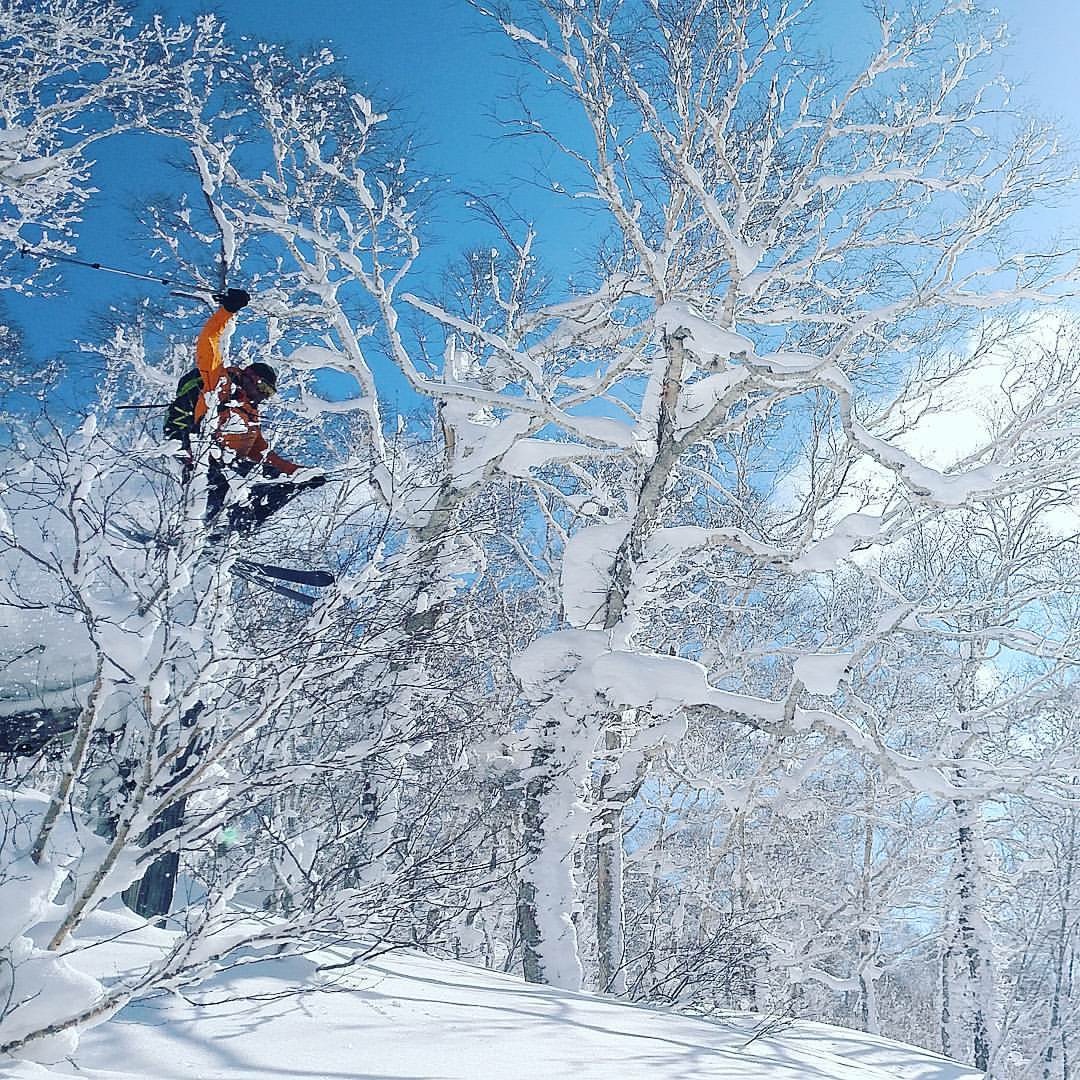
Japan in late February? Suggestions?
just some guy replied to OlympicMtnBoy's topic in the *freshiezone*
Great! I've spent more time in Hokkaido, we're planning on our third trip next season. So you're going to want to set up accommodations somewhere around Niseko village for the greatest access to the most places. A key point to know for BC access in Japan is that wherever there is an Onsen the road will be open and maintained year-round. For Niseko area you will want to use the roads toward Goshiki Onsen or Niimi Onsen as access points to some awesome terrain. Also, you can tour the north slope of Yotei from Niseko easily as well as the north side of Mt, Shiribetsu. On a rare clear weather day you can tour/hike all the way up the north side of Yotei and ski into the crater. Mt. Shiribetsu has a rather large resort on the south side named Rusutsu but the north aspect is better terrain and more importantly generally untracked pow laps. The easiest BC terrain from Niseko is the road to Goshiki Onsen, Goshiki is nestled in a high mountain valley between Mt. Niseko-Annupuri and Mt. Io, during winter it is the terminus of road 58. There are great laps to be had off of Mt. Io or the back side of Annupuri but the valley can get blasted during high winds and be a pretty uncomfortable whiteout. For better storm skiing the old resort of Chise, or Rankoshi Chisenuppuri is a surefire bet; when we first went to Japan we toured right in the old resort, now they are running a cat op there on the low angled old lift lines and plan to open up the whole thing again at some point. That's no problem though, you don't want there tracked out pow anyways, the better terrain is to the west and north of their boundary anyways and a clear day you can watch overstoked Aussie's howling into their GoPro's while their lower bodies struggle to ambulate anything resembling a reputable powder turn, while you harvest the good goods on the neighboring slopes in comparable silence. Park at the intersection of roads 66 and 58 and tour up the closed portion of 66, you can head almost straight NW immediately towards the top of one volcano 1060m between Io and Chise dake (dah-kay, means mountain/volcano) or tour up to the hairpin and continue from there to the top of Chise and continue over towards Shakunagedake (Chaka-khan-dake). You can also tour out of Niimi onsen which is the turnoff before Chise and heads up into a gnarly valley east of Shakunagedake. From Niimi you can head back west towards Chaka or tour Shirakabayama dake and Zenmekunaedake. Personally we liked heading over the hump to the flat plateau south of Mt Mekunnai and then dropping into drainages on the SW aspect. Locals generally tour with snowboards and snowshoes so they don't head out very far but will punch out your skin track, conversely you can take their pow trough on the approach towards the good terrain. 108 is about the minimum but will work fine for February, I ski Icelantic Gypsies which are 125 under foot but my wife skis something in the 1-teens, it doesn't really matter when it is coming in super cold and light, every ski maker is making cheap DPS clones these days, if you go to the resort you'll see a lot of people skiing really nice powder boards and never leaving piste. Late February is a good time to go because the storm cycle breaks up a bit and you actually get to see the volcanoes, when it's pukin' stay in the trees, when it clears head up and summit something the foreshortening on their volcanoes isn't like ours. The nice thing about touring out of an Onsen is coming back to it for a soak when you're done so bring a towel, some coins for the beer machine in the lobby, and your apre ski clothes. One of the guys at Niimi ran a ramen house in Bellevue for a few years, it's a small world. -
Thanks Eric! I find whiskey essential on most trips but it probably has to do with the terrain we enjoy, haha. The trail is pretty beat in but still manages to disappear in all the right spots, the moss boulders coming into Terror Creek are still somehow seemingly untrampled every damn time and the top of the ridge climbing out of terror creek goes without trail for quite a ways. We saw the summit register note from you guys on the central buttress and spent a while at camp trying to pick out the line, by the time we left we thought we mostly had it figured out but still were having trouble deciding on the first pitch, it definitely looked like a sweet line! Might have to head back in there with some more whisky and sort it out!
-
Japan in late February? Suggestions?
just some guy replied to OlympicMtnBoy's topic in the *freshiezone*
Which part of the islands are you going to? Honshu or Hokkaido? What kind of terrain do you enjoy? Steep, mellow, scenic? How fat are the boards you have? It is starting off to be a banner season over there right now. -
best content Help identifying the best content on CC.com
just some guy replied to olyclimber's topic in Climber's Board
I'm digging the Red tags! I was wondering how they were getting applied. You guys are rocking this new updated site, everyday it just keeps getting better. I was thinking this morning of a red Bulger tag for those TR's, after a few sips of coffee I got woke enough to realize that then choss dawging might expand even more in popularity with more pointed beta aimed in its direction. Wouldn't want the choss getting packed out and polished, gotta keep it fluffy and fresh. -
Are 80 m ropes going to be the new norm?
just some guy replied to genepires's topic in Climber's Board
We were just in Greece a month ago and 40M routes there are pretty popular and good, a lot of the steep tufa lines are 40M but there are also just as many long moderates that need 80M ropes. We made a pretty full and satisfying trip with a 70M but we also jumped on our friends 80M for some sweet pitches. We did meet up for drinks with the French climber Francois Guillot who told us about the need for a 100M rope on certain lines, a statement that blew our collective North American minds. -
[TR] Glacier Peak Wilderness Blast - 11 Bulgers - 7/14/2017
just some guy replied to Matt Lemke's topic in North Cascades
Matt, epic trip! Way to persevere in the wild of Swamp Creek and everywhere else for that matter. For what it's worth and not that it is any comfort now but there is indeed a trail from the Dark swamp meadow basin down to the uber brushy green meadow below the waterfall. I suppose this is for anyone in the future trying to repeat from your direction, the trail can be found by getting to the end of the meadow and heading uphill (east) into the dry mostly dead undergrowth of the larger trees, you go uphill about a hundred or so vert and then contour over the somewhat defined ridge crest to the north. The trail gets defined here as it steps down through some rock faces and roots, I want to say there might have been flagging, there was definitely a live ground hornet nest in the trail! Eventually it turns out of the pine needles and pitches down towards the waterfall into the lush prickly goodness that doesn't stop until you pick up the trail again on the other side of the creek way down valley, well, you may find remnants of trail before that but nothing truly satisfying. Way to get after them Bulger's. l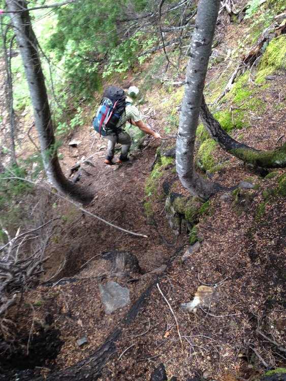
-
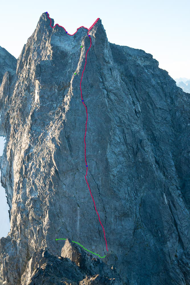
Yeah! You guys went full value on your trip, way to press on. It's still there, it's still good, next trip for sure. We looked over at Ottohorn and were contemplating scrambling up the east face but bagged it in order to still have stoke left for the NE ridge of the Chopping Block or The Stump as John would prefer. That's a nice pic! So I scribbled all over it how we climbed the route, I only marked the first two rappels below the subpoint as I couldn't remember where on the West Face the rest of the spots were exactly I did indicate the final ledge back to the col that we took, although looking at it now we might have landed on the ledge slightly further lookers right; anywho it's all there.

-
Ah, it's just the antioxidant power of the blueberries, that or the need to find water in the parched landscape that is the late season Barrier. Also, big kudos to the new site format! This is way easier to navigate and use, the ease to drag and drop photos when writing this TR was a game changer. Way to go team!
-
Trip: The Pickets - Himmelgeisterhorn - Wild Hair Crack Trip Date: 08/25/2017 Trip Report: Well, it would seem that I completely missed larch season this year as we were gone yanking on tufas in Greece and now ski season seems to be well on its way. It was another fine year of climbing, the hustle was put on in the spring to tie up some loose ends on larger Cascadian objectives which was immediately followed by a great deal of Mountain Loop cragging in Darrington and a lot of heavy packing and choss chucking to bolt a new route up by Mile High Club. Amongst all of that I did accomplish a long standing goal in the Pickets with my good buddy Imran, a tick of the Wild Hair Crack on Himmelgeisterhorn. Wild Hair Crack is a route that was established by Silas Wild, John Roper, and Russ Kroeker in 1981. For all the information you really need to know about the route and the hilarious story of it's conception go to John Roper's site Rhino Climbs. There's a lot of other great info there too if you look around a bit. Years ago, on a short and brutal traverse of the Pickets from the Chopping Block to Luna with the Running Dog we briefly stood in the notch of Otto-Himmel Col and gazed up slack jawed at the crack, knowing that we knew what it was but not being able to summon the name. Regardless, we figured we should probably come back and climb it and headed off down the Mustard Glacier to Frenzelspitz Camp where we immediately got smacked by a standard Picket thunderstorm on an otherwise bluebird day. A few years of shameless peakbagging had gone by since then as well as other trips into the Pickets but I had not yet focused up to get back to that beautiful piece of rock. Imran and I set a date early this year, weather window permitting and waited for the weekend to arrive. We've done so many trips together at this point that communication went as it often does these days, we knew which guy was in charge of what and which version he decided to show up with was completely up to him. Park and Ride time was decided upon and the supply of whiskey was double checked, the weather was looking bomber. Northgate, Arlington, Darrington, Marblemount, and Newhalem all in a row, we snapped pics of guidebook photos and headed up the trail just about 8AM. We made our way down into Crescent Creek Basin past the Chopping Block a little after noon passing one tent at the divide. The clouds had lifted as we made our way across the Barrier and now we suffered the sunny choss as we contoured around Crescent Creek and climbed up below Terror, making our camp at the obscenely beautiful promontory at 6300'. We gutted our packs, piled rocks over the important stuff and took advantage of our lightened feet by scrambling up the West Ridge of Terror, tagging the summit right at 5PM. Back at camp we rolled cigarettes, set up the tent and sipped Laphroaig telling jokes and watching the sunset. The next morning we dropped a little elevation right out of camp and then contoured old terminal moraines towards the hidden couloir that leads to Otto-Himmel Col. Last time I had been through here it was early season and we had just strolled to the top, this time it was a whole different animal. We predominantly stayed in the moat on the left stemming between ice and rock until being forced through a portal in the snow to the right side. Below the huge chockstone we scrambled up the rock on the left side and then back across smallish ledges right until back in the gulley above the chock. A few more feet of vert brought us to the Col and a bit of a breeze so we added some layers and got our gear on. I started up the righthand of the two large cracks and climbed for a ways until it appeared as though the rock might be of better quality over in the left crack. Imran was shouting at me to stay in the right side but I figured I'd go check out the other one at about half pitch. I liked what I saw so I continued up, I suppose following the right side is what is shown in Red Fred but both variations were climbed in the process of seeking the first ascent by Silas, Roper and Kroeker so I figured I'd split the difference on the first pitch. Both lines will take you to the base of the next pitch in a little alcove/cave below the offwidth chimney. If memory serves me there was a small slung chockstone here with what must have been some tasty cordage that a varmint had chewed through as well as some other old webbing that was in slightly better shape. I threw in a cam as backup and made an anchor to bring Imran up. Once he arrived all smiles as usual I set about getting my nerve up for the next lead. It looked big, slightly overhanging, and I could not see anywhere that took gear less than eight inches; 5.7? I'll bite. Up I went, the holds were...amazing! All the stances, everything was like a dream. I almost forgot about placing gear, which wouldn't have mattered anyways because unless you have a Big Bro or a length of 2X4 it doesn't matter until you are at least 20' out. The first placement is a small cam in a horizontal crack to the right of the crack, the next, about 5' higher is a bomber #1 or #2. The angle eases off after this and the pitch rambles up a ways nearing the ridge. Instead of heading over the ridge to the left we opted to continue up towards the subpoint angling slightly right to a weakness and chocked chimney just below the subpoint. I belayed Imran up while sitting on the chockstone and we unroped for the next bit of 3rd and 4th class terrain up and over the subpoint and across the ridge towards the true summit. There is a nice flat col before the final pitch up to the summit and we threw our packs down here and put the rope back on for safety sake. I placed a 0.5 or 0.75 in a feature to protect a bit of exposure but that was it. We had reached the top of the "Horn of the Sky Spirit" and the horizon was smoke free, giving us views for days. The summit is pretty small, we looked around for a summit register but could not locate one despite Jason and Tim reporting on it during their FA of Stonehenge. We hung out up there for quite a while but eventually decided we were hungry and we needed to figure out how to get down. We knew we didn't want to rappel the lower three pitches of the Wild Hair due to a lack of anchors for our single 70M rope (FA was with twin 50M ropes) and we didn't want to end up too far down the N face and have to come back up the Mustard Glacier. We had spotted a pretty nice looking anchor backed up with a nut and some fresh looking webbing just below the subpoint on the north aspect so we figured we'd start there. I ran the rope through, tied knots and chucked each half into the unknown. Looking down the face everything looked pretty ledgey but also decked out with areas of obviously loose rock so I exercised considerable caution keeping the rope free of debris. At about 25M I came upon a double piton anchor joined together with some old webbing but decided to try and angle off back towards a large boulder out right (skier's left), suspecting a possible anchor in that vicinity. I came up on the knots right as I touched on a ledge above the boulder, I unweighted the rope removed it from my belay device and scrambled around the boulder to find a nice looking rap anchor. Imran came down and we set the next rap angling hard back over the ridge towards Otto-Himmel Col. We found another anchor over the ridge and were able to rap into a small depression almost at level with the col with a slight ledge leading back to the col, I believe this is the depression and ledge described in the N. Face route description. Stoked to have made it back down on our single 70 with relative ease we rapped down past the chockstone and continued to rap most of the gulley on old suspect singlepoint anchors composed around sketchy rock or attached to jiggly pitons in jiggly rock. Eventually we emerged back in Crescent Creek Basin and rambled back to camp encountering a rather large and healthy set of mountain goats along the way. Somewhat begrudgingly we packed up camp and made our way back across the hot red choss to the Chopping Block where we set up camp for the night and encountered a curious Stoat for a split second before it went back to hunting down Pikas and other alpine morsels. Sunset was amazing in all directions and the nice view of Teebone Ridge had Fallen Angel stuck in my head for the rest of the trip but thanks to 4G service at the ridge I was able to scratch the media itch. In the morning we climbed the NE ridge of the Chopping Block staying generally on route but adding in a few short harder sections at the bottom and top for fun. Rapping this route with a single 70 is a bit of a rope stretcher and requires attention to detail. Finally, we packed up for good and headed down the Barrier gorging ourselves on blueberries the whole way back to Terror Creek. Another trip in the Pickets with a head full of ideas for the next time. I had the good fortune to talk to all the members of the first ascent team at this years Bulger Party and I think they got a kick out of the kids taking such pleasure in their route, it is a real gem! Thanks to Silas, Russ, and Roper for putting up the line! Okay, Pictures! Coming up the Barrier with clearing skies Crescent Creek choss heat. Terror! With Luna in the background. Camp life. Sunset from camp. Highly recommended accommodations at ca. 6300' Himmelgeisterhorn Starting up the right crack, the chimney of P2 can be seen above the left crack near the top of the rock in the picture. Imran climbing towards the top of P1, minimal gear was placed on ascent but lots of opportunities existed. Last Pitch Sky Spirit! Taking the ledge back to Otto-Himmel Col Super Crack! Late season gulley shenanigans. Sunset from Chopping Block camp. NE Ridge of the Chopping Block Picket Stoke! Gear Notes: Single rack of cams #00-#2, medium nuts, long runners, 70M rope, crampons, ice axe, whisky Approach Notes: Terror Creek to the Barrier to Crescent Creek Basin
-
just some guy changed their profile photo
-
Thought I would add a few more photos, beautiful area with some unique views. Jason scoping the route. View from camp on the ridge. Morning view of the N. Face, route just right of center. Jason about to traverse into the tips crux of P2, this pitch was phenomenal! Jason out on the start of a sustained 70M P5 scrubbing cracks for pro. Summit Pano. Nice view of the Nohokomeen on Jack. Summit shadow as we descend the east ridge. Descending the col from the east ridge. P2 of the Kearney-Harrington seems to have gone missing. Sunset through larches on the way to whiskey. Princess/Crow Creek Divide. Frosty/E1 Pano.
-
Thanks for the great write-up and kind compliments Jason, I'm just a stubborn guy with a high tolerance for suffering. It was great to get out in the mountains with you again on something more solid and with a super solid climber like yourself. This climb was a blast and just about every pitch was generally sustained at it's grade. The rock was very good and absent of lichen or grunge, P4 and P5 took some excavation of cracks for pro but cleaning 5.10 slab cracks on lead is a good character building experience. Jason wrote the grades for each pitch down on the drive home but if I remember them correctly they went something like this: P1 - mid fifth P2 - 5.10C C0/C1 P3 - 5.10C P4 - 5.10B P5 - 5.10C P6 - Belay Move low fifth P7 - 5.8 P8 - 5.10B P9 - 5.7 P10 - 5.9 Many of the pitches went for a full 70M but all stopped at pretty pleasant belay ledges with good protection. It's too bad this area doesn't see more traffic.