


jordansahls
-
Posts
504 -
Joined
-
Last visited
Content Type
Profiles
Forums
Events
Everything posted by jordansahls
-
[TR] Gimli - South Ridge III 5.9+
jordansahls replied to Nick Sweeney's topic in British Columbia/Canada
Love that climb! The Valhallas are a gem. -
Here is a TR from someone going up to Paradise from 6 days ago: https://www.wta.org/go-hiking/trip-reports/trip_report.2018-07-07.2517868071 They took a picture of the Nisqually glacier if that helps. Can't see the Fan but the upper section looks doable (you can see ski tracks coming down on the left side of the picture).
-
Anyone been up that way? I'm curious to get any information regarding the north side snow conditions, particularly the NFNWR.
-
I find I can usually ski from the summit to the lake at least until July, although it varies from year to year. And with all the crazy changes in the climate I'm less confident in old weather trends/patterns. On the plus side, once the lake starts to open up you can get some super fun pond skimming in!
-
I haven't been out there in two weeks but, given the fat conditions when I was out there I would say that Vesper is very very likely still skiable from the summit to Headlee pass. However, Headlee pass was starting to thin out at the bottom. You will probably have to remove the skies in a few spots (likely on the traverse from the lake to Headlee pass and probably at the bottom of Headlee), but I bet you can still ski down into the basin. If I didn't have other plans this weekend I would be out there for sure.
-
Not sure if this is helpful but I was out there June 3rd. The ledge system to the North face routes still had a lot of snow on it. It's possible that things have melted out more in the last couple of weeks but I would plan on having to deal with snow on a traverse to the Ragged Edge route. Both the Ragged Edge and True Grit looked relatively snow free on the routes themselves. -Jordan
-
Anyone been up that way recently? Trying to scope out the West face of Sahale for a ski, figured I would see if anyone has been up on that side of the mountain. Thanks!! -Jordan
-
Applauding risk acceptance beyond your own limits
jordansahls replied to glassgowkiss's topic in Climber's Board
This has always stuck with me. I was on that route a week prior to Leubben. The last repel is locked in my memory. Partner and I had to do something kind of sketchy. The rope wouldn't make it completely over the schrund, so we had to kick off the wall, jump the moat, and drop off the end of the rope a couple of feet from its edge. It was only a small drop off the rope. I didn't think much of it. In fact, it was exciting...fun even. But then I remember hearing that someone died at that exact spot. I was young at the time...easy to dismiss it and chalk it up to user error. But, the older I get...the more my past decisions get reframed, and really terrify me. How did I survive the learning curve? No god damn idea. All this to say that most of us on this forum have been in a situation that we survived that others didn't. Surprise has nothing to do with it. But empathy makes me feel the loss. Because it could have easily been me. Should have been me. -
Water Filtration: is it necessary?
jordansahls replied to bonathanjarrett's topic in Climber's Board
Holy shit! (no pun intended). I had the exact same experience with campylobacter. Except I got it from biting into slightly under cooked chicken. But the hallucinations and the call from the CDC are all on point. Not a pleasant experience by any margin. -
Man, I've done this route a couple of times in the Spring and Summer and it's never been anything to write home about. But, I have often wondered how it would climb in the winter. Looks like a lot of fun! Thanks for the TR.
-
Ivan's Beowulf quote has never been more fitting. Man is/was a legend with a hell of a legacy. RIP.
-
[TR] WA Pass- Cutthroat Wall - Easy Getaway 9/16/2017
jordansahls replied to EllieP's topic in North Cascades
You know....I have been in that way a hand full of times. I've climbed the North and W/NW Ridges of Hinkhouse and for the life of me I can't ever seem to sort out where in the hell Cutthroat wall is. I feel like it's fairly obvious and Blake wasn't mysterious about the approach. I just seem to go full retard when it comes to this particular wall. I Assume it's on the west side of the main arm that runs north, directly off of Hinkhouse? -
Silver Star high route - Varden creek?
jordansahls replied to jordansahls's topic in the *freshiezone*
Thank you both for the info. I wasn't sure if the DOT was plowing all the way to silver star creek. I checked the Methow trails report and just figured that the road was un-maintained after Early winters campground. Still would be fun to checkout the high route but the regular route is always a good time. -
Anyone ever done the Varden creek high route in the winter time to approach silver star peak? There is a brief mention in the CAG about the route. It says it starts at the foot of Cedar creek and cuts cross country. Any more specifics? Anyone done it before? Thanks for you help!
-
Thank you all for the suggestions! I knew I was forgetting some obvious options, totally forgot about Hardy and the north side routes. Also, the stuff along Kangaroo ridge looks like good fun.
-
Hey y'all! I've been racking my head trying to think of some ski options out around WA pass that involve steeper skiing. I've done most of the classics (Black peak, Silver star, SEWS couloir, Birthday tour, ect.) But I'm looking for something a little more interesting. Am I missing anything obvious? I know there's no shortage of terrain out there but I'm hoping that some of you grizzled veterans might have some suggestions?
-
Ha ha! Mystery solved. I wondered "wtf" when we took the turn-off down the drainage. Sweet tour by the way. That area is awesome.
-
Thank you Jason and Rad! We actually just used a smart phone with Google maps. Brian stored the maps for the area in his cache and kept a spare battery on his person. I will certainly look at the apps you mentioned since Google maps seems to have lost a step.
-
Thanks Tom! I re-uploaded the pictures. Let me know if that worked.
-
Trip: North Cascades Ski Tour - Eldorado to Silver Star Date: 4/1/2016 Trip Report: Spring has become somewhat of a mythical season for me. While every season holds its wonders, Spring has become the season of adventure. There is something about a large ski traverse that reminds me of the great adventurers of old. Each day holds its obstacles, difficulties and mysteries. You always end up at your destination, but never exactly as you planned. You fight the elements, you fight the gear, sometimes you even fight each other, and you certainly fight yourself. But you always come out stronger, with a clearer mind and a new appreciation for life and its many wonders. I guess what I'm saying is that I'm addicted, and it's for this reason that it has become a tradition for my climbing partner (Brian) and I to imagine improbable and grand lines across the Cascades. And this year might have been our most ambitious route to date. The route was essentially a more polished version of an attempted traverse we did two years ago. The plan was to ski from Eldorado to Silver Star while keeping a fairly high position the whole time. Like most adventures, we succeeded in some ways and not in others. But that's life, and the unintended consequence of it has been to solidify in me an obsession and determination that has been surprising in its intensity. With all the knowledge gained and the lessons learned I will undoubtedly be back to finish this traverse in its near perfect form. But until that times comes, here is a description of the route and the trip, enjoy. Day 1 - Eldorado: Day one saw us dropped off on the Cascade river road at the Eldorado creek gate. We had our very own sendoff party! It's always a good feeling to be moving after months of pouring over maps and books and trip reports. The day went about as expected. The slog from the road all the way up to the Inspiration glacier is a real bear, especially with 60 pounds of gear in tow. But, it was a comfortable day with clear skies and beautiful views. Johannesburg seemed to lumber behind us, warily considering out tracks and ambitions, two small ants in a land of giants. Almost to camp: Forbidden peak from camp: Day 2 - Eldorado to Thunder creek: Day two got to be a very interesting day. We descended down to Moraine lake and instead of climbing towards the North shoulder of Forbidden, we ducked down into the Moraine lake drainage in an attempt to take a more direct path to the Banded glacier on Logan (which was the next days objective). It was our hope to quickly descend the valley (more of a canyon, really) then cross Thunder creek around 2,600 feet and climb up and over the long, NW trending arm of Logan, and back down to the base of the Banded. In hindsight (and really, foresight), it was a god awful idea and we knew it. But, being the optimistic idiots that we are, we went for it anyways and I'm sure you can guess the results. It was a nightmare of twisted streams, slide alder, cliff bands, sketchy insecure melt-out down climbs and my all time personal favorite, devils club. At one point it took us 2 hours to travel 1/4 of a mile. The highlight came when Brian was violently bushwacking through slide alder and devils club and his shell pants started falling down to his ankles. He was swearing, grunting and fighting with nature all while trying to keep his pants up. I just about died laughing. It actually reminded me of this scene from . We finally made it down to Thunder creek and decided to set up camp and lick out wounds from our ill advised and poorly fought brawl with mother nature. Leaving Camp: Looking across the Inspiration glacier towards Klawatti: Descending down to Moraine lake and feeling like a tiny mortal staring up at the mighty Greek gods sitting atop their thrones in the halls of Olympus: Do NOT go this way: Right before things got ugly: Day's 3 and 4 - Thunder creek to Fischer pass: Brian and I had a decision to make. Did we try and climb the ridge up and over to the Banded glacier on Logan? Or did we traverse towards Easy pass, then head south around the North side of Logan towards Fischer pass? We knew bad weather was on its way, so we decided that our best option was to head towards Easy pass. We figured, if the weather held out, we could hit the drainage leading towards the base of the Banded glacier and still climb over logan. And if the weather came in early we would just continue around the North side of Logan and quickly get to Fischer pass where we would be more on the East side and near better weather. We ended up doing the later. The amount of snow in Thunder creek was surprisingly low. We walked on dry trail all the way up to the North side of Logan at 3,600 feet. Dark and ominous clouds started to roll in and the weather started to shift. Neither of us had climbed Logan so we didn't want to get stuck up there in a white out. We also had a set exit date and a strict schedule to keep so we took the easy way out and decided to make a B-line for Fischer pass, which turned out to be a wise decision since heavy rain, wind and snow moved in late day three and stuck with us all through day 4. After two days of shenanigans we were at Fischer pass. Amazing views of Logan from Fischer pass: Day 5: Fischer pass to Heather pass, up and over Black peak: The weather improved just slightly. At least it wasn't precipitating and things were looking up. We had to descend down from Fischer pass and hit the valley directly South of Black peak. We would than climb the prominent ridge rising from the valley to the saddle on the east side of the peak, directly below the South ridge scramble route. However, white out conditions made it very difficult to pick the right ridge which resulted in us picking the wrong ridge and ending up WAY too far East, practically next to Corteo peak. "How in the hell did we mess up so bad!?", was my first though upon realizing that we had to reverse direction and traverse the ridge back West, towards the saddle. The trend continued and what should have been easy turned into a grind. The entire ridge was a series of cornices and cliffs. Without any visibility it was impossible to tell if we could take any shortcuts down towards Lewis or Wing lakes. We knew there was a weakness in the ridge just SE of the Lewis glacier, in fact I had seen skiers take that route up and over into the basin South of Black peak in previous years. We even found the weakness (with the help of the map and GPS), but the drop off looked steep and we could only see about 20 feet ahead. We even tried throwing rocks, climbing to the rock, throwing it again, all in the hopes that it would show us some of the contours of the slope. Instead, the rock eventually disappeared over what appeared to be a significant drop. We decided not to kill ourselves and just climbed our way to the Saddle. We finally made it (after 5+ hours of wandering the ridge) and STILL had to figure out a way around the cornices that had formed. having climbed and skied Black peak many times, I remembered that even if you fell, it wasn't that steep dropping down onto the north side of the Saddle. So i said "Fuck it" and just booted my way down in the white out while Brian kept tabs on me from the ridge. And for once, everything worked out well. I was down quickly and safely and called for Brian, letting him know that it was good. We quickly skied down to Lewis lake and made the final slog up to heather pass where we camped for the night. Standing in the wind and clouds during a very brief clearing: Brian at the saddle below the south ridge of Black peak, looking down into the valley we climbed up: Skiing down towards Wing lake through the clouds: Day 6 - Heather pass to Stiletto peak: Finally! Blue skies and sunshine. Day 6 was a real joy. We climbed up from Heather pass towards Maple pass and dropped down the SE facing bowl towards Rainy lake. We then climbed along the base of the Lyall glacier to the far East side of the bowl and hit a small notch that dropped us into the drainage that we were able to ski all the way down to bridge creek. From there we climbed up the South side of Stiletto peak and set up our camp, enjoying some fine whisky and grand views. Finally, a day without undue stress and challenges! Views from Heather pass: Brian Skinning towards Maple pass: Looking from the Maple pass area towards our notch: Me traversing the low flanks of the Lyall glacier: The drainage we skiied down to Bridge creek: Camp: Day 7 - Stiletto high route to Washington pass: We awoke to another fine day. The Stiletto area is a wonderful little traverse with fantastic views. We had traveled it last year as part of a different tour. It felt good to be back. Our plan was to traverse from the South side of Stiletto to Kangaroo pass, from there we would climb up and over Kangaroo ridge to the base of Big Snagtooth. It was then our intention to get up the next, and final day, and climb the South facing couloir of Silver Star to 8,400 feet and ski our way down Silver Star creek to HW 20. Everything went off without a hitch until we hit Kangaroo pass. The temperature became uncomfortably hot. And, as a result, the snow turned into isothermal mush, careening into wet slides at every step and turn. The ridge we planned on hitting to get over to Big Snagtooth required us to traverse a steep-ish slope above a large cliff band. And with the unstable snow, it seemed like a very bad idea. So we tried to climb directly from Kangaroo pass up and over Kangaroo ridge, but found ourselves post holing through glide cracks and wet mank. We finally retreated and pondered our options. It was getting late and we could actually see the equipment from the HW20 clearing crews. It was a tough call and neither of us where happy about it, but we decided to descend down to the road, ski down from the pass and camp below Silver Star on its West side. The skiing was fun, and there was a great luge track from the tractors widening the road. We even took time to build a crappy snowman for the clearing crew, writing "thank you" in the snowbank. Not sure if they got it but it was fun to just mess around, briefly. Me on the Stiletto high route: Brian skinning along and enjoying the views from the Stiletto high route: Day 8 - Over Silver Star and down to the HW: We woke up and made the climb up and over Burgundy col without much fuss. It had remained warm all night so the snow was not the best for skinning or booting, but at that point we weren't really phased by anything. The ski down from Silver Star to the road was enjoyable, although the snow was wet and sticky. It felt good to hit the road and just relax for a brief second. There weren't many cars at the gate so we decided to start skinning/walking towards Mazama. We walked for around 3 miles before we were able to hitch a ridge into the Mazama store from a friendly local (Craig I believe. Thank you so much!). The first order of business upon arriving at the store was to buy a six pack of Pacifico beer and a lime. Brian and I walked into the shade and sat down, I mean really sat down, for the first time in a week. Nowhere to go, nothing to do or climb over, just the beautiful weather, soft breeze and a nice cold beer. Views from Burgundy col: Resting in the sun after skiing down to the road: So out little adventure resulted in 61-ish miles and around 29,000 feet of elevation gain. It was a great trip in a place that I hold very near and dear to my heart. There are certainly things I would do differently, aspects of the route that I would change, if and when I go back. But for now I am content, It's hard not to be out there. Gear Notes: Way to much gear... Approach Notes: Eldorado creek
-
Whistler back country recommendations?
jordansahls replied to jordansahls's topic in British Columbia/Canada
Thank you both for the info. Most people I talk to say the same thing, get the one way ticket up Blackcomb. However, the Blackcomb website says nothing about a one way ticket. I assume I can get one when I'n there? It seems like backcountry access tickets are somewhat of a hot topic at Whistler these days... -
So, I'm finally making the trip up to Whistler and I need some help figuring out some good backcountry ski options. I know Whistler is a virtual mecca of ski options but it seems like lots of the ones I have been seeing require a lift ticket to get to the backcounty zones. I'm just looking to go full human powered from start to finish. I have seen a lot of information on Oboe peak ad Cowboy ridge and the surrounding area, but I can't tell how the access works (gondola, lift to backcountry, skin up?). I have also been looking at Rainbow mountain and mount Sproatt as well as the Olympic park. Anyways, I just want to get into the good old backcountry and get a few turns, what do y'all recommend?
-
Trying to put a simple ski setup together for a friend. I have an old pair of Dynafit speed turn bindings but the heel piece is busted on one of them. Any chance someone out there has just the heel piece lying around?
-
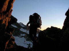
Trip: Ruth - Standard Date: 11/11/2014 Trip Report: Well, It's still early to be skiing but you can find turns out there. The trail was an ice rink so make sure to bring some sort of traction. Once you round the knoll on Hannegan pass the wind hits you full force. I had the pleasure of dealing with gale force winds all the way up to the top. I foolishly forgot to bring my balaclava so I improvised and wrapped my face with a spare t-shirt, it was that bad. The turns weren't anything to write home about but it still was a lot of fun. All in all not a bad early season ski session. Now, onto the few pics I managed to take before my battery froze. The mighty Shuksan. High winds on Ruth. Baker above the saddle. Gear Notes: Balaclava Approach Notes: Bring traction, the trail is icy as hell.
-
Foam rolling (or self myofascial release) research is still in its infancy, however there are a number of articles out there that seem to point to it being an effective tool for performance and recovery. Here are a couple of articles on the subject, if your interested: An acute bout of self-myofascial release increases range of motion without a subsequent decrease in muscle activation or force http://www.ncbi.nlm.nih.gov/pubmed/22580977 Roller-massager application to the hamstrings increases sit-and-reach range of motion within five to ten seconds without performance impairments http://www.ncbi.nlm.nih.gov/pubmed/23772339 Roller massager improves range of motion of plantar flexor muscles without subsequent decreases in force parameters http://www.ncbi.nlm.nih.gov/pubmed/24567860 The Effects of Myofascial Release With Foam Rolling on Performance http://journals.lww.com/nsca-jscr/Abstract/2014/01000/The_Effects_of_Myofascial_Release_With_Foam.8.aspx Acute effects of self-myofascial release using a foam roller on arterial function. http://www.ncbi.nlm.nih.gov/pubmed/23575360

